Embed Size (px)
Citation preview

Technical Report WRD93102
Viewed at 20:02:29 on 17/02/2010 Page 1 of 76.
POWER AND WATER AUTHORITY
REPORT 102/1993
P JOLLY
WATER RESOURCES STUDY TOUR OF OMAN MARCH 1993
PRINCIPAL ENGINEER GROUNDWATER \'lATER RESOURCES DIVISION
Technical Report WRD93102
Viewed at 20:02:29 on 17/02/2010 Page 2 of 76.
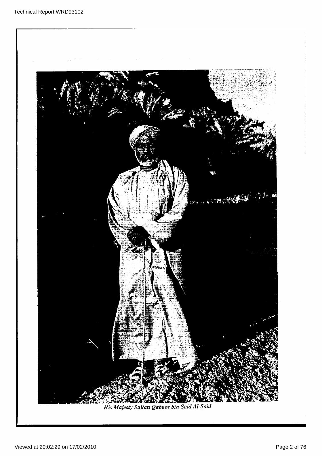
His Majesty Sultan Qaboos bin Said AI-Said

Technical Report WRD93102
Viewed at 20:02:29 on 17/02/2010 Page 3 of 76.
CONTENTS
1 INTRODUCTION AND ACKNOWLEDGMENTS
2 BACKGROUND
3 ECONOMIC DEVELOPMENT
4 GEOLOGY AND GEOMORPHOLOGY 4.1 Mountains 4.2 Gravel Plains 4.3 Coastal Plains 4.4 Sand Dunes
5 WATER RESOURCES OF OMAN 5.1 Surface water 5.2 Groundwater 5.3 Other water Sources
6 ARTIFICIAL RECHARGE
7 SEAWATER INTRUSION
8 WATER RESOURCE MANAGEMENT
9 MINISTRY OF WATER RESOURCES
10 DISCUSSION
APPENDIX A ITINERARY, OBSERVATIONS AND PHOTOGRAPHS
APPENDIX B MINISTRY OF WATER RESOURCES WELL PERMIT
PAGE
1
4
6
9 12 12 12 13
14 17 17 25
28
30
31
33
36

Technical Report WRD93102
Viewed at 20:02:29 on 17/02/2010 Page 4 of 76.
FIGURES AND TABLES
FIGURE 1.1 FIGURE 1.2 FIGURE 2.1 FIGURE 3.1 FIGURE 3.2 TABLE 4 FIGURE 4.1 FIGURE 4.2 FIGURE 5.1 FIGURE 5.2 FIGURE 5.3 FIGURE 5.4 FIGURE 5.5 FIGURE 5.6 FIGURE 5.7 FIGURE 5.8 FIGURE 8.1 FIGURE 9.1 FIGURE Al FIGURE A2
PLATES
LOCAT ION MAP MUSCAT AND ENVIRONJ)!ENTS GEOMORPHOLOGY OF OMAN }!AJOR ROADS OF OMAN OIL FIELDS OF OMAN STRATIGRAPHY OF OMAN THE TERRAIN OF OMAN SIMPLIFIED GEOLOGICAL HAP OF O~L~ THE F~.LAJ LOCATION HAP OF DANK AND ADN1 WADI DANK CATCHJ:.!ENT AREA LANDSAT MSS IHAGE OF \'lADI DANK ~.REA
ANNUAL RAINFALL DATA, YANQUL WADI FLo\<lS AT YANQUL WELL HYDROGRAPH AT FIDA, DOWNSTREAJ:.! FROJ:.! YANQUL HYDROGEOLOGY OF THE UeR AQUIFER HINISTRY OF WATER RESOURCES EDUCATIONAL LITERATURE ORGANISATION CH~.RT FOR J:.!INISTRY OF WATER RESOURCES FIELD TRIP ROUTES WADI DAYQAH AREA
PLATE 1 PLATE 2 PLATE 3 PLATE 4 PLATE 5 PLATE 6 PLATE 7 PLATE 8
HIJTTRAH AND HARBOUR THE HAJAR HOUNTAINS BlJRAIMI AND FALAJ FLOW HEASUREHENT INVESTIGATION DRILLING NEAR ADN1 ARTIFICIAL RECHARGE DN1 NEAR SEEB ACTIVITIES OF MINISTRY OF WATER RESOURCES EASTERN ~~AR HOUNTAINS AT AL AYN, EAST OF IBRI WESTERN HAJAR MOUNTAINS, WADI DAYQAH UPSTREN1 OF HAZARA
PLATE 9 EASTERN HAJAR MOUNTAINS, VILLAGE SITUATED AT BASE OF OLD ALLUVIAL TERRACE ON ROAD BETWEEN IBRI AND RUSTAQ
PLATE 10 OLD RIVER TERRACE IN WADI KHUBAYD,14 KM NORTH OF DANK PLATE 11 RECONSTRUCTION OF FALAJ AT AYNAYN, EAST OF IBRI PLATE PLATE PLATE PLATE PLATE PLATE
PLATE PLATE PLATE PLATE PLATE PLATE PLATE
12 SHAFT INTO F~~ TUNNEL NEAR AL MUDHAIBI 13 AL MINTIRIB - ,'lASHING l'.REA ON FALAJ 14 l'L MINTIRIB - MAIN IRRIGATION CHANNEL 15 F~LAJ AT HAYL AL GHAF ON vlADI DAYQAH 16 FALAJ AT HAYL AL GHAF ON WADI DAYQAH 17 FALAJ _'lITH HIGHLY ALKALINE WATER, FED FROM SPRING IN
OPHIOLITE, SUPPLYING SAAYAH, LOCATED UPSTREN1 OF YANQUL
18 BEDOUIN WELL IN WOODLANDS ON EDGE OF W~~IBA SANDS 19 HAWIZAH, 7.5 KM SOUTH OF AL HINTIRIB 20 WADI KABIR, UPSTREN1 OF AYAYN AND IBRI 21 INVESTIGATION BORE ON GRAVEL PLAINS NORTH OF DANK 22 TEST PRODUCTION BORE NEAR FIDA 23 INVESTIGATION BORE 25 KM WEST OF IBRI 24 TEST PUHPING INVESTIGATION BORE LOCATED ON COASTAL
PLAIN ON NORTHERN EDGE OF DISTRIBUT~.RY SYSTEl1 OF WADI DAYQAH
PLATE 25 POTABLE \'lATER TANKER "FILLING STATION" IN MUSCAT PLATE 26 HAIN STREET IN ADAJ:.!

Technical Report WRD93102
Viewed at 20:02:29 on 17/02/2010 Page 5 of 76.
1. INTRODUCTION AND ACKNOWLEDGMENTS
At the invitation of Barghash bin Ghalib Al Said, Director General of water Resources Assessment, Ministry of water Resources, Sultanate of oman, I visited Oman between the 16 March and 3 April, 1993. The visit was organised by former water Resources Division Hydrogeologist Geoff Prowse for the purpose of discussions and information exchange on the topic of the application of groundwater exploration techniques and development in arid areas. Geoff's sponsor, AUSeON, arranged the necessary documents to enable me to enter into Oman. The visit was supported by the Northern Territory Power and water Authority.
This report aims to provide the reader with an overview of the groundwater resources of Oman. Very occasionally comparisons are drawn between oman and the Northern Terri tory. It should be noted that any opinions expressed in this report are my own formed from what I have seen and heard during my visit, and what I have read on Oman before, during and after my visit. A summary of my itinerary, observations and relevant photographs and maps is contained in Appendix A.
I like would to thank the following people for making this study tour possible:
(a) Geoff Prowse who encouraged me to und~rtake the visit, arranged the necessary paperwork, and freely and enthusiastically passed on his understanding of not only the groundwater resources but also the history and culture of Oman.
(b) Barghash bin Ghalib Al Said, Director General of water Resources Assessment, Ministry of water Resources, for his invitation to visit Oman and discuss the groundwater resources of Oman with his staff.
(c) Bram Steele, Managing Director of AUSeON, who sponsored me during my visit to Oman.
(d) Keith Warne, Joe Papez and Simon Mc Neilege for their valuable assistance during my visit.
(e) Giuseppe Nicolosi, col Fuller and Norm watson from the Power and Water Authority, for their support of my visit.
(f) Last, but not least, my family for the encouragement and support they gave to me before, during and after the visit to Oman '''hile writing this report.
without the support of these people and many others who are not mentioned, I would not have been able to undertake this study tour of Oman.
1

Technical Report WRD93102
Viewed at 20:02:29 on 17/02/2010 Page 6 of 76.
.. / '/
----'-~:-::~~-l"\
"
:~ Sa:llll1
FIGURE 1.1 LOCATION MAP
2
JNDIA
DlstAMICRE!i10NS

Technical Report WRD93102
Viewed at 20:02:29 on 17/02/2010 Page 7 of 76.
Muscat & environs o KilllrTle1res 5 10 ) !
,
DMile3 5
GULF OF OMAN
15 ,
10
Sultan Oaboos Sports Centre
Shati At aurum Diplcmabc City
''-Stili 2-··----c--~-c-_l<tl:lw,; lntanll1icaai
Sultan fiabcos Garden
rlNTI,'1CCINmIENT'll,.. ... lOSPITAlS
$) fAlAJ I HOl,l
i
The "capital area" of today embraces Muscat and 1¥futrah, and the coastline from Seeb to Sidab.
FIGURE 1.2 MUSCAT AND Eh~lIRO~ENTS
PLATE 1 MUTTRAH AND HARBOUR
3
.<

Technical Report WRD93102
Viewed at 20:02:29 on 17/02/2010 Page 8 of 76.
2 • BACKGROUND
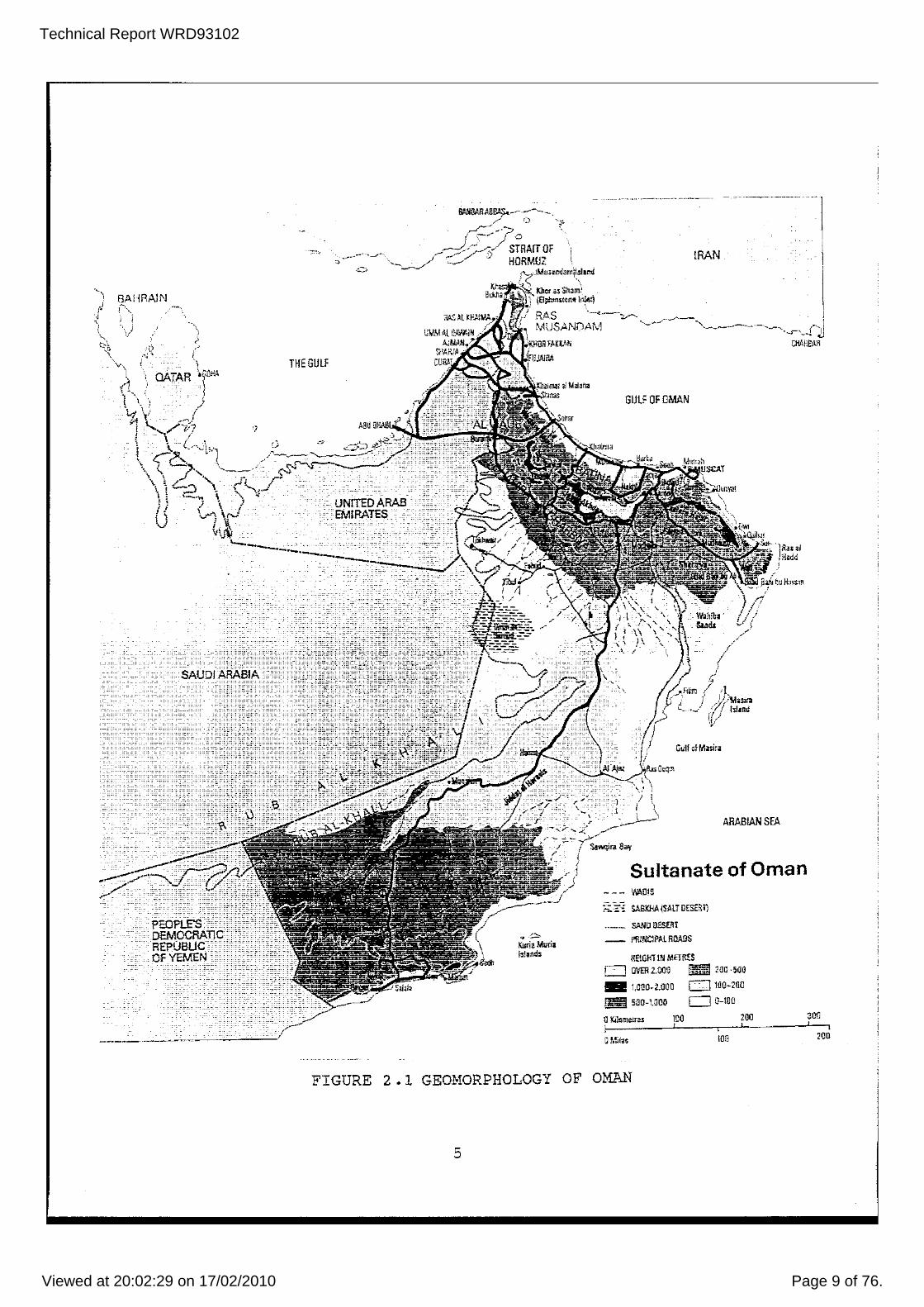
covering an area of approximately 300 000 square kilometres, Oman is a land of desert, stony wadis (ephemeral ri vers) , oases, scrub vegetation and barren rocky mountains (refer Figure 2). Most of the population of approximately 750 000 (estimate) live either on the northern coastal plains, in and adjacent to the Hajar Mountains (Plate 2), or in the 8alalah area in the south. Muscat, the capital, ~s located on the northern coastal plains.
Oman's climate is one of the harshest in the world. Annual rainfall exceeds 125 ID..1Jl only in the mountains where annual totals of 500 rom may be recorded. Annual potential evaporation of in excess of 2000 rom far exceeds rainfall throughout Oman. This harsh climate results from Oman being situated at the margin of two moisture bearing air masses, one coming from the Mediterra~ean and the other from the Indian Ocean. As a consequence rainfall is irregular. For example, while the average annual rainfall in Muscat is 90 mm, it is not unusual for more than 80% of this to fall in one month Al though January tends to be the month with the heaviest rainfall the pattern of rainfall is erratic.
The average daily maximum temperature in Muscat reaches 41°C in the height of summer, in late June and ~uly. However in 8alalah, which is affected by the summer monsoon, temperatures in the hottest month, May, reach only just under 30C. The relative humidity in 8alalah ranges between 96% in August and 54% in December. The range in Muscat is 94% in July to 20% in Hay.
It can be seen from the above, there are some similarities between the climate of Oman and that of the Northern Territory (NT). Oman is situated between latitudes 17N and 26N with the south of the country being affected by the summer monsoons and the interior very arid. The NT is located between latitudes 128 and 268 with the north being affected by the summer monsoons and the interior arid. The NT, however I has annual rainfalls ranging from 150 rom in the south to 1500 mm in the north, as compared to Oman's 125 rom. The NT also lacks Oman's mountains which reach heights of 3000 metres and where annual rainfalls (and very occasionally snowfalls) of 500 mm occur.
4
Technical Report WRD93102
Viewed at 20:02:29 on 17/02/2010 Page 9 of 76.
BAHRAIN 1-' .~,
, OATAR
)
THE GUlf
UNITED ARAB EMIRATES
.. ,~ KlIria Muria 1~lall,;j:
IRAN
GUlf OF OMM4
, I ,\
/ "./'"'\-'- \ , 1 -\\ \ ....
1, 1\ " ,,', ... \ ,
Culf nfMnirii
'l'IiU~j Hade
!
ARABIAN SEA
Sawqira Bay
Sultanate of Oman ~!l!S
SABKHA ,SALT OESERl}
SAND D.ESliU __ f'I1lNClPAL ROADS
HEIGHT IN METRES o OVER 2.0(10 t,~::t4 200 -5QI)
_ to.QO~2J)OO CJ 1110-21J(J
~ 5j]O-tOOO 0 0-100
1J Ki~meJrllS 100 I !
100
200 ,
FIGURE 2.1 GEO].lORPHOLOGY OF OMAN
5
300 , , 200

Technical Report WRD93102
Viewed at 20:02:29 on 17/02/2010 Page 10 of 76.
3. ECONOMIC DEVELOPMENT
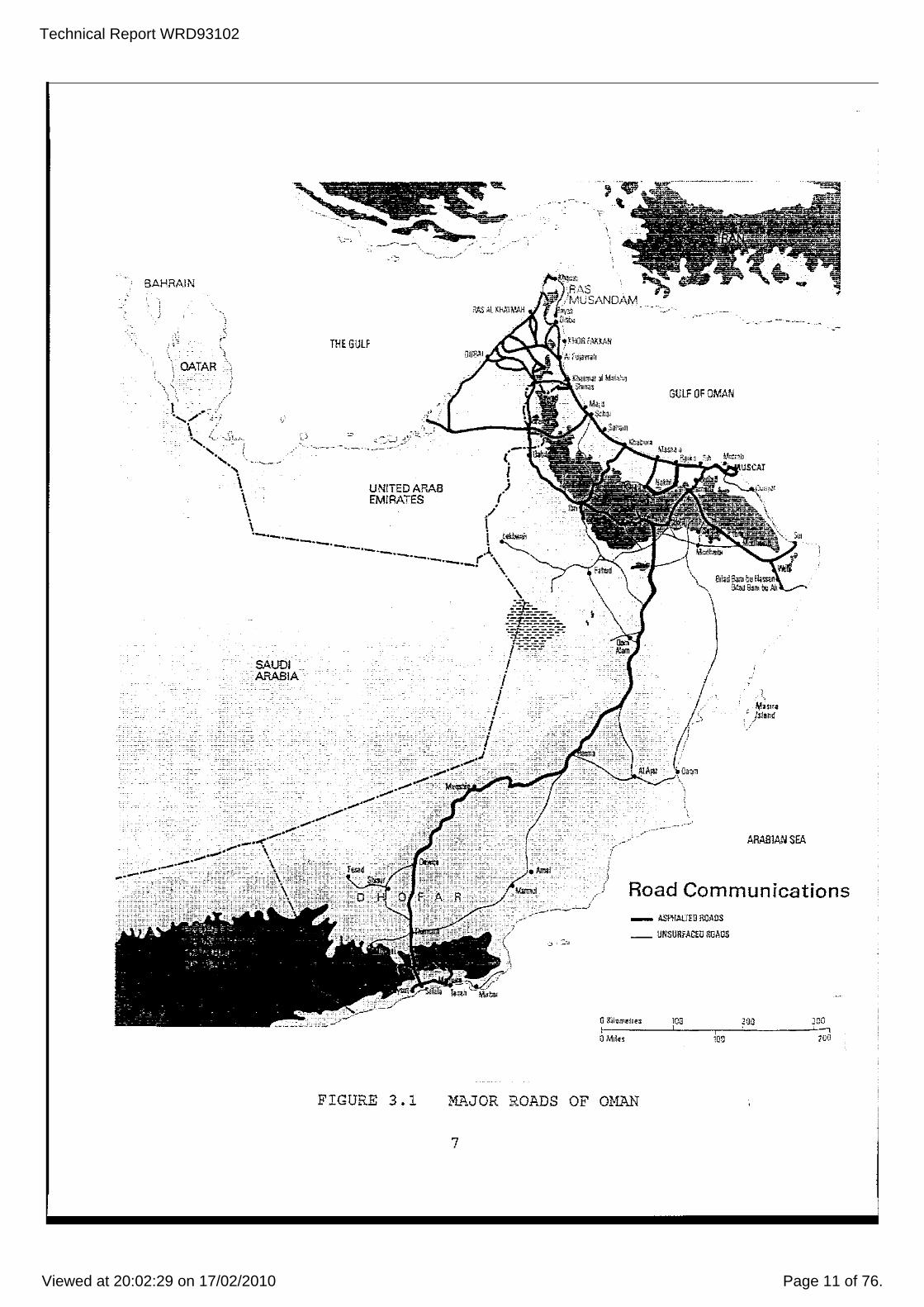
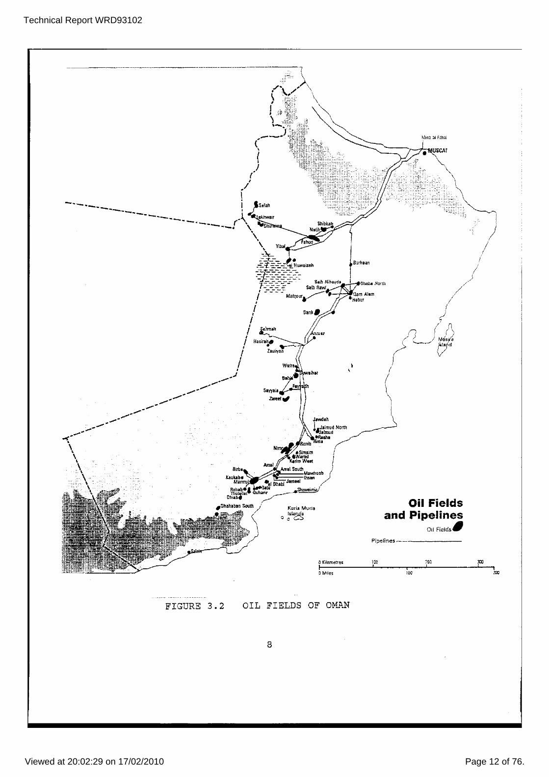
oil has transformed the economies of many counties in the Gulf area, and Oman is no exception. Most of Oman's economic development since 1970 has been financed by the income gained from the export of oil. Almost 80% of the government's revenues are generated by the oil sector. The construction of highways linking the major cities of the coast and interior, the development of advanced telecommunication networks, the implementation of health improvement programmes, the building of education facilities and the accelerated program of water resource investigation have all been financed by oil revenue (Figures 3.1 and 3.2).
While the pace of economic activity has decreased in recent times as a result of falling oil prices, Oman's non-oil sector still managed to record a healthy growth rate of 13.2% during 1991. Other relevant growth rates during 1991 were - 49.2% for the electricity and water sector, 17.4% for the construction industry, and 23.7% for retail trade. Land under cultivation (virtually all irrigated) has increased to almost 60 000 hectares in 1991, from just 40 000 hectares a decade ago.
oil revenue has indirectly led to a dramatic increase in population and consequent increase in water; demand to meet domestic and irrigation requirements. Some' of the problems arising from this increase in water demand are examined in this report, along with possible solutions and possible lessons that the Northern Territory can learn from what Oman has done.
- •.. PLATE 2 THE HAJAR MOUNTAINS
6
Technical Report WRD93102
Viewed at 20:02:29 on 17/02/2010 Page 11 of 76.
BAHRAIN
. ,
\ QATAR
. SAUDI ARABIA
THE GULF
----- ---~--
UNITED ARAB EMIRATES
FIGURE 3.1
-."-- -
GULF OF OMAN
ARABIAN SEA
) Road Communications _ ASPHAtTED ROADS
__ UNSURFACEO ROADS
lOIT I
,
10']
M.I,JOR ROl'.DS OF OMAN
7
JUC I
lcD
Technical Report WRD93102
Viewed at 20:02:29 on 17/02/2010 Page 12 of 76.
~~~~-------------~----
I_-'='~'rh Sqyaja~
"""" 1""'" •Jafm\l~ North
Jalmu-d ...... m.
o Killlme:tas I a Miles
FIGURE 3.2 OIL FIELDS OF OMF.N
8
aam Alam
.. " \
\ ~
)
Oil Fields and Pipelines
OljFie.jdS~
/ I
Pipelines ____________ _
1Ci) , , 100
::00 1 i
""

Technical Report WRD93102
Viewed at 20:02:29 on 17/02/2010 Page 13 of 76.
.' Q !(a~ml1!U 3QIl It! Q Milu. 2DO
FIGURE 4.1 THE TERRAIN OF OMAN
4. GEOLOGY AND GEOMORPHOLOGY
For the purposes of this report, Oman can be broadly broken up into four similar geomorphological environments mountains, gravel plains, coastal plains and sand dunes (refer Figure 4.1).
As the evolution of these geomorphological environments is dependent primarily on the geological history of Oman, it is important that the geology of Oman is understood. The following short geological history has been, in part, extracted from a paper by Neier and stranger (Figure 4.2 and Table 4).
The oldest rocks are gneisses and granites in the eastern and western Oman mountains. The age of this crystalline basement is Pre-Cambrian (about 860 Ma). The basement is overlain in southern and interior Oman by Precambrian / cambrian carbonates, clastics and evaporites (Huqf Group). These are followed by palaeozoic clastic deposits (Haima Group).
Conglomerates, sandstones and shales were deposited during the carboniferous / Permian above an unconformity. During the Permian the Tethys Sea transgressed over most of Oman (Hajar Super Group). Marine shelf carbonates contain a Permian to Lower Cretaceous fauna. After a time of non deposition, followed the upper Cretaceous shales (Fiqa Formation) in the interior and limestones, conglomerates and shales (Muti Formation) in the Hajar Mountains.
A sequence of nappes (folded groups of rocks) were then obducted onto the above formations. The Hawasina Group represents mainly clays and
9
Technical Report WRD93102
Viewed at 20:02:29 on 17/02/2010 Page 14 of 76.
HUQF
~'i' ~~;::ji--i=~'~~-' ~~~,,", ..... nl~o/u • "",-_UJo:.>j,c""",- .. .<7U'IU
•• "1'W~1""1<TOlI<7'"
= T.~ .-..... ( _u _ ,"'" .>< '~."41"'00$"U"" I'r:''''' "', '" "U"""'O :0 -Cl1T""""",, """ """"..-'''' _TO ,.." .. TOO: L«a,.,n .... fI . ...,..(>, ..... .,;:...,.«"' ........ (;0 ~~'( 'T"'" " ,n:." I.:, __ TO ." ,,,,,,, ~<n T<> """'T, UVIfU'_ 1>0( L_'''_ ... U .... ( ~'MTT C>' ,~, ~, U!L
EVE N T S
E1JS;A7~C seA LEVEi. CHAN;;;E:; ~I..IT'LE $T1,;C>1(OI
,; 1 MAIN UPLIFT OF II KlR CMAN: MCIJ~;AINS
I M"'~ WARPiNG t:PWA~? 01' HUN' AX:S
.~:Fi'NC iii GULF OF ADEN
REGil.ESSlCN 70 EVAPOR./l..:C RAM!'
'I C?ETACEO'J$ .~ 'Eft';'IA!!'!' REGRESS(:lN - TftA~5CllESStON
lEND OF N ••. P~E E.'.;PUCE).I£I.I7 ~ 0101':"'1 !.IClJl'lTAINS)
i
E.l,S,
IJP1..1FT, EROSION
(I.I$T.1.':::; SEA LEYEL RISE
(ONSE-: OF N':'PPE e:j,jPLACE;MENT IN OMAN MCUST.l.iNSJ
I" I, EUSTA'rIC SEA LEV£L f':lSE (!'OR!.IATIOS OF LITHOCLI~El
tr ,~Uu"v" -.•• ". L',( .... ~~,~,
i(1l:CS:CN, TEANSGRESS:Cl"
I iR1i"7ItlG. l,iP\.:FT
[-:-E7H'l'S 2l<EAK"JP 'JNC;;:NFQRMI'i""'t)
RE"Rl:SSlO!< ,0
EVAPC1\:,:e RAM?
lO.,I,R:1lE 'R;l.NSGFiESS~ON
'GO:;O'HAI"A i!..AC1ATtC"'"
UP .. ;F; J.NQ EROS;OH.
r.iA,JQ~ UPLlF'TS
S1.IP?!..']' CLAS-:-rCS ::':.:r ~~1.'.r:.:« ..,.-=,.,.., FA1.I!.. ;!HG/U?I.IFTS
Ir:::I.,.CANlSW
M~jA"'CP_"!HSM
l~ITlA"'ICN OF aAME"
t?R:FTl aA$NS
"'~'TAIoIOP.I'l'i!S:t.o:
l't.tHONISM
m I .. ~.~T "" ... -»> ... il:'uu -= ... /vu oArts !Z "1:'~ ~_ ...
t::""r...".~~ ~_ ...
TABLE 4 STRATIGRAPHY OF O~~~
10

Technical Report WRD93102
Viewed at 20:02:29 on 17/02/2010 Page 15 of 76.
'=
o
o ~,t.:;r!.:.. P'_:':'< ~q S ... a~H"'H
CJ ~\lNE ~<lE,~
~ q f.: ... ·J· ,l,tl.tN'.>.L ~~C ~;>;l."::L
I f1IIl "!''::U~G ~n"!~"''''' ~ EOCENE.·9.11..£:C,,;,;, .. r
&iii:! Sl'.:'.tAl1. ::?Hl'=L,:t
!E"B WI:SilI
,--, --" -•
o •
, , + , , , , , , ,
+ +
+ + +
;. ;. + , .,. ,
+ +
o
, "
FIGURE 4.2 SIMPLIFIED GEOLOGICAL MAP OF OMAN
11
o o ~

Technical Report WRD93102
Viewed at 20:02:29 on 17/02/2010 Page 16 of 76.
siltstones. Reef limestones and basalts of the Haybi complex follow. The sediments are extremely folded and imbricated. The Semail Ophiolite comprising mainly diorite, gabbro, serpentinite and basalt follows. The time of uplift of the Hajar Mountains is probably Eocene.
During the Tertiary (Maastrichtian) the sea transgressed over most parts of Oman, depositing thick shallow water limestones. The youngest formations are Plio-/Pleistocene wadi sediments, aeolian sands, and salt lakes.
4.1 Mountains
There are tvlO major mountain ranges in Oman. One - the Hajar Mountains - strikes south east - north west and runs for a distance of approximately 500 kilometres parallel. to Oman's north east coastline and attains elevations of 'up to 3000 metres. The majority of Oman's population live 'either in or adjacent to these mountains. The second range is located in the south east. It strikes east west, runs from approximately 200 kilometres east of Salalah into Yemen to the west, and attains elevations of 1000 metres, Vegetation is usually confined to the many oases which are normally located either on the banks of wadis or in them.
The Hajar Mountains consist essentially of a great up-fold of metamorphic 'and igneous rocks resting on sed1mentaries, mainly cretaceous limestone. It comprises three very different forms of topography - highly desiccated limestone country, limestone plateau, and an area of weathered ophiolite. The topography of all three is very rugged. The range near Salalah is composed primarily of limestone. The topography consists of steep coastal cliffs with the land sloping gently to the north -north east.
4.2 Gravel Plains
The gravel plains occur adjacent to the mountain ranges and extend for up to 250 kilometres from the ranges. The gravel plains adjacent to the Hajar Mountains are underlain primarily by conglomerate formed from material eroded from the Hajar Mountains. The gravel plains of the Dhofar, Nejd and Al Wustah regions of southern Oman are primarily underlain by limestone. Relief is very gentle with the interior plains sloping towards a large salt lake - Urnrn as samin - which covers an area of about 5000 square kilometres. Vegetation on the plains is very sparse except for a small region in Dhofar which is most affected by the summer monsoon and scattered oases.
4.3 Coastal Plains
Two coastal plains of importance exist, these being the Batinah Plain and the plain around Salalah. The plain around Salalah is underlain by shallow alluvial sediments overlying basement rocks and has limited areal extent. The Batinah Plain
12
Technical Report WRD93102
Viewed at 20:02:29 on 17/02/2010 Page 17 of 76.
is underlain by deep fluvial sediments derived from erosion of the Hajar Mountains located to the south west. The majority of Oman's population lives on this plain.It constitutes about half of the country's agricultural area.
4.4 Sand Dunes
There are t.vo extensive dune fields - Rub' al-Khali (the Empty Quarter) and Wahiba Sands. The Rub' al-Khali, which is mostly siliceous, extends from about 50 kID south of the Oman - saudi Arabia border north"lards into Saudi Arabia. It is known as the great sand sea of Arabia with dunes rising to 200 metres. Temperatures often exceed 50C in summer. The Wahiba Sands is situated bebveen Al Wustah and the western Hajar l10untains and continues unbroken down to the southern coastline. It is comprised substantially of the shells of minute sea creatures so it is predominantly calcareous. An interesting aspect of these Sands is that present day erosion is exposing the existence of a poorly cemented palaeo-dune field beneath the current dune field.
,
13
Technical Report WRD93102
Viewed at 20:02:29 on 17/02/2010 Page 18 of 76.
5. WATER RESOURCES OF OMAN
Given the extremely low rainfall and high evaporation rates of Oman, it could be expected that Oman would have minimal vlater resources available to assist in its development. The fact that until recently it has not is a tribute to the ingenuity of its people. The people of Oman developed a groundvlater "harvesting" system similar to the qanats of Iran. This system is known as the Falaj Syste.i'll. The origins of this widespread and sophisticated 'vater system are very ancient. omani legend attributes them to Solomon the son of David. virtually all fa1aj systems are located in, or adjacent to, the mountainous regions.
Falaj means a system for the distribution of ",ater amongst those who have established rights to a source of supply. The majority of these systems comprise very slightly inclined tunnels that have been extended until they intersect the water table in the wadi gravels (Figure 5.1 and Plate 3). Some of these tunnels are more than 10 km in length, intersecting the ",ater table at a depth of 15 metres or more, and discharging at rates in excess of 10 000 cubic metres per day (ie >100 Lis). The first access point in a community was for drinking water. The second for other domestic requirements (eg washing). The ",ater was then channelled off to water animals and irrigate date palms and other trees and produce such as (dependent on the region) mangoes, bananas, limes, paw paws and lucerne. The village and irrigated aceas ,vere always located down gradient from the source, thus ensuring the resource did not become contaminated. The chemical water quality was very good ",ith total dissolved salt contents of less than 500 mgll cornmon. The supply was self controlling in that during periods of drought flow in the fa1aj declined and water conservation ",as enforced. This can be illustrated by data from a fa1aj providing water to Adam ",here flo'll rates varied between 34 and 133 lis over a 9 year period.
During the past 20 years water drilling rigs have sunk thousands of bores into the wadi gravels. This has resulted in declining water tables in many areas and the subsequent drying up of some falaj systems. Thus the historical controls on overexploitation of Omani I s groundwater resources have been bypassed. Oman is currently conducting an accelerated assessment of its water resources in an attempt to efficiently manage them and thus delay (permanently?) the need to pipe desalinated water vast distances into its interior as does the United Arab Emirates and Saudi Arabia. Recent water resource investigation work undertaken near Adam has indicated that the sustainable yield of the groundwater resource underlying a particular wadi is not much greater than the flow in the falaj system when that system has been constructed to effectively exploit the full vlidth of the wadi gravels.
14
Technical Report WRD93102
Viewed at 20:02:29 on 17/02/2010 Page 19 of 76.
Care and upkeep oHhe falajes are community responsibilities and necessitate harmony in village life.
Aoove:-Theoiisis near·Sur'~~~co'ntains the fort of the Wali, the governor of the area. , The Rlainlands of Oman are irrigated by fa{aJes and wells, using water
. brought from the mountains and underground aquifers .. The farmers . need a steady and reliable water supply for their fields ., .
FIGURE 5.1 THE FALAJ
15
The skill of the falaj-builder has been passed from father to son for more than two thousand years.
. .. . ,
, . i ,," .'. -, .-- ",·--'1
, I

Technical Report WRD93102
Viewed at 20:02:29 on 17/02/2010 Page 20 of 76.
PLATE 3 BURAI~II AND FALAJ FLOW MEASUREMENT
16
Technical Report WRD93102
Viewed at 20:02:29 on 17/02/2010 Page 21 of 76.
5.1 Surface water
Due to the very low rainfall and high potential evaporation rates, surface water storage has, in general, not been considered to be a viable option except on the Musandam Peninsula where very limited groundwater resources exist. This combined with the fact that Oman only began detailed studies of its water resources in the early 1970's, has resulted in little data existing on both rainfall and runoff throughout Oman. Current interest in the use of artificial recharge dams to supplement natural recharge into wadi gravels has resulted in more work being undertaken. However quantitative data on rainfall and runoff is still scarce.
What is known about wadi flows is that they are responsive to relatively localised low rainfall events «25 mm). The reasons for this are probably - lack of soil development, steep slopes in the geologically young mountains and lack of vegetation cover. Because villages and cities (even parts of the capital) are built either on the banks of, or in, wadis damage resulting from flooding is significant. This is especially so with respect to new developments when inadequate attention is given to the possible effects of flash flooding.
One dam site w~ich is currently under consideration as a potential water supply for Muscat is located on Wadi Dayqah. The site is located about 45 kID from the coa~t, in the western Hajar Mountains, just downstream of the Junction of Wadi Dayqah and Wadi Tayin. Preliminary studies have indicated that construction of a dam capable of supplying 40 HL/day is hydrologically feasible at this site. This would meet the water supply requirements of 200 000 people (equates to 200 l/person/day - the aim is for Muscat to have fully reticUlated water supply and sewerage disposal systems). To date, the sociological and environmental aspects of such a dam have not yet been considered. Nor has the feasibility of constructing a dam that will work in this highly erodible, unstable environment.
5.2 Groundwater
Oman's groundw'ater resources are contained in four differing hydrogeological environments wadi gravels, alluvial sediments underlying the coastal plains, weathered fractured rocks primarily of, and adjacent to, the Hajar Nountains, and the limestone and sediments underlying the interior gravel plains and dune fields of the Rub'al-Khali. A brief summary of each hydrogeological environment follows.
(a) Wadi Gravels until the arrival of drilling rigs, most water supplies were sourced by either falaj systems or wells exploiting aquifers developed in this environment. With the exception of the Batinah Plains and Muscat, this is still the case today. Water quality in these aquifers is good with total dissolved solids contents normally in the 300 to 800 mg/L range.
17
Technical Report WRD93102
Viewed at 20:02:29 on 17/02/2010 Page 22 of 76.
Wadi gravels are composed of gravel eroded from the ranges and deposited and reworked in the valleys. The gravels have usually been sourced from ranges composed of either limestone or ophiolites. They are moderately to well cemented. It is not unusual for yields in excess of 10 litres per second to be airlifted from investigation holes without hole stability problems. Depths of gravel of 20 metres are not uncommon, as are valley widths in the order of hundreds of metres. Recharge is from the intermittent river flows in the wadis. A typical hydrograph for a well located at Fida in the eastern Hajar Mountains is shown in Figure 5.7.
Considerable difficulty is experienced in estimating the long term sustainable yield of aquifers developed in these gravels for the following reasons: (1) Anisotropy of the aquifer due to variations in cementing
and sediment size/sorting. (2) Very high but variable permeability combined with
nearness of aquifer boundaries. (3) Lack of availability of data to quantify the effect of
nearby falaj systems. (4) Absence of any meaningful rainfall or river flow da~a. (5) Insufficient knowledge and data on aauifers to enable
validation of physical models and hydraulic modelling methodology applied.
These difficulties can be shown by the following example. ? number of hydraulic models were used to quantify throughflow at a number of wadi cross sections for a wadi system to the north of Ibri. They produced values for throughflow that differed by more than one order of magnitude. None of the methods tried to model the effects of a nearby falaj system. If they had done this and then used the data thus obtained the inappropriate models that were used for some sections would not have been used. A consistent model, calibrated against the falaj flows, should have been used which would have given reliable results.
River gravels have not normally been exploited for water supplies in the Northern Territory. The primary reasons for this are that fluvial sediments are usually finer grained and thinner «10 m) due to the lack of topographic relief. This has resu:' ted because the land surface has been stable since the Cretaceous time period. Also sediments are composed primarily of silica and hence are not cemented. This results in stability problems when being drilled (or tunnelled) and hence difficulty in identifying useable supplies.
(b) Alluvial Sediments Underlying The Coastal Plains Aquifers occur in alluvial sediments adjacent to the coast. Both the Batinah Plain and the plain near Salalah are experiencing problems with overexploitation resulting in problems with saline intrusion and the upconing of saline water. The problems on both plains have only arisen since the early 70's first with the transition from animal bailed to pumped wells I and subsequently by agricultural expansion and
18

Technical Report WRD93102
Viewed at 20:02:29 on 17/02/2010 Page 23 of 76.
increasing urban and industrial water demands.
Techniques have been developed to monitor at a localised scale the consequences of this overexploitation. However predictive modelling of the long term effects of continuing overexploitation has not been possible to date for the following reasons: (1) Lack of data on the number of bores on the plains, their
extraction rates and the depth from which they are obtaining water.
(2) Quanti tati ve data on recharge from the wadis discharge from the overlying freshwater zone to underlying saline zone and hence to the sea.
(3) capacity to be able to model the existing environment.
and the
Similar problems only exist on a very localised scale in the Northern Territory. Development has not reached the stage where overexploitation in coastal regions is a problem. with the NT's higher rainfall, surface water options would be viable for large scale development in most localities.
(c) Weathered Fractured Rocks Exploitation of these aquifers only occurs at the village level and has not changed in recent times. The major aquifer exploited is in the weathered ophiolites of the Hajar Mountains. Exploitation is by channelling of spring flows usually of less than 200 cubic metres per day from the source to the village below. The water is very alkaJ.ine with ph's of up to 12. '
These aquifers have not been drilled in Oman primarily because investigation has concentrated on the other potentially higher yielding aquifers. Recent work however has indicated that these aquifers when developed in fractured limestones may have significant potential where near a concentrated recharge source such as a wadi or its floodout. They may be important as an alternate water source in periods of drought when the flows in either borefields or falaj systems constructed in the wadi gravels are inadequate. Care must be taken, however, to ensure that they are not utilised as an uncontrolled means of exploiting the groundwater resources of a region at a rate that is not sustai~able. They should be utilised as only one component of a well managed water supply system.
In the Northern Territory many communities obtain water supplies from this type of aquifer. This occurs because the rocks have been more deeply weathered and recharge from the tIT's higher rainfall is more reliable.
(d) Sediments Underlying .The Interior Gravel Plains And The Rub'al-Khali
A large Tertiary sedimentary basin underlies almost two thirds, or 200 000 square kilometres, of Oman. It is comprised of interbedded limestones, marls and shales. Recharge to the shallow unconfined aquifer is from the wadis that drain into the interior from the mountain ranges. Discharge is to the
19

Technical Report WRD93102
Viewed at 20:02:29 on 17/02/2010 Page 24 of 76.
YEMEN
\
"
!
ARABIAN GULF
--------------" U. A. E.
SAUDI ARABIA
o
" .
.........••..•... //
" , " , , ........ .
.... ~
/ /
N
• GULF OF OMA1\j
ARABIAl'i SEA
(= I ':.'-C;;;:;;-; = !UlAD
,'.' ~~ E::-:-' ~.,..,.~
• row
j FIGURE 5.2 LOCATION MAP OF DAl~ AND AD~~
20
: 1
1
Technical Report WRD93102
Viewed at 20:02:29 on 17/02/2010 Page 25 of 76.
\
-I I~ Ii
,
+
,!,·o,,,IU.,.
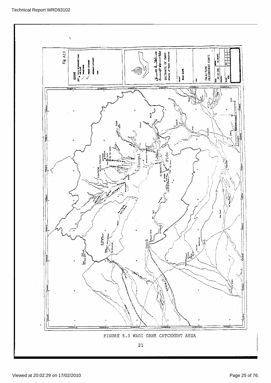
FIGURE 5.3 W}mI DANK C)).TCH!-lENT AREA
21

Technical Report WRD93102
Viewed at 20:02:29 on 17/02/2010 Page 26 of 76.
increasing urban and industrial water demands.
Techniques have been developed to monitor at a localised scale the conseauences of this overexploi tation. However predictive modelling - of the long term effects of continuing overexploitation has not been possible to date for the following reasons: (1) Lack of data on the number of bores on the plains, their
extraction rates and the depth from which they are obtaining _vater.
(2) Quantitative data on recharge from the wadis discharge from the overlying freshwater zone to underlying saline zone and hence to the sea.
(3) Capacity to be able to model the existing environment.
and the
Similar problems only exist on a very localised scale in the Northern Territory. Development has not reached the stage where overexploitation in coastal regions is a problem. with the NT's higher rainfall, surface water options would be viable for large scale development in most localities.
(cl Weathered Fractured Rocks Exploitation of these aquifers only occurs at the village level and has not changed in recent times. The major aquifer exploited is in the weathered ophiolites of the Hajar Mountains. Exploitation is by channelling of spring flows usually of less than 200 cubic metres per day from the source to the village below. The water is very alkaaine with ph's of , up to 12.
These aquifers have not been drilled in Oman primarily because investigation has concentrated on the other potentially higher yielding aquifers. Recent work however has indicated that these aquifers when developed in fractured limestones may have significant potential where near a concentrated recharge source such as a wadi or its floodout. They may be important as an alternate water source in periods of drought when the flows in either borefields or falaj systems constructed in the wadi gravels are inadequate. Care must be taken, however, to ensure that they are not utilised as an uncontrolled means of exploiting the groundwater resources of a region at a rate that is not sustainable. They should be utilised as only one component of a well managed water supply system.
In the Northern Territory many communities obtain water supplies from this type of aquifer. This occurs because the rocks have been more deeply weathered and recharge from the NT's higher rainfall is more reliable.
(d) Sediments Underlying The Interior Gravel Plains And The Rub'al-Khali
A large Tertiary sedimentary basin underlies almost two thirds, or 200 000 square kilometres, of oman. It is comprised of interbedded limestones, marls and shales. Recharge to the shallow unconfined aquifer is from the wadis that drain into the interior from the mountain ranges. Discharge is to the
19
Technical Report WRD93102
Viewed at 20:02:29 on 17/02/2010 Page 27 of 76.
.... _.- .. -~.-
FIGURE 5.4 ------.----.--- -' ------ --.-~-.-.-.-,-,-,-.-.--.-,.-,--,.--- _. - , ..
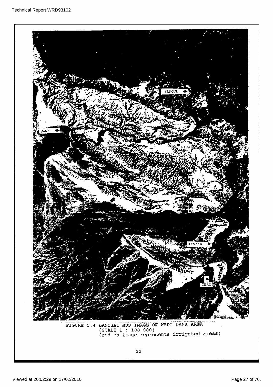
LANDSAT MSS IMAGE OF WADI DANK AREA (SCALE 1 : 100 OOO) . (red on image represents irrigated areas)
22

Technical Report WRD93102
Viewed at 20:02:29 on 17/02/2010 Page 28 of 76.
j
,
Annual Rainfall Data, Yanqui SLaLion .c-oQt'dinnte~ (we5 UTH M), 4~:;uOO E 2tl{)-J200 N
It I, I 1
, 1 I I
I ;\
! I /1,
I ! 1 . "- ; , I
! ,
I 'i ;\
! ! "- i \ "- ,,I
! ;
; IJ . , 1 1 , 1 , 1
\
l/?"M l't17e 1910 1060 1962 iDi)·i. lllC6 1ge1J 19;)0 YEAR
1 \
. Hllt;!
FIGURE 5.5 A..NNUAL RAINFALL DATA, YANQUL
Wil,di l"J..,I\" Gauge Re-cordings GilU\'~ ; DTI502?06AlJ in Wadi Yauqul at YanquI floI'(' in Cubic MeLl'"cs PCT Dl)Y
I I
Da(4 p::o .... lI:lee by SUd3C1! Water P~p.1r1.m>!:'lt. M..W,P_ iW!!.-' <late: ".!"nIIi.-nlnary· S<ll:JIICt 10 l~nl!Wall
o o
~~~._ ---'---,,-,,-li ~,JI.J~....l.--,---'l-i 1--,-1, IlL \llll7 j'988 t-gSll
FIGURE 5.6 WADI FLOWS AT YANQUL
FIGURE 5.7 WELL HYDROGRAPH AT FIDA, DOWNSTREA..l1FROM YANQUL
23

Technical Report WRD93102
Viewed at 20:02:29 on 17/02/2010 Page 29 of 76.
PLATE 4 INVESTIGATION DRILLING NEAR ADN1
24

Technical Report WRD93102
Viewed at 20:02:29 on 17/02/2010 Page 30 of 76.
large salt lake Umm as Samin, shallow water tables adjacent to the Oman - saudi Arabia border, and possibly outflow into the lagoons and the sea in the vicinity of Suqrah Bay.
A regional confined aquifer occurs in the basal Tertiary limestone unit - the Umm er Radhuma formation (Figure 5.8). This aquifer is known as the UeR aquifer. Regional information on its extent has been obtained from data acquired from oil wells. It is recharged in the mountains of western Oman and eastern Yemen from the wadis that flow across it. Groundwater then flows to the north east. Extensive volumes of good quality water have been proven in western Oman. Very little quantitative hydrolo~J has been done to determine how much of this water is modern and how much is ancient and hence determine either its long term or economic sustainable yields.
Recently work has been done investigating if a lateral equivalent of the UeR exists adjacent to the Hajar Mountains in the Buraimi Ibri region. This work has identified significant volumes of good quality water in a regionally unconfined aquifer. Further work is required to determine its thickness and extent.
A regional unconfined aquifer occurs in the Tertiary limestone and shales which overly the UeR. This aquifer regionally contains brackish to saline water. Recent work in the central Al Wustah region of Oman has highlighted ,the existence of localised zones of freshwater. Internally draining creeks have incised steep sided gutters that are up to 30 metres in depth into elevated limestone terraces. stable isotope data has shown that when these creeks flow (very infrequently as the region has an annual rainfall of probably <50 mm), recharge is very rapid to the water table (which is more than 100 metres below ground level in most places). This has resulted in a zone of fresh water occurring in a groundwater resource that becomes increasingly more saline with depth. Because of the deep water tables, high permeability of the limestone and use of rotary air drilling techniques, the presence of this fresh groundwater was not discovered until very recently. At Rima the Petroleum Development Organisation (PDO) has constructed a water supply bore which exploits this freshwater zone in the limestone. They tanker water from Rima to their operations in the region.
It is interesting to note that the Northern Territory also has large volumes of good quality water stored in these type of large regional sedimentary basins - Daly, Wiso and Georgina Basins to name three of the many. water Resources is currently undertaking work targeted at determining the amount of current day recharge. Like Oman we also rely on data from oil wells to determine the regional extent of these aquifers.
5.3 Other Water Sources
Muscat currently obtains a large part of its potable \'later supply requirements from the desalination of sea water. While
25

Technical Report WRD93102
Viewed at 20:02:29 on 17/02/2010 Page 31 of 76.
"-t- ------- - ----+---1'---- -~-
ARA AN I3U
-- -- --- ---+-.-.
, 0' : .... ..0
DISCHARGE AREA; SEEHKA Of UMM as
i U NITEf !J/ A8
~ lMIRAr!-S
I
I, SAM IN. TDS MAY EXCEED
200000 PPM IN U.R ,i.;'-' __ '-____ ---.,._1.-_...::>...._
I
,
,- -- ---- ._---;-----
l. '!(j!HD
_ -- W.OI
'~'t> S,13KH.1
.. MO!JNU1Nio (""er ~m)
_ IolJdH ~CIoO$
+ N I
-----'t---------~------
GU F OF OM iN
----H" s
LEGEND
V.R ABSENT H''"' OF TH!S LlNE
ARABIANl SEA
___ SALINITY (ppm)
••••• LIMIT OF FLOWING BOREHOLES
I '
-- PIEZOMETRIC ELEVATION (m.m~!) I ('=) AREA WITH SIGNifiCANT WATER LEVoL I'
DE tNES . .
FIGURE 5.8 HYDROGEOLOGY OF THE UeR AQUIFER
26
Technical Report WRD93102
Viewed at 20:02:29 on 17/02/2010 Page 32 of 76.
revenue from oil sales continues at its current level this energy hungry means of obtaining potable water will probably grow in importance (as it has in other Middle Eastern countries such as Saudi Arabia and the united Arab Emirates). In the near future, the use of significant quantities of desalinated water ~lill probably be confined to locations on the Batinah Plain such as Muscat.
Reuse of wastewater, such as sewerage effluent, occurs in Muscat. This water is transported by tanker to the areas where it is used for irrigation. The tankers are painted different colours, dependent on the type of water they are carrying, so that the type of water they are carrying can be easily identified. wastewater is mainly utilised on city beautification proj ects around Nuscat. As Muscat's sewerage system is extended, this water source will become more important.
27
Technical Report WRD93102
Viewed at 20:02:29 on 17/02/2010 Page 33 of 76.
6. ARTIFICIAL RECHARGE
Artificial recharge is a means of augmenting the natural infil tration of surface water into an aquifer at a rate that vastly exceeds that which would occur naturally. The method that has so far been utilised in Oman is to form artificial recharge basins by the construction of low head dams across wadis (Plate 5). This technique has been favoured because the wadi gravels are highly permeable and directly overlie the aquifer which is being exploited. The dam is usually located immediately upgradient of either the "mother well" of a falaj system or a borefield.
One such dam visited was located upstream of Ibri. It was designed so that large flows would either overtop the dam or bypass it at bed level on the right bank side of the dam. The design also allows for stored water to be slowly released through a number of discharge pipes located nearly at bed level in the dam wall. This facilitates the natural removal of any fine sediment contained in the stored water and increases the effective area of the recharge basin. Another recharge dam was also seen near Sur. It appeared to be of similar design.
The effectiveness of these artificial recharge dams is currently being questioned in Oman. Inadequate long term data on the rainfall falling on the catchment, the magnitude and return periods of flows in the wadi, and ilie interaction of the wadi and the aquifer it is recharging (ie the aquifers long term sustainable yield), are probably the major reasons for why this questioning is occurring. The last factor is probably the most important. Present investigators are having considerable difficulty in determining the long term sustainable yield of aquifers developed in the wadi gravels. It is improbable that, with the current level of knowledge of most of these type of aquifers, estimates of long term sustainable yield are accurate to within plus or minus 50 per cent. Against this background, and considering the short time period most of these dams have been in operation, it would be almost impossible to determine the effectiveness of these dams.
Notwithstanding the above, if Oman is going to effectively exploit its water resources, artificial recharge techniques will have to be utilised. It is imperative, however, that a good understanding of both the hydrology and geomorphology of the wadi catchment and the hydrology of the aquifer systems recharged by the wadi is gained prior to any schemes being put in place. Schemes put in place should be targeted at storing water that would normally flow to waste in the desert or the sea, not small flows that recharge the many small water supply systems that are distributed throughout the wadi catchment.
28

Technical Report WRD93102
Viewed at 20:02:29 on 17/02/2010 Page 34 of 76.
PLATE 5
Ai AI Khowd, near Sec", lil1y/igllres
~ii'C scale /0 flu: \'osr recharge dam /iI/cd fly recenl raill. The f700d \\'illerS storlll dml'll ji"011l Wadi
Slimail alld \I'ilife IIIOS! ,l/IIie \\'oter
IS rclaincc/, sujficieni POlll'S out /0
gh'e carly morning rrOl'ClfeL"" a JJ1uddl' \\"(/sil. /3ejfJl"(' the dam was
11IIili. Ihe roads a]"(llllld Seeh would /Ii' rendered il1ll'<1ssaiJle hy such a
nood. fll additioll, mallY millIOlls or ('/lili,. lI1ell"eS o{ \\',lier H'''lIfd he lost Tn the Of)!'!/ sea, Today mallY other
SHeil dams aFe heing huflt along rhe B,lf!inuli Plain ill all <:!j<JI"lIO
rCi'!ulrgc the aquij(lfS and slop sa!l
warer inrrusion which. WlClic{'/.;cd.
Wi/S sirnt'ly deslroyillg !nOllY nilllah/c {/ole palm groves along lite ('OI.l,lil. ,
ARTIFICIAL RECHARGE DAM NEAR SEEB

Technical Report WRD93102
Viewed at 20:02:29 on 17/02/2010 Page 35 of 76.
7. SEAWATER INTRUSION
significant seawater intrusion has only occurred beneath the Batinah Plain. This is Oman's main area of agricultural production. Traditional farms tended to be close by the sea where, before the advent of modern drilling machinery, hand dug wells made the most of shallow water tables. These wells exploited the freshwater which overlaid water which became more saline w"ith depth. New farms usually chose a position closer to the Hajar Mountains, with deeper water tables but better water quality (greater recharge). Agricultural activity on the Batinah Plain has increased rapidly during the 1980 I S and today covers an area of approximately 35 000 hectares.
Along with this rapid increase in agricultural acti vi ty, has come a dramatic increase in water consumption, leading to a considerable drop in water tables. As a result, in many areas the underlying more saline water has upconed and replaced the better quality water. In other areas adjacent to the coast sea water has displaced the freshwater. 1I.s the quality of the irrigation water has deteriorated, crop yields have reduced. The Ministries of Agriculture and water Resources have tackled this problem on two fronts.
The Ministry of Agriculture initiated a strategy in 1989 emphasising the introduction of modern water efficient irrigation systems] especially on the largE/' number of small scale farms where agriculture is used as a source for a second family income. The Ministry of I'later Resources is undertaking a major water resources management program involving: (1) The registering of all wells and bores that have been
drilled. until recently no records existed. (2) Acquiring data on these bores. This includes the amount
of water it is producing. (3) Requiring a permit before a new bore can be drilled. (4) Regional mapping delineating the extent of the areas
where problems are occurring. This includes the use of remote three dimensional reconnaissance techniques, such as airborne electromagnetics (recently utilised by WRD for a similar purpose on the Mary River floodplains).
(5) Detailed studies targeted at determining a sustainable development strategy that minimises the effects of seawater intrusion and the localised upconing of the more saline water tha;; underlies the good quality \vater that is suitable for irrigation.
Another possible solution to the problem is the use of desalinated water. Before a solution such as this is employed, careful consideration would need to be given to the economic benefits and costs of this solution as against the costs of importation of those items that require large amounts of irrigation water (or their replacement with a similar item that has greatly reduced water requirements). A careful study may indicate that there is great benefits in importing those items from another country where they can be produced more cheaply due to an abundance of natural resources.
30

Technical Report WRD93102
Viewed at 20:02:29 on 17/02/2010 Page 36 of 76.
8. WATER RESOURCE MANAGEMENT
until the 1970's Oman's water resources were managed in the same manner as they had been done for centuries previously. The way in which it was managed differed depending on whether the water was being extracted by means of shallow hand dug wells or falaj systems. The amount of water able to be drawn from shallow hand dug wells was limited to the amount of water that could be drawn by either animal or man power. Very limited agriculture was watered by this means, the majority of water being used for domestic purposes or watering of stock.
Falaj systems, however, were (and still are) capable of delivering water supplies in excess of 10 000 cubic metres per day. These supplies were used to irrigate most of the land used for agricultural purposes until the early 1970's. This i=igation was undertaken at the village level. At the very root of village life was the need to preserve water rights. The distribution of water was, therefore, carefully recorded in falaj books. There was often more than 200 owners of permanent water rights in a single falaj and many more who had temporary rights.
Each community dependent on a single falaj in a village represented a self sufficient hydrological society, whose members were compelled to cooperate. An average sized falaj supported about 1000 people (flow rate 4P l/s), while a village where a number of aflaj were concentrated supported populations of as much as 10 000. When you consider that the domestic requirements drawn by hand from the falaj were of the order of 20 L/day (0.25 L/S for a population of 1000), it is obvious that virtually all (>99%) of the water flowing in the falaj was used for irrigation.
The principles of shareholding in the irrigation water were complicated. Distribution to the garden was usually arranged in a set order and each plot of land had a prescribed period of time allocated to it. This period of time was known as an athar and was equivalent to half an hours watering. Temporary shares were sold at auction by people holding permanent shares. The bidar had the responsibility for distributing water within the village gardens. He was answerable to the aarif, the supervisor of the falaj, and not to individual owners.
This management system worked effectively for centuries until the advent of modern water bore drilling equipment in the 1970's. Until the late 1980's water bores were drilled at an ever increasing rate throughout Oman without any regulation (other than the actions of irate sheikhs) or requirement for information to be provided. In many instances, bores were sunk into the same aquifers that were exploited by the hand dug wells or aflaj. Subsequent pumping in some cases has resulted in declining yields in the aflaj and drying up or salinisation of hand dug wells.
31
Technical Report WRD93102
Viewed at 20:02:29 on 17/02/2010 Page 37 of 76.
Recently a project has been COID.>nenced targeted at registering these bores and gaining basic data on them. All new bores now require a permit (refer Appendix B) before drilling commences. An accelerated program of resource assessment and monitoring has commenced to provide the data upon which management strategies may be developed for the various groundwater systems. with development proceeding at the rate it is, it is highly probable that serious problems will occur in a number of aquifers before these management strategies are developed. Since very little of the water resources are used to fulfil domestic water supply requirements, it should be relatively easy to put in place now strategies which will ensure these supplies are protected, both in quantity and quality. Development of strategies for managing water used for irrigation will take longer and should proceed hand in hand with strategies directed at improving the efficiency of irrigated agriculture.
In the Northern Territory, since the 1960's, it has been compulsory for all bores to be registered and a range of data provided for each bore. The water Resources Division commenced its resource assessment progralll in the 1950's. It now has a data base which can be used to enable management strategies to be implemented in areas prior to significant problems occurring.
[ -:.::.,: .-, :::-. -. , '-,"':' ",..'-
.' ··r -' IJ,\ . ".. ~\ .. .. ,..;.~ . . .'
, •
.. FIGURE 8.1 MINISTRY OF WATER RESOURCES
EDUCATIONAL LITERATURE
32

Technical Report WRD93102
Viewed at 20:02:29 on 17/02/2010 Page 38 of 76.
9. MINISTRY OF WATER RESOURCES
When His Majesty sultan Qaboos opened the first session of the Maj lis A I Shura (People I s Assembly) on 21 December, 1991, it marked an important extension of the democratic process in Oman. The Majlis is made up of representatives of each of the sultanate's 59 wilayats (regions). The Cabinet of Ministers is the highest executive authority in the country, deriving its power from the sultan to whom it is collectively responsible.
There are 27 Ministers. The Minister of Water Resources is responsible for the management of water resources throughout Oman. Three Hinistries construct works exploiting the country's water resources - Ministry of Electricity and Water, Ministry of Agriculture and Fisheries, and Ministry of security and Defence. The Petroleum Development organisation (PDO) , another government organisation, is also a big user of groundwater. The remaining systems extracting groundwater are privately owned and operated.
The Ministry of water Resources is divided into 4 Departments water Resource Assessment, water Management, Regional
Affairs and Administration and Finance. The organisational structure for the Ministry is shown on Figure 9. There are 20 Divisions and 10 Regional Offices. The Ministry in April, 1992, had 787 approved positions - 659 for Omanis and 128 for Expatriates (mainly professionals from Australia, England, USA, India and Sri Lanka). In April, 1992, 592 positions were filled - 529 Omanis and 63 Expatriates. The current situation ,\vould not be very different as a 1992 recruitment drive was followed by a decision not to extend the contracts of junior expatriate professionals. The maj ori ty of expatriates work in the groundwater field. They are provided to the Hinistry by consultant companies (eg AUSCON) who engage staff on 12 month contracts that are usually renewed. All expatriates living or visi ting Oman have to be sponsored by an Omani or an Oman based company.
The Ministry contracts out all its drilling and test pumping work. In April, 1992, 14 contracts valued at $A6 million were current. It also contracts out the majority of its geophysical work, including all downhole logging work.
The Ivater Resources Division in the Northern Territory has 117 approved positions located either in Darwin or Alice springs. It does its own drilling and test pumping work. All of its geophysical work is done in-house.
33
Technical Report WRD93102
Viewed at 20:02:29 on 17/02/2010 Page 39 of 76.
• 2
• • · • · " • • "
" ~
" 8 , 0 •
!"'-.-Q~~ >~O .'- .'~ o~ ... '!: ......
• • ~ 0 - • • 0 0
~
<!l ;: \( w z ill w
'"
< t r;
'5 ,5 .a i E~
, . .. ,,~
,00<
';:..::~ , . , ,,-
~ ". '~ ., . ., ... , ., .,-
" 00_
"" . ,. ". , '0 "<-
~ · .~ E~~ , ..
, " 0.-
,; =:il <; .. .., ..... ;> 00-
• <, :;-= ;.~~ iU:~ ~~~
, o , ., o.~ 0_0
'I" ~~?
· • c:: ..... - >< , .. ,,, ~c, c ••
e · ~ · " ",-
· ~~ ;:§ o.
,~g ,-.~ .~
" .. >c< ,;;~
FIGURE 9.10RGANISATION CHART FOR MINISTRY OF .. ,ATER RESOURCES
34
, .0_ "'" :; ~~ ""~
~ .. -"." . -., . . ., '0.
s .. ~ <0" ~ .. -« ~;!:z.

Technical Report WRD93102
Viewed at 20:02:29 on 17/02/2010 Page 40 of 76.
PLATE 6
J
ACTIVITIES OF MINISTRY OF W"ATER RESOURCES
35

Technical Report WRD93102
Viewed at 20:02:29 on 17/02/2010 Page 41 of 76.
10 DISCUSSION
Oman, a country with 750 000 people occupying 300 000 square kilometres, has developed rapidly since the early 1970's. This development has been financed by the revenue gained from its oil sales. This deve~opment has resulted in very dramatic increases in domestic and agricultural water demand. Except for Muscat, this water demand has had to be met wholly from the country's groundwater resources. Muscat derives some of its domestic water supply requirements from desalinated sea water.
Oman has recognised that to groundvlater resources :.t must:
effectively utilise its
(1) Have knowledge on the quanti ty , quali ty and sustainability of all of its groundwater resources.
(2) Have in place a strategy to effectively manage its groundwater resources.
until recently very little information existed on Oman's groundwater resources. No requirement existed for anyone constructing a bore to provide the Government with any information on the bore. Very little expertise in the groundwater field existed in the country with most studies being short term studies undertaken by organisations with a specific immediate water supply need. ,
\
To undertake the regional investigation work it must do, the Ministry has had to recruit the necessary experienced groundwater professionals from outside the country. A large number of these professionals have been recruited from Australia because of their relevant applied experience in very hot, arid areas. Currently working in Oman are 7 professionals who have worked for water Resources Division in the Northern Terri tory. There are currently over 20 professionals working in the Ministry who have gained most of their relevant experience while working in Australia. Most of Oman's overseas groundwater professionals have been in Oman for less than 4 years. Most are contracted to manage one or two projects in a particular region. Oman does not have groundwater professionals who have worked on a variety of projects across Oman.
The NT is fortunate that it does have a group of experienced groundwater professionals who have gained a large part of that experience on proj ects across the NT. This then enables the development of regional resource investigation techniques that are cost effective for the hydrogeological environments they are applied to. It also' results in a groundwater management strategy that is directed towards the long term rather than the short term.
As with most groundwater studies, the major problem has been in determining the long term sustainable yields of the various groundwater systems. Recent work, however, which has equated
36
Technical Report WRD93102
Viewed at 20:02:29 on 17/02/2010 Page 42 of 76.
the sustainable yield of a large aquifer in cemented wadi gravels to approximately the flow in the existing falaj systems, may provide the basis on which these yields may be determined. These falaj systems have been in operation for centuries and may provide the long term data that is required to enable modelling of these systems to be undertaken. Once a calibrated model has been developed, informed decisions regarding effective management and possibly artificial recharge options can be made.
In a country with a cultural background that is as strongly linked to its groundwater resources as is oman's, the development and implementation of any water resource management strategies have to involve the people affected prior to any decisions being made. Once a decision is reached then education plays a big role in making sure that the strategy is effectively implemented. Oman has recognised this and is strongly pursuing this line. An example of this is the ongoing campaign to raise public awareness of the importance of conserving the Sultanate's precious water resources. This campaign is occurring in a country which has a per person water usage of between 50 and 200 litres per person per day (cf Alice Springs usage of 1200 litres per person per day). It should be pointed out that grass in Oman is a luxury only the very rich can afford.
The Northern Territory .,ith a population of 180 000 and an area of 1 342 000 square kilometres has a mu~h higher rainfall than Oman. However it lacks the mountains of Oman which concentrate runoff and the highly permeable wadi gravels which enable a large percentage of that runoff to be naturally stored in aquifers for later usage. The NT with its deeper clayier soils and much greater density of vegetation loses most of its rainfall to evapotranspiration. This has resulted in the NT obtaining most of its water supplies from groundwater resources stored in either large sedimentary basins or weathered fractured rocks. This type of resource has so far only been exploited on a minor scale in oman due to the large volumes of easily obtainable water stored in the aquifers developed in cemented wadi gravels. Increasing development pressures are forcing Oman to investigate the potential of their large sedimentary basins. Like the NT, much of the regional data for these basins has been acquired from oil wells due to the expense of constructing deep investigation bores.
Unlike oman, it has been compulsory for the last 25 years for all water bores to be registered and a range of data supplied for each bore. This has enabled a detailed inventory of the groundwater resources of the NT to be built up, something which Oman lacks. This lack of data is making it very difficult for Oman's Ministry of water Resources to assess the effectiveness of its regional resource investigation programs and put in place effective groundwater resource management strategies.
37

Technical Report WRD93102
Viewed at 20:02:29 on 17/02/2010 Page 43 of 76.
In summary it must be said that the people of Oman have a greater understanding of the value of water compared to the people of the NT. However the introduction of modern water bore drilling technology in the 1970' s has enabled irrigated agriculture to expand at a rate that is not economically sustainable in a number of areas. This combined with the lack of any regulatory controls has led to the current requirement for an accelerated resource assessment program to provide the data upon which effective water resource management strategies can be based. This program is being effectively managed by a team of groundwater professionals which includes a significant number of Australians. I am indebted to one of these Australians, Geoff Prowse, for taking the time to both explain and show to me so much about the hydrogeology of Oman.
38

Technical Report WRD93102
Viewed at 20:02:29 on 17/02/2010 Page 44 of 76.
APPENDIX A. ITINERARY, OBSERVATIONS AND PHOTOGRAPHS
, ,

Technical Report WRD93102
Viewed at 20:02:29 on 17/02/2010 Page 45 of 76.
BAHRA!N
\ QATAR
\
SAUDl ARABIA
THE GULF
UNITED ARAB EMIRATES
, I
GUlf Of OMAN
ARABIAN SEA
Road Communications _ ASFHAtTIiJ ROADS
__ UNSURFAC~DflDADS
"" __ FIELD TRIP 21-22 MARCH __ FIELD TRIP 23-27 MARCH
•••• FIELD TRIP 29 MARCH o "'l<lm~!I~! I D M;je~
~!lO
lao 300 ! "1
20C
FIGURE Al FIELD TRIP ROUTES

Technical Report WRD93102
Viewed at 20:02:29 on 17/02/2010 Page 46 of 76.
~, b
',::. 'c ';" .
! -'~ , , -
,
:i t ..
-
"~':" .....
,- <-=.:.:\. , ,
!.R t--,
i-,.. I J'.'.-~'
"?, .), ,
! Be
T IS
I"'".
, -1
0:2
---
o
__ L~ r,
! ~ -
, \. 1 , !
AI

Technical Report WRD93102
Viewed at 20:02:29 on 17/02/2010 Page 47 of 76.
ITINERARY, OBSERVATIONS AND PHOTOGRAPHS
Following are brief notes on discussions I had with a range of people and observations I made during my trip to Oman between 16 March and 3 April, 1993.
TUESDAY 16 MARCH, 1993 Departed Darwin 5pm Tuesday 16 Airlines Flight Number MH130 to 8.10pm and departed Kl on Malaysian MH18 for Dubai at 10.45pm.
WEDNESDAY 17 I~CH
March, flying Malaysian Kuala Lumpur. Arrived KL Airlines Flight Number
Arrived Dubai 1.45am. Spent over 9 hours in the Dubai airport transit area awaiting connection with Gulf Air Flight Number GFI02 which departed for Muscat, Oman, at IO.30am. Arrived at Muscat's airport at 11.15am. Very difficult to make out anything on ground while flying as air is full of dust plus there are few contrasting colours in a landscape which is very dry and barren. Cleared customs quickly as necessary paperwork in order - No Objection Certificate and Visa. Het at airport by Geoff Prowse and Joe Papez. Weather very mild- dry and about 30C. Taken to accommodation organised for me by AUSCON.
Settled in and then went into the Hinistry o~ water Resources Ruwi office and met one of Geoff's bosses - Brian Ecclestone. Brian is a very experienced English hydrogeologist who has worked extensively in Africa and the Middle East. Then visited the drilling section and discussed how things are done in the Ministry with 4 drilling supervisors, 3 of whom were Australian. All drilling work done by contract. Spent rest of day looking around Muscat and Ruwi and settling in.
THURSDAY 18 MARCH (FIRST DAY OF WEEKEND) went into Ruwi High street with Joe Papez for him to do some last minute shopping prior to his departure for Darwin. Then went to Ministry's office to meet Geoff and get a run down on how the Ministry does its groundwater investigation work. spent most of afternoon talking to an ex Victorian hydrogeologist Phil Macumber talking about the hydrogeology of the Al Wustah - area roughly betvleen Nedj and Wahiba Sands. \'later table beneath gravel plains on edge of Empty Quarter near Muqshin is <1 metre below ground level. Groundwater flows north east from mountains north and west of Salalah towards Umm as Sammim (very large salt lake). Some ground\>TatBr flows to Umm as Samrnim, the remainder flows east to Arabian Sea near Qahal. Base of dunes over Empty Quarter virtually level at about 150 - 170 metres above MSL. Umm as Sammim's elevation is about 60 metres (this situation not to dissimilar to Lake Eyre and the Great Artesian Basin in Australia) .
In evening took Joe Papez to airport for him to return to Australia for holidays.

Technical Report WRD93102
Viewed at 20:02:29 on 17/02/2010 Page 48 of 76.
FRIDAY 19 MARCH (SECOND DAY OF WEEKEND) Spent most of day relaxing, reading up on the history and the hydrogeology of Oman, and discussing Geoff's experiences in Oman.
SATURDAY 20 MARCH Again visited Ninistry's office and discussed how test pump analysis and modelling to determine sustainable yield was done with Geoff and young English physicist Peter Easton. Techniques used are often inconsistently applied. The Ministry lacks experience in this field and is currently recruiting from Australia to fill that need. Also discussed the application of geophysics and remote sensing with various officers. Geophysical techniques are currently limited in most regions to downhole logging which is carried out by contractors. In the field of remote sensing, applications are limited to the use of photographic Landsat TM products currently being acquired from Australia. In all these areas techniques currently being utilised by us are well in advance of those being used in Oman.
Discussed the application of the use of artificial recharge dams with a very experienced English engineer. The initial enthusiasm for this to be a solution to, some of Oman's overextraction problems has dimmed somewhat due probably to both the irregularity in river flows and the siltation problems arising from runoff from steep, highly erodible, sparsely vegetated catchments.
Prepared for trip into interior with Keith warne, a hydrogeologist who had formerly worked with WRD in Alice Springs. Trip to take two days and study the ~Iadi Dank catchment hydrogeology, the area Keith was project manager for.
SUNDAY 21 MARCH Travelled Ruwi to Dank, a distance of approximately 350km. Departed from Ninistry office at 9am. Travelled Ruwi to Nizwa via the highway through the Sumail Gap (152km). Sumail Gap entered at Fanj a. The highway traverses the Gap which has formed adjacent to the contact between the ophiolite and the limestone/calcareous shale. The highway exits the Gap at Izki, 33 km from Nizi'la. Countryside bare except for date palms around falaj systems.
Nizwa is a large regional centre (population 5000) that stands at the junction of two of Oman's major highways - Muscat to Salalah and Nizwa to Buraimi and on to the united Arab Emirates. From Nizwa to Ibri (139km) a large number of 2 to 5 hectare blocks have been newly developed adjacent to the highway. Except where adjacent to a falaj system, each has required the drilling and equipping of a bore. Until recently these bores were not licensed and serious water quantity and quality problems are evolving. A typical block will have a

Technical Report WRD93102
Viewed at 20:02:29 on 17/02/2010 Page 49 of 76.
dwelling, about 600 square metres of lucerne (for the goats), 100 to 200 square metres of date palms, and a bore 10 to 40 metres deep sunk in cemented river gravels.
Turned right from highway at Amlah, travelling on dirt track past some small villages (Plate 7). Schools servicing these villages are often located well away (2 to 5km) from the nearest village. Small trees are very thorny ,'lith branches covered in thorns 25 to 50mm in length. Area between Bat and Dariz showing signs that groundwater is being overexploited (ie too many bores, too little water) - date palms either dead or dying.
Examined artificial recharge dam west of Dariz (Plate 20). Designed for large flows to overtop or bypass main wall at bed level on right bank side and for stored water to be slowly released through a number of discharge pipes through the dam wall again at bed level. The design of the dam appears to be targeted at minimising the buildup of sediments I both fine (pipes) and coarse (overtopping and hence scouring). Purpose of recharge dam is to recharge falaj system servicing the downstream village of Aynayn and town of Ibri. The falaj l<las flowing at a rate of approximately 50 to 100 L/S. The first extraction point on the falaj was for drinking water, second for washing, and remainder for irrigation. Nany little black fish (up to 50mm) were swimming in the water. The falaj is being reconstructed by excavating adjacent I to the existing falaj and creating a new tunnel and entry points (ie manholes) lined with concrete (Plate 11). This reconstruction work is being financed by the Department of Agriculture and is required because some of the tunnels have collapsed and the skilled workers required to rebuild the tunnels in the traditional manner no longer exist. Falaj systems are still viewed as the most cost efficient way of exploiting groundwater resources and also form an integral part of the culture of each village.
Ibri is a regional centre with a population of about 3000. It is located about 20km west of the Hajar Range on the gravel outwash plains. Travelled further 20km to south west over the gravel outwash plains to a site which was being drilled for a proj ect being managed by an Australian hydrogeologist - Bob Read (worked for IVRD in Alice Springs in 1970'S) - based in Buraimi. The project was investigating if the UER aquifer also occurred in this region. The Ninistry had a young English hydrogeologist and an English drilling supervisor on site. A drilling company known as Arab Drilling Co were drilling on contract using a Drilltech top head drive rig with a 900 efm, 250 psi compressor on deck. The crew were Indian and an Indian engineer was on site managing the Company's work. They were drilling a 12 1/4 inch hole with a rock roller, followed by 8 inch collars and 4 1/2 inch drill pipe, to run 8 5/8 inch casing. They were down to 43 metres in calcareous conglomerate (most of calcareous cement leached out) of Fars Group. They were airlifting 30 L/s of water with a conductivity of 1600 us/em (Plate 23). The previous hole 1 km to the east, closer to the major outwash channel of Wadi Aynayn, airlifted 12 Lis, 900 us/em water from between 50 to 80 metres. This area is

Technical Report WRD93102
Viewed at 20:02:29 on 17/02/2010 Page 50 of 76.
devoid of vegetation and has a mean annual rainfall of probably <50 rom. possible reason for good quality water and high falaj flows might be a combination of higher rainfall in (>3000 metre) mountains, bare slopes (no sailor vegetation), leading to rapid runoff from high intensity storms infil trating quickly through coarse bouldery I cobbly wadi sediments. Recharge in wadis appears to be roughly about 1 metre for an average flow event (can be up to 5 metres or more for larger events). The specific yield of the cemented gravels probably in the 3 to 10% range.
Travelled Ibri to Dank in the dark. Arrived 10.30pm.
MONDAY 22 MARCH Weather in Dank hazy from dust, but othenlise ideal - fine, min 19C, max 33C. Visited part of Keith' study area in the mountains to north of Dank. Sediments in wadi appear to consist of a number of cut and fill periods - ie wadi cuts gorge through sediments, landslide blocks gorge, gravels fill valley behind gorge, wadi overtops blockage and cuts into gravels (Plate 10). Gravels well cemented due to the gravels consisting primarily of limestone.
Keith located a number of investigation bores beneath the gravel outwash plains north of Dank in a fault zone that runs parallel to and about 2 km west of the mountains (Plate 21). Yields of up to 20 Lis of good quality water were airlifted from depths of 50 to 100 metres from fractured Tertiary limestones. No work was programmed to deter~ne the long term potential of this fractured rock aquifer.
The main falaj system servicing Dank is not tunnelled into the cemented wadi gravels. It diverts water from a waterhole where the ~later table comes above ground level where the wadi valley becomes much narrower.The falaj was flowing at >100 Lis. A similar situation exists further up the catchment at Fida. An investigation bore drilled with air and cased with 10 inch casing and 30 m of screens, sited in the wadi adjacent to Fida intersected 40 m of gravels, and airlifted 200 Lis of good quality water (Plate 22). (Note - comments on a downhole video of this hole prior to it being cased are given in notes on 30 March). Data on long term water level fluctuation is given in Figure 5.7 for a bore close to Fida. Note the similarity to I'later level hydrographs obtained from central Australia where recharge events with long return periods (1 in 10 years or more) are also important.
Upstream of Fida lies the large town of Yanqui. YanquI's water supply is becoming more dependent on bores as the rapidly expanding town's water demand has lowered Iva ter 1 evel s to the point where the falaj does not function. Large areas of dying or dead date palms occur near Yanqui. About 20 km upstream of YanquI is the site of a possible gold I copper mine. The only potential water supply source for this mine is near Yanquil which v,ill lead to more problems with that town's water supply. The village, Saayah, near the mine obtains its water supply from a highly alkaline spring (flo~l rate about 2 Lis

Technical Report WRD93102
Viewed at 20:02:29 on 17/02/2010 Page 51 of 76.
reticulated along a small fractures in the ophiolite comprised (Plate 17).
concrete gutter) emanating from of which the nearby hills are
Returned to Muscat via Ibri, Rustaq and Nakhl. The mainly dirt track from Ibri to Rustaq traversed the Jabal Akdah of the Hajar Ranges. As for the highway through the semail Gap, the track roughly followed the ophiolite / limestone shale contact. The scenery was very rugged (peaks up to 3000 m) with many small villages (populations 20 to 500), and raised terraces (Plate 9) formed by the cut Ifill process described earlier. Rustaq is a large regional centre with a population of 10000. It is situated at the base of the Hajar Range on its eastern flank. Rustaq was reached just before dark. Highway Rustaq to Muscat of exceptionally high standard as are most highways in Oman. Reached Muscat at Spm.
TUESDAY 23 MARCH Prepared to leave this afternoon for trip to Wahiba Sands -Sur region with Geoff Prowse for the duration of the EID holidays (6 day holiday to mark the end of !1oslem fasting period knOlvn as Ramadaan during which no eating or drinking allowed from sunrise to sunset). \'lill be staying in village of Mudhayrib and using it as a base as accommodation during EID holidays at a premium.
On way out of Muscat took photographs of water tanker filling station (Plate 25). A large number of house.s in Huscat (and virtually all houses in the villages and ~egional centres) don't have retiCUlated water. They have a 1000 litre water tank on their roof that is filled from the tankers for a cost of 2RO (ie about $A7.50 per kL). Tankers discharge to connection at front of property and water is pumped to tank. \'later is retiCUlated around house as per normal. Tank lasts family about one week. Very effective water conservation technique since the majority of Muscat's water supply comes from either a large desalination plant or a number of small borefields constructed in wadi gravels and located within 20 kID of the city.
Travelled to Mudhayrib via Fanja and Ibra. lbra is a large regional centre similar to Ibri but more spreadout. The regional office of the Ministry of water Resources is located in Hudhayrib. 110re vegetation in this region than to north around Ibri. Could be due to either more rainfall or less goats. Dates and lucerne still main crops. However limes and mangoes are also grown.
Mudhayrib is a small town with a population of <1000. It has a well preserved old walled city surrounded by "jumbled up" outcrops of ophiolite. A large grove of date palms ~s irrigated by a falaj. Bores, however, are beginning to be used wi th signs of over extraction appearing on the outskirts of the town. For the duration of our stay a Drilltech drilling rig, similar to the one I visited in operation near Ibri, was parked at the back of the Ministry's office.

Technical Report WRD93102
Viewed at 20:02:29 on 17/02/2010 Page 52 of 76.
A large project targeted at investigating and documenting the groundwater resources of the plains between the Hajar Ranges and the I~ahiba Sands is being managed from this office by an experienced English hydrogeologist who was unfortunately away on holidays during my stay. He is also managing a similar proj ect covering the Wahiba Sands where previous investigations have failed to identify potable groundwater. Geoff Prowse was across the work and during our travels from this base was able to fill me in on what were the problems in each area and possible reasons for why they had arisen.
WEDNESDAY 24 MARCH Travelled on highway traversing the gravel plains between the Wahiba sands and the Hajar Range from Mudhayrib to town of Binad Bani Bu Ali via Al Kamil and Binad Bani Bu Hassan. All three are large towns with populations of about 5000. For most of the way highway travels along the left bank of wadi Al Batha. Villages and towns get water from falaj systems that exploit the gravels of the Wadi or its tributaries. The two Binad Bani Bu towns lie about 40 kID inland from the coast, adjacent to the Ivahiba sands, and historically for this region have been the closest location to the coast where potable water could be found. with rapid regional development the salinity of the two Binad Bani Bu towns' water supplies have increased to the point ,,,here piping of desalinated water from the coast is being seriously considered.
• \
Turned off at Binad Bani Bu Ali into I'loodlands on edge of Wahiba Sands. Travelled for 59 kID through the I'loodlands. Woodlands are narrow strip - 1 to 20 kID in width - of Prosopis (Ghaf) trees lying between a flat plain (in some places a sabkha) and the sand dunes of the Wahiba Sands. They are habitated by numerous (>100) small camps of nomadic Bedouins. Each camp seems to have a Toyota 4WD trayback. Where sands are red there usually seems to small outcrops of limestone/chert/ shale (Hawasina Complex). These rocks seem to outcrop/subcrop beneath the plain and maybe beneath the Prosopis Woodlands. Saw a fe~l wells equipped Ivith submersible pumps run off small portable generators (Plate 18). The wells appeared to be hand dug, about 1 metre in diameter, concrete lined with standing water levels around 5 metres (very shallm'l). Adjacent to each well was a small open concrete tank and \.;atering troughs for the goats, sheep and camels that the Bedouins had.
Left Woodlands and travelled on well graded road along coast for 39 km into Ashkharah, a large fishing village , which is the end of the bi turnen highway passing through the two Binad Bani Bu to~ms. Then returned to Mudhayrib.
THURSDAY 25 MARCH Sick all day.

Technical Report WRD93102
Viewed at 20:02:29 on 17/02/2010 Page 53 of 76.
FRIDAY 26 MARCH Travelled into edge of Wahiba Sands near Al Mintirib, 24 km east of Mudhayrib. Falaj at Al Mintirib flowing at about 50L/s (Plates 13 and 14). Large numbers of little fish (about 3 em in length) in water. continued on 7.5 kIn to village of Hawizah (population about 500). This village is rather unique in that it is located in a swale between the sand dunes on the Wahiba Sands side of Wadi Al Ba tha ( PIa te 19). Located beb"een the village and the Sands end of the swale was a small Bedouin camp. The track up the side of the dune looked as though it would be impossible for a vehicle to travel over it. However it is regularly used. In the area irrigated by the afalaj at both Al Mintirib and Hawizah grew not only dates and lucerne, but also mangoes, bananas and paw paws.
Travelled a further 60 km east on highway from Al Mintirib to Al Kamil on gravel plains, then turned left off on another new highway running north through the Hajar Range into the major coastal town of Sur. Wide valley through Range starts about 20 kID to the north of Al Kamil and continues for another 40 km to outskirts of Sur. Hany old river terraces occur in the valley. No villages probably due to the lack of any depth of river gravels belOl" water table. Many pools of water in Ivadi (unlike elsewhere) - probably because wadi cut into basement rock. Where a few houses exist, either carting water or exploiting pools in wadi. very little vegetation in valley in comparison to Ibra Al Kamil region where "relatively well grassed", many prosopis trees, and many towns and villages,' Sur lies at the northern end of the valley on the coast.
Sur is a picturesque regional centre with a population of approximately 10000. It ~s historically a famous seafaring town and wooden dhol"s are still constructed here using the traditional methods. As with other towns and villages, soccer appears to be the favourite sport. Here the beach at low tide was broken up into soccer fields with games been played by children and adults on each "field".
Sur is experiencing problems with its water source due to rapidly increasing demand. An artificial recharge darn has been constructed across the main wadi 1 0 km south of Sur and a borefield constructed down gradient of the darn. As with further up the valley the problem appears to be due to a lack of depth of river gravels (this could be due to the coast in this locality rising due to active faulting).
Sur was decorated up to the hilt and very clean for the visit of suI tan Qaboos. He had not visited Sur for a number of years. The SuI tan's royal camp was located amongst elevated old river terraces 10 km to the south of sur, adjacent to the highway and wadi. The camp was well protected by troop placements located on the old elevated river terraces ringing the camp. For this reason a visit to examine the nearby artificial recharge dam was considered to be unwise.

Technical Report WRD93102
Viewed at 20:02:29 on 17/02/2010 Page 54 of 76.
SATURDAY 27 MARCH Travelled to Adam via Al Mudhaibi and Sanaw. New highway as far as Sanaw (98 km). It appears that grasses/shrubs/Prosopis (could be considered as equivalent of Australian River Red Gum) don't grow in old raised river terraces. They appear to thrive in modern drainage systems probably because of a greater depth of soil and more water available. For Oman the countryside between Al Mudhayrib and Sanaw is well vegetated.
Two kilometres north of Al Mudhaibi a falaj was being reconstructed (Plate 12). This reconstruction was necessary because of decreasing flow rates in the falaj resulting from lack of maintenance of the tunnels. Skilled workers are no longer available who are prepared to clear blockages in the old unlined tunnels. As a result the Department of Agriculture is financing a major tunnel reconstruction program throughout Oman. Reconstruction of the tunnels is carried out in the manner described for this site.
A Cato excavator (with jackhammer attachment) was being used to dig a trench in the cemented river gravels to the level of the bottom of the old tunnel. This was approximately 8 metres below ground level. The new trench was being dug about 10 metres away from, and parallel to, the existing tunnel. The new IItunnel" was being constructed of concrete in the form of a totally enclosed box shaped channel ,.,ith the old and new tunnels appearing to be interconnected at t~e location of new manholes. This then enabled the benefits of the new ,vork to be utilised by the people of Al Mudhaibi while construction was taking place. The new manholes were constructed of concrete, the old were unlined shafts dug through the cemented river gravels.
The Cato benched itself downwards by making an initial wide trench of 4 metres depth, then driving down into trench and digging another trench of 4 metres depth. The water table was below the bottom of the trench. The material forming the side of the trench (from top down) was: (a) 0.5 metres of modern soil and river gravels (b) 3 metres of cemented gravels - mottled profile with cut
and fill structures. These structures were filled with loose sand/gravel. Roots were seen going down to >3 metres. The cemented gravels were white interlayered with khaki and were clayey.
(c) Below were loosely cemented bouldery gravels (up to 0.4 metres in diameter) and gravels.
Manganese staining was cornman in gravel layers (weathered ophiolitic gravels?). An attempt was made to estimate probable specific yields (SY) for the above material - bouldery gravels - SY of 5 to 10%; gravels - SY of 15 to 25%; and cemented clayey gravels -SY of 5 to 10%. Overall the river gravels would have a SY of probably around 10%.
As Sanaw is approached totally comprised of old of vegetation. The well
the country appears to be almost river terraces with a consequent lack graded dirt road from Sanaw to Adam

Technical Report WRD93102
Viewed at 20:02:29 on 17/02/2010 Page 55 of 76.
(60 Ian) traverses old river terraces (possibly belonging to the Fars Group) with virtually no vegetation until Wadi Halfayn is reached. Geoff had done a lot of investigation work in this area and had identified a high yielding 200 metres wide palaeochannel about 1 to 2 km to the west of, and parallel to, the existing Wadi Halfayn primary channel. The original course of Wadi Halfayn .,as located adjacent to the eastern end of the Jabal Madmar and has subsequently migrated to the east. Instantaneous yields of 40 L/s with a conductivity of 1700 uS/cm were obtained from up to 25 metres of cemented river gravels. The sustainable yield of this system is low «25 L/s), however, probably because it is remote from the source of modern recharge - Wadi Halfayn' s primary channel is incised into the well cemented gravels of the Tertiary Fars Group.
Geoff also investigated the potential of the fossiliferous Cretaceous limestone/shale forming the Jabal Madmar. Bores located on a fault zone produced instantaneous yields of between 1 and 10 L/s with a conductivity of 1900 uS/em. No work has been done on their sustainable yield but it would depend on their interconnection with the river gravels of the palaeochannel and the present wadi.
Drove into Adam from the south of Jabal Madmar, past the powerhouse which was appropriately located well down gradient of Adam's water source. Adam is a large regipnal centre built in and adjacent to the bed of the wadi as rt flows through a gap in the ranges at the western end of Jabal }rndmar. Most of the town, by necessity, has been constructed to withstand periodic flooding (Plate 26). As with all towns and villages using falaj systems, it is located up gradient of the date groves. It has a large hospital serving the town of 7000 and the larger region. Adam's potable water is tankered in from a bore located near Izz, 30 km to the north, because locals are worried about pollution of the water carried by the falaj system (from 4 separate aflaj). Water from the falaj system (flow rates ranging during the preceding 8 years from 190 to 300 L/s with a mean conductivity of between 1100 and 1700 uS/cm) is used for irrigating the large area of date palms. Geoff's major project has been to delineate the groundwater resources in the river gravels upstream of Adam and determining their sustainable yield. To do this, 45 bores have been drilled, 4 of which ",ere constructed as test production bores. Two palaeochannels were defined "lith a combined width of about 5 -km. Depths of cemented river gravels of up to 63 metres were intersected with airlift yields as high as 48 L/S. Conducti vi ties at depth in the higher yielding zones ranged from 1200 to 2100 uS/cm. Analysis of all data has determined that the sustainable yield of the system roughly equates to the flov; in the fala j system.
Assuming this conclusion is correct, management of this groundwater resource "'ill need to recognise this variability in the falaj flow. Since agriculture is more dependent on the long term availability of water I domestic water supply could be met by judicious use of the opportunities offered when flows are higher than the long term mean. Careful monitoring

Technical Report WRD93102
Viewed at 20:02:29 on 17/02/2010 Page 56 of 76.
of any changes in salinity of the soil water in the date groves would have to be done to be sure that any decrease in these higher falaj floVlS did not result in soil salinisation and the ensuing possible decrease in yield of dates.
Adam's current domestic water demand is around 30 to 50 L/day. There is no reticulated water supply with all water tankered in and then distributed by smaller tankers. For a population of 7000 this equates to a demand of 210 to 350 KIlday (2.5 to 4 L/S). This demand can be easily met with capacity for significant expansion. Some thought is now being given to the provision of a reticulated water supply. This would lead to demand increasing to 1400 to 2100 KIlday (based on a demand of 200 to 300 L/person/day). Not only would meeting this demand be a problem, but leakage of pipes and the disposal of waste water would be an even greater problem because the town is located in the lowest spot - the bed of the wadi. If Adam wasn't sewered at the same time significant health problems may arise.
As at Wadi Halfayn, Geoff also investigated faulting in the cretaceous limestone/shale with similar promising results. Adjacent to Adam (to west) is a large Bedouin camp with dwellings made from palm fronds (fronds can last up to 50 years). The camp is mainly used in s~mer and was vacant when we visited. In summer they pick dates. The rest of the year they are nomadic. , , Departed Adam at 7.30 pm for the 200 km trip to Muscat travelling north along the Salalah - Muscat highway. Light rain falling made driving difficult, especially after Izki, where large numbers of cars were returning to Muscat from the interior at the end of the Eid holidays. Bumper to bUlllper traffic travelling at 120 kill/hour (regularly being overtaken) on a single lane highway for 60 kill through the Sumail Gap in the dark I"i th lights on low beam is rather dangerous. Passed the inevitable head on collision near Fanja (car and truck) -this slowed traffic down. Arrived safely in Muscat at 10 pm.
SUNDAY 28 MARCH Spent morning cleaning up after field trip.
Visited Ministry office in afternoon with Geoff. Talked to: (a) Harley young a USA hydrogeologist from Wisconsin
managing project in Nedj about geomorphology near Muqshin which is located on the edge of the Empty Quarter.
(b) Simon Hc Neilege - engineer from New Zealand who worked with Australian Groundwater consultants in Brisbane - and Bob Paul hydrogeologist who had worked Ivith Kevin Morgan in Perth - about Wadi Dayqah proj ect which r was visiting the next day.
The Wadi Dayqah is thought to be the biggest wadi in Oman. Data indicates that it flows 4 or 5 times each year. Hydrographs indicate water levels in the wadi gravels rise by up to 7 metres after each flow. However, most of the base flow

Technical Report WRD93102
Viewed at 20:02:29 on 17/02/2010 Page 57 of 76.
flowing through the river gravels is lost when the wadi crosses the faulted contact between the Tertiary limestone and the older rocks of the Rajar Range. This contact is situated about 11 km from the coast. Prior to this all groundwater is confined to river gravels and the standing water level is about 16 metres above mean sea level. Downstream of contact SWL is about 2 metres above MSL. This is below the base of the gravels and in the Tertiary limestone. From there until 3 km from the coast gravels and limestone act as one aquifer system with the wadi being the major source of recharge and discharge being to the sea by spring flow (of brackish water) where the limestone outcrops on the coast and beneath the sea. Three kilometres from the coast, the wadi discharges through a distributary network onto the coastal plain. Underlying the coastal plain are highly permeable gravels. In both these gravels and the limestone, freshwater overlies increasingly more saline water with depth. The objective of the project simon and Bob are working on is to determine the sustainable groundwater resources available for development (primarily agriculture) on the coastal plain.
ll.t about 4 pm, a severe thunderstorm soaked Huscat with about 25 to 50 rnm of rain in about 30 minutes. Roads don't have drainage so they quickly became rivers. It is viewed that the rare inconvenience of the once yearly (or 2 yearly) rainfall does not warrant the expense of installing road drains. The Ministry's office leaked badly as did a recently completed house (Keith Warne's residence) I visited tAat evening where all light fittings were full of water! The rain cleared the dust from the air and hills. Everything appeared to be much cleaner!
MONDAY 29 MARCH with Simon, visited Wadi Dayqah study area located 9 km south of Quryat, which is 82 km south of Muscat. It is reached by a new sealed highway travelling through rugged country comprised primarily of ophiolite. Visited a bore site about 2 km from coast, located on northern distributary of Wadi Dayqah. The bore was constructed in the gravels underlying the coastal plain and was being test pumped at a rate of 30 Lis conductivity 3000 us/em (Plate 24). Tried to cross to southern side of wadi but wadi was flowing too deeply across road. Drove to communication tower located on top of Tertiary limestone hill and took panoramic photographs of I'iadi Dayqah discharging on to coastal plain and then into sea. Discussed feasibility of building structure where wadi exits from gorge incised into Tertiary limestone that would spread water more evenly over plain resulting in more recharge and less discharge to the sea.
Travelled to village of Hayl Al Ghaf which is located in a valley in the Tertiary limestone on the northern side of Wadi Dayqah, about 12 km upstream from the coast. This village had the largest plantation of mangoes that I had seen in Oman. The mangoes and a large area of date palms were irrigated by a falaj which originated about 7 km upstream of the villag.e. This falaj was flowing at about 200 lis (water spilling over

Technical Report WRD93102
Viewed at 20:02:29 on 17/02/2010 Page 58 of 76.
edge of distribution channel). The falaj obtained its water where its tunnel started in cemented river gravels 1 or 2 km upstream of the faulted contact between the permeable Tertiary limestone and the impermeable rocks of the Hajar Range. Water in the falaj was flowing crystal clear while the water in the adj acent wadi was yellowish bro~m. This falaj was different from others in that the tunnel must be completely sealed because where it exits from below the wadi bed level it comes up a vertical shaft and flows into an open channel located 2 metres above the bed of the wadi plates 15 and 16).
Travelled to village of Mazara located on Wadi Dayqah 12 km upstream of Hayl Al Ghaf. Mazara is located in the foothills of the mountains (elevations of >2000 metres) of the Hajar Mountains (Plate 8). Gauging station located here. When computing wadi flows, underflow beneath the control structure - a weir - have been ignored. If underflow in the cemented river gravels is similar to the rest of Oman then wadi flows have been significantly underestimated. Countryside to west of Mazara is very spectacular, especially after the recent rain had cleared the dust from the landscape and the air.
simon discussed a project looking at the potential of a dam site on Wadi Dayqah. The site was located about 45 km from the coast, in the Hajar Range, just downstream of the junction of Wadi Dayqah and Wadi Tayin. Prel iminary hydrological studies had indicated that the dam was capable of supplying 40 HL/day. This would meet the requirements of 200 000 people in Huscat (equates to 200 l/person/day - aim is for Hu:tcat to have fully reticulated water supply and sewerage disposal systems). The sociological and environmental aspects of such a dam have not yet been considered. Nor has the feasibility of constructing a dam that will work in this highly erodible and geologically unstable environment. Hopefully these aspects will be given the proper consideration before Oman commits itself to building the dam.
TUESDAY 30 MARCH Had a quiet morning sorting out my thoughts and cleaning up after recent field trips.
Went into Ministry's office in afternoon with Geoff PrOVlse. Discussed project, where drilling is about to commence, which covers the Al Wustah region (located between Nedj and Adam, and coast and Empty Quarter) with Phil Hacumber. Area mostly underlain by Tertiary limestone containing brackish to saline water. The present coastline appears to be rising (due to offshore faulting). This combined with the rising and falling sea levels of the glacial/interglacial time periods have resulted in elevated terraces that have been cut into the limestone. Creeks have incised steep sided gutters that are up to 30 metres in depth. stable isotope data has shown that when the very infrequent floods that occur in this region with an annual rainfall of probably <50 mm, recharge is very rapid to the water table (which is more than 100 metres below ground level in most places). This has resulted in a zone of fresh water occurring below these recharge areas. The groundwater

Technical Report WRD93102
Viewed at 20:02:29 on 17/02/2010 Page 59 of 76.
becomes increasingly more saline with depth. Because of the deep water tables, high permeability of the limestone and use of rotary air drilling techniques, the presence of this fresh groundwater was not discovered until very recently. The major objective of the project Phil is managing is to determine the extent of this freshwater and its sustainability.
The water table which is near ground level at Muqshin (150 metres above MSL) falls to near MSL (160 metres below ground level) 150 krn to the south east at Rima . Rima is 50 km from the coast. At Rima the Petroleum Development Organisation (PDO) has constructed a water supply bore which exploits the freshwater in the limestone. They tanker water from Rima to their operations in the region.
WEDNESDAY -31 MARCH Spent morning confirming return flight to Australia and attempting to arrange accommodation in Dubai for the 12 hour stopover in Dubai.
Had discussions with Don Davison and John Kay very experienced hydrogeologists from USA and England, respecti vely. Most of the discussions I"ere about the difficulties of working in the Ministry with an expatriate workforce that is rapidly turning over. The need to report on, in detail, all work that is undertaken ~;as emphasised.
Returned to Geoff Prowse's office and had" discussions with Eric Rooke - hydrogeologist who recently resigned from WRD's Alice Springs office - about the program that is in place to register all bores in Oman. He is working on this program on the Batinah Plain in the area around Sohar. Until recently no details 'were recorded on bores drilled in Oman. NOW, not only do bores have to be registered, but they also require a permit to be drilled. Hore than 100 people are working on this program throughout oman.
Went with Keith Warne to a house rented by Hydrotechnic, a European consul ting firm that provide downhole logging services for the Ministry, to viel" a downhole video of a 200 Lis bore drilled in cemented gravels near Fida (refer notes on 21 March). The video was in "black and vlhite". Interesting things seen on the video were:
(a) The sides of the hole were straight and clean. (b) The water was clear and visibility 100%. (c) It was clearly visible that the hole had drilled through
a number of "large lumps" of limestone that had fallen from the adjacent cliffs. Similar "lumps" several metres across could be seen in elevated river terraces in similar environments in Oman.
(d) Much of the high permeability was due to voids created bebleen these "lumps" and adjacent boulders and gravel.
(e) The contact between the gravels and the underlying limestone basement was clearly visible.

Technical Report WRD93102
Viewed at 20:02:29 on 17/02/2010 Page 60 of 76.
Visited Geographic Information System (GIS) Section and :,ad discussions with Phil Burden who manages the section. Phil is an Australian who used to work in Darwin. The development of the GIS is in its early days, with most of the work of the section being CAD work using AUTOCAD. The section is also trialing ERMAPPER for remote sensing work. All staff have Tertiary qualifications pertinent to the ongoing development and operation of the GIS.
Also discussed the organisational structure of the Ministry. The Mi:listry is divided into 4 Departments - water Resource Assessment, Water Management, Regional Affairs and Administration and Finance. There are 20 Divisions and 10 Regional Offices. The Ministry in April, 1992, had 787 approved positions - 659 for omanis and 128 for Expatriates (mainly professionals from Australia, England, USA, India and Sri Lanka). In April, 1992, 592 positions were filled - 529 omanis and 63 Expatriates. The current situation would not be very different as a 1992 recruitment drive was follov/ed by a decision not to extend the contracts of junior expatriate professionals. The majority of expatriates are provided to the Ministry by consultant companies (eg AUSCON) v/ho engage staff on 12 month contracts that are usually renewed. All expatriates living or visiting Oman have to be sponsored by an omani or an Oman based company.
THURSDAY 1 APRIL Finally managed to meet Bram Steele, he~d of AUSCON the company that sponsored my visit to Oman. Very dynamic engineer who used to work as a roads engineer in Darwin in the 70' s. AUSCON is into everything - roads, buildings (houses, office blocks and even renovations to the Sultan's palace), shopping centres, water supply and sewerage and marine surveys. AUSCON also acts as a "body shop", recruiting expatriate staff and contracting them to the Government (for this service they get a recruitment and ongoing management fee).
For the first time had a tour of the older part of Muscat, including the palace grounds. It was built around a small embayment in the ophiolite which could be easily defended. The greater Muscat now includes old Muscat, l<luttrah, Ruwi, Azaiba and Seeb (cf greater Darwin includes old Darwin, Nightcliff, Sanderson and Palmerston). Unless otherwise stated, Muscat in this report refers to the greater Muscat.
Talked to Bob Read at Buraimi about the work he is doing there. He is finding it more challenging than the work he was doing in Australia with the SA Department of Mines and Energy. Buraimi is located on the Oman I UAE border. On the UAE side it is known as Al Ain . The sheik who is in power in Abu Dhabi comes from Al Ain. He is actively greening the town and has built a 150 km pipeline carrying desalinated water from the coast to enable this greening to take place. on the other side of the border, the people of Buraimi are managing their groundwater source to meet their "ungreened" city's needs. Bob discussed the difficulties he is experiencing in determining the sustainable yields of aquifers developed in the cemented

Technical Report WRD93102
Viewed at 20:02:29 on 17/02/2010 Page 61 of 76.
river gravels one of the major difficulties being in calibrating a computer based mathematical model that adequately reflects the real situation.
FRIDAY 2 APRIL Awoke at 4 am to catch 7 am flight (Gulf Air Flight Number 501) from Seeb Airport to Dubai. still have fever. Geoff Prowse took me to airport. Sad to leave as had very enjoyable time and a lot more of Oman to see and learn from.
When I arrived at Dubai transit accommodation all stuffed up. Eventually Malaysian Airlines sorted it out and arranged 24 hour transit visa and accommodation at Palm Beach Hotel in the centre of Dubai. still feeling very sick so went to room and slept. Dubai flat and featureless with modern highways and buildings. Much bigger port and airport than Muscat but lacks the scenery and historical buildings of Huscat. Returned to airport in evening to find Malaysian Airlines Flight (Number 5) overbooked with me waitlisted. After 30 minute _ .. ai t they found a seat on the 747! This flight to Kuala Lumpur flies directly over Muscat! Flight covering 5665 km left Dubai at 8.25 pm and lasted about 6 hours.
SATURDAY 3 APRIL Arri ved KL 7 am KL time. countryside around KL very green. Left KL on Malaysian Airlines Flight Number 1'31 at 9.30 am for the 3696 km, 4 hours 35 minute, flight to Darwin. Arrived Darwin at 4 pm.

Technical Report WRD93102
Viewed at 20:02:29 on 17/02/2010 Page 62 of 76.
PLATE 7 EASTERN ~~JAR RANGE AT AL AYN, EAST OF IBRI
> \
PLATE 8 WESTERN HAJAR RANGE I WADI DAYQldl UPSTRE}\.H OF HAZl'_'U'.

Technical Report WRD93102
Viewed at 20:02:29 on 17/02/2010 Page 63 of 76.
PLATE 9 EASTERN HAJ1LR. RANGE, VILLAGE SITUl'.TJlID AT BASE OF OLD F.LLUVIAL TERR..l\.CE ON ROAD BETWEEN IBRI Mm RUSTAQ
PLATE 10 OLD RIVER TERRACE IN WADI KHUBF.YD 114 EG."i NORTH OF DIlllK

Technical Report WRD93102
Viewed at 20:02:29 on 17/02/2010 Page 64 of 76.
~. -~---.--------.- .. "--~-;j
:;,-
r
"
PLATE 11 RECONSTRUCTION OF FALAJ AT AYN1\.YN, EAST OF IBRI (Note old tunnel on right, new'concrete "tunnel" on left; flow in tunnel approximately 50 to 100 Lis)
PLATE 12 SHAFT INTO FALAJ TUNNEL NEAR AL HUDHAIBI

Technical Report WRD93102
Viewed at 20:02:29 on 17/02/2010 Page 65 of 76.
PLATE 13 AL MINTIRIB - WASHING AREA ON FALAJ (Note souq behind washing area)
PLATE 14 AL MINTIRIB - MAIN IRRIGATION CHANNEL (Flow about 50 Lis)
Technical Report WRD93102
Viewed at 20:02:29 on 17/02/2010 Page 66 of 76.
PLATE 15 F~~ AT HAYL AL GHAF ON WADI DAYQAH (Note flow upwelling from tunnel below bed level of wadi; wadi is flowing turbid while water in falaj is clear)
• ,
PLA'rE 16 FALAJ AT H..lI.YL At GRAF ON WADI DAYQAH (Flow in channel about 200 L/s)

Technical Report WRD93102
Viewed at 20:02:29 on 17/02/2010 Page 67 of 76.
PLATE 17 FALAJ WITH HIGHLY ALKALINE WATER, FED FROM SPRING IN OPHIOLITE, SUPPLYING SAAYAH, LOCATED UPSTREAM OF YP~QUL
(Note white deposits on channel; flow 2 to 5 Lis) •
PLATE 18 BEDOUIN WELL IN WOODLANDS ON EDGE OF WAHIBA SP~DS

Technical Report WRD93102
Viewed at 20:02:29 on 17/02/2010 Page 68 of 76.
-,--"',''' ... 'L"C,,-"i~'-'.~.~.-'-' .",~."c.."._. _~." .. " .. ~' L.~~""'~
PLAT" 19 HAWIZAH, 7.S KM SOUTH OF AL !1INTIRfB (Village located in swale between dunes of Wahiba Sands)
PLA':'E 20 WADI KABIR, UPSTREAM OF AYAYN l1.ND IBRI (Recharge dam in background, monitoring bore in foreground)

Technical Report WRD93102
Viewed at 20:02:29 on 17/02/2010 Page 69 of 76.
PLATE 21 INVESTIGATION BORE ON GRAVEL PLAINS NORTH OF DP~~ ,
PLATE 22 TEST PRODUCTION BORE NE~R FIDA (reported airlift yield of 200 Lis)
Technical Report WRD93102
Viewed at 20:02:29 on 17/02/2010 Page 70 of 76.
PLATE 23 INVESTIGATION BORE 25 KH I'IEST OF IBRI (Drilled on gravel plains by Arab Drillin~ Co using Drilltech 250 psi, 900 cfm top head drive drilling rig; airlifting 30L/s from a depth of 43 metres; water conductivity 1600 us/cm)
PLATE 24 TEST PUMPING. INVESTIGATION BORE LOCl\.TED ON COASTII.L PLAIN ON NORTHERN EDGE OF DISTRIBUTl\.RY SYSTEH OF WADI DAYQl'.H
(Discharge rate 30 L/s; conductivity 3000 us/cm)
Technical Report WRD93102
Viewed at 20:02:29 on 17/02/2010 Page 71 of 76.
PLF-.TE 25 POTF-.BLE HATER TANKER "FILLING STATION" IN NUSCAT
PLATE 26 !-lAIN STREET IN F.DF-.H

Technical Report WRD93102
Viewed at 20:02:29 on 17/02/2010 Page 72 of 76.
APPENDIX B. WELL PERMIT

Technical Report WRD93102
Viewed at 20:02:29 on 17/02/2010 Page 73 of 76.
Form WM/1 0/91
MINISTRY OF WATER RESOURCES
APPLICATION FOR A WELL PERMIT

Technical Report WRD93102
Viewed at 20:02:29 on 17/02/2010 Page 74 of 76.
MINISTRY OF WATER RESOURCES APPLICATION FOR A WELL PERMIT
Application No.: H I N~ 02537 Date received: ............................................ .
1. Name of Applicantis: • 1.0. Card No.: [ I [ J [ I [ J [ 1 ! I [ J ! ] [ I (Attach a copy)
* a. , .................. _ .... , ... ~ ..... Bin .,." .. , .... " ................. Bin ,···.·.··· ........ 'H ...• H····
b. . ................................. Bin ............................... Bin .............................. . c. . .................................. Bin .............................. Bin .............................. . .. .... r····· ................... , ""'" .......... ,,"" "'"'
d. . ............................... Bin ............................... Bin .............................. . e. . ................................. Bin ............................... Bin .............................. .
2. • Address: ....................................................................................................... Tel. No.: ......................................... .
3. Application Details: PLEASE MARK [./ liN APPROPRIATE BOX
a. Drilling of a new borehole c. Drilling of a replacement borehole e. Maintenance/cleaning of a borehole g. Deepening of a borehole
Widening of a borehole I.
k. Installation/replacement of a pump in a borehole
[ I [ ) [ ) [ I [ I
[ I
b. d. f. h. j. I.
Digging of a new open well [ I Digging of a replacement open well [ ) Maintenance!cleaning of an open well [ I Deepening of an open well [ J Widening of an oplln well [ I Pumping test
, [ 1
m. Change of water use [I n. Change in permitted discharge per day [ 1 o. Other purposes (please speclfy): .............................................................................................................. .
4. location of Well :
Quarter: ....... ...... .... ....................... ...... ......... ......... .... .... Village/Town: .................................................................... . Wilayat: ....................... ........ ............... ......................... Nearest Wadi: ................................................................... . Well registration nQ. (items 3c to 0) : ............................................................................................................................ .
(copy of registration certificate to be attached) 5. What is the Purpose?
Existing Proposed
a. For falaj support [ I Name of the falaj ............................................................................... .. b. For agricultural use [ I Area of the plot ....................................................................... acres c For domestic use [ 1 No. of persons ........................................... , ................................... .. d. For livestock use [ 1 No. of heads ................................................................................ . e. For industrial use ! 1 Volume per day ........................................................................... 1.13
f. Sale ot water [ J Volume per day ........................................................................... 1.13
g, Other reasons (please specify) ; ................................................. : .......................................................................... .
form WM/1 0191

Technical Report WRD93102
Viewed at 20:02:29 on 17/02/2010 Page 75 of 76.
6, If the application for a new or replacement well, state the reasons:
Develop a new farm [J b. Expand agriculture Existing well unsound [I d. Low yield
Water quality not suitable [J f. Deepening not possible
[ J [ J [ 1
Other Reasons (please specify) : ''' .......................... , ....... " .... ",,, .... ,,.,, .. ,, ........ " .... , .............. " ......... ""." ... " ........ . " .. - ............................ , ...... ""H, »", ....... > '"H". ».,. ......... , ''', •.... ,",., •.• " .. , .................... , , ••.•.... " '"' .. ,.,.."., ... .
.•.•.•• , ... ,,' ••••••• ., •• "-"p,' ,."."., •• " ......... » •••••••• .,., ....... ,," ,., ••••• ,.."" ......... " ••••••••••• " •••••• "", ... ."" ,., •• " •.•.•• .," " ........ ,.,. ••••
7. If the appllcation is for agricultural purposes, state the following:
Tetal area of the plot. "" .. " ............. " .......... "" ... acres. irrigated area ......... " .. " ....... "" ................ acres, out of which ....... " ...... acres are trees and ....... "" ............ "" ....... acres seasonal crops (vegetables and fodders).
8 Sources of water available in the plot other than the well on which the works are requested:
Borehoie Reglslration No. Open well Registration No.
1
3. 4
5.
... o ..... ".~". __ ._ ."","", •• "", ......... .. 1
2.
3. 4.
5.
, .. "," .. ~,." .. , ........ "~ ......... , ,. ......... " ..' ............. ." ,." . ., .. ,.""." ...... , .. ,,'" , "", ........ " ........................... , .... , ... " .... " ... , .. ''', .. ,' ... ,' " ............ , .. , ....... . . ....... ,. , ....... " ... " ......... ,", ... ,,' ... ,' ,.
9, Does this plot have a share of water from a falaj ?
If Yes Name of the Falaj ' ...... , ....... , ... , ............................................................................................................... ..
Share of water in athars (half-an-hour units) : ........................................................................................ .. Owned... .. ....... " .. " ........... athar!s Every ................. " ...................... days Rented ............................... atharis Every ......................................... days
If No: How is this plot irrigated now?
" ••••• •• or·, ",." ~ ~ , ~., , ...•••••.• , ................... " .••••• , .. ,''', ••• , _" <" "" .......... ,' ,. ......................... "'" ,,..,,,, .,. "n .... , ......... .
0> .................. " ",. •••••• ",. , .... <"""" ...... ,~., ............... ,'" ........... ,. ,." ..... ,. ... ,," .... " .................... " ...... ., ... ,,""'" .. .. ,
10. Irrigation system used:
Flood [ I Drip [ 1 Sprinkler [ J
11, Have you submitted an application for this location before which was rejected?
Yes [ J No [ I
r---7 Form WM/1 0/91 '2

Technical Report WRD93102
Viewed at 20:02:29 on 17/02/2010 Page 76 of 76.
12. Details of plot ownership (attach copies with this application) :
a. Krooky No. & Date: .............................................................. .. ........................................................ " ............ .. b. Lease Contract No. & Date: " ................... ".......................... .. ........................................................................ .. c. Legal Document No. & Date: ...... ............. .......... ...... .... ........ .. ......................................................................... .. d. Number & Date of the Ministry of Housing's approval of the well site:
~ ...... " ....................... ," ,., ,."., ... ,.,"" '''' "., ........................................ ", .................. ~ ... ,'"' ...... , , ..... '~""" ,,, ..... .,
13. Will you do the work Yourself { 1 or employ an approved contractor [ l?
DECLARATlON
I hereby declare that the information stated above is true. I further declare that I will bear any obligation OT loss that may occur as a result of obtaining a well permit from the Ministry of Water Resources if the declared information proves 10 be untrue.
Signature of Applicant: ............. ,' .................................. ,' ......... , .................. " ... , ....... .
Signature of Area Sheikh : .................................... , .................................................. ,." .. Signature of HE the Deputy GovernorlThe WaH attesting the Sheikh's signature:
FOR OFFICIAL USE ONLY
Wilayat's stamp: >
SULTANATE OF OMAN MINISTRY OF WATER RESOURCES
Name: ...................................................... , ............................................... Application No, : HI Ne 02537 Address: ......................................................................................... " .......................... , .. ,',., .. , .................. "., .... ,', .... , ... ,',.
To Call <In : ............................... , ................. Department'Office of : ......................................................... , ........................ ..
Signature of Person In·charge : ............................... , ..................................... , .. ....... ....... ............., .................................. ..
Date: ........................................... ..
Notice:
1. Please report only on the specified date,
2, Please bring this receipt with you when you call on the specified date,
3. If you fail to report on the specified date, you lose your turn, You will be placed on the waiting list and you will be given a new appointment.
4. It you fail to report on the specified date twice, your application will be cancelled.
5. Do not pump your well during the 24 hours before a site visit.
r----7 Form WM/1 DI91 3