Embed Size (px)
Citation preview
PPS 5 Heritage StatementProposed development at the Boars Head, Church Lane, Newchurch,
Rossendale
Hartley Planning and Development Associates Ltd
H PD A
January 2011
1
Application Site and its Surroundings
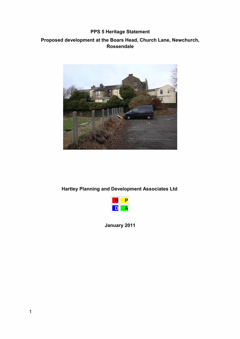
This statement is to accompany a planning application for the erection of eight
houses with associated gardens and car parking on the car park and bowling green
associated with the Boars Head public house, Church Lane, Newchurch. The site is
within an area of mixed use but which is essentially residential. St Nicholas’s church
is directly opposite.
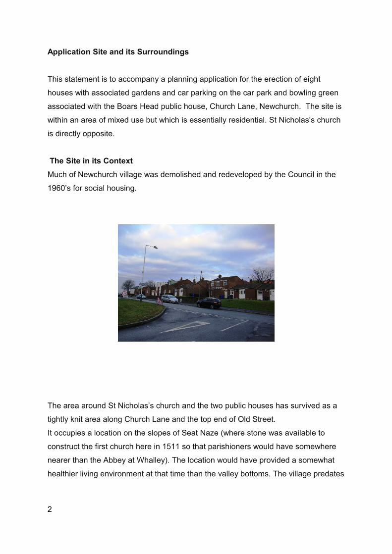
The Site in its Context Much of Newchurch village was demolished and redeveloped by the Council in the
1960’s for social housing.
The area around St Nicholas’s church and the two public houses has survived as a
tightly knit area along Church Lane and the top end of Old Street.
It occupies a location on the slopes of Seat Naze (where stone was available to
construct the first church here in 1511 so that parishioners would have somewhere
nearer than the Abbey at Whalley). The location would have provided a somewhat
healthier living environment at that time than the valley bottoms. The village predates
2
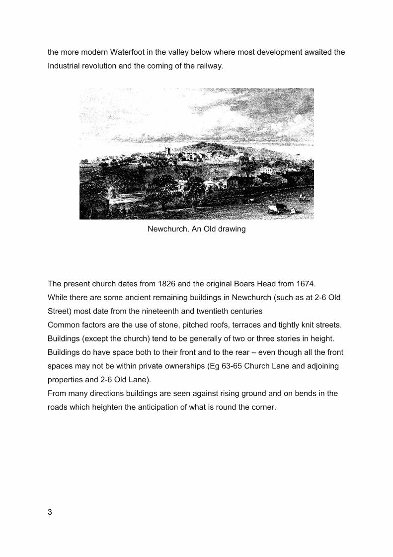
the more modern Waterfoot in the valley below where most development awaited the
Industrial revolution and the coming of the railway.
Newchurch. An Old drawing
The present church dates from 1826 and the original Boars Head from 1674.
While there are some ancient remaining buildings in Newchurch (such as at 2-6 Old
Street) most date from the nineteenth and twentieth centuries
Common factors are the use of stone, pitched roofs, terraces and tightly knit streets.
Buildings (except the church) tend to be generally of two or three stories in height.
Buildings do have space both to their front and to the rear – even though all the front
spaces may not be within private ownerships (Eg 63-65 Church Lane and adjoining
properties and 2-6 Old Lane).
From many directions buildings are seen against rising ground and on bends in the
roads which heighten the anticipation of what is round the corner.
3
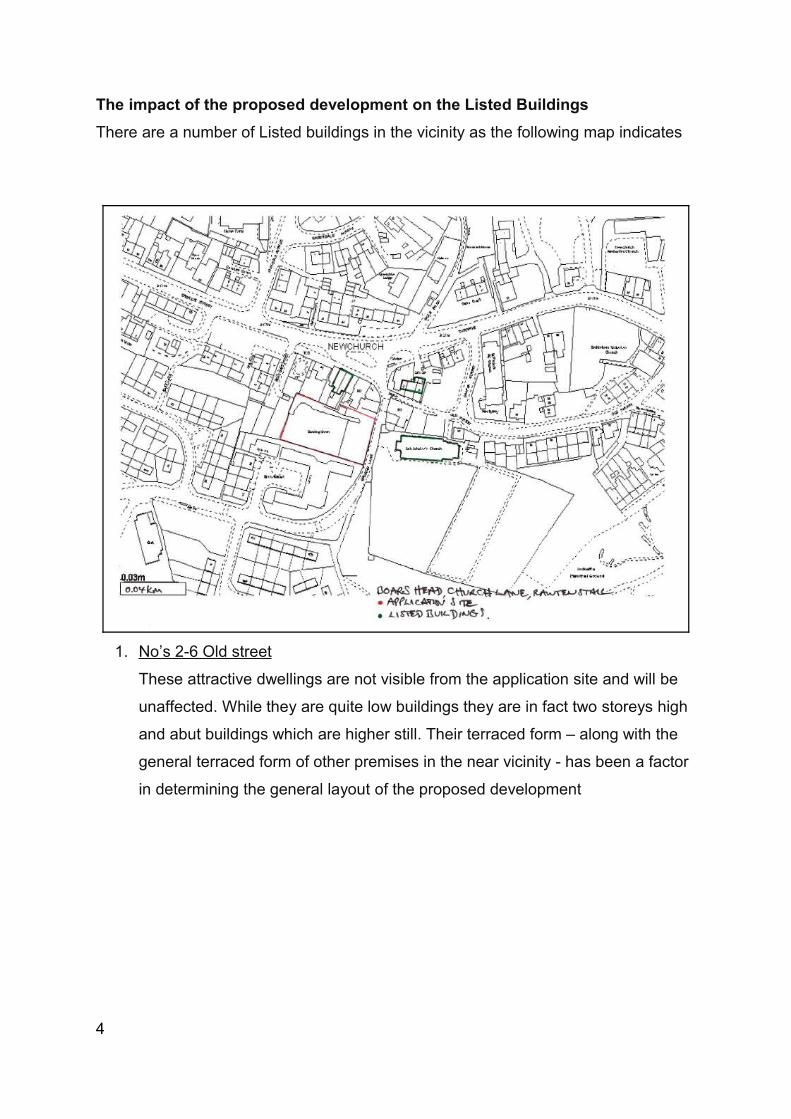
The impact of the proposed development on the Listed Buildings There are a number of Listed buildings in the vicinity as the following map indicates
1. No’s 2-6 Old street
These attractive dwellings are not visible from the application site and will be
unaffected. While they are quite low buildings they are in fact two storeys high
and abut buildings which are higher still. Their terraced form – along with the
general terraced form of other premises in the near vicinity - has been a factor
in determining the general layout of the proposed development
4

2. No’s 63-65 Church Street
The attraction of these buildings is their frontages when seen from church Lane/
Newchurch road
They are not nearly as impressive when viewed from the rear and the application site
5
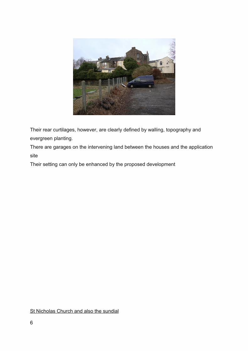
Their rear curtilages, however, are clearly defined by walling, topography and
evergreen planting.
There are garages on the intervening land between the houses and the application
site
Their setting can only be enhanced by the proposed development
St Nicholas Church and also the sundial
6
The church and the sundial are separately Listed
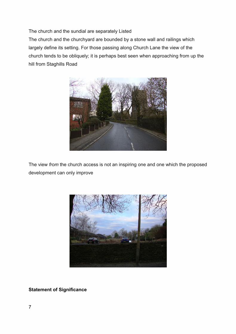
The church and the churchyard are bounded by a stone wall and railings which
largely define its setting. For those passing along Church Lane the view of the
church tends to be obliquely; it is perhaps best seen when approaching from up the
hill from Staghills Road
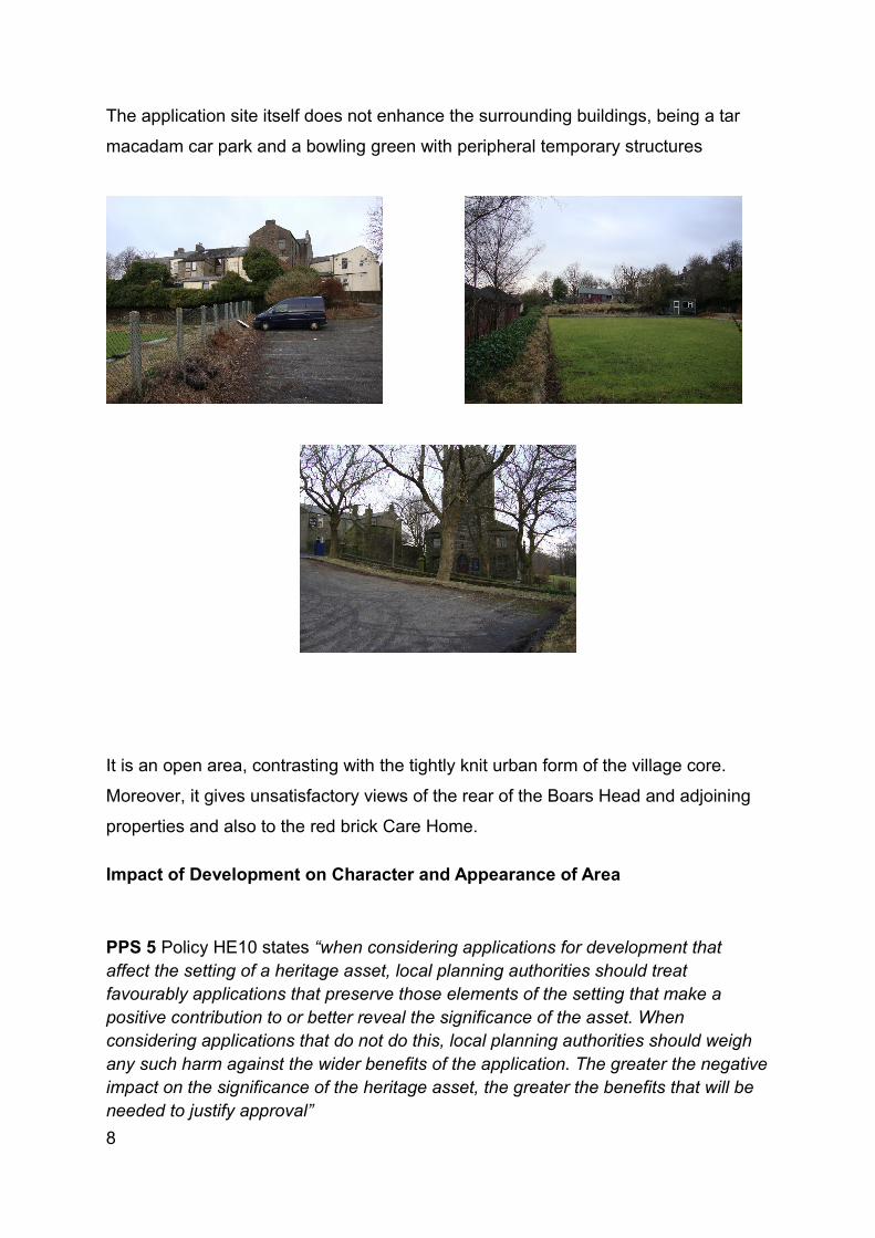
The view from the church access is not an inspiring one and one which the proposed
development can only improve
Statement of Significance
7
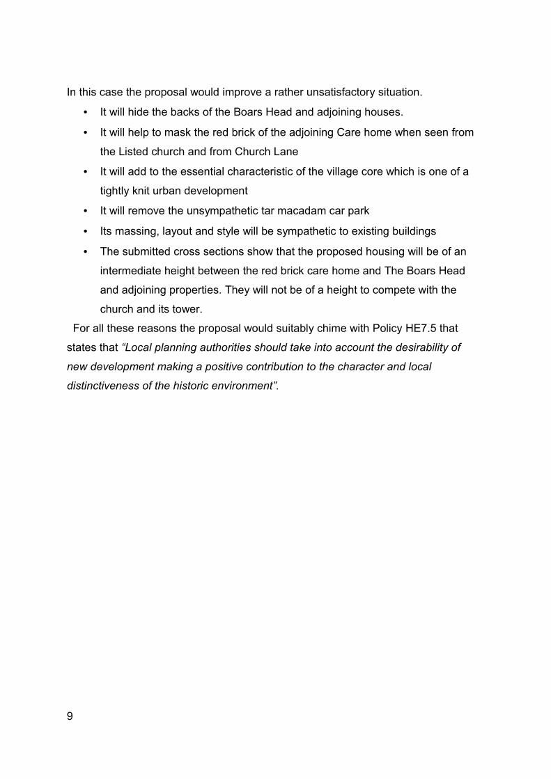
The application site itself does not enhance the surrounding buildings, being a tar
macadam car park and a bowling green with peripheral temporary structures
It is an open area, contrasting with the tightly knit urban form of the village core.
Moreover, it gives unsatisfactory views of the rear of the Boars Head and adjoining
properties and also to the red brick Care Home.
Impact of Development on Character and Appearance of Area
PPS 5 Policy HE10 states “when considering applications for development that affect the setting of a heritage asset, local planning authorities should treat favourably applications that preserve those elements of the setting that make a positive contribution to or better reveal the significance of the asset. When considering applications that do not do this, local planning authorities should weigh any such harm against the wider benefits of the application. The greater the negative impact on the significance of the heritage asset, the greater the benefits that will be needed to justify approval”8
In this case the proposal would improve a rather unsatisfactory situation.
• It will hide the backs of the Boars Head and adjoining houses.
• It will help to mask the red brick of the adjoining Care home when seen from
the Listed church and from Church Lane
• It will add to the essential characteristic of the village core which is one of a
tightly knit urban development
• It will remove the unsympathetic tar macadam car park
• Its massing, layout and style will be sympathetic to existing buildings
• The submitted cross sections show that the proposed housing will be of an
intermediate height between the red brick care home and The Boars Head
and adjoining properties. They will not be of a height to compete with the
church and its tower.
For all these reasons the proposal would suitably chime with Policy HE7.5 that
states that “Local planning authorities should take into account the desirability of
new development making a positive contribution to the character and local
distinctiveness of the historic environment”.
9


![Demografie[1].pps Ciortuz(Raj).pps](https://img.pdfslide.net/doc/110x75/577c7f6d1a28abe054a48292/demografie1pps-ciortuzrajpps.jpg)