Embed Size (px)
Citation preview
Prepared by:
Charles Baun
Conservation Branch Manager
IDARNG Environmental Management Office
Objectives
OCTC Summary - A Very Unique Place
Process, Partners, and Project Summaries
Partnering - Benefits and Constraints
Conclusion
Objectives
OCTC Summary - A Very Unique Place
Project and Partner Summaries
Partnering - Benefits and Constraints
Conclusion
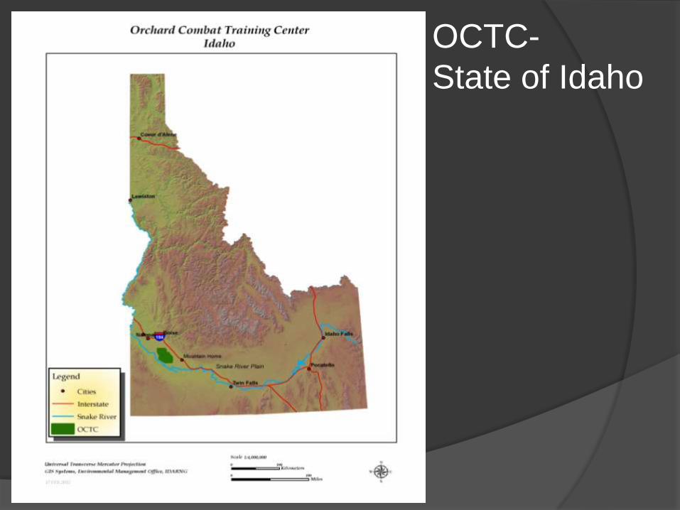
OCTC-
State of Idaho
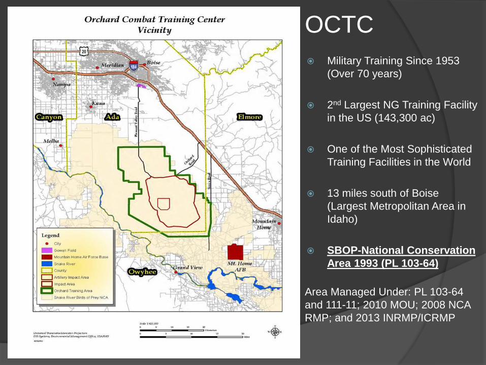
OCTC
Military Training Since 1953
(Over 70 years)
2nd Largest NG Training Facility
in the US (143,300 ac)
One of the Most Sophisticated
Training Facilities in the World
13 miles south of Boise
(Largest Metropolitan Area in
Idaho)
SBOP-National Conservation
Area 1993 (PL 103-64)
Area Managed Under: PL 103-64
and 111-11; 2010 MOU; 2008 NCA
RMP; and 2013 INRMP/ICRMP
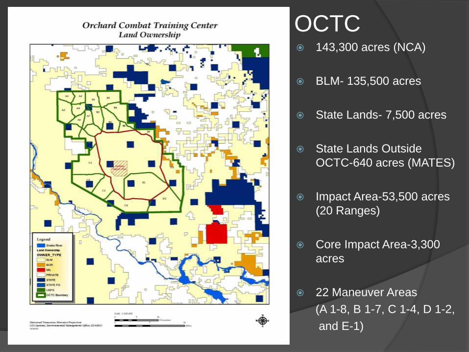
OCTC 143,300 acres (NCA)
BLM- 135,500 acres
State Lands- 7,500 acres
State Lands Outside
OCTC-640 acres (MATES)
Impact Area-53,500 acres
(20 Ranges)
Core Impact Area-3,300
acres
22 Maneuver Areas
(A 1-8, B 1-7, C 1-4, D 1-2,
and E-1)
IDARNG Resource Management
Programs
EMO (Natural/Cultural Resources & NEPA)
ITAM (Integrated Training Area Management)
Wildland Fire Program
Note: IDARNG can not directly manage impacts
associated with public recreation or livestock grazing.
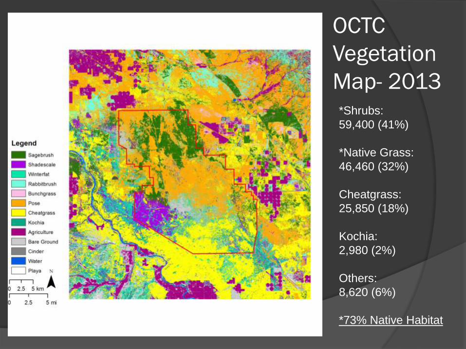
OCTC
Vegetation
Map- 2013*Shrubs:
59,400 (41%)
*Native Grass:
46,460 (32%)
Cheatgrass:
25,850 (18%)
Kochia:
2,980 (2%)
Others:
8,620 (6%)
*73% Native Habitat

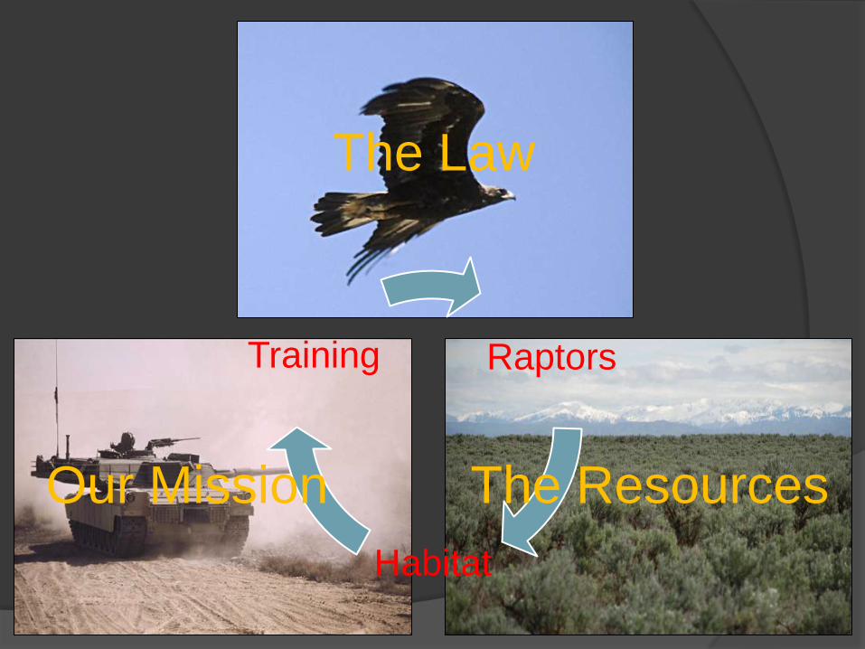
Raptors
Habitat
Training
Raptors
Habitat
Training
The Law
Our Mission The Resources

DoD
Spending
Then
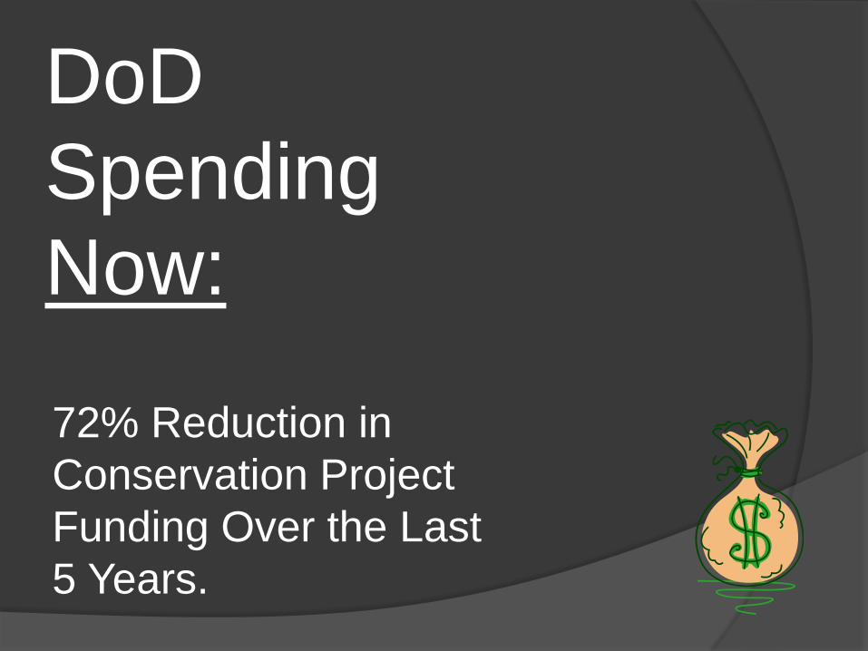
DoD
Spending
Now:
72% Reduction in
Conservation Project
Funding Over the Last
5 Years.
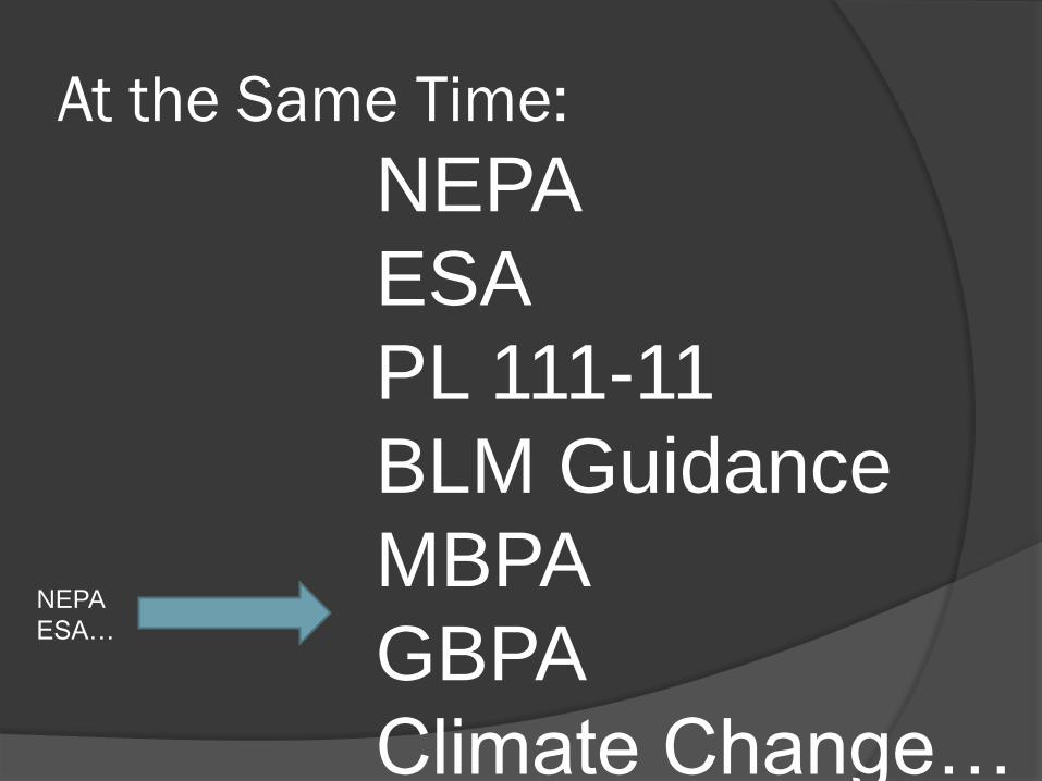
At the Same Time:
NEPA
ESA…
NEPA
ESA
PL 111-11
BLM Guidance
MBPA
GBPA
Climate Change…
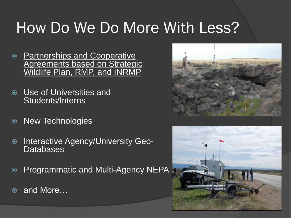
How Do We Do More With Less?
Partnerships and Cooperative Agreements based on Strategic Wildlife Plan, RMP, and INRMP
Use of Universities and Students/Interns
New Technologies
Interactive Agency/University Geo-Databases
Programmatic and Multi-Agency NEPA
and More…
Objectives
OCTC Summary - A Very Unique Place
Process, Partners, and Project Summaries
Partnering - Benefits and Constraints
Conclusion
Integration of Regional Plans
(RMP and Strategic Plan) into INRMP Annual Sikes Act Meeting: Conducted Every Year Between March-June
BLM (NLCS), FWS, IDFG, IDL, and IDARNG
Review Previous Year (IDARNG Summary Report)
Look at 3-5 year Work Plan (INRMP)
Develop Annual Work Plan
Annual Work Plan Identify Issues/Concerns and New Regulations
Develop Task/Project List for Annual Plan
Make Changes to 3-5 year Plan if Needed, Must be In Accordance with- RMP and State Wildlife Strategy
Other Issues and Projects as Needed (Adaptive Management)
Group Implementation
Project Examples
Cheatgrass Bio-control: ARS and IDL
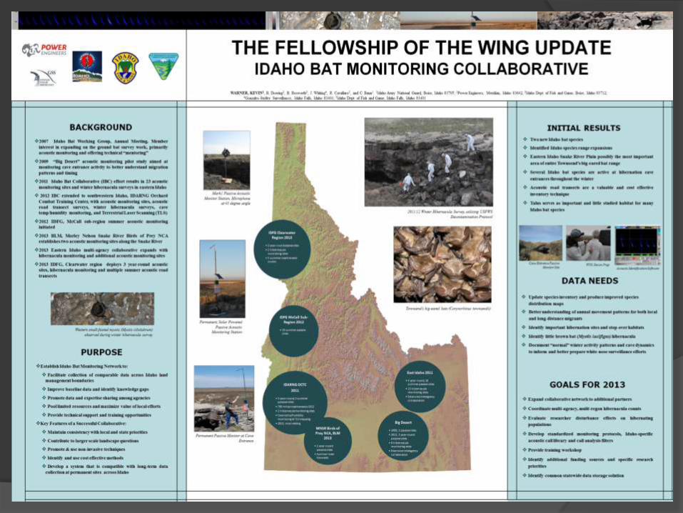
OCTC Bat Inventory and Proactive WNS Plan:
IDFG, UFWS, BLM, and BSU
NCA Raptor Monitoring Program: BLM,
USFWS, and IDFG
OCTC Vegetation Map: BSU, ISU, BLM, USGS
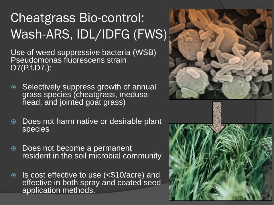
Cheatgrass Bio-control:
Wash-ARS, IDL/IDFG (FWS)
Use of weed suppressive bacteria (WSB) Pseudomonas fluorescens strain D7(P.f.D7.):
Selectively suppress growth of annual grass species (cheatgrass, medusa-head, and jointed goat grass)
Does not harm native or desirable plant species
Does not become a permanent resident in the soil microbial community
Is cost effective to use (<$10/acre) and effective in both spray and coated seed application methods.
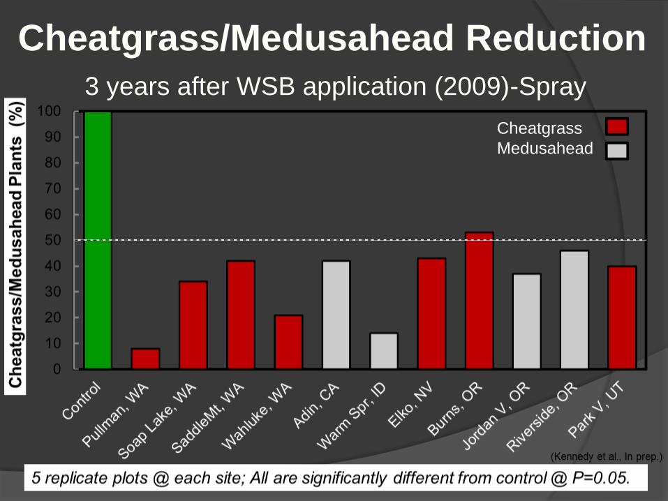
Cheatgrass
Medusahead
Cheatgrass/Medusahead Reduction
3 years after WSB application (2009)-Spray
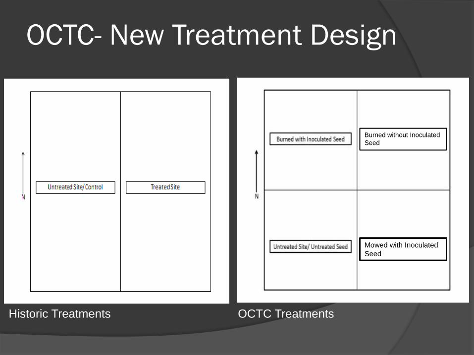
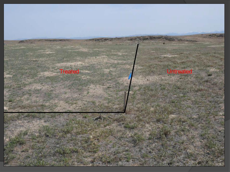
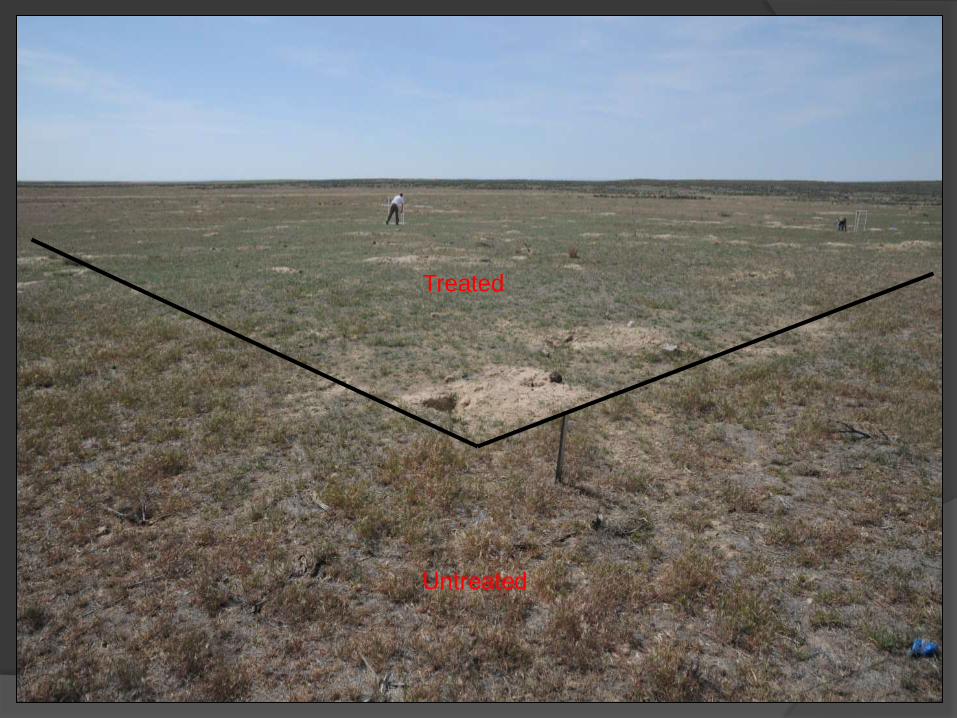
OCTC- New Treatment Design
Historic Treatments OCTC Treatments
Mowed with Inoculated
Seed
Burned without Inoculated
Seed
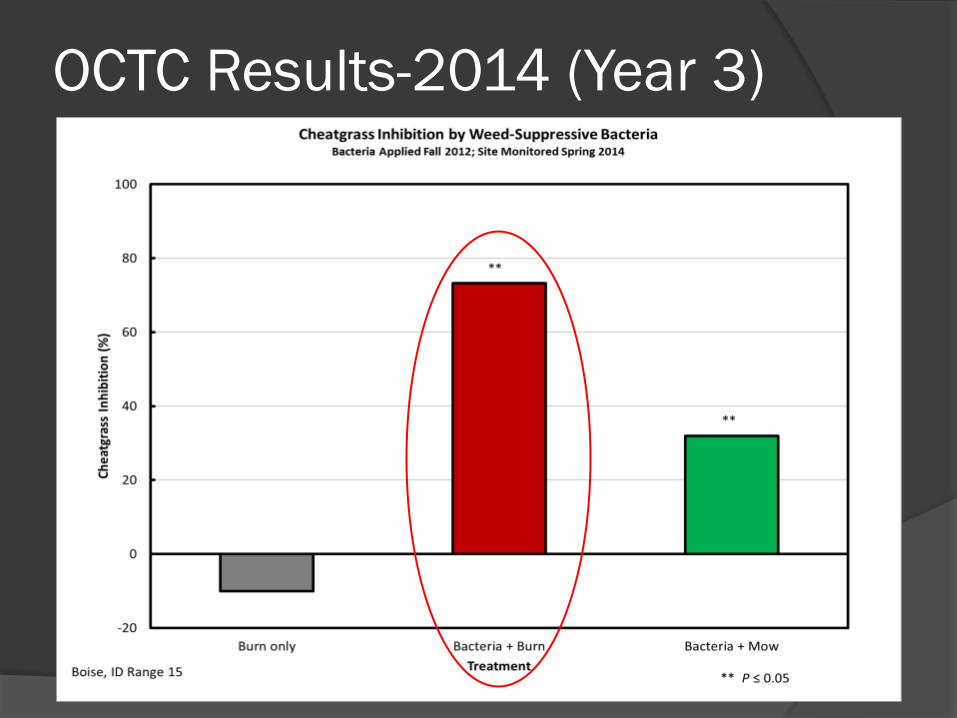
OCTC Results-2014 (Year 3)
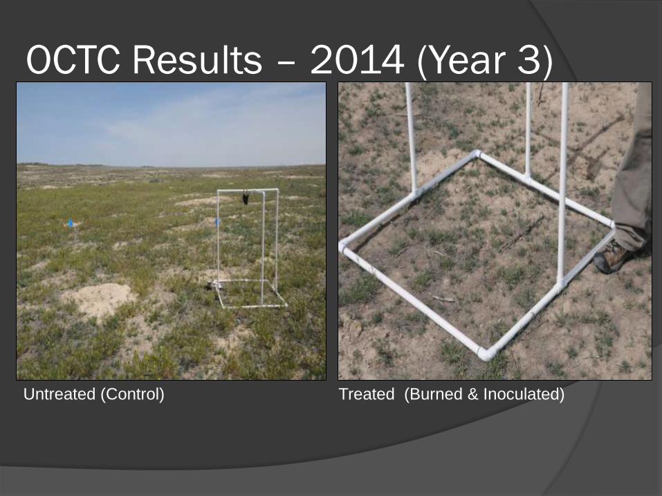
OCTC Results – 2014 (Year 3)
Untreated (Control) Treated (Burned & Inoculated)
Treated
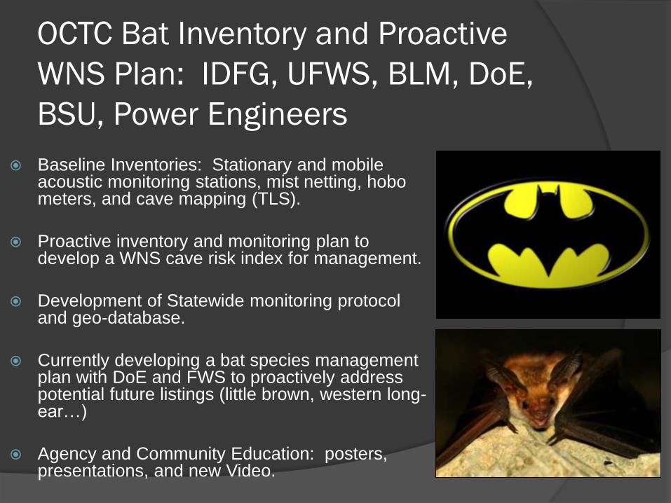
OCTC Bat Inventory and Proactive
WNS Plan: IDFG, UFWS, BLM, DoE,
BSU, Power Engineers
Baseline Inventories: Stationary and mobile acoustic monitoring stations, mist netting, hobo meters, and cave mapping (TLS).
Proactive inventory and monitoring plan to develop a WNS cave risk index for management.
Development of Statewide monitoring protocol and geo-database.
Currently developing a bat species management plan with DoE and FWS to proactively address potential future listings (little brown, western long-ear…)
Agency and Community Education: posters, presentations, and new Video.
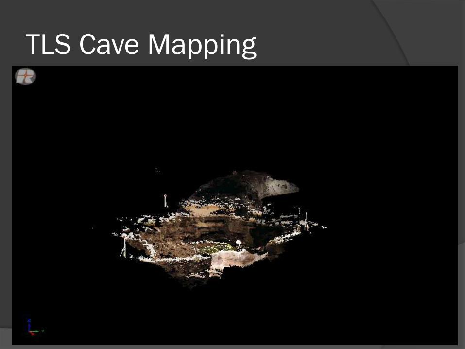
TLS Cave Mapping
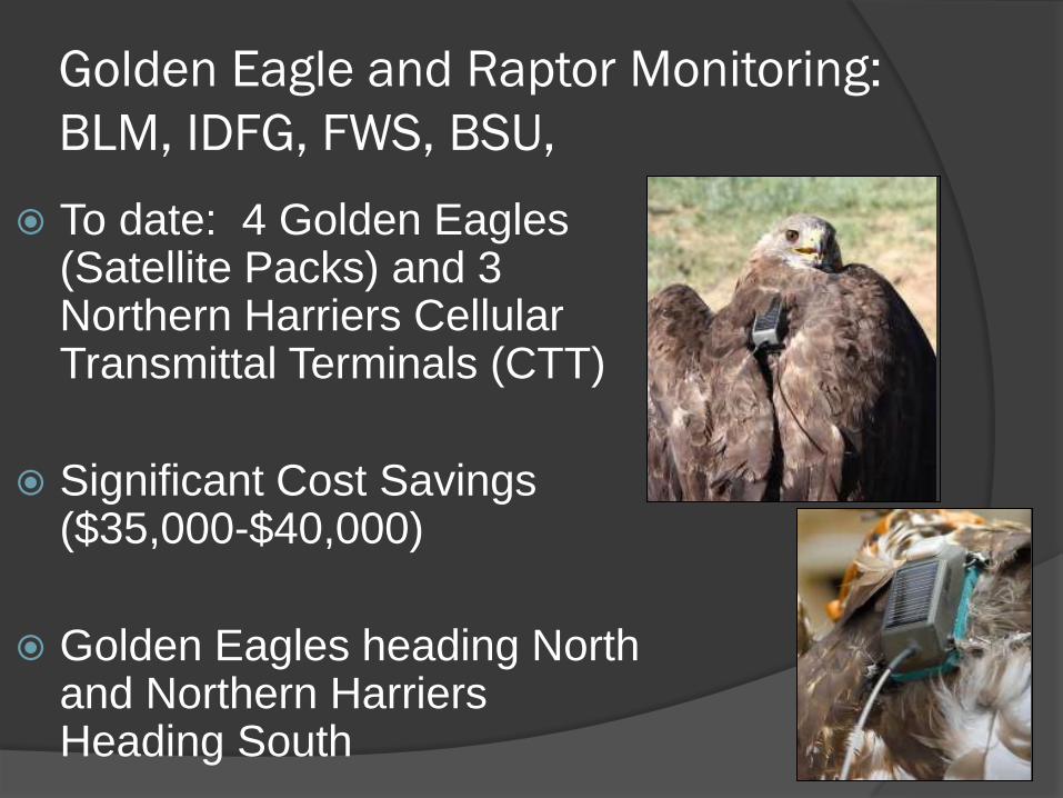
Golden Eagle and Raptor Monitoring:
BLM, IDFG, FWS, BSU,
To date: 4 Golden Eagles (Satellite Packs) and 3 Northern Harriers Cellular Transmittal Terminals (CTT)
Significant Cost Savings ($35,000-$40,000)
Golden Eagles heading North and Northern Harriers Heading South
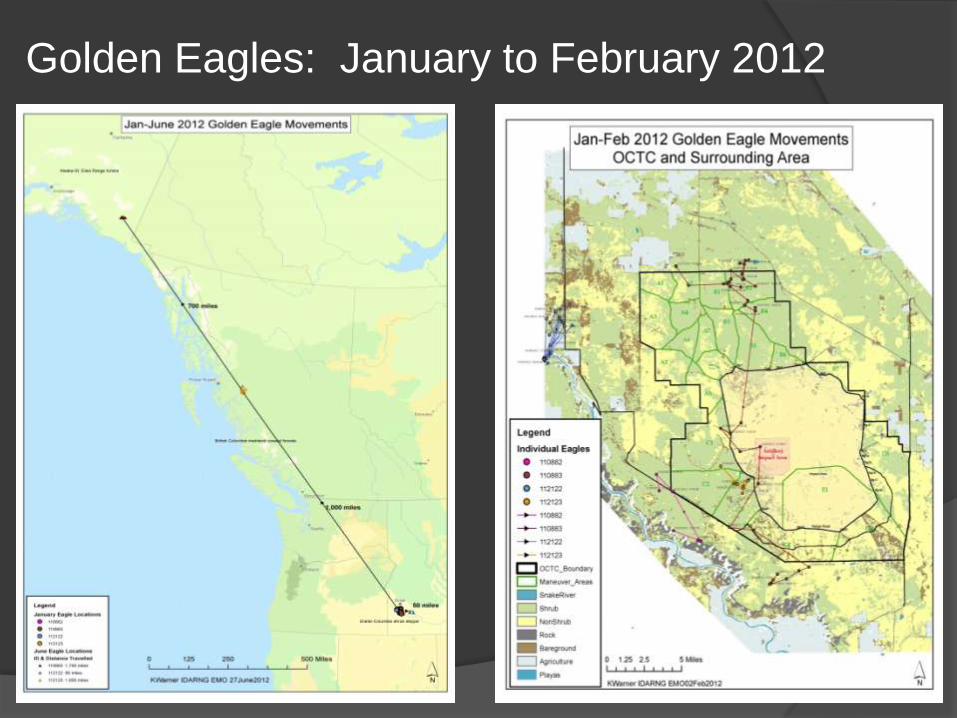
Golden Eagles: January to February 2012
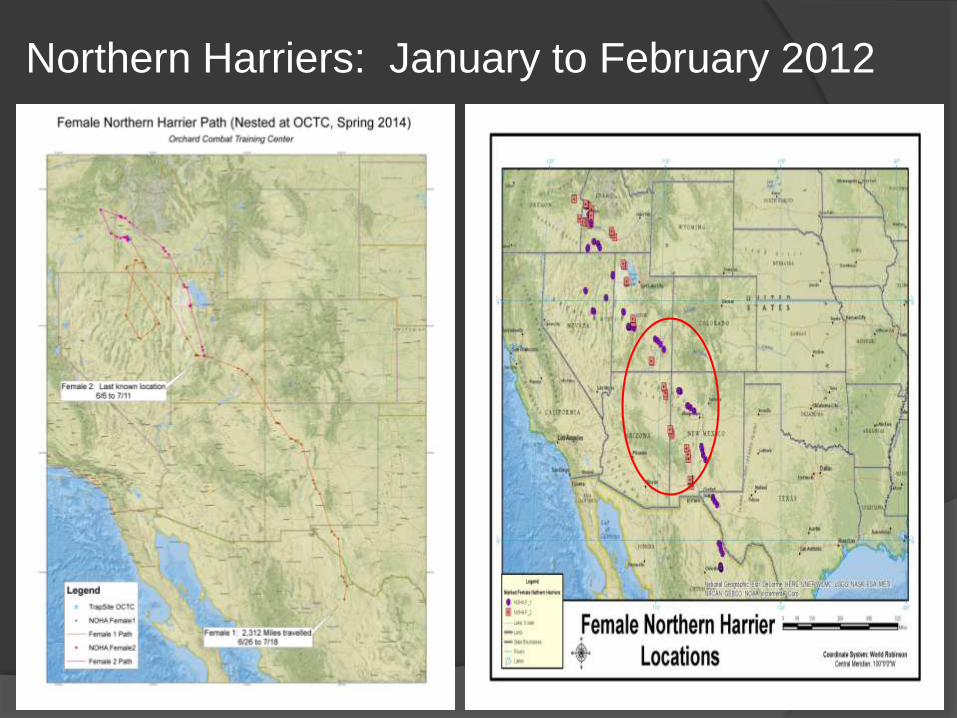
Northern Harriers: January to February 2012
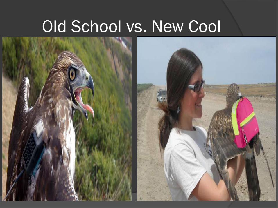
Old School vs. New Cool
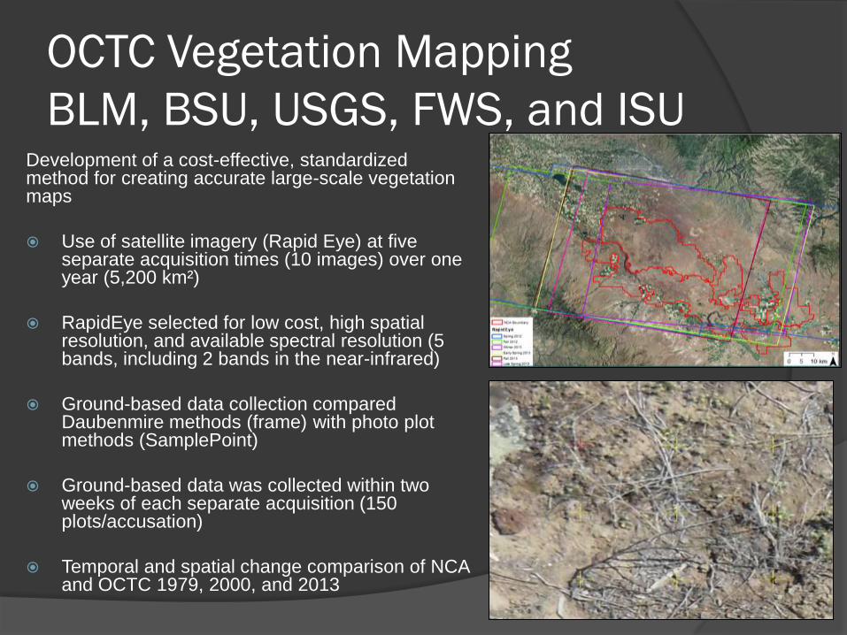
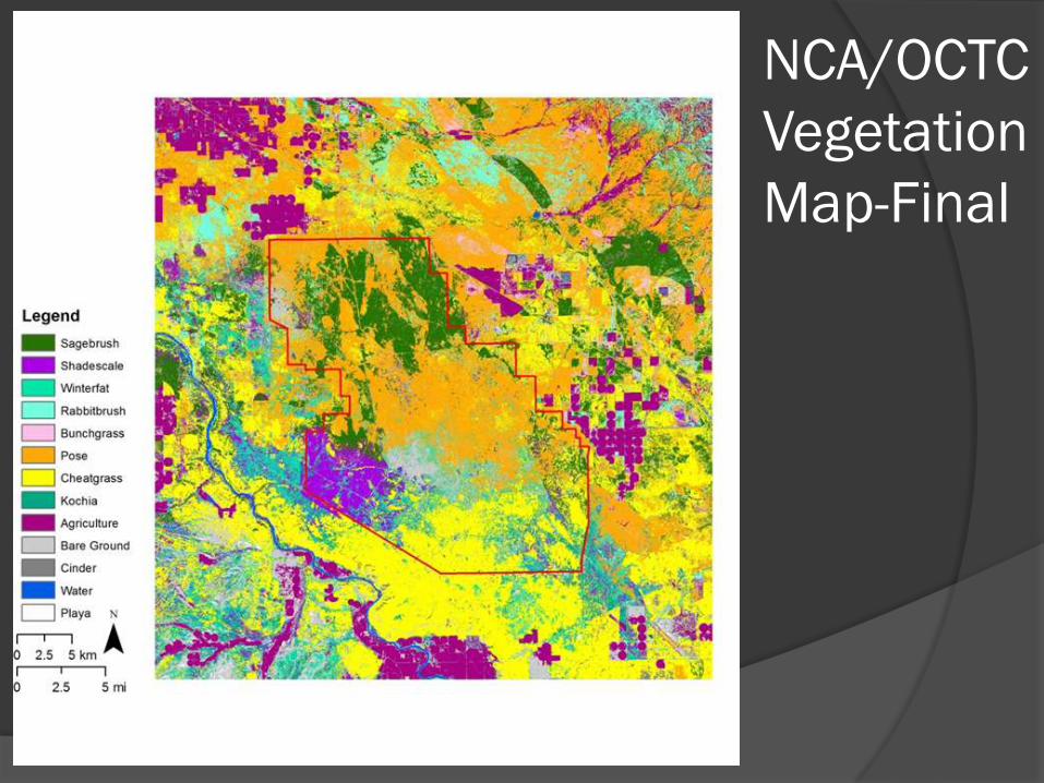
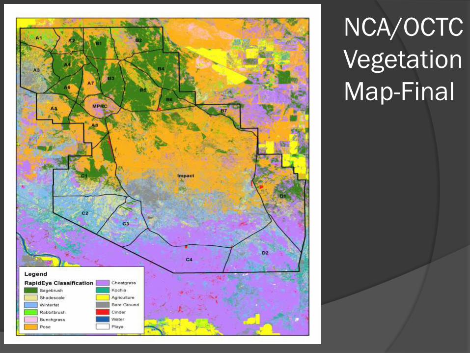
OCTC Vegetation Mapping
BLM, BSU, USGS, FWS, and ISUDevelopment of a cost-effective, standardized method for creating accurate large-scale vegetation maps
Use of satellite imagery (Rapid Eye) at five separate acquisition times (10 images) over one year (5,200 km²)
RapidEye selected for low cost, high spatial resolution, and available spectral resolution (5 bands, including 2 bands in the near-infrared)
Ground-based data collection compared Daubenmire methods (frame) with photo plot methods (SamplePoint)
Ground-based data was collected within two weeks of each separate acquisition (150 plots/accusation)
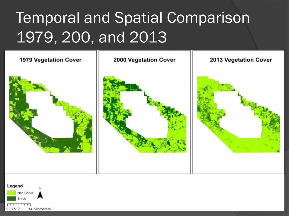
Temporal and spatial change comparison of NCA and OCTC 1979, 2000, and 2013
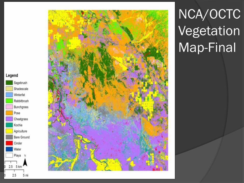
NCA/OCTC
Vegetation
Map-Final
NCA/OCTC
Vegetation
Map-Final
NCA/OCTC
Vegetation
Map-Final
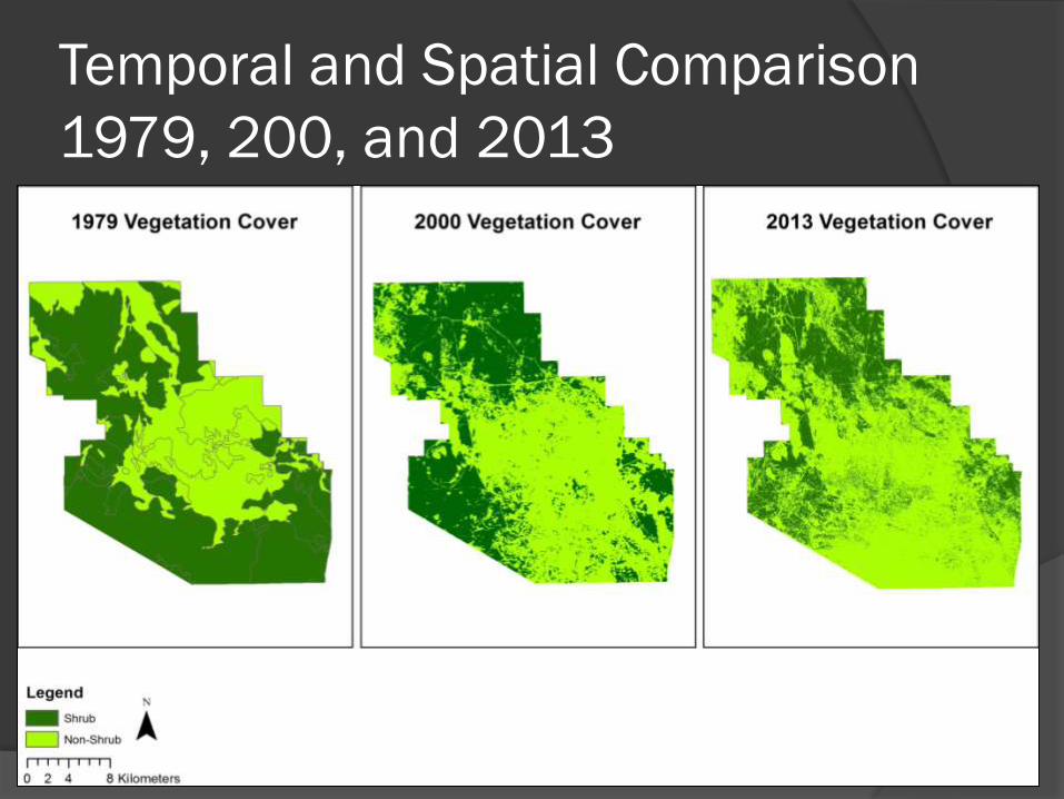
Temporal and Spatial Comparison
1979, 200, and 2013
Temporal and Spatial Comparison
1979, 200, and 2013
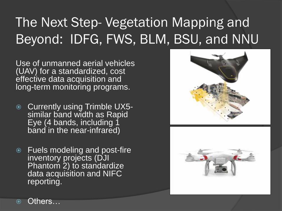
The Next Step- Vegetation Mapping and
Beyond: IDFG, FWS, BLM, BSU, and NNU
Use of unmanned aerial vehicles (UAV) for a standardized, cost effective data acquisition and long-term monitoring programs.
Currently using Trimble UX5-similar band width as Rapid Eye (4 bands, including 1 band in the near-infrared)
Fuels modeling and post-fire inventory projects (DJI Phantom 2) to standardize data acquisition and NIFC reporting.
Others…
Objectives
OCTC Summary - A Very Unique Place
Process, Partners, and Project Summaries
Partnering - Benefits and Constraints
Conclusion
Benefits of Partnerships
Coordinated Efforts, Communication, and Data Sharing (Stop Reinventing the Wheel)
Increased Publications and Peered Reviewed Literature
New/Shared Technology and Expertise
Different Perspective on Issues and Objectives
Student Experience (Field Work, Technology, and Hands-On Training)
Major Cost Savings ($300,000-$350,000) Over Last 4 Years
Others…
Constraints of Partnerships
Multiple Agencies or Partners Mean Additional Requirements (Administrative Baggage)
Differences in Goals and Objectives (Academic vs. Management)
Personality Conflicts and Control Issues
Timelines and Extensions
Deliverables
Rising Overhead Costs
Competition with Private Sector
Others…
The Results…
Vegetation Monitoring Plots:
25 Years of Change
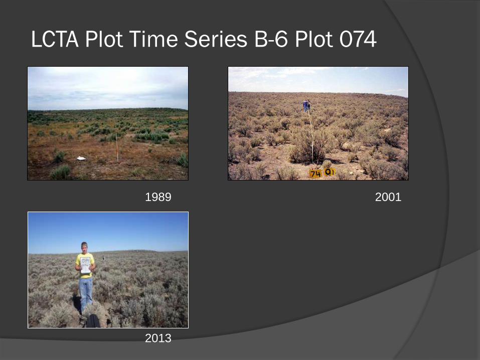
LCTA Plot Time Series B-6 Plot 074
20011989
2013
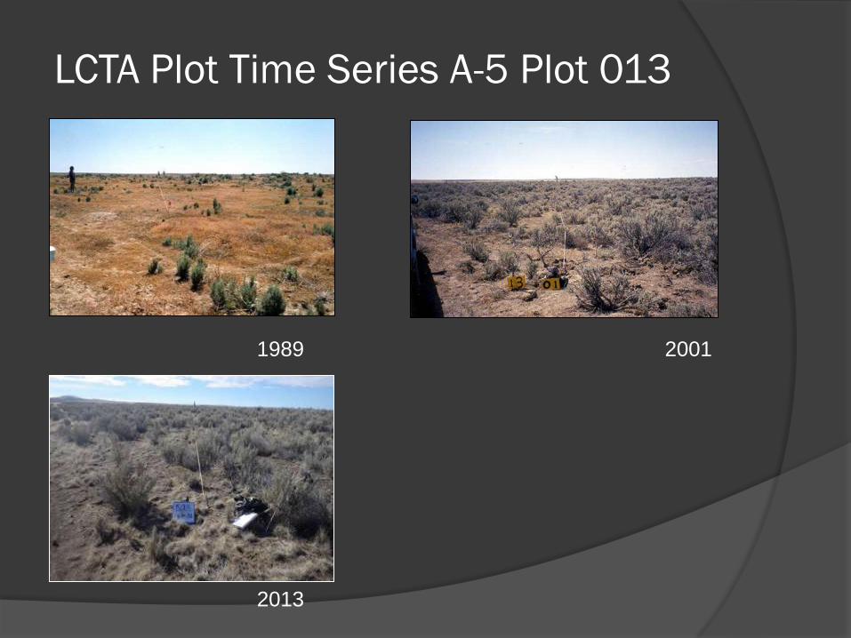
LCTA Plot Time Series A-5 Plot 013
20011989
2013
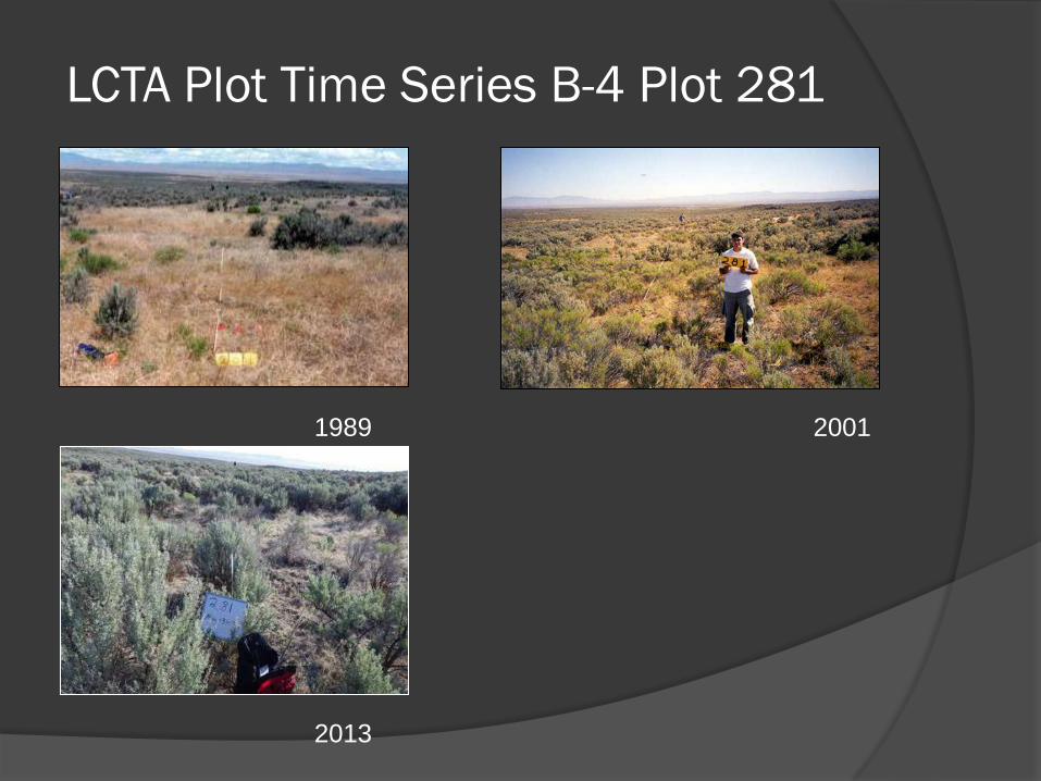
LCTA Plot Time Series B-4 Plot 281
20011989
2013
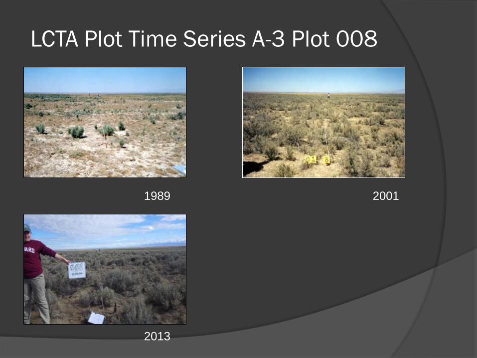
LCTA Plot Time Series A-3 Plot 008
20011989
2013
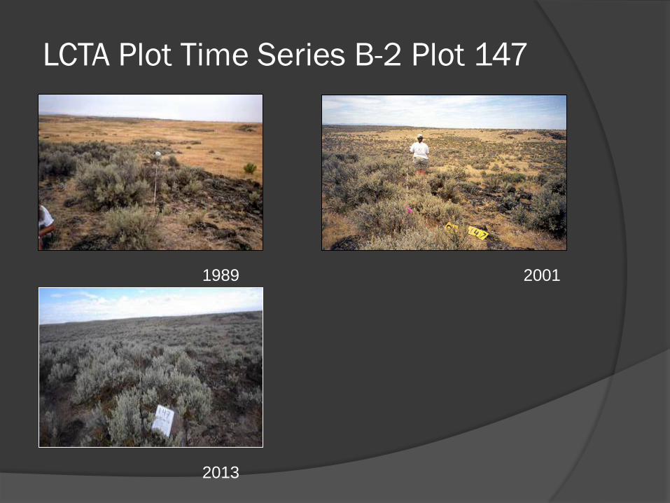
LCTA Plot Time Series B-2 Plot 147
20011989
2013
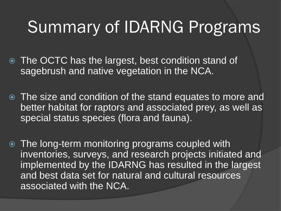
Summary of IDARNG Programs
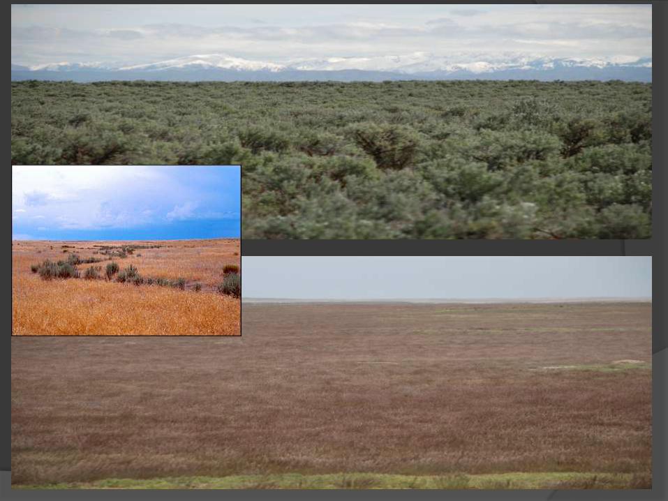
The OCTC has the largest, best condition stand of sagebrush and native vegetation in the NCA.
The size and condition of the stand equates to more and better habitat for raptors and associated prey, as well as special status species (flora and fauna).
The long-term monitoring programs coupled with inventories, surveys, and research projects initiated and implemented by the IDARNG has resulted in the largest and best data set for natural and cultural resources associated with the NCA.
Cooperative Bat Video
Questions/Comments?