Embed Size (px)
Citation preview
MINUTES OF A MEETING OF THE BOARD OF DIRECTORS OFTARRANT REGIONAL WATER DISTRICT
HELD ON THE 20th DAY OF DECEMBER 2016 AT 9:30 A.M.
The call of the roll disclosed the presence of the Directors as follows:
PresentVictor W. Henderson
Jack R. StevensMarty V. Leonard
Jim LaneMary Kelleher
Also present were Jim Oliver, Dan Buhman, Darrel Andrews, Darrell Season,
Steve Christian, Linda Christie, Wesley Cleveland, Randall Cocke, Woody Frossard,
Jason Gehrig, Rachel Ickert, Nancy King, Chad Lorance, David Marshall, Sandy Newby,
Wayne Owen, Jennifer Owens, Kirk Thomas, and Ed Weaver.
Also in attendance were George Christie, General Counsel for Tarrant Regional
Water District (District or TRWD); Lee Christie, Ethel Steele and Jeremy Harmon of Pope,
Hardwicke, Christie, Schell, Kelly, & Taplett, L.L.P.; Denis QuaIls of City of Dallas Water
Utilities; Bob Brashear of CDM Smith; Christopher Brashear of Boy Scouts of America
Troop 707; Don McDaniel of TMG Imaging; Andra Beatty of Andra Beatty Real Estate;
Amanda Smayda of JQ Infrastructure; Ty Hodsell, Scott Keenum, Renee Kemper, and
Ken Dean of the Fort Worth Police Department; Charles “C.B.” Team of Ellis and Tinsley;
Russell Gibson of Freese and Nichols, Inc.; and Alan Raynor and Molly Carson of McCall,
Parkhurst & Horton, L.L.P.
President Henderson convened the meeting with the assurance from management
that all requirements of the “open meetings” laws had been met.
1.
All present were given the opportunity to join in reciting the Pledge of Allegiance.
2.
On a motion made by Director Leonard and seconded by Director Kelleher, the
Directors voted unanimously to approve the minutes from the meeting held on November
15, 2016. It was accordingly ordered that these minutes be placed in the permanent files
of the Tarrant Regional Water District.
3.
With the recommendation of management, Director Leonard moved to approve the
purchase and donation of dual sport motorcycles to the City of Fort Worth for Trinity Trails
public safety. Funding for these items is unbudgeted, but will be funded in the Fiscal Year
2017 General Fund budget. Director Stevens seconded the motion and the vote in favor
was unanimous.
4.
With the recommendation of management, Director Stevens moved to approve the
following appointments as the District representatives for the Tax Increment Financing
(hF) Districts in which the District participates. Such approval by this Board shall serve
as a recommendation to the City Council of Fort Worth for final appointment by the City
Council.
TIF District Current Appointee(s)
3 (Downtown) Victor Henderson4 (Southside) Linda Christie6 (Riverfront) Linda Christie7 (North Tarrant Parkway) Linda Christie8 (Lancaster) Marty Leonard10 (Lone Star) Linda Christie
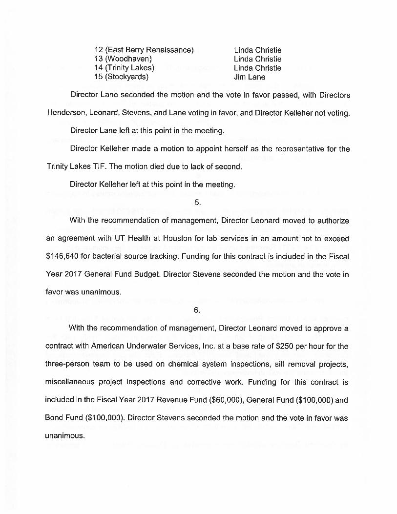
12 (East Berry Renaissance) Linda Christie13 (Woodhaven) Linda Christie14 (Trinity Lakes) Linda Christie15 (Stockyards) Jim Lane
Director Lane seconded the motion and the vote in favor passed, with Directors
Henderson, Leonard, Stevens, and Lane voting in favor, and Director Kelleher not voting.
Director Lane left at this point in the meeting.
Director Kelleher made a motion to appoint herself as the representative for the
Trinity Lakes TIE. The motion died due to lack of second.
Director Kelleher left at this point in the meeting.
5.
With the recommendation of management, Director Leonard moved to authorize
an agreement with UT Health at Houston for lab services in an amount not to exceed
$146,640 for bacterial source tracking. Funding for this contract is included in the Fiscal
Year 2017 General Fund Budget. Director Stevens seconded the motion and the vote in
favor was unanimous.
6.
With the recommendation of management, Director Leonard moved to approve a
contract with American Underwater Services, Inc. at a base rate of $250 per hour for the
three-person team to be used on chemical system inspections, silt removal projects,
miscellaneous project inspections and corrective work. Funding for this contract is
included in the Fiscal Year 2017 Revenue Fund ($60,000), General Fund ($100,000) and
Bond Fund ($100,000). Director Stevens seconded the motion and the vote in favor was
unanimous.
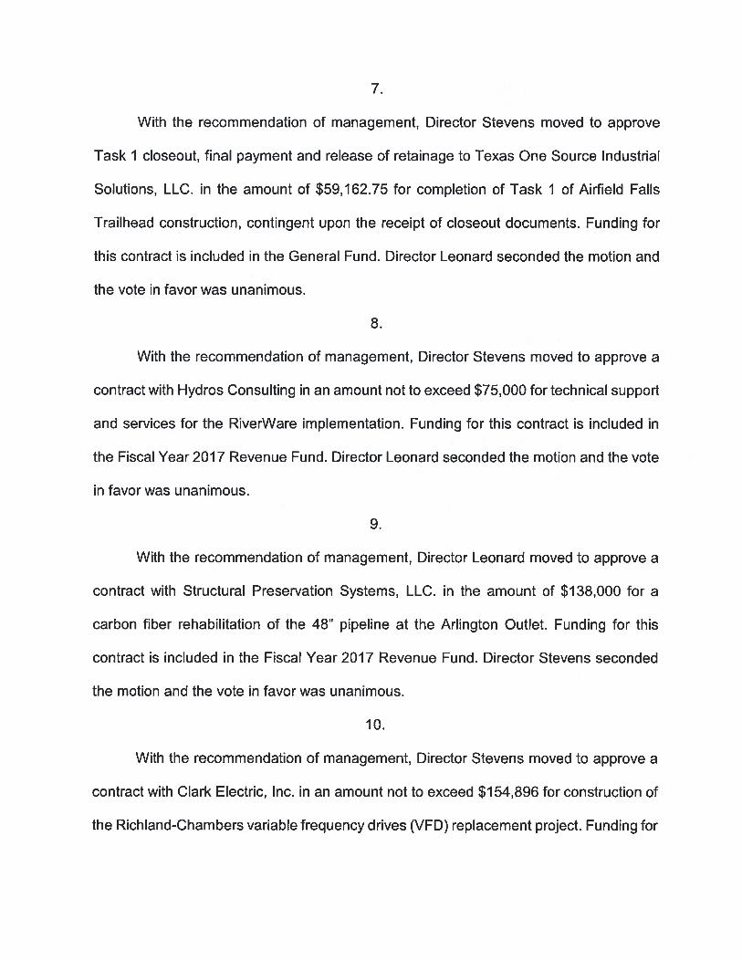
7.
With the recommendation of management, Director Stevens moved to approve
Task 1 closeout, final payment and release of retainage to Texas One Source Industrial
Solutions, LLC. in the amount of $59,162.75 for completion of Task 1 of Airfield Falls
Trailhead construction, contingent upon the receipt of closeout documents. Funding for
this contract is included in the General Fund. Director Leonard seconded the motion and
the vote in favor was unanimous.
8.
With the recommendation of management, Director Stevens moved to approve a
contract with Hydros Consulting in an amount not to exceed $75,000 for technical support
and services for the RiverWare implementation. Funding for this contract is included in
the Fiscal Year 2017 Revenue Fund. Director Leonard seconded the motion and the vote
in favor was unanimous.
9.
With the recommendation of management, Director Leonard moved to approve a
contract with Structural Preservation Systems, LLC. in the amount of $138,000 for a
carbon fiber rehabilitation of the 48” pipeline at the Arlington Outlet. Funding for this
contract is included in the Fiscal Year 2017 Revenue Fund. Director Stevens seconded
the motion and the vote in favor was unanimous.
10.
With the recommendation of management, Director Stevens moved to approve a
contract with Clark Electric, Inc. in an amount not to exceed $154,896 for construction of
the Richland-Chambers variable frequency drives (VFD) replacement project. Funding for
this contract is included in the Bond Fund. Director Leonard seconded the motion and the
vote in favor was unanimous.
11.
With the recommendation of management, Director Stevens moved to approve a
change order with Pentair Flow Technologies in the amount of $141,704 for a spare
rotating element at Joint Booster Pump Station 3 (JB3) of the Integrated Pipeline Project.
The total not to exceed contract value, including this change order, will be $11,258,183.
Funding for this change order is included in the Bond Fund. Director Leonard seconded
the motion and the vote in favor was unanimous.
12.
With the recommendation of management, Director Leonard moved to approve a
change in calculation of retainage being held for MWH Constructors, Inc. to 5% of the
total contract price following the recent 50% completion milestone of its contract for the
construction of Joint Booster Pump Station 3 (JB3) of the Integrated Pipeline Project. All
remaining contract payments are to be made in full, the Board having found that
satisfactory progress is being made. However, any changes to the contract price by
change order or alternate base bid work for the project will require adjustment to the
retainage schedule. Director Stevens seconded the motion and the vote in favor was
unanimous.
13.
With the recommendation of management, Director Leonard moved to approve a
contract with Ebara Corporation in the amount of $12,694,890 for the purchase of seven
pumping units at the Joint Cedar Creek Lake Pump Station, (JCC1). Funding for this
contract is included in the Bond Fund. Director Stevens seconded the motion and the vote
in favor was unanimous.
14.
With the recommendation of management, Director Leonard moved to approve a
change order with Blackhall Engineering Limited in the amount of $63,258 for the
purchase of mainline gate valves for the Integrated Pipeline Project. The total not to
exceed contract value, including this change order, will be $6,274,534. Funding for this
change order is included in the Bond Fund. Director Stevens seconded the motion and
the vote in favor was unanimous.
15.
With the recommendation of management, Director Stevens moved to approve a
credit change order with IPL Partners Joint Venture in the amount of $100,000 for the
Section 17 Trinity River Tunnel of the Integrated Pipeline Project. The total not to exceed
contract value, including this change order, will be reduced to $32,992,000. Director
Leonard seconded the motion and the vote in favor was unanimous.
16.
Staff Updates
• System Status Update• Twin Points Update
The Board recognized the horrific accident which injured Alan and SharonThomas and wished them well.
17.
There were no persons from the general public requesting the opportunity to
address the Board of Directors.
The Board of Directors recessed for a break from 10:46 a.m. to 11:04 a.m.
18.
The presiding officer next called an executive session at 11:04 a.m. under
V.T.C.A., Government Code, Section 551.071 to Consult with Legal Counsel on a Matter
in Which the Duty of Counsel Under the Texas Disciplinary Rules of Professional Conduct
Clearly Conflicts with Chapter 551, Texas Government Code, and to Conduct a Private
Consultation with Attorneys Regarding Pending or Contemplated Litigation (Tarrant
Regional Water District v. Lazy W District No. 7, et a!., Cause No. 2014C-0144 in the 3td
District Court of Henderson County, Texas, Cause No. 12-14-00329-CV in the Twelfth
Court of Appeals, Tyler, Texas and Cause No. 15-0117 in the Supreme Court of Texas;
White House Cemetery Association v. Jasper and Evelyn Stevens and Tarrant Regional
Water District, Cause No. 08001-CCL-15, in the County Court at Law No. 1 of Henderson
County, Texas); Wilson Family Cemetery Association v. The Estate of Genie Warren, Jr.
and Tarrant Regional Water District, Cause No. 08026-CCL-15 in the County Court at
Law No. 1 of Henderson County, Texas; and under Section 551.072 to Deliberate the
Purchase, Exchange, Lease or Value of Real Property
19.
With the recommendation of management, Director Stevens moved to grant
authority to acquire permanent easement interests in, over, under, and across the
following described properties for the public use and purpose of construction and
operation of the IPL Project by purchase or, if negotiations to acquire the property by
purchase are unsuccessful, by the use of the power of eminent domain. The motion was
made in the form provided by Chapter 2206, Texas Government Code, and indicated that
it intended to apply to all the units of real property described below. Funding for these
acquisitions is included in the Bond Fund.
• IPL Parcel 1041(Luck)
A permanent easement interest in, over, and across a 1.332-acre tract of landsituated in the James E. Phillips Survey, Abstract Number 1232, TarrantCounty, Texas, and being more particularly described as a portion of theremainder of that certain 34.0-acre tract conveyed to William Joseph Luck,as recorded in Volume 8823, Page 1878, Deed Records, Tarrant County,Texas, such tract being further described in the survey plat for Parcel 1041attached hereto. An appraisal prepared by an independent, qualified realestate appraiser using standard accepted valuation techniques establishedthe amount of $378,515 as just compensation for the above-describedproperty.
• IPL Parcel 96(C rabb)
A permanent easement interest in, over, and across a 2.488-acre tract of landsituated in the Joaquin Rendon Survey, Abstract Number 1263, TarrantCounty, Texas, and being more particularly described as a portion of thatcertain 16.188-acre tract conveyed to Lance A. Crabb and wife, Charlotte L.Crabb, as recorded in Instrument #D199256488, Deeds Records, TarrantCounty, Texas, such tract being further described in the survey plat forParcel 96 attached hereto. An appraisal prepared by an independent,qualified real estate appraiser using standard accepted valuation techniquesestablished the amount of $52,264 as just compensation for the above-described property.
• IPL Parcel 97(Wasilchak)
A permanent easement interest in, over, and across a 1.463-acre tract of landsituated in the Joaquin Rendon Survey, Abstract Number 1263, TarrantCounty, Texas, and being more particularly described as a portion of thatcertain 14.695-acre tract one and that certain 18.90-acre tract two, conveyedto John Wasilchak, as recorded in Volume 2518, Page 719, Deed Records,Tarrant County, Texas, such tract being further described in the survey platfor Parcel 97 attached hereto. An appraisal prepared by an independent,qualified real estate appraiser using standard accepted valuation techniquesestablished the amount of $23,042 as just compensation for the abovedescribed property.
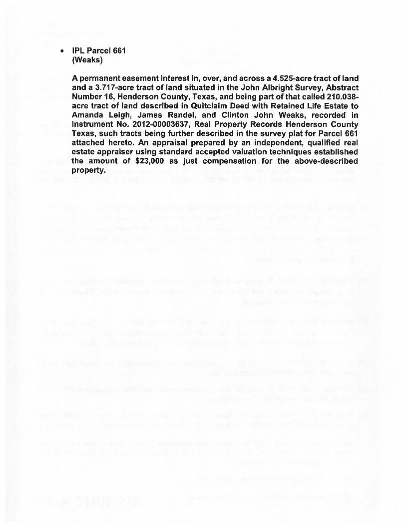
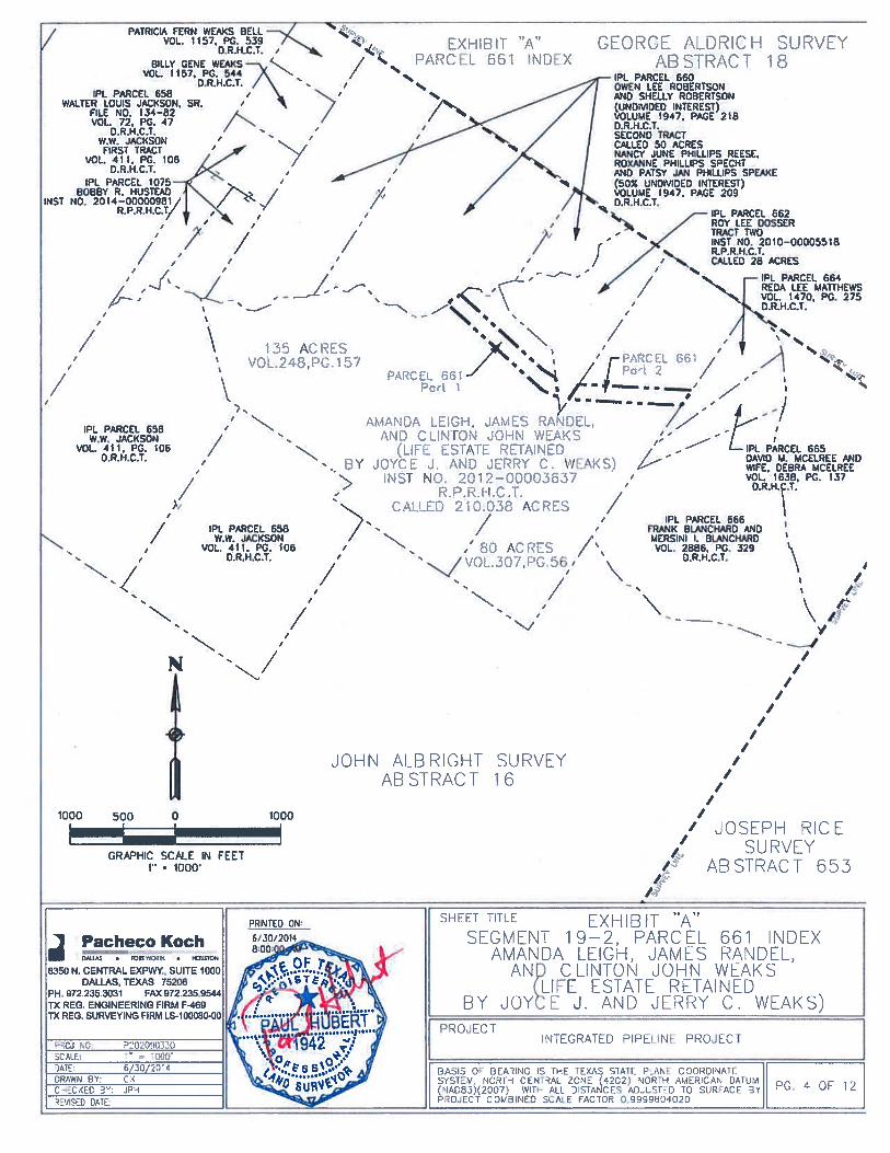
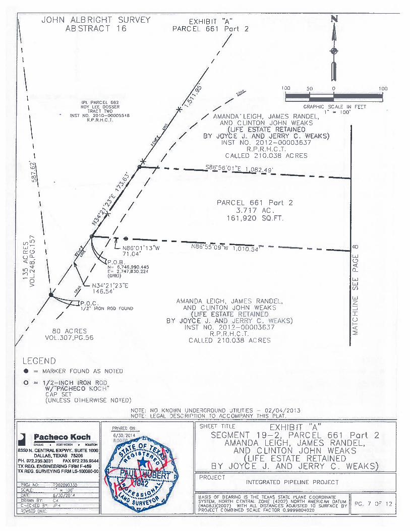
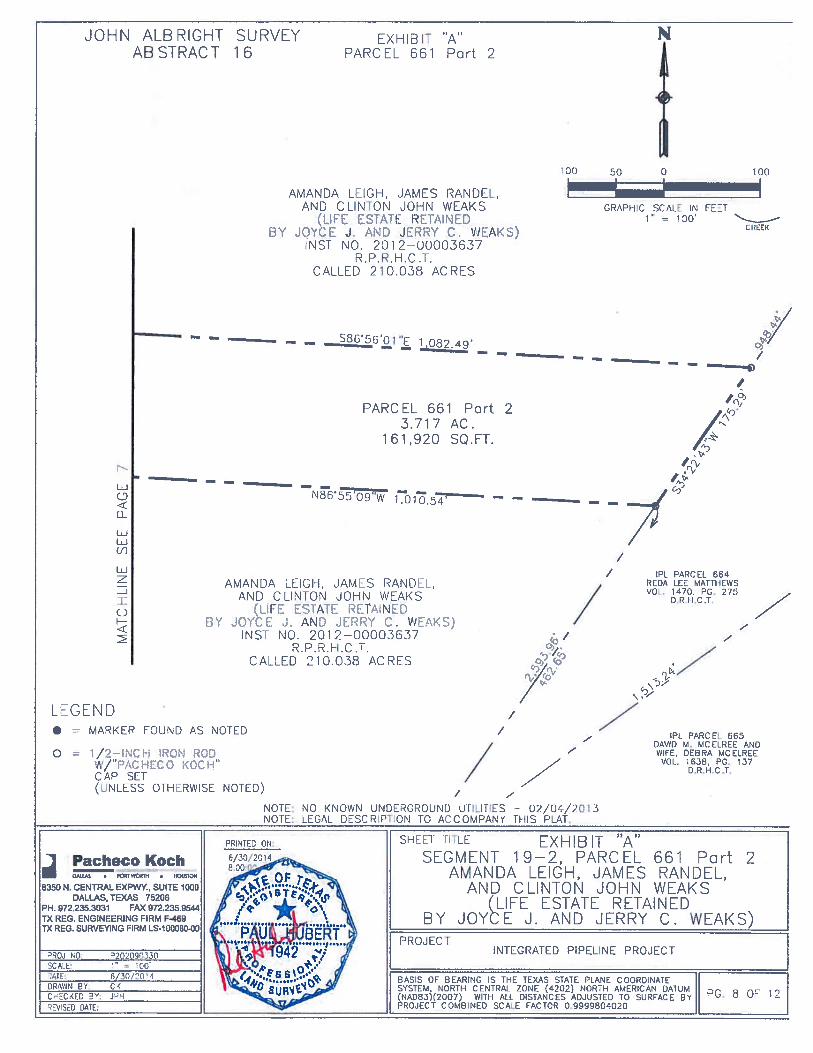
• IPL Parcel 661(Weaks)
A permanent easement interest in, over, and across a 4.525-acre tract of landand a 3.717-acre tract of land situated in the John Aibright Survey, AbstractNumber 16, Henderson County, Texas, and being part of that called 210.038-acre tract of land described in Quitclaim Deed with Retained Life Estate toAmanda Leigh, James Randel, and Clinton John Weaks, recorded inInstrument No. 2012-00003637, Real Property Records Henderson CountyTexas, such tracts being further described in the survey plat for Parcel 661attached hereto. An appraisal prepared by an independent, qualified realestate appraiser using standard accepted valuation techniques establishedthe amount of $23,000 as just compensation for the above-describedproperty.
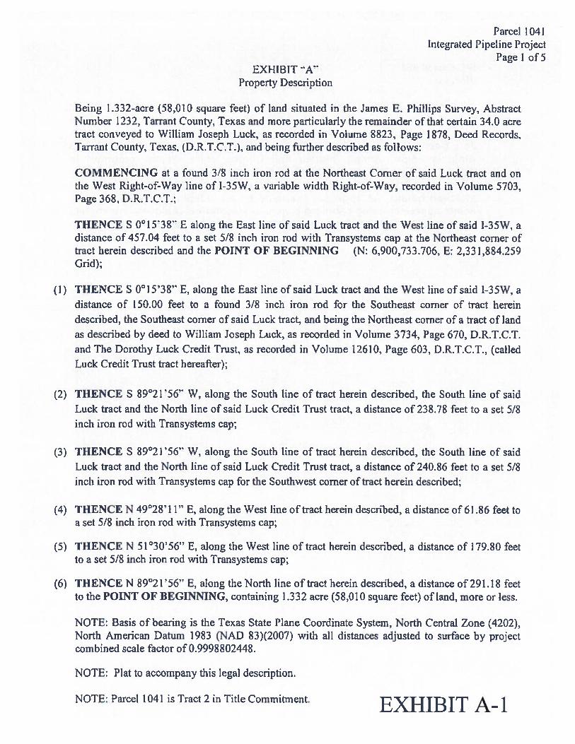
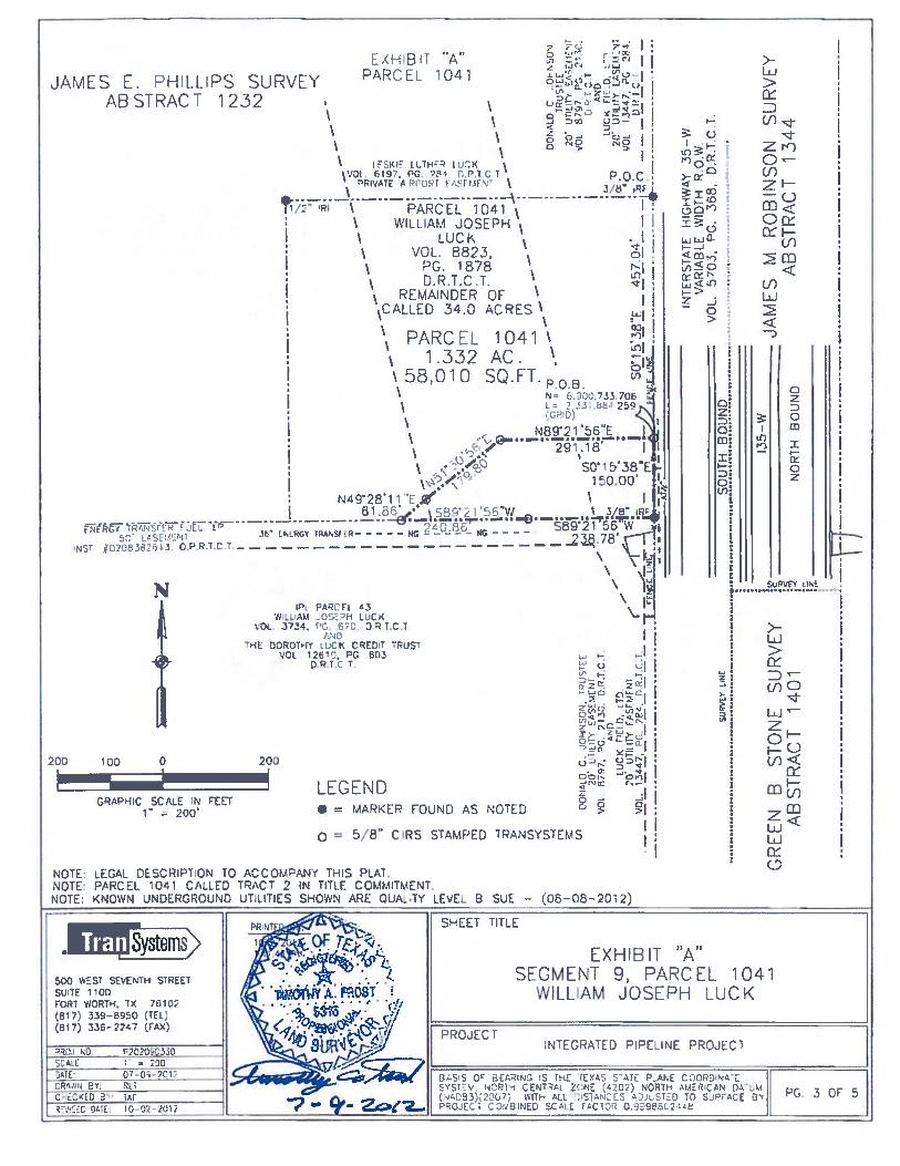
Parcel 1041Integrated Pipeline Project
Page 1 of5EXHIBIT
Property Description
Being 1 .332-acre (58,01 0 square feet) of land situated in the James B. Phillips Survey, AbstractNumber 1232, Tarrant County. Texas and more particularly the remainder of that certain 34.0 acretract conveyed to William Joseph Luck, as recorded in Volume 8823, Page 1878, Deed Records,Tarrant County, Texas, (D.R.T.C.T.), and being further described as follows:
COMMENCING at a found 3/8 inch iron rod at the Northeast Corner of said Luck tract and onthe West Right-of-Way line of 1-35W, a variable width Right-of-Way, recorded in Volume 5703,Page 368, D.R.T.C.T.;
THENCE S 0°l5’38’ E along the East line of said Luck tract and the West line of said 1-35W, adistance of 457.04 feet to a set 5/8 inch iron rod with Transysterns cap at the Northeast corner oftract herein described and the POINT OF BEGINNING (N: 6,900,733.706, E: 2,331,884.259Grid);
(1) THENCE S 0°15’38” E, along the East line of said Luck tract and the West line of said 1-35W, adistance of 150.00 feet to a found 3/8 inch iron rod for the Southeast corner of tract hereindescribed, the Southeast corner of said Luck tract, and being the Northeast corner of a tract of landas described by deed to William Joseph Luck, as recorded in Volume 3734, Page 670, D.R.T.C.T.and The Dorothy Luck Credit Trust, as recorded in Volume 12610, Page 603, D.R.T.C.T., (calledLuck Credit Trust tract hereafter);
(2) THENCE S 89°2 1 56” W, along the South line of tract herein described, the South line of saidLuck tract and the North line of said Luck Credit Trust tract, a distance of 238.78 feet to a set 5/8inch iron rod with Transystems cap;
(3) THENCE S 89°21 ‘56’ W, along the South line of tract herein described, the South line of saidLuck tract and the North line of said Luck Credit Trust tract, a distance of 240.86 feet to a set 5/8inch iron rod with Transystems cap for the Southwest corner of tract herein described;
(4) THENCE N 49°2811” B, along the West line of tract herein described, a distance of 61.86 feet toa set 5/8 inch iron rod with Transysterns cap;
(5) THENCE N 51°30’56” B, along the West line of tract herein described, a distance of 179.80 feetto a set 5/8 inch iron rod with Transystems cap;
(6) THENCE N 89°21’56’ B, along the North line of tract herein described, a distance of 291.18 feetto the POINT OF BEGINNING, containing 1.332 acre (58,010 square feet) of land, more or less.
NOTE: Basis of bearing is the Texas State Plane Coordinate System, North Central Zone (4202),North American Datum 1983 (NAD 83)(2007) with all distances adjusted to surface by projectcombined scale factor of 0.9998802448.
NOTE: Plat to accompany this legal description.
NOTE: Parcel 104] is Tract 2 in Title Commitment. E)(FIIBIT A.— 1
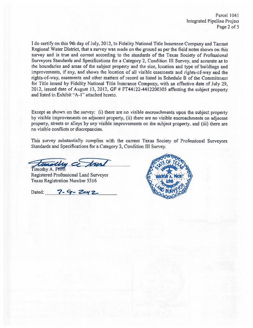
Parcel 1041Integrated Pipeline Project
Page 2 of 5
I do certify on this 9th day of July, 2012, to Fidelity National Title Insurance Company and Tai-rantRegional Water District, that a survey was made on the ground as per the field notes shown on thissurvey and is true and correct according to the standards of the Texas Society of ProfessionalSurveyors Standards and Specifications for a Category 2, Condition III Survey, and accurate as tothe boundaries and areas of the subject property and the size, location and type of buildings andimprovements, if any, and shows the location of all visible easements and rights-of-way and therights-of-way, easements and other matters of record as listed in Schedule B of the Commitmentfbr Title issued by Fidelity National Title Insurance Company, with an effective date of July 29,2012, issued date of August 13, 2012, OF # FT44122-4412200305 affecting the subject propertyand listed in Exhibit A-1” attached hereto.
Except as shown on the survey: (1) there are no visible encroachments upon the subject propertyby visible improvements on adjacent property, f ii) there are no visible encroachments on adjacentproperty, streets or alleys by any visible improvements on the subject property, and (iii) there areno visible conflicts or discrepancies.
This survey substantially complies with the current Texas Society of Professional SurveyorsStandards and Specifications for a Category 2, Condition III Survey.
Registered Professional Land SurveyorTexas Registration Number 5316
Dated: 7- $— Z.c.yZ...
k)
-a a
(I)
P1
rni
>(
c5
0o P
1>
-rJ
IC
)>
P1
-
rr
C ?
1) r
t’i
r1t
e>
I——
—
> m
-H >1
0=
1J oX --
4
—“1
0in
*
1in
C) > -U I C)
in C)
rtZ
r’a
‘1 P1
P1 -1
0 0
-o -0 0
-4 I re0
0<
0‘
eQ —
II.
r -413 O
C,
in
z en— z -
.
1- i.
Ir.j
—
•m
no P
1
cc3
P1
1 0 C z a (I, z 0 —1
P1 a
0 ii,
-U
C,
Lfl
LI?
-4 -U P1 a —4
LI?
(I?
-4 P1
LI?
(I? I P1
P1 -4 -4 -4 P1
I m 0 C P1 0 0 0 N)
——
——-
I
C)’
— I
-4
-U 0 C P1 C-,
-4
P1 0 > -4 a -o -o P1
C z P1 -U 0 C 4-
C-)
—
—--—
—
——
DO
tlA
tDC
JOH
NS
C-N
.T
PU
SIE
E20
LIt
TY
SE
ME
NT
VO
l7q7,
G,
243g.
D.R
.TC
t.‘
1)LU
CIC
ou
ittry
FA
SM
F1T
VO
L.364?,
Pc.7
,t)T
cj.
SUW
1.Y
UN
F
>0
‘—.4
—0
_i
-—
DO
NA
LD
CO
f-()N
0T
RU
SIE
E2
0U
ThLi
TrE
tZIt
l.’9
1VO
L3797
P,
w*
.Lw
ei
reo,
2QU
T1L’
VL
%S
Nin
C0
VO
Lt3
64
7
_L
iD
GR
EE
NB
STO
NE
SUR
VE
YA
BST
RA
CT
1401
SOU
TH
BO
UN
D
INTE
RST
ATE
HIG
HW
tY35
—W
VA
RIA
BLE
WID
THR
.OW
.V
OL.
5O
3.
PG.
368,
D.R
J.C
.T.
35-W
—JA
ME
SM
RO
BIN
SON
SUR
VE
YN
OR
TH
SOU
ND
AB
STR
AC
T13
44
Parcel 96Integrated Pipeline Project
Page 1 of4
EXHIBIT ‘A”Property Description
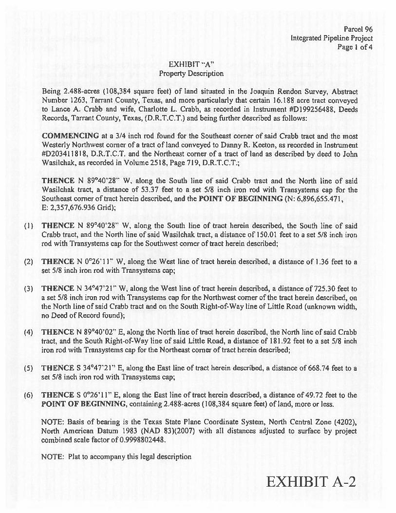
Being 2.488-acres (108,384 square feet) of land situated in the Joaquin Rendon Survey, AbstractNumber 1263, Tarrant County, Texas, and more particularly that certain 16.188 acre tract conveyedto Lance A. Crabb and wife, Charlotte L Crabb, as recorded in Instrument #D199256488, DeedsRecords, Tarrant County, Texas, (D.R.T.C.T.) and being further described as follows:
COMMENCING at a 314 inch rod found for the Southeast corner of said Crabb tract and the mostWesterly Northwest corner of a tract of land conveyed to Danny R. Keeton, as recorded in Instrument#D20341 1818, D.R.T.C.T. and the Northeast corner of a tract of land as described by deed to JohnWasilchak, as recorded in Volume 2518. Page 719, D.R.T,C.T.;
THENCE N 89°40’28” W. along the South line of said Crabb tract and the North line of saidWasilchak tract, a distance of 53.37 feet to a set 5/8 inch iron rod with Transystems cap for theSoutheast corner of tract herein described, and the POINT OF BEGINNING (N: 6,896,655.471,E: 2,357,676.936 Grid);
(1) THENCE N $9°40’28” W, along the South line of tract herein described, the South line of saidCrabb tract, and the North line of said Wasllchak tract, a distance of 150.01 feet to a set 5/8 inch ironrod with Transystems cap for the Southwest corner of tract herein described;
(2) THENCE N 0°26’ 11” W, along the West line of tract herein described, a distance of 1.36 feet to aset 51$ inch iron rod with Transystems cap;
(3) THENCE N 34°47”21” W, along the West line of tract herein described, a distance of 725.30 feet toa set 5/8 inch iron rod with Transystems cap for the Northwest corner of the tract herein described, onthe North line of said Crabb tract and on the South Right-of-Way tine of Little Road (unknown width,no Deed of Record found);
(4) THENCE N 89°40’02” E, along the North tine of tract herein described, the North line of said Crabbtract, and the South Right-of-Way line of said Little Road, a distance of 181 .92 feet to a set 5/8 inchiron rod with Transystems cap for the Northeast corner of tract herein described;
(5) THENCE S 34°4T21” E, along the East line of tract herein described, a distance of 668.74 feet to aset 5/8 inch iron rod with Transystems cap;
(6) THENCE $ 0°26’ 11” E. along the East line of tract herein described, a distance of 49.72 feet to thePOINT OF BEGINNING, containing 2.48$-acres (108,384 square feet) of land, more or kss.
NOTE: Basis of bearing is the Texas State Plane Coordinate System, North Central Zone (4202),North American Datum 1983 (NAD 83)(2007) with all distances adjusted to surface by projectcombined scale factor of 0.9998802448.
NOTE: Plat to accompany this legal description
EXHIBIT A-2
Parcel 96Integrated Pipeline Project
Page 2 of 4
I do certify on this 14th day of December, 2012, to Fidelity Nationai Title Insurance Company andTarrant Regional Water District, that a survey was made on the ground as per the field notes shownon this survey and is true and correct according to the standards of the Texas Society of ProfessionalSurveyors Standards and Specifications for a Category 2, Condition III Survey, and accurate as to theboundaries and areas of the subject property and the size, location and type of buildings andimprovements, if any, and shows the location of all visible easements and rights-of-way and therights-of-way, easements and other matters of’ record as listed in Schedule B of the Commitment forTitle issued by Fidelity National Title tnsurance Company, with an effective date of November 25,2012, issued date of December tI, 2012, GF # fT244122-44122009]7 affecting the subject propertyand listed in Exhibit A-l” attached hereto.
Except as shown on the survey: (1) there are no visible encroachments upon the subject property byvisible improvements on adjacent property, f ii) there are no visible encroachments on adjacentproperty, streets or alleys by any visible improvements on the subject property, and (iii) there are novisible conflicts or discrepancies.
This survey substantially complies with the current Texas Society of Professional SurveyorsStandards and Specifications for a Category 2, Condition III Survey.
Registered Professional Land SurveyorTexas Registration Number 5316 ,
1 rufl1A. FROST 1:;Dated: tZ’/2r..t2
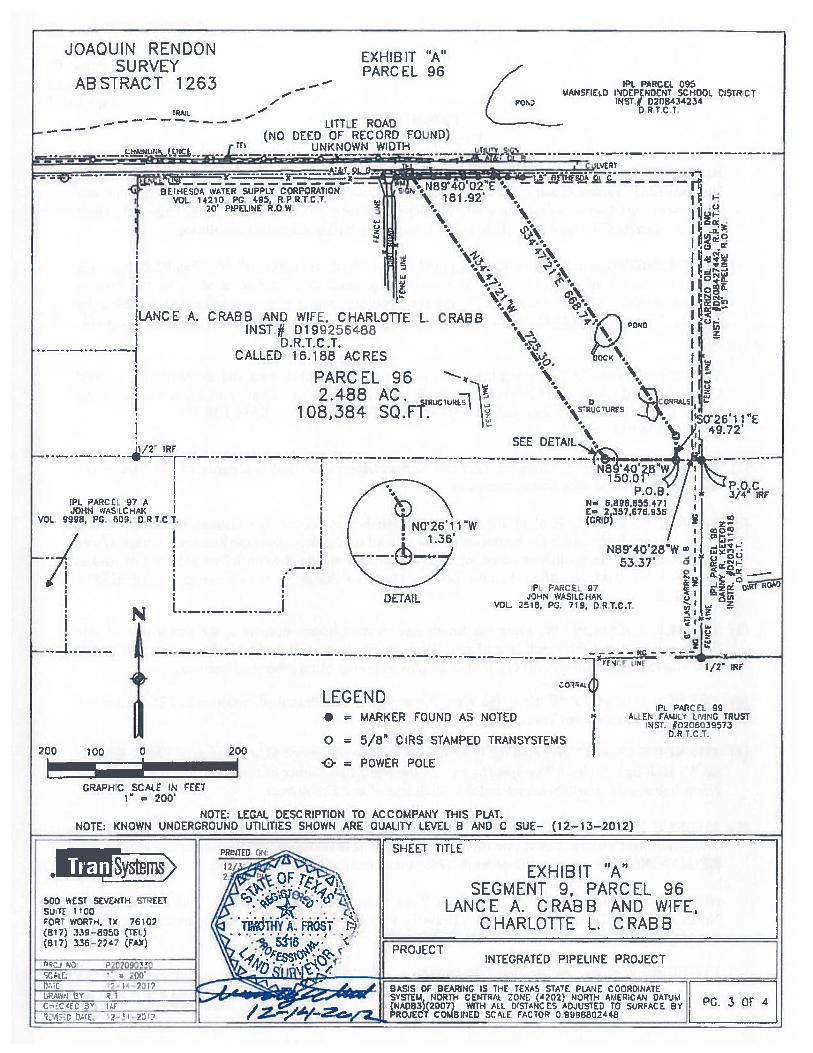
JOAQUIN RENDONSURVEY
ABSTRACT 1263 — —
EXHIBIT ‘A”PARC EL 96
IPI PARCEL 095VANStD IDEPENDCNT SCHOO. CISTRCI
)NST.Ø 0208434234OR 7Cr
PC PARC[ 97 AJOHN Wf.StCHAi<
VOL 9998. PG. 60Y, DR LC’
GRAPHIC SCAt F IN FEFI= 200’
— LITTLE ROAD-
— (No DEED OF RECORD fOUND)LUANk WC UNKNOWN WIDTH
I.
LANCE A. CRABS AND WIFI. CHARLOTTE L. CRASStNST.# D199256488
D.R.T.C .T.CALLED 16.188 ACRES
PARCEL 962.488 AC. ruu
106,384 SQ.Ff.
1 /2’ ‘RF
JI I
DETAIL
N
P.o
SEE DETAIL%
N89’40’2853.37’
PL PARCEc 97JOHN WASICCAI
VOL. 2518. PG. 119, DRT.C.T
‘3
200 100
1 ‘)/2
LEGEND 1 r PARCEL 99• = MARKER FOUND AS NOTED A Cr?uI’.ITRUST
t)RT.C.T,O = 5/8” CIRS STAMPED TRANSYSTEMS
200= POWER POLE
NOTE; LEGAL DESCRIPTION TO ACCOMPANY THIS PLAT.NOTE: KNOWN UNDERGROUND U11LITIES SHOWN ARE QUALITY LEVEL B AND C SUE— (12-13-2012)
500 WEST SEVENTH STREETS’JTF I 0OFOPT WOR-t, IX 76102(817) 339—81150 (IR)(617) 336—22’? (FAX)
EXHIBIT “A”SEGMENT 9, PARCEL 96
LANCE A. CRABB AND WIFE,CHARLOTtE L. CRABB
INTEGRATED PIPELINE PROJECT
THE TE’XAS STATE PLANE C00-JINA1LIAL ZONC (4202) NORTh ADERICN JAtlAU, 0STANC ES ADJJSTED TO EURACL Y
COA8iNED SCcE tCTCflI 0.91106802448PG. 3 QF 4
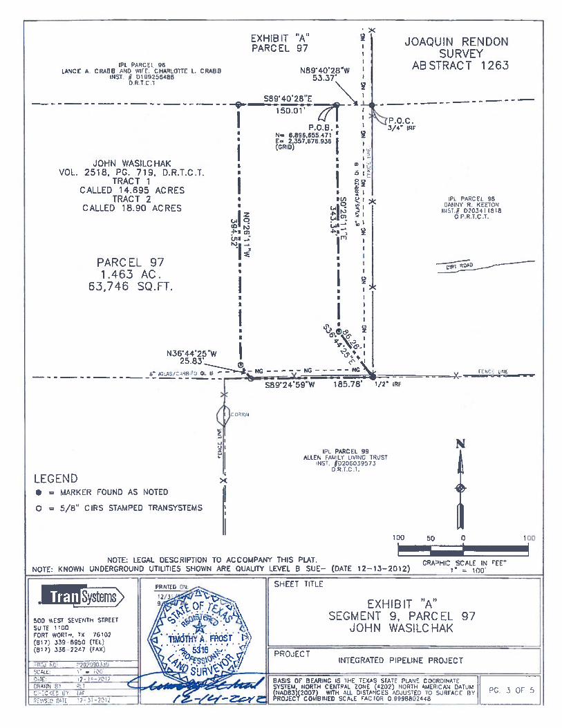
Parcel 97Integrated Pipeline Project
Page of5EXHIBIT A”
Property Description
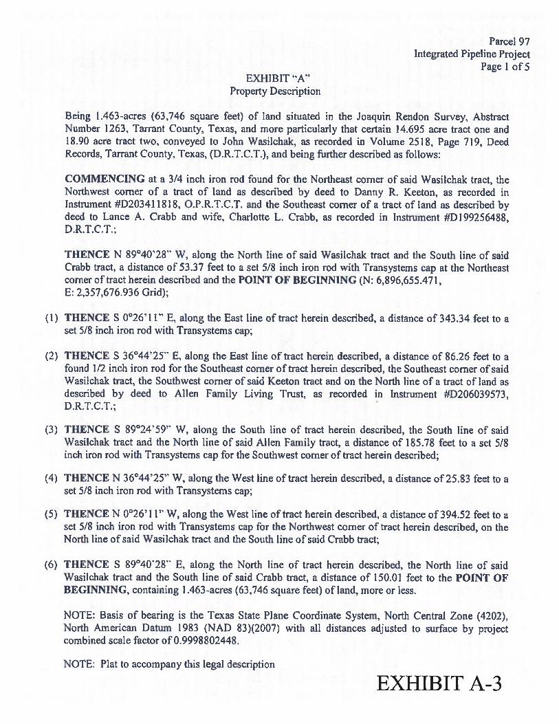
Being 1.463-acres (63,746 square feet) of land situated in the Joaquin Rendon Survey, AbstractNumber 1263. Tarrant County, Texas, and more particularly that certain 14.695 acre tract one and18.90 acre tract two, conveyed to John Wasilchak, as recorded in Volume 2518, Page 719, DeedRecords, Tan-ant County. Texas, (D.R.T.C.T.), and being further described as follows:
COMMENCING at a 3/4 inch iron rod found for the Northeast corner of said Wasilchak tract, theNorthwest corner of a tract of land as described by deed to Danny R. Keeton, as recorded inInstrument #D20341 1818, O.P.R.T.CJ, and the Southeast corner of a tract of land as described bydeed to Lance A. Crabb and wife, Charlotte L. CraW as recorded in Instrument #D199256488,D.R.T.C.T.;
THENCE N 89°40’28” W, along the North line of said Wasilehak tract and the South line of saidCrabb tract, a distance of 53.37 feet to a set 51$ inch iron rod with Transystems cap at the Northeastcorner of tract herein described and the POINT OF BEGINNING (N: 6,896,655.471,E: 2,357.676.936 Grid);
(1) THENCE S 00267 11” E, along the East line of tract herein described, a distance of 343.34 feet to aset 5/8 inch iron rod with Transysterns cap;
(2) THENCE S 36°44’25” E, along the East line of tract herein described, a distance of 86.26 feet to afound 1/2 inch iron rod for the Southeast corner of tract herein described, the Southeast corner of saidWasilchak tract, the Southwest corner of said Keeton tract and on the North line of a tract of land asdescribed by deed to Mien family Living Trust, as recorded in Instrument #D206039573,D.RJ.C.T.;
(3) THENCE S 89°24’59” W, along the South line of tract herein described, the South line of saidWasilehak tract and the North line of said Allen family tract, a distance of 185.7$ feet to a set 5/8inch iron rod with Transystems cap for the Southwest corner of tract herein described;
(4) THENCE N 36°44’25” W, along the West line of tract herein described, a distance of 25.83 feet to aset 5/8 inch iron rod with Transysterns cap;
(5) THENCE N 002671 1” W, along the West line of tract herein described, a distance of 394.52 feet to aset 5/8 inch iron rod with Transystems cap for the Northwest corner of tract herein described, on theNorth line of said Wasilchak tract and the South line of said Crabb tract;
(6) THENCE S 89°4028” E, along the North line of tract herein described, the North line of saidWasilchak tract and the South line of said Crabb tract, a distance of 150.01 feet to the POINT OFBEGINNING, containing 1.463-acres (63,746 square feet) of land, more or less.
NOTE: Basis of bearing is the Texas State Plane Coordinate System, North Central Zone (4202),North American Datum 1983 (NAD 83)(2007) with all distances adjusted to surface by projectcombined scale factor of 0.9998802448.
NOTE: Plat to accompany this legal description
EXHIBIT A-3
Parcel 97Integrated Pipeline Project
Page 2 of 5
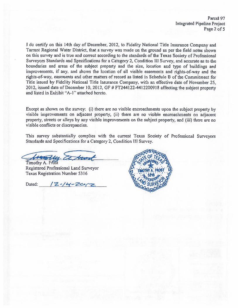
I do certify on this 14th day of December1 2012. to Fidelity National Title Insurance Company andTarrant Regional Water District, that a survey was made on the ground as per the field notes shownon this survey and is true and correct according to the standards of the Texas Society of ProfessionalSurveyors Standards and Specifications for a Category 2, Condition 111 Survey, and accurate as to theboundaries and areas of the subject property and the size, location and type of buildings andimprovements, if any, and shows the location of all visible easements and rights-of-way and therights-of-way, easements and other matters of record as listed in Schedule B of the Commitment forTitle issued by Fidelity National Title Insurance Company, with an effective date of November 25,2012, issued date of December 10. 2012, Gf # fT244122-4412200918 affecting the subject propertyand listed in Exhibit A-1 attached hereto.
Except as shown on the survey: (I) there are no visible encroachments upon the subject property byvisible improvements on adjacent property, (ii) there are no visible encroachments on adjacentproperty, streets or alleys by any visible improvements on the subject property, and (iii) there are novisible conflicts or discrepancies.
This survey substantially complies with the current Texas Society of Professional SurveyorsStandards and Specifications for a Category 2, Condition Ill Survey.
Timothy A. F ostRegistered Professional Land SurveyorTexas Registration Number 5316
Dated: — t
___
JOHN WASILCHAKVOL. 2518. PG. 719. D.R.LC.T.
TRACT 1CALLED 14.695 ACRES
TRACT 2CALLED 18.90 ACRES
P.0.8.’N— 6.696.655.471 ‘E 2 557 676 9.36fCRID
II I
I 0
Iqz
(0P.I cns . r
I I
(DATE 12—13—2012)ORA’HIC SCALE IN EE
— ICC
EXHIBIT “A”SEGMENT 9, PARCEL 97
JOHN WASILCHAK
INTEGRATED PIPELINE PROJECT
A5IS OF BEARINC IS IHE TENAS StATE PLANE COORDATE ISTEM NORTH CENTRAL ZONE (4202) NORTH ANERICAN DATUM I o r
NAD83k2007) WITH ALL DSThTICES ADjUSTED TQ SURFACE BY I . Ls, . U
ROJECT COMBINED SCAL. AC ICR C 9998a026$6
EXHIBIT “A”PARCEL 97
IPI ARCEL 95LANCE A CRABB WIi C1{4.0TTE L. CRABS N894O28W
INST # 0256486 53.3TD,RTE1
S894028”E— - - — - — - - — - - — - - — -
-I—
-
= -
z
rII
JOAQUIN RENDONSURVEY
ABSTRACT 1263
3/4 IRE
PL PARCEL 98DANNY R. REETOT3
IHST. D?C34 1816C P.R I.C.r.
.., rrc La
PARCEL 971.463 AC. ‘ I
63,746 SQ.FT. f f
p!
IN364425W I I258Y
—
___ _____
S692459”W 185,76 1/2W IRF
IPL PARCEL 99ALCEt FAMLY LyING LST
NST, ND206039573
IDRT,C,T.
LL.’.?l...INLI >(
• MARKER FOUND AS NOTED
o 5/8’ CIRS STAMPED TRANSYSTEMS
N
NOTE: LEGAL DESCRIPTION TO ACCOMPANY THIS PLAT.NOTE: KNOWN UNDERGROUND UTILITIES SHOWN ARE QUALITY LEVEL B SUE—
.Systenisemssca EsT SEVENTH STREETSUTE 1C0FCRT WORT-’, 7* 16102(517) 339 8950 (TEl)(511) 336 22’7 pAX)
100 50 0
ShEET TITLE
100
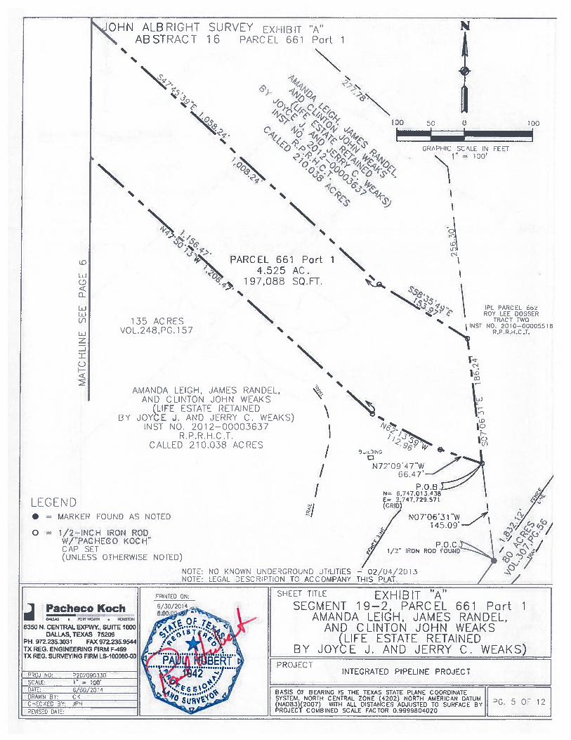
Parcel 661 — Part IIntegrated Pipeline Project
Page 1 of 12
Exhibit “A”Property Description
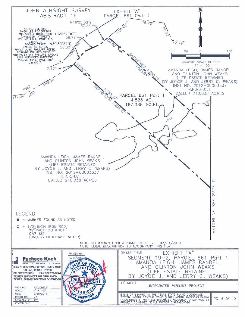
Being 4.525 acres (197,088 square feet) of land situated in the John Aibright Survey, Abstract Number 16,Henderson County, Texas and being part of that called 210.03$ acre tract of land described in QuitclaimDeed with Retained Life Estate to Amanda Leigh, James Randel, and Clinton John Weaks (Life Estateretained by Joyce J. and Jerry C. Weaks), recorded in Instrument No. 2012-00003637, Real PropertyRecords Henderson County Texas (R.P.R.H.C.T.), and being further described as follows:
COMMENCING, at a 1/2-inch iron rod found for the most southerly corner of that called 28 acre tract(Tract Two) described by Partition Deed recorded by Instrument No. 2010-00005518, R.P.R.H.C.T., andbeing an angle point in the northerly line of said 2 10.038 acre tract;
THENCE, N 07°06’31” W with a westerly line of said Tract Two and the northerly line of said 210.03$acre tract, a distance of 145.09 feet to a set 1/2-inch iron rod with “PACFIECO KOCH” cap for thePOINT OF BEGINNING (N: 6,747,013.438, E: 2,747,729.571 Grid);
(1) THENCE, N 72°09’47” W, a distance of 66.47 feet to a set 1/2-inch iron rod with “PACHECO KOCH”cap;
(2) THENCE, N 62°l3’59” W, a distance of 112.96 feet to a set 1/2-inch iron rod with “PACHECO KOCH”cap;
(3) THENCE, N 47°50’13” W, at a distance of 1,156.47 feet pass a set 1/2-inch iron rod with “PACHECOKOCH” cap, continuing for a total distance of 1,206.47 feet to a point in Walnut Creek;
(4) THENCE, N 39°53’37” E with Walnut Creek, a distance of 58.80 feet to a point;
(5) THENCE, N 65°52’06” E continuing with Walnut Creek, a distance of 58.79 feet to a point;
(6) THENCE, N 49°05’OO” E continuing with Walnut Creek, a distance of 37.33 feet to a point;
(7) THENCE, S 47°45’39” E leaving said creek, at a distance of 50.00 feet pass a set 1/2-inch iron rod with“PACHECO KOCH” cap, continuing for a total distance of 1,058.24 feet to a set 1/2-inch iron rod with“PACHECO KOCH” cap;
(8) THENCE. S 58°35’49” E, a distance of 153.97 feet to a set 1/2-inch iron rod with “PACHECO KOCH”cap on the common line for the aforesaid Tract Two and 210.03$ acre tract;
(9) THENCE, S 07°06’31” E with said common line, a distance of 186.24 feet to the POINT OFBEGINNING, containing 4.525 acre (197,088 square feet) of land, more or less.
EXHIBIT A-4
Parcel 661 — Part 2Integrated Pipeline Project
Page 2 of 12
Exhibit “A”Property Description
Being 3.717 acres (161,920 square feet) of land situated in the John Aibright Survey, Abstract Number 16,Henderson County, Texas and being part of that called 2 10.038 acre tract of land described in QuitclaimDeed with Retained Life Estate to Amanda Leigh, James Randel, and Clinton John Weaks (Life Estateretained by Joyce J. and Jerry C. Weaks), recorded in Instrument No. 2012-00003637, Real PropertyRecords, Henderson County, Texas (R.P.R.H.C.T.), and being further described as follows:
COMMENCING, at a found 1/2-inch iron rod for the most southerly corner of that called 28 acre tract(Tract Two) described by Partition Deed recorded by Instrument No. 2010-00005518, R.P.R.H.C.T., andbeing an angle point in the northerly line of said 2 10.038 acre tract;
THENCE, N 34°21 ‘23” E with the easterly line of said Tract Two and a westerly tine of said 210.032acre tract, a distance of 146.54 feet to a set 1/2-inch iron rod with “PACHECO KOCH” cap for thePOINT Of BEGINNING (N: 6,746,990.445, E: 2,747,830.224 Grid);
(1) THENCE, N 34°21’23” B continuing with said line, a distance of 173.63 feet to a set 1/2-inch iron rodwith “PACHECO KOCH” cap;
(2) THENCE, S $6°56’Ol” E, a distance of 1,082.49 feet to a set 1/2-inch iron rod with ‘PACHECO KOCH”cap on the east line of said 210.038 acre tract and the west line of that called 10.316 acres described bySpecial Warranty Deed to Reda Lee Matthews recorded by Volume 1470, Page 275, Deed RecordsHenderson County Texas (D.R.H.C .T.);
(3) THENCE, S 34°22’43” W with the line common to said tracts, a distance of 175.29 to a set 1/2-inch ironrod with “PACKECO KOCH” cap;
(4) THENCE, N 86°55’09” W, a distance of 1,010.54 feet to a set 1/2-inch iron rod with “PACIIECOKOCFI” cap;
(5) THENCE, N $6°01’13” W, a distance of 71.04 feet to the POINT OF BEGINNING, containing 3.717acres (161,920 square feet) of land, more or less.
Parcel 661Integrated Pipeline Project
Page 3 of 12
NOTE: Basis of bearing is the Texas State Plane Coordinate System, North Central Zone (4202), NorthAmerican Datum 1983 (NAD 83)(2007) with all distances adjusted to surface in projectcombined scale factor of’ 0.9999804020.
NOTE: Plat to accompany this legal description.
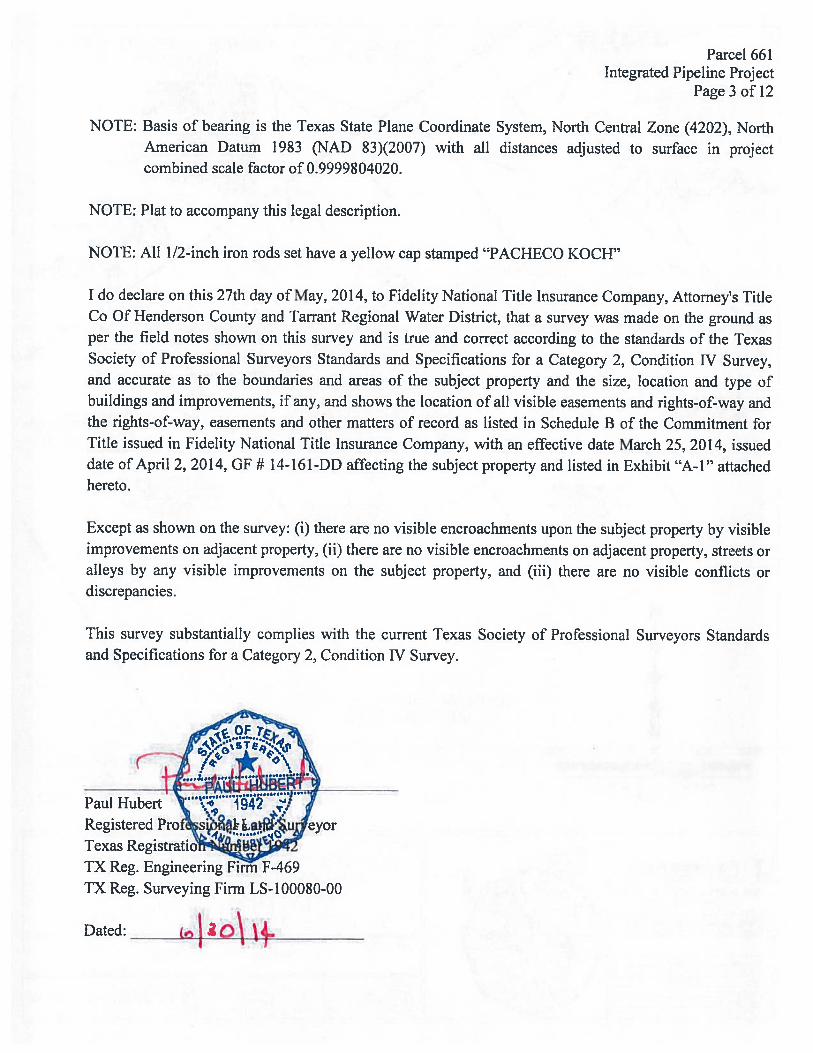
NOTE: All 1/2-inch iron rods set have a yellow cap stamped “PACHECO KOCH”
I do declare on this 27th day of May, 2014, to fidelity National Title Insurance Company, Attorney’s TitleCo Of Henderson County and Tarrant Regional Water District, that a survey was made on the ground asper the field notes shown on this survey and is true and correct according to the standards of the TexasSociety of Professional Surveyors Standards and Specifications for a Category 2, Condition IV Survey,and accurate as to the boundaries and areas of the subject property and the size, location and type ofbuildings and improvements, if any, and shows the location of all visible easements and rights-of-way andthe rights-of-way, easements and other matters of record as listed in Schedule B of the Commitment forTitle issued in Fidelity National Title Insurance Company, with an effective date March 25, 2014, issueddate of April 2, 2014, GF # 14-161-DD affecting the subject property and listed in Exhibit “A-I” attachedhereto.
Except as shown on the survey: (i) there are no visible encroachments upon the subject property by visibleimprovements on adjacent property, (ii) there are no visible encroachments on adjacent property, streets oralleys by any visible improvements on the subject property, and (iii) there are no visible conflicts ordiscrepancies.
This survey substantially complies with the current Texas Society of Professional Surveyors Standardsand Specifications for a Category 2, Condition IV Survey.
Paul HubertRegisteredTexas RegistratiTX Reg. Engineering FirTh f-469TX Reg. Surveying Firm LS-100080-00
Dated:
PC PARCEL 658WALTER LOUIS JACKSON. SR.
FILE NO. 134—82VOL. 72, PG. 47
D.R.H.C.T.W.W. JACKSON
FIRST TRACTVOL. 411, PG. 106
DR.H.C.I.IPL PARCEL 1075
BOOBY R. HUSTEADINST NO.
2014—0000098y
/ .7 /
IPL PARCEL 658W.W. JACKSON
VOL. 411, PG. 106D.R.H.C,T.
/F
GRAPHIC SCALE IN FEETV. 1000’
13% ACRESVOl ,48 ( 15?
GEORGE AlDRICH SURVEYABStRACT 18
IPL PARCEL 666FRANK BLANCHARD ANDMERSINI I. 8LANCHARDVOL. 2886, PG. 329
D.R.H,C.T.
/ PATRICIA FERN WEAKS BELLVOL. 1157. PG. 539
0.R.H.C.T.BILLY GENE WEAKS
VOL. 1157, PG. 544D.R.H.C.T.
>1
LXHIE3t “A”PARCEL 661 ND[X
/
—
/
- _j
IPL PARCEL 660OWEN LEE ROBERTSONAND SHECLY ROBERTSON
/%% (UNDIVIDED INTEREST)VOLUME 1947. PAGE 218
I,
D.R.H.C.T.
NANCY JUNE PHILLIPS REESE.ROXANNE PHILLIPS SPECHTAND PATSY JAN PHILLIPS SPEAKE
(50Z
UNDMOED INTEREST)
‘F ,‘ ROY LEE DOSSER
1’ - - ../“ INST NO 2010—00005516/ t R.P.R.H.C.T./ - CALLED 28 ACRES
7 / — 4%
- IPL PARCEL 664/ “% REDA LEE MATTHEWS\ VOL. 1470, PG. 275
IO.R.H.C.T.
/
7/
—‘-
4 ‘444%\ \\
44 ‘ i—PARCEL
PARCL 6l44 4%% / / Po’( 2
1 . — r— — —
V —
— —
AMANDA LEECH, JAMES ,/v
AND CUNION JOHN W(1 It ES lATE RI TAINED
BY JOYCE J. AND JERRY C. W A)NT NO, %Q1%-OO)D(;7
— R,.R.I IL .1.CAIIH) 21O.O% ACRI s /
4%4%
4%
/ IPL PARCEL 658/ W,W. JACKSON
VOL. 411, PG. 1060.R.H,C.T. I
LPRCEL 665DAVID U. UCECREE ANDWIFE, DEBRA MCELREEVOL 1638, PG. 137
D.R.H.r.T.
/F
I
/
/80 ACRLSVOL.307,PC F.
/
N
N
/
/I
1090 500 0
JOHN ALBRICHIAR STRACT
1000
SURVEY16
//
//
// JOSEPH RICE
SURVEYABSTRACT 653
Pacheco KochU, FCRTWORrH • OUUON
8350 N. CENTRAL EXPW. SUITEDALLAS. TEXAS 75206
PH. 972.235.3031 FAX 972.235.TX REG ENGINEERING FIRM F-469TX REG. SURVEYING FIRM LS-100080.
/
SHEET TITLE EXHIBIT “A”SEGMENT 19—2, PARCEL 661 INDEX
AMANDA LEIGH, JAMES RANDEL,AND CLINTON JOHN WEAKS
(LIFE ESTATE RETAINEDBY JOYëL J. AND JERRY C. WEAKS)
PROJECTINTEGRATED PIPELINE PROJECT
BASIS OE BEAOIG IS THE TEXAS STATE PLANE COORDINATESYSTEM, NCXT CENTXAL ZCNE (4202) NORTH AMERICAN DATUM(NAD63)(2007) WITH ALL )S’ANCES AO.,LSTD TO SURRACE 31P2OJECT COMBINED SCALE FACTOR 0 9999804020
LEGEND
OHN ALB RIGHTABSTRACT
• MARKER FOUND AS NOTED
o = i/p—iNCH IRON RODW/”PAC HEC 0 1<00 H”CAP SET(UNLESS OTHERWISE NOIED)
(0
N72’O4[’W7
N= 6,747,01 3438E= 2.747,729 571(CRIP
/ NO7’06’31145.09’
P.O.C.1/2” IRON ROD FOUND
— 02f]4/2O13THIS PIAI
SHEET TITLE EXHIB IT “A”SEGMENT 19—2, PARCEL 661 Part 1
AMANDA LEIGH, JAMES RANDEL,AND CLINTON JOHN WEAKS
(LIFE ESTATE RETAINEDBY JOYCE J. AND JERRY C. WEAKS)
PROJECT
SURVEY EXHIBIT “A” N16 PARCEL 661 Port 1
44
44
Jo
44’44
44
190 190
44
GRAPHIC SC’\cE IN EET130
44
\ PARCEL 661 Part 14.525 AC.
‘ 1 97,088 SQ.FT.
CO
tJED
0
Luu-iCr)Luz-J
()F
%%ç.4%135 ACRES
VOL.248 ,PG. 157
AMANDA LEIGH, JAMES RANDEL,AN[) CLINTON JOHN WEARS
(UEE ESTATE REtANEDB’’ JOYCE J. AND JLRRY C. WEARS)
NSF NO, 201%--00003637R.P.R.H.C .T.
CALLED 210.038 ACRES
IPL PARCH 601ROY 1FF DOSSER
TRACT TWONO 2010—00005518
R P.R H C T
44
I)
4%
/I
NOTE: NO KNOWN UNDERGROUND J7IUTIESNOJE: LEGAL DESCRIPTION TO ACCOMPAN
7
PRI’4T1 0
Pacheco KochDM1.4 • •
8350 N. CENTRAL EXPW’rL SUITE 1000DALLAS, TEXAS 75206
PH. 972.235.3031 FAX 972.23TX REG. ENGINEERING FIRM F-469TX REG. SURVEYING FIRM LS-1000&)-0O
/
INTECRAILD PIPELINE PROJECT
BASIS OF BEARING IS THE TEXAS STATE PLANE COORDINATESYSTEM, NORTH CENTRAL ZONE (4702) NORTH AMERICAN DATUMCNADB3)(2007) WITH ALL DISTANCES ADJUSTED TO SURFACE BYPROJECT COMBINED SCALE FACTOR O.99998O02O
G. 5 O 12
44
AMANDA LEIGH, JAMES RANDEL,AND CLINTON JOHN WLAKS
(LIFE ES1Ait RETAINEDBY JOYCE J. AND JERRY C. WEARS)
INST NO. 2012—00003637R. P.R H. C . T.
CALLED 210.038 ACRES
AMANDA LEIGH, JAMES RANDEL,AND CliNTON JOHN WEARS
l STAIF RET/IN’ Ii
Y’C J AND Jrj’1 C W’AK)INST NO. 2012—00003637
R.P.R.H.C .1-.CAUD 210.0.38 ACRES
JOHN ALB RIGHTABSTRACT
SURVEY16
EXFIIBIT “A”PARI F 661 Part 1
N49’O00”E
v\ /oOPt PARCEL 660OWEN tEE ROBERTSON
AND SHEI[Y ROBERTSON N65’52 06’E(UNDIVIDED INTEREST) 8 71
VOLUME 1947, PAGE 218D.R.H,C .T.
SECOND TRACT N39 53 37 ECALLED 50 ACRES 5$ SO’
NANCY JUNE PHILLIPS REESE,ROXANNF PHLLIPS SPEC UT
AND PAtSY JAN PHILLIPS SPUAKE(50% UNDIVIDED INTEREST)VOlUME 1947. PAGE 209
0 R H C T.
N
1k
4279’
1?0 9 100
GRAPHIC SCALE IN CEE1’1” = 100’
PARCEL 661 Part4.525 AC.
i97,O88 SQ.FT
44
1 44
44
—
LEGEND
44
• = MARKER FOUND AS NOTED
o 1/2—INiN IRON RODA/”RAC HEGO KOCH”CAR SEt(UNLESS OTHERWISE NOTED)
NOTE: NO KNOWN UNDECROUND JTLITIES — 02/04/2013NOTE: LEGAL DESCRIPTION TO ACCOMPANY THIS PLAT,
SHEET fILE EXHIBIT “A”SEGMENT 19—2, PARCEL 661 Part 1
AMANDA LEIGH, JAMES RANDEL,AND CLINTON JOHN WEARS
(LIFE ESTATE RETAINEDBY JOYtDE J. AND JERRY C. WEARS)
PROJECTINTEGRATED PIPELINE PROJECT
BASIS OF BEARING IS THE TEXAS STATE PLANE COORDINATESYSTEM, NORTH CENTRAL ZONE (4202) NORTH AMERICAN DATUM(NAD83)(200Y) WITN ALL DISTANCES ADJUSTED TO SLRFACE BY C 6 0- 1PROJECT COMBINED SCALE FACTOR 09999804020
NJOHN ALB RIGHTAB STRACT
SURVEY16
EXHIBIT “A”PARCEL, 661 Part 2
• = MARKER rOuND AS NOTED
— —
_____
— — — —
________
ccN8b’5 09 W 1010.54
C)
0
C)C)U)
LUz
1C)
Pacheco KochOT WORTh • HOURTON
8350 N, CENTRAL EXPWR, SUITE 000DALLAS, TEXAS 75206
PH. 972.235.3031 FAX 972.235.9544TX REG. ENGINEERING FIRM F469TX REG. SURVEYING FIRM LS-100080O0
IPL PARCEL 662ROY LEE DOSSER
TRACT TWOINST NO 2O1O-DOOO5S1N
R.P.R.H C T
V
130 5•0 9
TO,
r,.u)
N
C)DCC)
CL<cr5
—ö>
100
//
CRAOHIC SCALE IN FET
/ AMANDA LEIGH, JAMES RANDEL,1 = 100
/ AND CLINTON JOHN WEAKSci IL S1/\l RETAINED
BY )O L J ANT) JEI WAJ<S)INST NO. 2012—00003637
RP.R.H.C .T.CALLED 210.038 ACRES
— — —?8O1”E_1,08249’— =— — —
____
/
//
/
PARCEL 661 Part 23.717 AC.
161,920 SQ.FT.
N34’2 12 YE146.54’
/
P.O.c.1/2W IRON ROD biND
/
8f) ACRESVOL .30 7,PG.56
AMANDA LEIGH, JAMES RANDEL,AND CLINTON JOHN WEAKS
(I tEE INTAIr AH T)
JO?C E J. AN JERRY C. WEAKS)INST NO. 2012—000036.37
R.P.R.H.C .1./ CALLED 210.038 ACRES
LEGEND
o i —‘.“i iRO” RO’)W/”P,l1EC( k021 ‘
CAP SET(UNLESS OTHERWISE NOTLD)
ORHIFE ON.
6/30 2014
NOTE: NO KNOWN 1JNDECRO1JND UTILITIES 02/04/201.3NOTE. LEGAL DESCRIPTION TO ACCOMPANY THIS PLAT.
‘TD.I NO. D702O90330SCALE: ‘‘ =
DAtE. 6/30/204DRAWN R’t. Co :c<ro T: JR-bTEvISD DÁIL
SHE.E I’ TITLE EXHIB IT ‘A”SEGMENT 19—2, PARCEL 661 Part 2
AMANDA LEIGH, JAMES RANDEL,AND CLINTON JOHN WEAKS
(LIFE ESTATE RETAINEDBY JOYCE J. AND JERRY C. WEAKS)
PROJECTINTEGRATED PIPELINE PROJECT
BASIS OF BEARING IS THE TEXAS STATE PLANE COORDINATESYSTEM, NORTH CENTRAL ZONE (4202) NORTH AMERCAN DATUM(NAD83)f2007) WITH ALL DISTANCES ADJUSTED TO SURFACE BYPROJECT COMBINED SCALE FACTOR 0.9999804020
‘C 7 0” 12
N
CD
(1
wLi_I(f)
wz-J
0H
EXHIBIT “A”PARCEL 661 Part 2
AMANDA LEIGH, JAMES RANDEL,AND CLINION JOHN WEARS
(LIFE STAlE RE1t’INFDBY JO CE I . AND IF RR C. WAVS)
INST NO. 2012—00003637R.P,R.H.C .1.
CALLED 210.038 ACRES
/IPL PARCEL 664
REDA LEE MATThEWSVO, 17D, PG 775
DRHC.T,
Pt. PARCEL 665DAVID M. MCELREE ANDWIFE, DEBRA MCELREE
VOL. 1636, PG. 137DR H.CT,
JOHN ALBRIGHT SURVEYABSTRACT 16
-I
100 50 0 100
GRAPH C SCALE IN TET1” = 130
586’56’Q7”E 2.49’
______ ______
—
______
— — —
—
—
C9
— — —
PARCEL 661 Part 23.717 AC.
161,920 SQ.FT.
N8655’Q 1j)1,5
AMANDA LEIGH, JAMES RANDEL,AND CLINTON JOHN WEARS
(un SlAtE I 1BY JOYCE J. AN JERRY C. WiAKS)
INST NO. 2012—00003637R.P.R.H.C .T.
CALLED 210.038 ACRES
I
NOTE NO KNOWN UNDERGROUND UTILITIES — 02/04/2013NOTE LEGAL UESCRIPLON 10 ACCOMPANY THIS PLAT
LEGEND• — MARKER FOUND AS NOIED
o 1/2—INCH Cij RODw/”PACHt,LO KOCH”CAP SET(UNLESS OTHERWISE NOTED)
//
V
PRINITED SHEET TITLE EXHIB IT “A”Pacheco Koch E/33/1D1 SEGMENT 1 9—2, PARC EL 661 Part 2iA1L’5 • ORflN •
8350N.CENTRALEXPWY.SUITE1000AMANDA LEiGH, JAMES RANDEL,
AND CLINTON JOHN WEAKSDALLAS, TEXAS 75206
PH.972.235.3031 FAX972.235.9544 :‘(LIFE ESTATE RETAINED
TX REG. SURVNG FIRM LS-10006O0d PROJECT
TXREG.ENGINEERINGFIRMF469
.
BY JOYb E J. AND JERRY C. WEAKS)
4CJ 1O D7o2pgo3o —
‘
..1b42 .INTEGRATED PIPELINE PROJECT
SCAH = 10C6 5’.... 1
BASIS DF BEARING IS THE TEXAS STATE PLANE COORDINATE:‘3. 6/30120’4 — •.‘_ (.,., 4
DRAWN BY: C4 SYSTEM. NORTH CENTRAL ZONE (4202) NDRH AMERICAN DATUMDC 8 O 9C-ECED 3”: ]PH (NAD83)f 2007) WITH ALL DISTANCES ADJUSTED TO SURFACE BY
REVISED DATE: PROJECT COMBINED SCALE FACTOR 0 9999604020
In addition, R. Steve Christian and the staff of TRWD are authorized to initiate
eminent domain proceedings, to take all steps which may be reasonably necessary to
complete the acquisition of the above-described properties, to pay all customary,
reasonable and necessary closing and related costs, to deposit the amount of the special
commissioners’ award into the registry of the court in any eminent domain proceeding,
and to appeal any such award. Director Leonard seconded the motion and the vote in
favor was unanimous.
20.
With the recommendation of management, Director Stevens moved to grant
authority to acquire permanent easement interests, as set forth below, in, over, under,
and across the following described properties for the public use and purpose of
construction and operation of the Integrated Pipeline Project. Funding for these
acquisitions are included in the Bond Fund.
• IPL Parcel 765(Carter)
A permanent easement interest across a 1.455-acre tract of land situated in theRalph Hunter Survey, Abstract Number 11, Henderson County, Texas, and beingmore particularly described as a portion of that certain 48.931-acre tractconveyed to Fred B. Carter, as described by deed recorded in Volume 2403,Page 280 Real Property Records of Henderson County, Texas, and being furtherdescribed in the survey plat for Parcel 765 attached hereto for the appraisedvalue of $8,000.
• IPL Parcel 786(Dansby)
A permanent easement interest across a 3.694-acre tract of land situated in theAlfred Benge Survey, Abstract Number 57, Henderson County, Texas, and beingmore particularly described as a portion of that certain 20-acre tract of land(First Tract), and that certain 30-acre tract (Second Tract), less and except 2acres described in a deed recorded in Volume 55, Page 187, of the Deed Recordsof Henderson County, Texas, leaving 28 acres of land more or less, said First
Tract and Second Tract conveyed to Richard Ferrell Dansby as described bydeed recorded in Volume 1685, Page 197 of the Real Property Records ofHenderson County, Texas, and being further described in the survey plat forParcel 786 attached hereto for the negotiated purchase price of $65,000.
• IPL Parcel 1020(Parker) -
A permanent easement interest across a 4.723-acre tract of land situated in theJ. A. Castellow Survey, Abstract Number 991, Henderson County, Texas, andbeing more particularly described as a portion of that certain residue of a called40-acre tract, conveyed to Linda Ann Parker, as recorded in Volume 2641, Page656, Deed Records, Henderson County, Texas, and being further described inthe survey plat for Parcel 1020 attached hereto for the appraised value of$17,000.
Parcel 765Integrated Pipeline Project
Page 1 of4EXHIBIT “A”
Property Description
Being 1.455 acres (63,387 square feet) of land situated in the Ralph Hunter Survey, Abstract Number11, Henderson County, Texas, and more particularly that certain 48.931 acre tract conveyed to FredB. Carter, as described by deed recorded in Volume 2403, Page 280 Real Property Records ofHenderson County, Texas, (R.P.R.H.C.T.), and being further described as follows:
BEGINNING at a set 1/2” iron rod with red plastic cap stamped K.L.K. #4687 in the East line ofsaid Ralph Hunter Survey and said 48.39 1 acre Fred B. Carter tract and the West line of the Wm. J. L.Scott Survey, Abstract Number 13 and a called 497.955 acre tract conveyed to Bradley Hoeffner andHelen Hoeffner, as described by deed recorded in Volume 2213, Page 245 R.P.R.H.C.T. from whicha found 3/8” iron rod for Southeast corner of said 48.93 1 acre tract bears S 01°40’48” E, a distance of140.72 feet, said set 1/2” iron rod also being the Southeast corner of the tract herein described and thePOINT OF BEGINNING (N: 6,732,209.360, E: 2,854,369.055, Grid);
(1) THENCE S 88°01’19” W, along the along the South line of the tract herein described, a distance of422.60 feet to a set 1/2” iron rod with red plastic cap stamped K.L.K. #4687 in the West line of said4 8.93 1 acre Fred B. Carter and the East line of a called 62.5 11 acre tract conveyed to John D. Carter,as described by deed recorded in Volume 2403, Page 285 R.P.R.H.C.T. from which a 1/2” iron rodfound for the Southwest corner of said 48.93 1 acre tract and the Southeast corner of said 62.511 acretract bears S 01°39’38” E, a distance of 61.07 feet, said iron rod set also being the Southwest corner ofthe tract herein described;
(2) THENCE N 01°39’38” W, along the West line of the tract herein described and said 48.93 1 acre FredCarter tract and the East line of said 62.5 11 acre John Carter tract, a distance of 150.00 feet to a set1/2” iron rod with red plastic cap stamped K.L.K. #4687 for the Northwest corner of said tract hereindescribed;
(3) THENCE N 88°01’19” E, along the North line of said tract herein described, a distance of 421.44feet to a set 1/2” iron rod with red plastic cap stamped K.L.K. #4687;
(4) THENCE N 87°46’04” E, continuing along the North line of said tract herein described, a distance of1.11 feet to a set 1/2” iron rod with red plastic cap stamped K.L.K. #4687 in the East line of said48.93 1 acre Fred Carter tract and said Ralph Hunter Survey and the West line of said 497.955 acreHoeffner tract and said Wm. J. L. Scott Survey, also being the Northeast corner of the tract hereindescribed;
(5) THENCE S 01°40’48” E, along abovementioned East and West lines, a distance of 150.01 feet to thePOINT OF BEGINNING, containing 1.455 acres (63,387 square feet) of land.
NOTE: Basis of bearing is the Texas State Plane Coordinate System, North Central Zone (4202),North American Datum 1983 (NAD 83)(2007) with all distances adjusted to surface by projectcombined scale factor of 0.9999804020.
NOTE: Plat to accompany this legal description
Parcel 765Integrated Pipeline Project
Page 2 of 4
I do certify on this 15th day of January, 2016, to fidelity National Title Insurance Company,Attorney’s Title Company of Henderson County and Tarrant Regional Water District, that a surveywas made on the ground as per the field notes shown on this survey and is true and correct accordingto the standards of the Texas Society of Professional Surveyors Standards and Specifications for aCategory 2, Condition III Survey, and accurate as to the boundaries and areas of the subject propertyand the size, location and type of buildings and improvements, if any, and shows the location of allvisible easements and rights-of-way and the rights-of-way, easements and other matters of record aslisted in Schedule B of the Commitment for Title issued by fidelity National Title InsuranceCompany, with an effective date of November 30, 2015, issued date of December 9, 2015, Gf #15-337-DD affecting the subject property and listed in Exhibit “A-i” attached hereto.
Except as shown on the survey: (i) there are no visible encroachments upon the subject property byvisible improvements on adjacent property, (ii) there are no visible encroachments on adjacentproperty, streets or alleys by any visible improvements on the subject property, and (iii) there are novisible conflicts or discrepancies.
This survey substantially complies with the current Texas Society of Professional SurveyorsStandards and Specifications for a Category 2, Condition III Survey.
Kevin IL. ilgoreRegistere ssional Land SurveyorTexas Registration Number 4687
Dated:__________
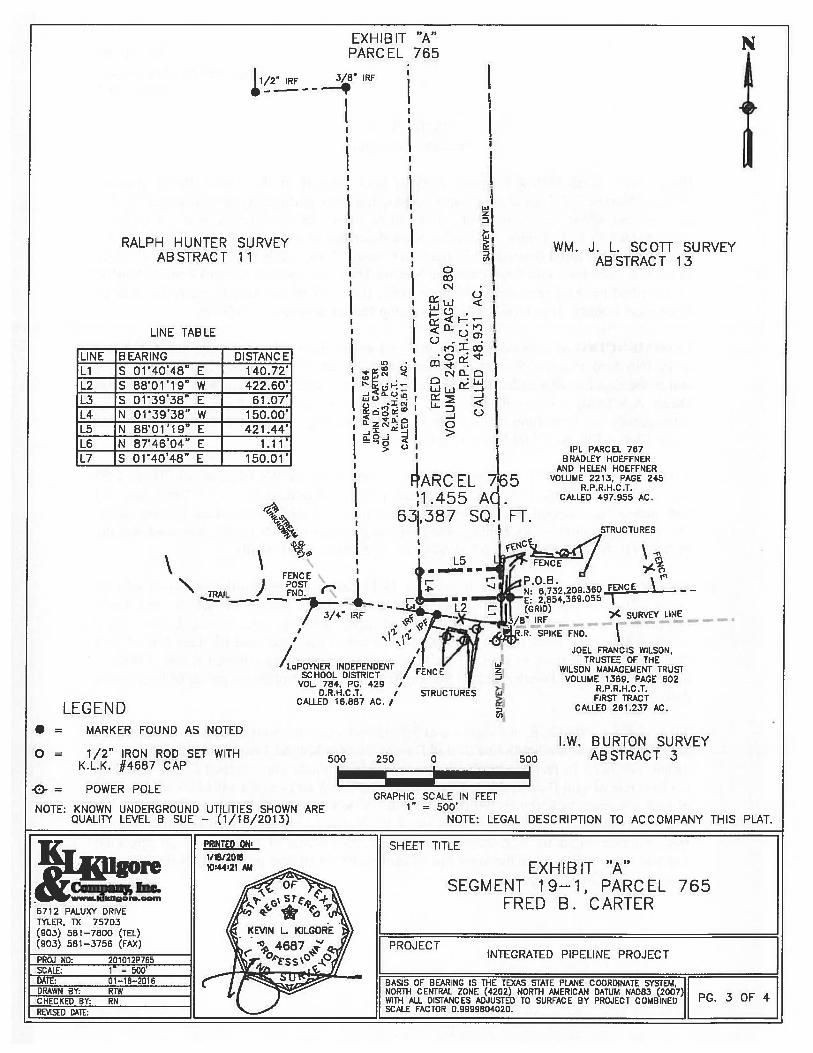
RALPH HUNTER SURVEYABSTRACT 11
LINE TABLE
*
— 3/8W IRE
______________________________________________
I
‘I
FENCE) POSTEN U
— 7:t - -
I
UNE BEARING DISTANCE
Li S Oi’40’48” E 140.72’
L2 S 8801’19 W 422.60’
L3 S 01’39’38” E 61.07’
L4 N Ol’39’38” W 150.00’
L5 N 88’Oi’i9” E 421.44’
L6 N 87’46’04 E 1.11’
L7 S 0140’48 E 150.01’
EXHIBIT “A” xPARCEL 765
LJ
.4
WM. J. L. SCOTT SURVEYABSTRACT 13
0IXic”3 ‘j
U’
‘D .
CNO-0
C Li..
fl.ZD: 0oj
IIPL PARCEL 757
IBRADLEY HOEFFNER
I AND HELEN HOEFENER
ARC El 76 VOLUME 2213, PAGE 245I I “ R.P.R.H.C.T.
1 .455 Aq . CALLED 497.955 AC.
63387 SQ.I FT.1 STRUCTURES
I POBN: 6732.209.360 L.—’I.-- — —
2,854,369.055
> SURVEY LINE-——
?. sPIKE END.
JOEL FRANCIS WILSON,TRUSTEE OF THE
WILSON MANAGEMENT TRUSTVOLUME 1369, PAGE 602
R.P.R.H.C ,T.FIRST TRACT
CALLED 261.237 AC.
/aPOYNER INDEPENDENTSCHOOL DISTRICT
VOL. 784 PG. 429 ,D.R.H.C.T. /
CALLED 16.887 AC. /LEGEND• = MARKER FOUND AS NOTED
o = 1/2” IRON ROD SET WITHK.L.K. #4687 CAP
-0- = POWER POLE
NOTE: KNOWN UNDERGROUND UTILITIES SHOWN AREQUALITY LEVEL B SUE — (1/16/2013)
z.4
>
U,
500 250 0 500
LW. BURTON SURVEYABSTRACT 3
GRAPHIC SCALE IN FEE11” = 500’
NOTE: LEGAL DESCRIPTION TO ACCOMPANY THIS PLAT.
PRINTED 0N SHEET TITLE1/16120151044;21 j EXHIBIT “A”
SEGMENT 19—1, PARCEL 765wwIkHgQr.om FRED B C AI’TIR
6712 PALUX’ DRIVE ‘‘ I l_
TYLER, TX 75703(903) 581—7800 (TEL)(903) 581—3756 (FAX) PROJECTPROJ ND: 201012P765 INTEGRATED PIPELINE PROJECT
SCALE: 1_=_500’
DATE: 01—18—2016 BASIS OF BEARING IS THE TEXAS STATE PLANE COORDINATE SYSTEM,DRAWN BY; RTW NORTh CENTRAL ZONE (4202) NORTh A),IERICAN DATUM NAD83 (2007)CHECKED BY: WITH ALL DISTANCES ADJUSTED TO SURFACE BY PROJECT COMBINED ‘
REIi1StD DATE: SCALE FACTOR 0.9999604020.
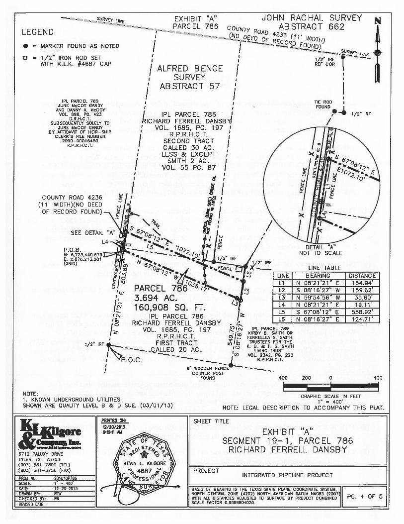
Parcel 786Integrated Pipeline Project
Page 1 of5
EXHIBIT “A”Property Description
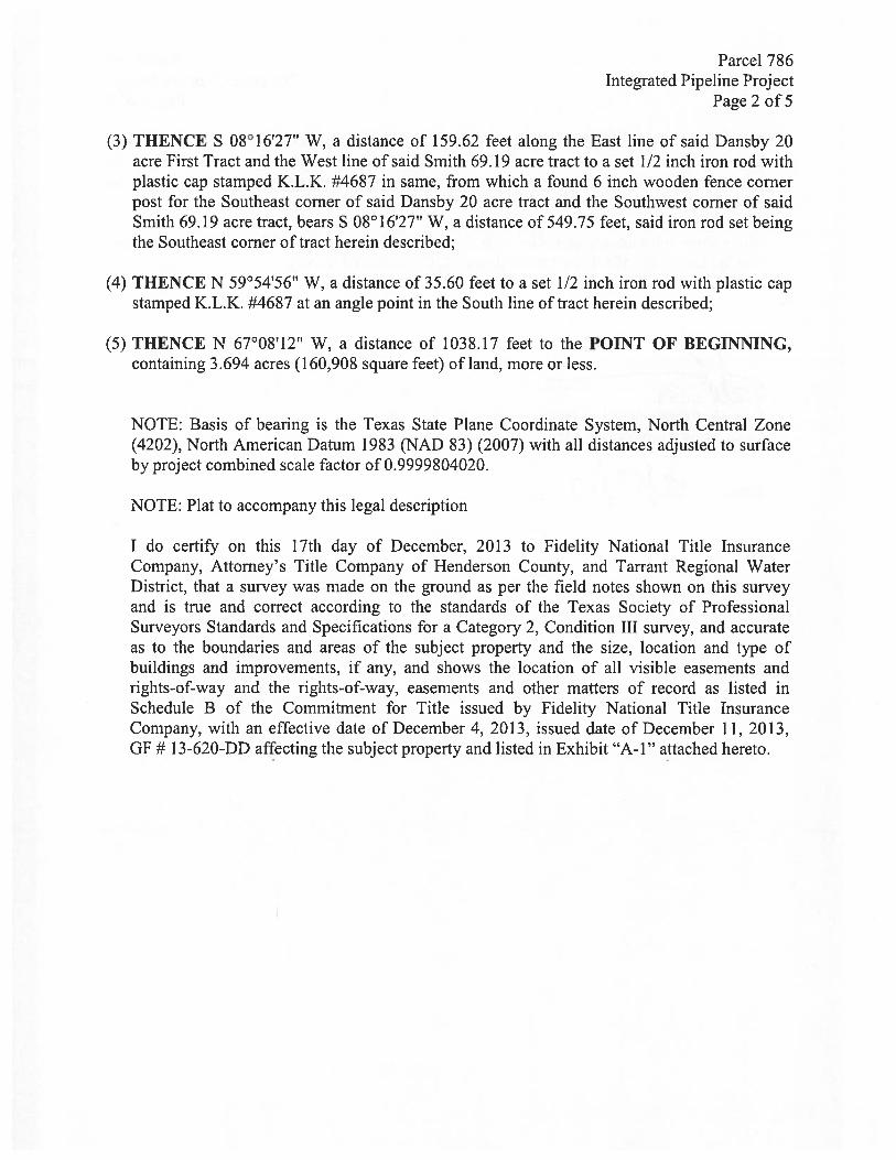
Being 3.694 acres (160,908 square feet) of land situated in the Alfred Benge Survey,Abstract Number 57, Henderson County, Texas, and more particularly in that certain 20 acretract of land, (First Tract), and that certain 30 acre tract, (Second Tract), less and except 2acres deeded to S. L. Smith, Sr., said 2 acres described in a deed recorded in Volume 55,Page 187, of the Deed Records of Henderson County, Texas, (D.R.H.C.T.), leaving 28 acresof land more or less, said First Tract and Second Tract conveyed to Richard Ferrell Dansby,as described by deed recorded in Volume 1685, Page 197 of the Real Property Records ofHenderson County, Texas, (R.P.R.H.C.T.), being further described as follows:
COMMENCING at a found 1/2 inch iron rod on the East side of County Road Number4236, (No deed of record found), at the Southwest corner of said Dansby 20 acre First Tractand in the East line of a called 82.713 acre tract of land conveyed to June McCoy Gandy andDanny A. McCoy, as described by deed recorded in Volume 89$, Page 423, D.R.H.C.T.,subsequently solely to June McCoy Gandy, as described by Affidavit of Heir-ship recordedunder Clerk’s File No. 2009-000 16480, R.P.R.H.C.T.;
THENCE N 08°21’21” E, a distance of 803.88 feet along the West line of said Dansby 20acre First Tract and the East line of said Gandy 82.7 13 acre tract, to a set 1/2 inch iron rodwith plastic cap stamped K.L.K. #4687 on the East side of said County Road Number 4236,(No deed of record found), being at the Southwest corner of tract herein described and thePOINT OF BEGINNING (N: 6,723,440.673, E: 2,876,213.201, Grid);
(I) THENCE N 0$°21’21” E, at a distance of 19.11 feet, pass the Northwest corner of saidDansby 20 acre First Tract and the Southwest corner of said Dansby 30 acre Second Tract,continuing for a total distance of 154.94 feet along the East side of said County RoadNumber 4236, the West line of said Dansby 20 acre First Tract and the East line of saidGandy 82.7 13 acre tract, to a set 1/2 inch iron rod with plastic cap stamped K.L.K. #4687, inthe West line of said Dansby 30 acre Second Tract and at the Northwest corner of tract hereindescribed;
(2) THENCE S 67°08’12” E, at a distance of 558.92 feet, cross the North line of said Dansby 20acre First tract and the South line of said Dansby 30 acre Second Tract, continuing for a totaldistance of 1072.10 feet to a set 1/2 inch iron rod with plastic cap stamped K.L.K. #4687 inthe East line of said Dansby 20 acre First Tract and the West line of a called 69.19 acre tractof land conveyed to Kirby B. Smith or Ferrellea S. Smith, as described by deed recorded inVolume 2342, Page 223, R.P.R.H.C.T., being the Northeast corner of tract herein described,from which a found 1/2 inch iron rod at the Northeast corner of said Dansby 20 acre FirstTract and an angle point in the West line of said Smith 69.19 acre tract, bears N 0$°16’27” E,a distance of 124.71 feet;
Parcel 786Integrated Pipeline Project
Page 2 of 5
(3) THENCE S 0$°16’27” W, a distance of 159.62 feet along the East line of said Dansby 20acre first Tract and the West line of said Smith 69.19 acre tract to a set 1/2 inch iron rod withplastic cap stamped K.L.K. #4687 in same, from which a found 6 inch wooden fence cornerpost for the Southeast corner of said Dansby 20 acre tract and the Southwest corner of saidSmith 69.19 acre tract, bears S 08°16’27” W, a distance of 549.75 feet, said iron rod set beingthe Southeast corner of tract herein described;
(4) THENCE N 59°54’56’ W, a distance of 35.60 feet to a set 1/2 inch iron rod with plastic capstamped K.L.K. #4687 at an angle point in the South line of tract herein described;
(5) THENCE N 67°0$’12” W, a distance of 1038.17 feet to the POINT OF BEGINNING,containing 3.694 acres (160,908 square feet) of land, more or less.
NOTE: Basis of bearing is the Texas State Plane Coordinate System, North Central Zone(4202), North American Datum 1983 (NAD 83) (2007) with all distances adjusted to surfaceby project combined scale factor of 0.9999804020.
NOTE: Plat to accompany this legal description
I do certify on this 17th day of December, 2013 to fidelity National Title InsuranceCompany, Attorney’s Title Company of Henderson County, and Tarrant Regional WaterDistrict, that a survey was made on the ground as per the field notes shown on this surveyand is true and correct according to the standards of the Texas Society of ProfessionalSurveyors Standards and Specifications for a Category 2, Condition III survey, and accurateas to the boundaries and areas of the subject property and the size, location and type ofbuildings and improvements, if any, and shows the location of all visible easements andrights-of-way and the rights-of-way, easements and other matters of record as listed inSchedule B of the Commitment for Title issued by fidelity National Title InsuranceCompany, with an effective date of December 4, 2013, issued date of December 11, 2013,Gf # 13-620-DD affecting the subject property and listed in Exhibit “A-i” attached hereto.
Parcel 786Integrated Pipeline Project
Page 3 of5
Except as shown on the survey: (i) there are no visible encroachments upon the subjectproperty by visible improvements on adjacent property, (ii) there are no visibleencroachments on adjacent property, streets or alleys by any visible improvements on thesubject property, and (iii) there are no visible conflicts or discrepancies.
This survey substantially complies with the current Texas Society of Professional SurveyorsStandards and Specifications for a Category 2, Condition III Survey.
‘Keviit, . KilgoRegist ed Pr essional Land SurveyorTexas Registration Number 4687
Dated: ‘2. /Q_.?)/1 3
IPL PARCEL 786tIC HARD FERRELL DANSU
VOL. 1685, PG. 197R.P.R.H.C.T.
SECOND TRACTCALLED 30 AC.LESS & EXCEPT
SMITH 2 AC.VOL. 55 PC. 87
ii- I
1/2”
GRAPHIC SCALE IN FEET1” = 400’
NOTE: LEGAL DESCRIPTION TO ACCOMPANY THIS FLAT.
LEGEND
0=I
JOHN RACHAL SURVEYABSTRACT 662
-- .URVE LLNE -
MARKER FOUND AS NOTED
1/2” IRON ROD SETWITH K.L.K. #4687 CAP
IPL PARCEL 785JUNE MC0Y CANDY
AND DANNY A. McCOYVOL. 898, PC, 423
D.R.H.C .1.SUBSEQUENTLY SOLELY TO
JUNE McCOY CANDYBY AFFIDAVIT OF HEIR—SHIP
CLERKS FILE NUMBER2009—00016480
R.P.R. H.C .T.
//
ALFRED BENGESURVEY
ABSTRACT 57
EXHIBIT “A”PARCEL 786 COU- -
- (No ED4235 (11 WIDTH)
I -
- RDLD)
___
I. URVy LINE
I 1/2” IRF ‘
/REFCOR
/I TIERODI FOUND
1/2 IRF
N
t]
/
COUNTY ROAD 4236(11’ WIDTH)(NO DEED
OF RECORD FOUND)_\
SEE DETAIL “A”
L4-1
I DETAIL “A”NOT TO SCALE
/2 IRF
-J
LINE TABLE
-J
LINE BEARING DISTANCELi N 08’21’21” E 154.94’t2 S 08’16’27” W 159.62’L3 N 59’54’56” W 35.6OL4 N 08’21’21” E 19.11’L5 S 6708’12” E 558,92’L6 N O816’27” E 124.71’
Io3‘ PARCEL 7
1LJ
‘. 3.694 AC.160,906 SQ. FT.
IPL PARCEL 786‘ RICHARD FERRELL DANSBY -0
VOL. 1685, PG. 197 IPL PARCEL 789
R.P.R.H.C.T.KIRBY B. SMITH ORFERRELLEA S. SMITH,
“‘-—--..QALLED 20 AC. 0 B. Ac F. S. SMITH1/2” IRF FIRST TRACT TRUSTEES FOR THE
LIVING TRUST
‘ P.O.C. — R.P.R.H,C.T.VOL. 2342, PG. 223
—8” WOODEN FENCE —
CORNER POSTFOUND
NOTE:1. KNOWN UNDERGROUND UTILITIESSHOWN ARE QUALITY LEVEL B & 0 SUE. (0.3/01/13)
400 200 0 400
PRTED ON: SHEET TITLE
9:15:11 i EX H B IT “A”12/20/2013
i.c.c. SEGMENT 19—1, PARCEL 786kkilger..oom RICHARD FERRELL DANSBY
6712 PALUXY DRIVETYLER, TX 75703(903) 581—7800 (TEL)(903) 581—3756 (FAx) F PROJECT
INTEGRATED PIPELINE PROJECTPROJ NO: 2O1O10P786 ISCALE: 1” = 400’ IDATE: 12—20—2013 BASIS OF BEARING IS THE TEXAS STATE PLANE COORDINATE SYSTEM, IDRAWN BY: RTW NORTH CENTRAL ZONE (4202) NORTH AMERICAN DATUM NA083 (2007)11 c. 4 OF 5CHECKED BY: RN WITH ALL DISTANCES ADJUSTED TO SURFACE BY PROJECT COMBINEDREWSED DATE: SCALE FACTOR 0.9999804020. II
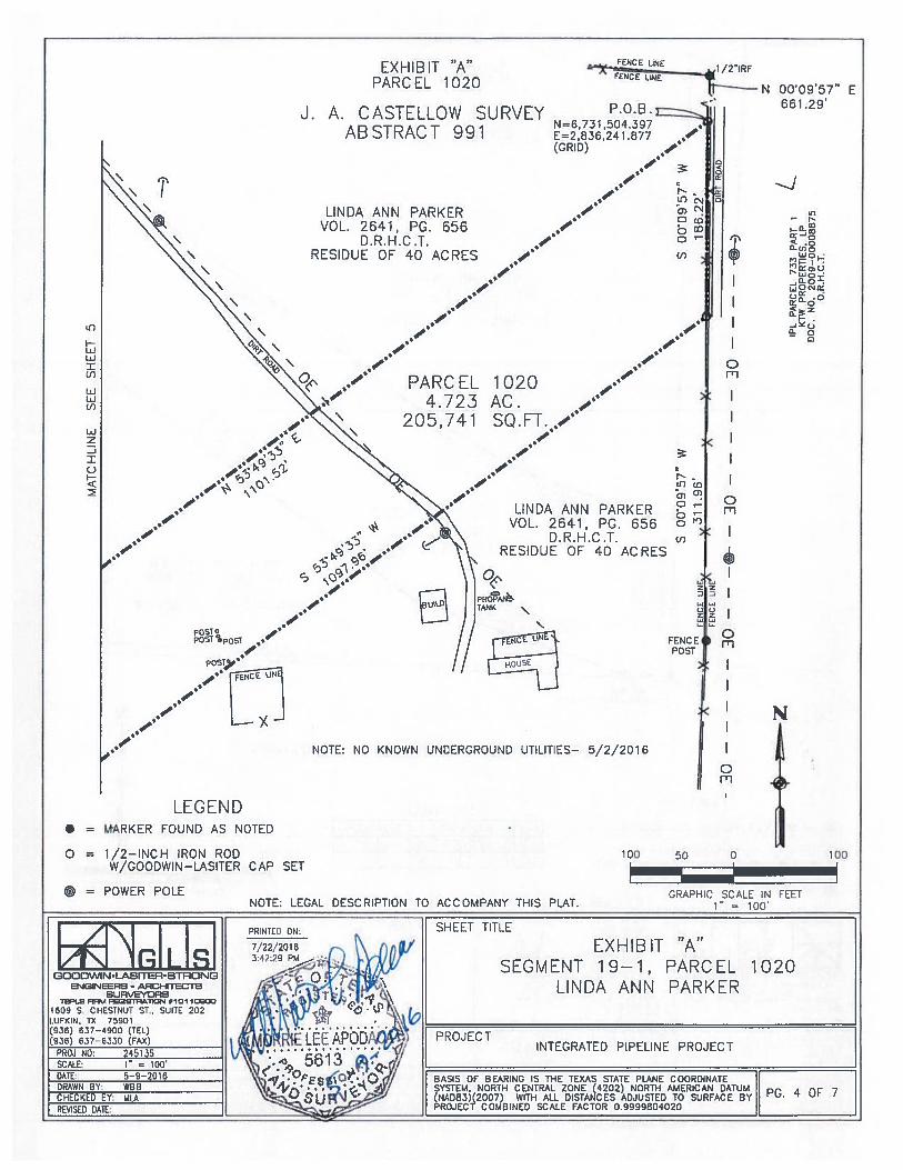
Parcel 1020Integrated Pipeline Project
Page 1 of7
EXHIBIT “A”Property Description
Being 4.723 acres (205,741 square feet) of land situated in the J. A. Castellow Survey, AbstractNumber 991 ,I-Ienderson County, Texas, and more particularly a portion of that certain residue of acalled 40 acre tract, conveyed to Linda Ann Parker. as recorded in Volume 2641, Page 656 oftheDeed Records, Henderson County, Texas, (D.R.H.C.T.). and being further described as follows:
BEGINNING at a set 1/2” iron rod with Goodwin-Lasiter cap for the Northeast corner of the tractherein described, in the East line of the referenced 40 acre residual tract and in the West line of a tractof land described as a 2,492.39 acre tract to KTW Properties, LP, as recorded in Document Number2009-00008875 of the Official Records, 1-lenderson County, Texas (O.R.H,C.T.), from which a found112” iron rod for the Northeast corner of the referenced tract bears N 00°09’57” E, a distance of661.29 feet, and being the POINT OF BEGiNNING (N: 6,731,504.397, E: 2,536,241.877 Grid);
(1) THENCE S 00°09’57” W, along the common line of tract herein described and the East line of thereferenced 40 acre residual tract, and the West line of the 2,492.39 acre tract, a distance of 1 86.22 feet, to aset 1/2” iron rod with Goodwin-Lasiter cap for the Southeast corner of the tract herein described, fromwhich a found Barbed wire fence post for the angle point in the East line of the referenced tract bears$ 00°09’57” W, a distance of 3 11.96 feet;
(2) THENCE S 53°49’33” W, along the South line of tract herein described, a distance of 1097.96 feet,to a set 1/2” iron rod with Goodwin-Lasiter cap, for an angle point in the South line;
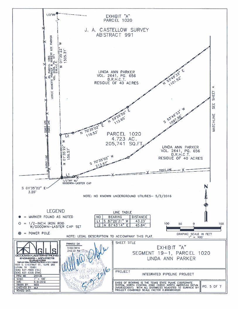
(3) THENCE S 70°35’02” W, along the South line of tract herein described, a distance of 2 13.57 feet, to a set1/2” iron rod with Goodwin-Lasiter cap, for an angle point in the South line;
(4) THENCE S 87°20’31” W, along the South line of tract herein described, a distance of 43.23 feet, to a set1/2” iron rod with Goodwin-Lasiter cap, for the Southwest corner of the tract herein described, in theWesterly line of the referenced 40 acre residual tract, same being in the East line of a tract of landdescribed as a 2.635 acre tract to Loyce Annette Parker & Robert Lee Parker, as recorded in Volume 2239,Page 671 Deed Records, Henderson County, Texas (D.R.H.C.T.), from which a found 1/2” iron rod withGoodwin-Lasiter cap at the $outhtvest corner of the referenced tract bears S 0103512211 E, a distance of3.20 feet;
(5) THENCE N 0l°35’22” W, along the common line of tract herein described and the West line of thereferenced 40 acre residual tract, and the East line of the 2.635 acre tract, a distance of 156.57 feet, to a set1/2” iron rod with Goodwin- Lasiter cap, for the Northwest corner of’ tract herein described, from which afound 1/2” iron rod bears N 0l03522 W, a distance of 1305.31 feet;
(6) THENCE N 81°43’14” E. along the North line of tract herein described, a distance of 45.84 feet, to a set1/2” iron rod with Goodwin-Lasiter cap, for an angle point in the North line;
(7) THENCE N 70°35’02” E, along the North line of tract herein described, a distance of 110.53 feet, to a set1/2” iron rod with Guodwin-Lasiter cap, for an angle point in the North line:
Parcel 1020Integrated Pipeline Project
Page 2 of?
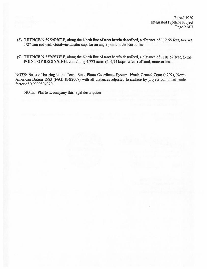
(8) THENCE N 59°26’50” E, along the North line of tract herein described, a distance of 112.65 feet, to a set1/2” iron rod with Goodwin-Lasher cap, for an angle point in the North line;
(9) THENCE N 53°49’33” E, along the North line of tract herein described, a distance of 1101.52 feet, to thePOINT OF BEGINNING, containing 4.723 acres (205,74lsquare feet) of land, more or less.
NOTE: Basis of bearing is the Texas State Plane Coordinate System, North Central Zone (4202), NorthAmerican Datum 1983 (NAB 83)(2007) with all distances adjusted to surface by project combined scalefactor of 0.9999804020.
NOTE: Plat to accompany this legal description
Parcel 1020Integrated Pipeline Project
Page 3 of 7
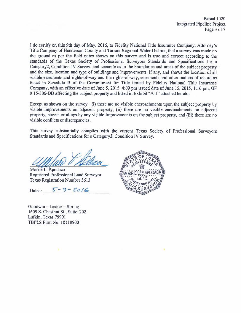
I do certify on this 9th day of May, 2016, to Fidelity National Title Insurance Company, Attorney’sTitle Company of Henderson County and Tarrant Regional Water District, that a survey was made onthe ground as per the field notes shown on this survey and is true and correct according to thestandards of the Texas Society of Professional Surveyors Standards and Specifications for aCategory2, Condition IV Survey, and accurate as to the boundaries and areas of the subject propertyand the size, location and type of buildings and improvements, if any, and shows the location of allvisible easements and rights-of-way and the rights-of-way, easements and other matters of record aslisted in Schedule B of the Commitment for Title issued by fidelity National Title InsuranceCompany, with an effective date of June 5, 2015, 4:09 pm issued date of June 15, 2015, 1:16 pm, GF# 1 5-306-DD affecting the subject property and listed in Exhibit ‘A- 1” attached hereto.
Except as shown on the survey: (i) there are no visible encroachments upon the subject property byvisible improvements on adjacent property, (ii) there are no visible encroachments on adjacentproperty, streets or alleys by any visible improvements on the subject property, and (iii) there are novisible conflicts or discrepancies.
This survey substantially complies with the current Texas Society of Professional SurveyorsStandards and Specifications for a Category2, Condition IV Survey.
th2Morrie L. podacaRegistered Professional Land SurveyorTexas Registration Number 5613
Dated:
Goodwin — Lasiter— Strong1609 S. Chestnut St., Suite. 202Lutkin, Texas 75901TBPLS Firm No. 10110900
‘I.)
Iw
LuzU)
Lu
Lu
U)
N
Q-cC
I-I
OC’1.0
C
I /T’\. I PRINTEDSHEET TITLE
I .1 I \J 7/22/2016 \ tInJ EXHIB IT “A”
I/IN iGLS 342.I
SEGMENT 19—1, PARCEL 1020
ENNEs=ARTEcTs LINDA ANN PARKERI ‘ ‘j’ ,“V
1609 S CHESTNUT ST. SUITE 202 4 oUFKIN, TX 75901 /KU I\ V4 1%
(936) 637—4900 (TEL) AlA •j(936) 637-6330 (FAX)
INTECRATED PIPELINE PROJECTPROJ NO: 245135 j V A ‘
SCALE: l’=IOO’ 1Oi.)DATE: 5—9—2016
- Q 1’ BASIS OF BEARING IS THE TEXAS STATE PLANE COORDINATEDRAWN BY: WBB \ 4.. .—k . SYSTEM, NORTH CENTRAL ZONE (4202) NORTH AMERICAN DATUMCHECICED EY: MLA ‘L. .j, ‘i -‘ ,NAD83%2OO7) WITH ALL DISTANCES ADJUSTED TO SURFACE BY Pc. 4 OF 7REVISED DATE: -- ROJEC COMBINED SCALE FACTOR 0.9999804020
EXHIBIT “A”PARCEL 1020
J. A. CASTELLOW SURVEYABSTRACT 991
I
N 0O’09’57” E661.29’
LINDA ANN PARKERVOL. 2641, PG. 656
D.R.H.C .T.RESIDUE OF 40 ACRES
\
\
U)
Luz
-J
ciF—
PARCEL4.723
205,741
1020AC.SQ. FT.
NU)
0)000
U)
LINDA ANN PARKERVOL. 2641, PG. 656
D.R.H.C .1.RESIDUE OF 40 ACRES
P 0 ST 0
p091 %POST
0m
0m
I’
0m
0m
\
LEGEND
NOTE: NO KNOWN UNCERGROUND UTILITIES— 5/2/2016
N
• = $*ARKER FOUND AS NOTED -
o 1/2—INCH IRON ROD 100W/GOODWIN—LASITER CAP SET I
= POWER POLENOTE: LEGAL DESCRIPTION TO ACCOMPANY THIS PLAT.
50 0 lOt)
GRAPHIC SCALE IN FEET= 100’
La
n.
0
EXHIBIT “A”PARCEL 1020
J. A. CASTELLOW SURVEYABSTRACT 991
LINDA ANN PARKERVOL. 2641, PG. 656
D.R.H.C .T.RESIDUE OF 40 ACRES
‘i
Fww
UU
Uz-JIUF
S O1’35’22”3.20’
5/2/2016
• = MARKER FOUND AS NOTED
O = 1/2—INCH IRON RODW/GOODWIN—LASITER CAP SET
LINE TABLENO BEARING DISTANCELi S 87’20’31” W 43.23’L2 N 81’43’i4” E 45.84’
= POWER POLENOTE: LEGAL DESCRIPTION TO ACCOMPANY THIS PLAT.
GRAPHIC SCALE IN FEET
ENINEER8 - ARCFWrECTBEURVEYQRS
ThPI.S Ri STRAT)ON iC11
S. CHESTNUT ST. SUITE 2024. IX 75901
637—4900
BASIS OF BEARING IS THE TEXAS STATE PLANE COORDINATESYSTEM. NORTH CENTRAL ZONE (4202) NORTH AMERICAN DATUM(NAD83)(2007) WITH ALL DISTANCES ADJUSTED TO SURFACE BYPROJECT COMBINED SCALE FACTOR 0.9999804020
PARCEL4.723
205,741
1 020AC.
S
LINDA ANN PARKERVOL. 2641, PG. 656
D.R.H.C .T.RESIDUE OF 40 ACRES
NOTE: NO
LEGEND
KNOWN UNDERGROUND UTILITIES—
N
100 50 0 100
SEGMENTEXHIBIT “A”19—1, PARCEL
LINDA ANN PARKER1 020
INTEGRATED PIPELINE PROJECT
In addition, R. Steve Christian, the Real Property Director of TRWD, and the staff
of TRWD are granted authority to execute all documents necessary to complete these
transactions and to pay all reasonable and necessary closing and related costs incurred
with these acquisitions. Director Leonard seconded the motion and the vote in favor was
unanimous.
21.
There were no future agenda items approved.
22.
The next board meeting was scheduled for January 17, 2017.
22.
There being no further business before the Board of Directors, the meeting was
a journed.
Jh V k.ry1President Secretary