Embed Size (px)
Citation preview
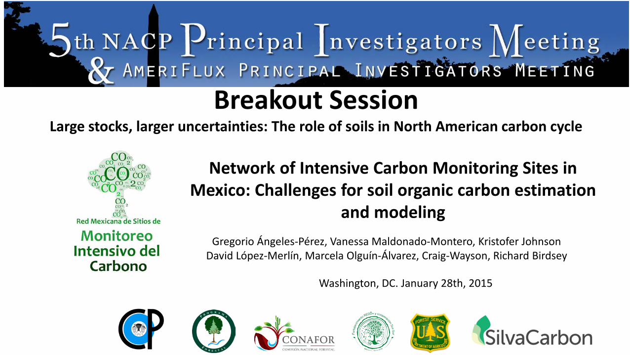
Breakout Session Large stocks, larger uncertainties: The role of soils in North American carbon cycle
Network of Intensive Carbon Monitoring Sites in Mexico: Challenges for soil organic carbon estimation
and modeling Gregorio Ángeles-Pérez, Vanessa Maldonado-Montero, Kristofer Johnson
David López-Merlín, Marcela Olguín-Álvarez, Craig-Wayson, Richard Birdsey
Washington, DC. January 28th, 2015
CICY José Luis Andrade José Luis Hernández Juan Manuel Dupuy COLPOS Gregorio Ángeles René Valdez Héctor de los Santos ECOSUR Ligia Esparza
PMN-CONAFOR Benjamín Méndez David López Gonzalo Sánchez Jorge Morfín Juan Pablo Caamal Marcela Olguín Oswaldo Carrillo Vanessa Maldonado
Comisión Nacional Forestal (CONAFOR) Comisión Nacional de Áreas Protegidas (CONANP) Comisión Nacional para el Conocimiento y Uso de la Biodiversidad (CONABIO)
Ejidos Atopixco-La Mojonera, Hidalgo Ejido Dos Lagunas Norte, Campeche Ejido Felipe Carrillo Puerto, Quintana Roo Reserva Biocultural Kaxil Kiuc , Yucatán
Local organizations
Canadian Forest Service David Greenberg Max Fellows Scott Morken Werner Kurz CEC Karen Richardson
US Forest Service-SilvaCarbon Craig Wayson Kristofer Johnson Richard Birdsey Zhaohua Dai
University of British Columbia Nicholas Coops Vanessa Silva
Mexico-Goverment organizations
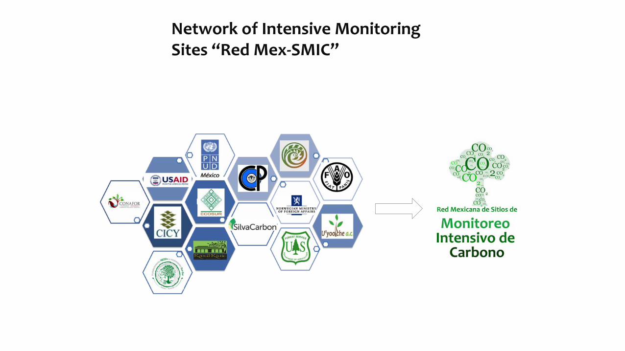
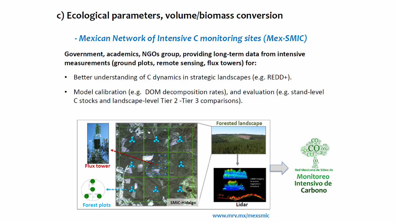
Network of Intensive Monitoring Sites “Red Mex-SMIC”
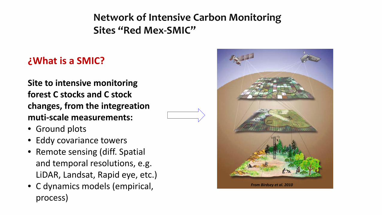
¿What is a SMIC? Site to intensive monitoring forest C stocks and C stock changes, from the integreation muti-scale measurements: • Ground plots • Eddy covariance towers • Remote sensing (diff. Spatial
and temporal resolutions, e.g. LiDAR, Landsat, Rapid eye, etc.)
• C dynamics models (empirical, process)
From Birdsey et al. 2010
Network of Intensive Carbon Monitoring Sites “Red Mex-SMIC”
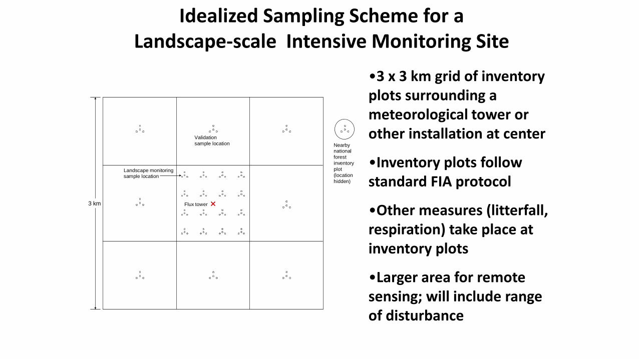
Idealized Sampling Scheme for a Landscape-scale Intensive Monitoring Site
•3 x 3 km grid of inventory plots surrounding a meteorological tower or other installation at center
•Inventory plots follow standard FIA protocol
•Other measures (litterfall, respiration) take place at inventory plots
•Larger area for remote sensing; will include range of disturbance
Nearby national forest inventory plot (location hidden)
Flux tower
Landscape monitoring sample location
Validation sample location
3 km
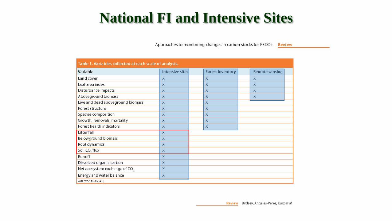
National FI and Intensive Sites

Kaxil Kiuic (Yucatán)
Calakmul (Campeche) Uyoolche
(Quintana Roo)
Atopixco (Hidalgo)
La Encrucijada (Chiapas)
Network of Intensive Carbon Monitoring Sites *Mex-SMIC*
Selection criteria: a) Landscapes with great
contribution to net carbon balance ( LULUC forest sector)
b) Priority area for REDD+ activities
c) Potential multi-institutional collaboration to collect and access data in the long term
Álamos (Sonora)
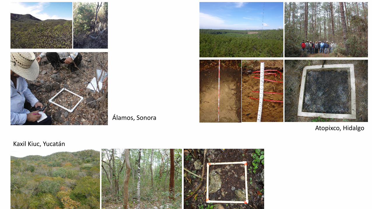
Álamos, Sonora
Kaxil Kiuc, Yucatán
Atopixco, Hidalgo
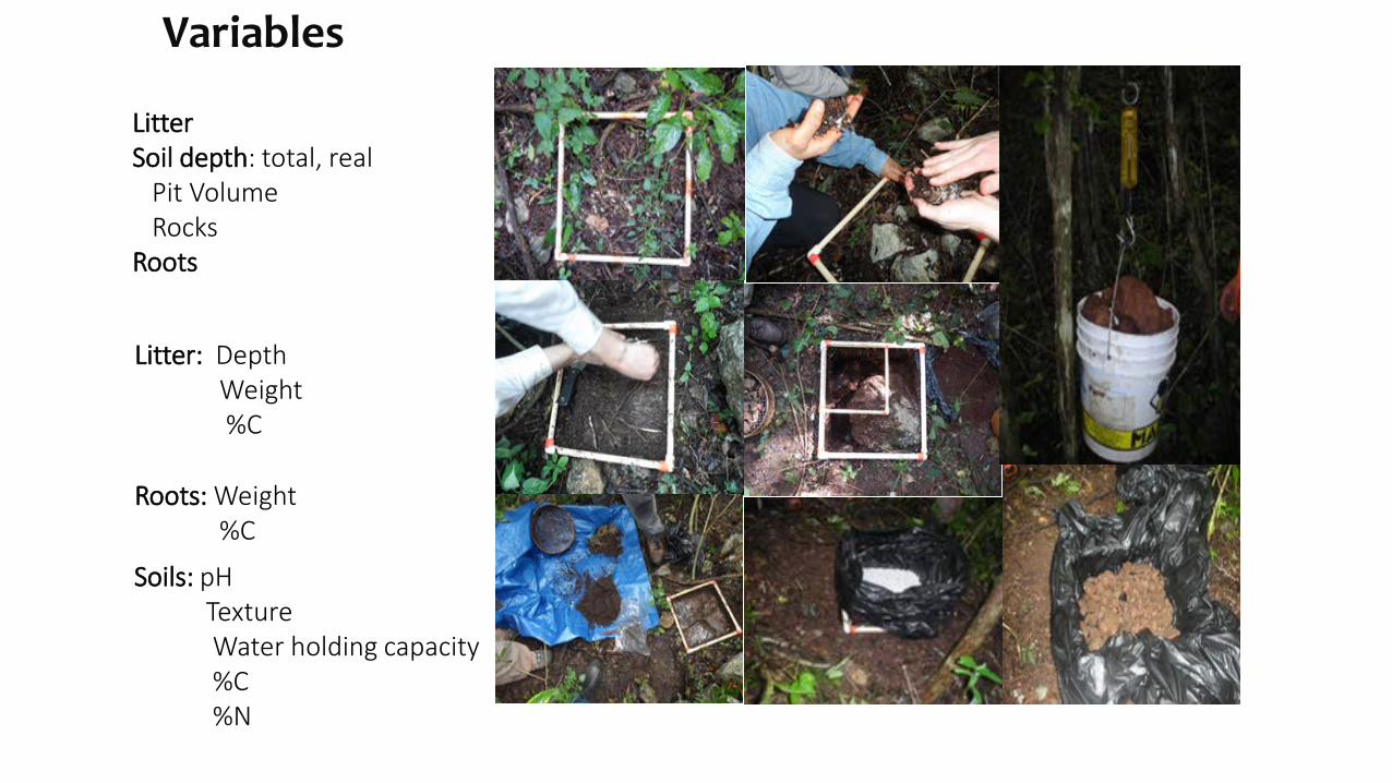
Roots: Weight %C
Litter: Depth Weight %C
Litter Soil depth: total, real Pit Volume Rocks Roots
Soils: pH Texture Water holding capacity %C %N
Variables
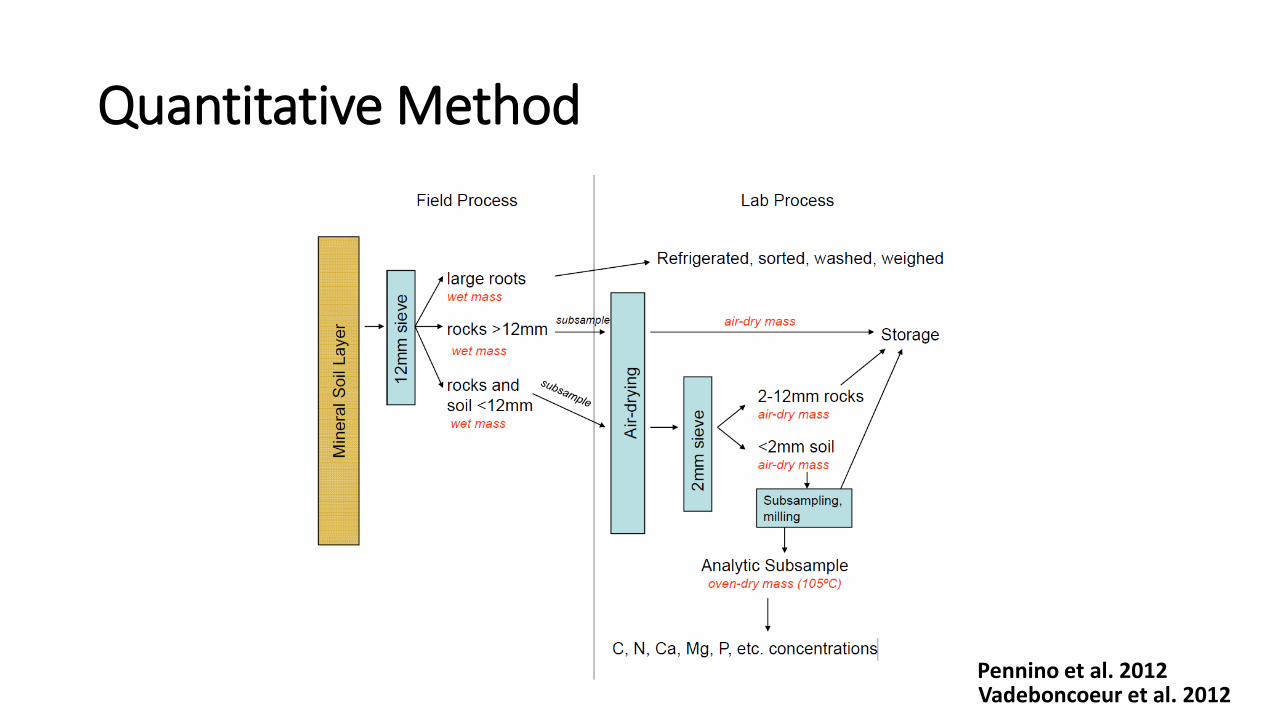
Quantitative Method
Vadeboncoeur et al. 2012 Pennino et al. 2012
Procedimiento para el material leñoso caído (MLC) en los SMI
Litter and Soil sampling
Understory vegetation
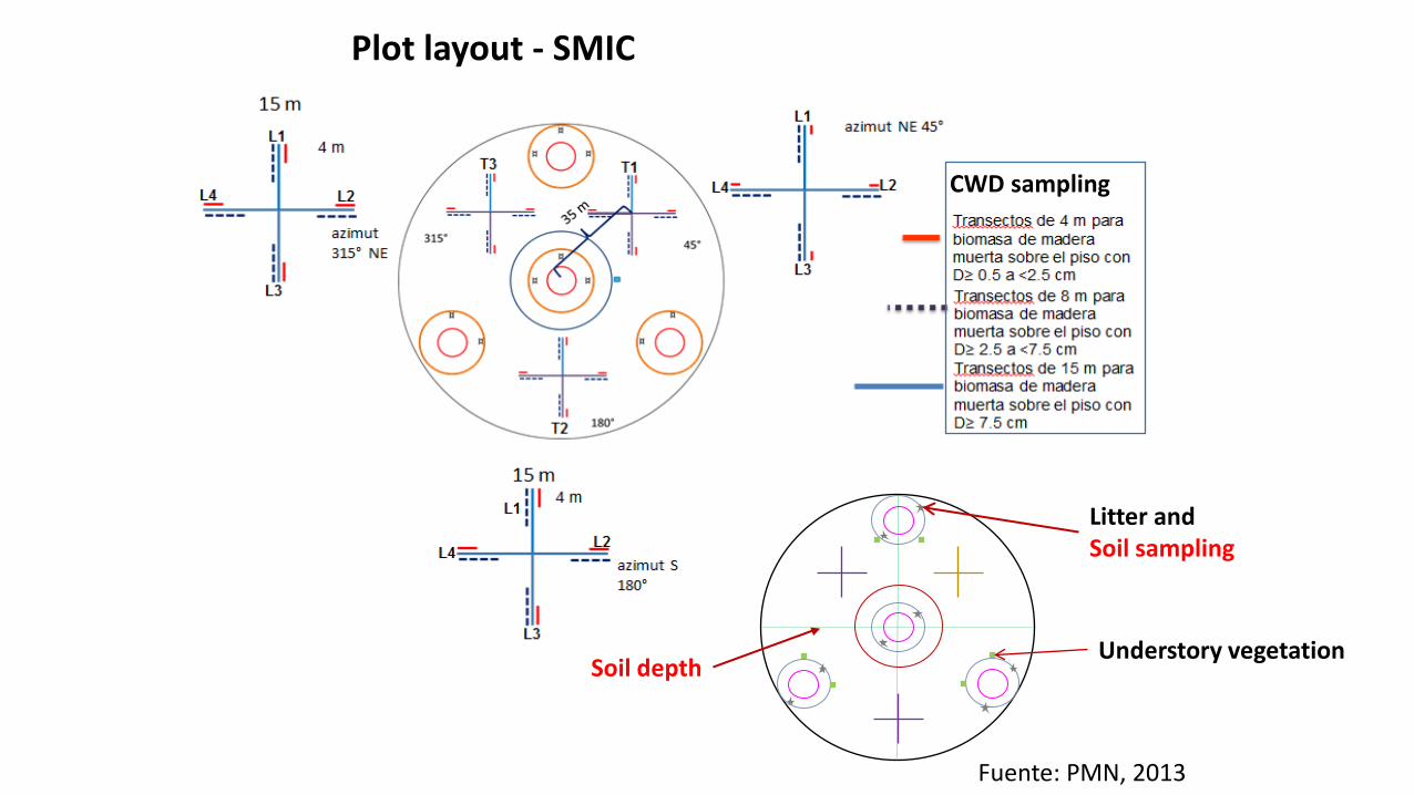
Fuente: PMN, 2013
Plot layout - SMIC
Soil depth
CWD sampling
Procedimiento para el material leñoso caído (MLC) en los SMI
Litter and Soil sampling
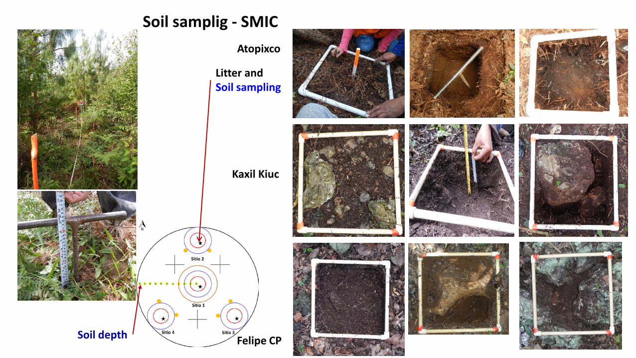
Soil samplig - SMIC
Soil depth
Atopixco
Kaxil Kiuc
Felipe CP
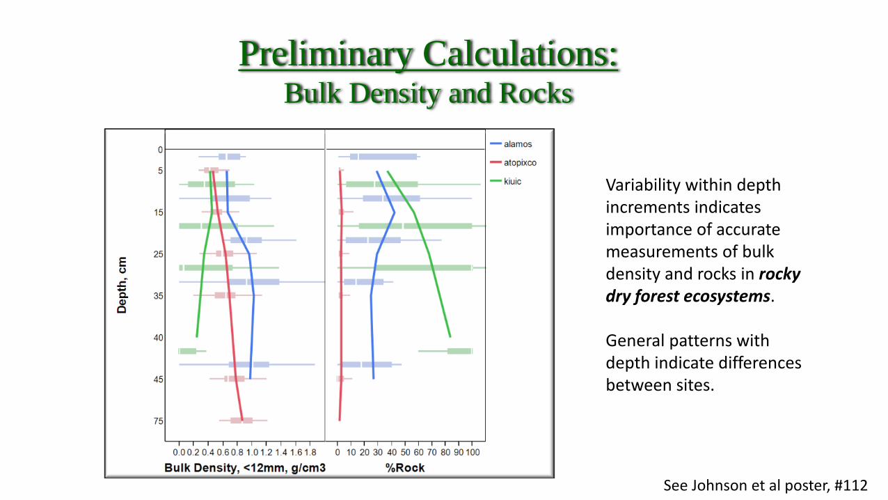
Preliminary Calculations: Bulk Density and Rocks
See Johnson et al poster, #112
Variability within depth increments indicates importance of accurate measurements of bulk density and rocks in rocky dry forest ecosystems. General patterns with depth indicate differences between sites.
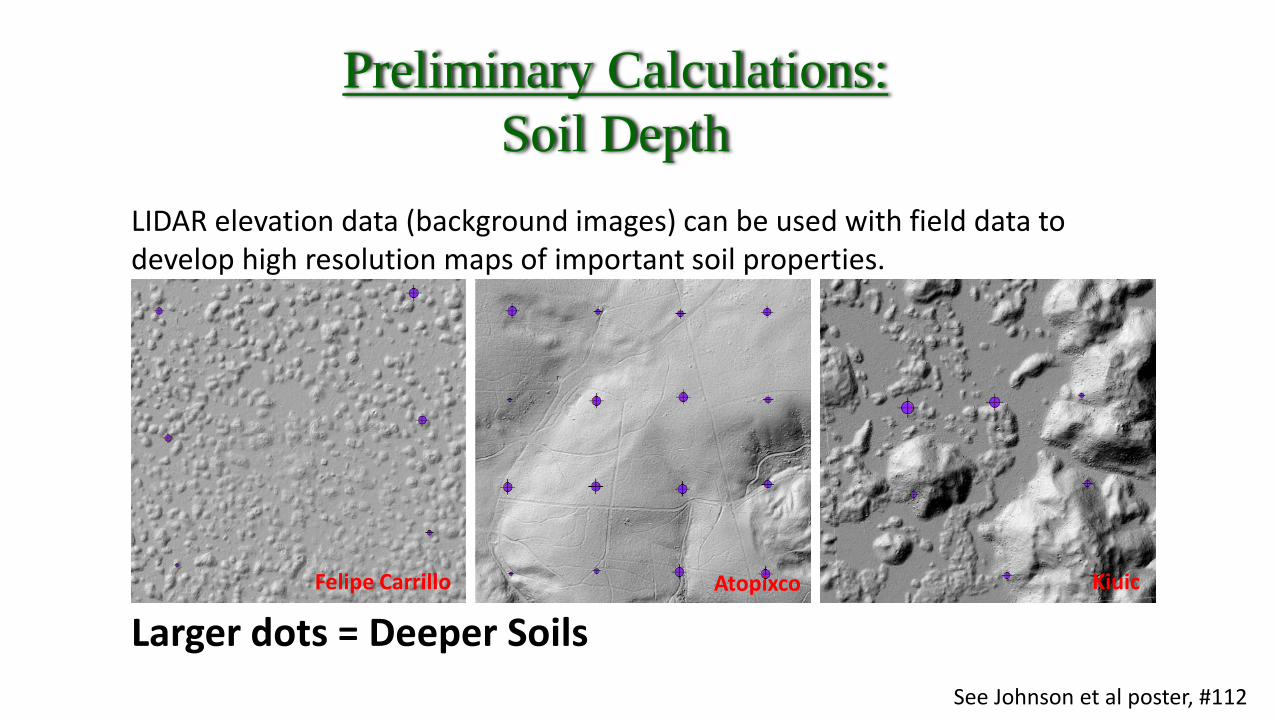
Preliminary Calculations: Soil Depth
See Johnson et al poster, #112
LIDAR elevation data (background images) can be used with field data to develop high resolution maps of important soil properties.
Larger dots = Deeper Soils Atopixco Kiuic Felipe Carrillo
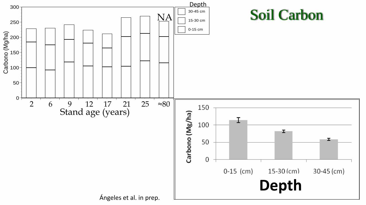
Depth
0
50
100
150
200
250
300Ca
rbon
o (M
g/ha
) 0-15 cm
15-30 cm
30-45 cm
2 6 9 12 17 21 25 ≈80
NA
Stand age (years)
Depth
Ángeles et al. in prep.
Soil Carbon
Atopixco
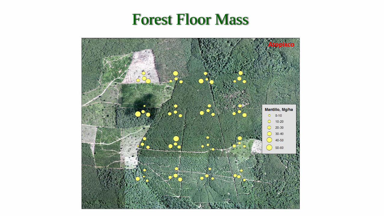
Forest Floor Mass
• The intensive sampling methods presented uniquely represent landscape scale soil properties that are important to ecosystem functions.
• Soil chemical and physical data support the calibration and validation of process models for scaling to larger regions (e.g. CBM-CFS3, Forest-DNDC, Century, RothC, Yasso, InteC).
• Additional belowground data is being collected:
litterfall production, litter and branch decomposition rates, soil respiration, belowground biomass, and fine root dynamics.
Final remarks
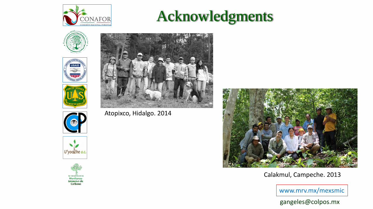
Acknowledgments
www.mrv.mx/mexsmic
Calakmul, Campeche. 2013
Atopixco, Hidalgo. 2014