Embed Size (px)
Citation preview
Page 1 Name | GICHD – Division name 08/03/16
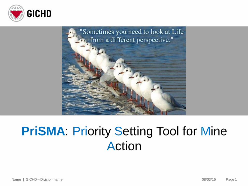
PriSMA: Priority Setting Tool for Mine
Action
Page 2 Name | GICHD – Division name 08/03/16
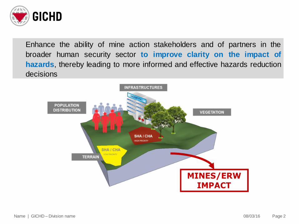
Enhance the ability of mine action stakeholders and of partners in the
broader human security sector to improve clarity on the impact of
hazards, thereby leading to more informed and effective hazards reduction
decisions
Page 3 Name | GICHD – Division name 08/03/16
Page 4 Name | GICHD – Division name 08/03/16
Page 5 Name | GICHD – Division name 08/03/16

Page 6 Name | GICHD – Division name 08/03/16
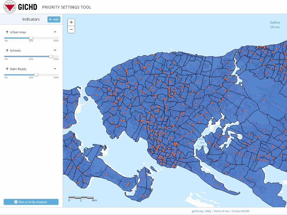
PriSMA Pilot Phase in Sri Lanka
Criteria Indicator Spatial Data &
Attribute
Source
Resettled population No of Returnees & No of Settlement
Population/ Settlement locations/ Hazard Area
Census and Statistical / GAs/IMSMA
Hazardous areas between 0.5 kilometers to 1 km from villages, main roads and access roads , Water body , school
HA located within 0.5 km to 1km of settlements or roads, Water and other
Landuse data/ HA Relevant Ministries/ Dept.
Land with essential infrastructure such as existing roads, electricity supply, water supply and irrigation systems
Proximity of the Infrastructure to HA
Spatial Data Water Board/ RDA, CEB etc
Land where people conduct their livelihood activities
Proximity to Livelihood Cultivated Area Survey Dep.
November December January
Setup criteria and data gathering / Testing with Operators (MAG, HALO Trust) Feedback reporting to GICHD /
Completion
Identification of practical & technical issues and solved
Demonstration to Mine Action stakeholders and other interesting Professional Parties ( Academic)
Page 7 Name | GICHD – Division name 08/03/16
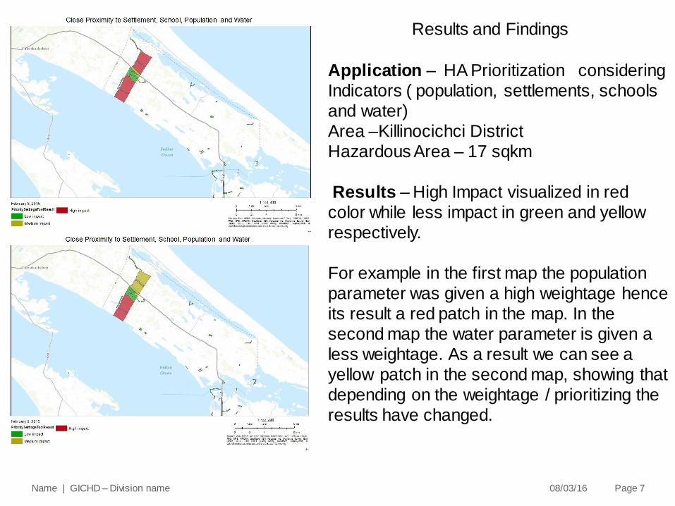
Results and Findings
Application – HA Prioritization considering
Indicators ( population, settlements, schools
and water)
Area –Killinocichci District
Hazardous Area – 17 sqkm
Results – High Impact visualized in red
color while less impact in green and yellow
respectively.
For example in the first map the population
parameter was given a high weightage hence
its result a red patch in the map. In the
second map the water parameter is given a
less weightage. As a result we can see a
yellow patch in the second map, showing that
depending on the weightage / prioritizing the
results have changed.
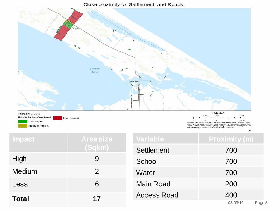
Page 8 Name | GICHD – Division name 08/03/16
Impact Area size
(Sqkm)
High 9
Medium 2
Less 6
Total 17
Variable Proximity (m)
Settlement 700
School 700
Water 700
Main Road 200
Access Road 400
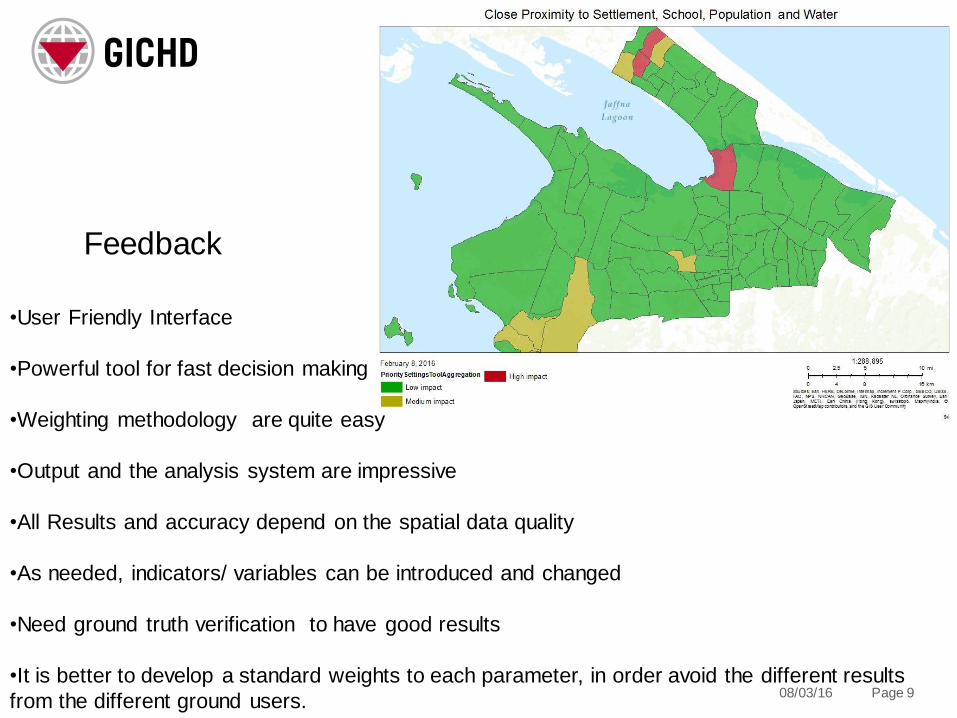
Page 9 Name | GICHD – Division name 08/03/16
•User Friendly Interface
•Powerful tool for fast decision making
•Weighting methodology are quite easy
•Output and the analysis system are impressive
•All Results and accuracy depend on the spatial data quality
•As needed, indicators/ variables can be introduced and changed
•Need ground truth verification to have good results
•It is better to develop a standard weights to each parameter, in order avoid the different results
from the different ground users.
Feedback