Embed Size (px)
Citation preview
Page 1
June 30, 2015
Mary Romero
Project Manager
U.S. Army Corps of Engineers - Alaska District
Regulatory Division
Post Office Box 6898
JBER, Alaska 99506-0898
RE: Proposed Blue Sky Estates Subdivision Development Drainage Summary, Bethel,
Alaska
Dear Ms. Romero:
The layout for the proposed Blue Sky Estates Subdivision, located in Bethel, Alaska, forms a
horseshoe shape around the north, east, and west sides of the adjacent existing Tsikoyak
Subdivision with BIA road forming the southern border of the Tsikoyak Subdivision. Tsikoyak
Subdivision residents had commented to the City of Bethel and USACE during previous public
comment periods (for Blue Sky Estates Subdivision) about existing drainage issues in the
subdivision and concerns about the new proposed subdivision exacerbating the problem. On
behalf of Lyman Hoffman, Restoration Science & Engineering, LLC (RSE) conducted a
drainage analysis which analyzed drainage at the proposed Blue Sky Estates Subdivision.
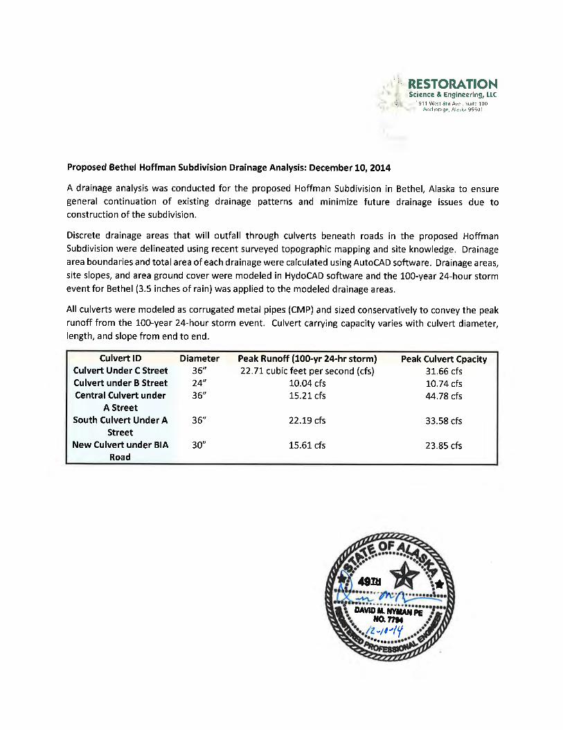
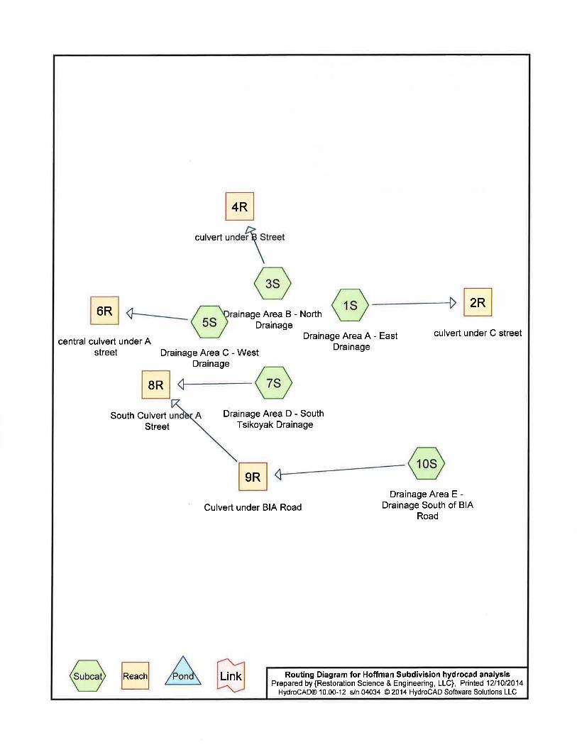
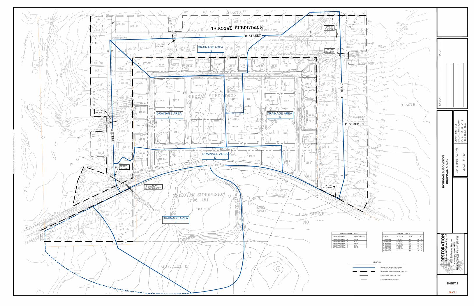
RSE analyzed topographical information collected from the area of the proposed subdivision
and the adjacent Tsikoyak Subdivision to determine drainage directions and divided the area
into five drainage areas each which collect runoff and discharge through a common location.
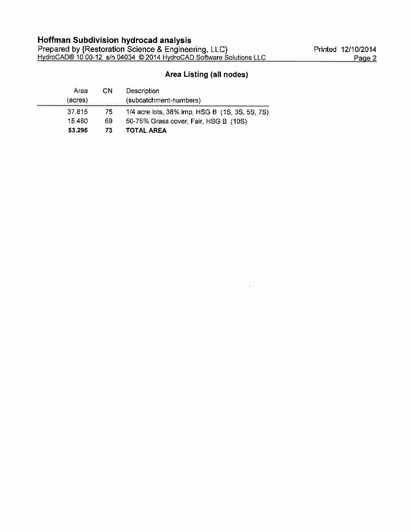
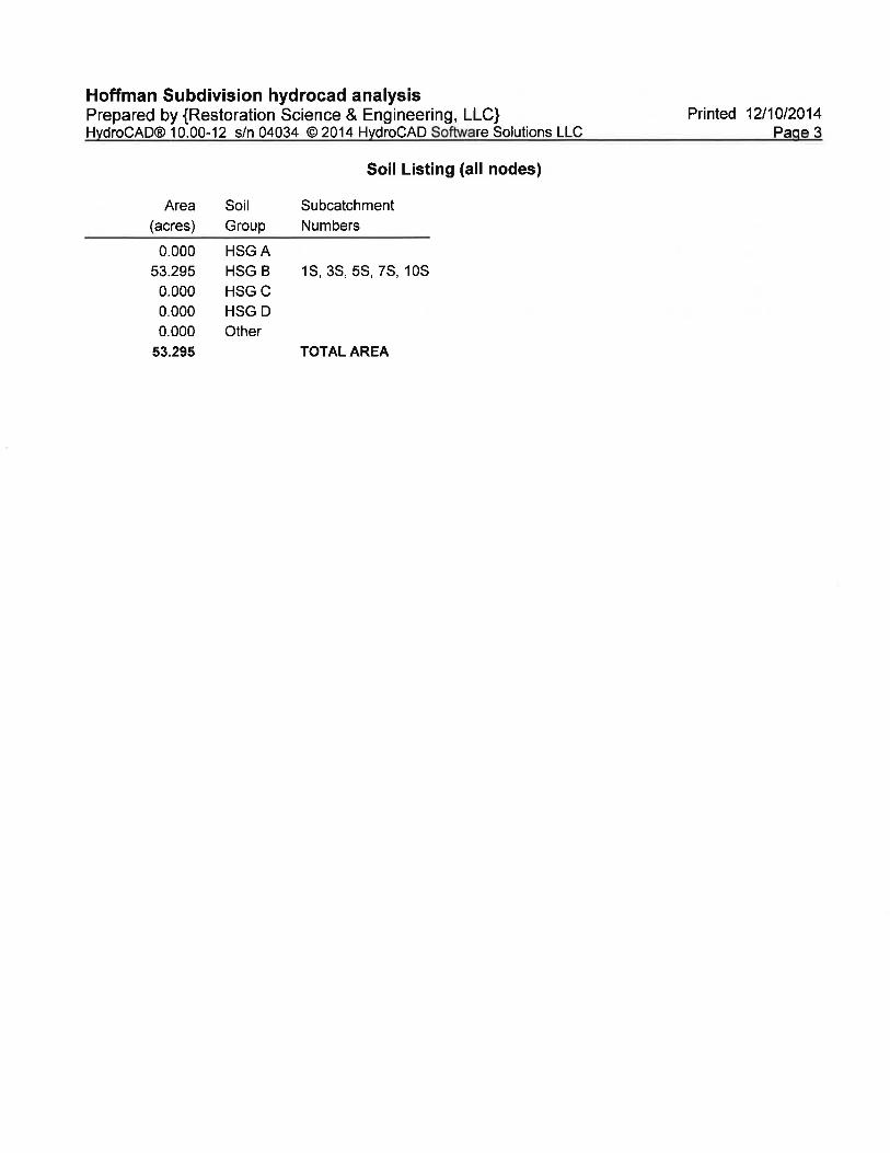
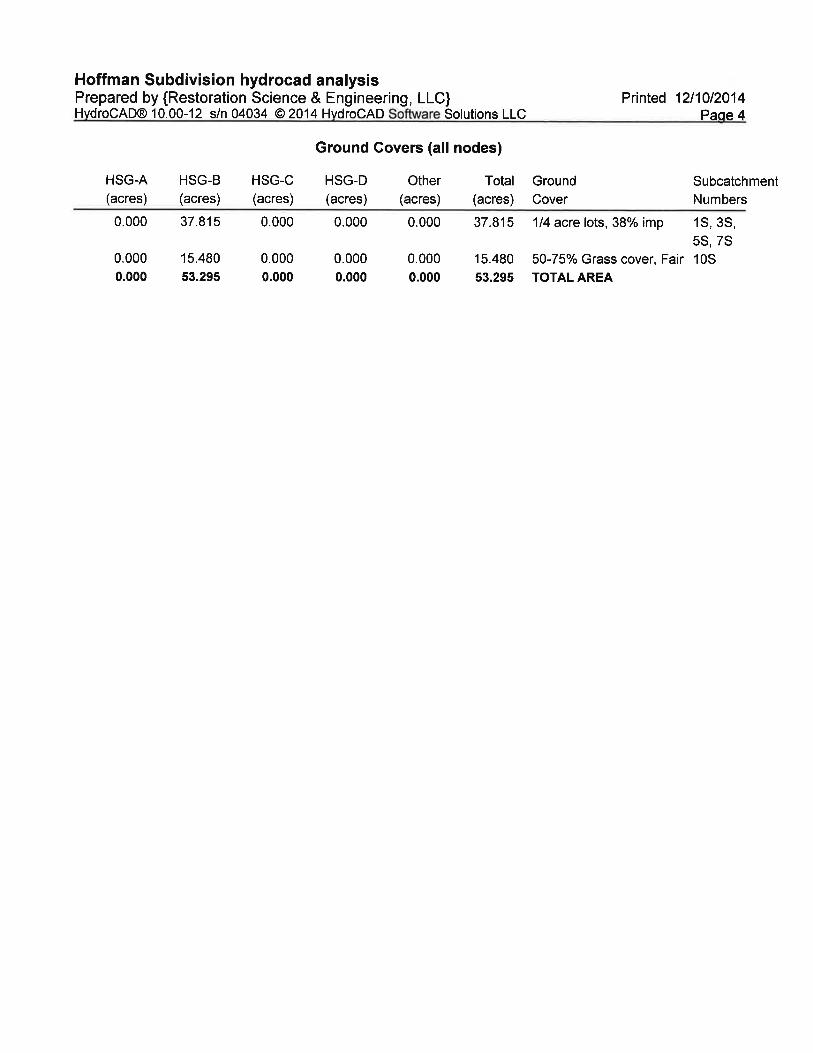
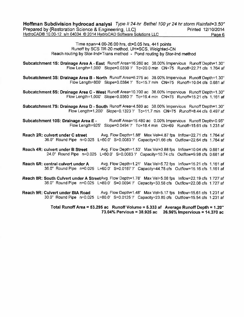
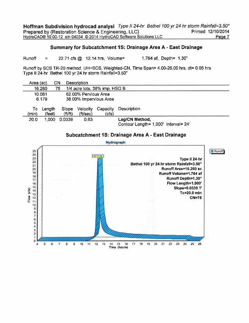
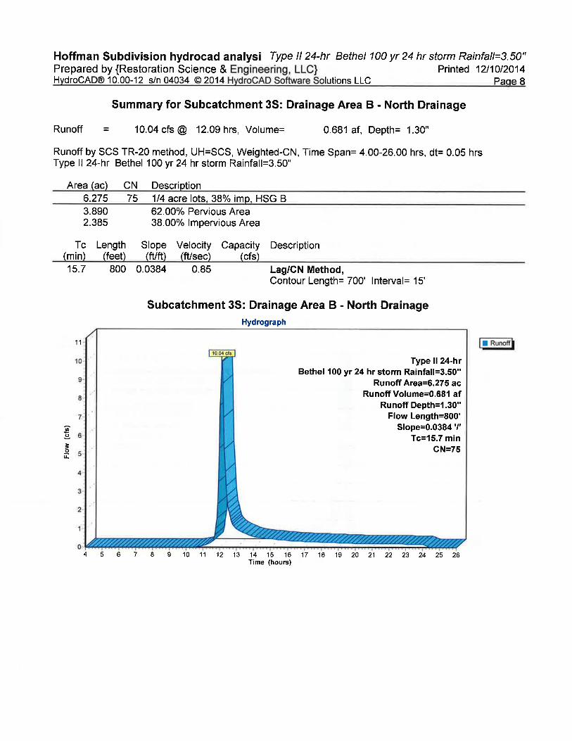
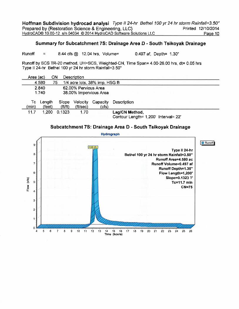
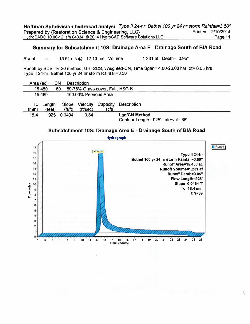
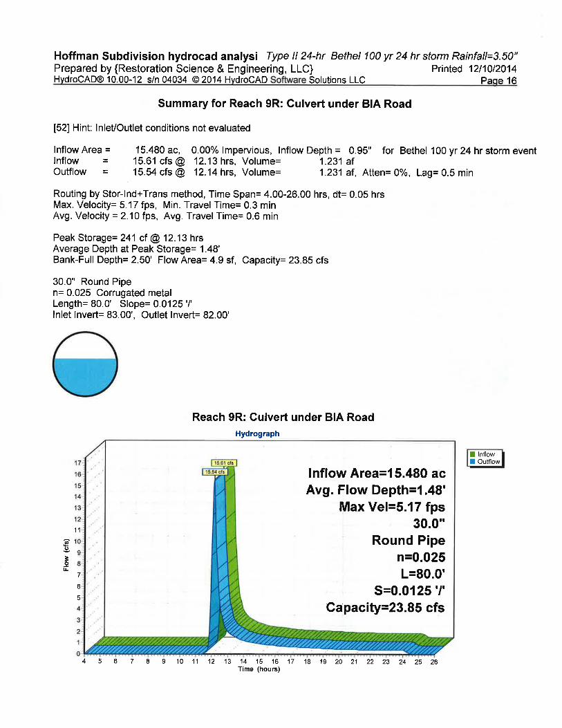
Typical ground cover for the existing and proposed subdivisions was modeled and runoff from
the five drainage areas was analyzed used HydroCAD modeling software to determine peak
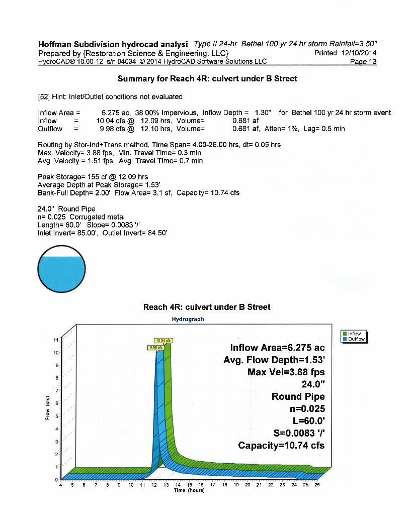
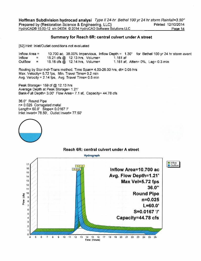
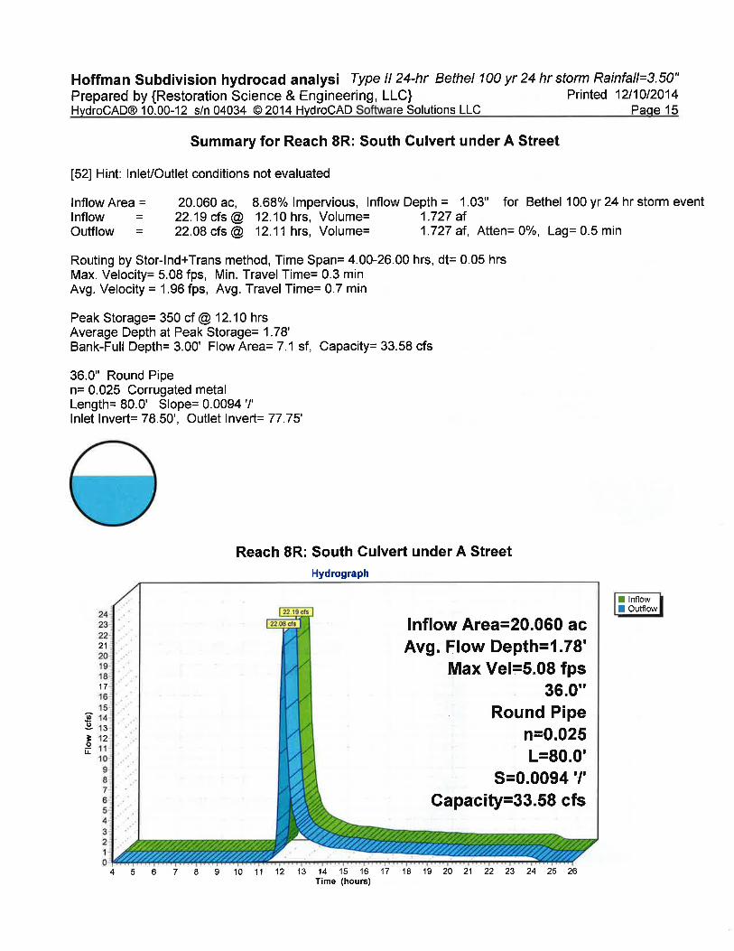
flow rates that drainages and culverts could be expected to experience from a 100-year 24-hour
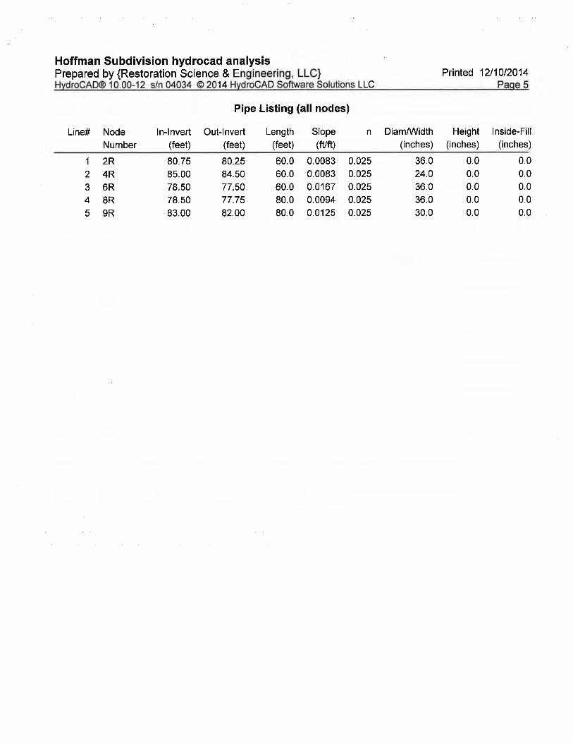
storm event (3.5 inches of rain for Bethel). Based on the results of the drainage analysis,
culverts were located and were sized to pass the 3.5-inch rain event which is almost ¼ of the
annual precipitation that Bethel receives.
The Blue Sky Estates Subdivision was designed to ensure general continuation of existing
drainage patterns conveying runoff away from the Tsikoyak Subdivision and minimize future
drainage issues due to construction of the Blue Sky Estates Subdivision. Blue Sky Estates lots
that border Tsikoyak Subdivision lots include 10 to 20 foot drainage easements along the
subdivision boundary which when coupled with existing 10 foot drainage easements along the
outside of Tsikoyak Subdivision lots provide 20 to 30 feet of designated space for drainage
conveyance. The proposed Blue Sky Estates design includes all main drainage ways that
convey runoff away from the Tsikoyak Subdivision and through the proposed Blue Sky Estates
Subdivision maintained as open space preservation areas to ensure drainage is not restricted.
Culverts will convey runoff away from the subdivision to the existing drainage channels
leading away from the Blue Sky Estates Subdivision.
2
If you have any questions regarding this submittal, please feel free to contact me at 278-1023
ext. 1108, or [email protected] or David Nyman at ext. 1103 or
[email protected]. Thank you for your time.
Sincerely,
Neil Waggoner, PE
RESTORATION SCIENCE & ENGINEERING, LLC
Attachments:
1. Proposed Bethel Hoffman Subdivision Drainage Analysis, December 10, 2014


HO
FF
MA
N S
UB
DIV
IS
IO
N
DR
AIN
AG
E A
RE
AS
DRAFT
RE
ST
OR
AT
ION
SC
IEN
CE
& E
NG
INE
ER
ING
, LL
C
LEGEND
DRAINAGE AREA BOUNDARY
HOFFMAN SUBDIVISION BOUNDARY
PROPOSED CMP CULVERT
INSTALL NEW
30" CMP CULVERT
36" CMP
CULVERT
36" CMP
CULVERT
24" CMP
CULVERT
24" CMP
CULVERT
36" CMP
CULVERT
24" CMP
CULVERT
SHEET 2
EXISTING CMP CULVERT
DRAINAGE AREA TABLE
DRAINAGE AREA
B
DRAINAGE AREA
C
DRAINAGE AREA
A
DRAINAGE AREA
D
DRAINAGE AREA
E
DRAINAGE AREA - A
DRAINAGE AREA - B
DRAINAGE AREA - C
DRAINAGE AREA - D
DRAINAGE AREA - E
DRAINAGE AREA AREA (ACRES)
17.29
6.29
10.72
4.58
15.48
CULVERT TABLE
A STREET
A STREET
B STREET
B STREET
C STREET
C STREET
BIA ROAD
STREET STATION SIZE
L.F.
36"
36"
24"
24"
24"
36"
30"
80 L.F.
60 L.F.
60 L.F.
60 L.F.
60 L.F.
62 L.F.
75 L.F.
31+08.00
5+17.36
0+26.50
11+91.50
0+35.50
10+51.00
-