Embed Size (px)
Citation preview
SANDAG.org/CMCP
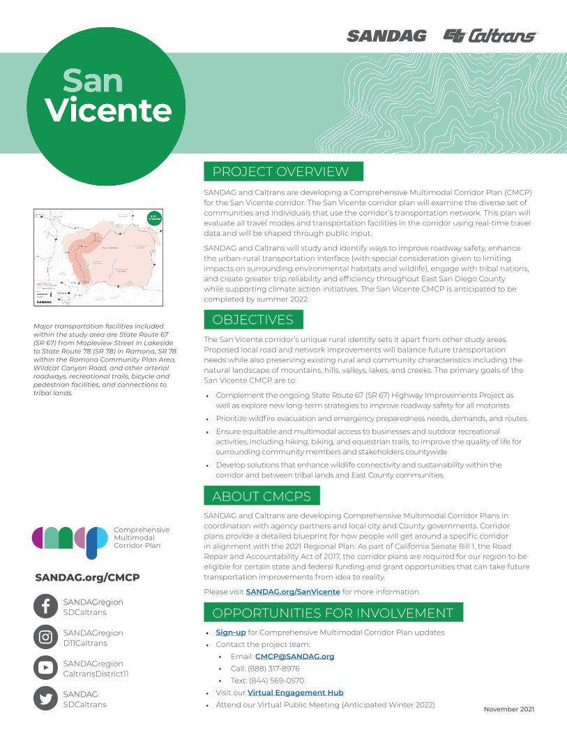
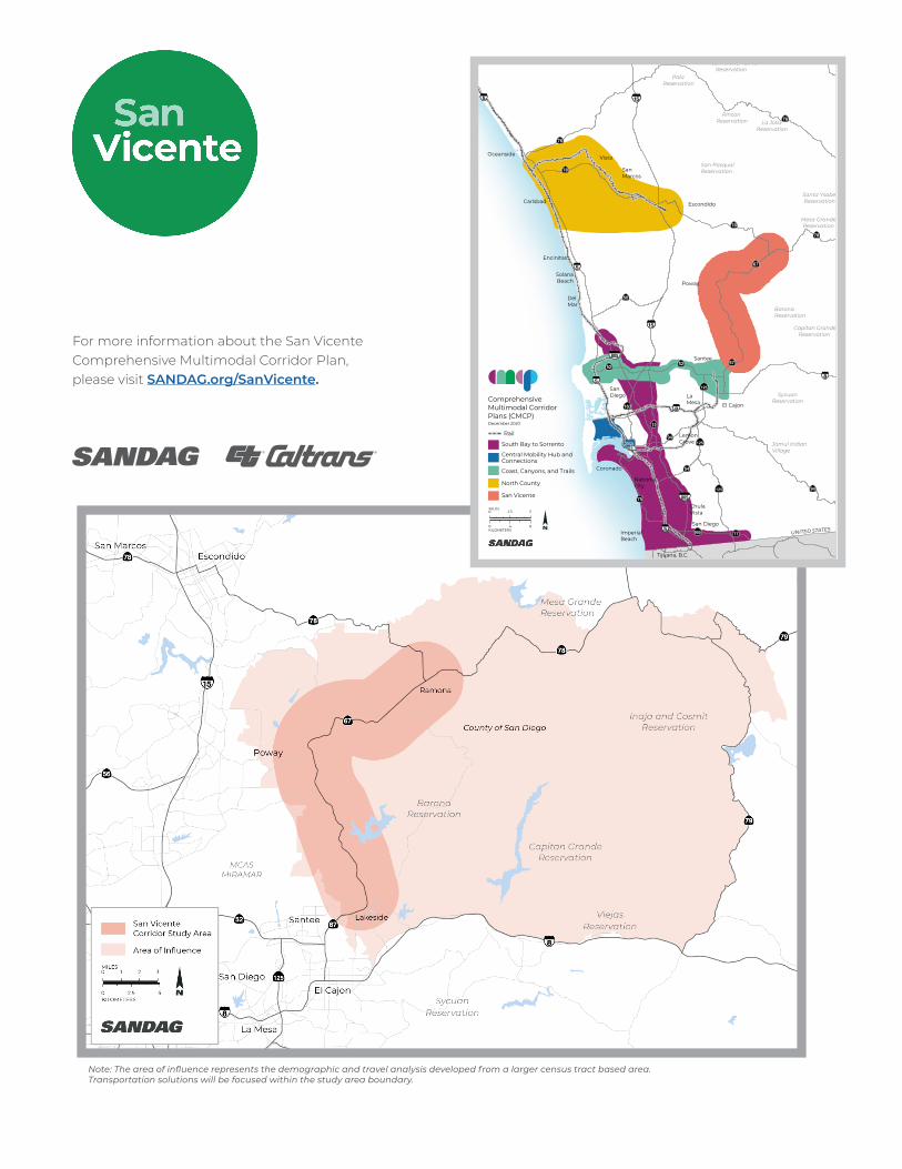
Major transportation facilities included within the study area are State Route 67 (SR 67) from Mapleview Street in Lakeside to State Route 78 (SR 78) in Ramona, SR 78 within the Ramona Community Plan Area, Wildcat Canyon Road, and other arterial roadways, recreational trails, bicycle and pedestrian facilities, and connections to tribal lands.
Comprehensive MultimodalCorridor Plan
SANDAGregion SDCaltrans
SANDAGregion D11Caltrans
SANDAGregion CaltransDistrict11
SANDAG SDCaltrans
November 2021
SANDAG and Caltrans are developing a Comprehensive Multimodal Corridor Plan (CMCP) for the San Vicente corridor. The San Vicente corridor plan will examine the diverse set of communities and individuals that use the corridor’s transportation network. This plan will evaluate all travel modes and transportation facilities in the corridor using real-time travel data and will be shaped through public input.
SANDAG and Caltrans will study and identify ways to improve roadway safety, enhance the urban-rural transportation interface (with special consideration given to limiting impacts on surrounding environmental habitats and wildlife), engage with tribal nations, and create greater trip reliability and efficiency throughout East San Diego County while supporting climate action initiatives. The San Vicente CMCP is anticipated to be completed by summer 2022.
PROJECT OVERVIEW
The San Vicente corridor’s unique rural identity sets it apart from other study areas. Proposed local road and network improvements will balance future transportation needs while also preserving existing rural and community characteristics including the natural landscape of mountains, hills, valleys, lakes, and creeks. The primary goals of the San Vicente CMCP are to:
• Complement the ongoing State Route 67 (SR 67) Highway Improvements Project as well as explore new long-term strategies to improve roadway safety for all motorists
• Prioritize wildfire evacuation and emergency preparedness needs, demands, and routes
• Ensure equitable and multimodal access to businesses and outdoor recreational activities, including hiking, biking, and equestrian trails, to improve the quality of life for surrounding community members and stakeholders countywide
• Develop solutions that enhance wildlife connectivity and sustainability within the corridor and between tribal lands and East County communities
OBJECTIVES
SANDAG and Caltrans are developing Comprehensive Multimodal Corridor Plans in coordination with agency partners and local city and County governments. Corridor plans provide a detailed blueprint for how people will get around a specific corridor in alignment with the 2021 Regional Plan. As part of California Senate Bill 1, the Road Repair and Accountability Act of 2017, the corridor plans are required for our region to be eligible for certain state and federal funding and grant opportunities that can take future transportation improvements from idea to reality.
Please visit SANDAG.org/SanVicente for more information.
ABOUT CMCPS
• Sign-up for Comprehensive Multimodal Corridor Plan updates
• Contact the project team:
· Email: [email protected] · Call: (888) 317-8976
· Text: (844) 569-0570
• Visit our Virtual Engagement Hub • Attend our Virtual Public Meeting (Anticipated Winter 2022)
OPPORTUNITIES FOR INVOLVEMENT
For more information about the San Vicente Comprehensive Multimodal Corridor Plan, please visit SANDAG.org/SanVicente.
SanDiego
SanMarcos
Santee
SolanaBeach
Vista
Carlsbad
ChulaVista
Coronado
DelMar
El Cajon
Encinitas
Escondido
ImperialBeach
LaMesa
NationalCity
Oceanside
Poway
San Diego
PalaReservation
Pauma and YuimaReservation
La JollaReservation
San PasqualReservation
Santa YsabelReservation
Mesa GrandeReservation
BaronaReservation
Capitan GrandeReservation
SycuanReservation
Jamul IndianVillage
UNITED STATES
Tijuana, B.C.
RinconReservation
LemonGrove
0 2.5 5MILES
0 4 8KILOMETERS
ComprehensiveMultimodal CorridorPlans (CMCP)
Rail
South Bay to Sorrento
Central Mobility Hub andConnections
Coast, Canyons, and Trails
North County
San Vicente
December 2020
12/21 5620Note: This map shows conceptual study area boundaries. Demographic and travel analysis may include data from an area of influence developed from a larger census tract area.
Note: The area of influence represents the demographic and travel analysis developed from a larger census tract based area. Transportation solutions will be focused within the study area boundary.