Embed Size (px)
Citation preview

November 2019
PROPOSED LOCAL DEVELOPMENT
PLAN 2
Argyll and Bute
Proposals MapsHelensburgh and Lomond

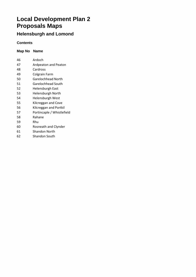
Local Development Plan 2 Proposals Maps Helensburgh and Lomond
Contents
Map No Name
46 Ardoch 47 Ardpeaton and Peaton 48 Cardross 49 Colgrain Farm 50 Garelochhead North 51 Garelochhead South 52 Helensburgh East 53 Helensburgh North 54 Helensburgh West 55 Kilcreggan and Cove 56 Kilcreggan and Portkil 57 Portincaple / Whistlefield 58 Rahane 59 Rhu 60 Rosneath and Clynder 61 Shandon North 62 Shandon South
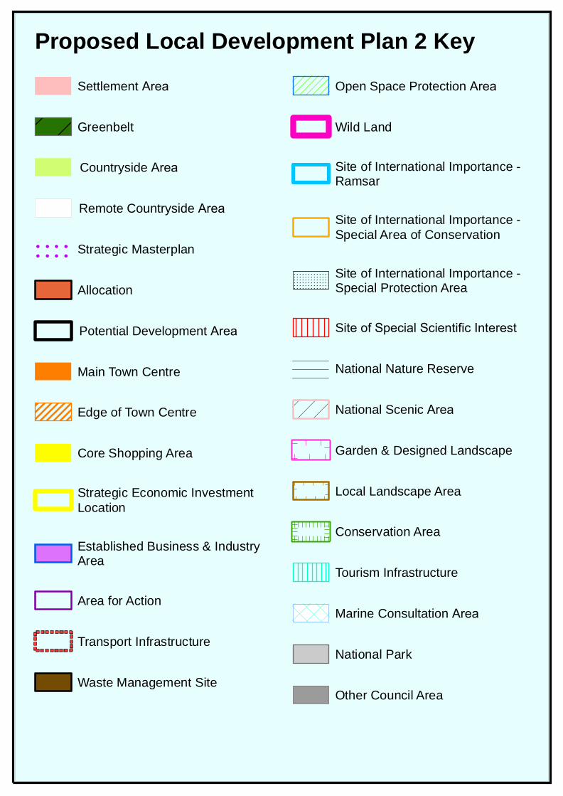
Proposed Local Development Plan 2 KeySettlement Area
Greenbelt
Countryside Area
Remote Countryside Area
Strategic Masterplan
Allocation
Potential Development Area
Main Town Centre
Edge of Town Centre
Core Shopping Area
Strategic Economic InvestmentLocation
Established Business & IndustryArea
Area for Action
Transport Infrastructure
Waste Management Site
Open Space Protection Area
Wild Land
Site of International Importance -Ramsar
Site of International Importance -Special Area of Conservation
Site of International Importance -Special Protection Area
Site of Special Scientific Interest
National Nature Reserve
National Scenic Area
Garden & Designed Landscape
Local Landscape Area
Conservation Area
Tourism Infrastructure
Marine Consultation Area
National Park
Other Council Area
°
236000
236000
6760
00
6760
00
6770
00
6770
00
© Crown copyright and database rights 2019. Ordnance Survey Licence number 1000233680 100 200 300
metres
1:7,500Scale at A4 -
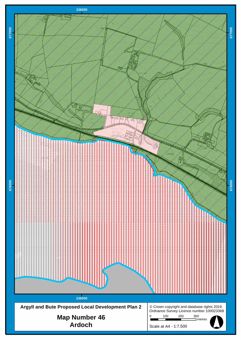
Argyll and Bute Proposed Local Development Plan 2Map Number 46
Ardoch
°
221000
221000
222000
222000
6850
00
6850
00
6860
00
6860
00
6870
00
6870
00
© Crown copyright and database rights 2019. Ordnance Survey Licence number 1000233680 100 200 300 400
metres
1:10,000Scale at A4 -
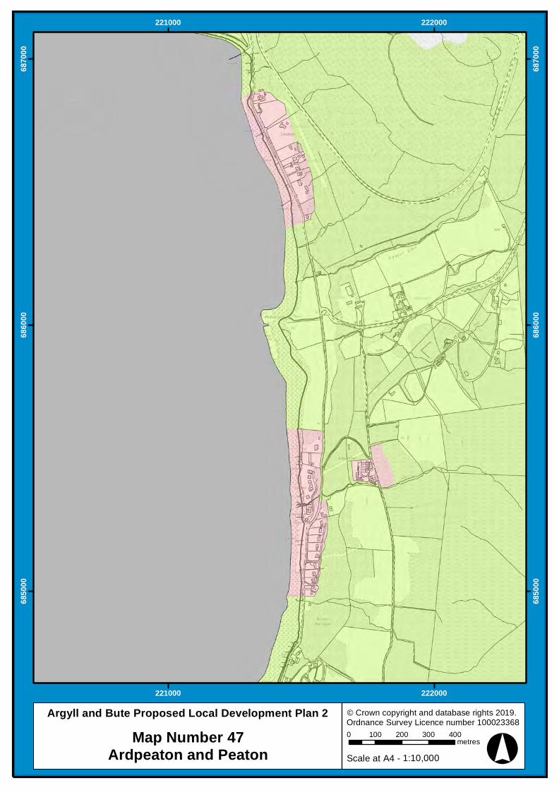
Argyll and Bute Proposed Local Development Plan 2Map Number 47
Ardpeaton and Peaton
°
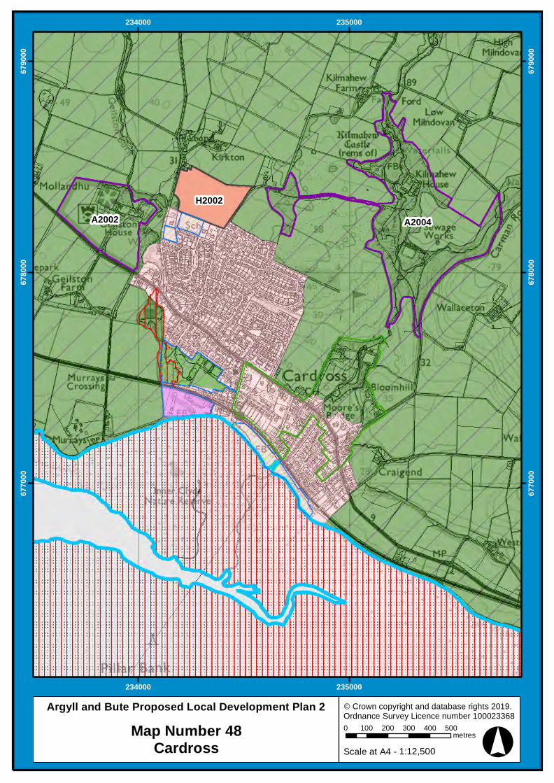
H2002A2004A2002
234000
234000
235000
235000
6770
00
6770
00
6780
00
6780
00
6790
00
6790
00
© Crown copyright and database rights 2019. Ordnance Survey Licence number 1000233680 100 200 300 400 500
metres
1:12,500Scale at A4 -
Argyll and Bute Proposed Local Development Plan 2Map Number 48
Cardross

°
B2001
232000
232000
233000
233000
680000
680000
© Crown copyright and database rights 2019. Ordnance Survey Licence number 100023368
0 100 200 300metres
1:7,500Scale at A4 -
Argyll and Bute Proposed Local Development Plan 2
Map Number 49Colgrain Farm
°
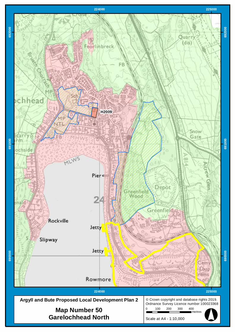
H2009
224000
224000
225000
225000
6900
00
6900
00
6910
00
6910
00
6920
00
6920
00
© Crown copyright and database rights 2019. Ordnance Survey Licence number 1000233680 100 200 300 400
metres
1:10,000Scale at A4 -
Argyll and Bute Proposed Local Development Plan 2Map Number 50
Garelochhead North
°
224000
224000
225000
225000
6880
00
6880
00
6890
00
6890
00
© Crown copyright and database rights 2019. Ordnance Survey Licence number 1000233680 100 200 300 400
metres
1:10,000Scale at A4 -
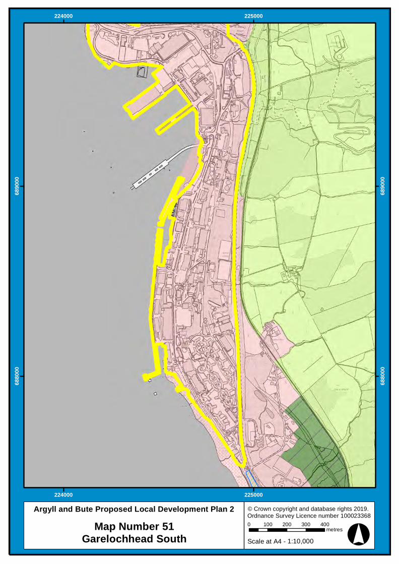
Argyll and Bute Proposed Local Development Plan 2Map Number 51
Garelochhead South
°
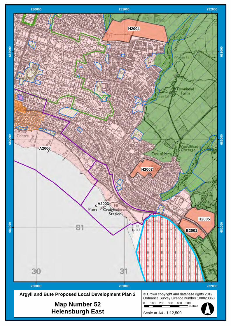
H2004
H2005
H2007
B2001
A2006
A2003
230000
230000
231000
231000
232000
232000
6810
00
6810
00
6820
00
6820
00
6830
00
6830
00
© Crown copyright and database rights 2019. Ordnance Survey Licence number 1000233680 100 200 300 400 500
metres
1:12,500Scale at A4 -
Argyll and Bute Proposed Local Development Plan 2Map Number 52
Helensburgh East

°
H2004
C2001
A2005
A2006
230000
230000
231000
231000
683000
683000
684000
684000
685000
685000
© Crown copyright and database rights 2019. Ordnance Survey Licence number 100023368
0 100 200 300 400 500metres
1:12,500Scale at A4 -
Argyll and Bute Proposed Local Development Plan 2
Map Number 53Helensburgh North
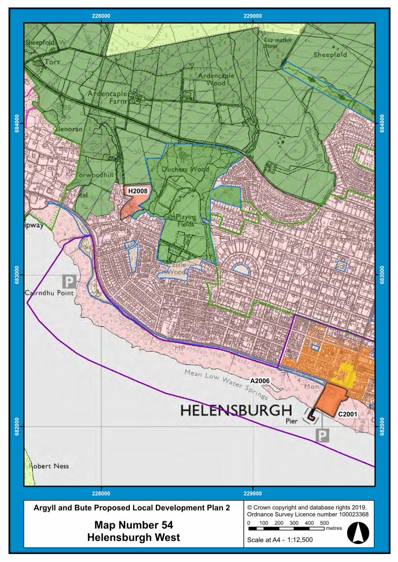
°
C2001
H2008
A2006
228000
228000
229000
229000
682000
682000
683000
683000
684000
684000
© Crown copyright and database rights 2019. Ordnance Survey Licence number 100023368
0 100 200 300 400 500metres
1:12,500Scale at A4 -
Argyll and Bute Proposed Local Development Plan 2
Map Number 54Helensburgh West
°
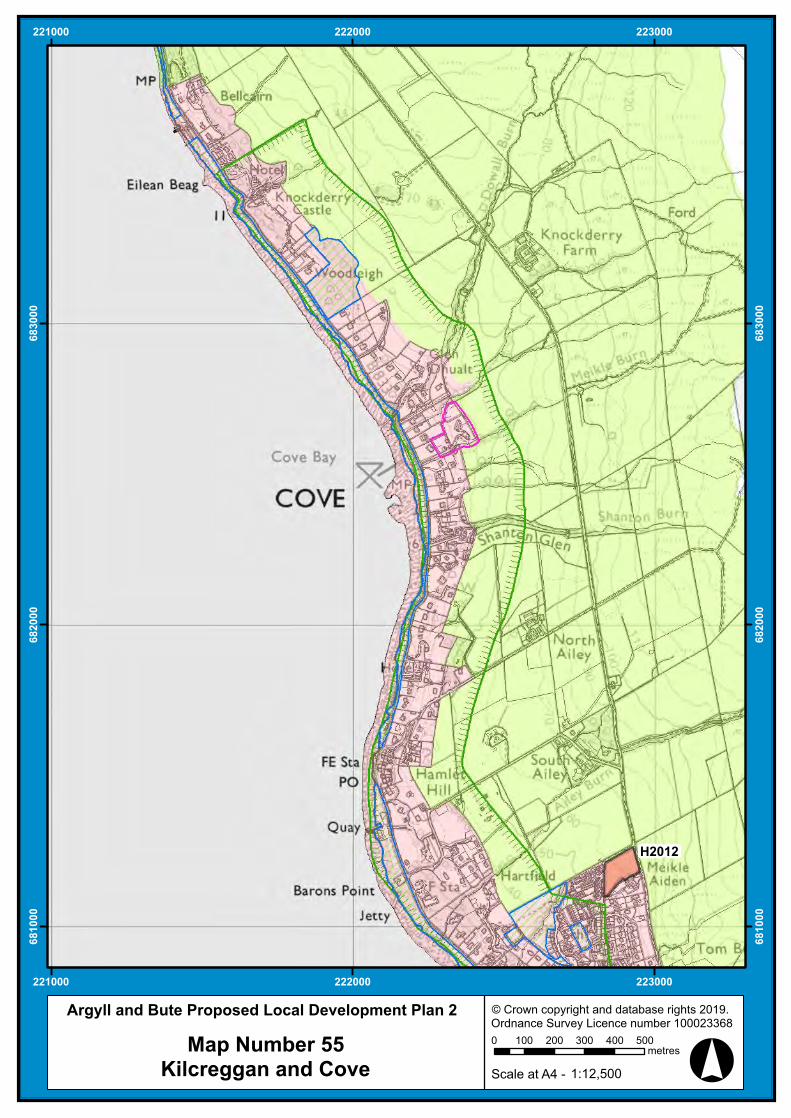
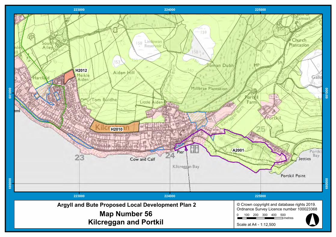
H2012
221000
221000
222000
222000
223000
223000
681000
681000
682000
682000
683000
683000
© Crown copyright and database rights 2019. Ordnance Survey Licence number 100023368
0 100 200 300 400 500metres
1:12,500Scale at A4 -
Argyll and Bute Proposed Local Development Plan 2
Map Number 55Kilcreggan and Cove
°
H2010
H2012
A2001
223000
223000
224000
224000
225000
225000
68
00
00
68
00
00
68
10
00
68
10
00
© Crown copyright and database rights 2019. Ordnance Survey Licence number 100023368
0 100 200 300 400 500metres
1:12,500Scale at A4 -
Argyll and Bute Proposed Local Development Plan 2
Map Number 56Kilcreggan and Portkil
°
223000
223000
224000
224000
6930
00
6930
00
6940
00
6940
00
© Crown copyright and database rights 2019. Ordnance Survey Licence number 1000233680 100 200 300 400
metres
1:10,000Scale at A4 -
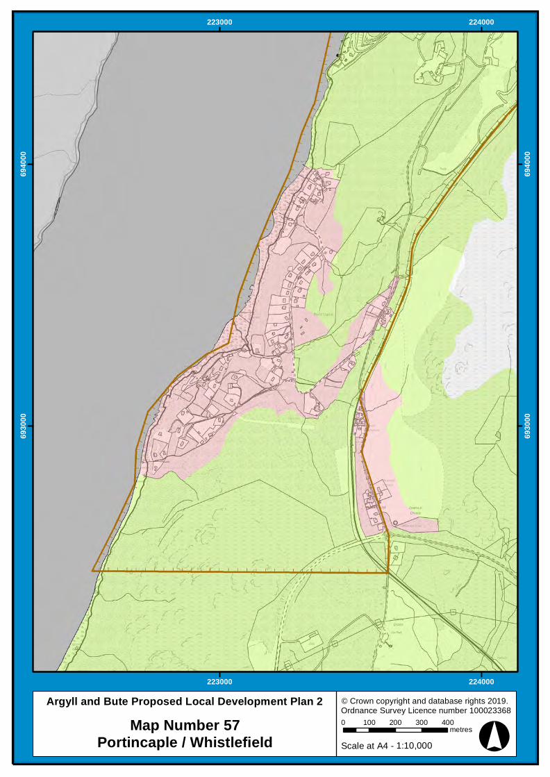
Argyll and Bute Proposed Local Development Plan 2Map Number 57
Portincaple / Whistlefield
°
223000
223000
224000
224000
6870
00
6870
00
6880
00
6880
00
© Crown copyright and database rights 2019. Ordnance Survey Licence number 1000233680 100 200 300 400
metres
1:10,000Scale at A4 -
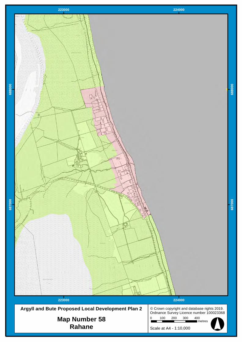
Argyll and Bute Proposed Local Development Plan 2Map Number 58
Rahane
°
P2003
P2002
H2013
H2006
A2006
226000
226000
227000
227000
228000
228000
683000
683000
684000
684000
685000
685000
© Crown copyright and database rights 2019. Ordnance Survey Licence number 100023368
0 100 200 300 400 500metres
1:12,500Scale at A4 -
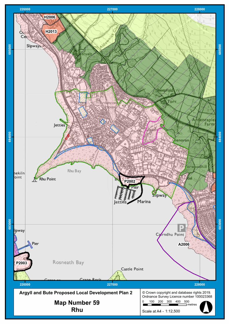
Argyll and Bute Proposed Local Development Plan 2
Map Number 59Rhu

°
P2003
H2011
H2013
225000
225000
226000
226000
683000
683000
684000
684000
685000
685000
© Crown copyright and database rights 2019. Ordnance Survey Licence number 100023368
0 100 200 300 400 500metres
1:12,500Scale at A4 -
Argyll and Bute Proposed Local Development Plan 2
Map Number 60Rosneath and Clynder

°
225000
225000
226000
226000
6870
00
6870
00
6880
00
6880
00
© Crown copyright and database rights 2019. Ordnance Survey Licence number 1000233680 100 200 300 400
metres
1:10,000Scale at A4 -
Argyll and Bute Proposed Local Development Plan 2Map Number 61Shandon North
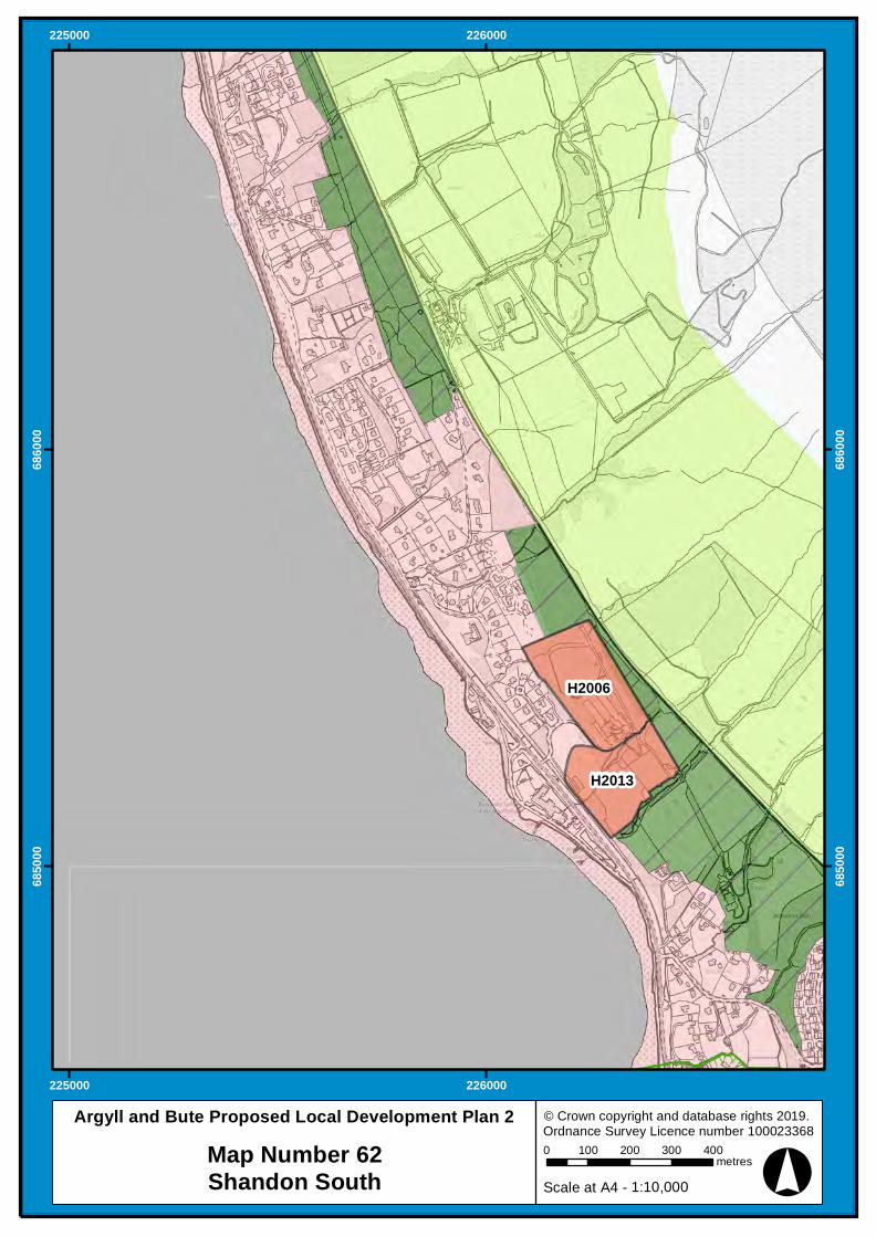
°
H2006
H2013
225000
225000
226000
226000
6850
00
6850
00
6860
00
6860
00
© Crown copyright and database rights 2019. Ordnance Survey Licence number 1000233680 100 200 300 400
metres
1:10,000Scale at A4 -
Argyll and Bute Proposed Local Development Plan 2Map Number 62Shandon South