Embed Size (px)
Citation preview
June au, Alaska Ootober 22nd, 1940.
L. P. Dawes, 24. D., F.A.C.S . , Juneau, Alaska.
Dear D r . Dawes:
On September 2$th, 1940 i n company w i t h your p a r t - ne r , M r . S tanton, I l e f t Juneau and went t o Yankee Cove t o make a r e p o r t on t h e Yankee Cove Gold Mining Co., which I underatand i s owned j o i n t l y by you and M r . Stanton. This p roper ty having been p rev ious ly known as t h e Aurora Borea l i s , and l a t e r as t h e Morning S t a r Group. My r e p o r t covers t h e progress that has been made and t h e work that has been done s i n c e t h e beginning of work on t h e s e claim8 about 1910. The fo l lowing i s my repor t :
LOCATION
The proper ty i s looa ted about 2-1/2 mi les e a s t of Yankee Cove and about 1000 it. e leva t ion . Yankee Cove i s about 35 mi les n o r t h of Juneau ( C a p i t o l of Alaska) on Lynn Canal, a salt water arm running between Juneau and t h e P a c i f i o Ocean.
The m i l l s i t e i s on a f lat about $0 aores i n ex ten t . Bess ie Mountain r i s e s at t h e r e a r of t h e p roper ty and t h e r e a r e s e v e r a l streams running down t h e mountain side which w i l l f u r n i s h abundance of water f o r power pur- poses. I would e s t i m a t e that Bess ie Mountain r i s e s above th is p roper ty some ldOO t o 2000 it. There a r e twelve claims i n this group which l i e on th i s mountain and ad- jacent t o t h e m i l l s i t e . The olalms a r e 600 it. x 1500 it. each and t h e two m i l l s i t e s belonging t o th i s group are eaoh 600 f t . by 600 ft. A t Yankee Cove t h e company owns 74.5 a c r e s of pa ten ted l and a long t h e beach, and two water r i g h t s .
TUNNELING AND PROSPECTING
The tunne l f o r Wanderer No. 5, on t h e nor theas t s i d e of Bessie Mountain and approxlrnately $00 f t . above, and 1000 it. on a d i r e c t l i n e from t h e o re b i n at the m i l l , i s a 5' x 7'- and 286 S t . t o t h e f a c e of t h e tunne l expos- i n g ledge of ore , running from 2ba t o Ma i n width and

ly ing between green stone walls. Th i e tunnel has suf f ic ien t grade f o r drainage. The ledge of ore i s exposed from the entrance of the mine t o the face.
On the southwest side of Bessie Mountain, on the sane ledge and approximately 200 it. above the previously mentioned tunnel, a l so known a s Wanderer No. 5, i s a Tunnel 5' x 7' and 176 f t . t o i t s face exposing ledge of ore averaging three it. t o four f t . i n width. This tunnel a l s o has a grade euff ic ient f o r drainage. There i s a 96 f t . shaf t extending down from the top of the r idge t o the tunnel and connecting with the tunnel about 125 f t . from i ts entrance. Both the above tunnels have side h i l l entrances.
I n what i s known as the Liberty G i r l Group of these claims a re several short tunnels, a l l side h i l l entrances, s i ze 5' x 7' and exposing a ledge of ore running from two f e e t t o twelve f e e t i n width. There i s approximately 325 it. of tunneling i n this group.
There a re t r u e f i s su re ledges t ravers ing this mountain p a r a l l e l t o each other and ranging from 100 it. t o 600 it. apart a s you go up the mountain, and varying from f ive f e e t t o s i x f e e t i n width. These ledges have been uncovered i n places, f o r a length of approximately 600 f t . and are seamed with arsenical iron. These ledges stand prac t ica l ly v e r t i c a l and from traoing, extend at l e a s t as far as the foot of the mountain. These ledges l i e In green stone.
POWER ._
Water power i s t o be used t o run the m i l l , sawmill, generators, etcetera. The intake i s t o be placed a t a place about 200 f t . elevation above the m i l l w i t h two water l i n e s from the intake; one t o the m i l l and the other t o supply water power t o the s a w m i l l and generators, using Pelton wheels. I n case of shortage of water i n the oreek water can be turned i n t o it from other oreeks closely adjaoent thereto. The water from Bessie Creek has been diverted i n t o t h i s creek previously when needed.
HANDLING ORE TO MILL
About 100 f t . West and on a l eve l w i t h the top of the ore b in i s a ledge of high grade ore, running from one foot"bo f ive f e e t i n width w i t h s t r ingers running p a r a l l e l t o it. It i s the intent ion t o run a tunnel i n the s ide of the mountain and follow the ledge, using mine traok and ore dump cars t o the bin.

above the m i l l i s the Wanderer No. 5 a t an elevation of 800 ft. above the m i l l . It i s the intent ion t o use a e r i a l tram (material on hand fo r i t s conatruotion) and bring the ore down t o the bin.
The above two operations a re the ones tha t w i l l be used at f i r s t ; l a t e r it i s the intent ion t o run a t rack around the foot of the h i l l about 3/4 of a mile t o the m i l l from the Liberty G i r l Tunnels. There i s a 12 f t . ledge beyond these tunnels tha t has been p a r t i a l l y uncovered and prospected and can be handled by a continuation of t h i s track.
TRAILS AND ROADS
From the Yankee Cove end at the beach t o a point about 1-1/2 miles toward the mine, running i n an eas te r ly direct ion, the Terr i tory of Alaska has a p a r t i a l l y b u i l t road. The present grade on t h i s road runs from 0.0 per oent to a grade of probably 20 per cent where there a re humps. It i s the Terr i tory ' s intent ion t o complete the road t o the mine and t o remove the humps so that the re should be a grade not t o exceed t en per oent at any place. There a re spots on t h i s road t h a t have been corduroyed. About 1-3/4 miles of the road w i l l have t o be gravelled; the remainder of the road i s cut out of the rock and w i l l not need surfacing. There are several spots along the road where gravel can be obtained f o r surfacing.
There are about a ix miles of t rai ls connecting the various ledges and tunnels together on the property. These a r e exoeptionally good trails out along the mountain s ide and up the mountain through s l ides , many large wind f a l l s and brush.
BUILDINGS
A t Yankee Cove where you disembark from the boat t o take the road t o t h e mine, there is a scow 22' x 54' i n s i z e w i t h a building on it equipped with beds, cooking stove and kitchen u tens i l s , with a storage space i n the r e a r f o r equipment brought up by the boat f o r the mine. t h i s l i e s on the 74.5 acres of patented land previously re f erred t o i n t h i s report .
A t M i l l s i t e there i s a new building constructed t o accommodate a complete ten stamp m i l l a s shown i n photograph marked nAw. This buildlng i s b u i l t of heavy timber w i t h a shake roof and w a s b u i l t i n the last two years.

Within 25 f t , of the m i l l building i s a building 14' x 18' i n s ize which w a s a l so b u i l t i n the last two years. This building i s equipped a s a blacksmith shop and has various equipment and tools a l so stored i n i t . Shown a s QB" on photograph.
On the m i l l s i t e grounds i s a lso constructed an extremely well b u i l t peeled log building, 1-1/2 s to r i e s high w i t h two rooms upstai rs and a large room down stairs. It i s 17' x 261 overal l i n size. The lower p a r t i s equipped as a kitchen and dining quarters with stove, kitchen u tens i l s and the neces8a.r equipment for a camp. T h i s i s shown on photograph as {ca
Direotly below the m i l l , and on a d i r ec t l i n e with it, i s the foundation f o r the saw m i l l oonstructed of heavy timber. The construction of th i s building i s at present being done. Shown as on photograph.
I n the m i l l building and adJaoent there to i s the equipment f o r a complete f i f t e e n stamp m i l l , inoluding stamps, jaw crusher, tablee, l i n e shaf t , pullege and a l l the miscellaneoue materials neoessary t o the oon- s t ruc t ion of a m i l l of t h i s s ize .
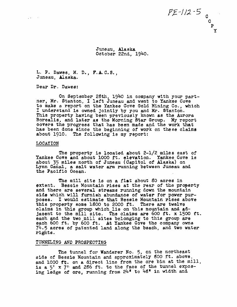
There i s the equipment f o r one aomplete sawmill including saws and a gas engine f o r running the m i l l and a Pelton wheel t o be used when water power i e furnished. Below i s a partial l i s t of other material on hand at the m i l l :
1 - g* 1 0 V t e a m air compressor 1500 - it. of 1 4 2 Black pipe 2000 - f t . of 1/2n black pipe 300 - it. of 3# black pipe
1 - stoper 600 - it, of 5/8* galv. wire rope
2000 - ft, of 1/2A wire rope 300 - 1/2"galvanized returns
2 - Ingerso l l - Rand Jack Hammers 12 - rounds of l-l/&-dri s t e e l 300 - ft . 7/8* D r i l l s t e e l
2000 - f t . BM Lumber Various miscellaneous tools including
sledges, mauls, saws, round and square pointed ehovela, picks, mattox, e ta .
2 - Sets of Stocks and Dies A large stock of pulleys, shafting, boxes
gear wheels and the various equipment needed f o r repa i rs around the mill.
go0 - it. 16# mine r a i l ,
1 - 3 ton chain black '
A quantity of valves and pipe f i t t i n g s 2 - 2 ton ore dump cars 2 - Pelton Wheels - 1- 61 dia. 1- 3t dia.
2 - 2 Centrifugal pumps 1 - ortable Ingersoll-Rand Air compressor
on wheels, capacity alr fo r s i x jack hammers .
I n addition t o the above there i s a quantity of f lat i ron and bar i ron, kegs of various sized n a i l s , bridge washers, dr i f t pins, bo l t s of a l l s izes , wire of various s izes , e tc .
VALOE OF EQUIPMENT, BUILDINGS, TUNNELING, , ETC . 683 - ft. of tunnel 5' x 7 ' , a l l hand d r i l l e d
at $18.00 per foot . . . . . . . . . . .( Lump - Locating and uncovering ledges, e tc . . . . . . . . . . . . . . . . . . . estimated . . . . . . 6 - Miles of t r a i n at $350.00 per mile Lump - Sluicing down dirt and rock t o f i l l . . . . . . . . . . . . . f l a t f o r buildinge
BuLldings, stoves, beds and oooking utensils . Lump - While a l l t h e equipment f o r f i f t e e n stamp
m i l l Is c l a s s i f i ed as second hand, t en stamps a r e new and a quantity of the other equipment together with the trans- . . . . . . . portion cos ts t o the m i l l s i t e . . . . . . . . . . . . . . . 1 - Complete sawmil l . . . . . . . . . . . . . . 2 - Compressors 1- steam . . . . . . . . . . 1- Ing. - Rand
Various s i z e s and lengths of pipe as . . . . . . . . . . . . . previously l i s t e d . . . . . . . . . 2 - Ingersol l - Rand Jack Hammers 7/dn and 1-l/da D r i l l s t e e l abpreviously . . . . . . . . . . . . . . . . . l i s t e d . . . . . . . . . . . . . . . 1 - 3 ton chain ho i s t . . . . . . . . . . . . . . . . . . . . . 1 - S t o p e r
1500 - it. of ir 1-1/2' pipe packed up t o m i l l . . . . . . . . . . . . s i t e at 42# per foot . . . . . 2000 - it. of 1/3# wire rope at 96 per foot . . . . . 600 - ft. 5/d@ galv. wire rope at 11.5 foot 2 - s t e e l p l a t e s especially b u i l t f o r overdrive . . . . . . . . . . . . . . w a t e r w h e e l . .
10 - Kegs of n a i l s inoluding f re ight and Packing up t o the mine . . . e . . . . . .

3000 - f t . BM lumber, f r e igh t and handling t o m i l l . .$ 300.00 Lump - Miscellaneous tools estimated . . . . . . . . . 1,000.00 Lump - Pulleys, shafting, gears, Pelton Wheels,
bearings, bridge washers, etc. not included i n m i l l and sawmill equipment, . . . . . . . . . . . . . . . . . es t ima ted , 2,000.00
Lump - Various valves and pipe f i t t i n g s a t . . . . . . . . . . . . . . . . . Yankee Cove 100.00 . . . . . . . . . 2 - 2 Ton ore cars at $7'5.00 each 150.00 . . . . . . 2 - 3w Centrifugal pumps at $75.00 each 150.00
. . . . Total # 67,013.01
PREAMBLE
A report (oopy attached) w a s made by Mr. J. D. McIntyre M.E. i n the ear ly p a r t of 1900, however the date i s unreadable, then on May loth, 1916, ahother repor t was made on the same property;by Mr. Blakeslee CE, EM, ( copy a l so attached) . Thees repor ts should give you a h is tory of the property up t o the time i t wae taken over by i t s present owner. M r . Blakeeleela report has some very in te res t ing assay reports attaohed to it, and i t i n my opinion explains the reason trhy the present owners have t r i e d so hard b p u t t h i s property over without outside help.
CONCLUSIONS
I n order. t o f i n i s h the road up quickly and avoid waiting f o r the Terr i tory of Alaska t o do the work, which has been under way now f o r the pas t two years, . . . . . . . . . . estimate t h a t it would take about 10,000.00
To oomplete the s a w m i l l building, se t up the equipment and get it in to operation . . . . . . . . . 2,000.00
To completely f i n i s h up the m i l l , ore bins, s e t up the machinery and get everything operating . . . . . . . . . . . . . . . . and the m i l l grinding ~ , O O O . O O
Put t ing i n intake, bringing water around t o i t , put t ing In pipe l i n e from intake t o m i l l 6 sawmill ... 2,000.00
I n s t a l l a t i o n of Aerial Tram ( ~ a t e r l a l on hand). 2,000.00
Necessary carrying funds for payrolls , eto. u n t i l m i l l i s i n operation and rea l iz ing from output . . . . . . . . . . . . . . . . . . . . . . or the m i l l 6,000.00
Insurance on buildings, equipment, eomPeneation and personal inauranee . . . . - . . . . . ~ , O O O . O O
-6-
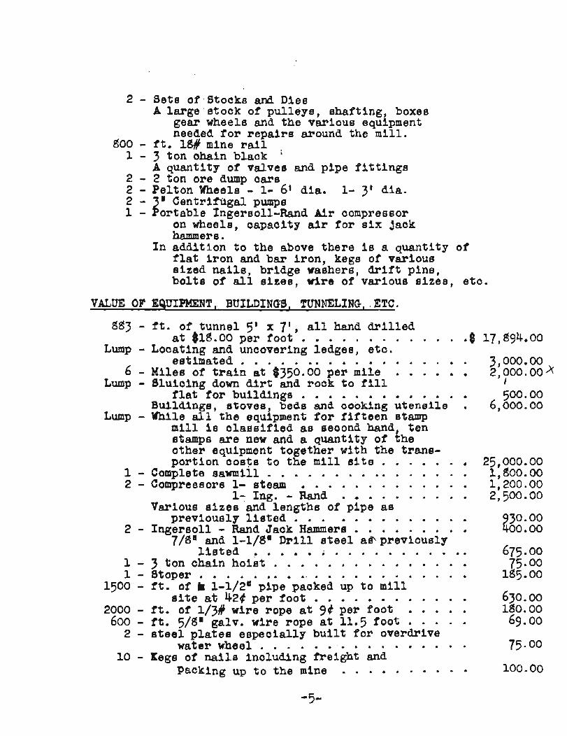
Estimated cost of putting mill on paying I production basis . . . . . . . . . . . . . . . . . . . $ 32,000.00 f
From the manner in which the various claims lay as to the mill site, the abundance of water power, easily accessible, the easy acesaibility of the varioue ore bodies to the mill, coupled with the fact that with the exaeption of the entrance to the various tunnels, no timbering will be necessary, I feel that this ore can be mined and milled, after the mill is in operation, at a very low cost. From the varioue assays I have seen and the panning0 that have been made from the earth a.t the edges of the ledge, there can be no doubt that you have throughout your claims very profitable commercial ore.
Below I submit the results of the assays made from s m B s of ore taken by me, theee asays were made by the depart- ment of mines, Territory of Alaska, Ketchikan, Alaska. The report wae made to Dr. L. P. Dawes under date of Oct .. 25, 1940. Gold - 1.2t3, @&.go; Silver 1.10, $0.77 . . . . . . . Wanderer No. 5 opposite the mill $ 45.57
old - 0.26, $ 9.10; Silver 0.70, $0.49 Wanderer No. 5, entrance to tunnel . . . . . . 9-59
Gold - 0.98, $34.30; Silver 1.30,$ 0.91 Upper tunnel No. 5 . . . . . . . . . . . . . . 35.21
Gold - 0.10, # 3.50; Silver 0.70, $0.49 Wanderer #7 . . . . . . . . . . . . . . . . . . 3.99
001d - 0.12, $ 4.20; Silver 0.80, $0.56 Top ledge . . . . . . . . . . . . . . . . . . . 4.76
Respectfully submitted,
(Signed) B. C. JOHNSON Inspection & Consultg. Engr., Foermerly with Robt. W. Hunt Co. , E n g r ~

Mr. Joe Graab Junaa.~, A3ea'a.a
Following are the msGts of ohftnna'l @ i ~ a ~ l . e e tsksn frw the hurors 3ersalle Adit Wo. 2 of 3- 27, 197, vith dssorfptionr and Soorttimrg
t?&aple Qza. Per ton Total Bltsbe~ Lc#nt_Los = b t l o n M & As Val-
1300 Ua- 2 ~ d i t Crushed a d 2' 0.07 0.90 $3.00 f oliep.t& quartz
l f O X 8kr baah -ti% and 26' 0.07 0.80 2.93 froa fsae banbed ohel8
1302 IOd8 ha l ; Butd4a 28' 0.20 0.w 70% WOP fee@ qu&% top .
1303 122' *oar Rlbbm 20' 0.u 0.60 4.70 fsoe -8.W. quartz rrlde bottom
1308 Lb8' from BM 26 o,06 0.W 2.60 iaoe -Saw. q w f r L
w a l l
1305 1 6 0 t b a ~ k ~ h i ~ s 5 , 0.03 0.50 1- 35 from iaeo g e e Qa
@bale
1307 lgO'baek atstage& 3' 0.09 O . 9 3-85 *am faea whit+ at anal1 quartz slip faalt

Page a2 - Mr. Joe k e e n -
aaragi~ Oza, Per tan Total lruarbar b a ~ t l ~ n I)ssar+~>%lon wldbh AU k V~3lu9 - - 1308 19OW tror Banded quartz 3' 0.03 0.50
f ase 1.35
H.P. ride of &dl%
5 1 ~ 0 9 fheoe v d u e a s m sub-cmmmoi~1 under the exlating prlce of gold and eooncola aond i t lms , I would a t l~ ls . a u n o e n t ~ t i o n of work on the Bensie and A l ~ e k a Washington relnr,

PIIEL IMINARY REPORT OF m R GROUP, (Bessie Prospect)
EAQE BIVGR DISTFUCT, JUNEAU GULD FELT, ALASKA, Ju ly 15, 1936.
Location and Accessibility:
The Wanderer Group of six claims is located two and a half miles due eas t and inland from Yankee Cove, approximately 35 miles north and west o f Juneau. This property is aocessible over the old plank road f'rom the head o f Yankee Cove tvo and a half miles. Another means of accessibility is by rollowing the Eagle River-Echo Cove trail f o r a dis- tance of 7 miles from the mouth of Esgle Biver. The l a t t e r trail i s kept i n good repa i r and pack horses may be used r i t h l i t t l e difficulty to the camp.
Owners :
This @up, which contains the shorings of Aurora Borealis, Bessie and Illash-&shington prospects, w a 8taked by H. Stanton. The present owners a r e Stanton and Dr. L. P. Dams of Juneau, Alaska.
History:
The Beaaie and Aurora Borealis discoveries =re made prior to 1903 by J. McVilliams and Peter Early. The Alaska-kshington vein was discovered about the same t i m e , horaver, the disaoverer i s unknown. Active development followed t o r several years whiah consisted mainly o r underground development, mainly tunneling. B 5-stamp mi l l eas re- ported i n operation on the Aurora Borealis pr lor to 1903 and a production of s e n m i l thouand do l l a r s i n gold is reported. Thie is reported along with a description of the vein, oorresponding description of the Bessie vein, and the Alaska-*ahington vein i n U. S. G. S. Bull. 287, "The Juneau Gold Belt* by 8. C. Spencer, pages l32-133. Further repor ts f r o m old timers in t h i s d i s t r i c t give the amount of gold produced at $6,000 with the first 5-stamp mill . Later 10 more stamp8 r e r e brought to the property, where they have remained i n the shipping c ra t e s u n t i l t h i s year. The reasons fo r suspending operations a t that time are not known. It is possibly due t o many factors , among which a r e spotty values, f l a t vein, f lat and possibly caving stopes together with high mining costs. An a e r i a l t r am, ramrants of which still exis t , ws used to convey the ore down the steep n a r r o w gulch to the mill. These properties rere later v i s i t e d i n 1910 by Adolph Knopf of the U. S. G. S. and descriptions a r e given i n RuI.1. 502, "The Eagle River Region, pp. 4749 .

Since t h i s report these propertiea have been inact ive u n t i l 1934 a t .hiah tlme Mr. Stanton did some sluicing of soft and weathered vein material along the Aumra Borealis vein. This season an attempt has been xmde t o re-erect the old m i l l with the prospects o r mill ing ore t h i s season. Since both geology and de ta i l descriptions of these properties are given i n the aforementioned reports only a br ief des- c r ip t ion is here contained.
Aurora Borealis:
The Aurora Borealis vein outcraps along the west s ide of a rrmall n a r r o w ravine .hi& extends up the mountain i n a southeast direction. This vein is called a blanket vein and occurs on a contact of black s l a t e and a greenstone conglomerate. Green ellipsoidal concretions, some nearly 10 inches i n diameter, occur in the slate. The vein can be traced f o r a distance o r 500' along the ravine between 990 to 1110' elevation. It has a northeast s t r i k e and a f l a t d ip of l e s s than 30' to the northwest which l a some*at variable. The vein averages between 2 and 3 f e e t in width, Sl ight movement of a few f e e t along the bedding plane has produced a banded nature and pmdueed rPnall lenses of banded q-z l a t e r than the first vein quartz both on the hawing and foot vallr. These later lenses of a fen r e e t carry the most values. Four tunnel8 have been driven on the vein a t various elevations s t a r t i n g behind the m i l l . They a r e caved, but the ore t h a t was milled no doubt came from small flat stopes in them. The mineralization consis ts of pyrite, arsenopyrite , a l i t t le galena and gold can be seen occasionally along the &z!k bands of the younger quartz. As a result of movement of the bedding plane a gouge has developed on both ralls. The gangue minerals a r e quartz, c a l c i t e and gouge material. o f the aall rocks. A few ounces o f epld has been obtained by sluicing the gouge and broken oxidized quartz along the outcrop of the vein.
Sample No. 46 takem across 15" of the gouge and l a t e r quartz i n No. 1 cut behind the mi l l gave 0.01 ounces of gold and a t race of a i l v e r . Bessie Vein:
The Bessie vein outcrops above the Aurora Borealis along the west b l u f f of the ravine a t an elevation of 1685l and nearly 1000' south of the m i l l and 800' above. kt t h i s point a tunnel has been driven 2871 on the vein. The vein s t r ikes N. 72O E. and dips 82O S. It appears from its character t o be a sheeted zone i n greenstone con- glomerate. A t a point 120' from the portal a f a u l t which s t r i k e s N. 150 W. and dips 8 3 O W. has displaced the vein 25'. The vein averages
f r o m 12 inches to 2 f e e t i n width. Sample No. 43 was taken across the vein a t a point 240' f r o m ad i t . The width of the sample was 24 inches and it gave 0.01 ounces per ton gold and a trace of s i lver . The mineralization is pyri te , arsenopyrite and f r ee gold i n a gouge of quartz and al tered wall rock.
Approximately 1000' southwest along the s t r i k e s f the vein and a t an elevation of 1840' a shaft was sunk which ras l a t e r connected by a tunnel below. This shaft ms inaccessible, but reported t o be 96' i n depth, and sunk on the vein. The vein is stripped on the surface northeast of the tunnel fo r a distance of 150' and has an average width of 18 inches. Mineralization from pieces men on the dump show pyrite, sphaler i te , arsenopgrite, gold and a bluish mineral on the seams tha t contains gold. Sample No. 44, picked pieces a t random on the dump, gave 0.39 ounces per ton gold and 0.10 ounces of s i lver .
A crosscut tunnel below the shaft along the bank of Bessie Creek, El . 1735' has a length of 125' of crosscut and a 75' length on the vein. The vein has a width f r o m 8" to 3'. The greenstone formation s t r ikes N. 30° 1. and the mouth of the crosscut tunnel i s i n s l a t e and grayracke. The vein has f r e e walls and a banded nature with numerous bluish streake shoring. On the f o o t d l a mineralized dike of a bluish gray to greenish porphyry follows the vein. Sample No. 45, taken a t random on the dump from sorted vein miter ial , gave .06 ounces of gold per ton and a t race of s i lver .
Alaska-Washington:
The Alaska-%shington vein was not v is i ted . It is reported to be s imilar i n general features t o the Bessie. It is exposed by opening over a distance of 3000' and l i e s a half mile aoutheaat of the Bessie vein. It cu t8 the same formation with a s t r i k e N. 8 5 O $. and averages 3' i n thickness. Movement along the vein ras reported w i ~ the e f fec t that the qnertz is b m c i a t e d and slickemsides developed on the calls. Development is reported t o consist of four tunnels, t o t a l ing 5001, a 20' r a i s e and a 30' shaft . The mineralization is reported as the same kind and type aa the Bessie.
Machinery and Buildings:
Some of the mil l machinery that r e ~ l ~ ~ i n s on the property could probably be used. It consis ts of 2 - Sstamp ba t te r ies , Allis Chalmers, 1 - 5-stamp Flrrmnnnd battery, stems, shoes and dies. Par t s of Allis Chalmers crusher 1 0 ~ 7 ~ jaws, 3flR Pelton wh-1 (good condition), m 6 ' Diester concentrating t ab le , 6' bull wheel (good condition), 8000' of 1 / 2 ~ cable and 500' of 5 / 8 ~ cable, new. A log cabin situated near the m i l l s i t e and a new 14x17' blacksmith shop is located on the property, and a scow at Yankee k v e is used as l iv ing quarters.

TERRITORY O F A L A S K A
DEPARTMENT OF MINES
J U N E A U . A L A S K A . ._ . &. ....,. .> . - . .,: J.d12,'
SUPPLEM:cNT,lRY FGPORT of WANDERER GTOUP of CLAIMS YANKEE Con, :d,4GLE RIVER M I N I N G DISTRICT /
JUNZAU PWCINCT , ALASKA , > By J. C . Roehrn, Assoc i a t e Mining Engineer
June 39, 1947 I ' ~
A t t h e r e q u e s t of Joe Green, of Juneau, f o r a s s i s t a n c e i n p l ann ing e x p l o r a t o r y work on t h e 'flanderer Group of c l a ims , t h e w r i t e r l e f t Juneau a t 1 2 noon June 26 and r e t u r n e d June 29 a t 3 P. M. The t r i p was made by c a r t o Eagle R ive r l and ing , t hence by b o a t t o Yankee Cove, and thence by f o o t t r a i l t o t h e p rope r ty .
The w r i t e r wishes t o acknowledge a s s i s t a n c e from D r . L. P. Dawes and Joe Green i n f u r n i s h i n g in fo rma t ion r e g a r d i n g t h e p r o p e r t y and t r a n s p o r t a t i o n . This p rospec t was examined by t h e w r i t e r on J u l y 15, 1936 and r e f e r e n c e i s hereby made t o t h i s r e p o r t which i s on f i l e a t t h e o f f i c e o f t h e Commissioner of Mines a t Juneau.
This t r i p w a s made p r i m a r i l y as a p r e l i m i n a r y i n v e s t i g a t i o n t o de te rmine and e s t i m a t e t h e amount of work neces sa ry s o that a d e t a i l e d examination cou ld be made i n o r d e r t o de t e rmine t h e va lue of t h e p r o p e r t y i n connec t ion w i t h t h e p r e s e n t op t ion .
Housing F a c i l i t i e s :
The camp f a c i l i t i e s a r e adequate for a crew of f o u r t o s i x men, b o t h at t h e beach a t Yankee Cove and a t t h e m i l l s i t e l o c a t e d at t h e lower workings of t h e Aurora B o r e a l i s vein. On t h e beach t h e f a c i l i t i e s c o n s i s t of a two room, one s t o r y b u i l d i n g on a scow, a l o g c ~ b i n i n good c o n d i t i o n and shed. A good f o o t - % r a i l f o l l ows t h e o l d roadway from t h e beach up a l o n g Bess i e Creek for n e a r l y two mi l e s , t hence over a low d i v i d e and down f o r t h r ee - fou r th s o f a mi l e t o t h e camp and m i l l s i t e a t an e l e v a t i o n o f a ~ p r o x i m a t e l y 1000 f e e t . This upper camp c o n s i s t s of a we l l - sons t ruc t ed two- s t o r y c2b in , one s m l l cab in , b l acksmi th shop and m i l l shed.
The Aurora. B o r e a l i s o r Blanket v e i n ou t c rops a long t h e banks o f a, smal l s t ream which descends off t h e mounta,in and flows northwest . Along t h e west bank t h e r e i s evidence of c o n s i d e r a b l e open-cut work a long t h e ou tc rop of t h e ve in . Apparent ly some of t h e m a t e r i a l was removed, which w a s

probably m i l l e d d u r i n g some e a r l y p roduc t ion p r i o r t o 1914, These c u t s , however, have become f i l l e d and s loughed t o such an e x t e n t t h a t c o n s i d e r s b l e work i s r e q u i r e d t o expose the v e i n f o r sampling. Four a .d i t s were d r i v e n i n t o t h e west bank, as i n d i c a t e d by dumps. One a d i t , l o c a t e d 200 f e e t southwest from t h e m i l l shed, has been reopened and t imbered a t t h e porta.1. This a.di t has a l e n g t h of over 200 f e e t . The v e i n w a s encounte red at a p o i n t 35 f e e t from t h e p o r t a l , and thence t u r n s southwest and fo l l ows t h e ve in . The v e i n i s made up of milky whi te q u a r t z , s l i g h t l y bandedi and i n t e n s e l y f r a . c tu red and broken. The width ranges from 32 f e e t nea r t h e p o r t a l t o 20 inches a t t h e f a c e w i t h some broken and b l a n k s e c t i o n s i n between. The format ion e n c l o s i n g t h e v e i n c o n s i s t s of b l a c k c l a y s h a l e s fo lded and h i g h l y compressed, The ve in , which s t r i k e s ~ . 4 0 O E. and d i p s from 30 t o 35' NW., conforms t o t h e s c h i s t o s i t y o f t h e s h a l e s . This ve in , which ou t c rops on t h e west s i d e of t h e c reek , occupies t h e west limb of t h e small a n t i c l i n a l f o l d , and t h e v e i n which occupies t h e e a s t bank and now only p a r t l y v i s i b l e a: t h e e a s t c o r n e r of t h e m i l l shed, occupies t h e e a s t l i m b o f t h e same f o l d ,
Ten channe l samples Noa, J.C.R. 1300 t o 1309, i n c l u s i v e , were t aken a.t i n t e r v a l s of 10 t o 20 f e e t a l o n g t h e v e i n i n t h e a d i t . Very small amounts of s u l p h i d e s were no t ed d u r i n g t h e sampling, R e s u l t s of t h e s e samples w i l l be a t t a c h e d t o t h i s r e p o r t upon r e c e i p t of r e t u r n s .
Alaska Washington Vein: - ~x , /2-ag
The workings and outcroppfngs of t h e Alaska Washington were no t found d u r i n g t h e l i m i t e d time. They a r e l o c a t e d around t h e nose of t h e mountain about t h r e e - f o u r t h s of a mi l e t o t h e e a s t and much h i g h e r up on t h e rnountzin, Lack of t r a i l and markings accounted f o r not encoun te r ing t h e showings,
B e s s i e Vein: 112-
The B e s s i e v e i n and workings were no t v i s i t e d , How- eve r , t h e w r i t e r i s q u i t e familiar w i t h t h e s e workings and t h e r e has not been any a d d i t i o n a l work s i n c e t h e y were v i s i t e d i n 1936.
P r e l i m i n a r y work r e q u i r e d b e f o r e an evaluation examinat ion can bz made:

Aurora B o r e a l i s :
Three a d i t s r e q u i r e reopening. This w i l l r e q u i r e c o n s i d e r a b l e mucking a t t h e p o r t a l 2nd s u f f i c i e n t re - t imber ing t o p reven t f u r t h z r s loughing. F u r t h s r t r e n c h i n g may b e war ran ted on t h e lower p o r t i o n of t he v e i n i n t h e v i c i n i t y of t h e m i l l shed. The reopening of t h e a d i t s i s warranted, p r o v i d i n g t h e c h a n e l sampl ing i n t h e one a .d i t shows o r i n d i c a t e s commercial val71es.
Alaska Washington:
A good marked f o o t - t r 3 . i l i s r e q u i r e d from t h e camp- s i t e t o t h e showings. The f o u r d r i f t ad i ts should be re- opened i f caved, and t h e 70-foot r a i s e t imbered t o t h e e x t e n t of a l a d d e r way suppor ted by s t u l l s , The su r f ace t r e n c h e s should be cles.ned o u t , p a r t i c u l e r l y t h e r e p o r t e d 12-foot wid th showing nea r t h e t o p of t h e r i d g e , S ince t h i s p rospec t has no t been v i s i t e d , t h e amount of work neces sa ry w a s not determined, There hae no t , however, been any f u r t h e r underground development on t h i s p r o s p e c t s i n c e that r e p o r t e d by t h e U.S.G.3, i n 1912.
The Bess ie :
A f o o t - t r a i l from t h e camp t o the B e s s i e ad i t s i s r e q u i r e d , S t r i p p i n g and uncover ing by t r e n c h i n g of t h e Bess i e v e i n a long i t s s t r i k e , b o t h e a s t and west o f t h e shaft which connec t6 w i t h the west adit, i s warranted- Coarnercial v a l u e s i n gold were ob tz ined from a dump sam?le of t h i s shaft by t h e w r i t e r d u r i n g t h e examinat ion i n 1936. S t r i p p i n g each d i r e c t i o n from t h e s h a f t w i l l de te rmine t h e l e n g t h of t h e o r e shoot.
Timbering t o the e x t e n t of s t u l l s s e t every f i v e f e e t on t h e f o o t w a l l of t h e shaft from t h e adit l e v e l t o t h e s u r f a c e i s r e q u i r e d , with a ladder-way, t o o b t a i n channe l sa.rnples, Sampling of t h e shaft w i l l i n d i c a t e t h e average t e n o r of t h e o re , F u r t h e r s t r i p g i n g of t h e v e i n between t h e two a ,d i t s and on i t s e x t e n s i o n t o t h e west a c r o s s B e s s i e Creek should be done p r o v i d i n g it can be l o c a t e d ,
Conclusion:
The amount of work r e q u i r e d o t h e r t h a n t h e opening of t h e Aurora B o r e a l i s ad i t s should be accompliahed i n two months w i t h f ou r o r s i x men, t h e number depending upon t h e exper ience o f t h e men.

Juneau, Baa. May loth, 1916.
The Morning Star Group consisting of the best claims of the Aurora Borealis and Bessie Groups; this property is situated 2-l/2 miles east of Yankee Cove; a small indenture six miles north of the mouth of Eagle River on Lynn Canal, and being about 2t3 miles north of the city of Juneau, and located upon the Great Juneau Gold Belt, one of the largest mineralized zones ever discovered.
This property has been idle for a number of years, owing to lack of finances. The property is connected w l th Yankee Cove by a 12 ft. planked roadway, built at a cost of $19,000.00. The other improvements consist of all necessary buildings and a five stamp mill. This five stamp mill was dismantled preparatory to the erection of a ten stamp unit which has been purchased and landed at Yankee Cove. Work was ordered discontinued before the construction on the new ten stamp mill had been started, and everything closed down. The claims have reverted back to original locators and since then the only activity has been the usual assessment work required.
The Morning Star Group is comprised of the following 14 lode mining olaime; and are known ae follows, t o - w i t : The North Star, Golden West, Northwest Extension Golden Weet, Boutheast Extension Morning Star, Morning Star, Northwest Extension Morning Star, Little Wanderer, Little Wanderer Extension, Blue Jay, No. 1, Bessie, Jumbo, Black Cat, Standard, and Eagle.
Extensive work has been done upon the Morning Star, Southwest Extension of the Morning Star and the Little Wanderer. The Beesie Vein, so-called, seems to oarry the highest assays. The strike of the vein is south 75 degreee west and dip of same is almost vertical. The development consist s of surf ace trenches, two tunnels and a shaft. The depth gained by this work shows 120 ft. of backs. The tunnel WQ" (see plat attached) is about 700 ft. above the site of the old Aurora mill site, or an altitude of 1700 ft. and is in 245 feet on the vein. The width of ore averages better than 18' to 4 ft. and the sheeted structure is a feature of the vein, the quartz has a brecciated appearance. At a point approximately 110 it. from portal of tunnel the vein has faulted 45 feet northwesterly along fault zone trending north fifteen degrees west. The vein was recovered by deflecting the tunnel toward northwest, thence south 75 degrees 10oo

it. more or l e s s along s t r ike of vein t o tunnel a cross tunnel which was driven 125 f t . t o in te rsec t bottom of shaf t aIn* Here the vein was opened by a d r i f t 75 f t . long.
The walls of the Bessie Vein are composed of green stone conglomerate, e tc . The e t r ike of formation i s north 30 degrees west, that of the vein being south 75 de- grees west, ahows s t r i k e a t ri t angles and in te r sec t s numeroua veins and veinlets . !? tunnel L ~ q b a c k s l a t e and gray wacke i s exposed. The Beasie Vein shows a width of 14-0 4 f t . The quartz ca r r i e s pyr i tes , arsenal pyr i t e s , r a r e galena and sphaler i te . Wherever oxidation has taken place f r e e gold Is desernable t o the eye.
The Morning S t a r inrichment o r veins s t r i k e north 40 degrees west and varr ies or waves s l igh t ly ; has a d ip 27 degrees northeast. These veins follow contact between the black s l a t e and the green stone. The heavy green stone foot and the e l a s t i c blaok s l a t e hanging w a l l giving evidence of permanency. The width of the vein on surface variee from three t o four f e e t and i n tunnel ( see p l a t at tached) shows a stoping width of 14 f t . The vein matter ahows some brecciat ion and i s heavily oxidized.. The oxidized ore shows oonsiderable f r e e gold when mortared t o pan. The sulphide i n the ore a r e arsenal pyr i tes , py r i t e s and sub- ordinate galena. The stoping has been confined t o tunnels ?A%nd and considerable ore extracted and milled b y the Aurora M i l l . The t o t a l tunnel work exceeds 14-00 f t . ( see A, B, C, D, and F p l a t a t tached) , not including sur- face trenching. Ore shows i n every tunnel and has been exposed on many open cuts on surface.
From his tory and present condition of t h i s property everything would Jus t i fy development. Values have ahown i n every place veina a re exposed t o sampling. Undoubtedly fu r the r development w i l l show Jus t i f i ca t ion i n Increasing the m i l l oapacity from the obsolete f ive stamps t o the new ten stamp m i l l which now l i e s unpaoked and crated on the m i l l s i t e .
evident j u s t i f i
Regarding the previous exploitat ion, the people l y overbid t h e i r resources, as nothing apparently .es the cessation of a c t i v i t i e s as f a r as the ore and
mining p o s s i b i l i t i e s a re concerned. The ore i s there t o be extracted and shows good values. The mine J u s t i f i e s fu r the r development. The ore has been assayed from time t o time showing coneistent enrichment.
Copies of assays attached and marked.

(Sheet #3 Assays report of Blakeslee)
Various assays
#1 . Gold. 2.56&, S i lver trace. picked sample tunnelB . . . . . . . . . . . . . . 8 51.20
2 . Gold. 1.03, $20.60; Silver. 4.02, $2.31 Tunnel E . . . . . . . . . . . . . . 22.91
3 - Gold. 2.01, $40.20; Si lver . 1.5, 82# . . . . . . open cut above tunnel H 41.02 4 - Gold. .66. $17.20; Bilver. .64. 46d
TunnelB . . . . . . . . . . . . . . 17.66 5 - Gold. 1.34, #26.30; s i lve r . 1.45, 804 . . . . . . Tunnel G . . . . . . . 27.60 6 - old. 14. 2.430. s i l v e r 34 oz.. $1.75. . . . . 7 - Gold. 1.27. 23.40. Silver. t race
4 3 5 . . . . . . . 2 3 . 0 g - Gold. 11. 2.20. Silver. 7 ozs . $3.50 . . . . . 9 - Gold. t5 -- Waste on M i l l d u p . . . . . . . . . . 5 3 0
1 . 0 10 - Gold. 5.02. Surface sample shaf t . . . . . . . 100.40 11 - Gold. 1.16 - Surface trench on Bessie Vein
600 f t . south from QU . . . . . . . 23.20 12 - Gold. 1.01 - Surfaoe trench on Bessie Vein . . . . 20.20
- Gold. .19.- Trench above Tunnel A . . . . . . . . 3 A O - G o d 1.11, 822.20; Silver. 8.4, #4.20 above tunnel D . . . . . . . . . . . 26.40
1 4 ~ -Gold. .3$. $ 7.60; s i l v e r . 3.1, $1.55 . . . . . Bessie Vein below tunnel G 15 - Sent t o S t e p a n . Hunter Bay. by Mc Williams.
9-15 Gold. $6.00; Si lver 1.0 oz . at 50#. . . . . . . surface trench on Jumbo 11.00
16 - ~01.d only .I. . . . . . . . . . . . . . . . . . . . 2.00 17 - Burfaoe trench on Jumbo. gold only . . . . . . . . 14.00 i d - ~ o i d only. 3.06 . . . . . . . . . . . . . . . . . . 61.20 19 - Gold only. 3.82 . . . . . . . . . . . . . . . . . . 76.40 20 - Gold only. -29 . . . . . . . . . . . . . . . . . . 5 . ~ 0
To Prof. E. W. Shelton, Sea t t l e , Washingt on.
Dear Sir:
Under your direct ion I have v i s i t e d Alaska and made a careful examination of the Bessie Gold Mine and adJoining claims known as the Aurora Borealis property.
These propert ies are located a t Yankee Cove a point i n Lynn Canal, about 23 miles north of Juneau. A mile and a half from the beaoh the Aurora Borealis Btamp m i l l and boarding house8 are reached.
The m i l l i s located a t the foot of Bessie Mountain which r i s e s t o an elevation of about 1000 f t . above the m i l l . I eas i ly traced three veins of ore i n the Aurora Borealis and one i n the Bessie running di- agonally across the property.
My f i r s t impression was that i t would be great ly t o the advantage of both propert ies owing t o t h e i r physical location, i f they could be consolidated, and while e i t h e r property could be worked aeparately and d i s t i n a t l y , yet they could be more conveniently operated as a whole.
Five d i f fe rent tunnel leve ls have been run in to the mountain, four of them on the Aurora Borealis and one on the Bessie; a l s o a shaft 110 f t . deep connecting the Bessie Tunnel with the surface at the top of the mountain. I found these l eve l s , each and all of them, contained l a rge quant i t ies of ore; In f ac t , none of them were run on barren ground. The veins seem t o penetrate regularly inot the very-deptha of the mountain and a re contact veins. The hanging w a l l s a r e of porphyry and the foot w a l l s s l a t e .
a
A s o l i d mass of ore i s exposed i n eaoh of the f ive l e v e l s from the foot of the mountain, a t the mi l l , a l l the way up t o the top, a thousand fee t higher, h e r e the Bessie i s located.
I made a careful examination of the Bessie dumps and a l l the d i f fe rent leve ls of the Aurora Borealis , and obtained a back load of f r ee gold specimens. With t h i s showing 1 oommenced panning, first a t the Bessie dump, then along the d i f fe rent tunnel leve ls , a l l the way down t o the m i l l , using the water of the Aurora
Borealis Creek the water power which runs through the '
property and passes close by the m i l l . I never f a i l ed t o get not only *colorsw, but prospects of gold a l l the way up t o three inches long i n the pan. This, together w i t h the f a c t tha t the ore i s a beaut i ful urose quartzu, convinaed me at once that I had met with one of those r a r e f inds i n mining whioh insures a great future. I made a general sample of the Bessie dump on the top of the mountain, wbich as I sa id before, i s a thousand f e e t above the m i l l and taking s l a t e , e a r t h and everything, the sample assayed 44-50 per ton. I may add here tha t a m i l l run from t h i s dump l a t e r on brought 23.00 per ton. My panning8 averaged a l l the way from 1 5.00 t o $100.00 per ton i n the Aurora Borealis l eve l s , and m i l l runs on this property made afterwards amounting t o over two thousand f ive hundred tons averaged nearly s i x dol lara per ton; that inoluded surface d i r t , ear th and a la t e mixed with the quartz, whioh must have considerably reduced the average output of the m i l l , and t h i s only represents about s i x t y percent of the value of the ore, f o r the reason that no attempt was made t o save the ta i l ing8 or t o ooncentrate them.
Tunnel No. 1 at the m i l l l eve l shows a four t o s i x foot vein of mill ing ore.
Tunnel No. 2 about gO f ee t higher shows a vein of mil l ing ore four t o s i x fee t thick.
Tunnel No. 3 about 150 f t . higher than the m i l l shows a vein of from s i x t o fourteen fee t of mil l ing ore.
Tunnel No. 4 about three hundred f e e t higher than the m i l l shows a vein of from s i x t o sixteen fee t of mil l ing ore.
Tunnel No. 5 on the top of the Bessie Mountain Spur which i s the Bessie tunnel hereinbefore described ahows a vein two t o three f ee t thick. This vein does not vary much i n width anywhere, l i e s between smooth contact walls, and has an exposure of 275 it. i n the tunnel and 110 f e e t a l l i n ore i n the shaf t reaohing the tunnel. This vein i s a l so plainly traceable on the surface fo r the whole length of the Bessie property, as well a s i n the tunnel above described, and no where does it vary muoh i n thickness and i s of a uniform riohness. This was ahown i n my samples and i n the m i l l runa obtained since my examination.
The large quant i t ies of f r ee gold found i n t h i s vein a re not i n seams or i n pockets, but are d is t r ibuted everywhere through the veins and are d i rec t ly i n the matrix of the quartz.

The property as it stands today i s not a prospect, but a developed mine. There a re three years ore i n s ight f o r a ten stamp m i l l , and another thousand f e e t of new de- velopment tunnels would, beyond a doubt, put many more years run of ore i n eight. Over two-thousand f ive hundred tons have been milled and the average has been from s i x do l l a r s t o $24.00 per ton f o r the d i f fe rent cleanups. It Is my opinion tha t th ia property, w i t h a good up-to-date ten stamp mi l l , can earn a p r o f i t of from t h i r t y thousand t o f i f t y thousand dol la rs per year and perhaps more. I am also of the opinion tha t owing t o the idea l natural conditions the f i r s t dividend could be declared out of the f irst monthis run of the m i l l . I base t h i s asser t ion on the following fac ts :
There i s one continuoue body of mil l ing ore f o r one thousand f e e t high up the mountain from the m i l l . There has been two-thousand f i v e hundred tons of t h i s ore milled and it has paid well. The mine f o r at l e a s t one thousand f e e t above the m i l l i s a gravity tunnel proposition. There i s abundant water power d i reo t ly on the property t o operate a water power m i l l , e l e c t r i c l i g h t plant fo r the power d r i l l e , haulage, and f o r all other power needed i n the operation of the mine. The ore i s f r e e mill ing and the concentrates can be worked by cyanide on the ground. There i s abundance of good timber everywhere. The mine i s only 1-1/2 miles from deep salt water harbor. A l l the natural conditions are found here f o r the cheapest pfoduction of gold bul l ion. The ore has always paid well. The mine i s s i tua ted on the great mineral b e l t of Alaska, known a s the Juneau and Berner's b e l t , and extends f o r over f i f t y miles p a r a l l e l w i t h the coast. No mine on this b e l t , which has been economically managed, has f a i l e d t o y ie ld a p r o f i t t o i t s owners, and some of them have returned mill ions.
A few of these are the Alaska-Treadwell, The Ready Bullion, the Mexican, the Sheep Creek, The Ebner property, The Berner's B a y , The Jual ian and t h e i r a r e many others. The Comet yielded $60,000.00 i n one day.
I f e e l confident that the Bessie property w i l l be yielding up good dividends when th ia generation i s passed away. I could furnish many assays, but the m i l l runs a re pore valuable than a multitude of assays; hence I furnish them instead. I consider the Bessie Property worth at l e a s t a half mil l ion dol la rs a t the present time, and several more valuable ledges w i l l i n a l l probabi l i ty be found i n future development of the property.
Yours very t r u l y
( Sgd) J. D. McIntyre, Mining Engineer