Embed Size (px)
Citation preview
Ontario Agricultural Land Resource Information (OALRI) - Presentation No. 2012-06
Provincial soil map renewal in Ontario:
Honouring legacy mapping through innovative predictive approaches
Ontario ALRI Presentation No. 2012-06
Stewart J. Sweeney, B.Sc. (Hons.), M.Sc., Ph.D.
and
J. Douglas Aspinall, B.Sc.
Ontario Ministry of Agriculture, Food and Rural Affairs,
Resource Information and Business Services Unit,
Environmental Management Branch
June 03, 2012

Ontario’s Soil Mapping - The Legacy
Ontario has a long history of soil survey work that serves
as a strong foundation for its agricultural and
environmental future.
• Hundredth anniversary of soil map development for the province of
Ontario is fast approaching (2014).
• Active soil survey for more than eight decades produced over 150
printed soil survey reports, maps, and summary documents (141 of these are
available at the CanSIS “Soil Surveys of Ontario” web site;
http://sis.agr.gc.ca/cansis/publications/surveys/on/index.html).
Ontario’s Soil Mapping - The Legacy
Ontario’s mapping pedologists have been innovators who
changed many aspects of both their soil mapping
approaches and map products over the years.
• They adapted to incorporate the newest approaches, taxonomy renewal
and technology developments that occurred during their mapping project
time periods.
• Their legacy of soil map products testifies to this evolving science.

Ontario’s Soil Mapping - The Legacy
Geospatial technology advances have been assimilated
into Ontario’s soil mapping approaches as they became
available.
• Aerial photography and interpretation techniques forever changed the
approaches to soil mapping campaign planning, field reconnaissance and final
map development.
Ontario’s Soil Mapping - The Legacy
Geospatial technology advances have been assimilated
into Ontario’s soil mapping approaches as they became
available.
• Computer-based geographic information system (GIS) implementation
ushered in new era for soil mapping and map presentation to users.
• This landmark technology development has forever changed Ontario soil
map product development, presentation and possibilities. Pedologists now
had the power to represent and extrapolate their field and
photogrammetric observations like never before.
• Ontario’s most recent county-level soil map versions were all digitized.
• These products have become the dominant means through which
geospatial soil information is accessed, analyzed and presented by a
broad range of users.

Geospatial technology advances have been assimilated into Ontario’s soil mapping approaches as they became available.
•1982, access to CanSIS detailed profile data base, flat files
•1983, first desktop computer
•Late 80’s, OMAFRA acquired GIS, digitizing tables, began converting paper maps to digital
•1985 OMAFRA purchased a Giddings soil corer, over 1000 described and analyzed soil profiles collected from 60 fields
•1986 Total Station used to collect elevation data on 10 x 10 m grids in farm fields
•Early 90’s, eastern county soil map upgrades using Provincial DEM to disaggregate legacy polygons (slope)
•Oxford county soil survey upgrade, sample sites located with GPS, 100’ accuracy
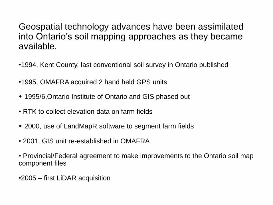
Geospatial technology advances have been assimilated into Ontario’s soil mapping approaches as they became available. •1994, Kent County, last conventional soil survey in Ontario published
•1995, OMAFRA acquired 2 hand held GPS units
• 1995/6,Ontario Institute of Ontario and GIS phased out
• RTK to collect elevation data on farm fields
• 2000, use of LandMapR software to segment farm fields
• 2001, GIS unit re-established in OMAFRA
• Provincial/Federal agreement to make improvements to the Ontario soil map component files
•2005 – first LiDAR acquisition
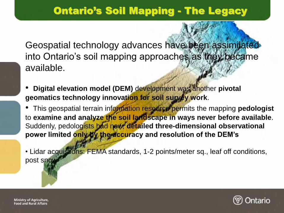
Ontario’s Soil Mapping - The Legacy
Geospatial technology advances have been assimilated
into Ontario’s soil mapping approaches as they became
available.
• Digital elevation model (DEM) development was another pivotal
geomatics technology innovation for soil survey work.
• This geospatial terrain information resource permits the mapping pedologist
to examine and analyze the soil landscape in ways never before available.
Suddenly, pedologists had new, detailed three-dimensional observational
power limited only by the accuracy and resolution of the DEM’s
• Lidar acquistions: FEMA standards, 1-2 points/meter sq., leaf off conditions,
post snow
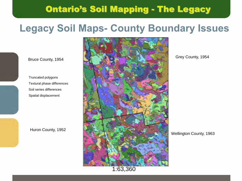
Legacy Soil Maps- County Boundary Issues
Bruce County, 1954
Huron County, 1952
Grey County, 1954
Wellington County, 1963
Truncated polygons
Textural phase differences
Soil series differences
Spatial displacement
1:63,360
Ontario’s Soil Mapping - The Legacy
10
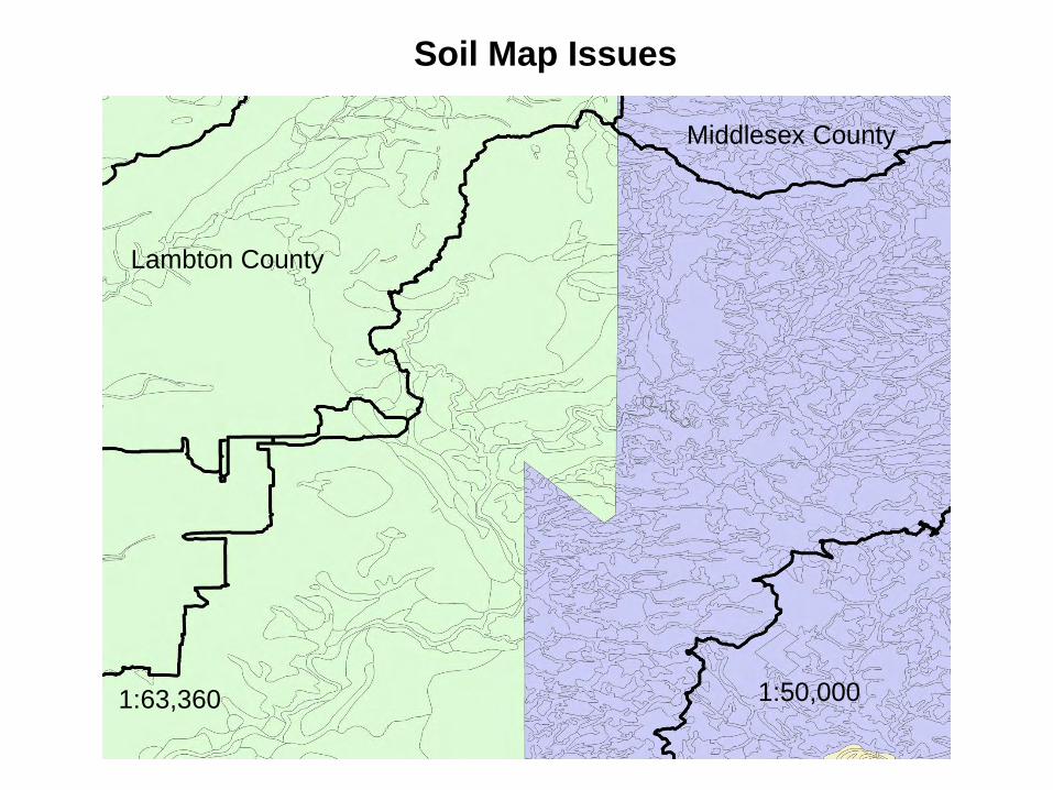
Soil Map Issues
Lambton County
Middlesex County
1:63,360 1:50,000

11
Issue:
Simple vs Complex
Map units
“Pc”
80% Perth clay
20% inclusions
“HU6/b”
60% Perth sicl
40% Brookston sicl
Ontario’s Soil Mapping - The Legacy
Geospatial technology advances have been assimilated
into Ontario’s soil mapping approaches as they became
available.
• Sometimes advances in geospatial technology applications were both
a blessing and a curse. It wasn’t until Ontario soil scientists overlaid the
county-level digital soil map products on the first provincial DEM that it was
discovered that the digitizing process had distorted and shifted soil map
unit polygons from their “concept” positions.
• This issue is not trivial as many Ontario regulations for land use
planning and environmental issues (nutrient management) lean on the
“modern” digital soil classification maps and allied soil property
derivatives for boundary delineation.
Ontario’s Soil Mapping - The Legacy
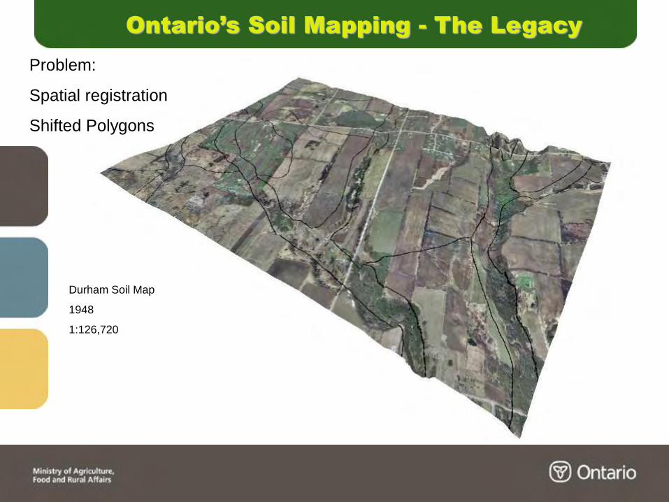
Problem:
Spatial registration
Shifted Polygons
Durham Soil Map
1948
1:126,720

Ontario’s Soil Mapping - The Present
New geospatial technology applications and innovations
are shaping Ontario’s soil map renewal approaches.
• The big question... how can the issues with the first wave of digital
technology applications to Ontario’s soil map presentation be addressed
in a systematic, time efficient and cost-effective way - with the existing
pedology staff expertise and compliment?
• The long process of Ontario soil map renewal has begun.
• After several years of systematic assessment and incremental projects, the
acquisition of high-resolution DEM’s (with sub-metre vertical accuracies)
was determined to be “mission critical” for moving forward with Ontario’s
soil map renewal efforts.
• These DEM’s are the foundation for Ontario’s new Predictive Digital Soil
Mapping (PDSM) approach that is being developed and implemented.
Ontario’s Soil Mapping - The Present
Honouring Ontario’s legacy of soil mapping in shaping the
soil map renewal approaches.
• All of Ontario’s legacy soil map products have scale dependancies and
somewhat smoothed soil unit boundary lines. Protocols were followed for
a specific number of field site inspection points per areal land unit - depending
on the final map product scale target. This cartographic constraint
traditionally “ruled” the Ontario soil mapping process.
• GIS technology has the ability to store and present data sets, developed
at different scales, concurrently. This is both a blessing and a curse for
OMAFRA in providing soil map information publicly through this medium.
• Many Ontario digital soil map product users do not understand map
scale significance and constraints. Legacy “1 inch to 1 mile” (1:63,360) soil
map information is often used at the farm property/field level for an agricultural
production, environmental or property development issue.
Ontario’s Soil Mapping - The Present
Honouring Ontario’s legacy of soil mapping in shaping the
soil map renewal approaches.
• Ontario’s soil map renewal process has been freed from the former
cartographic constraints through the adoption of a “multi-scale, nested
hierarchy” approach.
• Map production at a range of spatial scales is now a straightforward
cartographic process - not the “driver” in limiting geospatial soil map
information development.
• Soil map products can now be made available at the field-specific
management level for farmers as well as at scales ranging upwards to the
1:50,000 regional planning scale.
Ontario’s Soil Mapping - The Present
Honouring Ontario’s legacy of soil mapping in shaping the
soil map renewal approaches.
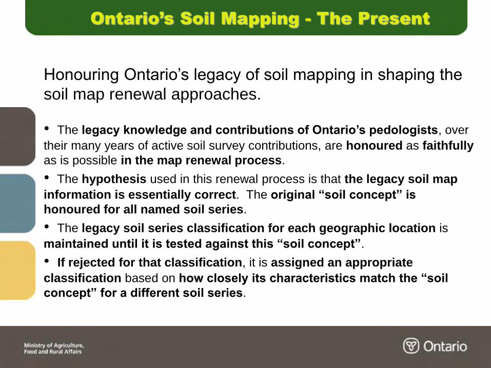
• The legacy knowledge and contributions of Ontario’s pedologists, over
their many years of active soil survey contributions, are honoured as faithfully
as is possible in the map renewal process.
• The hypothesis used in this renewal process is that the legacy soil map
information is essentially correct. The original “soil concept” is
honoured for all named soil series.
• The legacy soil series classification for each geographic location is
maintained until it is tested against this “soil concept”.
• If rejected for that classification, it is assigned an appropriate
classification based on how closely its characteristics match the “soil
concept” for a different soil series.
Ontario’s Soil Mapping - The Present
Honouring Ontario’s legacy of soil mapping in shaping the
soil map renewal approaches.
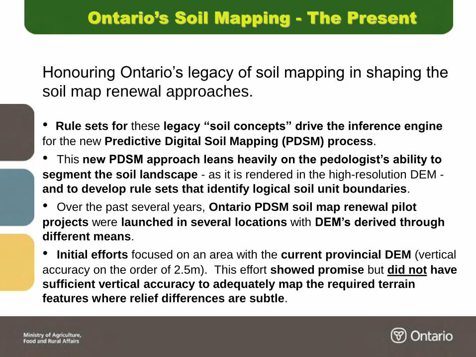
• Rule sets for these legacy “soil concepts” drive the inference engine
for the new Predictive Digital Soil Mapping (PDSM) process.
• This new PDSM approach leans heavily on the pedologist’s ability to
segment the soil landscape - as it is rendered in the high-resolution DEM -
and to develop rule sets that identify logical soil unit boundaries.
• Over the past several years, Ontario PDSM soil map renewal pilot
projects were launched in several locations with DEM’s derived through
different means.
• Initial efforts focused on an area with the current provincial DEM (vertical
accuracy on the order of 2.5m). This effort showed promise but did not have
sufficient vertical accuracy to adequately map the required terrain
features where relief differences are subtle.


Comparison of Lidar and
Provincial DEM
LiDAR Provincial
LandMapR segmentation
Ontario Agricultural Land Resource Information (OALRI) - Presentation No. 2012-06
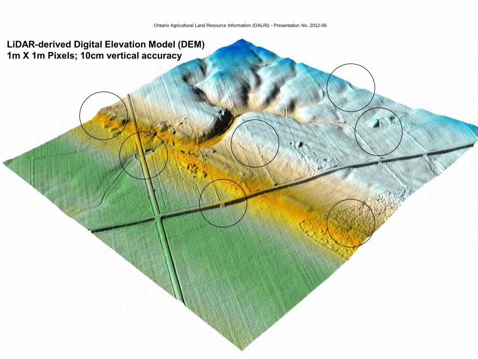
LiDAR-derived Digital Elevation Model (DEM)
1m X 1m Pixels; 10cm vertical accuracy
Ontario’s Soil Mapping - The Future
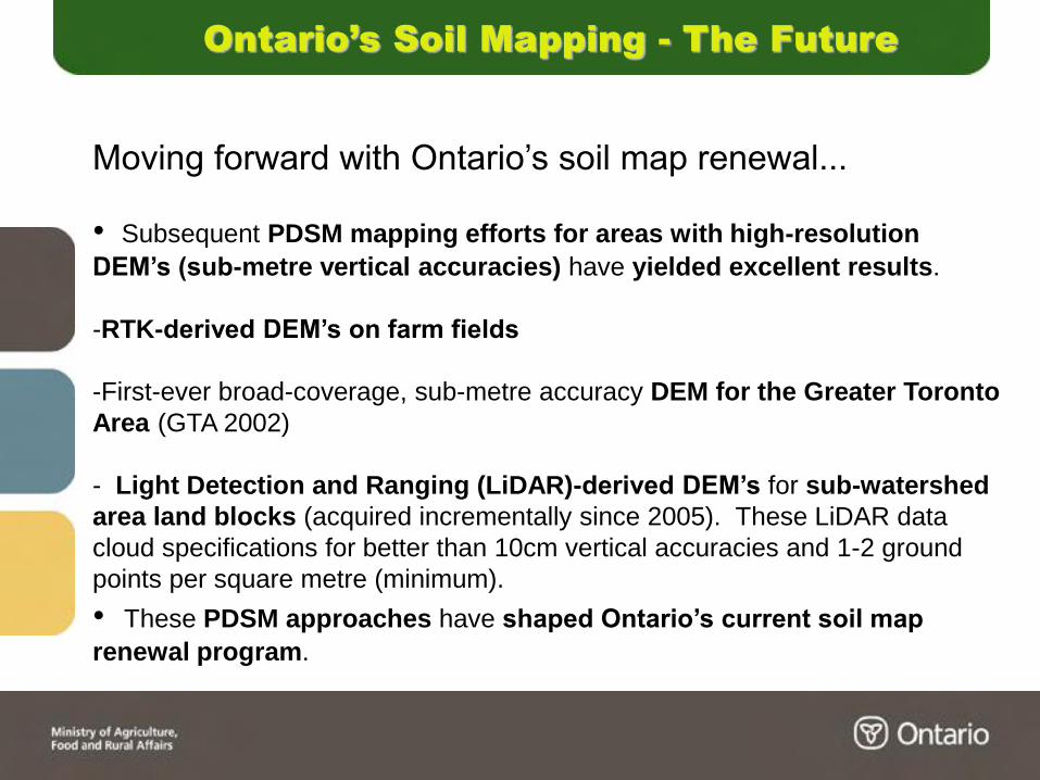
Moving forward with Ontario’s soil map renewal...
• Subsequent PDSM mapping efforts for areas with high-resolution
DEM’s (sub-metre vertical accuracies) have yielded excellent results.
-RTK-derived DEM’s on farm fields
-First-ever broad-coverage, sub-metre accuracy DEM for the Greater Toronto
Area (GTA 2002)
- Light Detection and Ranging (LiDAR)-derived DEM’s for sub-watershed
area land blocks (acquired incrementally since 2005). These LiDAR data
cloud specifications for better than 10cm vertical accuracies and 1-2 ground
points per square metre (minimum).
• These PDSM approaches have shaped Ontario’s current soil map
renewal program.
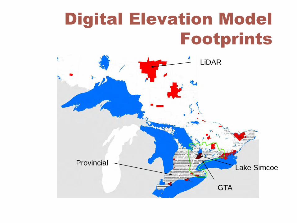
Digital Elevation Model
Footprints
LiDAR
GTA
Provincial Lake Simcoe
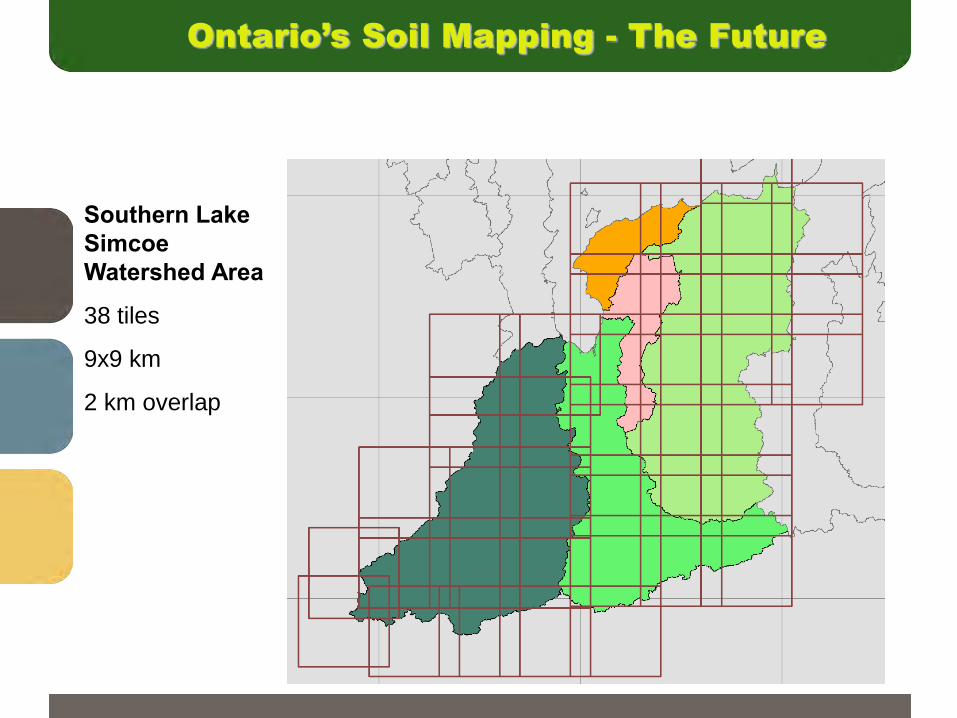
Southern Lake
Simcoe
Watershed Area
38 tiles
9x9 km
2 km overlap
Ontario’s Soil Mapping - The Future
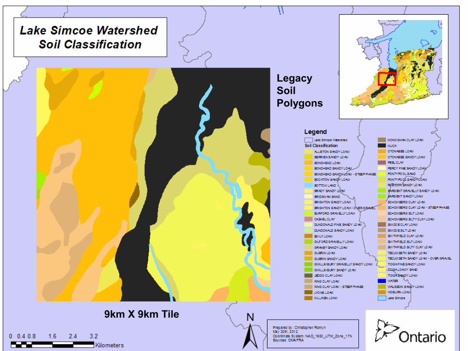
9km X 9km Tile
Legacy
Soil
Polygons

Soil Property Maps
Soil Property Mapping
Ontario’s Soil Mapping - The Future
Farm field-specific
RTK-based DEM PDSM
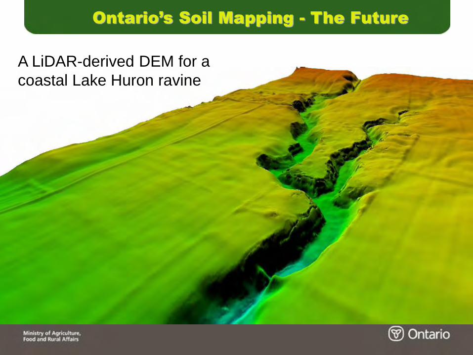
A LiDAR-derived DEM for a
coastal Lake Huron ravine
Ontario’s Soil Mapping - The Future
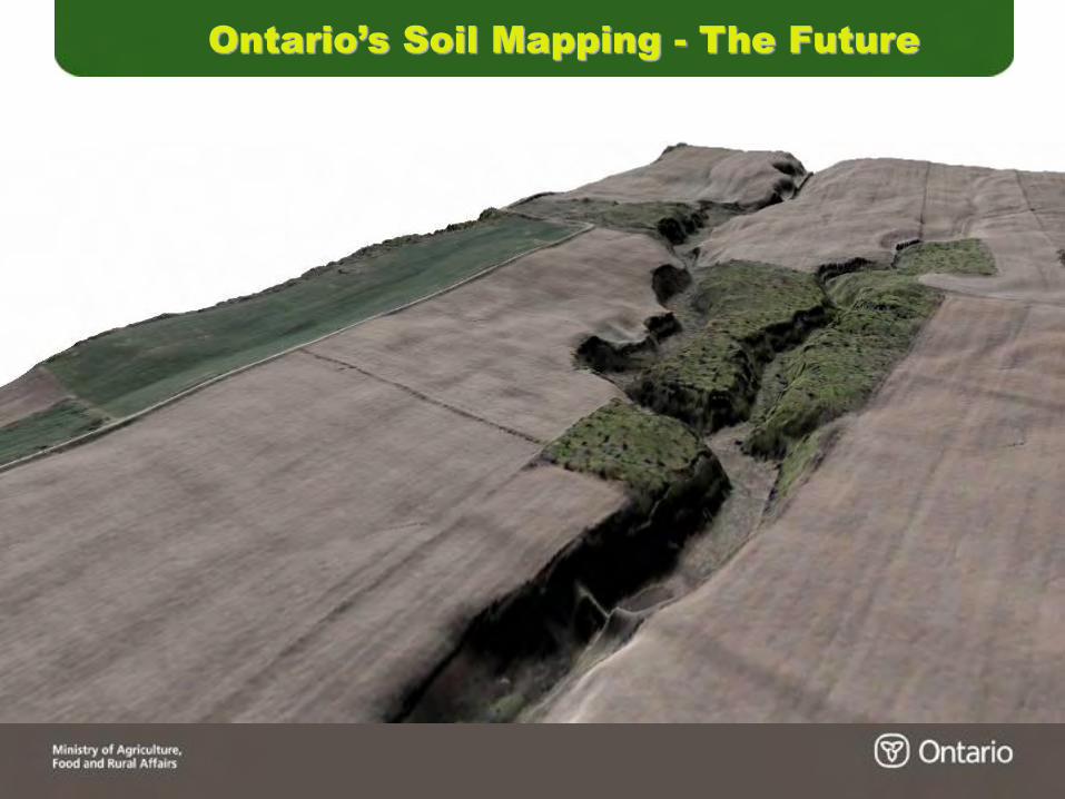
Ontario’s Soil Mapping - The Future
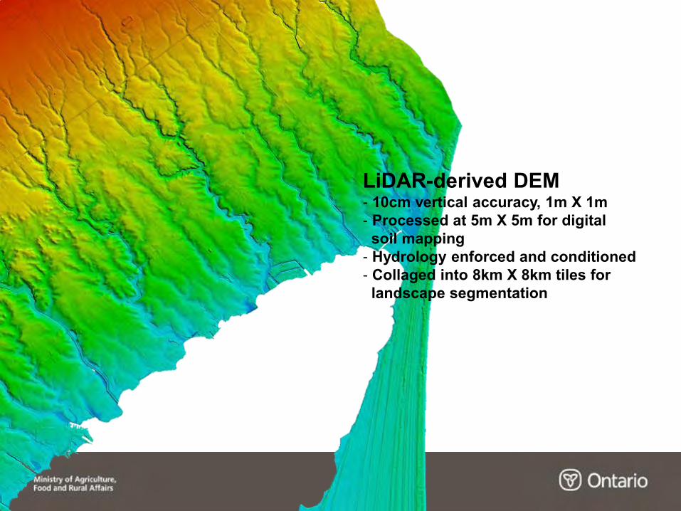
LiDAR-derived DEM - 10cm vertical accuracy, 1m X 1m
- Processed at 5m X 5m for digital
soil mapping
- Hydrology enforced and conditioned
- Collaged into 8km X 8km tiles for
landscape segmentation
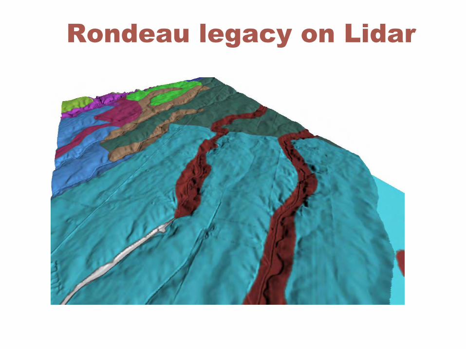
Rondeau legacy on Lidar
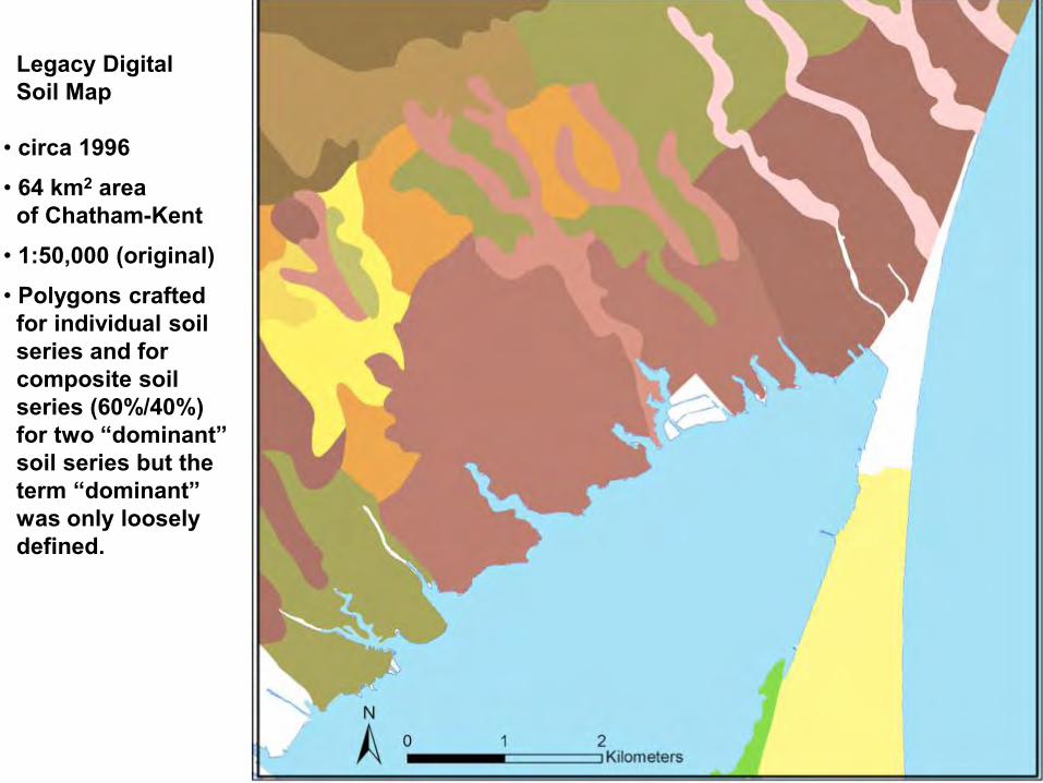
Legacy Digital
Soil Map
• circa 1996
• 64 km2 area
of Chatham-Kent
• 1:50,000 (original)
• Polygons crafted
for individual soil
series and for
composite soil
series (60%/40%)
for two “dominant”
soil series but the
term “dominant”
was only loosely
defined.

Rondeau Bay
Legacy Polygons and
Dissaggregated Polygons
Ontario Agricultural Land Resource Inventory (AgRI) - Presentation No. 2012-06
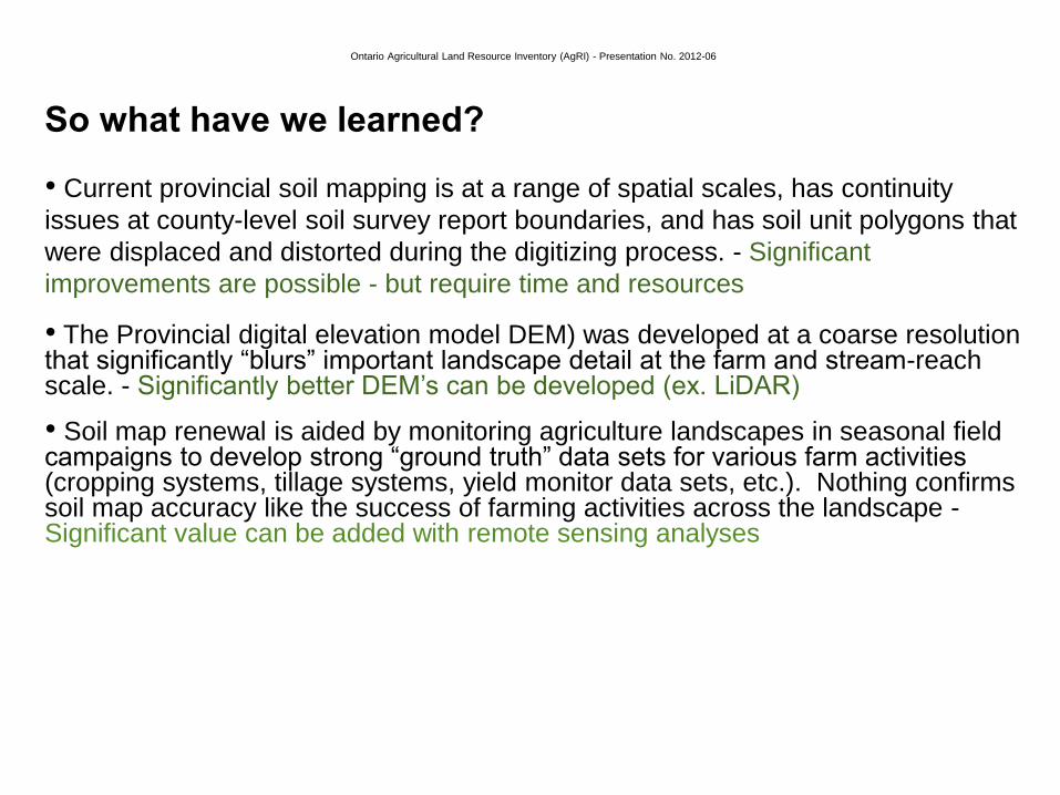
So what have we learned?
• Current provincial soil mapping is at a range of spatial scales, has continuity
issues at county-level soil survey report boundaries, and has soil unit polygons that
were displaced and distorted during the digitizing process. - Significant
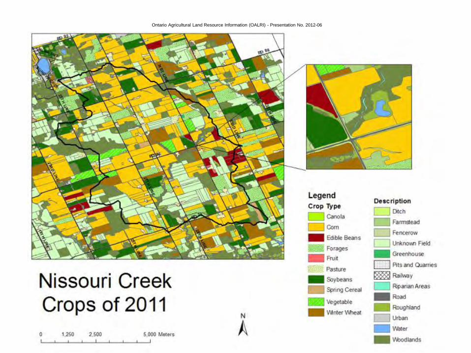
improvements are possible - but require time and resources • The Provincial digital elevation model DEM) was developed at a coarse resolution that significantly “blurs” important landscape detail at the farm and stream-reach scale. - Significantly better DEM’s can be developed (ex. LiDAR) • Soil map renewal is aided by monitoring agriculture landscapes in seasonal field campaigns to develop strong “ground truth” data sets for various farm activities (cropping systems, tillage systems, yield monitor data sets, etc.). Nothing confirms soil map accuracy like the success of farming activities across the landscape - Significant value can be added with remote sensing analyses

Ontario’s Soil Mapping - The Future
Moving forward with Ontario’s soil map renewal...
• Ontario’s current soil map renewal program
1) A common suite of soil map legend colours has been incrementally
developed for all named soil series and phases in the province.
- This GIS map layer product will be available within this fiscal year - complete
with a metadata layer.
- It gives a “standardized thematic look and feel” to the presentation of the
soil classification resource information.
- It will aid in the rapid interpretation of similarities and differences of
Ontario’s soils at local, regional and provincial scales.
- Resulting “standardized” soil map products will start to permeate
agricultural, environmental and planning reports over time. This will
facilitate soil knowledge transfer and significantly enhance
understanding of the value of the provincial asset that is the Ontario soil
map information.
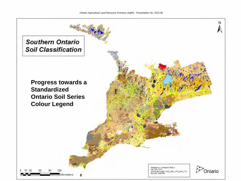
Ontario Agricultural Land Resource Inventory (AgRI) - Presentation No. 2012-06
Progress towards a
Standardized
Ontario Soil Series
Colour Legend

Ontario Agricultural Land Resource Information (OALRI) - Presentation No. 2012-06
Ginseng 2009
Ginseng
2006
Rye
2006
Ontario Agricultural Land Resource Information (OALRI) - Presentation No. 2012-06
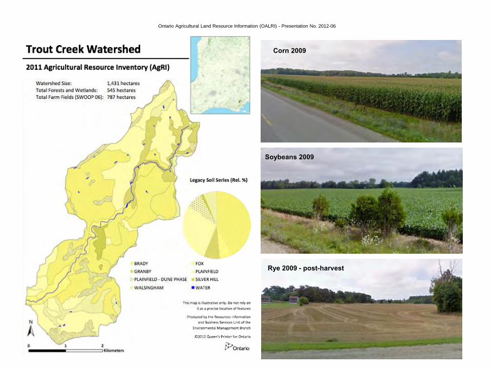
Corn 2009
Soybeans 2009
Rye 2009 - post-harvest
Ontario Agricultural Land Resource Information (OALRI) - Presentation No. 2012-06
Ontario Agricultural Land Resource Information (OALRI) - Presentation No. 2012-06
Ontario Land Agricultural Resource Information (OALRI) - Presentation No. 2012-06

Ontario Agricultural Land Resource Information (OALRI) - Presentation No. 2012-06
County
Boundary
Ontario Agricultural Land Resource Information (OALRI) - Presentation No. 2012-06
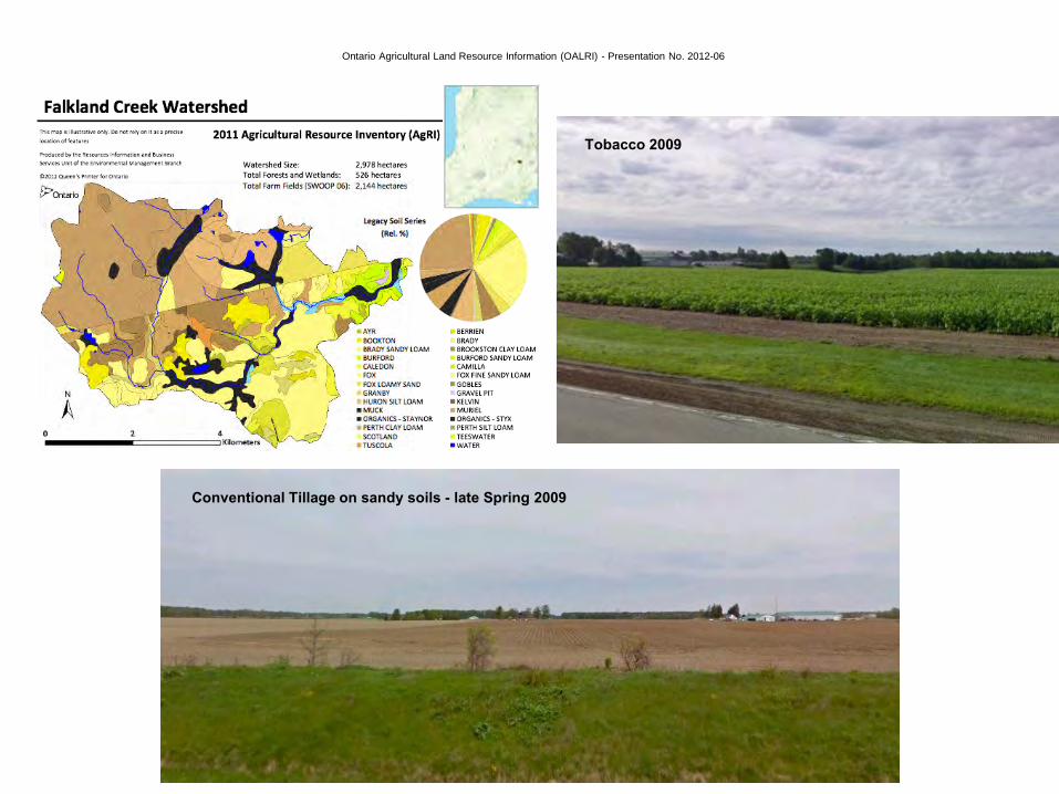
Tobacco 2009
Conventional Tillage on sandy soils - late Spring 2009

Ontario Agricultural Land Resource Information (OALRI) - Presentation No. 2012-06
Corn 2009
Soybeans 2009
Winter Wheat 2009
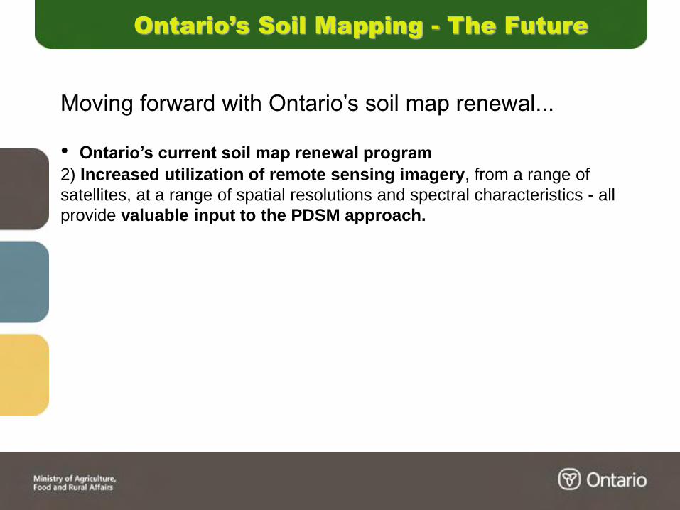
Ontario’s Soil Mapping - The Future
Moving forward with Ontario’s soil map renewal...
• Ontario’s current soil map renewal program
2) Increased utilization of remote sensing imagery, from a range of
satellites, at a range of spatial resolutions and spectral characteristics - all
provide valuable input to the PDSM approach.
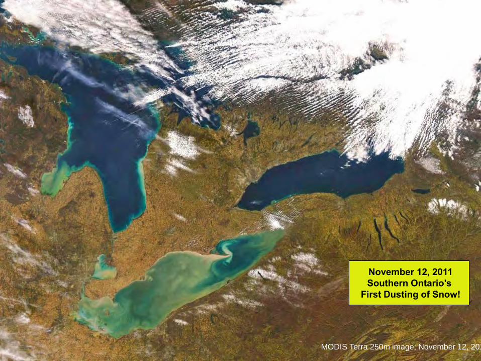
November 12, 2011
Southern Ontario’s
First Dusting of Snow!
MODIS Terra 250m image; November 12, 2011
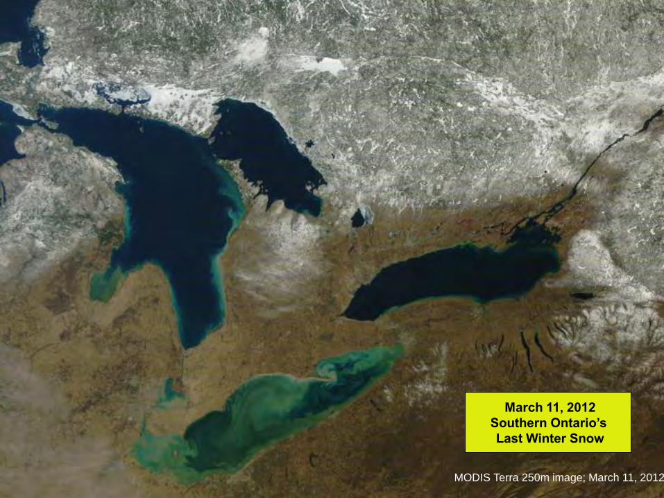
March 11, 2012
Southern Ontario’s
Last Winter Snow
MODIS Terra 250m image; March 11, 2012

Ontario’s Soil Mapping - The Future
Moving forward with Ontario’s soil map renewal...
• Ontario’s current soil map renewal program
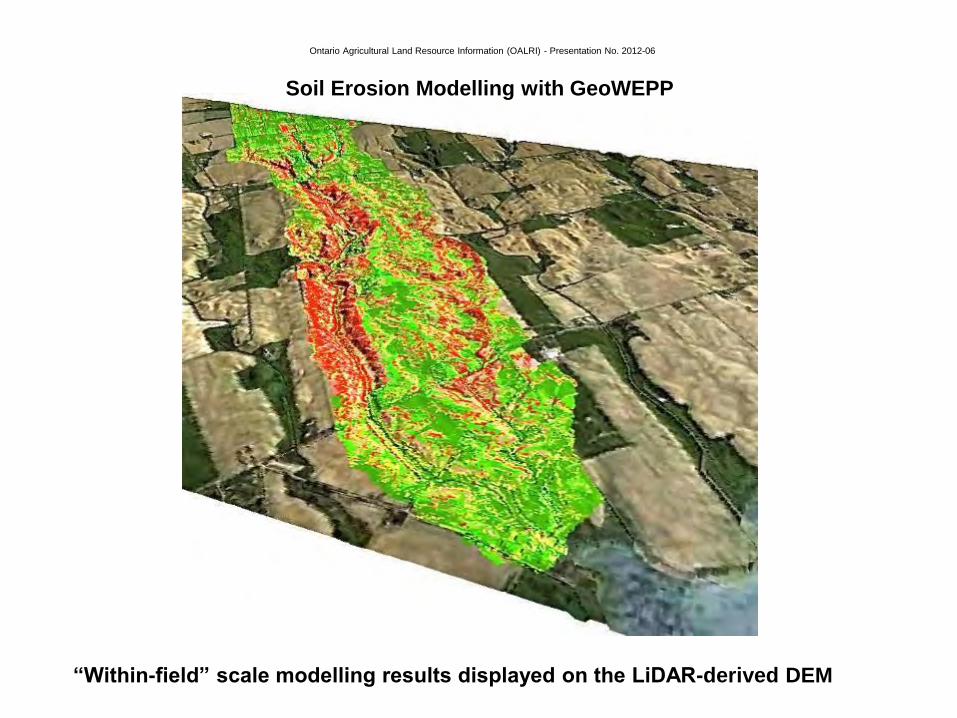
3) Derivative products will include soil erosion model results at a range of
spatial scales.
- OMAFRA RUSLE2 pilot project has been launched
- OMAFRA GeoWEPP modelling has been ongoing for several years on
selected sentinel subwatersheds
Ontario Agricultural Land Resource Information (OALRI) - Presentation No. 2012-06
“Within-field” scale modelling results displayed on the LiDAR-derived DEM
Soil Erosion Modelling with GeoWEPP

Ontario’s Soil Mapping - The Future
Moving forward with Ontario’s soil map renewal...
• Several key issues have to be addressed.
- Ontario, like all Canadian provinces, has a soil-based agricultural
economy and yet the foundational knowledge and talent to craft the
critical soil classification maps from which all other derivatives (pH, organic
matter, hydrologic properties, etc.) come has steadily declined to
unsustainable levels - who will carry on important this work into the
future?
- A long-standing arrangement (signed MOU) between Ontario and Canada
for soil science talent collaboration has all but been forgotten in the recent
provincial and federal government agricultural science restructuring.
- Ontario pedology instruction and research - particularly at the University of
Guelph - is no longer supported sufficiently to contribute to soil resource
information development and map product renewal.
Ontario’s Soil Mapping - The Future
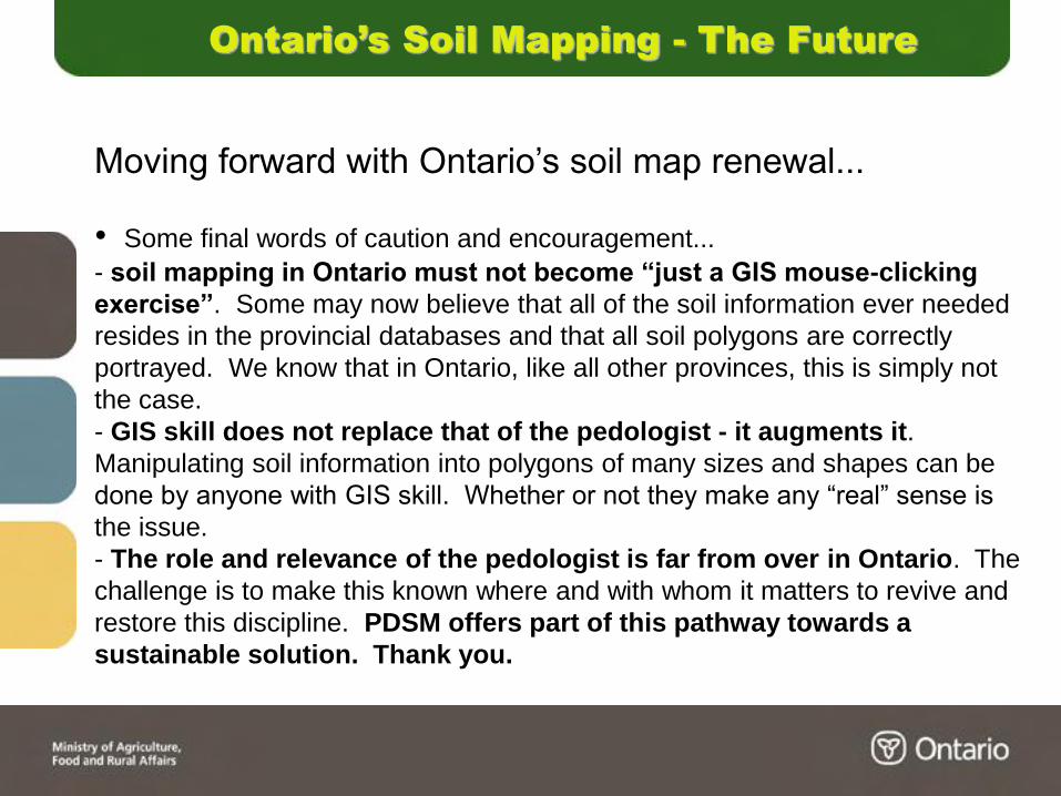
Moving forward with Ontario’s soil map renewal...
• Some final words of caution and encouragement...
- soil mapping in Ontario must not become “just a GIS mouse-clicking
exercise”. Some may now believe that all of the soil information ever needed
resides in the provincial databases and that all soil polygons are correctly
portrayed. We know that in Ontario, like all other provinces, this is simply not
the case.
- GIS skill does not replace that of the pedologist - it augments it.
Manipulating soil information into polygons of many sizes and shapes can be
done by anyone with GIS skill. Whether or not they make any “real” sense is
the issue.
- The role and relevance of the pedologist is far from over in Ontario. The
challenge is to make this known where and with whom it matters to revive and
restore this discipline. PDSM offers part of this pathway towards a
sustainable solution. Thank you.

Ontario Agricultural Land Resource Information (OALRI) - Presentation No. 2012-06
Beef Farm 2011
Corn 2011
Alfalfa 2011
Muskrat Creek - Salem Creek area - Northern Huron - Southern Bruce
Thank You!