Embed Size (px)
Citation preview
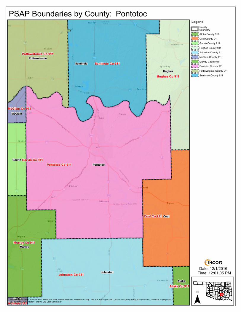
Ardmore 911
McClain Co 911
Hughes Co 911
Seminole Co 911
Atoka Co 911
Pontotoc
Coal
Johnston
Seminole
Hughes
Murray
Pottawatomie
Garvin
Atoka
McClain
Carter
Garvin Co 911Pontotoc Co 911
Johnston Co 911
Murray Co 911
Pottawatomie Co 911
Coal Co 911
Date: 12/1/2016Time: 12:01:05 PM
PSAP Boundaries by County:
¯
LegendCountyBoundaryAtoka County 911Coal County 911Garvin County 911Hughes County 911Johnston County 911McClain County 911Murray County 911Pontotoc County 911Pottawatomie County 911Seminole County 911
Pontotoc
Service Layer Credits: Sources: Esri, HERE, DeLorme, USGS, Intermap, increment P Corp., NRCAN, Esri Japan, METI, Esri China (Hong Kong), Esri (Thailand), TomTom, MapmyIndia, ©OpenStreetMap contributors, and the GIS User Community