Embed Size (px)
Citation preview

PPuukkeennuuii FFoorreesstt –– NNggaahheerree oo PPuukkeennuuii MMaannaaggeemmeenntt PPllaann
IInncclluuddiinngg PPuukkeennuuii FFoorreesstt,, WWhhaauu
VVaalllleeyy CCaattcchhmmeenntt,, CCoorroonnaattiioonn SScceenniicc RReesseerrvvee,, BBaarrggee SShhoowwggrroouunnddss aanndd
WWhhaannggaarreeii QQuuaarrrryy GGaarrddeennss
WHANGAREI DISTRICT COUNCIL
Pukenui Forest – Ngahere o Pukenui Management Plan Page 2 06/701103
Pukenui Forest – Ngahere o Pukenui Management Plan Page 3 06/701103
Pukenui Forest – Ngahere o Pukenui Management Plan
Acknowledgements
Special thanks are extended to the members of the Western Hills – Pukenui Forest Advisory Committee and of Nga Ahi Kaa o Pukenui for their dedication and encouragement in the preparation of this management plan.
Western Hills - Pukenui Forest Advisory Committee
• Vaughan Cooper - Northland Regional Council
• Jim Boswell – Local resident, Three Mile Bush Road
• Denis Hewitt - Private landowner
• Ngaio Davis - Whangarei Fifties Forward
• Sue Malloy - Northern Branch, Forest and Bird
• Murray Madden - Whau Valley Road Residents and Landcare Group
• Robyn Bregmen - Waiarohia Streamcare
• Rudi Hoetjes - Northland Region, Fish & Game New Zealand
• Murray Jagger - Whangarei Agricultural and Pastoral Society Inc.
• Ann Neill/Gerry Brackenbury/Linda Wigley - Whangarei Museum and Heritage Park
• David Muir – Project Manager, Whangarei Quarry Gardens Trust
• Alan Martin – Tramping Clubs rep
• Julie Holt – Education (Primary)
• Andrew Saunders – Northland Polytechnic
Nga Ahi Kaa o Pukenui (The original people who kept the fires burning for their grandchildren)
• Hoori (George) Tuhiwai – Te Parawhau Te Korokota Te Tirarau Marae
• Fred Tito - Te Parawhau Te Korokota Te Tirarau Marae
• Richard (Dick) Shepherd – Ngati Kahu o Torongare
• Takiri Puriri - Ngati Kahu o Torongare
• Sharon Kaipo – Mangakahia Maori Komiti
• Rev. Haki (Jack) Parata – C/- Whangarei Terenga Paraoa Marae

Pukenui Forest – Ngahere o Pukenui Management Plan Page 4 06/701103
Contents Cultural Preface.........................................................................................................6 Rainbow over Pukenui ...............................................................................................7 Section 1 Introduction..........................................................................................8
1.1 Purpose of this Management Plan ...................................................................................8 1.2 Plan Review ..................................................................................................................8 1.3 Location and General Description....................................................................................8 1.4 Land Tenure and Status............................................................................................... 11 1.5 Statutory and Planning Context .................................................................................... 13 1.6 Department of Conservation and Whangarei District Council ........................................... 13
Section 2 Vision, Outcomes and Objectives.........................................................15 2.1 Vision ......................................................................................................................... 15 2.2 Outcomes ................................................................................................................... 16 2.3 Objectives................................................................................................................... 16
Section 3 Natural Heritage .................................................................................19 3.1 Geology...................................................................................................................... 20 3.2 Soils ........................................................................................................................... 21 3.3 Hydrology................................................................................................................... 23 3.4 Landscape .................................................................................................................. 24 3.5 Ecology ...................................................................................................................... 28 3.6 Restoration ................................................................................................................. 32 3.7 Fire Management ........................................................................................................ 42
Section 4 Cultural and Historic Heritage .............................................................44 4.1 Tikanga Maori ............................................................................................................. 45 4.2 European/Pakeha Associations...................................................................................... 45 4.3 Archaeology................................................................................................................ 47 4.4 Managing Cultural and Historic Heritage ........................................................................ 48
Section 5 Recreation and Tourism ......................................................................50 5.1 Visitor Management Policy............................................................................................ 51 5.2 Visitor Use .................................................................................................................. 51 5.3 Information, Interpretation and Education ..................................................................... 53 5.4 Access........................................................................................................................ 55 5.5 Facilities and Services: General..................................................................................... 60 5.6 Facilities and Services: Pukenui Forest – Forested Portion ............................................... 61 5.7 Facilities and Services: Barge Showgrounds ................................................................... 63 5.8 Facilities and Services: Whangarei Quarry Gardens......................................................... 69 5.9 Commercial Recreation and Tourism ............................................................................. 70
Section 6 Whau Valley Water Supply ..................................................................72 6.1 Changes to the Management of Water Supplies ............................................................. 73 6.2 Future Water Sources .................................................................................................. 73
Section 7 Other Land Uses ..................................................................................75 7.1 Grazing....................................................................................................................... 75 7.2 Forestry...................................................................................................................... 75 7.3 Network Utility Services ............................................................................................... 76
Section 8 Surrounding Land Uses .......................................................................78

Pukenui Forest – Ngahere o Pukenui Management Plan Page 5 06/701103
8.1 Whangarei Museum and Heritage Park .......................................................................... 79 8.2 Quarry Arts Centre ...................................................................................................... 80 8.3 Quarrying ................................................................................................................... 80 8.4 Rural and Rural-Residential Use .................................................................................... 81
Section 9 Where to From Here? ..........................................................................82 9.1 A Community Management Body .................................................................................. 82 9.2 Reserves Act ............................................................................................................... 82 9.3 Resource Management Act – Whangarei District Plan ..................................................... 83 9.4 Land Acquisition .......................................................................................................... 83
Glossary and Abbreviations .....................................................................................85 References...............................................................................................................88 Appendices ..............................................................................................................89
Appendix 1 Land Titles and Status ..................................................................................... 90 Appendix 2: Legislation........................................................................................................... 93 Appendix 3: Vegetation of Pukenui Forest – Forested Portion..................................................... 97 Appendix 4: Flora of Barge Showgrounds ............................................................................... 100 Appendix 5: Fauna of Pukenui Forest – Forested Portion ......................................................... 102 Appendix 6: Fauna of Barge Showgrounds ............................................................................. 104
Figures
Figure 1: Pukenui Forest (Western Hills) and surrounds ............................................................ 10
Figure 2: Barge Showgrounds – Restoration ............................................................................ 38
Figure 3: Access into Pukenui Forest ....................................................................................... 56
Figure 4: Barge Showgrounds – Recreation ............................................................................. 66

Pukenui Forest – Ngahere o Pukenui Management Plan Page 6 06/701103
Cultural Preface
Whakatauki
Hutia te rito o te harakeke
Kei hea te komako e ko
Ki mai ki ahau
He aha te mea nui I te Ao
Maku e ki atu
He tangata, he tangata, he tangata.
To give focus and an expression of feeling for the forest, Pukenui, this whakatauki (proverb) was chosen as it sums up the common person’s understanding of all things being equal and connected. It exemplifies the common person’s belief that the valleys, rivers, lakes, mountains, birds, animals, sea and forests are our partners in life – integrated and inseparable. It severs the notion that the importance of people is based on material wealth, social and economic needs but gains momentum when it is seen that the heart of the harakeke (flax) remains intact and the komako (bellbird) is able to use it as the rostrum to herald the message that a healthy people, a healthy environment provides for a healthy nation.
E mihi atu ki nga kaumatua i runga te taumata o Ngapuhi mo ratau manaakitanga ia matau te roopu anei “Te Ahi Kaa O Pukenui”. E mihi atu ki nga kai tuhituhi i tenei whakatauki, e whakatauki tino aroha mo nga mea katoa i roto i te Ao Maori.

Pukenui Forest – Ngahere o Pukenui Management Plan Page 7 06/701103
Rainbow over Pukenui
A spring morning,
New season dawning
Gently falling rain
Papatuanuku weeps to the refrain
Of tui high on kowhai nectar
Whilst kereru noisily patrol their sector.
The marvel of creation renewing its soul
Refurbishing life forces – to make a forest whole.
Taniwha’s linger as guardians of the past
Assisting our preservation efforts to last
Rebuilding and reconciling commences in the heart
The rainbow a manifestation of a season’s new start.
A divine symbol to call us to arms.
And forever preserve Whangarei’s pristine charms.
Photo: Kukupa
Copyright: http://www.richard-seaman.com/Wallpaper/Nature/Birds/ForestAndField/index.html
Poem: Alan Martin, Tramping Clubs rep., Western Hills – Pukenui Forest Advisory Committee
Chief of Seattle – Cree Indian Wisdom
Only when the last tree has died,
The last river has been poisoned
And the last fish has been caught,
Will we realise that we cannot eat money.

Pukenui Forest – Ngahere o Pukenui Management Plan Page 8 06/701103
Section 1 Introduction
1.1 Purpose of this Management Plan
The Pukenui Forest – Ngahere o Pukenui Management Plan contains specific management provisions for public land administered by the Whangarei District Council (WDC) and Department of Conservation (DOC) in the hills to the immediate west of Whangarei city.
It has been prepared in accordance with Section 41 of the Reserves Act 1977. Section 41(3) of the Act sets out the purpose of a reserve management plan, which is to:
“ provide for and ensure the use, enjoyment, maintenance, protection, and preservation … and development, as appropriate, of the reserve for the purposes for which it is classified.”
With respect to the DOC-administered portion of Pukenui Forest, this plan also serves as a conservation management plan in terms of the Conservation Act 1987 (section 17E). It is consistent with the wider “Conservation Management Strategy for Northland, 1999-2009” (DOC).
The relationship of the management plan to any iwi management plans prepared for the area has yet to be determined.
Pukenui (‘big hill’) is a prominent feature in the southern portion of the hills to the west of Whangarei city. To Maori, Pukemiro (“hill of miro trees”) represents the northern portion of these hills – approximating the area referred to as Coronation Scenic Reserve. For the purposes of this management plan, Pukenui Forest/Ngahere o Pukenui is used to note the contiguous bushed area extending along the western fringe of Whangarei city, and its adjacent buffers of Barge Showgrounds and Whangarei Quarry Gardens.
1.2 Plan Review
The management plan, once approved, has a proposed 10 year life. A full review of the plan will be conducted at the completion of this period.
The long term vision for Pukenui Forest is set out in this plan. It is what we all, community and agencies alike, wish to see achieved for the forest. Although agencies such as WDC, DOC and NRC can achieve some of this vision, much relies on community support and commitment in getting behind this vision. By its very complexity and enormity of task, “long term” means beyond the ten year timeframe of this plan; we will still be working together on projects to achieve the stated vision for Pukenui Forest in 20-30 years time.
1.3 Location and General Description
“The people of Whangarei City are ever so fortunate in having such a treasure at their doorstep (Local Whangarei resident).
A prominent feature of the Whangarei landscape and easily seen from many parts of the city, Pukenui Forest – Ngahere o Pukenui abuts the western edge of the city from Maunu in the south to Western Hills Drive and Kamo in the north, and northwest to Three Mile Bush (Figure 1). It encompasses an area of some 1700 hectares of public land, administered by WDC and DOC.
Public access into the forest is via motor vehicle, horse (as appropriate), cycle or foot to various entry points located around the perimeter, and from there by foot into the interior (Figure 1).
The Pukenui Forest/Whau Valley water supply catchment is a relatively large area of native (temperate) lowland broadleaf forest. This type of habitat is now rare in Aotearoa/New Zealand. It is

Pukenui Forest – Ngahere o Pukenui Management Plan Page 9 06/701103
known to contain a number of threatened species, including long tailed bat, North Island brown kiwi and NZ wood pigeon (kukupa). It is the largest contiguous area of relatively unmodified native forest within 20 kilometres of Whangarei city and probably the best of very few such areas within the district. As part of a continuous corridor from Maungatapere to Three Mile Bush, and with nearby Parihaka, it forms a natural back-drop for Whangarei city.
Cultural sites in the area of importance to Maori and Pakeha include the Kauika Pa site, Pa of Te Parawhau, remnants of former logging and quarrying activities.
Its proximity to Whangarei city provides opportunities for tangata whenua and other local community members to become actively involved as kaitiaki (guardians) as they put into practice a shared common vision for the area.
Community thoughts expressed on Pukenui:
“An asset for the whole of Whangarei”
“Gives Whangarei people a sense of identity”
“Peace and serenity of the forest”
“An undeveloped skyline”
“Visually stunning”
There is no one single value that should be seen as the most important part of Pukenui Forest – Ngahere o Pukenui. It is a connected whole. To view the connectedness between te whenua (the land), nga rakau (the trees), te korero o nga manu (the song of the birds), he tangata (the people) and te wairua (the spirit of the place) is to see the richness of the area as one. This is Pukenui Forest – Ngahere o Pukenui.

Pukenui Forest – Ngahere o Pukenui Management Plan Page 10 06/701103

Pukenui Forest – Ngahere o Pukenui Management Plan Page 11 06/701103
1.4 Land Tenure and Status
Land parcels in Pukenui Forest covered by this management plan are listed below and shown on Figure 1).
• Pukenui Forest (DOC-administered portion)
• Whau Valley Catchment
• Coronation Scenic Reserve
• Maunu Scenic Reserve
• Barge Showgrounds*
• Whangarei Quarry Gardens
• Several smaller reserves around the perimeter to be managed as part of the area e.g. “Glendale Road” Scenic Reserve.
Together, these public lands total 1700 hectares.
A complete list of land titles and status for Ngahere o Pukenui is given in Appendix 1 in this management plan. Information given below concentrates only on legal status, area and any associated leases or licences. For historical information on land parcels in the area, see Section 4: Cultural and Historic Heritage.
Pukenui Forest (DOC)
Administered by DOC, the Pukenui Forest has an area of 592 hectares. It is classified as a Conservation Park under section 19 of the Conservation Act 1987. Such areas are managed to protect their natural and historic resources, and consistent with this provision, to facilitate public recreation and enjoyment.
Whau Valley Water Catchment
Whau – a native tree.
With an area of 865 hectares, the Whau Valley catchment is owned and managed by WDC. The majority of this area, 690 hectares or 80%, is classified as Local Purpose (Water Supply) Reserve under the Reserves Act 1977. The majority of this area is also recognised as a Water Catchment under the council’s Water Supply Bylaw 2000. The land is held in fee simple.
Coronation Scenic Reserve
The Coronation Scenic Reserve is owned and managed by WDC. It has an area of 102 hectares, all but 1.5 hectares of which is gazetted as a Scenic Reserve under section 19 of the Reserves Act 1977. Scenic reserves are managed for the protection and preservation of their natural or scenic values and for the benefit, enjoyment, and use of the public.
Maunu Scenic Reserve
Located in proximity to North Ridge Rise, to the north of Millington Road and Golf Harbour Drive, Maunu, and abutting both the Whau Valley catchment and Pukenui Forest (DOC), are two small reserves shortly to be amalgamated into one and named Maunu Scenic Reserve. Together they comprise 38.7 hectares, owned and managed by WDC.
The larger of the two land parcels, at 26.7 hectares, was acquired under the Public Works Act 1981, by agreement with the former owners, John (Jack) Guy and Marie Guy, for a scenic reserve and vested in the former Whangarei City Council. As such, it automatically becomes subject to the

Pukenui Forest – Ngahere o Pukenui Management Plan Page 12 06/701103
Reserves Act 1977 provisions for scenic reserves. The smaller land parcel was vested on deposit of subdivision plan (Golf Harbour) to WDC.
Barge Showgrounds
Barge Showgrounds has an area of 64.6 hectares. The land is held by WDC in Fee Simple. It is not recognised or protected under the Reserves Act. While this management plan can only provide guiding principles for Barge Showgrounds inclusion of this land recognises its role in the integrated management of Pukenui/Western Hills1.
The Whangarei Agricultural and Pastoral Society (referred in this plan as ‘A & P Society’) have a 21 year lease over a 1.5 hectare area near SH 14 within Barge Showgrounds. It contains the cattle sheds and adjacent grassed area. The lease commenced 1 July 2002 with a right of renewal for the same period and an option for purchase by the lessee. The lease was granted on the condition that the A & P Society continues to function for the purposes of the Agricultural and Pastoral Societies Act. It provides for activities such as the temporary accommodation of livestock; the holding of any show, exhibition, sale or display; conducting of specialist tuition, craft schools, conventions, meetings, fair ground amusements and dancing; administration offices and parking of vehicles; holding of sports and recreational activities both indoor and outdoor; operation of a camping ground and associated amenities for temporary accommodation of users of the Showgrounds. Permission for such activities represents a carrying over of the rights given to A & P Society when they were operating on Kensington Park.
The A & P Society has user rights on the upper fields and lower fields of Barge Showgrounds.
The A & P Society has a second lease with the WDC, for land on which is situated the Barge Showgrounds Events Centre.
The Whangarei Riding Therapy Centre (formerly recognised and noted in their lease agreement as the “Whangarei Group of Riding for the Disabled Association Inc.”) leases an area of 5.3 hectares of Barge Showgrounds from the WDC. The lease allows the use of the land for sheep, cattle and horse grazing. According to the lease, “no activities shall be undertaken which are in any way commercial in nature (e.g. horse trekking, riding schools, etc.)” The erection of any further or additional buildings requires the prior written consent of the Council. Weed and animal pest control is required. The lease has a 20-year term commencing 1 March 1994.
In 2003, the WDC, Northland Area Equestrian Federation and Northern Area Pony Club signed a Licence providing for the equestrian interests to use Barge Showgrounds for an equestrian cross country course. The Licence is valid for five years. See Section 5.7.1 for further information on equestrian activities in Barge Showgrounds.
Whangarei Quarry Gardens
Owned by WDC and managed on behalf of Council by the Whangarei Quarry Gardens Trust is the 24.2 hectare Whangarei Quarry Gardens, located off Russell Road, Whangarei. The land is held in fee simple. It is not recognised or protected under the Reserves Act 1977. (See Sections 9.2: Reserves Act and related 9.6: Policies and Actions for information on WDC’s intention to classify as recreation reserve Barge Showgrounds (excluding the 1.5 hectare area described above) and Whangarei Quarry Gardens.)
The Whangarei Quarry Gardens Trust, a charitable body, was formed to look after planned development at the Russell Road quarry site. It is recognised as a Council Organisation (CO) under
1 Land which is not subject to the Reserves Act can be included in a Management Plan but the plan has no statutory weight for that land and Council cannot be bound by the terms of the act (Reserves Act Guide, 1999).
Pukenui Forest – Ngahere o Pukenui Management Plan Page 13 06/701103
the Local Government Act 2002. This means the Council has an involvement and close working relationship, but not a significant interest or influence over the Trust. It must monitor the performance of the Trust. Council continues to assist in funding the operations of the Trust through its annual plans and Community Fund I.
A 25 year lease was issued under the Local Government Act 1974 to the Whangarei Quarry Gardens Trust, commencing 1 September 2000. The lease enables the Trust to develop and maintain the Russell Road Quarry as public gardens. The lessee may with the prior written consent of the WDC undertake commercial uses and activities on the land provided they are ancillary to the use as public gardens. See Section 5.9: Commercial Recreation and Tourism for further discussion on this theme.
Small Reserves
Four smaller blocks of land neighbouring the Whangarei Quarry Gardens and Coronation Scenic Reserve will be added to and managed as part of Coronation Scenic Reserve, recognising and protecting their scenic and conservation values. They include a 6.9 hectare scenic reserve at the end of Glendale Road, Maunu and a 4.0 hectare land parcel abutting the southwest boundary of the Whangarei Quarry Gardens. Further details are given in Appendix 1: Land Titles and Status.
1.5 Statutory and Planning Context
The primary acts and bylaws which affect the management of the area are as follows.
• Reserves Act 1977
• Conservation Act 1987
• Wildlife Act 1953
• Historic Places Act 1993
• Local Government Act 2002
• Resource Management Act 1991 (and its Amendment of 2003)
• Treaty of Waitangi Act 1975 (and its Amendment of 1985)
• Biosecurity Act 1993
• Wild Animal Control Act 1977
• WDC’s Water Supply Bylaw 2000
Details of their provisions as they relate to Ngahere o Pukenui are given in Appendix 2: Legislation.
1.6 Department of Conservation and Whangarei District Council
Department of Conservation
Mission:
To conserve New Zealand’s natural and historic heritage for all to enjoy now and in the future.
He aata whakaute, manaaki, me te tiaki ia Papatuanuku ki Aotearoa kia uu tonu ai toona whakawaiuutanga hei oranga ngakau moo te tini te mano inaaianei, aake tonu ake.
Vision:
New Zealand’s natural and historic heritage is protected, people enjoy it and are involved with the department in its conservation.

Pukenui Forest – Ngahere o Pukenui Management Plan Page 14 06/701103
Kei te mahi ngaatahi te Papa Atawhai me ngaa iwi whaanui kit e whakaute, te manaaki me te tiaki I ngaa taonga koiora me ngaa taonga tuku iho o Aotearoa hei painga moo te katoa.
The legislative mandate of DOC is the Conservation Act 1987 and other key statutes such as the National Parks Act 1980 and Reserves Act 1977 – see Appendix 2: Legislation for further details.
DOC also advises the Minister of Conservation and the Government and implements Government policy.
Whangarei District Council
Vision for the Whangarei District:
To be a vibrant attractive and thriving District by developing sustainable lifestyles based around our unique environment: the envy of New Zealand and recognised world wide.
Ka kitea to Ihi, te Ataahuatanga kia anga mua tonu nga mahi I roto I too taatou rohe. Kia puumau tonu, te ahurei oo te Ti Ao. Ka aahua koohaehae te titiro mai oo tea o whanui ki a Aotearoa.
Mission for the Whangarei District:
Creating the ultimate living environment.
Aauaha mutunga kore o te Aao tuuroa.
The WDC plans for and manages land use and subdivision activity within the district. It also develops and maintains a wide range of public services and facilities, including parks and reserves, to provide for a quality lifestyle for people living in the district.

Pukenui Forest – Ngahere o Pukenui Management Plan Page 15 06/701103
Section 2 Vision, Outcomes and Objectives
2.1 Vision
The Vision (Section 2.1) and Outcomes (Section 2.2) provide a statement of how the people of Whangarei would like to see Pukenui Forest – Ngahere o Pukenui in the future. From this statement, specific Objectives (Section 2.3), and Policies and Actions (throughout the plan) are developed to enable on-ground projects to happen, resulting in the Vision and Outcomes becoming a reality. The Objectives and their corresponding Policies and Actions are repeated throughout this management plan.
Pukenui taonga a forest treasure a beating heart with our help its health and wellbeing remains, for future generations Whakahoki te mana te oranga me te wairua o te taonga nei hei tohu mo o tatou mokopuna
Photo: Tui
Copyright: Travelindex – New Zealand Native Birds
Pukenui Forest – Ngahere o Pukenui Management Plan Page 16 06/701103
2.2 Outcomes 2.2.1 Pukenui is a fully functioning forest ecosystem capable of representing natural biodiversity.
2.2.2 Cultural and historic significant heritage sites, places and landscapes in the forest are identified, acknowledged, respected and protected.
2.2.3 The restoration inspires the community and visitors to undertake their own action.
2.2.4 The results of an ongoing research programme are applied to enhance the management of the forest.
2.2.5 Information, interpretation, education and concessions are available to help visitors understand, protect and appreciate the area.
2.2.6 High quality facilities and services are located so visitors see and enjoy the area.
2.2.7 Tangata whenua, neighbouring landowners and the community are actively involved in the guardianship (kaitiakitanga) and conservation of the forest supported by the Whangarei District Council, Department of Conservation and Northland Regional Council.
2.3 Objectives
2.3.1 General
• To protect and manage Pukenui Forest as an integral part of the Whangarei open space network.
2.3.2 Natural Heritage
Geology
• To protect the enduring nature and values of the whenua (land), and recognise and provide for geological features.
Soils
• To protect the soil resource and soil processes to assist in naturally functioning ecosystems.
Hydrology
• To protect and maintain the health (waiora) of the natural water systems flowing through the forest, Barge Showgrounds and Whangarei Quarry Gardens.
Landscape
• To maintain, and where necessary enhance, landscape, scenic, aesthetic and visual values of the forest.
Ecology
• To conserve and protect indigenous flora and fauna, their natural communities and habitats, indigenous species diversity and nationally threatened or regionally significant indigenous species.
Pukenui Forest – Ngahere o Pukenui Management Plan Page 17 06/701103
Restoration
• To restore to the Pukenui Forest and associated wetlands a healthy diversity of indigenous plants and animals and of ecological processes within the forest.
Fire Management
• To reduce the threat of fire, and protect people, built structures and facilities from fire in Pukenui Forest.
Scientific Research and Monitoring
• To undertake, support and encourage scientific research and monitoring that provides information which is relevant to understanding, interpreting and managing the forest and its surrounds.
2.3.3 Cultural and Historic Heritage
• To protect heritage sites, places and landscapes in Pukenui Forest – Ngahere o Pukenui.
• To interpret the cultural and spiritual significance of heritage sites, places and landscapes in consultation with tangata whenua and other interested parties.
2.3.4 Recreation
Visitor Management Policy
• To put in place appropriate policy to manage visitors to Pukenui Forest.
Visitor Use
• To more fully understand visitor use, numbers, characteristics, behaviour, needs and expectations in order to provide for effective visitor management and improve the quality of visitor experience.
Information, Interpretation and Education
• To enhance visitor understanding and appreciation of the natural and cultural values of the area, and assist visitor enjoyment.
Access
• To provide for suitable access to the forest, whilst protecting its natural and cultural values, water supply requirements and visitor experiences within the area.
Facilities and Services (Pukenui Forest – forested portion)
• To provide facilities and services appropriate to the retention of a rural, natural setting with a low degree of challenge for visitors.
Facilities and Services (Barge Showgrounds)
• To develop and maintain Barge Showgrounds as a focal point for public recreational and tourism events in Pukenui Forest.
Facilities and Services (Whangarei Quarry Gardens)
• To provide facilities and services appropriate for the development and maintenance of an internationally recognised subtropical garden on a former quarry site, consistent with the

Pukenui Forest – Ngahere o Pukenui Management Plan Page 18 06/701103
conservation and enhancement of the local ecology and providing a special place for community interaction.
Commercial Recreation and Tourism
• To ensure any commercial recreation and tourism operations established in Pukenui Forest – Ngahere o Pukenui are managed sustainably and ensure minimal impact on the environment, protection of the spirit (wairua) of the forest, protection of the natural and cultural values of the forest and the quality of visitor experience.
2.3.5 Other Uses
Whau Valley Water Supply
• To improve the supply of high quality water for Whangarei city.
Grazing
• To phase out the grazing of cattle on Barge Showgrounds.
Forestry
• To convert Whau Valley Forest from exotic production to native bush conservation.
Network Utilities
• To recognise and protect the existing network utility infrastructure located within or traversing Pukenui Forest – Ngahere o Pukenui.
• To protect public safety.
Surrounding Land Uses
• To work with adjacent landowners, including the Whangarei Museum & Heritage Park, Northland Craft Trust, commercial and residential property owners, to ensure the protection of the health and well-being of Pukenui Forest – Ngahere o Pukenui.
Where To From Here?
• To put in place a community management structure to assist with the long-term management of Pukenui Forest – Ngahere o Pukenui.
• To use available legislation to strengthen protection of the natural, cultural and spiritual values of Pukenui Forest.

Pukenui Forest – Ngahere o Pukenui Management Plan Page 19 06/701103
Section 3 Natural Heritage
Photo: Mida or Willow-leaved maire
Copyright: HALEY 2001, Hauturu, www.y23.com

Pukenui Forest – Ngahere o Pukenui Management Plan Page 20 06/701103
3.1 Geology
Pukenui Forest – Ngahere o Pukenui sits astride the eroded remnant of the greywacke Maunu Fault Block, one of many such fault blocks that make up the hill country along the east coast of Northland from the Brynderwyn Range in the south to Mangonui Harbour in the north and extending inland to Ruatangata. The fault block, defined by fault lines on all four sides but particularly to the north and south, is an uplifted piece of the earth’s crust that has tilted to the north, with a steeper scarp slope above the Maunu Fault on the southern edge from near the top of Fourth Avenue in Whangarei and along Kara Road, and the more gentle dip slope facing to the north.
Overlying the greywacke, are successive layers of sandstone, crystalline Whangarei limestone, more sandstone and, on top, mudstone. Where these overlying sediments have been exposed, they have been eroded away, leaving the greywacke only exposed throughout the entire forest.
South of the forest, sandstone is also found in the catchment of the Kirikiri Stream in the vicinity of Pukenui Road and in the catchment of Te Hihi Stream behind Barge Showgrounds. Crystalline Whangarei limestone appears as spectacular outcrops in Ngahere Drive and Hospital Road. These deposits overly greywacke deposits of the Otaika Fault Block to the south of the Maunu Fault Block. They have been protected from erosion by the Maunu lava flow.
Greywacke is hard grey sandstone that has been compressed at great depth in sediments on the ocean floor. Despite being relatively hard, Northland’s warm, moist climate has caused the greywacke to be weathered to up to 30 metres in Pukenui Forest, as can be observed in the faces of quarries along Western Hills Drive and Maunu Road.
The short, steep streams draining the scarp slopes of the Pukenui Fault Block carry a moderate natural gravel load. These tributaries drain into the Kirikiri, (Glenvale) and Waiarohia Streams on the Whangarei side of the Fault Block and tributaries of the Mangere Stream on the Kara side. The streams draining via Whangarei are unable to deal with their gravel load in the normal manner, by meandering backwards and forwards across an alluvial fan, as the fans are now fully occupied for housing. Instead, the ground cover under the bush needs to be kept as healthy and as dense as possible to reduce the volume of gravel generated. Gravel will also need to be harvested from the channels so as to retain sufficient capacity to carry flood flows.
Lava flows from basaltic volcanoes protect remnants of underlying sedimentary rocks both to the north and the south of Ngahere o Pukenui. The northern edge of the Maunu Fault Block is overlain by basaltic lava flows and scoria cones from volcanoes that have erupted along the fault bordering its northern edge from Ngararatunua to Onoke at Kamo. The lava flows have protected the rocks which overly the greywacke from erosion. Coal was mined from these deposits on the northern side of Whau Valley Road.
South of the Maunu Fault Block, basaltic material erupted from Maunu mountain and the lava flow that preceded the eruption have capped the underlying sedimentary rocks. The Te Hihi and Raumanga Streams have cut down through the basalt, exposing the softer sandstone and limestone rocks. In both of these volcanic areas are basins created where the lava flows have blocked off streams.
Lake Ora, on the southern edge of the Three-Mile Bush volcanic field, is the only one of these trapped valleys that still contains a lake. There is no surface outlet to Lake Ora unless there is a torrential downpour within its catchment when it can spill over. Otherwise, the lake drains out through fractures in the lava flow. Elsewhere on the Three Mile Bush field are peat basins and swampy basins with deposits of limonite (bog iron).
Two large basins at the end of Millington Road, where material erupted from Maunu mountain blocked off valleys in the sandstone and greywacke on the southern edge of the Maunu Fault Block, may well have been lakes but the water would have quickly drained out through the very friable scoria erupted from Maunu mountain. The large basin in which Barge Showgrounds is situated may also have been a lake, created when the Maunu lava flow blocked off valleys in the sedimentary rocks overlying the

Pukenui Forest – Ngahere o Pukenui Management Plan Page 21 06/701103
greywacke fault block. When the surface level of the lake moved up into the porous sandstone layer, it would have seeped out through this material. In time it would have created a tunnel through this material and the lava flow would have become a natural bridge. When the bridge collapsed, we were left with the narrow cleft through which the Te Hihi Stream flows above and below Black Bridge.
Whilst there are no recognised geological sites of regional or national importance within Pukenui Forest, several sites exist nearby including Hurupaki scoria cone, Maunu volcanic cone (Maunu No. 2), Ngararatunua volcanic cone and Rawhitiroa scoria cone. These sites are protected in the Whangarei District Plan.
3.1.1 Objective – Geology
To protect the enduring nature and values of the whenua (land), and recognise and provide for geological features.
3.1.2 Policies and Actions
1. Impacts on geology and geological processes, including stream bank stability and the retention of ground cover under the forest to reduce erosion, will be monitored and actions taken where necessary to minimise any detrimental impacts.
(See also Section 3.5.4: Policies and Actions (Ecology).)
3.2 Soils
3.2.1 Marua Clay Loam Soils
Apart from a small area of Rangiora clay, clay loam and silty clay loam at the southern end of Russell Road between the Whangarei Quarry Gardens and Coronation Scenic Reserve (Margie Maddren’s area), the remainder of the forest interior has Marua clay loam soils. The easier ridge on the northern side of Pukenui Forest has Marua clay loam but on most of the area the shallower Marua clay loam hill soil predominates.
Soils formed on greywacke slopes over 12o are inherently unstable and prone to slipping under high intensity rainstorms, almost regardless of the vegetative cover, although dense native bush gives the greatest protection and also reduces the rate of runoff, so helping to reduce flood peaks. Soils of the age of those in Pukenui Forest weather to either yellow or red clays, depending on the source of the sand from which the rock was formed. The soils have high clay content and material from slips can cause serious discoloration of river and harbour water and can smother in-stream biota. The red-weathered phase of these soils, which gains its red colouration from the volcanic origin of the sand from which the greywacke was formed, is inherently more unstable than the yellow phase. Exposed soil profiles in the forest suggest that the area has the yellow weathered phase.
Marua soils have a strongly developed columnar subsoil structure with the columns extending down to the underlying “rotten” rock (parent material or regolith). Clay weathered from the soils has washed down between the columns and been deposited on top of the parent material. Water draining down between the columns flows along this clay layer creating a very effective slip plane. There is evidence to suggest that the water flowing over the slip plane creates a tunnel which reduces support for the soil above. During extended wet periods, land upslope of the tunnel slowly slumps into the tunnel resulting in a horse shoe-shaped slump but with soil surface remaining intact except for concentric terracettes. When, however, the area is subjected to high intensity rain, the land moves much more quickly causing horse shoe-shaped soil slips.
While a bush or exotic forest cover will not prevent slipping, the incidence of slips will most probably be less than under other vegetative covers because the forest cover has buffered the soil surface against fluctuating soil moisture levels and hence surface cracking, so slowing down the percolation of

Pukenui Forest – Ngahere o Pukenui Management Plan Page 22 06/701103
water into the soil. Scrubland, young exotic forest (less than 5 to 7 years) and rank, laxly grazed pasture appear to be the most susceptible to slipping of this kind. Given the strategic position of Ngahere o Pukenui within the catchments of streams draining through the Whangarei urban area, a healthy indigenous forest cover performs a very important watershed protection function.
The Marua soils are moderately to strongly leached Yellow brown earths. They are of moderate natural fertility and their natural cover is mixed broadleaf podocarp forest. Scrub areas on both the Marua and Rangiora soils regenerate quickly to bush, providing a seed source is available, in particular to kauri.
3.2.2 Waiotira Clay Loam Hill Soils
The lower slopes of the southern scarp slope facing Whangarei city has Waiotira clay loam hill soils. These Yellow brown earth soils are derived from sandstone, one of the sedimentary rocks overlying the greywacke Otaika Fault Block to the south of the Maunu Fault Block. Waiotira clay loam is a moderately fertile soil and when cleared for primary production, it is capable of high pastoral production or plantation forestry. In its natural state, this soil type carries dense podocarp-broadleaf forest with some dense stands of kauri. Waiotira clay loam is prone to soil slipping and tunnel gully erosion. It is also prone to deep-seated earthflows and there is evidence of this form of erosion in the catchments of both the Kirikiri and Te Hihi Streams. While surface erosion forms, soil slipping and tunnel gully erosion, are less common under forest cover, the deep-seated movements occur under any form of vegetative cover.
A general lack of impermeable surfaces and the use of vegetated swales in Barge Showgrounds have avoided severe erosion and bank failure in Te Hihi Stream and its tributaries. However, in parts of the Showgrounds denuded soils, cattle grazing and weed invasions along steep banks have lead to soil erosion and increased sediment loading of streams. Lower reaches of Te Hihi Stream exhibit a lack of riparian vegetation and an infestation of ginger resulting in erosion and bank failure.
3.2.3 Kiripaka Bouldery Silt Loam Soils and Maunu Silt Loam Soils
The soil type on the lava flow along Three-Mile Bush Road is Kiripaka bouldery silt loam. In places, particularly near the edges of the lava flow, the soil is very bouldery. Boulders removed from paddocks were used for build stone walls by the early settlers and during the economic depression of the mid-1890s. There are small patches of Kamo clay loam, formed on volcanic alluvium, in basins on this volcanic field.
The parent material of soils on the Maunu volcanic field includes softer basalt rocks and scoria erupted from the volcano, as well as lava. The flat to gently sloping soils volcanic soils in the Maunu area are Maunu silt loam. Mounds of erupted material and patches with no rock are more common at Maunu than Three-Mile Bush. Again, the edges of the lava flow are more bouldery because as well as residual rock from the surface or soil layers of the lava flow, there are large boulders from the less weathered underside of the flow.
Both of these soils derived from basaltic volcanic material are free draining, relatively fertile and well suited to a wide range of farming and forestry uses, particularly tree crops such as avocado. Unfortunately, both areas are being rapidly converted to urban use, destroying both the opportunity for primary production and the historic and picturesque stonewalls.
3.2.4 Objective – Soils
To protect the soil resource and soil processes to assist in naturally functioning ecosystems.
3.2.5 Policies and Actions 1. Where disturbance or erosion of soils is impacting on conservation, aesthetic or cultural
values, such areas will be rehabilitated.

Pukenui Forest – Ngahere o Pukenui Management Plan Page 23 06/701103
2. Walking tracks will be located, used and maintained so as to minimise erosion and sedimentation and reduce the need for rehabilitation.
3.3 Hydrology
3.3.1 Pukenui Forest
The greywacke basement rock which forms the Pukenui Fault Block is one of the better water-yielding rocks in Northland, sustaining summer low flows in the various rivers and streams draining the eastern side of Northland. Unlike the softer sandstones, mudstones and shales more commonly found in central and south-western Northland, the streams of which can dry up in summer, the fractured, crushed and faulted greywacke stores water, releasing it slowly through summer and autumn.
The major streams draining the Pukenui Fault Block are the Mangere Stream, which drains into the Northern Wairoa River system to the west, and the Whangarei Harbour tributaries, Te Hihi and Kirikiri Streams to the south and the Waiarohia Stream to the north and east. The summer low flow in the Waiarohia Stream is further supplemented by water stored in the porous basalt rocks, scoria cones and ash deposits from the volcanoes along Three-Mile Bush Road on the northern edge of the fault block. Similarly, Te Hihi Stream low flows are supplemented by springs leaking water from the volcanic deposits around Maunu Mountain on the Pukenui Fault and down the lava flow that extends from the mountain down towards Raumanga.
There is a risk that as increasing areas of the Three-Mile Bush and Maunu lava flows are covered over with impermeable roads, concrete surfaces and buildings, there will be a decreasing recharge of these volcanic aquifers, reducing spring and stream flows.
The greywacke hill country along the east coast of Northland is high enough to attract orographic rainfall from both the west and east coast. While this regular rain helps to sustain low flows, benefiting in-stream flora and fauna, being a block of higher hills at the head of a coastal valley makes the Pukenui Forest area susceptible to the occasional high intensity, short duration rainstorm. Much of the Avenues, Horahora and CBD areas of Whangarei are built on the alluvial fans and floodplains of the Kirikiri and Te Hihi Streams, making them susceptible to sudden flooding.
The bush cover of Pukenui Forest performs a very important role in ameliorating the effects of heavy rain. A dense cover of healthy indigenous forest can reduce the incidence of soil erosion and the rate of runoff in all but extreme rainfall events. The bush cover also reduces the rate at which greywacke gravel is fed into the tributary streams, helping to control their meandering and retaining capacity in the channel to carry floodwaters. In short, the bush on the western hills buffers its tributary streams against both high and low rainfall in all but extreme events. The bush cover encourages infiltration, protects water quality and helps to sustain summer low flows in streams. The healthier the bush and the denser its understorey, the greater will be the effects on flood flows, soil conservation, in-stream ecological values (including access for migratory native fish such as inanga) and on water quality.
Whau Valley dam has an important flood control role, particularly during high flow periods when control of discharge is important. See also Section 6: Whau Valley Water Supply.
3.3.2 Barge Showgrounds
Barge Wetland is a remnant of a larger natural wetland, part of which was reclaimed for the adjacent Showgrounds through the instalment of a bund, a drain and an engineered outlet. It is spring fed with some overland flow entering from the Whangarei Museum and Heritage Park. The wetland is listed by DOC as a Site of Special Biological Interest (SSBI) with a moderate to high ranking. As a eutrophic wetland, the habitat is uncommon elsewhere in the district, and ranks second in terms of priorities out of five protected wetland types in Northland. Barge Wetland also achieves its status through the presence of a regionally threatened species, the spotless crake (Porzana tabuensis plumbea) (DOC, 1993).
Pukenui Forest – Ngahere o Pukenui Management Plan Page 24 06/701103
The outlet from Barge Wetland drops to a culvert beneath a metalled road. The culvert flows to an open water body, the “duck pond”, before cascading over a small weir into an equestrian water jump. Plantings on either side of the pond consist of turf grass with flax species. Downstream of the water jump, the watercourse flows through open pasture. It is choked with weeds.
Soon after Te Hihi Stream enters the Barge Showgrounds basin from Whangarei Museum, willow trees have created a braided stream of back wetlands, oxbow wetlands and pools. This section of the stream currently represents poor aquatic habitat value and low species diversity. Downstream of the willows, Te Hihi Stream narrows between steep banks. At a large roadway culvert (road access to the Riding Therapy Centre) is a boulder cascade and an area of significant stony habitat.
3.3.3 Stormwater Management
To enhance stormwater management existing swales and watercourses should be planted for varying levels of inundation and pollutant loads, and to prevent erosion. Stormwater and grey water from rooftops and buildings may require direction to bioretention facilities before entering watercourses. There are also issues of stormwater runoff from hard surfaces, tracks, roads and car parks, notably in Barge Showgrounds and Whangarei Quarry Gardens. The proximity of horses & horse pens to Te Hihi Stream, Barge Showgrounds is a potential problem, with run-off wastes entering the stream.
3.3.4 Objective – Hydrology
To protect and maintain the health (waiora) of the natural water systems flowing through the forest, Barge Showgrounds and Whangarei Quarry Gardens.
3.3.5 Policies and Actions 1. The health of freshwater streams will be monitored to ensure the protection of the natural
water quality and biota of the streams.
2. A stormwater management plan will be prepared by WDC for Barge Showgrounds and Whangarei Quarry Gardens.
3. WDC will put in place measures to halt run-off wastes from the horse yards at Barge Showgrounds entering Te Hihi Stream, for example, creation of an artificial wetland and installation of sewerage connections.
3.4 Landscape
‘Without Parihaka (sic) and Western Hills Whangarei would just not be Whangarei.’
‘It is a beautiful backdrop to the city’.
(Comments from submitters in the initial phase of this management plan.)
Whilst the defined study area for this management plan only comprises land held within public ownership (DOC and WDC), this assessment will address the broader context of the Pukenui Forest, including the contiguous bush area and bush remnants around the fringes. In visual terms the integrity of the forest relies on the bush as a whole and whilst the management plan may not have authority over those areas in private ownership, it is considered important that potential issues and threats that may detract from the visual significance of the forest be identified.
3.4.1 Whangarei District Landscape Assessment
In 1994 LA4 Landscape Architects carried out a landscape assessment for the Whangarei District. The various landscape types within the district were mapped and ranked in terms of sensitivity and quality. Pukenui Forest is encompassed by a number of landscape types described in the assessment. Pukenui Forest and Parihaka Forest/reserves were included within the T14 landscape
Pukenui Forest – Ngahere o Pukenui Management Plan Page 25 06/701103
unit, which the assessment states “provide a very strong natural backdrop to the urban centre.” (Steven Brown, 1994).
In late 2005, a WDC-commissioned landscape study commenced to update the 1994 work. A district Plan Change is being prepared during 2006/07 to incorporate new landscape rules into the District Plan.
3.4.2 Physical Characteristics
The physical landscape combines elements of geology, soils, hydrology, topography and ecology including flora and fauna. These are described in detail in previous sections of this management plan. The physical characteristics are, however, briefly repeated here as they are important when describing the physical landscape as a whole.
Pukenui Forest comprises an area of some 1700 hectares and forms an area of elevated land rising to a maximum height of 361 metres. It is bounded on its northern side by the volcanic plateau associated with Three Mile Bush Road and to the south and east and north east by Maunu, Whangarei and Kamo respectively. The abrupt escarpment along the southern edge of the forest is formed by the Maunu Fault. Three catchments make up the area. The forest has a high diversity of vegetation types – 32 in total including some unmodified areas.
3.4.3 Heritage Characteristics
The heritage component of the landscape is of equal importance to its physical component. By heritage, we mean the values, beliefs and perceptions placed on the landscape by humans. These include its spiritual, aesthetic, cultural, amenity and visual values. For Tangata Whenua, they do not separate the physical from the cultural or historic – they are one with the land and the landscape; it is their very essence, through their tupuna (ancestors) and whakapapa (genealogy).
3.4.4 Land Use
Signs in the landscape of past land use, including pa complexes, stone walls, gold prospecting and kauri extraction are in most cases very evident. (See Section 4: Cultural and Historic Heritage for further information.)
Whilst the majority of Pukenui Forest appears largely intact, more recently development and clearance for grazing on its fringes have eroded the forested character of the margins. In many cases clearance has reflected land ownership boundaries although total removal of the vegetation cover has been rare. More frequently it is the ridges and less steep slopes that have been cleared whilst the steeper gullies and slopes have been retained in bush, although under grazing of these areas has been common.
Built development has been extending into the margins of the forest where land is held in private ownership – on the western edge of Kamo (above Fairway Drive), to the north of and above State Highway 14 in Maunu and in the vicinity of Golf Harbour Drive. Development on the edge of the forest is highly visible from an extensive catchment, particularly in more elevated locations and where the bush is relatively intact. The cutting of access tracks up the flanks of the hills also has the potential to be highly visible.
(See Section 8: Surrounding Land Uses, in particular Section 8.4: Rural and Rural-Residential Use and its corresponding Policies and Actions in Section 8.6.)
At the end of Westwood Lane, Maunu the Western Hills Quarry cuts into the edge of the forest. Whilst not readily visible from locations along State Highway 14 it is a significant feature from more elevated locations. (See Section 8: Surrounding Land Uses, in particular Section 8.3: Quarrying and its corresponding Policies and Actions in Section 8.6.)

Pukenui Forest – Ngahere o Pukenui Management Plan Page 26 06/701103
On the eastern edge of the forest, two former quarries have now been retired and developed for alternative uses. These are the Selwyn Avenue Craft Quarry and the Whangarei Quarry Gardens (Russell Road).
3.4.5 Character Areas
This section provides an overview of the existing characteristics of Pukenui Forest and its surrounds and analyses the landscape values of each. It identifies distinct character areas. The character of an area is defined by the interrelationship between topography, vegetation and land use patterns. It is the landscape patterns which govern the ability of an area to accommodate development without compromising the intrinsic landscape values of that area. In some cases the ‘capacity’ of an area may be increased by enhancing or strengthening the landscape patterns.
Three distinct character areas have been identified within or adjacent to Pukenui Forest. These are:
• Pukenui Bush Upland
• Undulating Vegetated Pastoral Mix
• Restored Quarries
Pukenui Bush Upland
This character area comprises the contiguous bushed forest ranges and foothills. The landform is dissected by a dense network of watercourses and is characterised by steeply incised gullies. The bush comprises both regenerating and old growth vegetation and is, for the most part, intact.
In the north-eastern corner of Pukenui Forest, the Whau Valley Dam nestles comfortably into the bush. The dam face and eastern margins are grassed. The dam and its margins are popular for informal recreation.
Some portions of this character area extend beyond the edges of Pukenui Forest. These occur at the following locations:
• At the southern end of Forest View Road (off Three Mile Bush Road).
• Between Coronation Reserve and the Pukenui Forest.
• To the west of Westwood Lane.
• To the west of the Golf Harbour Views Subdivision.
Since the forest tends to occupy the steepest and most elevated terrain locally it tends to act as a visual focus or backdrop to the surrounding area and there is significant potential for inappropriate development on these more elevated areas to detract from the visual amenity of the feature.
Management issues associated with the Pukenui bush upland character area are:
• Weed and pest management.
• Additional potential for edge effects and fragmentation of bush.
• Potential visual effects as a result of bush clearance or development.
• Protection of riparian margins to maintain linkages and avoid additional sedimentation.
Undulating Vegetated Pastoral Mix
This large character area extends around the edge of the Pukenui Forest and forms a zone of transition between the intact bush and the more intensively developed flatter land. The intricacy of the landform; its steep slopes and incised gullies (many of which retain large areas of bush remnants), scattered trees and groups of trees characterise this area. In places, off the main ridges, the landform and vegetation create an intimacy and enclose character which is unexpected. The

Pukenui Forest – Ngahere o Pukenui Management Plan Page 27 06/701103
balance of native vegetation, both in terms of bush remnants and scattered groups of trees results in a moderately high level of coherence.
Within this framework of vegetation and pasture, scattered development is generally well integrated, although some more recently built properties appear to have been designed and located such that they are more dominant in the landscape. These buildings demonstrate how inappropriately located (and frequently inappropriately designed) buildings, earthworks and accesses can detract from the visual amenity of the character area.
In some locations, for example Whau Valley, State Highway 14 (Maunu Road corridor), west of Western Hills Drive and west of Fairway Drive, development pressure has been greater and this has resulted in more intense built development which in the latter three instances is visible from the wider area.
On the southern edge of the forest, extending between the forest and State Highway 14, Barge Showgrounds and Whangarei Museum and Heritage Park are included within this landscape assessment study area. In this locality, and the portion of this character area to the north, stone walls are a cultural and historical feature which reflects the volcanic nature of the geology of Whangarei.
Management issues associated with the Undulating Vegetated Pastoral Mix character area are:
• Fragmentation and degradation of bush remnants
• Management of riparian margins to improve ecological linkages and water quality.
• Weed infestation.
• Potential visual effects as a result of development.
Restored Quarries
This small character area comprises two retired quarries on the eastern edge of the forest. They include the Selwyn Avenue ‘Craft Quarry’ and the significantly larger Whangarei Quarry Gardens. Both have developed new activities within the confines of the old quarries, the former focusing on developing facilities for the creation and display of arts and crafts whilst the latter seeking to develop a subtropical garden within its site. Both quarries have significant weed problems, particularly with Pampas grass which was deliberately propagated when the quarries were closed to stabilize the old workings.
The Whangarei Quarry Gardens is progressively developing a distinctive landscape structure for the site, gradually tackling the significant weed issues and developing walkway links with the adjoining Coronation Reserve. As a consequence of its small size and greater enclosure provided by the surrounding bush the Craft Quarry has less significant landscape issues to deal with, although weed infestation on its margins is a problem.
Management issues associated with the Restored quarries character area are:
• Management of riparian margins to improve ecological linkages and water quality.
• Weed infestation.
3.4.6 Objective – Landscape
To protect, maintain, and enhance the landscape and visual values of the forest and its margins.
3.4.7 Policies and Actions 1. WDC and DOC will protect Pukenui Forest as a natural backdrop and prominent landmark of
Whangarei city and surrounds.
Pukenui Forest – Ngahere o Pukenui Management Plan Page 28 06/701103
2. WDC and DOC will seek and encourage appropriate subdivision, use and development which protect and maintain the landscape values of Pukenui Forest and its margins, including elevated areas, ridgelines and the southern escarpment facing Whangarei city, through the resource consent process.
3. WDC and DOC will seek to acquire for public ownership areas of forest in private ownership that become available and would enhance the protection of the Pukenui Forest and its margins.
4. WDC and DOC will protect the cultural and historic heritage landscape of Pukenui Forest.
(See also Policies and Actions under the following Sections: Soils (3.2), Hydrology (3.3), Ecology (3.5), Restoration (3.6), Cultural and Historic Heritage (4), Facilities and Services (5.5 – 5.8), Grazing (7.1), Network Utility Services (7.3), Quarrying (8.3) and Rural and Rural-Residential Use (8.4).)
3.5 Ecology
The Western Hills/Pukenui Forest is part of a larger network of ecological sites or areas around Whangarei. Along the western edge of the city, Pukenui links with Parikiore, Rurarangi and Lake Ora northwards and, to the south, Maunu & Maungatapere. On a direct flight path eastwards is Parihaka, with Mt Manaia, Mt Aubrey and Bream Head further east. The inter-connectedness of these areas is critical to ensuring their survival and effective management.
DOC has often referred to Pukenui Forest as encompassing land they administer plus the adjacent Whau Valley catchment. This is the case in the PNAP report on the ‘Natural areas of Whangarei Ecological District’, which includes the Pukenui Forest site (2,033 hectares) (Manning, 2001). The PNAP describes the forest as having a high diversity of vegetation types (32 in total) including some unmodified areas which support a number of threatened species. The study reports that ‘…there are large areas of mature, unmodified forest…’ and that the logged areas are ‘showing vigorous regeneration with a high density of podocarps’. In addition the study states that ‘the upper headwaters of the Mangere River are one of the last remaining examples of riverine old growth forest habitat in this Ecological District’.
The Whangarei Ecological District, part of the Eastern Northland Ecological Region, lies to the northwest of and including Whangarei Harbour. It covers approximately 81,800 hectares, and encompasses 108 areas of ecological significance.
Barge Showgrounds is unique for its diversity of wetland systems, including a large eutrophic wetland, pond systems, floodplain wetlands, back wetlands and upland marshes. These areas are linked by open streams, many of which contain significant riparian vegetation. These riparian corridors are in turn connected to the extensive tracts of native vegetation associated with Pukenui Forest by way of narrow native vegetation corridors. The relationship between these areas allows for unique ecological assemblages and potential for movement of individuals and populations of native invertebrates, birds and fish species.
3.5.1 Flora
Forested Portion
Pukenui Forest - Ngahere o Pukenui is significant as it is the largest remaining area of forest in the Whangarei Ecological District. It is highly diverse with 32 recognised vegetation types. These include: mamaku fernland, kanuka/manuka shrubland, kanuka/manuka-totara shrubland, kauri forest, kanuka/manuka-totara forest, taraire-towai forest, totara forest, totara-towai forest, totara-kahikatea forest, kahikatea forest, kahikatea-taraire-totara forest, rimu forest, taraire forest, taraire-kahikatea forest and puriri-taraire-totara forest.” (Manning, 2001, 141). A detailed description of the vegetation types within Pukenui Forest, taken directly from Manning’s report on the Whangarei Ecological District (2001), is given in Appendix 3.
Pukenui Forest – Ngahere o Pukenui Management Plan Page 29 06/701103
The Mangere Stream which drains westwards contains a small but significant area of alluvial terrace forest that is occasionally inundated by floods. It is characterised by some huge old growth kahikatea trees and taraire forest, together with a small ox-bow type of wetland within the alluvial forest area. This area of alluvial forest is one of the finest representative areas of its type that has been identified in Northland. It has never been milled.
The hinterland area and Mangere valley of Pukenui Forest contain old growth forest. This is characterised by large old trees such as kahikatea, taraire, puriri, towai, totara and occasional rimu, northern rata and kauri. These trees were of such size and age that the area was targeted for logging in the past. Some large old stumps can still be found. Due to the presence of old growth trees, this forest contains one of Northland’s largest remaining long-tailed bat colonies. They have become locally extinct in other areas due to predators and absence of old growth trees.
The eastern and southern parts that bound the core area of Pukenui Forest (i.e. facing Whangarei city, Coronation Scenic Reserve) were generally cleared and burned before and possibly since the 20th century. Some remnants of the original forest still remain within the gullies of these peripheral foothills. Regeneration is vigorous, with a high density of podocarps. Any old photograph, however, could falsely assume to the viewer that the whole forest was once cleared.
Barge Showgrounds
The majority of Barge Showgrounds is in grass, with the area on the south side of Te Hihi Stream (containing the Events Centre) predominantly mown and the area to the north grazed under lease agreement primarily as a form of grass management. A framework of indigenous vegetation includes bush remnants connecting to the Whau Valley water catchment to the north and vegetation communities in association with Barge Wetland and Te Hihi Stream.
Raupo is locally abundant throughout Barge Wetland. Its competitive abilities may be the reason weed species have not dominated wetland fringes. Isolepis sedges and Baumea sp. also are dominant in the wetland. Other plants occurring include Carex secta, Blechnum capense, Eleocharis acuta, Cyperus ustulatus, Willow weed and Juncus rush. The southern and western fringes of the wetland support remnant swamp forest communities dominated by Kahikatea, Pukatea and Cabbage Tree (Boffa Miskell, 2005). (See Appendix 4 for a comprehensive list of Barge Wetland flora.)
See Section 3.6.2: Removal of Threats to Ecological Values for information on future ecological management of Barge Wetland and Te Hihi Stream.
Whangarei Quarry Gardens
The Whangarei Quarry Gardens has a different mix of flora; being more of a ‘landscaped subtropical pleasure garden’ and a ‘celebration of ornamental gardening’ (pers. comm. David Muir, Project Manager, Whangarei Quarry Gardens Trust). Its botanical spread includes plants from subtropical and tropical regions of the world, both humid and arid, together with plants that have a subtropical look but which originate from temperate regions. A ‘Garden of the Five Senses’ exhibits species such as Gardenia, citronella, taro, culinary ginger, lamb’s ears, cotton and swan plant. A nearby bronze plaque says: “May our visitors come here, with their senses awakened, to discover the full beauty of plants.”
Concern has been raised on the need to minimise the spread of exotics from Whangarei Quarry Gardens into the adjacent hills.
Significant Plant Species
Pukenui Forest is one of only two sites in the Whangarei Ecological District where king fern (Marattia salicina) has been recorded. Its presence is in serious decline, as shown on the following table of rare plant species present in Ngahere o Pukenui.

Pukenui Forest – Ngahere o Pukenui Management Plan Page 30 06/701103
Table 1: Significant Plant Species
Common Name Latin Name Status
King fern Marattia salicina Serious decline
Hard beech Nothofagus truncata Not threatened but rare in Northland
Kawaka Libocedrus plumosa Nationally threatened (sparse)
Carmine rata Metrosideros carminea Not threatened but rare in Northland
Fern Loxsoma cunninghamii Not threatened but rare in Northland
Mida or Willow-leaved maire Mida salicifolia Was widespread in Northland but in gradual decline nationally
Makamaka Ackama rosaefolia Northland Endemic
3.5.2 Fauna
Forested Portion
A former local resident noted that 50 years ago “kaka used to blacken the skies between Parihaka and Pukenui”, adding “this is not the case now.” (pers. comm. via a current landowner).
A list of fauna present in the native forest portion of Pukenui Forest appears as Appendix 5 at the rear of this plan. This list is derived from the report, “Natural Areas of Whangarei Ecological District” (Manning, 2001), and updated by DOC staff. Healthy stream environments in the forest include large numbers of koura (Paranephrops planifrons) and a freshwater limpet (Latia sp.), both of which are indicators of high habitat quality. Cran’s bully (Gobiomorphus basalis) is also present in the streams (in Pierce, 2005). Two species of Australian Green bell frogs are found in the forest, both of which are now threatened in Australia. Freshwater crab is known from the Mangere Stream, just outside the boundary of Ngahere o Pukenui. Banded kokopu have been sighted in a tributary of the Waiarohia Stream flowing through the lower margins of Whangarei Quarry Gardens.
Barge Showgrounds
Te Hihi Stream has high ecological values with excellent water quality, diverse and sensitive macro invertebrate communities, deep-water habitat suitable for large eels and generally good riparian cover. Eels and koura are present (Boffa Miskell, 2005).
The pond system and watercourse below Barge Wetland are relatively degraded. The pest fish, Gambusia, (Gambusia affinis) are abundant in the open watercourse below the ponds, as are Eels (Anguilla spp.). Macro invertebrate communities are relatively abundant, e.g. the Snail Physa, Stoneflies or Chironomid Midges and the Water boatman, Sigara. An absence of sensitive taxa indicates relatively poor environmental quality (Boffa Miskell, 2005).
Downstream of the open watercourse is a series of cascades and pools. In general, this area has low ecological values, related to modification of the channel and banks, a lack of riparian vegetation, low diversity of native fishes and a lack of sensitive macro invertebrate species (Boffa Miskell, 2005).
Barge Wetland is significant for the occurrence of the nationally threatened Spotless Crake (sparse) (Porzana tabuensis plumbea). A pair of Spotless Crake was recorded in late 2004 in the raupo-dominant area of Barge Wetland (Boffa Miskell, 2005). Ideal habitat for these birds is the dark, damp understorey of thickly vegetated wetlands, specifically in clumps of grasses in Raupo swamps. Populations of Pukeko (Porphyrio porphyrio melanotus), Paradise Shelduck (Tadorna variegate), Australasian Bittern (Botaurns poiciloptilus) (nationally threatened – Northland Endemic), Grey Duck (Anas s. superciliosa) (nationally threatened – gradual decline) and Mallard Duck (Anas platyrhynchos), and occasional White Faced Heron have also been noted in the Wetland. Barge Wetland and the associated pond systems are often used for the transitional release of injured birds from the nearby Native Bird Recovery Centre.

Pukenui Forest – Ngahere o Pukenui Management Plan Page 31 06/701103
Refer to Appendix 6: Fauna of Barge Showgrounds for a comprehensive list of fauna.
Threatened Fauna
Threatened and regionally significant fauna are shown in the following table. DOC advises the status of species is subject to review. Information on threatened status is sourced from Hitchmough, 2002, New Zealand Threatened Classification Lists. Regionally significant status is determined by DOC Northland Conservancy.
Apparently high numbers of the acutely threatened Pekapeka or long-tailed bat (Chalinolobolus tuberculata) are present in the forest, particularly in the upper Mangere Stream catchment. Long-tailed bats are also present on some forest margins and associated buffer areas, such as Maunu. Recent records (1990’s) show the presence of the chronically threatened North Island kiwi (Apteryx australis mantelli). Formerly the acutely threatened North Island kaka (Nestor meridionalis septentrionalis) and regionally significant red-crowned kakariki (Cyanoramphus novaeseelandiae) had a conspicuous presence in the forest, but now there is only the occasional visitation. The chronically threatened yellow-crowned kakariki was present in the 1970’s, but is now regionally extinct (in Pierce, 2005).
Table 2: Threatened Fauna
Common Name Latin Name Status
North Island brown kiwi
Apteryx mantelli Serious decline
North Island kaka Nestor meridionalis septentrionalis
Nationally endangered
Kukupa/kereru (NZ wood-pigeon)
Hemiphaga novaeseelandiae
Gradual decline
Red-crowned kakariki Cyanoramphus novaeseelandiae
Virtually extinct on mainland. Found only on off-shore islands. Regionally significant species.
Miromiro (North Island tomtit)
Petroica macrocephala toitoi
Uncommon in Northland but found elsewhere in NZ
Spotless crake Porzana tabuensis plumbea
Sparse
Grey duck Anas s. superciliosa Serious decline
Black shag Phalacrocorax caro navaehollandiae
Sparse
Pekapeka (Long-tailed bat)
Chalinalobus tuberculata Nationally vulnerable
Forest gecko Hoplodactylus granulatus Regionally significant species
Pacific gecko Hoplodactylus pacificus Gradual decline
Banded kokopu Galaxias fasciatus Regionally significant species
Long-finned eel Anguilla dieffenbachii Gradual decline
Australasian bittern Botaurns poiciloptilus Nationally endemic

Pukenui Forest – Ngahere o Pukenui Management Plan Page 32 06/701103
3.5.3 Objective – Ecology
To conserve and protect indigenous flora and fauna, their natural communities and habitats, indigenous species diversity and nationally threatened or regionally significant indigenous species.
(See also Section 3.6: Restoration)
3.5.4 Policies and Actions
1. WDC and DOC will strive to retain a strong, healthy cover of indigenous forest to help control erosion of the steep, deeply weathered and potentially erodable soils, reduce the rate of flood runoff, encourage infiltration, protect water quality and help to sustain summer low flows in streams.
2. WDC, DOC and NRC will, through public education and other methods, encourage the protection and enhancement of bush remnants and riparian margins.
3. Bush remnants on the fringes of the forest will be maintained, and where appropriate enhanced. Adjacent landowners are encouraged to protect bush remnants on their property. If this is not possible, minimising the effects of fragmentation and degradation of bush remnants is encouraged.
4. DOC and WDC will work with Nga Ahi Kaa o Pukenui to determine access for Maori to their taonga in Ngahere o Pukenui. Consideration will be given to the establishment, use and management of plants and plantings for cultural purposes (e.g. medicinal, weaving and basket making), including the establishment of a planted area on the edge of the forest. All harvesting of taonga from the forest will be on the principle of sustainability of the resource for future generations and to protect its intrinsic values.
5. WDC and DOC will monitor and manage species and populations of rare and threatened flora and fauna so as to assist their recovery.
6. WDC will facilitate native fish passage at the inlet to Barge Wetland and through culverts on Te Hihi Stream.
7. The Whangarei Quarry Gardens will be developed as a public ornamental garden with native and exotic plant species for recreational and educational purposes, where those species do not threaten the ecological values of Pukenui Forest or Waiarohia Stream.
8. DOC and WDC will encourage local business sponsorship in ecological management.
3.6 Restoration
Restoration assists in the enhancement of the forest ecosystem and its ecological values, as well as the prevention of any further loss of native plant species. It involves the removal of threats to those values (e.g. pest plants, inappropriate adjacent land use, possums, goats, rats and exotic invertebrates) to allow the bringing of an area back to a more natural state. It can also assist in enhancement of access to and use of materials of cultural importance for Maori.
Pukenui Forest – Ngahere o Pukenui Management Plan Page 33 06/701103
3.6.1 Threats to Ecological Values
Habitat Loss and Deterioration
During the 1970’s, according to the observations of one long-term resident, the forest was lush, completely free of weeds (except for gorse) and diverse in broad-leafed natives. There were many kukupa (Hemiphaga novaeseelandiae), North Island tom-tit (Petroica macrocephala toitoi) and at night, kiwi could be heard. Unfortunately, the steady build-up of possum (Trichosurus vulpecula) numbers, and to a lesser extent, goats (Canis familaris), was also noticed. By 1980, kohekohe and towai were beginning to decline. Large healthy totara were succumbing to pressure from possums.
In 1991, the same resident was confronted by a sub-canopy and forest floor littered with dead standing and fallen decayed kohekohe trees, many of considerable size and age, and severe towai decline. He adds it was also disturbing to see small but numerous infestations of ginger, Tradescantia and less obvious weeds. Subsequent surveys, it was claimed, revealed that ginger was rife along the southern boundary and at the Barge Showgrounds track entry into the hills, and too established in the Coronation Scenic Reserve to be eradicated without huge expenditure.
A resident living adjacent to Coronation Scenic Reserve has seen a steady decline since about 1990 in the forest health. They suggest possum browse is affecting rata and totara. Where five pair of kukupa had been sighted before, now this was down to one pair. Another resident has observed the king fern population has decreased.
Whau Valley residents indicate a depredation of forest has occurred through possums and goats, and kukupa numbers dwindling.
Other comments made in public submissions include “Kiwi numbers have declined dramatically”. “The bush is silent in places”.
Deterioration of habitat can also result through fragmentation of bush, for example rural/residential subdivision, or fire. Adjacent land use has had a long history of negative impacts resulting from pollution and siltation of streams, the spread of garden weeds, the impacts of dogs on kiwi and the impacts of cats on fauna generally. The recent escalation in land subdivision has the potential to further exacerbate these effects, including the introduction of more weed species (e.g. exotic palms), siltation of northern and southern tributaries of the Mangere Stream and increased predation of indigenous fauna (Pierce, 2005). Further discussion of these themes is given in Section 8.4: Rural and Rural-Residential Use and Section 3.7: Fire Management, respectively.
Possums
Possums are common and their negative impacts on vegetation are clearly evident. Many tree species are affected by possums, with kohekohe (Dysoxylum spectabile), mahoe (Melicytus ramiflorus) and northern rata (Metrosideros robusta) being particularly susceptible, even when possum densities are relatively low. At moderate densities many other important forest species are also affected, such as taraire (Beilschmiedia taraire), pate (Schleffera digitata) and five-finger (Pseudopanax arboreus). Possums also prey on eggs and young of forest birds, including kukupa and kaka. (Pierce, 2005)
The NRC in 1993 oversaw a possum control programme in Pukenui Forest and surrounding private land excluding DOC’s administered portion of the forest. Traps were used along the urban perimeter and within the water supply catchment, and elsewhere poison. The target was an 80% kill-rate. According to official NRC reports, the programme was successful. However, no maintenance possum control work was carried out in the following 10 years and possum numbers increased dramatically during this period.
In 2002, DOC determined that “the structure and composition of Pukenui Forest are being significantly modified by possums.” (DOC, 2002, internal report). This conclusion was reached after a one-off survey of possum impacts, following a five-year period of poison bait trials for possums and rats in the north and west of the forest.

Pukenui Forest – Ngahere o Pukenui Management Plan Page 34 06/701103
Severe defoliation and many dead and dying kohekohe particularly on the ridges, most likely caused by possums, had been observed during the survey. The average foliage cover for kohekohe was only 28%. (In Northland a healthy kohekohe generally has a foliage cover of at least 65%.) Forty percent of the trees had only 5% foliage cover. Without possum control, DOC staff said, it was likely the current local extinction of kohekohe would extend. Mahoe, though less palatable to possums than kohekohe, had also suffered with low foliage cover – averaging 54%. Possum browse and/or stem use was observed on towai and totara. There were several large standing dead totara and rata in the forest. Pigeonwood was locally abundant and dominated patches of regeneration.
At the 2002 possum density, the report noted, there were almost certainly other impacts on the forest which had not been assessed, such as reduced flowering and fruiting of certain tree species and increased predation of invertebrates and birds.
The report’s recommendations were as follows.
• Carry out possum control to halt the spread of localised extinction of kohekohe and reduce other impacts.
• Set up regular monitoring to provide mortality data.
A technical report on possum control was prepared by NRC for WDC in December 2003. Although concentrating on WDC administered lands both inside and outside of the water catchment area, it also provided some comment on DOC’s Pukenui Forest estate. It focused on the options and methods for controlling possums in the Western Hills/Pukenui Forest area. The report’s summary contained the following statement.
Any control operations in Pukenui Western Hills need to be co-ordinated between the Department of Conservation, District Council, and adjacent landowners to ensure that the possum control operations are effective. Failure to carry out effective initial control operations and continued maintenance operations over the whole Pukenui/Western Hills area will result in re-invasion and re-establishment of the possum population to pre-control levels within 5 years.
A co-ordinated possum control effort between NRC, DOC and WDC across Pukenui Forest and approximately 600 hectares of adjacent private land took place between June 2004 and April 2005. Of an estimated 30,000 possums in this area, just over 90% were eradicated. During 2005/06 – 2008/09, continuing pest animal control operations should see possums maintained at low levels (aiming for 5% Residual Trap Catch (RTC)), the commencement of eradication of goats and the control of pigs to low numbers.
See Section 3.6.4: Policies and Actions (Restoration) for details of a four-staged ecological restoration programme for Pukenui Forest.
Goats
Feral goats (Canis familaris) have been present in the area for more than 100 years. It is thought they escaped initially from Gibbs’ farm. Council efforts in the 1940’s resulted in a decline in their numbers. Estimates indicate more than 250 goats may be present in the forest. Feral goats can have major effects on forest understorey because of selective grazing pressure on preferred species. Goats can devastate the forest understorey of preferred sites when undisturbed for long periods. (Pierce, 2005)
A feral goat herd lives above the Whau Valley dam reserve. Private landowner control initiatives are reducing this population, and it is considered their control is relatively easy to achieve.
Pigs
Pigs (Sus scrofa) are present in parts of the forest. As with goats, they can have major effects on the understorey due to uprooting (and consumption) of ground cover species. Pigs also prey on land snails and other invertebrates. (Pierce, 2005)

Pukenui Forest – Ngahere o Pukenui Management Plan Page 35 06/701103
Public comment indicates feral pigs have been deliberately released into the area for hunting purposes, and are now present in numbers on the north-western side of the water supply catchment. Low numbers of feral pigs were present from mid 1980s to 1995, but very few have been seen recently.
Pigs and goats can be eradicated or controlled to very low levels where they no longer have a significant impact.
Other Pest Animals
Mustelids, including ferrets (Mustela furo) and stoats (Mustela erminea), cats (Felis catus) and dogs (Canis familiaris) have probably been key agents in the demise of kaka, kakariki and kiwi in Pukenui Forest and will have contributed to the depletion of other species, such as lizards. Dogs were recorded killing kiwi at Pukenui in the early 1990s. (Pierce, 2005) The stoat population within Whangarei Quarry Gardens is observed to be significant (David Muir, Project Manager, Whangarei Quarry Gardens, pers. comm.).
Mustelids and cats are far more difficult to deal with than possums, goats and pigs. The only measure of success is to monitor the survival of key bird species such as kiwi chicks and adults prior to and during control operations. Once commenced in an area, cat and mustelid trapping, like possum trapping should be ongoing (not necessarily continuous but rather at required intervals), otherwise re-invasion will occur.
(See also Sections 5.4: Access, 5.4.4: Dogs in Whangarei Quarry Gardens and 5.4.5: Dogs in Barge Showgrounds for information on where people may take their dogs into the area.)
Ship rats (Rattus rattus) and Norway rats (Rattus norvegicus) have negative impacts on a wide variety of fauna and plant species, including germination rates and growth of plants. The fauna groups affected include invertebrates (e.g. weta species, land snails), lizards and small birds, the latter mainly through predation of eggs and young. Some larger birds, including kukupa and kaka, are also affected by ship rats and Norway rats. Other small pests, including house mouse (Mus musculus) and hedgehog (Erinaceus europaeus) also affect invertebrate fauna. (Pierce, 2005)
Exotic invertebrates such as Vespula and Polistes wasp species have been present in Northland for many years, while Argentine ants (Linepithema humile) have recently become established in Whangarei. The likely impacts of these and other alien invertebrates are not yet clear. (Pierce, 2005)
Rabbits are a problem in Barge Showgrounds. Previous control has been bait poison.
Pest Animal Control in the Whau Valley Catchment
The use of poisons (and baits) within the Whau Valley water catchment area is strongly discouraged by WDC to ensure protection of the high water quality available to City residents. Rats carry leptospirosis and possums carry giardia. The likelihood of any significant amount of poison getting into the water supply is very low and some poisons are not very toxic except at high doses.
The problems relate more to public perception in the use of poisons in the catchment and their possible effect on City water supply, and dead possums lying in the bush, on public tracks or getting into waterways. The WDC’s Water Supply Bylaw states “using any pesticide, herbicide or toxic substance for any purpose whatsoever” shall not be undertaken unless permitted in writing by the Water Supply Authority” (i.e. WDC). (Simon Weston, Manager Works and Services, WDC). Trapping is considered a more acceptable method of possum control and keeps possum carcases out of waterways. However, trapping can put wildlife such as kiwi at greater risk, is much more expensive and limits effective rat control to areas outside the catchment.
Pest Plants
Pest plants (invasive weeds) prevent the growth of indigenous plant species and ultimately alter the composition of entire plant communities. Key pest plants in Ngahere o Pukenui/Pukenui Forest are

Pukenui Forest – Ngahere o Pukenui Management Plan Page 36 06/701103
the shade-tolerant tradescantia (Tradescantia fluminensis) and selaginella (Selaginella kraussiana), both of which have invaded the margins of the Mangere Stream in several places and selaginella is also present along some tracks. Mistflower (Ageratina riparia) is also present and increasing in scale of infestation (though, recent bio control for this species is proving effective in parts of Northland). The edges of the forest are prone to weed invasion, particularly high use areas. Forest margins between Maunu and Whau Valley, adjacent to Whangarei City, are infested with ginger (Hedychium gardnerianum), moth plant (Araujia sericifera), climbing asparagus (Asparagus scandens) and Taiwanese cherry (Prunus campanulata) and need attention (Pierce, 2005). An increase in pest plants including tobacco weed and ragwort has been noticed in the Whau Valley catchment.
According to DOC, the southern and eastern boundaries of Whau Valley catchment/Pukenui Forest are under threat of rapid invasion by Taiwanese cherry (Prunus campanulata). This species is considered highly invasive. In just a few years, their numbers have exploded throughout Maunu Hill, the Hospital road area and Puriri Park Road area. A handful of properties along Te Hape Road are also affected. Seedlings are now being noticed growing well inside the forest. Reasonably urgent action is required to minimise or eradicate the Taiwanese cherry before it becomes established in the Western Hills/Pukenui Forest area.
Bush edge activities, including the dumping of garden waste from residential properties over the back fence, is a problem. Managing the bush edges will require a more concerted effort by agencies into public relations, e.g. advice on suitable plantings within the buffer zone, weed spread from garden waste.
Some 18 exotic weed species have been identified at Barge Showgrounds, the most significant being Wandering Jew, Kahili Ginger, Fireweed and Crack Willow. The control of these species is a task requiring substantial effort over a long timeframe. Because of the levels of infestation and the perceived bank of viable seed it will be necessary to establish rapid cover over any bare earth. Vigilant monitoring will assist in the progressive removal and eradication of key weed species. Refer to Appendix 4 for a list of weed species in Barge Showgrounds.
Pampas and gorse thrive in Whangarei Quarry Gardens.
Pest plants are a problem in that they are all different; some have seed spread by birds (e.g. woolly nightshade) or wind (e.g. pampas) and some have seed that lasts for 50 years or more (e.g. gorse). It is best to target those with less re-invasion potential first. There is also the problem of the ‘ripple effect’, i.e. what is going to occupy the niche of the pest plant that has been removed. Follow-up control work is necessary to ensure that control works were effective and to control any seedlings. Planting out some areas where control work has taken place to suppress seedling establishment and invasion of other pest plant species may be necessary.
3.6.2 Removal of Threats to Ecological Values
Pukenui Forest (forested portion)
In early 2005, Wildland Consultants Ltd. (Dr Ray Pierce) was commissioned by WDC and DOC to document the ecological values of Ngahere o Pukenui, evaluate the threats to those values and provide recommendations on potential ecological restoration outcomes and various management scenarios. A forest hikoi (walk) and workshop were held in April 2005, attended by members of the community Advisory Committee, Nga Ahi Kaa o Pukenui, DOC, NRC and WDC. An ecological restoration report was subsequently developed (Pierce, 2005).
Four stages for ecological restoration of the ngahere are being put forward for consideration. DOC, WDC and NRC are presently working on Stage 1. They realise however that the implementation of this programme, i.e. through to the completion of Stage 4, is long term, requires considerable resources and, most importantly, requires commitment from the community.
If the community aspires to a higher level of restoration for Pukenui Forest than just completion of Stage 1, it must get on board with the agencies for the future benefit of the forest. In other words, a base level of care committed to by the agencies can then be built upon by the significant efforts and

Pukenui Forest – Ngahere o Pukenui Management Plan Page 37 06/701103
contribution of the community. One way of achieving this is the formation of a Trust. The efforts of the Bream Head Conservation Trust in driving the restoration of Bream Head Scenic Reserve are an excellent example of what could happen to assist in the restoration of Pukenui Forest. (See Section 9.1: A Community Management Body.)
In summary, ecological management of Ngahere o Pukenui should focus initially on improving forest and stream health and ecological processes in these ecosystems. Associated management tasks include the maintenance of low infestations of possums and weeds, eradication of goats and pigs and reducing development threats around the forest perimeter and in stream headwaters. As forest health improves, additional focus should be placed on the recovery of threatened and sensitive fauna species, e.g. kiwi and native parrots, through intensive control of mustelids, cats and dogs throughout the forest and along margins. There is potential for further recovery of other threatened or sensitive fauna e.g. birds, bats, lizards and invertebrates, by control of small mammalian predators, e.g. rats, mice, hedgehogs, in appropriate core areas. Because of the proximity of human habitation, education and ongoing surveillance are essential to prevent new threats to biodiversity values at Pukenui.
Barge Showgrounds – Wetland, Te Hihi Stream and Ecological Corridors
According to a Memorandum released by DOC in 1993, Barge Wetland is in a “rapid state of deterioration due to drying out.” They estimated the wetland was “presently ecologically unviable for approximately 75% of its total area”. The Memorandum called for urgent mitigation in order to preserve the biological integrity of the wetland (DOC, 1993). In response, WDC with help from DOC, Wetland Development Services Ltd. and the Whangarei Native Bird Recovery Centre raised the wall around the wetland to help restore the water level, planted flaxes and released many endemic and native birds.
A Barge Showgrounds Wetlands Plan was prepared by Boffa Miskell Ltd. for WDC in early 2005. It provided a solid framework for the restoration and habitat enhancement of the Barge Wetland, the associated outflow pond system, Te Hihi Stream and native vegetation corridors. Management issues and recommended Policies and Actions from the Wetlands Plan are summarised in this management plan – see below as well as Sections 3.3: Hydrology, 3.5.1: Flora and 3.5.2: Fauna. Figure 2 following show the restoration proposals for Barge Showgrounds.
Integral to the enhancement of Barge Wetland is the restoration of groundwater levels. Although some work has been done in the past, it is estimated a further increase of levels is needed to protect the ecological values of the wetland (Boffa Miskell, 2005). A balance is required that minimises effects on the adjacent fields and farm forestry plantings while restoring water levels to support native wetland plant communities.
Restoration of native vegetation along wetland margins and stream banks would provide physical filtering, chemical transformation and biological uptake of sediment and pollutants, improving water quality while enhancing habitat structure in Barge Showgrounds.
Te Hihi Stream is not fenced, permitting stock and horses to wander in and pollute the stream. The stream is also willow-choked along some of its length. Work commenced on removing some of these willows in 2005 and will continue during 2006.
Fingers of native vegetation extend from the bush down to Te Hihi Stream. Enhancement of these corridors with additional native plantings is desired. On a larger scale, similar corridors could potentially extend from the uplands of Maunu and Pukenui Forest, to Te Hihi Stream and the Whangarei Harbour/Terenga Paraoa.

Pukenui Forest – Ngahere o Pukenui Management Plan Page 38 06/701103

Pukenui Forest – Ngahere o Pukenui Management Plan Page 39 06/701103
A Community Pest Control Area?
It is the responsibility of the landowner/land manager to control pests on their land. This means DOC is responsible for the Crown-owned portion of Pukenui Forest (590 hectares) and WDC is responsible for the Whau Valley catchment, Whangarei Quarry Gardens, Coronation Scenic Reserve, Barge Showgrounds and associated smaller reserves.
The NRC prepares Northland Regional Pest Management Strategies under the Biosecurity Act 1993 as a mechanism for the management and control of selected pests within the Northland Region. The application and integration of the Strategies can be achieved in Pukenui Forest by the establishment of a Community Pest Control Area (CPCA). This must be driven by the community (adjacent land occupiers and community groups), who define and agree upon an Area and pests to be targeted, before putting in an application to NRC for funding assistance. The criteria for a CPCA do not permit either WDC or DOC to apply, however they can give their support to the community. In the case of DOC, this means securing their buy-in through the Regional Pest Strategy funding, recognising they are a non-ratepayer for land they administer on behalf of the Crown. An Integrated Pest Management Plan must be developed or proposed prior to seeking CPCA status from NRC. NRC staff can assist with its preparation. Within the CPCA, the NRC carries out the initial knockdown of pests and may also supply subsidised resources for ongoing maintenance operations for a further four years. Once the pest population density has been reduced to a pre-determined level, the land occupiers and/or any associated community group assumes responsibility for maintenance. To ensure that maintenance requirements can be enforced, landholders or a community group will be required to sign an agreement which will specify the level of pest control the landholder or group is required to maintain.
(Refer to Section 9.1: A Community Management Body. The establishment of a Community Pest Control Area could be a responsibility of a future community-based trust or other similar body.)
3.6.3 Objective – Restoration
To restore to the Pukenui Forest and associated wetlands a healthy diversity of indigenous plants and animals and of ecological processes within the forest.
3.6.4 Policies and Actions
1. WDC, DOC and NRC will work with tangata whenua and the community to implement the following four stages for ecological restoration of Pukenui Forest. The commencement of Stage 2 is dependent on the prior establishment of a Pukenui Forest Trust and their success in raising the required funds (a priority for 2007), thereby ensuring community buy-in to the project. Dates quoted below are a guideline only – if resources become available earlier then progression with forest restoration could be quicker.
Stage 1: General protection of the forest ecosystem (2004/05 – 2008/09)
Objective:
To maintain and enhance forest ecosystem functions, i.e. protect the key ecological processes.
Management Tasks:
• Where practical, co-ordinate restoration (including pest control) with similar operations being carried out on adjacent land.
• Undertake pest control in the Whau Valley catchment which does not require the use of poisons and toxins.
• Sustain possum populations to low levels (aim for = or < 5% Residual Trap Catch (RTC)) and a re-treatment trigger of 10%.
• Aim for the eradication of goats.
Pukenui Forest – Ngahere o Pukenui Management Plan Page 40 06/701103
• Aim to eradicate pigs.
• Undertake control of identified key weed species (see Section 3.6.1 above) as deemed necessary or practical, including buffers.
• Provide information to neighbours on the disposal of weeds, suitable and safe plants, risks of dumping domestic waste and the values of maintaining healthy bush on weed hygiene, safe plants and risks of dumping domestic waste.
• Use native plants sourced from the Whangarei Ecological District when restoring the forest.
• Protect upstream catchments from inappropriate use and development, and advocate for the protection of buffer areas from inappropriate use and development.
• Ongoing surveillance for pest plant and pest animal species, including Argentine ants. Undertake control where deemed necessary or practical.
• Monitor ecosystem outcomes, including sensitive indicators such as kohekohe, mahoe, king fern, Mida or willow-leaved maire (Mida salicifolia), kukupa and aquatic (stream) indicators.
• Assess condition of boundary fences and exclude stock as funding becomes available.
Outcomes:
• Improved under-storey health.
• Healthy canopy.
• Improved functioning of ecological processes, e.g. flowering, pollination, fruiting, seed dispersal, germination and growth.
• Recovery of threatened plants, e.g. king fern, Mida salicifolia.
• Recovery of kukupa.
• Retention of the Pekapeka (long-tailed bat) population. (Precise limiting factors are unknown posing uncertainty to achievement of this outcome.)
• Increased numbers of kaka and kakariki.
• Protection of stream environments with thriving aquatic fauna.
• Community is engaged and actively involved.
Stage 2: General protection of the forest ecosystem and larger threatened bird species (2009/2010 or sooner if possible)
Objective:
To establish a healthy forest ecosystem, with the recovery of larger threatened bird species (e.g. kiwi, kaka).
Management Tasks:
As for Stage 1 above plus:
• Control of mustelids, cats and dogs throughout the forest and its buffers.
• Initiate an intensive public awareness programme.
• Survey kiwi and evaluate the need for ONE programme (e.g. Operation Nest Egg) (implement if required).
• Ongoing monitoring of kiwi, native parrots and Pekapeka.
Pukenui Forest – Ngahere o Pukenui Management Plan Page 41 06/701103
Outcomes:
As for Stage 1 above plus the recovery of kiwi and kaka populations, a faster increase in the kukupa population than in Stage 1 and a potential increase in security for kakariki and Pekapeka.
Stage 3: General protection of the forest ecosystem and all threatened bird species (2010/2011 or sooner if possible)
Objective:
To achieve general ecosystem protection with the recovery of all threatened bird species.
Management Tasks:
As for Stage 2 above plus:
• Intensive control of rats during the bird breeding season (spring-summer) in the most diverse part of the forest, including old-growth forest.
• Monitoring of rats and indigenous birds.
Outcomes:
As for Stage 2 above plus a faster recovery of kaka and kukupa through more successful nesting in core areas, recovery of kakariki through successful nesting and the potential re-introduction of locally extinct birds, e.g. toutouwai (North Island robin).
(Core area: An area of about 200-400 hectares within the forest that has diverse habitats and important species. Could these become “mainland islands”?)
Stage 4: General protection of the forest ecosystem and representative fauna populations, including re-introduction of “forgotten fauna” (long term)
Objective:
To achieve recovery of ecosystem health, and bird, bat, reptile and invertebrate populations.
Management Tasks:
As for Stage 3 above plus:
• Continuous (year-round) control of rats, and preferably also mice and hedgehogs in core areas.
• Monitoring of pests and indigenous fauna.
• Potential re-introduction of locally extinct fauna species.
• Investigating alternative options for restoration enhancement including a predator proof fence.
Outcomes:
As for Stage 3 above plus recovery of lizard populations and invertebrates (e.g. snails, weta) in core areas, re-introduction of locally extinct species, faster recovery of the understorey due to less rodent predation of seeds and seedlings. This is likely to be the most secure scenario for the pekapeka population.
2. WDC will work with interested groups and agencies to implement the recommendations of the “Barge Showgrounds Wetlands Plan”, 2005, including the restoration of the groundwater levels of Barge Wetland.
3. The WDC will liaise with adjacent public and private landowners to define and agree upon a suitable area and pests to be targeted in the establishment of a Community Pest Control Area

Pukenui Forest – Ngahere o Pukenui Management Plan Page 42 06/701103
(CPCA). Subject to obtaining this agreement, CPCA status will be sought from NRC. WDC and DOC, with assistance from NRC, will carry out a public education and information exercise on the CPCA once declared.
4. Monitoring will be carried out as appropriate and will be focused on achievement of the outcomes for ecological restoration.
3.7 Fire Management
The Whangarei District comprises a total area of approximately 271,000 hectares. Within this area, approximately 8,833 hectares of “Urban Fire District” are under the control of the New Zealand Fire Service (NZFS). Approximately 92,926 hectares of Crown land with a one kilometre safety margin is under the control of DOC. The balance, approximately 169,241 hectares of land is administered by WDC, who contract out their fire management responsibilities to Forest Protection Services. Fire management in Pukenui Forest is shared between WDC and DOC.
WDC and DOC are legally recognised as Rural Fire Authorities (RFA). A Principal Rural Fire Officer is responsible for carrying out fire control functions within their Rural Fire Area including response to fire incidents. Rural Fire Plans detail policies and procedures for fire reduction, readiness, response and recovery. There are three phases of Fire Season – Open, Restricted and Prohibited. Under a Restricted Fire Season, the lighting of any fire in the open air (e.g. not in a fireplace, barbecue or incinerator) is restricted and controls may be put in place on the use of ‘commercially constructed barbecues’. In terms of Pukenui Forest, a Restricted Fire Season may mean that no fire shall be lit or allowed within 500 metres of any bush, scrub, forest or reserve.
DOC’s mandate as a RFA comes from both the Conservation Act 1987 and Forest and Rural Fires Act 1977. They are responsible for the control of fires on lands they administer, on a one kilometre buffer zone around these lands and on unalienated Crown lands. DOC runs a 365 day all year “Restricted Fire Season”. Fire Prohibitions can also be imposed during periods of high fire risk.
WDC’s mandate as a Rural Fire Authority comes from Section 10 of the Forest and Rural Fires Act 1977. Under the Forest and Rural Fires Act 1977, WDC operates three phases of Fire Season; Open, Restricted and Prohibited.
The risk of fire in the area is considered to be very low except for the fringes. Much of the forested interior has a low combustibility due to heavy fuel types. On the fringes the regenerating scrubland poses a higher risk. Human settlement of properties adjacent to the bush is also a factor in increasing the risk of fire.
Whilst noting the general low risk of fire, three fires in the Whangarei Quarry Gardens between November 2005 and January 2006 showed clearly what damage fire can do to vegetation, wildlife and steep fractured rock faces. Potential threats in these instances were the Radiata pine plantation at the top of Whau Valley and Coronation Scenic Reserve.
The provision and use of barbecues, gas cookers and fuel stoves in Whangarei Quarry Gardens and Barge Showgrounds was discussed at the subsequent debriefing session.
Pursuant to Section 32 of the Forest and Rural Fires Act, the WDC may restrict entry into its portion of Pukenui Forest in times of elevated fire danger. All recreational and other non-operational access to the forest would require a permit from WDC. Restrictions may be imposed at other times, by agreement between the WDC’s Principal Rural Fire Officer, when any combination of factors indicate that entry restrictions would be a prudent fire prevention measure.
3.7.1 Objective – Fire Management
To reduce the threat of fire, and protect people, built structures and facilities from fire in Pukenui Forest.

Pukenui Forest – Ngahere o Pukenui Management Plan Page 43 06/701103
3.7.2 Policies and Actions
1. Fire management in the area will comply with relevant legislative provisions, including the Forest and Rural Fires Act 1977 and Conservation Act 1987.
2. Fire management will aim to ensure safety to human life, control and suppress wildfire, protect built structures and facilities, and protect neighbouring properties from fire.
3. Appropriate levels of fire prohibition will be imposed when fire danger exists.
4. The lighting of open fires in Pukenui Forest, including Barge Showgrounds and Whangarei Quarry Gardens is not permitted, except for WDC-controlled burning of vegetation for property improvement purposes by the WDC in Barge Showgrounds.
5. A permit is required from DOC for open air fires within a 1 km perimeter area around the DOC-administered portion of Pukenui Forest. A permit is required from WDC in the rest of the district when a Restricted Fire Season is in operation.
6. The use of enclosed fuel stoves, gas cookers and enclosed fireplaces in the forested areas covered by this management plan, i.e. DOC-administered Pukenui Forest, Whau Valley water catchment, Coronation Scenic Reserve and adjoining smaller scenic reserves, will not be permitted. Enclosed fuel stoves and gas cookers, portable barbecue units, and fixed barbecue units provided and maintained by the WDC, will be permitted within Barge Showgrounds. Fixed barbecue units may also be provided for visitors in the Whangarei Quarry Gardens. Excepting for Whangarei Quarry Gardens, all cooking units must have a minimum of 100 metres clearance from forest and other vegetated areas. Where vegetation is close to fixed barbecue units in Whangarei Quarry Gardens, this vegetation must comprise fire resistant or tolerant species.
7. Restricted entry and access for recreational and non-operational activities into Pukenui Forest in times of extreme fire danger, or at any other times when any combination of factors indicate that entry restrictions would be a prudent fire prevention measure, may be imposed in accordance with the Forest and Rural Fires Act 1977.
8. WDC will reduce fuel loads by ongoing control of species such as pampas and gorse in fire prone areas and encourage adjacent residents to do the same.
9. Fire resistant or tolerant species will be used in revegetation plantings, in areas of high public use, on ridges and on property boundaries with adjacent private or public land, where appropriate.
10. Access tracks and fire breaks will be maintained and all practicable steps taken to lessen the risk of fire especially during drier periods where the Rural Fire Authority concerned deems it to be necessary.
11. A co-ordinated approach by the fire authorities across Pukenui Forest and an agreement between the Authorities on fire response procedures for Pukenui Forest will be put in place.
See Section 5.7: Facilities and Services: Barge Showgrounds for information on camping and other overnight accommodation facilities.

Pukenui Forest – Ngahere o Pukenui Management Plan Page 44 06/701103
Section 4 Cultural and Historic Heritage
Photo: “Pekapeka (native bat)”
Copyright: Greenstone carvings, Richard Anderson
http://www.aotearoa.co.nz/greenstone/artwork/pekapeka1.jpg

Pukenui Forest – Ngahere o Pukenui Management Plan Page 45 06/701103
Heritage combines the fabric, the stories and the community of a particular place. To Maori and Pakeha alike, the names Ngahere o Pukenui/Pukenui Forest, Pukemiro and Western Hills are of great historical and cultural significance.
4.1 Tikanga Maori
“Our desire is to recapture the vision of our Tupuna and give support to the proverbs our kaumatua know. The vision is set on the basis of principles such as kaitiakitanga, maramatanga and rahui.” “The forest has mana.”
(Comments made in Hui.)
See Cultural Preface following the Contents pages for a whakatauki (proverb) for Ngahere o Pukenui as provided by Nga Ahi Kaa o Pukenui.
4.2 European/Pakeha Associations
4.2.1 Early Settlement
William Carruth was the first European settler in Whangarei. Sir Theodore Gibbs arrived in 1863 and settled into what is now Kensington. Others soon followed, settling up the Whau Valley e.g. the Hawkins.
Stone walls present in the nearby Three Mile Bush area were built during the 1895 Depression and through to the mid 1900’s. These walls provided a means of clearing the land of rock and for fencing at the same time. They were mainly constructed by landowners and casual labour, which were either self-taught or taught by their fathers. In some ways, the stone walls contain the heritage of the people who built them. Black fingernails and blisters were testament to the art of stone walling, one that has left its historical footprint across Whangarei city’s landscape. (See section on Barge Showgrounds below for further information on stonewalls.)
Two gold prospecting shaft entrances and a possible prospectors trench close to the Frank Holman Track (north-east corner of Coronation Scenic Reserve) are the only remains of a gold mine driven in the 1870’s which proved to be uneconomic. These sites are noted in the NZ Archaeological Association Records as Q07/906 and Q07/908 respectively.
4.2.2 Pukenui and Whau Valley Water Catchment
A portion of present day Pukenui Forest was formerly part of the Kaitara No. 2 Block (Native Land). On 3 August 1875, this block, with an area of 6,722 acres, was sold by local Maori to the Crown for 800 Pounds. (Deeds Index 3B 815.)
In 1943, Ngahere o Pukenui (1500 acres or 607.3 hectares at that stage) transferred to the New Zealand Forest Service (NZ Gazette 1943 P.1339) and became ‘permanent State forest’. In 1973, it became a Recreation Area available for public recreation subject to the following conditions (NZ Gazette 1973 P. 2763):
• no camping or staying overnight, and
• no unauthorised use of firearms, traps or snares.
The forest had been reduced to 592.7 hectares by 1973, the reason for such uncertain. Pukenui Forest was given the status of a Forest Park in 1984. Following central government re-organisation in

Pukenui Forest – Ngahere o Pukenui Management Plan Page 46 06/701103
1987, it passed from NZFS to the newly created DOC, and was classified as a Conservation Park under the Conservation Act 1987.
The Whau Valley catchment portion of the former Kaitara No. 2 Block – i.e. 160 acres (64 hectares approximately) was taken under the Public Works Act 1928 in 1942 for the purposes of waterworks and vested in the Borough of Whangarei (NZ Gazette 1942 P. 1324-1326). In 1958, an area of 1,787 acres (723.5 hectares) was declared a wildlife refuge under the Wildlife Act 1953 (NZ Gazette 1958 P. 199). In 1971, however, this was revoked and the area noted only as ‘Water Reserves at Whangarei’ (NZ Gazette 1971 P. 939).
The majority of the present catchment area (80%) is classified as Local Purpose (Water Supply) reserves under the Reserves Act 1977.
Management of the catchment passed to the Whangarei City Council, and onto WDC in 1989 following local government amalgamation.
Kauri cutting in Pukenui Forest commenced in the early 1900’s. Some of the timber extracted was used for housing in Whangarei city, and some houses constructed from this timber still stand. Large kauri trees were also bled for their gum.
Evidence of kauri operations in the forest include wheel ruts along the routes where the kauri was taken out and small stone bridges.
The Whau Valley dam was commissioned in 1967. An earthen structure situated at the end of Whau Valley Road, this facility supplies approximately 50-60% of the water to the Whangarei City Water Supply Area including Whangarei Heads. Its storage capacity is 1.87 million m3.
In 2000, an investigation was carried out by WDC to establish a water supply dam (referred to as ‘the Kara Dam proposal’) in the Mangere Stream catchment of Pukenui Forest. A subsequent assessment of the Mangere catchment by DOC showed the relative ecological value of the catchment, declaring
“The area that would be impacted by the dam proposed consists of a rare and unique/flood forest type of which only 1% remains in Northland of what once existed.”
A decision was made by WDC not to proceed with the Kara dam. The Whau Valley catchment is expected to be used for water supply for at least another 100 years.
See Section 6: Whau Valley Water Supply for information on the importance of the water supply to Whangarei.
4.2.3 Coronation Scenic Reserve
The Borough of Whangarei purchased a block of land in 1912 to commemorate the coronation of King George V.
4.2.4 Barge Showgrounds
The “Barge property” was owned and managed as a farm by the Barge family for four generations. It was used for dairying and kiwifruit.
In the early 1900’s – 1918, stone walls were built by an Irish gentleman who pitched his tent on site and carted large foundation stones into place by the use of horse and sledge. An eight-foot high stone wall was built around the original cow shed in the 1920’s by Sid Tatton (Yugoslavian descent). Unfortunately this wall no longer exists.
Mr Doug Barge, a son of the original owner, remembers as a boy picking up stones to build the walls as part of his daily chores. The walls provided stock and other small animals from shelter from the weather and insulation as the rocks held a lot of heat. The cattle sadly at times inflicted damage to

Pukenui Forest – Ngahere o Pukenui Management Plan Page 47 06/701103
the walls as they would scratch their bodies on them. Bullocks with very long horns would disturb and knock stones off the walls.
The stone walls still standing are a significant feature of the District and are protected in the Whangarei District Plan.
Relics of farm machinery throughout the Whangarei Museum and Heritage Park and into Barge Showgrounds are further remnants that speak of early pastoral farming in the area.
The former Whangarei City Council purchased the “Barge property” owned by DW & EJ Barge in 1987-’88. The primary reason for the purchase was to provide for the re-location of the Whangarei A & P Society from Kensington Park.
The A & P Society has two leases on Barge Showgrounds – the cattle sheds and adjacent grassed area (1.5 ha.) and a small area on which the Events Centre sits. (See Section 1.4: Land Tenure and Status – Barge Showgrounds for further information on the lease agreement.)
A former singlemens’ dining hall, located at the Marsden Point Refinery premises on Te Wai-iti Road, Tarewa, was moved to Barge Showgrounds in 1989/1990, at the same time as the A & P Society moved to the Showgrounds. This was sold by WDC to the Society, and the building renovated in 2002 into a major events, conference and functions facility. (See Section 5.2: Visitor Use for information on the public use of this facility.)
4.2.5 Whangarei Quarry Gardens
A quarry was established by the Hardie Bros. in the late 1940’s on Russell Road for the production of aggregate for local roading projects. Following a severe flood in 1974, Hardie Bros. moved their quarry operations to Otaika. Winstones Ltd. took over the quarry, which was only operational for another couple of years. Quarrying remnants visible today include concrete foundations of the former crushing and screening plant, conveyor tunnels in the hillsides, storage bins, tram lines, and not least the landforms themselves, with a rock amphitheatre and distinctive ‘benches’ or ledges.
In 1976, Winstones Ltd. donated the site to the Council to become part of the City’s parks and reserves network. For the next 20 years or so however, the site was used as a dump. Exotic weed species thrived.
In 1990, Mr Laughton King approached the WDC to negotiate the formation of a public garden on the site. Seven years later, the Council purchased 2.5 hectares of adjoining land to include the waterfall into the Whangarei Quarry Gardens site. A group of enthusiasts – ‘Friends of the Quarry Garden’ were formed, continuing to this day to assist the Whangarei Quarry Gardens Trust in clearing and restoring the site to create an attractive public gardens.
4.2.6 Maunu Scenic Reserve
The former Whangarei City Council, in 1988, acquired under the Public Works Act 1981 an area of 26 hectares in the vicinity of Millington Road for a scenic reserve (NZ Gazette, 1988, P. 5295/4). More recently (2006), as a result of the Golf Harbour subdivision approved in 2004, a 12 hectare area was vested in WDC. This smaller land parcel will be formally classified as scenic reserve and amalgamated with the 26 hectare land parcel to make up the Maunu Scenic Reserve. (See Appendix 1: Land Titles and Status for further details.)
4.3 Archaeology
The Historic Places Act 1993 provides for the identification, protection, preservation and conservation of the historic and cultural heritage of Aotearoa/New Zealand. Under the Act, an archaeological site is defined as a place associated with pre-1900 human activity, where there may be evidence relating to
Pukenui Forest – Ngahere o Pukenui Management Plan Page 48 06/701103
the history of Aotearoa/New Zealand. The Act provides protection for all archaeological sites, whether recorded or not.
It is an offence under the Historic Places Act to modify, damage or destroy an archaeological site without an archaeological Authority obtained from the New Zealand Historic Places Trust. An Authority is required whether or not the land on which an archaeological site may be present is designated, or a resource consent or building consent has been granted. Should any site be inadvertently uncovered, work should cease, and the Trust and local iwi consulted immediately. The NZ Police should also be consulted if the discovery includes koiwi or human remains. Prosecution under the Historic Places Act is risked if damage to an archaeological site occurs when and where it can be demonstrated by the Trust that the offender had ‘reasonable cause’ to know of the site’s existence.
Archaeological research carried out by the NZ Archaeological Association for DOC has revealed 20 sites of great significance to Maori within the area, many of these quite extensive (NZAA Records). In general, their location co-incides with Coronation Scenic Reserve, Barge Showgrounds and the scarp slopes of the forest facing Whangarei City. See Appendix 7: Archaeological Sites.
The Kauika Pa site within Coronation Scenic Reserve has extensive pit, terrace, defensive ditch, walking track and midden features. The site is believed to be in good condition. Also within the reserve, a second Pa, referred to as the Pa of Te Parawhau, features multiple ditches, midden, terracing, pits, whare and an elevated fighting platform (kuwaha). This pa site was a single defence unit built at the end of a steep ridge overlooking central Whangarei.
To the Tangata Whenua Barge Showgrounds is significant for its history and for the cultural Taonga still present. There are many Waahi Tapu that give evidence to pre-1900 habitation of the area by Tangata Whenua. While no archaeological features are currently visible in and around the wetland, stories of waka (canoes) buried in the wetland are well established and a wooden digging stick has previously been recovered from the area. (The story of a buried waka was relayed to Boffa Miskell staff by Tangata Whenua during a site visit in October 2004.) At least one midden (bulldozed and destroyed in the 1980s) exists on the property. Close to Te Hihi Stream, in separate locations, have been located a burial mound and a collapsed burial cave. Te Hihi Stream probably provided access in the past from Whangarei Harbour (Te Renga Paraoa) to the hinterland. A scatter of kumara pits and terraces are recorded in the general area.
In 1984, I Lawlor undertook a reconnaissance survey of the Pukenui Forest Block managed by the former NZ Forest Service. This brief survey included the main ridge and stream systems in the block, and limited background research, including talking to knowledgeable locals. Lawlor reported that he encountered no sites. Further information on this survey is held in the NZAA Report File at DOC Northland Conservancy Office, Whangarei.
Verification of whether or not any sites of historical or cultural significance existed on the land currently managed as Whangarei Quarry Gardens prior to the quarrying operations, or whether past quarrying operations affected such sites, has yet to be undertaken.
A large pa was constructed in the hills at Maunu, with satellite pa at Maungatapere, Maunu and Anzac Park.
4.4 Managing Cultural and Historic Heritage
When any development work is proposed, such as track maintenance and upgrading, installation of a signboard, or construction of a car park or building, an assessment should be carried out on whether the proposed works will potentially affect any archaeological site and, if so, how such impacts will be managed to the extent that damage is ideally avoided. The first option should be redesign of the proposal to avoid damaging the site. If avoidance is not possible, an Authority is required from the New Zealand Historic Places Trust.

Pukenui Forest – Ngahere o Pukenui Management Plan Page 49 06/701103
4.3.7 Objective – Cultural and Historic Heritage
To conserve and, following consultation with affected parties, interpret heritage sites, places and landscapes of cultural and spiritual significance in Pukenui Forest - Ngahere o Pukenui.
4.3.8 Policies and Actions 1. WDC and DOC recognise the tangata whenua as an important partner in the management of
Pukenui Forest as a taonga through their vision, local knowledge and their association with the land and its mauri. The WDC and DOC will carry out on-going consultation with tangata whenua to ensure the appropriate management of natural and cultural resources.
2. Where considered appropriate by tangata whenua, acknowledgement and interpretation of waahi tapu will be carried out to enhance public awareness in understanding, appreciation and protection of cultural taonga.
3. WDC and DOC will consult with the New Zealand Historic Places Trust in recognition of their statutory responsibility for protecting archaeological sites under the Historic Places Act 1993.
4. WDC and DOC will ensure appropriate mechanisms are in place for the protection of archaeological sites and for the identification of unrecorded or unknown archaeological sites in accordance with the Historic Places Act 1993.
5. All archaeological sites, identified and unidentified, in Pukenui Forest will be protected in accordance with the Historic Places Act 1993. These include:
• Sites of significance to Maori, including Kauika Pa and Pa of Te Parawhau, burial sites, terraces and middens.
• Two sites of remains of gold prospecting activity within Coronation Scenic Reserve.
• Stone walls in Barge Showgrounds.
6. WDC and DOC will have due regard for the need to protect and maintain archaeological sites when planning and siting new recreational/public facilities, upgrading existing facilities, providing new recreational opportunities and carrying out forest and wetland restoration.
7. WDC and DOC will comply with the requirements of the Historic Places Act 1993 where work (e.g. recreational facility development, forest and wetland restoration, pest control) is to be undertaken on or near archaeological sites and ensure that any disturbance that results in the exposure of potential archaeological material will be stopped immediately and reported to either WDC or DOC. Internal procedures will be developed to follow in the event of the discovery or disturbance of archaeological sites.
8. WDC will prepare an historic protection plan for land it administers with archaeological and historic heritage values.
9. WDC will register the Kauika Pa site and the Pa of Te Parawhau, located within Coronation Scenic Reserve, under the Historic Places Act 1993.
10. A fence will be erected around the gravesite, recorded as NZAA site Q07/927 and close to Barge Wetland, with a plaque to acknowledge the burial of an unknown person.
11. Horse riders are requested not to ride their horses close to the stone walls in Barge Showgrounds as the pounding of horse hooves can cause the walls to tumble.
12. Where practical, evidence of past kauri operations in the forest will be protected and interpreted.
13. WDC will support archaeological research being conducted in the interior of the forest by appropriate members of the community.

Pukenui Forest – Ngahere o Pukenui Management Plan Page 50 06/701103
Section 5 Recreation and Tourism
Photo: Whangarei Quarry Gardens
Copyright David Muir, Project Manager, Whangarei Quarry Gardens Trust

Pukenui Forest – Ngahere o Pukenui Management Plan Page 51 06/701103
5.1 Visitor Management Policy
In 2003, the DOC released its Northland Conservancy Visitor Strategic Plan 2003-2009: A guide for planning and managing Department of Conservation visitor activities. This plan provides a priority development plan for visitor sites and resources in Northland Conservancy over the five-year period.
Using criteria such as visitor numbers and conservation appreciation, the Recreation Opportunity Spectrum, national Visitor Asset Management System, community and iwi support and social and economic trends, DOC’s visitor sites in Northland have been divided into groups of high, medium and low priority. Pukenui Forest (DOC administered portion) is of ‘medium’ priority, where the emphasis is on maintaining the existing facilities.
The WDC’s Open Space Strategy, 2001 recognises Western Hills - Pukenui Forest area, excluding Barge Showgrounds, as a primary open space destination for residents and visitors within the Whangarei district – a ‘Destination Park’. Strengths and opportunities identified include:
• Protection of historic Maori sites
• Well-developed connections and access points (e.g. Whangarei Quarry Gardens and Whangarei Craft Quarry)
• Protection and enhancement of wildlife habitat, ecological value and reserves, in partnership with DOC
• Prioritise pest control operations
• Development of walking tracks and visitor facilities
• An amphitheatre for outdoor performance and teaching space at Whangarei Quarry Gardens
Barge Showgrounds is seen as a centre of recreation activity in the district – a ‘Recreation Hub’. As part of the ‘Rural hinterland to the city’, its strengths and opportunities include:
• Restoration of stone walls
• Agricultural events – potential as a farm park
The Open Space Strategy is to be reviewed in 2007/08.
5.1.1 Objective – Visitor Management Policy
To put in place appropriate policy to manage visitors to Pukenui Forest.
5.1.2 Policies and Actions 1. Visitor management policy for the forest will aim to protect the natural and cultural and
historic heritage and provide for managed public access.
2. Regular meetings will continue to be held between DOC and WDC to ensure consistency of approach in the management and development of Pukenui Forest.
5.2 Visitor Use
The Northland Conservancy Visitor Strategic Plan, 2003-2009 (DOC) defines the visitor group to Pukenui Forest (DOC-administered portion) as ‘Day Visitors’, the primary Recreation Opportunity Spectrum (ROS) Class as ‘Rural’ and the track classification as ‘Day’ walk. A day visit is defined as more than an hour and up to a day. By ‘Rural’, there’s a moderate to high probability the visitor may interact with other users, challenge or risk is not so important and there may be a natural remnant element (Pukenui has high scenic and conservation values). It should have easy foot access.

Pukenui Forest – Ngahere o Pukenui Management Plan Page 52 06/701103
See Section 5.6: Facilities and Services – Pukenui Forest – forested portion, for information specific to tracks in the area.
The estimated total number of visitors using the DOC-administered portion of Pukenui Forest is 10,000 per year. The trend is for a significant increase (>30%) in numbers over the next five years (2006-2010). The three main recreation activities undertaken in this area are tramping, photography and scenic drive/view. The primary recreation activity is tramping. Potential recreation activities include botanic appreciation and outdoor education.
The Whangarei Tramping Club, comprising 60-70 members (2006), uses the Pukenui Forest extensively, with 20-30 “official” Club tramps annually and many more unofficial tramps. (Submission to draft management plan, 28 August 2006.) A second tramping group, calling themselves the Thursday Group, varies in size from 10 to 22 members depending on conditions and other obligations. The number of official and unofficial tramps in the forest by the Thursday Group is very similar to that of the Whangarei Tramping Club. (Submission to draft management plan from Thursday Group, 6 September 2006.)
Casual group walkers are using the area to a moderate extent. Information from the Whangarei Fifties Forward shows there are two regular casual groups of older people who do 2-4 hour walks in the forest, any day of the week. One of these groups, averaging 8 people, goes out on approximately 20 occasions each year. Both groups use the track network across the hills, from access points in Coronation Scenic Reserve, Whangarei Quarry Gardens and Barge Showgrounds. Some of the casual groups have been walking in the area for about 20 years. Such use shows the importance of walking opportunities for socialising and maintaining friendships.
Whau Valley Road and the dam/reservoir area are used daily by dozens of recreational walkers, and often by tramping groups, heading into the bush. It seems to be an extremely popular route for joggers, parents with push-chairs, children and cyclists.
The Barge Showgrounds Events Centre is a very popular venue for corporate and social events alike, and its usage continues to increase. The equestrian fraternity uses the Events Centre café and office reasonably frequently. The venue also attracts numerous other users, such as North Tec (Northland Polytechnic). It is also being used as a religious retreat. Bookings during 2005 were nearly always made by local people.
The grassed outdoors area of Barge Showgrounds is used for a range of events, including:
• equestrian – show jumping, dressage, pony club events, cross-country (in conjunction with the adjacent Heritage Park site), – facilities include horse pens (near Te Hihi Stream) and the, Whangarei Riding Therapy Centre as a focus for co-ordination of riding therapy/rehabilitation for young persons;
• cross-country running, orienteering (particularly by clubs and school groups, and in conjunction with the adjacent Heritage Park site);
• dog shows and obedience trials (e.g. Northland Canine Assoc.);
• annual events (e.g. Whangarei Wine and Food Festival, Whangarei A&P Show); and
• passive uses (e.g. walking and walking the dog, jogging, bird watching).
Equestrian riders are requested not to ride too close to the stone walls around Barge Showgrounds as it appears the pounding of horse hooves, if ridden close to the walls, can cause the walls to tumble.
DOC’s Kiwi project involves dog obedience training sessions at Barge Showgrounds. The NZ Police also use the Showgrounds for dog training.
A ‘guesstimate’ has been suggested for Whangarei Quarry Gardens of 10,000 – 15,000 visitors/year. According to its Project Manager, the Gardens have the potential to become a prime visitor site in the future with up to 100,000 visitors per year.

Pukenui Forest – Ngahere o Pukenui Management Plan Page 53 06/701103
Information on visitor profiles, use and characteristics is either limited or not available for the area. There are no installed track counters, and no visitor surveys have been conducted.
5.2.1 Objective – Visitor Use
To more fully understand visitor use, numbers, characteristics, behaviour, needs and expectations in order to provide for effective visitor management and improve the quality of visitor experience.
5.2.2 Policies and Actions
1. A comprehensive visitor survey of Ngahere o Pukenui will be conducted in the medium term (5-8 years) by WDC and DOC as visitor numbers increase following rationalisation of tracks.
2. Track counters will be installed at strategic visitor points in the forest.
3. Visitor use will be monitored for management purposes. This monitoring will focus on:
• visitor numbers and their impact on the values of the area and on visitor experience,
• visitor impact on cultural and other vulnerable sites to help determine site protection and management and
• visitor satisfaction.
(See also Section 5.4.8: Policies and Actions (Access).)
5.3 Information, Interpretation and Education
Interpretation has been defined as ‘a means of communicating ideas and feelings, which helps people enrich their understanding and appreciation of their world and their role within it.’ (Interpretation Australia Association in Australasian Parks and Leisure, summer 2003, pg. 2 – Journal of Parks and Leisure Australia and New Zealand Recreation Assoc.)
Information, interpretation and education are critical to the delivery of quality experiences, as well as fostering an appreciation of, and caring attitude towards the area and its values.
The main themes for interpretation and education of Pukenui Forest are suggested to be:
• Cultural heritage – Maori and Pakeha
• Flora and fauna, public gardens
• Recreation – equestrian, tramping/bush walking
• Water supply
Existing on-site interpretation includes information boards at entry areas, and orientation and directional information (e.g. track signs). Printed material includes the following brochures: ‘Whangarei Walks’ (WDC), ‘Whangarei District Walks’ (DOC), ‘Visit New Zealand’s Sub-tropical paradise: Whangarei Quarry Gardens’ (Whangarei Quarry Gardens Trust) and ‘Hillside Walks in Whangarei Quarry Gardens’ (Whangarei Quarry Gardens Trust) brochures. A revised WDC ‘Whangarei Walks’ brochure for Pukenui Forest (similar to the 2006 brochure for Parihaka/A H Reed reserve/Whangarei Falls) is planned after completion of the rationalisation of tracks in the forest. Web sites of DOC and WDC further promote the forest.
With respect to information and interpretation of Maori cultural materials/taonga – see Section 4: Cultural Heritage and Environment – Policies and Actions.
Pukenui Forest – Ngahere o Pukenui Management Plan Page 54 06/701103
A Pukenui Forest – Ngahere o Pukenui Interpretation Plan is needed, providing a comprehensive assessment of what’s required for co-ordinated interpretation across the entire forest.
WDC and DOC are exploring the use of a stylised King fern frond as a common theme or icon for on-site and off-site information (e.g. signs, track markers, newsletters, brochures) for Pukenui Forest including Barge Showgrounds and Whangarei Quarry Gardens. The track markers on the Hatea River Walk, for example, show an “eel” symbol to identify the physical and cultural relationships between the tracks and the river. The Whangarei Museum and Heritage Park has asked that this common theme be extended to include track markers and signs on their property.
There is tremendous potential for outdoor education. Ideas include school/tertiary institution education programmes on nature conservation or pest control – e.g. the study of wetland plant and animal communities associated with Barge Wetlands, ‘adopt a wetland or patch of bush’, and the sharing of environmental knowledge (e.g. community chat sessions). Flowing out from this could be research, surveys, restoration and conservation project work. See also Section 8.1: Whangarei Museum and Heritage Park for discussion of a proposed outdoor education centre and a proposed visitor’s centre for visitors to the Museum and Pukenui Forest.
Public advocacy could be strengthened through volunteer activities, such as restoration, track building and pest control. Volunteer involvement in Pukenui Forest would reaffirm a sense of guardianship (kaitiakitanga) for those participating and ensure long term support for the forest.
5.3.1 Objective – Information, Interpretation and Education
To enhance visitor understanding and appreciation of the natural and cultural values of the area, and assist visitor enjoyment.
5.3.2 Policies and Actions
1. The educational value of Pukenui Forest will be promoted through on-site and off-site information.
2. A Pukenui Forest Interpretation Plan will be prepared establishing priorities for interpretation and methods for developing co-ordinated consistent interpretation across Pukenui Forest. This plan will include the following matters.
• Guidance on promotion of Pukenui Forest.
• Use of a common theme or icon for on-site and off-site information for Pukenui Forest – Ngahere o Pukenui.
• Use of bilingual language (Te Reo Maori/English).
3. Interpretation of the former goldmine in Coronation Scenic Reserve will be enhanced.
4. Consultation and approval of Nga Ahi Kaa o Pukenui must be obtained prior to any interpretation of Maori cultural materials and their taonga in the forest.
5. WDC will encourage the Whangarei Quarry Gardens Trust to develop outdoor education programmes in the Whangarei Quarry Gardens.
6. A regular Newsletter and a Pukenui web site will be developed to help increase community awareness, understanding and appreciation of the forest.
7. WDC will produce a revised ‘Whangarei Walks’ brochure for Pukenui Forest following the completion of the rationalisation of tracks in the forest.
8. WDC and DOC will explore and develop in consultation with the Whangarei Museum and Heritage Park, Whangarei Quarry Gardens Trust and interested educational organisations joint education programmes and interpretive signage to help strengthen the ties between the activities of Pukenui Forest and the Heritage Park.

Pukenui Forest – Ngahere o Pukenui Management Plan Page 55 06/701103
9. Interpretation will ensure the public is well informed of safety issues and impacts on the environment associated with their activities.
5.4 Access
People wishing to access and use the forest interior should be physically fit and appropriately prepared for a change in conditions. Access into Barge Showgrounds and Whangarei Quarry Gardens is on reasonably flat terrain where a lower level of fitness is suitable.
Current entry points into the forest include Barge Showgrounds (Maunu), Selwyn Street, Kauika Road, Western Hills Drive and Russell Road (Coronation Scenic Reserve), Whangarei Quarry Gardens (Russell Road), Whau Valley dam (Whau Valley Road) and Pukenui Walkway (Amalin Drive, off Three Mile Bush Road). See Figure 3: Access into Pukenui Forest.
The WDC Dog Management Policy, prepared under the Whangarei District Dog Control Bylaw 2000, as reviewed in May 2003, declares the Western Hills as a ‘no dog zone’. This statement is reflected in the Dog Management Bylaw 2005. The Dog Management Policy explains that where the ecology of an area needs protection, it is inappropriate to allow dogs into the area, adding that at-risk populations of kiwi are thought to be present in the Western Hills. Barge Showgrounds and Whangarei Quarry Gardens are not considered part of the Western Hills under the Dog Management Policy, although a change in this status is being sought – see Sections 5.4.4 and 5.4.5 below.
Dogs are not permitted on any land administered by DOC pursuant to the Conservation Act 1987, including Pukenui Forest, unless the owner is in possession of a written permit issued by DOC authorising such access.
5.4.1 Development of Entry Points
Improvement of public access to Pukenui Forest - Ngahere o Pukenui via a number of developed entry points is a strong desire expressed through public consultation on this plan. Recognising the need to prioritise resources and projects, it is suggested a grading system for entry points into Pukenui Forest should be adopted (Figure 3).
Primary entry points could be developed to include a car park, picnic area, major signposting and information, and facilities such as picnic tables and toilets. These entry points would be the focus for visitor activity. Examples are Barge Showgrounds (Maunu), Selwyn Avenue (Central), Whangarei Quarry Gardens (Kensington) and Amalin Drive (Three Mile Bush).
Recent subdivision along Three Mile Bush Road has resulted in the sealing of a portion of Amalin Drive, bringing visitors approximately 300 metres closer to the start of the Pukenui Walkway (see Figure 3). In response, DOC has relocated the car park from the corner of Three Mile Bush Road and Amalin Drive down Amalin Drive, initially just before the stile crossing the rock wall on the Pukenui Walkway where the metalled road surface currently terminates. This new location is temporary, pending further subdivision and extension of road sealing along Amalin Drive to the boundary of Pukenui Forest. Information boards on Three Mile Bush Road will be shifted to the final car park site, though a road sign will remain on the corner of Amalin Drive and Three Mile Bush Road to direct visitors. Once the final car park development is in place, it will avoid the need to go across the paddocks.
See Sections 5.6.3 and 5.6.4 respectively for information on the development of Whau Valley Road and Selwyn Avenue and entry points.

Pukenui Forest – Ngahere o Pukenui Management Plan Page 56 06/701103

Pukenui Forest – Ngahere o Pukenui Management Plan Page 57 06/701103
Secondary entry points could be developed to include such facilities as signposts and a walking track. Limitations on developing secondary entry points, such as their location, topography, site security, land tenure and land availability, may deter their development as primary entry points. Maunu Road, Kauika Road, the Western Hills Drive entrance into Coronation Scenic Reserve and Whau Valley Road are examples of proposed secondary entry points. WDC Parks staff is in discussion with the developer’s agents of a subdivision development on Maunu Road, below its intersection with Pukenui Road, to secure a scenic reserve with public walking access into the adjacent Whau Valley water catchment. The development of secondary entry points is of lower priority than primary entry points.
Potential future entry points are less certain. These could include Millington Road, Golf Harbour Drive and Te Hape Road, Maunu, which do not currently have a direct access link into the Western Hills. The Millington Road entry point is a fair distance from the Maunu Scenic Reserve and, subject to private landowner consent, an access strip or easement would need to be provided to allow walkers to cross private land. Provision for vehicle parking would also need to be considered. Golf Harbour Drive is closer to Maunu Scenic Reserve, but again constraints on parking are a factor. Walking access across private land is an issue with Te Hape Road, Maunu, and parking may be difficult to develop in the existing road reserve. Consideration had been given to Pukenui Road. However as it is a cul-de-sac with private properties radiating outwards and is some distance from the boundary of the forest, this option was removed. In addition, Pukenui Road is close to the existing primary entry point of Barge Showgrounds.
5.4.2 Access in the Whau Valley Water Catchment
Meeting the national health and environmental requirements for a high quality water supply will take precedent in the management of the Whau Valley catchment. Recreation access and use in the catchment must be compatible with its primary purpose for water supply.
Section 23 of the Reserves Act 1977 concerning local purpose reserves, under which 80% (690 hectares) of the catchment is defined, provides for local authorities by public notice to prohibit access to all or part of the reserve. A permit must be issued under these circumstances to persons entering the reserve.
Pending legislation changes may see the Whau Valley catchment classed as a ‘Controlled catchment’, indicating tighter restrictions on public access. See Section 6: Whau Valley Water Supply for further information on changes to the management of water supplies in New Zealand.
See Section 8.3: Quarrying with respect to a desired physical linkage across private land to enhance access between Whau Valley catchment and Whangarei Quarry Gardens/Coronation Scenic Reserve.
5.4.3 Mountain Biking and Horse Trekking
From an assessment of public submissions on this management plan, opinions on access for mountain bikes and horses into the forested portion of Pukenui Forest vary. Comments ranged from possible damage to tracks and flora, Parihaka Forest as a more suitable venue, to current use of the area should be recognised and protected and separate tracks provided for mountain bikes and horses. The WDC considers Parihaka Forest as a more suitable venue than Pukenui Forest for mountain biking and will be developing, together with recreational groups, a network of tracks for mountain biking, horse riding and walking following harvesting of the forest. Accordingly, mountain bikes and all cycles will not be permitted in Pukenui Forest.
Conflicts of interest have risen between people and plants, and cyclists in Whangarei Quarry Gardens. The Trust has responded by declaring that bicycles (including mountain bikes) are not permitted beyond the car park of the gardens.
Potential for horse trekking in Barge Showgrounds exists on the gentler slopes below the bush-line. Horse trekking further into Pukenui Forest is incompatible with the protection of the native flora and fauna. Support for horse trekking has been conveyed by local pony clubs to WDC via the Council’s Urban Growth Strategy, 2003. See Section 5.7.1: Equestrian Activities, as they relate to Barge Showgrounds.

Pukenui Forest – Ngahere o Pukenui Management Plan Page 58 06/701103
5.4.4 Dogs in Whangarei Quarry Gardens
The Whangarei Quarry Gardens is recognised as a ‘public place’ under WDC’s Whangarei District Dog Management Policy as reviewed in May 2003. This policy allows for dogs in a public place providing that dogs must always be on a lead (this does not apply to registered Police or Guide dogs). There is no specific mention to the Whangarei Quarry Gardens in the associated Dog Management Bylaw 2005, although the issue of banning dogs (for and against) in the Gardens was raised in submissions to this bylaw.
The Gardens are being developed into an internationally recognised subtropical public garden. The Whangarei Quarry Gardens Trust aims to protect the flora of the gardens, both in terms of its ecological values and its community interaction and education values. Further, the Trust seeks to manage the gardens in a manner consistent with the protection and restoration of native flora and fauna present in the adjacent Pukenui Forest. The WDC supports the Trust in their efforts.
The WDC is aware of problems arising from conflict between dogs and other users of the Gardens. These problems include lack of control of dogs by owners, dogs defecating throughout the Gardens, damage to garden beds and plants, and frightening of other visitors. As the Gardens are developed and visitor numbers increase, there is potential for these problems to increase.
Adjacent to the Gardens is the Coronation Scenic Reserve to the south and bush areas in private ownership which link through to the Whau Valley water catchment in the west. Improvements to public access between the Gardens and these areas, for example, the Rotary Centennial Kauri Walk, will allow for easier access to the forest for dogs, posing a potentially detrimental effect on the wildlife and native vegetation of the forest. The WDC, DOC and the Trust do not want to place under threat of damage or death to native plant or bird species in Pukenui Forest from dogs.
The Whangarei Quarry Gardens Trust is continuing to seek solutions to these matters. Advice received from the Trust by WDC Parks’ staff indicates that a total ban on dogs could be implemented, but exactly how has not yet been determined.
5.4.5 Dogs in Barge Showgrounds
Barge Showgrounds is recognised as a ‘Dog Exercise Area’ in the Whangarei District Dog Management Bylaw 2005. Dogs must be under continuous and effective control. This means dogs are allowed to exercise freely off the leash, but dog owners must have in their possession a lead or strap to restrain the dog if necessary. It is proposed, through information and signs, to more clearly define the ‘dog exercise area’ as being the upper fields, the slope down to the wetlands and pond system, and lower fields (see Figure 4). Dogs will not be permitted in or near the Barge Wetland and pond system, and the upper side of Te Hihi Stream, to minimise conflict with wildlife and other ecological values and with existing uses such as equestrian.
5.4.6 Firearms
No firearms are permitted on the Pukenui Walkway or within the DOC-administered portion of Pukenui Forest under the Conservation Act 1987.
The use of firearms or any other weapons or instruments have the potential to conflict with recreational walkers and may harm wildlife. Their use however may be necessary in approved pest control operations. Prior permission of WDC is required.
5.4.7 Objective – Access
To provide for suitable access to the forest, whilst protecting its natural and cultural values, water supply requirements and visitor experiences within the area.

Pukenui Forest – Ngahere o Pukenui Management Plan Page 59 06/701103
5.4.8 Policies and Actions 1. The following primary entry points will be developed as focal points for visitor activity in the
area.
• Barge Showgrounds, Maunu
• Selwyn Avenue, Western Hills
• Whangarei Quarry Gardens, Russell Road, Kensington
• Amalin Drive (off Three Mile Bush Road), Kamo (Pukenui Walkway)
2. The following secondary entry points are recognised and will be developed having regard to their physical limitations and lower priority with respect to primary entry points.
• Whau Valley dam and reservoir, Whau Valley Road
• Kauika Road, Western Hills
• Western Hills Drive (Coronation Scenic Reserve) – walking access only
• Russell Road (Coronation Scenic Reserve)
• Westwood Lane, Maunu (‘Westwood Lane’ Scenic Reserve)
• Maunu Road, below its intersection with Pukenui Road – walking access only
3. The following potential entry points may be considered in the future for development, subject to consultation and approval of private landowners. They may not necessarily be developed until after the development of the primary and secondary entry points.
• Millington Road, Maunu
• Golf Harbour Drive, Maunu
• Te Hape Road, Maunu
4. Interpretation themes for each primary entry point will be developed using the following as a guide:
• Barge Showgrounds = equestrian, educational and recreational
• Whangarei Quarry Gardens = public gardens
• Amalin Drive (Pukenui Walkway) = conservation of flora and fauna, stone walls and early European settlement
• Selwyn Ave. = cultural values both Maori and Pakeha.
5. Public access and use of the Whau Valley catchment will be consistent with its primary purpose of protecting and providing for a high quality water supply for Whangarei. Until the Health (Drinking Water) Amendment Bill comes into force, public access and use of the Whau Valley catchment will be managed along the following lines. Once enacted, this approach will be reviewed by WDC and changes made where necessary to protect the water supply function of the catchment.
• Access and use of Whau Valley catchment is for daytime use only – overnight camping will not be permitted.
• Commercial recreation and tourism is not permitted.
• Except for tracks (and associated bridges/culverts) and signs, no facilities or structures will be provided in the catchment for recreation – the catchment will be managed as a remote area with ‘tramping’ graded tracks.
• With the exception of access around the reservoir and Whau Valley entrance, tracks will generally follow ridgelines and not valley floors, and will not be located near streams.
• Recreational use will be monitored to ensure consistent achievement of required high water quality standards.

Pukenui Forest – Ngahere o Pukenui Management Plan Page 60 06/701103
• Temporary closures and restricted access will be put in place when required for management purposes.
• WDC may by public notice under the Reserves Act 1977, prohibit access to all or part of the catchment if it is determined that activities in the area are detrimentally affecting the water supply.
6. Access opportunities for people with disabilities and special needs will be provided within Barge Showgrounds and Whangarei Quarry Gardens, and where appropriate at other primary entry points. The steep terrain of the forest interior prevents similar opportunities being provided.
7. Motor vehicles are not permitted beyond the defined entry points except for management and emergency purposes. Off-road motorised vehicles (including trail bikes) are not permitted in Pukenui Forest.
8. Tourist and local resident campervans will be permitted only within Barge Showgrounds and Whangarei Quarry Gardens and only in these areas during daylight hours. No overnight stopping by campervans is permitted in the forest. (Campervans are permitted to use the Whangarei Museum and Heritage Park, adjacent to Barge Showgrounds, for overnight stays.)
9. Mountain bikes and other cycles are permitted into the car parks associated with the primary entry points of Pukenui Forest (see Policies and Actions statement #1) and on the proposed walking/cycling track that links Barge Showgrounds and the Whangarei Museum and Heritage Park. They are not permitted elsewhere in Pukenui Forest. Use of mountain bikes and other cycles will be promoted and provided for in Parihaka Forest.
10. Horse riding, including horse trekking will be permitted only in Barge Showgrounds. Where possible, tracks for horse riding will be physically separated from walking and cycling tracks. Horse riding in the remainder of Pukenui Forest is not permitted.
11. Group activities and special events for horses in Barge Showgrounds will require the prior consent of the WDC.
12. Dogs are permitted in Barge Showgrounds within the area defined as a ‘Dog Exercise Area’ and must be under continuous and effective control. Dogs are permitted to exercise freely off the leash, but dog owners must have in their possession a lead or strap to restrain the dog if necessary to ensure it is under control.
13. With the exception of Police dogs, DOC trained dogs for their Kiwi Recovery Programme and ‘companion’ dogs, dogs are not permitted in the forested portion of Pukenui Forest (i.e. Coronation Scenic Reserve, Whau Valley catchment, DOC’s Pukenui Forest block and the scenic reserves).
14. WDC will work with the Whangarei Quarry Gardens Trust on dog access issues and will support the Trust if its decides to place a total ban on dogs to help protect the ecological values of the adjacent forest and the flora of the gardens.
15. Except with the prior written permission of the respective landowner (DOC or WDC), the carrying or use of firearms or any other weapons or instruments of a dangerous character in Western Hills/Pukenui Forest is prohibited.
5.5 Facilities and Services: General
Existing visitor facilities and services in the area include the Pukenui Walkway, walking tracks, signs, car parks, toilets, seating, the Whau Valley reservoir and the Barge Showgrounds Events Centre. It is the intention of this plan to provide for limited facilities and services in the forested portion of Pukenui to protect its conservation and ecological values and the health of the catchment for water supply purposes. The majority of facilities and services would instead be directed to Barge Showgrounds and Whangarei Quarry Gardens, noting their ease of access from urban areas, flat to gentle slope and existing land use. For example, walking tracks would be maintained to ‘bush’ standard, well marked and provide for a more ‘remote’ experience for visitors. In comparison, tracks within Barge Showgrounds and Whangarei Quarry Gardens would be of a sufficiently high standard to provide for

Pukenui Forest – Ngahere o Pukenui Management Plan Page 61 06/701103
ease of access. Across the entire area, consistent standards for tracks, signs and other outdoor visitor structures will be used. A consistent theme or logo will also be developed and used across the entire area.
For visitors seeking easier grade bush tracks, and tracks of a higher standard, A H Reed Memorial Kauri Park and the Hatea River Walk provide this experience, complimenting and contrasting with that suggested for Pukenui Forest.
See also Section 5.2: Visitor Use for information on DOC’s track grading system as applied to Pukenui Forest.
5.6 Facilities and Services: Pukenui Forest – Forested Portion
5.6.1 Walking Tracks
There are two recognised walking tracks within the DOC-administered portion of Pukenui Forest. The Pukenui Walkway is an 8.5 km, four hour return walk, and is recognised under the New Zealand Walkways Act. A second loop track is 6.5 km. Access is from Three Mile Bush Road, about four kilometres from the Kamo traffic lights. Features of these walks include open pasture, attractive dry stone walls and a variety of forest types. There are good picnic spots along the Mangere Stream. Both of these tracks are managed by DOC as a “Day” walk with a ‘Rural’ ROS (Recreation Opportunity Spectrum) Class. See Section 5.2: Visitor Use for an explanation of these terms.
Comments in public submissions suggested that access and signage at the start of the Pukenui Walkway is poor and the state of the track itself is sub-standard. In accordance with their Northland Conservancy Visitor Strategic Plan 2003-2009, DOC will be undertaking maintenance and, as necessary sensitive upgrade works on the track and associated facilities, consistent with the retention of the native bush character and experience for visitors.
Existing tracks in the largely forested portion of the area are generally unmarked, in poor to very poor condition, and become extremely slippery and sometimes dangerous in winter. A proliferation of tracks has developed in the Whau Valley water catchment and the DOC-managed Pukenui Forest that neither WDC nor DOC have constructed or sanctioned. Discussions between WDC, DOC and Northland Land Search and Rescue have revealed these tracks are causing major problems for personnel. Less experienced trampers and casual walkers are getting lost and confused in the forest. In many instances, these encounters are not reported. However, when WDC, DOC, Northland Land Search and Rescue or the Police do become involved, it requires a great deal of human and financial resources to find and ensure the lost person(s) is safe and well.
The tracks in Pukenui Forest must be rationalised to reduce the number of search and rescue missions undertaken and create a safe and enjoyable walking environment for all members of the wider community. Rationalisation is also required to protect the health of the catchment for water supply purposes. It is therefore suggested to provide a track network comprising a main ridgeline track with ‘finger’ tracks coming down to link with forest entrances of Barge Showgrounds, Whau Valley Road, Coronation Scenic Reserve and Whangarei Quarry Gardens. The main ridgeline track would also link with the existing Pukenui Walkway. Tracks would comply with the SNZ 8630 Standard, and be consistent with the retention of a rural, natural setting with a low degree of challenge for all visitors.
There are five existing tracks in Coronation Scenic Reserve, ranging from a 15 minute to a two hour walk. The Pukemiro Track was upgraded in 2004. On its re-opening in September 2004 a blessing was held together with the planting of miro trees for the kukupa. The tracks are, in increasing length, as follows.
• Rust Track (goldmine) – 10 minutes, 450 metres, 562 steps
Pukenui Forest – Ngahere o Pukenui Management Plan Page 62 06/701103
• Pukemiro Track: Selwyn Avenue to Pukemiro Pa Site - 15 minutes, 450 metres, 562 steps. Selwyn Avenue to Frank Holman Track - 30 minutes, 900 metres, 1,125 steps
• Kauika Road West to Pa Site 2 (Kauika Pa) – 25 minutes, 750 metres, 937 steps
• Frank Holman Memorial Track: Pa site 2 (Kauika Pa) to ‘Maddren’ entrance on Russell Road – 2 hours, 3.7 kilometres, 4,625 steps
A track from Russell Road, adjacent to the Maddren’s private property, provides for access into Coronation Scenic Reserve. This entrance is recognised as a secondary entry point into Western Hills. It may have potential for a small six-vehicle car park, signs and improved track marking to a standard suitable for a secondary entry point.
5.6.2 Overnight Stays
Camping and staying overnight is not permitted within the DOC-administered portion of Pukenui Forest - Ngahere o Pukenui. In recognition of its steep topography and water supply interests, camping and staying overnight is also not permitted within the Whau Valley catchment and southern scarp area to the immediate south.
5.6.3 Whau Valley Road Entrance
A small car park/picnic area exists at the end of Whau Valley Road, providing access to the edge of the Whau Valley reservoir. Activities in this area are occurring, however, that are adversely impacting on its peaceful and attractive setting and on public safety. These include “Boy-racers”, vandalism (smashed cars, damage or removal of signs and bollards), litter (including beer cans and syringes), dumping of car parts and the frightening of children and horses.
Proposals being actively pursued to deal with these matters include enhancement of the dam entrance area with native tree planting, upgrading the existing car park to create an attractive low key, passive recreation area (e.g. seating, interpretation panels, landscaping), construction of a track around the reservoir with lookout points, replacement of pines with native plantings, the removal of the old wire fence, enhancement of the wetland area to the left (south-east) of the reservoir, sealing of the metalled track from the end of Whau Valley Road to and including the car park and the installation of traffic control measures.
Recreational freshwater angling – fly fishing only - is carried out in the reservoir, under permit from Northland Fish and Game. They annually stock the reservoir with trout for fishing purposes. Boating, kayaking and swimming are not permitted on the reservoir as they pose a threat to Whangarei City’s high quality water supply. Occasionally, Water Services allow search and rescue teams to carry out exercises on the water. They also carry out inspections of water supply infrastructure from the water.
5.6.4 Selwyn Avenue Entrance
The Northland Craft Trust allows for members of the public to drive through the Quarry Arts Centre at the end of Selwyn Avenue, Whangarei to access the WDC car park adjacent to the Pukemiro Track, Coronation Scenic Reserve (see Figure 3).
Improvements to the Selwyn Avenue entry point into the forest are needed. These include reducing the steep gradient of the banks of the small stream along the shared property boundary, weed control and planting with natives along these banks, formalising the present gravelled car park, grading the area flat, providing a suitable small area for several tent sites, erecting a couple of picnic tables and improving signage to direct the public from the Quarry Arts Centre to the start of the Pukemiro Track. The WDC car park may also be used by Quarry Arts Centre visitors on public open craft days.
It is proposed the Northland Craft Trust and WDC enter into a formal arrangement to carry out site improvements.

Pukenui Forest – Ngahere o Pukenui Management Plan Page 63 06/701103
5.6.5 Objective – Facilities and Services: Pukenui Forest – forested portion
To provide facilities and services appropriate to the retention of a rural, natural setting with a low degree of challenge for visitors.
5.6.6 Policies and Actions 1. The development of facilities and services will seek to avoid all archaeological sites, areas of
waahi tapu and high native flora and fauna conservation value. Where such development may facilitate access to places of heritage significance, without damaging them, prior consultation and agreement with Nga Ahi Kaa o Pukenui, iwi and other affected parties will be pursued.
2. DOC and WDC will apply the guidelines of the NZ Handbook, Tracks and Outdoor Visitor Structures, 2004 to the management of their tracks and outdoor visitor structures in Pukenui Forest. Additionally, DOC will use the standards set down in their Visitor Asset Management Systems.
3. Recreational facilities and services in the Whau Valley catchment (e.g. tracks, signs, seating) must ensure they do not result in any pollution of the water supply.
4. DOC will carry out maintenance and sensitive upgrade of the Pukenui Walkway tracks and associated facilities, consistent with the above Objective 5.6.5.
5. WDC and DOC, in consultation with affected interests, will carry out a rationalisation of tracks within Pukenui Forest, taking into account physical, cultural and historic, water supply, safety and visitor experience matters.
6. WDC will develop the Whau Valley Road car park and associated facilities.
7. Camping and overnight stays are not permitted in Pukenui Forest.
8. Recreational boating, kayaking and swimming will not be permitted in the Whau Valley reservoir.
9. Recreational fishing in the Whau Valley reservoir is permitted by permit from Northland Fish and Game.
10. WDC, in consultation with the Northland Craft Trust, will carry out improvements to the Selwyn Avenue entrance into Coronation Scenic Reserve during the life-time of this management plan.
5.7 Facilities and Services: Barge Showgrounds
Note: Barge Showgrounds is held by WDC in Fee Simple. It is not recognised or protected under the Reserves Act. While this management plan can only provide guiding principles for Barge Showgrounds, inclusion of this land recognises its role in the integrated management of Pukenui/Western Hills2.
5.7.1 Equestrian Activities
The primary focus for outdoor recreation at Barge Showgrounds will continue to be on Whangarei A & P Society and equestrian activities (see Figure 4). This is consistent with the agreement between
2 Land which is not subject to the Reserves Act can be included in a Management Plan but the plan has no statutory weight for that land and Council cannot be bound by the terms of the act (Reserves Act Guide, 1999).
Pukenui Forest – Ngahere o Pukenui Management Plan Page 64 06/701103
WDC and equestrian interests to relocate the equestrian facilities and activities from their former base at Kensington Park to Barge Showgrounds and provide a long-term centre for equestrian interests in Whangarei.
In 1993 an equestrian cross country course using Barge Showgrounds and the adjacent Whangarei Museum land was developed for the NZ Pony Club Championships. Subsequently, a Maunu Cross Country Committee was formed to manage the course. Facilities include permanent horse jumps, including the water jump below Barge Wetland, and moveable jumps, put in place for each event and stored in the lower paddock when not in use. This course was upgraded and extended to cater for the 2006 New Zealand Pony Club Horse Trials Teams Championships (April 2006).
Subsequently, the course will be used for regular regional events and the occasional national event. During these events, the equestrian clubs will manage horse/pedestrian movements across the narrow stream crossing. No horse trucks will be permitted across Te Hihi Stream into the upper area. General public access into the forest beyond will continue, even during an equestrian event.
Many equestrian events held at Barge Showgrounds occur over weekends or extended days requiring horses to be penned on site. An area of horse pens is located adjacent to the lower southern paddock immediately above Te Hihi Stream. Some participants of equestrian events stay overnight in their caravans within the Showgrounds.
The Whangarei Riding Therapy Centre, located on the Showgrounds, provides therapy/rehabilitation to children and young adults with special needs. They have requested a bridle path be constructed to enable them to take people on treks. The Centre receives enquiries from tourists and local residents wishing to hire their horses to go on a trek in the area. The closest trekking centre at present to Whangarei city is Waipu.
In the medium term (2011-2012 approximately), a large, covered multi-use arena for use as an exhibition hall and an indoor equestrian centre has been suggested for Barge Showgrounds. (See the WDC’s “District Sport Facilities Plan”, November 2003.) This facility would be used by the Whangarei A & P Society and other exhibition events as well as by equestrian groups for practice and events. The arena could be a base for the Whangarei Riding Therapy Centre, such as recently developed at Canterbury Park in Christchurch.
The lease for the Riding Centre declares that “no activities shall be undertaken which are in any way commercial in nature (e.g. horse trekking, riding schools, etc.)”. Before any of the above equestrian proposals are implemented on a commercial footing, the lease agreement will need to be amended.
Horse trails will not be established within bushed areas in the upper portion of Barge Showgrounds.
5.7.2 Orienteering
The local orienteering club uses Barge Showgrounds for orienteering events. The club has advised WDC they do not wish to extend their activities up into the bush, which WDC supports. A permanent events course may be marked out on Barge Showgrounds in the future, involving a series of inconspicuous control points (inconspicuous so that event participants can not easily see them as they are running around the course) and a start/finish chute. These facilities will be removed between events.
5.7.3 Car Parks, Vehicle and Pedestrian Tracks
Hard-surfaced car parking provides for approximately 60 vehicles. The majority of this is in front of the Events Centre. Additional informal parking on the grounds is permitted for approved events subject to weather and ground conditions.
Limited vehicle access is permitted across Te Hihi Stream to the upper portion of Barge Showgrounds for property maintenance, bush search and rescue, and equestrian officials. A metalled, single lane, vehicle farm track may be constructed up from the stream to the top of the equestrian area. A gate

Pukenui Forest – Ngahere o Pukenui Management Plan Page 65 06/701103
or similar barrier would be installed where the existing roadway down to the stream intersects with the access road to the Whangarei Riding Therapy Centre (See Figure 4).
The restoration of water levels in Barge Wetland could co-incide with the construction of a track around the whole or part of the wetland and a wildlife hide set back from the edge of the wetland (See Figure 2 in Section 3.6.2: Removal of Threats to Ecological Values).
A lack of shorter tracks within Barge Showgrounds exists, and so a series of loop tracks is proposed. These tracks would provide passive recreation for short-term visits, linking areas of significant natural or cultural value such as waterfalls, the arboretum, Pa sites and exceptional viewpoints (See Figure 4).

Pukenui Forest – Ngahere o Pukenui Management Plan Page 66 06/701103
Pukenui Forest – Ngahere o Pukenui Management Plan Page 67 06/701103
Potential exists for a well-marked track(s) to connect Barge Showgrounds with the Whangarei Museum and Heritage Park. This would assist in the two-way flow of visitors between these sites, and enable easier access for Museum visitors into the adjacent forested hills.
A poorly marked and rough track connects Barge Showgrounds with the ridgeline track on the southern edge of the Whau Valley catchment. The track needs attention as it passes close to several archaeological sites of significance to Maori and a large kauri. Current use of the track is largely confined to those having local knowledge of Pukenui Forest – Ngahere o Pukenui. However, with increasing use of the Barge Showgrounds and desire for outdoor bush experiences close to Whangarei, it is considered an upgrade of this connecting track is necessary.
5.7.4 Events Centre
Barge Showgrounds Events Centre, renovated in 2002, features a large function room (that can be split into three smaller rooms), a small café facility (that could also be used as another meeting room), a fully functional kitchen and a separate events administration facility for users of the grounds. Booking and hire of the Events Centre is done through the Whangarei A&P Society. (For information on the use of this facility, see Section 5.2: Visitor Use.)
5.7.5 Overnight Stays
Events-related camping presently occurs in various locations within Barge Showgrounds on the SH14 side of Te Hihi Stream. This includes equestrian-related camping, where the horse-floats include self-contained overnight accommodation for horses and riders, and Scout Jamboree. Camping is both formal and informal.
See Section 8.1: Whangarei Museum and Heritage Park for further information on proposed eco-camping, outdoor education centre and visitor centre projects of great interest to Pukenui Forest.
5.7.6 Supporting Facilities
This includes the development of boardwalks, viewing platforms and wildlife hides in association with the Barge Wetland, and picnic areas with associated seating and shelter plantings (see Figure 2).
The grassed slope on the Museum side of the Events Centre building, extending down towards the wetlands, will be developed as an amphitheatre for outdoor concerts. The siting of an amphitheatre in a rural setting such as Barge Showgrounds is considered more appropriate than in or close to a built-up residential area.
5.7.7 Objective – Facilities and Services: Barge Showgrounds
To develop and maintain Barge Showgrounds as a focal point for public recreational and tourism events in Pukenui Forest.
5.7.8 Policies and Actions 1. WDC will promote and encourage public use of the Barge Showgrounds Events Centre as a
focal events facility for Whangarei.
2. The primary outdoor recreation use of Barge Showgrounds will continue to be on Whangarei A & P Society activities and equestrian activities.
3. The following loop tracks will be constructed in Barge Showgrounds:
• Track extending from boundary with the Whangarei Museum, in association with the Barge Wetland, with options to continue around the lower field.
• Track following the oxen cart track from the Whangarei Museum to Te Hihi Stream cascades and the site of the Maori Pa, along Te Hihi Stream, through riparian and floodplain wetlands, underneath the canopy of Totara and Kahikatea forest to join with the Barge Showgrounds roadway at the culvert bridge (proximity of Riding Centre).
Pukenui Forest – Ngahere o Pukenui Management Plan Page 68 06/701103
• Track leading to the northern periphery of the property with views to the ocean.
4. Boardwalks, viewing platforms and wildlife observation hides may be installed along interpretive tracks within Barge Showgrounds. A wildlife observation hide may be established at the northern end of the restored Barge Wetland, set back from the wetland. No access or facilities would be allowed in or crossing the wetland. Facilities such as a shelter, bridge or boardwalk may be constructed in association with restoration of the outflow pond from the wetland.
5. In consultation with Nga Ahi Kaa and affected interest groups, WDC will construct a walking track from Barge Showgrounds to the ridgeline track on the southern edge of the Whau Valley catchment. It will connect with loop tracks established in Barge Showgrounds.
6. A walking/cycling track network will be developed to link Barge Showgrounds with Whangarei Museum and Heritage Park in consultation with the Museum.
7. The lease agreement between WDC and the Whangarei Group of Riding for the Disabled Assoc. Inc. (now known as the Whangarei Riding Therapy Centre) will be amended to provide for commercial equestrian activities, specifically horse trekking and the operation of a riding school in consultation with other equestrian interests.
8. In consultation with equestrian interests, a loop track for horses within Barge Showgrounds below the bush line will be constructed.
9. WDC will encourage the use of Barge Showgrounds for orienteering events. Associated facilities provided by orienteering interests will require the prior permission of the WDC.
10. Limited vehicle traffic (i.e. vehicle traffic for the purposes of bush search and rescue, property maintenance, equestrian officials, and, subject to public submissions on this management plan, access to a small camping area.) will be permitted to cross Te Hihi Stream and access the upper portion of Barge Showgrounds. Horse floats are not permitted to use the crossing or park on the upper portion of Barge Showgrounds.
11. Events-related camping on the SH 14 side of Te Hihi Stream will continue to be permitted for such activities as Scout Jamboree and equestrian. Prior booking with the Parks Division of WDC is essential.
12. WDC supports the rebuilding and covering in of the existing horse yards and the construction of an adjacent horse wash down pad by the Barge Showgrounds Equestrian Liaison Group. (See Section 3.3.5: Policies and Actions (Hydrology) requiring measures to halt run-off wastes from the horse yards entering Te Hihi Stream.)
13. A large, covered, multi-use arena for use as an exhibition hall and an indoor equestrian centre by the Whangarei A & P Society and other interested parties would be of great benefit to the leased portion (Lot 1 DP 134938) of the Barge Showgrounds area.
14. WDC will develop the grassed slope behind the Events Centre and extending down to the wetlands as an amphitheatre for outdoor community concerts and an uncovered, all-weather surface arena.
15. A toilet/shower and small storage building will be constructed on the lower fields by the Barge Showgrounds Equestrian Liaison Group in accordance with WDC requirements.
16. Picnic areas, with seating and shelter plantings will be provided in Barge Showgrounds as necessary.
17. A ‘pack in pack out’ policy will be applied with respect to rubbish. Bins will only be provided in proximity to the main car park and Events Centre at Barge Showgrounds.
18. Proposed buildings and structures, such as hides, information kiosks and viewing platforms, will have a minimum footprint, fit into the natural context of landform and planting, use neutral colours and natural materials, and be in a style and scale that is sensitive to the ecological and cultural landscape.
Pukenui Forest – Ngahere o Pukenui Management Plan Page 69 06/701103
5.8 Facilities and Services: Whangarei Quarry Gardens
5.8.1 Existing Features
Remnants of former quarry activities have been interwoven with planted areas and an artificial lake to form an attractive landscaped subtropical garden. Cultural trails for identification of medicinal plants have been established. Planted areas include a Bromeliad Garden, a subtropical Iris Garden, a Garden of the Five Senses, an Arid Garden, and what is thought to be the world’s largest collection of scented Camellias. Seating is scattered around the gardens to aid relaxation and contemplation.
An artificial lake for ornamental purposes is located at the head of the floor of the former quarry. It is approximately 6,000 m2 in surface area, four metres deep and 20,000 m3 capacity. Due to safety and ecological considerations, no water-based recreational activity (swimming, diving, boating, fishing, etc.) is permitted without prior written permission of the Whangarei Quarry Gardens Trust. It is, however, suitable as a source of water for fire fighting in the local area.
A track skirts around the quarry about halfway up its slopes, of variable standard and surface, commanding good views down into the quarry floor and across parts of the city towards Tikipunga. On its southern side are visible remnants of quarrying structures, with a concrete-lined drain off to one side, and hidden in the nearby bush, an alignment of another drain designed to reduce hillside water flowing down into the quarry floor. From this track, it is possible to access the tops of the Western Hills, however, this route is poorly marked, rough surface and its use presently not publicly promoted.
5.8.2 Site Planning and Development
The Whangarei Quarry Gardens Development Masterplan, Jan 2002 is a design plan showing the desired physical development - landscaping and infrastructure, for the gardens. It includes a proposed café, toilets, administration building/visitor centre and car park. A community environmental education centre could be integrated into these proposals. There is no time period set out for the completion of these projects, and funding is not discussed.
The provision of an amphitheatre for outdoor performance and teaching was mentioned in the WDC’s Open Space Strategy, 2001. It was not, however, carried forward into the 2002 Development Masterplan as it was considered to be impracticable. For any performance space to be viable, a reasonable audience number is needed. The gardens have insufficient flat land to be developed as car parking to sustain large audiences.
A Strategic Plan for the Whangarei Quarry Gardens is in its early stages of preparation.
Much of the responsibility for the maintenance and development of the gardens rests with community volunteers, friends and supporters.
A track linking Whangarei Quarry Gardens to the Russell Road access into Coronation Scenic Reserve (next to Marge Maddren’s property) is a future possibility. This does not involve private property as the Gardens abut the Scenic Reserve to the north/northwest.
The construction of a small custodian’s residence cottage near the Russell Road entrance, although in the past being of low priority, has since 2004-05 become more urgent with the occurrence of numerous incidents of antisocial behaviour and four serious arsons. A custodian’s cottage would not only help to reduce these problems and enhance on-site security, but would bring benefits to the level of service given to visitors to the Gardens and Pukenui Forest.
See Section 5.9: Commercial Recreation and Tourism, for discussion on the Whangarei Quarry Gardens being managed on a commercial footing in the future.

Pukenui Forest – Ngahere o Pukenui Management Plan Page 70 06/701103
5.8.3 Objective – Facilities and Services: Whangarei Quarry Gardens
To provide facilities and services appropriate for the development and maintenance of an internationally recognised subtropical garden on a former quarry site, consistent with the conservation and enhancement of the local ecology and providing a special place for community interaction.
5.8.4 Policies and Actions 1. WDC and the Whangarei Quarry Gardens Trust will assess, and if suitable develop, a walking
track to link Whangarei Quarry Gardens and the Russell Road entrance to Coronation Scenic Reserve.
2. The Whangarei Quarry Gardens Development Masterplan, 2002, will be implemented over the life-time of this management plan. Key items to be implemented over the life-time of this management plan, subject to funding and, where required, resource consent, are:
• Visitor Centre incorporating a horticultural educational space and public toilets.
• Infrastructure – construction of a bridge over the stream and a public car park.
• Viewing platform close to the lake.
• Upgrade of tracks from the Gardens up into the hills.
• Landscape maintenance and development.
3. A custodian’s residence cottage will be constructed on Lot 2 DP 206917 near the Russell Road entrance to the Whangarei Quarry Gardens during the lifetime of this management plan.
4. Proposed buildings and structures, such as hides, information kiosks and viewing platforms, will have a minimum footprint, fit into the natural context of landform and planting, use neutral colours and natural materials, and be in a style and scale that is sensitive to the ecological and cultural landscape.
5.9 Commercial Recreation and Tourism
Commercial activities conducted on public conservation land require an official authorisation from DOC, known as a ‘concession’. A concession system helps to ensure that commercial activities are compatible with caring for New Zealand’s natural and cultural heritage by allowing DOC to limit any adverse effects these activities may have on the environment. For further information, see DOC’s “Concessions Policy”. At this point in time, there are no commercial recreation and tourism concessions operating on the DOC-administered portion of Pukenui Forest.
Commercial activities on Barge Showgrounds currently include annual events such as the Wine & Food Festival and the A & P Summer Show. The A & P Show is a right of use. There is no written commercial recreation policy or procedure for WDC parks and reserves.
5.9.1 Proposal for Pukenui Forest
Limited and carefully controlled commercial recreation and tourism operations within the DOC-administered portion of Pukenui Forest, Whau Valley catchment and Coronation Scenic Reserve are a possibility. Small group guided walks to view natural and cultural features would be considered. Operations would have an ecotourism slant and a high conservation and outdoor education content. Operators or guides would be licensed, initially on a 12-month trial basis, their activities subject to assessment and review at the end of this period.
Barge Showgrounds and Whangarei Quarry Gardens, situated on the fringes of the forested interior, could serve as concentration points for the provision of controlled commercial facilities and services.

Pukenui Forest – Ngahere o Pukenui Management Plan Page 71 06/701103
See also Section 5.7: Facilities and Services: Barge Showgrounds and Section 5.8: Facilities and Services: Whangarei Quarry Gardens.
Putting the Whangarei Quarry Gardens on a commercial footing is seen as critical to the long-term viability of the gardens. At present, development of the gardens and its visitor services is constrained.
The Deed of Lease between WDC and Whangarei Quarry Gardens Trust (Sep. 2000) provides for the Trust to undertake commercial uses and development on the gardens site, with the prior written consent of the WDC and the proviso that such use and development is ancillary to the use of the land as a public gardens (Clause 24). The Trust may also “fix charges for the admission to and use of the facilities” in the Gardens (Clause 13), subject to WDC consent. However, in the fixing of charges the Trust must not “restrict the right of the general public to have access to the said land.”
At the moment there are no admission charges to Whangarei Quarry Gardens. The development of two entrances into the gardens has been raised; the first giving direct and free access up into the Western Hills via Coronation Scenic Reserve, the second with a gate charge into the ornamental gardens section on the quarry floor. The Trust is working on the mechanics of how two separate entrances might operate.
Future possibilities must be consistent with any lease agreements operating in Barge Showgrounds or Whangarei Quarry Gardens, and meet the requirements of the Reserves Act 1977 should these areas become reserves in the future.
5.9.2 Objective – Commercial Recreation and Tourism
To ensure any commercial recreation and tourism operations established in Pukenui Forest – Ngahere o Pukenui are managed sustainably and ensure minimal impact on the environment, protection of the spirit (wairua) of the forest, protection of the natural and cultural values of the forest and the quality of visitor experience.
5.9.3 Policies and Actions 1. Proposals for commercial concessions on the DOC-administered portion of Pukenui Forest will
be subject to the provisions of DOC’s Concessions Policy.
2. Proposals for commercial recreation and tourism operations in Pukenui Forest must meet the following criteria.
• Operations proposed for Barge Showgrounds and Whangarei Quarry Gardens will be preferred to those proposed for the interior of Pukenui Forest.
• Have a proven ability to minimise or negate any negative impact on the environment.
• Have a strong environmental or educational focus.
• Involve high quality interpretation.
• Utilise the services of a trained local guide.
• Have a strong conservation and ecological focus.
• Have a strong Maori cultural dimension.
3. WDC in consultation with other relevant parties will develop a Commercial Recreation Policy for its parks and reserves in the Whangarei District, to include Coronation Scenic Reserve, Whangarei Quarry Gardens and Barge Showgrounds.
4. Monitoring and regular inspections of operations will be carried out by the respective landowner(s) – DOC/WDC.

Pukenui Forest – Ngahere o Pukenui Management Plan Page 72 06/701103
Section 6 Whau Valley Water Supply
Photo: Whau Valley Reservoir.
Copyright: Water Services, WDC
Pukenui Forest – Ngahere o Pukenui Management Plan Page 73 06/701103
The Whau Valley catchment is an important source of high quality water for the residents of Whangarei, supplying 50-60% of the water to the City Water Supply Area. It will continue to serve this purpose for at least another 100 years. With the growing population of the district, WDC is looking elsewhere to find alternative new water sources to satisfy demand.
6.1 Changes to the Management of Water Supplies
Management of the Whau Valley catchment is carried out under WDC’s Water Supply Bylaw 2000. The Bylaw recognises the Whau Valley dam and associated catchment classed as a ‘Restricted Catchment’. Access into a restricted catchment for a range of activities (including hunting, trapping, camping, fishing, lighting any fire, or use of any toxic substance) requires prior written permission of the Water Supply Authority (in this case, WDC).
Historically, water supplies were graded according only to the degree of water treatment undertaken by the Water Supply Authority. The Whau Valley catchment supply was officially graded “B”. Following a review of the 2000 Guideline for Drinking-Water Standards in New Zealand, a new system came into effect from 30 December 2005. It included the grading of source (catchment) water.
A review of the Health Act 1956 is also planned. It may, amongst other things:
• require compliance with the reviewed 2000 Guideline for Drinking-Water Standards in New Zealand (these set out maximum allowable values for a range of contaminants, and specify monitoring regimes for drinking-water quality control);
• require the preparation of Public Health Risk Management Plans for all stages of water supply (from the health of the catchments to the household tap); and
• improve the health of water catchments.
It is a possibility that the Whau Valley catchment will be classed as a ‘Controlled Catchment’, inferring increased protection of the Whau Valley water supply from the present ‘Restricted Catchment’ status. There may also be a definition for what is meant by a ‘Controlled Catchment’ and how it should be managed.
The implications of the new legislative framework are that more stringent conditions may be necessary to minimise pollutants entering the watercourses, controls on public access and use of the Whau Valley catchment may be set and the current District Plan Designation for Water Supply will be maintained.
6.2 Future Water Sources
The community have indicated they do not want another dam in Pukenui Forest. WDC made a decision not to proceed with the Kara Dam several years ago, and are now looking outside the Whau Valley catchment for alternative future sources of high quality water. Some of these alternatives are viewed as expensive options by the WDC.
The community has also said it is important to protect the high quality water supply of the Whau Valley catchment.
(See Section 5.4.2: Access in the Whau Valley Water Catchment, and corresponding Policies and Actions under Section 5.4.8, and Section 4.2.2: Pukenui and Whau Valley Water Catchment.)
Pukenui Forest – Ngahere o Pukenui Management Plan Page 74 06/701103
6.3 Objective – Whau Valley Water Supply
To improve the supply of high quality water for Whangarei city.
6.4 Policies and Actions
NB: The following policies and actions may be subject to change pending revision of the Health Act 1956.
1. Activities carried out in the Whau Valley catchment such as hunting, trapping, fishing or the lighting of fires will require the prior written permission of the Water Services Manager, WDC. (This may change if the catchment is re-classified to one needing greater protection.)
2. WDC will reduce, and work towards, the prevention of contaminants entering the City’s drinking water supply in order to reduce risks to public health.
3. Regular monitoring and reporting of the quality of the City’s drinking water will be carried out by Water Services, WDC.
4. WDC will prepare a Public Health Risk Management Plan for the Whau Valley water supply.
5. Further dams in Pukenui Forest (including Whau Valley catchment) for alternative future water supply are considered as an inappropriate use or development by WDC and DOC.
Pukenui Forest – Ngahere o Pukenui Management Plan Page 75 06/701103
Section 7 Other Land Uses
7.1 Grazing
At present, WDC has an arrangement with the Whangarei A & P Society for the grazing of cattle in Barge Showgrounds above Te Hihi Stream. This arrangement is on an annual basis. The grazing is for the purpose of maintaining open space and controlling weeds. It provides an income stream to assist WDC in the future management of the Showgrounds.
Improvements in grazing management are required to protect riparian areas. The area presently grazed is only partially fenced. Stock access Te Hihi Stream for water as no alternative supply is provided. The stream should be fenced to exclude stock and to protect in-stream biodiversity and biological (the control of E. coli and other bacterial nasties) values. The bushed gully corridors, aligned generally north-south heading up from the stream into the east-facing scarp face, should also be fenced. A boundary fence prevents stock from accessing the forest above Barge Showgrounds.
WDC will phase out the grazing of cattle in Barge Showgrounds over a managed time period. Their replacement with sheep to manage grass growth is one possibility. Alternatively, the phasing out of all stock from Barge Showgrounds may occur. A decision has yet to be made by WDC. (See also 7.2: Forestry below for discussion on a proposed arboretum at Barge Showgrounds.)
Grazing is not practised or permitted in the rest of Pukenui Forest – Ngahere o Pukenui.
7.1.1 Objective – Grazing/Arboretum
To phase out the grazing of cattle on Barge Showgrounds.
7.1.2 Policies and Actions 1. The grazing of cattle in Barge Showgrounds will be gradually phased out.
2. WDC will continue to assess grass control options for Barge Showgrounds and will put in place a suitable regime.
3. Grazing is not permitted in the forested portion of Pukenui Forest (i.e. DOC-managed Pukenui Forest, Whau Valley catchment and Coronation Scenic Reserve), Whangarei Quarry Gardens and the smaller scenic reserves included in the management plan area.
7.2 Forestry
The WDC owns an area of 6.3 hectares of production forest located at the head of the Whau Valley. Planted in 1985, the current tree crop is pruned to 6 m and standing at 290 stems per hectare (sph). The trees are of good form. WDC will, following harvest of the current crop (approximately 2008 though dependent on markets), leave the forest to regenerate into native bush consistent with the surrounding bush.
One idea mooted for future use of part of the current grazing area in Barge Showgrounds is the development of an arboretum. The creation of an attractive planted area, which relates to the topography, showcases a variety of species consistent with native species in the adjacent water supply catchment and aims for multi purpose (e.g. shelter, amenity, protect soil and water resources) is supported. The arboretum may or may not be used for sheep grazing (cattle excluded), for the specific purpose of controlling grass growth. WDC would be interested to enter into a joint project with community interests such as farm forestry or landcare groups.

Pukenui Forest – Ngahere o Pukenui Management Plan Page 76 06/701103
7.2.1 Objective – Forestry
To convert Whau Valley Forest from exotic production to native bush conservation.
7.2.2 Policies and Actions 1. The Whau Valley Forest, following harvest, will be left to regenerate into native bush
consistent with surrounding bush.
2. WDC, in association with the community, will explore, and if appropriate develop, an arboretum on Barge Showgrounds. A joint venture or partnership with a community organisation(s) to develop the arboretum may be entered into by WDC.
7.3 Network Utility Services
7.3.1 Use of a Reserve – General
Section 48A of the Reserves Act guides the use of a reserve for communications stations. It provides for the granting of licences to erect, maintain and use buildings, dwellings, masts and other structures, plant and machinery, and to construct and maintain associated tracks, for the transmission, emission or reception of radio, electric, or electronic communication on a reserve (Sec. 48A (1)). Before a licence is issued, an administering body must be satisfied that,
a) the buildings, dwellings, masts, etc. are necessary for the purposes of the communications station, and
b) they cannot readily be provided outside the reserve. (Sec. 48A (2)
Where the granting of any licence does not comply with, or is not contemplated by, this management plan (once approved), the proposal is advertised for public submissions which will be considered by the appropriate body – WDC or DOC – and a decision made. This procedure, however, does not apply where the reserve is not likely to be “materially altered or permanently damaged” and the rights of the public in respect of the reserve are not likely to be “permanently affected.” (Sec. 48A (4)
Further guidance to the assessment of proposed network utility services is given in the Whangarei District Plan. Within Chapter 22 are Objectives and Policies on the provision of services, environmental effects, amenity values, health and safety, radio frequency fields and electromagnetic radiation, and encroachment (by subdivision, use and development).
The use of scenic reserves within Pukenui Forest, such as Coronation Scenic Reserve, “Westwood Lane”, “Millington Road”, “Golf Harbour” and “Glendale Road” for communications stations and network utility services is discouraged. This recognises their primary purpose of classification under the Reserves Act, being the protection and preservation of their intrinsic, scenic, landscape or natural features values.
There are important sites to Maori and Pakeha within the Pukenui Forest, such as Pukemiro Pa, Kauika Pa and the Pa of Te Parawhau (Coronation Scenic Reserve), the stone walls in and around Barge Showgrounds, and Barge Wetlands. (See Section 4: Cultural and Historic Heritage for further detail.) Network utility services will be discouraged from siting close to these features.
7.3.2 Electricity Transmission
Traversing the Whau Valley catchment, in its south-eastern corner adjacent to Brock’s Western Hills Quarry, is the Kensington – Maungatapere A 110kV double circuit electricity line. This line is part of the National Grid (and therefore a significant transmission line corridor) owned and operated by Transpower New Zealand Ltd. A span of approximately 540 metres of line is within the area covered by this management plan. There are no support structures (i.e. towers) along this span. However, Transpower does have utilities in the vicinity of the area, such as the Kensington Substation.

Pukenui Forest – Ngahere o Pukenui Management Plan Page 77 06/701103
This management plan will recognise and provide for the maintenance and operational requirements, and where necessary the future development, of the electricity distribution network within the Northland region, consistent with the Objectives of this management plan and guidance set out in Section 7.3.1 above.
The New Zealand Code of Practice for Electrical Safe Distances 2001 (NZECP 34:2001) sets out mandatory safe distance requirements between electricity lines and the ground, buildings and a number of other activities, such as vegetation planting and maintenance, use of machinery and excavation works. These requirements are designed not only to protect the infrastructure but also to protect public safety.
Transpower New Zealand Ltd. is granted physical access rights to its infrastructure under the Electricity Act 1992. Activities provided for in this plan should not prevent Transpower from exercising these rights.
7.3.3 Objectives – Network Utilities
To recognise and protect the existing network utility infrastructure located within or traversing Pukenui Forest – Ngahere o Pukenui.
To protect public safety.
7.3.4 Policies and Actions 1. WDC and DOC will assess proposals for communications stations in accordance with the
relevant legislative requirements.
2. Where possible, communications stations should not be sited within the scenic reserves of Pukenui Forest, on ridgelines or skylines, or in proximity to heritage buildings and sites of significance to Maori.
3. WDC and DOC will ensure that separation distances from electricity infrastructure within Pukenui Forest are in accordance with the ‘New Zealand Electrical Code of Practice for Electrical Safe Distances 2001 (NZECP 34:2001)’, in order to protect infrastructure and public safety.
4. In accordance with the Electricity Act 1992, provision will be made for the continued and unrestricted access, inspection, operation and maintenance of the existing electricity infrastructure traversing the area.
5. WDC and DOC will liaise where appropriate with infrastructure providers to ensure appropriate management and development of the area and network utility infrastructure.

Pukenui Forest – Ngahere o Pukenui Management Plan Page 78 06/701103
Section 8 Surrounding Land Uses
Photo: Proximity of Westwood Lane, Maunu, with Western Hills Quarry and Whau Valley Production Forest in the background
Copyright: WDC Photographic Collection 2005
Pukenui Forest – Ngahere o Pukenui Management Plan Page 79 06/701103
This section is a non-statutory part of the management plan. It recognises land uses and activities adjacent to Pukenui Forest – Ngahere o Pukenui that may influence or affect the management of the forest. Its aim is to highlight matters where the WDC and DOC wish to enhance their relationship with adjacent landowners, and where appropriate, carry out projects for the benefit of both the forest and the wider area. (See also specific sections of this plan discussing flora and fauna, pest control, access and track linkages.)
The Reserves Act 1977 does not give WDC or DOC the power or authority to specify management policies and actions in a reserve management plan for land outside of its public jurisdiction. That is, this management plan can only advocate what it would like to see happen on adjacent lands such as the properties owned by the Whangarei Museum and Heritage Park or the Northland Craft Trust. Partnerships are encouraged by WDC as it strengthens its working relationships with adjacent landowners.
8.1 Whangarei Museum and Heritage Park
The following information has been kindly provided by Ann Neill (former Director) and Linda Wigley (present Director) of the Whangarei Museum and Heritage Park.
The Whangarei Museum and Heritage Park is Northland’s largest natural history, cultural and heritage facility. It is owned and operated by an incorporated society, Whangarei Museum Inc., which has a nine member Board of Governors, including representatives from WDC. Approximately 50 percent of operational budget is contributed by WDC under a community grants scheme, with the remainder derived from a Ministry of Education contract (LEOTC – learning outside the classroom), local fundraising through Live Days and sponsorship, pub charities and visitor admission.
The 25 hectare park is a prominent landmark on the western city fringe, in the suburb of Maunu, accessed off State Highway 14. It is adjacent to WDC-owned Barge Showgrounds and the extensive Pukenui Forest.
The Whangarei Museum and Heritage Park is home to a museum, a nocturnal kiwi house, historic buildings including the 1886 Clarke Homestead (classified Category 2 by NZ Historic Places Trust), Oruaiti Chapel, an 1898 schoolroom, the Jane Mander writing study, 10 special interest clubs (including vintage machinery, stationary engine, railway and model engineering, astronomy), and the nationally acclaimed Native Bird Recovery Centre. The museum’s collection numbers around 50,000 items, with nationally significant pre-European Maori artefacts. Captive endangered species permits are held for four kiwi, two species of gecko and a morepork. Further clubs have leased land and built workshops and facilities.
The Whangarei Museum and Heritage Park is planning a fit-out of its Kiwi House building, providing a nocturnal kiwi house, outdoor kiwi breeding pens and interactive displays on Northland’s unique natural history. The new facility is to be known as the Enchanted Forest, and could become the education/visitor centre for users of not only the Museum but also of Barge Showgrounds and Pukenui Forest. Consultation continues between the Museum and WDC on this exciting project.
Overnight facilities are currently provided for members of the New Zealand Motor-Caravan Association. Plans are being made to broaden the overnight accommodation options. An area of the property, close to an existing large building near the boundary with Barge Showgrounds, is being considered for a permanent, self-contained eco-camp site. Research and discussions on this proposal have commenced between the Whangarei Museum and Heritage Park, Enterprise Northland, DOC and WDC. It is thought the existing large building (mentioned earlier in this paragraph) could be developed as a self-contained outdoor education centre for use by schools.
The NZ Farm Forestry Association has established a small demonstration area of trees on the Museum property as a showcase for farmers on potential species for their farms.

Pukenui Forest – Ngahere o Pukenui Management Plan Page 80 06/701103
Visitor numbers were 20,000 per annum in 2003/04, with current admissions to the park up 50 percent on previous years. This figure covers admission to the kiwi house/museum, events (e.g. Live Days such as Ford Car Day and Thomas the Train, weddings), education (school visits and school holiday programmes) and miscellaneous (e.g. hire of meeting rooms, casual day visitors picnicking on the park).
Further potential for strengthened ties between the activities of Barge Showgrounds/Pukenui Forest and the Whangarei Museum and Heritage Park exist in joint education and conservation programmes. These programmes could emphasize the sustainability of the bush, stream and forest biota, as well as the wetland area sited mainly on Barge Showgrounds, with a small portion on the Whangarei Museum and Heritage Park. Interpretive signage could storyboard the significance of each of the ecosystems (pasture land, wetland, stream, bush, and aquifer) for casual visitors as well as for groups booked for educational tours. There are also opportunities for guided school and other interested groups to enjoy dawn and dusk choruses, kiwi listening, etc.
A proposed track connection between the Whangarei Museum and Heritage Park and Barge Showgrounds will enhance the two-way flow of visitors – see Figure 4:– Barge Showgrounds – Recreation in Section 5.7.
Further possibilities include combined public events programmes, e.g. Live Days, Show Days, or use as open air venues with access to large outdoor space and car parking for such purposes as themed displays/fairs, concerts and outdoor movies. Already, equestrian, cross-country and orienteering events are held combining both the Whangarei Museum and Heritage Park and Barge Showgrounds.
8.2 Quarry Arts Centre
The Northland Craft Trust is an incorporated society. Their craft operations are run from their property, the Quarry Arts Centre, located at 21 Selwyn Avenue, Whangarei.
The WDC’s Coronation Scenic Reserve, adjacent to the Quarry Arts Centre, can be accessed via the Centre’s property to a car park at the start of the Pukemiro Track. It is the intention of WDC to upgrade this entry point in consultation with the Northland Craft Trust – see Section 5.6.4: Selwyn Avenue Entrance.
8.3 Quarrying
Brock Holdings Limited owns and manages the Western Hills Quarry. The greywacke sourced from this quarry is of high quality and in high demand for road building. There are few similar local quarries of such quality.
It is not the intention of this management plan, or of WDC and DOC, to guide or interfere with the operations of the Western Hills Quarry. The Council does, however, wish to explore with Brock Holdings Limited possibilities for formalised walking access across the top end of the quarry property to provide a linkage between Whau Valley catchment and Coronation Scenic Reserve/Whangarei Quarry Gardens. A long term access agreement (e.g. covenant or easement) would be desirable, written so that recreational activities would not affect quarry operations and placing the onus for recreation-related health and safety matters on WDC.
In addition to the Western Hills Quarry, Brock Holdings Limited owns several parcels of land to the north of the quarry located between the Whau Valley water catchment and Whangarei Quarry Gardens.
See also Section 9.4: Land Acquisition.

Pukenui Forest – Ngahere o Pukenui Management Plan Page 81 06/701103
8.4 Rural and Rural-Residential Use
Public consultation on this management plan and on the Whangarei Urban Growth Strategy has identified a need to protect the hills of Pukenui Forest – Ngahere o Pukenui from development through the creation of a buffer zone. Areas suggested as a buffer zone (or green belt) include the southern side of Three Mile Bush Road, upper portion of Whau Valley Road, above Kensington - western slopes where present bush areas serve as important corridor linkages to/from Pukenui, and northern side of Maunu Road.
The buffer zone should be established to protect existing natural bush remnants bounding Pukenui Forest (e.g. through mechanisms such as conservation covenants), stone walls, rural amenity, steep hillsides and erosion prone slopes. It should comprise large lot sizes (e.g. minimum of 4,000 m2).
The WDC encounters problems with some people who live adjacent to the forest and who are either not aware or do not understand the values of the forest and the impacts of residential development on the forest. Problems faced include the dumping of rubbish “over the back fence”, cats and dogs accessing the forest and hunting birds, timber being chopped down for firewood and boundary fencing in need of maintenance or repair. (WDC and DOC also acknowledge they share responsibilities for the maintenance of boundary fencing to reduce problems such as stock accessing into the bush or water catchment.) Information and education on such matters as the planting of appropriate native trees adjacent to the forest, the value of trees for enhancing amenity and birdlife, promotion of growth of weeds through the dumping of garden and plant waste and the control of cats and dogs, would help. A buffer would be more effective in reducing the potential for edge effects on the forest.
The WDC has taken on board public concerns, with the commencement of a District Plan Change (through the Resource Management Act) involving the preparation of a new Rural Residential Environment (or ‘zone’). This document will be prepared in 2006-2008, and include provision for public comment on a draft.
8.5 Objective – Surrounding Land Uses
To work with adjacent landowners, including the Whangarei Museum & Heritage Park, Northland Craft Trust, commercial and residential property owners, to ensure the protection of the health and well-being of Pukenui Forest – Ngahere o Pukenui.
8.6 Policies and Actions 1. WDC will foster partnerships with the Whangarei Museum and Heritage Park to encourage
joint education, conservation, visitor management and events programmes to enhance Pukenui Forest.
2. WDC, in consultation with the Northland Craft Trust, will seek to formalise arrangements to enhance cross-boundary management.
3. WDC will liaise with Brock Holdings Ltd. on the establishment of a formalised walking track across its land to link public access between Whau Valley catchment and Whangarei Quarry Gardens/Coronation Scenic Reserve.
4. WDC, by way of a Change to the Whangarei District Plan, will make provision for a rural-residential zone in the district that provides for a protective buffer around the perimeter of Pukenui Forest.
5. WDC and DOC will carry out an assessment of fences around the perimeter of Pukenui Forest. WDC and DOC acknowledge the requirements of the Fencing Act, and will work with adjacent landowners on shared boundary fencing.

Pukenui Forest – Ngahere o Pukenui Management Plan Page 82 06/701103
Section 9 Where to From Here?
9.1 A Community Management Body
The community-based Western Hills – Pukenui Forest Advisory Committee and Nga Ahi Kaa o Pukenui have assisted the preparation of this management plan. They will be disbanded upon the approval of the management plan. The next stage, implementation of the management plan, is a long-term task where community involvement will be essential. Accordingly, a community-based Pukenui Forest Trust with representation from DOC staff and WDC staff is suggested. Existing bodies, such as the Whangarei Quarry Gardens Trust, are encouraged to be involved with the proposed trust.
Existing local examples include Friends of Matakohe/Limestone Island and the Bream Head Conservation Trust. Further afield is the Puketi Forest Trust, Maungatautari Trust (Waikato) and Karori Wildlife Sanctuary Trust (Wellington). The Bream Head Conservation Trust was established as a partnership between the community and DOC. Its purpose is to achieve a set of outcomes, including restoration and maintenance of the ecological environment, preservation of archaeological and historical sites and enhancement of recreational and educational potential where this is compatible with ecological values. Supporting the Conservation Trust is a Restoration Committee. The Committee assists with financial material and on-ground projects, enhances public awareness (e.g. public relations, media, and information) and provides opportunities for public involvement in restoration work. It also organises the Friends of Bream Head.
9.2 Reserves Act
The WDC owns and manages Whangarei Quarry Gardens and Barge Showgrounds as ‘land in fee simple’ (land owned outright, freehold). This status does not necessarily recognise or protect the recreational, cultural, or historic values associated with these land parcels, or the existing and planned recreational facilities on the land.
The primary purpose of recreation reserves under the Reserves Act 1977 is the provision of areas for recreation and sporting activities and the physical welfare and enjoyment of the public, and the protection of the natural environment with emphasis on the retention of open spaces and on outdoor recreational activities, including recreational tracks. Scenic, historic, archaeological, geological, biological features or indigenous flora and fauna are protected to the extent compatible with the primary purpose of the reserve. In general, the public has freedom of entry and access to the reserve. (Section 17 of the Reserves Act.)
It is intended to strengthen the protection of the Whangarei Quarry Gardens. Written support has been received from the Whangarei Quarry Gardens Trust for WDC to proceed with recreation reserve classification. However, Barge Showgrounds will remain land in Fee Simple (recognising its lease provides for future possible sale of the leased area by WDC to the Whangarei A & P Society). In outlining this the management plan does provide guiding principles for Barge Showgroundgs, thereby, recognising this area as an integrated part of the multi-reserve plan3.
3 Land which is not subject to the Reserves Act can be included in a Management Plan; it just needs to be appropriately provided for (Reserves Act Guide, 1999).

Pukenui Forest – Ngahere o Pukenui Management Plan Page 83 06/701103
9.3 Resource Management Act – Whangarei District Plan
The majority of Pukenui Forest – Ngahere o Pukenui is noted as Open Space Environment within the Whangarei District Plan. The Open Space Environment covers land owned by WDC, DOC or other organisations for recreational and/or conservation purposes. Open space is important for both community well-being and environmental health.
Barge Showgrounds, a small portion of Whangarei Quarry Gardens and parts of the Whau Valley catchment, are noted as Countryside Environment and Living 3 Environment. These categories are considered less suitable for land owned by WDC or DOC which is used for conservation or recreation purposes. For consistency and appropriate District Plan protection across Pukenui Forest, it is suggested these land parcels, excluding a small area supporting infrastructure for water supply (dam wall, pipelines, etc.), be accorded Open Space Environment status in the Whangarei District Plan.
The Whau Valley dam and catchment are designated in the Whangarei District Plan for ‘Water Supply’ – see DW 52 in the plan for further details.
9.4 Land Acquisition
The present legal boundaries of the publicly owned and managed Pukenui Forest do not, in several instances, align themselves well with geographic features. There are noticeable areas of contiguous bush, steep gully and watercourses adjacent to and outside of the protected public reserves comprising the forest. Public access is prohibited, restricted, or based on informal arrangement only in some areas.
WDC and DOC desire to strengthen the protection of the conservation and recreation values of the Pukenui Forest through methods such as land purchase, land exchange, reserve contribution, easement, covenant, lease, or management agreement. It is not intended to force anyone to sell their land; rather WDC and DOC wish to achieve protection of the forest in the long term through partnerships or on the basis of willing seller-willing buyer.
Priority areas adjacent to the publicly owned and managed Pukenui Forest of interest to WDC and DOC are as follows. This list represents long term achievement goals for the forest.
• Northern portion of Whau Valley catchment, presently in private ownership, accessed off Three Mile Bush Road, in excess of 70 hectares.
• Privately owned land corridor between the Whau Valley catchment and Coronation Scenic Reserve/Whangarei Quarry Gardens (excluding the active Western Hills Quarry), extending northwards with fingers of bush between raised pasture, in excess of 70 hectares.
• Privately owned land parcels along Maunu Road, part of south-facing scarp, approximately 34 hectares.
• Bush and gullies area north of Sherwood Park Golf Club. (In the vicinity the Golf Harbour Scenic Reserve was recently placed under public ownership as a result of subdivision.)
9.5 Objectives – Where to From Here?
To put in place a community management structure to assist with the long-term management of Pukenui Forest – Ngahere o Pukenui.
To use available legislation to strengthen protection of the natural, cultural and spiritual values of Pukenui Forest.

Pukenui Forest – Ngahere o Pukenui Management Plan Page 84 06/701103
9.6 Policies and Actions 1. A Pukenui Forest Trust and supporting committees will be established by DOC and WDC as
soon as possible to implement this management plan. The Trust will give recognition to the legal requirements of WDC to manage the water supply functions of the Whau Valley catchment.
2. Whangarei Quarry Gardens will be classified as recreation reserve under the Reserves Act 1977 in order to protect their recreational, cultural and historic values and provide for continued public access.
3. A Plan Change to the Whangarei District Plan will be promoted seeking to rezone Pukenui Forest (excluding water supply infrastructure) and Barge Showgrounds as Open Space Environment. Following construction of a custodian’s residence cottage on Lot 2 DP 206917, part of the Whangarei Quarry Gardens, a Plan Change to the Whangarei District Plan will be promoted to rezone Lot 2 DP 206917 as Open Space Environment consistent with the rest of Whangarei Quarry Gardens.
4. WDC and DOC will give priority to the purchasing or covenanting of the following areas of privately owned land, where a negotiated agreement with landowners is possible.
• Northern portion of Whau Valley catchment
• Corridor between Whau Valley catchment and Coronation Scenic Reserve/Whangarei Quarry Gardens excluding the active Western Hills Quarry
• Part of the south-facing scarp west of the Western Hills Quarry
• Between Sherwood Park Golf Club and the southern boundary of the DOC-managed Pukenui Forest.
5. The justification for purchasing or acquiring land to add to Pukenui Forest will be based on one or more of the following general criteria:
• It would protect important natural and cultural heritage values of the forest.
• It would further protect the character of existing forest land.
• It would enhance the benefit, enjoyment and use of the forest by the public.
• It would improve public access to or use of the forest in an area where this would be desirable.
• It would enhance or add to existing recreational opportunities.
• It would help to rationalise the boundaries of the forest.
• It would benefit future management and protection of the forest.

Pukenui Forest – Ngahere o Pukenui Management Plan Page 85 06/701103
Glossary and Abbreviations Aesthetic
Relating to such concepts as beauty, taste. (From Greek: to perceive, feel) (Collins Concise English Dictionary)
Biodiversity
The variability among living organisms from all sources including, inter alia, terrestrial, marine, freshwater and other aquatic ecosystems and the ecological complexes of which they are part; this includes diversity within species, between species and of ecosystems. (IUCN 1994)
Biota
All living things.
(Staff at DOC, Whangarei Area Office)
Ecological District
A local part of New Zealand where geological, topographical, climatic and biological features and processes, including the broad cultural pattern, interrelate to produce a characteristic landscape and range of biological communities.
(Manning, 2001, Natural areas of Whangarei Ecological District: Reconnaissance Survey Report for the Protected Natural Areas Programme)
Ecology
The study and function of how plants, animals, minerals interact.
(Staff at DOC, Whangarei Area Office)
Ecosystem
A collection of habitats that interact and function together, e.g. a forest could have the following habitats: canopy, sub-canopy, understorey, ground cover, litter layer, soils, and underlying rocks.
(Staff at DOC, Whangarei Area Office)
See definition below for Habitat
Fully functioning forest ecosystem
A forest ecosystem missing certain components would not be fully functioning. For example, a forest minus large fruit eating birds like kereru and kokako. The only way some trees with very large fruits get to regenerate and expand is by having their fruits pass through the digestive system of a large bird. If there are no large birds, the system cannot be fully functioning.
(Staff at DOC, Whangarei Area Office)

Pukenui Forest – Ngahere o Pukenui Management Plan Page 86 06/701103
Habitat
Components that make up an ecosystem. Habitats are made up of and include micro-habitats, e.g. a rotting log may have micro-habitats like under the bark, inside the rotting knot holes, inside the log, beneath the log.
(Staff at DOC, Whangarei Area Office)
Intrinsic (Value)
In relation to ecosystems, means those aspects of ecosystems and their constituent parts which have value in their own right.
(Resource Management Act 1991)
Network Utilities
The means by which natural or manufactured gas, petroleum, geothermal energy, telecommunication or radio communication, electricity, water for supply, drainage or sewerage are distributed or transmitted (e.g. pipelines, power lines), and the network of roads and railway lines. (Basis is adapted from Sec 166 of the Resource Management Act 1991)
Ngahere
Bush; forest.
Pukemiro
Puke (hill); miro (native tree)
Pukenui
Puke (hill); nui (big)
Regeneration
Example: As a tree falls over and creates a gap all the surrounding plants rush to fill the gap and hence regenerate either themselves or the complete system.
(Staff at DOC, Whangarei Area Office)
Soil conservation
Avoiding, remedying, or mitigating soil erosion and maintaining the physical, chemical, and biological qualities of soil. (Resource Management Amendment Act 2003)
Sustainability
Ecological areas: The long-term ecological viability of a natural area. This is related to the size and shape of the area as well as to threats from introduced pests. (DOC, 2001, Natural Areas of Whangarei Ecological District)

Pukenui Forest – Ngahere o Pukenui Management Plan Page 87 06/701103
Sustainable management
Managing the use, development, and protection of natural and physical resources in a way, or at a rate, which enables people to provide for their social, economic, and cultural well being and for their health and safety … (Resource Management Act 1991)
Waihoanga
Wai – water, hoanga – sandstone
Sandstone stream.
The legal description for Barge Showgrounds shows that this land is part of the Waihoanga Block. Waihoanga may have been used by Maori for the area.
Whau
Whau - a native tree.
Pukenui Forest – Ngahere o Pukenui Management Plan Page 88 06/701103
References Boffa Miskell Ltd., 2005, Barge Showgrounds Wetlands Plan, report prepared by Boffa Miskell for the Whangarei District Council, Boffa Miskell Ltd., Auckland.
Brook, F., 1996, Ecological Districts of Northland, Unpub. Report, Northland Conservancy, Department of Conservation, Whangarei.
Conservation, Department of, undated, Sites of Special Biological Significance (SSBI) Information System, Northland Conservancy, Department of Conservation, Whangarei.
Conservation, Department of, 1993, Department of Conservation Memorandum “Wetland – Barge Property, Maunu”, October 1993, Whangarei Area Office, Department of Conservation, Whangarei.
Conservation, Department of, 1998, Restoring the dawn chorus, Department of Conservation, Wellington.
Conservation, Department of, 1999, Conservation Management Strategy for Northland 1999-2009, Northland Conservancy, Department of Conservation, Whangarei
Conservation, Department of, 2002, Pukenui Vegetation Monitoring Report, Northland Conservancy, Department of Conservation, Whangarei (unpub?)
Institute of Geological and Nuclear Sciences, 2003 (unpub.), A review of natural hazards information for Whangarei District, Prepared for Whangarei District Council - Client Report 2003/xx July 2003, IGNS, Lower Hutt. Confidential.
Kenny, Jill A., Hayward, Bruce W. (Eds.), 1996, Inventory and Maps of Important Geological Sites and Landforms in the Northland Region’, Geological Society of New Zealand Misc. Pub. 83, Geological Society of New Zealand, Lower Hutt.
Lawlor, I., 1985, Report of the Auckland Conservancy Archaeologist submitted at the completion of archaeological contract No. 6 1982-1984. NZ Forest Service, Auckland.
Manning, D., 2001, Natural Areas of Whangarei Ecological District: Reconnaissance Survey Report for the Protected Natural Areas Programme, Northland Conservancy, Department of Conservation, Whangarei.
Ministry of Consumer Affairs, 2001, New Zealand Electrical Code of Practice for Electrical Safe Distances 2001 (NZECP 34:2001), Wellington, NZ.
Pierce, R.J., 2005, Restoration of Pukenui Forest/Ngahere o Pukenui, Whangarei, Contract Report No. 1063 prepared for Whangarei District Council, Wildland Consultants, Whangarei.
Saunders, A., 2000, A review of Department of Conservation mainland restoration projects and recommendations for further action, Department of Conservation, Wellington.
Whangarei District Council, 2001, Proposed Whangarei District Plan as Amended by Council Decision, July 2001, Whangarei.
Whangarei District Council, 2003, District Sport Facilities Plan, Whangarei District Council, Whangarei.
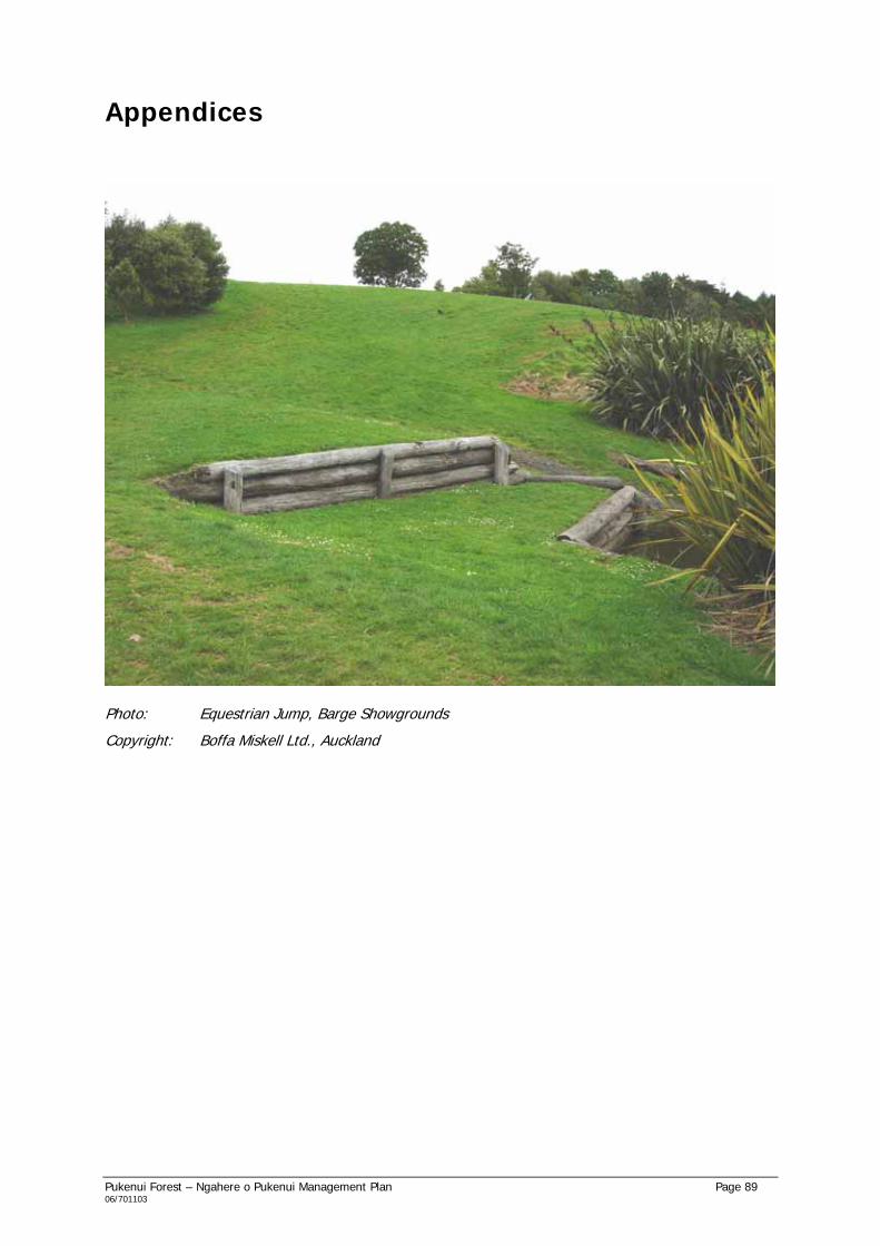
Pukenui Forest – Ngahere o Pukenui Management Plan Page 89 06/701103
Appendices
Photo: Equestrian Jump, Barge Showgrounds
Copyright: Boffa Miskell Ltd., Auckland

Pukenui Forest – Ngahere o Pukenui Management Plan Page 90 06/701103
Appendix 1 Land Titles and Status
Land Title Legal Description, area Current Reserves Act status Pukenui Forest – Department of Conservation NZ Gazette: 1973, p. 2763
Three Mile Bush Quarry – Land Information NZ
Note: this parcel is not classified under the Reserves Act. While this plan can only provide guiding principles for Three Mile Bush Quarry inclusion of this land recognises its role in the integrated management of Pukenui/Western Hills4.
592.6216 hectares Pt Allot 45 (157.491 ha.), Allot 46 (155.804 ha.), Allot 52 (3.9912 ha.), Allot 55 (0.6702 ha.), Allot 56 (0.4907 ha.), Allot 57 (57.5665 ha.) and Allot 58 (216.608 ha.), Parish of Kaitara 1.1689 hectares Pt. Allotment 54, Parish of Kaitara
Northland State Forest Park – Recreation Area (1973). Under Sec 61 of the Conservation Act 1987, former State forest land was now held for conservation purposes. Classified as a Conservation Park under Sec 19 Conservation Act 1987. Quarry Reserve (not classified).
Whau Valley Water Supply Reserve - WDC CFR NA1185/6 CFR NA31B/11 CFR NA26C/1179 CFR NA788/288 G/N 963100.1
865.4379 hectares Sec. 38 Parish of Kaitara, Sec 8 Parish of Pukenui, Sec. 76 Parish of Whangarei (Total = 662.0657 ha.) Pt Allot 74 Parish of Whangarei, Allot 75 Parish of Whangarei (Total = 21.9425 ha.) Lot 2 DP 63280 (11.1162 ha.) Allot 52 Parish of Whangarei, Allot 53 Parish of Whangarei, Allot SE55 Parish of Whangarei (Total = 64.7649 ha.) Allot 54 Parish of Whangarei
Classified Local Purpose (Water Supply) Reserve, NZG 2008, p1646. As above As above As above As above
4 Land which is not subject to the Reserves Act can be included in a Management Plan but the plan has no statutory weight for that land and Council cannot be bound by the terms of the act (Reserves Act Guide, 1999).

Pukenui Forest – Ngahere o Pukenui Management Plan Page 91 06/701103
Land Title Legal Description, area Current Reserves Act status CFR NA16B/314 CFR NA16B/315 CFR NA540/212
(28.1257 ha.) Pt Allot 56 Parish of Whangarei (12.3141 ha.) Allot 58 Parish of Whangarei (17.3560 ha.) Allot NW55 Parish of Whangarei (47.7529 ha.)
As above As above As above
Westwood Lane Scenic Reserve, Maunu - WDC
0.2515 hectares Lot 3 DP 119717
Classified Scenic Reserve, NZG 2008, p1646.
Coronation Scenic Res. NZG 1942, p486, SO 16342 CFR NA384/152 NZG 1956, p1508 NZG 1956, p1508 CFR NA2B/1126 CFR NA46C/939 CFR NA14D/344 CFR NA21C/694 CFR NA14D/525 CFR NA6A/984 CFR NA96B/380
113.8699 hectares Sec 2 BLK XII Purua SD (47.548 ha.) * Lot 1 DP 13936 (19.826 ha.) * Lot 2 DP 13936 (1.5628 ha.)* Lot 3 DP 13936 (14.3461 ha.)* Lot 1 DP 27927 (0.5127 ha.);* Lot 2 DP 27927 (1.0355 ha.);* Lot 3 DP 27927 (1.3183 ha.);* Pt Lot 1 DP 27619 (4.7247 ha.);* Lot 1 DP 41416 (8.7083 ha.);* Lot 2 DP 41416 (0.043 ha.);* Lot 63 DP 51349 (1.5646 ha.); Lot 5 DP 49638 (0.1669 ha.) Lot 1 DP 47892 (0.4495 ha.) Lot 10 DP 35135 (0.2393 ha.) Pt Lot 12 DP 27128 (0.8266 ha.) Lot 1 DP 54652, Pt. Southern portion of Allotment 77, Parish of Whangarei (4.0479 ha.) Lot 3 DP 160189 (6.9497 ha.)
Classified Scenic Reserve, NZG 1979, p18. As above As above As above As above As above As above As above As above As above As above As above As above Classified Scenic Reserve, NZG 2008, p1646. As above As above As above
Maunu Scenic Reserve NZ Gazette 1988, p5295/4 CT 132773
38.7568 hectares Pt. Lot 2 DP 13000, Block XI, Purua SD (26.7438 ha.) Lot 32, DP 332400 (12.0130 ha.)
Classified Scenic Reserve, NZG 2008, p1646. As above

Pukenui Forest – Ngahere o Pukenui Management Plan Page 92 06/701103
Land Title Legal Description, area Current Reserves Act status
Barge Showgrounds – WDC CT 79C/634 CT 79C/635
Note: these parcels are not recognised or protected under the Reserves Act. While this plan can only provide guiding principles for Barge Showgrounds inclusion of this land recognises its role in the integrated management of Pukenui/ Western Hills5.
64.5955 hectares Lot 1 DP 134938, Pt Waihoanga No. 2 Block, Block XII Purua SD (1.5655 ha.) Lot 2 DP 134938, Pt Waihoanga No. 2 Block, Blocks XII and XVI Purua SD (63.0300 ha.)
Not subject to the Reserves Act. Not subject to the Reserves Act.
Whangarei Quarry Gardens – WDC NA 135B/365
24.2496 hectares Lot 1 DP 187969 and Lot 2 DP 206917
Classified Recreation reserve, NZG 2007, p49.
TOTAL AREA: 1,700.9517 Hectares
NOTE : Parts of Coronation Scenic Reserve marked * are Crown owned but Council is appointed to control and manage.
5 Land which is not subject to the Reserves Act can be included in a Management Plan but the plan has no statutory weight for that land and Council cannot be bound by the terms of the act (Reserves Act Guide, 1999).

Pukenui Forest – Ngahere o Pukenui Management Plan Page 93 06/701103
Appendix 2: Legislation
Reserves Act 1977
This Act provides for the ‘preservation and management for the benefit and enjoyment of the public’ of areas with recreational, wildlife, indigenous flora or fauna, environmental and landscape amenity, natural, scenic historic, cultural, archaeological, biological, geological, educational, scientific or community values.
Areas covered by this management plan which are protected under the Reserves Act are as follows.
• Coronation Scenic Reserve
• Maunu Scenic Reserve
• “Glendale Road” Scenic Reserve
• “Golf Harbour” Scenic Reserve
The DOC administers the Act.
Conservation Act 1987
The Conservation Act established and sets out the functions of DOC. Key functions of DOC are to:
• manage land and other natural and historic resources;
• preserve as far as practicable all indigenous freshwater fisheries, protect recreational fisheries and freshwater habitats;
• advocate conservation of natural and historic resources;
• promote the benefits of conservation (including Antarctica and internationally);
• provide conservation information; and
• foster recreation and allow tourism, to the extent that use is not inconsistent with the conservation of any natural or historic resource.
DOC is required to administer the Act, and Acts named in the First Schedule (e.g. Historic Places Act 1993, Native Plants Protection Act 1934, New Zealand Walkways Act 1990, Queen Elizabeth II National Trust Act 1977, Reserves Act 1977, Wild Animal Control Act 1977, Wildlife Act 1953 and Wildlife Regulations 1955).
The “Conservation Management Strategy for Northland, 1999-2009” (DOC) is given legal status under the Conservation Act 1987 (as amended by the Conservation Law Reform Act 1990). There is no specific reference to Pukenui Forest in the Conservation Management Strategy (CMS), and it falls outside of the priority areas for integrated management.
Local Government Act 2002
The Local Government Act 2002 provides for local authorities to promote the social, economic, environmental and cultural well-being of their communities through a sustainable development approach. All local authorities are required to prepare Long Term Council Community Plans (LTCCP) to guide the way councils and others will operate over the years ahead. Community involvement is essential in identifying Community Outcomes in the LTCCP. For the Whangarei district, the following Community Outcomes have been identified (2004 consultation process).
• A community which enjoys and treasures its natural and cultural values.
• A district which is safe and crime free.
• A district with growing business and employment opportunities.

Pukenui Forest – Ngahere o Pukenui Management Plan Page 94 06/701103
• A community which is healthy and educated.
• A district with lots of community facilities and programmes for all ages.
The objectives of this management plan will need to tie in to the Community Outcomes.
Councils are also required to prepare Annual Plans which outline council’s activities over the coming financial year and the funds required to carry out these activities. This management plan, through the setting of objectives and policies for Pukenui Forest, may influence the contents of WDC’s Annual Plan and budget.
Resource Management Act 1991
The stated purpose of the Resource Management Act (RMA) is to promote the sustainable management of natural and physical resources. Supporting principles cover Matters of National Importance (Sec 6), Other Matters (Sec 7) and Treaty of Waitangi (Sec 8). The Act requires the preparation of regional policy statements, regional plans and district plans to assist in the implementation of the Act’s stated purpose and principles.
Regional Policy Statement for Northland, NRC
The following general directions have been developed for resource management in Northland. They have been used as a basis for establishing objectives, policies and methods in subsequent sections of the plan.
• Protection and Improvement of Environmental Quality
• Enabling Development while Avoiding, Remedying and Mitigating Adverse Effects
• Allowing Time for Change and Finding Solutions (resource use practices)
• Promoting Individual and Community Involvement
• Partnerships with Tangata Whenua (Treaty of Waitangi partnership principles)
• Necessity to have Environmental Standards
• Current Resource User to Pay
• Precautionary Approach
There are no objectives, policies or methods that are directed specifically at the Pukenui Forest area, though the general approach, in covering all of Northland, still applies.
Regional Water and Soil Plan for Northland, NRC
The general approach taken within the plan is to:
• Control point source discharges to land and water and to manage their effects on the environment;
• To control land uses, and resulting non-point source discharges, for the purpose of soil conservation and the maintenance and enhancement of water quality and hazard mitigation;
• To control the taking, use, damming, and diversion of water; and
• To control the use and development of river and lake beds.
There are no policies or methods targeted solely at Pukenui Forest area, though the general approach, in covering all of Northland, still applies.
Proposed Whangarei District Plan, WDC
The majority of Ngahere o Pukenui is noted as Open Space Environment (‘zone’) within the Whangarei District Plan. The Open Space Environment covers land owned by WDC, DOC or other organisations
Pukenui Forest – Ngahere o Pukenui Management Plan Page 95 06/701103
for recreational and/or conservation purposes. Barge Showgrounds and a small portion of the Whau Valley catchment are noted as Countryside Environment.
Open space is important for both community well being and environmental health. Recreational open space provides for a wide range of social and recreational opportunities, while open space for conservation purposes preserves and protects landscape and ecological values.
The District Plan sets out Objectives, Policies and Rules for the Open Space Environment. Associated relevant Policy areas include Amenity Values, Tangata Whenua, Landscape, and Indigenous Vegetation and Habitat. Associated relevant Rules include Notable Landscape Area (parts of Barge Showgrounds, Pukenui Forest, Whau Valley catchment, Coronation Scenic Reserve, Millington Road reserve and Whangarei Quarry Gardens) and Esplanade Priority Area (streams through Pukenui Forest, Waiarohia Stream and Te Hihi Stream through Barge Showgrounds).
Whau Valley dam and catchment is designated for water supply (DW 52).
See Section 9.4 - Rural and Rural/Residential Use for information on the Whangarei Urban Growth Strategy and associated Structure Plans.
Resource Management Amendment Act 2003
Iwi Management Plans
The status of iwi planning documents has been raised. Previously councils were required to “have regard to” iwi planning documents. With the Amendment Act of 2003, councils must now “take into account” iwi planning documents. The intention, with respect to Ngahere o Pukenui is that WDC will be able to show how any iwi planning document prepared for the area has influenced the provisions of this management plan.
Historic Heritage Protection
Historic heritage protection is recognised as a Matter of National Importance.
Biodiversity
The maintenance of indigenous biodiversity is an increasing issue both nationally and regionally. As part of a number of initiatives to improve biodiversity management, the Amendment Act has introduced changes to the RMA to make regional councils expressly responsible for:
“The establishment, implementation, and review of objectives, policies, and methods for maintaining indigenous biological diversity”.
The Regional Policy Statement for Northland sets out the local authorities who are responsible for specifying objectives, policies and methods for the control of the use of land to maintain indigenous biological diversity. For example:
Section 23.4, Method of Implementation 1: “Include appropriate policies, methods and other provisions in District Plans controlling the adverse effects of subdivision, use, development and protection of land in order to protect significant indigenous vegetation and significant habitats of indigenous fauna, and in order to maintain general ecosystem health and indigenous biodiversity…”
Section 10 (1) of the Resource Management Amendment Act 2003 makes the maintenance of indigenous biological diversity a function of territorial authorities.

Pukenui Forest – Ngahere o Pukenui Management Plan Page 96 06/701103
Biosecurity Act 1993
The Northland Regional Pest Management Strategies have been prepared under the Biosecurity Act 1993 by the NRC as a mechanism for the management and control of selected pests within the Northland Region. The primary objective of the Strategies is to achieve comprehensive and integrated pest management. The NRC is the management agency responsible for implementing all but one of these Strategies – DOC is responsible for the Northland Regional Pest Management Strategy for Feral Deer.
Historic Places Act 1993
This Act provides for the promotion, identification, protection, preservation and conservation of the cultural and historic heritage of New Zealand. It also provides for the New Zealand Historic Places Trust to play a lead role in such initiatives, through the protection of archaeological sites, administering the registration of historic places, historic areas, waahi tapu and waahi tapu areas, and fostering historic heritage protection through statutory advocacy processes and educational initiatives.
Te Tiriti o Waitangi
The Treaty of Waitangi Act 1975 and its amendment of 1985 provide for the hearing of Maori grievances dating back to 1840 by the Waitangi Tribunal. Maori land claims are lodged with the Tribunal against the Crown.
WDC and DOC acknowledge that several claims have been lodged with the Waitangi Tribunal inclusive of Pukenui Forest. We acknowledge the place of Te Tiriti o Waitangi in the management and development of this area, and will respect Tribunal decisions.
We note, further, the following legislative requirements on the Crown and local government with respect to the Treaty of Waitangi and interests of Maori more generally.
• Sections 6 (e) - relationship of Maori to culture, traditions, etc.., 7 (a) – kaitiakitanga, and 8 – taking account of the principles of the Treaty, of the Resource Management Act 1991.
• Section 4 of the Conservation Act 1987 - giving effect to the principles of The Treaty.
• Section 4 of the Local Government Act 2002 – take appropriate account of the principles of the Treaty of Waitangi, and maintain and improve opportunities for Maori to contribute to local government decision-making processes.
WDC and DOC are committed to effective on-going consultation with the tangata whenua. Nga Ahi Kaa o Pukenui has been set up to assist preparation of this management plan and has a continuing active role in management of the area.

Pukenui Forest – Ngahere o Pukenui Management Plan Page 97 06/701103
Appendix 3: Vegetation of Pukenui Forest – Forested Portion
The following description has relied heavily on material contained in the report, “Natural areas of Whangarei Ecological District: Reconnaissance Survey Report for the Protected Natural Areas Programme”, 2001, written by Diana Manning and published by the Department of Conservation, Northland Conservancy (pages 135-142).
North-west of the Whau Valley dam outlet is an area of mamaku fernland on a south-east facing toe slope. Kahikatea is frequent with occasional puriri, totara and nikau. On the moderately steep hill slope above this, totara is abundant with occasional kanuka and towai.
Westwards and adjacent to the dam wall, taraire-towai forest is present. There is frequent rimu and emergent rewarewa with scattered tawa, kanuka and nikau.
Taraire-towai forest occurs on the western side of the dam on east facing hill slopes. Other species include frequent emergent rewarewa and occasional miro, puriri, karaka, nikau, mamaku and emergent northern rata and rimu. Bordering the western side of the dam is an area of shrubland containing mamaku, mahoe and tobacco weed. Gorse and hangehange are frequent while cabbage tree (ti kouka) and kahikatea are occasional. Adjacent to this is an area of kanuka/manuka shrubland with occasional mamaku, ti kouka and pampas. Emergent rimu, totara and kauri are also present in low numbers. An area of this shrubland also occurs on the southern edge of the dam.
On the north-facing hill slopes to the south of the southern arm of this area there is an area of tanekaha-totara-towai forest. Rimu and emergent rewarewa are frequent with occasional tawa, nikau and kanuka. On a north-east facing hill slope in the vicinity, kanuka/manuka-towai forest is associated with frequent rimu, taraire and emergent rewarewa. Puriri is also present in low numbers.
On the steep east-facing hill slope on the western side of the stream that drains into the southern end of the Whau Valley reservoir, there is an area of tanekaha-totara forest. Emergent rewarewa is frequent while puriri, rimu, tawa, kanuka and mamaku are occasionally present.
On a ridge south of here there is a small area of mature kauri forest. Tanekaha and rimu are frequently present. Further south on a ridge top, rimu is abundant with kauri, taraire, rewarewa and tanekaha present in low numbers.
Within the south-eastern edge of Ngahere o Pukenui adjacent to the suburb of Woodhill, the ridges are of tanekaha forest with frequent totara and rewarewa. Also present are kanuka, rimu, tawa and towai.
Westwards to Pukenui Road, the stream that flows out of Pukenui Forest here (Te Hihi Stream??) has riverine forest of dominant totara and common kahikatea. Kanuka is frequent while kowhai, puriri, karaka, pukatea and taraire are occasional. Taraire-towai forest occurs on east facing hill slopes in this area. This forest type has frequent puriri and rewarewa with occasional tanekaha, tawa, nikau, kahikatea, rimu, karaka and pukatea. Emergent kauri and tanekaha are present on the ridges while totara is concentrated on the forest margins. The epiphyte puka is also present.
To the south-western corner of Pukenui Forest (to the north of Maunu Mountain), the forest is no longer contiguous and pasture extends into the area.
Taraire-towai forest occurs east of Kara Road on west-facing hill slopes. It is associated with frequent rewarewa and tawa with occasional totara, lancewood, tanekaha, rimu, kahikatea and mamaku. Further northeast, totara forest occurs on west-facing hill slopes and hilltops. Associated species are frequent taraire and occasional rewarewa, towai, puriri, kahikatea, mamaku and emergent rimu.
East of McKinley Road, the lower slopes of the forest is dominated by taraire with frequent totara and rewarewa. Also present are kahikatea, titoki, puriri, tawa, rimu, pukatea and nikau. The upper slopes are covered with totara-towai forest with frequent kanuka. Puriri, rewarewa, ti kouka and mamaku are occasional.

Pukenui Forest – Ngahere o Pukenui Management Plan Page 98 06/701103
East of here and on the south side of Wood Road and Mangere Stream, the steep hill slopes are totara dominant with frequently occurring kanuka, taraire and towai. Occasional species include kahikatea, tawa, tanekaha and rewarewa.
Along the Mangere Stream just west of the weir, taraire forest with emergent kahikatea occurs.
Further east the steep, north-facing forest is dominated by kanuka and manuka with totara common. Towai and mamaku are frequent with occasional puriri, taraire, rewarewa, pigeonwood and Pinus sp.
Continuing eastwards, the forest on the northeast facing ridges is dominated by tanekaha with kanuka/manuka and emergent rimu common. Rewarewa, towai, mamaku and emergent kauri are also present. On the opposite side of the gully on a steep west-facing hill slope there is a small area of kanuka/manuka shrubland with occasional towai and mamaku. Adjacent to this and further north, kanuka/manuka with common mamaku occurs. Totara and towai are present occasionally. This grades into forest of abundant taraire with towai common on a north-facing slope. Also present are frequent totara and rewarewa with occasional puriri, kauri, tawa and kanuka. Eastwards to the opposite side of the hill, kanuka is dominant with frequent mamaku and occasional Acacia sp. and totara.
Moving southwards up the valley, there is an area of steep shrubland that has recolonised pasture. Three metre high kanuka/manuka is dominant with totara common. Mamaku is also present occasionally.
On the other side of the valley the forest is contiguous with the main part of Pukenui Forest. On the ridge tops rimu is dominant with kauri rickers common. Frequently occurring species are rewarewa, totara and miro with occasional kanuka and towai.
At the weir on Mangere Stream, the surrounding riverine forest is kahikatea dominant with occasional rimu and totara. Downstream, the south-facing hill slopes on the northern side of Mangere Stream are towai dominant with taraire and rewarewa common. Rimu, pukatea, mamaku, karaka and tawa are occasional.
West of the quarry on Wood Road, towai is common on south-facing hill slopes with frequent totara and tanekaha. Rewarewa, kahikatea and mamaku are also present.
Continuing westward, totara-towai forest occurs on a southwest-facing hill slope. Totara and towai are common with kanuka, manuka and Pinus sp. frequent. There is also occasional cabbage tree and mamaku.
Towai forest occurs at the top of the hill. Towai is abundant with taraire and totara frequent. Other species in the canopy are rimu, puriri, kahikatea, rewarewa, miro, kauri and tanekaha. On the other side of the hill (north-facing) taraire-towai forest is associated with frequent rewarewa and rimu. There is also occasional tanekaha, totara, kauri, puriri and mamaku.
On the north-western side of Ngahere o Pukenui and to the west of Gray Road, there is a separate valley remnant of tanekaha-totara forest. Rimu is present frequently with occasional kauri, towai, taraire, mamaku, Pinus sp. and macrocarpa. A stream which flows out of the forest forms a wetland which is crossed by Gray Road. It consists of 100% vegetation comprising predominantly raupo and willow weed. Harakeke and Juncus sp. are frequent and ti kouka (cabbage tree) is present occasionally. Bordering this wetland is a small area of totara riverine forest where kahikatea is frequent.
Southeast from here, tanekaha-totara forest occurs on a north-facing hill slope. It has frequent kanuka and manuka with occasional kahikatea, mamaku and towai.
A separate remnant to the east and at the end of James Road has taraire-totara forest with frequent puriri and kahikatea. Rewarewa and rimu are also present occasionally.

Pukenui Forest – Ngahere o Pukenui Management Plan Page 99 06/701103
Moving eastwards there is another separate remnant of totara forest on a moderate hill slope, with frequent kahikatea and manuka and occasional taraire and rimu.
To the east of this, in the main part of Pukenui Forest, taraire forest is abundant with frequent towai and rimu and occasional puriri, northern rata and rewarewa. North of here on the edge of the forest, taraire forest continues on a gentle hill slope. Associated species are frequent puriri and rewarewa while totara, karaka and kahikatea are occasional.
On the south side of Three Mile Bush Road, there is a small separate remnant of kahikatea-taraire-totara forest on a moderate west-facing slope. Occasional species include puriri, karaka, tawa and titoki. The Pukenui Track, which begins on Three Mile Bush Road and extends as far as Mangere Stream passes through several forest types. These include taraire forest on hill slopes, kahikatea forest on volcanic flat and kanuka-manuka forest with the occasional totara and ti kouka on hill slopes. Riverine forest made up of taraire with frequent rimu, kahikatea and towai occurs where the track turns north to follow the northern branch of Mangere Stream. Tawa, miro and kauri are also present. Old growth taraire forest on alluvial flats with emergent kahikatea occurs in the Mangere Stream area by Woods Road.
Moving back to the eastern edge of Pukenui Forest, there is an area of forest on a moderate north-facing slope in between Whau Valley dam and Waiarohia Stream. Puriri, taraire and totara are common with frequent kohekohe and tawa. Karaka, towai, rewarewa, mamaku and nikau are occasional.

Pukenui Forest – Ngahere o Pukenui Management Plan Page 100 06/701103
Appendix 4: Flora of Barge Showgrounds
Barge Pond System – Indigenous Plants
Common Name Maori Name Scientific
Starwort - Callitriche sp.
Duckweed - Lemna minor
Naturalised Plants and Weed Species
Oxygen weed - Elodea sp.
Watercress - Rorippa nasturtium aquaticum
Barge Wetland – Indigenous Plants
Common Name Maori Name Scientific
Flax Harekeke Phormium tenax
Raupo Raupo Typha orientalis
Carex Pukio Carex secta
Baumea Baumea Baumea sp.
Sedge sp. - Isolepis sp
Kiokio Kiokio Blechnum capense
Swamp Kiokio Kiokio Blechnum minus
Spike Sedge - Eleocharis acuta
Swamp Millet - Isachne globosa
Rushes - Juncus sp.
Showy Willow-Herb - Epilobium pallidiflorum
Clubrush Kuta Schoenoplectus tabernaemontani
Giant umbrella sedge - Cyperus ustulatus
Naturalised Plants and Weed Species
Fireweed - Senecio minima
Tradescantia - Tradescantia fluminensis
Reed Sweet Grass - Glyceria maxima
Soft Rush - Juncus effusus
Arum Lily - Zantedeschia aethiopica
Swamp Forest – Indigenous Plants
Common Name Maori Name Scientific
Kahikatea Kahikatea Dacrycarpus dacrydioides
Pukatea Pukatea Laurelia novae-zelandiae
Cabbage Tree Ti Kouka Cordyline australis

Pukenui Forest – Ngahere o Pukenui Management Plan Page 101 06/701103
Riparian (including Te Hihi Stream) and Wetland Margins – Indigenous Plants
Common Name Maori Name Scientific
Rimu Rimu Dacrydium cupressinum
Kahikatea Kahikatea Dacrycarpus dacrydioides
Totara Totara Podocarpus totara
Kohekohe Kohekohe Dysoxylum spectabile
Towai Towai Weinmannia silvicola
Cabbage Tree Ti Kouka Cordyline australis
Nikau Nikau Rhopalostylis sapida
Silver Fern Ponga Cyathea dealbata
Karamu Karamu Coprosma robusta
Hangehange Hangehange Geniostoma rupestre
Kawakawa Kawakawa Macropiper excelsum
Putaputaweta Putaputaweta Carpodetus serratus
Mahoe Mahoe Melicytus ramiflorus
Mapou Mapou Myrsine australis
Wheki Wheki Dicksonia squarrosa
Flax Harekeke Phormium tenax
Blechnum Blackspot Kiokio Blechnum “blackspot”
Perching Lily - Collospermum hastatum
Naturalised Plants and Weed Species
Crack Willow Whiro Salix fragilis
Tradescantia - Tradescantia fluminensis
Kahili Ginger - Hedychium gardneriana
Jerusalem Cherry - Solanum pseudocapsicum
Cleaver - Galium aparine
Australian Fireweed - Senecio bipinnatisectus
German Ivy - Senecio mikanioides
Inkweed - Phytolacca octandra
Pasture Escapes
Blackberry - Rubus fruiticosus
Sorrell - Rumex sp.
Cow Parsley - Oenanthe pimpinelloides

Pukenui Forest – Ngahere o Pukenui Management Plan Page 102 06/701103
Appendix 5: Fauna of Pukenui Forest – Forested Portion
Birds, Nga Manu
Common Name Maori Name Latin Name
North Island kiwi Kiwi Apteryx australis mantelli
North Island kaka Kaka Nestor meridionalis septentrionalis
NZ pigeon Kukupa, kereru Hemiphaga novaeseelandiae
Red-crowned parakeet Kakariki Cyanoramphus novaeseelandiae
NI tomtit Miromiro Petroica macrocephala toitoi
Tui Tui Prosthemadera novaeseelandiae
Morepork Ruru Ninox novaeseelandiae
Shining cuckoo Pipiwharauroa Chrysococcyx lucidus
NI fantail Piwakawaka Rhipidura fulignosa placabilis
Silvereye Tahou Zosterops lateralis
Grey warbler Riroriro Gerygone igata
Australasian shoveler Kuruwhengi Anas rhynchotis
NZ scaup Paponga Aythya novaeseelandiae
Grey teal Tete Anas gracilis
Grey duck Parera Anas superciliosa
Mallard Anas platyrhynchos
Paradise shelduck Putangitangi Tadorna variegate
Little shag Kawaupaka Phalacrocorax melanoleucos
Other Fauna
Common Name Scientific Name
Introduced Mammals Cattle Goat Feral cat Mouse Stoat Pig Possum
Bos taurus Canis familaris Felis catus Mus musculus Mustela erminea Sus scrofa Trichosurus vulpecula
Reptiles and Amphibians (*=introduced) Forest gecko Copper skink Long-tailed bat Green bell frog* Golden bell frog* Southern bell frog*
Hoplodactylus granulatus Cyclodina aenoa Chalinolobolus tuberculata Litorea aurea Litorea ? Litorea raniformis

Pukenui Forest – Ngahere o Pukenui Management Plan Page 103 06/701103
Common Name Scientific Name
Indigenous freshwater fish, Nga Ika Banded kokopu Common bully Long-finned eel Cran’s bully Koura Freshwater limpet
Galaxia fasciatus Gobiomorphus cotidianus Anguilla dieffenbachia Gobiomorphus basalis Paranephrops planifrons Latia sp.
Introduced freshwater fish, Nga Ika Trout
Freshwater invertebrates Freshwater crab
Halicarcinus incustris

Pukenui Forest – Ngahere o Pukenui Management Plan Page 104 06/701103
Appendix 6: Fauna of Barge Showgrounds
Aquatic Fauna
Family Genus MCI Wetland Tributary Te Hihi Stream
Xanthocnemis 5 C - Odonata
Austrolestes 6 R -
Coleoptera Dytiscidae 5 C -
Sigara 5 A - Hemiptera
Anisops 5 R -
Austrosimulium 3 - -
Hexatomini 5 - -
Aphrophila 5 - R
Zelandotipula 6 - -
Orthocladiinae 2 - -
Chironomus 1 - -
Tanypodinae 5 - R
Polypedilum 3 A -
Paradixa 4 - -
Tanytarsini 3 - -
Maoridiamesa 3 - -
Diptera
Tabanidae 3 - -
Megaloptera Archichauliodes 7 - C
Zephlebia 7 - A
Coloburiscus 9 - A
Deleatidium 8 - A
Acanthophlebia 9 - R
Ephemeroptera
Nesameletus 9 - A
Aoteapsyche 4 - C
Oxyethira 2 R -
Hydrobiosis 6 - C
Psilochorema 8 - R
Pycnocentrodes 5 - R
Trichoptera
Olinga 9 - A
Acroperla 5 - R Plecoptera
Stenoperla 10 - R
Paratya 5 - C Crustacea
Paranephrops 5 R R
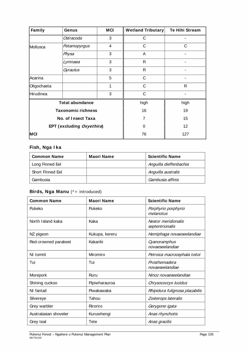
Pukenui Forest – Ngahere o Pukenui Management Plan Page 105 06/701103
Family Genus MCI Wetland Tributary Te Hihi Stream
Ostracoda 3 C -
Potamopyrgus 4 C C
Physa 3 A -
Lymnaea 3 R -
Mollusca
Gyraulus 3 R -
Acarina 5 C -
Oligochaeta 1 C R
Hirudinea 3 C -
Total abundance high high
Taxonomic richness 16 19
No. of Insect Taxa 7 15
EPT (excluding Oxyethira) 0 12
MCI 76 127
Fish, Nga Ika
Common Name Maori Name Scientific Name
Long Finned Eel Anguilla dieffenbachia
Short Finned Eel Anguilla australis
Gambusia Gambusia affinis
Birds, Nga Manu (*= introduced)
Common Name Maori Name Scientific Name
Pukeko Pukeko Porphyrio porphyrio melanotus
North Island kaka Kaka Nestor meridionalis septentrionalis
NZ pigeon Kukupa, kereru Hemiphaga novaeseelandiae
Red-crowned parakeet Kakariki Cyanoramphus novaeseelandiae
NI tomtit Miromiro Petroica macrocephala toitoi
Tui Tui Prosthemadera novaeseelandiae
Morepork Ruru Ninoz novaeseelandiae
Shining cuckoo Pipiwharauroa Chrysococcyx lucidus
NI fantail Piwakawaka Rhipidura fulignosa placabilis
Silvereye Tahou Zosterops lateralis
Grey warbler Riroriro Gerygone igata
Australasian shoveler Kuruwhengi Anas rhynchotis
Grey teal Tete Anas gracilis

Pukenui Forest – Ngahere o Pukenui Management Plan Page 106 06/701103
Common Name Maori Name Scientific Name
Grey duck Parera Anas superciliosa
Mallard* - Anas platyrhynchos
Paradise shelduck Putangitangi Tadorna variegate
Little shag Kawaupaka Phalacrocorax melanoleucos
House sparrow* - Passer domesticus
Yellow Hammer* - Emberiza citrinella
Kingfisher Kotare Halcyon sancta vagans
Spotless Crake Puweto Porzana tabuensis plumbea
Welcome Swallow - Hirundo tahitica neoxena
Blackbird* - Turdus merula
Eastern Rosella* - Platycercus eximius
Chaffinch* - Fringilla coelabs
Australian Magpie - Gymnorhina tibicen
Introduced Animals
Common Name Maori Name Scientific Name
Cattle - Bos taurus
Feral goat Nanenane Capra hircus
Feral cat Ngeru Felis catus
Dog Kuri Canis familiaris
Ship rat Kiore Rattus rattus
Norway rat Kiore Rattus norvegicus
Mouse Kiore-iti Mus musculus
Hedgehog Tuatete Erinaceus europaeus
Stoat - Mustela erminea
Ferret - Mustela furo
Pig Poaka Sus scrofa
Brushtail possum - Trichosurus vulpecula

Pukenui Forest – Ngahere o Pukenui Management Plan Page 107 06/701103
Appendix 7: Archaeological Sites
Compiled from the New Zealand Archaeological Association’s Site Record Forms (NZMS260) for Pukenui Forest.
Map No., Map name, Map ed., Grid ref.
NZAA Metric Site No., Date visited, Site type, Site name
State of site, Possible future damage
Description of site Owner
N20, Whangarei, 4th ed. 1977, E1796 N7959
Q07/1. N20/4, Apr 1979, Pa, Maori
Mostly good state of preservation, some erosion, possible damage to ditches from logging.
Western Hills. Small pa, comprehensive system of ridgetop terraces, pits, house sites and ditches, centred on top of knoll.
WDC
N20, Whangarei, 4th ed. 1977, E1804 N7960
Q07/53. N20/97, Apr 1979, Pa, Maori
Mostly good state of preservation.
On and around level stretch of ridgetop to west of Maunu quarry, in water reserve. Large pa – extensive system of ridgetop terraces, pits, house sites and ditches.
WDC
N20, Whangarei, 4th ed. 1977, E1820 N7968
Q07/54. N20/98, Feb 1979, Pa, Maori
Good state of preservation, some features eroded.
Coronation Reserve – Kauika. (2 midden sites investigated)
WDC
N20, Whangarei, 4th ed. 1977, E1793 N7958
Q07/55. N20/99, Apr 1979, Pits
Pits are eroded. Near bottom of ridge with knoll to west of Silverstream II, in Western Hills. 4 pits.
WDC
N20, Whangarei, 4th ed. 1977, E1792 N7960
Q07/56. N20/100, Apr 1979, Pits
Good state of preservation.
At top of knoll in ridge to west of Silverstream II, in Western Hills. 2 large pits.
WDC
N20, Whangarei, 4th ed. 1977, E1815 N7968
Q07/61. N20/120, Feb 1979, Pa, Maori
Good state. Coronation Reserve, off end of Kauika Rd. Kauika Pa. Condition of features varies from eroded to good.
WDC
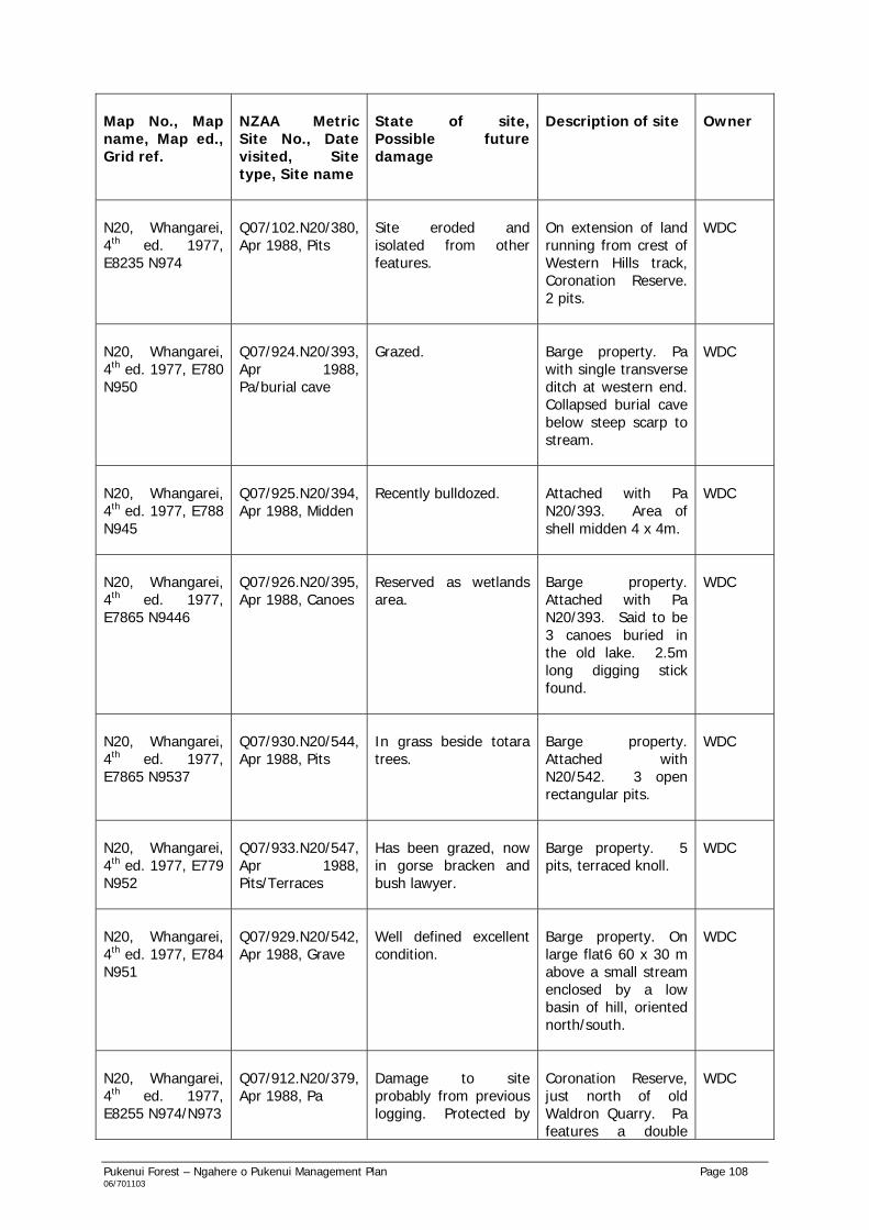
Pukenui Forest – Ngahere o Pukenui Management Plan Page 108 06/701103
Map No., Map name, Map ed., Grid ref.
NZAA Metric Site No., Date visited, Site type, Site name
State of site, Possible future damage
Description of site Owner
N20, Whangarei, 4th ed. 1977, E8235 N974
Q07/102.N20/380, Apr 1988, Pits
Site eroded and isolated from other features.
On extension of land running from crest of Western Hills track, Coronation Reserve. 2 pits.
WDC
N20, Whangarei, 4th ed. 1977, E780 N950
Q07/924.N20/393, Apr 1988, Pa/burial cave
Grazed. Barge property. Pa with single transverse ditch at western end. Collapsed burial cave below steep scarp to stream.
WDC
N20, Whangarei, 4th ed. 1977, E788 N945
Q07/925.N20/394, Apr 1988, Midden
Recently bulldozed. Attached with Pa N20/393. Area of shell midden 4 x 4m.
WDC
N20, Whangarei, 4th ed. 1977, E7865 N9446
Q07/926.N20/395, Apr 1988, Canoes
Reserved as wetlands area.
Barge property. Attached with Pa N20/393. Said to be 3 canoes buried in the old lake. 2.5m long digging stick found.
WDC
N20, Whangarei, 4th ed. 1977, E7865 N9537
Q07/930.N20/544, Apr 1988, Pits
In grass beside totara trees.
Barge property. Attached with N20/542. 3 open rectangular pits.
WDC
N20, Whangarei, 4th ed. 1977, E779 N952
Q07/933.N20/547, Apr 1988, Pits/Terraces
Has been grazed, now in gorse bracken and bush lawyer.
Barge property. 5 pits, terraced knoll.
WDC
N20, Whangarei, 4th ed. 1977, E784 N951
Q07/929.N20/542, Apr 1988, Grave
Well defined excellent condition.
Barge property. On large flat6 60 x 30 m above a small stream enclosed by a low basin of hill, oriented north/south.
WDC
N20, Whangarei, 4th ed. 1977, E8255 N974/N973
Q07/912.N20/379, Apr 1988, Pa
Damage to site probably from previous logging. Protected by
Coronation Reserve, just north of old Waldron Quarry. Pa features a double
WDC

Pukenui Forest – Ngahere o Pukenui Management Plan Page 109 06/701103
bush. ditch with pit, slopes to another ditch. Reputedly built 1700. Possible large pit. (Pa of Te Parawhau)
N20, Whangarei, 4th ed. 1977, E782 N960
Q07/369.N20/274, Apr 1982, Pits
Good condition, in bush.
Water Supply Area, on ridge at end of Te Hape Rd. 2 pits. 600m south is another set of pits – N20/273.
WDC
N20, Whangarei, 4th ed. 1977, E827 N979
Q07/906.N20/373, Apr 1988, Gold prospecting mine
In Coronation Reserve. 2 mine shafts beside Frank Holman Track. Gold prospecting shaft entrances.
WDC
N20, Whangarei, 4th ed. 1977, E8258 N978
Q07/908.N20/375, Apr 1988, Trench mining shaft collapsed
(No info on Site Record Form)
Coronation Reserve, near ridgeline. 70 cm deep narrow ditch, possibly a collapsed drive – prospectors trench.
WDC
N20, Whangarei, 4th ed. 1977, E823 N9765
Q07/909.N20/376, Apr 1988, Pits/terraces
In Coronation Reserve. 2 pits each at 3 x 2 m 30 cm deep, 2 terraces, scarps.
WDC
N20, Whangarei, 4th ed. 1977, E826 N976
Q07/910.N20/377, Apr 1988, Pits
In scrub. Coronation Reserve, near Western Hills Bypass boundary. 2 open pits beside rimu tree under cabbage tree.
WDC
N20, Whangarei, 4th ed. 1977, E8255 N974
Q07/911.N20/378, Apr 1988, Pits/terraces
Poor condition – in gorse and low scrub.
Edge of Coronation Reserve. 2 pits, 3 terraces.