Embed Size (px)
Citation preview
Quiz 7.21. National interests and national unity should be placed
ahead of regional interests.2. “Leave us alone and we will leave you alone” (which
foreign policy)3. Maintained balance of power in Congress; No slavery
north of 36’30.4. Secretary of State, believed in foreign policy of
nationalism5. Steamboat Captain, Tested power of the Supreme
Court and their control of state lines
A. Monroe Doctrine B. Aaron Ogden C. Nationalism
D. Missouri Compromise E. John Quincy Adams
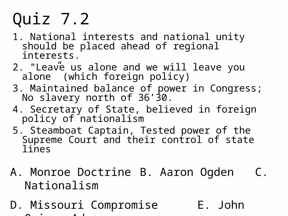
John Quincy Adams= Secretary of State under Pres. Monroe
is an advocate of Nationalism
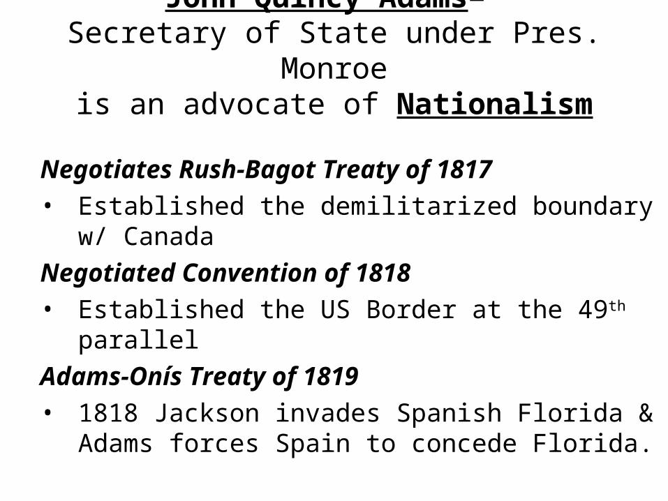
Negotiates Rush-Bagot Treaty of 1817• Established the demilitarized boundary w/
CanadaNegotiated Convention of 1818• Established the US Border at the 49th parallelAdams-Onís Treaty of 1819 • 1818 Jackson invades Spanish Florida & Adams
forces Spain to concede Florida.
http://spider.georgetowncollege.edu/HTALLANT/courses/his325/1818-19.gif
SLAVERY, SECTIONALISM, BALANCE?
Debate over Missouri’s admission as a state threatens the balance of power.
• Missouri is the first state from the LA Territory• Tallmadge amendment proposes to prohibit
slavery in the territory. As a result, the South fears federal intervention over slavery in the South itself
• Seen by South as a “tipping point” – falling behind more and more in population
• Missouri Compromise is forged by Henry Clay
http://www.pbs.org/wgbh/amex/lincolns/politics/es_shift.html#
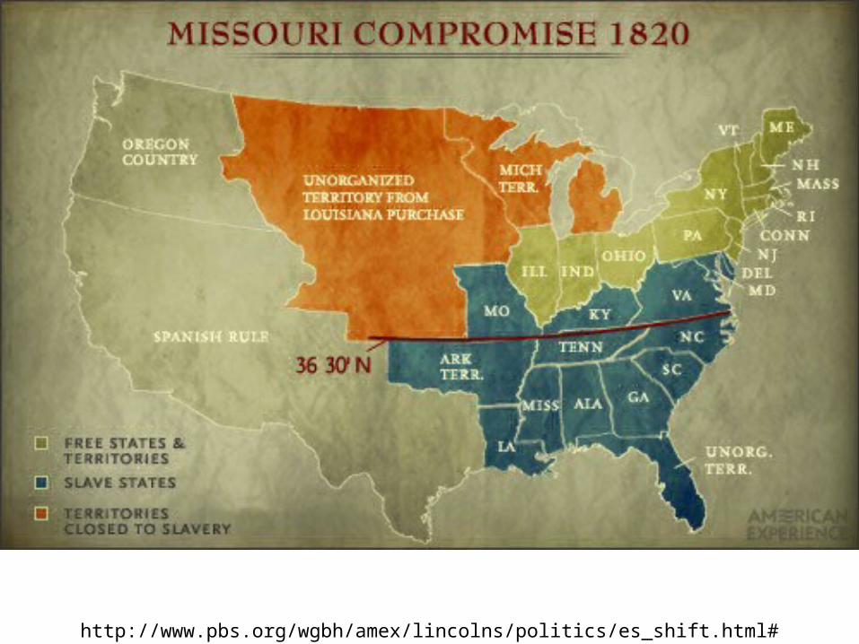
Missouri Compromise of 1820• A little horse-trading:
Maine will be admitted as a free stateMissouri will be admitted as a slave state
• This keeps the balance of slave : free at 12 : 12.• Southern Boundary of Missouri, latitude 36°30’
set as the northernmost boundary of slavery• True compromise: nobody very happy with result!• Despite conflict over slavery, nationalism prevails,
for now.
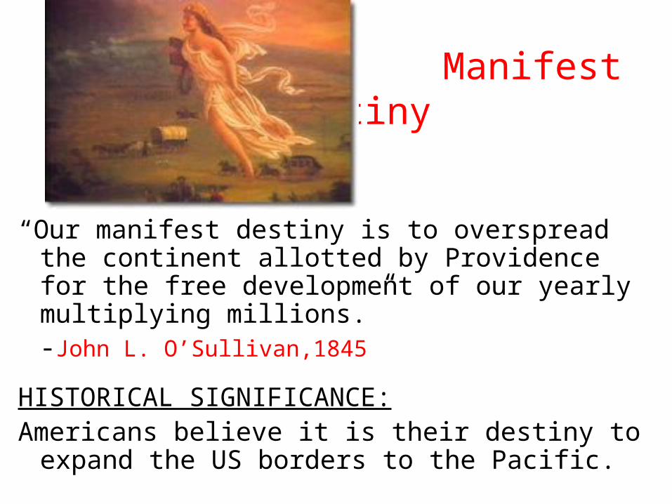
Manifest Destiny
“Our manifest destiny is to overspread the continent allotted by Providence for the free development of our yearly multiplying millions.”
-John L. O’Sullivan,1845
HISTORICAL SIGNIFICANCE:Americans believe it is their destiny to expand the
US borders to the Pacific.
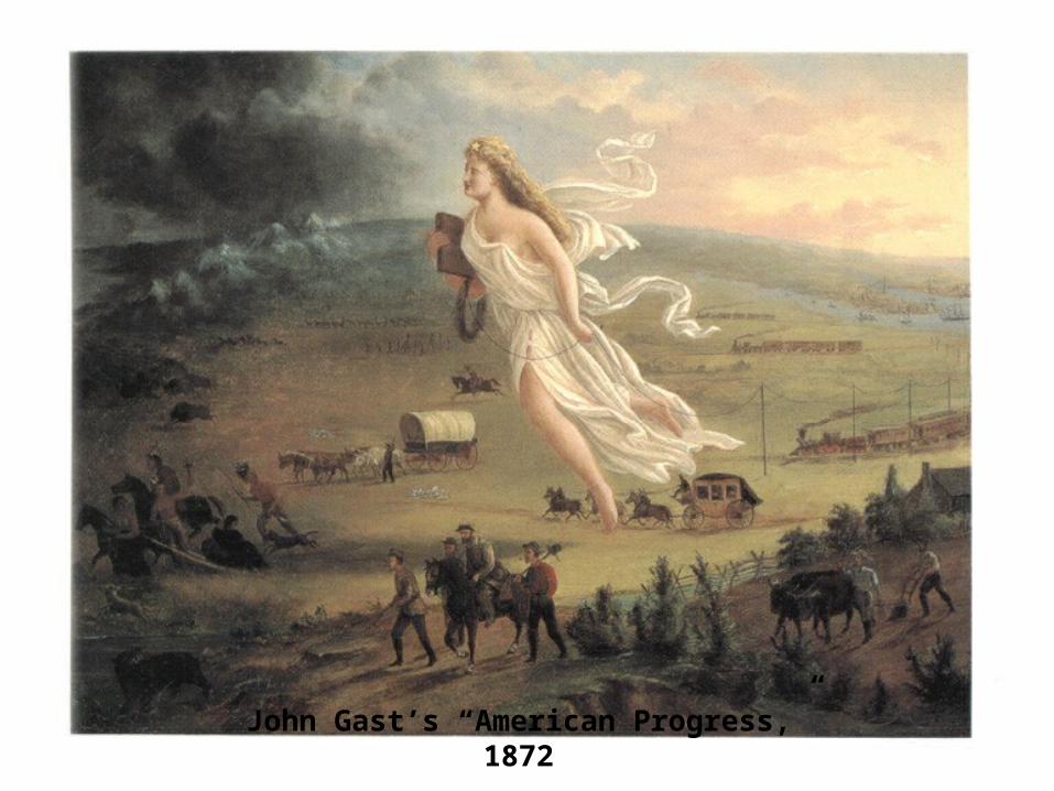
John Gast’s “American Progress,” 1872
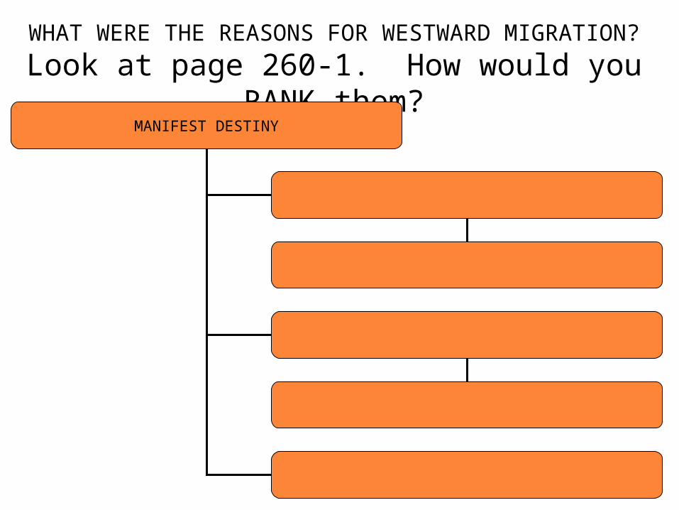
WHAT WERE THE REASONS FOR WESTWARD MIGRATION?
Look at page 260-1. How would you RANK them?MANIFEST DESTINY
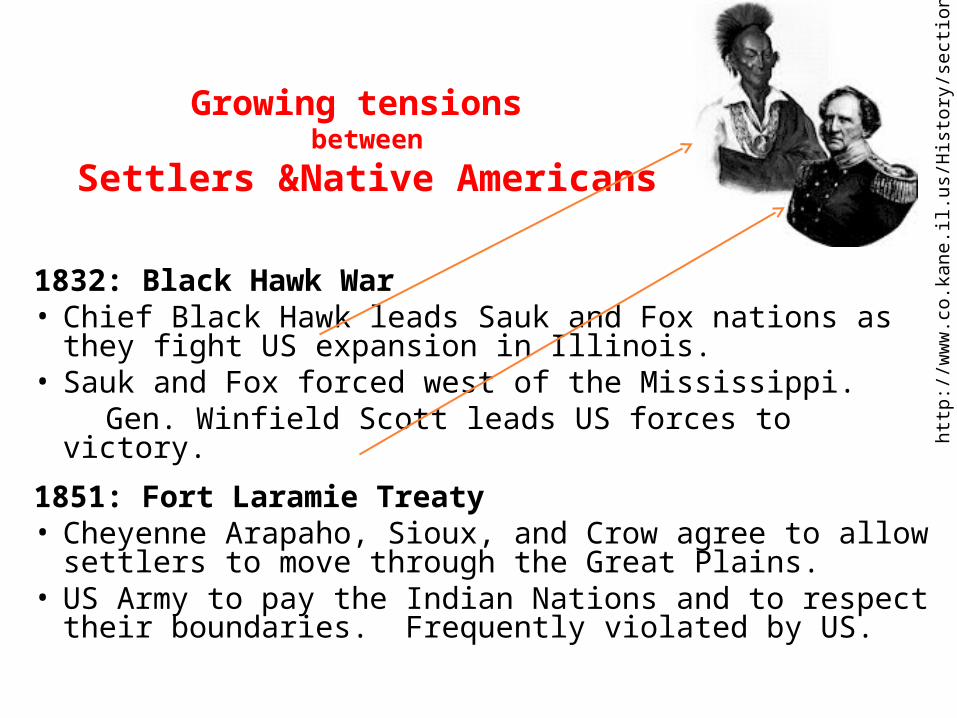
Growing tensions between
Settlers &Native Americans
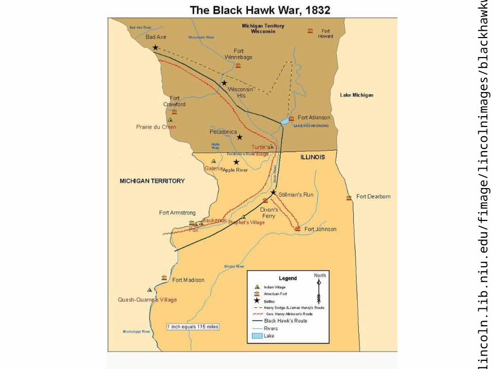
1832: Black Hawk War• Chief Black Hawk leads Sauk and Fox nations as they
fight US expansion in Illinois. • Sauk and Fox forced west of the Mississippi. Gen. Winfield Scott leads US forces to victory.
1851: Fort Laramie Treaty• Cheyenne Arapaho, Sioux, and Crow agree to allow
settlers to move through the Great Plains. • US Army to pay the Indian Nations and to respect their
boundaries. Frequently violated by US.
http
://w
ww
.co.
kane
.il.u
s/H
isto
ry/s
ecti
on03
.htm
http
://l
inco
ln.li
b.ni
u.ed
u/fi
mag
e/li
ncol
nim
ages
/bla
ckha
wkw
ar.jp
g

Map drawn by Father Pierre de Smet,SJ to help clarify the division of lands negotiated in the Fort Laramie Treaty of 1851. DeSmet came to the treaty talks with the Assiniboin, Arikara, Hidatsa and Crow of the upper Missouri River. (Library of Congress)
http
://w
ww
.pbs
.org
/wet
a/th
ewes
t/re
sour
ces/
arch
ives
/thr
ee/6
3_09
.htm
Oregon Territory
Oregon Trail
St. Louis
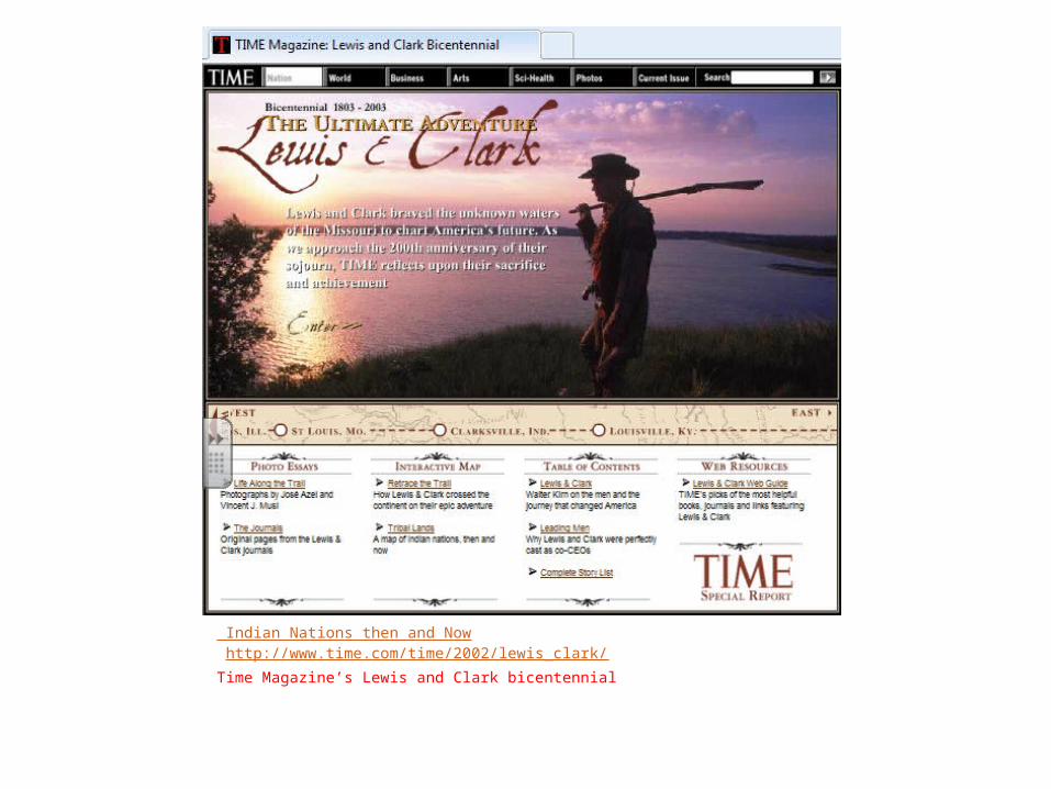
Indian Nations then and Now http://www.time.com/time/2002/lewis_clark/Time Magazine’s Lewis and Clark bicentennial
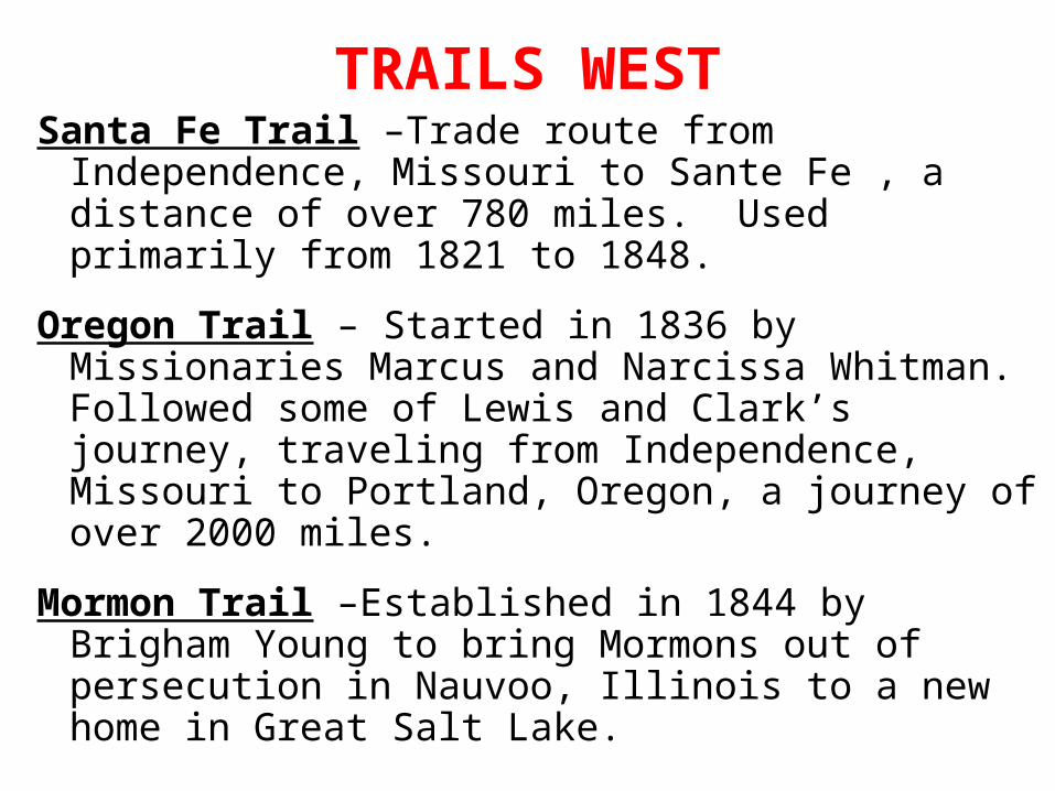
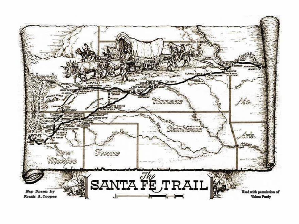
TRAILS WESTSanta Fe Trail –Trade route from Independence,
Missouri to Sante Fe , a distance of over 780 miles. Used primarily from 1821 to 1848.
Oregon Trail – Started in 1836 by Missionaries Marcus and Narcissa Whitman. Followed some of Lewis and Clark’s journey, traveling from Independence, Missouri to Portland, Oregon, a journey of over 2000 miles.
Mormon Trail –Established in 1844 by Brigham Young to bring Mormons out of persecution in Nauvoo, Illinois to a new home in Great Salt Lake.

Western Trails
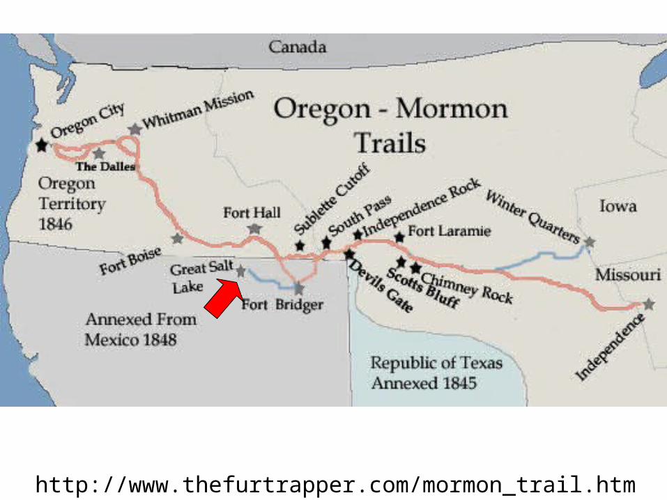
http://www.thefurtrapper.com/mormon_trail.htm
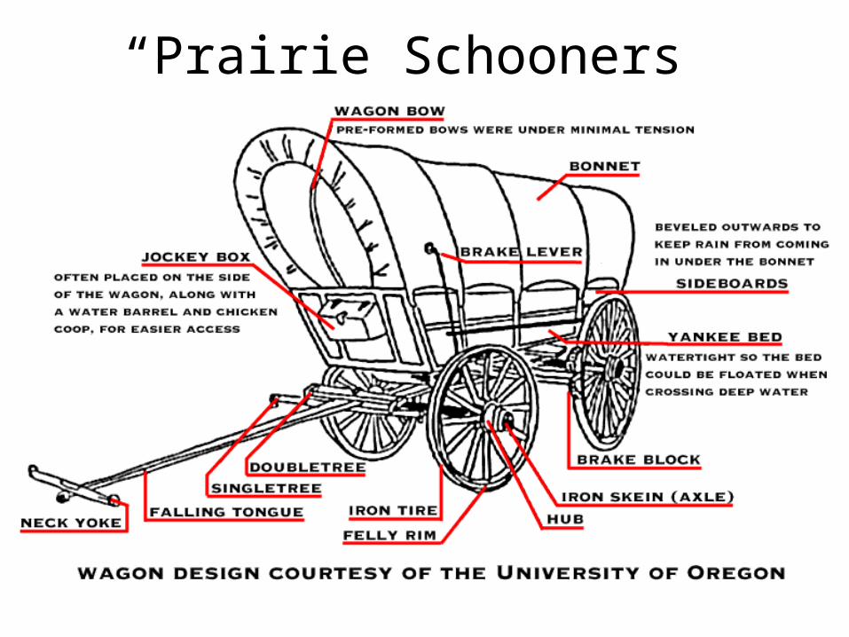
“Prairie Schooners”
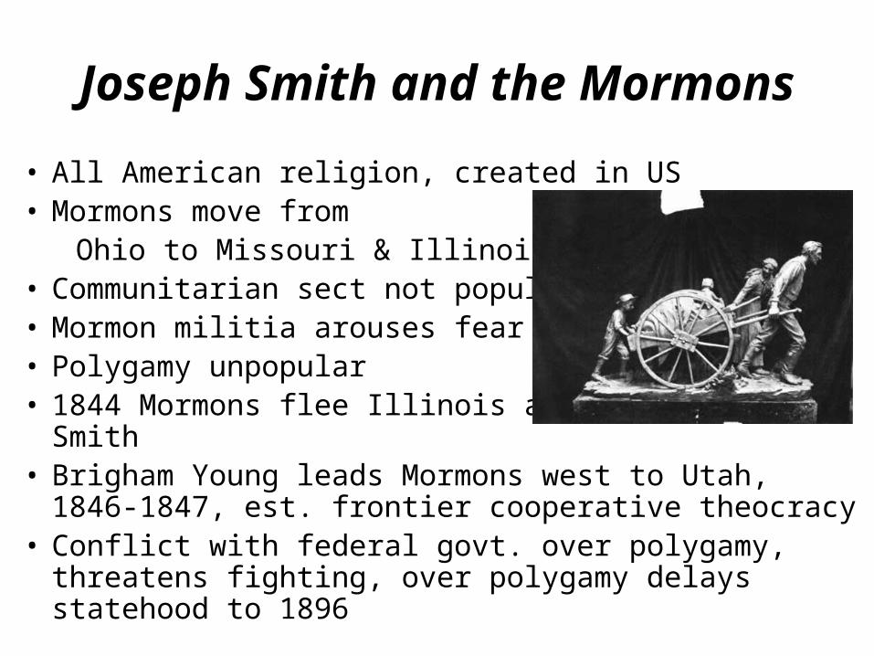
Joseph Smith and the Mormons
• All American religion, created in US• Mormons move from Ohio to Missouri & Illinois.• Communitarian sect not popular• Mormon militia arouses fear• Polygamy unpopular• 1844 Mormons flee Illinois after mobs murder Smith • Brigham Young leads Mormons west to Utah, 1846-1847,
est. frontier cooperative theocracy• Conflict with federal govt. over polygamy, threatens
fighting, over polygamy delays statehood to 1896
http://www.pbs.org/americanprophet/joseph-smith.html
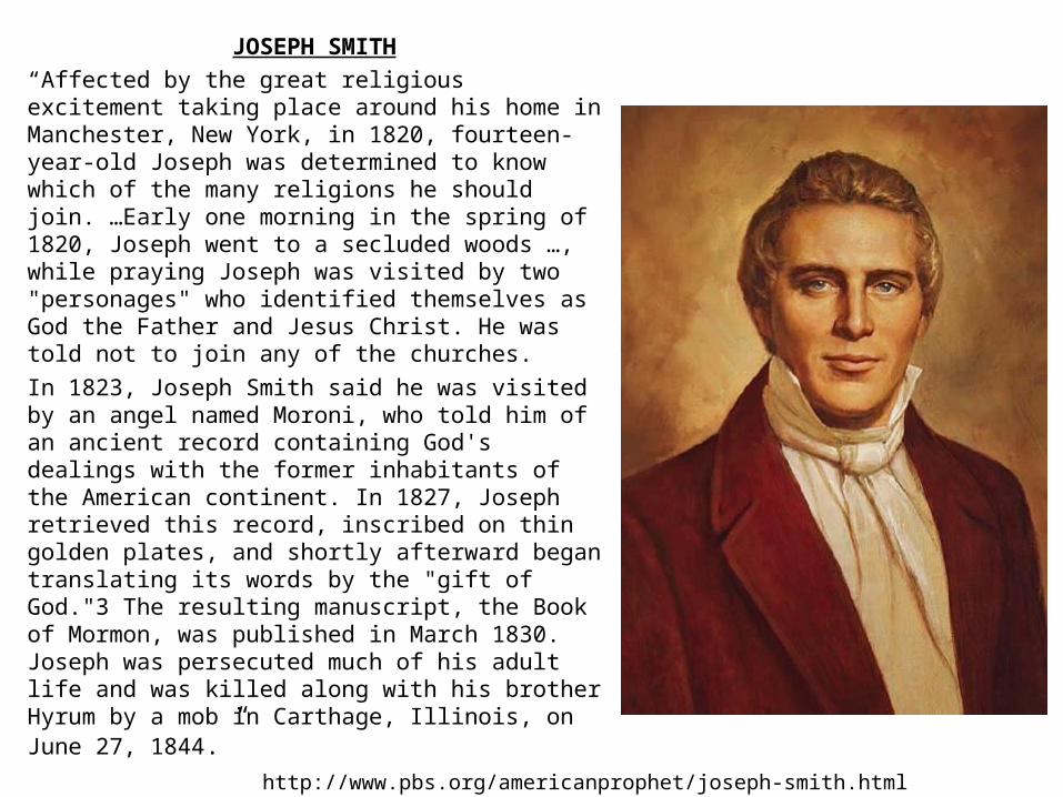
JOSEPH SMITH“Affected by the great religious
excitement taking place around his home in Manchester, New York, in 1820, fourteen-year-old Joseph was determined to know which of the many religions he should join. …Early one morning in the spring of 1820, Joseph went to a secluded woods …, while praying Joseph was visited by two "personages" who identified themselves as God the Father and Jesus Christ. He was told not to join any of the churches.
In 1823, Joseph Smith said he was visited by an angel named Moroni, who told him of an ancient record containing God's dealings with the former inhabitants of the American continent. In 1827, Joseph retrieved this record, inscribed on thin golden plates, and shortly afterward began translating its words by the "gift of God."3 The resulting manuscript, the Book of Mormon, was published in March 1830. Joseph was persecuted much of his adult life and was killed along with his brother Hyrum by a mob in Carthage, Illinois, on June 27, 1844.”
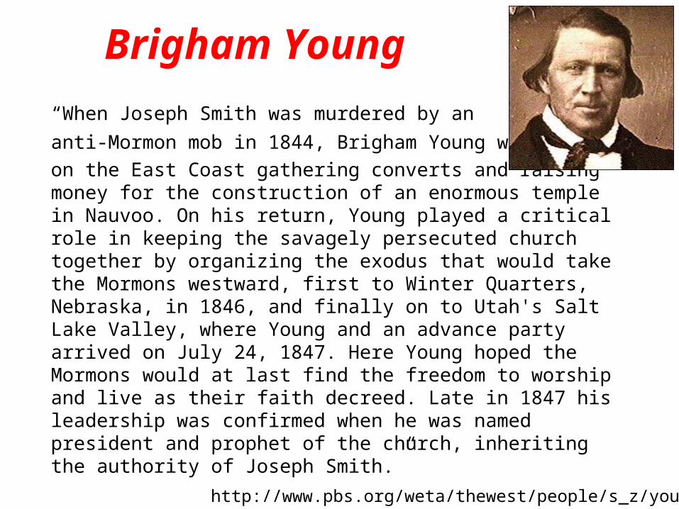
Brigham Young
“When Joseph Smith was murdered by an anti-Mormon mob in 1844, Brigham Young wason the East Coast gathering converts and raising money for the construction of an enormous temple in Nauvoo. On his return, Young played a critical role in keeping the savagely persecuted church together by organizing the exodus that would take the Mormons westward, first to Winter Quarters, Nebraska, in 1846, and finally on to Utah's Salt Lake Valley, where Young and an advance party arrived on July 24, 1847. Here Young hoped the Mormons would at last find the freedom to worship and live as their faith decreed. Late in 1847 his leadership was confirmed when he was named president and prophet of the church, inheriting the authority of Joseph Smith.”
http://www.pbs.org/weta/thewest/people/s_z/young.htm
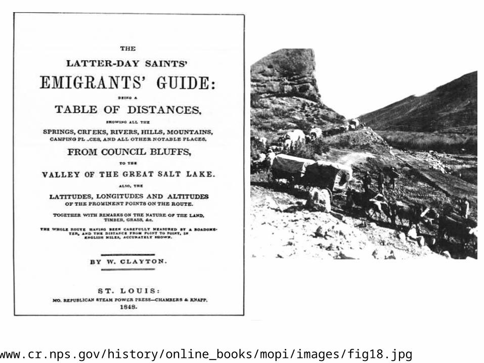
http://www.cr.nps.gov/hi story/onl ine_books/mopi/images/fig3 2.j pg
http://www.cr.nps.gov/history/online_books/mopi/images/fig18.jpg

COMPARE AND CONTRAST
THE SANTE FE, THE OREGON TRAIL, AND THE MORMON TRAIL
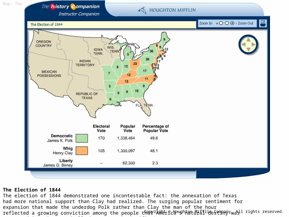
Map: The Election of 1844
The Election of 1844The election of 1844 demonstrated one incontestable fact: the annexation of Texas had more national support than Clay had realized. The surging popular sentiment for expansion that made the underdog Polk rather than Clay the man of the hour reflected a growing conviction among the people that America's natural destiny was to expand into Texas and all the way to the Pacific Ocean. Copyright © Houghton Mifflin Company. All rights reserved.
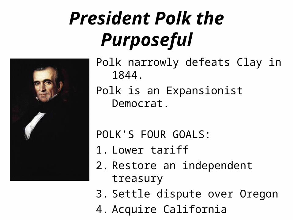
President Polk the Purposeful
Polk narrowly defeats Clay in 1844.Polk is an Expansionist Democrat.
POLK’S FOUR GOALS:1. Lower tariff2. Restore an independent treasury3. Settle dispute over Oregon4. Acquire California
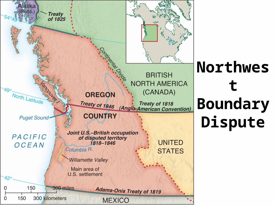
Northwest Boundary Dispute
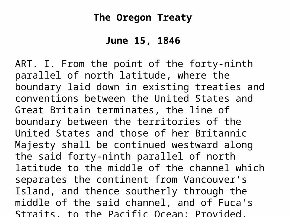
The Oregon Treaty
June 15, 1846
ART. I. From the point of the forty-ninth parallel of north latitude, where the boundary laid down in existing treaties and conventions between the United States and Great Britain terminates, the line of boundary between the territories of the United States and those of her Britannic Majesty shall be continued westward along the said forty-ninth parallel of north latitude to the middle of the channel which separates the continent from Vancouver's Island, and thence southerly through the middle of the said channel, and of Fuca's Straits, to the Pacific Ocean: Provided, however, That the navigation of the whole of the said channel and straits, south of the forty-ninth parallel of north latitude, remain free and open to both parties.

Maine: War with Canada?Canadian Bacon?
• 1837: US Steamer Caroline attacked while ferrying supplies to insurrectionists in Canada, is destroyed.
• War threatens b/w US and GB over land route to Quebec cutting through Northern Maine
• Lord Ashburton and Secretary Webster renegotiate Maine’s boundaries, swapping land.
• 1842: War is averted.
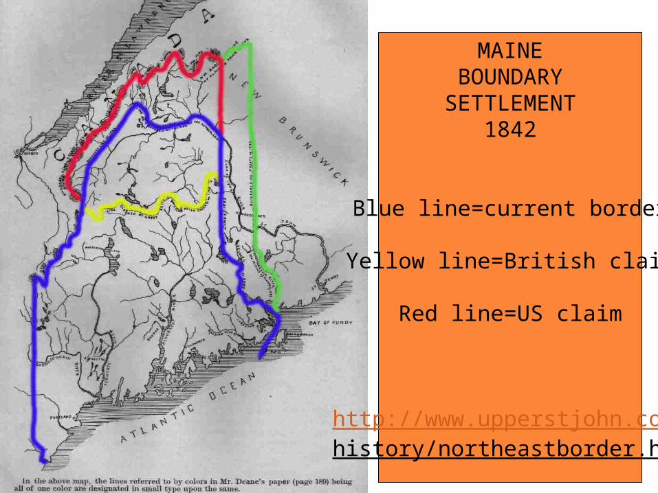
MAINEBOUNDARY
SETTLEMENT1842
Blue line=current border
Yellow line=British claim
Red line=US claim
http://www.upperstjohn.com/history/northeastborder.htm