Embed Size (px)
Citation preview
JUNE 2011
Plan B Natural HeritageBaird Inc.Avens Associates Ltd.
FRAMEWORK FOR NEIGHBOURHOOD DEVELOPMENTYELLOWKNIFE HARBOUR PLAN
SCALE 1:12500
Redevelop
Maintain with minor infill
Maintain with revitalization
LEGEND
Jackfish Lake
Frame Lake Downtown
Frame LakeNeighbourhood
Range Lake
Range LakeNeighbourhood
Yellowknife/Mackenzie Hwy.
Yellowknife/Mackenzie Hwy.
Niven Lake
TwinPineHill
TinCanHill
Old Town
Giant Mine
Ingr
aham
Tra
il
Ingra
ham Tr
ail
Grace Lake
Long Lake
YellowknifeAirport
Fred Henne Park
Kam Lake
Fox Lake
Joe Lake
Yellowknife R
iver
Yellowknife Bay(Great Slave Lake)
Negus Point
Con Mine
PudLake
Rat Lake
KegLake
MegLake
JolliffeIsland
LathamIsland
BurwashPoint
Back BayJackfishRavine
MosherIsland
Dettah
Ndilo
Frankli
n Ave
Fran
klin
Ave
48 St
48 S
t
Old Airport Rd
Old
Airp
ort R
d
Deh Cho Blvd
Redevelop
Maintain with minor infill
Maintain with revitalization
LEGEND
SCALE 1:12500
100 200 500 1000 m
SCALE
300 400 7500
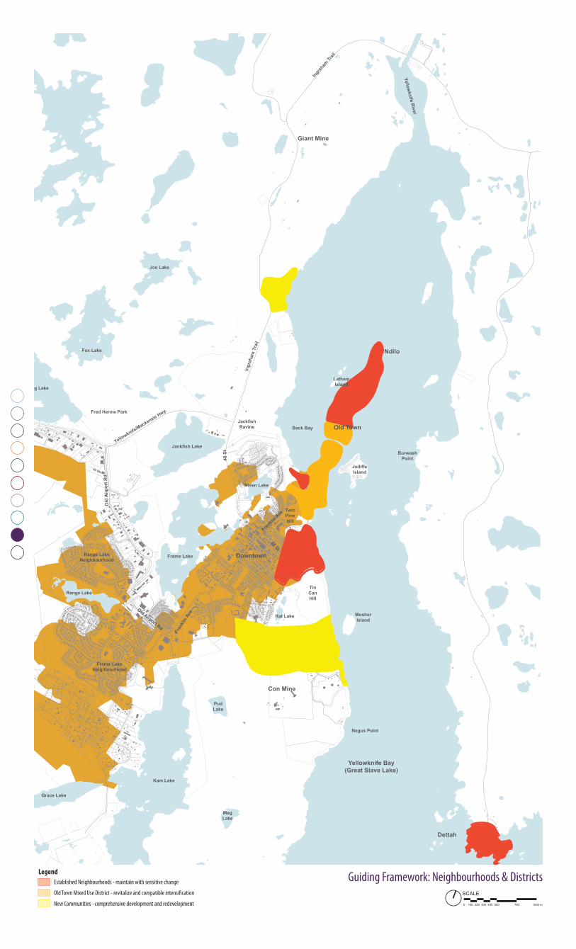
Guiding Framework: Neighbourhoods & DistrictsEstablished Neighbourhoods - maintain with sensitive change
Old Town Mixed Use District - revitalize and compatible intensification
New Communities - comprehensive development and redevelopment
Legend
43Yellowknife Harbour Plan Stage 1 - Background Report & Implementation Strategy: Vision & Frameworks
Neighbourhoods& Districts
9pr
eced
ents
Waterfront preserved for public use
High quality open spaces and amenities
Walkable, compact built form
Multifunctional spaces
A tightly woven mix of land uses
High quality architecture
Beautiful parks and open spaces
Respect for built and natural heritage
Walkable streets, balanced for all users
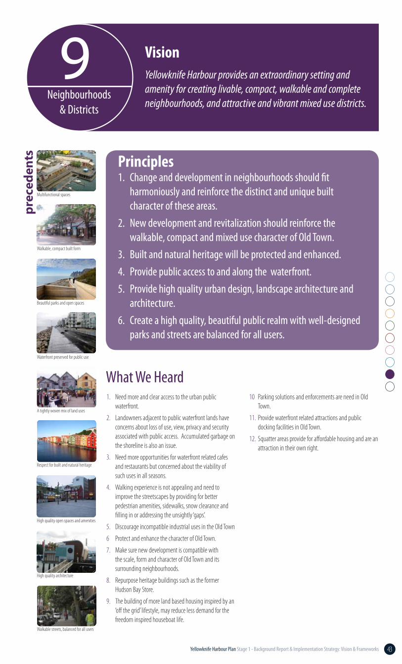
Yellowknife Harbour provides an extraordinary setting and amenity for creating livable, compact, walkable and complete neighbourhoods, and attractive and vibrant mixed use districts.
1. Change and development in neighbourhoods should fit harmoniously and reinforce the distinct and unique built character of these areas.
2. New development and revitalization should reinforce the walkable, compact and mixed use character of Old Town.
3. Built and natural heritage will be protected and enhanced.4. Provide public access to and along the waterfront.5. Provide high quality urban design, landscape architecture and
architecture.6. Create a high quality, beautiful public realm with well-designed
parks and streets are balanced for all users.
Principles
What We Heard1. Need more and clear access to the urban public
waterfront.
2. Landowners adjacent to public waterfront lands have concerns about loss of use, view, privacy and security associated with public access. Accumulated garbage on the shoreline is also an issue.
3. Need more opportunities for waterfront related cafes and restaurants but concerned about the viability of such uses in all seasons.
4. Walking experience is not appealing and need to improve the streetscapes by providing for better pedestrian amenities, sidewalks, snow clearance and filling in or addressing the unsightly ‘gaps’.
5. Discourage incompatible industrial uses in the Old Town
6 Protect and enhance the character of Old Town.
7. Make sure new development is compatible with the scale, form and character of Old Town and its surrounding neighbourhoods.
8. Repurpose heritage buildings such as the former Hudson Bay Store.
9. The building of more land based housing inspired by an ‘off the grid’ lifestyle, may reduce less demand for the freedom inspired houseboat life.
Vision
10 Parking solutions and enforcements are need in Old Town.
11. Provide waterfront related attractions and public docking facilities in Old Town.
12. Squatter areas provide for affordable housing and are an attraction in their own right.
44 Yellowknife Harbour Plan Stage 1 - Background Report & Implementation Strategy: Vision & Frameworks
Ingraham Drive
Wiley Road
PilotsMonumentRotary
Park
Fritz Theil Park
Peace RiverFlats
Twin Pine Hill
McAvoy Rock
LathamIslandPark
MitchelDrive
Waterfront
LATHAM ISLAND
JOLLIFFE ISLAND
YELLOWKNIFEBAY
BACK BAY
Mitchel Drive
Morrison Drive
Ott
o D
rive
Les
sard
Dri
ve
McDonald Drive
Franklin Avenue
Franklin Avenue
School Draw Road
Bryson Road
Brock R
oad
Ragged Ass Road Bretzlaff D
rive
McAvoy Road
Pilots Lane
Stou
t Roa
d
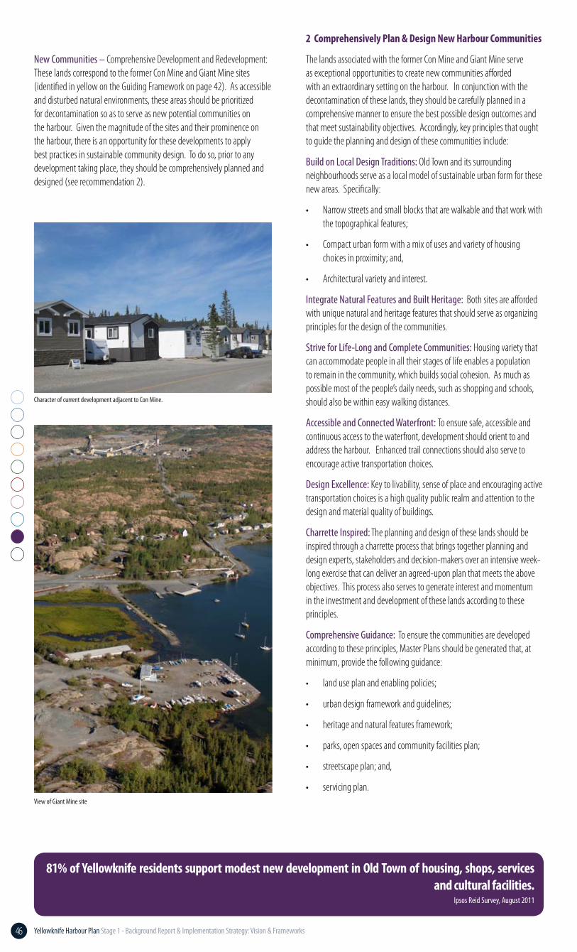
Demonstration plan of the possible long-term revitalization of Old Town
DEMONSTRATION PLANYellowknife Harbour Plan
YELLOWKNIFE HARBOUR PLANJULY 2011
Plan B Natural HeritageBaird & AssociatesAvens Associates Ltd.
The Planning Partnership
Float Home docking area and boat launch
(Marina is located elsewhere in the
Harbour)
Boardwalk through
wetland with interpretive
signage
Potential civic / cultural use
adjacent to new gateway parkette
Enhanced Rotary Park
Mixed-uses focused on new
open space
Special paving to identify key intersection & focus area
Waterfront square & event
space
Pedestrian-oriented streetscape improvements
Series of public spaces for access to the water’s edge
Continuous dock walk pending agreement with private landowners
New park & float plane /boat dock
Higher density residential infill
Enhanced streetscapes
Parking areas hidden in
courtyards
Art gallery in the art park that leverages natural beauty
Medium density
mixed-use, retail &
restaurants
Canoe/kayaklaunch
Canoe/kayaklaunch andstorage
Canoe/kayaklaunch and
storage
Back Bay Landing
• Parks, open space and community facilities plan;• Streetscape plan; and,• Servicing.
3. Encourage, enable and guide context specific development in the Old Town through urban design guidelines in conjunction with a program of incentives. This is to encourage investment, high quality design, and the provision for public benefits such as affordable housing, public open spaces, and arts/cultural facilities.
4. Enhance the quality of streetscapes in Old Town so as to improve the walking experience and to stimulate private investment and revitalization.
5. Establish a strategy to explore options for the evolution of the informal settlements on public land in Old Town. This could include a collaborative process to examine methods of providing options for affordable housing in Old Town, while enabling public access on public land.
6. Restrict leases for private use of public land on the waterfront.
1. Develop a planning framework supported by character area-specific design guidelines that shapes change in neighbourhoods and districts according to the following three categories:• Maintain with sensitive development;• Revitalize and intensify with compatible
development/redevelopment; and,• Large-scale development/redevelopment.
2. Areas for major development/redevelopment should be comprehensively planned and designed to create appealing, complete and life long communities with particular regard for:• Natural and cultural heritage;• Trail connectivity;• Walkable streets and blocks and compact form;• Mix of uses and variety of housing forms; and,• High quality open spaces and amenities.Comprehensive Plans should include:• Urban design plan and guidelines;• Land use plan and policies;• Heritage and natural features framework;
Recommendations
Demonstration of implementation of key recommendations for Old Town
45Yellowknife Harbour Plan Stage 1 - Background Report & Implementation Strategy: Vision & Frameworks
Ingraham Drive
Wiley Road
PilotsMonumentRotary
Park
Fritz Theil Park
Peace RiverFlats
Twin Pine Hill
McAvoy Rock
LathamIslandPark
MitchelDrive
Waterfront
LATHAM ISLAND
JOLLIFFE ISLAND
YELLOWKNIFEBAY
BACK BAY
Mitchel Drive
Morrison Drive
Ott
o D
rive
Les
sard
Dri
ve
McDonald Drive
Franklin Avenue
Franklin Avenue
School Draw Road
Bryson Road
Brock R
oad
Ragged Ass Road Bretzlaff D
rive
McAvoy Road
Pilots Lane
Stou
t Roa
d
Demonstration plan of the possible long-term revitalization of Old Town
DEMONSTRATION PLANYellowknife Harbour Plan
YELLOWKNIFE HARBOUR PLANJULY 2011
Plan B Natural HeritageBaird & AssociatesAvens Associates Ltd.
The Planning Partnership
Float Home docking area and boat launch
(Marina is located elsewhere in the
Harbour)
Boardwalk through
wetland with interpretive
signage
Potential civic / cultural use
adjacent to new gateway parkette
Enhanced Rotary Park
Mixed-uses focused on new
open space
Special paving to identify key intersection & focus area
Waterfront square & event
space
Pedestrian-oriented streetscape improvements
Series of public spaces for access to the water’s edge
Continuous dock walk pending agreement with private landowners
New park & float plane /boat dock
Higher density residential infill
Enhanced streetscapes
Parking areas hidden in
courtyards
Art gallery in the art park that leverages natural beauty
Medium density
mixed-use, retail &
restaurants
Canoe/kayaklaunch
Canoe/kayaklaunch andstorage
Canoe/kayaklaunch and
storage
Back Bay Landing
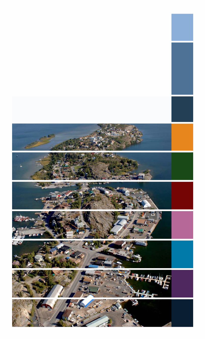
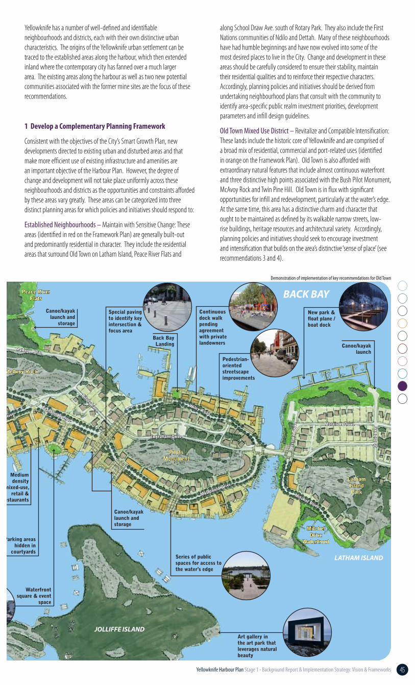
Yellowknife has a number of well-defined and identifiable neighbourhoods and districts, each with their own distinctive urban characteristics. The origins of the Yellowknife urban settlement can be traced to the established areas along the harbour, which then extended inland where the contemporary city has fanned over a much larger area. The existing areas along the harbour as well as two new potential communities associated with the former mine sites are the focus of these recommendations.
1 Develop a Complementary Planning Framework
Consistent with the objectives of the City’s Smart Growth Plan, new developments directed to existing urban and disturbed areas and that make more efficient use of existing infrastructure and amenities are an important objective of the Harbour Plan. However, the degree of change and development will not take place uniformly across these neighbourhoods and districts as the opportunities and constraints afforded by these areas vary greatly. These areas can be categorized into three distinct planning areas for which policies and initiatives should respond to:
Established Neighbourhoods – Maintain with Sensitive Change: These areas (identified in red on the Framework Plan) are generally built-out and predominantly residential in character. They include the residential areas that surround Old Town on Latham Island, Peace River Flats and
along School Draw Ave. south of Rotary Park. They also include the First Nations communities of Ndilo and Dettah. Many of these neighbourhoods have had humble beginnings and have now evolved into some of the most desired places to live in the City. Change and development in these areas should be carefully considered to ensure their stability, maintain their residential qualities and to reinforce their respective characters. Accordingly, planning policies and initiatives should be derived from undertaking neighbourhood plans that consult with the community to identify area-specific public realm investment priorities, development parameters and infill design guidelines.
Old Town Mixed Use District – Revitalize and Compatible Intensification: These lands include the historic core of Yellowknife and are comprised of a broad mix of residential, commercial and port-related uses (identified in orange on the Framework Plan). Old Town is also afforded with extraordinary natural features that include almost continuous waterfront and three distinctive high points associated with the Bush Pilot Monument, McAvoy Rock and Twin Pine Hill. Old Town is in flux with significant opportunities for infill and redevelopment, particularly at the water’s edge. At the same time, this area has a distinctive charm and character that ought to be maintained as defined by its walkable narrow streets, low-rise buildings, heritage resources and architectural variety. Accordingly, planning policies and initiatives should seek to encourage investment and intensification that builds on the area’s distinctive ‘sense of place’ (see recommendations 3 and 4).
Demonstration of implementation of key recommendations for Old Town
46 Yellowknife Harbour Plan Stage 1 - Background Report & Implementation Strategy: Vision & Frameworks
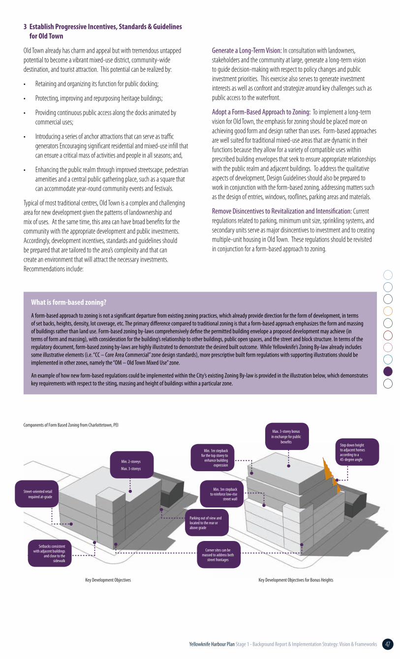
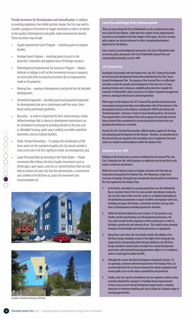
New Communities – Comprehensive Development and Redevelopment: These lands correspond to the former Con Mine and Giant Mine sites (identified in yellow on the Guiding Framework on page 42). As accessible and disturbed natural environments, these areas should be prioritized for decontamination so as to serve as new potential communities on the harbour. Given the magnitude of the sites and their prominence on the harbour, there is an opportunity for these developments to apply best practices in sustainable community design. To do so, prior to any development taking place, they should be comprehensively planned and designed (see recommendation 2).
2 Comprehensively Plan & Design New Harbour Communities
The lands associated with the former Con Mine and Giant Mine serve as exceptional opportunities to create new communities afforded with an extraordinary setting on the harbour. In conjunction with the decontamination of these lands, they should be carefully planned in a comprehensive manner to ensure the best possible design outcomes and that meet sustainability objectives. Accordingly, key principles that ought to guide the planning and design of these communities include:
Build on Local Design Traditions: Old Town and its surrounding neighbourhoods serve as a local model of sustainable urban form for these new areas. Specifically:
• Narrow streets and small blocks that are walkable and that work with the topographical features;
• Compact urban form with a mix of uses and variety of housing choices in proximity; and,
• Architectural variety and interest.
Integrate Natural Features and Built Heritage: Both sites are afforded with unique natural and heritage features that should serve as organizing principles for the design of the communities.
Strive for Life-Long and Complete Communities: Housing variety that can accommodate people in all their stages of life enables a population to remain in the community, which builds social cohesion. As much as possible most of the people’s daily needs, such as shopping and schools, should also be within easy walking distances.
Accessible and Connected Waterfront: To ensure safe, accessible and continuous access to the waterfront, development should orient to and address the harbour. Enhanced trail connections should also serve to encourage active transportation choices.
Design Excellence: Key to livability, sense of place and encouraging active transportation choices is a high quality public realm and attention to the design and material quality of buildings.
Charrette Inspired: The planning and design of these lands should be inspired through a charrette process that brings together planning and design experts, stakeholders and decision-makers over an intensive week-long exercise that can deliver an agreed-upon plan that meets the above objectives. This process also serves to generate interest and momentum in the investment and development of these lands according to these principles.
Comprehensive Guidance: To ensure the communities are developed according to these principles, Master Plans should be generated that, at minimum, provide the following guidance:
• land use plan and enabling policies;
• urban design framework and guidelines;
• heritage and natural features framework;
• parks, open spaces and community facilities plan;
• streetscape plan; and,
• servicing plan.
Image
81% of Yellowknife residents support modest new development in Old Town of housing, shops, services and cultural facilities.
Ipsos Reid Survey, August 2011
View of Giant Mine site
Character of current development adjacent to Con Mine.
47Yellowknife Harbour Plan Stage 1 - Background Report & Implementation Strategy: Vision & Frameworks
3 Establish Progressive Incentives, Standards & Guidelines for Old Town
Old Town already has charm and appeal but with tremendous untapped potential to become a vibrant mixed-use district, community-wide destination, and tourist attraction. This potential can be realized by:
• Retaining and organizing its function for public docking;
• Protecting, improving and repurposing heritage buildings;
• Providing continuous public access along the docks animated by commercial uses;
• Introducing a series of anchor attractions that can serve as traffic generators Encouraging significant residential and mixed-use infill that can ensure a critical mass of activities and people in all seasons; and,
• Enhancing the public realm through improved streetscape, pedestrian amenities and a central public gathering place, such as a square that can accommodate year-round community events and festivals.
Typical of most traditional centres, Old Town is a complex and challenging area for new development given the patterns of landownership and mix of uses. At the same time, this area can have broad benefits for the community with the appropriate development and public investments. Accordingly, development incentives, standards and guidelines should be prepared that are tailored to the area’s complexity and that can create an environment that will attract the necessary investments. Recommendations include:
Generate a Long-Term Vision: In consultation with landowners, stakeholders and the community at large, generate a long-term vision to guide decision-making with respect to policy changes and public investment priorities. This exercise also serves to generate investment interests as well as confront and strategize around key challenges such as public access to the waterfront.
Adopt a Form-Based Approach to Zoning: To implement a long-term vision for Old Town, the emphasis for zoning should be placed more on achieving good form and design rather than uses. Form-based approaches are well suited for traditional mixed-use areas that are dynamic in their functions because they allow for a variety of compatible uses within prescribed building envelopes that seek to ensure appropriate relationships with the public realm and adjacent buildings. To address the qualitative aspects of development, Design Guidelines should also be prepared to work in conjunction with the form-based zoning, addressing matters such as the design of entries, windows, rooflines, parking areas and materials.
Remove Disincentives to Revitalization and Intensification: Current regulations related to parking, minimum unit size, sprinkling systems, and secondary units serve as major disincentives to investment and to creating multiple-unit housing in Old Town. These regulations should be revisited in conjunction for a form-based approach to zoning.
What is form-based zoning?
A form-based approach to zoning is not a significant departure from existing zoning practices, which already provide direction for the form of development, in terms of set backs, heights, density, lot coverage, etc. The primary difference compared to traditional zoning is that a form-based approach emphasizes the form and massing of buildings rather than land use. Form-based zoning by-laws comprehensively define the permitted building envelope a proposed development may achieve (in terms of form and massing), with consideration for the building’s relationship to other buildings, public open spaces, and the street and block structure. In terms of the regulatory document, form-based zoning by-laws are highly illustrated to demonstrate the desired built outcome. While Yellowknife’s Zoning By-law already includes some illustrative elements (i.e. “CC – Core Area Commercial” zone design standards), more prescriptive built form regulations with supporting illustrations should be implemented in other zones, namely the “OM – Old Town Mixed Use” zone.
An example of how new form-based regulations could be implemented within the City’s existing Zoning By-law is provided in the illustration below, which demonstrates key requirements with respect to the siting, massing and height of buildings within a particular zone.
Setbacks consistent with adjacent buildings
and close to the sidewalk
Corner sites can be massed to address both
street frontages
Parking out of view and located to the rear or above grade
Street-oriented retail required at-grade
Min. 2-storeys
Max. 3-storeys
Max. 3-storey bonus in exchange for public
benefits
Min. 3m stepback to reinforce low-rise
street wall
Step down height to adjacent homes according to a 45-degree angle
Min. 1m stepback for the top storey to
enhance building expression
Key Development Objectives Key Development Objectives for Bonus Heights
Components of Form Based Zoning from Charlottetown, PEI
48 Yellowknife Harbour Plan Stage 1 - Background Report & Implementation Strategy: Vision & Frameworks
Provide Incentives for Revitalization and Intensification: In addition to revisiting regulations that inhibit positive change, the City may need to consider a program of incentives to trigger investment as well as to deliver on the quality of development and public realm improvements desired. These incentives may include:
• Façade Improvement Grant Program – matching grants to improve facades;
• Heritage Grants Program – matching grants to assist in the protection, restoration and adaptive reuse of heritage resources;
• Redevelopment/Improvement Tax Assistance Program – rebates, deferrals or holidays to off-set the incremental increase in property tax that results from increased assessments due to improvements made on the property;
• Waiving Fees – waiving of development and permit fees for desirable developments;
• Streamlined Approvals – providing quick and guaranteed approvals for developments that are in conformance with the vision, form-based zoning and design guidelines;
• Bonusing – to work in conjunction for form-based zoning a clearly defined envelope that is a bonus in development permissions can be considered in exchange for providing benefits to the area such as affordable housing, public space, publicly accessible waterfront easements, and arts/cultural facilities;
• Public-Private Partnerships – To catalyze the revitalization of Old Town and to set the standard of quality, the City should consider a more active role in the first significant mixed-use development; and,
• Lower Perceived Risks by Investing in the Public Realm – Private investment often follows the lead of public investment (such as streetscapes, open spaces, and civic or cultural facilities) that not only help to enhance the area, but that also demonstrates a commitment and confidence for Old Town as a place for investment (see recommendation 4).
Examples of architecture/design in Old Town
Land Use and Design Policy Enhancements
There are many things the City of Yellowknife can do to implement its long-term vision for the Harbour. Aside from the creation of new administrative structures as articulated in the final chapter of this report, the City’s existing policy regime can also be enhanced to reflect emerging development objectives for the Harbour.
From a land use and development perspective, the City of Yellowknife relies on two key policy documents: the City of Yellowknife General Plan and corresponding Zoning By-Law No. 4404.
2011 General Plan
Developed concurrently with the Harbour Plan, the 2011 General Plan builds on the long-term development framework established by the City’s Smart Growth Development Plan. The purpose of the General Plan is to effectively articulate a vision for growth and development in the City over a 10-year planning horizon and, in doing so, establish policy directives to guide the evolution of Yellowknife’s urban structure as its relates to growth management, land use, municipal infrastructure and transportation.
With respect to the Harbour, the 2011 General Plan provides broad directives encouraging strong partnerships and collaboration with all key interests in the development and use of the Harbour, including the YKDFN and Federal and Territorial partners. However, in terms of more detailed policies, the General Plan largely defers to the Harbour Plan and recognizes the potential need for future General Plan amendments to ensure that policies between the two planning documents are consistent.
Overall, the 2011 General Plan provides sufficient policy support for the long-term planning and development of the Harbour. Therefore, no amendments to the General Plan are required in the immediate term to implement the land/water use-related recommendations within the Harbour Plan.
Zoning By-law No. 4404
Building on the broad land use policies established by the General Plan, the City’s Zoning By-law (No. 4404) provides an additional level of specificity with respect to land use permissions.
While the current land use zones are largely consistent with the land use framework envisaged by the Harbour Plan, the following is a high-level overview of strategic Zoning By-law amendments that should be considered as the City implements the Harbour Plan.
1. In the future, and subject to securing jurisdiction over the Yellowknife Bay or a portion thereof, the City may consider extending its zoning by-law over the water (either over the surface or on lakebed depending on the jurisdictional parameters in place) to define and regulate water uses, including moorage, float homes, commercial activities and any other forms of development extending beyond the shoreline.
2. While the Old Town Mixed Use zone (Section 10.18) provides a very flexible and forward thinking set of development permissions, the City could consider further expansion of those permissions in order to facilitate a greater mix and intensity of use. This could be done primarily through increased height and density permissions as appropriate.
3. Along those same lines, the City should consider the addition of an Old Town Design Standards section in Part Eight of the Zoning By-law. Supported by corresponding Urban Design Guidelines, the Old Town Design Standards should clearly articulate form-based development permissions with potential bonusing provisions subject to set conditions and/or in exchange for public benefits.
4. Although the current Shoreline Development Standards (Section 7.4) are generally consistent with the broad intent of the Harbour Plan, it is recommended that this section be enhanced to include regulations that ensure public access to the water is provided for and protected.
5. Finally, some site-specific amendments may be required to address areas currently inhabited by “squatters” to facilitate future improvements to those areas as more formal development opportunities, including reductions in minimum dwelling unit sizes to allow for a broader range of housing opportunities.
49Yellowknife Harbour Plan Stage 1 - Background Report & Implementation Strategy: Vision & Frameworks
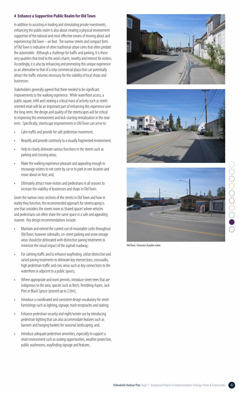
4 Enhance a Supportive Public Realm for Old Town
In addition to assisting in leading and stimulating private investments, enhancing the public realm is also about creating a physical environment supportive of the rational and most effective means of moving about and experiencing Old Town – on foot. The narrow streets and compact form of Old Town is indicative of other traditional urban cores that often predate the automobile. Although a challenge for traffic and parking, it is these very qualities that lend to the area’s charm, novelty and interest for visitors. Accordingly, it is also by enhancing and promoting this unique experience as an alternative to that of a strip commercial plaza that can potentially attract the traffic volumes necessary for the viability of local shops and businesses.
Stakeholders generally agreed that there needed to be significant improvements to the walking experience. While waterfront access, a public square, infill and creating a critical mass of activity such as street-oriented retail will be an important part of enhancing this experience over the long-term, the design and quality of the streetscapes will be critical to improving this environment and kick-starting revitalization in the near term. Specifically, streetscape improvements in Old Town can serve to:
• Calm traffic and provide for safe pedestrian movement;
• Beautify and provide continuity to a visually fragmented environment;
• Help to clearly delineate various functions in the streets such as parking and crossing areas;
• Make the walking experience pleasant and appealing enough to encourage visitors to not come by car or to park in one location and move about on foot; and,
• Ultimately attract more visitors and pedestrians in all seasons to increase the viability of businesses and shops in Old Town.
Given the narrow cross-sections of the streets in Old Town and how in reality they function, the recommended approach for streetscaping is one that considers the streets more as ‘shared spaces’ where vehicles and pedestrians can often share the same space in a safe and appealing manner. Key design recommendations include:
• Maintain and extend the current use of mountable curbs throughout Old Town; however sidewalks, on-street parking and snow storage areas should be delineated with distinctive paving treatments to minimize the visual impact of the asphalt roadway;
• For calming traffic and to enhance wayfinding, utilize distinctive and raised paving treatments to delineate key intersections, crosswalks, high pedestrian traffic and civic areas such as key connections to the waterfront or adjacent to a public spaces;
• Where appropriate and room permits, introduce street trees that are indigenous to the area, species such as Birch, Trembling Aspen, Jack Pine or Black Spruce (pruned up to 2.0m);
• Introduce a coordinated and consistent design vocabulary for street furnishings such as lighting, signage, trash receptacles and seating;
• Enhance pedestrian security and night/winter use by introducing pedestrian lighting that can also accommodate features such as banners and hanging baskets for seasonal landscaping; and,
• Introduce adequate pedestrian amenities, especially to support a retail environment such as seating opportunities, weather protection, public washrooms, wayfinding signage and features.
Old Town. Character of public realm
50 Yellowknife Harbour Plan Stage 1 - Background Report & Implementation Strategy: Vision & Frameworks
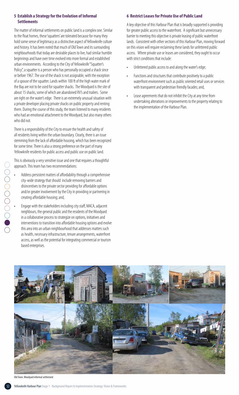
Old Town. Woodyard informal settlement
6 Restrict Leases for Private Use of Public Land
A key objective of this Harbour Plan that is broadly supported is providing for greater public access to the waterfront. A significant but unnecessary barrier to meeting this objective is private leasing of public waterfront lands. Consistent with other sections of this Harbour Plan, moving forward on this vision will require reclaiming these lands for unfettered public access. Where private use or leases are considered, they ought to occur with strict conditions that include:
• Unfettered public access to and along the water’s edge;
• Functions and structures that contribute positively to a public waterfront environment such as public oriented retail uses or services with transparent and pedestrian friendly facades; and,
• Lease agreements that do not inhibit the City at any time from undertaking alterations or improvements to the property relating to the implementation of the Harbour Plan.
5 Establish a Strategy for the Evolution of Informal Settlements
The matter of informal settlements on public land is a complex one. Similar to the float homes, these ‘squatters’ are tolerated because for many they hold some sense of legitimacy as a distinctive aspect of Yellowknife culture and history. It has been noted that much of Old Town and its surrounding neighbourhoods that today are desirable places to live, had similar humble beginnings and have over time evolved into more formal and established urban environments. According to the City of Yellowknife “Squatter’s Policy”, a squatter is a person who has personally occupied a shack since or before 1967. The use of the shack is not assignable, with the exception of a spouse of the squatter. Lands within 100 ft of the high water mark of the Bay are not to be used for squatter shacks. The Woodyard is the site of about 15 shacks, some of which are abandoned RV’s and trailers. Some are right on the water’s edge. There is an extremely unusual situation with a private developer placing private shacks on public property and renting them. During the course of this study, the team listened to many residents who had an emotional attachment to the Woodyard, but also many others who did not.
There is a responsibility of the City to ensure the health and safety of all residents living within the urban boundary. Clearly, there is an issue stemming from the lack of affordable housing, which has been recognized for some time. There is also a strong preference on the part of many Yellowknife residents for public access and public use on public land.
This is obviously a very sensitive issue and one that requires a thoughtful approach. This team has two recommendations:
• Address persistent matters of affordability through a comprehensive city-wide strategy that should include removing barriers and disincentives to the private sector providing for affordable options and/or greater involvement by the City in providing or partnering in creating affordable housing; and,
• Engage with the stakeholders including city staff, MACA, adjacent neighbours, the general public and the residents of the Woodyard in a collaborative process to strategize on options, initiatives and interventions to transition into affordable housing options and evolve this area into an urban neighbourhood that addresses matters such as health, necessary infrastructure, tenure arrangements, waterfront access, as well as the potential for integrating commercial or tourism based enterprises.
51Yellowknife Harbour Plan Stage 1 - Background Report & Implementation Strategy: Vision & Frameworks
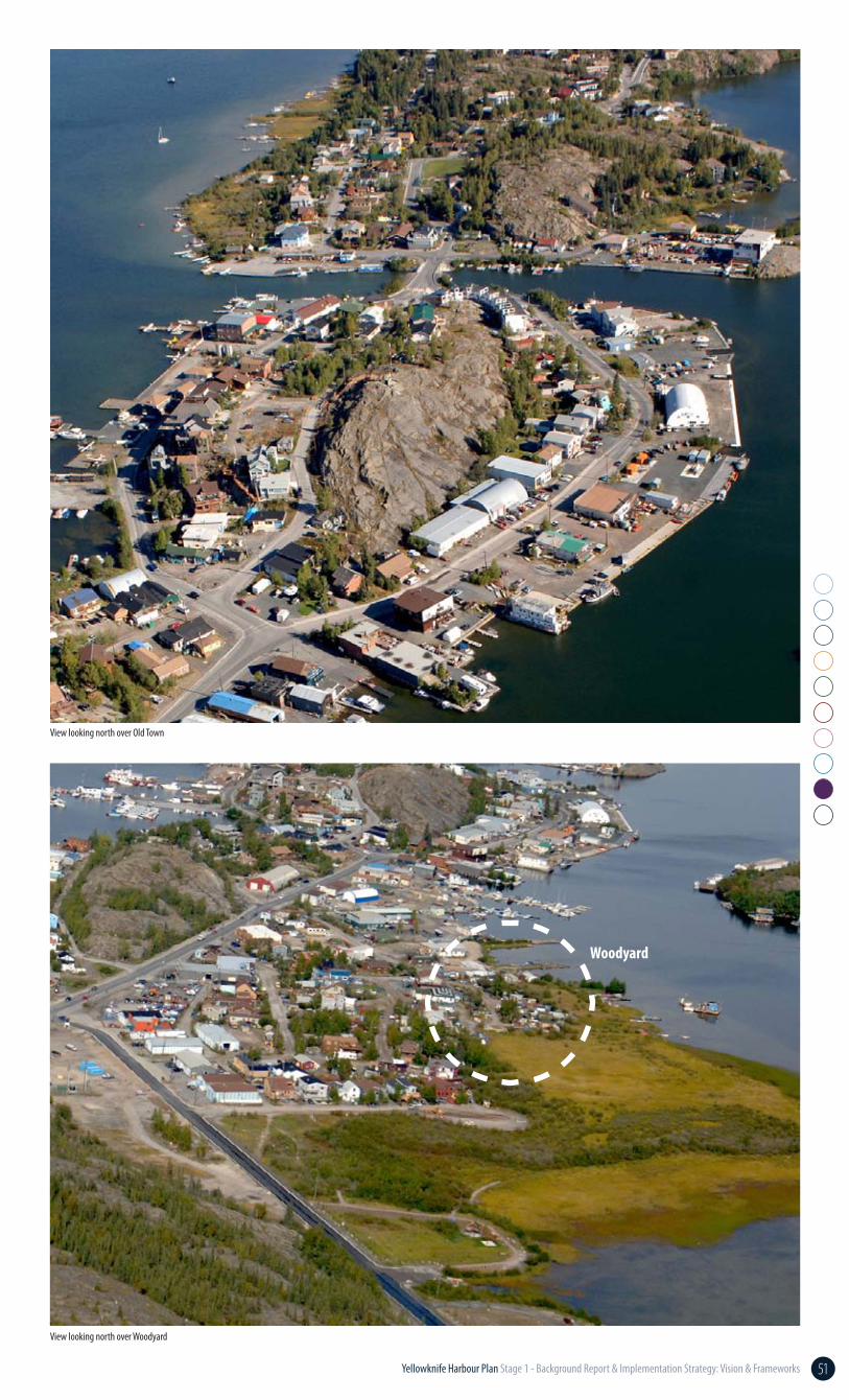
View looking north over Old Town
View looking north over Woodyard
Woodyard
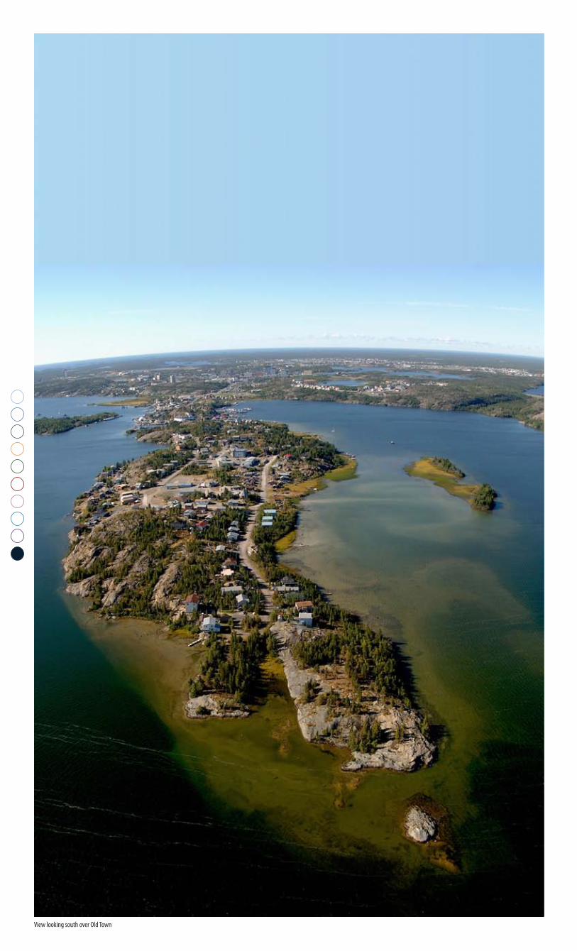
View looking south over Old Town
53Yellowknife Harbour Plan Stage 1 - Background Report & Implementation Strategy: Vision & Frameworks
Implementation
The Harbour Management Strategy was developed based on a review of case studies, conversations with stakeholders and understanding of the particular conditions and uses of the Yellowknife Harbour. The philosophy of the management strategy, the preferred management approach and key actions are described in this chapter.
10Introduction
Philosophy of the Harbour Management Strategy
Yellowknife’s Harbour is a tremendous shared community resource. The Harbour represents a dynamic mix of uses and functions, specifically it:
• bears cultural and historic significance to the Yellowknives Dene First Nation and residents of the area;
• serves as a year-round recreational hub for residents and visitors;
• is a key component of the City’s transportation network (float planes, boats, and vehicular use on the Dettah Ice Road);
• supports economic development and commercial activity; and
• provides the setting for Yellowknife’s unique float home community.
However, in the absence of a clear long-term vision for the Harbour, an effective planning and management framework and/or consistent enforcement of existing regulations, the intensity of development and activity within the Harbour has led to growing conflict among uses. Based on the guiding principles and recommendations within the Harbour Plan, this section outlines several priority tasks to strategically advance the long-term vision.
This Harbour Management Strategy, and the broader Harbour Plan, is based on the philosophy that the long-term development of the Yellowknife Harbour must serve the common good and ensure that:
• the Harbour Plan, and its implementation, is fair and reasonable;
• safety and sustainability are promoted;
• adverse social and environmental impacts are avoided, minimized or mitigated;
• all Yellowknifers have the opportunity to benefit from the Plan’s implementation; and,
• key stakeholders, including the Yellowknives Dene First Nation and community members, are consulted throughout the implementation process.
As highlighted in the Background Report, the Plan is being driven by the need to address a number of issues currently facing Yellowknife’s Harbour, including:
• lack of coordinated long-term vision for the Harbour;
• ambiguity with respect to jurisdictional authority;
• lack of enforcement and development control;
• increased congestion and conflict between uses/users;
• liability with respect to servicing provisions and Harbour safety;
• impacts on water quality and the environment;
• impacts on natural and cultural heritage resources;
• constraints to public access to the waterfront; and,
• growing intensity of informal residential development both within the Harbour and along the waterfront.
54 Yellowknife Harbour Plan Stage 1 - Background Report & Implementation Strategy: Vision & Frameworks
Administration Framework - Harbour Management ModelsGiven the jurisdictional complexities around the regulation of uses and activities within the Harbour, a clear delineation of responsibilities is essential to achieve the goals and objectives set out in the Harbour Plan. As part of the background work undertaken for this study, a variety of Harbour management models – based on national and international case studies – were examined, each varying in terms of controlling authority, governance structures, mandates and administration. The evaluation and analysis of those Harbour management models is detailed below.
Harbour Authority
Description: A third-party Harbour Authority, governed by a Board of Directors (elected or appointed) to oversee planning and management of the Harbour and its facilities.
Implementation: While Small Craft Harbours’ Harbour Authority Manual (1998) provides fairly detailed technical guidance on the administrative, financial, operational and environmental management aspects of establishing and managing a Harbour Authority, the initial establishment of a third-party Harbour Authority is relatively complex.
Given Yellowknife’s regulatory and governance intricacies and the diversity of interests at play in Yellowknife’s waterfront area, securing sign-off on the establishment of a third-party Harbour Authority and subsequent recognition of that Authority from those interests would likely be challenging and subject to lengthy and complicated negotiations. Furthermore, most third-party Harbour Authorities have relatively limited mandates, focused primarily on the development and operation of the physical Harbour facilities and associated services provided therein. To establish a Harbour Authority with a broader mandate with powers to regulate waterfront development and activities on the open water would likely require extensive negotiation at the political level and between all levels of government.
Administration: Aside from the challenges of establishing such an entity aside, the administration of a Harbour Authority would be relatively straightforward, subject to securing stable revenue sources through user fees and committed funds from participating members. Notwithstanding that, the creation of another formal entity with direct interest in the Harbour could create additional adverse complexity in the regulation and management of uses and activities in the Harbour. Likewise, from the City’s perspective, the creation of a third-party entity to oversee Harbour management would not provide the necessary assurances that the City’s long-term Harbour planning and development objectives would be pursued and/or achieved.
Compatibility with existing regulatory context: As indicated above, the regulatory context in which Yellowknife operates in is already multi-layered, with various Federal and Territorial departments/agencies, the YKDFN and the City overseeing overlapping jurisdictional responsibilities. The creation of a Harbour Authority would essentially create another layer of bureaucracy and thereby increase the potential for inter-jurisdictional conflict in the planning, development, management and enforcement of activity within the Harbour.
Intergovernmental Development Corporation
Description: An inter-jurisdictional corporation with a specific mandate and powers to control and oversee development and activity within the Harbour.
Implementation: Of the management models examined here, an intergovernmental development corporation is the most complex to implement, both politically and administratively. The establishment of an intergovernmental corporation would require a high degree of political will from all levels of government and extensive negotiation on the mandate, powers and funding structure of such an entity. Such negotiations could take years.
Administration: Notwithstanding the challenges associated with implementing an intergovernmental super-agency to oversee the development and management of the Yellowknife Harbour, the creation of a separate authority with decision-making abilities could lead to adverse complexity and conflict in the regulation and management of uses and
activities in the Harbour. Likewise, from the City’s perspective, the creation of a super-agency to oversee Harbour management would not provide the necessary assurances that the City’s long-term Harbour planning and development objectives would be pursued and/or achieved.
Compatibility with existing regulatory context: It is foreseeable that an intergovernmental corporation or agency to oversee the regulation of development and activity within the Harbour could be designed to fit within, or even supercede, the multi-layered regulatory regime currently in place. However, the establishment of a such a corporation/agency would create an entirely new layer of bureaucracy and, as a result, could generate inefficiencies in terms of administrative costs, encumber the timeliness of critical decision-making and heighten the potential for inter-jurisdictional conflict in the planning, development, management and enforcement of activity within the Harbour.

55Yellowknife Harbour Plan Stage 1 - Background Report & Implementation Strategy: Vision & Frameworks
Specialized Municipal Agency
Description: A specialized City agency or commission created to lead the planning, permitting, management and enforcement of development and activity within the Harbour.
Implementation: The implementation of a specialized City agency to oversee the planning, management and enforcement of development and activity within the Harbour could be facilitated through Council direction. The key benefit to this approach is that it allows the City to maintain a high degree of administrative oversight and gives the City the ability to link the mandate of the agency with the vision, objectives and recommendations of this Plan.
Administration: Subject to the extent of the department’s scope and a subsequent assessment of staffing needs and budgetary requirements, this specialized agency could be structured in two ways:
1. As a stand-alone administrative unit with its own dedicated staff – this option would have greater administrative costs associated with it and would require its own operating budget; or,
2. As an interdepartmental group that functions as a coordinating body set-up to address matters related to the Harbour. The latter option could be jointly headed by a number of directors/management, with support from their existing staff teams.
Compatibility with existing regulatory context: As a City-controlled entity, new municipal by-laws could be drafted to implement and establish the mandate of the agency. This agency could then work with its inter-governmental counterparts to resolve ongoing jurisdictional issues related to the Yellowknife Harbour and in the longer-term look at opportunities for transferring its responsibilities for Harbour management to an inter-governmental or third-party authority.
Memorandum Of Understanding (MOU)
Description: A written agreement between various interests that sets out core principles, objectives and responsibilities of the signatories.
Implementation: MOUs are a common tool used between various authorities to articulate a common understanding of their working relationship as it pertains to a particular issue or objective. While the development of a Memorandum of Understanding related to Harbour planning, management and enforcement would likely be subject to lengthy, and potentially contentious, negotiations, the process could also be a constructive platform to raise awareness of the City’s vision for the Harbour, foster a spirit of collaboration between the various interests and clarify how new and existing regulations will be interpreted and enforced.
Administration: An MOU is more of an administrative tool than an administrative model. However, it can be an important mechanism to
establish a structure for partnership between the signatories and reinforce administrative roles and responsibilities of those signatories. As such, an MOU could be used in conjunction with any of the preceding Harbour administrative models, to articulate the roles and responsibilities of the future Harbour authority in whatever form it may eventually take.
Compatibility with existing regulatory context: An MOU can be tailored to augment or fit within the existing regulatory context. How the terms of an MOU are integrated within the context of broader regulations and jurisdictional responsibilities will likely be one of the most crucial aspects in the negotiations to draft the MOU.
89% of Yellowknife residents agree that better management and enforcement would enhance the use of Yellowknife Harbour for everyone.
Ipsos Reid Survey, August 2011
56 Yellowknife Harbour Plan Stage 1 - Background Report & Implementation Strategy: Vision & Frameworks
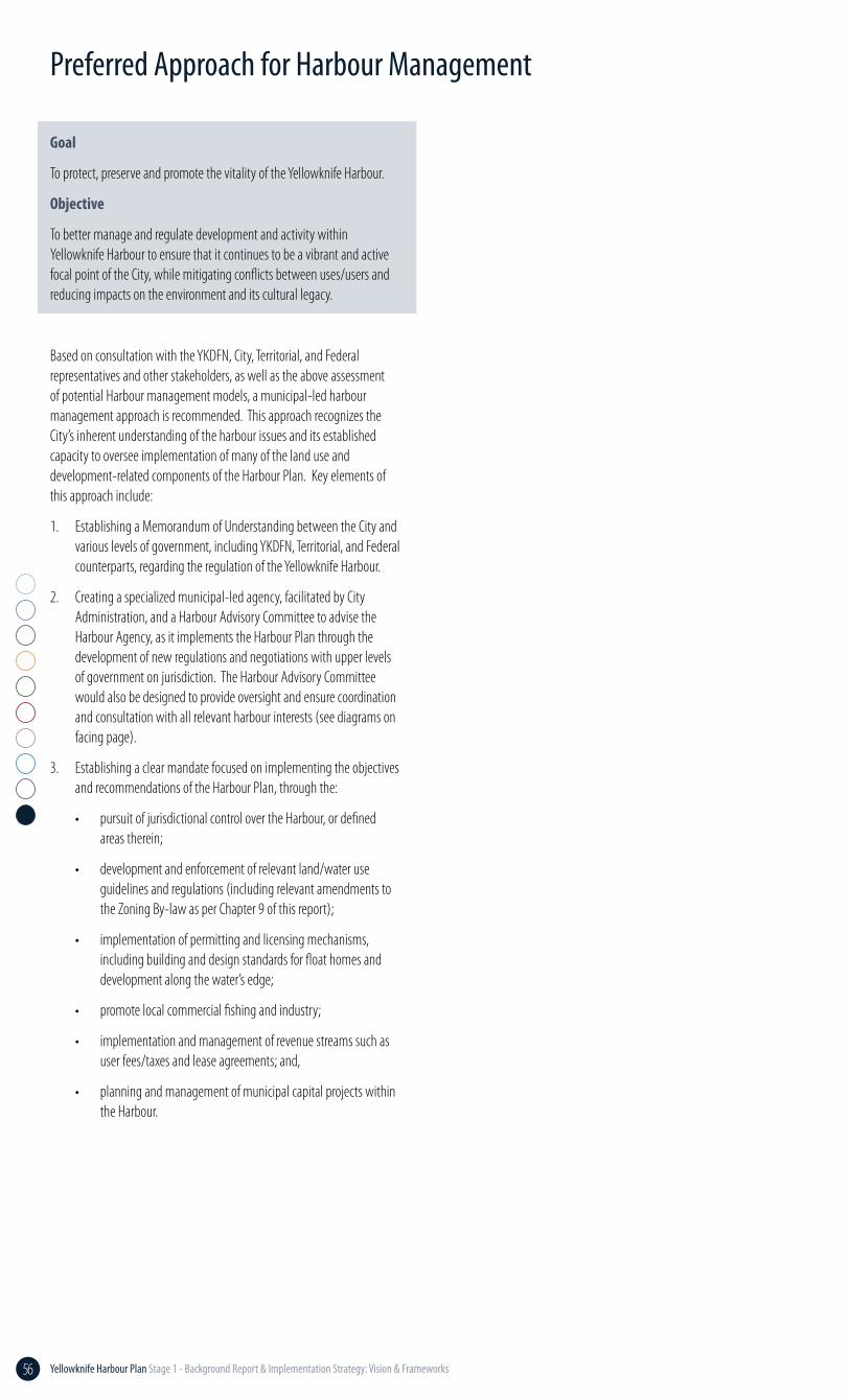
Preferred Approach for Harbour Management
Goal
To protect, preserve and promote the vitality of the Yellowknife Harbour.
Objective
To better manage and regulate development and activity within Yellowknife Harbour to ensure that it continues to be a vibrant and active focal point of the City, while mitigating conflicts between uses/users and reducing impacts on the environment and its cultural legacy.
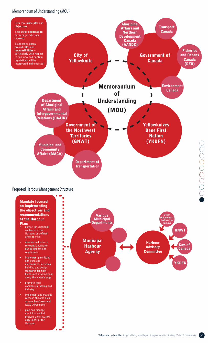
Based on consultation with the YKDFN, City, Territorial, and Federal representatives and other stakeholders, as well as the above assessment of potential Harbour management models, a municipal-led harbour management approach is recommended. This approach recognizes the City’s inherent understanding of the harbour issues and its established capacity to oversee implementation of many of the land use and development-related components of the Harbour Plan. Key elements of this approach include:
1. Establishing a Memorandum of Understanding between the City and various levels of government, including YKDFN, Territorial, and Federal counterparts, regarding the regulation of the Yellowknife Harbour.
2. Creating a specialized municipal-led agency, facilitated by City Administration, and a Harbour Advisory Committee to advise the Harbour Agency, as it implements the Harbour Plan through the development of new regulations and negotiations with upper levels of government on jurisdiction. The Harbour Advisory Committee would also be designed to provide oversight and ensure coordination and consultation with all relevant harbour interests (see diagrams on facing page).
3. Establishing a clear mandate focused on implementing the objectives and recommendations of the Harbour Plan, through the:
• pursuit of jurisdictional control over the Harbour, or defined areas therein;
• development and enforcement of relevant land/water use guidelines and regulations (including relevant amendments to the Zoning By-law as per Chapter 9 of this report);
• implementation of permitting and licensing mechanisms, including building and design standards for float homes and development along the water’s edge;
• promote local commercial fishing and industry;
• implementation and management of revenue streams such as user fees/taxes and lease agreements; and,
• planning and management of municipal capital projects within the Harbour.
57Yellowknife Harbour Plan Stage 1 - Background Report & Implementation Strategy: Vision & Frameworks
Memorandum of Understanding (MoU)
City of Yellowknife
Government of Canada
Fisheries and Oceans
Canada (DFO)
Aboriginal Affairs and Northern
Development Canada
(AANDC)
Yellowknives Dene First
Nation (YKDFN)
Government of the Northwest
Territories (GNWT)
Memorandum of
Understanding
(MOU)
Municipal and Community
Affairs (MACA)
Department of Aboriginal Affairs and
Intergovernmental Relations (DAAIR)
Transport Canada
Environment Canada
Department of Transportation
Sets core principles and objectives
Encourage cooperation between jurisdictional interests
Establishes clarity around roles and responsibilities – particularly with respect to how new and existing regulations will be interpreted and enforced
• pursue jurisdictional control over the Harbour, or defined areas therein
• develop and enforce relevant land/water use guidelines and regulations
• implement permitting and licensing mechanisms, including building and design standards for float homes and development along the water’s edge
• promote local commercial fishing and industry
• implement and manage revenue streams such as user fees/taxes and lease agreements
• plan and manage municipal capital projects along water’s edge lands of the Harbour.
Mandate focused on implementing the objectives and recommendations of the Harbour Plan:
Municipal Harbour Agency
Resultant Structure
Harbour Advisory
Committee
GNWT
YKDFN
Gov. ofCanada
VariousMunicipal
Departments
Other stakeholders that use the
Harbour
Proposed Harbour Management Structure
Memorandum of Understanding (MOU)
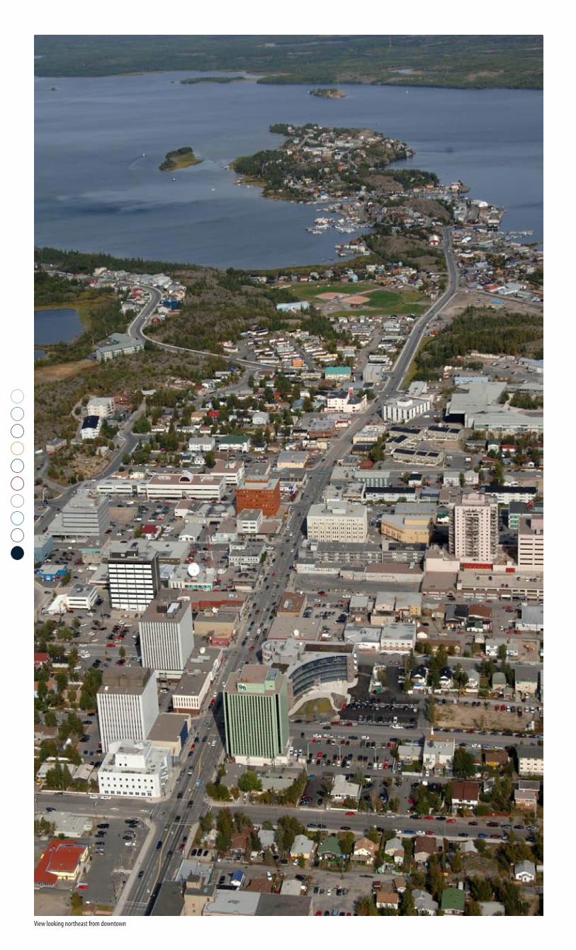
View looking northeast from downtown
59Yellowknife Harbour Plan Stage 1 - Background Report & Implementation Strategy: Vision & Frameworks
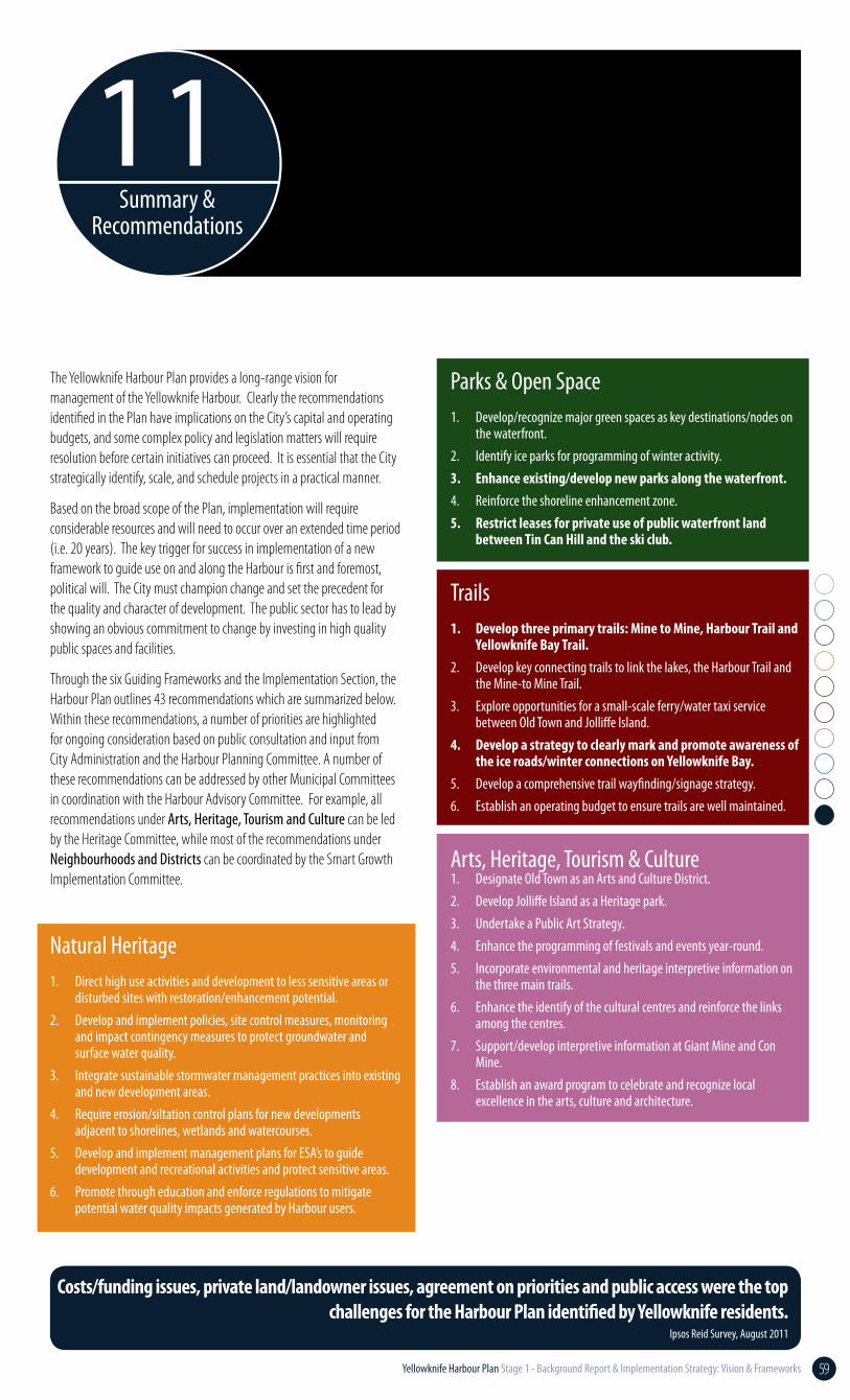
Summary &Recommendations
11
The Yellowknife Harbour Plan provides a long-range vision for management of the Yellowknife Harbour. Clearly the recommendations identified in the Plan have implications on the City’s capital and operating budgets, and some complex policy and legislation matters will require resolution before certain initiatives can proceed. It is essential that the City strategically identify, scale, and schedule projects in a practical manner.
Based on the broad scope of the Plan, implementation will require considerable resources and will need to occur over an extended time period (i.e. 20 years). The key trigger for success in implementation of a new framework to guide use on and along the Harbour is first and foremost, political will. The City must champion change and set the precedent for the quality and character of development. The public sector has to lead by showing an obvious commitment to change by investing in high quality public spaces and facilities.
Through the six Guiding Frameworks and the Implementation Section, the Harbour Plan outlines 43 recommendations which are summarized below. Within these recommendations, a number of priorities are highlighted for ongoing consideration based on public consultation and input from City Administration and the Harbour Planning Committee. A number of these recommendations can be addressed by other Municipal Committees in coordination with the Harbour Advisory Committee. For example, all recommendations under Arts, Heritage, Tourism and Culture can be led by the Heritage Committee, while most of the recommendations under Neighbourhoods and Districts can be coordinated by the Smart Growth Implementation Committee.
Natural Heritage 1. Direct high use activities and development to less sensitive areas or
disturbed sites with restoration/enhancement potential.2. Develop and implement policies, site control measures, monitoring
and impact contingency measures to protect groundwater and surface water quality.
3. Integrate sustainable stormwater management practices into existing and new development areas.
4. Require erosion/siltation control plans for new developments adjacent to shorelines, wetlands and watercourses.
5. Develop and implement management plans for ESA’s to guide development and recreational activities and protect sensitive areas.
6. Promote through education and enforce regulations to mitigate potential water quality impacts generated by Harbour users.
Costs/funding issues, private land/landowner issues, agreement on priorities and public access were the top challenges for the Harbour Plan identified by Yellowknife residents.
Ipsos Reid Survey, August 2011
Parks & Open Space1. Develop/recognize major green spaces as key destinations/nodes on
the waterfront.2. Identify ice parks for programming of winter activity.3. Enhance existing/develop new parks along the waterfront.4. Reinforce the shoreline enhancement zone.5. Restrict leases for private use of public waterfront land
between Tin Can Hill and the ski club.
Trails1. Develop three primary trails: Mine to Mine, Harbour Trail and
Yellowknife Bay Trail.2. Develop key connecting trails to link the lakes, the Harbour Trail and
the Mine-to Mine Trail.3. Explore opportunities for a small-scale ferry/water taxi service
between Old Town and Jolliffe Island. 4. Develop a strategy to clearly mark and promote awareness of
the ice roads/winter connections on Yellowknife Bay.5. Develop a comprehensive trail wayfinding/signage strategy.6. Establish an operating budget to ensure trails are well maintained.
Arts, Heritage, Tourism & Culture1. Designate Old Town as an Arts and Culture District.2. Develop Jolliffe Island as a Heritage park.3. Undertake a Public Art Strategy.4. Enhance the programming of festivals and events year-round.5. Incorporate environmental and heritage interpretive information on
the three main trails.6. Enhance the identify of the cultural centres and reinforce the links
among the centres.7. Support/develop interpretive information at Giant Mine and Con
Mine.8. Establish an award program to celebrate and recognize local
excellence in the arts, culture and architecture.
Significant public input was received at all stages of the Harbour Plan’s development and the Harbour Planning Committee spent considerable time weighing the public input and revising the report to optimize public expectations. Given the scope of the Plan it is evident that implementation will need to occur over an extended period of time (i.e. 20 years). As a result of public input and resources the Committee recommended five priority tasks for immediate implementation:
1. Pursue the feasibility of a Giant Mine Marina Site concurrently with exploring Mosher Island as an alternate marina site;
2. Establish a memorandum of understanding, seek jurisdiction over the Yellowknife Harbour (lake bed Great Slave Lake within the municipal boundaries);
3. Pursue a Float Plane/small Boat Marina at the proposed Back Bay site on Latham Island;
4. Seek municipal tenure to the DFO property (the government dock: Lot 10, Block A, Plan 3801) and clean it up; and
5. Maintain and upgrade the existing parks (upgrades to include amenities and appropriate lighting). The City should focus its efforts on the following sites in the short-term: Pilot’s Monument, Wiley Road parcel, Otto Drive Park, and the Rotary Park.
These five recommendations were adopted by Council and will allow Administration to pursue a number of initiatives over the next 12-18 months while the balance of the Harbour Plan is considered for implementation.
Implementing the broader aspects of the Harbour Plan will require considerable time and resources. With the recommended tasks and priorities in mind, it is important that the City pursue those harbour initiatives which are imperative to building momentum and public support. A number of projects can be completed with limited resources, while others require long-range planning, budgeting, and legislative support. A balanced approach which concurrently pursues small scale projects with preliminary planning on larger initiatives may be the most effective.
The purpose of the Committee, as per the initial Terms of Reference, was to facilitate the interests of the various governmental bodies in developing a regulatory framework and development vision for the Yellowknife Harbour. With the planning framework in place, the City is now prepared to move forward with this essential task. As outlined in the Implementation section of the Harbour Plan, this will be achieved through a MOU with various orders of government and the Yellowknives Dene First Nation, establishing jurisdiction, and creating a Harbour Agency. It is envisioned that the other components of the Plan can be implemented through recommendations from the Harbour Agency and Advisory Committee as well as the annual budget process with Council.
Harbour Uses1. Undertake a market analysis to evaluate whether a marina
could be supported.2. Optimize docking in Old Town.3. Develop a docking area along the public lands adjacent to
Morrison Drive.4. Implement a moratorium on all new float homes. Define a
float home zone. Adapt safety and building standards for float homes. Explore long-term development of a marina-based float home community.
5. Provide deep draft boat launches. Provide boat launches for shallow draft boats. Remove the current boat launches in Old Town.
6. Provide canoe and kayak storage.7. Enhance the management of the Harbour.8. Develop a mechanism to improve education and safety of
harbour users and awareness of and cooperation with others.9. Work with commercial and private plane operators to more
clearly delineate the aerodrome and its limits.
Neighbourhoods & Districts1. Develop a planning framework, supported by character area-specific
design guidelines to shape change in neighbourhoods and districts according to the three categories on the Guiding Frameworks plan.
2. Prepare comprehensive plans for large scale areas for redevelopment.3. Prepare urban design guidelines for Old Town.4. Enhance the streetscapes in Old Town.5. Prepare a strategy for the evolution of informal settlements
on public land in Old town, including development concepts, tenure options and planning/development controls.
Implementation1. Assign senior City administrator to head up City led Harbour
Agency and oversee coordination of the Plan’s phased implementation.
2. Establish interdepartmental harbour Agency and initiate formation of intergovernmental Harbour advisory groups.
3. Initiate consultation with Federal, GNWT and YKDFN on the terms of the MOU(s).
4. Undertake periodic review (every 5 years) of the Harbour Plan and its implementation.