Embed Size (px)
Citation preview
rapid 02biological inventories
Perú: BiaboCordillera Azul
William S. Alverson,
Lily O. Rodríguez, y /and
Debra K. Moskovits, editores /editors
FEBRERO /FEBRUARY 2001
Instituciones Participantes /Participating Institutions :
The Field Museum
Asociación Peruana para laConservación de la Naturaleza(APECO)
Museo de Historia Natural de laUniversidad Nacional Mayor de San Marcos
Louisiana State University Museumof Natural Science
Los Inventarios Biológicos Rápidos son publicados por /Rapid Biological Inventories Reports are published by :
THE FIELD MUSEUMEnvironmental and Conservation Programs1400 South Lake Shore DriveChicago, Illinois 60605-2496 USA312.665.7430 tel, 312.665.7433 faxwww.fieldmuseum.org
Editores /Editors : William S. Alverson, Lily O. Rodríguez, y/and Debra K. Moskovits
Diseño/Design: Costello Communications, ChicagoTipografía / Typesetting: Linda ScusselMapas/Maps: William S. Alverson y/and Gretchen BakerTraducciones / Translations : Angela Padilla, Lily O. Rodríguez,
y/and Tyana Wachter
El Field Museum es una institución sin fines de lucro exenta de impuestos federales bajo la sección 501 (c) (3) del Código Fiscal Interno. / The Field Museum is a non-profit organization exempt from federal income tax under section 501 (c) (3) of the Internal Revenue Code.
ISBN 0-914868-51-9 © 2001 por el Field Museum. Todos los derechos reservados. / © 2001 by The Field Museum. All rights reserved.
Cualquiera de las opiniones expresadas en los Informes de los Inventarios BiológicosRápidos son expresamente las de los autores y no reflejan necesariamente las delField Museum./ Any opinions expressed in the Rapid Biological Inventories Reportsare those of the writers and do not necessarily reflect those of The Field Museum.
Impreso en papel reciclado. / Printed on recycled paper.
Esta publicación ha sido financiada en parte por la John D. and Catherine T. MacArthur Foundation. / This publication has been funded in part by the John D. and Catherine T. MacArthur Foundation.
Cita Sugerida / Suggested Citation : Alverson, W.S., L.O. Rodríguez, and D.K. Moskovits (eds.). 2001. Perú: Biabo Cordillera Azul. Rapid Biological Inventories Report 2. Chicago, IL: The Field Museum.
Fotografía de la carátula / Cover photograph:Eleutherodactylus sp., E. conspicillatus grupo/group, por/by H. Bradley Shaffer
R A P I D B I O L O G I C A L I N V E N T O R I E S INFORME/REPORT NO. 22

89perú: cordillera azul FEBRERO/FEBRUARY 2001
ENGLISH CONTENTS
(For color plates, see pages 19-30)
91 In Memoriam
92 Gratitude to the PNP
93 Dedication of the Report
94 Participants
96 Institutional Profiles
98 Acknowledgements
100 Report at a Glance
103 Why Cordillera Azul?
105 Overview of Results
105 Ecological Profile
108 Inferred History of Human Impact
108 Fishes
108 Amphibians and Reptiles
109 Birds
110 Mammals
111 Conservation Targets
113 Threats
114 Opportunities for Conservation
116 Recommendations
119 Technical Report
119 Overview of Sites Sampled
122 General Physiography, Geochemistry,
and Climate
124 Flora and Vegetation
137 Fishes
141 Amphibians and Reptiles
146 Birds
155 Mammals
159 Appendices
160 Vascular Plants
195 Limnology
196 Fishes
202 Amphibians and Reptiles
206 Birds
226 Mammals
228 Literature Cited
In memory of Livio Orozco EscobarCopilot and lieutenant, peruvian national police
�
The rapid biologica l inventory team
expresses the ir deepest sorrow for the loss of Liv io
in an acc ident that occurred whi le we were
in the f ie ld . Our hearts and thoughts are with him,
and with his fami ly and c lose f r iends .
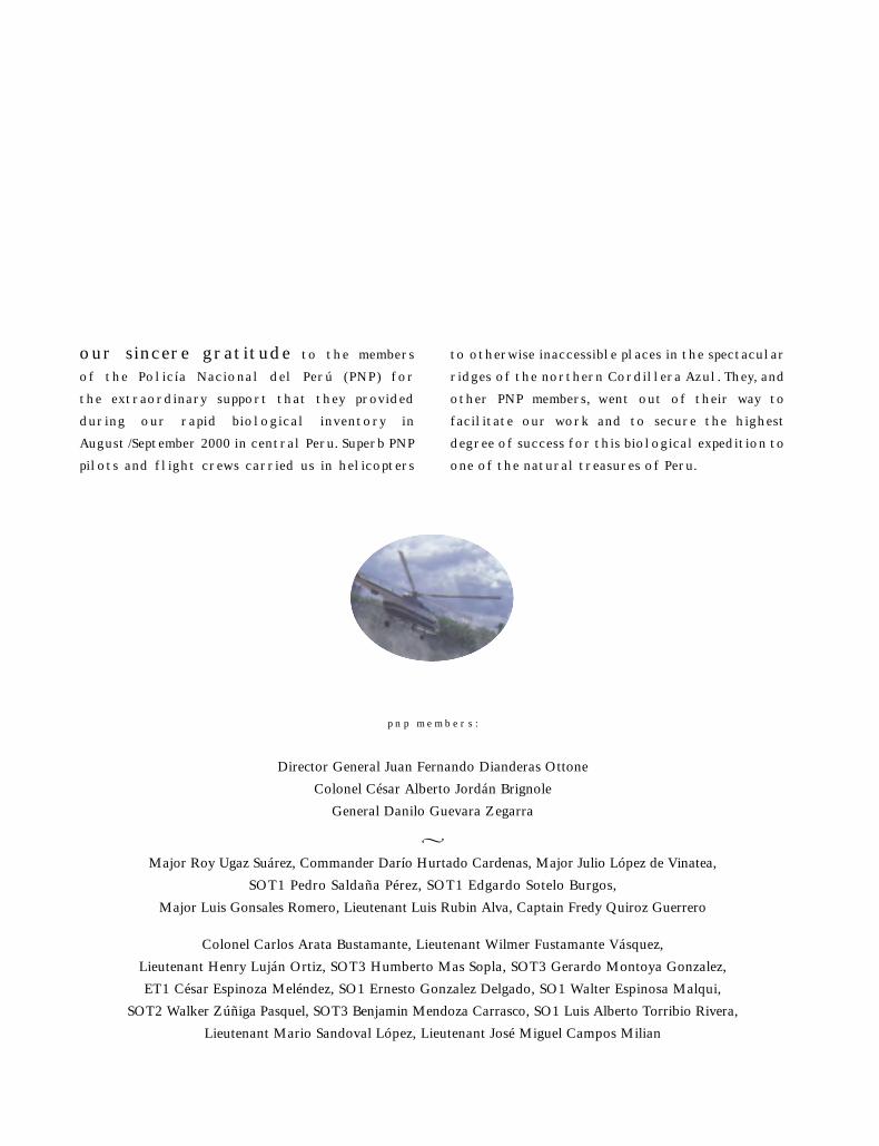
p n p m e m b e r s :
Director General Juan Fernando Dianderas Ottone
Colonel César Alberto Jordán Brignole
General Danilo Guevara Zegarra
�
Major Roy Ugaz Suárez, Commander Darío Hurtado Cardenas, Major Julio López de Vinatea,
SOT1 Pedro Saldaña Pérez, SOT1 Edgardo Sotelo Burgos,
Major Luis Gonsales Romero, Lieutenant Luis Rubin Alva, Captain Fredy Quiroz Guerrero
Colonel Carlos Arata Bustamante, Lieutenant Wilmer Fustamante Vásquez,
Lieutenant Henry Luján Ortiz, SOT3 Humberto Mas Sopla, SOT3 Gerardo Montoya Gonzalez,
ET1 César Espinoza Meléndez, SO1 Ernesto Gonzalez Delgado, SO1 Walter Espinosa Malqui,
SOT2 Walker Zúñiga Pasquel, SOT3 Benjamin Mendoza Carrasco, SO1 Luis Alberto Torribio Rivera,
Lieutenant Mario Sandoval López, Lieutenant José Miguel Campos Milian
our sincere gratitude to the members
of the Policía Nacional del Perú (PNP) for
the extraordinary support that they provided
during our rapid biological inventory in
August /September 2000 in central Peru. Superb PNP
pilots and flight crews carried us in helicopters
to otherwise inaccessible places in the spectacular
ridges of the northern Cordillera Azul. They, and
other PNP members, went out of their way to
facilitate our work and to secure the highest
degree of success for this biological expedition to
one of the natural treasures of Peru.
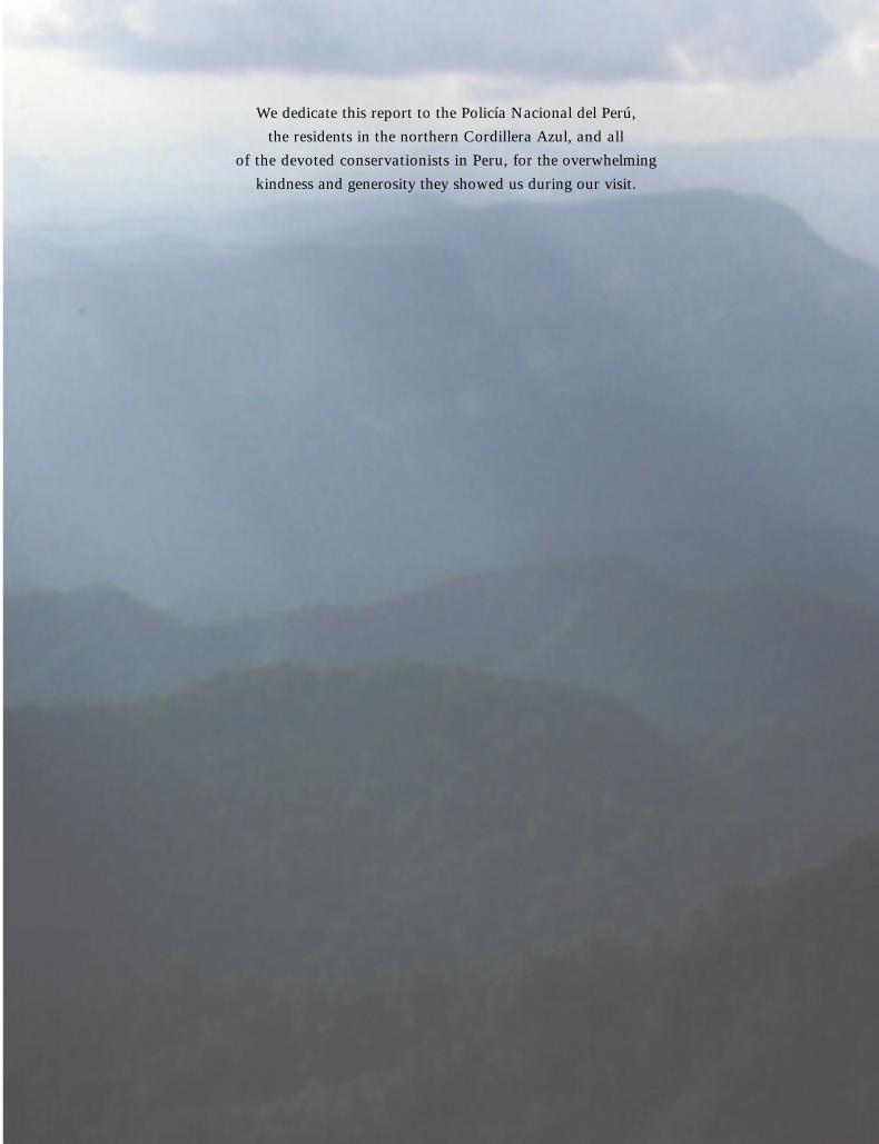
We dedicate this report to the Policía Nacional del Perú,
the residents in the northern Cordillera Azul, and all
of the devoted conservationists in Peru, for the overwhelming
kindness and generosity they showed us during our visit.
PARTICIPANTS
R A P I D B I O L O G I C A L I N V E N T O R I E S INFORME/REPORT NO. 294
FIELD TEAM
Christian Albújar (birds)
Museo de Historia Natural
Universidad Nacional Mayor de San Marcos,
Lima, Peru
William S. Alverson (plants)
Environmental and Conservation Programs
The Field Museum, Chicago, IL, U.S.A.
Lily C. Arias (mammals)
Museo de Historia Natural
Universidad Nacional Mayor de San Marcos,
Lima, Peru
Hamilton W. Beltrán (plants)
Museo de Historia Natural
Universidad Nacional Mayor de San Marcos,
Lima, Peru
Robin B. Foster (plants)
Environmental and Conservation Programs
The Field Museum, Chicago, IL, U.S.A.
Max H. Hidalgo (fishes)
Museo de Historia Natural
Universidad Nacional Mayor de San Marcos,
Lima, Peru
Daniel F. Lane (birds)
Museum of Natural Science
Louisiana State University, Baton Rouge, LA, U.S.A.
Debra K. Moskovits (coordinator)
Environmental and Conservation Programs
The Field Museum, Chicago, IL, U.S.A.
John P. O’Neill (birds)
Museum of Natural Science
Louisiana State University, Baton Rouge, LA, U.S.A.
Hernán Ortega T. (fishes)
Museo de Historia Natural
Universidad Nacional Mayor de San Marcos,
Lima, Peru
Víctor R. Pacheco (mammals)
Museo de Historia Natural
Universidad Nacional Mayor de San Marcos,
Lima, Peru
José Pérez Z. (amphibians and reptiles)
Museo de Historia Natural
Universidad Nacional Mayor de San Marcos,
Lima, Peru

Patrick de Rham (fishes)
Membre correspondant, Muséum d’histoire naturelle
de la Ville de Genève, Suisse
Lily O. Rodríguez (amphibians and reptiles, coordinator)
Asociación Peruana para la Conservación de la
Naturaleza (APECO)
Lima, Peru
Thomas S. Schulenberg (birds)
Environmental and Conservation Programs
The Field Museum, Chicago, IL, U.S.A.
H. Bradley Shaffer (amphibians and reptiles)
Section of Evolution and Ecology
University of California, Davis, CA, U.S.A.
Sophia B. Twichell (program logistics)
Environmental and Conservation Programs
The Field Museum, Chicago, IL, U.S.A.
Thomas Valqui (birds)
Museum of Natural Science
Louisiana State University, Baton Rouge, LA, U.S.A.
Claudia Vega (field logistics)
Asociación Peruana para la Conservación de la
Naturaleza (APECO)
Lima, Peru
COLLABORATORS
Rafael J. Galván
Secretario Técnico, Comité Especial BIABO
Comisión de la Promoción de la Inversión Privada
(COPRI), Lima, Peru
Jared Hardner
Managing Partner, Hardner & Gullison Associates, LLC
Palo Alto, CA, U.S.A.
Felipe A. Ramírez D.
Presidente, Comité Especial BIABO
Comisión de la Promoción de la Inversión Privada
(COPRI), Lima, Peru
Richard Rice
Chief Economist, Center for Applied Biodiversity Science
Conservation International, Washington, DC, U.S.A.
95perú: cordillera azul FEBRERO/FEBRUARY 2001

The Field Museum
The Field Museum is a collections-based research and
educational institution devoted to natural and cultural
diversity. Combining the fields of Anthropology,
Botany, Geology, Zoology, and Conservation Biology,
Museum scientists research issues in evolution,
environmental biology, and cultural anthropology.
Environmental and Conservation Programs (ECP)
is the branch of the Museum dedicated to translating
science into action that creates and supports lasting
conservation. With losses of natural diversity world-
wide and accelerating, ECP’s mission is to direct the
Museum’s resources —scientific expertise, worldwide
collections, innovative education programs – to the
immediate needs of conservation at local, national,
and international levels.
The Field Museum
1400 S. Lake Shore Drive
Chicago, IL 60605-2496
312.922.9410 tel
www.fieldmuseum.org
The Peruvian Association for the Conservation of Nature (APECO)
APECO, created in 1982, is the oldest non-profit
conservation organization in Lima, Peru. APECO’s
mission is to support the conservation of nature in
Peru, promoting biodiversity conservation and the
sustainable use of natural resources. APECO’s
main areas of work are: environmental education,
biodiversity research, management of natural
resources, conservation planning, biodiversity
enterprises, and tourism. APECO’s resources come
from international agencies, private donors, and
other income.
APECO
Parque José de Acosta 187
Lima 17, Perú
511.264.5804 tel
511.264.0094 tel
511.264.3027 fax
barrioperu.terra.com.pe/apeco
INSTITUTIONAL PROFILES
R A P I D B I O L O G I C A L I N V E N T O R I E S INFORME/REPORT NO. 296
The Field Museum
The Field Museum is a collections-based research and
educational institution devoted to natural and cultural
diversity. Combining the fields of Anthropology,
Botany, Geology, Zoology, and Conservation Biology,
Museum scientists research issues in evolution,
environmental biology, and cultural anthropology.
Environmental and Conservation Programs (ECP)
is the branch of the Museum dedicated to translating
science into action that creates and supports lasting
conservation. With losses of natural diversity world-
wide and accelerating, ECP’s mission is to direct the
Museum’s resources —scientific expertise, worldwide
collections, innovative education programs – to the
immediate needs of conservation at local, national,
and international levels.
The Field Museum
1400 S. Lake Shore Drive
Chicago, IL 60605-2496
312.922.9410 tel
www.fieldmuseum.org
The Peruvian Association for the Conservation of Nature (APECO)
APECO, created in 1982, is the oldest non-profit
conservation organization in Lima, Peru. APECO’s
mission is to support the conservation of nature in
Peru, promoting biodiversity conservation and the
sustainable use of natural resources. APECO’s
main areas of work are: environmental education,
biodiversity research, management of natural
resources, conservation planning, biodiversity
enterprises, and tourism. APECO’s resources come
from international agencies, private donors, and
other income.
APECO
Parque José de Acosta 187
Lima 17, Perú
511.264.5804 tel
511.264.0094 tel
511.264.3027 fax
barrioperu.terra.com.pe/apeco
Museo de Historia Natural de la Universidad Nacional Mayor de San Marcos
The Natural History Museum, a non-profit institution
of the National University of San Marcos in Lima
founded in 1918, is the oldest museum and herbarium
continually active in Peru. Since its creation, the
museum has contributed greatly to the scientific
knowledge of the zoology, botany, and geology of
Peru, becoming the main repository of collections in
the country. The museum is a research and educational
institution with goals to develop scientific collections,
systematic research, and public exhibitions that
provide the data, expertise, and human resources
necessary for understanding Peruvian biodiversity and
promoting conservation of Peru’s many ecosystems.
The museum conducts field studies and research in
the areas of Botany, Zoology, Ecology, and Geology-
Paleontology. Over the past 10 years, the museum has
conducted intensive fieldwork in different protected
areas in lowland and montane forests, such as Manu
National Park, Abiseo National Park, and Pacaya-
Samiria National Reserve.
Museo de Historia Natural
Universidad Nacional Mayor de San Marcos
Apartado 14-0434, Lima, Perú
511.471.0117 tel
511.265.6819 fax
Louisiana State University (LSU)Museum of Natural Science
LSU Museum of Natural Science is a component of
the Louisiana Museum of Natural History, whose
collections include nearly 3 million specimens, objects,
and artifacts from throughout the world. Its mission
is acquisition, preservation, and study of research
collections to generate knowledge of regional and
global biodiversity, geological history, and human
history and prehistory. The museum’s collection of
frozen tissues (for use in DNA studies of wild species)
is the largest of its kind in the world, and the bird
collection is the fourth largest university–based
collection in the nation. Ethnographic collections in
the museum include the McIlhenny and Jastremski
Chitimacha Indian Basketry Collections, two of the
most important of their kind in the nation.
LSU Museum of Natural Science
119 Foster Hall, Louisiana State University
Baton Rouge, LA 70802
225.578.2855 tel
www.museum.LSU.edu
97perú: cordillera azul FEBRERO/FEBRUARY 2001
ACKNOWLEDGEMENTS
The remote ridges of the northern Cordillera Azul
posed tough challenges for our expedition. And a large
number of individuals and organizations responded
with overwhelming support. When this many people
become integral to the effort, no acknowledgement
comes close to recognizing the critical help of all indi-
viduals. We deeply thank each and every person—in
the Cordillera Azul region, Yarina Cocha, Pucallpa,
Lima, Washington DC, and Chicago—who went out
of their way to facilitate our work and to secure the
success of this expedition. Although we individually
name only a fraction of those who supported us below,
we remain profoundly grateful to all.
Our preparatory work for the expedition
began in earnest in March ’00. We thank Roland
Patrnovic, the staff of APECO, Mision Suiza (Jonás
Gafner and Renate Thimm), SAMAIR Peru and Pablo
Flores, John O’Neill, Dan Lane, and Avecita Chicchón
for critical discussions and for help on the ground.
Anne Metcalf and George Hull (Metcalf Federal
Relations), through Eduardo Orrego, opened doors
to tremendous assistance in Peru and to new, valued
friendships. Claudia Vega, Max Hidalgo, Orlando
Riva, Herminio del Aguila, Alejandro Villavicencio,
and Shipibo guides from Nuevo Edén—Roger Linares,
Ignacio Amasifuén, Jaime Flores, Felix Zevallos, Jayo
Linares, Custodio Urquia, Demetrio Amasifuén, Tito
Gratelly, Benjamin Nunta, José Antonio Linares, and
Catiano Perez —provided critical logistics, trails, and
river travel in the field. The management and staff
at Hostal Señorial, Lima, and Grand Hotel Mercedes,
Hostal Arequipa, and Club Divina Montaña, Pucallpa,
facilitated our work in Lima and in Pucallpa and were
wonderfully tolerant of our special requests. Travel
agent Carmen Bianchi (Kantu Tours) accommodated
our multiple, last-minute travel arrangements. George
Sloan was instrumental in our use of a satellite phone.
Silvia Sanchez (APECO), Jorge Caillaux (SPDA),
Alvaro Quijandría, and others helped us obtain the
permits to enter the field.
Because of the extraordinary support that
we received from the Peruvian National Police (Policía
Nacional del Perú, PNP) we were able to cover a large
expanse of the northern Cordillera Azul during our
three weeks in the field. We especially thank General
Fernando Dianderas, then Director General of the
PNP, for his personal attention. Every representative
we met of the PNP made us feel extremely at home.
Starting with Colonel PNP Alberto Jordán and his
wife Carmen, who took it upon themselves to secure
the highest degree of success to our expedition, we
continued to be overwhelmed with the kindness
extended to us by the PNP staff in Lima, in Pucallpa,
and in the field in the Cordillera Azul. The team of
PNP pilots and helicopter crew who supported us
were readily attentive to our needs. We especially
thank pilots Major Roy Ugaz, Commander Darío
Hurtado, Major Julio López, and Major Luis
Gonsales—along with flight mechanic First Lieutenant
Edgardo Sotelo and flight engineer First Lieutenant
R A P I D B I O L O G I C A L I N V E N T O R I E S INFORME/REPORT NO. 298
Pedro Saldaña—for stunning flights and for their
friendship. Lieutenant Wilmer Fustamante and
Lieutenant Henry Luján went well beyond the call
of duty to assist us in the field. To all the police who
supported us, we extend our most sincere thanks.
After the fieldwork, as before, the staff of
Aero Andino provided fantastic overflights that helped
us put our results in regional perspective. Once our
preliminary results were compiled, the efforts of Sophia
Twichell, Rafael Galván (COPRI), Hernan Ortega,
Silvia Sanchez (APECO), and Pía Delgado (COPRI)
were instrumental in bringing people together, both in
Pucallpa and in Lima, to discuss next steps for conser-
vation. We thank COPRI for their generous hosting of
the meetings in Lima at PetroPerú, and for their maps
and transparencies for the presentation. We further
thank Rafael Galván and Felipe Ramirez (COPRI) for
continued discussions about possible conservation
management of some of the lowland concessions that
border the hills of the northern Cordillera Azul.
Patricia Fernández-Dávila (BIOFOR/USAID) gave us
permission to use all the information gathered by the
Red Ambiental Peruana, which served as the point of
departure for our expedition. INRENA’s Nora Block
accompanied us to our first field site, and Luis Alfaro
(General Director ANPFS-INRENA) met with us to
discuss the status of the “Zona Reservada” and
new limits for the reserve.
For thinking through the economic logistics to
allow critical conservation work in the region, and for
totally reliable support before and after our expedition,
we sincerely thank Dick Rice (CABS, Conservation
International) and Jared Hardner (Hardner & Gullison
Associates, LLC), who launched the idea of conserva-
tion concessions.
We thank all field participants for coming
through with their reports under tight schedules
and for continued focus on excellence and detail. We
sincerely thank Jennifer M. Shopland and Douglas F.
Stotz for reading the manuscript and offering insightful
comments, and Peter Lowther for keeping files flowing
between continents no matter what problems we
encountered with the Internet. Tyana Wachter and
Angela Padilla came through with translations under
impossible deadlines. We are very grateful to James
Costello (Costello Communications) and Linda Scussel
(Scussel & Associates) for keeping the production on
schedule despite delays on our part, and for their
efforts on the extra design considerations in this issue.
We continue to be awed by the magic that
Sophie Twichell and Tyana Wachter perform with
logistics and intricate coordination. Sophie, with the
help of Tyana, successfully cleared the many snags and
challenges that appeared along our way. We are deeply
grateful to John W. McCarter, Jr., for his unfailing
support of our programs, and for Avecita Chicchón, at
the MacArthur Foundation, for her support and inter-
est at every step of this project. Funding for this rapid
inventory came from The John D. and Catherine T.
MacArthur Foundation and from The Field Museum.
99perú: cordillera azul FEBRERO/FEBRUARY 2001

R E P O R T AT A G L A N C E
Dates of field work 23 August - 14 September 2000
Region Northeasternmost extension of the Cordillera Azul mountain range in central Peru,
between the Huallaga and Ucayali rivers (Figures 2 and 3). This section of the
Cordillera Azul lies almost entirely in the departments of Loreto and San Martín
(with a small overlap into Huánuco and Ucayali), spans altitudes of 200- 2400 m
(RAP 1999), and includes a portion of the upper Río Biabo.
Sites surveyed One area in the upper Río Pauya (with five subsites at different elevations), and two
areas in the upper Río Pisqui (with a total of five subsites)—see Figures 2 and 3 and
Overview of Sites Sampled in the Technical Report.
Organisms surveyed Vascular plants, fishes, reptiles and amphibians, birds, large mammals.
Highlight of results The diversity of habitats is extraordinary; the northern Cordillera Azul region may
well have the highest concentration of habitat types among all Peruvian protected
areas within this altitudinal range. Unusual highland swamps and isolated lakes hidden
deep in the Cordillera add to this diversity (Figures 8D, 8E, 8F).
During the three weeks in the field, the rapid inventory team registered species of
restricted range and habitat distributions for all groups of organisms sampled. Several
of the records are new for Peru and 28 or more species encountered appear to be new
to science. A brief summary per organism group follows.
Plants : The team registered about 1600 species of plants (and estimated 4000-6000
for the region), with more than 12 species new to science. The diversity of palms—
an important food resource for maintaining high densities of several mammals and
birds—is remarkable. In just three weeks, the team encountered 43% of the 105
palm species known from Peru.
Mammals : The team registered 71 species, including one small, black squirrel possibly
new to science. Noteworthy mammal records include bush dogs, spectacled bears,
10 species of primates (with 3 of the large species—woolly, spider, and saki
monkeys—common and tame), and daily sightings of large herds of white-lipped
peccaries. The sightings include 13 CITES I and CITES II species (i.e., species globally
threatened or potentially threatened with extinction).
Birds: More than 500 species are now registered for the region, with one new species—
the Scarlet-banded Barbet (Capito wallacei) —newly described from a single group
of ridges in the northern section of the Cordillera. Three species are new records for
Peru. The Cordillera has large populations of game birds (cracids) and moderately
large populations of some species of large parrots and macaws. It is likely the center
of distribution for two poorly known, habitat-restricted species: the Royal Sunangel
(Heliangelus regalis) and the Bar-winged Wood-Wren (Henicorhina leucoptera).
R A P I D B I O L O G I C A L I N V E N T O R I E S INFORME/REPORT NO. 2100

R E P O R T AT A G L A N C E
Amphibians and Reptiles : The inventory team registered 82 species, with eight new
records (possibly new species) of frogs and one new species of salamander (only the
fourth known from Peru and at a higher altitude than previous records).
Fishes : A sampling of fishes in the headwaters revealed a rich fauna with at least
22 new records for Peru, of which 10 are possibly new to science.
Major Opportunities Virtually no people live within the northern Cordillera Azul. The eastern slopes beyond
and adjacent to the sheer eastern rock face of the Cordillera remain intact, with a very
light human “footprint.” To the west, the coca fields of the Huallaga valley border but
do not penetrate the Cordillera. To the north, colonists are pushing into valleys of small
tributaries of the Río Huallaga, but only up to the edge of the Cordillera.
The opportunities in the region are immense. Conservation measures in the
northern Cordillera Azul region can:
Main Threats Imminent threats include logging, new roads, and the inevitable colonization that
follows roads and leads to damage far beyond the immediate sites of timber removal.
Coca plantations already have destroyed portions of the western mountains, but many
of these coca fields around the Santa Lucía police base are now abandoned and are
reverting back to forest. Disorganized expansion of small-scale agriculture, however,
remains a threat, particularly from the north.
1) protect endangered, highland ecosystems before degradation and deterioration set in;
2) protect the entire, contiguous rangeof biological communities, from tallfloodplain forests along the lowlandrivers to elfin forests and meadowson the mountain crests;
3) protect a mix of geological featuresthat are not represented in any current national park in Peru;
4) support integrated management of land and resource use betweenthe protected highlands and theadjacent logging-concessions in the eastern lowlands;
5) catalyze close collaboration with an interested, resident indigenouscommunity—the Shipibo at NuevoEdén—to develop ecologically sound harvest methods and marketsfor non-timber products in theseforestry concessions; and
6) promote the development of economic alternatives, for local residents and nearby urban centers (e.g., Pucallpa, Contamana), that are compatible with the long-termsurvival of plants and animals within the spectacular landscapes in the region.
101perú: cordillera azul FEBRERO/FEBRUARY 2001
R E P O R T AT A G L A N C E
Current Status On 7 September 2000, the Peruvian government declared nearly 1.14 million
hectares in the northern Cordillera Azul “Zona Reservada Biabo Cordillera Azul,”
literally a reserved zone, signifying temporary protection from timber harvest and
agriculture. The adjacent 984,000 hectaresof lowland forests to the east were
designated simultaneously for “permanent harvest” of timber (Bosque de Producción
de la Zona Forestal Permanente). An additional 64,700 hectares, also within the
Bosque de Producción, belong to indigenous communities, have been designated
for colonists, or were in litigation in 2000.
The northern Cordillera Azul offers remarkable opportunities for protection and
coordinated management of a rich array of habitat types, of range-restricted and
endemic species, and of unique assemblages of species. The rapid biological inventory
team recommends the following:
1) Categorize the “Reserved Zone” as a National Park (ParqueNacional Cordillera Azul Biabo)with limits that follow natural contours of the terrain (Figure 3).
National Park status will promoteprotection of the globally significantplant and animal communities, as well as the abundant populationsof large mammals, fishes, and game-birds, which can act as recoverysources for populations of animalshunted elsewhere in the region.
The proposed limits offer protectionto the endangered biological communities of the highlands—including unusual highlandswamps—while forming natural,easily identified, and easily controlledborders for the protected zone.
2) Coordinate management of the protected area with the adjacentlowlands—currently targeted as logging concessions.
3) Develop collaborative, ecologicallysensitive alternatives for the economic well-being of residents in the region.
Principal
Recommendations
for Protection and
Management
R A P I D B I O L O G I C A L I N V E N T O R I E S INFORME/REPORT NO. 2102

The spectacular terrain of the northern Cordillera Azul mountain range—
2.5 million hectares between the Huallaga and Ucayali rivers in central
Peru—is the last large, intact expanse of lower-montane forest remaining
in Peru. The rugged Cordillera is an isolated outlier east of the main range
of the Andes. Hills and lowlands of the Río Huallaga valley surround the
Cordillera to the west, while extensive lowlands of the Río Ucayali unfold
to the east. The promise of high richness and uniqueness of species in
the Cordillera, combined with the vastness and intact nature of the region,
led to the inclusion of the northern Cordillera Azul within the 38 areas
of priority for conservation in Peru (Rodríguez 1996, Red Ambiental
Peruana 1999).
At present, virtually no one lives within the northern Cordillera. The
eastern face of the Cordillera is a sheer rock wall, with adjacent hills that
are largely intact and show only a light human “footprint” in narrow strips
along the rivers draining into the lowlands. To the west, the coca fields of
the Huallaga valley approach but do not penetrate the Cordillera; these
fields are now being abandoned and are reverting to forest. To the north,
colonists push into valleys of small tributaries of the Río Huallaga, but
only up to the edge of the Cordillera.
Why Cordillera Azul?
103perú: cordillera azul FEBRERO/FEBRUARY 2001

Change, however, approaches swiftly. The most immediate threat
comes from a large expanse of logging concessions (984,000 hectares)
adjacent to the eastern edge of the Cordillera. New roads, built to extract
timber from these concessions, will attract human colonization that
leads to damage far beyond the direct impact of selective logging, unless
comprehensive measures for conservation are in place.
To ensure effective protection of the extraordinary biological richness
of the Cordillera, the Red Ambiental Peruana—a Peruvian coalition from
the private sector—in coordination with the Peruvian authorities responsible
for the transfer of lands to private concessions, recommended in 1999 the
establishment of a new National Park within the northern Cordillera Azul.
The goal of the current rapid biological inventory was to obtain the biological
information needed to empower and sustain these regional conservation
efforts, and to do so quickly, before habitat fragmentation and degradation
forever transform the landscape.
R A P I D B I O L O G I C A L I N V E N T O R I E S INFORME/REPORT NO. 2104

105perú: cordillera azul FEBRERO/FEBRUARY 2001
ECOLOGICAL PROFILE
The northern portion of the Cordillera Azul is a dramatic and dynamic land-
scape that represents the easternmost—and youngest—range of the Andes at the
latitude of central Peru. This complex of small mountain ranges has sprung up
between the lowlands of the Río Ucayali to the east and the hills and valleys
above the Río Huallaga to the north and west. Ringed by sheer rock escarpments
that run as far as the eye can see, the heart of the northern Cordillera Azul
region is a mix of mountain crests and ridges, with abundant landslides and
sheer rock cliffs, as well as broad lowland valleys and slopes, high-altitude lakes
and marshlands, and unusual, eroded rock formations (Figures 2–8).
Much of the eastern face of the Biabo Cordillera Azul Reserved Zone—
proposed here as Parque Nacional Cordillera Azul Biabo*—is delineated by a
stunning escarpment of rock that has been lifted by tectonic forces and broken
into a series of huge, triangular plates, called “Vivian formations.” The central
section of this escarpment rises a vertical mile out of the eastern lowlands (and
is reminiscent of the front range of the Grand Tetons in Wyoming, USA).
Overall, the area of the proposed Parque Nacional Cordillera Azul Biabo is
large enough to protect ecosystem processes and entire, important biological
communities: 1.42 million hectares (compared to 1.53 million hectares in the
Manu National Park in Peru, and 58% larger than Yellowstone National Park
in the United States).
One of the most striking and important aspects of the northern Cordillera
Azul region is the tremendous diversity of habitat types. The wide range of
altitudes (200 to 2400 m), wetlands, and different soil and rock types contribute
O V E RV I E W
O F R E S U LT S
* In their report in 1999, the Red Ambiental Peruana proposed “Parque Nacional Alto Biabo Manashahuemana” as the name for the new park. In the language of the Shipibo, “manashahuemana” means turtles. The Shipibo use this name for the area because the peaks of thestunning front range of the Cordillera line up like turtles on a log (see Figure 5A). The westernpart of the proposed park encompasses the headwaters of the Río Biabo, in the watershed of theRío Huallaga. For simplicity, we propose the less evocative name, “Cordillera Azul Biabo.”
Contributors /Authors: W.S. Alverson, R. B. Foster, L.O. Rodríguez, T.S. Schulenberg,
V. Pacheco, P. de Rham, H.Ortega, J. P. O’Neill, D.F. Lane, H. Beltrán, M. Hidalgo, L. Arias,
J. Pérez, C. Albújar, T. Valqui
R A P I D B I O L O G I C A L I N V E N T O R I E S INFORME/REPORT NO. 2106
to this diversity. The surface coverage by acidic rock
is greater here than in any other reserve in the Andes.
Less acidic rocks and richer soils cover much of the
lowlands in the region, in combination with pockets of
acid rock and soils that have been washed or shaken
(by earthquakes) from the surrounding mountains.
Most habitats within the proposed park
remain unmodified by human action. There are few
or no permanent residents within the highlands. A
small number of transient, chain-saw lumbermen have
traveled the major rivers for decades and have removed
the most valuable timber close to the Ríos Cushabatay,
Pauya, and Pisqui. But human visitation is very low,
even from the indigenous Shipibo community in the
lowlands to the east.
Because of the extreme difficulty of access to
the region, helicopters deposited the rapid biological
inventory team at one point in the upper Río Pauya
watershed (see Figures 2 and 3, and Overview of Sites
Sampled for details), and at two points farther south,
along the Río Pisqui. The team spread out along trails
radiating from these principal camps and established
several satellite camps across a range of elevations.
We also report here the ornithological data from a
separate expedition by Louisiana State University
Museum of Natural Science (LSUMZ) and by the Museo
de Historia Natural de la Universidad Nacional Mayor
de San Marcos (MUSM) to the Pauya sites in 2000, as
well as data from an expedition by LSUMZ/MUSM in
1996 to the Cushabatay drainage, farther northeast in
the Cordillera (Figure 3).
Given the absence of scientific exploration of
the region, we were not surprised to record 28 or more
species likely new to science and many additional
species not previously known to occur in Peru. In our
brief visit to the northern Cordillera Azul we observed
1616 different species of plants, and identified 566 of
these to the species level (Appendix 1). We estimated
4000–6000 species of vascular plants within the northern
Cordillera Azul, and directly observed more than 12
that are probably new to science; the actual count of
new species may be several times this number.
We observed 71 species of mammals, of which 1 (a small
squirrel) appears to be new to science. Among the three
expeditions, we have registered more than 500 species of
birds, including a new species discovered by the 1996
LSUMZ/MUSM expedition. We observed 82 species of
amphibians and reptiles during our fieldwork, of which
several, including a high-altitude salamander, appear to
be new species. Finally, we registered approximately 93
species of fishes (62 collected and 31 observed), of
which 10 appear to be new to science.
FLOODPLAIN FORESTS
Floodplain forests occur in a narrow and meandering
band along the Río Pauya and more broadly around the
Río Pisqui. Both rivers have successional communities
characteristic of lowland Amazonian forests on beaches
and levees. Dense palm understories and thick tangles
of lianas dominate many of the poorly drained sections.
Areas with better drainage support tall floodplain forest
dominated by trees estimated to be two centuries old.
HILLS AND ALLUVIAL FANS
Forest canopies with a high frequency of deciduous
species and palm-dominated understories characterize
both the alluvial fans and the dry hills of the Río
Pauya. The alluvial fans experience episodic washouts
generated by landslides in the surrounding mountains.
In general, the sites along the Río Pauya are drier than
equivalent sites by the Río Pisqui because of a rain
shadow produced by the high ridges along the east face
of the Cordillera. However, a blanket of fog forms at
night over the valley of the Río Pauya, allowing a
number of epiphytes to survive.
The Río Pisqui sites that we examined lay
just outside of the main wall of the Cordillera and
had a broader variety of habitats, including low, recent
terraces (old floodplains); hills with reddish, semiacidic
clays; higher, older, sandy terraces with scattered boggy
areas; and high hills with evergreen forest.
107perú: cordillera azul FEBRERO/FEBRUARY 2001
MOUNTAIN SLOPES AND CRESTS
Forests on the mountain slopes above the Río Pauya—
ca. 600 to 900 m elevation—are evergreen, grow on
rich, non-acidic, slippery clay soils, and share many
species with lowland forests on rich soil. Slopes on
some of the mid-elevation ridges have a more acidic
soil and flora similar to that of wet, semi-acidic hills
of the lowlands.
On the upper Río Pisqui, slope forests at
elevations of 500 to 600 m have a distinct stratum of
exposed limestone and derived soils. The result is a
striking band of floodplain and low alluvial fan species
(of canopy and understory plants) perched on the
mountainside. Even the typical floodplain “cedro”,
Cedrela odorata, grows here rather than the hill
species, Cedrela fissilis.
Another distinct type of slope forest in the
upper Pisqui is that on horizontal ridges, between
approximately 750 and 900 m elevation. Several of the
conspicuous understory plants of the ancient Tertiary
sandy terraces of the lowlands are abundant here,
mixed with dense stands of palm species and trees of
the family Rubiaceae.
Above approximately 900 m on the upper
Pauya ridge slopes, and 1100 m on the upper Pisqui
slopes, the forests become shorter—to approximately
10 m in height—and have a spongy, unstable, superficial
root mat over soft, acidic sandstone. Although less
species-rich than forests at lower elevations, these short
forests have a greater abundance and number of species
of epiphytes. Dominant trees represent the families
Sapotaceae, Theaceae, and Melastomataceae. Forest
stands in the ravines between ridges are moister and
taller than forests on the ridge slopes, and have a com-
pletely different flora. Our trails were mostly limited to
ridge slopes, however, so we spent an unsatisfyingly
small amount of time investigating these interesting,
high ravines.
We examined several mountain crests between
1400 and 1700 m elevation. These are challenging places
to live, subjected at times to severe winds, lightning,
dense cloud cover, seasonally severe drought, and fires.
The underlying rock is hard, very acidic, and miserly:
plants here must grow slowly because few nutrients are
available. Trees are generally spaced widely, separated
by 2–3 m-tall shrubland (Figure 7C). Wet depressions
and small ravines are scattered throughout, with slightly
taller (4–9 m) elfin forest (Figure 7D).
We encountered several new or rare
plant species on the crests, including a new Parkia
(Fabaceae) and a new Stenopadus (Mutisiae tribe,
Asteraceae), a genus new for Peru and mainly found in
the Guiana Highlands. We also found, for the second
time in history, the tiny fern Schizaea poeppigiana.
Many Bromeliaceae grow here, including several large
species that occur both as epiphytes and on the ground.
Dense mats of lichens cover small, treeless barrens.
High cliffs at upper elevations also appeared to have
species specifically associated with them.
PALMS
Palms are abundant in the northern Cordillera Azul,
both in number of individuals and species. We encoun-
tered a remarkable 45 species within the proposed
Parque Nacional Cordillera Azul Biabo, equivalent to
43% of all palm species known from Peru and including
at least two that are species new to science, or new
records for Peru. One of these new species is a multi-
stemmed Euterpe that may prove economically valuable,
allowing the harvest of hearts-of-palm without killing
the individual being harvested, as is now the case with
the commercial, single-stemmed species in Peru.
Palms are especially dominant in the understory
of the alluvial fans and low foothills of the mountains
(Figure 4D); in the understory of horizontal, acidic
ridges perched on midelevation mountain slopes; and
in lowland palm swamps (aguajales) with nearly mono-
specific stands of Mauritia and Mauritiella.

R A P I D B I O L O G I C A L I N V E N T O R I E S INFORME/REPORT NO. 2108
TREE SPECIES OF ECONOMIC IMPORTANCE
Economically valuable timber trees have been largely
eliminated from areas of the northern Cordillera Azul
that are accessible by the major rivers. For years, itin-
erant lumbermen have cut mahogany (caoba, Swietenia
macrophylla), tropical cedar (cedro blanco, Cedrela
odorata), and Cedrela fissilis (cedro colorado). Now,
they are removing Cedrelinga catenaeformis (tornillo).
Other, less valuable timber species have not yet been
cut, such as Amburana (ishpingo, Fabaceae)
and Cordia alliodora (Boraginaceae). Medicinal and
ornamental plants, as well as commercial palms, have
been harvested only lightly, in limited areas.
INFERRED HISTORY OF HUMAN IMPACT
The abundance of large game mammals and birds and
the harvest of only the most valuable timber—and only
in areas close to the main rivers—indicate that humans
have been present only rarely in the northern Cordillera
Azul in recent decades, or likely centuries (although ruins
400 to 500 years old have been found in the Pauya,
RAP 1999). A very low level of visitation by humans is
not surprising, given the extreme inaccessibility of the
interior portions of the Cordillera. We saw no indication
of permanent settlements anywhere within the proposed
park except for small intrusions to the west and north.
FISHES
The upper Río Pisqui and upper Río Pauya pierce the
rock wall along the east face of the Cordillera Azul
and then meander eastward to the Río Ucayali. These
rivers support human communities (e.g., Nuevo Edén,
Manco Capac, Pampa Hermosa) and a myriad of
wildlife in the forestry concessions along their way
(Figures 4, 5). The headwaters of these rivers are critical
not only for the fish communities, but also for the
health of the entire watershed. The headwaters harbor
unique species and provide spawning grounds for
many of the migratory fishes, which include the large
species hunted by humans for food.
Species richness is high in both the upper
Pisqui and upper Pauya watersheds, reflecting the high
diversity of microhabitats. Most of the species in the
headwaters are small (<5 cm), primarily scaled fishes
(Characiformes), adapted to living in clear, rapidly
flowing, shallow waters (Figures 9A, 9B). We present
the description of habitats and limnological data in
Appendix 2. Headwater fishes are highly restricted in
range and habitat and include many endemics: we
found no overlap between the fish faunas of the upper
Pisqui and the upper Pauya. For the upper Pauya, we
registered 21 species, including a species of Creagrutus
potentially new to science and 5 new records for Peru.
In the upper Pisqui, with greater diversity of aquatic
habitats and greater sampling effort, we registered 67
species (49 collected), with 9 new to science and 14
new records for the country. Appendix 3 presents the
composition of species we found in each river sampled.
Characiformes and Siluriformes dominate the fauna
(with 35 and 22 species, respectively). Also notable is
the common occurrence of large individuals of species
typically exploited for human consumption. The fish
communities in the upper Pauya and Pisqui watersheds
are currently in an excellent state, due to low human
presence in the region and intact headwaters.
AMPHIBIANS AND REPTILES
The proposed Parque Nacional Cordillera Azul Biabo
harbors a rich biogeographic mix of amphibians and
reptiles, with good representation of the herpetofaunas
of both montane and lowland forests, and of northern
and central Peru. During our rapid inventory, we
recorded 58 species of amphibians and 24 of reptiles
(Appendix 4). Of these, 31 species of amphibians and
11 of reptiles were at the Río Pauya study sites and 35
and 17 species of amphibians and reptiles, respectively,
at the Río Pisqui sites. Because we sampled the region
during the dry season, when only few species of frogs
109perú: cordillera azul FEBRERO/FEBRUARY 2001
were calling and active, our results underestimate the
total species in the region. We also were unable to reach
remote wetlands that we saw during overflights, which
are prime habitats for amphibians (especially for hylids,
which are poorly represented in our samples). Never-
theless, the sum of 58 amphibians recorded during 20
days in the field implies a high species richness in the
region. For comparison, 15 years of inventory in the
Parque Nacional Manu, to the south (from lowlands
to 1700 m), have accumulated 120 amphibians.
We expect the northern Cordillera Azul, with its vast
terrain in the 600–1700 m altitudinal range, to have a
richer set of unique amphibians at these elevations.
The amphibian and reptile fauna of the upper
Pauya sites is similar to that of the montane forests
in the valley of the Río Huallaga, while the fauna at
the Pisqui sites, with more southern biogreographic
elements, resembles more that of the lowland forests
of the Ríos Ucayali and Amazonas.
Among our most significant findings was a
species of salamander (Bolitoglossa sp.) at 1700 m,
the highest altitude recorded for a salamander in Peru
(Figure 9C). The species, likely new to science, is the
fourth salamander known for the country. We also
found several species of frogs restricted to the region
and at least 6 possibly new to science (Figure 10).
These include species in the genera Adenomera,
Colostethus, and Epipedobates, and 3 species of
Eleutherodactylus. We recorded 12 species of
Eleutherodactylus (along with other Leptodactylidae),
4 species of Centrolenidae, and 13 species of
Dendrobatidae (with several species of Colostethus,
Epipedobates, and Dendrobates).
The reptiles both at the Pauya and at the Pisqui
are a fauna typical of the Amazonian and montane
habitats sampled, with slight differences between the
two watersheds. The vine snakes Imantodes lentiferus
and Dipsas indica that were common at the upper
Pauya are normally rare in the lowlands. In contrast,
Anolis lizards, so typical of lowland forests, hardly
were seen at the upper Pauya, but were relatively
common at the Pisqui.
In general, the herpetofauna was in excellent
condition and is under little current threat. One excep-
tion is the river turtle (Podocnemis unifilis), which is
hunted heavily for food and appears to need special
management. The yellow-footed tortoise (Geochelone
denticulata) seems to tolerate current hunting pressure.
The white caiman (Caiman sclerops) and probably also
the small species of Paleosuchus occur in the region
(LSUMZ/MUSM 1996 expedition and reports from
Shipibo residents); however, we found no evidence for
black caiman (Melanosuchus niger), and we do not
know the status of the populations of any of the caiman
species in the region.
BIRDS
During the three weeks in the field, the rapid inventory
team registered 375 species in the Pauya and Pisqui
drainages (with 227 species during one week in the
Pauya, and 328 species during two weeks in the Pisqui).
An expedition earlier in 2000 to the same region of the
upper Río Pauya, by a team of ornithologists from
Louisiana State University Museum of Natural Science
(LSUMZ) and the Museo de Historia Natural de la
Universidad Nacional de San Marcos (MUSM),
registered almost 400 species during a two-month stay.
North-northeast of the Pauya sites, on the Río
Cushabatay (Figure 3), a two-month expedition by the
LSUMZ/MUSM team, in 1996, reported 386 species,
of which 40 species were not found in the Pauya or
Pisqui sites. Overall, the current number of bird species
known within the proposed Parque Nacional
Cordillera Azul Biabo approaches 520 (Appendix 5).
Actual species richness probably exceeds 800 species.
Among the most interesting records is the
discovery of a new species of bird in 1996 by the
LSUMZ/MUSM team (Figure 1). The Scarlet-banded
Barbet (Capito wallacei) appears to be endemic to a
small area of tall cloud-forest in the northern ridges of
the Zona Reservada (Figure 7B). Other noteworthy
records include the first specimens of Purple-breasted
R A P I D B I O L O G I C A L I N V E N T O R I E S INFORME/REPORT NO. 2110
Cotinga (Cotinga cotinga) for Peru (upper Río Pauya,
LSUMZ/MUSM, in 2000), and common occurrences
of the Royal Sunangel (Heliangelus regalis) and the
Bar-winged Wood-Wren (Henicorhina leucoptera) in
stunted forests along the crests of ridges in the Pauya
watershed. The latter two species are known from
only a few sites in the Andes, in apparently small,
isolated populations.
Large populations of big gamebirds, both in
the Pauya and the Pisqui drainages, indicate minimal
pressure from hunting by humans, at present. These
large birds included Spix’s Guan (Penelope jacquacu),
Blue-throated Piping-Guan (Pipile cumanensis),
Wattled Guan (Aburria aburri), and, importantly,
the Razor-billed Curassow (Crax tuberosa), which is
particularly vulnerable to hunting.
The biogeographic patterns of species of
the hill and crest forests were complex, with more
variability than expected among sites. Some of the most
characteristic birds of Andean hill-forests appeared to
be entirely absent from the region, or present only in
very low populations. In contrast, poorly known and
elevationally constricted species of Andean hill-forests
were common at one or more of the sites investigated.
MAMMALS
The mammalian fauna of the northern Cordillera Azul
is rich in species (Appendix 6). During our three weeks
of fieldwork, we detected 71 species of large mammals,
of which 12 are of international concern because of their
global rarity. Ten species of monkeys were present,
including 3 listed in CITES Appendix II. We registered
9 other CITES I and CITES II species: spectacled bears
(Tremarctos ornatus), neotropical otters (Lontra longi-
caudis), giant river otters (Pteronura brasiliensis), tapirs
(Tapirus terrestris), white-lipped peccaries (Tayassu
pecari), jaguars (Panthera onca), bush dogs (Speothos
venaticus), giant anteaters (Myrmecophaga tridactyla),
and giant armadillos (Priodontes maximus). We also
found a potentially new species, a small, black squirrel
(Microsciurus “oscura”), which we cannot describe yet
because of lack of specimens. (Abiding by INRENA’s
decision, we made no collections of mammals or plants
during this expedition.) Local residents reported the
presence of the water opossum (Chironectes minimus)
and of the short-eared dog (Atelocynus microtis; also
seen by the LSUMZ/MUSM expedition in 1996), both
of which seem to be rare in the region.
The sheer abundance of some of the large
mammals was as, or even more striking than the
conspicuous richness of mammal species. In our daily
walks in the forest, we commonly encountered large
monkeys—woolly (Lagothrix) and spider (Ateles)—
and saw several groups of white-lipped peccaries, each
herd with more than 100 individuals. Bats and primates
dominated the mammal fauna in both the upper Pauya
and the upper Pisqui sites, with carnivores also a strong
element in the Pisqui sites.

111perú: cordillera azul FEBRERO/FEBRUARY 2001
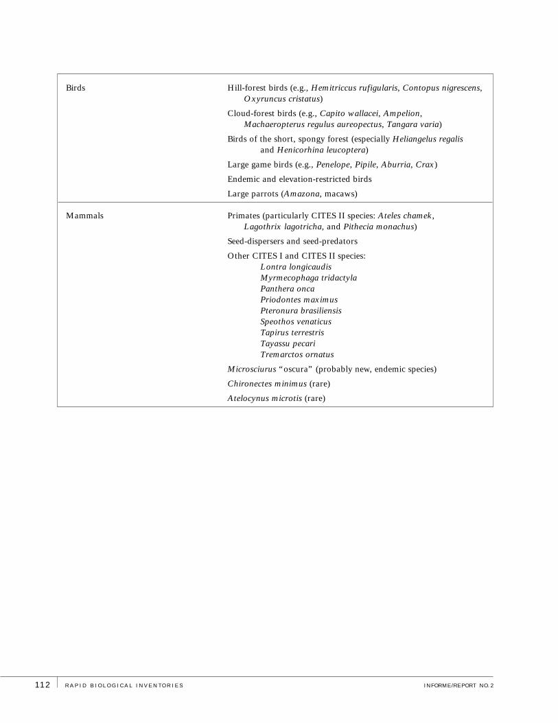
Organism Group Conservation Targets
Biological communities Lowland forests with populations of Cedrelinga (tornillo), Cedrela(cedro) and Swietenia (mahogany, caoba)
Spongy, short forests; elfin forests; and shrublands on upper slopes and crests (unique assemblages of plants)
Alluvial terraces, hill forests, and lower slopes (important habitats for plants, birds, mammals, and herpetofauna)
Extensive wetlands of middle and high elevations, with associated palm stands
Isolated lakes
Streams and rivulets (important habitats for fishes, herps, Lontra, and Chironectes)
Functional, representative samples of all habitat types
Tree species Cedrela odorata (cedro, Meliaceae)
Amburana cearensis (ishpingo, salta, Fabaceae)
Swietenia macrophylla (caoba, Meliaceae)
Cedrelinga catenaeformis (tornillo, Fabaceae)
Fishes Headwater fishes
Main-channel fishes
Reptiles and amphibians High-altitude species: Bufo of the B. typhonius group, Colostethusspp., Bolitoglossa salamander
Species that live in mosses and terrestrial bromeliads: Syncope sp.
Cochranella species
Atelopus andinus (an endemic species)
Eleutherodactylus of the E. conspicillatus group
Lowland species: Dendrobatidae
Epipedobates species
Geochelone denticulata
Podocnemis unifilis
Caiman species (Caiman sclerops, Paleosuchus spp.)
CONSERVATION TARGETS
The following species and communities are of primary focus for conservation within the northern Cordillera Azul
region because of their (1) global or regional rarity, (2) influence on community dynamics, and/or (3) significance
for intact ecosystem functions.
R A P I D B I O L O G I C A L I N V E N T O R I E S INFORME/REPORT NO. 2112
Birds Hill-forest birds (e.g., Hemitriccus rufigularis, Contopus nigrescens,Oxyruncus cristatus)
Cloud-forest birds (e.g., Capito wallacei, Ampelion,Machaeropterus regulus aureopectus, Tangara varia)
Birds of the short, spongy forest (especially Heliangelus regalisand Henicorhina leucoptera)
Large game birds (e.g., Penelope, Pipile, Aburria, Crax)
Endemic and elevation-restricted birds
Large parrots (Amazona, macaws)
Mammals Primates (particularly CITES II species: Ateles chamek, Lagothrix lagotricha, and Pithecia monachus)
Seed-dispersers and seed-predators
Other CITES I and CITES II species: Lontra longicaudisMyrmecophaga tridactylaPanthera oncaPriodontes maximusPteronura brasiliensisSpeothos venaticusTapirus terrestrisTayassu pecariTremarctos ornatus
Microsciurus “oscura” (probably new, endemic species)
Chironectes minimus (rare)
Atelocynus microtis (rare)
113perú: cordillera azul FEBRERO/FEBRUARY 2001
THREATS
Imminent threats to the northern Cordillera Azul
include designated logging concessions in a large
expanse (close to one million hectares) covering the
adjacent lowlands, associated construction of new roads
for timber removal, and the inevitable colonization
that follows roads and that leads to damage far beyond
the immediate area of timber removal. Illegal extraction
of economically valuable timber already poses serious
threats to targeted species (e.g., mahogany, Cedrela,
Cedrelinga), especially within a 2-km or wider swath
along the rivers. Illegal wood-cutting is very conspicuous
along many trails at the two macrosites we sampled
(upper Río Pauya and upper Río Pisqui) within the
Zona Reservada Biabo Cordillera Azul. At the time of
our inventory, logging camps were large and clearly
active along the upper Río Pauya and the Río Aguaytía.
Estimates of itinerant chainsaw-loggers in the upper
Pauya during our stay in the field ran as high as 2000
individuals. Increased exploitation by illegal loggers and
colonization within the reserve are grave future threats.
The valuable species of trees targeted for timber harvest
survive almost exclusively in areas inaccessible to roads
and rivers.
Logging is both extensive and intensive within
timber concessions to the east of the Zona Reservada
(e.g., near Manco Capac). From experience in many
other tropical forests, we predict that such forest
conversion and colonization will lead to erosion, sedi-
mentation, and subsequent reduction of species diversity
and community integrity, both aquatic and terrestrial.
Increased hunting pressure on large game birds and
mammals (peccaries, guans, curassows) will affect not
only the populations of those animals, but also the com-
plex dynamics of seed dispersal and seed predation.
Palms and Uncaria (uña de gato) also are har-
vested in areas with relatively easy access by humans.
Palm populations already show mild effects of over-
harvesting in the upper Río Pisqui, and are in need of
adaptive management plans and monitoring. Uncaria
grows in disturbed, secondary forests, and is not in
any danger in the foreseeable future.
Coca plantations have destroyed forest stands
on slopes near the western limit of the Zona Reservada.
Many of these coca fields have been abandoned as a
consequence of the Santa Lucía anti-drug base and are
reverting back to forest. However, the western and
northern portions of the Zona Reservada continue to be
the most accessible and vulnerable to colonization and
exploitation by humans. Disorganized expansion of
small-scale agriculture also remains a threat, particularly
from the north.

R A P I D B I O L O G I C A L I N V E N T O R I E S INFORME/REPORT NO. 2114
OPPORTUNITIES FOR CONSERVATION
The northern Cordillera Azul offers the rare opportunity to protect an intact, functioning ecosystem
before degradation and fragmentation set in. The sandstone ridges of the Cordillera hold an outstand-
ing example of the endangered, lower montane ecosystem of the Andes. This mountain complex
also encompasses a remarkable array of other habitats, including jagged, piranha-tooth peaks with
nearly vertical slopes jutting a mile above the surrounding lowlands; tall, lowland forests that grade
into elfin forests, shrublands, and meadowlands on ridges and crests; an unusual, high-altitude
complex of wetlands; and unexplored lakes hidden amidst eroding towers of red rock (Figures 4–8).
The proposed Parque Nacional Cordillera Azul Biabo would protect a unique set of biological
communities, among the most diverse of all conservation areas in Peru. Many of these communities
are endangered or unprotected elsewhere, and fast disappearing.
The low human population in the Cordillera, the natural geographic barriers, the unusual
geological formations with acidic soils and spectacular landscape, the large number of unique
species and species assemblages, and the abundance of game birds and large mammals, all point
to the outstanding conservation opportunities in the region. Appropriate land-management and
economic alternatives in the northern Cordillera Azul will engender protection of the entire,
contiguous range of biological communities from dwarf vegetation at the mountain crests to the
rainforests along lowland rivers. This proposed national park offers a rare opportunity to protect
undamaged headwaters and almost entire watersheds that will encompass intact ecological regimes
(e.g., natural disturbance, pollinators, seed dispersers) in a matrix large enough to include adequate
population sizes for uncommon species. The sheer size and isolation of the Parque Nacional
Cordillera Azul Biabo will allow it to function as a source and genetic refuge for game animals
and for commercial tree species that may be exploited to extirpation elsewhere in Peru (Figure 6).
In September 2000, the Peruvian government declared nearly 1.14 million hectares in the
northern Cordillera Azul a “Reserved Zone” (Zona Reservada Biabo Cordillera Azul). At the same
time, the government allocated the adjacent ca. 984,000 ha of lowland forests to “Permanent
Production” (Bosque de Producción de la Zona Forestal Permanente). Formerly, both of these
regions together constituted the Bosque Nacional Biabo Cordillera Azul. The region now offers
critical opportunities for coordinated management between the protected highlands and the
adjacent concessions in the still-intact lowlands (Figure 4A). Seven concessions lend themselves
particularly well to management for conservation (Figure 3) and to development of economic
alternatives that would minimize impact on the region’s biodiversity. Four of these concessions (to
the north) would create a strategic buffer zone for the narrow neck of the proposed national park,
and become a base for controlling and monitoring access along the Ríos Cushabatay and Pauya.
The three concessions to the south offer an outstanding opportunity for coordinated management

115perú: cordillera azul FEBRERO/FEBRUARY 2001
with a large, interested, resident indigenous community—the Shipibo of Nuevo Edén. These
concessions along the Río Pisqui (Figures 3, 5A) are prime areas for collaborative development and
implementation of sustainable harvest and economic practices (e.g., tourism, ornamental fishes
and plants, hearts-of-palm, medicinal plants) that promote long-term survival of local cultures,
and of the plants and animals in the region. Surveillance in the conservation concessions also
would control access along the Río Pisqui. Meanwhile, the sheer, impenetrable wall of the
Cordillera would protect the proposed park between the Ríos Pisqui and Pauya.
The urban centers around the northern Cordillera Azul (Pucallpa, Contamana, Orellana,
Tarapoto) further offer the opportunity to involve local residents in the economic benefits of respon-
sible use of the region’s rich natural resources. Opportunities include development of ecologically
sensitive tourism and markets for local handicrafts and other non-timber products.

R A P I D B I O L O G I C A L I N V E N T O R I E S INFORME/REPORT NO. 2116
R E C O M M E N D AT I O N S
This rapid survey has laid the groundwork for the participatory process of conservation design through
preliminary identification of the northern Cordillera Azul region’s ecological context, biological
values, threats, and conservation opportunities. The design process will root the visions, goals, and
strategies for the proposed national park in the region’s biological values and threats to these values. An
agenda for ecological research, inventory and monitoring then can build on these emerging goals and
strategies. Below, we list our preliminary recommendations, the most urgent of which concern the
protection and management of this spectacular landscape and its inhabitants.
1) Categorize the “Reserved Zone” as a National Park (Parque Nacional
Cordillera Azul Biabo): National Park status will engender protection of
the many endangered and unique communities in the region and huge, intact
watersheds, by preventing the harvest of timber, extensive conversion of
habitat, and disorganized human colonization. It also will protect the
abundant populations of large mammals and game birds in the region.
2) Adjust the limits of the protected area to follow natural contours of the terrain
(see Figure 3): The proposed limits offer protection to endangered highland
communities—including unusual highland swamps – while forming natural,
easily identified, and easily controlled boundaries for the protected zone
(e.g., rocky escarpments to the west and south).
3) Coordinate management of the protected area with the adjacent lowlands
to the east, now officially classified as logging concessions, to minimize
negative impacts of concession activities on the rich biological communities
of the region.
4) Develop collaborative, ecologically sensitive alternatives for the economic
well-being of residents in the region.
5) Dedicate the southwest corner of the proposed national park to studies of
reforestation techniques (north and west of Santa Lucía, where abandoned
coca plantations cover much of the terrain).
6) Control access to the park by effective monitoring of traffic on the three rivers
to the east (Pauya-Cushabatay, Shaypaya, and Pisqui) near the points at which
they emerge from the escarpment wall.
7) Keep fishing and hunting pressures at present levels (i.e., for subsistence
by local residents only).
8) Develop a management program for Podocnemis turtle and Caiman populations
to ensure their survival even as they are harvested.
Protection
and Management

117perú: cordillera azul FEBRERO/FEBRUARY 2001
R E C O M M E N D AT I O N S
Research 1) Diagnose the potential for local and international ecotourism in the
proposed park and buffer zone.
2) Research the carrying capacity for fishing and hunting (mammals,
birds, reptiles).
3) Investigate the potential for Platycerium andinum (staghorn fern, cuerno
de ciervo) and other attractive plants to be cultivated for sale as ornamentals.
4) Investigate the potential for the multi-stemmed palm, Euterpe cf. E. oleracea,
to be harvested sustainably for hearts-of-palm (palmito).
5) Research the carrying capacity for harvesting Uncaria (uña de gato),
ornamental fishes, and other non-timber resources.
6) Study the fruit production of plant species (especially palms) important as
food resources for mammals and birds.
7) Study the biogeography, habitat fidelity, and reproductive modes of the
frogs Colostethus, Bufo typhonius group, Epipedobates pictus group, and
the Eleutherodactylus conspicillatus group.
8) Investigate the current status of the caiman populations (all species).
9) Encourage detailed studies of bird distribution at the different elevations.
10) Investigate the status of mammal species that were reported by the
indigenous residents but were not recorded by the inventory team
(e.g., Pteronura brasiliensis, Priodontes maximus).
Further Inventory 1) When a plant-collecting permit can be obtained from INRENA (to allow
proper documentation of new species within the northern Cordillera Azul
region), inventory high-elevation forests and high-mountain ridge crests,
where the majority of the new and endemic plant species reside.
2) When a mammal-collecting permit can be obtained from INRENA (to allow
proper documentation of new species within the northern Cordillera Azul
region), inventory small mammals throughout all habitats and elevations,
and inventory high-elevation forests of the upper Río Pauya, where the
potentially new species of squirrel resides.
R A P I D B I O L O G I C A L I N V E N T O R I E S INFORME/REPORT NO. 2118
Monitoring
R E C O M M E N D AT I O N S
3) With these same permits in hand, conduct ground surveys (1) of the
high-altitude wetland complex in the southwest corner of the reserve
(Figures 8E, 8F); (2) on the unvisited, highest mountain peaks; (3) in the
tall cloud-forests of the Cushabatay and elsewhere; and (4) of the red-rock
towers in the northeast portion of the park (Figure 8C).
4) Inventory birds on ridges throughout the northern Cordillera Azul and across
all vegetative communities between 300 m and 2000 m.
5) Conduct more complete inventories of the herpetofauna in high, isolated
habitats and habitats that we inventoried insufficiently (e.g., streams at higher
elevations), or not at all (e.g., high swamps, marshes, lakes, highest peaks).
6) Conduct additional surveys of fishes in both the upper Pauya and the upper
Pisqui watersheds, across a wide altitudinal gradient, with additional sampling
means, and during different seasons.
1) Monitor extent of deforestation with satellite images (in cooperation with other
organizations). Share these data with the Shipibo community and collaborate
in training for the use and interpretation of these data. If possible, work with
the Peruvian National Police or others to use remote visualization resources to
monitor incursions from the western part of the park.
2) Collaborate with the Shipibo community in monitoring river access to the
proposed park.
3) Identify key access points to the north and west of the Reserve and collaborate
with local communities to limit destructive access and colonization while
building ecologically sensitive incentives (tourism, etc.).
4) If the presence of humans in the northern Cordillera Azul region increases,
then regulate the harvest of large fish species to ensure that they continue
as viable populations. Control the intensity of fishing during periods when the
fish are spawning. Develop an adaptive management program for the fishes,
with biannual monitoring of vulnerable species to verify their population
status. Involve the resident communities in these monitoring efforts.
5) Monitor populations of aquatic turtles, caimans, and other hunted animals
to ensure sensible harvest strategies.
119perú: cordillera azul FEBRERO/FEBRUARY 2001
OVERVIEW OF SITES SAMPLED
For intensive, on-the-ground inventories, we accessed the northern Cordillera Azul
at three points (Figures 2 and 3): one in the watershed of the upper Río Pauya
(at Pauya Campamento Principal); the second ca. 65 kilometers to the south,
along the Río Pisqui (at Pisqui Campamento Planicie); and the third (Pisqui
Campamento Playa), 5–6 kilometers upstream and southwest of the first Pisqui
site, from where we gained easier access to the mountains.
Helicopter access to the Pauya site was possible because of the labor of
J. P. O’Neill and colleagues on the LSUMZ/MUSM ornithological expedition,
who prepared and used a heliport just prior to our rapid biological inventory.
Rocky, dry-season beaches along the Río Pisqui (Figure 4C) provided access to
the other sites, along with a heliport prepared with local Shipibo residents. In
addition to several hours of helicopter overflights in transit to our sampling sites,
we had 10 additional hours of flight time in small planes, which allowed us to
examine other, remote areas of the huge, northern Cordillera Azul. We indicate
the most notable of these areas in Figures 2 and 3.
Below, we provide general descriptions of the three major study sites (the
Pauya and Pisqui “macrosites”) and the distinct subsites and trails studied within
each. These descriptions also apply to the LSUMZ/MUSM expedition to the upper
Río Pauya in 2000. For description of the LSUMZ/MUSM study sites in the upper
Río Cushabatay, see the Technical Report: Birds, and O’Neill et al. (2000). The
range of values in seconds of latitude and longitude reflect the variability of our
GPS readings at each study site.
UPPER RIO PAUYA MACROSITE
Although the Río Pauya eventually runs into the eastern lowlands, its headwaters
drain the northwestern peaks of the Cordillera Azul. This uppermost reach of
the Río Pauya is roughly parallel to the lower portion of the Río Biabo, though
the Biabo runs north and the Pauya runs south. As the Río Pauya continues
T E C H N I CA L R E PORT
R A P I D B I O L O G I C A L I N V E N T O R I E S INFORME/REPORT NO. 2120
downstream, it carves a broad U-turn around a high
mountain range (“Serrania del Pauya”), where our
access point was located (at Pauya Campamento
Principal). The access point was on the west flank of this
north-south mountain range. Our sampling ranged from
a narrow floodplain at ca. 350 m to mountain ridges at
over 1700 m; other parts of the Serrania del Pauya reach
2000 m. Beyond our study sites, the Río Pauya curves
northwards, penetrates the western-curving front
escarpment of the Cordillera through a narrow opening,
and in the lowlands soon joins the Río Cushabatay.
Members of the rapid biological inventory team
visited these Pauya sites between 23 and 31 August
2000. We often worked in teams that were sorted by
focal organisms. In the technical reports we note the
specific dates of visitation by these field teams to the
particular subsites.
Pauya Campamento Principal
(07°35'09.9–16.7"S, 75°56'00.6–01.6"W,
ca. 420 m elevation)
Our main camp in the Pauya watershed, this was also
the main camp of the O’Neill LSUMZ/MUSM ornitho-
logical expedition that immediately preceded us into
the area; they called this Campamento 2. The site was
a lowland forest on an alluvial fan, adjacent to a small
stream (Quebrada John, after John O’Neill), which
flowed to the upper Río Pauya. It was from the heliport
and camp that we accessed all other Pauya sites on
foot, by trails cut for the LSUMZ/MUSM expedition.
One study trail headed west-northwest of camp for
several kilometers and met the Río Pauya at about
07°36'02.2"S, 75°57'09.0"W. Two additional trails left
the Campamento Principal en route to the next four
sites listed below.
Pauya Campamento Orilla del Río
(07°36'17.0–22.5"S, 75°56'26.3–28.0"W, ca. 360 m)
This study site was several kilometers southwest of the
main camp, in alluvial fan and terrace habitats on the
shore of the Río Pauya at the point of its convergence
with Quebrada John. The LSUMZ/MUSM expedition
called this site Campamento 1.
Pauya Campamento Ladera
(07°33'36.1–40.0"S, 75°54'54.5–58.0"W, ca. 1100 m)
The trail running northeast from the Campamento
Principal, roughly parallel to the Quebrada John and
rising gently but steadily, bifurcated at ca. 510 m eleva-
tion (07°34'45.4"S, 75°55'08.1"W). The dominance of
palms in the understory decreased steadily as the trail
ascended from the lowlands. The left fork of the trail
junction climbed to Campamento Ladera. Both the
rapid inventory and the O’Neill expeditions used this
satellite camp; the O’Neill expedition called it
Campamento 4. The camp itself was on a flat ridgetop
of tall Cedrelinga forest. Above this camp, the trail
rose steeply through the spongy, short forest into the
shrubland and elfin forest at the ridgecrests, from
1300–1450 m (07°33'21.1"S, 75°54'39.6"W).
Pauya Campamento Torrente
(ca. 07°34'15"S, 75°54'40"W; 600 m)
The right fork of the bifurcation mentioned above cuts
across several kilometers of lowland forest on hills and
intervening alluvial fans and stream beds, until it follows
the upper Quebrada John to this temporary camp at
streamside, used primarily by the ichthyologists.
Approximately 200 meters upstream from this camp,
the Quebrada John divides into two smaller streams.
The ichthyologists ascended and sampled the east
branch (“Torrente Este”) for 1.5 kilometers, until they
reached 700 m altitude.
Pauya Campamento Cumbre
(07°34'00.0–07.5"S, 75°53'31.7"W, 1400–1440 m)
From the Campamento Torrente, the trail climbed
steeply upwards for several more kilometers through
slope forests along the ridges. The camp was on a
sharp ridge in spongy, short forest adjacent to a richer,
more humid ravine. The trail then continued along a
steep ridge above camp, through landslides into elfin
forest and shrublands on the crest, at ca. 1700 m.
THE UPPER RIO PISQUI MACROSITES
Most of the water entering the southeast drainage of
the northern Cordillera Azul finds its way into the Río

121perú: cordillera azul FEBRERO/FEBRUARY 2001
Pisqui. The Pisqui and its tributaries, the Quebrada
Nucane and the Río Shaypaya, drain the highest part
of the front escarpment, the spectacular Serrania de
Manashahuemana (meaning “turtle” in the Shipibo
indigenous language, see Figure 5A), whose peaks line
up like turtles on a log. The upper Río Pisqui is a larger
river than the upper Río Pauya and, being closer to its
mountain sources, is faster moving. Because of this
faster flow, the beaches are mostly covered with stones
and small boulders, even though the meanders are larger
than those of the Pauya. Our base camps (Campamento
Planicie and Campamento Playa) were just below rapids
difficult enough to impede navigation by boat. This
proximity to higher lands near the river gave us access
(from the lower Campamento Planicie macrosite) to
high floodplains, various river terraces of different age,
and tertiary hills; and (from the higher, Campamento
Playa macrosite) to the highest ridges of the small
mountain range that separates the Pisqui from the
Aguaytía drainage. At Campamento Planicie, our
sampling ranged from 220 m to 340 m, between the
river and the tertiary hills on the west side (Trocha
Huangana). On the east side of the Pisqui, we sampled
habitats along Trocha 6 km and Trocha Hacia Apua,
from 220 m to 500 m across hills and ancient terraces,
and into the watershed of the Río Aguaytía and its
tributary, Quebrada Apua. From the upstream camp,
Pisqui Campamento Playa, our sampling included
transects along the Trochas a las Colinas, from 230 to
600 m on the high hills of the west side, and 230 to
1300 m to the mountain crest on the east side (see
Campamentos Quebrada, Subcresta, and Cresta, below).
The habitats of the upper Pisqui were all wetter than
their counterparts on the upper Pauya.
Pisqui Campamento Planicie
(08°24'15.5–22.7"S, 75°42'05.2–06.2"W; ca. 200 m)
This main camp at our second macrosite was on a high,
young river terrace with tall, widely spaced, emergent,
floodplain trees separated by a lower canopy with many
palms and viney thickets. Shipibo hunters have used this
as a camp in the past, and we could see evidence of palm
and timber harvest locally.
Pisqui Trocha Huangana
This 3-km long, newly cut trail ran northwest from our
Pisqui Campamento Planicie for 1.9 km, through a high
but poorly drained floodplain with a very open canopy,
thick with vine tangles (at ca. 200 m) and then ascend-
ed to 340 m into low hills with Cedrelinga forest.
Pisqui Trocha 6 km
This newly cut trail originated on the east side of the
Río Pisqui, directly across from Pisqui Campamento
Planicie, and ran 6 km due south. The first 3 km of the
trail ran through high forest on the young river terrace,
and across several small ravines, all between 200 and
280 m elevation. The second half of the trail climbed
into low hills and old terraces.
Pisqui Trocha Hacia Apua
This path is a route actively used by the Shipibo for
travel between the Río Pisqui (which it departs just
below the first difficult rapids) and the Quebrada
Apua, in the separate watershed of the Río Aguaytía.
The path intersects the northern portion of our
“Trocha 6 km” very near the river (Pisqui) and soon
climbs out of the young floodplain to over 500 m in
the hills and sandy, ancient terraces, then descending to
meet the Quebrada Apua at ca. 245 m, 08°26'12.2"S,
75°40'49.7"W.
Pisqui Campamento Playa
(08°25'57.8"S, 75°43'43.2"W, ca. 260 m)
This main camp was the hub of our third macrosite. It
was perched on a slightly raised island of the floodplain
between a broad, dry, rocky, seasonal beach of the
Pisqui and a small stream. Tall, floodplain forest, early-
successional forest, and the vegetation of rocky and
sandy beaches and rocky riverbanks surrounded the
camp. This camp was ca. 2 km above the point where
the Quebrada Nucane joins the Río Pisqui, on the
opposite river bank.
Pisqui Campamento Quebrada
(estimated as 08°27'15"S, 75°43'46"W, too dense for a
GPS reading; 310–320 m)
This satellite camp was adjacent to a small, swiftly
flowing stream along the newly cut trail running from
R A P I D B I O L O G I C A L I N V E N T O R I E S INFORME/REPORT NO. 2122
Campamento Playa on the river up to the mountain
crests. The hill forest here was a mixture of elements
from the floodplain and hills above (see Vegetation
and Flora in Overview and Technical Reports for
more detail).
Pisqui Campamento Subcresta
(ca. 08°28'35"S, 75°43'49"W, 1150–1170 m)
A camp in short, spongy forest on a narrow ridge,
ca. 30 minutes (nearly vertical) walk below the crest
of the mountain.
Pisqui Campamento Cresta
(08°28'45.6"S, 75°43'52.1"W, ca. 1220 m)
This terminus of the newly cut trail from Campamento
Playa was in moist, very mossy, elfin forest with
scattered, larger trees, on the exposed crest of the
mountain ridge that sits southeast of the point at
which the Río Pisqui emerges from the mountains.
Pisqui Trochas a las Colinas
There were two trails on the west side of the Pisqui,
both upstream from our Campamento Playa. The first
was a poorly marked trail that leaves the Río Pisqui
at ca. 265 m and 08°26'26.6"S, 75°44'21.7"W (at
the limit of navigation, from a bank of solid rock),
and runs up the surrounding hills. The trail is used
only occasionally by hunters and itinerant loggers.
Tall, lowland forest at riverside becomes slightly drier,
and more frequently disturbed on the ridges, which
are separated by shallow, humid valleys. We reached
ca. 510 m on this trail, at which point it faded away.
The second trail, newly cut, was further downstream
across from the Pisqui Campamento Playa and crossed
old river terraces and high hills, along with several
streams, until reaching a sharp drop-off at 600 m.
Continuing in the same direction, one would soon
encounter the main escarpment of the Cordillera.
GENERAL PHYSIOGRAPHY, GEOCHEMISTRY,
AND CLIMATE
Author: Robin Foster
PHYSIOGRAPHY
The northern Cordillera Azul encompasses a complex of
smaller mountain ranges and represents the easternmost
outlier of the Andes at this latitude, except possibly for
the much lower Serrania de Contamana, just east of the
Río Ucayali, which remains poorly known and may be
geologically distinct. Each range is a separate, uplifted
block of mostly Jurassic and Cretaceous strata, which
predominate in the northeastern Peruvian Andes south
of the Río Marañon. Most of these uplifted, tilted blocks
are oriented north and south, but some curve to run east
and west. The easternmost uplift, the most recent of all,
is a long, remarkably uniform, sinuous ridge system,
which seen in the satellite images resembles the shape
of a mammalian spinal column (Figure 2). This eastern
escarpment of the Cordillera forms a sheer wall block-
ing access to the southern two-thirds of the northern
Cordillera Azul from the eastern lowlands. Only the
Ríos Pauya, Shaypaya, and Pisqui penetrate this formi-
dable wall of mountains (towering 1800 m above the
adjacent lowlands) through a few narrow openings.
To the north, this escarpment curves westward and
smashes into the north-south running escarpment that
terminates at the Río Pauya (just north of our upper
Río Pauya study sites).
In the northeasternmost part of the Cordillera
Azul, a similar but lower escarpment faces northeast
and is bisected by the Río Huallaga to the north. In the
broad gap between this steep, northeastern wall and
the main escarpment to the south, the Río Cushabatay
penetrates into two low, broad, ridge-filled basins.
Northward, these basins constrict into narrow necks,
separated by a high north-south running mountain
range with peaks of 1700 m and higher. The broader,
western basin is an extraordinary geological formation
with long, low, flat, anvil shaped ridges sloping to the
south and a virtually flat-bottomed center (elevation
450 m) with dozens of emerging small, steep ridges up

123perú: cordillera azul FEBRERO/FEBRUARY 2001
to 400 m. Nested within this strange landscape is a
large, isolated blackwater lake. A tributary of the Río
Chipuruna drains this northern part of the basin, then
plunges through a narrow canyon in the eastern wall
and finally runs north to merge with the Río Huallaga.
In the central portion of the northern Cordillera
Azul, the eastern slopes of the peaks (to 2400 m) drain
down narrow openings to the Río Ucayali. The west
slopes of these peaks drain into the straight, northward
flowing valleys of the Río Biabo, and eventually to the
Huallaga. Just south of the upper Río Pauya, an eastern
branch of the Río Biabo drainage comes right up to the
west slope of the east wall. In the southernmost portion
of the northern Cordillera Azul, a small river passes
through high-elevation swamps and into the upper
Huallaga to the southwest. These high swamps (at
1400 m elevation) are an unexpected feature in such
close proximity to steep mountains. A newer uplift of
very hard rock presumably formed these unusual
swamps by blocking the drainage of a valley.
A distinctive geological feature, the “Vivian
formations”—rows of giant, flat, sloping triangles of
rock up to 7 km broad at the base and 4 km from the
base to the tip (but usually smaller), resembling “zig-
zags” (Figures 7E, 11)—are well developed and almost
perfectly symmetrical in two areas of the northern
Cordillera Azul. One is a 50-km row of Vivians along the
east slope of the mountains running north of our study
sites on the upper Río Pauya. The other is a 20-km
stretch of smaller, 2–3 km broad Vivians running east-
west from the main eastern escarpment, just south of the
“U-curve” formed by the Río Pauya (Figure 2). Smaller
versions of similar, sloping rock triangles occur in other
ranges in the Cordillera. Recent uplift of very erosion-
resistant rock, such as quartzite, and concurrent erosion
of much softer rock beneath it, presumably created these
Vivian formations. Drainage from the higher mountain
valleys above the Vivian formations continues to carve
gaps between the segments, often resulting in spectacular
waterfalls. North of the Río Pauya are higher and
presumably older rows of Vivians that are more eroded,
but still maintain their basic “zig-zag” form.
The high range of hills in the forestry
concessions between the Río Ucayali and the eastern
escarpment of the northern Cordillera Azul appear to be
the beginning of the uplift of the next mountain range,
as the Nazca Plate at the bottom of the Pacific Ocean
continues to slide eastwards under the South American
continent. This uplift will take a while, but this phenom-
enon emphasizes the unstable and geologically dynamic
nature of the eastern slopes of the Andes. The area
shows considerable indication of old seismic activity,
with ridge systems displaced along fault lines and
recent activity, as evidenced by massive simultaneous
landslides in several areas. One of these earthquakes
occurred within the last few years, in the mountain
range just north of the Río Cushabatay: a “huaico”
mudslide, from the merged landslides, damaged a wide
swath along a northern tributary of the Cushabatay,
the Río Inahuaya (Figure 8A).
GENERAL GEOCHEMISTRY
The Jurassic and Cretaceous strata that make up most
of the Cordillera Azul are formed from a mixture of
mostly very acidic, continental and marine sediments.
The area has more surface coverage by acidic types of
rock than any other reserve in the Andes. Neither the
Bahuaja-Sonene park, nor the Manu, Vilcabamba,
Yanachaga, or Abiseo reserves have such extensive
nutrient-poor rock formations within their mountains.
This rock appears to be mainly soft sandstones, but may
include harder quartzites or granites and other rock
that creates acid soils. In Peru, only the top mesa of the
Cordillera Condor and the Tabaconas Namballe reserve
north of the Río Marañon have large extensions of
sandstone, but they represent less extensive coverage
of the mountainous areas.
In contrast to the nutrient-poor strata that
dominate the mountains, the less extensive lower slopes
and lowlands of the northern Cordillera Azul have
considerable exposure of rich strata such as limestones
and rich alluvial terraces. These slopes date to the
Cretaceous-Tertiary boundary and more recent Tertiary
and Quaternary sources. They are sometimes interlaced

R A P I D B I O L O G I C A L I N V E N T O R I E S INFORME/REPORT NO. 2124
with pockets of acid soil, usually displaced from above,
just as there are some strata of more basic soil perched
higher on the mountains. The recent (Tertiary) hills
extending from the mountains eastwards are mostly
intermediate in acidity.
CLIMATE
This region is subject to the southern-hemisphere pattern
of drier periods from June/July to October/November.
These periods of drought are likely not as severe or
prolonged as they are to the south, in Madre de Dios,
but from our observations they are clearly more
pronounced than the weak dry-periods that the Iquitos
area experiences around August. The prevailing winds
during these drier periods bring moisture northwards
from Argentina and Bolivia with the frontal systems
locally known as “friaje.” The highest mountains of the
northern Cordillera Azul are in the south, and pose a
barrier to this northward flow of moisture. The eastern
wall of the Cordillera, in turn, blocks moisture arriving
across the Amazonian plains to the east. As a conse-
quence, the northwest part of the northern Cordillera
Azul appears to be driest at all elevations. We predict
that the two broad basins in the northeasternmost
portion of the proposed Parque Nacional Cordillera
Azul Biabo get more rainfall and cloud moisture in the
dry period than does the upper Río Pauya region,
because of the gap in the east wall and subsequent
funneling of clouds to the northwest, into these basins.
FLORA AND VEGETATION
Participants/Authors: Robin Foster, Hamilton Beltrán,
William S. Alverson
Conservation targets: 1) all plant community types (floodplain
forests, alluvial terraces, hill forests and lower slopes; short,
spongy forests; elfin forests; shrublands and meadows on upper
slopes and crests; swamps at middle and high elevations; isolated
lakes); 2) plant species commonly overexploited (Swietenia
macrophylla, Cedrela odorata, Cedrelinga catenaeformis,
Amburana cearensis); and 3) new and rare species.
METHODS
Flora Sampling
Collections: Abiding by INRENA’s decision, we were
unable to make botanical collections during the expedition.
Photographs: We photographed plants for documenta-
tion and possible later identification and verification, as
well as to create color field guides to the species of the
area. We took an estimated 1000 pictures of 500 species.
Species notes: In the field and during overflights, we
noted easily recognizable species, or species not acces-
sible for photographs.
Vegetation Sampling
Transects: We used variable transects (Foster et al. ms.,
www.fmnh.org/rbi) to sample composition and relative
abundance of different classes of plants. For emergent
trees (>60 cm DBH) and canopy trees (>30 cm DBH), we
recorded all individuals encountered along 20-m wide
strips. For medium, subcanopy trees (10–30 cm DBH),
we used 5-m wide strips. For shrubs (1–10 cm DBH)
1-m wide strips, and for herbs we used 1 x 5 m segments
with each species represented once per segment
(because most herbaceous forest plants are clonal).
In sum, we conducted 16 transects in 6 areas, with
1660 individuals sampled.
Vegetation Notes: We made anecdotal observations
during overflights and on the ground, noting differences
in composition between lowland, slope, and crest
forests; canopy and understory plants; successional
versus older stands; frequency of open versus closed
canopy; patchiness of species; forest dynamics including
regeneration from windthrow, landslide, and fire.
RESULTS
The outline below lists the physiographic habitats we
recorded within the northern Cordillera Azul. Some of
these we documented only from overflights. Later in
this section (under Pauya and Pisqui study sites), we
describe in more detail the habitats that we were able
to examine closely.
125perú: cordillera azul FEBRERO/FEBRUARY 2001
Lowlands
River floodplain
Periodically flooded
Active beaches
Shrub and vine thickets
Early-successional forest (Cecropia, Ochroma,
Guazuma)
Tall floodplain forest
Stable alluvium
Eroding banks
Rocky-river-margin
Oxbow lakes
Swamps
Non-flooded, recent (Quaternary) terraces
Rock and gravel terraces
Sandy terraces
Clay terraces
Swampy terraces
Foothills
Alluvial fans
Stream edges
Well-drained soils
Disturbed areas (landslides, washouts,
human activity)
Very acid alluvial soils
Tertiary hills and ancient terraces
Limestone hills
Semi-acid hills
Sandy terraces
Stream edges
Disturbed areas
Mountains
Slopes
Basic or semi-acid rock
Valleys
Ridge slopes
Landslides
Very acid rock substrates
Valleys
Ridge slopes
Narrow, horizontal ridges
Vivian formations
Landslides and sheer rock walls
High Crests (the highest peaks and ridges that are
frequently cloaked by clouds)
Basic or semi-acidic rock
Broad summits
Narrow summits
Small, high-altitude streams
Landslides
Very acid rock
Broad summits
Narrow summits
Small, high-altitude streams
Landslides and sheer rock walls
High marshlands and swamps
Open water
Water with floating vegetation
Shrub thickets
Bamboo groves
Palm stands
FLORISTIC RICHNESS, COMPOSITION,
AND DOMINANCE
In our brief visit to the northern Cordillera Azul, we
were able to distinguish 1616 different species of plants.
We identified 566 of these to the species level; most of
the remaining 1050 species will not be identified,
because we were not permitted to collect voucher
specimens. With only three weeks to survey the northern
Cordillera Azul, we did not intensively study the lianas
or epiphytes, such as orchids. We estimate that the flora
in the proposed Parque Nacional Cordillera Azul Biabo
has between 4000 and 6000 species of vascular plants.

R A P I D B I O L O G I C A L I N V E N T O R I E S INFORME/REPORT NO. 2126
VEGETATION AND FLORA
OF THE PAUYA MACROSITES
Lowlands: Floodplains
The upper Río Pauya floodplain, narrow and meander-
ing, leaves a few small ox-bow lakes and a very short
series of levees covered by successional bands of
vegetation. The narrow beaches are silty, with scattered
stones, and the successional strip closest to the river is
usually a band of Gynerium (caña brava). When these
levees age and stabilize, other successional species
emerge, also typical of Amazon floodplains: Cecropia
membranacea, Guazuma crinita, Triplaris americana,
Acacia loretensis—but only occasional Ficus insipida.
Whatever Cedrela odorata may once have been on these
older levees is now gone. Dense tangles of vines, and
extensive, understory stands of the stemless Phytelephas
macrocarpa palms—mixed mainly with Astrocaryum
and Attalea—cover some poorly drained floodplains.
Phytelephas also occurs in scattered patches in the hills
and other unflooded areas, but never in such large
stands. These poorly drained areas along the Río Pauya
may be flooded only infrequently. They show abundant
evidence of frequent use by herds of white-lipped
peccaries. Petiveria alliacea shrubs are very abundant
here, and their seeds are probably dispersed by attaching
themselves to the peccaries. Old floodplain forest or high
terraces seem absent; they may be obliterated by frequent
landslides and washouts (huaicos) on the alluvial fans.
Lowlands: Alluvial Fans and Dry Hills
A scattering of very low hills separates the mountains
from the floodplain of the Río Pauya. The shallow
corridors between the hills have allowed extensive
development of alluvial fans of sediment—filled with
rocky boulders—spreading out in a gradual slope from
the base of the mountains to the river. The rock under-
lying the soils on the hills appeared to be limestone or
some similar, non-acidic rock. Forest canopies with a
high frequency of deciduous species, along with under-
stories dominated by palms (Figure 4D), characterize the
alluvial fans and dry hills. There is considerable floristic
overlap between these two habitat types. The emergent
deciduous species are largely genera of Bombacaceae
(such as Matisia, Pachira, and Ceiba, as well as Hura
crepitans, Gallesia integrifolia, Apeiba membranacea)
and several Fabaceae (Apuleia leiocarpa, Dipteryx
micrantha, and Amburana cearensis). These are mixed
mainly with evergreen species of Moraceae (with
conspicuous, truly enormous individuals of Ficus
schultesii), Sapotaceae, Chrysobalanaceae, and other
Fabaceae. Many or most of these species would occur
in old floodplain terraces if these habitats existed along
the Río Pauya. The understory of alluvial fans and dry
hills has a mixture of palms, but is heavily dominated by
Attalea phalerata and Astrocaryum murumuru, which
are also characteristic species of old floodplains.
Low hills and alluvial fans, which are closely
juxtaposed, differ primarily in that the hills have a
less dense canopy but higher diversity of trees, and an
obviously greater density and diversity of lianas (often
with large tangles of lianas), shrubs, juvenile palms,
and ephemeral herbs. The hills also have large patches
of the terrestrial bromeliad, Pitcairnea, which spreads
vegetatively. On the alluvial fans, the deep-rooted
palms probably have greater access to underground
water than do those on the hills. This may permit
denser packing of these palm species and subsequent
shade inhibition of the establishment of lianas, shrubs,
herbs, and other tree species. The herbs on the alluvial
fan are dominated by a few, vegetatively spreading
species. The age of the forest also may be relevant to
this difference between the hill and alluvial-fan forests.
Large segments of the alluvial fans are typically formed
during a single, major disturbance, such as a major
mud and rockslide that covers an area and wipes out
most of the existing trees. Such an event generates a
relatively uniform successional development on the
mud, sand, and rocks that are deposited—much like
the development on floodplain beaches.
We crudely estimate that the age of what
appears to be successional forest on the alluvial fan at
our Pauya Campamento Principal is about 200 years.
We base this estimate on the size of individuals of
127perú: cordillera azul FEBRERO/FEBRUARY 2001
different species, their estimated growth rates, and the
composition of other successional tropical forests of
known age. The alluvial-fan forest probably has not
had as much time to accumulate species as has the hill
forest, nor have the alluvial fans had as many large
treefalls that would allow lianas and other understory
species to become established.
Likewise, because of their presumably recent
origin, and perhaps also because of their seasonal
instability and canopy cover, the small streams that run
through these alluvial fans have only a few plant species
associated with their banks, such as Ochroma, Cecropia,
Croton lechleri, Condaminea corymbosa, Banara
guianensis, Vernonia megaphylla, Urera laciniata,
Liabum sp., and the grass Arundinaria berteroniana.
As is true in most semideciduous forests,
epiphytes are only occasional in the hill and alluvial-fan
forests. The most unusual and conspicuous epiphyte in
these lowlands is the staghorn fern, Platycerium andinum
(Figure 9E). The few other localities in Peru and Bolivia
where this fern occurs are low Andean valleys with dry
deciduous or semideciduous forest, but with a distinct
climatic feature: the valley bottoms consistently form a
low cloud or fog layer at night during the dry season,
which does not dissipate until mid-morning. From our
experience (and that of John O’Neill, pers. comm.), such
fog is present almost every morning in the upper Río
Pauya valley, covering most of the lowlands. It is reason-
able to expect that some other species of epiphytes,
especially orchids, also occur in this valley because this
unusual climatic phenomenon allows them to absorb
moisture and survive the dry season, despite being stuck
to the sides of dry trees. In most dry forests, the only
epiphytes that survive are those that basically shut down
during the dry season.
These dry conditions change dramatically closer
to the base of the mountains, where the surrounding
slopes and hills increasingly crowd the streambeds. Here,
humidity is high even during the dry season. Species
found downstream, in drier habitats, also occur here,
but these moist banks are much richer in species, have
an abundance of Siparuna and Myriocarpa, have more
epiphytes on tree trunks, and are richer in herb species
(especially ferns, aroids, and Peperomia). The canopy
over the adjacent, alluvial slopes is also more evergreen
and richer in species. The large palm, Iriartea deltoidea,
which is so common in most of the upper Amazon
floodplain and hill forest, finally makes its appearance
here. The understory is more speciose, but with few and
different palms, and with occasional aggregations of
single species such as the large-seeded Patinoa
(Bombacaceae). Overall, the hills adjacent to the
mountains are not so different from the hills closer to
the river. They have dry soils, frequent vine tangles, and
much the same flora (including the palms) that make
up so much of the alluvial-fan forests downslope. The
floras of the hills and recent alluvial fans converge in
composition when closer to the river but diverge when
closer to the mountains, apparently because the humid-
ity and/or soil moisture in the dry season are more
constant on the hills than on the lower-lying alluvium.
Mountains: Slope Forests
Because our trails up the mountains of necessity
followed the ridges and not the valleys, this description
of vegetation is confined mostly to ridge slopes. As in
mountains everywhere, the vegetation of lower eleva-
tions typically reaches a higher elevation in the valleys
than it does on the ridge slopes.
Dark-brown clay forest – The vegetation of
the ridge slopes, from ca. 600 to 900 m, is evergreen
and grows mostly on dark-brown, slippery clays. These
clays appear to be rich, basic soils and are slippery in
part because the plant roots embed themselves in the
clay rather than form a superficial mat (as occurs on
the more acidic soils), and also because such rich soils
usually support a slick, superficial growth of algae.
The flora on these dark-clay soils mostly
consists of species found in rich-soil lowland forests,
especially those in moist areas such as near the moun-
tains. Few of the deciduous species of the lowlands are
here. A large, herbaceous fern, Metaxya rostrata, covers
much of the steep slopes. One area of understory was

R A P I D B I O L O G I C A L I N V E N T O R I E S INFORME/REPORT NO. 2128
dominated by a rare genus of small trees, Sanango
(Buddlejaceae, Loganiaceae, or Gesneriaceae).
Cedrelinga forest – On some, but not all of the
ridge slopes, between 900–1100 m or higher, are areas
with semi-acid soil and a vegetation remarkably similar
to that of the semi-acid Tertiary hills in the lowlands
(Figure 7A). These relatively flat areas, perched halfway
up the mountainsides, have a moderate amount of
surface roots. The forest canopies are dominated by
huge Cedrelinga catenaeformis (tornillo), as well as by
large Brosimum utile, Tachigali vasquezii, Protium,
and Attalea maripa. Species such as Wettinia augusta,
Faramea capilipes, and Palicourea punicea dominate the
understories. All these species usually occur on lowland
hills, at elevations of 200 to 400 m. Some kind of older
rock, or mixture of rocks, has apparently given rise to a
soil that nearly duplicates that of the common Tertiary
sediments and these plant species have managed to
disperse up to the higher elevations. An analagous
situation occurs on the limestone strata of the upper
Río Pisqui slopes (see below).
A few abundant species in these forests, such as
the common Protium and some of the Geonoma palms,
occur also in the short, spongy, forest above, and some-
times in the dark-clay forest below. Where Cedrelinga
forest is missing on the mountain slopes, several of its
species occur in the short transition between the dark-
clay soils and the higher, spongy forest over sandstone.
A few species not seen elsewhere, e.g. a terrestrial
Anthurium and a terrestrial Elaphoglossum, are also
noticeable on these transitions.
Short, spongy forest – During our overflights,
we observed that the ridge slopes above 900 m, and often
lower, usually are covered with a distinctive forest of
reduced stature. This forest is short, usually about 10 m
tall, and covers an acidic, soft, pink sandstone. The soils
on these ridges are apparently so lacking in nutrients that
plant roots are almost entirely on the surface, where they
catch what nutrients come their way in rain- and litter-
fall. This creates a deep mat of roots and other organic
matter that, when stepped on, sinks down and bounces
back with a “spongy” feel. The analogy probably holds,
in that this root mat probably holds water on or near
the surface of the soil much as a sponge would.
This short, spongy forest is not as rich in
woody plant species as are forests lower down the upper
Pauya slopes, but it appears to have a high number of
epiphyte species. The dominant trees are a large-leaved
Pouteria, a Bonnetia paniculata, and three species of
capsulate Graffenrieda (Melastomataceae). These are
mixed with a couple dozen other species of small-tree
genera, such as Clusia, Miconia, Schefflera, Alchornea,
as well as Dictyocaryum palms and genera of Myrtaceae
and Lauraceae. The common Pouteria also occurs in the
semi-acid soils of the Cedrelinga forest, lower on the
slopes. Meanwhile, the Bonnetia and the Graffenrieda
species, among others, also occur in the shrublands of
the high mountain crests, but with smaller stature.
The understory of this short, spongy forest
frequently has small bamboos such as Chusquea;
common understory herbs include Schizaea elegans,
Lindsaea, and Trichomanes. The commonest vines are
species of Mikania, Piptocarpha, Dioscorea, Gnetum,
the climbing ferns Sticherus and Dicranopteris, and an
occasional, climbing Ericaceae. Parasitic Loranthaceae
are conspicuous.
Species with small, wind-dispersed seeds
dominate the flora of the short, spongy forests and of
the higher, elfin forests and shrublands, all of which
are underlain by acid rock. While several genera of
Melastomataceae, Rubiaceae, Myrtaceae, and
Araliaceae, in addition to the Pouteria species produce
animal-dispersed fruit in these habitats, most of these
were not fruiting during the dry season. This is impor-
tant, considering how much of the northern Cordillera
Azul is covered with this kind of forest. These areas
probably support local migrations of frugivorous birds
and mammals in the wet season, rather than having
resident populations year-round.
Colonization of steep landslides in this habitat
is variable but usually includes a white-leaved Guettarda,
Tibouchina, Oreocallis, several species of the crawling
ferns Sticherus and Lycopodiella, and several Asteraceae
and Cyperaceae.
129perú: cordillera azul FEBRERO/FEBRUARY 2001
The wet ravines and small valleys we were
able to inspect at the higher elevations seemed richer in
species and had a radically different flora from the
ridgeslopes, as well as being totally different from the
stream margins at the base of the mountains. In the
ravine near our Pauya Campamento Cumbre, at ca.
1400 m, we did observe a large-fruited Capparis, as
well as Chrysochlamys, Aegiphila, and the unexpected
Chaetocarpus echinocarpus (see below). But our
observations were insufficient to generalize about
what was common in these habitats.
Mountains: High Crests
The crestlines of the mountaintops and the highest
ridges are often horizontal or gently sloping surfaces,
exposed to wind, lightning, and frequent mist, as well
as to occasional, severe droughts.
Shrublands and elfin forest – The crests of the
mountains above the Río Pauya, as well as in most of
the northern Cordillera Azul, are underlain by very acid,
hard rock that has resisted erosion. The plants that live
in such areas are usually slow-growing species, often
with high concentrations of polyphenolic compounds,
which make them vulnerable to fire during extreme
drought. We have no evidence that these fires are very
frequent on the mountain and ridgetops, but they appear
to be frequent enough to have caused the formation of
dense shrublands at elevations one normally would
expect to find forest (Figures 7E, 7F). Such fires need
not occur more than once every one or two centuries to
suppress the forest and maintain a shrubland. It is not
unreasonable to expect that something like the El Niño/
La Niña phenomenon could, at rare intervals, cause
extreme drought in the drier parts of the northern
Cordillera Azul, and that this would make the crests
and ridges vulnerable to lighting fires over small areas.
On both high crests we visited in the Pauya, a
high, flat ridgetop at 1400 m and the mountain crest-
line at 1700 m, the shrubland (2 to 3 m tall) has many
species in common with the short, spongy forest lower
on the ridge slopes. The same tree species are present,
but stunted and separated enough that a large number
of other shrubby species, which do not occur with any
regularity in the short forest, also survive here. Common
shrubs that are mostly restricted to these mountain
crests are several Rubiaceae, such as Retiniphyllum and
Pagamea, the dwarf palm Euterpe catinga, Purdiaea
nutans (Cyrillaceae), Macrocarpaea (Gentianaceae), and
a few Myrtaceae and Myrsinaceae. It is not clear that
epiphytes are any more numerous or diverse here than
in the short forest, but they are more often noticeable at
eye level. Many of the large bromeliad species are both
epiphytic or terrestrial.
The shrublands are interspersed with wet
depressions or small ravines that bear a slightly taller,
elfin-forest vegetation, usually 4–9 m tall. This elfin
forest appears to be a shorter version of the short,
spongy forest, mixed with the species of wet ravines
and of the shrubland itself. As such, the elfin forest, a
mixture of plants from different habitats—a three-way
ecotone—is extremely rich in species. A sample of all
vascular plants in a very small, 20 m by 1 m, strip
through flat elfin forest at 1400 m contained a remark-
able 47 species. Many of the rare and new plants we
found in the northern Cordillera Azul were in this mosaic
of vegetation. The Parkia, Talauma, Stenopadus were
all emergents in the shrubland and not seen elsewhere,
although Talauma, found along a tiny streamlet, might
be present as well in the high ravines, which we did not
investigate. The tiny fern Schizaea poeppigiana, known
previously from a single collection made 170 years ago,
was in an open section of low shrubland, growing out
of a mat of Sphagnum moss and Cladonia lichen.
VEGETATION AND FLORA
OF THE PISQUI MACROSITE
Lowlands: Floodplains
The floodplain of the upper Río Pisqui rapidly broadens
after the river emerges from the canyon at the base of
the mountains. Much of this floodplain is elevated,
however, and only becomes inundated in the highest of
floods, perhaps not annually. Thus, this stretch of the
river course is analogous to an alluvial fan, confined by
high terraces or hills on either side. The river meanders

R A P I D B I O L O G I C A L I N V E N T O R I E S INFORME/REPORT NO. 2130
and splits mostly by large leaps of position, which create
broad strips of nearly even-aged successional forest
along the floodplain.
The floodplain we studied intensively was
just below the first serious rapids of the Pisqui, and the
gradient was already shallow enough that there was
poor drainage throughout. The result is a fairly high
terrace but with open, semi-swampy vegetation over
most of it; it was lowest and wettest where the flood-
plain meets the hills. We saw similar floodplains in our
overflights of many parts of the upper Río Pisqui and
other rivers east of the Cordillera. These poorly
drained floodplains are unpleasant places for humans,
though the white-lipped peccaries have a great affinity
for them (presumably due to the abundance of palm
fruits). The forest was thick with vine tangles, spiny
and urticating plants, and the greatest concentration of
stinging and biting ants that we have ever seen.
The better-drained pockets of the floodplain had
many of the typical large floodplain trees, such as Ceiba
pentandra, Dipteryx micrantha, Matisia cordata and M.
bicolor (both also abundant in the smaller size classes),
Clarisia biflora, and Ampelocera ruizii. The high density
of Sterculia apetala, a species usually not very abundant,
was surprising. The wetter, more-frequently flooded areas
of the floodplain, when not devoid of canopy trees, had
an abundance of Mauritia flexuosa palms, the conspic-
uous, orange-red flowered Erythrina poeppigiana,
Ficus insipida and F. maxima, and Acacia loretensis.
The conspicuous medium-sized trees of the
floodplain were mainly the palms Astrocaryum
murumuru, Iriartea deltoidea, and Socratea exorrhiza,
but also abundant were Dendropanax arboreus,
Chrysochlamys ulei, Lonchocarpus spiciflorus,
Pleurothyrium sp., Otoba parvifolia, Leonia crassifolia,
and various species of Pourouma, Inga, and Guarea.
No single species in the shrub class was particularly
common, and a large proportion of them were juvenile
trees. The herbs, in contrast, were dominated by a
Calathea, a Pariana, and a tiny Psychotria.
The stony beaches along the Río Pisqui are
colonized frequently by Baccharis salicifolia, Calliandra
angustifolia, and several herbs, but these stands seem
to be ephemeral; a successional sequence to Gynerium,
Cecropia, and Ochroma does not seem to occur until
sand and clay has accumulated. Where the river meets
the bedrock of the hills, a different, more stable riparian
vegetation is established, dominated by overhanging
trees of Zygia longifolia; shrubs of Ardisia, Eugenia,
Psychotria carthaginensis, and a small Acalypha; and a
specialized set of small herbs clinging to the rock:
Matelea rivularis, and a Justicia, Ruellia, Spigelia, and
a species of Cuphea.
Lowlands: Terraces and Hills
The relatively recent (Quaternary) terraces on either
side of the upper Río Pisqui are mostly 5–25 m above
the river level in the dry season, and the adjacent hills
are 50–200 m above that. The terraces, which are
essentially old floodplain, have many species in common
with the younger floodplain. However, there is an
almost continuous gradient of species into the flora
of the adjacent hills. The forest composition varies
considerably from place to place within these species-
rich habitats, and it is difficult to recognize distinct
communities. Mostly, the hills are very dissected, steep,
and with frequent landslides.
Dense stands of single species are common in
the understory of the hills. Among the most conspicuous
are areas dominated by the herbaceous Danaea spp.,
Clidemia heterophylla, Spathiphyllum, Calathea wallisii,
and Calathea altissima; or shrubs and small trees
belonging to Hippotis, Rinorea, and Galipea. We did
not sample sufficiently to compare the hills on opposite
of the river, but did notice dense stands of Rinorea
viridifolia and Esenbeckia amazonica on the hillslopes
of the west side of the river but not on the east.
The following, distinct habitat types are
exceptions to the general heterogeneity of the hills:
Cedrelinga forest – This distinctive community
is associated with the semi-acid, reddish sandy clays on
the Tertiary-age hills. Such hills are less eroded than
the other hills and usually gently sloping, with tall
closed-canopy forest and a conspicuous presence of
131perú: cordillera azul FEBRERO/FEBRUARY 2001
large Cedrelinga catenaeformis (now mostly as stumps).
The most common understory shrub is usually
Tabernaemontana undulata.
Ancient sandy terraces – Along the top of
the broad system of hills (ca. 500 m) that separate the
upper Río Pisqui from the Río Aguaytía drainage
(along the Trocha Hacia Apua trail), there are extensive
flat terraces of very sandy, brown soil. Though not as
extreme as the white-sand soils of the Iquitos region,
these terraces have a distinctive understory composition
with a high density of two pole-like, long-branched
treelet species of Flacourtiaceae (Neoptychocarpus
killipii and Ryania speciosa) and small Iriartella
stenocarpa palms, with a high frequency of Rapatea
among the herbs (Figure 4E). These terraces are dotted
with poorly drained depressions, some at least a hectare
in size, with mono-dominant stands of a small-leaved
species of Zygia trees.
Mountains: Upland Slopes
The slopes of the upper Pisqui Mountains, below
500 m elevation, did not differ noticeably from the high
hill-forests. They appeared to have semi-acid, clay soils
rather than any basic, dark-brown soils as found on
the lower slopes of the upper Río Pauya. But higher on
the slopes were two distinctive plant communities.
Limestone forest – Slope forests between
500 and 600 m along the trail connecting the Pisqui
Campamento Quebrada and Pisqui Campamento
Subcresta had a distinct stratum of exposed limestone
and slippery, derived soils. This resulted in a rather
stunning band of tree and understory species from the
floodplain and low alluvial fans, perched atop the
mountainside. Even the typical lowland cedro, Cedrela
odorata, was here rather than the typical hill species,
Cedrela fissilis. Floodplain tree species found in this
limestone band included Stryphnodendron, Lunania
parviflora, Garcinia madruno, Patinoa, Matisia cordata,
Cedrela odorata, Schizolobium parahybum, Tetragastris
altissima, Guarea pterorhachis, Zizyphus cinnamomum,
Caryodaphnopsis fosteri, Quararibea wittii, Theobroma
cacao, Otoba parvifolia, Clarisia racemosa, Triplaris
poeppigiana, Ceiba pentandra, Posoqueria latifolia, and
Astrocaryum murumuru. Shrubby floodplain species
present were Tabernaemontana sananho, Randia armata,
2 Clavija spp., Piper reticulatum, Pentagonia, Sanchezia,
Urera baccifera and U. caracasana, Pachystachys, Ixora
peruviana, Calyptranthes longifolia, Calycolpus, and
Acalypha macrostachya. Finally, also present were the
floodplain climbers Monstera obliqua, Omphalea diandra,
and Anomospermum grandifolium; and floodplain herbs
Tectaria incisa, Cyclopeltis semicordata, and Pariana sp.
Horizontal ridges of small palms and
rubiaceaeous trees – At approximately 750 m altitude,
and at intervals above that, the ridges our trails followed
flattened out over what appeared to be a much sandier,
erosion-resistent rock. Two of the conspicuous under-
story plants of the ancient Tertiary, sandy terraces—
Iriartella stenocarpa and a Rapatea sp.—are abundant
here. But this time they were mixed with dense stands of
several other palm species, such as Geonoma maxima,
another Geonoma sp., a Bactris sp., and Wettinia
augusta in the understory, with an overstory largely
composed of several arboreal species of Rubiaceae with
capsulate fruits and wind-dispersed seeds. Lacking
abundance of fleshy fruits and edible seeds, these are not
likely to be popular areas for vertebrates, except for the
few that take advantage of small, hard palm fruits.
Though quite exceptional, neither the limestone
forest nor this flat-ridge forest was easily recognizable
from the air, except that the limestone forests had a
greater frequency of deciduous trees and more vine
tangles than surrounding forests on semi-acid soil. The
forest on the ridgeslopes apart from these two habitats
was less distinct.
The forest on the ridge slopes outside the
distinctive limestone and horizontal ridge communities
was very rich in species, not easy to characterize, and
highly variable in composition from place to place.
From 600 to 1150 m, there seemed to be an uneven
but gradual transition from semi-acid clays to sandier
soils, with forests of 40-m tall trees dwindling to 20-m
tall trees, and roots becoming more prominent on
the surface.
R A P I D B I O L O G I C A L I N V E N T O R I E S INFORME/REPORT NO. 2132
On these upper slopes, plants characteristic
of the semi-acid Tertiary hills and short, spongy forest
were mixed with many species not seen before, but no
group of species seemed dominant. Cedrelinga was
absent. Brosimum utile, and the common Pouteria and
Micropholis of the upper Pauya mountains, were only
occasional. Many species of Melastomataceae were
abundant in the understory in addition to the occasional
Graffenrieda sp. (previously seen in the slopes above
the Río Pauya). One of the most conspicuous of these
Melastomes, not seen elsewhere, is the unusual
Florbella. Many species of Rubiaceae, Lauraceae, and
Inga also occur here. Some lowland gap species of
semi-acid soils, such as Psychotria poeppigiana and
Warszewiczia coccinea were surprisingly abundant at
the higher elevations (over 1000 m) and rarely seen
elsewhere, perhaps because of the increasing frequency
of landslides higher on the ridges.
Mountains: High Crests
The high, gently sloping crests of the Pisqui (at 1250 to
1300 m), are covered with an extremely wet forest over
a moss-laden, spongy ground layer (Figure 7D). This
forest includes many of the same species that we saw on
the mountain crests of the upper Río Pauya. In contrast,
only a very few, small areas here could be considered
shrubland, perhaps because of more persistent moisture
and less frequent fires.
The commonest trees were a large-leaved
Schefflera, a large pink-leaved Clusia, Clethra,
Ternstroemia, Bonnetia paniculata, a Graffenrieda,
2 capsulate Rubiaceae trees, and a distichous Wettinia.
Common shrubs were Pagamea, Miconia, an Ericaceae,
Stenospermation, Cybianthus, Retiniphyllum fuchsioides,
and 3 Myrtaceae. Epiphytes were common, including
a conspicuous, new species of fern vine (Solanopteris,
see below and Figure 9D), with its tuberous formicaria
lining the branches of the Schefflera spp. Other common
epiphytes included 2 Bromeliaceae, a tiny Peperomia,
2 Trichomanes, Sphaeradenia, Cavendishia, and a large,
yellowish Phoradendron. The cliffs seemed to have a
few species specifically associated with them, notably
the rare Godoya (Ochnaceae).
COMPARISON OF FORESTS
IN THE PAUYA AND PISQUI SITES
The floodplain of the upper Río Pauya is too small
to be directly comparable with that of the upper Río
Pisqui, and the flora of the former appears to be a
small subset of the latter. In contrast, the differences
are considerable in the predominant species of shrubs,
small palms, and herbs between the mountains of the
two areas. This may be due in part to the contrasts in
dry-season moisture—the upper Pisqui drainage
remaining much moister. However, marked differences
in the understory flora over short distances is not
uncommon in other tropical forests, even when the
habitats have similar moisture and soil regimes. This
phenomenon is likely due to the limited range of seed
dispersal by understory plants, which creates a “pioneer
effect,” in which the first colonizers of a local area main-
tain their dominance for many years, while latecomers
are recruited only gradually.
The appearance of the forests in the low-
lands and lower-mountain slopes is similar at both
macrosites, except for a greater frequency of epiphytes
and trunk climbers in the wetter Pisqui sites, and a
greater frequency of deciduous canopy tree species at the
drier, Pauya sites. This difference in moisture between
the two macrosites also was manifested in another way.
In the Pauya watershed, there was a great contrast
between the vegetation on dry hills and the intervening,
moister valleys. In the Pisqui watershed, the generally
moister hills and adjacent valleys were not so different
from each other.
Many of the tree species appear to be the same
in the upper-mountain habitats of the two macrosites.
However, on the mountaintops and high ridge crests,
the difference in the moisture regimes of the Pauya and
Pisqui macrosites is dramatic. The short, spongy forest
and shrublands of the wetter mountains of the Pisqui
watershed have deep layers of moss and perched
133perú: cordillera azul FEBRERO/FEBRUARY 2001
organic material on the ground and on leaning stems
and branches. This ground surface is a serious hazard
for the unwary trying to walk through it; a wrong step
plunges one waist-deep into a mass of roots, moss, and
litter duff. Each stem that emerges is covered with moss,
giving it a false diameter that is often many times greater
than the actual diameter. In contrast, the drier, short,
spongy forest and shrublands of the mountain crests of
the Pauya watershed have little moss on the ground and
on upright stems. At both sites, the density of vascular
epiphytes, such as orchids and bromeliads, appears to
diminish in areas of dense moss, probably because estab-
lishment of a firm foothold on the host plant is more
difficult for the tiny seedlings when a dense covering of
moss is present. Some of these epiphytes may require a
micro-disturbance to create a bare stem for colonization.
OTHER VEGETATION TYPES
REGISTERED FROM OVERFLIGHTS
We spent approximately ten hours in small planes or
helicopters over the huge expanse of the proposed
Parque Nacional Cordillera Azul Biabo. From this
privileged perspective, we viewed a number of
important habitats that we were unable to access and
examine on foot, including the following:
•extensive, kaleidoscopically diverse, high-elevation
(1400 m) wetland complexes, with open water,
extensive floating vegetation, swamp forest with large
monospecific stands of a tree species that we couldn’t
identify from the air, dense palm stands of Euterpe,
large areas of rooted, herbaceous vegetation
(Cyperaceae?), bamboo, and vine-laden forests
(Figures 8E, 8F);
•meadows on the highest peaks (2000–2500 m), with
a dense, puna-like low, grassy, vegetation, which had
a high density of terrestrial bromeliads—not unlike
some of the vegetation on top of the Cordillera del
Condor in northern Peru, but more sloping and not
interrupted with shrub thickets or matorrales;
•odd mixtures of seemingly short forest and river flood-
plain forest at low elevations along the Río Biabo;
•broad expanses of short, dry forest on the sloping,
massive backs of Vivian formations (Figure 7E); and
•unusual, eroding red hills from which huge sheets
of vegetation routinely slough off, either due to
frequent earthquakes, unstable plates of soil or rock,
or both (Figure 8C).
We also overflew several lakes deeply hidden
within the Cordillera that probably have been visited
rarely, if ever, by humans (Figure 8D).
An assessment of the diversity of these commu-
nities, and of the many additional, new species of plants
that likely occur there, awaits the next expedition.
PALMS
The northern Cordillera Azul stands out as a center
of palm species diversity and abundance. Peru has
105 known species of palms (Henderson, Galeano,
and Bernal 1995). In our brief visit, we encountered
45 species within the proposed park, equivalent to
43% of the total for all of Peru. Of these, at least 2
are either new species or new records for the country.
Although palms are encountered with frequency
throughout the area, from lowland floodplain to the
dense shrublands at high elevations, they are especially
dominant in certain areas: the understory of the alluvial
fans and of low foothills (Figure 4D), the understory of
flat acidic ridges at mid-elevations, and the more common
lowland palm swamps (aguajales) with Mauritia and
Mauritiella. In a transect on the alluvial fan near our
Pauya Campamento Principal site, of 60 mid-size trees
(10–30 cm DBH), 4 species of palms constituted 73%
of the individuals. At mid-elevations (750 m) above
the upper Pisqui, in a very different flora of small
palms (1–10 cm DBH), 5 species constituted a similar
percentage of the individuals.
The high diversity of palms is attributable to
the high diversity of habitats in the northern Cordillera
Azul, especially with soils varying from highly acidic to
highly basic, across a range of elevations and moisture
regimes. Palm species are almost evenly split between
those more frequently encountered on poor soils (mostly
in the mountains) and those more common on richer soils
R A P I D B I O L O G I C A L I N V E N T O R I E S INFORME/REPORT NO. 2134
(mostly in the lowlands). The reasons for the striking
dominance of palms in particular areas are less clear.
High density of palms on alluvial fans spread-
ing out from the mountains might be a secondary effect
of the more widely spaced crowns of the canopy trees in
these areas and the higher frequency of deciduous trees,
both of which contribute to more light in the understory.
The density of understory palms in these lowland areas
is readily visible from overflights due to the openness
of the canopy. In contrast, palm-dominated forests at
mid-elevation in the Cordillera are barely noticeable
from the air. An explanation for their occurrence is not
obvious, though it presumably has something to do
with the underlying soil conditions. Forests on both the
alluvial fans and mid-elevation slopes have well-drained
soils, yet palms are not very tolerant of conditions that
will dry out their roots.
In contrast, palm swamps are well known and
widespread in the neotropics. In the northern Cordillera
Azul, they are scattered in poorly drained areas, but
are not a dominant feature of the landscape as they are
in other, large areas of the Amazon lowlands. Why the
dominance by Mauritia in such areas has not been
broken up by more species of trees adapted to swamp
conditions remains a mystery.
In the unusual, high-elevation swamps
(at 1400 m) in the southwest corner of the northern
Cordillera Azul, the dense patches of multi-stemmed
Euterpe in standing water were a big surprise. This is a
species very similar in form to Euterpe oleracea known
from the Chocó region of Colombia, from lowland wet
areas such as tidal swamps near the sea, and from
swamps along the coast of Guiana and the mouth of the
Amazon River. The discovery, high in the eastern Andes
of Peru, of an important economic palm (hearts-of-palm)
or, perhaps, a similar but new species of palm, was
totally unexpected. This Euterpe species could be quite
economically valuable: it may serve directly as a genetic
resource, or for hybridization with other species to
provide continual production of hearts-of-palm and the
edible fruits. The clustered, multiple stems of this species
may allow sustainable harvest of the apical meristems
(hearts-of-palm) without killing the entire palm, as is
now the case in Peru.
NEW SPECIES, NEW RECORDS, UNUSUAL PLANTS
We observed at least 12 species of plants during our
field work in the northern Cordillera Azul that appear
to be new to science, several more that are likely new
records for Peru, and hundreds that may be new
records for the Department of Loreto.
Expeditions to large, remote regions like the
northern Cordillera Azul, which have not been explored
scientifically, often lead to the discovery of new species
in large genera, such as Psychotria, Inga, Guarea,
Pouteria, Ocotea, Paullinia, Calathea, Ischnosiphon,
Schefflera, and Dendropanax. Yet, even experts who
study these specific groups (when such experts exist) have
trouble determining if a species is new while in the field.
Such determinations require comparative examination of
dried specimens. In the northern Cordillera Azul, we saw
many species in these groups that none of us had ever
seen before, which are likely species new to science.
Unfortunately, these cannot be formally described and
given scientific names without voucher specimens.
Recognition of new species, while in the field,
is more feasible for smaller genera that are better
known. Yet, even these new species cannot receive
scientific names without voucher specimens. Among
the more conspicuous of these species in the northern
Cordillera Azul are:
•A small tree in the tribe Mutisiae of the Asteraceae,
genus Stenopadus, mainly known from the Guianas
and not known from Peru. We encountered a single
tree of this undescribed species in flower at 1700 m
on the ridge at the upper Pauya (Figure 9F).
•Parkia, a pantropical genus of the Fabaceae, which
consists mainly of large lowland trees (usually 30–50 m
tall) having distinctive leaves and inflorescences. We
encountered a small patch of dwarf trees (less than 5 m
tall), with erect inflorescences and short fruit at 1400–
1450 m, on a ridge above our Pauya Campamento
Ladera. In addition to being new, this species sets an
altitudinal record for the genus.

135perú: cordillera azul FEBRERO/FEBRUARY 2001
•Solanopteris, a neotropical fern genus with only 4
species that bears enlarged, ball-like structures inhab-
ited by ants. We encountered a species of Solanopteris
(or perhaps a new genus)—also with ants in swollen
structures, but with fertile fronds completely different
from the known species (Figure 9D). We first found
this fern on the highest ridges of the Pauya site (above
1400 m), but it was very abundant on the ridge at
the Pisqui Campamento Cresta (1250–1300 m),
where it covered the branches of most individuals
of the common Schefflera.
•Zamia, a genus of Cycads (“primitive,” cone-bearing
plants), of which only 3 species are known from Peru.
Large-stemmed species of Zamia are typically endemic
with very restricted distributions. We encountered
2 individuals of a large-stemmed species on the wet
hills (ca. 500 m elevation) along the Trocha a las
Colinas, upper Pisqui.
•Gnetum, another “primitive” genus of seed plants,
has only 2 known species in Peru, both from the
lowlands. We encountered a distinctive species on the
high, acid ridges and slopes of the upper Pisqui: it is
2-meters tall, has large leaves, and is unlike other
large-leaved species in the genus (Figure 9G).
•Geonoma, a large genus of small palms. One (and
possibly 2) of the 11 species we encountered does not
match the descriptions in the recent books on palms
(e.g., Henderson, Galeano, and Bernal 1995).
•Euterpe, an economically important palm (hearts-of-
palm). During our overflights, we saw a possibly new,
multi-stemmed species in the high-elevation swamps
(see above, under Palms).
•Wettinia, a palm genus with 4 of its 21 species known
from Peru. We encountered 2 species that do not match
any of the 4; they are possibly also new to science.
The large quantity of new records for the
Department of Loreto is not surprising, since only small
parts of western Loreto have high mountains, mostly
in areas fairly inaccessible like this one, which are not
frequently inventoried. Most of these montane species
are probably known from the adjacent department of
San Martín. Examples of these and some of the other
unusual plants we encountered include:
•Godoya, a small genus of trees in the Ochnaceae,
not represented in the Herbario Nacional, with large
yellow flowers and small leaves. We encountered 2
large G. obovata in flower near the top of the ridge
(ca. 1200 m) at our Pisqui Campamento Subcresta.
•Platycerium andinum (“cuerno de ciervo”), a strange-
looking fern that is popular as a houseplant (Figure
9E). All species of the genus, except this one, occur in
Asia. This species is known only from a few sites in
Peru and Bolivia (Parker and Bailey 1991). During
this trip we encountered the first record for Loreto;
it is relatively abundant in the lowlands of the upper
Río Pauya, within the Zona Reservada.
•Talauma, a genus closely related to Magnolia, a
group of flowering trees mostly known from the
Northern Hemisphere. We encountered 3 individuals
in flower at the top of the 1700 m ridge above our
Pauya Campamento Cumbre.
•Pentaplaris, a genus of trees historically placed in the
family Tiliaceae, but now known to be a basal lineage
of the core group comprised by traditional Malvaceae.
Until recently, it was known only from Costa Rica, but
2 additional species were described in 1999 from
Bolivia, Ecuador, and Peru. Interestingly, one of these
new species, P. davidsmithii Dorr & C. Bayer was
called Reevesia smithii A. H. Gentry in the report from
the first RAP in 1990, but was never published.
We frequently encountered this same species, with long
narrow buttresses, in the lowlands of the Río Pauya.
•Schizaea poeppigiana, a tiny fern we encountered in
the shrublands on the acid ridges of the upper Pauya.
It had been collected only once before, in 1829.
•Chaetocarpus echinocarpus, a small tree in the
Euphorbiaceae, only recently added to the flora of Peru
from a collection in the Santuario de Pampas del Heath.
We saw one individual in fruit in a high, wet ravine, at
1400 m near our Pauya Campamento Ladera.
•Phyllonoma fuscifolia, a rarely collected shrub of the
Grossulariaceae, with flowers that emerge from the
edges of the leaves. We encountered it on the high, steep
slope ridges around our Pauya Campamento Ladera.
R A P I D B I O L O G I C A L I N V E N T O R I E S INFORME/REPORT NO. 2136
•Sciaphila purpurea, a rarely collected, achlorophyllous
saprophyte, or parasite, in the poorly known family
Triuridaceae. We encountered this species several
times on the high, steep-slope ridges around Pisqui
Campamento Cresta, always growing out of terrestrial
termite mounds.
•Florbella, a recent segregate of the Melastome genus
Conostegia, rarely collected and unusual in the family
in having a large flower with hundreds of pink stamens.
We found a possibly new species of Florbella, high on
the ridge above the Rio Pisqui, with a huge calyptrate
calyx that turns red and at anthesis is flipped to one
side of the flower and adds to pollinator attraction,
presumably hummingbirds.
•Retiniphyllum, a genus of Rubiaceae associated with
acid soils, mainly in the Guiana Highlands. Only 2
species are known from Peru. We found one,
R. fuschioides, on the upper ridges of the upper
Pauya and the upper Pisqui. A second, more common
species on these ridges is not known from Peru.
Other plant species are of particular interest
not because of their rarity, but because of some unusual
biological feature or behavior. These include more than
20 species in the northern Cordillera Azul that have
obligate mutualisms with ants: Cordia alliodora and
C. nodosa (Boraginaceae), Duroia hirsuta (Rubiaceae)
Ocotea javitensis and Pleurothyrium spp. (Lauraceae),
Triplaris americana and T. poeppigiana (Polygonaceae),
Maieta guianensis and M. poeppigiana, Tococa
guianensis and 5 other Tococa spp., and 3 species of
Clidemia (Melastomataceae), Lonchocarpus spiciflorus
and 3 species of Tachigali (Fabaceae), 6 species of
Cecropia (Cecropiaceae), Streptocalyx sp.
(Bromeliaceae), as well as Peperomia macrostachya
(Piperaceae) and a species of Philodendron (Araceae).
We encountered 5 species of trees in the
genus Tachigali, some with and others without ant
associations. All show evidence of monocarpy, i.e.,
flowering only once in their life, then dispersing seed
and dying.
In an area of mountains and lowlands, most
plants have some restrictions in their habitat, especially
with regard to soil. However, a few species seem to be
able to occupy a whole range of habitats. These are
plants with no apparent ecological niche or with a uni-
versal niche, in spite of competition from thousands of
other plant species. Species with such broad ecological
amplitudes are worthy of much more study to under-
stand their success. Two examples from this region are
the large herb, Cyclanthus bipartitus (Cyclanthaceae) and
the small tree, Tovomita weddelliana (Clusiaceae) both
of which can be found in the northern Cordillera Azul
from fertile lowland forests all the way up to the most
acidic ridgetop shrublands. These also have broad geo-
graphic distributions, from Central America to Bolivia.
Finally, several montane forest genera that are
common and characteristic throughout the Andes (but
mainly on richer soils) have not yet been encountered
in the Cordillera Azul. These include Hedyosmum,
Saurauia, and Alzatea. Even Weinmannia and large
Clusia trees, usually the dominants of high montane
forest, are few and far between in this Cordillera.
STATUS OF COMMERCIALLY VALUABLE SPECIES
Mahogany (caoba, Swietenia macrophylla) is rare and
has nearly vanished, already, from the alluvial fans of
the mountains and the river floodplains of the northern
Cordillera Azul. Likewise, tropical cedar (cedro blanco,
Cedrela odorata) is uncommon and mostly gone from
the river floodplain and limestone strata. Cedrela fissilis
(cedro colorado) is uncommon and has been mostly
removed from the hill forest. Cedrelinga catenaeformis
(tornillo) is still fairly frequent but being cut out from
hill forests and old river terraces. Amburana cearensis
(ishpingo) has not yet been cut, and is frequent on
well-drained alluvial deposits. There are also many
robust individuals of Cordia alliodora along the rivers.
The medicinal vine, Uncaria tomentosa (uña
de gato), is harvested but remains fairly frequent in
lowlands; in any case, it is a fast-growing species of
secondary habitats and is not of great conservation
concern. Small populations of Croton lechleri (sangre
137perú: cordillera azul FEBRERO/FEBRUARY 2001
de grado) remain intact along the margins of streams
and landslides. The palm, Phytelephas macrocarpa
(tagua), is still abundant on poorly drained river terraces
and Euterpe precatoria (huasaí) is infrequently seen but
is not much cut. Other palms are mostly abundant and
uncut except in local sites along the major rivers.
The northern Cordillera Azul is rich in orchid
species but not in orchid abundance. It is also rich in
ornamentals—especially very showy Acanthaceae and
ferns, including the rare neotropical Platycerium
staghornfern (see above), with moderate numbers of
showy Bromeliaceae, Marantaceae, Rubiaceae,
Melastomataceae (especially Tibouchina), and a few
Heliconia, but few Gesneriaceae.
INFERRED HISTORY OF HUMAN IMPACT
Humans have greatly reduced the abundance of the most
valuable timber species within a few kilometers of the
major rivers in the northern Cordillera Azul but have
had little impact on other plant communities or species.
The sheer inaccessibility of much of the Cordillera has
discouraged human visitation and rendered uneconomic
the extraction of other commercial resources.
FISHES
Participants/Authors: Max Hidalgo, Patrick de Rham, and
Hernan Ortega
Conservation targets: The fish communities of the Biabo Cordillera
Azul headwaters, in particular, species adapted to fast-running
water and species of the main river-channels.
METHODS
We conducted our inventory at 3 sites within the
watersheds of the upper Río Pauya and at 16 points in
the upper Río Pisqui. All inventory work took place
between 27 August and 13 September 2000.
We focused on all types of water bodies
and used several means for sampling, including netting
by hand, netting with 6 x 2 m and 2 x 1 m dragnets,
targeted fishing with hook and line, and direct
observation while diving and snorkeling. Many of our
observations were in situ because the water was
completely transparent. We deposited the fish collections
at the Museo de Historia Natural de la Universidad
Nacional Mayor de San Marcos (MUSM), in Lima,
under collection numbers of the MUSM.
Across all sites, we recorded 93 species of fish,
of which 10 appear to be new to science (Figure 9A).
At least 22 of these are new records for Peru.
The fish community was particularly rich in
species of Characiformes and Siluriformes. At all sites,
we registered endemic species, and species showing
conspicuous adaptations to life in clean, fast-flowing
water (Figure 9B). We also frequently registered large
individuals of fish species that are commonly exploited
for human consumption.
RESULTS
Pauya Campamentos Principal,
Llanura Del Rio, and Torrente
In the upper Pauya watershed, from 27–30 August, we
sampled many points across the following 3 main sites:
(1) the lower portion of Quebrada John (named after
the ornithologist John O’Neill), close to its mouth on the
upper Río Pauya, where the trail to Campamento Orilla
del Río crosses the stream; (2) in the pool, at the level of
the Pauya Campamento Principal; and (3) around the
Campamento Torrente (below, at the level, and above
the Campamento), following the northeast fork of the
Quebrada (“Torrente Este”) to an altitude of 700 m.
We also collected a few Loricariids (carachamas) under
driftwood in the upper Río Pauya, at the level of
Campamento Orilla del Río (Figure 4B), and further
upstream, where the west-northwest trail from the
Pauya Campamento Principal reaches the river.
Overall, we observed 20 species within the
Río Pauya and Quebrada John, of which we collected
16. The collections were dominated by Characiformes
of small and medium size (commonly named mojaritas,
mojaras, sardinas—9 species) and Siluriformes (bagres
and carachamas, 6 spp.). Three of the fishes appear to
be undescribed species, and an additional 5 are new
records for Peru.
R A P I D B I O L O G I C A L I N V E N T O R I E S INFORME/REPORT NO. 2138
The fish community appears intact and is rich
in unique forms. Particularly notable were the specially
adapted forms of Astroblepus spp., Trichomycterus sp.,
a large Characidium sp., and a Creagrutus sp. (with a
band on the anal fin). These fishes are probably new
species to science, belonging to the genera adapted to
torrent conditions. Because these genera are restricted
to the cool, well-oxygenated headwaters, they are
likely to develop endemic populations and species. The
small catfishes of the genus Astroblepus, which extend
along the Andes from Bolivia to Panama, can rightly
be considered the most torrent-adapted fishes of the
world: they can ascend waterfalls by clinging with their
strong, sucker mouth to vertical and even overhanging
rock. Although Trychomycterus and Characidium
have no such device, we also found them in the water-
fall-studded east fork, Torrente Este, of the Quebrada
John. In this watershed, Astroblepus and Trychomycterus
most likely climb to the highest elevations, followed by
Characidium, and a bit lower Creagrutus. Both
Creagrutus (see Vari 1998, Vari and Harold 1998) and
Astroblepus probably have unique species in each
watershed where they occur. Trychomycterus, a genus
of small Siluriformes of fast-flowing waters, has special
feeding adaptations.
The upper Pauya watershed is an important
element for the conservation of fish diversity. The water-
shed harbors an intact fish community with distinct
altitudinal gradients and the fish fauna includes marked
evolutionary specializations. The upper Pauya sites also
offer a remarkable opportunity (especially along the
relatively accessible Quebrada John) to study a pristine,
lotic community of fishes, as it changes over a short
distance according to slope gradient and altitude. The
torrent-adapted genera also deserve research focus, both
in taxonomy and geographic distribution. Although
some of these groups have undergone recent taxonomic
revisions, these genera are prone to speciate in their
isolated headwater habitats, and many regions rich in
such habitats are still unexplored in Peru.
Pisqui Campamento Planicie
From 1–6 September, we sampled 9 points both in the
Río Pisqui itself and in small, tributary streams within
approximately 3 km of this riverside camp. The river
itself was well oxygenated (>7 ppm) and had a high
conductivity (>600 microsims/cm), the latter probably
due to salt deposits near its sources in the mountains.
Other limnological data for the river and other water-
courses in the region appear in Appendix 2.
The river averaged 50-m wide here, and was
generally shallow (less than 5 m). Few areas were more
than 2-m deep, such as the base of steep banks and the
exterior bank of river bends. The bed was composed of
sand or loose stones and rocks from 10 to 100 cm in
diameter. The stretches with conspicuous drop-offs and
strong currents (“cachuelas”) ran over loose rocks.
During our stay at Campamento Planicie the river
water was clear, transparent to 2 m depth, and when
seen from a distance (e.g., from the overflights; Figure
4C), aquamarine in color.
The larger streams feeding the Río Pisqui at
this point are relatively open (not strongly shaded by
overhanging canopy) and averaged about 5 m in
width. Their water was completely transparent, slightly
greenish in color, and shallow (no more than 1-m deep).
It ran over sand and clay in the slow-flowing stretches,
and over loose rocks and gravel in the rapids.
The small streams in the area, densely shaded
by forest canopy, were 2 m or less in width, no more
than 30 cm in depth (at the time of our dry-season visit),
and often steep and with small waterfalls. Some had
clear water, while a few others had “black” water—
stained by organic matter. Some small streams had
rock beds, often with large rocks and boulders. But
others had a predominantly mud or sand bottom, such
as those in the low alluvial terrace of the upper Río
Pisqui’s west bank.
Within these habitats, we recorded 53 species,
of which 40 were collected. For practical reasons, we
did not preserve specimens of large Characiformes or
Siluriformes, but we measured, weighed, and photo-
graphed them for documentation.

139perú: cordillera azul FEBRERO/FEBRUARY 2001
We found considerable species richness in the
upper Pisqui, likely due to the great quantity of different
microhabitats. Four species that we collected around
the Campamento Planicie appear to be new to science
and another 8 are new records for Peru. Characiformes
and Siluriformes fishes dominated, with 30 and 20
species, respectively. We observed only 2 species of
Cichlids, Crenicichla sedentaria (añashua) and a
Bujurquina sp. (bujurqui).
Small fish (<5 cm long), adapted to shallow
water, dominate the streams. A Rivulus sp. was common
in the smallest streams of the east bank of the upper
Río Pisqui, where they were often the only fish present.
Strangely, we found no Rivulus in the west alluvial bank
streams, at the level of Campamento Pisqui Planicie.
Especially interesting species collected at this
site were small, unidentified catfishes (Pimelodidae),
Glandulocaudinae (Characidae), and some Loricariidae.
Also worth special mention are the large individuals
that the Shipibo caught of species commonly harvested
as food. The large sizes indicate that the stocks of these
edible species are still largely untapped and that the
fish community of the upper Pisqui is in near-pristine
condition. Especially outstanding was an extremely
large (>50 cm) specimen of an unidentified Panaque sp.,
Loricariidae (carachama gigante).
Pisqui Campamento Playa
From our second camp on the Río Pisqui, about 5 km
upstream from Campamento Planicie, we sampled
aquatic habitats at 7 points, between 260–400 m in
elevation, from 9 to 13 September 2000. At this site,
the Río Pisqui has a large, boulder-strewn bottom and
strong current. Moreover, shortly after our arrival,
brief but heavy rains resulted in the river becoming
completely turbid, with a reddish color. Because of
these adverse conditions and lack of time, we attempted
no collecting in the main river at this site. The rapid
increase of sediment load of the upper Pisqui—
a watershed free of human activity in this upper portion
—after a heavy, but short rain episode, indicates that
strong natural erosion takes place in this tectonically
young area. It also indicates that the Río Piqui must be
turbid during much of the year, becoming clear only at
the peak of the dry season.
Our sampling included lentic habitats such
as relictual pools—filled by streams or seeps—with
brownish-green water on the east side of the Río Pisqui’s
dry bed, which were up to 2-m deep, with sandy, muddy,
or occasionally rocky bottoms. The larger of the 2
main pools we sampled had an extension of a few
hundred meters.
We also examined larger feeder streams that
averaged about 5-m wide, with shallow (to 1 m),
completely transparent, slightly green-tinted water
flowing over sand and clay (where the water current
was slow) or gravel and loose rocks (where the current
was strong). The smaller streams were similar to those
near the Campamento Planicie (described above),
although we found no slow-moving, small streams (as
those on the west alluvial bank, behind Campamento
Planicie) at this site.
In the vicinity of the Campamento Playa, we
recorded 39 species of fish, of which 26 were collected
and 13 were documented by other means. Of these, 3
were new to science and an additional 6 are new records
for Peru. As at the other Pisqui sites, Characiformes
(15 species) and Siluriformes (7 species) dominated the
species richness.
Of special scientific interest was a
Crossoloricaria sp. (Loricariidae)—probably a fourth,
undescribed species of this genus, closely related to,
but different from, C. rhami, which is endemic to the
Río Aguaytía basin, to the south. The small fishes of
the subfamily Glandulocaudinae (Characidae) are also
worthy of attention. They represent a group of several
genera that are presently the object of detailed research
because of their special sexual apparatus and peculiar
reproductive biology (internal fertilization). These
minute fishes, many colorful, often are collected as
aquarium fishes. The samples of the genera Scopaecharax
and Chryssobrycon, collected at this site and down
stream, are likely to include new species.
R A P I D B I O L O G I C A L I N V E N T O R I E S INFORME/REPORT NO. 2140
As in the downstream study site, our Shipibo
assistants caught several large individuals of species
commonly fished by local people, which confirmed that
the upper Río Pisqui is still little exploited and that the
fish community here is largely intact. Similarly, the fish
fauna is diverse and appears to contain several endemic
species with marked specializations for life in torrential
currents. This portion of the upper Río Pisqui also serves
as a migration route for many fish species, including
several of the most desirable for human consumption.
We found few species in common in the Pauya
and the Pisqui sites. However, this may be due, in part,
to the special characteristics of the Quebrada John
(strong gradient, fairly high altitude). No such streams
were available close to the Pisqui study sites. Also, had
we collected more thoroughly in the Río Pauya, the
number of species common to both watersheds would
very likely have been higher.
THREATS AND RECOMMENDATIONS
The upper Pauya and Pisqui watersheds are in excellent
condition and are critical habitat for the fish community
of the northern Cordillera Azul and adjacent lowlands.
They offer the rare opportunity to protect virtually entire
watersheds. The Río Pisqui itself is lightly fished by
transient timber-cutters and native Shipibo, but not yet
to the degree where the fish community is threatened.
With increased human pressure, however—as would
result from influx in colonization with the opening of
roads for logging concessions, or as could result from
the steady demographic growth of the native community
of Nuevo Edén—this could change rapidly. At low water
levels, the Río Pisqui is shallow and transparent, and
the large adult individuals that ensure the bulk of
reproduction of their species are vulnerable to spear and
castnet fishing, as practiced by the Shipibo. Naturally, a
large-scale timber operation (as opposed to the current,
single-tree poaching at low levels) would not only
greatly disturb and impoverish terrestrial ecosystems,
but would have similar consequences in aquatic ecosys-
tems, as erosion and sedimentation in all water bodies
would increase rapidly. Conversion of terrestrial habitats
to the cultivation of crops or cattle ranches would have
an even more dramatic impact on all natural ecosystems
of the area, severely reducing the diversity and produc-
tivity of fish communities. To maintain the current level
of species diversity, and to protect the specialized forms,
we recommend that appropriate measures be instituted
now—before degradation sets in—to conserve the
watershed (and especially the headwaters) against
deforestation. We also recommend that fishing activities
be monitored, and if necessary regulated, to avoid over-
exploitation of food-fish stocks. It will be especially
important to keep fishing in the region open for local
consumption only and not for wide commercialization.
The aquatic habitats of the upper Pisqui are
very important because they provide breeding habitat
for the many migratory species of fish, especially species
commonly harvested for human consumption, such as
Colossoma macropomum (gamitana), Piaractus
brachypomum (paco), Prochilodus nigricans
(boquichico), Brycon cephalus (sabalo cola roja), Brycon
melanopterum (sabalo cola negra), Salminus affinis
(sabalo macho), Pseudoplatystoma fasciatum (doncella),
Zungaro zungaro (zúngaro), large Loricariids
(carachamas), Potamotrygon spp. (rayas), and others.
These habitats also harbor a myriad of small
fishes, many of which are endemic species with distinc-
tive morphological adaptations to life in shallow water
and/or strong current. The role of these small species
in the overall functioning of forest ecosystems is little
known, but available studies show that the small fishes
living in forest-shaded creeks feed mainly on alloctonous
materials that fall or wash down from the canopy, such
as ants and other arthropods. These fishes also feed on
plant material, such as pollen, seeds, and leaves; they
are likely to play an important role in the recycling of
nutrient-rich organic matter. In more open situations,
where light can penetrate to the bottom of the stream
allowing primary production to take place, many small
fishes appear to feed mainly on periphyton and algae
filaments found in shallow areas, on stones, or
submerged wood. Of course, in such situations the
invertebrate fauna—aquatic insects, crustaceans,
141perú: cordillera azul FEBRERO/FEBRUARY 2001
mollusks—are also an important food source. We
found freshwater crabs and shrimps to be plentiful in
the upper Pauya and upper Pisqui watersheds, with
shrimps present and often numerous in even the tiniest
of forest creeks, ascending often to higher elevations
than fishes. As a further example of interrelations
between forest and aquatic ecosystems, some Loricariid
species (carachamas) are able to feed on dead wood on
submerged fallen tree parts that they rasp with their
specialized mouth and teeth. Some, like the Panaque
species, feed on dead wood exclusively. Like the insects
that feed on wood, these fishes probably have symbiotic
microorganisms in their guts, enabling them to break
down and assimilate cellulose. The amount of wood
falling into Amazonian water bodies is enormous, and
Loricariids can be locally very abundant, as we
observed under driftwood in the upper Pisqui, upstream
from Campamento Planicie. These fishes may well play
the same function, and have an equivalent importance
in the aquatic ecosystem, as termites have on land.
The above examples amply show that the
preservation of the large and topographically diverse area
of the northern Cordillera Azul would not only protect a
huge diversity of terrestrial and aquatic living beings, but
also would preserve the complex and vital interrelation-
ships between the terrestrial and aquatic biomes.
AMPHIBIANS AND REPTILES
Participants/Authors: Lily O. Rodríguez, José Pérez Z., and
H. Bradley Shaffer
Conservation targets: High-altitude species: Bufo of the
B. typhonius group, Colostethus spp., Bolitoglossa salamander,
species that live in mosses and terrestrial bromeliads
(Syncope sp.), Atelopus andinus. Lowland species: Epipedobates
spp., Eleutherodactylus of the E. conspicillatus group,
Geochelone denticulata, Podocnemis spp., and caiman species
(Caiman, Paleosuchus; also Melanosuchus, if present)
METHODS
Our data are based on visual and auditory observations,
along transects that followed available trails through a
wide array of habitats, from lowland to elfin forests.
Because of the affinity of amphibians for moist and
wet habitats, we paid particular attention to streams,
especially at higher elevation slopes and ridgecrests.
We collected up to 4 individuals per species
when this was necessary to supplement the preliminary
identifications we made in the field; these specimens
are deposited at the Museo de Historia Natural de la
Universidad Nacional Mayor de San Marcos (MUSM).
We also made tape recordings of the majority of the
species that were difficult to identify in the field; we
will analyze these sonographically and deposit the
tapes at the American Museum of Natural History
(AMNH, New York, USA).
We typically made our observations and
collections from mid-afternoon (3 pm on) into the early
hours of the night, when amphibians are most active.
However, we took advantage of any opportunity, day
or night, to document the herpetofauna, such as when
we were moving between camps.
We noted relative abundance in qualitative
terms, using auditory and visual records to rank species
as abundant when they were commonly seen or heard;
as common when they were present, but only in
restricted habitats; and as rare when we only had a
single record per macrosite.
We did not attempt to obtain a complete list
of the species of amphibians and reptiles present at the
study sites; the limited amount of time available for
fieldwork prevented this. Instead, we targeted taxonomic
groups that would best characterize the type and unique-
ness of the herpetofauna in the northern Cordillera
Azul. We therefore focused our inventories on Anurans,
particularly on the Eleutherodactylus (Leptodactylidae)
and Dendrobatidae. We selected Eleutherodactylus
because of its high species diversity, the restricted ranges
but high local abundance of many of its species, and the
independence of its species from water for reproduction
(all species have direct development). Dendrobatidae,
on the other hand, consists of diurnal species with dis-
tributions closely associated with drainage systems and
elevation; they have distinct, conspicuous calls, making
them ideal for rapid inventories. Eleutherodactylus and

R A P I D B I O L O G I C A L I N V E N T O R I E S INFORME/REPORT NO. 2142
dendrobatids also have a tendency to show differences
in species composition and abundance between habitats
and even among sites.
We also gathered data on the Centrolenidae.
This diverse and interesting group of Anurans is
restricted to fast streams and adjacent, very moist
areas. As such, they cannot serve as a broad basis of
comparison among sites.
Reptiles generally occur at low densities (for
example, one snake per 7 km of transect—Zimmerman
and Rodrigues 1990), have wide distributions, and are
less conspicuous than Anurans. We did not specifically
search for reptiles on this rapid inventory.
RESULTS OF THE HERPETOLOGICAL SURVEY
At the Pauya study sites, we (LR, BS, and JP) found
31 species of amphibians and 11 reptiles over
90 person-hours of searching during 6 days. In the Pisqui
study sites, we (LR and JP) encountered 35 species of
amphibians and 17 reptiles during 102 person-hours of
searching over a 14-day period.
Overall, we recorded a total of 58 amphibian
species, sampled over 20 days. This total suggests that
the herpetofauna of the zone is quite rich, especially
given that we sampled during the dry season (when a
large number of the species were not breeding and
therefore less conspicuous). Inaccessibility prevented us
from sampling several swamps and marshes, prime
habitats for Hylid frogs (which are represented poorly
in our samples).
Our most significant record was a species
of salamander (Bolitoglossa sp.), which is likely new
to science. Prior to this sighting, only 3 species of
salamanders were known from Peru and these were all
below 1700 m. We now need to determine whether
this specimen is conspecific with an individual collected
from the Río Shaypaya, at 200 m, in the lowland
watershed of the Río Pisqui (RAP 1999).
We found 14 species of amphibians on the
upper slopes and crests around the Río Pauya and 9
on the upper slopes and crests of the Río Pisqui, well
within the range of species richness expected for these
altitudes. Nevertheless, the exposed, seasonally dry
vegetation of these crests is by no means optimal
habitat for amphibians.
The overall species composition we found in the
northern Cordillera Azul is a good representation of the
herpetofauna of montane and lowland forests of northern
and central Peru, with 4 species of Centrolenidae,
12 of Eleutherodactylus (Leptodactylidae), and 13 of
Dendrobatidae, including several species of Colostethus,
Epipedobates, and Dendrobates. This exceptionally
high number of Dendrobatids highlights the importance
of the northern Cordillera Azul for the diversity of this
group in the region of the Central Andes.
There may be endemic species of
Eleutherodactylus in our collections from the northern
Cordillera Azul; we need further comparative work with
museum specimens for a definitive answer. We found
several species of the E. conspicillatus group and they do
not seem to correspond to other collections made east
of the Río Huallaga. We also registered several species
of the Bufo typhonius group, although in our lists we
include only the 2 species for which we tape recorded
calls. This group definitely needs further studies.
With regard to the Dendrobatidae, the presence
of Epipedobates trivittatus was significant: it was the
most abundant frog in both the upper Pauya and the
upper Pisqui watersheds. The call notes and coloration
of E. femoralis were notably different than those of
populations of presumably the same species in the Río
Llullapichis area, to the southeast. We also observed
several forms of Epipedobates pictus group (e.g.,
E. hanheli and E. rubriventris, the latter endemic to
the Cordillera Azul). We found 3 species of small
Colostethus in the lowlands of both watersheds (all
forms of the C. marchesianus/trilineatus complex) and
2 species of Colostethus—that appear to be new to
science—in the highlands, at the top of the ridges at
both the Pauya and the Pisqui.
The greater abundance of streamside habitats
that we visited in the upper elevations of the Pauya,
compared to the Pisqui, probably explains the better
representation of Centrolenidae in the Pauya.
143perú: cordillera azul FEBRERO/FEBRUARY 2001
The herpetofauna of several sites in the general
vicinity of the northern Cordillera Azul has received some
inventory attention. These sites include Panguana
(Río Llullapichis) and the Cordillera del Sira, along the
Pucallpa-Tingo María highway; the zone of the Huallaga,
which has been surveyed for Dendrobatid frogs (Schulte
1999); and a short expedition in 1999 to the Ríos Pisqui
and Shaypaya in the northern Cordillera Azul (RAP
1999). Some older collections reside at the AMNH in
New York. From those records, we know some of the
endemic species to the area: Atelopus andinus
(Bufonidae), Epipedobates rubriventris (Dendrobatidae),
and Neusticurus strangulatus (Teiidae). Yet, despite
this previous work, we encountered several species
that are likely new to science: Colostethus spp., and
Epipedobates sp. (Dendrobatidae); 3 Eleutherodactylus
spp.; Adenomera sp. (Leptodactylidae), and
Bolitoglossa sp. (Plethodontidae).
Perhaps because we sampled at higher elevations
in the Pauya than in the Pisqui, the herpetofauna we
found at the Pauya is slightly more similar to that of
montane forests of the Huallaga river valley, while the
herpetofauna at the Pisqui is more like that of lowland
forests of the Ríos Ucayali and Amazonas and has
more southern biogreographic elements. Overall, the
herpetofauna at the northern Cordillera Azul is a
biogeographic mix that includes species complementary
to, and not yet included in, the habitats protected within
the Sistema Nacional de Areas Naturales Protegidas
por el Estado (SINANPE).
Through casual observations at both the upper
Pauya and upper Pisqui watersheds, we registered the
presence of lizards, geckos, and snakes usually common
in the habitats surveyed. We found a few differences
between the watersheds; for example, Anolis lizards, so
typical of lowland forests, were almost absent from the
Río Pauya sites but were relatively common in the Pisqui
watershed. The presence in the Pauya of the snakes
Imantodes lentiferus and Dipsas indica was of note,
because these species are relatively rare in more inten-
sively sampled lowlands elsewhere.
Residents along the Pisqui regularly harvest
aquatic turtles, especially Podocnemis unifilis. This
species requires focused management and monitoring
efforts, to ensure that populations remain stable. The
yellow-footed tortoise (motelo, Geochelone denticulata),
on the other hand, seems to tolerate current levels of
harvest (which appear to be low) in both the upper
Pauya and upper Pisqui watersheds.
Observations made at the Shaypaya in 1999,
and at the upper Pisqui during this expedition, report the
presence of the white caiman (Caiman sclerops) in the
region. Based on the 1996 LSUMZ/MUSM expedition
and reports from Shipibo residents, the smaller caiman,
a species of Paleosuchus, also occurs within the northern
Cordillera Azul. However, there are no current records
of the black caiman (Melanosuchus niger). Further field
studies should focus on the status of the populations of
these conservation targets.
Pauya Campamento Principal and Trail to
Campamento Torrente
Each of us surveyed the terraces and low hills around
the main Pauya camp for 10 hours (day and evening)
between 29–30 August (for a total of 30 person-hours).
We also spent several daytime hours walking between
Pauya Campamento Quebrada and Campamento
Principal, on 26 August.
We found frog species typical of lowland
forests, including Chiasmocleis bassleri, a
Microhylidae; a large number of Dendrobatidae; and
Bufo of the B. typhonius group. The dendrobatids
included several unusual records: the red Epipedobates
cainarachi, known from the other side of the Río
Huallaga (Lamas region); possibly a new morph of
E. cf. hanheli; and variations in E. cf. femoralis and
E. trivitattus, which were both very common in the
sites we surveyed. These frogs showed differences from
known populations either in call (E. cf. femoralis), or
in color pattern (E. trivitattus—we found differences
even between the Pisqui and Pauya morphs). We also
collected a possibly new species of Adenomera, which
reproduces in masses of foam on the forest floor, and

R A P I D B I O L O G I C A L I N V E N T O R I E S INFORME/REPORT NO. 2144
whose call is distinct from the other two known species
in the genus.
During our brief period in the area, we
encountered at least two individuals of Geochelone
denticulata—a species heavily harvested through most
of its range.
Pauya Campamento Ladera
We examined habitats around a stream at 1400 m,
elfin forest on the ridge tops, forested slopes, and tank
bromeliads along the trails, for 10 hours during 24–25
August; and during ca. 5 hours of travel to lower
elevations while returning to Campamento Principal on
26 August (for a total of ca. 15 person-hours).
Despite the small size of this high-elevation
stream, we found unexpected records, including some
elements of lower elevation forests, such as Neusticurus
cf. ecpleopus and a Bufo (B. typhonius group, collected
at 1100 m), which may be a new species. Two species
of Cochranella (one green, one spotted) were common
along the highest portions of the stream. The dwarf
forests of upper elevations, with their terrestrial
bromeliads and mosses, provide microhabitats and
refuges for frogs. The habitat seems particularly favor-
able to Syncope sp., a very small microhylid that
reproduces in bromeliads, laying few but large eggs
that hatch into nonfeeding tadpoles (as reported previ-
ously from the Serranía del Sira, between the Pachitea
and Ucayali Rivers, where the same species has been
recorded—Krügel 1993).
Pauya Campamento Cumbre
We surveyed a stream at 1700 m, and forest habitats
(especially bromeliads) along the ridges for 10 hours on
27–29 August (total of 30 person-hours). At this highest
site that we inventoried in the northern Cordillera Azul,
we found 17 highland species, with good taxonomic
diversity of frogs, salamanders, and lizards. The forest
on the ridge crest was very short in stature and seemed
to be a somewhat dry habitat (see Flora and Vegetation).
However, the forests on the slopes just below the crest
provided good habitat for many species of herpetofauna.
The valleys on the slopes were the best habitats for
amphibians and reptiles, probably because they were
sheltered from sun and wind.
Our most significant record, as mentioned
above, was a species of salamander (Bolitoglossa sp.),
which is likely new for Peru and possibly new to science.
Other interesting findings include Atelopus andinus, a
poorly known species endemic to the Cordillera Azul;
Colostethus sp., a typical montane species and very
aquatic; and a more terrestrial and smaller Colostethus
sp. that belongs to a group restricted to montane forests.
Both of these Colostethus appear to be new species
(although we still need to do further comparative work
with museum collections). We also found a Neusticurus
(strangulatus?, species still to be determined), a group
restricted to montane forests, and a Centrolene that
needs further work for identification.
Pisqui Campamento Planicie
and Trocha Huangana
We surveyed habitats in alluvial forest along the Río
Pisqui, a sand-bottomed stream, low-forested hills, and
small streams, for 18 hours during 1–3 and 6 September
(36 person-hours).
Of all sites examined in the northern Cordillera
Azul, the herpetofauna here most resembled that of the
lowland forests of northern Peru. Within the area, some
species showed high fidelity to particular habitats, e.g.,
the frogs Colostethus cf. trilineatus and Epipedobates cf.
petersi occurred only in the hills that were above the
seasonal floodplain, and Osteocephalus cf. leprieurii
was abundant in these same non-flooded habitats. The
tortoise, Geochelone denticulata was present, despite
regular visits to the area by local hunters (in fact,
our Campamento Planicie was an old hunting camp,
complete with cultivated papayas and peppers).
We found several significant records for
frogs of the genera Bufo, Cochranella, Epipedobates,
Eleutherodactylus, and Physalaemus in this area. For
example, a population of Epipedobates cf. petersi may
represent a new species in that its ventral coloration
145perú: cordillera azul FEBRERO/FEBRUARY 2001
ranges from turquoise to greenish yellow, almost with-
out spots, and its back is coffee-colored with green
dorsolateral stripes bordered with black. We found a
Cochranella species in a wooded stream; it may be a
species of calm waters. A Bufo from the typhonius group
here had a different call (to be compared with the other
records from this expedition and from the Ucayali). We
found only one Physalaemus petersi, a species normally
very common in seasonally flooded forests.
Pisqui Trocha 6 km
We spent a total of 9 hours (18 person-hours) searching
along this newly cut trail on 4 and 5 September, in
habitats along small rocky streams and the Río Pisqui
itself, as well as in high forests on the raised alluvial
terrace and low hills.
The most notable find here was Dendrobates
cf. lamasi, a species previously known from adjacent
southern areas of the Cordillera Azul (Huánuco and
Junín). The herpetofauna of the terrace differed from
that of the seasonally inundated areas on the other side
of the river (i.e., along most of Trocha Huangana). For
example, Colostethus cf. trilineatus was a very common
species in this habitat. We also found Osteocephalus cf.
leprieurii (a species that needs thorough revision, as
several related species are currently been described from
northern and southern regions—Iquitos and Manu,
respectively). Given the location of its calls, we believe
that this species nests in tree cavities, which is unusual
for hylid frogs.
Pisqui Campamento Playa, Campamento
Quebrada, and Trail Between the Two Camps
We spent 14 person-hours running transects along
streams and trails on old river-terraces and low hills
covered with lowland forest, on 8–9 and 11 September.
These habitats were moister than the other
lowland Pisqui sites and appeared to be in a good state
of conservation. Our most notable record in this area
was a second unidentified species of Colostethus cf. C.
marchesianus, which inhabited the highest river terrace
at ca. 300 m. We found several individuals of the snake
Xenodon severus. However, we encountered no tortoises
(Geochelone denticulata).
Pisqui Campamento Subcresta
We sampled forest habitats on the slopes around the
camp at ca. 1150 m for 8 person-hours on 9 and 10
September. These forests are quite exposed to winds.
Several species of Eleutherodactylus and Hemiphractus
johnsoni are representatives of this area.
On the slopes towards this camp, in the forest
at ca. 700 m, we observed Dendrobates variabilis, one
of the most attractive species in the region. We found a
pair of eggs of this species developing in a knothole of
a tree at 280 m, suggesting that it belongs to the lowland
rather than the montane fauna.
Pisqui Campamento Cresta
For 10 person-hours during 9 and 10 September, we
inventoried mossy, short forests between 1150 and
1250 m, above Pisqui Campamento Subcresta. This
was the highest forest that we surveyed in the Pisqui
and the most humid. It is heavily covered with mosses
and has dense root-mats over sterile, coarsely sandy
rock (see Flora and Vegetation for further description).
The trees on the ridgetop were higher in stature than
the ridge-top forests of the Pauya.
Our most notable record was a probably new
species of Colostethus, also recorded at Pauya
Campamento Cumbre.
Pisqui Trocha a Las Colinas
We spent 10 person-hours at this site on 12 September,
walking old, logging trails that crossed old river terraces
and hills, as well as sampling the habitats along a
stream near the end of the trail.
We encountered a species of Epipedobates
(E. cf. petersi)—with a unique ventral pattern—that
was very abundant in this area; it may represent a new
species to science. E. trivittaus was uncommon here, in
contrast to other sites that we visited. Likewise, it was

R A P I D B I O L O G I C A L I N V E N T O R I E S INFORME/REPORT NO. 2146
striking that Colostethus was totally absent from the
forest on the old river terrace (possibly due to the drying
winds from the nearby hills).
THREATS
Overall, the amphibian fauna of the northern Cordillera
Azul seems remarkably rich and intact at present, offer-
ing a tremendous opportunity for conservation and for
further research. The most immediate, direct threat to
this fauna seems to be habitat destruction, especially
alteration of habitat structure. Logging seems imminent
in the areas adjacent to the proposed national park.
We do not yet understand the full impact that timber pro-
duction will have on the herpetofauna due to alterations
of microhabitats by selective logging and to construction
of roads that could fragment the amphibian populations
(given their limited capacity for dispersal).
Conditions also are good at present for reptiles,
with the exception of a few species—especially aquatic
turtles, caimans, yellow-footed tortoise, and perhaps
boas—that already are, or may soon be affected by
harvest for food by local residents. Sensible management
plans, especially for aquatic turtles, will be critical.
RECOMMENDATIONS
The higher slopes and crest forests of the northern
Cordillera Azul merit special protection. These isolated
habitats are critical for the diversity of montane
amphibians and for protection and integrity of unique
natural processes, such as frequent landslides. Of special
interest to the herpetofauna are the small, upper eleva-
tion streams and ravines. These vulnerable elements
provide good habitats for several species, such as the
new salamander and centrolenid frogs.
The northern Cordillera Azul region harbors an
interesting confluence of herpetofauna. Further studies
of the complex biogeography of these amphibians and
reptiles would provide a better understanding of the
origins of this fauna. In particular, the following taxa
merit further research: Colostethus, Bufo typhonius
group, Epipedobates pictus group, Eleutherodactylus
conspicillatus group. More detailed studies on the
fidelity of anurans to particular habitats and on different
modes of reproduction also are important to obtain
adequate information on the vulnerability of these
populations to different degrees of habitat conversion.
We recommend more complete inventories of
the herpetofauna in the region, especially of the high,
isolated habitats (e.g., the mountains north of the Río
Cushabatay, the mountains between the Ríos Pisqui and
Chupichotal, the highest peaks in northern Cordillera
Azul), and of other habitats that we did not have the
opportunity to inventory (e.g., high-elevation swamps
and marshes, isolated lakes) or that we inventoried
insufficiently (e.g., streams and forests along the whole
altitudinal gradient).
Dedicated research on selected turtles
(especially Podocnemis and Geochelone) and caimans
will help determine tolerable levels of harvest for local
consumption. These species, as well as other game
animals, should be the targets of adaptive management
plans, to ensure their continued survival.
Field guides with photographs of the common
amphibians and reptiles in the region could become
great aids for ecotourism: these animals are gorgeous,
common through much of the area, and easy to observe.
BIRDS
Participants/Authors: Thomas S. Schulenberg, John P. O’Neill,
Daniel F. Lane, Thomas Valqui, Christian Albújar
Conservation targets: Bird communities of hill, cloud, and
short, spongy forests; endemic and elevation-restricted birds;
large parrots; large gamebirds.
METHODS
Participants on the rapid biological inventory team
(August–September 2000) were Thomas S. Schulenberg
and Christian Albújar, with supplemental observations
from Debra K. Moskovits and other members of the
survey team. In this report, we also include results from
two expeditions—by the Louisiana State University
Museum of Natural Science (LSUMZ) and the Museo de
147perú: cordillera azul FEBRERO/FEBRUARY 2001
Historia Natural de la Universidad Nacional Mayor de
San Marcos (MUSM)—to the upper Río Cushabatay
(June–August 1996) and to the upper Río Pauya (June–
August 2000).
The basic protocol for the rapid surveys
involved walking trails through the forest to locate and
identify birds. Each observer was in the field from first
light (or very shortly thereafter). Depending on the
length of the trail, an observer might be in the field until
late afternoon; those who did return for lunch were in
the field again from early afternoon until dusk. We made
an effort to survey all habitats in the area. Ornithologists
usually walked the trails separately, and, when possible,
walked different trails on different days. Schulenberg and
Albújar, and several members of the LSUMZ/MUSM
expeditions carried portable cassette tape recorders and
directional microphones to make sound recordings of
bird species. The sound recordings will be deposited at
the Library of Natural Sounds, Cornell Laboratory of
Ornithology (LNS). We did not conduct transects or
point counts, but Schulenberg and Albújar tallied the
number of individuals observed daily, for each bird
species, to aid in the assessment of relative abundances.
The LSUMZ/MUSM expeditions used long lines of
mistnets for bird capture. Voucher specimens obtained
by the LSUMZ/MUSM expeditions are deposited in
both the Museo de Historia Natural de la Universidad
Nacional Mayor de San Marcos (Lima, Peru), and the
Louisiana State University Museum of Natural Science
(Baton Rouge, Louisiana, U.S.A.).
RESULTS OF THE BIRD SURVEYS
The rapid biological survey team recorded a total of
375 species during the three weeks in the field in the
Pauya and Pisqui drainages, with 227 species recorded
in the Pauya basin and 328 species in the Pisqui. The
higher total that we observed in the Pisqui reflects at
least two main factors, namely (1) that we spent more
time overall in the Pisqui drainage (two weeks instead
of one week), and (2) that we made more extensive
observations at the lower (and more species-rich)
elevations in the Pisqui. The 2000 LSUMZ/MUSM
expedition to the Pauya registered almost 400 species
during the more intensive studies, suggesting that the two
watersheds have similar diversities. In addition, the 1996
LSUMZ/MUSM expedition to the high ridges north of
the Río Cushabatay reported 386 species (with an addi-
tional 54 species observed only along the Río Cushabatay
itself, from the field camp downstream to Pampa
Hermosa). Of this total, 40 species were not found in
the Pauya or Pisqui study sites. The number of bird
species currently known from the Cordillera Azul is 520.
Broadly speaking, we divide the forest birds
into three components or macrohabitats: (1) those
restricted to lowland forests, including floodplain
forests (along rivers and large streams) and old river
terraces, at elevations below 300–500 m (depending
upon local topography); (2) slope forests, including
those that occur on the hills and ridges from ca. 300 m
up to 1000–1100 m; and (3) crest forests, namely, those
found in cloud forests; mossy, short, spongy forest;
elfin forests; and high-elevation shrublands (ca. 1100–
1200 m and higher).
Birds of the Lowland (Floodplain and
Terrace) Forests
We expect the greatest species richness—for birds as
well as for all other organisms—to be in the lowland
(floodplain/terrace) and hill forests. That said, the bird
diversity of such forests throughout the northern
Cordillera Azul is relatively low compared to many
other parts of Peru. For example, even relatively lengthy
surveys, such as the 2000 LSUMZ/MUSM expedition to
the upper Pauya, resulted in only 14 species of ovenbirds
(Furnariidae) in the lower-elevation forests, while
extensive floodplain forests at other sites in eastern Peru
may support up to 20 or 25 species (T. A. Parker unpub.,
Terborgh et al. 1984, Foster et al. 1994). Admittedly, a
better comparison would be other rainforest sites in
central Peru, but very few localities in the Ucayali valley
have been surveyed well. Furthermore, the relative
densities of many of the “expected” species of the low-
land rainforests of the northern Cordillera Azul seemed
lower than at other sites with which we are familiar.
R A P I D B I O L O G I C A L I N V E N T O R I E S INFORME/REPORT NO. 2148
The avifauna of the floodplain and terrace
forests of the northern Cordillera Azul represents an
area of faunal mixing, with elements of what often are
considered “north [Amazon] bank” and “south bank”
avifaunas. This north-south dichotomy, however, is too
simple, given that many so-called “north bank” taxa
occur on the south bank of the Amazon in the valley of
the Río Huallaga, or between the mouths of the Ríos
Huallaga and Ucayali (Haffer 1978). Species present in
the northern Cordillera Azul that conform to the “north
bank” distributional pattern include Black-headed
Parrot (Pionites melanocephala), Yellow-billed
Jacamar (Galbula albirostris), White-chested Puffbird
(Malacoptila fusca), Short-billed Antwren
(Myrmotherula obscura), White-plumed Antbird
(Pithys albifrons), and Nightingale Wren
(Microcerculus marginatus, northern song type). Species
representative of the “south bank” include Razor-billed
Curassow (Crax tuberosa), Pale-winged Trumpeter
(Psophia leucoptera), White-throated Jacamar
(Brachygalba albogularis), Lemon-throated Barbet
(Eubucco richardsoni aurantiicollis), Brown-mandibled
Aracari (Pteroglossus azara mariae), White-winged
Shrike-Tanager (Lanio versicolor), and Red-billed Pied
Tanager (Lamprospiza melanoleuca).
Beyond this general pattern of faunal mixing,
we observe specific instances in which two closely
related taxa apparently replace one another over short
distances in or near the Cordillera Azul. For example,
at Sarayacu, a site in the Río Ucayali floodplain just to
the northeast of the Cordillera Azul, the following
species are reported: Blue-cheeked Jacamar (Galbula
cyanicollis), Rufous-necked Puffbird (Malacoptila
rufa), Saturnine Antshrike (Thamnomanes saturninus),
and Wire-tailed Manakin (Pipra filicauda) (Sclater and
Salvin 1873; Zimmer 1931, 1932; Haffer 1974). Each
of these species is replaced by a sister taxon at our study
sites on the Río Cushabatay, ca. 80 km to the southwest
—Yellow-billed Jacamar (Galbula albirostris), White-
chested Puffbird (Malacoptila fusca), Dusky-throated
Antshrike (Thamnomanes ardesiacus), and Band-tailed
Manakin (Pipra fasciicauda). Within the northern
Cordillera Azul, we recorded Moriche Oriole (Icterus
chrysocephalus, a “north bank” species) on the Río
Cushabatay, whereas we saw this species and its (“south
bank”) congener Epaulet Oriole (Icterus cayanensis)
along the Río Pauya. Meanwhile, we encountered only
the “south bank” I. cayanensis on the Río Pisqui. Most
of our observations are sight records only (i.e., not
documented with specimens), so subtle signs of intro-
gression might not be apparent; nonetheless, it appears
that these two species geographically replace one
another over a distance of only ca. 70 km. Two species
of Thamnomanes antshrikes present a complicated
scenario. The LSUMZ/MUSM expedition collected the
Cinereous Antshrike (T. caesius) along the Río
Cushabatay, whereas the southern Bluish-slate Antshrike
(T. schistogynus) has been collected at Sarayacu (to the
northeast of the Río Cushabatay; Zimmer 1932), and
we found it along the Río Pisqui (to the south of the
Cushabatay). At a more local level of faunal turnover,
the populations of the Paradise Tanager (Tangara
chilensis) from the Río Cushabatay sites belong to the
nominate subspecies (chilensis), which is widespread
through much of western and southern Amazonia.
However, at the Río Pauya sites we collected a wide
range of individuals, some with plumage characters of
the nominate subspecies (chilensis), others with
characters of the subspecies chlorocorys (known from
the Río Huallaga valley), and still others intermediate
between these two.
The first specimen records for Peru of the
Purple-breasted Cotinga (Cotinga cotinga) come from
the LSUMZ/MUSM expedition to the Río Pauya. This
species, which has a primarily Guianan distribution, was
known in Peru only from sight records (T. Schulenberg,
B. Walker, and others) from one locality in San Martín,
east of Moyobamba, at Jesús del Monte. The San
Martín site, like the northern Cordillera Azul, also is
an area with outcrops of sandy soil (Davis 1986).
Despite the relatively low species richness of
the lowland forests in the northern Cordillera Azul, the
floodplains and terraces represent an area of conserva-
tion interest both because of the transition in faunal
149perú: cordillera azul FEBRERO/FEBRUARY 2001
elements and because of the relatively large populations
of game birds: Spix’s Guan (Penelope jacquacu), Blue-
throated Piping-Guan (Pipile cumanensis), and, most
importantly, Razor-billed Curassow (Crax tuberosa).
We know that the chain-saw loggers who work the upper
Río Pauya hunt these birds for food, as do the Shipibo
communities in the upper Río Pisqui. Nonetheless,
we saw these large game birds almost daily at both the
Pauya and the Pisqui macrosites, suggesting that the
region harbors substantial populations of these species.
Macaws and large parrots (Amazona) were not abundant
at the study sites; however, we did see these birds daily, in
reasonable numbers, in the upper Río Pisqui and on the
Río Cushabatay. Populations of these species (especially
of macaws) have declined greatly in many parts of
Amazonian Peru, due to the combined pressures of
habitat destruction and capture for the pet trade.
Birds of the Slope Forests (to 1200 meters)
Typically, a large portion of the avifauna of the flood-
plain and old terraces ascends the lowermost hills of the
Andes. In the low hills of the northern Cordillera Azul,
however, the first elements of the Andean avifauna
appear at elevations as low as 300 m. As one ascends the
hills and the mountain slopes, more and more Andean
species appear and at ca. 1200 m the Amazonian species
have dropped out, being replaced by a purely Andean
avifauna. The overall species richness in the northern
Cordillera Azul is high: we estimate the total for the
region to reach or perhaps exceed 800 species.
Several hill- and slope- forest birds character-
istically have narrow elevational distributions. These very
elevational bands often are prime targets for agriculture
(e.g., coffee, cereals), putting these birds at risk of
extinction. The hill and slope forests and their biological
communities are therefore important targets for conser-
vation in the northern Cordillera Azul. As yet untouched
by agriculture, we had expected these forests of
the northern Cordillera Azul to present an exceptional
opportunity for the conservation of this threatened
avifauna. We were surprised to find that some of the
most characteristic birds of the hill and slope forests
appeared to be entirely absent from the region, e.g.,
Blue-rumped Manakin (Lepidothrix isidorei) and Ornate
Flycatcher (Myiotriccus ornatus), or present only in
low numbers and not found at all sites surveyed, e.g.,
Thrush-like Manakin (Schiffornis turdinus), and
Carmiol’s Tanager (Chlorothraupis carmioli). On the
other hand, some of the more poorly known and
elevationally constricted, hill- and slope-forest species
were present at one or more of the sites investigated, e.g.,
Buff-throated Tody-Tyrant (Hemitriccus rufigularis),
Scaled Fruiteater (Ampelioides tschudii), Gray-tailed
Piha (Lipaugus subalaris), and Sharpbill (Oxyruncus
cristatus). We also found Blackish Pewee (Contopus
nigrescens), a bird of this elevational zone that is known
from only a handful of other localities in Peru.
The hill and slope forests in the Cushabatay
and the upper Pauya are the only sites at which two
taxa previously known only from northeastern South
America—“Golden-chested” Manakin (Machaeropterus
regulus aureopectus) and Dotted Tanager (Tangara
varia)—have been recorded in Peru. We first found
these birds in the upper Cushabatay and then recorded
them again in the upper Pauya. Albújar observed
Tangara varia in the upper Pisqui, but we have no
records of the Machaeropterus from that basin.
Birds of the Upper Slope and Crest Forests
Above ca. 1200 m, the forest turns more humid and
mossy and the ground very spongy (see short, spongy
forests, in Flora and Vegetation). At the uppermost
ridges of the upper Pauya and Pisqui basins, we found
stunted forests, and from our overflights it was clear
that this stunted vegetation seems to be the rule along
the crests of northern Cordillera Azul (see Flora and
Vegetation). Our only encounter with tall, cloud
forest was along the crest of one ridge on the upper
Cushabatay, in 1996 (LSUMZ/MUSM expedition).
Comparing the three upper-elevation forest areas we
sampled (Cushabatay: relatively extensive area, well
sampled, tall forest, to 1500 m; Pauya: relatively
extensive area, well sampled, forest of low stature,
to 1650 m; Pisqui: relatively extensive area, lightly
R A P I D B I O L O G I C A L I N V E N T O R I E S INFORME/REPORT NO. 2150
sampled, largely forest of low stature, to 1250 m),
we find that the upper-elevation avifauna changes
considerably from one ridge or crest to the next.
Each study site contains a common set of species,
supplemented by species not known from either of the
two other sites. Most of these montane forest species are
widespread and common in the main Andes, but two
elements stand out as faunal elements of considerable
interest and of conservation importance. The first of
these is an endemic species of tall cloud forest in the
northern Cordillera Azul, the Scarlet-banded Barbet
(Capito wallacei). Based on our overflights and from
what we could see of other ridges from our study
sites, suitable habitat for this species is restricted to
a relatively small number of ridge crests within the
Cordillera. Given the low levels of human activity in
the region, especially at the higher elevations, this
species is not threatened at present, but it nonetheless
must have one of the most geographically restricted
ranges of any Andean bird. The other component of
interest and conservation importance encompasses two
species that are restricted to the stunted forest along the
crests of the ridges: Royal Sunangel (Heliangelus regalis)
and Bar-winged Wood-Wren (Henicorhina leucoptera).
Both species are known from only a few other sites in
the Andes, and in what seem to be small, isolated
populations; the Heliangelus has been considered to
be “vulnerable” to extinction (Collar et al. 1994). In
the northern Cordillera Azul, however, the habitat
occupied by both of these species appears to be the
dominant plant community at the higher elevations
throughout the Cordillera. Cordillera Azul could be
the center of abundance for both of these species (and
these species may be less threatened than previously
thought). The northern Cordillera Azul forests also
hold sizeable populations of Wattled Guan (Aburria
aburri), another large game species that is declining
with increasing hunting pressure and habitat loss
(Ortiz and O’Neill 1997).
UPPER RÍO CUSHABATAY
(John P. O’Neill, Daniel F. Lane)
An expedition from the Louisiana State University
Museum of Natural Science (LSUMZ) and from the
Museo de Historia Natural de la Universidad Nacional
Mayor de San Marcos (MUSM) surveyed birds in the
upper Río Cushabatay from June to August 1996.
Ornithologists on this expedition were John P. O’Neill,
Leticia A. Alamía, Angelo P. Capparella, Andrew W.
Kratter, Daniel F. Lane, and Cecilia Fox. We inventoried
the birds with mistnets and general observations, and
obtained vouchers (specimens and tape recordings) for
the majority of the species registered during the trip.
Specimens are deposited at LSUMZ and MUSM, and
the tape recordings will be deposited at Cornell
Laboratory of Ornithology (Library of Natural Sounds).
Our aim was to survey the avifauna of the
tallest peaks accessible from the Río Cushabatay. We
established camp at about 200 meters near the river.
From here we cut a trail that generally headed northeast,
and established a series of field camps along the route.
Eventually, the expedition reached the summit of a tall
(ca 1540 m) ridge at 7°05'S, 75°39'W. Locations of the
Cushabatay field camps were: Camp I at 7°09'S,
75°44'W, 200 m; Camp II at 7°08'S, 75°41'W, 350 m,
and Camp III at 7°05'S, 75°39'W, 1000 m.
The vegetation along the trail from the river
to the top of the peak was extremely variable; unfortu-
nately, time constraints did not allow us to survey
adequately many of the vegetation types that we
encountered. The area immediately around the base
camp on the banks of the river was not typical of the
lowland forests of eastern Peru with which we are
familiar. The understory was full of palms and viney
growth (see also Flora and Vegetation). There was a
cocha-like swampy area about 0.5 km inland from the
river with a Mauritia palm swamp at one end. We spent
little time exploring these two habitats and doubtless
overlooked some species specializing in them. The forest
was not overly tall, with a canopy that rarely exceeded
30 m. The forest on the first small hills contained a
large number of palms, but diversity and size of trees

151perú: cordillera azul FEBRERO/FEBRUARY 2001
seemed to be more typical of the rainforests of eastern
Peru, with the canopy reaching approximately 40 m in
height. Certain birds typical of lowland forest, such as
greenlets (Hylophilus), all Turdus thrushes (except
White-necked Thrush, T. albicollis) and most species of
manakins were rare or absent in the riverine forest. In
the hill forest, we found most typical lowland species,
but often not in large numbers, especially in comparison
to equivalent forests in southeastern Peru. Bamboo was
essentially absent from the whole transect, being found
only on the second ridge and consisting of a small area
of Chusquea and two plants of Guadua. Despite this
almost total lack of bamboo habitat, however, we
did encounter 2 individuals of the Rufous-headed
Woodpecker (Celeus spectabilis), a near-obligate bamboo
specialist (Kratter 1997).
The forest at the second camp was fairly
typical of lowland hill forest, with tall trees, few buttress
roots, a “normal” quantity of palms, and emergent
trees with a canopy over 40 m tall. The soil here was
mostly sandy. The avifauna was typical of lowland
hill-forest, and most waders and other riverine or
swamp-forest species dropped out, e.g. all herons,
Variable Chachalaca (Ortalis motmot), Pale-vented
Pigeon (Columba cayennensis), White-tipped Dove
(Leptotila verreauxi), Chestnut-fronted Macaw (Ara
severa), Dusky-headed Parakeet (Aratinga weddellii),
Canary-winged Parakeet (Brotogeris versicolurus),
Swallow-winged Puffbird (Chelidoptera tenebrosa),
Little Woodpecker (Veniliornis passerinus), and
Yellow-bellied Elaenia (Elaenia flavogaster).
The most interesting species we encountered on
a ridge above Camp II was an adult male White-bellied
Dacnis (Dacnis albiventris). This is one of the few low-
land forest species that truly seems to be rare, or at
least to exhibit an extremely patchy distribution; we
know of only about 3 other specimens from Peru.
The crests of most ridges were composed
of sandy or rocky soils, probably from block faulting
followed by erosion and the breakdown of exposed
rock. These ridges support a dense, stunted vegetation
with lots of Melastomataceae (especially Miconia), an
understory of shrubs, ferns, and some terrestrial
Bromeliaceae, and ground cover of Selaginella and
mosses (quite dry and shriveled at the time of our visit).
In several places on most ridges we found ourselves
walking along the upper edge of landslides, and in some
areas we crossed fairly large rockslides that were just
beginning to develop new vegetation. The canopy on
most ridges was in the range of 4–10 m. As these ridges
were located between the field camps, we did not survey
them adequately for birds. It was in such forest, how-
ever, that Lane sighted the only record for the seemingly
rare and patchily distributed Cinnamon Manakin
(Neopipo cinnamomea). Another manakin species, the
Striped Manakin (Machaeropterus regulus), was not
confined to the stunted forest, but seemed to reach its
peak abundance there. The form we found in the
Cushabatay closely matches specimens of the subspecies
M. r. aureopectus, previously known only from the
Guianan Shield area of southern Venezuela and northern
Brazil. Aureopectus typically occurs at elevations of
400 m or higher. The elevational distribution of
aureopectus (i.e., restricted to relatively high elevations)
and its disjunct occurrence in the Cordillera Azul and in
Roraima suggest that this taxon is a biological species.
Our specimens show consistent differences when
compared to Roraiman specimens of M. r. aureopectus,
and we suspect that the Cushabatay birds represent an
undescribed subspecies, closely allied to the Guianan
taxon. We further suspect that members of the
aureopectus group are patchily distributed in poor-soil
vegetation in areas of more than 500 m elevation. The
bird should be looked for in suitable habitat in the areas
of southeastern Colombia, eastern Ecuador, and north-
western Brazil that lie between Venezuela and Peru.
Another habitat that we did not adequately
sample was the tall, very humid forest in the deep,
narrow canyons between ridges. In such forest, near
the saddle between ridges “4” and “5,” we found the
Gray-tailed Piha (Lipaugus subalaris). Its congener, the
Olivaceous Piha (L. cryptolophus), was an uncommon
resident of the cloud forest above 1300 m. Although
the 2 may replace each other elevationally, this is the
R A P I D B I O L O G I C A L I N V E N T O R I E S INFORME/REPORT NO. 2152
first instance in which they have been found at the
same locality.
The trail continued up to a small water seep
where two hills came together, at a ridge of 1000 m,
the site of Camp III. Above Camp III is where the
expedition first collected the Dotted Tanager (Tangara
varia), the first record of this species for Peru.
It previously was known from northeastern South
America, primarily from the Guianan region. We
found it as low as 400 m on Ridge 1; it usually seems
to be associated with poor-soil vegetation.
Some of the tallest humid forest was on the
steep slopes of the main peak (1000–1300 m range),
with a canopy height of approximately 45 m. Here
foraging flocks were common and noisy, and contained
birds typical of those elevations, such as Bay-headed
Tanager (Tangara gyrola) and Carmiol’s Tanager
(Chlorothraupis carmioli).
The most abrupt and dramatic vegetational
change came at approximately 1250 m, where, on most
days, the lower level of the cloudbanks hangs over the
mountain. At this point, trees and forest floor went from
having few epiphytes to having surfaces festooned with
bromeliads, orchids, mosses, bryophytes, ferns, small
tree seedlings, and other vegetation (Figure 7B). As the
trail reached the upper ridge-top and began to level
out, the vegetation once again became scrubby and
was composed mainly of Miconia, Clusia and other
poor-soil plants. At the peak, we cleared a small area
that allowed a 360° view of the surrounding lowlands.
When the weather was clear, we were able to see
southeast as far as the banks of the Río Ucayali (ca.
120 km away), west to the mountains in the upper Río
Pauya drainage (ca. 70 km distant), and north to the
next high peaks (ca. 25 km away). Most of the areas to
the east, west, and south were hilly and forested. But to
the north was one of the most incredible views O’Neill
has ever witnessed in his 40 years of Peruvian travel.
There were huge canyons; tall, block-faulted mountains
with 300–500 m cliff faces on their east-facing sides,
and mountains of 800–1000 m that rolled off into the
distance with no end in sight. In the entire 360° view
there was no sign of human disturbance except for a
smoky haze that comes as people burn small plots that
they clear in the dry season.
The avifauna of the cloud forest (the wet,
epiphyte-laden forest from 1250 m to the 1540 m
summit) was the main focus of our expedition. This
may be the most isolated cloud forest in Peru and in the
continent. The most exciting find was a spectacular,
brilliantly colored new species of barbet, the Scarlet-
banded Barbet (Capito wallacei, O’Neill et al. 2000;
Figure 1). Aside from the barbet, the overall avifauna
of the cloud forest was quite strange in composition.
Most notable was the total lack of Tangara tanagers, a
group that normally typifies the lower elevation cloud
forests of the Andes. At the other extreme, we certainly
did not expect to encounter the Wattled Guan (Aburria
aburri), a large bird that would not seem to be able to
maintain a population in such a small area of forest.
Present were a number of predictable species such as the
Green Hermit (Phaethornis guy), Versicolored Barbet
(Eubucco versicolor), Slaty Antwren (Myrmotherula
schisticolor), Scaled Antpitta (Grallaria guatemalensis),
Slaty-capped Flycatcher (Leptopogon superciliaris),
Green Jay (Cyanocorax yncas), Slate-throated Redstart
(Myioborus miniatus), and White-winged Tanager
(Piranga leucoptera). Other surprises included the
prominence of Blue-winged Mountain-Tanager
(Anisognathus somptuosus) as the common tanager in
mixed species flocks, and the presence of a Scytalopus
tapaculo in such an isolated forest. In several cases, the
“expected” species of hill forest species was absent, but
was replaced by a congener, e.g. the (lowland) Blue-
crowned Manakin (Lepidothrix coronata) went all the
way to the summit instead of being replaced in the
cloud forest by Blue-rumped Manakin (L. isidorei),
and the Chestnut-tipped Toucanet (Aulacorhynchus
derbianus) was common in the cloud forest, but we did
not encounter its lower hill-forest replacement, the
Emerald Toucanet (A. prasinus).
The peculiarities of the avifaunal composition
of this cloud forest probably reflect several factors,
including the unusual nature of the sandy-soil substrate

153perú: cordillera azul FEBRERO/FEBRUARY 2001
of these ridges, the long period of isolation of these
cloud forests, and the relatively small, overall size of the
forest area (ca. 5 x 5 km). Aside from the peaks to the
north, we estimate our study site to be at least 60 km
away from another such area of cloud forest. The extent
of forest may be greater on the peak to the north, where
two high peaks seem to be joined by a long saddle.
The only signs of humans we encountered away
from the river were two trees near our second camp,
which had been tapped by rubber workers, one bearing
a date of 1965. Mammals were fairly common, but it
was obvious that lumbermen and rubber-tappers had
hunted in the area for some time: animals were quite
wary near the river, but from Camp II up, monkeys
and other mammals were fairly tame. Game is easily
hunted only in the flatter areas near the river, and we
did not see Brazil nuts in the area. Aside from logging,
there seems to be little reason for humans to enter the
region except for subsistence hunting in the lowland
forests along the river.
UPPER PAUYA BASIN
(Thomas S. Schulenberg, John P. O’Neill, Daniel F. Lane,
Thomas Valqui, Christian Albújar)
An expedition from the Museum of Natural Science,
Louisiana State University and the Museo de Historia
Natural, Universidad Nacional Mayor de San Marcos
surveyed this area from 11 June until 15 August 2000.
This team established 4 camps in the upper Pauya
watershed: Campamento Pauya Orilla del Río (O’Neill
Camp 1), Campamento Principal (O’Neill Camp 2),
Campamento Cresta (O’Neill Camp 4), and
Campamento Ladera (O’Neill Camp 3). See Overview
of Sites Sampled (in this Technical Report) for further
information about these localities. The rapid biological
survey team was at these upper Pauya Basin sites from
23–31 August 2000.
The LSUMZ/MUSM team collected the first
specimens for Peru of the Purple-breasted Cotinga
(Cotinga cotinga) from an emergent tree directly over
the campsite at Campamento Principal. Razor-billed
Curassow (Crax tuberosa) regularly frequented this
region, although illegal loggers had worked in the area
and presumably had hunted Crax for food. White-
breasted Pygmy-Tyrant (Myiornis albiventris) was
common in the forest on the slopes of the ridges from
700 to 1200 m; this species previously was known
north only to southern Huánuco, although it was tape
recorded by Lane on the Río Cushabatay (400–600 m),
and by Valqui at Jesús del Monte, east of Moyobamba
in San Martín.
The most notable records in the Pauya
macrosite were the birds of cloud forests. The Scarlet-
banded Barbet (Capito wallacei) was not found, perhaps
because only very small patches of its habitat—tall
cloud forest—occurred at this site. This species may
well be on another ridge, just to the northwest, which
(as seen from a distance) seemed to have an extensive
area of suitable, tall forest along its crest. Two locally
distributed species associated with stunted forests on
sandy soil outcroppings, the Royal Sunangel
(Heliangelus regalis) and Bar-winged Wood-Wren
(Henicorhina leucoptera), were common in this habitat
above the two higher camps. Curiously, although the
forests on the crests of the Pauya ridges generally were of
lower stature than the forests (at 1300–1500 m) on the
Río Cushabatay, the Pauya localities had a large number
of cloud-forest species that were not detected along the
Cushabatay; among these are Buff-fronted Owl
(Aegolius harrisii), Rufous-webbed Brilliant (Heliangelus
branickii), Bronzy Inca (Coeligena coeligena), Booted
Raquettail (Ocreatus underwoodii), Crested Quetzal
(Pharomachrus antisianus), Brown-billed Scythebill
(Campylorhamphus pusillus, previously known with
certainty south only to the headwaters of the Río Mayo,
in San Martín, although it probably also was seen by
Kratter at the Río Cushabatay), Streaked Tuftedcheek
(Pseudocolaptes boissonneautii), Variable Antshrike
(Thamnophilus caerulescens), Chestnut-crowned
Gnateater (Conopophaga castaneiceps), Chestnut-crested
Cotinga (Ampelion rufaxilla), Scarlet-breasted
Fruiteater (Pipreola frontalis), Andean Cock-of-the-Rock
(Rupicola peruviana), Glossy-black Thrush (Turdus
serranus), and Tricolored Brush-Finch (Atlapetes
R A P I D B I O L O G I C A L I N V E N T O R I E S INFORME/REPORT NO. 2154
tricolor). Also of interest was the presence of White-
capped Dipper (Cinclus leucocephalus) along the stream
below Campamento Cresta, and once along Quebrada
John (at Campamento Torrente). As we noted on the
Río Cushabatay, we also found here sizeable populations
of Wattled Guans (Aburria aburri) in taller forests at
the higher elevations.
UPPER PISQUI MACROSITES
(Thomas S. Schulenberg, Christian Albújar)
We surveyed two sites within the upper Río Pisqui
basin, each for one week. At Pisqui Campamento
Planicie (31 August to 8 September 2000), on the west
bank of the upper Río Pisqui, we had a limited number
of trails available, all of which were through areas at
relatively low elevations. Pisqui Trocha Huangana
headed directly northwest from the camp. Two trails
were accessible on the east bank of the Río Pisqui,
opposite camp. The first of these, Pisqui Trocha 6 Km,
headed due south, and initially was parallel to the
river. We only worked the northern 3 km or so of this
trail. On two occasions we also surveyed Pisqui Trocha
Hacia Apua.
At the second macrosite on the upper Río Pisqui
(8–14 September), in contrast, we were able to spend
more time investigating the ridges on the southeast bank
of the river. We spent three nights (9–11 September) at
Pisqui Campamento Subcresta, at 1150 m, just below
the crest of the ridge. From here we surveyed for birds
both in the moderately tall forest along the ridge, in
the vicinity of camp, and in the stunted forest at the
crest, above camp (at about 1200 m). We (primarily
Albújar) spent a limited amount of time surveying
birds in hill forests near Pisqui Campamento Quebrada
and along some of the Pisqui Trochas a las Colinas, on
the northwest bank of the Río Pisqui.
It was at Pisqui Campamento Planicie that we
recorded Thamnomanes schistogynus and Icterus
cayanensis, 2 species that seem to “replace” congeners
found in the Pauya drainage, to the north. As along the
upper Río Pauya sites, we found large game birds such
as Pipile cumanensis and Crax tuberosa to be fairly
common. We observed the highest densities of large
parrots (macaws and Amazon parrots) along the Pisqui.
One curious habit we observed was large numbers of
parrots descending to the ground, very early in the
morning, on the banks of the upper Río Pisqui,
primarily where small side tributaries emptied into the
river and rivulets of water flowed around the small
rocks that formed the riverbanks. These congregations
of parrots had the appearance of the concentrations
that gather at colpas (“salt” licks) elsewhere, although
the parrots on the Pisqui gave the impression of being
attracted by the water. Also of interest was that the
common (and possibly only?) Amazon parrot observed
in the upper Pisqui drainage was the Yellow-headed
Parrot (Amazona ochrocephala), while the only Amazon
we found in the upper Pauya drainage was the Mealy
Parrot (A. farinosa).
Although the vegetation along the crest of the
ridge, at 1200 m, is floristically similar in species to the
ridge crests of the Pauya basin, we did not record the
two most interesting birds, Heliangelus regalis and
Henicorhina leucoptera, which were found in the
Pauya. On the other hand, although the highest ridge
on the south bank of the upper Río Pisqui reaches only
1200 m (in contrast to almost 1700 m on the upper
Pauya, and 1500 m on the Río Cushabatay), we
recorded several lower montane species here that we
did not find at the higher sites. Among these species
are White-backed Fire-eye (Pyriglena leuconota),
Rufous-breasted Antthrush (Formicarius rufipectus),
Scaled Fruiteater (Ampelioides tschudii), and Scarlet-
rumped Cacique (Cacicus uropygialis).
THREATS AND
PRELIMINARY RECOMMENDATIONS
Currently, we see little threat to the higher elevations of
the northern Cordillera Azul. However, the forests of the
floodplain, terraces, and hills are vulnerable to logging
and subsistence hunting. We do not know what effect
the removal of selected species of commercial trees would
have on the bird community, but subsistence hunting
by seasonal loggers will lower the local populations of
155perú: cordillera azul FEBRERO/FEBRUARY 2001
game birds (and of large mammals as well). From the
east, at least, the rapids (pongos) on the rivers that drain
this region of the Cordillera provide good protection
from human colonization, but encroachment from the
northwest (and perhaps eventually from the west) is a
real possibility and threat.
The northern Cordillera Azul is a region of
impressive habitat heterogeneity. Only a few of these
habitats have been surveyed for birds. A priority for
further inventory is to confirm our suspicions that
areas containing what looks to be similar vegetation on
different ridges indeed support the same or similar bird
communities. The differences among the different
cloud-forest sites leave us cautious about extrapolating
too greatly from one ridge to another. In any event, what
looks from the air to be the same or similar vegetation
is found from 2000 m down to 300 m; we imagine that
the bird community could change considerably over
this large elevational range, so this habitat type should
be surveyed at several different elevations. The forests
of the Vivian formations along the front range of the
Cordillera Azul warrant investigation. Also of interest
would be the avifauna of the high elevation swamps
(pantanos) in the southern portion of the northern
Cordillera Azul. During the overflight we saw Horned
Screamer (Anhima cornuta), normally a bird of lowland
rivers and cochas (oxbow lakes), in these pantanos at
the extraordinary elevation of 1400 m.
The combination of large populations of game
birds, the presence of endemic species, the presence of
species of restricted elevational and/or geographic dis-
tribution, and the almost total absence of a permanent
human presence in the Cordillera Azul make the region
a prime target for conservation. The value of the
Cordillera Azul as a site for conservation action further
is highlighted by the fact that the high cordilleras that
line this region on almost all sides help form protective,
natural boundaries.
MAMMALS
Participants/Authors: Víctor Pacheco and Lily Arias
Conservation targets: Mammals classified as CITES I (threatened
with extinction) and CITES II (potentially threatened if no action
is taken), including Ateles chamek, Lagothrix lagotricha, Lontra
longicaudis, Myrmecophaga tridactyla, Panthera onca, Pithecia
monachus, Priodontes maximus, Pteronura brasiliensis, Speothos
venaticus, Tapirus terrestris, Tayassu pecari, and Tremarctos
ornatus; also, rare mammals (Atelocynus microtis and
Chironectes minimus), and seed-dispersers and seed-predators.
Names generally follow Emmons and Feer 1997.
METHODS
The protocols we used to evaluate the species richness of
mammals within the northern Cordillera Azul consisted
of both visual sightings and trapping. Sightings included
direct observations, complemented with tape recording
of vocalizations, and indirect evidence (e.g., tracks,
dung). For non-lethal trapping, we used 12-m mistnets
for bats and Tomahawk and Sherman traps for non-
flying mammals. We also interviewed indigenous
Shipibo working with us as guides and trailcutters. For
both visual and trapping protocols, we attempted to
include the diverse array of habitat types present, for
example floodplains, terraces, hills, and lower and upper
slopes. Our observations occurred during daytime and
nighttime hours along existing trails, and along river-
banks (there were no roads in the region we surveyed).
Daytime observations spanned 0630 and 1700 hours
and nighttime observations were from 1900 to 2200
(i.e., we did not limit our observations to the period of
peak activity). We walked at a pace of approximately
1–1.5 km/hour, scanning from understory to canopy and
focusing on any movement or noise. When necessary,
we followed the animals until we could obtain positive
identification. For each sighting, we noted the time of
day, location, elevation, habitat type, number of individ-
uals, height in the vegetation, and distance from the
trail. INRENA did not give us permits to collect
specimens, so we were unable properly to document our
findings of small mammals and bats. Also because of
restrictions on collecting, we were unable to use certain
traps (e.g., snap traps), which are usually more efficient
R A P I D B I O L O G I C A L I N V E N T O R I E S INFORME/REPORT NO. 2156
in the capture of small mammals in the lowlands.
We therefore concentrated on bats and large mammals.
We also documented our records photographically, when
possible. The photographs and tape recordings remain
with V. Pacheco at the Museo de Historia Natural de
la Universidad Nacional Mayor de San Marcos (MUSM),
in Lima. Our records also include observations from
other members of the rapid inventory team, especially
from Thomas S. Schulenberg, Debra K. Moskovits,
and Christian Albújar, as well as from the O’Neill
expeditions (LSUMZ/MUSM).
RESULTS OF THE MAMMAL SURVEY
We recorded 71 mammal species in our inventories at
the Pauya and Pisqui macrosites, including 31 species
for the upper Río Pauya watershed and 61 species for
the upper Río Pisqui. The greater number of species for
the Pisqui primarily reflects the information that we
obtained from the Shipibo residents. Among the most
notable records are 10 species of primates (Appendix
6), tapirs (Tapirus terrestris), 2 species of peccary
(Pecari tajacu, Tayassu pecari), 4 cats (Leopardus
pardalis, Panthera onca, Puma concolor, and
Herpailurus yaguarondi), 2 dogs (Speothos venaticus
and Atelocynus microtis), and the spectacled bear
(Tremarctos ornatus). Our low number of bat and
rodent species is almost certainly due to the restrictions
on collecting (see above). Nevertheless, our records of
the larger mammals indicate that the mammal fauna is
intact. We encountered many CITES I and II species.
These species, which are often rare or missing in other
natural areas, were strikingly abundant in the sites we
surveyed. We saw large numbers of monkeys (Pithecia
monachus, Lagothrix lagotricha, Ateles chamek) and
large herds of white-lipped peccaries (Tayassu pecari).
These large populations reflect virtually no hunting
pressure and habitats in good condition.
Our most significant find was a dark, small
squirrel, no larger than Microsciurus flavieventer,
which was present both at the upper Pauya and upper
Pisqui sites. This species is probably new to science,
and here we call it Microsciurus “oscura.” We also
observed several lowland species high up on the slopes.
Among the more noteworthy records are the altitudinal
range-extension for saki monkeys (Pithecia monachus),
at 1000 m, and frequent observations of large, tame
groups of woolly monkeys (Lagothrix lagotricha).
Our initial results suggest great similarity in the
mammal fauna of the upper Pauya and upper Pisqui
watersheds. As expected, we found differences between
the lowland and highland (above 900 m) fauna, with
more species in the lowlands than in the highlands.
We registered 6 species of monkeys in the higher slopes,
versus 10 species in the lowlands. We found most of
the other large species (e.g., deer, peccaries, dogs) only
in the lowlands.
Pauya Orilla Del Rio
The ornithological (LSUMZ/MUSM) group that visited
the upper Río Pauya just prior to our arrival recorded
Callicebus cupreus along the river, fide Daniel Lane. We
did not observe this species during our weeklong stay in
the Pauya, although we did record it at the Pisqui sites.
Pauya Campamento Principal
We surveyed the terraces and low hills around our
main camp on the upper Río Pauya and encountered
29 individual mammals, representing 18 species.
Especially notable were Ateles chamek, Lagothrix
lagotricha, Pithecia monachus, Tapirus terrestris,
Lontra longicaudis, Tayassu pecari, and the water
opossum, Chironectes minimus. The O’Neill expedition
also registered Myrmecophaga tridactyla at this site.
Primates, with 9 species (including the previous obser-
vations by the O’Neill expedition of Saimiri sciureus
and Saguinus fuscicollis), are the dominant component
of the mammal fauna at this subsite. We found a large
group of at least 14 individual wooly monkeys
(Lagothrix lagotricha) spread over an area of ca. 100 m,
separated about 300 m from a group of another 6 indi-
viduals, all of which were moving in the same direction
and were likely part of the same group. The groups of
spider monkeys (Ateles chamek) were smaller (2 groups

157perú: cordillera azul FEBRERO/FEBRUARY 2001
of 2 and one sighting of 1 individual). We saw saki
monkeys (Pithecia monachus) only once. These 3 species
forage in the higher layers of the canopy, usually above
20 m. We also noted medium and large rocks in the
terrain that formed refuges for bats, including Diphylla
ecaudata (seen hopping on the ground, under large
rocks) and Tonatia sylvicola (found inside a cavity of
a fallen tree). We encountered a large group of white-
lipped peccaries (Tayassu pecari) foraging in the same
site during our entire stay, probably attracted by the
large quantities of palm nuts. V. Pacheco counted at
least 65 individuals on one occasion, but estimates
more than 100 individuals in the group, based on the
calls and grunts of more distant animals.
This subsite is a priority for conservation of
mammals because of the diversity and abundance of
primates and other threatened species that occur here,
including tapirs, white-lipped peccaries, and nutrias.
Pauya Campamento Ladera
We surveyed forests on the lower slopes (900 to 1200 m
altitude) to the north of our main camp on the upper
Río Pauya, including records from other members of
the inventory team who ascended to 1700 m. We
encountered 25 mammals, representing 16 species.
Among the most interesting records is a small squirrel,
uniformly black, and of a size similar to Microsciurus
flaviventer. This little squirrel may be an undescribed
species and we called it Microsciurus “oscura.” We also
recorded an altitudinal range extension for the saki
monkey (Pithecia monachus), which was known to
occur only to 600 m (Emmons and Feer 1997). Also
notable for their frequent occurrence at high elevations
were Lagothrix lagotricha (800 to 1100 m). We saw
4 groups during our few days at this site, with 4 to 12
individuals per group.
Pisqui Campamento Planicie
and Trocha Huangana
We surveyed the alluvial habitats of both of these sub-
sites from 1 to 8 September 2000, and registered 30
mammals, representing 22 species. The most commonly
encountered mammals at this site were frugivorous
bats. We also encountered 5 species of monkeys
(Ateles chamek, Lagothrix lagotricha, Pithecia
monachus, Saguinus fuscicollis and Saimiri sciureus),
with Ateles common. The name of the trail is due to
the frequent presence of a large herd of white-lipped
peccaries, Tayassu pecari, with at least 80 individuals.
The large mammals were very tame at this site. We
captured and released 11 species of bats in mistnets
(see Appendix 6), and in the Tomahawk traps, we
captured one Didelphis marsupialis female with young,
and one Proechimys cf. simonsi.
Pisqui Trocha 6 km
At this site, we walked along a recently cut trail—
across alluvial plain, river terrace, and into surrounding
hills—recording all mammals seen or heard. We
observed 28 individuals, representing 11 species.
Especially notable at this subsite were Speothos venaticus
(the only record from our inventory, by V. Pacheco)
and Tapirus terrestris. We also recorded Saguinus
fuscicollis and Callicebus cupreus, sometimes in mixed
groups. We did not trap along this trail.
Pisqui Trocha Hacia Apua
We sampled terraces and hills along this well-established
Shipibo trail on 5–6 September. Pithecia monachus and
Tapirus terrestris were present, as were 7 other species
of mammal. We encountered a very tame pair of coati,
Nasua nasua, who continued to climb and descend
trees less than 10 m away from us. We did not trap
along this trail.
R A P I D B I O L O G I C A L I N V E N T O R I E S INFORME/REPORT NO. 2158
Pisqui Campamentos Playa y Quebrada
We used traps, nets, and visual and auditory observa-
tions to survey mammals in the alluvial plain and
terraces at this subsite, from 9 to 13 September.
We had 11 individuals representing 8 species, among
which were Panthera onca and Pithecia monachus.
In the Sherman traps, we caught Oryzomys cf.
megacephalus and Proechimys sp., and we caught
3 species of bats in our mistnets.
Pisqui Campamentos Subcresta
We also used traps and nets, in addition to visual and
auditory observations, to examine these generally
north-facing slopes from 8 to 12 September. We had 28
encounters representing 17 species, of which the most
significant was another sighting of the “new” squirrel,
Microsciurus “oscura.” We saw tapirs (Tapirus terrestris)
and a large number of wooly monkeys (Lagothrix
lagotricha). We also found Microsciurus flaviventer at
this site, so the two small squirrels are sympatric. At the
higher reaches of the mountain, at 1200 m, we found
several species of bats and night sightings of the night
monkey (Aotus sp.) and kinkajou, Potos flavus (both
species foraging close to camp). We also had daily
sightings of white-fronted capuchin monkey, Cebus
albifrons. The abundance of monkeys in this region was
notable and makes it a high priority for conservation.
Pisqui Trochas a Las Colinas
Finally, we surveyed terraces along the Río Pisqui,
recording 7 species in 10 events on 12 and 13 September.
Conservation targets present in this area included Ateles
chamek, Pithecia monachus, and Lagothrix lagotricha.
The area is significant because of the abundance of
primates (all of which were extremely tame). We saw 6
species of primates in the two days, with two groups of
wooly monkey (Lagothrix lagotricha), one with 30 and
the other with 4 individuals, a group of 12 Ateles
chamek, a group of 4 Pithecia monachus, and a group
of about 10 Cebus albifrons.
THREATS AND
PRELIMINARY RECOMMENDATIONS
We recommend further inventory work in the Pauya
and Pisqui watersheds, along with additional inventories
at other sites in the northern Cordillera Azul, with
adequate and appropriate collection permits to document
the diversity of small mammals. A careful inventory of
the flying and non-flying small mammals can easily
double the total number of species we recorded. The
Pauya Campamento Ladera and Pisqui Campamento
Subcresta sites should be revisited to collect specimens
of the small, dark squirrel (Microsciurus “oscura”), to
determine whether it is a species new to science, and to
document it appropriately. The Pisqui Trocha 6 km
subsite would be a good site to evaluate the population
and conservation status of Speothos venaticus.
The northern Cordillera Azul contains an
unusually high richness of large mammal species, with
high estimated densities, indicating an intact and
healthy condition of the forests. The rarity or absence
of these species at other sites highlights the importance
of designating the highest degree of protection to this
area, that is, the creation of the proposed Parque
Nacional Cordillera Azul Biabo. At areas closer or
more accessible to resident human populations, careful
restrictions on hunting, with allowance for subsistence
only, under sensible management, will guarantee the
continued survival of such mammalian richness.

R A P I D B I O L O G I C A L I N V E N T O R I E S INFORME/REPORT NO. 2228
Collar, N. J., M. J. Crosby, and A. J. Stattersfield. 1994.
Birds to watch 2: the world list of threatened birds.
BirdLife Conservation Series Number 4. Cambridge,
U.K.: BirdLife International.
Crump, M. 1974. Reproductive strategies in a tropical anuran
community. Misc. Publ. Mus. Nat. Hist. Univ. Kansas
61: 1–68.
Davis, T. J. 1986. Distribution and natural history of some birds
from the departments of San Martín and Amazonas,
northern Peru. Condor 88: 50–56.
Emmons, L. H., and F. Feer. 1997. Neotropical Rainforest
Mammals: A Field Guide, second edition. Chicago:
University of Chicago Press.
Foster, R. B., T. A. Parker III, A. H. Gentry, L. H. Emmons,
A. Chicchón, T. Schulenberg, L. Rodríguez, G. Lamas,
H. Ortega, J. Icochea, W. Wust, M. Romo, J. A. Castillo,
O. Phillips, C. Reynel, A. Kratter, P. K. Donahue, and
L. J. Barkley. 1994. The Tambopata-Candamo Reserved
Zone of southeastern Perú: a biological assessment.
RAP Working Papers 6. Washington, D.C.:
Conservation International.
Haffer, J. 1974. Avian speciation in tropical South America.
With a systematic survey of the toucans (Ramphastidae)
and jacamars (Galbulidae). Publications of the Nuttall
Ornithological Club Number 14.
Haffer, J. 1978. Distribution of Amazon forest birds.
Bonner Zoologische Beiträge 29: 38–78.
Henderson, A., G. Galeano, and R. Bernal. 1995. Field Guide to
Palms of the Americas. Princeton: Princeton University Press.
Kratter, A.W. 1997. Bamboo specialization by Amazonian birds.
Biotropica 29: 100–110.
Krügel, P. 1993. Biologie und Okologie der Bromelienfauna von
Guzmania weberbaueri im amazonischen Peru erganzt durch
eine umfassende Bibliographie der Bromelien-Phytotelmata.
Biosystematics and ecologie series N. 2. Wien, Austria:
Verlag der Osterreichischen Akademie der Wissendchaften.
O’Neill, J. P., D. F. Lane, A.W. Kratter, A. P. Capparella, and
C. Fox J. 2000. A striking new species of barbet
(Capitoninae: Capito) from the eastern Andes of Peru.
Auk 117: 569–577.
Ortiz T., E., and J. O’Neill. 1997. Situación actual de la familia
Cracidae en Perú. Pages 361–374 in S. D. Strahl,
S. Beaujon, D. M. Brooks, A. J. Begazo, G. Sedaghatkish,
and F. Olmos (eds.), The Cracidae: Their Biology and
Conservation. Blaine, Washington: Hancock House.
Parker, T. A., III, and B. Bailey (eds.). 1991. A Biological
Assessment of the Alto Madidi Region. RAP Working
Papers 1. Washington, D.C.: Conservation International.
Red Ambiental Peruana (RAP). 1999. Lineamientos para la
Gestion de la Zona de Proteccion en el Bosque Nacional
de Produccion Forestal Permanente Biabo-Cordillera
Azul. Unpublished technical document, 99 pp.
Rodríguez, L. O. (ed.). 1996. Diversidad Biológica del Perú:
Zonas Prioritarias para su Conservación. Proyecto de
Cooperación Técnica Ayuda en la Planificacíon de una
Estrategia para el Sistema Nacional de Areas Naturales
Protegidas. Lima: Proyecto FANPE GTZ-INRENA.
Schulte, R. 1999. Pfeilgiftfrosche “Artenteil – Peru.”
Stuttgart, Germany.
Sclater, P. L., and O. Salvin. 1873. On the birds of eastern Peru,
with notes on the habits of the birds by Edward Bartlett.
Proceedings of the Zoological Society of London 1873:
252–311.
Terborgh, J.W., J.W. Fitzpatrick, and L. Emmons. 1984.
Annotated checklist of bird and mammal species of
Cocha Cashu Biological Station, Manu National Park.
Fieldiana (Zoology), new series, Number 21.
Vari, R. P. 1998. Higher level phylogenetic concept within
Characiforms (Ostariophysi), a historical review. Pages
111–122 in Malabarba, L., R. Reis, R.Vari, Z. Lucena,
and C. Lucena (eds.), Phylogeny and Classification of
Neotropical Fishes. Porto Alegre, Brasil: EDIPUCRS.
Vari, R. P., and A. S. Harold. 1998. The genus Creagrutus
(Teleostei: Characiformes: Characidae): monophyly,
relationship and undetected diversity. Pages 245–260
in Malabarba, L., R. Reis, R.Vari, Z. Lucena, and
C. Lucena (eds.), Phylogeny and Classification of
Neotropical Fishes. Porto Alegre, Brasil: EDIPUCRS.
Zimmer, J. T. 1931. Studies of Peruvian birds–I. New and other
birds from Peru, Ecuador, and Brazil. American Museum
Novitates Number 500.
Zimmer, J. T. 1932. Studies of Peruvian birds–VII. The genera
Pygiptila, Megastictus, Dysithamnus, Thamnomanes,
Cercomacra, and Phlegopsis. American Museum
Novitates Number 558.
Zimmerman, B. L. and M. T. Rodrigues. 1990. Frogs, Snakes and
Lizards of the INPA-WWF Reserves from Manaus, Brazil.
Pages 426–454 in A. Gentry (ed.), Four Neotropical
Rainforests. New Haven: Yale University Press.
LITERATURA CITADA / LITERATURE CITED