Embed Size (px)
Citation preview
( ( Page 1 of 1
--ÿ:; HoKua Place - Draft EIS - Comments from W-KNA
RAYNEREGUSHto:
luc, info, gallen06/22/2015 10:47 PMHide DetailsFrom: [email protected]: [email protected], [email protected], [email protected]
I Attachment
HoKuaPlace-WKNA Comments-DEIS-JU NE2015.pdf
Aloha,
Attached please find comments from the Wailua-Kapaa Neighborhood Association regarding theDraft EIS for HoKua Place (Petition for a Boundary Amendment).
Mahalo,Rayne RegushW-KNA Chair651-1318 c.
file:///C:/Users/RileyH/AppData/Local/Temp/notesAF2DAB/Nweb5703.htm 6/23/2015
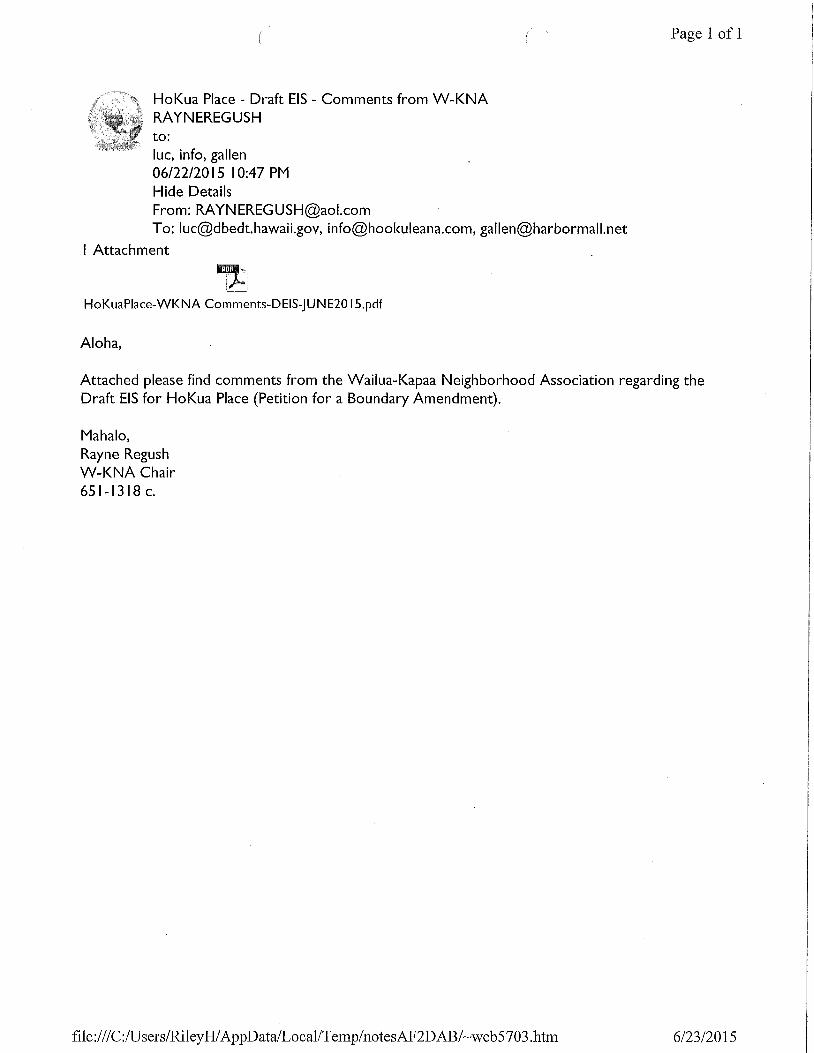
WAILUA- KAPA'ANEIGHBORHOODASSOCIATION
June 22, 2015
Daniel E. OrodenkerState Land Use CommissionP. O. Box 2359Honolulu, HI [email protected]
Peter T. YoungHo'okuleana LLC1539 Kanapu'u DriveKailua, HI [email protected]
Greg Allen, Jr.HG Kaua'i Joint Venture161 Wailua RoadKapa'a, HI [email protected]
RE: Draft EIS for HoKua Place, Kapa'a - Petition for District Boundary Amendment for 97-acres fromAgriculture District to Urban District, TMK (4)4-3-03:001
The Wailua-Kapa'a Neighborhood Association (W-KNA) cannot suppoÿ this Bounda12¢ Amendlnent atthis time. It is imperative that roadway infrastructure improvements are implemented first and foremostto resolve long-standing traffic congestion in Kapa'a. Development and population growth hasoutpaced the town's roadway infrastructure and HoKua Place (even if phased) may intensify thisproblem.
Members of the W-IQÿIA board have recently selÿced on the State DePartment of Transportation'sCitizen Advisory Committee for the Kapa'a Transportation Solutions Study. We understand theurgency to address traffic needs before increasing residential density in Kapa'a. Yet, we understand theacute need for affordable housing and support siting urban expansion adjacent to the Kapa'a town core.But, allowing more density now is a risk to the colnmunity until roadway solutions are implemented.
Within the role of the Land Use Commission (LUC), can specific conditions be imposed on theapplicant to mitigate critical transpolÿation concerns? For example, could an agreement be negotiated togrant the BoundaDÿ Amendment once HoKua Place "Road A" is operational for public use? This way, atransportation solution is guaranteed in advance of any housing construction.
The petition for the boundary amendment for Urban District entitlements should not be granted until:1. One or more traffic congestion mitigation solutions are in the construction phase, and2. The project's financial plan is vigorously assessed by the LUC to indicate that fimds are
sufficient to execute the 97-acre Phase II development. Othelÿvise, the project may bespeculative in nature, seeking entitlements that will increase the property's market value.
Traffic Circulation and Congestion.HoKua Place represents a dramatic increase in housing for East Kaua'i and once occupied, it willcontribute significantly to regional traffic. Utilization of multi-modal design will not alleviate existingcongestion problems.
The 1997 Kaua'i Long-Range Land Transportation hnplementation Plan has not met its 2000 and 2006deadlines for Kapa'a roadway widening in areas affected by the proposed boundary change. And,recommendations in the 2035 Transportation Plan for the Kauai District (July 2014) have not beenimplemented. Recommendations in the Kapa'a Transportation Solutions Study (2015) have not yetbeen published, but will include some priority projects which could be completed in five years.
Serving Residents of the Kawaihau District"We O'easure our rural comnluniOÿ"
340 Aina Uka Street, Kapa'a, Hawai'i 96746 * 821-2837
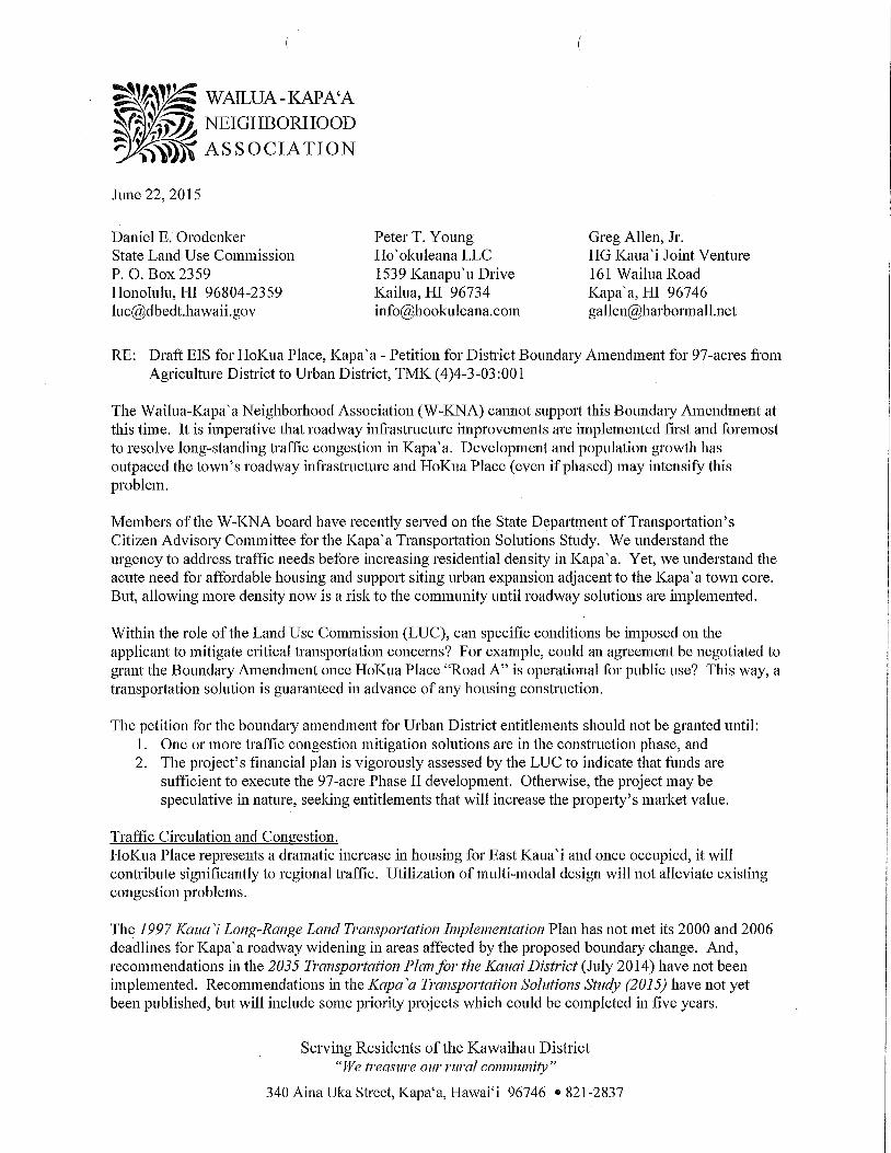
Page 2W-KNA Comments on the HoKua Place Draft EISJune 22, 2015
a) What is the status of the Draft TIAR dated June 6, 2014?b) What are the specific times described as "peak hours" in the TIAR? Please include a description
of weekend traffic congestion in the DEIS.c) Discuss how the Applicant might panner with the county to design and construct a roundabom
or a 4-way intersection alternative where Olohena, Ka" apuni, Keahulua Roads and HoKua Place"Road A" meet. What partnership terms might the Applicant agree to as a condition for grantingthe Boundal2¢ Amendment?
d) Provide a topographical rending of the proposed Overpass that will cross the Bypass Road.e) We concur with the County's recommendation for a left turn storage lane from the Kapaa
Bypass (northbound) into "Road A" and a southbound right turn lane into "Road A". Pleaseprovide an overlay illustration of how the Bypass Road will accommodate these turn lanes andexplain whether or not the Applicant will agree to not deferring these improvements.
f) We agree with the County's recommendation that the TIAR analyze: a) the intersection ofKuhio Highway and Lehua Street, and b) Olohena Road and Lehua Street.
g) The DEIS should describe the anticipated traffic impacts at the Kapa'a Roundabout, but not inthe context of Bypass Road closure.
Density.a) The proposed 769 housing units on 97-acres is high density for a rural island. Why didn't the
EISPN provide alternatives for reduced residential density by decreasing the 683 multi-familyunits? Please provide alternate scenarios.
b) Alternative 3 Residential Lot Subdivision (page 23) does not disclose the number of singlefamily housing lots proposed. Please provide that number and describe how it will "pencil out".
c) Why are there no Kaua'i Housing Code designated affordable single family homes and instead,only affordable multi-family housing?
d) Siting multi-family, multi-story housing along sloped topography involves additional cost andother challenges. Please provide more narrative about this and a visual aid showing the multi-story designs built on the hillside.
Phasinÿa) Explain the relationship between Phase I-HoKua Farm Lots and Phase II-Hokua Place
describing in detail any constraints (especially financial) that one may have upon the other.
DEIS Maps.a) The EISPN Concept Plan Map October 2010 (which gave a good visual representation of the
placement of all the housing units, greenbelts and roads) was replaced by Conceptual Plan MapMarch 2015 that has far less detail (see pages 13, 20 and 161). What do the unlabeled blueboundary lines represent? Why are they drawn through several proposed houses?
b) Providing a fnll page, color configuration of the proposed 769 housing unit buildout similar tothe Concept Plan Map October 2010, would be ve12¢ helpful.
c) A full page topographic map should be included with legible elevation lines, streams, ditches,diversions, wells, bridges and other pel"6nent notations including boundaries of adjacentlandowners with TMK numbers.
d) Provide a site map showing existing cane haul roadways (paved and unpaved) and the proposedroadways sited throughout the development.
e) A current FIRM Map needs to replace the FIRM Map Overlay dated 2005 (page 146).
Page 3W-KNA Comments on the HoKua Place Draft EISJune 22, 2015
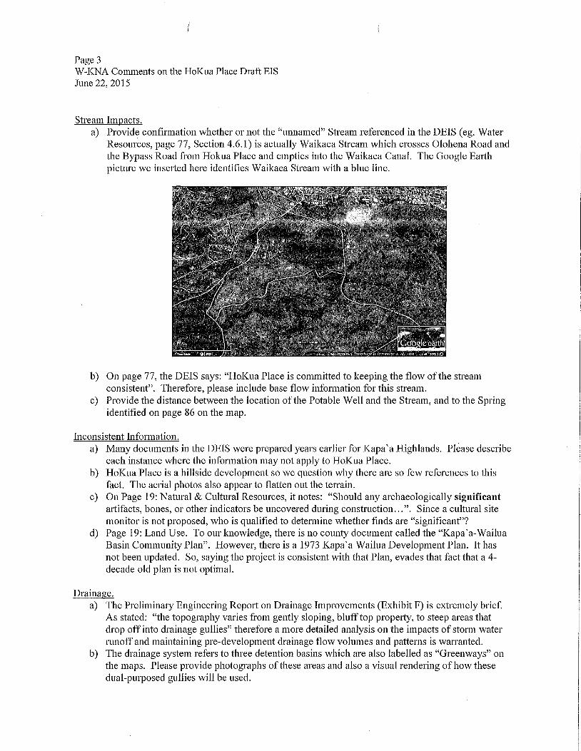
Stream Impacts.a) Provide confirmation whether or not the "remained" Stream referenced in the DEIS (eg. Water
Resources, page 77, Section 4.6.1) is actually Waikaea Stream which crosses Olohena Road andthe Bypass Road from Hokua Place and empties into the Waikaea Canal. The Google Earthpicture we inserted here identifies Waikaea Stream with a blue line.
b) On page 77, the DEIS says: "HoKua Place is committed to keeping the flow of the streamconsistent". Therefore, please include base flow information for this stream.
c) Provide the distance between the location of the Potable Well and the Stream, and to the Springidentified on page 86 on the map.
hlconsistent hlformation.a) Many documents in the DEIS were prepared years earlier for Kapa'a Highlands. Please describe
each instance where the information may not apply to HoKua Place.b) HoKua Place is a hillside development so we question why there are so few references to this
fact. The aerial photos also appear to flatten out the terrain.c) On Page 19: Natural & Cultural Resources, it notes: "Should any archaeologically significant
artifacts, bones, or other indicators be uncovered during construction...". Since a cultural sitemonitor is not proposed, who is qualified to determine whether finds are "significant"?
d) Page 19: Land Use. To our knowledge, there is no county document called the "Kapa'a-WailuaBasin Community Plan". However, there is a 1973 Kapa'a Wailua Development Plan. It hasnot been updated. So, saying the project is consistent with that Plan, evades that fact that a 4-decade old plan is not optimal.
Drainage.a) The Preliminary Engineering Report on Drainage hnprovements (Exhibit F) is extremely brief.
As stated: "the topography varies froln gently sloping, bluff top propelty, to steep areas thatdrop off into drainage gullies" therefore a more detailed analysis on the impacts of storm waterrunoff and maintaining pre-development drainage flow volumes and patterns is warranted.
b) The drainage system refers to three detention basins which are also labelled as "Greenways" onthe maps. Please provide photographs of these areas and also a visual rendering of how thesedual-purposed gullies will be used.
Page 4W-KNA Comments on the HoKua Place Draft EISJune 22, 2015
\
Visual and Aesthetic Resources.a) Significant views of Nounou Mountain Range and Mount Waialeale can be seen from the
Middle School property. Discussion has been omitted concerning how the development willimpact the line of sight to this spectacular scenery.
b) The surrounding landscape offers sweeping vistas looking makai to the ocean and maukatowards the mountains. The development needs to provide scenic overlooks and vista points forpublic benefit. The 3-acre park may not offer sufficient views of these dramatic panoramas.
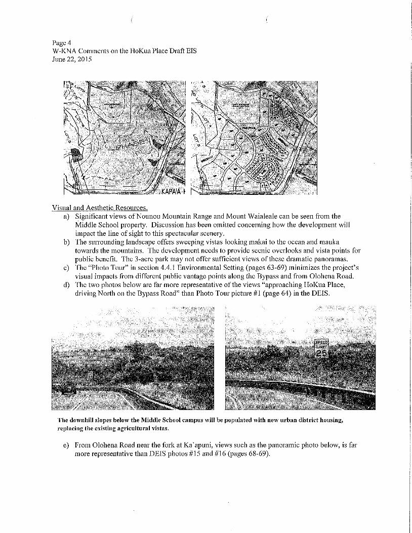
c) The "Photo Tour" in section 4.4.1 Environmental Setting (pages 63-69) lninimizes the project'svisual impacts fi'Oln different public vantage points along the Bypass and fi'om Olohena Road.
d) The two photos below are far more representative of the views "approaching HoKua Place,driving North on the Bypass Road" than Photo Tour picture #1 (page 64) in the DEIS.
The downhill slopes below the Middle School campus will be populated with new urban district housing,replacing the existing agricultural vistas.
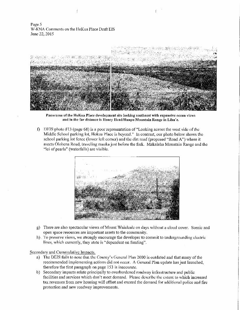
e) From Olohena Road near the fork at Ka'apuni, views such as the panoramic photo below, is farmore representative than DEIS photos #15 and #16 (pages 68-69).
Page 5W-KNA Comments on the HoKua Place Draft EISJune 22, 2015
f
Panorama of the HoKua Place development site looking southeast with expansive ocean viewsand in the far distance is Hoary Head/Haupu Mountain Range in Lihu'e.
f) DEIS photo #13 (page 68) is a poor representation of"Looking across the west side of theMiddle School parldng lot, Hokua Place is beyond." hÿ contrast, our photo below shows theschool parldng lot fence (lower left corner) and the dilÿ road (proposed "Road A") where itmeets Olohena Road, traveling mauka just before the fork. Makaleha Mountain Range and the"lei of pearls" (waterfalls) are visible.
g) There are also spectacular views of Mount Waialeale on days without a cloud cover. Scenic andopen space resources are important assets to the community.
h) To preserve views, we strongly encourage the developer to commit to undergrounding electriclines, which currently, they state is "dependent on funding".
Secondary and Culnmulative Impacts.a) The DEIS fails to note that the County's General Plan 2000 is outdated and that many of the
recommended implementing actions did not occur. A General Plan update has just launched,therefore the first paragraph on page 153 is inaccurate.
b) Secondary impacts relate principally to overburdened roadway infrastructure and publicfacilities and services which don't meet demand. Please describe the extem to which increasedtax revenues from new housing will offset and exceed the demand for additional police and fireprotection and new roadway improvements.
Page 6W-KNA Comments on the HoKua Place Draft EISJune 22, 2015
c) Cumulative impacts relate to HoKua Place in the context of two large resmÿ developmentsapproved just a few miles away - Coconut Beach Resort (343 units) and Coconut PlantationVillage (198 units) along with pending permit approvals for the Coco Palms Resoÿ's 350-unithotel. Please discuss the social impacts or diminished quality of life fi'om the anticipatedpopulation growth from these resorts.
d) The information provided from the DOE's Classroom Utilization Report 2007-2008 and theSchool Status and Improvelnem Reports for School Year 2010-2011 (pages 112-113) would bemore meaningful if you provide charts showing multiple years, and include more current data.
DEIS Volume II.a) Volume II is ahnost 400 pages in length and should have been paginated. It is extremely
challenging to navigate the Appendices.b) W-KNA did not receive the consultant's undated letter acknowledging our EISPN comments,
but we did see it reproduced near the end of Volume II.
Thank you for the opportunity to comment. We look forward to a detailed response fi'om the consultant,Ho'okuleana LLC and a copy of the FEIS.
Sincerely,
Rayne RegushChairperson, on behalf of the W-IÿNA Board
i ( Page 1 of 1
-'ÿ.ÿ Welti Comments on Hokua Place
Cynthia Weltito:info, luc06/22/2015 10:20 PMCc:Bruce WeltiHide DetailsFrom: Cynthia Welti <[email protected]>To: [email protected], [email protected]: Bruce Welti <[email protected]>Please respond to [email protected]
Dear Mr Young,
We have read the extensive Draft Environmental Impact Statement for Hokua Place and remain opposedto this development for 2 reasons.
1. Traffic. Though the DEIS addresses traffic along with many subjects, the fact remains Kapaa isalready overloaded with vehicular traffic and the new improvements will not do enough to alleviatewhat we already have. The DEIS study dates from almost 2 years ago for its Existing Conditions, andtraffic has grown significantly worse since then. Indeed between the hours of 8-6 traffic comespractically to a halt in at least one direction of the highway if not both, and beyond these hours as well.
2. Upzone. We are opposed to upzone without significant mitigation. While there is clearly some goodmitigation in the proposal, we are unable to determine if it compensated for the enormous financialbenefit of changing the zoning to urban.
Despite the impressive amount of content in the document about the site and beyond, we have severemisgivings about it for multiple reasons and wish to voice our strong opposition to the development.
Sincerely,
Bruce and Cynthia WeltiKapaa
file :///C :/Users/RileyH/AppData/Local/Temp/notesAF2DAB/Nweb2449.htm 6/23/2015
i / Page 1 of 1
HoKua Place ObjectionPatricia Shieldsto:Luc06/22/2015 09:09 PMHide DetailsFrom: ParMa Shields <[email protected]>To: [email protected]
i am a senior resident who is still enjoying my independence by driving from the Homestead into Kapaatwice each day to swim & walk along the beach. In my late eighties, this is a daily devotional Itreasure. ! strongly object to a zoning change to facilitate the HoKua Place project. It is irresponsible topermit building which will increase an already present traffic problem before the necessaryinfrastructure is in place.
Marlo for considering the views of your residents,
Pat ShieldsWailua Homestead
file :///C :/Users/RileyH/AppData/Local/Temp/notesAF2DAB/-web9297.htm 6/23/2015
/ / Page 1 of 1
.: -" HoKua Place, Kapaa, HIGeoffrey Shieldsto:luc06/22/2015 08:57 PMHide DetailsFrom: Geoffrey Shields <[email protected]>To: [email protected]
Attention Land Use Commission,As a resident of Kauai, I would like to express my concern about the development of agricultural land inKapaa for the HoKua Place housing project. We live in the Wailua Homestead community, a few milesnorth of the proposed development site. Access in & out of our neighborhood is limited to two roadsconnecting to Kuhio Hÿr in Kapaa, one of which runs in front of the proposed site on Olohena Rd.Both of these roads become congested during morning & afternoon commutes, primarily because KuhioHwy is already overcrowded. This project would serve to exacerbate this situation. Without meaningfulimprovements to the Kapaa bypass in advance, of any developments of this magnitude, I am confidentthat the driving experiences of all homeowners in the Homestead will become quite frustrating.
There appear to be alternative parcels on Kauai suitable for a housing project of this scale that are not insuch a congested traffic area like Kapaa. It would also come to reason that many of the prospectiveowners in HoKua Place will be worldng couples, commuting to where the jobs are, which is not Kapaa.So much land west of Lihue offer traffic patterns able to handle responsible growth, in closer proximityto employment opportunities. There is nothing responsible about encouraging more vehicles to bedomiciled in Kapaa before the roads are changed to better handle the existing traffic.
Please preserve all Agriculture dedicated land in Kapaa until which time our current traffic problems areactually fixed, not just debated.
Respectfully submitted,Geoff Shields6290 Olohena Rd.Kapaa, HI 96746
file :///C:iUsers/RileyH/AppData/Local/Temp/notesAF2DAB/Nweb 1329.htm 6/23/2015
( / Page 1 of 2
2ÿ ÿ Hokua Place DevelopmentRichard Diamondto:info, luc06/22/2015 05:11 PMHide DetailsFrom: Richard Diamond <[email protected]>To: [email protected], [email protected]
Aloha,
Considering the increasingly burdensome traffic in the Kapaa area, the Hokua Place project willseverely exascerbate our dire problems. The massive amounts of materials needed and then using themfor construction here will make an unacceptably substantial contribution to global carbon dioxidepollution, not to mention erosion, increasing our already desperate climate situation.
The Hokua Project proposes 86 single-family lots and 683 multi-family units in townhouse units, or 769family homes. It has been estimated that as much as 1,500 vehicles or more could be added to our roadsin the Kapaa area, resulting in overwhelming congestion on our already taxed road system.
It is outrageous that the developer has denied the need for significant changes in road construction,saying that traffic studies done in 2012 are adequate and that 'traffic impacts due to the project are notconsidered important. It is obvious that the traffic impacts of 1,500 vehicles added to our roads wouldactually be quite significan!!
Further, the developer's own Traffic hnpact Assessment Report, m'itten in 2012, as part of the DraftEnvironmental hnpact Statement for the HoKua Place development recognized that the traffic flowthrough the Kapaa roundabout and the intersection of the Kapaa bypass and Kuhio Highway werealready at failing grades for level-of-service or traffic flow. Little or no traffic mitigation has been donesince that report was written and the traffic has grown noticeably worse over the last three years.
It is clear that the substantial potential problems of this massive development will contribute, inevitably,to the lowered quality of life on our tiny garden island.
We implore you to urge the State Land Commission to reject the DEIS.
Thank you for your attention to this, and to the numerous other letters you have received in opposition tothis proposed development.
file:///C:/Users/RileyH/AppData/Local/Temp/notesAF2DAB/ÿweb3465.htm 6/23/2015
I Page 2 of 2
Aloha,
Richard (Diamond) Moll
P.O. Box 113
Kapaa, HI 96746
file:///C:/Users/RileyH/AppData/Local/Temp/notesAF2DAB/Nweb3465.htm 6/23/2015
( Page 1 of 1
Re: DEIS Hokua P1. pub. 5-8-15 by OECQC --- Please halt the Hokua Place development inKapaa, KauaiM.Mulhallto:luc, into, mwilliams06/22/2015 03:22 PMHide DetailsFrom: "M.Mulhall" <[email protected]>To: <[email protected]>, <[email protected]>, <[email protected]>
Dear Members of the Commission:Please halt the development of HoKua Place in Kapaa, Kauai.
It is an insane idea to add homes in that area of Kapaa, and if you had to drive throughit daily as many of us do, you would understand what I mean.
1. Kapaa's traffic is legend ...... in a horrifying way.Personally, I often drive from the Wailua Homesteads down Kuamoo to the highwayand then to Lihue to shop during the daylight hours rather than sit in traffic in Kapaa,wasting time and getting more and more irritated.Five years ago, some visitors commented to me that they would never again stay inKapaa or North of Kapaa because, they said, the "traffic is murder!" (their words.)My point: traffic is not only affecting us, the residents of Kauai.Kapaa traffic has a negative effect on tourism as well.
. We do not even have sidewalks most places on Kauai.The kids have to walk or ride bikes along the roads to school.OIohena Road, where HoKua place would be built, is so hazardous that bike ridershave been sent head-over-heels into roadside ditches as people come down thehill and are unable to see people on bikes in time to stop or slow down.Olohena is a county road, poorly engineered for today's needs. It is winding, withpoor visibility along its many curves.The increased traffic plus the increased number of children on the road is a setupfor disaster.
The cost burden to the County for improvements to the roads, sewers, water supply,utilities, added to the loss of tourism due to the terrible traffic adds up to an economicdisaster for Kauai.
Please, please, please ..... either halt or re-locate the HoKua development.
Mahalo,Mary Mulhall, Kapaa resident1210 Crossley Rd.Kapaa, Hi. 96746
file :///C :/Users/RileyH/AppData/Local/Temp/notesAF2DAB/Nweb4592.htm 6/23/2015
rÿ, i co
Comments on Hokua Place --- DEISKen Taylor to: luc 06/23/2015 11:14 AMCc: info
Comments on Hokua Place‐‐‐ DEIS (4) pages attached 6/23/15 Minor Changes On page two please find three changes, changes are in red.Paragraph Four changed east to west twice. Then in paragraph Five changed west to south.
Sorry for the inconvenience. Ken
This email is free from viruses and malware because avast! Antivirus protection is active.
61.pdf61.pdf
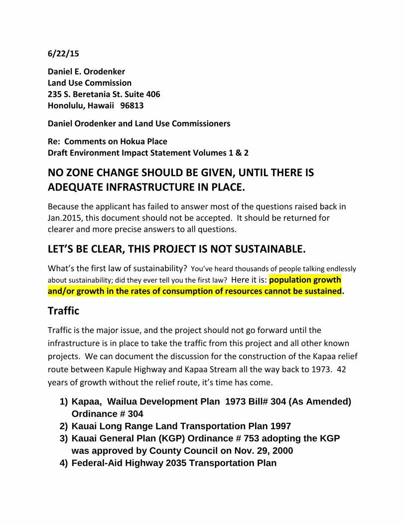
6/22/15
Daniel E. Orodenker Land Use Commission 235 S. Beretania St. Suite 406 Honolulu, Hawaii 96813
Daniel Orodenker and Land Use Commissioners
Re: Comments on Hokua Place Draft Environment Impact Statement Volumes 1 & 2
NO ZONE CHANGE SHOULD BE GIVEN, UNTIL THERE IS ADEQUATE INFRASTRUCTURE IN PLACE.
Because the applicant has failed to answer most of the questions raised back in Jan.2015, this document should not be accepted. It should be returned for clearer and more precise answers to all questions.
LET’S BE CLEAR, THIS PROJECT IS NOT SUSTAINABLE.
What’s the first law of sustainability? You’ve heard thousands of people talking endlessly
about sustainability; did they ever tell you the first law? Here it is: population growth and/or growth in the rates of consumption of resources cannot be sustained.
Traffic
Traffic is the major issue, and the project should not go forward until the
infrastructure is in place to take the traffic from this project and all other known
projects. We can document the discussion for the construction of the Kapaa relief
route between Kapule Highway and Kapaa Stream all the way back to 1973. 42
years of growth without the relief route, it’s time has come.
1) Kapaa, Wailua Development Plan 1973 Bill# 304 (As Amended)
Ordinance # 304
2) Kauai Long Range Land Transportation Plan 1997
3) Kauai General Plan (KGP) Ordinance # 753 adopting the KGP
was approved by County Council on Nov. 29, 2000
4) Federal-Aid Highway 2035 Transportation Plan
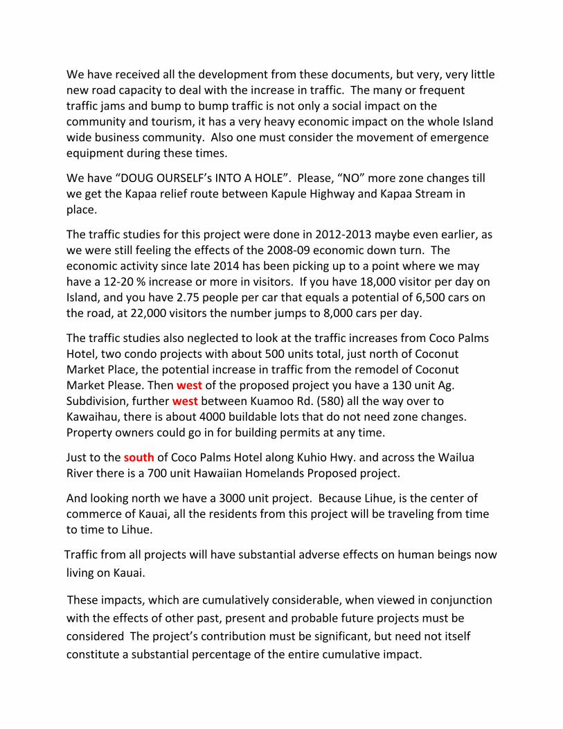
We have received all the development from these documents, but very, very little new road capacity to deal with the increase in traffic. The many or frequent traffic jams and bump to bump traffic is not only a social impact on the community and tourism, it has a very heavy economic impact on the whole Island wide business community. Also one must consider the movement of emergence equipment during these times.
We have “DOUG OURSELF’s INTO A HOLE”. Please, “NO” more zone changes till we get the Kapaa relief route between Kapule Highway and Kapaa Stream in place.
The traffic studies for this project were done in 2012-2013 maybe even earlier, as we were still feeling the effects of the 2008-09 economic down turn. The economic activity since late 2014 has been picking up to a point where we may have a 12-20 % increase or more in visitors. If you have 18,000 visitor per day on Island, and you have 2.75 people per car that equals a potential of 6,500 cars on the road, at 22,000 visitors the number jumps to 8,000 cars per day.
The traffic studies also neglected to look at the traffic increases from Coco Palms Hotel, two condo projects with about 500 units total, just north of Coconut Market Place, the potential increase in traffic from the remodel of Coconut Market Please. Then west of the proposed project you have a 130 unit Ag. Subdivision, further west between Kuamoo Rd. (580) all the way over to Kawaihau, there is about 4000 buildable lots that do not need zone changes. Property owners could go in for building permits at any time.
Just to the south of Coco Palms Hotel along Kuhio Hwy. and across the Wailua River there is a 700 unit Hawaiian Homelands Proposed project.
And looking north we have a 3000 unit project. Because Lihue, is the center of commerce of Kauai, all the residents from this project will be traveling from time to time to Lihue.
Traffic from all projects will have substantial adverse effects on human beings now
living on Kauai.
These impacts, which are cumulatively considerable, when viewed in conjunction
with the effects of other past, present and probable future projects must be
considered The project’s contribution must be significant, but need not itself
constitute a substantial percentage of the entire cumulative impact.
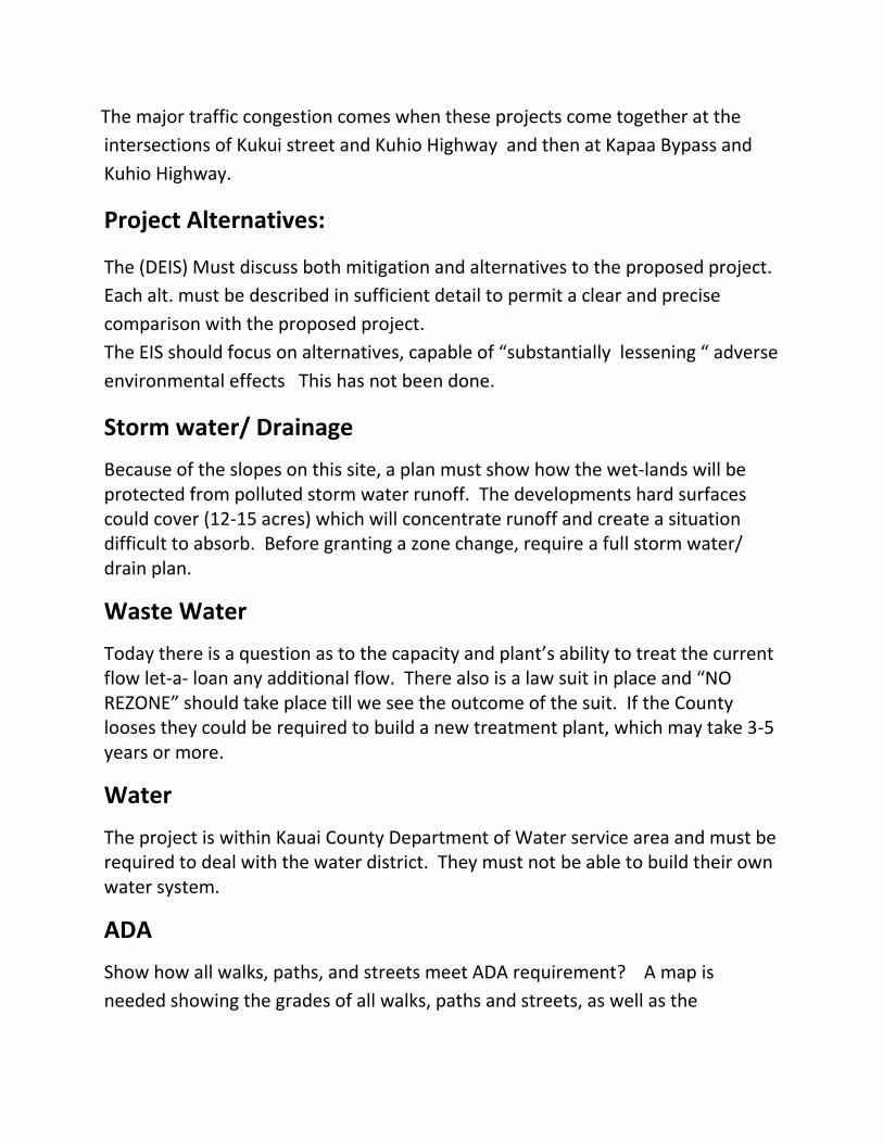
The major traffic congestion comes when these projects come together at the
intersections of Kukui street and Kuhio Highway and then at Kapaa Bypass and
Kuhio Highway.
Project Alternatives:
The (DEIS) Must discuss both mitigation and alternatives to the proposed project.
Each alt. must be described in sufficient detail to permit a clear and precise
comparison with the proposed project.
The EIS should focus on alternatives, capable of “substantially lessening “ adverse
environmental effects This has not been done.
Storm water/ Drainage
Because of the slopes on this site, a plan must show how the wet-lands will be protected from polluted storm water runoff. The developments hard surfaces could cover (12-15 acres) which will concentrate runoff and create a situation difficult to absorb. Before granting a zone change, require a full storm water/ drain plan.
Waste Water
Today there is a question as to the capacity and plant’s ability to treat the current flow let-a- loan any additional flow. There also is a law suit in place and “NO REZONE” should take place till we see the outcome of the suit. If the County looses they could be required to build a new treatment plant, which may take 3-5 years or more.
Water
The project is within Kauai County Department of Water service area and must be required to deal with the water district. They must not be able to build their own water system.
ADA
Show how all walks, paths, and streets meet ADA requirement? A map is
needed showing the grades of all walks, paths and streets, as well as the
connectivity to old town. It should also show how one may get to the church
across the street, swimming pool and commercial areas of the project.
Show a complete North/South circulation plan.
How does the transportation plan and its mitigation promote resiliency for the
community?
Please, “NO ZONE CHANGE” till the Kapaa relief route, is
in place.
4 pages
Thank You
Ken Taylor