Embed Size (px)
Citation preview
RECENT TECHNOLOGICAL ADVANCEMENT
AND SUSTAINABLE SOLUTIONS FOR FLOOD
ISSUES IN NORTH BIHAR
Murlidhar SinghB.E (Civil) M.E (Roorkee),Ph.D.
Professor (Environment and Drainage)
WATER AND LAND MANAGEMENT
INSTITUTE,PHULWARISHARIF,
PATNA,BIHAR
INDIA
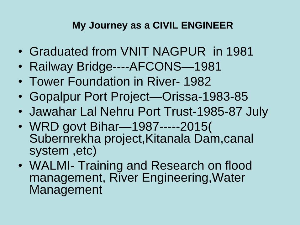
My Journey as a CIVIL ENGINEER
• Graduated from VNIT NAGPUR in 1981
• Railway Bridge----AFCONS—1981
• Tower Foundation in River- 1982
• Gopalpur Port Project—Orissa-1983-85
• Jawahar Lal Nehru Port Trust-1985-87 July
• WRD govt Bihar—1987-----2015( Subernrekha project,Kitanala Dam,canalsystem ,etc)
• WALMI- Training and Research on flood management, River Engineering,WaterManagement
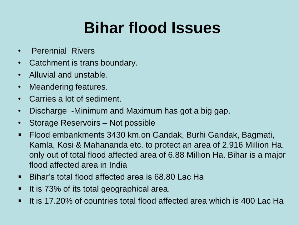
Bihar flood Issues
• Perennial Rivers
• Catchment is trans boundary.
• Alluvial and unstable.
• Meandering features.
• Carries a lot of sediment.
• Discharge -Minimum and Maximum has got a big gap.
• Storage Reservoirs – Not possible
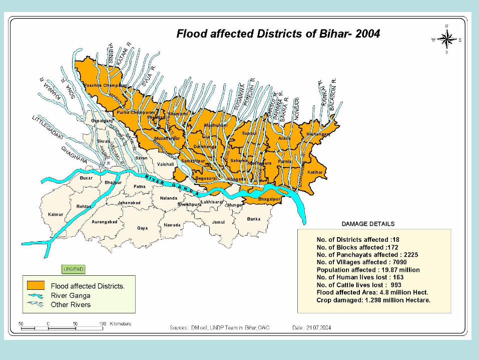
Flood embankments 3430 km.on Gandak, Burhi Gandak, Bagmati,
Kamla, Kosi & Mahananda etc. to protect an area of 2.916 Million Ha.
only out of total flood affected area of 6.88 Million Ha. Bihar is a major
flood affected area in India
Bihar’s total flood affected area is 68.80 Lac Ha
It is 73% of its total geographical area.
It is 17.20% of countries total flood affected area which is 400 Lac Ha
•
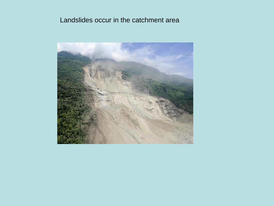
Landslides occur in the catchment area
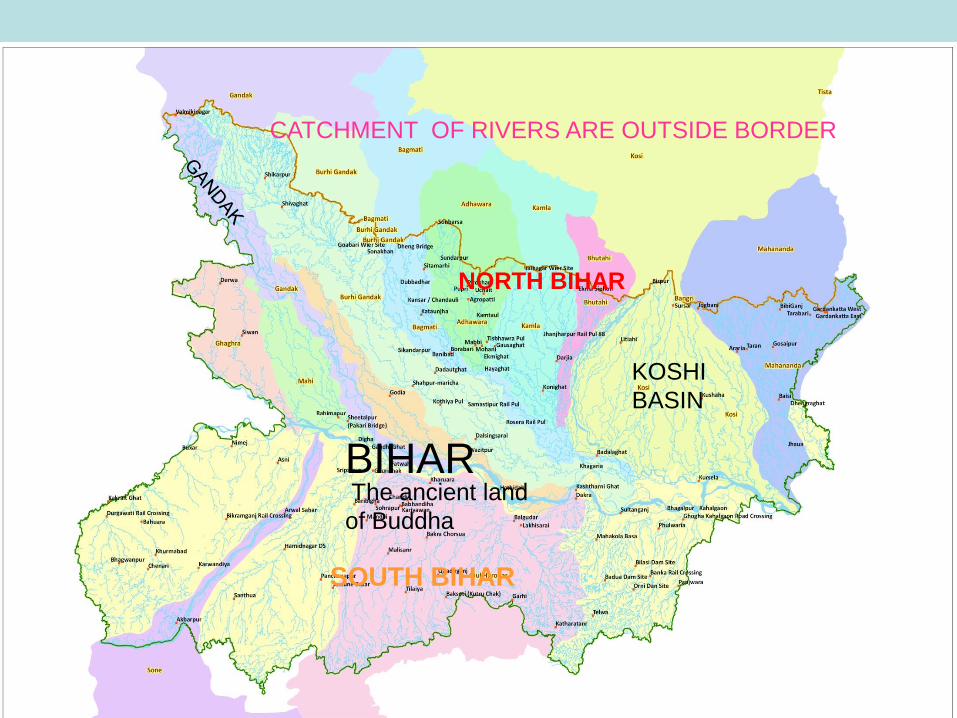
BIHAR
NORTH BIHAR
SOUTH BIHAR
CATCHMENT OF RIVERS ARE OUTSIDE BORDER
KOSHI
BASIN
The ancient land
of Buddha
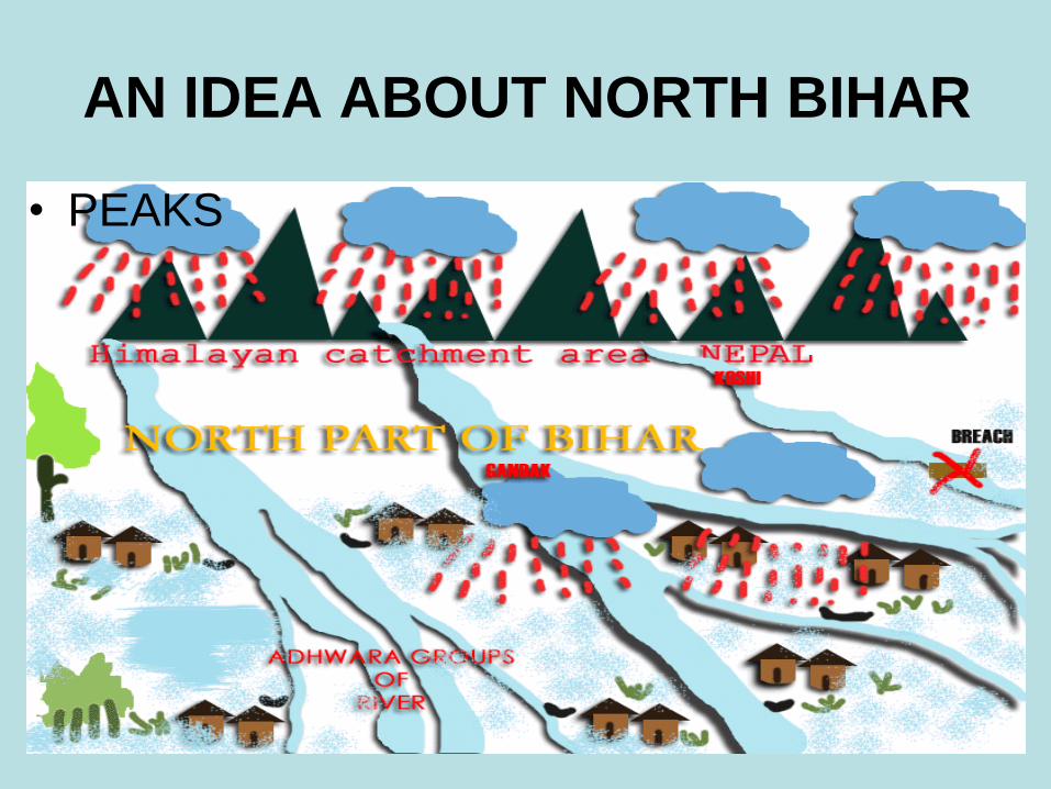
AN IDEA ABOUT NORTH BIHAR
• PEAKS

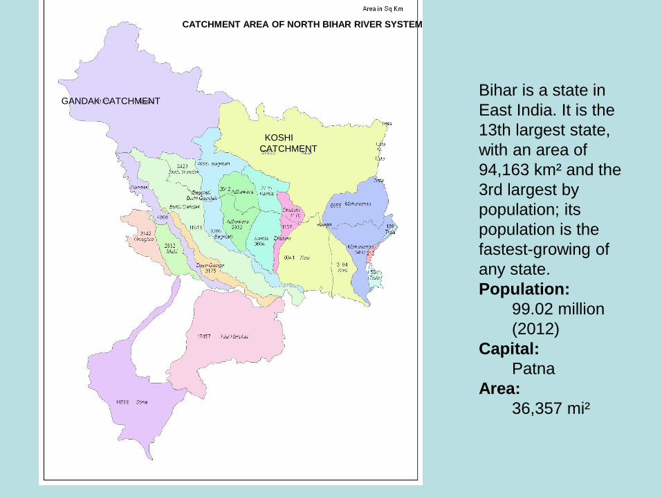
GANDAK CATCHMENT
KOSHI
CATCHMENT
CATCHMENT AREA OF NORTH BIHAR RIVER SYSTEM
Bihar is a state in
East India. It is the
13th largest state,
with an area of
94,163 km² and the
3rd largest by
population; its
population is the
fastest-growing of
any state.
Population:
99.02 million
(2012)
Capital:
Patna
Area:
36,357 mi²

HIMALAYAN SNOW CATCHMENTS

FLOOD HISTORY
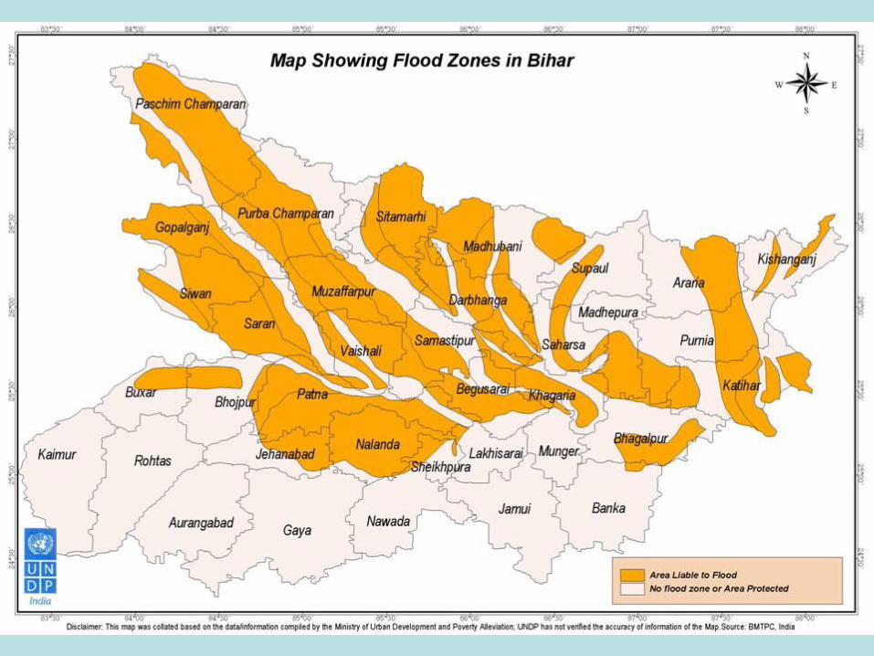
• Bihar is India’s most flood-prone State, with
76 percent of the population, in the North
Bihar living under the recurring threat of flood
devastation. About 68800 sq Km out of total
geographical area of 94160 sq Km
comprising 73.06 percent is flood affected.
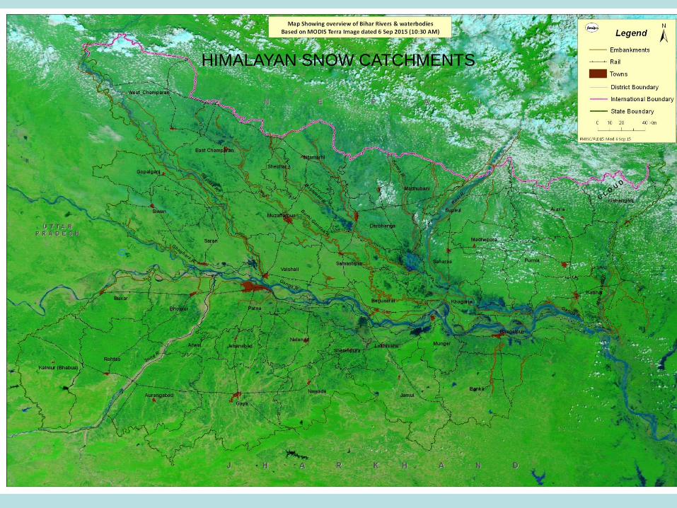
Drainage System of Bihar
• The plains of Bihar, adjoining Nepal, are drained by a number of rivers that have their catchments in the steep and geologically nascent Himalayas. Kosi, Gandak,Burhi Gandak, Bagmati, Kamla Balan, Mahananda and Adhwara Group of rivers originates in Nepal, carry high discharge and very high sediment load and drops it down in the plains of Bihar. About 65% of catchments area of these rivers falls in Nepal/Tibet and only 35% of catchments area lies in Bihar. A review by Kale (1997) indicated that the plains of north Bihar have recorded the highest number of floods during the last 30years. In the years 1978, 1987, 1998, 2004 and 2007 Bihar witnessed high magnitudes of flood.

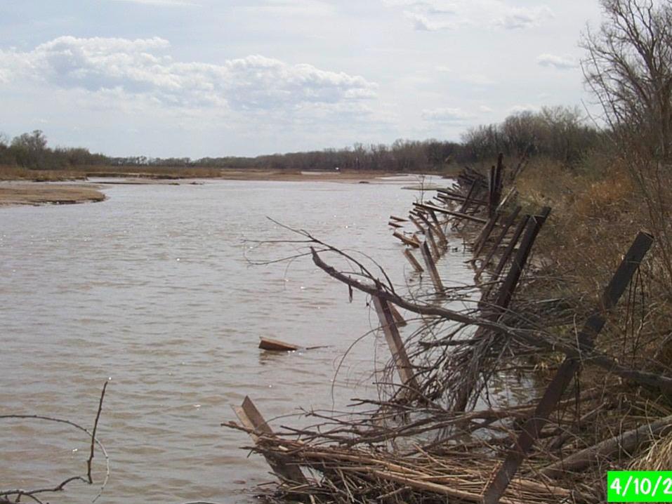
2008 Koshi breach
• 2008 :- an appreciable amount of rainfall was received on very first day of monsoon season i.e. 15th June ( 160mm at Chanpatia, 141 mm at Sikanderpur and 92.2 mm at Khagaria ). July was the wettest month having maximum rainy days followed by August-08.There was an unprecedented flood due to breach near 12.9km of Eastern Kosi Afflux Embankment near Kussha village in Nepal on 18th August 2008 that took a shape of a catastrophe leading to miseries to lakhs of people in Sunsari and Saptari districts of Nepal and Supaul, Madhepura, Araria, Saharsa, Katihar and purnea districts of Bihar. River Kosi entirely changed its course from earlier one which was again tamed to its original course by Water Resources Department after a tremendous effort keeping in line with the advice of Kosi Breach Closure Advisory Committee ( KBCAT ).
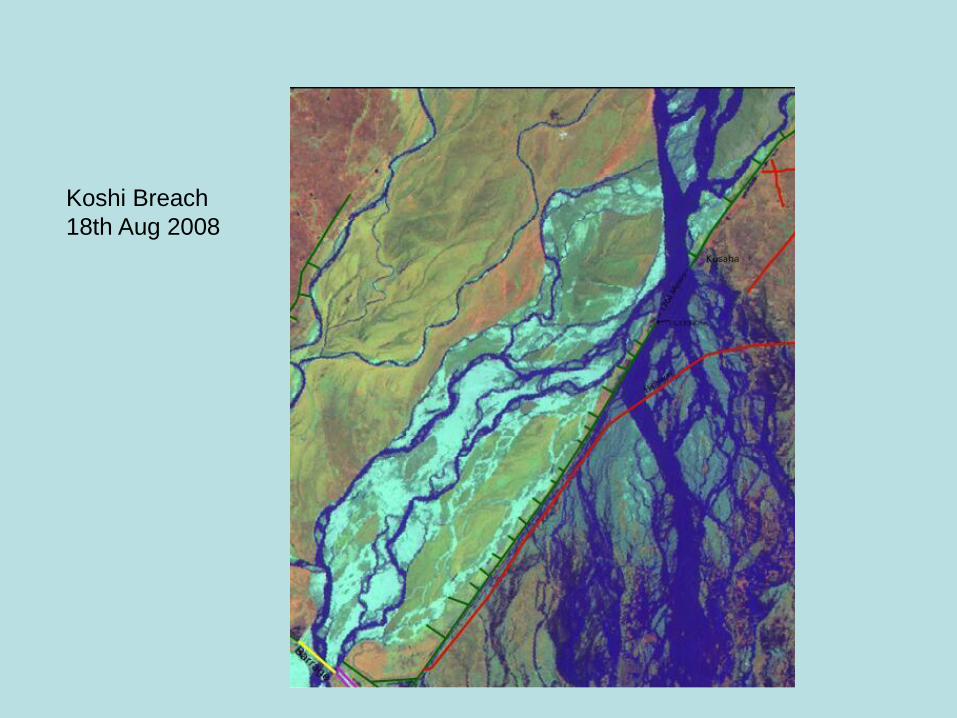
Koshi Breach
18th Aug 2008
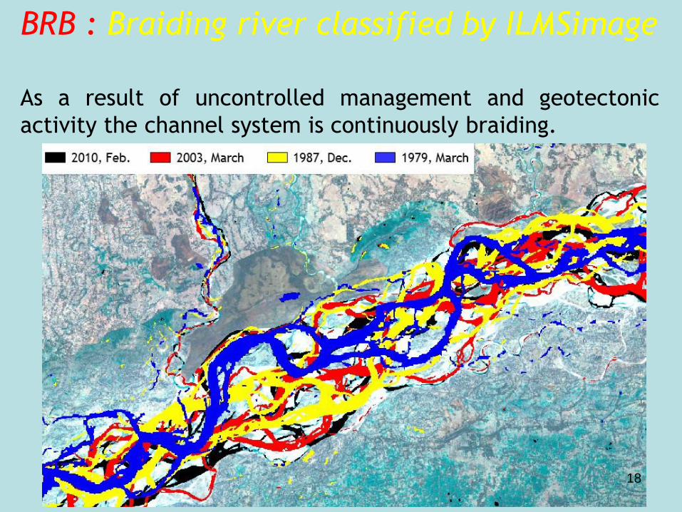
BRB : Braiding river classified by ILMSimage
As a result of uncontrolled management and geotectonic
activity the channel system is continuously braiding.
18
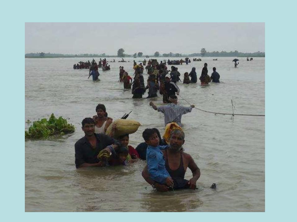
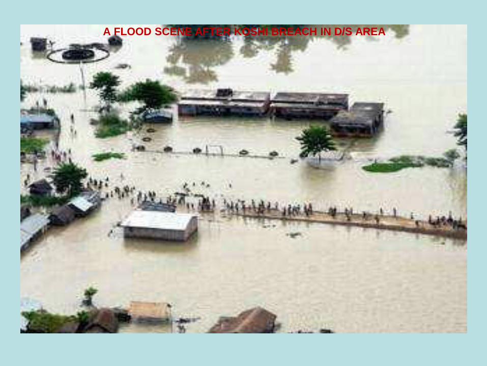
A FLOOD SCENE AFTER KOSHI BREACH IN D/S AREA
RECENT TECHNOLOGICAL
ADVANCEMENT IN RIVER TRAINING
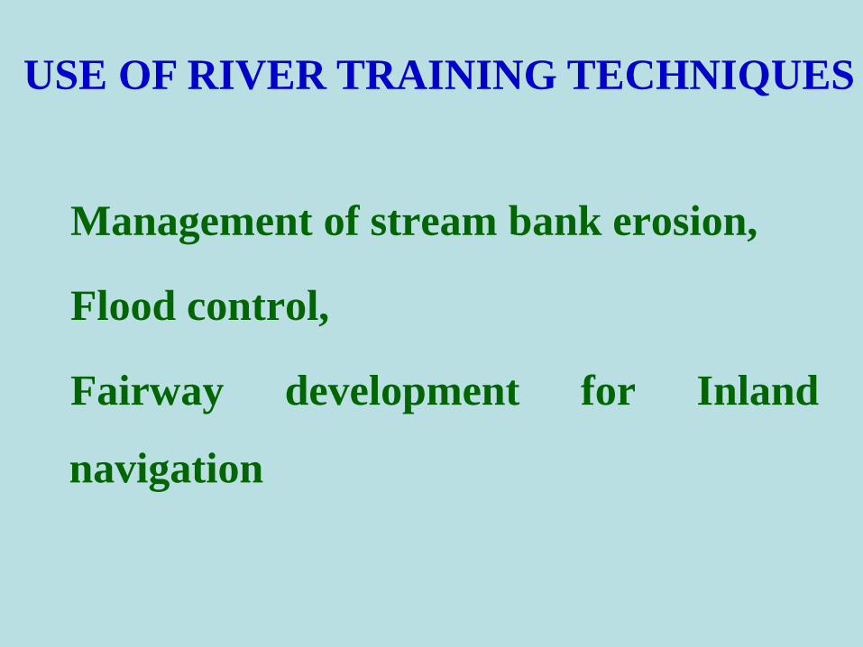
USE OF RIVER TRAINING TECHNIQUES
Management of stream bank erosion,
Flood control,
Fairway development for Inland
navigation
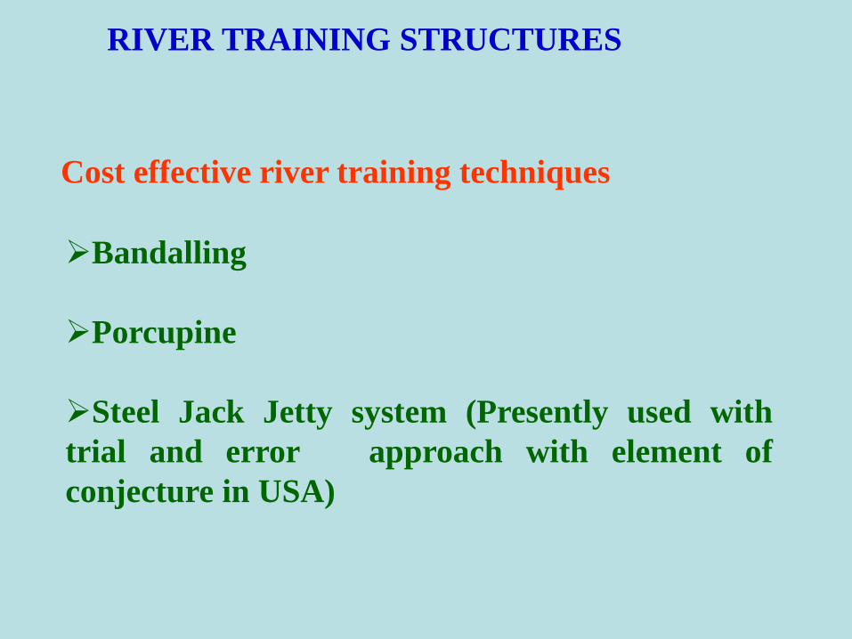
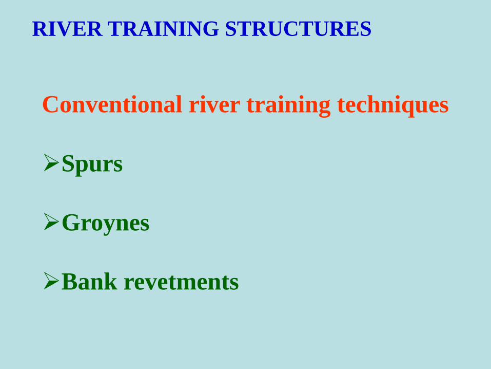
RIVER TRAINING STRUCTURES
Cost effective river training techniques
Bandalling
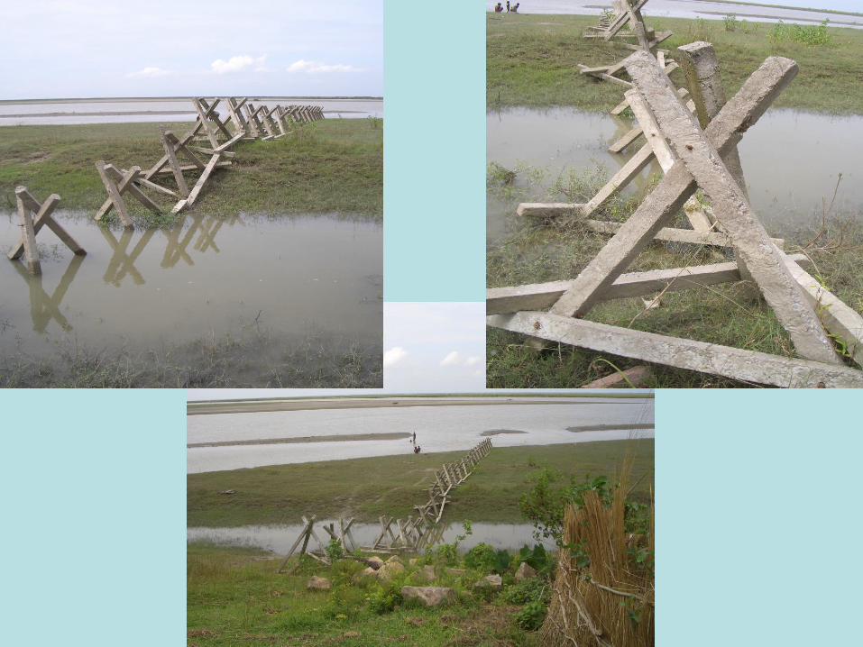
Porcupine
Steel Jack Jetty system (Presently used with
trial and error approach with element of
conjecture in USA)
RIVER TRAINING STRUCTURES
Conventional river training techniques
Spurs
Groynes
Bank revetments

Expensive and less cost effective Due to
Rising costs of labour
Rising costs of the construction material such as
boulders, wire nets etc.
Costly both in terms of capital cost as well as with
regard to high yearly maintenance cost
Practically unaffordable for large river network
PROBLEM OF CONVENTIONAL RIVER
TRAINING STRUCTURES

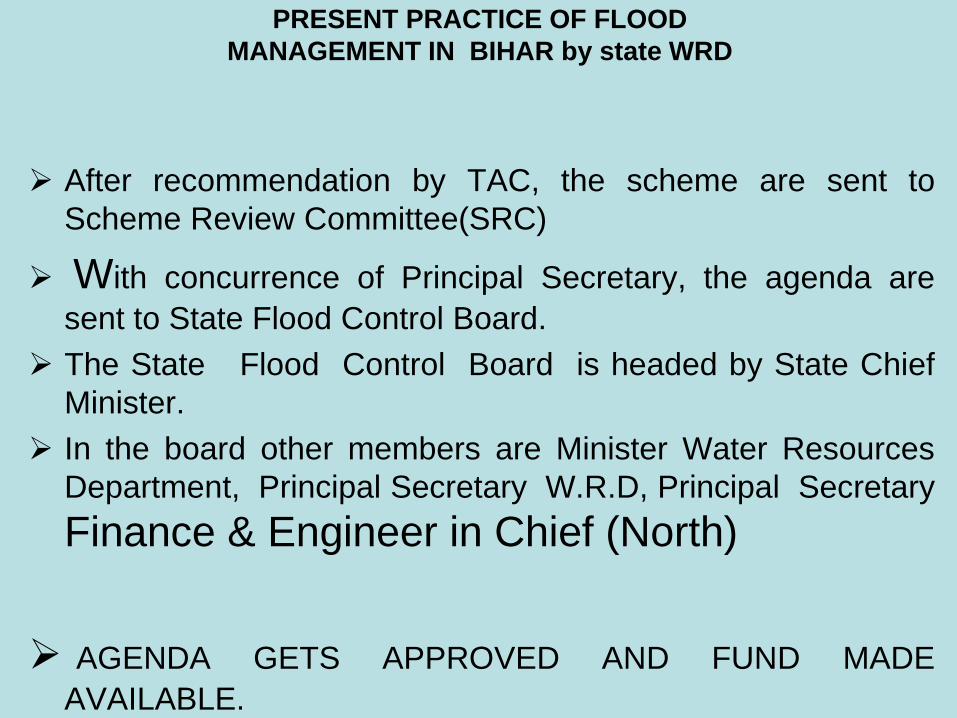
PRESENT PRACTICE OF FLOOD
MANAGEMENT IN BIHAR by State WRD
Before monsoon period anti-erosion works and during the
monsoon, flood fighting works are done at vulnerable sites by
State Water Resources Department
The joint committee seeing the river regime after the flood,
erosion, vulnerable sites are suggested and proposed for anti-
erosion schemes.
On the basis of the committee’s report, field Executive
Engineers measure the damages, frame scheme as per
relevant design and prepare estimate. They put it before
Technical Advisory committee(TAC).
PRESENT PRACTICE OF FLOOD
MANAGEMENT IN BIHAR by state WRD
After recommendation by TAC, the scheme are sent to
Scheme Review Committee(SRC)
With concurrence of Principal Secretary, the agenda are
sent to State Flood Control Board.
The State Flood Control Board is headed by State Chief
Minister.
In the board other members are Minister Water Resources
Department, Principal Secretary W.R.D, Principal Secretary
Finance & Engineer in Chief (North)
AGENDA GETS APPROVED AND FUND MADE
AVAILABLE.

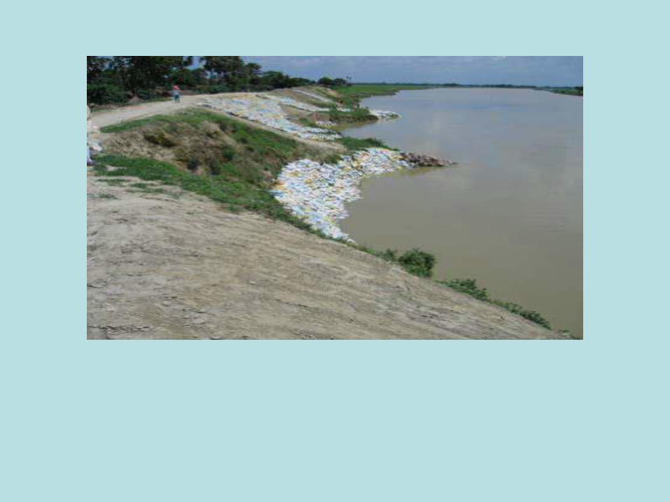
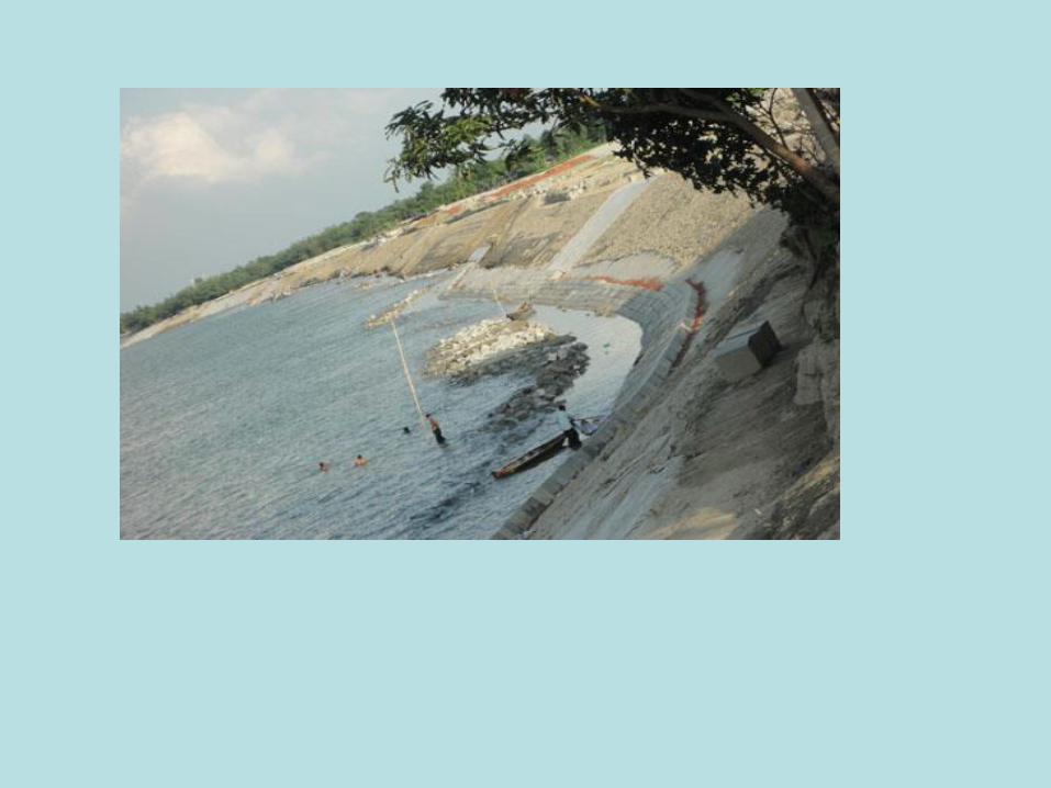
Bank Protection With Boulder


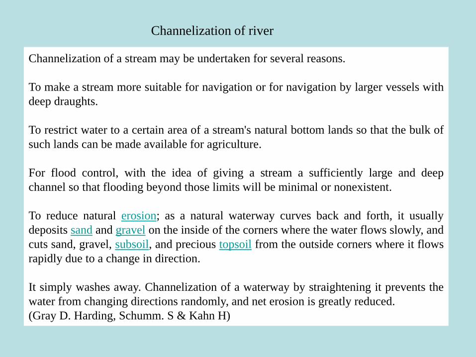
Channelization of a stream may be undertaken for several reasons.
To make a stream more suitable for navigation or for navigation by larger vessels with
deep draughts.
To restrict water to a certain area of a stream's natural bottom lands so that the bulk of
such lands can be made available for agriculture.
For flood control, with the idea of giving a stream a sufficiently large and deep
channel so that flooding beyond those limits will be minimal or nonexistent.
To reduce natural erosion; as a natural waterway curves back and forth, it usually
deposits sand and gravel on the inside of the corners where the water flows slowly, and
cuts sand, gravel, subsoil, and precious topsoil from the outside corners where it flows
rapidly due to a change in direction.
It simply washes away. Channelization of a waterway by straightening it prevents the
water from changing directions randomly, and net erosion is greatly reduced.
(Gray D. Harding, Schumm. S & Kahn H)
Channelization of river

1. Resectioning by Widening and Deepening: - Widening and deepening increase the channel cross
section; therefore, channel capacity to contain flows is increased and floodplain is inundated less
frequently (flood control and agricultural purposes).
2. Straightening:- Straightening implies the cut of river bends (meander cutoff in the case of a
meandering river); it produces shortening of the river channel, increasing of the gradient, and
increasing of the flow velocity. The purpose is to reduce flood heights.
3. Levees (or Embankments):- The aim of levees is to increase channel capacity so that flood flows
are confined and do not inundate the areas adjacent to the channels (floodplains), which would be
inundated under normal conditions.
4. Flood Walls and Lined Channels: - This type of method is commonly used in urban areas where
other kinds of channelization are limited or where access for maintenance is restricted.
5. Bank Protection Structures: - Groynes are structures built transverse to the river flow and extending
from the banks into the channel. The aim of these structures, which deflect the direction of the
flow, is to protect the banks from erosion processes .
6. Diversion Channels: - New channels can be constructed to divert flows out of the existing channel.
7. Culverts: - This type of channelization has often been used for urban streams, but also for small
rural/mountain streams.
Types of Channelisation
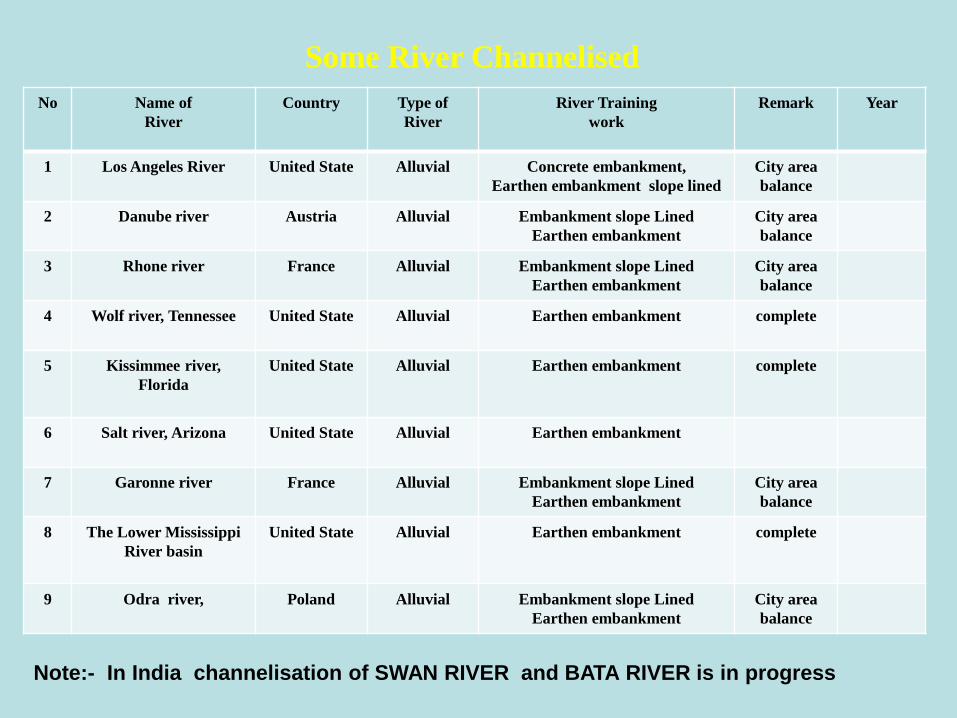
No Name of
River
Country Type of
River
River Training
work
Remark Year
1 Los Angeles River United State Alluvial Concrete embankment,
Earthen embankment slope lined
City area
balance
2 Danube river Austria Alluvial Embankment slope Lined
Earthen embankment
City area
balance
3 Rhone river France Alluvial Embankment slope Lined
Earthen embankment
City area
balance
4 Wolf river, Tennessee United State Alluvial Earthen embankment complete
5 Kissimmee river,
Florida
United State Alluvial Earthen embankment complete
6 Salt river, Arizona United State Alluvial Earthen embankment
7 Garonne river France Alluvial Embankment slope Lined
Earthen embankment
City area
balance
8 The Lower Mississippi
River basin
United State Alluvial Earthen embankment complete
9 Odra river, Poland Alluvial Embankment slope Lined
Earthen embankment
City area
balance
Some River Channelised
Note:- In India channelisation of SWAN RIVER and BATA RIVER is in progress
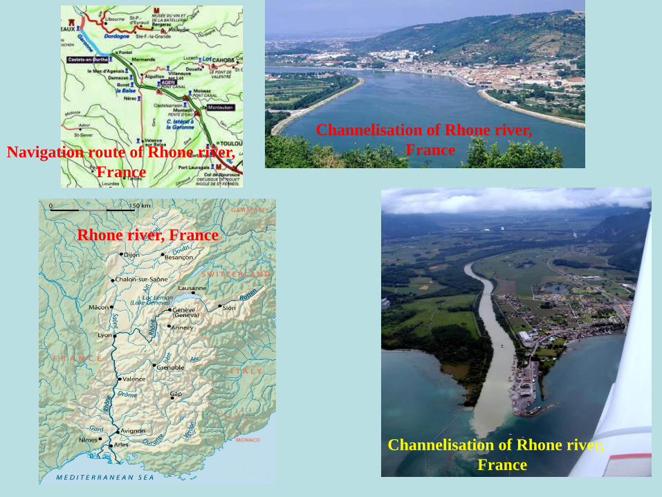
Rhone river, France
Channelisation of Rhone river,
France
Channelisation of Rhone river,
FranceNavigation route of Rhone river,
France
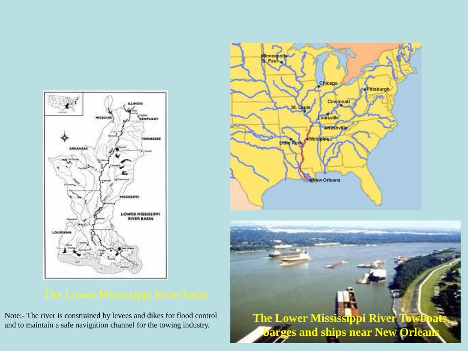
The Lower Mississippi River basin
The Lower Mississippi River Towboats,
barges and ships near New Orleans
Note:- The river is constrained by levees and dikes for flood control
and to maintain a safe navigation channel for the towing industry.
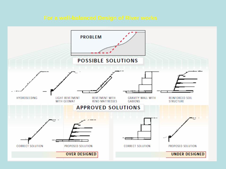
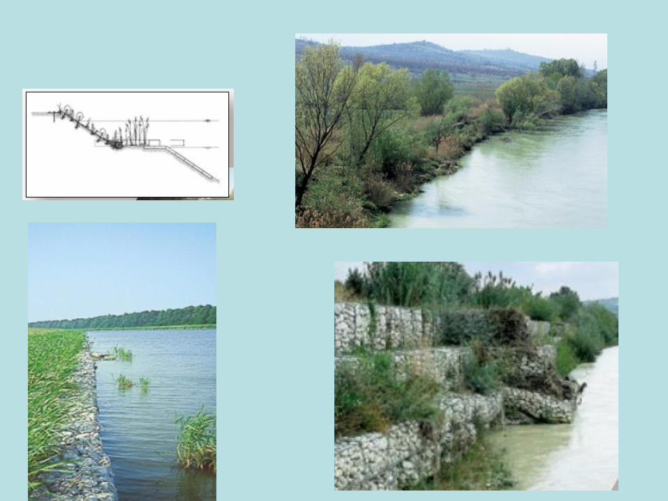
For a well-balanced Design of River works
channelized with concrete embankments channelized with earthen embankments
channelized with earthen embankments channelized with riprap
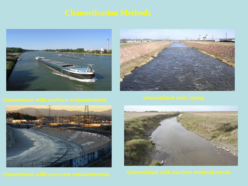
Channelisation Methods
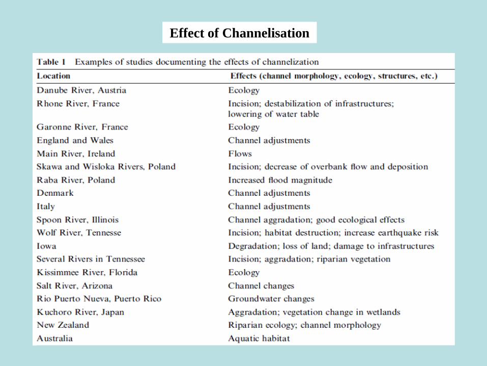
Effect of Channelisation
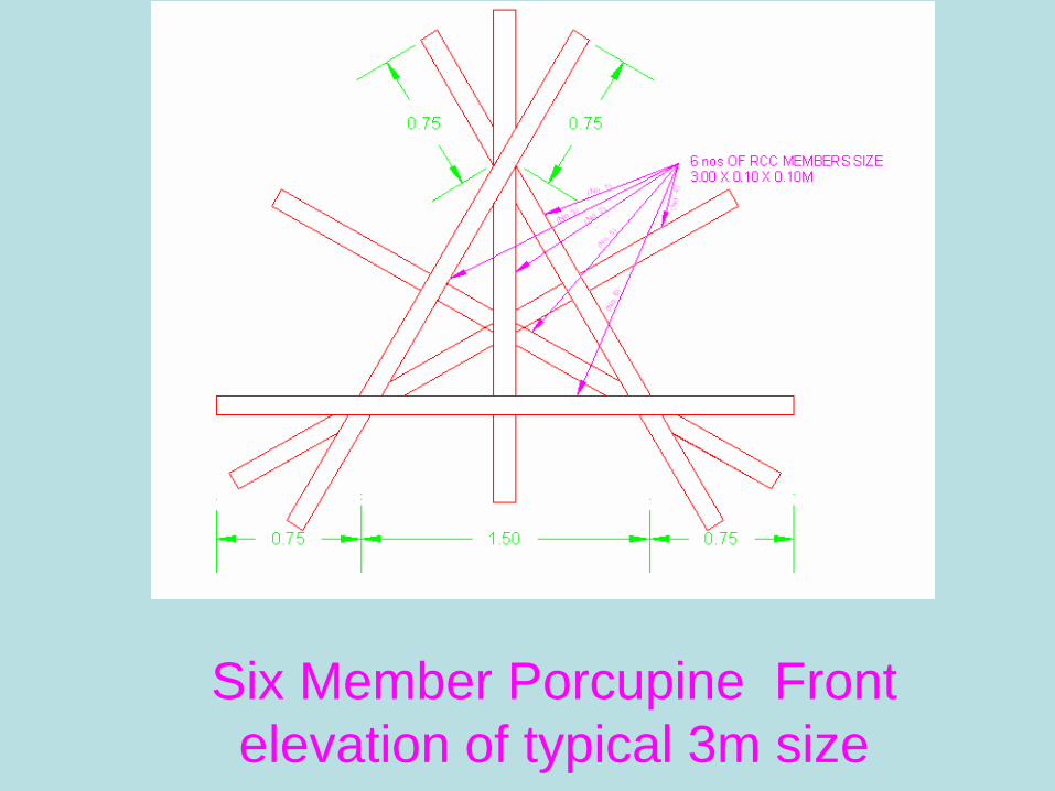
Six Member Porcupine Front
elevation of typical 3m size

New Nine Member Porcupine
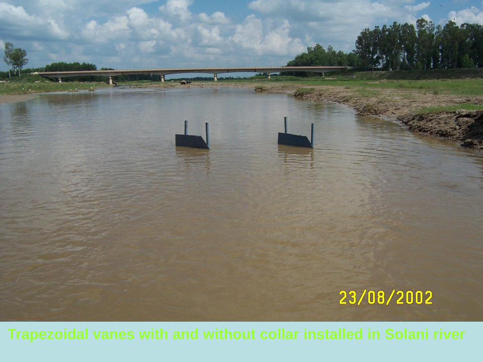
Trapezoidal vanes with and without collar installed in Solani river

Sediment deposited on vanes after flood in Solani river
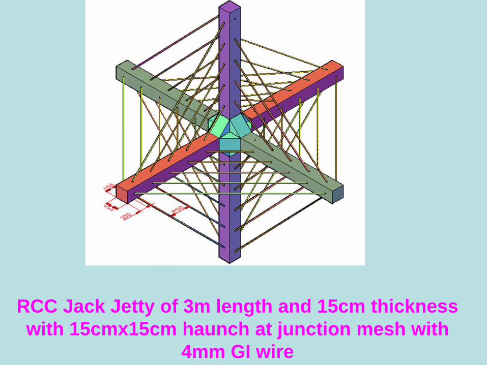
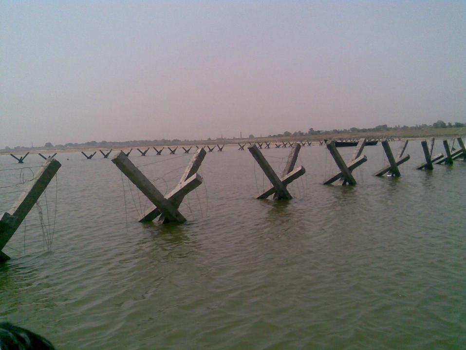
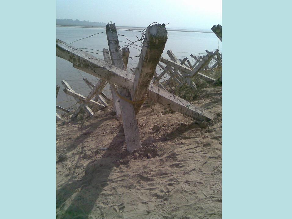
RCC Jack Jetty of 3m length and 15cm thickness
with 15cmx15cm haunch at junction mesh with
4mm GI wire
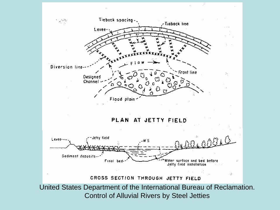
United States Department of the International Bureau of Reclamation.
Control of Alluvial Rivers by Steel Jetties
SUSTAINABLE SOLUTIONS OF
NORTH BIHAR FLOODS
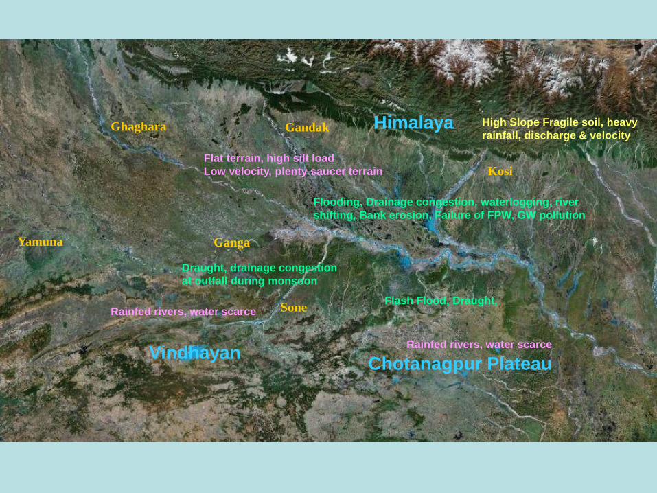
Himalaya
VindhayanChotanagpur Plateau
High Slope Fragile soil, heavy
rainfall, discharge & velocity
Flat terrain, high silt load
Low velocity, plenty saucer terrain
Ganga
Ghaghara Gandak
Kosi
Sone
Flooding, Drainage congestion, waterlogging, river
shifting, Bank erosion, Failure of FPW, GW pollution
Yamuna
Rainfed rivers, water scarce
Draught, drainage congestion
at outfall during monsoon
Flash Flood, Draught,
Rainfed rivers, water scarce
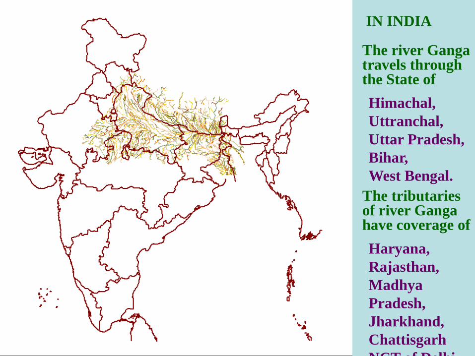
IN INDIA
The river Ganga travels through the State of
Himachal,
Uttranchal,
Uttar Pradesh,
Bihar,
West Bengal.
The tributaries of river Ganga have coverage of
Haryana,
Rajasthan,
Madhya
Pradesh,
Jharkhand,
Chattisgarh
NCT of Delhi
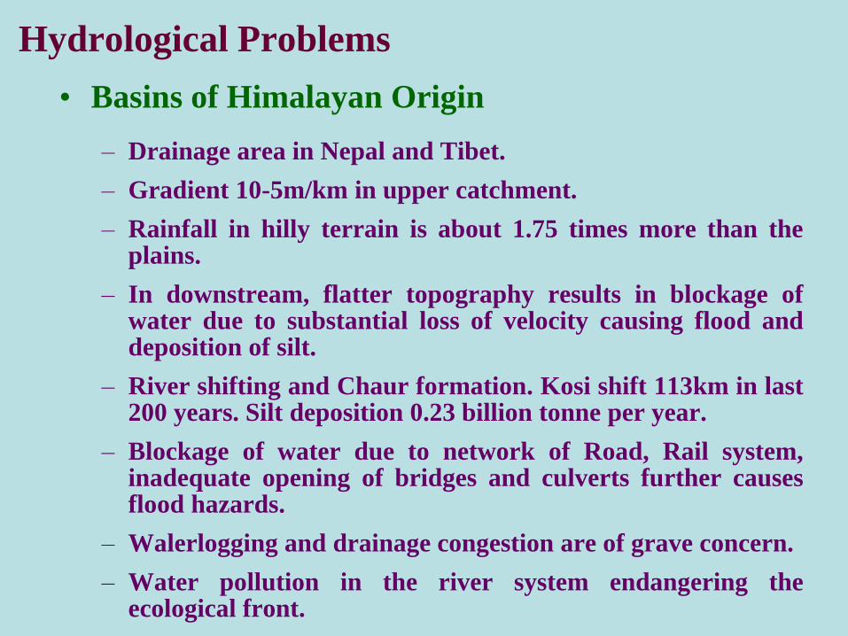
• Basins of Himalayan Origin
– Drainage area in Nepal and Tibet.
– Gradient 10-5m/km in upper catchment.
– Rainfall in hilly terrain is about 1.75 times more than theplains.
– In downstream, flatter topography results in blockage ofwater due to substantial loss of velocity causing flood anddeposition of silt.
– River shifting and Chaur formation. Kosi shift 113km in last200 years. Silt deposition 0.23 billion tonne per year.
– Blockage of water due to network of Road, Rail system,inadequate opening of bridges and culverts further causesflood hazards.
– Walerlogging and drainage congestion are of grave concern.
– Water pollution in the river system endangering theecological front.
Hydrological Problems
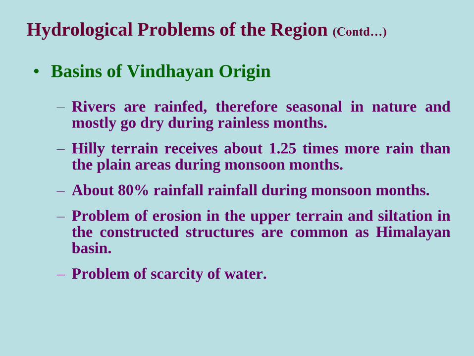
Hydrological Problems of the Region (Contd…)
• Basins of Vindhayan Origin
– Rivers are rainfed, therefore seasonal in nature andmostly go dry during rainless months.
– Hilly terrain receives about 1.25 times more rain thanthe plain areas during monsoon months.
– About 80% rainfall rainfall during monsoon months.
– Problem of erosion in the upper terrain and siltation inthe constructed structures are common as Himalayanbasin.
– Problem of scarcity of water.
Hydrological Problems of the Region (Contd…)
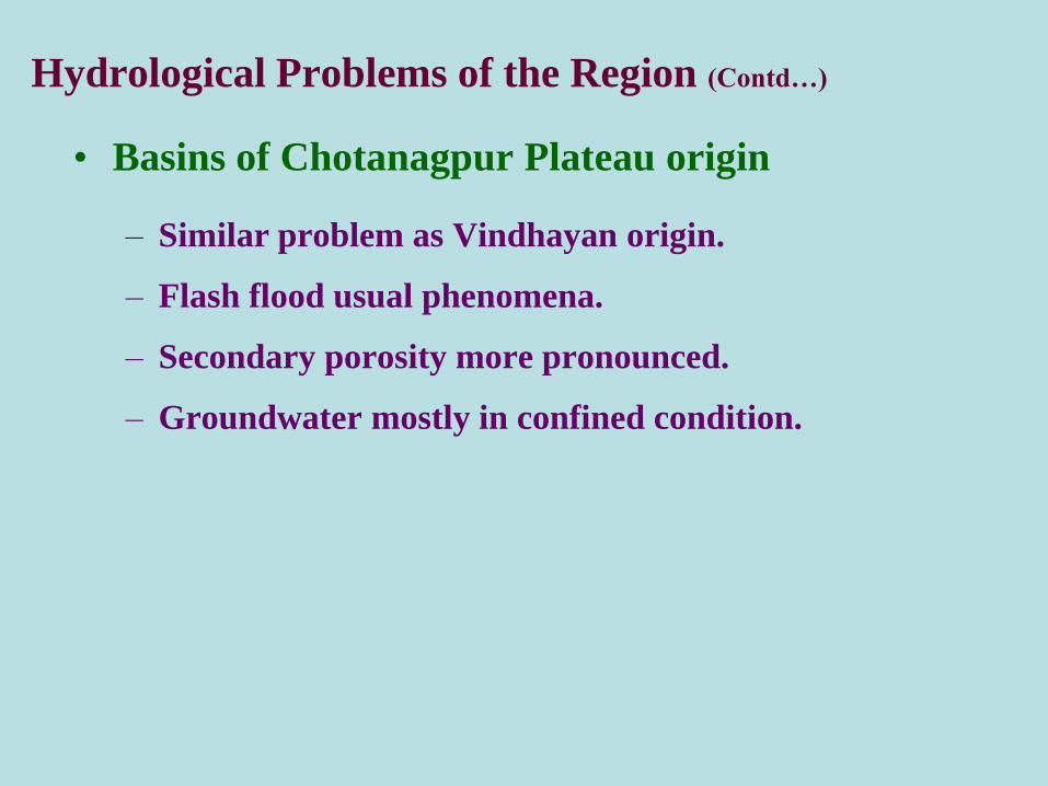
• Basins of Chotanagpur Plateau origin
– Similar problem as Vindhayan origin.
– Flash flood usual phenomena.
– Secondary porosity more pronounced.
– Groundwater mostly in confined condition.
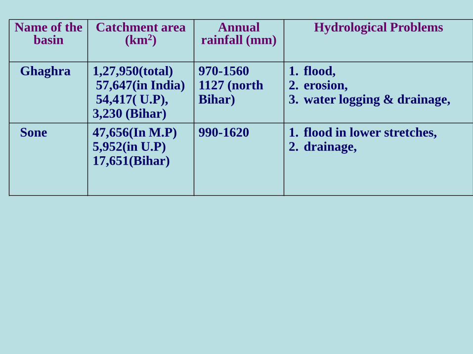
Name of the basin
Catchment area (km2)
Annual rainfall (mm)
Hydrological Problems
Ghaghra 1,27,950(total)57,647(in India)54,417( U.P),
3,230 (Bihar)
970-1560 1127 (north Bihar)
1. flood,2. erosion,3. water logging & drainage,
Sone 47,656(In M.P)5,952(in U.P)17,651(Bihar)
990-1620 1. flood in lower stretches,2. drainage,

Name of thebasin
Catchment area (km2)
Annual rainfall (mm)
Hydrological Problems
Sone(South Bihar)(Kanhar & N. Koel are tributaries )
10,57.44 (N.Koel)
990 1. bank spilling,2. drainage congestions,3. drought in North Koel
basin.
Gandak (North Bihar)
46,300 (total)7,620 (Bihar)
1120 1. river course shifting & erosion,
2. flood,3. water logging & drainage,
Buri Gandak (North Bihar)
12,500(total)10,150 (Bihar)
1180-1390 1. flood,2. erosion,3. drainage congestion,
Bagmati & Adhwara (North Bihar)(Tributaries of the Kosi)
13,400(total)6320 (Bihar)3720(Bagmati)2600(Adhwara)
1180 i) severe flood,ii) Drainage congestion
Name of the basin
Catchment area (km2)
A/rainfall (mm)
Hydrological Problems
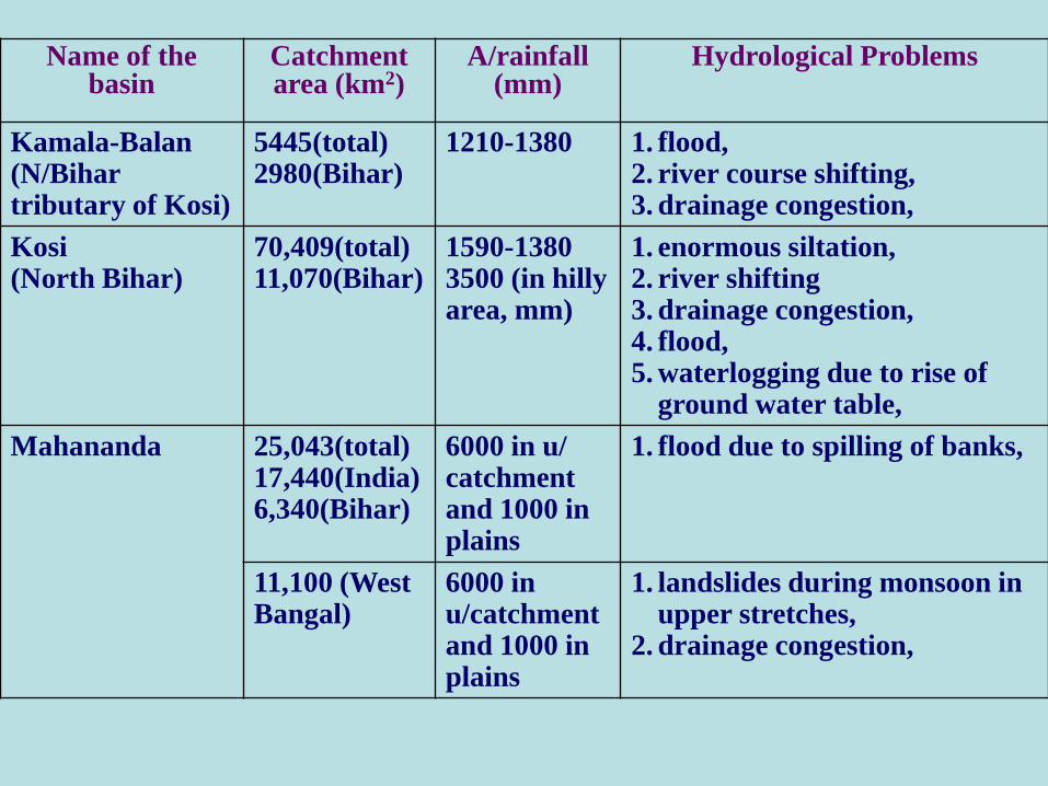
Kamala-Balan(N/Bihartributary of Kosi)
5445(total)2980(Bihar)
1210-1380 1. flood,2. river course shifting,3. drainage congestion,
Kosi(North Bihar)
70,409(total)11,070(Bihar)
1590-13803500 (in hilly area, mm)
1. enormous siltation,2. river shifting3. drainage congestion, 4. flood,5. waterlogging due to rise of
ground water table,
Mahananda 25,043(total)17,440(India)6,340(Bihar)
6000 in u/ catchment and 1000 in plains
1. flood due to spilling of banks,
11,100 (West Bangal)
6000 inu/catchment and 1000 in plains
1. landslides during monsoon in upper stretches,
2. drainage congestion,
Name of the basin
Catchment area (km2)
A/rainfall (mm)
Hydrological Problems
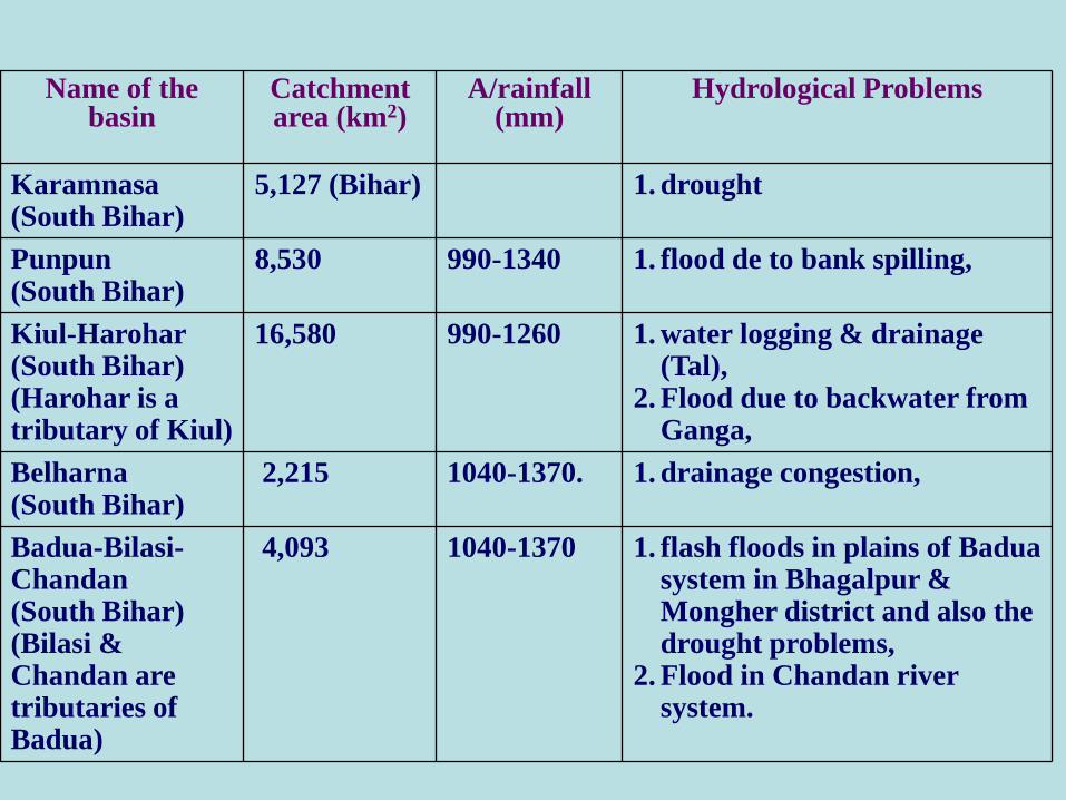
Karamnasa(South Bihar)
5,127 (Bihar) 1. drought
Punpun (South Bihar)
8,530 990-1340 1. flood de to bank spilling,
Kiul-Harohar (South Bihar)(Harohar is a tributary of Kiul)
16,580 990-1260 1. water logging & drainage (Tal),
2. Flood due to backwater from Ganga,
Belharna(South Bihar)
2,215 1040-1370. 1. drainage congestion,
Badua-Bilasi-Chandan(South Bihar)(Bilasi & Chandan are tributaries of Badua)
4,093 1040-1370 1. flash floods in plains of Badua system in Bhagalpur & Mongher district and also the drought problems,
2. Flood in Chandan river system.
Name of the basin
Catchment area (km2)
A/rainfall (mm)
Hydrological Problems
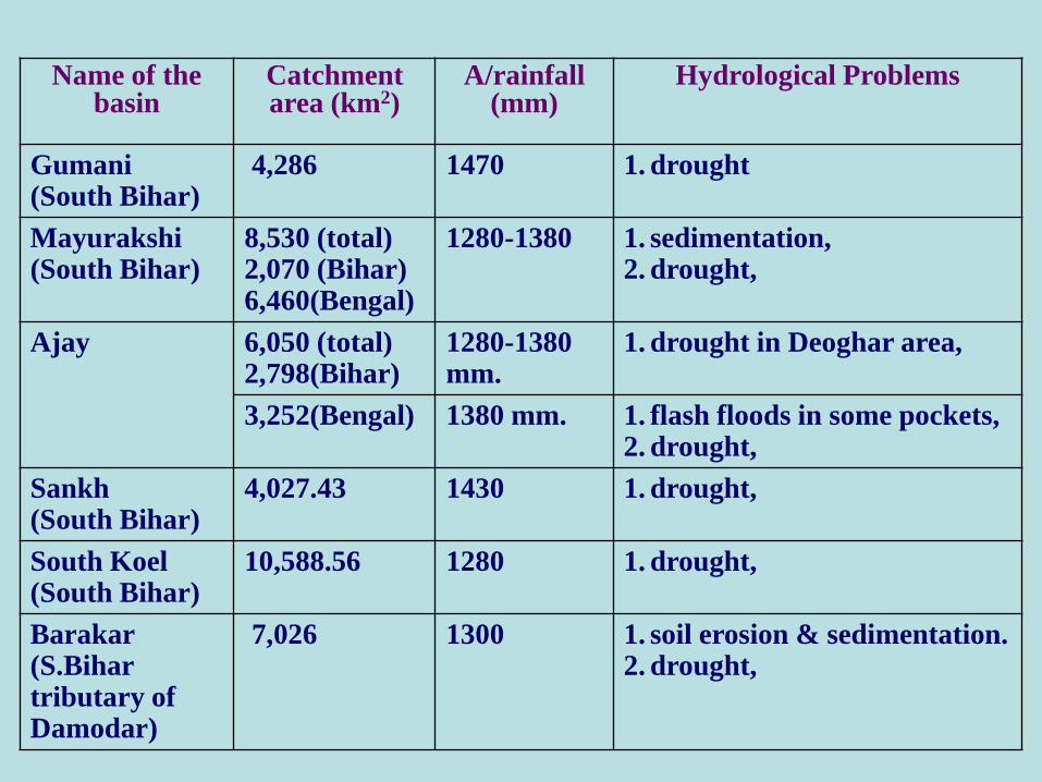
Gumani(South Bihar)
4,286 1470 1. drought
Mayurakshi(South Bihar)
8,530 (total)2,070 (Bihar)6,460(Bengal)
1280-1380 1. sedimentation,2. drought,
Ajay 6,050 (total)2,798(Bihar)
1280-1380 mm.
1. drought in Deoghar area,
3,252(Bengal) 1380 mm. 1. flash floods in some pockets,2. drought,
Sankh(South Bihar)
4,027.43 1430 1. drought,
South Koel(South Bihar)
10,588.56 1280 1. drought,
Barakar(S.Bihar tributary of Damodar)
7,026 1300 1. soil erosion & sedimentation.2. drought,
Name of the basin
Catchment area (km2)
A/rainfall (mm)
Hydrological Problems
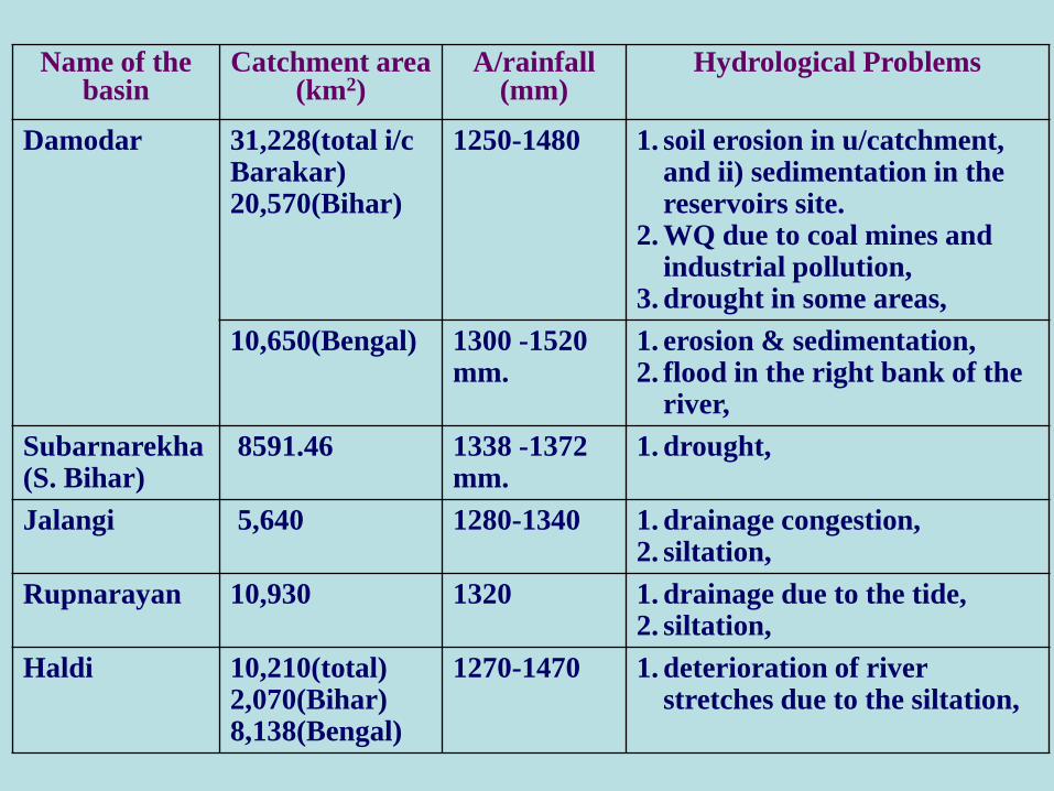
Damodar 31,228(total i/cBarakar)20,570(Bihar)
1250-1480 1. soil erosion in u/catchment, and ii) sedimentation in the reservoirs site.
2. WQ due to coal mines and industrial pollution,
3. drought in some areas,
10,650(Bengal) 1300 -1520 mm.
1. erosion & sedimentation,2. flood in the right bank of the
river,
Subarnarekha(S. Bihar)
8591.46 1338 -1372 mm.
1. drought,
Jalangi 5,640 1280-1340 1. drainage congestion,2. siltation,
Rupnarayan 10,930 1320 1. drainage due to the tide,2. siltation,
Haldi 10,210(total)2,070(Bihar) 8,138(Bengal)
1270-1470 1. deterioration of river stretches due to the siltation,
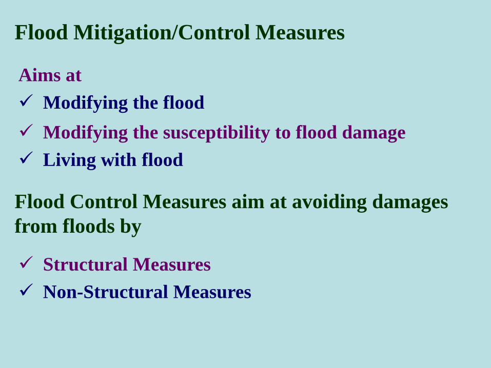
Flood Mitigation/Control Measures
Structural Measures
Non-Structural Measures
Flood Control Measures aim at avoiding damages
from floods by
Aims at
Modifying the flood
Modifying the susceptibility to flood damage
Living with flood
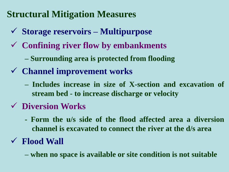
Structural Mitigation Measures
Storage reservoirs – Multipurpose
Confining river flow by embankments
– Surrounding area is protected from flooding
Channel improvement works
– Includes increase in size of X-section and excavation of
stream bed - to increase discharge or velocity
Diversion Works
- Form the u/s side of the flood affected area a diversion
channel is excavated to connect the river at the d/s area
Flood Wall
– when no space is available or site condition is not suitable

Structural Measures…….
Flood Ways
– A portion of the flood water is diverted in the low lying
areas along the course of the river through a natural or
artificial channel
Runoff reduction by watershed management – an
indirect method applied to the watershed which has
long term effect on flood disaster mitigation
– Includes Afforestation, Contour farming, Contour bunds,
Check bunds, Gully plugging, Bank protection,
Diversion drains, Strip cropping

Non-Structural Mitigation Measures
Include modifying the susceptibility to flood damage by
Flood plain management
Flood proofing including disaster preparedness
Response planning
Flood forecasting and warning
Include modifying the loss burden by
Disaster relief
Flood fighting including public awareness
Flood insurance
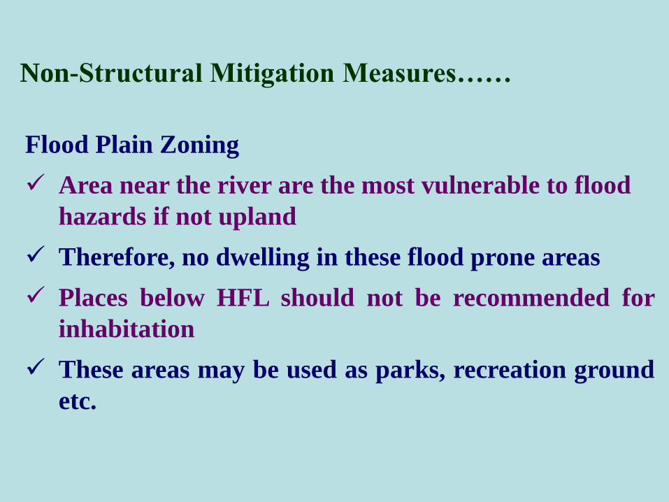
Non-Structural Mitigation Measures……
Flood Plain Zoning
Area near the river are the most vulnerable to flood
hazards if not upland
Therefore, no dwelling in these flood prone areas
Places below HFL should not be recommended for
inhabitation
These areas may be used as parks, recreation ground
etc.
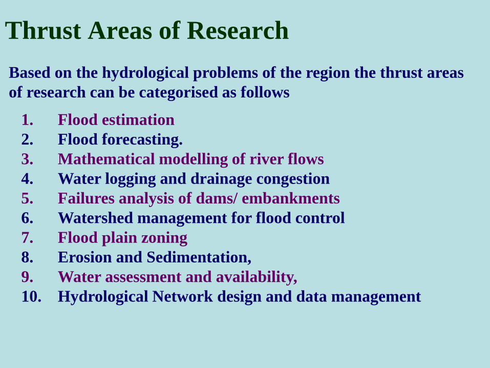
Based on the hydrological problems of the region the thrust areas
of research can be categorised as follows
1. Flood estimation
2. Flood forecasting.
3. Mathematical modelling of river flows
4. Water logging and drainage congestion
5. Failures analysis of dams/ embankments
6. Watershed management for flood control
7. Flood plain zoning
8. Erosion and Sedimentation,
9. Water assessment and availability,
10. Hydrological Network design and data management
Thrust Areas of Research
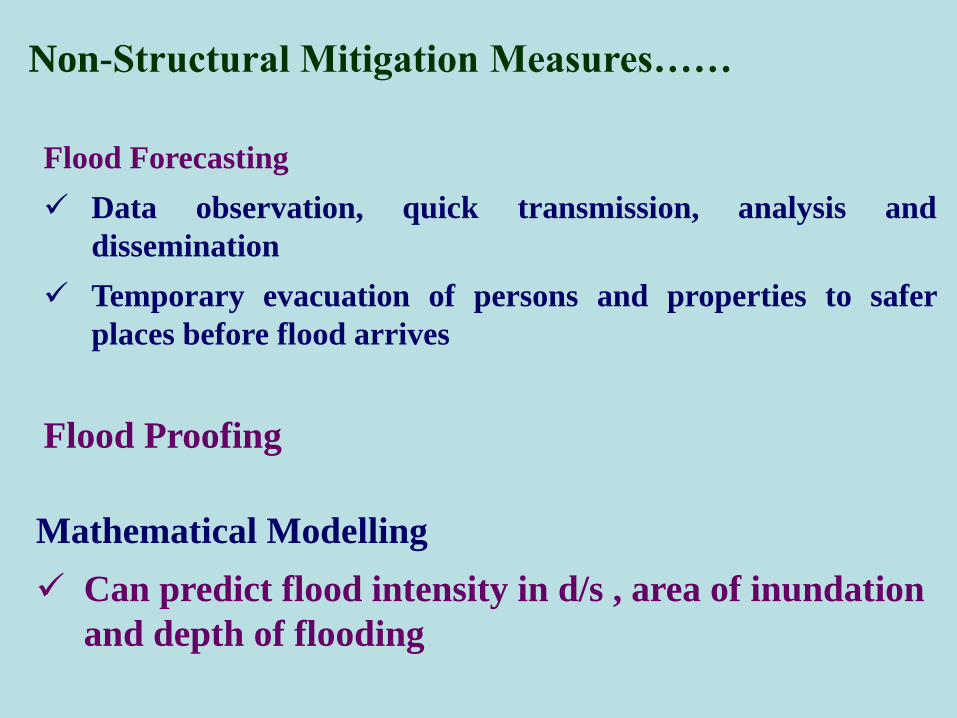
Non-Structural Mitigation Measures……
Flood Proofing
Mathematical Modelling
Can predict flood intensity in d/s , area of inundation
and depth of flooding
Flood Forecasting
Data observation, quick transmission, analysis and
dissemination
Temporary evacuation of persons and properties to safer
places before flood arrives
1. Development of hydrologic response modelling for the trans-boundary watershed
for simulation of discharge dynamics driven by season monsoon rains
complemented by snow and glacier melt water runoff along with sediment yield.
The above will provide the required hydrological information on runoff generation
from the watershed pertaining to water and sediment on spatial and temporal
basis, which are responsible for shaping the river behaviour.
Latest modelling software will be used supplemented with high resolution
multispectral satellite data for assessment of Land Use Land Cover (LULC)
characteristics, and identify zones for required implementation of watershed
management measures.
2. Assessment of river plan form changes using multi-spectral multi-date satellite
imageries to identify & prioritize the vulnerable locations, as well as monitor the
behaviour / hazard of spur protected bank-line.
3. Development of flow simulation computerized river model of
SWAT MODEL USE FOR FINDING SUSTAINABLE
SOLUTIONS FOR NORTH BIHAR RIVER FLOODS
3. the Koshi,Gandak ,Bagmati, Kamala and all other rivers which should be
calibratedwith surveyed river cross-sections & other hydrological data.
The above model will be helpful for flood forecasting, planning for channel
improvement programme etc. of North bihar Rivers
4. Development of robust, sustainable and cost effective river training system for Kosh
all the rivers for channelization & imparting hydraulically efficient sediment transport
capacity, desired flow conveyance .
5. Assessment of confluence zone of all north Bihar rivers with the Ganga near their
meeting points with Ganga from the standpoint of fluvial behaviour and evolve
suitable measures.
4. Assessment of human dimension of flood and erosion vulnerability for evolving
appropriate disaster mitigation & rehabilitation plan duly incorporating socio-
economic factors.

Thank You