Embed Size (px)
Citation preview

GEOHART CONSULTANTS
Geotechnical (Mining & Civil)
Ben Pang
Sarra Hayes
Eastern Australia Ground Control Group
13th March 2014

GEOHART CONSULTANTS
Geotechnical (Mining & Civil)
Introduction
Ground Control Strategy
Mining method Interpretation & Analysis
Data Collection
Long-term monitoring
data
Simplified Ground Control Process

GEOHART CONSULTANTS
Geotechnical (Mining & Civil)
Borehole logs
Rock joint mapping data
Field testing result
Laboratory testing report
Monitoring reading
Common Geotechnical Data
GEOHART CONSULTANTS
Geotechnical (Mining & Civil)
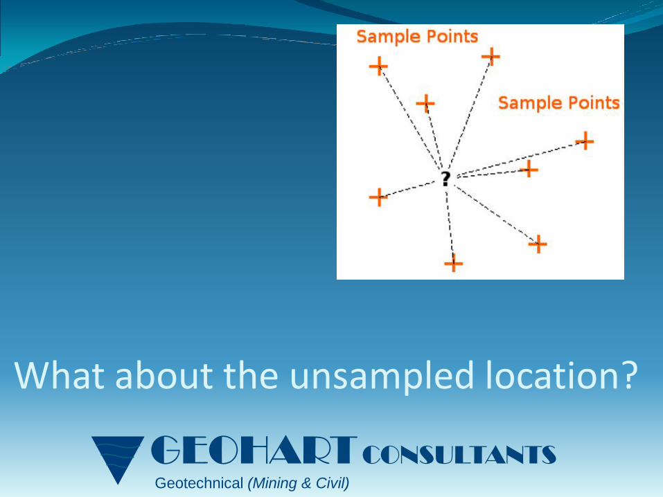
What about the unsampled location?
GEOHART CONSULTANTS
Geotechnical (Mining & Civil)
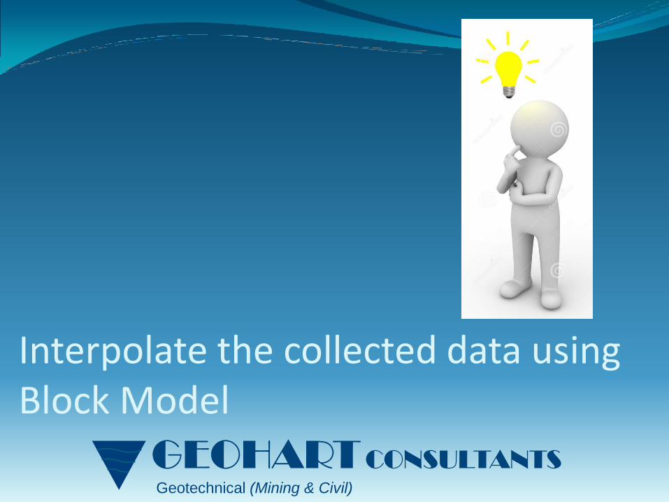
Interpolate the collected data using Block Model

GEOHART CONSULTANTS
Geotechnical (Mining & Civil)
The Dargues Reef project site was located within the Lachlan Fold Belt underlain by Devonian-aged Granodiorite
Dargues Reef

GEOHART CONSULTANTS
Geotechnical (Mining & Civil)
This block model aimed to assist in determining interlode pillar stability and dilution estimates during the feasibility study
The software SurpacTM was used to develop a mine-wide block model to carry out spatial interpolation for all available RQD drillhole data
Block modelling

GEOHART CONSULTANTS
Geotechnical (Mining & Civil)
Size of block
Interpolation method
Search ellipsoid
Maximum search radius and vertical search distance
Block modelling parameters
The selection of above parameters depends on the geological and geotechnical conditions and the purpose of the modelling
The following set of parameters are required for each block model

GEOHART CONSULTANTS
Geotechnical (Mining & Civil)
Depends on the amount of data available and the purpose of the block model
For the Dargues Reef block model, we used a 10m block size
Size of block

GEOHART CONSULTANTS
Geotechnical (Mining & Civil)
Inverse Distance method is adopted
The Inverse Distance interpolation method assumes that the variance between values is solely based on the distance between data points
Interpolation method

GEOHART CONSULTANTS
Geotechnical (Mining & Civil)
The RQD values often trend along geological structures or lithology
For this case, the orientation of the ellipsoid search is assumed to be the dip and dip direction of the ore body to address the anisotropic condition of data
Search ellipsoid

GEOHART CONSULTANTS
Geotechnical (Mining & Civil)
The selection of maximum search radius and the maximum vertical search distance depends on the geotechnical and geological variability
If the search radius and vertical search distance are too small, literally no interpolation would be implemented
For Dargues Reef example, a 25 m maximum search radius was adopted
Search radius & vertical distance

GEOHART CONSULTANTS
Geotechnical (Mining & Civil)
Gold mineralization at Dargues Reef is structurally controlled and is hosted within east‐west trending steeply dipping lenses.
An approximately 10 to 15m thick diorite dyke is located sub-parallel to the mineralisation.
Numerous drill holes had been logged for RQD
Mineralisation

GEOHART CONSULTANTS
Geotechnical (Mining & Civil)
Plan view showing diorite dyke and numerous mineralised lenses
Mineralisation
N

GEOHART CONSULTANTS
Geotechnical (Mining & Civil)
10m blocks showing interpolated RQD values for each block
Model can be sliced so that area of interest can be seen
Example shows horizontal slice through the model
Model Results
GEOHART CONSULTANTS
Geotechnical (Mining & Civil)
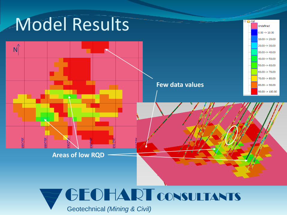
Model Results
Few data values
Areas of low RQD
N

GEOHART CONSULTANTS
Geotechnical (Mining & Civil)
The diorite dyke runs sub parallel to the mineralisation
Expect that geotechnical characteristics in the dyke may be different from country rock
Look at how removing values from within the dyke effects the results
Model Result

GEOHART CONSULTANTS
Geotechnical (Mining & Civil)
Model Result
Area of low RQD – outside dyke
Low RQD within dyke - removed
N

GEOHART CONSULTANTS
Geotechnical (Mining & Civil)
What if a 20m block and a wider search radius were used?
Model Result
Area of high RQD to the North
Very generalised results
Low RQD areas not clear
N

GEOHART CONSULTANTS
Geotechnical (Mining & Civil)
Block model not split it into domains Quantity and Quality of Data
Co
mp
lexi
ty o
f R
ock
mas
s (a
re t
he
pro
per
ties
dif
fere
nt
for
dif
fere
nt
do
ma
ins?
)
•Good coverage based on data available
•Smoothing of data values across domains
•Good coverage based on data available
•Smoothing of data values across domain boundaries
•Significant errors
•Need to carefully consider search radius
•Excellent coverage
•Need to carefully consider search radius
•May highlight change in rock properties
•Some smoothing of data values across domain boundaries

GEOHART CONSULTANTS
Geotechnical (Mining & Civil)
Block model split it into domains Quantity and Quality of Data
Co
mp
lexi
ty o
f R
ock
mas
s (a
re t
he
pro
per
ties
dif
fere
nt
for
dif
fere
nt
do
ma
ins?
)
•Smoothing of data values
•May be large gaps in coverage
•Consider DTM accuracy
•Smoothing of data values
•Significant errors
•May be large gaps in coverage
•Consider search radius
•Excellent coverage
•Reliable results
•Consider search radius
•May highlight change in rock properties

GEOHART CONSULTANTS
Geotechnical (Mining & Civil)
The mine-wide block modelling aims to indicates the quality of rock mass in general.
The block model also highlighted the areas with potential low RQD and their spatial characteristics, i.e. location, depth, extent and orientation.
This assists in the understanding of the spatial relationships of the geotechnical conditions within the rock mass.
The block model may need to be further subdivided if there is evidence to suggest distinct geotechnical domain boundaries exist and there is sufficient data
Discussion

GEOHART CONSULTANTS
Geotechnical (Mining & Civil)
Always remember that every model is a simplified reality no matter how complicated
The “unknown” addressed by a model gives the direction of the next step for ground investigation
Understanding of site geology and judgement are essential to determine the extent of block model and the associated input parameters
Conclusions


![New Iterative Methods for Interpolation, Numerical ... · and Aitken’s iterated interpolation formulas[11,12] are the most popular interpolation formulas for polynomial interpolation](https://img.pdfslide.net/doc/110x75/5ebfad147f604608c01bd287/new-iterative-methods-for-interpolation-numerical-and-aitkenas-iterated-interpolation.jpg)