Embed Size (px)
Citation preview

Renewal of Waste Discharge Requirements
for Injection of Treated Groundwater
Initial Study and
Proposed Negative Declaration
Colorado River Basin Regional Water Quality Control Board
August 2006

PROPOSED NEGATIVE DECLARATION
Name of Project: Renewal of Waste Discharge Requirements (WDRs) for Injection of Treated Groundwater
Lead Agency: Colorado River Basin Regional Water Quality Control Board (RWQCB), 73-720 Fred Waring Drive, Suite 100, Palm Desert, California 92260
Project Proponent: Pacific Gas and Electric (PG&E), P.O. Box 7442, San Francisco, California 94120
Project Location: The project is located in southeastern San Bernardino County approximately 15 miles southeast of Needles, California, near the PG&E Topock Compressor Station (see Figures 1 and 2).
Project Description: PG&E is conducting investigative and remedial activities at the Topock Compressor Station under the oversight of the California Environmental Protection Agency, Department of Toxic Substances Control, as well as the U. S. Department of the Interior, U.S. Bureau of Land Management, U.S. Fish and Wildlife Service, and U.S. Bureau of Reclamation. On-going remedial activities include Interim Measures (IM) No. 3, which involves the extraction, treatment, and management of groundwater with the objective of maintaining hydraulic control of a chromium plume in groundwater. Associated IM No. 3 facilities include groundwater extraction wells, a water treatment system, conveyance piping, injection wells, and monitoring well facilities (see Figure 3).
On-going operation of the IM No. 3 system since July 2005 includes the injection of treated water into injection well fields in accordance with the Waste Discharge Requirements (WDRs) issued by the Colorado River Basin Regional Water Quality Control Board (Regional Board). The WDRs were authorized by the Regional Board on October 13, 2004, and expire on January 31, 2007. Renewal of the permit would allow PG&E to continue to inject treated water. No additional facilities would be constructed or expanded as a result of renewal of the WDRs, and no change to existing operations is anticipated.
Finding: The Regional Board has prepared an Initial Study of the project described above and determined that the proposed renewal of the WDRs could not have a significant effect on the environment. A copy of the Initial Study that supports this finding is attached.
Mitigation Measures: Based on the conclusions provided in the attached Initial Study, the project could not have a significant effect on the environment. Therefore, no mitigation measures are required.
Signature
Date

envcheck.wpd-12/30/98 1
CEQA Initial Study Environmental Checklist Form
1.
Project title:
Renewal of Waste Discharge Requirements (WDRs) for injection of treated groundwater 2.
Lead agency name and address:
Colorado River Basin Regional Water Quality Control Board 73-720 Fred Waring Drive, Suite 100 Palm Desert, CA 92260
3.
Contact person and phone number:
Robert Perdue; (760) 776-8938 4.
Project location:
The project is located in southeastern San Bernardino County approximately 15 miles southeast of Needles, California near the Pacific Gas and Electric (PG&E) Topock Compressor Station (Figure 1). Associated facilities occupy approximately 4 acres and extend over an area generally bounded by the Colorado River in the east, National Trails Highway in the north, the Burlington Northern-Santa Fe (BNSF) Railway in the south and open space to the west (Figure 2). The majority of the associated facilities are sited within a 100-acre parcel owned by PG&E; the remainder of the nearby area is owned and/or managed by the United States Bureau of Land Management (BLM). As shown on Figure 2, regional access to the project is provided by Interstate 40. Access is available from a western access road located several hundred feet north of Interstate 40 along Park Moabi Road. Alternate access is available by continuing north on Park Moabi Road, east on National Trails Highway and south on National Trails Highway to the eastern access road. Directly north of the National Trails Highway, at the underpass of the BNSF Railway, is an approximately 1-acre “bench” located above the Colorado River floodplain. This area is referred to as the MW-20 bench. Some associated facilities are sited on the MW-20 bench, including related trucking operations.
5.
Project sponsor’s name and address:
Pacific Gas and Electric Company P.O. Box 7442 San Francisco, CA 94120 Contact: Barbara Benson; (415) 973-6634

Needles CA
PG&E TopockCompressor Station
Topock AZ
Lake Havasu City
I-40
FIGURE 1REGIONAL LOCATION MAPINTERIM MEASURES NO.3 PG&E TOPOCK COMPRESSOR STATIONNEEDLES, CALIFORNIA
0 2 4 6Miles
BAO \\ZINFANDEL\PROJ\PACIFICGASELECTRICCO\TOPOCKPROGRAM\GIS\MXD\2006\IM3_REGIONAL_LOCATION_MAP.MXDIM3_REGIONAL_LOCATION_MAP.PDF 6/14/2006 10:14:08
1 inch equals 4 miles
Project AreaCalifornia
Arizona
Nevada
40
15
10
Mojave NPRES
Death Valley NP Las Vegas
Kingman
Los Angeles Metro Area Joshua Tree NP
Lake Mead NRA
San Bernardino NF
Color
ado R
iver
Colorado River Aqueduct

Colorado River
INTERSTATE
DEBRIS RAVINE
TOPOCKCOMPRESSORSTATION
FORMEREVAPORATIONPOND SITE
BAT CAVE WASH
BNSF RAILROAD
MOABIREGIONALPARK
PG&EMetropolitan
Water District of Southern California
(MWDSC)
National Trails HwyHavasu NationalWildlife Refuge
(HNWR)(Managed by U.S. Fish and Wildlife Service)
PG&E
Bureau ofReclamation
(Managed by BLM)
Bureau of Land Management(Managed by BLM)
Leased toSan Bernardino County
(Managed by BLM)
Bureau of Land Management(Owned and Managed by BLM)
Havasu NationalWildlife Refuge
(HNWR)(Managed by U.S. Fish and
Wildlife Service)
MW-20BENCH
EXISTINGEVAPORATIONPONDS
GROUNDWATERTREATMENTFACILITY
Park Moabi Rd.
TOPOCKMARINA
WESTERN ACCESS
EASTERN ACCESS
0 800 1,600Feet
LEGENDProperty Boundaries
BAO \\ZINFANDEL\PROJ\PACIFICGASELECTRICCO\TOPOCKPROGRAM\GIS\MXD\2006\IM3_SITE_ACCESS.MXD IM3_SITE_ACCESS.PDF 6/14/2006 11:23:14
FIGURE 2PROJECT SITE VICINITYINTERIM MEASURES NO.3PG&E TOPOCK COMPRESSOR STATIONNEEDLES, CA
1 inch equals 800 feetCalifornia State Plane NAD83 Zone 5 US Feet
Site Access Route

CEQA Initial Study Environmental Checklist Form
envcheck.wpd-12/30/98 2
6.
General plan designation: Resource Conservation (RC)1
7. Zoning: RC
8. Description of project: (Describe the whole action involved, including but not limited to later phases of the project, and any secondary, support, or off-site features necessary for its implementation. Attach additional sheets if necessary.) Background PG&E is conducting investigative and remedial activities at the Topock Compressor Station under the oversight of the California Environmental Protection Agency, Department of Toxic Substances Control (DTSC), the United States Department of the Interior, BLM, United States Fish and Wildlife Service, and United States Bureau of Reclamation. These activities relate to historic operations of the Topock Compressor Station that involved the former use of hexavalent chromium in the compressor station cooling water. Subsequent discharge of the cooling water into Bat Cave Wash resulted in the hexavalent chromium [Cr(VI)] entering the groundwater aquifer.
Ongoing remedial activities include Interim Measures (IM) No. 3, titled “Emergency Groundwater Extraction and Management” (IM No. 3), which provides for the extraction and treatment of groundwater with the objective of managing the chromium plume by maintaining hydraulic control through the selected placement and use of several extraction wells. IM No. 3 facilities include groundwater extraction wells, conveyance piping, treatment facilities, injection wells, and monitoring facilities (Figure 3). Construction of IM No. 3 facilities commenced on September 27, 2004. The facilities became operational on July 31, 2005. Ongoing operation of the IM No. 3 system involves the continued extraction of groundwater via the extraction wells, conveyance of the extracted groundwater through the piping system to the IM No. 3 treatment plant, treatment at the plant to remove chromium and total dissolved solids (TDS), and subsequent injection of the treated water back into the groundwater aquifer.
Prior to construction and operation of the IM No. 3 facilities, DTSC, acting as Lead Agency under the California Environmental Quality Act (CEQA) (California Public Resources Code Section 21000 et seq.), was required to determine whether the proposed facilities were subject to environmental review under CEQA. DTSC determined that the IM No. 3 facilities were statutorily exempt from CEQA, concluding that the facilities fell within the statutory exemption for specific actions necessary to prevent or mitigate an emergency. (See California Public Resources Code Section 21080(b)(4); CEQA Guidelines, California Code of Regulations, Title 14, Section 15269(c).) Accordingly,
1 The RC designation is applied to project lands under the jurisdiction of the County of San Bernardino and allows for the cultivation of crops, farm-related activities, and additional land uses that include hazardous waste operations. Portions of the IM No. 3 site fall under federal jurisdiction and are not subject to general plan policies or the zoning ordinance of the County of San Bernardino.

OW-2
OW-1OW-5
OW-3 Colorado River
INTERSTATE
BAT C
AVE W
ASH
BN&SF RAILROAD
MW-20 Bench
National Trails Hwy
EastMesa
BLM
Historic Route 66
BLM
PG&E
40
TreatmentPlant
CW-4
IW-2IW-3
CW-3
CW-2
CW-1
HNWR
0 325 650Feet
LEGENDIM-3 Injection Well
Observation Well Cluster
Compliance Monitoring Well Cluster
IM Extraction Well
Influent Pipeline
Effluent Pipeline
Property Boundaries
BAO \\ZINFANDEL\PROJ\PACIFICGASELECTRICCO\TOPOCKPROGRAM\GIS\MXD\2006\IM3_PROJECT_FACILITIES.MXD IM3_PROJECT_FACILITES.PDF 6/15/2006 14:24:32
FIGURE 3IM-3 FACILITIES AND GENERAL SITE FEATURESINTERIM MEASURES NO.3PG&E TOPOCK COMPRESSOR STATIONNEEDLES, CALIFORNIA
California State Plane NAD83 Zone 5 US Feet

CEQA Initial Study Environmental Checklist Form
envcheck.wpd-12/30/98 3
DTSC filed a Notice of Exemption with the State Clearinghouse on July 1, 2004,2 which explained the basis for its determination that the proposed construction and operation of the IM No.3 facilities were exempt from CEQA.
Because portions of the IM No. 3 facilities are located on lands managed by the BLM, project implementation required approval from that federal agency. BLM gave its approval in an Action Memorandum, dated September 17, 2004, which it issued pursuant to its authority under Section 104 of the Comprehensive Environmental Response, Compensation, and Liability Act of 1980 (42 U.S.C. Section 9601 et seq.). The Action Memorandum required PG&E to implement several mitigation measures to mitigate the potential environmental impacts associated with the construction and operation of the proposed IM No. 3 facilities. The DTSC Notice of Exemption and BLM Action Memorandum are provided in Attachment A.
In addition to the BLM and DTSC approvals required, the injection of the treated groundwater from the IM No. 3 facilities also required the approval of the Colorado River Basin Regional Water Quality Control Board (Regional Board). The Regional Board provided that approval by adopting Waste Discharge Requirements Order No. R7-2004-0103 at its regularly-scheduled meeting held on October 13, 2004. The WDRs authorize and regulate treated water injection from the IM No. 3 facilities.
Prior to adopting the WDRs, however, the Regional Board was also required, as a Responsible Agency under CEQA, to independently review DTSC’s Notice of Exemption and the basis for the emergency determination made by that agency. Following its review, the Regional Board concurred with DTSC’s determination, explaining in the WDRs that “an emergency condition exists because the flow of groundwater to the Colorado River has not yet been contained,” and “[i]t is necessary and desirable to have in place alternative disposal options to accommodate increased extraction and treatment rates (resulting in the need for increased disposal capacity) that may be required to contain the groundwater flow to the river” (WDRs, Finding No. 37). The Regional Board added that “[w]hile the duration of the Interim Measures has not been determined, it is appropriate to limit the term of this Order [to January 31, 2007], by which time it is reasonable to conclude that DTSC will have undertaken an environmental analysis of all disposal alternatives.” (Ibid.)
2 In the Notice of Exemption, DTSC explained the basis of the emergency, stating that “[t]hese project activities are necessary to prevent or mitigate an emergency situation wherein the waters of the Colorado River may be impacted with a hazardous constituent, chromium, which is in contaminated groundwater in close proximity to the river. Immediate action is necessary to contain and reverse the flow of groundwater away from the Colorado River. Commencement of the development of additional extraction, treatment, and treated water disposal capacity is urgent to assure that increased pumping rates will be available to respond to impending fluctuations of the Colorado River level.”
CEQA Initial Study Environmental Checklist Form
envcheck.wpd-12/30/98 4
Subsequent injection of treated water from IM No. 3 has occurred in accordance with the
WDRs with no reported violations. Because the WDRs expire on January 31, 2007, PG&E submitted a Report of Waste Discharge to the Regional Board, dated June 8, 2006, to renew the WDRs. The proposed WDRs would allow for the continued injection of treated water from the IM No. 3 treatment facilities.
In accordance with CEQA and implementing CEQA Guidelines, this Initial Study evaluates whether the proposed renewal of the WDRs, which would allow PG&E to continue to inject treated groundwater into the same injection well system (the project) at the same rate and with the same effluent limitations, may have a significant effect on the environment. As discussed further below, the results of the Initial Study will help the Regional Board, as Lead Agency for the project, to determine whether an Environmental Impact Report (EIR) or a Negative Declaration should be prepared. Although the project appears to qualify for four exemptions under CEQA and thus, be exempt from further CEQA review, the Regional Board has decided to prepare this Initial Study to ensure that any potentially significant environmental impacts associated with renewal of these WDRs are identified and considered.3
Associated Facilities The IM No. 3 facilities include extraction wells, injection wells, monitoring wells, a water treatment plant, and several thousand feet of aboveground and subsurface pipelines. The IM No. 3 facilities are depicted on Figure 3. Construction of the IM No. 3 system was completed in July 2005. No additional facilities would be constructed or expanded as a result of renewal of the WDRs.
IM No. 3 extraction well facilities include TW-3D on the MW-20 bench and PE-1 on the Colorado River floodplain. Extraction wells TW-2D and TW-2S are also located on the MW-20 bench and are available as supplemental or alternative extraction wells.
Extracted water is conveyed via double-walled influent piping installed subsurface. Beginning at the PE-1 extraction well, influent piping extends below ground surface for approximately 500 feet across the Colorado River floodplain to the MW-20 bench. At the
3 The four CEQA exemptions that appear to apply are described in the following CEQA Guidelines sections: (1) Section 15061(b)(3) (a proposed action is exempt from CEQA if “it can be seen with certainty that there is no possibility that the activity in question may have a significant effect on the environment”); (2) Section 15301 (the operation, repair, maintenance, permitting, or minor alteration of existing facilities involving negligible or no expansion of use beyond that existing); (3) Section 15307 (actions by regulatory agencies for protection of natural resources); and (4) Section 15308 (actions by regulatory agencies for protection of the environment). In addition to providing the factual basis for the proposed adoption of a negative declaration, this Initial Study also provides the factual basis for determining that the project is exempt from CEQA pursuant to these four exemptions and that the exceptions to these exemptions, set forth in CEQA Guidelines Section 15300.2, do not apply. As mentioned, even though these exemptions appear to apply, the Regional Board has nevertheless decided to prepare this Initial Study to ensure that any potentially significant environmental impacts associated with the WDR renewal are identified and considered.

CEQA Initial Study Environmental Checklist Form
envcheck.wpd-12/30/98 5
MW-20 bench, the influent pipeline interconnects with the TW-3D extraction well piping and continues for approximately 3,000 feet to the IM No. 3 water treatment plant. As shown on Figure 3, the influent piping between the MW-20 bench and treatment plant generally follows existing access roads, extending north within the National Trails Highway alignment and up to the treatment plant within the unnamed eastern access road.
The IM No. 3 water treatment facilities occupy approximately 1 acre. Treated water is conveyed via an approximately 1,900-foot effluent pipeline extending west from the treatment plant along the shoulder of the eastern access road and extending north to the East Mesa injection well field. The East Mesa includes injection wells IW-2 and IW-3 and observation wells installed to monitor changes in water levels and water quality during operation of the injection wells. Four compliance monitoring well clusters (CW-1 through CW-4) generally surround the injection well field, as shown on Figure 3.
Access to the IM No. 3 treatment plant is provided by roads extending from the east and west off Park Moabi Road and National Trails Highway (Figure 2). These access roads have been improved to facilitate safe transportation to the treatment plant and to protect key cultural resources. To protect the historic roadway structure of former Route 66, which provides western access to the IM No. 3 treatment facilities, a protective fabric and approximately 5 inches of road base were placed on the roadway between Park Moabi Road to the west and the IM No. 3 treatment plant to the east. To minimize potential effects on cultural resources, including historic Route 66, ongoing project operations discussed below are subject to the Cultural Resources Management Plan for the Topock Compressor Station Expanded Groundwater Extraction and Treatment System (Applied Earthworks 2004), as well as the Transportation Management Plan For Cultural Resources Protection for Interim Measures No. 3 (CH2M HILL 2004a).
Existing Operations Operation of IM No. 3 commenced in July 2005. Up to 135 gallons per minute of groundwater are currently extracted and conveyed to the water treatment facility. Periodically, small volumes of purge water from groundwater well installation and monitoring activities are also treated within the IM No. 3 treatment system. The treatment system reduces hexavalent chromium to the less-soluble trivalent form [Cr(III)] by chemical reaction with ferrous chloride. Iron and Cr(III) solids are formed by precipitating the solution with sodium hydroxide and air. The majority of the precipitated solids are removed by gravity separation in a clarifier. Clarified water is passed through a microfilter to remove additional solids. TDS in the groundwater are reduced using reverse osmosis.
Treated water is conveyed along approximately 1,900 feet of pipeline to the East Mesa injection well field. Treatment residuals include brine (water with elevated TDS) and precipitated solids (sludge). The brine is conveyed via pipeline from the treatment plant to the MW-20 bench along the same alignment as the influent pipeline. Approximately

CEQA Initial Study Environmental Checklist Form
envcheck.wpd-12/30/98 6
26 truckloads per week of brine waste are transported via tanker truck from the MW-20 bench to an appropriate permitted offsite disposal facility. The disposal facility currently in use is located in Los Angeles. Sludge is hauled directly from the treatment plant approximately twice per month to an appropriate permitted solid waste facility.
Ongoing IM No. 3 operations require one to two staff to manage and monitor IM No. 3 functions 24 hours per day, primarily at the IM No. 3 treatment plant. Operations personnel drive to the injection well area and the extraction well locations several times each day to monitor the condition of the wells and conveyance piping and to conduct any necessary maintenance activities on equipment. In addition to the operations staff, a security company employed by PG&E provides 24-hour-a-day patrol. IM No. 3 operations also involve supplemental staff conducting regular sampling and data collection at the observation and compliance monitoring wells.
Periodic maintenance activities include routine repairs, well maintenance, waste removal, and deliveries of supplies and treatment compounds. Delivery of supplies and materials occurs several times per week. Typical repair activities include recent repairs to the IM No. 3 access road, which involved installing culverts sized to convey stormwater below the roadway, and adding fill material to repair eroded sections.
9. Surrounding land uses and setting: Briefly describe the project’s surroundings:
The project lies within an area of significant cultural and sacred tribal resources. Portions of the Topock Maze are located nearby. The maze is a geoglyph (ground marking) and is of extreme importance to the local Native American community. The project is within the traditional territory of the Aha Makav or Fort Mojave Indian Tribe. While the material remains of the past are important to these tribes, this area of traditional and spiritual use knows no boundaries for the Fort Mojave Indian Tribe.
The project is located within the Mojave Desert ecological and geographic province. The area is characterized by arid conditions with precipitation averaging less than 5 inches per year and high temperatures typical to the Mojave Desert. The landscape within the project area is considerably eroded by natural processes, which include wind and water erosion. The resulting landforms are characterized in part by alluvial terraces and incised drainage channels. One of the largest incised channels is Bat Cave Wash, which runs from the Chemehuevi Mountains in the south toward the Colorado River in the north. Terraces occurring onsite are homogeneous and comprise rocky soils with very sparse vegetation. Elevations in the project area range from about 550 feet above mean sea level (msl) at the compressor station to 450 feet above msl at the Colorado River floodplain.
Land uses near the project are predominantly open space, interspersed with industrial facilities, recreational uses, and transportation infrastructure. Open space at and nearby the project area is characterized primarily by desert vegetation, but also includes Bat Cave Wash and several unnamed washes that flow north across the project area to the confluence of the Colorado River. Open space on the Colorado River floodplain is

CEQA Initial Study Environmental Checklist Form
envcheck.wpd-12/30/98 7
characterized by shifting sand dunes and associated riparian vegetation, primarily non-native tamarisk (salt cedar).
Developed land uses near the project include the existing IM No. 3 facilities, National Trails Highway, former Route 66, and various unnamed access roads. In addition, numerous groundwater well clusters are located throughout the area, related to the ongoing groundwater investigation activities. A major gas utility and transportation corridor is located directly south of the project. This corridor is developed with gas transmission pipelines, the BNSF Railway, and Interstate 40.
Directly south of the BNSF Railway is the Unites States Fish and Wildlife Service’s Havasu National Wildlife Refuge (HNWR). The 37,515-acre HNWR extends for approximately 26 miles along the Colorado River, from Needles, California, to Lake Havasu City, Arizona. Further south of the railway is the Topock Compressor Station, located on an approximately 65-acre parcel owned by PG&E. Remaining lands surrounding the project include primarily open space owned or managed by the BLM. This includes the Moabi Regional Park located northwest of the project, which is leased by BLM to the County of San Bernardino. East of the project across the Colorado River is the Topock Marina and related water and recreational infrastructure.
The local geology consists of recent and older river deposits progressing westward to older alluvial deposits associated with the local mountains. Sand, gravel, and cobblestone dominate these deposits, comprising the principal groundwater aquifer at the site. Surface water drainage at the project site flows to Bat Cave Wash and a large unnamed desert wash to the west. These ephemeral desert washes are dry most of the year, but during heavy precipitation events the washes can have surface flow.
10.
Other public agencies whose approval is required (e.g., permits, financing approval, or participation agreement.)
Beyond renewal of the WDRs by the Regional Board, no other approvals are required to continue the injection of treated water from the IM No. 3 water treatment system. Prior approvals obtained from the DTSC, BLM, and County of San Bernardino remain in effect. IM No. 3 implementation was also subject to various ministerial approvals, including issuance of the Authority to Construct and Permit to Operate by the Mojave Desert Air Quality Management District (MDAQMD).

CEQA Initial Study Environmental Checklist Form
envcheck.wpd-12/30/98 8
ENVIRONMENTAL FACTORS POTENTIALLY AFFECTED: The environmental factors checked below would be potentially affected by this project, involving at least one impact that is a "Potentially Significant Impact" as indicated by the checklist on the following pages.
Aesthetics
Agriculture Resources
Air Quality
Biological Resources
Cultural Resources
Geology /Soils
Hazards & Hazardous Materials
Hydrology / Water Quality
Land Use / Planning
Mineral Resources
Noise
Population / Housing
Public Services
Recreation
Transportation/Traffic
Utilities / Service Systems
Mandatory Findings of Significance
DETERMINATION: (To be completed by the Lead Agency) On the basis of this initial evaluation:
I find that the proposed project COULD NOT have a significant effect on the environment, and a NEGATIVE DECLARATION will be prepared.
I find that although the proposed project could have a significant effect on the environment, there will not be a significant effect in this case because revisions in the project have been made by or agreed to by the project proponent. A MITIGATED NEGATIVE DECLARATION will be prepared.
I find that the proposed project MAY have a significant effect on the environment, and an ENVIRONMENTAL IMPACT REPORT is required.
I find that the proposed project MAY have a "potentially significant impact" or "potentially significant unless mitigated" impact on the environment, but at least one effect 1) has been adequately analyzed in an earlier document pursuant to applicable legal standards, and 2) has been addressed by mitigation measures based on the earlier analysis as described on attached sheets. An ENVIRONMENTAL IMPACT REPORT is required, but it must analyze only the effects that remain to be addressed.

CEQA Initial Study Environmental Checklist Form
envcheck.wpd-12/30/98 9
I find that although the proposed project could have a significant effect on the environment, because all potentially significant effects (a) have been analyzed adequately in an earlier EIR or NEGATIVE DECLARATION pursuant to applicable standards, and (b) have been avoided or mitigated pursuant to that earlier EIR or NEGATIVE DECLARATION, including revisions or mitigation measures that are imposed upon the proposed project, nothing further is required.
Signature
Date

CEQA Initial Study Environmental Checklist Form
envcheck.wpd-12/30/98 10
EVALUATION OF ENVIRONMENTAL IMPACTS:
Potentially Significant
Impact
Less Than
Significant with Mitigation
Incorporation
Less Than Significant
Impact
No
Impact
I. AESTHETICS -- Would the project:
a) Have a substantial adverse effect on a scenic vista?
b) Substantially damage scenic resources, including, but not limited to, trees, rock outcroppings, and historic buildings within a state scenic highway?
c) Substantially degrade the existing visual character or quality of the site and its surroundings?
d) Create a new source of substantial light or glare which would adversely affect day or nighttime views in the area?
Setting The visual environment of the project area is characterized primarily by open space over topographically varied terrain, interspersed with industrial facilities and transportation infrastructure. Elevations at the site range from approximately 450 msl at the Colorado River to just over 550 feet msl at the Topock Compressor Station; the Chemehuevi Mountains rise abruptly south of the project area. The overall landscape within the study area is considerably eroded, as characterized by the terraces and incised drainage channels throughout the project area. The terraces are comprised of rocky soils with very sparse vegetation. The largest incised channel is Bat Cave Wash, which runs from the Chemehuevi Mountains in the south toward the Colorado River in the north.
Prominent visual features near the project and vicinity include the Colorado River and adjacent floodplain, which traverse the northern and eastern portions of the site. The IM No. 3 water treatment plant occupies approximately 1 acre and is located directly west of Bat Cave Wash. The Interstate 40 and the BNSF Railway corridors traverse the southern portion of the area in an east-west fashion. The paved two-lane Park Moabi Road and National Trails Highway extend across the northern and eastern portion of the area. Several unpaved roadways also traverse the area. Various groundwater wells have been installed throughout the area. The groundwater wells are not visually prominent; many are flush-mounted to the ground and not visible from a distance.

CEQA Initial Study Environmental Checklist Form
envcheck.wpd-12/30/98 11
South of the project are industrial facilities associated with the Topock Compressor Station. Other prominent visual features in the project vicinity include development at Moabi Regional Park northwest of the project, the four lined evaporation ponds associated with the Topock Compressor Station southwest of the project, and the Topock Marina across the Colorado River east of the project.
Impacts Renewal of the existing WDRs would allow for the continued injection of water treated by the IM No. 3 water treatment plant. No additional facilities are proposed, and no change to the existing visual environment would result from renewal of the WDRs. No aesthetic impacts would result from ongoing operations.
II. AGRICULTURE RESOURCES: In determining whether impacts to agricultural resources are significant environmental effects, lead agencies may refer to the California Agricultural Land Evaluation and Site Assessment Model (1997) prepared by the California Dept. of Conservation as an optional model to use in assessing impacts on agriculture and farmland. Would the project:
Potentially Significant
Impact
Less Than
Significant with Mitigation
Incorporation
Less Than Significant
Impact
No
Impact
a) Convert Prime Farmland, Unique Farmland, or Farmland of Statewide Importance (Farmland), as shown on the maps prepared pursuant to the Farmland Mapping and Monitoring Program of the California Resources Agency, to non-agricultural use?
b) Conflict with existing zoning for agricultural use, or a Williamson Act contract?
c) Involve other changes in the existing environment which, due to their location or nature, could result in conversion of Farmland, to non-agricultural use?

CEQA Initial Study Environmental Checklist Form
envcheck.wpd-12/30/98 12
Setting
The project area is comprised primarily of open space, along with a mix of recreational and industrial land uses, including the existing IM No. 3 facilities. No agricultural lands or activities occur at the project area. Based on information provided by the County of San Bernardino planning staff (S. Hall 2004), the project is not located within an area of prime, unique, or important farmland.
Impacts
No agricultural resources occur at the project site or nearby vicinity. No impact will result.
III. AIR QUALITY -- Where available, the significance criteria established by the applicable air quality management or air pollution control district may be relied upon to make the following determinations. Would the project:
Potentially Significant
Impact
Less Than
Significant with Mitigation
Incorporation
Less Than Significant
Impact
No
Impact
a) Conflict with or obstruct implementation of the applicable air quality plan?
b) Violate any air quality standard or contribute substantially to an existing or projected air quality violation?
c) Result in a cumulatively considerable net increase of any criteria pollutant for which the project region is non-attainment under an applicable federal or state ambient air quality standard (including releasing emissions which exceed quantitative thresholds for ozone precursors)?
d) Expose sensitive receptors to substantial pollutant concentrations?
e) Create objectionable odors affecting a substantial number of people?

CEQA Initial Study Environmental Checklist Form
envcheck.wpd-12/30/98 13
Setting
The project area is characterized by arid conditions and high temperature. Precipitation averages less than 5 inches per year at the project site and mainly comes during winter months, and occasionally during the summer. The California Air Resources Board regulates air quality in California and has divided the state into air basins according to topographic and air-related characteristics. Each District is responsible for regulating stationary sources of air pollution and the implementation of air quality programs per state and federal mandates. The project area falls within the jurisdiction of Mojave Desert Air Quality Management District (MDAQMD). Prior to construction of the IM No. 3 facilities, the MDAQMD issued the Authority to Construct and Permit to Operate the IM No. 3 facilities. In addition, the onsite portable generator used for backup electrical power was registered with the California Air Resources Board under the portable equipment registration program.
The project is located in an area designated as non-attainment for ozone and particulate matter less than 10 microns (PM10). The project falls within a federal non-attainment area for both PM10 and ozone (1-hour and 8-hour standards). In addition, the project is located in a State of California non-attainment area for both PM10 and ozone. No sensitive receptors (e.g., hospital, school, etc.) are located at the project site or nearby vicinity.
The MDAQMD has prepared the Federal Particulate Matter (PM10) Attainment Plan to address the United States Environmental Protection Agency (USEPA) moderate non-attainment classification for PM10. However, the project is not located within the planning area; therefore, project activities are not subject to the PM10 attainment plan. Activities at the project site are typically implemented in accordance with MDAQMD Rule 403, which provides reasonable precautions to minimize fugitive dust emissions. Operations at the project area include the watering of access roads several times per week to minimize dust and PM10 emissions resulting from vehicle traffic.
MDAQMD has also adopted the 2004 Ozone Attainment Plan (State and Federal). As noted in the plan, MDAQMD does not propose any additional measures beyond the existing Reasonably Available Control Technology requirements applicable to new sources (i.e., with emissions greater than 25 tons per year). This does not apply to activities associated with the IM No. 3 operations.
Existing IM No. 3 air emissions include those from delivery and maintenance vehicles, pickup truck, and ATV operation during the Compliance Monitoring Program and Performance Monitoring Program activities and the off-site transport of brine waste from IM No. 3 operations (approximately 26 trucks per week). In addition, IM No. 3 operations involve the periodic use of an onsite generator when electrical power from the electrical utility is unavailable.

CEQA Initial Study Environmental Checklist Form
envcheck.wpd-12/30/98 14
Impacts Air emission levels following renewal of the WDRs would not change from existing emission levels. Ongoing IM No. 3 operations following renewal of the WDRs would involve the periodic use of an onsite generator when electrical power from the electrical utility is unavailable. Air emissions associated with generator usage would be short term and would not constitute a substantial portion of any criteria pollutant, including ozone. As noted above, the backup IM No. 3 generator is authorized to operate under the California Air Resources Board portable equipment registration program. Dust control measures, such as the watering of IM No. 3 access roads, would minimize dust and associated PM10 emissions resulting from ongoing IM No. 3 operations. Mobile emission sources include the approximately 26 truckloads per week associated with the off-site hauling of brine waste. Air emissions from this activity and other IM No. 3 operations (e.g., delivery and maintenance vehicles) would not represent a substantial contribution to regulated air emissions.
No air quality impacts would result from renewal of the WDRs.4 IV. BIOLOGICAL RESOURCES -- Would the project:
Potentially Significant
Impact
Less Than
Significant with Mitigation
Incorporation
Less Than Significant
Impact
No
Impact
a) Have a substantial adverse effect, either directly or through habitat modifications, on any species identified as a candidate, sensitive, or special status species in local or regional plans, policies, or regulations, or by the California Department of Fish and Game or U.S. Fish and Wildlife Service?
b) Have a substantial adverse effect on any riparian habitat or other sensitive natural community identified in local or regional plans, policies, regulations or by the California Department of Fish and Game or US Fish and Wildlife Service?
4 It should also be noted that a decision not to renew the WDRs would require implementing some other means for disposing of the treated water from the IM No. 3 water treatment plant. The likely means of doing this would be to truck the treated water to a permitted offsite disposal facility. Up to 300 truckloads per week of treated water might be required to be hauled offsite if the existing WDRs are not renewed. The vehicle emissions from these trucking operations would be significantly greater than existing air emission levels, as well as the emission levels associated with renewal of the WDRs.

CEQA Initial Study Environmental Checklist Form
envcheck.wpd-12/30/98 15
c) Have a substantial adverse effect on federally protected wetlands as defined by Section 404 of the Clean Water Act (including, but not limited to, marsh, vernal pool, coastal, etc.) through direct removal, filling, hydrological interruption, or other means?
d) Interfere substantially with the movement of any native resident or migratory fish or wildlife species or with established native resident or migratory wildlife corridors, or impede the use of native wildlife nursery sites?
e) Conflict with any local policies or ordinances protecting biological resources, such as a tree preservation policy or ordinance?
f) Conflict with the provisions of an adopted Habitat Conservation Plan, Natural Community Conservation Plan, or other approved local, regional, or state habitat conservation plan?
Setting
Prior to the construction of the IM No. 3 facilities, biological investigations were conducted at the project area, as documented in the Final Biological Resources Investigations for Interim Measures No. 3: Topock Compressor Station Expanded Groundwater Extraction and Treatment System (CH2M HILL 2004b). Subsequent biological surveys at the project site are documented in the Biological Resources Survey Report for the Area of Potential Effect (APE) Topock Compressor Station Expanded Groundwater Extraction and Treatment System Needles (CH2M HILL 2005a). The following information summarizes the biological conditions at the project site and in the vicinity of the existing IM No. 3 facilities, as documented in these reports.
The Colorado River is the primary aquatic habitat located approximately 1,300 feet east of the Topock Compressor Station. The river is approximately 700 to 900 feet wide and 8 to 15 feet deep at this location. Little to no submergent vegetation exists within the river. Small patches of emergent vegetation along the banks consist of common reed (Phragmites communis), cattails (Typha sp.), sedges (Carex sp.), and bulrush (Scirpus sp.). Several of these wetland patches are located at the confluence of Bat Cave Wash and near Moabi Regional Park. Larger wetlands and marshes exist along the eastern bank of the peninsula near the Topock Marina. The Topock

CEQA Initial Study Environmental Checklist Form
envcheck.wpd-12/30/98 16
Marsh, located northeast of the project within the HNWR, provides important aquatic marsh and riparian habitat in the project vicinity.
Terrestrial habitats near the project consist of creosote bush scrub, Mojave wash, desert riparian, and tamarisk thicket. The dominant upland plant community is creosote bush scrub. The area is sparsely vegetated with widely-distributed creosote bushes (Larrea tridentata). Other plant species that occur within this plant community include burrobush (Ambrosia dumosa), allscale (Atriplex polycarpa), split grass (Schismus sp.), spineflower (Chorizanthe sp.), desert trumpet (Eriogonum inflatum), beavertail cactus (Opuntia basilaris), golden cholla (Opuntia echinocarpa), brittlebush (Encelia farinosa), cheesebush (Hymenoclea salsola), dalea (Dalea mollisima), red barrel cactus (Ferocactus pilosus), sweetbush (Bebbia juncea), and ratany (Krameria erecta).
Mojave Wash is comprised of Bat Cave Wash and other unnamed washes in the area. Bat Cave Wash is an ephemeral drainage that extends from the Chemehuevi Mountains to the Colorado River approximately 3,500 feet north of the Topock Compressor Station. Although this wash may periodically flood during stormwater runoff events, it remains dry throughout most of the year due to arid desert conditions. The wash floor is relatively barren of vegetation and consists of sand, gravel, and cobblestone substrate. Although the drainages occur within the creosote bush scrub plant community, several native tree species are associated with the washes including palo verde (Cercidium sp.), acacia (Acacia greggii), mesquite (Prosopis sp.), and smoke tree (Dalea spinosa).
Desert riparian vegetation is present at the confluence of Bat Cave Wash and the Colorado River. This plant community consists of scattered mesquite, palo verde, and tamarisk (Tamarix sp.).
Tamarisk thicket is the dominant plant community along the Colorado River floodplain. This invasive, exotic plant species has displaced native plant species. This plant community consists of dense monotypic stands of tamarisk with an understory of arrowweed (Pluchea sericea). In general, tamarisk does not provide optimal wildlife habitat, but it does provide a roosting structure for several avian species.
Avian species commonly associated with the river include American coot (Fulica americana), mallard (Anas platyrhynchos), pied-billed grebe (Podilymbus podiceps), great egret (Casmerodius albus), great blue heron (Ardea herodias), northern rough-winged swallow (Stegidopteryx serripennis), and belted kingfisher (Ceryle alcyon). Other avian species found in the upland areas include red-tailed hawk (Buteo jamencensis), Gambel’s quail (Callipepla gambelii), mourning dove (Zenaida macroura), common raven (Corvus corax), song sparrow (Melospiza melodia), Canyon wren (Catherpes mexicanus), brewer’s blackbird (Euphagus cyanocephalus), great-tailed grackle (Quiscalus mexicanus), turkey vulture (Cathartes aura), greater roadrunner (Geococcyx californianus), lesser nighthawk (Chordeiles acutipennis), and rock dove (Columba livia).
Mammals that may occur at the project area include deer mouse (Peromyscus maniculatus), Merriam kangaroo rat (Dipodomys merriami), whitetail antelope squirrel (Ammospermophilus leucurus), desert woodrat (Neotoma lepida), California ground squirrel (Spermophilus beecheyi),

CEQA Initial Study Environmental Checklist Form
envcheck.wpd-12/30/98 17
desert cottontail (Sylvilagus audubonii), and black-tailed hare (Lepus californicus), coyote (Canis latrans), desert kit fox (Vulpes macrotis), American badger (Taxidea taxus), bobcat (Lynx rufus), striped skunk (Mephitis mephitis), beaver (Castor canadensis), and raccoon (Procyon lotor).
Reptiles that may occur in the area include chuckwalla (Sauromalus obesus), side-blotched lizard (Uta stansburiana), western whiptail lizard (Cnemidophorus tigris), zebra-tailed lizard (Callisaurus draconoides), coachwhip (Masticophis flagellum), gopher snake (Pituophis melanoleucus), and western diamondback rattlesnake (Crotalus atrox).
Impacts
Renewal of the WDRs would allow for the continued injection of treated water into the groundwater aquifer. No physical changes will occur. Thus, no impact to biological resources is anticipated to result from renewal of the WDRs. V. CULTURAL RESOURCES -- Would the project:
Potentially Significant
Impact
Less Than
Significant with Mitigation
Incorporation
Less Than Significant
Impact
No
Impact
a) Cause a substantial adverse change in the significance of a historical resource as defined in '15064.5?
b) Cause a substantial adverse change in the significance of an archaeological resource pursuant to '15064.5?
c) Directly or indirectly destroy a unique paleontological resource or site or unique geologic feature?
d) Disturb any human remains, including those interred outside of formal cemeteries?
Setting
The project site and surrounding area has been the subject of several cultural resource investigations, including most recently the Cultural Resources Investigations, Third Addendum: Survey of the Original and Expanded APE: Volume I, for Topock Compressor Station Site Vicinity, San Bernardino County, California (Applied Earthworks 2005). Prior to construction of the IM No. 3 facilities, the Cultural Resources Investigations for Interim Measures No. 3 Topock Compressor Station Expanded Groundwater Extraction and Treatment System was prepared (CH2M HILL 2004c) and was used for the consultation with the State Historic Preservation Office (SHPO). As a result of the SHPO consultation, a Memorandum of Agreement was signed by the BLM and SHPO, with concurrence provided by PG&E. The Memorandum of Agreement provided for the preparation

CEQA Initial Study Environmental Checklist Form
envcheck.wpd-12/30/98 18
and implementation of a Cultural Resources Management Plan during construction and operation of the IM No. 3 facilities. The Cultural Resources Management Plan for the Topock Compressor Station Expanded Groundwater Extraction and Treatment System (Applied Earthworks 2004) was prepared in September 2004 and remains in effect.
Archeological resources in the project vicinity include the Topock Maze. The Maze was created by modifying the desert landscape through creation of long parallel rows of stacked or piled dark colored desert-varnished rocks. These dark lines alternate with light bands formed where the varnished desert pavement was removed. The resultant pattern, also called the “Mystic Maze,” carries cultural and spiritual significance for the Fort Mojave Indian Tribe. One of the three manifestations of the Maze was included in the National Register of Historic Places (NRHP) in 1978 for its unique scale and design and for its potential to provide data on geoglyph (ground markings) construction and use. Along with this portion of the Maze, 136 lithic scatters and other prehistoric remnants have been recorded in the project vicinity.
As previously mentioned, the Maze and the project are within an area of extreme importance to the local Native American community. The project area lies within the traditional territory of the Fort Mojave Indian Tribe or Aha Makav. While the material remains of the past are of import to them, this area of traditional and spiritual use knows no boundaries for the Fort Mojave Indian Tribe.
Historic resources in the area include two segments of historic Route 66, which was listed in the NRHP in 1990. The first segment is a 1.3-mile section of road extending from Park Moabi Road to the BNSF railway, which was designated Route 66 between 1926 and 1947. Several features such as flagstone drainages, gutters, right-of-way marker posts, and a stacked concrete bag revetment also are a part of this segment. Along with the physical elements of the roadway itself, historical debris and other features may be associated with the roadway and may have characteristics that contribute to its significance. This segment of historic Route 66 is intersected by two abandoned graveled road sections, which may represent portions of National Old Trails Road, the predecessor to Route 66.
The second segment of Route 66 in the area follows the former alignment of a railway constructed by the Southern Pacific Railroad Company in 1883. This segment passes through the southeastern portion of the project area and is currently operated as National Trails Highway. Between 1947 and 1966, Route 66 followed this alignment. The former railroad right-of-way is eligible for the NRHP.
Prior to the construction of IM No. 3 facilities, historic Route 66 between Park Moabi Road and the BNSF railway was provided with structural protection to minimize any potential impact to the roadway fabric. Specifically, a geotextile membrane and approximately 5 inches of road base were placed on the road to protect the historic roadway fabric between Park Moabi Road and the IM No. 3 treatment plant. This protection remains in place and will be removed when no longer needed.

CEQA Initial Study Environmental Checklist Form
envcheck.wpd-12/30/98 19
In addition to Route 66, there are 12 other historic sites that occur near the project, as documented in the CH2M HILL report (2004c) and Applied Earthworks report (2005).
No known paleontological or unique geologic features are present at or in proximity to the project.
Impacts
Approval of the renewal of the WDRs would allow for the continuation of injection operations. Continued injection will not involve any change from existing operations. Further, all IM No. 3 operations are currently subject to an existing Cultural Resources Management Plan that provides for the protection of Route 66, as well as other historic and archeological resources near the project. This plan will continue to apply to continued operations. No construction activity is proposed. Therefore, no potential for direct impacts to archeological sites, historic resources, or human remains is expected. Paleontological resources or unique geologic features do not occur at the project site. No impact to cultural resources would result from renewal of the WDRs. VI. GEOLOGY AND SOILS -- Would the project:
Potentially Significant
Impact
Less Than
Significant with Mitigation
Incorporation
Less Than Significant
Impact
No
Impact
a) Expose people or structures to potential substantial adverse effects, including the risk of loss, injury, or death involving:
i) Rupture of a known earthquake fault, as delineated on the most recent Alquist-Priolo Earthquake Fault Zoning Map issued by the State Geologist for the area or based on other substantial evidence of a known fault? Refer to Division of Mines and Geology Special Publication 42.
ii) Strong seismic ground shaking? iii) Seismic-related ground failure, including liquefaction?
iv) Landslides? b) Result in substantial soil erosion or the loss of topsoil?

CEQA Initial Study Environmental Checklist Form
envcheck.wpd-12/30/98 20
c) Be located on a geologic unit or soil that is unstable, or that would become unstable as a result of the project, and potentially result in on- or off-site landslide, lateral spreading, subsidence, liquefaction or collapse?
d) Be located on expansive soil, as defined in Table 18-1-B of the Uniform Building Code (1994), creating substantial risks to life or property?
e) Have soils incapable of adequately supporting the use of septic tanks or alternative waste water disposal systems where sewers are not available for the disposal of waste water?
Setting
Geology in the vicinity of the project consists of recent and older river deposits progressing westward to older alluvial deposits associated with the local mountains. Sand, gravel, and cobblestone dominate these deposits, comprising the principal groundwater aquifer at the site. The landscape is considerably eroded by natural processes that include wind and water erosion. Land forms are characterized by alluvial terraces and incised drainage channels. One of the largest incised channels is Bat Cave Wash, which runs from the Chemehuevi Mountains in the south toward the Colorado River in the north. Terraces occurring nearby are homogeneous, comprising rocky soils with very sparse vegetation. Elevations in the project vicinity range from just over 800 feet msl south of the Topock Compressor Station to 450 feet msl at the Colorado River floodplain.
There are no known recent active faults identified by California Division of Mines and Geology (1994). Older faults greater than 10,000 years from the Late Quaternary or Tertiary age exist within 6 miles.
The project area varies topographically. Much of the area soils are unconsolidated sedimentary alluvium (sandy gravel and finer grained sand). The nearby floodplain of the Colorado River consists of a shifting sand-dune system. The project area does not consist of expansive soils. The design of the existing IM No. 3 facilities conforms to the County Building Code and Uniform Building Code standards, which serve to minimize potential geologic hazards.
Sewers are not available in the project area. Wastewater generated from existing IM No. 3 operations is managed with a sewage holding tank, in accordance with existing building and land use permits issued by San Bernardino County. The sewage holding tank is a zero-discharge facility that is regularly pumped-out for disposal at a permitted offsite facility.

CEQA Initial Study Environmental Checklist Form
envcheck.wpd-12/30/98 21
The injection of treated groundwater is subject to existing WDRs Order No. R7-2004-0103 adopted by the Regional Board on October 13, 2004. The WDRs apply to the re-injection of treated groundwater into the injection well field. Brine waste and sludge produced as a by-product of the water treatment process are hauled off-site for disposal at permitted facilities. The injection of treated water has operated in full compliance with the WDR requirements since startup in July 2005.
Impacts
Renewal of the WDRs would allow for the continued injection of treated water from the IM No. 3 facilities. No new facilities would be constructed as a result of WDR renewal. Future operation of the IM No. 3 facilities would not differ from existing operations. Existing facilities, including those involving human occupancy, have been designed and constructed in accordance with County of San Bernardino building standards, which account for potential seismic activity in the project vicinity.
VII. HAZARDS AND HAZARDOUS MATERIALS -- Would the project:
Potentially Significant
Impact
Less Than
Significant with Mitigation
Incorporation
Less Than Significant
Impact
No
Impact
a) Create a significant hazard to the public or the environment through the routine transport, use, or disposal of hazardous materials?
b) Create a significant hazard to the public or the environment through reasonably foreseeable upset and accident conditions involving the release of hazardous materials into the environment?
c) Emit hazardous emissions or handle hazardous or acutely hazardous materials, substances, or waste within one-quarter mile of an existing or proposed school?
d) Be located on a site which is included on a list of hazardous materials sites compiled pursuant to Government Code Section 65962.5 and, as a result, would it create a significant hazard to the public or the environment?

CEQA Initial Study Environmental Checklist Form
envcheck.wpd-12/30/98 22
e) For a project located within an airport land use plan or, where such a plan has not been adopted, within two miles of a public airport or public use airport, would the project result in a safety hazard for people residing or working in the project area?
f) For a project within the vicinity of a private airstrip, would the project result in a safety hazard for people residing or working in the project area?
g) Impair implementation of or physically interfere with an adopted emergency response plan or emergency evacuation plan?
h) Expose people or structures to a significant risk of loss, injury or death involving wildland fires, including where wildlands are adjacent to urbanized areas or where residences are intermixed with wildlands?
Setting
On-going operation of the existing IM No. 3 facilities involves the extraction, conveyance, and treatment of chromium in groundwater. Chromium levels in groundwater extracted for treatment do not typically exceed the toxicity characterization threshold concentrations for hazardous waste of 5.0 parts per million. The typical toxicity characteristics of sludge generated from the water treatment plant are not subject to regulation under the federal Resource Conservation and Recover Act (RCRA). However, the sludge is a state-regulated hazardous waste under Title 22 of the California Code of Regulations and, as such, is transported to a permitted, offsite, hazardous waste disposal facility. Reverse osmosis concentrate (brine) generated from the water treatment plant does not contain elevated levels of chromium but does contain dissolved solids at elevated concentrations. The brine is also transported offsite to a permitted disposal facility.
Operations at the IM No. 3 facilities involve the use, storage, and transport of relatively small amounts of regulated compounds, which are stored within containment structures and managed in accordance with federal, state, and local regulations. These compounds include ferrous chloride, sodium hydroxide, sulfuric acid, and various fuels, lubricants, and solvents. Any spill associated with IM No. 3 operations is subject to immediate cleanup and reporting in

CEQA Initial Study Environmental Checklist Form
envcheck.wpd-12/30/98 23
accordance with the Emergency Notification Binder (CH2M HILL 2005b) and Hazardous Materials Business Plan (PG&E 2006).
No schools or other sensitive receptors are located within one-quarter mile of the project. The project site is not included on a list of hazardous material sites compiled pursuant to Government Code Section 65962.5. No private or municipal airports are located in the nearby vicinity of the project.
Impacts Future operations resulting from renewal of the WDRs would not differ from existing operations. All hazardous chemicals are stored within containment structures and managed in accordance with federal, state, and local regulations. IM No. 3 operations are subject to the Emergency Notification Binder and Hazardous Materials Business Plan, which would serve to limit any impact resulting from the spill of a regulated compound. Sparse vegetation at the project area limits the potential for wildfires. Because no change in IM No. 3 operations would result from WDR renewal, no impacts are anticipated.
VIII. HYDROLOGY AND WATER QUALITY -- Would the project:
Potentially Significant
Impact
Less Than
Significant with Mitigation
Incorporation
Less Than Significant
Impact
No
Impact
a) Violate any water quality standards or waste discharge requirements?
b) Substantially deplete groundwater supplies or interfere substantially with groundwater recharge such that there would be a net deficit in aquifer volume or a lowering of the local groundwater table level (e.g., the production rate of pre-existing nearby wells would drop to a level which would not support existing land uses or planned uses for which permits have been granted)?
c) Substantially alter the existing drainage pattern of the site or area, including through the alteration of the course of a stream or river, in a manner which would result in substantial erosion or siltation on- or off-site?

CEQA Initial Study Environmental Checklist Form
envcheck.wpd-12/30/98 24
d) Substantially alter the existing drainage pattern of the site or area, including through the alteration of the course of a stream or river, or substantially increase the rate or amount of surface runoff in a manner which would result in flooding on- or off-site?
e) Create or contribute runoff water which would exceed the capacity of existing or planned stormwater drainage systems or provide substantial additional sources of polluted runoff?
f) Otherwise substantially degrade water quality?
g) Place housing within a 100-year flood hazard area as mapped on a federal Flood Hazard Boundary or Flood Insurance Rate Map or other flood hazard delineation map?
h) Place within a 100-year flood hazard area structures which would impede or redirect flood flows?
i) Expose people or structures to a significant risk of loss, injury or death involving flooding, including flooding as a result of the failure of a levee or dam?
j) Inundation by seiche, tsunami, or mudflow?
Setting Precipitation in the project area averages less than 5 inches per year. Precipitation at the project site evaporates, soaks into the surface soils, or drains to the Colorado River, Bat Cave Wash, and other unnamed washes to the west end at the Colorado River. These ephemeral desert washes are dry most of the year, but during heavy precipitation events the washes can have surface flow. Storm water facilities are primarily limited to roadway culverts and ditches. Recent improvements along the existing IM No. 3 access routes included the installation of additional and/or expanded culverts and ditches to minimize roadway erosion. Groundwater at the

CEQA Initial Study Environmental Checklist Form
envcheck.wpd-12/30/98 25
project site is part of an alluvial aquifer at depths of 40 to 350 feet below ground surface. Depth to groundwater is controlled topographically.
The 100-year floodplain at the project site is limited to portions of the floodplain adjacent to the channel of the Colorado River. The PE-1 extraction well facilities are partially located in the potential 100-year flood area but have been designed to avoid any adverse effect resulting from flooding of the facilities. No housing or other occupied structures are located within the 100-year floodplain at the project site.
The project is located within the jurisdiction of the Colorado River Basin Regional Board. Water quality objectives for groundwater and surface water in the region are contained in the Water Quality Control Plan, Colorado River Basin – Region 7 (including amendments adopted through October 2005). WDR Order No. R7-2004-103 was adopted by the Regional Board on October 13, 2004 and applies to the re-injection of treated water from the IM No. 3 water treatment plant into the groundwater aquifer. These WDRs contain effluent limitations for Cr(VI), total chromium, and pH. Additionally, IM No. 3 effluent must not contain heavy metals, chemicals, pesticides, or other constituents in concentrations toxic to human health.
Impacts Continued injection of treated water from the IM No. 3 facilities is subject to the renewal of WDR Order No. R7-2004-0103, which expires on January 31, 2007. Future IM No. 3 operations are expected to be subject to requirements substantially similar to those in the existing WDRs. These requirements include effluent limitations, regular sampling of treated water, and monitoring of groundwater in the vicinity of the injection field. To date, no violation of the parameters provided in the WDRs has occurred. Continued IM No. 3 operations are not expected to result in any violation of the anticipated water quality standards applied by the Regional Board.
No new facilities are proposed for construction as a result of the renewal of the WDRs. Existing drainage patterns would not change. No occupied structures would be subject to flooding or other water-related hazards. No adverse impact to hydrology and water quality would occur as a result of renewal of the WDRs.
IX. LAND USE AND PLANNING -- Would the project:
Potentially Significant
Impact
Less Than
Significant with Mitigation
Incorporation
Less Than Significant
Impact
No
Impact
a) Physically divide an established community?

CEQA Initial Study Environmental Checklist Form
envcheck.wpd-12/30/98 26
b) Conflict with any applicable land use plan, policy, or regulation of an agency with jurisdiction over the project (including, but not limited to the general plan, specific plan, local coastal program, or zoning ordinance) adopted for the purpose of avoiding or mitigating an environmental effect?
c) Conflict with any applicable habitat conservation plan or natural community conservation plan?
Setting Land use at the project area and nearby vicinity is predominantly open space, interspersed with industrial facilities, recreational uses, and transportation infrastructure. Land use at the project area is under the jurisdiction of the County of San Bernardino and BLM. The 100-acre parcel developed with the existing IM No. 3 water treatment plant and related facilities may be subject to local land-use regulations of the County of San Bernardino. Areas surrounding the 100-acre PG&E parcel are federally owned or managed and are not subject to County land-use control. Land-use approvals in these areas are subject to the management considerations of the BLM.
The County of San Bernardino General Plan (1989) designates the 100-acre PG&E parcel as Resource Conservation (RC). This land-use classification provides for the cultivation of crops and other farm-related activities. Pursuant to the County of San Bernardino Development Code, additional uses are allowed in areas designated “Resource Conservation,” subject to issuance of a Department Review/Conditional Use Permit. Such additional uses are specified in Section 84.0410 of the County Development Code and include, but are not limited to, gas pressure control stations, water treatment plants, water storage tanks, and hazardous waste operations (treatment, incineration, recycling, storage, transfer, residual repository and land disposal facilities). The IM No. 3 system was approved by the County of San Bernardino in a Departmental Review (DS1455-257/2004/DR01), effective September 21, 2004. BLM approval was provided in the September 2004 Action Memorandum previously mentioned in accordance with the management considerations of that agency.
The project is located near an area of the Colorado River floodplain within the planning area of the Lower Colorado River Multi-species Conservation Program, which extends from Lake Mead north of Topock down to the border with Mexico in the south. The Multi-species Conservation Program is applicable primarily to flood control operations undertaken by the Bureau of Reclamation and other public agencies. Ongoing IM No. 3 operation, including groundwater injection, does not conflict with this program.

CEQA Initial Study Environmental Checklist Form
envcheck.wpd-12/30/98 27
Impacts No change to the existing land use or related operational activities would result from renewal of the WDRs. No land use impacts would result. X. MINERAL RESOURCES -- Would the project:
Potentially Significant
Impact
Less Than
Significant with Mitigation
Incorporation
Less Than Significant
Impact
No
Impact
a) Result in the loss of availability of a known mineral resource that would be of value to the region and the residents of the state?
b) Result in the loss of availability of a locally-important mineral resource recovery site delineated on a local general plan, specific plan or other land use plan?
Setting The geology at the project site is not known to support mineral resources of value. The project area is not designated by the County of San Bernardino as a known mineral resource.
Impacts No known mineral resources occur at the project site. Renewal of the WDRs would not result in any impact to mineral resources.
XI. NOISE -- Would the project result in:
Potentially Significant
Impact
Less Than
Significant with Mitigation
Incorporation
Less Than Significant
Impact
No
Impact
a) Exposure of persons to or generation of noise levels in excess of standards established in the local general plan or noise ordinance, or applicable standards of other agencies?
b) Exposure of persons to or generation of excessive groundborne vibration or groundborne noise levels?

CEQA Initial Study Environmental Checklist Form
envcheck.wpd-12/30/98 28
c) A substantial permanent increase in ambient noise levels in the project vicinity above levels existing without the project?
d) A substantial temporary or periodic increase in ambient noise levels in the project vicinity above levels existing without the project?
e) For a project located within an airport land use plan or, where such a plan has not been adopted, within two miles of a public airport or public use airport, would the project expose people residing or working in the project area to excessive noise levels?
f) For a project within the vicinity of a private airstrip, would the project expose people residing or working in the project area to excessive noise levels?
Setting Existing stationary noise sources at the project vicinity include the Topock Compressor Station facilities and the existing IM No. 3 treatment plant. Mobile noise sources include vehicles on Interstate 40 and trains along the BNSF rail line. Limited vehicle noise is generated primarily along the access routes during the transport of supplies and waste associated with IM No. 3 operations. Recreational off-highway vehicle (OHV) activity on BLM-managed lands is also a mobile noise source. Other noise sources include boating and watercraft activity on the Colorado River. On-going groundwater monitoring generates noise related to use of ATVs, small trucks, and generators. The project is not located within an airport land-use plan or in the vicinity of a private airstrip.
Noise standards of the County of San Bernardino are specified in Section 87.0905(b) of the Development Code. Typical outdoor noise standards from stationary sources range from 55 dB(A)5 for residential land uses to 70 dB(A) for industrial uses. Noise standards are also applicable to mobile sources and vary based on the adjacent land uses; any exceedance of the prescribed noise levels is required to be mitigated accordingly. County noise standards are generally applicable to developed land uses, which are limited primarily to the recreational and 5 dB(A) refers to the sound pressure level, which is measured in decibels on a sound level meter using the A-weighting filter network. The A-weighting filter de-emphasizes the very low and very high frequency components of the sound, placing greater emphasis on those frequencies within the sensitivity range of the human ear.

CEQA Initial Study Environmental Checklist Form
envcheck.wpd-12/30/98 29
short-term residential uses at Moabi Regional Park northwest of the project. Noise generated at the IM No. 3 water treatment plant is substantially attenuated at Moabi Regional Park due to the approximately 0.5-mile distance and varied topography between these two areas.
Impacts No changes to the IM No. 3 facilities or operations would occur as a result of renewal of the WDRs. Therefore, no change to the existing noise environment is anticipated, and no impact would result from renewal of the WDRs.
XII. POPULATION AND HOUSING -- Would the project:
Potentially Significant
Impact
Less Than
Significant with Mitigation
Incorporation
Less Than Significant
Impact
No
Impact
a) Induce substantial population growth in an area, either directly (for example, by proposing new homes and businesses) or indirectly (for example, through extension of roads or other infrastructure)?
b) Displace substantial numbers of existing housing, necessitating the construction of replacement housing elsewhere?
c) Displace substantial numbers of people, necessitating the construction of replacement housing elsewhere?
Setting The immediate project area is unpopulated and contains no housing. Approximately 0.5 mile northwest of the existing IM No. 3 facilities is Moabi Regional Park, which includes approximately 35 recreational vehicle sites and allows for long-term winter stays of up to 5 months. The Topock Marina is located east of the project across the Colorado River in Arizona and includes a mobile home park. A few additional homes are located in the vicinity of the Topock Marina.
Impacts Ongoing injection of treated water from IM No. 3 operations would not affect existing housing in the project vicinity. Continued injection of groundwater at the project site would not induce

CEQA Initial Study Environmental Checklist Form
envcheck.wpd-12/30/98 30
or facilitate population growth. No impacts to population or housing would result from the renewal of the WDRs.
XIII. PUBLIC SERVICES
Potentially Significant
Impact
Less Than
Significant with Mitigation
Incorporation
Less Than Significant
Impact
No
Impact
a) Would the project result in substantial adverse physical impacts associated with the provision of new or physically altered governmental facilities, need for new or physically altered governmental facilities, the construction of which could cause significant environmental impacts, in order to maintain acceptable service ratios, response times or other performance objectives for any of the public services:
Fire protection?
Police protection?
Schools?
Parks?
Other public facilities?
Setting
The project is located within a rural environment; public services are generally commensurate with the land uses and population density at the project site and surrounding areas. Public services at the project site are provided primarily through the County of San Bernardino.
Impacts
Continued operations resulting from renewal of the WDRs would not change from existing operations. The design of the existing IM No. 3 facilities, including roads providing access to the project, reflects the emergency access requirements of the County of San Bernardino. No impacts to public services would result from renewal of the WDRs.

CEQA Initial Study Environmental Checklist Form
envcheck.wpd-12/30/98 31
XIV. RECREATION --
Potentially Significant
Impact
Less Than
Significant with Mitigation
Incorporation
Less Than Significant
Impact
No
Impact
a) Would the project increase the use of existing neighborhood and regional parks or other recreational facilities such that substantial physical deterioration of the facility would occur or be accelerated?
b) Does the project include recreational facilities or require the construction or expansion of recreational facilities which might have an adverse physical effect on the environment?
Setting
No recreational facilities are located at the project site. Nearby lands managed by the BLM do not include any formal recreation facilities, but support recreational activities that include OHV activity. Various recreational facilities are located in the project vicinity. East of the project, the Colorado River is a popular destination for water-related recreational activity. Nearby Moabi Regional Park and the Topock Marina provide facilities such as boat ramps and docks, which support recreational activity on the river. The United States Fish and Wildlife Service HNWR lands provide both water and terrestrial recreational opportunities in the project vicinity.
Impacts
Renewal of the WDRs would not increase demand for recreational facilities or otherwise affect recreational activity in the project vicinity. No impact would result. XV. TRANSPORTATION/TRAFFIC -- Would the project:
Potentially Significant
Impact
Less Than
Significant with Mitigation
Incorporation
Less Than Significant
Impact
No
Impact
a) Cause an increase in traffic which is substantial in relation to the existing traffic load and capacity of the street system (i.e., result in a substantial increase in either the number of vehicle trips, the volume to capacity ratio on

CEQA Initial Study Environmental Checklist Form
envcheck.wpd-12/30/98 32
roads, or congestion at intersections)? b) Exceed, either individually or cumulatively, a level of service standard established by the county congestion management agency for designated roads or highways?
c) Result in a change in air traffic patterns, including either an increase in traffic levels or a change in location that results in substantial safety risks?
d) Substantially increase hazards due to a design feature (e.g., sharp curves or dangerous intersections) or incompatible uses (e.g., farm equipment)?
e) Result in inadequate emergency access?
f) Result in inadequate parking capacity? g) Conflict with adopted policies, plans, or programs supporting alternative transportation (e.g., bus turnouts, bicycle racks)?
Setting
Access to the project is provided from the Park Moabi Road exit of Interstate 40. Park Moabi Road is a two-lane paved facility that becomes National Trails Highway at the entrance to Moabi Regional Park. National Trails Highway continues in an east-west direction and then continues in a north-south direction along the floodplain of the Colorado River. Access to the existing IM No. 3 treatment plant from the west is provided by the historic alignment of Route 66, which extends off of Park Moabi Road. Eastern access is provided off National Trails Highway along an unnamed access road. Various unimproved roads traverse the project vicinity.
Traffic volumes at the project vicinity reflect the predominantly rural character of the area. Traffic is generated through ongoing operation of the IM No. 3 treatment plant, the most substantial of which is the approximately 26 truckloads per week of brine waste hauled from the treatment plant to an off-site facility in Los Angeles. Additional traffic associated with ongoing IM No. 3 operations relates to the transport of staff, materials, and waste, and maintenance vehicle activity. Adequate parking is provided for staff and visitors at the Topock
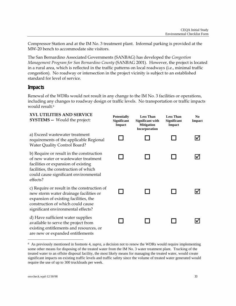
CEQA Initial Study Environmental Checklist Form
envcheck.wpd-12/30/98 33
Compressor Station and at the IM No. 3 treatment plant. Informal parking is provided at the MW-20 bench to accommodate site visitors.
The San Bernardino Associated Governments (SANBAG) has developed the Congestion Management Program for San Bernardino County (SANBAG 2001). However, the project is located in a rural area, which is reflected in the traffic patterns on local roadways (i.e., minimal traffic congestion). No roadway or intersection in the project vicinity is subject to an established standard for level of service.
Impacts Renewal of the WDRs would not result in any change to the IM No. 3 facilities or operations, including any changes to roadway design or traffic levels. No transportation or traffic impacts would result.6
XVI. UTILITIES AND SERVICE SYSTEMS -- Would the project:
Potentially Significant
Impact
Less Than
Significant with Mitigation
Incorporation
Less Than Significant
Impact
No
Impact
a) Exceed wastewater treatment requirements of the applicable Regional Water Quality Control Board?
b) Require or result in the construction of new water or wastewater treatment facilities or expansion of existing facilities, the construction of which could cause significant environmental effects?
c) Require or result in the construction of new storm water drainage facilities or expansion of existing facilities, the construction of which could cause significant environmental effects?
d) Have sufficient water supplies available to serve the project from existing entitlements and resources, or are new or expanded entitlements
6 As previously mentioned in footnote 4, supra, a decision not to renew the WDRs would require implementing some other means for disposing of the treated water from the IM No. 3 water treatment plant. Trucking of the treated water to an offsite disposal facility, the most likely means for managing the treated water, would create significant impacts on existing traffic levels and traffic safety since the volume of treated water generated would require the use of up to 300 truckloads per week.

CEQA Initial Study Environmental Checklist Form
envcheck.wpd-12/30/98 34
needed?
e) Result in a determination by the wastewater treatment provider which serves or may serve the project that it has adequate capacity to serve the project’s projected demand in addition to the provider’s existing commitments?
f) Be served by a landfill with sufficient permitted capacity to accommodate the project’s solid waste disposal needs?
g) Comply with federal, state, and local statutes and regulations related to solid waste?
Setting The IM No. 3 injection operations are currently operating in accordance with WDR Order No. R7-2004-103 issued by the Regional Board in October 13, 2004. The WDRs specify effluent limitations, prohibitions, specifications, and provisions for subsurface injection. The effluent limitations apply to Cr(VI), total chromium, and pH. Additionally, effluent must not contain heavy metals, chemicals, pesticides, or other constituents in concentrations toxic to human health. Water extracted for project operations is within the existing PG&E water rights allocation from the Colorado River and associated groundwater basin. The majority of extracted water is injected following treatment, in accordance with WDR Order No. R7-2004-103. Wastes generated from treatment system operations include solid waste (sludge) and reverse osmosis concentrate (brine). These waste streams are characterized and disposed of at a permitted off-site facility.
Impacts
Renewal of the WDRs would not result in the construction of new facilities. Thus, no construction-related impacts would result. Continued operations resulting from renewal of the WDRs would not change from existing operations. PG&E maintains rights to allocated amounts of water from the Colorado River and the nearby groundwater basin. Renewal of the WDRs would not require new or expanded entitlements. IM No. 3 operations since startup in July 2005 have not exceeded the effluent standards established in WDR Order No. R7-2004-103. Standards in the renewed WDRs are expected to be similar to current standards. Based on past IM No. 3 monitoring and reporting, ongoing operations are not expected to exceed WDR requirements.
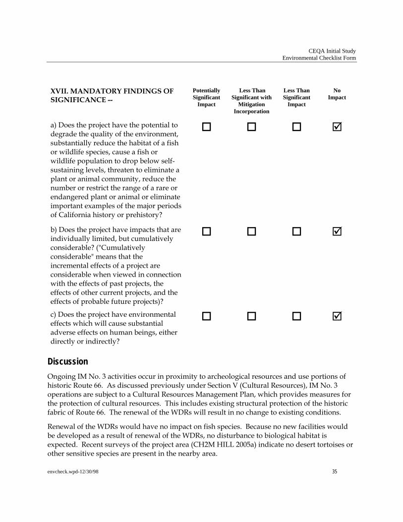
CEQA Initial Study Environmental Checklist Form
envcheck.wpd-12/30/98 35
XVII. MANDATORY FINDINGS OF SIGNIFICANCE --
Potentially Significant
Impact
Less Than
Significant with Mitigation
Incorporation
Less Than Significant
Impact
No
Impact
a) Does the project have the potential to degrade the quality of the environment, substantially reduce the habitat of a fish or wildlife species, cause a fish or wildlife population to drop below self-sustaining levels, threaten to eliminate a plant or animal community, reduce the number or restrict the range of a rare or endangered plant or animal or eliminate important examples of the major periods of California history or prehistory?
b) Does the project have impacts that are individually limited, but cumulatively considerable? ("Cumulatively considerable" means that the incremental effects of a project are considerable when viewed in connection with the effects of past projects, the effects of other current projects, and the effects of probable future projects)?
c) Does the project have environmental effects which will cause substantial adverse effects on human beings, either directly or indirectly?
Discussion Ongoing IM No. 3 activities occur in proximity to archeological resources and use portions of historic Route 66. As discussed previously under Section V (Cultural Resources), IM No. 3 operations are subject to a Cultural Resources Management Plan, which provides measures for the protection of cultural resources. This includes existing structural protection of the historic fabric of Route 66. The renewal of the WDRs will result in no change to existing conditions.
Renewal of the WDRs would have no impact on fish species. Because no new facilities would be developed as a result of renewal of the WDRs, no disturbance to biological habitat is expected. Recent surveys of the project area (CH2M HILL 2005a) indicate no desert tortoises or other sensitive species are present in the nearby area.

CEQA Initial Study Environmental Checklist Form
envcheck.wpd-12/30/98 36
The existing IM No. 3 system is a component of ongoing investigative and interim remedial measures associated with the Topock Compressor Station. Other related projects at the Topock Compressor Station vicinity include groundwater monitoring activities conducted at wells located throughout the project area and concentrated on the floodplain of the Colorado River. In addition, an in-situ pilot study is underway in a floodplain area of the Colorado River directly east of the MW-20 bench to determine the viability of this particular method of chromium remediation. In-situ floodplain facilities include groundwater wells clustered in an approximately 0.25-acre area of the floodplain.
Future investigative activities at the site may include additional groundwater well installation and monitoring activities, soil sampling activities, and an additional in-situ pilot study in an upland location. These investigative activities will culminate in the formulation and implementation of a final cleanup remedy for the site. The parameters of the final remedy are not currently known, and an assessment of the environmental impacts would be speculative at this time.
All activities at the site are subject to the management considerations of the BLM, HNWR, DTSC, and other agencies with full or partial jurisdiction at the project site (e.g., California Department of Fish and Game, San Bernardino County). The measures applied to on-going investigative and interim remedial activities, as well as future activities, will serve to limit adverse environmental impacts. Because no new facilities or activities would result from renewal of the WDRs and, because existing IM No. 3 operations would not change, no adverse impacts are anticipated. Therefore, no cumulative impacts would result from WDR renewal.
IM No. 3 operations include the removal of chromium from groundwater. Ongoing operations resulting from renewal of the WDRs would not cause an adverse effect on human beings.

CEQA Initial Study Environmental Checklist Form
envcheck.wpd-12/30/98 37
References Applied Earthworks. 2004. Cultural Resources Management Plan for the Topock Compressor Station
Expanded Groundwater Extraction and Treatment System.
Applied Earthworks. 2005. DRAFT: Cultural Resources Investigations, Third Addendum: Survey of the Original and Expanded APE: Volume I, for Topock Compressor Station Site Vicinity, San Bernardino County, California.
California Department of Conservation, Division of Mines and Geology. 1994. Fault Activity Map of California and Adjacent Areas. Compiled by Charles W. Jennings.
CH2M HILL. 2004a. Transportation Management Plan For Cultural Resources Protection For Interim Measures No. 3: Topock Compressor Station Expanded Groundwater Extraction and Treatment System. June.
CH2M HILL. 2004b. Final Biological Resources Investigations for Interim Measures No. 3: Topock Compressor Station Expanded Groundwater Extraction and Treatment System San Bernardino County, California.
CH2M HILL. 2004c. Cultural Resources Investigations for Interim Measures No. 3. Topock Compressor Station Expanded Groundwater Extraction and Treatment System. August.
CH2M HILL. 2005a. Biological Resources Survey Report for the Area of Potential Effect (APE) Topock Compressor Station Expanded Groundwater Extraction and Treatment System Needles, California. October.
CH2M HILL. 2005b. Emergency Notification Binder. July.
Colorado River Basin Regional Water Quality Control Board. 2004. Order No. R7-2004-0103. Waste Discharge Requirements for Pacific Gas and Electric, Owner/Operator Groundwater Remediation Facility. October 13.
CH2M HILL. 2005. Water Quality Control Plan, Colorado River Basin – Region 7. Including amendments adopted by the Regional Board through October 2005.
Hall, Shirley. 2004. County of San Bernardino Planning Department Site Data Sheet.
Mojave Desert Air Quality Management District (MDAQMD). 1995. Final Mohave Desert Planning Area Federal Particulate Matter (PM10) Attainment Plan. July 31.
CH2M HILL. 2004. MDAQMD 2004 Ozone Attainment Plan (State and Federal). April 26.
Pacific Gas and Electric (PG&E). 2006. Hazardous Materials Business Plan. February.
San Bernardino Associated Governments (SANBAG). 2001. Congestion Management Program for San Bernardino County.
San Bernardino County. 1989. County of San Bernardino General Plan. June.

Attachment A