Embed Size (px)
Citation preview

GM 12949REPORT ON ELECTROMAGNETIC AND GEOLOGIC SURVEYS

Ministère des Richesses Naturelles, Québec
SERVICE DES GITES MINERAUX
No GM- 2 (./..
REPORT OF
E Lturf-toyr. lc :IT GEC LOG IC SURVEYS
Ct;
CARPENTrER WEST TICUNDARY 'CROUP CF CLAIMS
CARMTIER aTti BARRAUTE TOW17SHIPS
FFOVINCE CF flUEBEC
by
F. J. Evelegh
and
F.. V. Stewart
Exploration Department, January 25, 1963 Canadian Johm-anville Company Limited Matheson, Ontario.
Table cf Contents
Page
Introduction . . . . . . . . . . . . . . . • . . . . 1
Property 2
Location and ;ecce sibility . . . . . . . . . . . . . • . • 2
Topography 3
Previous ,'ork 3
Line Cutting and Chaining 4
Electromagnetic Survey 4, 5, 6
General Geolo^y 6, 7, S
Geological Survey. . .. . . . . . . . . . . . . . . . . . . . 8, 9
Rock Types:
Andesites . . o . • • • 00 . • . • . . . • • • • • • • 9
Rhyolitic to Intermediate Volcanics 9
Bedded Tuffs and Aggloueratic Horizons 9, 10
Diorite 10
Feridoti`e 10., 11
Quartz-Feldspar Porphyry ''.
Structure 11, 12
Economic Geology:
Base 'Metals 12
Asbestos 12, 13
Interpretation of Electromagnetic Survey . . . . . . . . . . 13, 14
Conclusions and Recommendations. . . 14
Detailed Aseessment Report i
Certificate of Verification -- R. V. Stewart
Certificate of Verification -- F. J. Evelegh
List of Taps
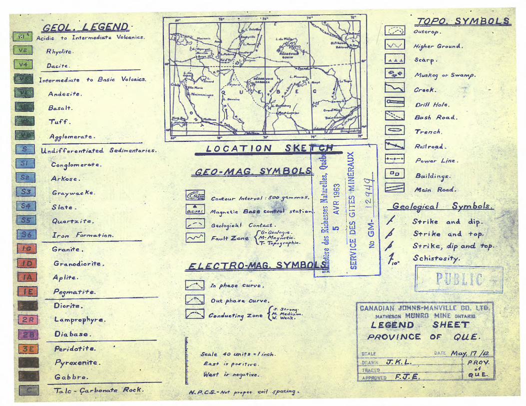
Legend Sheet for Vorthwestern Quebec
Township Layout Plans •.. Barraute and Carpentier Townships
Geologic and Topographic Plans am Electromagnetic Profile Plans on a scale
of 1 inch equals 200 feet
Sheets C6 and C11 -- Carpentier Township
Sheets D5, D6, and D9 -- Barraute Township

R'r~1FCRT ON GP.( LCCIC iP:1', ELE;CTdiC;'t+iGMT IC ARir'EYs,
CARPi;PTIEII ;1E,,i: I3GtTI`•ARY GROUP CF CLAIMS,
CARF4TTtSSt~;.
T 1rt1T BAR:wtiI
7JTi~L~tLVfî+C-:i-~~,HIPS,
Fi1C~Y lYyCi~, CF ~:~~U4~s1.7L'L
Introduction:
The followin ; report describes the geologic and electromagnetic sur-
veys co ,.; leted during 1962 on seventeen mining claims located in Carpentier
and Parr t.ute Townships, Province of Cuebec.
Cutting and chaining of picicet lines were contracted to J. Alix Com-
pany Limited of Val d'0r, Quelec. Pieket lines were cut at right angles to a
northwest-southeast trending; base line and were established at 2004-foot inter-
vals. Picket: were fixed every 50 feet along these offset lines by chaining.
Electromagnetic surveying was conducted by R. Kaltwasser, senior
fieldman with Canadian Johns-Manville Company Limited. W. Scott assisted R.
Kaltwa:ser during the course of the survey. Electromagnetic readings were re-
corded at 100-foot intervals along the offset lines using a Ronka park I, hori-
zontal loop type unit. The results of this work are shown on the accompanying
Electromagnetic Profile Plans on a scale of one inch equals 200 feet.
Geological mapping was conducted by R. V. Stewart, geologist with
Canadian Johns-Manville Compary Limited; R. Kaltwasser, senior fieldman,
assisted during the course of the work. All rock exposures were tied into
the picket lines by chaining. add all topographic details were carefully noted.
The results ci this work are shown on the accompanying Geologic and Topographic
Plans on a scale of one inch equals 200 feet.
Supervision, interpretation and compilation of part of Vis report -
were the responsibility of F. J. Evelegh, senior geologist with Canadian Johns-
Manville Company Li._=itec. Pote that R. V. Stewart compiled the portion of
this report dealing with the geology of the claims group.
Property:
The claims surveyed coprise a contiguous group in Ranges IV and V
of Carpentier and Barraute Townships, Province cf Quebec
further identified as follows:
and are numbered and
C-186489 claims 1-2-3-4 -- N/2 lot 62
Range IV, Barraute Township ✓
Range IV, Carpentier Township V/
N/2 lots 1-2-3 Mho 110.
Development Licence No. 186489
C-186486 claims 1-2 -- N/2 lots 60-61
Range IV, Barraute Township v/
Development Licence No. -- 186486
C-184785 claims 1-2-3-4 -- 3/2 lot: 3-4
N/2 lots 5-4
- -
--
Range V, Carpentier Township ✓
Range IV, Carpentier Township ✓
C-186417 claims
C-184787 claims
C-184786 claims
Development Licence No. -- 184785
3-4 -- 3/2 lots 58-59 -- Range V, Barraute Township ✓
Development Licence No. 186417
2-3-4 -- 3/2 lots 60-61-62 - Range V, Barraute Township ✓
Development Licence No. -- 184787
3-4 -- 3/2 lots 1-2 -- Range V, Carpentier Township V"
Development Licence No. -- 184786.
These seventeen claims comprise approximately 850 acres.
Location and Accessibility:
The Canadian Johns-Manville claims are loc=:ted in Ranges IV and V
of Carpentier and Barraute Townships and form a contiguous group.
Access to within one mile of the property is provided by a coloniza-
tion road branching to the east from the highway leading north from Barraute.
This road has been constructed along the line between Ranges IV and V. The
range line has been well cut out from the Barraute-Chibougamau Railway to the
property and is passable by muskeg tractor.
3
Topography:
The major portion of the claims rrouj is covered by wet spruce mus-
keg with a. thick intergrowth of tag alders. Rock exposures are sparse as the
terrain is relatively flat and; exton'ively clay covered. Cutcrops occur
along low poplar ridges in the northeast, southwest and north-central portions
of the ;rcperty.
Prainage :Ls provided by narrow streams which flow to the west and
empty into the LaFlame River.
Previous 'Fork: ....-,.-
Staking and general exploration work have been carried out or the
claims discussed in this report since the time of the "Barvue" discovery in
the late 1940.s. Barrentier Cold Mires and Chatelet Mines Limited conducted
exploration programs on tee group. This wer<-; consisted of line cutting,, re-
connaissance magnetic surveying, geological mapping aWd diamond drilling of
magnetic anomalies. As no sulphide values of interest were encountered dur-
ing the course of this worl, the claims were allowed to lapse.
The Carpentier West Boundary Group of claims was staked during Sep-
tember 1961 and same were ]ater transferred to Canadian Johns-Manville Company
Limited. Line cutting and retailed magnetic surveying were carried out during;
the early winter of 1962 anè the work was filed for assessment purposes in
September of that year.
This area has been mapped by geologists of both the Geological. Survey
of Canada and the Quebec Department of Natural Resources, the latter in consid-
erable detail. and maps have been publ i feed covering the general area (see
section entitled "General Geology" for details).
4
Line Cutting and Chainins:
Lim cutting and chaining were contracted to J. Alix Company Limited
of V11 d'Or,..,•uabec, and the work was carriel out during the period January 9
to 31, inclusive, 1962. A base line striking N. 59° W. was turned off from a
point on the line between flanges IV and V, Carpentier Township, 400 feet east
of the Post between Lot• 2 and 3. This line was cut to the southeast for a
length of 3400 feet and to the northwest for a length of 5200 feet.
Picket liner wer turned off at right angles to the bare line and
were spaced at 200-foot intervals. Every second line was cut to the boundar-
ies of the claims group, -- the intermediate lines were cut to the arumed
limits of the ultrabasic zone (see accompanying plans).
Pickets with numbered locations were fixed every 50 feet along the
offset lines by chaînage. As the zone of interest was in close proximity to
the base line, the ends of the 400-foot lines were not tied in alert the claim
boundaries.
A total. of 23.4 miles of picket and base lines was cut and chaired
during the courre of niF1 Trogram.
rote that the line cutting and chairing were filed for assessment
purposes as part of the magnetic survey.
Electromagnetic Survey:
An electromagnetic survey was conducted over the Carpentier vest
Boundary Group of claims by E. Kaltwasser, senior fieldman with Canadian Johns-
Manville Company Limited; assisted by W. bcott. This program was carried out
during the period April 6 to 18, 1962.

-5 -
Readings were recorded unir: a Rorke ';4ark I, horizontal loop type
survey unit with a coil spacir.f. cf 200 feet. Thi wit had been zeroed on
both the "in" and "out" of p'rh:is e components over the ultrabasic sill at the
Beatty Fire of CanedIan Johns- 4anvill.e Co:1 ;any Limited in Beatty Township,
Province of Cntario, imaediately prior to the commencement of the survey.
? total of 847 stations spiced at 100-foot intervals was recor-
des during the course of the survey.
Test surveys have been coapleted with this unit over a graphitic
zone, a massive sulphide zone and a disseminated sul h da zor ,~, as aids in in-
terpreting the results obtained on unexplored claims groups. The following
data was obtained during these tests:
1. Massive sulphide zone -- a strong positive rise on the in-phase component
followed by an intense negative with a resuml tion to zero
or near-zero when the station was off the conductor. The
out-of phase component remained within 15 of zero.
2, Disseminated sulphide zone -- similar to No. 1 but with lower in-phase
peaks.
3. Graphitic zoro -- both the in-phase and out-of phase components paralleled
one another and followed the pattern of the in-phase of
T.o. 1.
It should also be rotee that coil spacing (should be exactly 200
feet) and the angle of the coils to the horizontal (each coil should be hori-
zontal) play a large part in this type of survey. Errors in one or both of
the above may cause anouF lies of sufficient magnitude to indicate the presence
of a disseminated sulphide zone. Consequently, topography is an important
factor in this work.

The results of the electromagnetic survey are shown, on the accompany-
irg Electromagnetic Profile Flans on a scale of one inch equals 200 feet.
General Geology:
The geology of the area has been mapped by L. J. Weeks for the Goo-
logical Survey of Canada during 1936-37 and the results are shown on. Map 529A
entitled "Duverny Gast Half)" on a scale of one inch equals one mile.
During 1948-49 W. tlI . Weber mapped the area for the Quebec Depart-
ment of Natural Resources and the results are shown on Map No. B484 entitled
"Geological Sketch '4ap of the Amos-Duvex T4hrraute Area" and published during
1951.
The Carpentier portion, of the map area was mapped in detail during
the 1962 field season by the Quebec Department of Natural Resources. The
results of this mapping will be published on 1000 scale sheets.
The following "Table of Formations" has been to en directly. from
Page 2 of P.L. No. 228, compiled by W. W. Weber.

Table of Formations
quaternary Pleistocene
Stream and swamp deposits
Till, sac°, gravel, and lacustrine clays
Late Precambrian Keewenawan (?) Tiabase, gabbro, and quartz gabb o dykes
Post-Alncman or
Late A1goman
Quartz veins
Faulting
Early Precambrian - 'Algo;nan (?)
AYlite, dicrite, quartz porphyry, and diorite porphyry dykes
Granite, rorphyritic granite and granodio-rite
Pwt-Ke wa.tin- type
Peridotite
Quartz and feldspar, albite porphyries
Gabbro, dicrite and quartz diorite
Faulting and folding
Keewatin-typa
Metadiorite and metadiabase
Acidic lavas, pyroclastics, and minor inter mediate volcanics
Intermediate lavas, agglomerate
Basic lavas, tuffs, flow breccia
The volcanic rocks in the map area are a complex assemblage of acid
and intermediate lava, with pyroclastic volcanic types occurring to a lesser
extent associated with these more massive lavas. The pyroclastic types are
mainly minor agglomerate bands and bedded tuffs.
Intrudirg these volcanic rocks in the central part of the claims
group is a basic sill composed of diorite and peridotite.

Also found cutting the volcanic rocks in the area were narrow dykes
of quartz and feldspar porphyry.
The general strike of all rock types in the area is S. 60° E., and
the din deduced from diamond drilling, Inform ton, is generally 70 degrees to
8C degrees to the northeast.
The map area is possibly part cf the south limb of the tuverny syn-
cline which lies approximately four miles to the northeast, and parallels the
regional strike (the axis of this syncline).
Geological Survey:
A det%iled program of geological. mapping and prospecting as carried
out on the Carpentier qest Boundary Group of claims by R. V. Stewart, geologist
with Canadian Johns-Yenville Company Limited; assisted by R. haltwasser,
senior fioldman. This work was carried out during the period August 12 to 20,
1962.
All rock exposures and topographic features were tied into the picket
line grid by the chain and compass method. Cutcrops were partially stripped
for detailed examination for chrysotile fibre and sulphide mineralization.
The results of the detailed magnetic survey, (previously Mee for
assessment purposes) wore used extensively during the course of this work as
wore aerial photographs of the area. The geologic interpretation of the map
ara is based to a moderate extent on the results of the magnetic survey.
These results wore especially useful in tutlining the ultrabasic intrusive
and the cross structures offsetting same.
Geological survey results are shown on the accompanying five Geologic
and Topographic Plans on a scale of one inch equals 200 feet.
It should be noted that R. V. Stewart compiled the portion of tais
report dealing with the geology of the claims group, while F. J. Evelegh in-
terpreted the naps and co-:piled the remainder of the report,
Rock Types:
Andesite:
This rock is very fine-grained to apharitic and is greyish-green in
colour. Occasional variations in composition to a more basic volcanic rock
occur locally, but the intermediate ande itic type predominates. Cnly four
scattered andesitic outcrop areas exist on the claims group, so that only
limited information was gleaned. Using the limited amount of outcrops and
generalizing, the •andesite is liessive with no pillows or flow structure evi-
denced. Locally the rock is sheared and moderately schistose, eg., south half
of Lot 57, Range IV, Barraute Township.
Rhyolitic to Intermediate Volcanics:
This is a very fine-grained to aphanitic, massive, greyish-buff to
white coloured rock, with minor evidence of flow banding locally. Local car-
bonatization of the rhyolite adjacent to fault shear zones was noted to a
minor extort. The buff colour of the rhyolite appears to be caused locally
by fine oxidized pyrite disseminations throughout the rhyolite.
Minor variations to a more intermediate type occur locally within and
adjacent to the massive rhyolite type.
Bedded Tuffs and Aggloneratic Horizons:
Surface mapping has outlined only two small tuff outcrops in the map
area. However, it ie suspected that jart of the volcanic outcro p area north
of the peridotite outcrop in Lot 62, Range V, Barraute Township, is composed
of interbedded tuffs. The remaining evidence of tuff-agglomeratic existence
i:: that taken fro% original diamond drilling in the area. It appears from

- 10 -
drilling adjacent to the basic sill intrusion that a complex assemblige of inter-
bedded tuffs, apçlomerate and rhyolitic bands, approximately 400 feet wide,
parallels, and is in contact with the peridotite intrusion on the north or
hanging wall side of tho sill. Logging of holes in this horizon indicates acid
and intermediate tuffs with tedding and schistosity of the tuffs steeply dip-
ping to the north. Agglomerate horizons have acidic bombs of approximately
one inch average size.
Diorite:
Only three small outcrops of diorite occur on the claims group, and
these are found in the south part of Lot 57, Range V of Barraute Township; and
are not part of the main diorite-peridotite sill complex.
From diamond drill examination of the main sill, the diorite appears
to be a fine- to medium-grained, greenish-grey coloured rock, with an apparent
differential metamorphism locally, to give a "meta-diorite' with the true dio-
ritic texture obscured. Pue to the lack of outcrop, no valid explanation can
be given for this secondary alteration of the diorite. The three diorite out-
crops in the area have essentially the same texture as that described above,
and this separate intrusion is most likely the same age as the larger diorite
body some 700 feet due north.
Peridotite:
The three small existing peridotite outcrops on the claims group in
Lot 62 of Barraute Township can be termed a pyroxene rich peridotite. It is a
medium to coarse-grained, greenish-black rock, with very distinct large pyrex-
one cleavages noted. Serpentinization of the peridotite appears to be only
slight to moderate here.

-11 -
Examination cf the diamond drill core cutting the peridotite reveeled
a finer graines:, more highly rarpentinized peridotite, v, te a definite decrease
ir, the number of pyroxenes. Cerbonatization of the peridotite has also been
noted to a moderate degree near the central portion of the peridotite, but the
contacts of the feridotite •- with the volcani.cs ana the gabbro -- are note-
ably fresh and unaltered. Absence of serpentine-picrolite veins within the
peridotite is distinctive. ti few white carbonate veins cut the mass locally.
Nowhere could any chrysotile fibre veine be seen.
Quartz-Felds r PorEhyrz:
Only two small occurrences of quartz-porphyry dyke were located on
the map area. Examination showed these to be coarse-grained dyke rocks -- the
width of dykes noted being about ten feet, and the strike parallel to the
regional strike, e} , S. 60° E. Examination of these dykes from core drilling
indicates finer grained feldspar porphyry dykes also cutting the volcanics.
Thus these porphyry dykes may be quite common within the map area. No mineral-
ization was noted in these dykes.
Structures
The main •structural feature of the area appears to be the constant
persistent strike of all rock types in a direction S. 60° E. Diamond drilling
has indicated a quite consistent dip of rock types at approximately 60 to 80
degrees to the northeast. The projection of the''Duvern .r Syncline" axis to the
southeast from the "Geological Sketch Map of the Amos-Duverny-F3arraute Area"
onto the herein described claims group, appears to coincide with h the thesis that
the map area is part of the south limb of this syncline.
Due to the lack of outcrop in the area, it was almost impossible to
deduce much about the existence of strong faulting in the area. However, shear-
ing noted in outcrop and diamond drill core indicates the shearing parallels the

- 12 •
regional strike. L;hearirg to a minor extent was evidenced - in almost all out-
crop areas, so that t'ele structural trait appears quite cor_sictent throughout
the area.
It is important to rote from previous .work completed by the Quebec
Department of !`atural Resources in the area that a major fault break called
the "Barvue Break" apparently is contained in the band of tuff and agglomerate
immediately north of the main basic intrusive in the map area. This is the
same fault zone on which the Barvue Mines ore zone is located some six wiles
along the strike to the northwest. Evidence of faulting in this zone is only
moderately indicated from the recent mapping mainly due to the lack of outcrop.
However, a major shear of this intensity would probably acount for the sheared
nature of the rocks it the man area.
A distinct contact between the diorite and peridotite was evidenced
in diamond drill core, which indicates separate age intrusions for these two
rock types. Due to their close association and conformable nature, it is
suggested that the time between intrusions is not very great, and they may have
been separate injections from a parent magma.
Although no dykes of porphyry were noted cutting the peridotite, it
is assumed from the more general geology of the tcwnshiee that these dykes
belong to the Early Precambrian possibly of Algernon age, and are therefore the
youngest rocks in the area.
Economic Geology:
Bane Metals:
No sulphide m.ineralizati. n to any extent has been noted on the out-
crops or in the Grill core examined on the claims group.
Asbestos:
No trace of chrysotile asbestos fibre was noted either in outcrops or

-13 -
diamond drill core examined. Due to the complete diamond drill intersection
of the peridotite in Lot 60, Sarraute Township and Lot 3, Carpentier Township
without a trace of fibre, it is felt that due to the narrowing of the perido--
tite resepectively west and east of these two locations, no further work need
be done here. A strong magnetic cross fault in Lot 2, Carpentier Township
appears to offset the peridotite by approximately 100 feet.
A limited amount of drilling adjacent this fault, and possibly in
magnetically favourable areas east and west of this zone, would prove or dis-
prove the economic fibre pos. ibilities for the map area.
Interpretation of Electromagnetic Survey:
A study of the electromagnetic profile plans indicates little varia-
tion over the claims group. Several weak, isolated "in-phase" peaks occur on
Map Sheet D-6. However, as these peaks range only from 15 to 20 units, the
conductors are probably due to disseminated pyrite and/or pyrrhotite mineral-
ization in the diorite and intermediate volcanic rocks. The zone over the
ultrabasic intrusive on line 2400 West, immediately north of the base line
is probably caused by this type of mineralization. A similar weak conducting
zone occurs in the north part of Map Sheet D-9, conforming with. the regional
strike of the formations, and extending over a length of 1500 feet. Due to
the weak parallelism of the "in-phase" and "out-of phase" curves, this zone
is assumed to represent a tuffaceous horizon contas.ning minor graphite and sul-
phide mineralization. Another, extremely weak, irregular zone occurs in the
north part of Map Sheet C-6. However, as the "in-phase" peaks do not exceed
10 units, this zone has not been outlined on the maps.
Two isolated moderate to strong conducting zones occur on line 20}00
West, to the south of the base line and are shown on Map Sheets D-6 and D-9.

- 14 -
The most northerly zone has an "in-phase" peak of 51 but due to the similar
"out-of phase" peak of 42, this conductor is probably due to graphite. The
conductor to the south has a marked crossover with reverse "in-phase" peaks
of 28 and 15. The "out-of phase" component shows a slight parallel effect.
This tone is probably due to a graphitic zone with moderate sulphide mineral-
ization.
Conclusions and Recommendations:
The results of axploraticn work completed to date on the Carpentier
'test. Boundary Croup of claims indicate little potential for either chrysotile
or sulphic w mirera ization of ecoroa:ic importance. However, prior to allowinE
the claims to lapse, limited diamond drilling is recommended to test the
ultrabasic intrusive in the vicinity of the crocs structure shown on the
accompanying plans. Further work would. depend upon the results obtained from
this. program.
R. V. Stewart, Geologist
Jar:,ary 25, 1963.
F. J. E'vel gh, Senior Geologist

August 12 - 30, 1962 and January 7 - 8, 1963 -- 17 x 8
August 12 - 30, 1962 •- 15 x 8
September 3 - 13, 1962 - 9 x 8 January 25, 1963 -- 1 x 8
September 9 - 11, 1962 and January 7 9, 1963 -- 4 x 8
•-
R. Stewart -- geologist
R. Kaltwasser
J. Lytle B. Kallunki
F. J. Lvelegh
assistant
draughtsman
typist
geologist
40.
NO 40
--
01.410
4000
41006
a-
i DET.? ILk.L Aa.3LSS`ZENT REPORT
CARPENTIER WEST BOUNDARY CROUP CF CLAM,
CARFEFTIE`- and BARRAUTç TOWNSHIPS,
PROVINCE CF QUEBEC
Geological Surva:
This work was carried out by R. V. Stewart, assisted by R. r:'. Yalt-wasser. All personnel connected with this work are employees with Canadian Johns-Manville Company Limited and reside at Matheson, Ontario.
136 hours
120 hours
72 hours
8 hours
32 hours
Total 368 hours
Total number of man days worked -- X68 x 7 -- 322 days -- "B" 8
Electromagnetic Survey:
This work was conducted by R. Kaltwasser with the assistance of J. Scott. All personnel connected with this work are employees with Canadian Johns-Manville Company Limited and reside at Matheson, Ontario.
R. Kaltwasser -- operator -- April 6 - 18, 1962 -- 12 x 8
W. Scott -- assistant -- April 6 - 18, 1962 -- 12 x 8
J. Lytle -- draughtsman -- June 2 - 10, 1962 -- 8 x 8
F. J. Evelegh-- geologist -- January 10 11, 1963 -- 2 x 8
Total
01/011,
000
4040
96 hours
96 hours
64 hours
16 hours
272 hours
Total number of man days worked -- 272 x 7 -- 238 days -- "B" s
Total number of man days to be applied against mining claims 0-186489-1-2-3-4;
C-186486-1-2; C-184785-1-2-3-4; C-186417-3-4; C-184787-2-3-4 and C-184786-3-4 --
322 t 238 s 5Q days
F. J. Evel.egh, Senior Geologist
January 25, 1963

Certificate Verifying Geologic and Electromagnetic
Report and Maps Cc\verine the Mining Claims of the
Carpentier West Boundary Group of Claires ac Listed
in this report and located in Carpentier and
Sarraute Townships,. Province of Quebec.
I, R. Ti. Stewart, general Delivery, Matheson, Ontario
hereby- certify
1. That I have a personal ar_c intimate knowledge of the facts and data set
forth in the report and maps covering the surveys on the mining claims
of the Carzentier fleet Boundary Group.
2. That the grounds of my knowledge are geological mapping of the claims
group and ccyipilation of the geological section of the report.
3. That the attached report and maps are correct on the basis cf work come
pletBd to data.
R. V. Stewart, Geologist
Sworn before me at Matheson,
in the Province of Ontario.
This 25t1 dey of Jeruary, 1963.
/ f1 ro-.;~ N.,
S aria u-: of Ccerciissioner
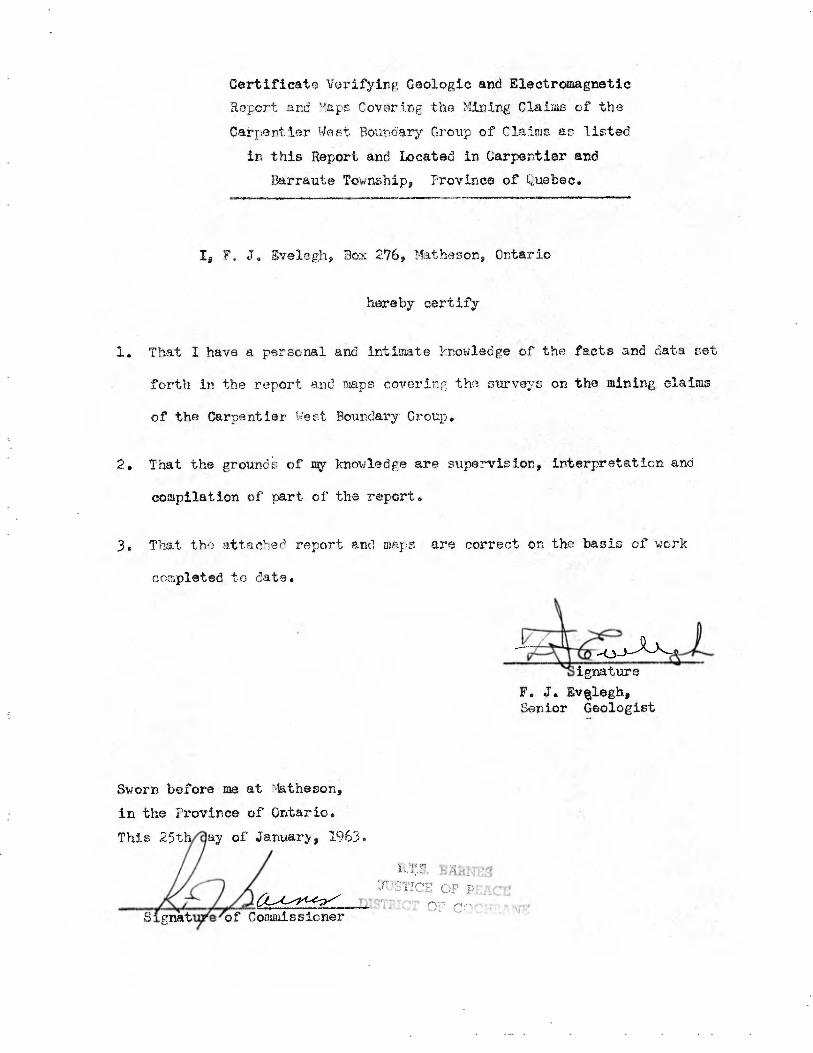
• S`a?Cr'., _ ~ ~ ,
f.:::' .
Certificate Verifying Geologic and Electromagnetic
Report and ''a.ps Covering the Mining Claims of the
Carpentier t4est Boundary Croup of Claims as listed
in this Report and Located in Carpentier and
13arraute Township, Province of Quebec.
I, F. J. 3velegh, 3ox 276, Math+eson, Ontario
hereby certify
1. That I have a personal and intimate knowledge of the facts and data set
forth in the report and maps covcrin ! the surveys on the mining claims
of the Carpentier 1;est Boundary. Group.
2. That the ground's of my knowledge are supervision, interpretation and
compilation of part of the report.
3. That the •atta< ied report and maps are correct on the basis of work
completed to date.
F. J. Evtlegh., Senior Geologist
Sworn before me at Matheson,
in the Province of Ontario.
This 25th .ay of January, 1963.
S gnat e of Commissioner
s
S I
S2
S3
S4
S5
S6
IG
10
IA;,
IE
1 2 R 1
3E
Iron Forr„ation.
Granite .
Granoâiorite
Aphte.
Pe9nriati te.
Ma9netie Bose Control stmt; a.
Geolo9ieal Contact .
f G- •Geo/ ^9 rc .
FQ..It Zone . M-r/a~ prit• T- Tpc9 raPh:c-
~—.
~ a Z
Scale 40 units ./inch.
East s po.rit,ve.
West it ne4utive.
N.P.C.S.- Not p r-r er Coil 4-pacing .
.L -L 1
o
00
TOPO. SYM$OL$ outcrop.
Higher G roan a.
Scarp .
Muskeg or Swamp.
Creek.
Drill Hole.
Busl, Road.
Trench,
Rail recd -
Power Line .
Buildin1S.
Main Road.
/Geo/o5ica l Syrr► boIs.
Strike and dip.
Strike and top.
Strike, dip and top.
Sc histosity.
CANADIAN JOHNS-MANVILLE CO. LTD, MATHESON MUNRO MINE ONTARIO
LEGEND SHEET ~ PROVINCE OF QUE.
scats . ;;A /b1 aLyt_ /î f62
nhk4,'r;~J: K. L. PRQ1/ TRAM ~ 4. ef . APoR vrD F. û: E .~ e s ~
u E.
A
OA•
4e
• • 76• 7A- 7L- o.
rOF ..(. .
M...,....
I
.,
°w
,-,
'Rp~ ,
"â:o,
L.1,....,. ~ T ..r n~.,,~„
~ r~„ti
gpyprtlie I
c.R
~.
.ti
e^ •
M rww
•~`
Vdda L. c.:,.
a
4
Y L. 7.iv
Ld . r,:~
d RSRRVor
oourv
R . ► SL
-F i_
lia .
11
~,..
....: • L,•R(slR
) CA6yM ..
t l
...r . •
lQ U E L O....:., ,t
P
°
vo1R5: ..d ...
T 1..
-11,4T+ssM"
CA L.
B 1.\'''. Ô (t V
/ P'
Bar a., ~
}} Kew* p,
r
- ,
Alit
Ak~~t Lo Tuy,.r
`. i ~ Q
~N.rwyJc.
~ /..
(.1R r:
»!! I
DO- ~~ 6
Diorite,
Lan,prophyre.
Dia base .
Peridotite.
Pyroxenite
Gabbro.
Tni.lc - Ça.rbonate Rock.
=NM
~ _
= Q
CEO /WAG SYMBOLS_ .:=,. at 4.1.1 °
44.4... Z. ~ ca to 2 ~ s...~.
CT) tr- Contour- Mier-Val : 500 9a r, ,r.raS, ~
7•1 >, !v CC ~
^+
~ g a CD iv ~ ~ i; • U-4p
47
v~ :a
ca'U
,ry, >•c~ Od
ELECTRO-MAG, SYMBIN_,Z la ,.--.4
GEOL. .• L EGEND - Acidic to Intermediate Volcanics.
R hyoNte.
Dacite
Intermediate to Basic Volcaics.
A ndesite .
Basa It.
Tuff.
Agglomerate.
Undiff'erentiatecl Sedimentaries.
Con9 lorr,ero.te.
Arkose .
G ro.y wac ke.
S late.
Quartzite,
LOCATION SKE
% '♦
In phase curve.
Out phase Curve.
Conducting Zone M. Medial,.,.
W. weak .
V2
V4