Embed Size (px)
Citation preview

REPORTS OF INTERNATIONALARBITRAL AWARDS
RECUEIL DES SENTENCESARBITRALES
The Chamizal Case (Mexico, United States)
15 June 1911
XI pp. 309-347VOLUME
NATIONS UNIES - UNITED NATIONSCopyright (c) 2006

THE CHAMIZAL CASE
PARTIES: Mexico, United States of America.
COMPROMIS: Convention of 24 June 1910.
ARBITRATORS: International Boundary Commission: E. Lafleur;A. Mills ; F. Beltram y Puga.
AWARD: 15 June 1911.
Title to the Chamizal Tract — Boundary rivers — Effects of natural change inthe course of such rivers — Treaty interpretation — Retroactive effects of treatyprovisions — Prescription.
1 For the questions at issue, the background of this case, and for the contentionsof the Parties, see the introductory part of the award.

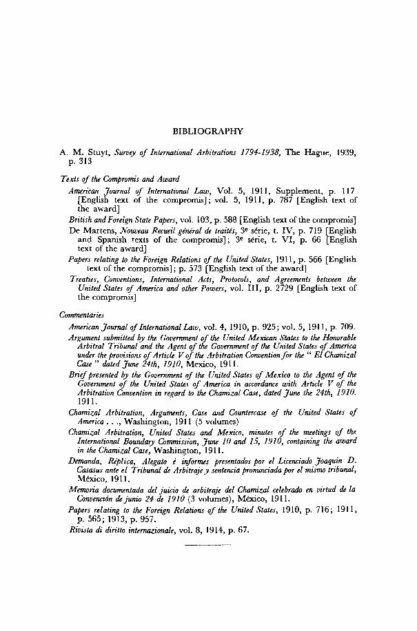
BIBLIOGRAPHY
A. M. Stuyt, Survey of International Arbitrations 1794-1938, The Hague, 1939,p. 313
Texts of the Compromis and Award
American Journal of International Law, Vol. 5, 1911, Supplement, p. 117[English text of the compromis]; vol. 5, 1911, p. 787 [English text ofthe award]
British and Foreign State Papers, vol. 103, p . 588 [English text of the compromis]De Martens, Nouveau Recueil général de traités, 3 e série, t. IV, p. 719 [English
and Spanish texts of the compromis] ; 3 e série, t. VI , p. 66 [Englishtext of the award]
Papers relating to the Foreign Relations of the United States, 1911, p. 566 [Englishtext of the compromis] ; p. 573 [English text of the award]
Treaties, Conventions, International Acts, Protocols, and Agreements between theUnited States of America and other Powers, vol. I l l , p. 2729 [English text ofthe compromis]
Commentaries
American Journal of International Law, vol. 4, 1910, p . 925; vol. 5, 1911, p. 709.Argument submitted by the Government of the United Mexican States to the Honorable
Arbitral Tribunal and the Agent of the Government of the United States of Americaunder the provisions of Article V of the Arbitration Convention for the " El ChamizalCase " dated June 24th, 1910, Mexico, 1911.
Brief presented by the Government of the United States of Mexico to the Agent of theGovernment of the United States of America in accordance with Article V of theArbitration Convention in regard to the Chamizal Case, dated June the 24th, 1910.1911.
Chamizal Arbitration, Arguments, Case and Countercase of the United States ofAmerica . . ., Washington, 1911 (5 volumes)
Chamizal Arbitration, United States and Mexico, minutes of the meetings of theInternational Boundary Commission, June 10 and 15, 1910, containing the awardin the Chamizal Case, Washington, 1911.
Demanda, Réplica, Alegato é informes presentados por el Licenciado Joaquin D.Casasus ante el Tribunal de Arbitrajey sentencia pronurwiada por el mismo tribunal,Mexico, 1911.
Memoria documentada del juicio de arbitraje del Chamizal celebrado en virtud de laConvention dejunio 24 de 1910 (3 volumes), Mexico, 1911.
Papers relating to the Foreign Relations of the United States, 1910, p. 716; 1911,p. 565; 1913, p. 957.
Rivista di diritto intemazionale, vol. 8, 1914, p. 67.

CONVENTION FOR THE ARBITRATION OF THE CHAMIZALCASE CONCLUDED ON 24 JUNE 1910 1
The United States of America and the United States of Mexico, desiring toterminate, in accordance with the various treaties and conventions now existingbetween the two countries, and in accordance with the principles of inter-national law, the differences which have arisen between the two Governmentsas to the international title to the Chamizal tract, upon which the membersof the International Boundary Commission have failed to agree, and havingdetermined to refer these differences to the said commission, established by theconvention of 1889, which for this case only shall be enlarged as hereinafterprovided, have resolved to conclude a convention for that purpose, and haveappointed as their respective plenipotentiaries:
The President of the United States of America, Philander C. Knox, Secretaryof State of the United States of America ; and
The President of the United States of Mexico, Don Francisco Leôn de laBarra, ambassador extraordinary and plenipotentiary of the United States ofMexico at Washington;
Who, after having exhibited their respective full powers, and having foundthe same to be in good and due form, have agreed upon the following articles :
Article I. The Chamizal tract in dispute is located at El Paso, Texas, andCiudad Juarez, Chihuahua, and is bounded westerly and southerly by themiddle of the present channel of the Rio Grande, otherwise called RioBravo del Norte, easterly by the middle of the abandoned channel of 1901, andnortherly by the middle of the channel of the river as surveyed by Emory andSalazar in 1852, and is substantially as shown on a map on a scale of 1-5,000signed by General Anson Mills, commissioner on the part of the United States,and Senor Don F. Javier Osorno, commissioner on the part of Mexico, whichaccompanies the report of the International Boundary Commission, in CaseNo. 13, entitled " Alleged Obstruction in the Mexican End of the El PasoStreet Railway Bridge and Backwaters Caused by the Great Bend in the RiverBelow ", and on file in the archives of the two Governments.
Article II. The difference as to the international title of the Chamizal tractshall be again referred to the International Boundary Commission, which shallbe enlarged by the addition, for the purposes of the consideration and decisionof the aforesaid difference only, of a third commissioner, who shall presideover the deliberations of the commission. This commissioner shall be aCanadian jurist and shall be selected by the two Governments by commonaccord, or, failing such agreement, by the Government of Canada, which shallbe requested to designate him. No decision of the Commission shall be per-fectly valid unless the commission shall have been fully constituted by the threemembers who compose it.
Article III. The commission shall decide solely and exclusively as to whetherthe international title to the Chamizal tract is in the United States of America
1 Papers relating to Foreign Relations of the United States. 1911, p . 566.
314 MEXICO/UNITED STATES
or Mexico. The decision of the commission, whether rendered unanimouslyor by majority vote of the commissioners, shall be final and conclusive uponboth Governments, and without appeal. The decision shall be in writing andshall state the reasons upon which it is based. It shall be rendered withinthirty days after the close of the hearings.
Article IV. Each Government shall be entitled to be represented before thecommission by an agent and such counsel as it may deem necessary to designate ;the agent and counsel shall be entitled to make oral argument and to examineand cross-examine witnesses and, provided that the commission so decides, tointroduce further documentary evidence.
Article V.1 On or before December 1, 1910, each Government shall presentto the agent of the other party two or more printed copies of its case, togetherwith the documentary evidence upon which it relies. It shall be sufficient forthis purpose if each Government delivers the copies and documents aforesaidat the Mexican Embassy at Washington or at the American Embassy at theCity of Mexico, as the case may be, for transmission. As soon thereafter aspossible, and within ten days, each party shall deliver two printed copies ofits case and accompanying documentary evidence to each member of the com-mission. Delivery to the American and Mexican commissioners may be madeat their offices in El Paso, Texas; the copies intended for the Canadian com-missioner may be delivered at the British Embassy at Washington or at theBritish legation at the City of Mexico.
On or before February 1, 1911, each Government may present to the agentof the other a countercase, with documentary evidence, in answer to the caseand documentary evidence of the other party. The countercase shall bedelivered in the manner provided in the foregoing paragraph.
The commission shall hold its first session in the city of El Paso, State ofTexas, where the offices of the International Boundary Commission are situated,on March 1, 1911, and shall proceed to the trial of the case with all convenientspeed, sitting either at El Paso, Texas, or Ciudad Juarez, Chihuahua, asconvenience may require. The commission shall act in accordance with theprocedure established in the Boundary Convention of 1889. It shall, however,be empowered to adopt such rules and regulations as it may deem convenientin the course of the case.
At the first meeting of the three commissioners each party shall deliver toeach of the commissioners and to the agent of the other party, in duplicate,with such additional copies as may be required, a printed argument showingthe points relied upon in the case and countercase, and referring to the documen-tary evidence upon which it is based. Each party shall have the right to filesuch supplemental printed brief as it may deem requisite. Such briefs shallbe filed within ten days after the close of the hearings, unless further time begranted by the commission.
Article VI. Each Government shall pay the expenses of the presentation andconduct of its case before the commission; all other expenses which by theirnature are a charge on both Governments, including the honorarium for the
1 In accordance with a Supplementary Protocol, signed at Washington on5 December 1910, the date for the presentation of the respective cases and documen-tary evidence was fixed for 15 February 1911; the date for the presentation of therespective countercases and documentary evidence was fixed for 15 April 1911;the date for the first session of the Commission was fixed for 15 May 1911. (For thisProtocol see: Papers relating to Foreign Relations of the United States, 1911, p. 569.)
CHAMIZAL CASE 3 1 5
Canadian commissioner, shall be borne by the two Governments in equalmoieties.
Article VII. In case of the temporary or permanent unavoidable absence ofany one of the commissioners, his place will be filled by the Government con-cerned, except in the case of the Canadian jurist. The latter under any likecircumstances shall be replaced in accordance with the provisions of thisconvention.
Article VIII. If the arbitral award provided for by this convention shall befavorable to Mexico, it shall be executed within the term of two years, whichcannot be extended, and which shall be counted from the date on which theaward is rendered. During that time the status quo shall be maintained in theChamizal tract on the terms agreed upon by both Governments.
Article IX. By this convention the contracting parties declare to be null andvoid all previous propositions that have reciprocally been made for the diplo-matic settlement of the Chamizal case; but each party shall be entitled to putin evidence by way of information such of this official correspondence as itdeems advisable.
Article X. The present convention shall be ratified in accordance with theconstitutional forms of the contracting parties and shall take effect from thedate of the exchange of its ratifications.
The ratifications shall be exchanged at Washington as soon as possible.
IN WITNESS WHEREOF, the respective plenipotentiaries have signed the abovearticles, both in the English and Spanish languages, and have hereunto affixedtheir seals.
DONE in duplicate at the city of Washington, this 24th day of June, onethousand nine hundred and ten.
Philander C. KNOX [SEAL]
F. L. DE LA BARRA [SEAL]

AWARD BY THE INTERNATIONAL BOUNDARY COMMISSIONIN THE MATTER OF THE INTERNATIONAL TITLE TO THE
CHAMIZAL TRACT, RENDERED ON 15 JUNE 1911 »
Titre sur le territoire dit « Chamizal » — Fleuves frontières— Effets des modi-fications naturelles du lit de tels fleuves—Interprétation des traités—Effetsrétroactifs des traités— Prescription.
PREAMBLE
WHEREAS a convention between the United States of America and theUnited States of Mexico for the arbitration of the differences which havearisen between the two Governments as to the international title to the Chamizaltract was concluded and signed by their respective plenipotentiaries at Washing-ton on the twenty-fourth day of June, 1910, which is as follows: z
AND WHEREAS the said convention was duly ratified on both parts and theratifications of the two Governments were exchanged at the city of Washingtonon the twenty-fourth day of January, 1911.
AND WHEREAS on the fifth day of December, 1910, the plenipotentiaries whonegotiated and signed the said convention of June 24, 1910, being thereuntoduly empowered by their respective Governments, agreed upon a supplemen-tary protocol, which is as follows: 3
AND WHEREAS the parties to the said convention of 24th of June, 1910, haveby common accord, in conformity with Article II thereof, enlarged the saidInternational Boundary Commission by the addition for the purposes of theconsideration and decision of the aforesaid difference of a third commis-sioner, viz :
Eugene Lafleur, one of His Britannic Majesty's counsel, doctor of civil lawand former professor of international law at McGill University, who, togetherwith
Anson Mills, brigadier-general of the United States Army (retired), memberof the American Geographical Society, American Commissioner of the Inter-national Boundary Commission, and
Fernando Beltrân y Puga, civil engineer, Mexican commissioner of theInternational Boundary Commission, member of the Geographical Society ofMexico and of the American Geographical Society, member of the Society ofCivil Engineers and Architects of Mexico,
Have been constituted as a commission for the decision as to whether theinternational title to the Chamizal tract is in the United States of America orin the United States of Mexico.
1 Papers relating to Foreign Relations of the United Slates, 1911, p. 573.2 See supra., p. 313.
See supra, p. 314, footnote 1.
CHAMIZAL CASE 3 1 7
AND WHEREAS the agents of the parties to the said convention have duly, andin accordance with the terms of the convention, communicated to this com-mission their cases, countercases, printed arguments, and other documents.
AND WHEREAS the agents and counsel for the parties have fully presented tothis commission their oral arguments during the sittings held at die city of ElPaso between the first assembling of die commission on die 15th May, 1911,to the close of die hearing on die 2d June, 1911.
Now, dierefore, diis commission, having carefully considered die said con-vention, cases, countercases, printed and oral arguments, and die documentspresented by either side, after due deliberation, makes die following decisionand award:
The Chamizal tract consists of about six hundred acres, and lies between dieold bed of die Rio Grande, as it was surveyed in 1852, and the present bed ofdie river, as more particularly described in article 1 of the convention of 1910.It is the result of changes which have taken place through the action of thewater upon the banks of the river causing the river to move southward intoMexican territory.
With the progressive movement of the river to the south, the American cityof El Paso has been extending on the accretions formed by the action of theriver on its nordi bank, while die Mexican city of Juarez to the south hassuffered a corresponding loss of territory.
By the treaties of 1848 and 1853 the Rio Grande, from a point a little higherthan the present city of El Paso, to its moudi in the Gulf of Mexico, was con-stituted the boundary line between the United States and Mexico.
The contention on behalf of the United States of Mexico is that diis dividingline was fixed under diose treaties in a permanent and invariable manner, andconsequently that the changes which have taken place in the river have notaffected die boundary line, which was established and marked in 1852.
On behalf of the United States of America it is contended diat according tothe true intent and meaning of die treaties of 1848 and 1853, if die channel ofthe river changes by gradual accretion, the boundary follows the channel, anddiat it is only in case of a sudden change of bed that the river ceases to be theboundary, which then remains in the abandoned bed of the river.
It is furdier contended on behalf of die United States of America that by theterms of a subsequent boundary convention in 1884 rules of interpretation wereadopted which became applicable to all changes in the Rio Grande which haveoccurred since die river became the international boundary, and diat thechanges which determined die formation of the Chamizal tract are changesresulting from slow and gradual erosion and deposit of alluvion within themeaning of diat convention and consequently changes which left die channelof die river as die international boundary line.
The Mexican- Government, on die odier hand, contends diat the Chamizaltract having been formed before die coming in force of die convention of 1884,that convention was not retroactive and could not affect die tide to die tract,and furdier contends diat, even assuming die case to be governed by die con-vention of 1884, die changes in the channel have not been die result of slow andgradual erosion and deposit of alluvion.
Finally die United States of America have set up a claim to the Chamizaltract by prescription, alleged to result from the undisturbed, uninterrupted, andunchallenged possession of die territory since the treaty of 1848.
In 1889 die Governments of die United States and of Mexico, by a conven-tion, created the International Boundary Commission for the purpose of carryingout the principles contained in die convention of 1884 and to avoid diedifficul-
318 MEXICO/UNITED STATES
ties occasioned by the changes which take place in the bed of the Rio Grandewhere it serves as the boundary between the two Republics, and for otherpurposes enumerated in Article I of die convention of 1889.
At a session of the boundary commissioners held on the 28th September, 1894,the Mexican commissioner presented the papers in a case known as " ElChamizal No. 4 ". These included a complaint made by Pedro Ignacio Garcia,who alleged, in substance, that he had acquired certain property formerly lyingon the south side of the Rio Grande, known as El Chamizal, which, in conse-quence of the abrupt and sudden change of current of die Rio Grande, wasnow on the north side of die river and within the limits of El Paso, Texas. Thisclaim was examined by the International Boundary Commissioners, who heardwitnesses upon the facts, and who, after consideration, were unable to cometo any agreement, and so reported to their respective Governments.
As a result of this disagreement the convention of 24th June, 1910, was signed,and the decision of the question was submitted to the present commission.
FIXED LINE THEORY
Article V of the treaty of Guadalupe Hidalgo of 1848 provides for a boundarybetween the United States and Mexico in the following terms :
The boundary line between the two Republics shall commence in the Gulfof Mexico, three leagues from land, opposite die mouth of the Rio Grande,otherwise called Rio Bravo del Norte, or opposite the mouth of its deepestbranch, if it should have more than one branch emptying directly into the sea;from thence, up the middle of that river, following the deepest channel, whereit has more dian one, to the point where it strikes the southern boundary ofNew Mexico; thence, westwardly, along the whole southern boundary of NewMexico (which runs north of the town called Paso) to its western termination;thence northward, along the western line of New Mexico until it intersects thefirst branch of die river Gila (or if it should not intersect any branch of thatriver, then to the point on the said line nearest to such branch, and thence ina direct Une to the same) ; thence down the middle of the said branch and of thesaid river, until it empties into the Rio Colorado; thence, across the RioColorado, following the division line between Upper and Lower California,to the Pacific Ocean.
The southern and western limits of New Mexico, mentioned in this article,are diose laid down in the map entitled " Map of the United Mexican States, asorganized and defined by various acts of the Congress of said Republic, and constructedaccording to the best authorities. Revised edition. Published at New York in 1847 byJ. Disturnell " ; of which map a copy is added to this treaty, bearing the sig-natures and seals of the undersigned plenipotentiaries. And, in order topreclude all difficulty in tracing upon the ground the limit separating Upperfrom Lower California, it is agreed.that the said limit shall consist of a straightline, drawn from the middle of the Rio Gila, where it unites with die Colorado,to a point on die coast of the Pacific Ocean, distant one marine league due southof the southernmost point of die port of San Diego, according to the plan ofsaid port made in the year 1782 by Don Juan Pantoja, second sailing masterof the Spanish fleet, and published at Madrid in the year 1802 in the atlas tothe voyage of die schooners Sutil and Mexicana, of which plan a copy is hereuntoadded, signed and sealed by the respective plenipotentiaries.
In order to designate the boundary line with due precision upon authoritativemaps, and to establish upon the ground landmarks which shall show the limitsof bodi Republics, as described in the present article, the two Governmentsshall each appoint a commissioner and a surveyor, who, before die expiration

CHAM1ZAL CASE 3 19
of one year from the date of the exchange of ratifications of this treaty, shallmeet at the port of San Diego and proceed to run and mark the said boundaryin its whole course to the mouth of the Rio Bravo del Norte. They shall keepjournals and make out plans of their operations, and the result agreed upon bythem shall be deemed a part of this treaty, and shall have the same force as ifit were inserted therein. The two Governments will amicably agree regardingwhat may be necessary to these persons, and also as to their respective escorts,should such be necessary.
The boundary line established by this article shall be religiously respected byeach of the two Republics, and no change shall ever be made therein, exceptby the express and free consent of both nations, lawfully given by the GeneralGovernment of each, in conformity with its own constitution.
The fluvial portion of the boundary called for by the above treaty, in so faras the Rio Grande is concerned, extending from its mouth to the point whereit strikes the southern boundary of New Mexico, appears to have been fixedby the surveys of the International Boundary Commission in 1852.
In 1853, in consequence of a dispute as to the land boundary and the acquisi-tion of a portion of territory now forming part of New Mexico and Arizona,known as the " Gadsden Purchase ", the boundary treaty of 1853 was signed,the first article of which deals with the boundary as follows :
The Mexican Republic agrees to designate the following as her true limitswith the United States for the future : Retaining the same dividing line betweenthe two Californias as already defined and established, according to the fiftharticle of the treaty of Guadalupe Hidalgo, the limits between the two Republicsshall be as follows : Beginning in the Gulf of Mexico, three leagues from land,opposite the rrouth of the Rio Grande, as provided in the fifth article of thetreaty of Guadalupe Hidalgo; thence, as defined in the said article, up themiddle of that river to the point where the parallel of 31° 47' north latitudecrosses the same; thence due west 100 miles; thence south to the parallel of31° 20', north latitude; thence along the said parallel of 31° 20' to the 111thmeridian of longitude west of Greenwich ; thence in a straight line to a pointon the Colorado River 20 English miles below the junction of the Gila andColorado Rivers; thence up the middle of the said river Colorado until itintersects the present line between the United States and Mexico.
For the performance of this portion of the treaty, each of the two Govern-ments shall nominate one commissioner, to the end that, by common consent,the two thus nominated, having met in the city of Paso del Norte, three monthsafter the exchange of the ratifications of this treaty, may proceed to surveyand mark out upon the land the dividing line stipulated by this article, whereit shall not have already been surveyed and established by the mixed commis-sion, according to the treaty of Guadalupe, keeping a journal and makingproper plans of their operations. For this purpose, if they should judge itnecessary, the contracting parties shall be at liberty each to unite to its respec-tive commissioner, scientific or other assistants, such as astronomers and sur-veyors, whose concurrence shall not be considered necessary for the settlementand ratification of a true line of division between the two republics ; that lineshall be alone established upon which the commissioners may fix, their consentin this particular being considered decisive and an integral part of this treaty,without necessity of ulterior ratification or approval, and without room forinterpretation of any kind by either of the parties contracting.
The dividing line thus established shall, in all time, be faithfully respectedby the two Governments, without any variation therein, unless of the express

320 MEXICO/UNITED STATES
and free consent of the two, given in conformity to the principles of the law ofnations, and in accordance with the constitution of each country, respectively.
In consequence, the stipulation in the fifth article of the treaty of Guadalupeupon the boundary line therein described is no longer of any force, wherein itmay conflict with that here established, the said line being considered annulledand abolished wherever it may not coincide with the present, and in the samemanner remaining in full force where in accordance with the same.
The treaty of Guadalupe Hidalgo, signed on the 2d February, 1848, providesthat the boundary line between the two Republics from the Gulf of Mexicoshall be the middle of the Rio Grande, following the deepest channel, where ithas more than one, to the point where it strikes the southern boundary of NewMexico. It is conceded on both sides that if this provision stood alone it wouldundoubtedly constitute a natural, or arcifinious, boundary between the twonations and that according to well-known principles of international law thisfluvial boundary would continue, notwithstanding modification of the courseof the river caused by gradual accretion on the one bank or degradation on theother bank; whereas if the river deserted its original bed and forced for itself anew channel in another direction the boundary would remain in the middleof the deserted river bed. It is contended, however, on behalf of Mexico, thatthe provisions in the treaty providing for a designation of the boundary linewith due precision, upon authoritative maps, and for establishing upon thegrounds landmarks showing the limits of both Republics, and the direction tocommissioners and surveyors to run and mark the boundary in its full courseto the mouth of the Rio Grande, coupled with the final stipulation that theboundary line thus established should be religiously respected by the two Re-publics, and no change should ever be made therein, except by the express andfree consent of both nations, takes this case out of the ordinary rules of inter-national law, and by a conventional agreement converts a natural, or arcifinious,boundary into an artificial and invariable one. In support of this contentioncopious references have been made to the civil law distinguishing between landswhose limits were established by fixed measurements (agri limitati) and arci-finious lands, which were not so limited {agri arcifinii). These two classes oflands were sometimes contrasted by saying that arcifinious lands were thosewhich had natural boundaries, such as mountains and rivers, while limitedestates were diose which had fixed measurements. As a consequence of thisdistinction the Roman law denied the existence of the right of alluvion in favorof the limited estates which it was the custom to distribute among die Romangenerals, and subsequently to the legionaries, out of conquered territory. Thisrestriction of the ordinary rights appurtenant to riparian ownership is, however,considered by the best authorities to have been an exceptional provisionapplicable only to the case above mentioned, and one of the principal authoritiesrelied on by the Mexican counsel ('A. Plocquo, Legislation des eaux et de la navi-gation, vol. 2, p. 66) clearly establishes that the mere fact that a riparian pro-prietor holds under a title which gives him a specified number of acres of landdoes not prevent him from profiting by alluvion. The difficulty in this casedoes not arise from the fact that the territories in question are established byany measurement, but because the boundary is ordered to be run and markedalong the fluvial portion as well as on the land, and on account of the furtherstipulation that no change shall ever be made therein. Do these provisionsand expression, in so far as they refer to the fluvial portion of the boundary,convert it into an artificial boundary which will persist notwithstanding allchanges in the course of the river? In one sense it may be said that the adoptionof a fixed and invariable Une, so far as the river is concerned, would not be a

CHAMIZAL CASE 321
perpetual retaining of the river boundary provided for by the treaty, and wouldbe at variance with the agreement of the parties that the boundary shouldforever run in the middle of the river. The direction as to marking the courseof the river as it existed at the time of the treaty of 1848 is not inconsistent witha fluvial line varying only in accordance with the general rules of internationallaw, by erosion on one bank and alluvial deposits on the other bank, for thismarking of the boundary may serve the purpose of preserving a record of theold river bed to serve as a boundary in cases in which it cuts a new channel.
Numerous treaties containing provisions as to river boundaries have beenreferred to by the two parties, showing that in some cases conventional arrange-ments are made that the river simpliciter shall be the boundary, or that theboundary shall run along the middle of the river, or along the thalweg or centeror thread of the channel, while a small number of treaties contain elaboratedispositions for a fixed line boundary, notwithstanding the alterations whichmay take place in the river, with provision, however, for periodical readjust-ments in certain specified cases. The difficulty with these instances is that nocases appear to have arisen upon the treaties in question and their provisionsthrow little, if any, light upon the present controversy. In one case only amongthose cited there appears to have been a decision by the Court of Cassation inFrance (Dalloz, 1858, Part 1, p. 401) holding that when a river separates twodepartments or two districts, the boundary is fixed in an irrevocable -manneralong the middle of the bed of the river as it existed at the time of the establish-ment of the boundary and that it is not subject ot any subsequent variation,notwithstanding the changes in the river. Whatever authority this decisionmay have in the delimitation of departmental boundaries in France, it does notseem to be in accordance with recognized principles of international law, if, asappears from the report, it holds that the mere designation of a river as aboundary establishes a fixed and invariable line.
The above observations as to the treaty of 1848 would seem to apply to theGadsden treaty of 1853, taken by itself, for it provides, in similar language, thatthe boundary shall follow the middle of the Rio Grande, that the boundaryline shall be established and marked, and that the dividing line shall in alltime be faithfully respected by the two Governments without any variationtherein.
While, however, the treaty of 1848 standing alone, or the treaty of 1853,standing alone, might seem to be more consistent with the idea of a fixedboundary than one which would vary by reason of alluvial processes, thelanguage of the treaty of 1853, taken in conjunction with the existing circum-stances, renders it difficult to accept the idea of a fixed and invariable boundary.During the five years which elapsed between the two treaties, notable variationsof the course of the Rio Grande took place, to such an extent that surveys madein the early part of 1853, at intervals of six months, revealed discrepancies whichare accounted for only by reason of the changes which the river had undergonein the meantime. Notwithstanding the existence of such changes the treaty of1853 reiterates the provision that the boundary line runs up the middle of theriver, which could not have been an accurate statement upon the fixed linetheory.
Some stress had been laid upon the observations contained in the records ofthe boundary commissioners that the line they were fixing would be thence-forth invariable, but apart from the inconclusive character of this conversation,it seems clear that in making any remarks of this nature, the boundary com-missioners were exceeding their mandate, and that their views as to the properconstruction of the treaties under which they were working could not in anyway bind their respective Governments.
322 MEXICO/UNITED STATES
In November, 1856, the draft for the proposed report of the boundary com-missioners for determining the boundary between Mexico and the UnitedStates under the treaty of 1853 was submitted by the Secretary of the Interiorof the United States to the Hon. Caleb Cushing for his opinion as to whetherthe boundary line under that treaty shifted with changes taking place in the bedof the river, or whether the line remained constant where the main course ofthe river ran as represented by the maps accompanying the report of the com-missioners. The opinion of Mr. Cushing is a valuable contribution to thesubject by an authority on international law. After consideration of the pro-visions of the treaty, and an examination of a great number of authorities uponthe subject, Mr. Cushing reported that the Rio Grande retained its function ofan international boundary, notwithstanding changes brought about by accretionto one bank and the degradation of the other bank, but that, on the other hand,if the river deserted its original bed and forced for itself a new channel inanother direction, then the nation through whose territory the river thus brokeits way did not lose the land so separated; the international boundary in thatcase remaining in the middle of the deserted river bed.
This opinion was transmitted to the Mexican legation at Washington andacknowledged by Senor Romero, then Mexican ambassador at Washington,who, without in any way committing his Government, stated his own personalacquiescence in the principles enunciated as being equitable and founded uponthe teachings of the most accredited expositors of international law. He furtherstated that he was transmitting a copy of the opinion to his Government. Theredoes not appear to have been any expression of opinion by the Mexican Govern-ment at that time as to the soundness of the views expressed by the Hon.Mr. Cushing.
From the last-mentioned date until the signing of the convention of 1884 aconsiderable amount of diplomatic correspondence took place as to the meaningand effect of the boundary treaties of 1848 and 1853. Without going into allthe details of this correspondence, which has been fully discussed in the printedand oral arguments of the parties, it is sufficient to say that during that period,with the exception of certain statements contained in a letter of Mr. Freling-huysen, which will be adverted to later, the Government of the United Statesconsistently adhered to the principles enunciated by Attorney-General Cushing.On the Mexican side the correspondence reveals more fluctuations of opinion ;the writers sometimes indicating their view that the boundary created by thetreaties in question was a fixed line, but more frequently qualifying such state-ments by making an exception in the case of slow and successive increasesresulting from alluvial deposits.
While considerable importance appeared to be attached by the parties tovarious expressions contained in this correspondence, the commissioners, at anearly stage in the argument, expressed their view that neither of the highcontracting parties should be bound by the unguarded language contained inmany of the letters. The only real importance to be attached to this corre-spondence is that it shows conclusively that a considerable doubt existed as tothe meaning and effect of the boundary treaties of 1848 and 1853.
However strongly one might be disposed to think that the treaty of 1848,taken by itself, or the treaty of 1853, taken by itself, indicated an intention toestablish a fixed line boundary, it would be difficult to say that the question isfree from doubt, in view of the opinion expressed by so high an authority asthe Hon. Mr. Cushing upon the very point at issue, and in view of the occasionalconcurrence in this opinion by some of the higher Mexican officials at the timeit was given.
CHAMIZAL CASE 323
It is in consequence of this legitimate doubt as to the true construction of theboundary treaties of 1848 and 1853 that the subsequent course of conduct of theparties and their formal conventions may be resorted to as aids to construction.In the opinion of the majority of this commission the language of the subsequentconventions and the consistent course of conduct of the high contracting partiesis wholly incompatible with the existence of a fixed line boundary.
In 1884 the following boundary convention was concluded between the twoRepublics :
BOUNDARY CONVENTION, RIO GRANDE AND RIO COLORADO
Convention between the United States of America and the United States of Mexico touchingthe boundary line between the two countries where it follows the bed of the Rio Grandeand the Rio Colorado
Whereas, in virtue of the 5th article of the treaty of Guadalupe Hidalgo betweenthe United States of America and the United States of Mexico, concluded February2, 1848, and of the first article of that of December 30, 1853, certain parts of thedividing line between the two countries follow the middle of the channel of theRio Grande and the Rio Colorado, to avoid difficulties which may arise throughthe changes of channel to which those rivers are subject through the operation ofnatural forces, the Government of the United States of America and the Govern-ment of the United States of Mexico have resolved to conclude a convention whichshall lay down rules for the determination of such questions, and have appointed astheir plenipotentiaries:
The President of the United States of America, Frederick T. Frelinghuysen,Secretary of State of the United States; and the President of the United States ofMexico, Matias Romero, envoy extraordinary and minister plenipotentiary of theUnited Mexican States;
Who, after exhibiting their respective full powers, found in good and due form,have agreed upon the following articles:
ARTICLE I
The dividing line shall forever be that described in the aforesaid treaty and followthe center of the normal channel of the rivers named, notwithstanding any alterationsin the banks or in the course of those rivers, provided that such alterations be effectedby natural causes through the slow and gradual erosion and deposit of alluvium andnot by the abandonment of an existing river bed and the opening of a new one.
ARTICLE II
Any other change wrought by the force of the current, whether by the cuttingof a new bed or when there is more than one channel by the deepening of anotherchannel than that which marked the boundary at the time of the survey madeunder the aforesaid treaty, shall produce no change in the dividing line as fixed bythe surveys of the International Boundary Commissions in 1852; but the line thenfixed shall continue to follow the middle of the original channel bed, even thoughthis should become wholly dry or be obstructed by deposits.
ARTICLE III
No artificial change in the navigable course of the river, by building jetties, piers,or obstructions which may tend to deflect the current or produce deposits of alluvium,or by dredging to deepen another than the original channel under the treaty whenthere is more than one channel, or by cutting waterways to shorten the navigabledistance, shall be permitted to affect or alter the dividing line as determined by the
324 MEXICO/UNITED STATES
aforesaid commissions in 1852 or as determined by Article I hereof and under thereservation therein contained ; but the protection of the banks on either side fromerosion by revetments of stone or other material not unduly projecting into thecurrent of the river shall not be deemed an artificial change.
ARTICLE IV
If any international bridge have been or shall be built across either of the riversnamed, the point on such bridge exactly over the middle of the main channel asherein determined shall be marked by a suitable monument, which shall denotethe dividing line for all the purposes of such bridge, notwithstanding any change inthe channel which may thereafter supervene. But any rights other than in the bridgeitself and in the ground on which it is built shall in event of any such subsequentchange be determined in accordance with the general provisions of this convention.
ARTICLE V
Rights of property in respect of lands which may have become separated throughthe creation of new channels as defined in Article II hereof shall not be affectedthereby, but such lands shall continue to be under the jurisdiction of the countryto which they previously belonged.
In no case, however, shall this retained jurisdictional right affect or control theright of navigation common to the two countries under the stipulations of Article VIIof the aforesaid treaty of Guadalupe Hidalgo; and such common right shall continuewithout prejudice throughout the actually navigable main channels of the saidrivers, from the mouth of the Rio Grande to the point where the Rio Coloradoceases to be the international boundary, even though any part of the channel ofsaid rivers, through the changes herein provided against, may be comprised withinthe territory of one of the two nations.
ARTICLE VI
This convention shall be ratified by both parties in accordance with their respectiveconstitutional procedure, and the ratifications exchanged in the city of Washingtonas soon as possible.
In witness whereof the undersigned plenipotentiaries have hereunto set theirhands and seals.
Done at the city of Washington, in duplicate, in the English and Spanish languages,this 12th day ot November, A.D. 1884.
The preamble of this convention states that it refers to those parts of theboundary line between the two countries which follow the bed of the Rio Grandeand the Rio Colorado, and proceeds to explain that the portions of the dividing linebetween the two countries which follows the middle of the channel of the RioGrande and the Rio Colorado are those mentioned in the treaties of 1848 and1853. The convention thus seems to have been designed to apply to the wholeof the Rio Grande in so far as the treaties of 1848 and 1853 constitute this riveras the dividing line between the two countries. The first article provides thatthe dividing line shall forever be that described in the aforesaid treaty, andfollowing the center of the normal channel of the rivers named, etc. Thisappears to be a clear recognition of the fact that the line which is, accordingto the agreement of the parties, to be henceforth their boundary line, is alsothat which was created by the former treaties. It is, to that extent, a declaratoryarticle importing in the treaties of 1848 and 1853 the construction which theparties had determined to adopt, as the preamble states, in order " to avoiddifficulties which may arise through the changes of channel to which those
CHAMIZAL CASE 3 2 5
rivers are subject through the operation of natural forces ", and " to lay downrules for the determination of such questions ".
On behalf of Mexico it has been strenuously contended that this conventionwas intended to operate in the future only, and that it should not be given aretroactive effect so as to apply to any changes which had previously occurred.Reference was made to a number of well-known authorities establishing theproposition that laws and treaties are not usually deemed to be retrospective intheir effect. An equally well-known exception to this rule is that of laws ortreaties which are intended to be declaratory, and which evidence the intentionof putting an end to controversies by adopting a rule of construction applicableto laws or conventions which have been subject to dispute. The internalevidence contained in the convention of 1884 appears to be sufficient to show anintention to apply the rules laid down for the determination of difficulties whichmight arise through the changes in the Rio Grande, whether these changeshad occurred prior to or after the convention, and they appear to have beenintended to codify the rules for the interpretation of the previous treaties of1848 and 1853 which had formed the subject of diplomatic correspondencebetween the parties. While it is perfectly true that the convention was to beapplied to disputes which might arise in future, it nowhere restricts thesedifficulties to future changes in the river. It expressly declares that by thetreaties of 1848 and 1853, the dividing line had followed the middle of the river,and that henceforth the same rule was to apply.
At the time this convention was signed all the great changes in the courseof the Rio Grande had occurred, and practically the whole Chamizal tract hadbeen formed. It appears, in fact, that the river of 1852 and the river of 1884had no points in common, except points of intersection. It is quite true thatthe parties may not have been aware of the entire separation of the old riverbed from the new, from El Paso down to die Gulf of Mexico, but the factremains that all the great and visible changes which are reported to have takenplace during the floods extending ffrom 1864 to 1868 had done their work, and,in the case of the Chamizal tract, the changes had been so considerable in theupper portion of the river, which is proved to have been less liable to modifica-tions owing to the nature of its soil than the lower part of the river, that itformed the subject of much diplomatic correspondence.
Having regard to the existence of such notable changes in the river bed, it isobvious that the convention of 1884 would have been nugatory and inapplicableupon the hypothesis of ̂ fixed line boundary, for when once the river had movedaway from the fixed line into the territory of one or other of the two nations itwas idle and useless to provide for erosive or other changes which might sub-sequently occur in its bed, the river being ex hypothesi, wholly in die territory ofone or other of the nations on either side of the supposed fixed boundary.
If any doubt could be entertained as to die intention of the parties in makingdiis convention, it would disappear upon a consideration of the uniform andconsistent manner in which it was subsequently declared by the two Govern-ments to apply to past as well as to future changes in the river.
Copious references were made by the parties to die diplomatic correspondencewhich preceded this convention, but these communications, when closely ex-amined, are inconclusive and add little or nodiing to the language of the treaty.
Equally inconclusive are the declarations made after the signing of theconvention by high officers of States on both sides. For example, Senor Romero,on the 13th April, 1834, is reported to have said to the Mexican department offoreign affairs that the treaty did not decide cases previous to its date, becauseit could not have retroactive effect, but could only be applied to such cases as
326 MEXICO/UNITED STATES
might occur subsequently. On the other hand, the President of Mexico, inhis message of April, 1891, recommending the adoption of the conventionof 1889, which created the boundary commission to carry out the provisions ofthe convention of 1884, refers to the convention as being for the establishmentof an international commission to study and determine pending boundaryquestions, or those which may arise by reason of the variation of the course of theriver.
It would be useless to multiply citations from diplomatic correspondence,which is not always consistent, and which falls under the rule laid down byThe Hague Tribunal in the recent award in the North Atlantic Coast Fisheriesreference. Speaking of similar unguarded expressions contained in diplomaticcorrespondence the presiding commissioner expressed the following opinion,which seems applicable to a great many of the communications which have beenrelied upon by one or other of the parties in the present case:
The tribunal, unwilling to invest such expressions with an importance entitlingthem to affect the general question, considers that such conflicting or inconsistentexpressions as have been exposed on either side are sufficiently explained by theirrelations to ephemeral phases of a controversy of almost secular duration, and shouldbe held to be without direct effect on the principal and present issues.
The same considerations apply to the correspondence with reference to aclaim to Morteritors Island, on which considerable reliance was placed byMexican counsel as showing the abandonment of the United States of the viewseth forth in Attorney-General Cushing's opinion, and an acceptance of thefixed line theory. Without discussing the details of this case, it is sufficient tosay that the decision arrived at was in no way based upon the fixed boundarytheory, but was a conclusion which was inevitable from the application of thetreaties of 1848 to 1853. It is contended, however, that certain expressionsused by Mr. Secretary Frelinghuysen in his correspondence with the MexicanGovernment, when he was resisting the Mexican claim, are inconsistent withthe idea of a fluvial boundary, and can only be explained on the theory thatMr. Frelinghuysen believed in the existence of a fixed boundary. Viewed inconnection with the facts of the case, these expressions scarcely bear the inter-pretation which the Mexican counsel desire to put upon them, but even assumingthat in the course of his argument on behalf of his department, Mr. Freling-huysen committed himself to the theory that the United States could notrecognize the annexation of its territory by accretion, such casual and un-guarded language, which was certainly not relevant to the decision of the caseupon the facts actually proved, could not bind his Government any more thansimilar expressions used by Mexican high officials, above referred to, couldbind their Government.
Far more conclusive is the course of action entered upon and persistentlyfollowed by both nations upon the appointment of the boundary commissionof 1889.
In 1893 a dispute arose in a case known as the " Banco de Camargo ", whichinvolved a claim that the land had formed by gradual erosion and deposit ofalluvium since 1865. After a correspondence between Senor Mariscal and theUnited States minister, in which they refer to the convention of 1884, it wasdecided to bring the case, along with similar ones, before the attention of theboundary commission, when organized. Upon the organization of the commis-sion the case was duly submitted, and the commission found that the erosionin question dated back to the year 1865, and applied the provisions of theconvention of 1884 to its solution.
CHAMIZAL CASE 327
In 1893 a dispute arose as to the arrest of American citizens on land whichwas claimed by citizens of both nations, and which had formed on the edge ofthe river prior to 1884. The two Governments thereupon agreed to refer thematter to the International Boundary Commission, which was organized forwork on the 4th January, 1894.
In the case of the " Banco de Vela ", a claim based upon accretions whichbegan in 1853, the matter was also referred to the boundary commission.
In the case of the " Banco de Granjeno ", under circumstances which weresimilar, the accretions having begun in 1853, the controversy was referred toand dealt with by the same commission.
In the case of the " Banco de Santa Margarita ", an analogous conditionexisted, and a similar disposition of the case was made.
The bancos above referred to were formed by accretions to land on one sideof the river, with erosions on the other side, until the channel ran on a curve,and a time came when the force of the current made a new channel, leavinga banco between the new and old channel.
In dealing with the above cases the commissioners, in a joint report dated15th January, 1895, concluded that the application of the treaty of 1884 tothese bancos would be inconvenient and would create difficulties which hadnot been foreseen. They accordingly recommended the elimination of thebancos from the convention of 1884 and the signing of a special agreement withreference thereto.
As a result of this report, a convention was formally signed in 1905, whichclearly acknowledges the application of Article II of the Convention of 1884to fifty-eight bancos which had been surveyed and described in the report ofthe consulting engineers.
The convention further recites " That the application to these bancos of theprinciple established in Article II of the Convention of 1884 renders difficultthe solution of the controversies mentioned, and, instead of simplifying, com-plicates the said boundary line between the two countries ", and provides thatthese bancos, together with those which may in future be formed, shall beeliminated from the operation of the convention of 1884, and shall be dealt within a different manner.
This recognition of the retrospective application of the convention of 1884is not that of subordinates, but of the Governments themselves, which expresslyadopted the views of the commissioners as to the application of the treaty of1884 and as to the desirability of taking such cases, both past and future, outof the convention and substituting new provisions.
In 1895 the Chamizal claim was submitted to the commission in a letter ofMr. Mariscal, above referred to. While the claim is a private one, there is nodoubt that it was presented with the authority and concurrence of the MexicanGovernment and received its support throughout its various stages as involvinga controversy as to the international title to the Chamizal tract. The claimof Pedro Y. Garcia, on its face, showed that it was based on changes whichhad occurred in the river prior to 1884, and, notwithstanding this well-knownfact, the matter was referred to the International Boundary Commission tobe dealt with, and would have been disposed of but for a disagreement betweenthe two commissioners, one of whom considered that the changes had resultedfrom slow and gradual erosion, as required by the convention of 1884, whilethe other commissioner considered that the erosion had been violent and inter-mittent and not of such a character as, under the terms of the convention of1884, could change the international boundary.

328 MEXICO/UNITED STATES
While the Chamizal case was pending before the International BoundaryCommission, they became seized of the controversy concerning the island ofSan Elizario, which was presented to the commission by the Mexican com-missioner on the 4th November, 1895. The decision in this case, rendered onthe 5th October, 1896, was based upon changes which occurred in the years1857 and 1858. Like all other decisions of the boundary commission, it wascommunicated to the Mexican Government, which, under the terms of theConvention of 1889, could disapprove of the action of the commissioners withinone month from the day of its pronouncement. Far from being disallowed, thedecision was expressly approved by the Mexican Government, as appears fromthe letter addressed by Mr. Mariscal to the Mexican minister at Washingtonon 5th October, 1896.
Thus in all cases dealt with by the two Governments after the convention of1884 referring to river changes occurring prior to that date, the provisions ofthat convention were invariably and consistently applied.
On the whole, it appears to be impossible to come to any other conclusionthan that the two nations have, by their subsequent treaties and their consistentcourse of conduct in connection with all cases arising thereunder, put such anauthoritative interpretation upon the language of the treaties of 1848 and 1853as to preclude them from now contending that the fluvial portion of the bound-ary created by those treaties is a fixed line boundary.
The presiding commissioner and the American commissioner therefore holdthat the treaties of 1848 and 1853, as interpreted by subsequent conventionsbetween the parties and by their course of conduct, created an arcifiniousboundary, and that the convention of 1884 was intended to be and was maderetroactive by the high contracting parties.
(Mr. Commissioner Puga dissents from this holding for the reasons set forthin his subjoined opinion.)
PRESCRIPTION
In the countercase of the United States, the contention is advanced that theUnited States has acquired a good title by prescription to the tract in dispute,in addition to its title under treaty provisions.
In the argument it is contended that the Republic of Mexico is estopped fromasserting the national title over the territory known as " El Chamizal " byreason of the undisturbed, uninterrupted, and unchallenged possession of saidterritory by the United States of America since the treaty of Guadalupe Hidalgo.
Without thinking it necessary to discuss the very controversial question asto whether the right of prescription invoked by the United States is an acceptedprinciple of the law of nations, in the absence of any convention establishing aterm of prescription, the commissioners are unanimous in coming to the con-clusion that the possession of the United States in the present case was not ofsuch a character as to found a prescriptive title. Upon the evidence adducedit is impossible to hold that the possession of El Ghamizal by the United Stateswas undisturbed, uninterrupted, and unchallenged from the date of the treatyof the creation of a competent tribunal to decide the question, the Chamizalcase was first presented. On the contrary, it may be said that the physicalpossession taken by citizens of the United States and the political controlexercised by the local and Federal Governments, have been constantly chal-lenged and questioned by the Republic of Mexico, through its accrediteddiplomatic agents.
CHAMIZAL CASE 3 2 9
As early as 1856, the river changes threatening the Valley of El Paso hadcaused anxious inquiries, which resulted in a reference of the matter to theHon. Caleb Cushing for his opinion.
In January, 1867, Don Matias Romero forwarded to Mr. Seward, Secretaryof State, a communication from the perfecture of Brazos relating to the con-troversy between the people of El Paso del Norte (now Juarez) and the peopleof Franklin (now El Paso, Tex.) over the Chamizal tract, then in process offormation. From that time until the negotiation of the convention of 1884, aconsiderable amount of diplomatic correspondence is devoted to this veryquestion, and the convention of 1884 was an endeavor to fix the rights of thetwo nations with respect to the changes brought about by the action of thewaters of the Rio Grande.
The very existence of that convention precludes the United States fromacquiring by prescription against the terms of their title, and, as has beenpointed out above, the two Republics have ever since the signing of thatconvention treated it as a source of all their rights in respect of accretion to theterritory on one side or the other of the river.
Another characteristic of possession serving as a foundation for prescriptionis that it should be peaceable. In one of the affidavits filed by the UnitedStates to prove their possession and control over the Chamizal distict (that ofMr. Coldwell) we find the following significant statement :
In 1874 or 1875 I was present at an interview between my father and Mr. JesusNecobar y Armendariz, then Mexican collector of customs at Paso del Norte, nowCiudad Juarez, which meeting took place at my father's office on this side of the river.
Mr. Necobar asked my father for permission to station a Mexican customhouseofficer on the road leading from El Paso to Juarez, about 200 or 300 yards northof the river. My father replied in substance that he had no authority to grant anysuch permission, and even if he had, and granted permission, it would not be safefor a Mexican customs officer to attempt to exercise any authority on this side ofthe river.
It is quite clear from the circumstances related in this affidavit that howevermuch the Mexicans may have desired to take physical possession of the district,the result of any attempt to do so would have provoked scenes of violence andthe Republic of Mexico cannot be blamed for resorting to the milder forms ofprotest contained in its diplomatic correspondence.
In private law, the interruption of prescription is effected by a suit, but indealings between nations this is of course impossible, unless and until an inter-national tribunal is established for such purpose. In the present case, theMexican claim was asserted before the International Boundary Commissionwithin a reasonable time after it commenced to exercise its functions, and priorto that date the Mexican Government had done all that could be reasonablyrequired of it by way of protest against the alleged encroachment.
Under these circumstances the commissioners have no difficulty in comingto the conclusion that the plea of prescription should be dismissed.
APPLICATION OF THE CONVENTION OF 1884
Upon the application of the convention of 1884 to the facts of this case thecommissioners are unable to agree.
The presiding commissioner and the Mexican commissioner are of the opinionthat the evidence establishes that from 1852 to 1864 the changes in the river,which during that interval formed a portion of the Chamizal tract, were
330 MEXICO/UNITED STATES
caused by slow and gradual erosion and deposit of alluvium within the meaningof Article I of the convention of 1884.
They are further of opinion that all the changes which have taken place inthe Chamizal district from 1852 up to the present date have not resulted fromany change of bed of the river. It is sufficiently shown that the Mexican bankopposite the Chamizal tract was at all times high and that it was never over-flowed, and there is no evidence tending to show that the Rio Grande in thatvicinity ever abandoned its existing bed and opened a new one. The changes,such as they were, resulted from the degradation of the Mexican bank and thealluvial deposits formed on the American bank, and, as has been said, up to1864 this erosion and deposit appear to come within Article I of the conventionof 1884.
With respect to the nature of the changes which occurred in 1864 and duringthe four succeeding years, the presiding commissioner and the Mexican com-missioner are of opinion that the phenomena described by the witnesses ashaving occurred during that period cannot properly be described as alterationsin the river effected through the slow and gradual erosion and deposit ofalluvium.
The following extracts from the evidence are quoted by the presiding com-missioner and the Mexican commissioner in support of their views :
JESÛS SERNA: Q,. When the change took place was it slow or violent?—A. Thechange was violent, and destroyed the trees crops, and houses.
YNOCENTE OCHOA: Q_. When the change took place was it slow or violent?—A.As I said before, it was sometimes slow and sometimes violent, and with such forcethat the noise of the banks falling seemed like the boom of cannon, and it wasfrightful.
E. PROVINCIO: Q,. Explain how you know what you have stated.—A. Because theviolent changes of the river in 1864 caused considerable alarm to the city, and thepeople went to the banks of the river and pulled down trees and tried to check theadvance of the waters. I was there sometimes to help and sometimes simply toobserve. I helped to take out furniture from houses in danger and to remove beamsof houses, etc.
Q.. When the change took place was it slow or violent?—A. I cannot appreciatewhat is meant by slow or violent, but sometimes as much as fifty yards would bewashed away at certain points in a day.
• • • • * * +
Q.. Please describe the destruction of the bank on the Mexican side that youspoke of in your former testimony. Describe the size of the pieces of earth that yousaw fall into the river.—A. When the river made the alarming change it carriedaway pieces of earth one yard, two yards, etc., constantly, in intervals of a fewminutes. At the time of these changes the people would be standing on the bankswatching a piece going down, and somebody would call " look out, there is moregoing to fall " and they would have to jump back to keep from falling into die river.
• • • * * • *
Q,. Do you think that those works were constructed to protect against the slowand gradual work of the river or against the floods?—A. They were made to protectthe town from being carried away in the event of another flood like that of '64,because the curve that the river had made was dangerous to the town.
JOSÉ M. FLORES: Q,. Did the current come with such violence between 1864 and1868 that houses and fields were destroyed?—A. Yes, sir.
• * * • » * *
Q,. Please describe the manner of the tearing away of the Mexican bank by thecurrent when these changes were taking place.—A. The current carried the sand

CHAMIZAL CASE 331
from the bank and cut in under, and then these pieces would fall into the water.If the bank was very high it took larger pieces; say two yards, never more than threeyards wide, and where the banks were low it took smaller pieces.
DOCTOR MARIANO SAMANIECO describes the violence of the change as follows:" The changes were to such a degree that at times during the night the river wouldwear away from fifty to one hundred yards. There were instances in which peopleliving in houses fifty yards from the banks on one evening had to fly in the morningfrom the place on account of the enroachments of the river, and on many occasionsthey had no time to cut down their wheat or other crops. It carried away forestswithout giving time to the people to cut the trees down."
Q_. Of the changes of the river that you have mentioned, were they all perceptibleto the eye?—A. Yes, sir.
The presiding commissioner and the Mexican commissioner consider thatthe changes referred to in this testimony cannot by any stretch of the imagina-tion, or elasticity of language, be characterized as slow and gradual erosion.
The case of Nebraska v. Iowa (143 U.S., 359), decided by the SupremeCourt of the United States in 1892, is clearly distinguishable from the presentcase. In Nebraska v. Iowa the court, applying the ordinary rules of inter-national law to a fluvial boundary between two States, held that while theremight be an instantaneous and obvious dropping into the Missouri River ofquite a portion of its banks, and while the disappearance, by reason of thisprocess, of a mass of bank might be sudden and obvious, the accretion to theother side was always gradual and by the imperceptible deposit of floatingparticles of earth. The conclusion was, therefore, that notwithstanding therapidity of the changes in the course of the channel, and the washing from theone side onto the other, the law of accretion controlled on the Missouri River,as elsewhere.
In the present case, however, while the accretion may have been slow andgradual, the parties have expressly contracted that not only the accretion, butthe erosion, must be slow and gradual. The convention of 1884 expresslyadopts a rule of construction which is to be applied to the fluvial boundarycreated by the treaties of 1848 and 1853, and this rule is manifestly differentfrom that which was applied in the case of Nebraska v. Iowa, in which thecourt was not dealing with a special contract. If it had been called upon, inthe case just cited, to decide whether the degradation of the bank of the MissouriRiver had occurred through a slow and gradual process, the answer would un-doubtedly have been in the negative.
In the case of St. Louis v. Rutz (138 U.S., 226), the Supreme Court ofthe United States, dealing with facts very similar to those established by theevidence in the present case, found that the washing away of the bank ofthe Mississippi River did not take place slowly and imperceptibly, but, on thecontrary, the caving in and washing away of the same was rapid and perceptiblein its progress; that such washing away of said river bank occurred principallyat the rises of floods of high water in the Mississippi River, which usually oc-curred in the spring of the year ; that such rises or floods varied in their duration,lasing from four to eight weeks before the waters of the river would subside totheir ordinary stage or level; that during each flood there was usually carriedaway a strip of land from off said river bank from 240 to 300 feet in width,which loss of land could be seen and perceived in its progress ; that as muchas a city block would be cut off and washed away in a day or two and thatblocks or masses of earth from 10 to 15 feet in width frequently caved in andwere carried away at one time.
332 MEXICO/UNITED STATES
If the degradation of the bank of the Mississippi River, above described, wasfound by the Supreme Court not to be slow and imperceptible progress, it isdifficult to understand how the destruction of land, houses, and forests, describedby the witnesses in the present case, can be regarded as examples of slow andgradual erosion.
Nor can the presiding commissioner and the Mexican commissioner giveeffect to the contention that Mexico must be held to have put a constructionon the words " slow and gradual " in the preamble of the Banco Treaty of1905, which adopted the report of the commissioners stating that the changesproducing the bancos were due to slow and gradual erosion coupled withavulsion, although it is alleged by the United States that the erosion in that casewas even more violent than that which occurred at the Chamizal. The reportrendered by the commissioners to their respective governments in no waydiscloses any facts tending to show the nature and extent of the erosive changes,and properly so, because that was not material to the question to be decided.It is true that by making a minute examination of the plans accompanying thereport the actual extent of the erosive changes might have been ascertained,but there certainty was nothing in the question submitted to the governmentsfor solution to necessitate, or even suggest, such an inquiry.
It has also been contended on behalf of the United States that before thesigning of the treaty of 1905 the Mexican government had received the opinionof the American commissioner in the Chamizal case, which asserted that if theerosion in Chamizal was not slow and gradual, then a fortiori the erosion whichhad formed the bancos in the lower part of the river could not be slow andgradual. The effect of this assertion on the part of the American commissioner,however, was counteracted by the reply of the Mexican commissioner, whoargued that there was no similarity between the two cases and no inconsistencybetween his report on the bancos and his attitude in the Chamizal case. Underthese circumstances it is reasonable to conclude that the Mexican Governmentadopted the view of their commissioner, and in any event it can not be success-fully contended that in assenting to the language of the preamble of the BancoTreaty it was precluded from contending that the Chamizal case was of adifferent nature.
It has been suggested, and the American commissioner is of opinion, thatthe bed of die Rio Grande, as it existed in 1864, before the flood, cannot belocated, and moreover that the present commissioners are not authorized bythe convention of the 5th December, 1910, to divide the Chamizal tract andattribute a portion thereof to the United States and another portion to Mexico.The presiding commissioner and the Mexican commissioner cannot assent tothis view and conceive that in dividing the tract in question between the parties,according to the evidence as they appreciate it, they are following the precedentlaid down by the Supreme Court of the United States in Nebraska v. Iowa,above cited. In that case the court found that up to the year 1877, the changesin the Missouri River were due to accretion, and that, in that year, the rivermade for itself a new channel. Upon these findings it was held that the boun-dary between Iowa and Nebraska was a varying line in so far as affected byaccretion, but that from and after 1877 the boundary was not changed, andremained as it was before the cutting of a new channel. Applying this principle,mutatis mutandis, to the present case, the presiding commissioner and the Mexicancommissioner are of opinion that the accretions which occurred in the Ghamizaltract up to the time of the great flood in 1864 should be awarded to the UnitedStates of America, and that inasmuch as the changes which occurred in that
CHAMIZAL CASE 3 3 3
year did not constitute slow and gradual erosion within the meaning of theconvention of 1884, the balance of the tract should be awarded to Mexico.
They also conceive that it is not within their province to relocate that line,inasmuch as the parties have offered no evidence to enable the commissionersto do so. In the case of Nebraska v. Iowa the court contented itself with in-dicating, as above stated, the boundary between the two States and invited theparties to agree to a designation of the boundary upon the principles enunciatedin the decision.
The American commissioner dissents from the above holding, for the reasonsgiven in his Subjoined memorandum, and is of opinion that all the changes whichhave taken place at the Chamizal since 1852 were due to slow and gradualerosion and deposit of alluvium, within the meaning of the convention of 1884.
He is further of opinion that the commissioners have no jurisdiction toseparate the Chamizal tract, and award a portion to the United States anda portion to Mexico; and, in view of his conviction that the position of the riverbed in 1864 can not be ascertained, he considers that the award of the majorityof the commissioners cannot be made effective.
Wherefore the presiding commissioner and the Mexican commissioner, con-stituting a majority of the said commission, hereby award and declare that theinternational title to the portion of the Chamizal tract lying between the middleof the bed of the Rio Grande, as surveyed by Emory and Salazar in 1852, andthe middle of the bed of the said river as it existed before the flood of 1864, is inthe United States of America, and the international title to the balance of thesaid Chamizal tract is in the United States of Mexico.
The American commissioner dissents from the above award.
El Paso, 15th June, 1911.
(Signed) E. LAFLEUR
ANSON MILLS
F. B. PUGA
Dissenting opinion of the American commissioner
The American commissioner concurs in the findings of the presiding com-missioner to the effect that the treaties of 1848 and 1853 did not establish afixed and invariable line; that the treaty of 1884 was retroactive, and in thefinding of the presiding commissioner and the Mexican commissioner to theeffect that the United States has not established a title to the Chamizal tractby prescription. He is compelled to dissent in tola from so much of the opinionand award as assumes to segregate the Chamizal tract and to divide the partsso segregated between the two nations, and from that part of the opinion andaward which holds that a portion of the Chamizal tract was not formed through" slow and gradual erosion and deposit of alluvium " within the terms of thetreaty of 1884.
The reasons for the dissent are threefold: First, because in his opinion, thecommission is wholly without jurisdiction to segregate the tract or to makeother findings concerning the change at El Chamizal than " to decide whetherit has occurred through avulsion or erosion, for the effects of articles 1 and 2of the convention of November 12, 1884 " (and art. 4, convention of 1889);secondly, because, in his opinion, the convention of 1884 is not susceptible to
334 MEXICO/UNITED STATES
any other construction than that the change of the river at El Chamizal wasembraced within the first alternative of the treaty of 1884. And, thirdly,because, in his opinion, the finding and award is vague, indeterminate, anduncertain in its terms, and impossible of execution.
DIVISION OF TRACT A DEPARTURE FROM CONVENTION OF 1910
In the judgment of the American commissioner, articles 1 and 3 of the con-vention of June 24, 1910, providing for the present arbitration, submit to thiscommission the question as to the international title of the Chamizal tract in itsentirety and this question only. Article I of the convention bounds the Chamizaltract with technical accuracy, while article 3 provides that " the Commissionshall decide solely and exclusively as to whether the international title to theChamizal tract is in the United States of America or Mexico ".
It is believed that by those provisions, when read together, the two govern-ments have asked this commission a specific and definite question and that thecommission is " solely and exclusively " empowered and required to give aspecific and definite answer — either that the international title to the Chamizaltract as defined in the convention is in the United States or that it is in Mexico.The prima facie meaning of the language of the convention is reinforced whenthe convention is read in the light of the history of the controversy which calledit into being, and in the light of the conduct of the two parties before this com-mission. From Sefior Romero's note of January 9, 1867 (U.S. Case App., p.553) which is, so far as appears, the first reference to what is now known as theChamizal tract in the correspondence between the two governments, down tothe concluding arguments before this commission on June 2 last, there is notthe slightest suggestion on the part of either of the two governments that therecould be any question of a division of the tract. The presiding commissionerwas the first to raise the question of a division of the tract in connection withanother point which was under discussion by counsel for the United States.(Record, pp. 430, 432.) Subsequently, counsel for Mexico defined the attitudeof Mexico as to the issue before the Tribunal in the following language :
In answer to that (i.e., the suggestion that no monuments were fixed) I have bu:to remind this court that the treaty of 1910 says that the monuments are fixed, saysthat the line was run, tells this court where to find it and says that either that is theline between this country and Mexico or the present channel of the Rio Grande asit runs is the line. (Record, p. 500.)
Thereafter, counsel for the United States recurred to the question andspecifically took the position that the only question before the Tribunal wasas to the international title to the tract in its entirety, called attention to theevident agreement of the parties upon this point, and pointed out that a decreesegregating the tract " would be a departure from the terms of the convention ".(Record, pp. 535, 536.)
Even in ordinary tribunals of general jurisdiction it is regarded as a dangerouspractice for the court to award a decree not solicited or indorsed by counselfor either party. Is not this danger accentuated when an international tribunal,which has no powers except those conferred upon it by the terms of the submis-sion under which it sits, assumes to raise and answer a question never suggestedby the parties in the course of negotiations extending over fifty years and notindorsed by either party in argument when suggested from the bench? Particu-larly is this true when it can be asserted without fear of contradiction that ifthere had been the slightest idea in the minds of the negotiators of the treatyof June 24, 1910, that it was susceptible of the construction which has been
CHAMIZAL CASE 335
placed upon it by the majority of the commission, the possibility of such anunfortunate result would have been eliminated in even more precise andaffirmative language.
The commissioner for the United States is unable to understand the forceof the reference in the opinion of the presiding commissioner to the case ofNebraska v. Iowa as a " precedent " for " dividing the tract in question betweenthe parties ". There is an apparent difference between the powers of theSupreme Court of the United States, acting under the provisions of the Con-stitution of the United States, conferring general and original jurisdiction incontroversies between States on a bill and cross bill in equity to establish adisputed boundary line between two States, and this commission with powersand jurisdiction strictly limited by the conventions which have called it intobeing. Indeed, the opinion of the majority of the commission seems to recognizethis distinction in another connection is stating the proposition, in which theAmerican commissioner concurs, that the present commission, unlike theSupreme Court in Nebraska v. Iowa, is bound by the terms of the conventionof 1884. It is also bound by the terms of the convention of 1910.
It is axiomatic that " a clear departure from the terms of the reference "(Twiss, The Law of Nations, 2d éd., 1875, p. 8) invalidates an internationalaward, and the American commissioner is constrained to believe that such adeparture has been committed by the majority of the commission in this casein dividing the Chamizal tract and deciding a question not submitted by theparties.
TWO KINDS OF EROSION A DEPARTURE FROM CONVENTION OF 1884
But this is not all; as The Hague Court recently pointed out in the case ofthe Orinoco Steamship Co., " excessive exercise of power may consist notonly in deciding a question not submitted to the arbitrators, but also in mis-interpreting the express provisions of the agreement in respect of the way inwhich they are to reach their decisions, notably with regard to the legislationor the principles of law to be applied ". (United States v. Venezuela, beforeThe Hague Court. American Journal of International Law, vol. 5, No. 1,pp. 232 and 233.)
The preamble of the convention of June 24, 1910, prescribed the law whichgoverns this commission, namely, " the various treaties and conventions nowexisting between the two countries and * * * the principles of internationallaw ". The commission has held the convention of 1884 retroactive and there-fore in general applicable to this case. While the convention of 1884 purports tocover all changes that may occur in the course of the Rio Grande and the RioColorado where they constitute a boundary between the United States andMexico, it nevertheless makes provision for but two methods of effecting suchchanges, or rather distinguishes the changes which may occur into two distinctclasses, viz, one covers alterations in the banks or the course of those rivers,effected by natural causes through the slow and gradual erosion and depositof alluvium, and the other covers " any other change wrought by the forceof the current, whether by the cutting of a new bed or when there is more thanone channel by the deepening of another channel than that which markedthe boundary at the time of the survey made in 1852 ".
The American commissioner deems it unnecessary to examine further intothe question of the cutting or deepening of a new bed since the presiding com-missioner and the Mexican commissioner have found that no change whichhas taken place opposite the Chamizal tract since 1852 has resulted " from anychange of bed of the river " (Opinion, p. 29), and in that finding the Americancommissioner concurs.
336 MEXICO/UNITED STATES
The commissioner for the United States does deem it proper, however, topoint out that the language of Article II of the convention of 1884 makes noprovisions respecting the boundary in the event of any other change of theriver than that embraced in " the cutting of a new bed " or the " deepeningof another channel than that which marked the boundary at the time of thesurvey " of 1852.
It is true that Article II of the convention begins with the words " any otherchange wrought by the force of the current ", but those words are immediatelyfollowed by the provision " whether by the cutting of a new bed, or when thereis more than one channel by the deepening of another channel than that whichformed the boundary at the time of the survey made under the aforesaid treaty ."
It is a rule of interpretation which the Supreme Court of the United Statessays to be " of universal application " (United States v. Arredondo, 6 Pet., 691)that " where specific and general terms of the same nature are embraced inthe statute, whether the latter precede or follow the former, the general termstake their meaning from the specific and are presumed to embrace only thingsor persons designated by them ". (Fontenet v. The State, 112 La., 628, 36 So.Rep., 630.)
Authorities to support this proposition might be adduced without number,but reference will be made to a few; U.S. v. Bevans, 3 Wheat., at pi. 390;Moore v. American Transportation Co., 24 Howard, 1-41; U.S. v. Irwin,Federal Cases No. 14445; Supreme Court of Ky. in City of Covington v.McNicholas Heirs, 57 Ky., 262; Rogers v. JBoiller, 3 Mart. O.S., 665; City ofSt. Louis v. Laughlin, 49 Mo., 559; Brandon ». Davis, 2 Leg. Rec, 142; Felt v.Felt, 19 Wis., 183, also State v. Gootz, 22 Wis., 363; Gaither v. Green, 40 La.Ann., 362; 4 Sô. Rep., 210; Phillips v. Christian Co., 87 111. App., 481; in reRouse, Hazzard & Co., 91 Fed. Rep., 96; Barbour v. City of Louisville, 83 Ky.,95; Townsend Gas & Electric Co. v. Hill, 64 Pac. Rep., 778, 24 Wash., 369;State v. Hobe, 82 N.W., Rep., 336, 106 Wis., 411.
In Regina ». France, 7 Quebec Q.B., 83, it is stated that:It is immaterial, it has been held, whether the generic term precedes or
follows the specific terms which are used. In either case the general word musttake its meaning and be presumed to embrace only things or persons of thekind designated in the specific words. (Quoted from Am. & Eng. Enc. of Law,vol. 26, p. 610, under captain " Statute ".)
DID THE UNITED STATES ABANDON VESTED RIGHTS?
Not only does the language of Article II confine its meaning to specificchanges of channel described therein, but the fifth article of the same conventionmakes provision for the protection of property rights " in respect of lands whichmay have became separated through the creation of new channels as definedin Article II ", but it makes no provision whatever for the protection ofproperty rights in contemplation of any other change in the course of theriver, much less does it make such provision as to lands degraded by rapid andviolent erosion. It was suggested by the honorable presiding commissionerduring the argument of this case that no provision was necessary to protectprivate rights in case the land was carried away by any character of erosionbecause the property itself was destroyed and no private rights could remain.(Record, pp. 704, 705.) In this proposition the United States commissionerconcurs, but he is wholly at a loss to discover how a public or international titlecould remain in property diat was so effectually destroyed as to annihilateprivate rights. Even supposing it was unnecessary to protect private rightson the banks thus degraded, would no idea have suggested itself with regard
CHAMIZAL CASE 3 3 7
to the rights of those who had taken up their residence on the other side, forinstance at El Chamizal, or at Santa Cruz Point? As suggested by the presidingcommissioner, " all the great changes in the course of the Rio Grande hadoccurred and practically the whole Chamizal tract had been formed • • *but the fact remains that all the great and visible changes which are reportedto have taken place during the floods extending from 1864 to 1868 had donetheir work, and, in the case of the Chamizal tract, the changes had been soconsiderable in the upper portion of the river, which is proved to have beenless liable to modifications owing to the nature of its soil than the lower partof the river, that it formed the subject of much diplomatic correspondence ".(Opinion, p. 20.) And yet the record in the case discloses that every foot of theaccretion at El Chamizal had been occupied prior to 1884 under color ofAmerican title. (See official map of El Paso, Tex., 1881, U.S. Countercase,Portfolio, Map No. 10; also act incorporating the city of El Paso, U.S. Counter-case, p. 139, and Patents of the State of Texas and Minutes of the City Councilof the City of El Paso, U.S. Countercase, pp. 139-168.)
The Supreme Court of the United States, in the case of United States v.Arredondo, supra, says:
That it has been very truly urged by the counsel of the defendant in error thatit is the usage of all the civilized nations of the world, when territory is ceded, tostipulate for the property of its inhabitants. An article to secure this object, sodeservedly held sacred in the view of policy as well as of justice and humanity, isalways required and never refused.
And further in that case the court, in alluding to the treaty between theUnited States and Spain, concluded on the 27th of October, 1795, said:
Had Spain considered herself as ceding territory, she could not have neglected astipulation which every sentiment of justice and national honor would have deman-ded and which the United States could not have refused.
Under the fluvial boundary, which this commission has held the treaties of1848 and 1853 created, a title had vested in the United States and the citizensthereof in all accretions to the Chamizal tract under the recognized principlesof international law. If the language of the convention of 1884 recognized inMexico or its citizens any right in any portion of such accretions, howeverformed, the United States divested itself and its citizens of rights which inter-national law had given them and yet the United States did, if the opinion ofthe majority of this commission is correct, neglect " a stipulation which everysentiment of justice and national honor would have demanded, and which theUnited States [Mexico] could not have refused ".
Vattel says (Law of Nations, Book 1, chap. 2, sec. 17) :
The body of a nation cannot then abandon a province, a town, or even a singleindividual who is a part of it unless compelled to it by necessity or indispensablyobligated to it by the strongest reasons founded on the public safety.
The foregoing views are in entire accord with the opinion of the Mexicancommissioner as expressed in the second paragraph of the dissenting opinion.
WHAT LAW GOVERNS?
The commissioner for the United States has been unable to discover, althoughhe has made a careful study of the opinion of the majority of the commission,under what provision of the convention of 1884 it is conceived that Mexico can
338 MEXICO/UNITED STATES
be entitled to any portion of the Chamizal tract, the formation of which maybe ascribed to any character of erosion, whether slow and gradual or rapidand violent. Had the commissioner for the United States been able to expelfrom his mind and to disregard the language of the treaties of 1889 and 1905,had he been able to forget and disregard the construction which has been placedupon Article I of the convention of 1884 by the International Boundary Com-mission since its organization in 1893, and had he been wholly uninfluencedby the fact that counsel for Mexico as well as counsel for the United Stateswere agreed that the convention of 1884 embraced but two classes of changesas hereinbefore set forth (Record, p. 608), he might have been able to concurwith the majority of the commission that the degradation of the Mexicanbank of the river at some uncertain points and at some uncertain times was notwithin the meaning of Article I of the treaty of 1884; but the commissioner forthe United States does not believe that by any strength of the imagination orany elasticity of the law, any character of erosion and deposit can be broughtwithin the meaning of Article II of that convention. Therefore, the resultmust have been the same; if the change which occurred at El Chamizal wasnot within the meaning of either Article I or II of the convention of 1884,then said convention becomes inapplicable and we must look to the principlesof international law for the rule which is to govern our action. But it is admittedboth in the language of the commission as embodied in the record of ourhearing (Record, pp. 203, 300) as well as in the printed argument of counselfor Mexico (Mexican Argument, p. 31) that under the principles of internationallaw the change in the course of the river due to erosion and deposit would carrythe boundary line with it, no matter how rapid might be the degradation ofone bank by erosion, provided only that the growth of the other bank wasaccomplished by gradual deposit of alluvium, and such the American commis-sioner conceives to be the undisputed evidence and the admitted facts of this case.
The precise language in which the learned agent of Mexico sets forth hisposition upon this point is so significant as to deserve quotation:
In fact, the convention only occupied itself with two classes of alterations orchanges of the bank and channel of the river; one, that originated by the slow andgradual erosion of one bank and the deposit of alluvium, and the other by the aban-donment of an old bed and the opening of a new one. (Record, p. 203.)
In view of the foregoing the commissioner for the United States cannot butregard it as unfortunate that the commission should have indicated no desireto hear further argument on this point (as appears in the record of the hearingat pp. 608-614), where the commission indicated that it scarcely seemed desir-able to pursue this point since counsel for both sides seemed agreed that theconvention of 1884 embraced but two classes of changes, because he venturesto believe that counsel for the United States would have convinced the com-mission that it must assign the change at El Chamizal to the first alternative inArticle I of the convention of 1884, or else disregard the convention of 1884entirely and decide the case upon the principles of international law.
In the opinion of the presiding commissioner (Opinion, p. 33) reference hasbeen made to the case of the City of St. Louis v. Rutz (138 U.S., 226), and it isstated that the facts in that case are very similar to those established by theevidence in the present case. But, with all respect, the American commissionersubmits that while the rapid degradation of the east bank of the MississippiRiver, as described in that case, is very similar to the erosion that is shown tohave occurred at certain or rather uncertain points opposite El Chamizal, thevital facts in that case and the present case are very different. In that case the

CHAMIZAL CASE 339
evidence disclosed a rapid degradation of the east bank of the river and thecomplete submergence for several years of that portion of plaintiff's surveys.Subsequently an island formed on the east side of the thread of the river andthat island became joined by accretion to plaintiff's surveys. The court heldthat under the laws of Illinois the plaintiff owned in fee simple that portion ofthe river bed lying east of the thread of the stream and that when new landformed east of the thread of the stream it belonged to the former owner. Thecourt makes very clear that the ground of its decision is that the holder of theMissouri title on the west bank could not own the land which thus appearedfirst by an island formation and subsequently by accretion thereto east ofthe thread of the stream.
An analogous case would have been presented here if after the river hadinvaded Mexican territory by rapid erosion, making for itself a bed 500 yardswide, as one witness testified it did (U.S. Case, App., p. 118), an island hadsubsequently arisen to the south of the thread of the stream. That islandwould have belonged to Mexico whether it subsequently became joined to thesouth bank or not, or even though it might have become joined by accretionafter its formation to the north bank, but there is not a suggestion in theevidence that such a fact ever occurred. On the contrary, the evidence indis-putably shows that the north bank did not even move south simultaneouslywith the destruction of the south bank but that it grew up in a long course ofyears by the slow and gradual deposit of alluvium.
The American commissioner is constrained to hold, therefore, that themajority of the commission have failed to apply to the case the express ruleslaid down by the convention of 1884; and by this failure have departed fromthe terms of the submission and invalidated the award.
A DEPARTURE FROM THE CONVENTION OF 18B9
In the opinion of the American commissioner this failure becomes the moremanifest by reference to the terms of article 4 of the convention of 1889, towhich, supplemented by the convention of 1910, this commission owes its life.By that article, the very law of its being, this commission when considering anyalteration in the course of the river named, is confined " to decide whether ithas occurred through avulsion or erosion, for the effects of articles 1 and 2 ofthe convention of November 12, 1884 ". The American commissioner conceivesthat this provision was not only declaratory and interpretative of the changescontemplated by the convention of 1884, but that said clause is jurisdictionalin so far as the powers of this commission are concerned.
In the opinion of the American commissioner, the two Governments in thepreamble of the Banco Treaty of 1905 again placed an authoritative inter-pretation upon the words " slow and gradual " in the convention of 1884.In that treaty the two Governments after reciting articles 1 and 2 of the treatyof 1884, expressly declared that the changes whereby the so-called bancos hadbeen formed were " owing to the slow and gradual erosion coupled withavulsion. " That the erosive action thus rerfered to was and is far more rapidand violent than that which occurred in the Chamizal tract is unquestionable,but the presiding commissioner and the Mexican commissioner observe, withreference to the investigations undertaken by the International BoundaryCommission upon which the banco treaty was based, that
The report rendered by the commissioners to their respective Governments in noway discloses any facts tending to show the nature and extent of the erosive changes,and properly so, because that was not material to the question to be decided. It istrue that, by making a minute examination of the plans accompanying the report,
340 MEXICO/UNITED STATES
the actual extent of the erosive changes might have been ascertained, but therecertainly was nothing in the question submitted to the Governments for solution tonecessitate, or even to suggest, such an inquiry. (Opinion, p. 34.)
With all respect, it would seem that the question as to whether or not thechanges which resulted in the banco formation were " slow and gradual "within the meaning of the treaty of 1884, was so " material to the question tobe decided " that if those changes were not " slow and gradual " there wouldin most instances have been no bancos to eliminate. It is true that the com-missioners did not think it necessary to state in figures the rate of erosion oneach banco, but the rate of erosion was obtainable by a casual examination ofthe maps and reports if the plenipotentiaries were interested in knowing therate. Having the information before them they were free to use it or not inframing their language, but no rule either of logic or justice is perceived thatwould relieve them or the contracting parties from being held to the account-ability which binds all other men when they use language in a legal documentto express ideas.
And again the American commissioner feels constrained to say that he cannot understand the method of the interpretation which gives such emphasisto the words " slow and gradual " in Article I of the treaty of 1884 as tooverride not only the ordinary rules of international law and the uniformconstruction placed upon the treaty by the International Boundary Commissionsince its organization and by agents and counsel for both parties before thiscommission, but also what appears to him to be the plain and unmistakableintent of Article II to confine all "other changes " to the cutting of a new bedor the deepening of an existing channel, while the same words in the BancoTreaty of 1905, although entirely consistent with the purpose and scope of thattreaty, are apparently deemed negligible and unimportant.
The failure of the presiding commissioner to regard the Banco Treaty of1905 as placing an authoritative interpretation upon the words " slow andgradual " in the treaty of 1884, appears all the more strange to the Americancommissioner in view of the fact that the presiding commissioner, earlier inhis opinion, in his discussion of the retroactivity of the treaty of 1884, attachesgreat weight to this same treaty of 1905 because it provides for the eliminationfrom the treaty of 1884 of bancos formed prior to 1884. The presiding com-missioner has no difficulty in holding the governing minds of the two countriesresponsible for the language which they used in the treaty of 1905 so far as itconstrues the treaty of 1884 retroactively. He says:
This recognition of the retrospective application of the convention of 1884 is notthat of subordinates, but of the Governments themselves, which expressly adoptedthe views of the commissioners as to the application of the treaty of 1884 and as tothe desirability of taking such cases, both past and future, out of the convention andsubstituting new provisions. (Opinion, p. 24.)
It is difficult to see why the plenipotentiaries should be charged with noticeof the date at which these bancos were cut off and not of the rate at which theywere formed.
It should furthermore be remembered that in his opinion in Chamizal caseNo. 4 in 1896 the American commissioner called attention to the rapidity ofthe erosion which has been recognized as slow and gradual in the case of thebancos and gave the figures of erosion in the case of one banco, the Banco deCamargo, 87 meters a year, figures which exceed any erosion which could havetaken place in the Chamizal tract, even on an assumption most favorable to the
CHAMIZAL CASE 341
Mexican contention. In discussing the reports rendered by the commissionersto their respective Governments in 1896, in which the American commissionerasserted that if the erosion in El Chamizal was not slow and gradual, then afortiori, the erosion which had formed the bancos in the lower part of the rivercould not be slow and gradual,1 the presiding commissioner suggests that thatreport " was counteracted by the reply of the Mexican commissioner, whoargues that there was no similarity between the two cases ", and deduces there-from the conclusion that " under these circumstances it is reasonable to concludethat the Mexican Government adopted the view of their commissioner "(Opinion, pp. 34, 35). It is difficult to accept this conclusion in view of thefact that in drafting the treaty of 1905 the Mexican Government brushed asidethe distinction, sought to be established by its commissioner and applied theprovisions of the banco treaty to the Rio Grande in the upper as well as in thelower division of the river " throughout that part of the Rio Grande * • *which serves as a boundary between the two nations ." (U.S. Case, App., p. 87.)
The irresistible logic with which the presiding commissioner drives home theconclusion that the ambiguity, if any, in the convention of 1884, in so far as theretroactivity of the convention is concerned, is removed by the practical con-struction placed upon that treaty by the contracting parties as well as by thelanguage of the treaties of 1889 and 1905, compels the admiration and approvalof the American commissioner, but he cannot expel from his mind that theconclusion from the same course of practical construction and subsequent treatyinterpretation applies with equal force to the ambiguity, if any, of the con-vention of 1884 when dealing with erosion and avulsion.
The words " slow and gradual " are relative terms. The treaty of 1884 wasdrafted specifically for the Rio Grande, and its changes at the point in questionhave been slow and gradual compared to other changes both in the upper andlower river or when compared with the progress of a snail.
AWARD VOID FOR UNCERTAINTY
The award of the presiding commissioner and the Mexican commissioner,constituting a majority of the commission, is to the effect that the —
1 The presiding commissioner has fallen into error (Opinion, p. 34) in suggestingthat the American commissioner in 1896 compared the erosion at Chamizal to thatwhich formed the bancos only, whereas the American commissioner in his opinionwas referring to the erosion at every bend in the river throughout the 800 mileswhere it flowed through alluvial formation.
The following are the words used by him:" In the opinion of the United States commissioner, if the changes at El Chamizal
have not been ' slow and gradual ' by erosion and deposit within the meaning ofArticle I of the treaty of 1884, there will never be such a one found in all the 800miles where the Rio Grande with alluvial banks constitutes the boundary, and theobject of the treaty will be lost to both Governments, as it will be meaningless anduseless, and the boundary will perforce be through all these 800 miles continuouslythat laid down in 1852, having literally no points in common with the present river,save in its many hundred intersections with the river, and to restore and establishthis boundary will be the incessant work oflarge parties for years, entailing hundredsof thousands of dollars in expense to each Government and uniformly dividing thelands between the nations and individual owners that are now, under the suppositionthat for the past forty years the changes have been gradual and the river acceptedgenerally as the boundary, under the same authority and ownership; for it mustbe remembered that the river in the alluvial lands, which constitute 800 miles, hasnowhere to-day the same location it had in 1852." (Proceedings of InternationalBoundary Commission, vol. 1, p. 93.)
342 MEXICO/UNITED STATES
international title to the portion of the Chamizal tract lying between the middle ofthe bed of the Rio Grande, as surveyed by Emory and Salazar in 1852, and themiddle of the bed of the said river as it existed before the flood of 1864, is in theUnited States of America, and the international title to the balance of the saidChamizal tract is in the United States of Mexico. (Opinion, p. 36.)
The American commissioner is of opinion that this award is void for thefurther reason that it is equivocal and uncertain in its terms and impossible ofaccomplishment. The presiding commissioner and the Mexican commissioner" conceive that it is not within their province to relocate that line [the line of1864], inasmuch as the parties have offered no evidence to enable the commis-sioners to do so ". (Opinion, p. 36.) It is submitted, with all respect, that thefact that the parties have offered no evidence of the location of the line of 1864is suggestive of the fact that it was not within the contemplation of the partiesthat the tract should be divided. Perhaps the reason that agent and counsel oneither side, even after the suggestion of the court as to the possibility of dividingthe tract along the channel of 1864, did not ask leave to offer evidence for thepurpose of relocating this channel was because they were and are well awarethat it would be as impossible to locate the channel of the Rio Grande in theChamizal tract in 1864 as to relocate the Garden of Eden or the lost Continentof Atlantis.
In concluding this dissenting opinion it is impossible to refrain from pointingout the unfortunate results which this decision would have in the contingencythat the two countries should attempt to follow it in interpreting the treaty of1884 in other cases.
The American commissioner does not believe that it is given to human under-standing to measure for any practical use when erosion ceases to be slow andgradual and becomes sudden and violent, but even if this difficulty could besurmounted, the practical application of the interpretation could not be viewedin any other light than as calamitous to both nations. Because, as is manifestfrom the record in this case, all the land on both sides of the river from theBosque de Cordoba, which adjoins the Chamizal tract, to the Gulf of Mexico(excepting the canyon region) has been traversed by the river since 1852 in itsunending lateral movement, and the mass, if not all, of that land is the productof similar erosion to that which occurred at El Chamizal, and by the new inter-pretation which is now placed upon the contention of 1884 by the majority ofthis commission not only is the entire boundary thrown into well-nigh inex-tricable confusion, but the very treaty itself is subjected to an interpretationthat makes its application impossible in practice in all cases where an erosivemovement is in question.
The convention of 1910 sets forth that the United States and Mexico " de-siring to terminate * • * the differences which have arisen between the twocountries ", have " determined to refer these differences " to this commissionenlarged for this purpose. The present decision terminates nothing; settlesnothing. It is simply an invitation for international litigation. It breathes thespirit of unconscious but nevertheless unauthorized compromise rather than ofjudicial determination.
(Signed) Anson MILLS

CHAMIZAL CASE 343
Individual opinion of the commissioner of Mexico
[Translation.]
The Mexican commissioner respectfully begs to differ from the opinion ofhis learned colleagues in definitely judging the subject of the Chamizal in thematter of the fixedness and invariability of the boundary line of 1852, and alsoin regard to the retrospective application of the convention of 1884, as it doesnot appear to him that the findings of the majority on both points are supportedby the record and the arguments that figure in the proceedings.
The agent of the Government of Mexico has left established a fundamentalaxiom in right — that the alluvium should be governed and qualified by thelaws in force at the time in which it commenced to form. In the depdi of thisprinciple is enveloped the universal maxim of the irretroactivity of the laws,unless it is stipulated expressly in them, or that at the time the phenomena inquestion took place there should have been no provisions to cover it.
Neither of the two exceptions cited occur in the case of the Chamizal, as in1852 there existed a perfectly defined law to apply — the treaty of Guadalupe.The convention of 1884 evidently does not contain any direct and precisestipulation as to its retrospective power.
My first proposition, according to this, is that the treaty of 1848 stipulatedin a clear and precise manner a fixed or " limited " line.
The agent of Mexico expounds in methodical and sufficient form the classicaldivision, universally adopted, of property in two large categories: " Arcifinious "property and " limited " property. The characteristic of the former is to bedetermined in one of its boundaries by natural geographical " accidents ", suchas mountain ranges, rivers, etc., which by their manifest discernibility on theground constitute within themselves limited lines, which in order to designateperfectly it is sufficient to mention. In order that the property may be in thesecond category, evidently it is sufficient that it does not pertain to the first,although further than that it is indicated characteristically as that whoseboundaries in all senses are marked by means of definite and permanent linesor signs.
Now, it has remained undenied in this judgment that the treaty of 1848directed the general setting of landmarks on the dividing line between Mexicoand the United States, and the marking of these landmarks on precise andauthentic plans, as well as a religious conservation in the future of the line sofixed, and it is also shown in the record, without discussion on the part ofAmerica, that the commissioners charged with executing diis convention, com-plying with the letter of their instructions, agreed, ordered, and carried to aconclusion the erection of permanent monuments, identical in character tothose of the nonfluvial line, along the length of the fluvial, and that diis op-eration was known to the two Governments and was not disapproved by them,to which they gave account of all their acts.
In the matter of the Chamizal, there is data to prove that at least twoof these monuments (of iron) were placed ; one on the right bank of the river,in what is now Cuidad Juarez, and another on the left, in Magoffinsville,now part of El Paso. That these monuments were properly " mojoneras "(landmarks) and not signs of topographical reference is undeniable, for thereason that they did not connect topographically with die lines of the survey.Their sole object was to " show the limits of both Republics ", and theirerection would have been absolutely unnecessary in case of an arcifiniousboundary.
344 MEXICO/UNITED STATES
It is the opinion of the majority of the commissioners that the declarationin the treaty of 1853 (Article I) that the limits between both countries shouldfollow the middle of the Rio Bravo, as stipulated in that of 1848, is the best proofthat the former'treaty created an arcifinious and not a fixed line; because, itis said, if the line had been fixed before 1853, it would not have been affirmedthen — both Governments knowing, as they did know, that the river hadchanged its course between the former and the latter treaty — that the centerof the bed would continue being the point of separation between the eminentdomains of the two nations. The commissioner for Mexico feels it necessaryto state that he fails to see the force of the argument, because in his conceptionthe treaty of 1853 had three objects: First, to establish a boundary line in theterritory between the Rivers Bravo and Colorado; second, to finish the establish-ment, where it had not already been concluded, of that portion of the line of1848 not affected by the Gadsden Treaty; third, and very important, to ratifythe portions already established of the line of 1848; and the n;w commissioners, towhom was entrusted the execution of Article I of the agreement, were givenentire and final powers for each and every one of the three parts of their trust.Therefore, when in 1857 they jointly delivered to their Governments as resultof their labors a collection of plans in which was clearly shown the positionof the dividing line, according to the last treaty, that line (it might have beenrun in 1849, in 1852, or in any other year) remained adopted as the sole andinvariable line of separation between the two Republics.
In the particular matter referred to the judgment of this arbitration court,the river has varied after the survey of 1852 and before the signing of the con-vention of La Mesilla, and the new commissioners knew it perfectly. Whatshould they have done had they believed the treaty of 1853 considered theriver as arcifinious? Undoubtedly resurveyed map No. 29 in order to clearlymark out upon it the new and exact position of the dividing line; but as theydid not so understand it, but knew that the line of 1852 ought to be fixed, andthat the new line to be established after 1853 not having been already establishedbefore, would also have to be fixed, they comprehended that, assuming that in1852 the position of said line in this valley had been finally decided and markedon official maps adopted by both commissions, the treaty of 1853 imposed uponthem the obligation of ratifying it, and thus they did, signing in 1855 the finalsheet No. 29, notwithstanding the fact that the river marked on it did not thencorrespond with the true position which its course followed in the valley in 1855.This is the reason why the argument of his colleagues works in an oppositesense in the mind of the Mexican commissioner than [sic] it does in theirs.
The opinion of the majority of the honorable commissioners is that thesubsequent acts of the two Governments show: On the part of the United States,an invariable judgment in favor of the interpretation of the treaties of 1848and 1853 as establishing an arcifinious limit in the fluvial portion of the bound-ary common to them ; on the part of Mexico a lack of determination between theidea of the fixed line and a fluvial arcifinious limit.
Admitting, as the Mexican commissioner clearly does, the doctrine of thiscourt that isolated expressions of officials of one or the other Governments donot in any manner constitute an international obligation binding upon thenations whom they serve respectively, it is right to pass over the diverse opinionsemitted by Messrs. Lerdo de Tejada, Frelinghuysen, etc., and look exclusivelyto the correspondence and negotiations sanctioned internationally and recognizedby both Governments, in order to ascertain their attitudes in the matters underdiscussion, and even then in only their vital points and not in their minor orincidental points.
GHAMIZAL CASE 345
It is not shown in the record that there was correspondence or negotiationsof that character touching the interpretations of the treaties of 1848 and 1853but on three occasions: In 1875 between Mr. Mariscal and Mr. Gadwalader;in 1884, between Mr. Romero and Mr. Frelinghuysen, in connection with theisland of Morteritos ; and in the same year and between the same last-namedpersons, concerning the preliminaries of the convention of 1884.
In 1875 the allusion to the fixed line, in the past, appears evident by theterms of Article II, both of the draft for a convention presented by Mr. Mariscalto Mr. Cadwalader on March 25 and a second draft dated December 2 of thatyear. In both reference is unmistakably made to the dividing line astronomi-cally fixed by the boundary commission of both Governments in 1852, whichruns in the middle of the current of the rivers, according to their course at thetime of their survey.
In regard to the case of Morteritos, the terms of the decision of the majorityof this tribunal relieve the Mexican commissioner of the necessity of insistinghere that the uniform attitude then shown by the Mexican Government was inthe sense of the fixed line, inasmuch as it is thus recognized in such document.
Lastly, in the negotiations of the convention of 1884, a reading of the instruc-tions which guided Mr. Romero, and of his correspondence with the AmericanDepartment of State, does not leave room for doubt as to the position adoptedby Mexico in regard to the nature of the boundary line from its originaldemarcation until then — that it was fixed and invariable and constituted toMexico in her northern frontier an " ager limitatus ", as these properties areunderstood by civil and international law.
It being established that until 1884 Mexico considered the line of 1852 asfixed, is it admissible that in that year she would negotiate a treaty convertingit into an arcifinious boundary with retroactive effect? If the declarations ofthe Mexican negotiator, Don Matisa Romero, are not sufficient to destroy alldoubt in this respect, the following consideration would be more than sufficient:that Mexico could not in any manner have adopted a new boundary — sup-posing that the river had then ceased to be the boundary and was again takenas such — without protecting or ceding conveniently or by means of an expressclause free from confusion, the rights of individuals and of the Mexican nation,to the lands embraced between the fixed line which was abandoned and thenew fluvial line then adopted. As no such clause existed in the convention of1884, in view of the fact that all the language of it refers indisputably to thefuture ; and considering the nature of the negotiations that preceded it, theMexican commissioner feels himself unable to accept the possible retroactivityof that convention.
Then, the opinion of the majority of the honorable commissioners is that theapplication which both Governments made of the convention of 1884 to the caseof San Elizario and the 58 original bancos of the lower Bravo is another proofthat the principle of the retroactivity had firm connection in the mind of theMexican Government in respect to the application of that convention. Fromsuch an opinion also dissents, and he believes with good reason, the Mexicancommissioner.
In the first place, there is no reason tq infer from the fact that the Mexicancommissioner in 1894 presented the commission with the case of San Elizario,that the Government of Mexico, by this act, knowingly put under the juris-diction of the treaty of 1884 the changes which occurred in the Bravo since 1857.The only thing that the cited procedure indicates is that Mexico submittedthat question to the jurisdiction of the boundary commission established by thetreaty of 1889. Now, the powers of such commission were not limited in any
346 GERMANY/GREAT BRITAIN
manner to the application of the principles of 1884, but they covered and they•were declared " exclusive ", the resolution of all the questions or difficulties thatin the future might arise between the two countries and in which affected theposition of the dividing line, subject to the approval of both Governments. InSan Elizario, without doubt, it was endeavored to ascertain if that so-called" island " pertained to Mexico or to the United States, and it certainly wasthe commission who had to decide it, whether the theory of a fixed or of anarcifinious line in regard to that ground was in force. The case was discussed,then, in quality of question solely, and not of erosive or avulsive change. Itis certain that die commission decided it, taking into consideration certainvery slight alluvial changes, occurring between 1852 and 1857; but taking theterms of their judgment, and considering that die essential of it was the defini-tion of die nationality of the ground, that was that which was asked of thecommissioners, it is not to be believed that the Governments paid any attentionto the insignificant divergences, shown by die consulting engineers between thecourses of the river, as given by Salazar, Emory, and dîe survey of 1890,because such divergences might very well appear to be due to the imperfectionof the methods employed by one or the other of die engineers, notwithstandingwhat the later commission said to the contrary.
Now, in regard to the resolutions adopted by the two Governments, in thematter of die bancos in the lower River Bravo, it is sufficient to destroy theinference diat is alleged to be deduced as to the retroactivity of die conventionof 1884, to say that the treaty in virtue of which it has been possible to approvesaid resolutions, expressly adopted as retroactive certain principles which calledfor " elimination " of those bancos in all those parts of the international dividingline which are constituted by die centers of die beds of die Bravo and GoloradoRivers. This condition of die intemadonality of die river remained plainlydecided by that treaty in regard to'die stretch of the Bravo embraced betweenits mouth and die confluence of die San Juan, due to the explicit adoption ofthe central line of its course of 1897 as boundary between die two countries andto die declaration that in future that boundary would follow the deepest channel,which was equivalent to converting into arcifinious diis stretch of die Bravo. Inregard to the rest of this river and to die Colorado, die principle of eliminationwill also be applicable widi retroactive force in all those parts in which theircourse may be international, and in no odier, unless in the future some arrange-ment may be made in virtue of which in the whole course of die Bravo andColorado die fixed boundary of 1852 may be abandoned, and, as was done inthe lower river, die real watercourse adopted as die new international boundary.In any event, die retroactivity that has resulted or might result from this shouldbe attributed solely and directly to die express and clear clauses of die conven-tion of 1905, that adopt it as a rule, but never to the power, direct or indirect,of that of 1884.
Such are die ideas of die Mexican commissioner on die fixedness of diedividing line of 1852, and die irretroactivity of the convention of 1884; but ashe has been defeated in bodi points by die majority of the court, and the latterhas left established that as a result of die sequel of the case, die only principleswhich should govern are diose contained in diat convention of 1884, diis com-missioner believed it to be his duty to amply express his opinion from the newpoint of view and had the fortune to have the presiding commissioner agreewith him in regard to the matter in which die convention referred to should beapplied to the case, which has permitted die court to dictate by majority a finalsentence, diat would otherwise have been impossible, since the attitude of the
WALFISH BAY BOUNDARY CASE 3 4 7
commissioner of the United States in regard to such application divergesdiametrically from that of the presiding commissioner.
This opinion and the context of the sentence in the points agreed to leavesufficiently and totally explained the position of the commissioner of Mexico inthe present arbitral judgment.
(Sigrud) F. B. PUCA