Embed Size (px)
Citation preview

RESEARCH APPLICATIONS
OMS3 Applications• OMS3/AgES → 5 year CRIS ARS• OMS3/JGrass →(Univ Trento/HydroloGIS)• OMS3/McCabe WBM → Nile Project (IAEA)• OMS3/Rusle2 → CDSI (CSIP NRCS)• OMS3/PRMS → WSF NRCS NWCC
• OMSLab
AGES-W
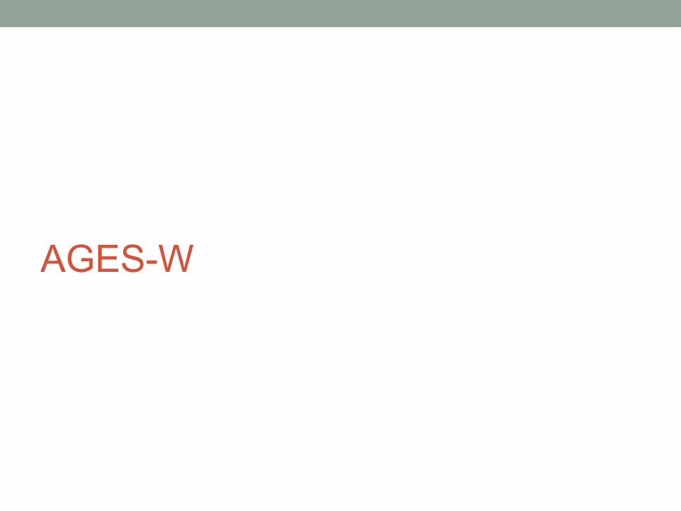
AgES vs. SWAT …
The semi-distributed SWAT concept considers distributed information within a subbasinonly statistically but not in termsof its location.Important processes e.g. lateral water and nutrient transport, specific management in some parts of a subbasin cannot be simulated.
The fully distributed AgESconcept allows theconsideration of suchprocesses.
[Krause]
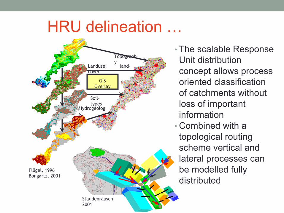
HRU delineation …• The scalable Response Unit distribution concept allows process oriented classification of catchments without loss of important information
• Combined with a topological routing scheme vertical and lateral processes can be modelled fully distributed
Staudenrausch 2001
Flügel, 1996Bongartz, 2001
GISOverlay
Topography
Landuse, land-cover
Soil-types
Hydrogeology
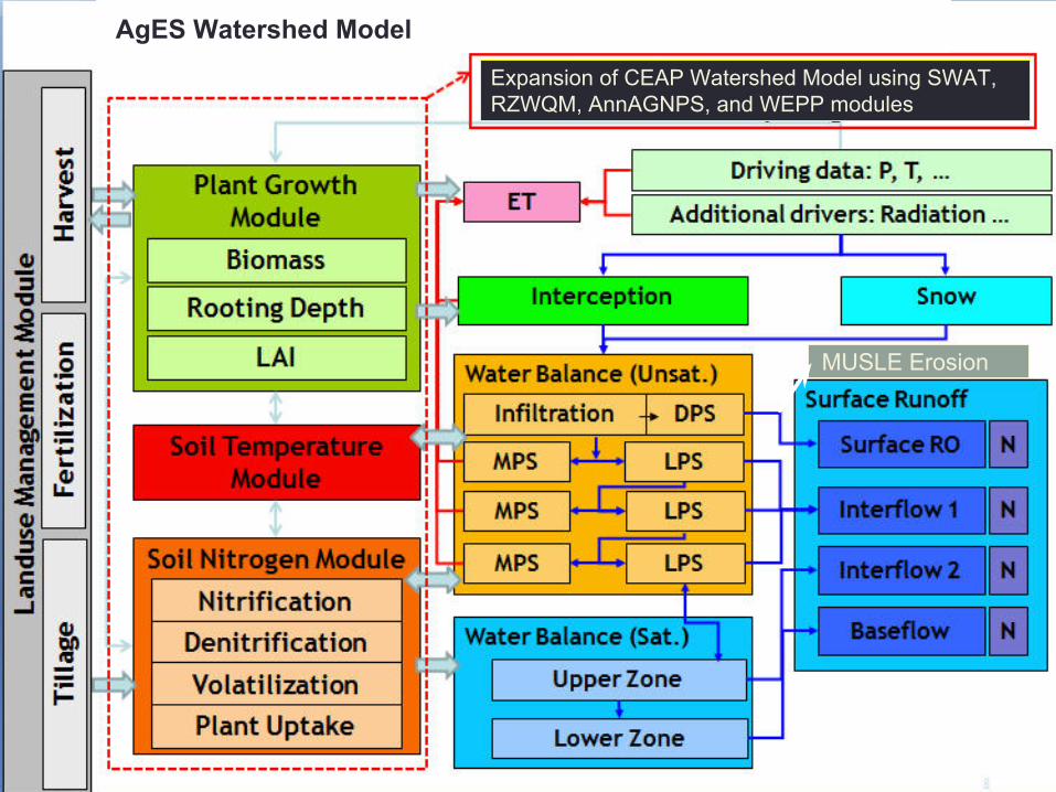
Expansion of CEAP Watershed Model using SWAT, RZWQM, AnnAGNPS, and WEPP modules
MUSLE Erosion
AgES Watershed Model
tmean
Tmin
Tmax
Ahum
Solrad
Wind
AreaAggregator
EntityReader
ManagementReader
Init Temporal/Spatial Processing
CalcIDWeights
AreaWeight
LatLong
LanduseStateVars
ExtraTerrRad
RegiionalizerRegiionalizerRegiionalizerRegiionalizerRegiionalizerRegiionalizerRegiionalizer
Relative Humidity
DailyNetRadiation
Penman/Monteith
Rain/Snow Parts
Interception
Snow
J2KProcessLayeredSoilWater200
8
J2KSNDormancy
ETPETP
ManageLanduseSzeno
PotCropGrowth
J2KSoilTemplayer
J2KNSoilLayer
J2KProcessGroundwater
J2KGroundwaterN2005
J2KPlantGrowthWaterStress
J2KPlantGrowthTempStress
J2KPlantGrowthNitrogenStress
J2KPlantGrowthStress
J2KProcessHorizonRouting
J2KNRoutinglayer
Surface - Processes SubSurface - Processes Routing
J2KProcessReachRouting
J2KProcessReachRoutingN
Output
CalcIDWeights
CalcIDWeights
CalcIDWeights
CalcIDWeights
CalcIDWeights
CalcIDWeights
CalcIDWeights
HRU 1
HRU 4
HRU 2HRU 3
HRU 5
HRU 6
Reach 1
Reach 3
Reach 2
HRU x HRU ?
HRU ?
Creation
Initialization
Output
Reach x
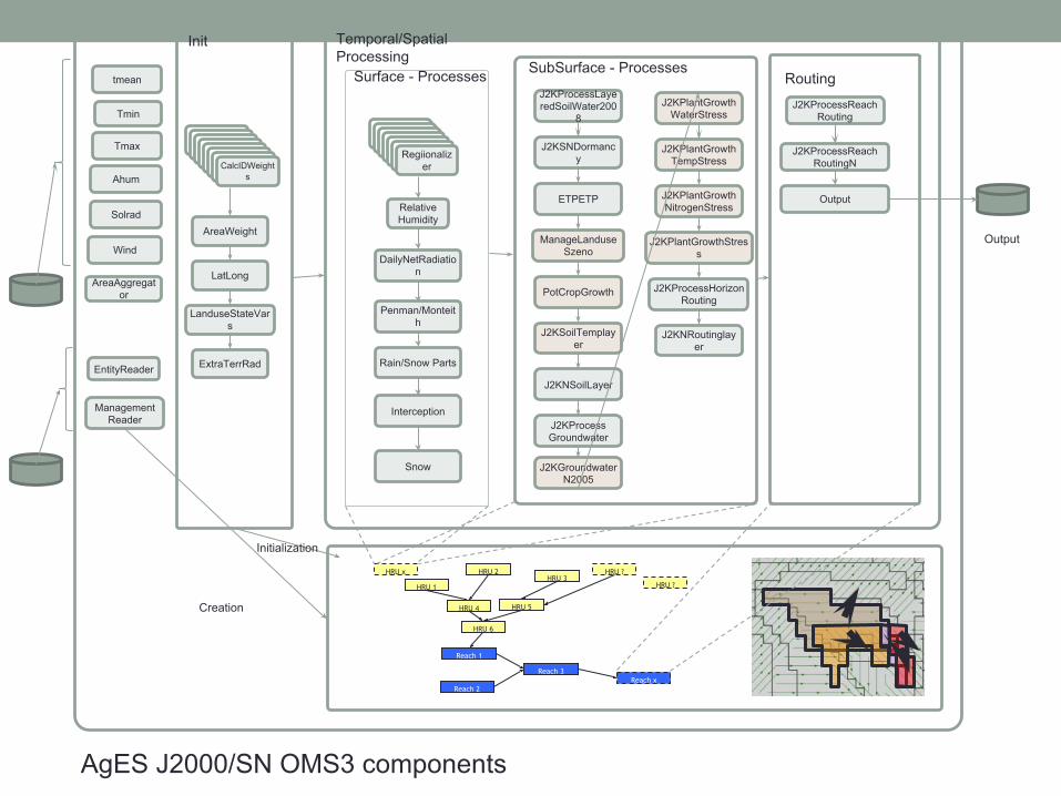
AgES J2000/SN OMS3 components
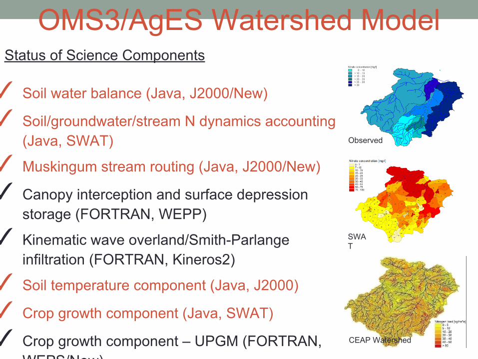
OMS3/AgES Watershed ModelStatus of Science Components
✓ Soil water balance (Java, J2000/New)
✓ Soil/groundwater/stream N dynamics accounting (Java, SWAT)
✓ Muskingum stream routing (Java, J2000/New)
✓ Canopy interception and surface depression storage (FORTRAN, WEPP)
✓ Kinematic wave overland/Smith-Parlange infiltration (FORTRAN, Kineros2)
✓ Soil temperature component (Java, J2000)
✓ Crop growth component (Java, SWAT)
✓ Crop growth component – UPGM (FORTRAN, WEPS/New)
✓ Land use/tillage management component (Java, SWAT)
✓ Tile drainage (Java, DRAINMOD/RZWQM2)
✓ Erosion – RUSLE (FORTRAN, AnnAGNPS/New), MUSLE (Java, SWAT), WEPP Hillslope (FORTRAN, WEPP)
SWAT
Observed
CEAP Watershed
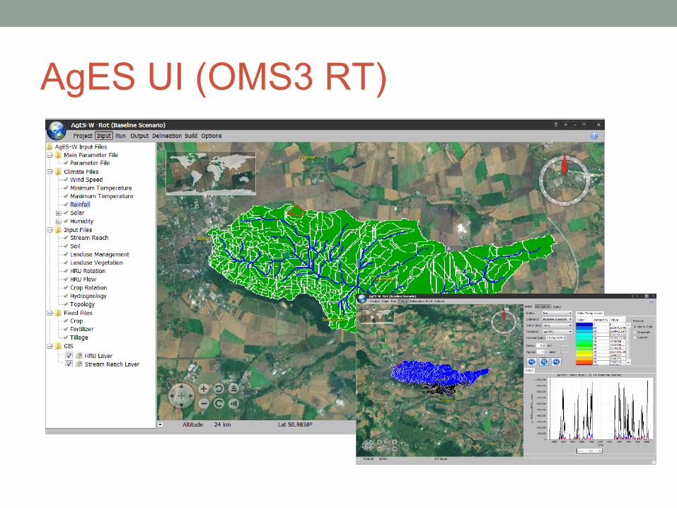
AgES UI (OMS3 RT)
Jgrass / OMS

OMSBox (Modeling Support in uDig)
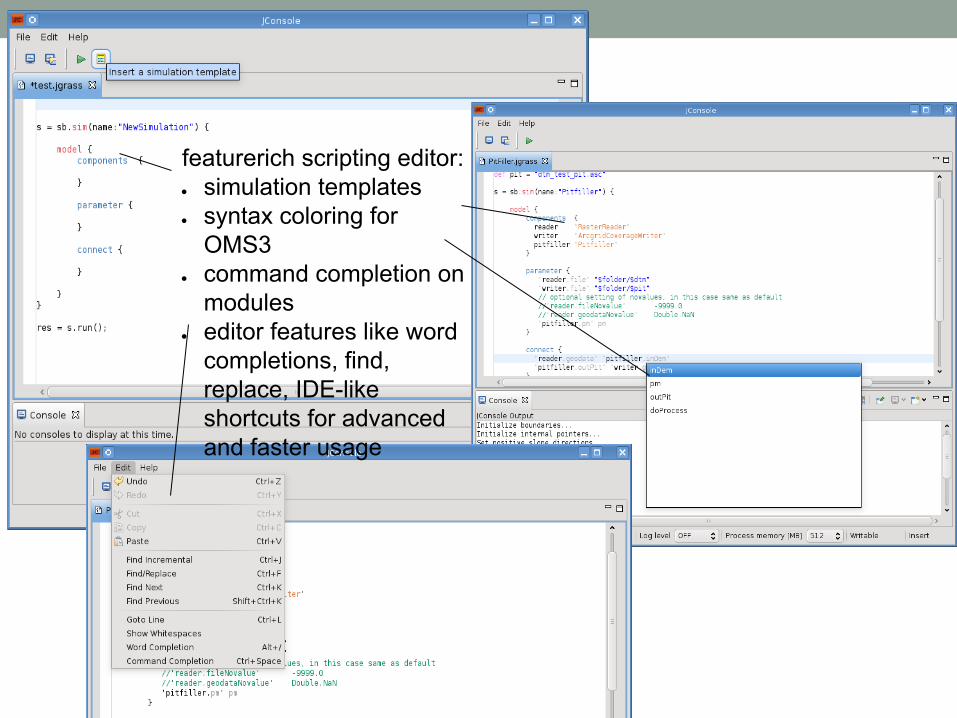
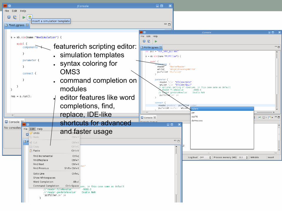
featurerich scripting editor:● simulation templates● syntax coloring for
OMS3● command completion on
modules ● editor features like word
completions, find, replace, IDE-like shortcuts for advanced and faster usage
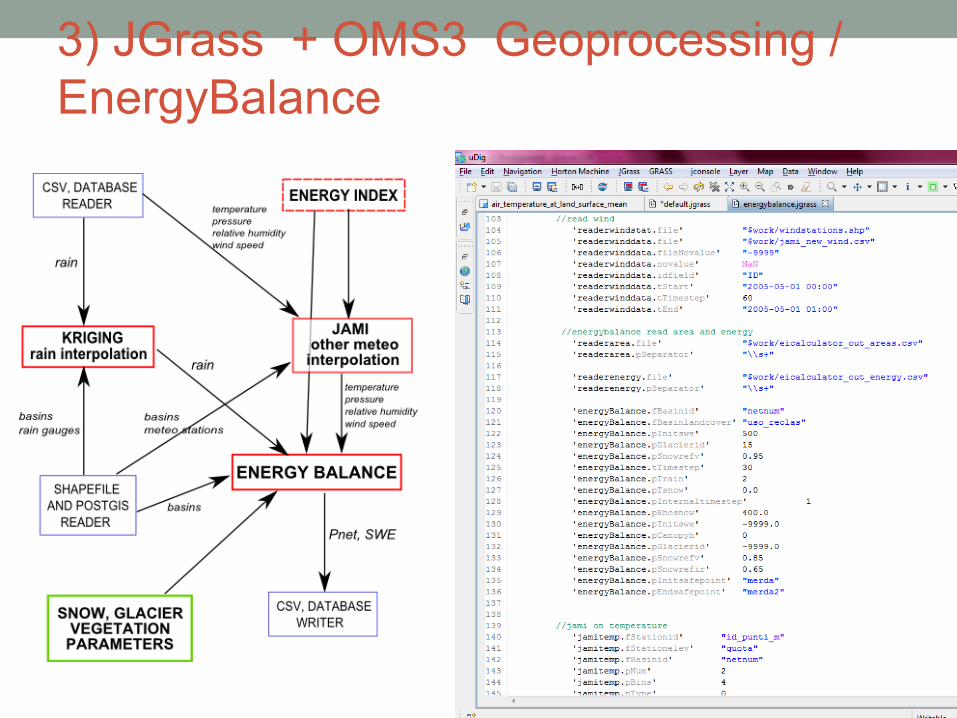
3) JGrass + OMS3 Geoprocessing / EnergyBalance
featurerich scripting editor:● simulation templates● syntax coloring for
OMS3● command completion on
modules ● editor features like word
completions, find, replace, IDE-like shortcuts for advanced and faster usage
CSIP / OMS
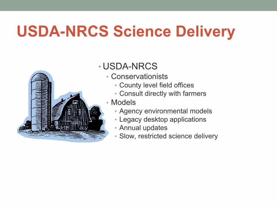
USDA-NRCS Science Delivery
• USDA-NRCS• Conservationists
• County level field offices• Consult directly with farmers
• Models • Agency environmental models • Legacy desktop applications• Annual updates • Slow, restricted science delivery
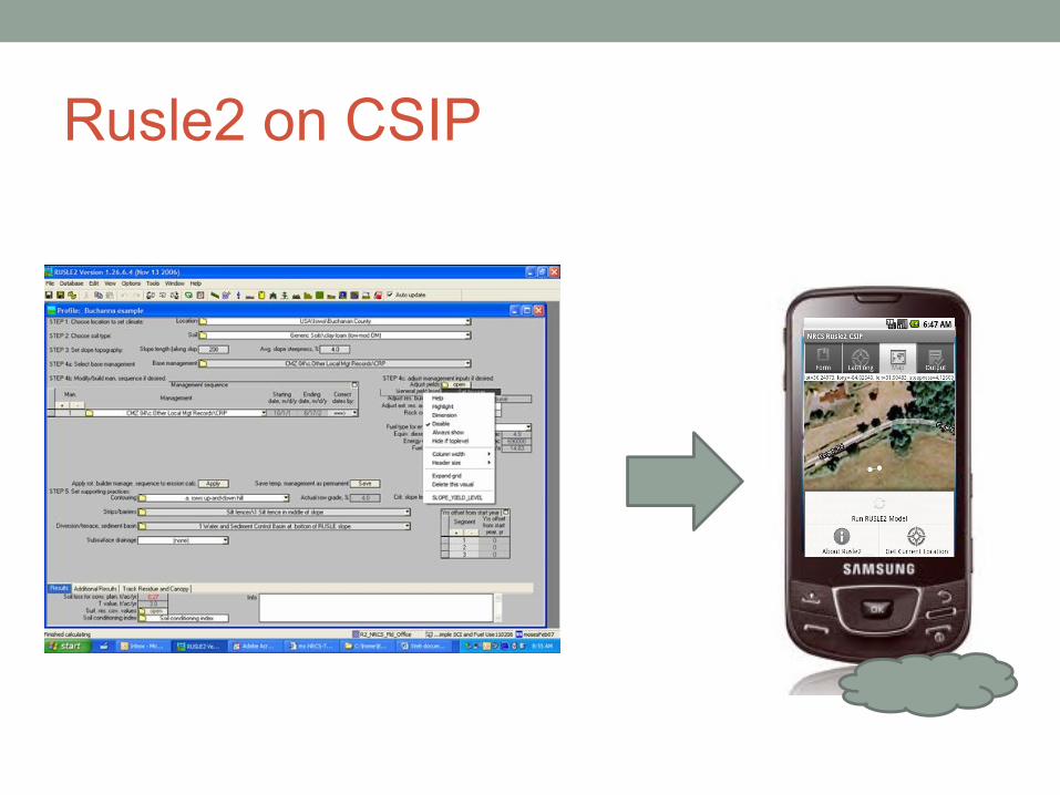
Rusle2 on CSIP
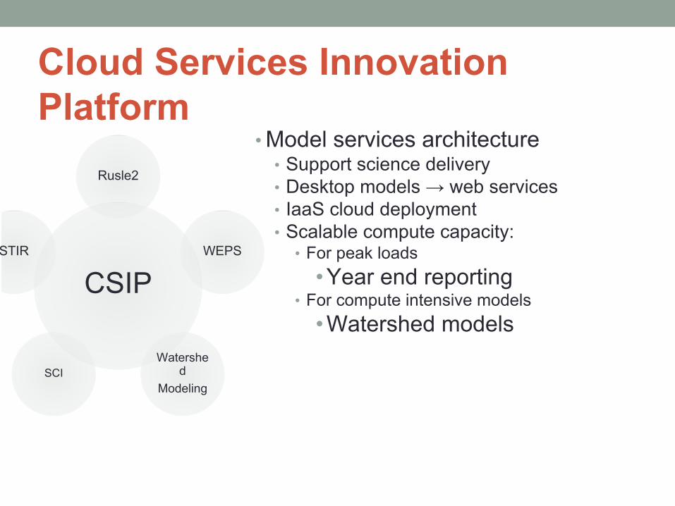
Cloud Services Innovation Platform
• Model services architecture • Support science delivery• Desktop models → web services• IaaS cloud deployment• Scalable compute capacity:
• For peak loads •Year end reporting
• For compute intensive models•Watershed models
CSIP
Rusle2
WEPS
Watershed
ModelingSCI
STIR
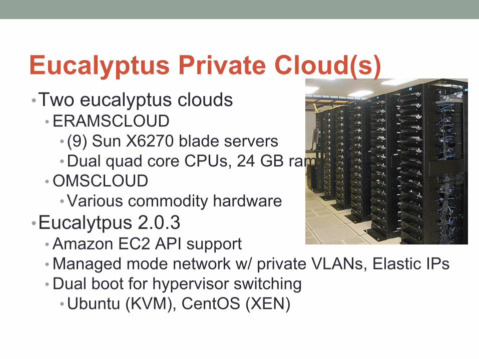
Eucalyptus Private Cloud(s)•Two eucalyptus clouds
• ERAMSCLOUD• (9) Sun X6270 blade servers• Dual quad core CPUs, 24 GB ram
• OMSCLOUD• Various commodity hardware
•Eucalytpus 2.0.3• Amazon EC2 API support• Managed mode network w/ private VLANs, Elastic IPs• Dual boot for hypervisor switching
• Ubuntu (KVM), CentOS (XEN)
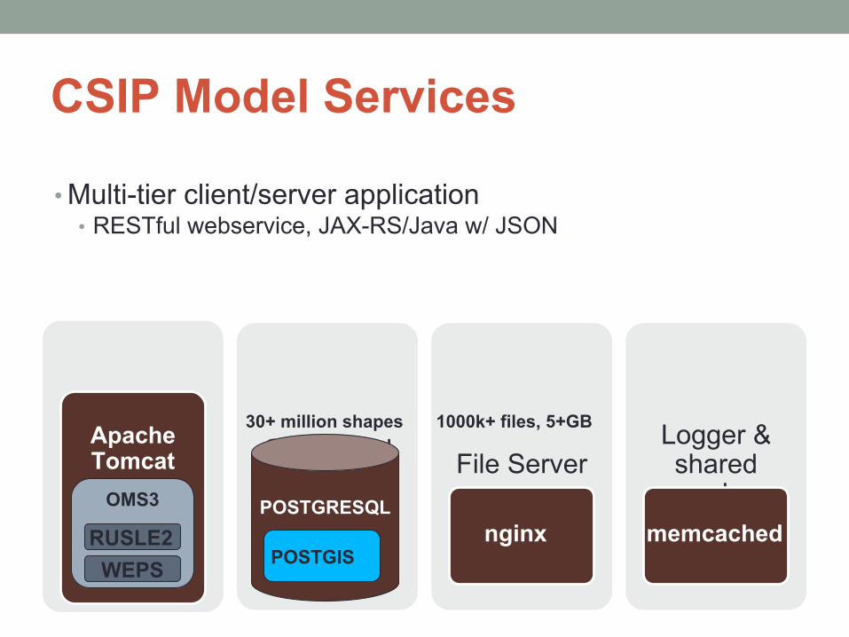
CSIP Model Services
• Multi-tier client/server application• RESTful webservice, JAX-RS/Java w/ JSON
App ServerApache Tomcat Geospatial
rDBMS File Server
nginx
Logger & shared cache
memcachedOMS3
RUSLE2POSTGRESQL
POSTGIS
30+ million shapes 1000k+ files, 5+GB
WEPS
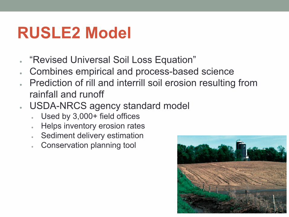
RUSLE2 Model● “Revised Universal Soil Loss Equation”● Combines empirical and process-based science● Prediction of rill and interrill soil erosion resulting from
rainfall and runoff● USDA-NRCS agency standard model
● Used by 3,000+ field offices● Helps inventory erosion rates● Sediment delivery estimation● Conservation planning tool
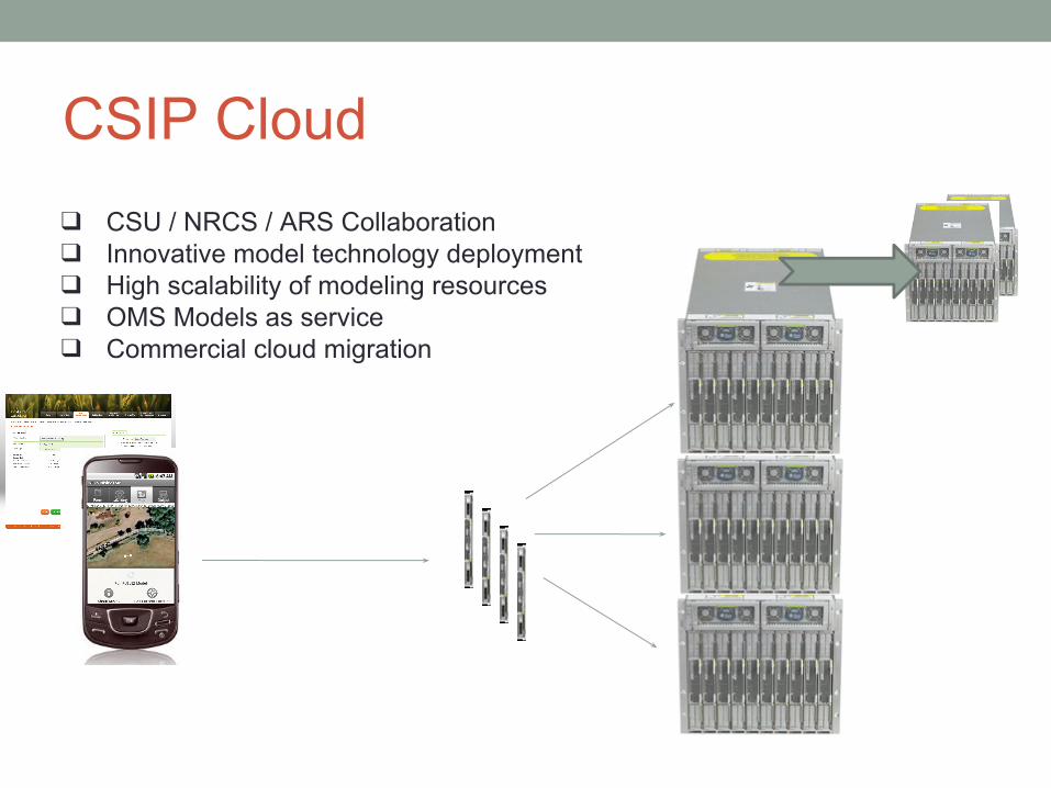
CSIP Cloud
❑ CSU / NRCS / ARS Collaboration❑ Innovative model technology deployment❑ High scalability of modeling resources❑ OMS Models as service ❑ Commercial cloud migration
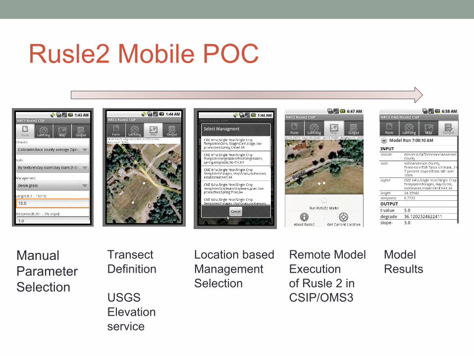
Rusle2 Mobile POC
Manual ParameterSelection
TransectDefinition
USGS Elevationservice
Location basedManagementSelection
Remote Model Executionof Rusle 2 in CSIP/OMS3
Model Results
Water Balance Model - IAEA

Mainstreaming Groundwater Considerations into the Integrated Management of the Nile River Basin
4) UN Development ProgramGlobal Environment Facility Project
Governments of Burundi, DR Congo, Egypt, Ethiopia, Kenya, Rwanda, Sudan, Tanzania and Uganda
International Atomic Energy Agency(G.H. Leavesley)
Provide the scientific basis and necessary institutional and policy support for incorporating a groundwater dimension into planning and management of the Nile basin ecosystem as an essential component of sustainable development of the Nile Basin.
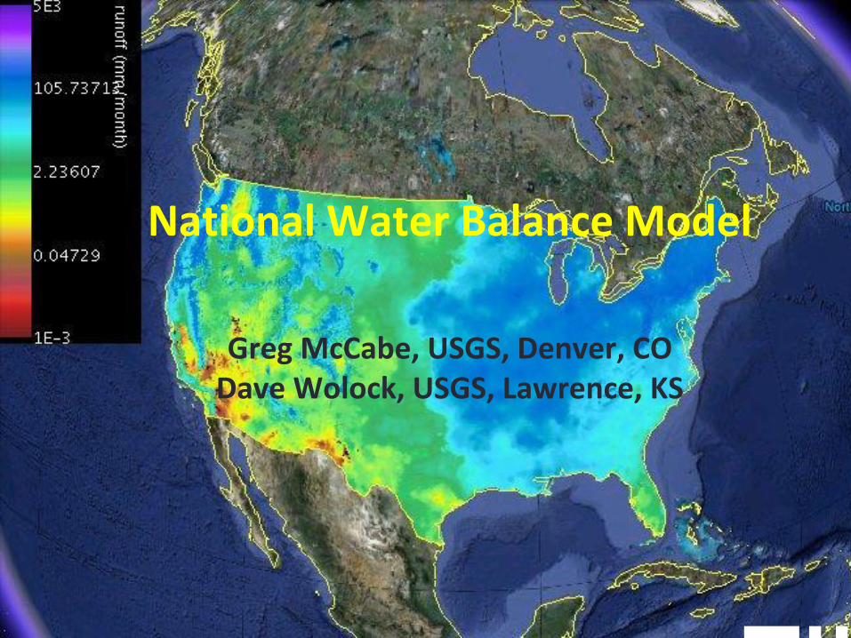
National Water Balance Model
Greg McCabe, USGS, Denver, CODave Wolock, USGS, Lawrence, KS
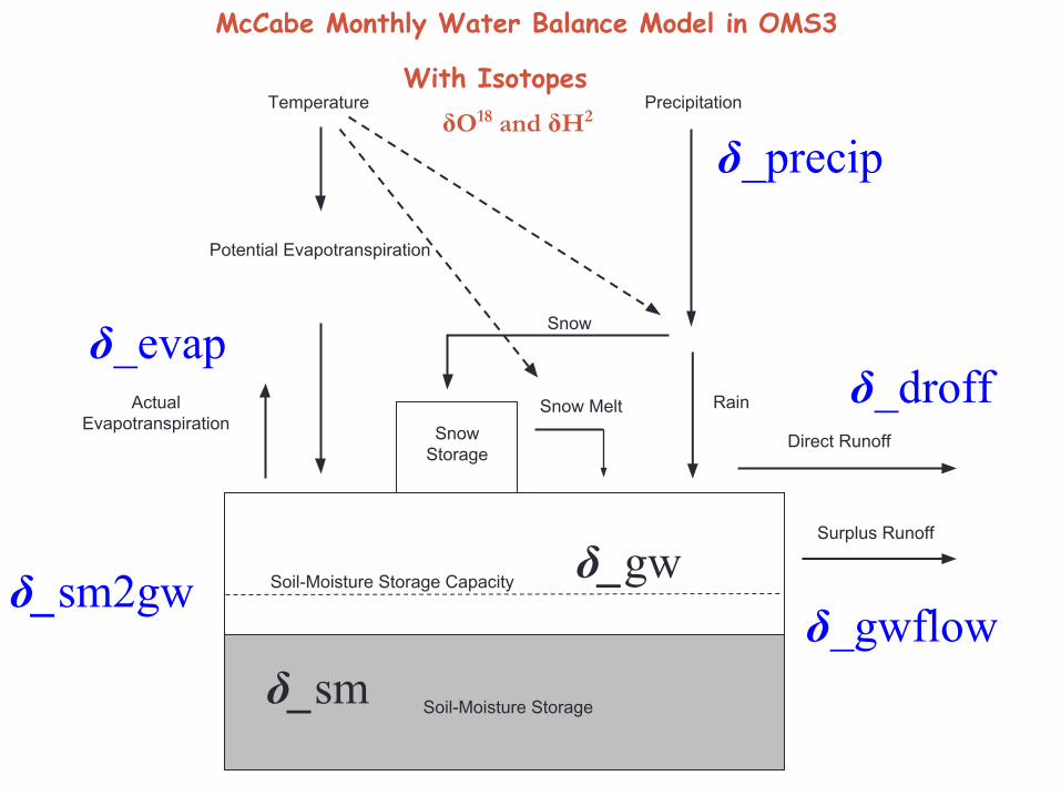
McCabe Monthly Water Balance Model in OMS3
Actual Evapotranspiration
Potential Evapotranspiration
Temperature
Soil-Moisture Storage
Soil-Moisture Storage Capacity
Precipitation
SnowStorage
Snow
Snow Melt Rain
Direct Runoff
Surplus Runoff
δ_precip
δ_evapδ_droff
δ_gwflowδ_sm
δ_gwδ_sm2gw
With IsotopesδO18 and δH2
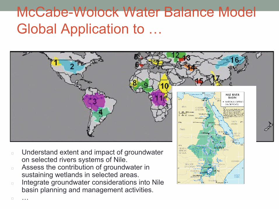
McCabe-Wolock Water Balance ModelGlobal Application to …
◻ Understand extent and impact of groundwater on selected rivers systems of Nile.
◻ Assess the contribution of groundwater in sustaining wetlands in selected areas.
◻ Integrate groundwater considerations into Nile basin planning and management activities.
◻ …
OMS3 for WSF at the NWCC
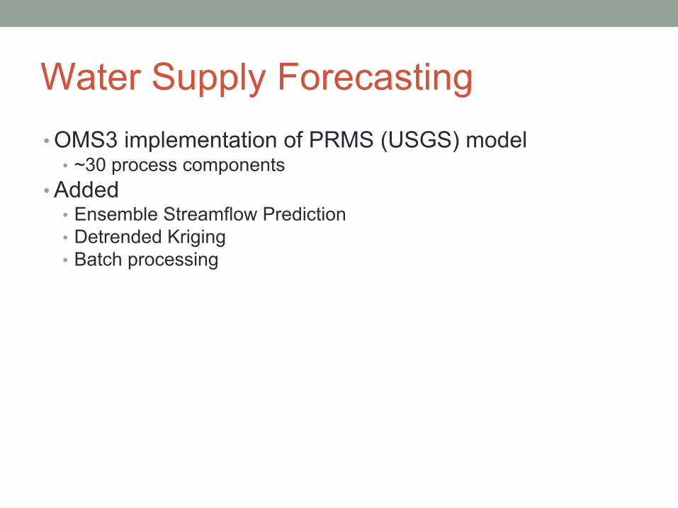
Water Supply Forecasting• OMS3 implementation of PRMS (USGS) model
• ~30 process components• Added
• Ensemble Streamflow Prediction• Detrended Kriging• Batch processing
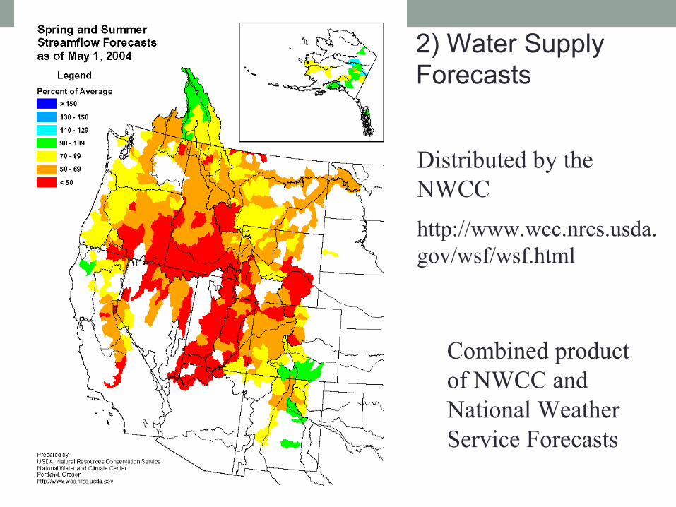
2) Water Supply Forecasts
Distributed by the NWCChttp://www.wcc.nrcs.usda. gov/wsf/wsf.html
Combined product of NWCC and National Weather Service Forecasts
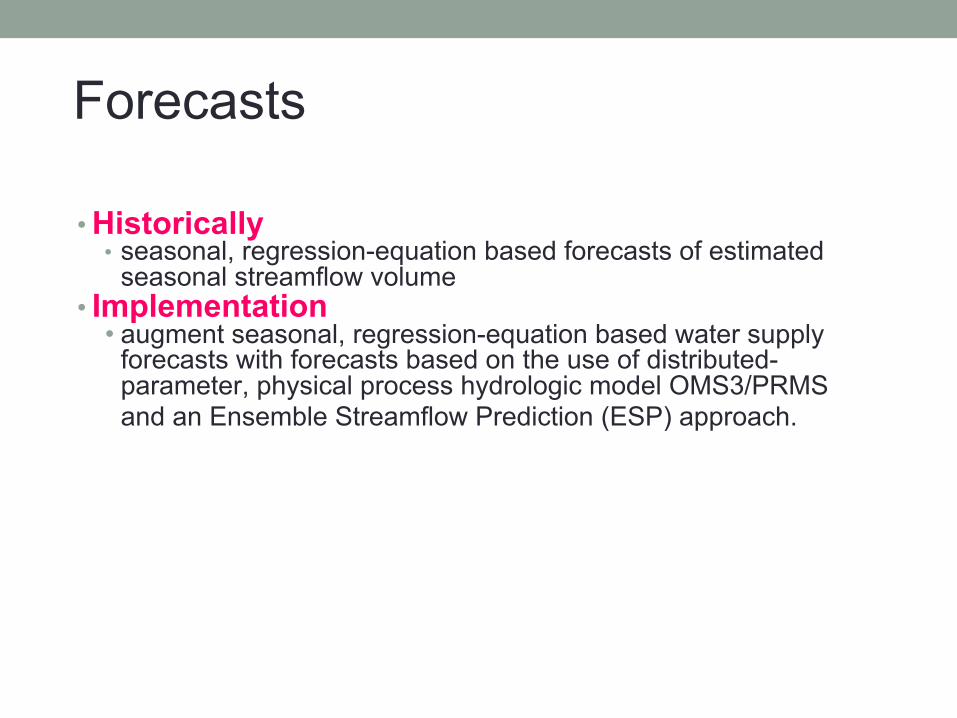
Forecasts
• Historically• seasonal, regression-equation based forecasts of estimated
seasonal streamflow volume • Implementation
• augment seasonal, regression-equation based water supply forecasts with forecasts based on the use of distributed-parameter, physical process hydrologic model OMS3/PRMS and an Ensemble Streamflow Prediction (ESP) approach.
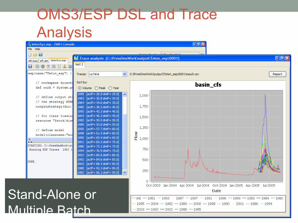
OMS3/ESP DSL and Trace Analysis
Stand-Alone or Multiple Batch
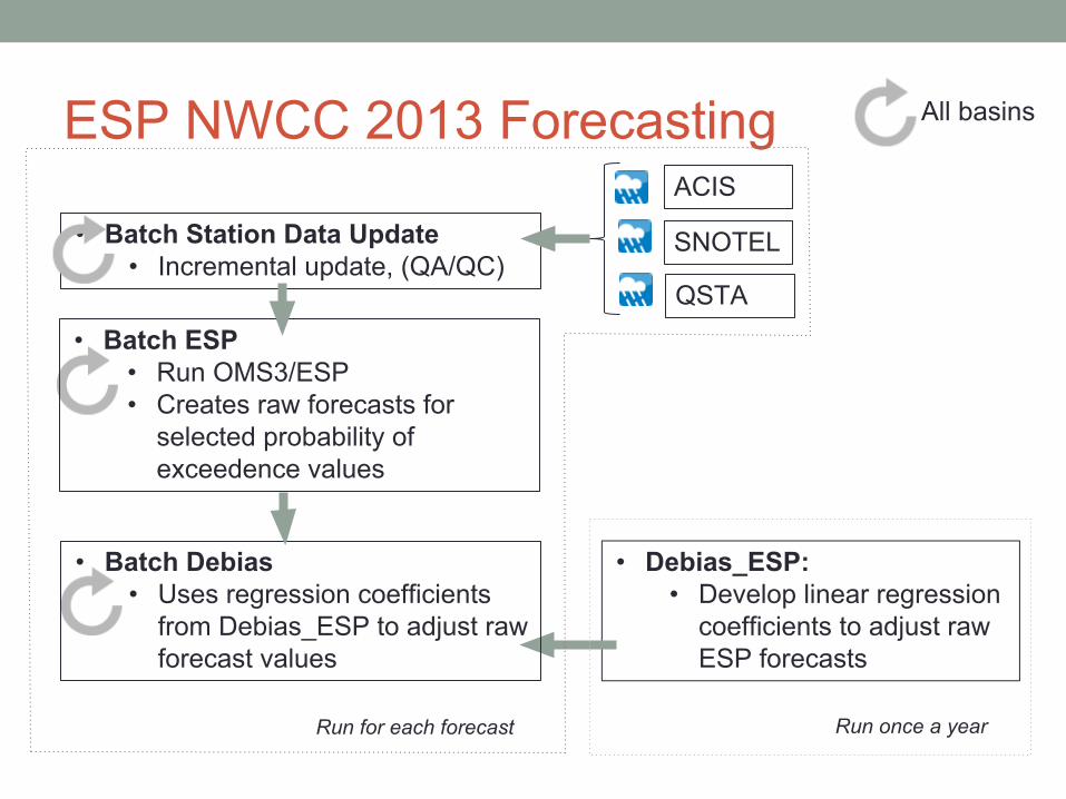
ESP NWCC 2013 Forecasting
• Debias_ESP:• Develop linear regression
coefficients to adjust raw ESP forecasts
• Batch Station Data Update• Incremental update, (QA/QC)
Run for each forecast Run once a year
ACIS
SNOTEL
QSTA
• Batch ESP• Run OMS3/ESP• Creates raw forecasts for
selected probability of exceedence values
• Batch Debias• Uses regression coefficients
from Debias_ESP to adjust raw forecast values
All basins
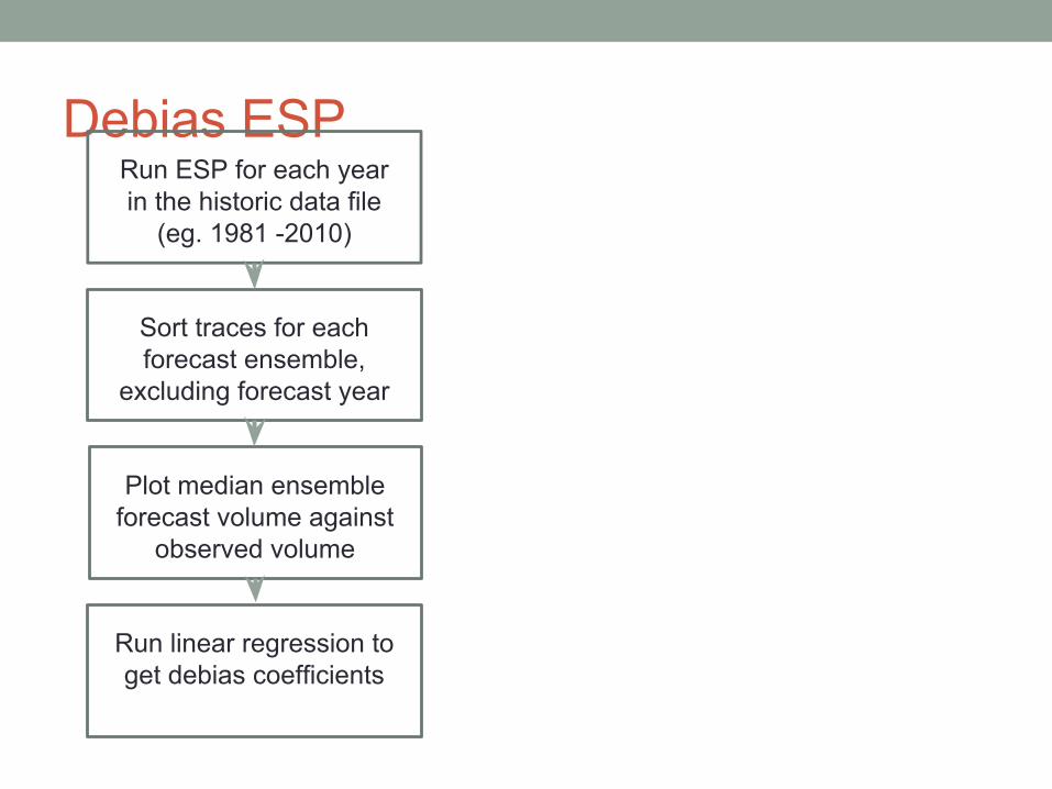
Debias ESP
Run ESP for each year in the historic data file
(eg. 1981 -2010)
Sort traces for each forecast ensemble,
excluding forecast year
Plot median ensemble forecast volume against
observed volume
Run linear regression to get debias coefficients
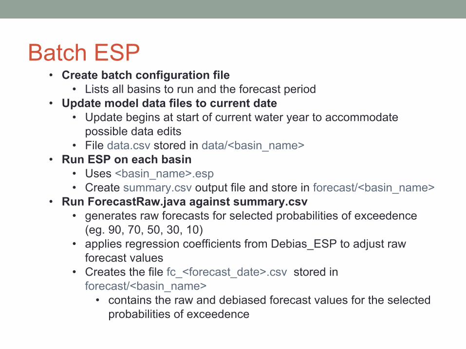
Batch ESP
• Create batch configuration file • Lists all basins to run and the forecast period
• Update model data files to current date• Update begins at start of current water year to accommodate
possible data edits• File data.csv stored in data/<basin_name>
• Run ESP on each basin• Uses <basin_name>.esp • Create summary.csv output file and store in forecast/<basin_name>
• Run ForecastRaw.java against summary.csv • generates raw forecasts for selected probabilities of exceedence
(eg. 90, 70, 50, 30, 10)• applies regression coefficients from Debias_ESP to adjust raw
forecast values• Creates the file fc_<forecast_date>.csv stored in
forecast/<basin_name>• contains the raw and debiased forecast values for the selected
probabilities of exceedence
OMS Laboratory• Established July 2011 as organization within the CSU Department of Civil and Environmental Engineering
• Purpose: maintain and facilitate the further development and use of the OMS platform: modeling framework, data provisioning, model/data service hosting, and model/data content management (knowledge base) through collaborations among participating organizations
• Charter collaborators: CSU, USDA-ARS, USDA-NRCS• Services: model development, model/data service hosting, training, OMS platform maintenance/enhancement
OMSLab Collaborations• NRCS Water and Climate Center next generation water supply forecasting
system based on the USGS precipitation and runoff (PRMS) model deployed to the OMS platform – CSU/NRCS
• OMS erosion model service hosting supporting the Keystone Center Field to Market Initiative – CSU/ZedX
• Groundwater modeling in the Nile Basin using the OMS-IAEA water balance model (based on McCabe/Wolock) – CSU/IAEA
• OMS resource analysis model services (erosion, soil organic matter depletion) for the Conservation Desktop of the NRCS Conservation Delivery Streamlining Initiative – CSU/NRCS
• Development of the AgES-Watershed agro-ecosystem model – CSU/ARS• OMS-based hydrologic modeling in Europe – CSU/HydroloGIS/University of
Trento• Joint workshop on OMS and BioMA with EU-MARS project• OMS training to crop modelers – CSU/DSSAT Foundation/ARS• OMS training to social science modelers – CSU/US Army COE