Embed Size (px)
Citation preview
FORA ESCA RP Interim RACR Interim Action Ranges MRA
Response to Comments Draft Interim RACR, Interim Action Ranges MRA Phase II, dated May 12, 2014 Review Comments provided by Judy Huang of the EPA, dated June 11, 2014
General Comments
App_K-rtc-rpt-IRACR.doc:AJT Page K-1
No. Comment
Type / Report Section
Comment/Response
1 General Comment
Comment: The review of the Draft Interim Remedial Action Completion Report, Volume 1- Interim Remedial Action Field Activities and Results, Interim Action Ranges Munitions Response Area, Phase II (hereinafter referred to as the Draft Report Volume 1), noted an issue concerning the quantities of munitions and explosives of concern (MEC) and the weight of munitions debris (MD) recovered during each noted activity. A comparison of the quantities and weights provided in the narratives of the noted activities in Section 5 do not appear to be consistent with the figures provided in Table 5-1, Interim Action Ranges MRA [munitions response area] Phase II Design Study MEC and MD Recovered. While the initial summary numbers provided in Section 5.0, Design Study Results appear to be consistent with Table 5-l, the numbers in the subsections do not. Please review the noted section and its subsections, as well as the cited table, and revise them as necessary to make them consistent. If there is some reason for the inconsistencies, please provide an explanation. Response: The quantities and weights presented in Table 5-1 and Sections 5.1.1 through 5.3.3 have been reviewed and revised, as appropriate. Additionally, footnotes have been added to Table 5-1 to provide references to corresponding text sections where MEC and MD findings are discussed. Also see response to Army Volume 1 Comment 21.
2 General Comment
Comment: US Fish and Wildlife Service do not have any substantive concerns or comments regarding Habitat Management Plan, biological opinion compliance, or the activities and results in Volume 2 of the Draft Interim Remedial Action Completion Report. However, please notify US Fish and Wildlife Service if any changes are made to existing monitoring protocols. Response: US Fish and Wildlife Service will be notified if changes are made to the existing habitat restoration monitoring protocols.
FORA ESCA RP Interim RACR Interim Action Ranges MRA
Response to Comments Draft Interim RACR, Interim Action Ranges MRA Phase II, dated May 12, 2014 Review Comments provided by Judy Huang of the EPA, dated June 11, 2014
Specific Comments Volume 1
Page K-2 App_K-rtc-rpt-IRACR.doc:AJT
No. Comment
Type / Report Section
Comment/Response
1 Page vii, Acronyms and Abbreviations
Comment: The definition of the acronym "EOD" should be "Explosive Ordnance Disposal." Please make this correction. Response: The acronym definition has been revised.
2 Page 3-2, Section 3.1.1.1, Range 44 SCA (North)
Comment: The second bullet in this section is entitled "Analog-Assisted Near-Surface Investigation (Section 3.4.4)." No explanation is presented as to the depth that constitutes "near-surface." Please revise this section or the Glossary to include the definition of the term "near- surface." Response: The following definition for near-surface anomaly has been added to the glossary:
“A subsurface anomaly that is within 3 inches of the surface and can be excavated using hand tools, as described in Section 2.3.3 of the Final Phase II Interim Action Work Plan (ESCA RP Team 2011).”
3 Page 5-3, Section 5.1.2, Transect DGM Survey and Target Investigation Results
Comment: The Range 44 SCA (South) and Central Area NCAs [Non-Completed Areas] subsection notes the recovery of "1 signal illumination rifle grenade" in the listing of MEC found. However, Table 5-1, Interim Action Ranges MRA Phase II Design Study MEC and MD Recovered, appears to list this item as "Signal, Illumination, Ground, Parachute, Rifle, M19." Both of these descriptions are inconsistent with the correct nomenclature found in Technical Manual (TM) 43-0001-37, Army Ammunition Data Sheets, Military Pyrotechnics. The item is listed there as "Signal, Illumination, Ground: Green Star, Parachute M19A2 and M19A2B2." The term "M19 series" is generally acceptable as a substitute for the M19A2 and M19A2B2 terms. Please correct the noted portions of the Draft Report Volume 1 to be consistent with the terminology used in TM 43-0001-37. Response: The item descriptions in Table 5-1 and Section 5.1.2 have been revised to “signal, illumination, ground: green star, parachute, M19 series”.
4 Page 5-7, Section 5.2.4, Transect Verification DGM Survey Target
Comment: The first paragraph of this section states that, "One MD item (fragment) and one MEC item (fuze, point-initiating, base detonating, M412) associated with a sensitively-fuzed 66mm, HEAT [high explosive anti-tank], M72 series rocket, and one MEC (frag ball) associated with a sensitively-fuzed 40mm high explosive (HE) projectile were found during the transect verification

FORA ESCA RP Interim RACR Interim Action Ranges MRA
Response to Comments Draft Interim RACR, Interim Action Ranges MRA Phase II, dated May 12, 2014 Review Comments provided by Judy Huang of the EPA, dated June 11, 2014
Specific Comments Volume 1
App_K-rtc-rpt-IRACR.doc:AJT Page K-3
No. Comment
Type / Report Section
Comment/Response
Investigation Results
DGM survey operations." This is followed by the statement that, "These items do not indicate that intact sensitively-fuzed items remain in Range 44 SCA (North)." No further explanation for this determination is provided in this paragraph, and the paragraph continues with a listing of the materials recovered during the investigation. The following paragraph provides a statement that, "The transect verification DGM survey and target investigation resulted in a lack of evidence for sensitively-fuzed items to remain in Range 44 SCA (North)." It then explains the additional investigation performed and the logic behind this determination. It would, therefore, seem that the initial statement that the results did not appear to indicate that intact sensitively-fuzed items remain in Range 44 SCA (North) is out of place without the further explanation and investigation noted in the second paragraph where this conclusion is restated and expanded in detail. Please remove the statement that, "These items do not indicate that intact sensitively-fuzed items remain in Range 44 SCA (North)" from the noted first paragraph. Response: The cited sentence has been deleted from Section 5.2.4.
5 Page 6-1, Section 6.1 Soil Excavation and Sifting Results
Comment: This section indicates that, "Soil was excavated from Range 47 SCA in the soil removal area shown on Figure 3-2 to a depth of 6 to 36 inches bgs, totaling approximately 37,000 cubic yards of soil." No basis or other explanation is provided for the 6 to 36-inch depth differential. Please revise the section to include the reason for the noted depth differential. Response: As discussed in Section 3.5, Soil Excavation and Sifting Operations, soil was excavated in Range 47 SCA during Interim Action due to metallic debris present in the soil. The depth of the excavation was dependent on the amount of soil necessary to remove the metallic debris. The cited sentence has been revised as follows:
“Soil was excavated from Range 47 SCA in the soil removal area shown on Figure 3-2 to a depth of 6 to 36 inches bgs, depending on the amount of metallic debris in the soil, totaling approximately 37,000 cubic yards of soil.”
FORA ESCA RP Interim RACR Interim Action Ranges MRA
Response to Comments Draft Interim RACR, Interim Action Ranges MRA Phase II, dated May 12, 2014 Review Comments provided by Judy Huang of the EPA, dated June 11, 2014
Specific Comments Volume 1
Page K-4 App_K-rtc-rpt-IRACR.doc:AJT
No. Comment
Type / Report Section
Comment/Response
6 Appendix H, Subsections H-2A, H-2B, and H-2C
Comment: These appendices are somewhat difficult to understand, as no legend is provided to explain some of the entries. For example, it is unclear what is intended by the term "(standard)" following entries in the "Item Category" column. Also, it is unclear what is meant by the term "363" in the "i OE Model ID" column, and what that column designation refers to. A final example is that units of measure (i.e., feet, inches, meters) are not defined in the "Depth" and "Weight" columns. Please provide a legend/explanation for the items listed and any other non-intuitive columns in the tables in these subsections. Response: The anomaly, DGM, and sift databases provided in Appendices G, H, and I have been updated. Units of measure, footnotes for column headings, and additional quality control (QC) information has been added.
FORA ESCA RP Interim RACR Interim Action Ranges MRA
Response to Comments Draft Interim RACR, Interim Action Ranges MRA Phase II, dated May 12, 2014 Review Comments provided by Judy Huang of the EPA, dated June 11, 2014
Minor Comments Volume 1
App_K-rtc-rpt-IRACR.doc:AJT Page K-5
No. Comment
Type / Report Section
Comment/Response
1 Page xvii, Executive Summary
Comment: The second paragraph of the Introduction and Purpose subsection states that, "Approximately 35 acres of SCAs and approximately 9 acres of NCAs within MRS Ranges 43-48 are located within the boundaries of the IAR [Interim Action Ranges] MRA and are the subject of this IRACR [Interim Remedial Action Completion Report]." However, Section 2.4.2, Army Phase I Interim Action, indicates that, "Approximately 34 acres of SCAs and approximately 9 acres of NCAs within MRS Ranges 43-48 are located within the boundaries of the IAR MRA and are the subject of this IRACR." Please correct the two cited sentences as necessary to make the SCA acreage consistent. Response: The cited text in the Executive Summary in Volume 1 and Volume 2 have been revised as follows:
“Approximately 35 acres of SCAs and approximately 9 acres of NCAs within MRS Ranges 43-48 are located within the boundaries of the IAR MRA. Range 44 SCA (approximately 18.9 acres), Range 47 SCA (approximately 15.2 acres), and Central Area NCAs (approximately 9.2 acres) and are the subject of this IRACR. Two additional SCAs (Range 45 Trench SCA [approximately 1.15 acres] and a small portion of the Fenceline SCA [one partial 100-ft by 100-ft grid]) are also located within the IAR MRA; however, these areas are not included in this IRACR.”
Text in the last paragraph of Section 2.4.2 has been revised as follows:
“Approximately 34 35 acres of the SCAs and approximately 9 acres of NCAs within MRS Ranges 43-48 are located within the boundaries of the IAR MRA. Range 44 SCA (approximately 18.9 acres), Range 47 SCA (approximately 15.2 acres), and Central Area NCAs (approximately 9.2 acres) and are the subject of this IRACR (Figure 1-2). Two additional SCAs (Range 45 Trench SCA [approximately 1.15 acres] and a small portion of the Fenceline SCA [one partial 100-ft by 100-ft grid]) are also located within the IAR MRA; however, these areas are not included in this IRACR.”
Also see response to Army Volume 1 Comment 2. 2 Page 3-16,
Section 3.4.5.3, Excavation of DGM
Comment: The Range 44 SCA (South) and Central NCAs Design Study Transect Target Investigation subsection notes that, ''No evidence of sensitively-fuzed munitions or related debris were encountered in the transect targets; however, target investigation was increased to 50% of the transect targets (randomly
FORA ESCA RP Interim RACR Interim Action Ranges MRA
Response to Comments Draft Interim RACR, Interim Action Ranges MRA Phase II, dated May 12, 2014 Review Comments provided by Judy Huang of the EPA, dated June 11, 2014
Minor Comments Volume 1
Page K-6 App_K-rtc-rpt-IRACR.doc:AJT
No. Comment
Type / Report Section
Comment/Response
Anomaly Targets
selected) at and above the 50mV target selection threshold in 16 grid (Figure 3-4)." As currently constructed, the intent of this sentence is unclear. Please revise the sentence to clarify if the"...in 16 grid..." statement indicates that this change was implemented in some unidentified 16 grids, or that it was accomplished in a grid somehow associated with the number 16. Response: The typo in the cited text has been corrected as follows:
“No evidence of sensitively-fuzed munitions or related debris were encountered in the transect targets; however, target investigation was increased to 50% of the transect targets (randomly selected) at and above the 50mV target selection threshold in 16 grids (Figure 3-4).”
The sixteen grids where 50% of the transect targets were investigated are identified in Figure 3-4.
3 Appendix J, MEC Photographs
Comment: There are minor issues with two of the photographs in the appendix. These are:
• Photograph 11: The item in the photograph is identified as "Cartridge, 40mm, HE, M406." However, the photograph shows a projectile, not a cartridge, as there is no cartridge case attached.
• Photograph 12: The photo and the page present two different nomenclatures for the item. The page title is correct, and the title in the photograph is incorrect.
Please correct Photograph 11 and note the error on the title in Photograph 12. Response: The title of Photograph 11 and the item description in the photograph caption have been revised to “Projectile, 40mm, HE, M406”. The item description in the Photograph 12 caption has been revised to “Livens Projectile, Model Unknown”.
FORA ESCA RP Interim RACR Interim Action Ranges MRA
Response to Comments Draft Interim RACR, Interim Action Ranges MRA Phase II, dated May 12, 2014
Review Comments provided by William K. Collins of the Army, dated June 12, 2014 Volume 1 Comments
App_K-rtc-rpt-IRACR.doc:AJT Page K-7
No. Comment
Type / Report Section
Comment/Response
1 Page xvii, Executive Summary, Introduction and Purpose, Second paragraph
Comment: Eighth sentence reads, “subsurface removal was not completed within Special Case Areas (SCAs) and Non-Completed Areas (NCAs) due to high concentrations of metallic debris or high density of anomalies (Parsons 2007).” Please delete NCAs from this statement, as the stated rationales are not applicable. Same comment applies to Volume 2, Executive Summary (page xv) and Volume 2, Section 1.5 (page 1-5). Response: The suggested revision has been made to the cited occurrences and to the occurrence of the statement in Volume 1, Section 2.4.2, Army Phase I Interim Action, third paragraph, second sentence.
2 Page xvii, Executive Summary, Introduction and Purpose, Second paragraph
Comment: • Ninth sentence reads, “Approximately 35 acres of SCAs and
approximately 9 acres of NCAs within MRS-Ranges 43-48 are located within the boundaries of the IAR MRA and are the subject of this Interim Remedial Action Completion Report (IRACR).” It should be clarified that there are two SCAs that fall within the footprint of IAR MRA that were not included in work described in the IRACR. For completeness, please include information about the two other SCAs within the footprint of the IAR MRA and reason why they were not included in the Design Studies. Clarifying information should also be included in appropriate portion(s) of the document (both volumes).
• The acreage of SCAs subject to this report is 34 acres in Section 2.4.2 (page 2-5). Please check information.
Response: The cited text in the Executive Summary in Volume 1 and similar text in the Executive Summary in Volume 2 have been revised as follows:
“Approximately 35 acres of SCAs and approximately 9 acres of NCAs within MRS Ranges 43-48 are located within the boundaries of the IAR MRA. Range 44 SCA (approximately 18.9 acres), Range 47 SCA (approximately 15.2 acres), and Central Area NCAs (approximately 9.2 acres) and are the subject of this IRACR. Two additional SCAs (Range 45 Trench SCA [approximately 1.15 acres] and a small portion of the Fenceline SCA [one partial 100-ft by 100-ft grid]) are also located within the IAR MRA; however, these areas are not included in this IRACR. The data and recommendations for these areas will be included in the Feasibility Study (FS) for the IAR MRA to support a final remedial decision.”
FORA ESCA RP Interim RACR Interim Action Ranges MRA
Response to Comments Draft Interim RACR, Interim Action Ranges MRA Phase II, dated May 12, 2014
Review Comments provided by William K. Collins of the Army, dated June 12, 2014 Volume 1 Comments
Page K-8 App_K-rtc-rpt-IRACR.doc:AJT
No. Comment
Type / Report Section
Comment/Response
The following text has been added to the second paragraph of Section 1.0 (Volume 1):
“Two additional SCAs (Range 45 Trench SCA and a small portion of the Fenceline SCA) are also located within the IAR MRA; however, these areas are not included in this IRACR. Removal actions completed by the Army in these areas are discussed in the Final MRS-Ranges 43-48, Interim Action, Technical Information Paper. It was recommended in the technical information paper that construction support be required for any intrusive activities in the Range 45 Trench SCA if no further removal action is taken (Parson 2007). If no further removal action is taken in the Fenceline SCA, the technical information paper recommended limiting access to workers trained in MEC recognition or with a UXO escort (Parsons 2007). No further remedial actions were completed in the two SCAs. The data and recommendations for these areas will be included in the FS for the IAR MRA to support a final remedial decision.”
The last paragraph of Section 2.4.2 (Volume 1) has been revised as follows:
“Approximately 34 35 acres of the SCAs and approximately 9 acres of NCAs within MRS Ranges 43-48 are located within the boundaries of the IAR MRA. Range 44 SCA (approximately 18.9 acres), Range 47 SCA (approximately 15.2 acres), and Central Area NCAs (approximately 9.2 acres) and are the subject of this IRACR (Figure 1-2). Two additional SCAs (Range 45 Trench SCA [approximately 1.15 acres] and a small portion of the Fenceline SCA [one partial 100-ft by 100-ft grid]) are also located within the IAR MRA; however, these areas are not included in this IRACR.”
The second paragraph of Section 1.5 (Volume 2) has been revised as follows:
“Approximately 35 acres of SCAs and approximately 9 acres of NCAs within MRS Ranges 43-48 are located within the boundaries of the IAR MRA. Range 44 SCA (approximately 18.9 acres), Range 47 SCA (approximately 15.2 acres), and Central Area NCAs (approximately 9.2 acres) and are the subject of this IRACR. Two additional SCAs (Range 45 Trench SCA [approximately 1.15 acres] and a small portion of the Fenceline SCA [one partial 100-ft by 100-ft grid]) are also located within the IAR MRA; however, these areas are not included in this IRACR. The data and
FORA ESCA RP Interim RACR Interim Action Ranges MRA
Response to Comments Draft Interim RACR, Interim Action Ranges MRA Phase II, dated May 12, 2014
Review Comments provided by William K. Collins of the Army, dated June 12, 2014 Volume 1 Comments
App_K-rtc-rpt-IRACR.doc:AJT Page K-9
No. Comment
Type / Report Section
Comment/Response
recommendations for these areas will be included in the FS for the IAR MRA to support a final remedial decision.”
3 Page 1-1, Section 1.0, Introduction, Second paragraph
Comment: Second sentence refers the reader to Figure 1-2 for MRS-Ranges 43-48, but the figure does not show the full extent of the site. Please consider referring to Figure 1-1 instead. Response: The citation has been revised to refer the reader to Figure 1-1.
4 Page 1-1, Section 1.0, Introduction, Third paragraph
Comment: Final sentence. The description of the remedy selected for the Impact Area MRA is not entirely accurate. Please delete the text “to address high density anomaly areas with potential presence of sensitively-fuzed munitions.” Under the Track 3 ROD, subsurface removal of munitions and explosives of concern (MEC) will be conducted on regularly maintained fuel breaks and access roads; 100-foot wide buffers along habitat-development borders; and in other areas to address specific risk and/or land use needs, specifically identified following a process provided in the Track 3 ROD. Examples include areas where there are high density anomalies associated with impact areas where military munitions with sensitive fuzes were located; such an area would be identified as a candidate for subsurface removal using excavation and sifting. Response: The cited text has been deleted.
5 Page 2-1, Section 2.1, IAR MRA and Phase II Area Location, Third paragraph
Comment: Second sentence states the sources of the proposed future land use information include the 1995 Site Use Management Plan. While that document is one of the sources of information related to the Impact Area MRA, the 1997 Installation-wide Multispecies Habitat Management Plan (HMP) provides more current information about anticipated future activities to manage the habitat reserve. Since the 1995 Site Use Management Plan was not referenced in the work plan, please consider deleting the reference, unless specific information in that document was used to update the future land use information. Same comment applies to Volume 2, Section 1.3 (page 1-3). Response: The reference to the 1995 Site Use Management Plan has been deleted from Section 2.1 of Volume 1 and Section 1.3 of Volume 2.
6 Page 2-3, Section 2.3, Site History
Comment: “Historical range usage” is identified in bullets. It should be clarified that the listed activities did not occur continuously from 1917 to base closure. Please consider updating the text to reflect the timeframes of usage as provided in the work plan.
FORA ESCA RP Interim RACR Interim Action Ranges MRA
Response to Comments Draft Interim RACR, Interim Action Ranges MRA Phase II, dated May 12, 2014
Review Comments provided by William K. Collins of the Army, dated June 12, 2014 Volume 1 Comments
Page K-10 App_K-rtc-rpt-IRACR.doc:AJT
No. Comment
Type / Report Section
Comment/Response
Response: The bullets in Section 2.3 presenting historical range use have been revised as follows:
• Range 43 - mortar training and subsequently as a platoon live fire course at the time of base closure
• Range 44 - antitank (AT) weapons range at the time of base closure
• Range 45 - grenade launcher range at the time of base closure
• Range 46 - small arms range from the late 1950s to the time of base closure
• Range 47 - 40 millimeter (mm) grenade range in the 1960s 7 Page 2-4,
Section 2.4.1, Actions Conducted Prior to Phase I Interim Action
Comment: The work identified in the third to the last bullet (Ranges 43-48: Subsurface Removal) occurred in Range 46. The work is reported in Final 100% Grid Sampling 4’ OE Removal, Site OE-15 Seaside 1-4, DRO.02 and MOCO 1 & 2, After Action Report, dated October 13, 2001 (Administrative Record [AR] number: OE-0338). Response: The text of the cited bullet has been revised as follows:
“Range 46 43-48 Subsurface Removal (April to August 1999) – a 4-ft removal with Schonstedt magnetometers on nine grids within Range 46 43-48 to support efforts to remediate spent small arms ammunitions (SAA) and lead-contaminated soil. Portions of these grids were located within the IAR MRA (USA 2001b).”
The cited document has been revised in Section 8.0, References. 8 Page 2-4,
Section 2.4.2, Army Phase I Interim Action
Comment: The Interim Action activities are summarized in bullets. The descriptions of work conducted within Range 45 and adjacent Range 45 pad are somewhat confusing. The work included: (a) excavation and sifting, followed by analog subsurface removal and digital geophysical mapping (DGM)–based subsurface removal, in Range 45 (14 acres); and (b) deconstruction of Range 45 pad (1.75 acres in 8 grids), followed by analog subsurface removal and DGM-based subsurface removal in the footprint. Please review the information and update as needed to clarify. Response: The third bullet in Section 2.4.2 has been revised as follows:
FORA ESCA RP Interim RACR Interim Action Ranges MRA
Response to Comments Draft Interim RACR, Interim Action Ranges MRA Phase II, dated May 12, 2014
Review Comments provided by William K. Collins of the Army, dated June 12, 2014 Volume 1 Comments
App_K-rtc-rpt-IRACR.doc:AJT Page K-11
No. Comment
Type / Report Section
Comment/Response
“Range 45 Excavation and sifting and MEC removal operations, followed by analog subsurface removal and digital geophysical mapping (DGM)-based subsurface removal in a 14-acre area of Range 45 (May to October 2005) to a depth of 2 ft and deconstruction of the Range 45 pad (1.75 acres in 8 grids) followed by analog subsurface removal and DGM-based subsurface removal in the pad footprint (October and November 2005)deconstruction from May to October 2005”
The fourth bullet in Section 2.4.2 has been deleted. 9 Page 2-5,
Section 2.4.3, Army Soil Remediation Activities
Comment: Second paragraph describes surface MEC removal conducted in Range 44 in March 2007. This work was not related to the soil remediation program. To avoid potential confusion please relocate the text to elsewhere. Response: The title of Section 2.4.3 has been revised to “Army Activities after Phase I Interim Action”. The cited paragraph has been moved up to be the first paragraph of the section.
10 Page 2-5, Section 2.4.3, Army Soil Remediation Activities, Third paragraph
Comment: • It describes the status of soil remediation in Historical Areas 43 and
44. Reports of completed soil remedial actions within Site 39 (which encompasses the former Impact Area) is now available in Draft Final Remedial Action Completion Report, Site 39 Inland Ranges Habitat Reserve, Former Fort Ord, California, dated April 29, 2014 (AR number: RI-047A).
• The second to the last sentence indicates an additional evaluation of cleanup levels “for the Interim Action sites with lead in soil, including Site 39B” was conducted. To clarify its relevancy to the IAR MRA, we would like to suggest the following modification: “As a follow-up to the 3rd Five-Year Review, an additional evaluation was conducted by the Army to determine the protectiveness for 17 lead-impacted sites, including Site 39.”
Response: Regarding the first bulleted comment, the Remedial Action Completion Report has been added to Section 8.0, References, and the following text has been added at the end of the third paragraph of Section 2.4.3:
“As presented in the Draft Final Remedial Action Completion Report, Site 39 Inland Ranges Habitat Reserve, results of the soil remedial action completed by the Army meet the remedial action
FORA ESCA RP Interim RACR Interim Action Ranges MRA
Response to Comments Draft Interim RACR, Interim Action Ranges MRA Phase II, dated May 12, 2014
Review Comments provided by William K. Collins of the Army, dated June 12, 2014 Volume 1 Comments
Page K-12 App_K-rtc-rpt-IRACR.doc:AJT
No. Comment
Type / Report Section
Comment/Response
objectives established for the Site 39 Inland Ranges for removal of soil contaminated with lead and/or explosives constituents (ITSI Gilbane 2014).”
Regarding the second bulleted comment, the cited sentence has been revised as follows:
“Review, an additional evaluation was conducted by the Army to determine the protectiveness of the human health based cleanup levels for the Interim Action sites with lead in soil for 17 lead-impacted sites, including Site 39B (Army 2012).”
11 Page 3-1, Section 3.1.1.1, Range 44 SCA (North) (Design Study), First paragraph
Comment: It describes that the Design Study in Range 44 SCA (North) involved investigation in two parallel, 10-ft wide transects. In the field variance form (FVF) IAWP-004, which described the completed transect investigation and recommended an expansion of the Design Study, the transects were described as 8.2-ft wide. In Figure 5-3 the transects are noted as 8.2-ft wide and in other figures they are noted as 10-ft wide. Please review the information and clarify the apparent discrepancies. Response: The width of the transects in Rage 44 SCA (North) were misreported as being 8.2-ft wide in FVF IAWP-004 (Appendix C). Text has been added to Section 3.1.1.1 to explain the discrepancy. Figure 5-3 has been revised to indicate that the transects were 10-ft wide.
12 Page 3-5, Section 3.1.1.3, Range 47 SCA (Design Study)
Comment: • The planned Design Study at Range 47 SCA included excavation and
sifting, followed by DGM and target investigation, in one transect per grid. The final paragraph includes a statement indicating that “the majority of the [DGM] targets identified along transects…were not required to be investigated.” No rationale is provided for the decision not to require investigation of the majority of the anomaly targets. Section 5.3.2 (page 5-9) provides some text explaining why, after investigating 20% of the targets in one transect, the remaining targets were not investigated. Please provide a brief explanation here in Section 3.1.1.3.
• Also, Section 3.1.1.3 (page 3-5) provides no information indicating that the DGM investigation of the investigated transect was partial. Section 3.4.5.3 (page 3-16) describes that approximately 18% of the transect targets were randomly selected and investigated on one transect. Section 5.3.2 (page 5-9) states that 20% of the targets in one transect was intrusively investigated. Please review the information
FORA ESCA RP Interim RACR Interim Action Ranges MRA
Response to Comments Draft Interim RACR, Interim Action Ranges MRA Phase II, dated May 12, 2014
Review Comments provided by William K. Collins of the Army, dated June 12, 2014 Volume 1 Comments
App_K-rtc-rpt-IRACR.doc:AJT Page K-13
No. Comment
Type / Report Section
Comment/Response
and clarify the apparent discrepancies.
• In Section 3.4.5.3 Excavation of DGM Anomaly Targets (Range 47 SCA Design Study transect target investigation) (page 3-16), it is stated “sift transects were selected for target investigation” which resulted in selection of one transect, in which 18% of anomalies were randomly selected. Please provide a rationale for the selection of one transect for target investigation. Please also indicate whether DGM targets were investigated based on DGM surveys conducted following each soil lift.
• In Section 3.1.1.3, final paragraph, second to the last sentence, indicates that “selected transects were scraped in lifts…and DGM surveys were conducted following each soil lift to evaluate the depth of soil excavation.” If these DGM surveys did not include anomaly target selection and investigation, please state. It is also unclear how these DGM surveys were used to determine whether to conduct (or not) another lift within each of the transects; and how the they relate to the decision not to investigate DGM anomalies beyond the 18% to 20% in one transect. Please expand/clarify.
Response: Regarding the first and fourth bulleted comments, the second bullet in Section 3.1.1.3 has been revised as follows:
“Soil Sifting Operations (Section 3.5) – soil in the transects was scraped and sifted to evaluate the high density of metallic debris. Some transects required removal of multiple 6-inch soil lifts to reduce the anomaly density. Following the removal of each soil lift, the anomaly density was verified by conducting a post-scrape DGM survey. The Interim Action Work Plan did not require investigation of all anomalies in all transect segments following the DGM surveys conducted to verify anomaly density. Sifting operations included disposal of debris, MEC demolition operations, and the replacement of the sifted soil to the location of origin at the conclusion of the work in the area.”
Additionally, the last paragraph of Section 3.1.1.3 has been revised as follows:
“The results of the Design Study in Range 47 SCA are presented in Section 5.3. Transect investigation rResults of the data collected indicated that completion of the Phase II Interim Action was warranted in the Range 47 SCA (Section 5.3) due to the limited
FORA ESCA RP Interim RACR Interim Action Ranges MRA
Response to Comments Draft Interim RACR, Interim Action Ranges MRA Phase II, dated May 12, 2014
Review Comments provided by William K. Collins of the Army, dated June 12, 2014 Volume 1 Comments
Page K-14 App_K-rtc-rpt-IRACR.doc:AJT
No. Comment
Type / Report Section
Comment/Response
effectiveness of target investigation caused by high anomaly density and recovery of numerous sensitively-fuzed munitions as presented in a FVF (Section 3.2). Due to the planned Phase II Interim Action, which included soil excavation and sifting, the majority of the targets identified along transects during the Design Study were not required to be investigated. In addition, selected transects were scraped in lifts to remove the high anomaly density and DGM surveys were conducted following each soil lift The depth of soil excavation necessary to complete an effective target investigation during the Phase II Interim Action, which was determined to be between 6 to 24 inches bgs as presented in the FVF (Section 3.2). The Phase II Interim Action activities included excavation of 12.4 acres of the Range 47 SCA Design Study area, DGM survey and target investigation over the majority of the SCA, and analog survey and target investigation of the sloped escarpment. These activities are described in Section 3.1.2. Soil excavated from the Design Study transects was sifted and returned to the excavated area following completion of the Phase II Interim Action activities.”
In response to the second bulleted comment, the text in the third bullet of Section 3.1.1.3 has been revised as follows:
“DGM Survey and Target Investigation (Section 3.4.5) – DGM survey activities included geophysical data collection along transects, data processing, target selection, and investigation of a portion of the selected targets. A post-scrape DGM survey was initially conducted to observe the saturation of anomalies and to determine if individual targets could be selected effectively or if additional soil excavation would be required to reduce anomaly densities. As part of the Design Study, the DGM survey and selected target investigation was conducted to determine the depth of soil to be excavated during Phase II Interim Action and did not require investigation of every anomaly in every transect segment. Approximately 18% of the post-scrape DGM target anomalies were investigated to determine appropriate soil lifts depths during the Phase II Interim Action. All of the investigated anomalies were located within one transect. Phase II Interim Action included excavation and sifting of the majority of the SCA followed by a post-scrape DGM survey and target investigation. Target investigation activities included removal and disposal of recovered MEC, MD, and other debris.”
The first paragraph of Section 5.3.2 has also been revised in response to the
FORA ESCA RP Interim RACR Interim Action Ranges MRA
Response to Comments Draft Interim RACR, Interim Action Ranges MRA Phase II, dated May 12, 2014
Review Comments provided by William K. Collins of the Army, dated June 12, 2014 Volume 1 Comments
App_K-rtc-rpt-IRACR.doc:AJT Page K-15
No. Comment
Type / Report Section
Comment/Response
second bulleted comment as follows:
“DGM survey and target investigation was performed in the Range 47 SCA transects during the Design Study to observe the density of anomalies in the area following a soil excavation to determine if additional soil excavation was necessary or if individual targets could be selected without removing additional soil. The DGM surveys indicated that remaining anomalies could be investigated as individual targets; therefore, a portion of the anomalies in the transects (18% of the selected anomalies) were investigated to confirm that remaining anomalies could be investigated as individual targets. It was determined that anomalies could be investigated as individual targets. A total of 26 lbs of MD were recovered during DGM survey target investigation in the Range 47 SCA prior to discontinuing the activity. As part of the Design Study, the DGM survey and target investigation was conducted to determine the depth of soil to be excavated during Phase II Interim Action and did not require investigation of every anomaly in every transect segment. After investigation of 20% of the targets in one transect, the operation was halted to evaluate the collected data. A high density of metallic debris was observed during the Range 47 SCA Design Study DGM survey and target investigation in the range fan portion of the SCA, which would limited the effectiveness of target investigation if soil was not removed prior to conducting DGM surveys. A total of 26 lbs of MD were recovered during DGM survey target investigation in the Range 47 SCA prior to discontinuing the activity. Because of the limited effectiveness of target investigation and the presence of sensitively-fuzed munitions during transect soil sifting, soil excavation was warranted in the area. Since the anomalies remaining after the Design Study would be resolved as part of Phase II Interim Action; therefore, the remaining targets were not investigated during the Design Study. Results of the DGM survey were assessed to determine excavation depths for completion of the Phase II Interim Action.”
Regarding the third bulleted comment, a citation to the expanded text in Section 3.1.1.3 has been added to the last paragraph of Section 3.4.5.3.
13 Page 3-6, Section 3.1.2.1, Range
Comment: The first bullet on the page indicates that the remedial action activities included analog survey and target investigation. Based on Section 3.4.6 (page
FORA ESCA RP Interim RACR Interim Action Ranges MRA
Response to Comments Draft Interim RACR, Interim Action Ranges MRA Phase II, dated May 12, 2014
Review Comments provided by William K. Collins of the Army, dated June 12, 2014 Volume 1 Comments
Page K-16 App_K-rtc-rpt-IRACR.doc:AJT
No. Comment
Type / Report Section
Comment/Response
47 SCA (Phase II Interim Action Activities)
3-17) this activity was conducted only in the sloped escarpment section of Range 47. To reduce the chance of misunderstanding, please clarify the extent of the analog subsurface removal in Section 3.1.2.1. The extent of analog subsurface removal should also be displayed in one of the figures. Response: The text of the cited bullet has been revised as follows:
“Analog Survey and Target Investigation (Section 3.4.6) – activities were completed in the excavated face of the sloped escarpment including analog survey, target investigation, and removal and disposal of recovered MEC, MD, and other debris in the excavated face of the sloped escarpment (Figure 3-3).”
The extent of the analog survey area at the sloped escarpment is shown in Figure 3-3, as cited.
14 Page 3-6, Section 3.1.2.1, Range 47 SCA (Phase II Interim Action Activities)
Comment: The final paragraph describes that additional excavation and sifting was conducted in “verification polygons” following QC-2, and references Figure 3-3 for the location of the polygons. This information is not identified in Figure 3-3 (it is shown in Figure 3-2). Response: The figure citation has been revised to direct the reader to Figure 3-2.
15 Page 3-11, Section 3.4.3, Geophysical System Verification, Fifth paragraph
Comment: The seed items buried in the Instrument Verification Strips (IVSs) were likely inert, and not MEC, items. Please change the wording in the sentence “Three inert MEC items were placed….” Also, please indicate (here or elsewhere in the document) whether the IVSs remain in the site or they have been removed. Response: The fifth paragraph of Section 3.4.3 has been revised as follows:
“To accommodate the three- or four-coil towed array configurations, one four to five ISO items per coil was were placed along-track, staggered at a 10-ft interval to eliminate signal overlap between items. Three Two to three inert MEC 37mm projectile items were placed along the center coil track to increase the sample size of the three- or four-coil towed array dataset through collection of the IVS down the center track.”
A statement has been added to the second paragraph of Section 3.4.3 to
FORA ESCA RP Interim RACR Interim Action Ranges MRA
Response to Comments Draft Interim RACR, Interim Action Ranges MRA Phase II, dated May 12, 2014
Review Comments provided by William K. Collins of the Army, dated June 12, 2014 Volume 1 Comments
App_K-rtc-rpt-IRACR.doc:AJT Page K-17
No. Comment
Type / Report Section
Comment/Response
indicate that the IVSs currently remain at the site. 16 Page 3-20,
Section 3.5, Soil Excavation and Sifting Operations, Range 47 SCA Phase II Interim Action
Comment: Soil excavation and sifting in three footprints are discussed. The first two bullets describe that an excavation of the top 6 inches was conducted, and then an excavation of subsoil (6 to 36 inches) was conducted “in the area shown on Figure 3-2.” It is unclear if “the area shown on Figure 3-2” refers to “vegetation removal and soil scrape areas” or to the “verification polygons” in the figure. Please clarify. Please provide a figure that shows the actual excavations depths in portions of the Range 47 SCA. Response: Figure 3-5 has been added to Volume 1showing the approximated excavation depths in the Range 47 SCA. The first sentence of the cited bullet has been revised as follows:
“Following top soil excavation, approximately 19,750 cubic yards of subsoil (below 6 inches bgs) was excavated in the area shown Range 47 SCA, as shown on Figure 3-5, and sifted.”
17 Page 3-23, Section 3.6.2.3, Habitat Restoration, Second paragraph
Comment: Because remediation activities were not conducted in the ingress/egress routes, we would like to suggest modification to the first sentence to “Work areas in the IAR MRA included Range 44 SCA (North), Range 44 SCA (South) and Central Area NCAs, Range 47 SCA, and ingress/egress routes established during remedial activities.” Response: The cited text has been revised as suggested.
18 Page 4-7, Section 4.2.2, QC-2
Comment: Third paragraph discusses a QC-2 failure, root cause analysis, and the resulting corrective action. However, the nature of the failure is not described. Please provide additional information. Response: The first sentence of the third paragraph has been revised as follows:
“A QC-2 failure was reported during Phase II Interim Action at the Range 47 SCA due to. During root cause analysis, it was determined that the item was in a large cluster type anomaly anomalies that should have been identified as an investigation polygons instead of individual targets. The identification of the re-acquirable anomalies was determined to meet QC-2 failure criteria “2”, as described
FORA ESCA RP Interim RACR Interim Action Ranges MRA
Response to Comments Draft Interim RACR, Interim Action Ranges MRA Phase II, dated May 12, 2014
Review Comments provided by William K. Collins of the Army, dated June 12, 2014 Volume 1 Comments
Page K-18 App_K-rtc-rpt-IRACR.doc:AJT
No. Comment
Type / Report Section
Comment/Response
above.” 19 Section 5.0,
Design Study Results
Comment: Numbers of MEC items and quantities of MD recovered during different activities are summarized in this section. When the number of MEC items are provided as MEC (not as unexploded ordnance [UXO]), does that mean some of the items were discarded military munitions (DMM)? Tables 5-1, 6-1 and 6-2 list at least one DMM item and some munitions debris items as “cartridge.” Please clarify. In Appendices G, H and I, some of the recovered items are listed as material potentially presenting an explosive hazard (MPPEH). Please check that the information in the appendices is up to date and check the summary numbers in Section 5.0 for possible updates. Response: The descriptions for MD items listed as “Cartridge, 40mm, Practice, M781” in Table 5-1 have been revised to “Projectile, 40mm, M781, Practice”. The description for the item previously listed as DMM with a description of “Cartridge, 40mm M407A1, Practice” in Table 5-1 has been revised to “Projectile, 40mm M407A1, Practice” and has been updated to indicate that the item was determined to be UXO. With the revisions described above, all MEC items reported throughout Sections 5and 6, and Tables 5-1, 6-1, and 6-2 of the draft final document are UXO. Appendices G, H, and I have been updated to replace MPPEH with the final disposition of those items. See also response to EPA General Comment 1.
20 Page 5-5, Section 5.2, Range 44 SCA (North) Design Study Expansion, Second paragraph
Comment: The last two sentences indicate that, in the southernmost eight grids, DGM targets could not be fully resolved due to high density of metal objects; however, the results “were sufficient to determine that there is no evidence of sensitively-fuzed munitions target areas” in those grids. Please provide additional discussion to explain how the inability to complete a subsurface investigation does not interfere with the ability to make the stated determination. Also, the inability to fully resolve targets within the 3-foot radius would suggest that QC-1 would not have been completed at these locations. However, this was not discussed in Section 4.2.1 (page 4-6). Please expand to clarify. Response: Sections 3.1.1.1, 3.4.5.3, and 5.1.4 have been revised to clarify the field activities conducted during the Design Study Expansion; Sections 4.2.1, and
FORA ESCA RP Interim RACR Interim Action Ranges MRA
Response to Comments Draft Interim RACR, Interim Action Ranges MRA Phase II, dated May 12, 2014
Review Comments provided by William K. Collins of the Army, dated June 12, 2014 Volume 1 Comments
App_K-rtc-rpt-IRACR.doc:AJT Page K-19
No. Comment
Type / Report Section
Comment/Response
5.2.1 through 5.2.6 have been expanded to include discussion of the finding in the southern eight grids of Range 44 (North) and the rationale for the conclusion.
21 Page 5-6, Section 5.2.2, DGM Survey Target Investigation Results
Comment: Multiple DGM surveys in different footprints were conducted during the Range 44 SCA (North) Design Study Expansion. Please provide the results (summary of recovered items) for each of the surveys (or modify Table 5-1). Response: Section 5.2.2 has been revised to present the physical findings separately for the two DGM surveys conducted. Additionally, the weights for other debris have been corrected to indicate a total of 4,867 lbs; 4,339 lbs recovered during the first DGM survey target investigation and 528 lbs recovered during the second DGM survey target investigation.
22 Page 5-6, Section 5.2.3, Soil Sifting Results (Range 44 SCA (North) Design Study Expansion)
Comment: The text describes that eight polygons were identified as sifting polygons, and refers the reader to Figure 5-8. However, the polygons are not identified in the figure. Please update. Response: The figure cited has been revised to direct the reader to Figure 3-2 which identifies the eight excavated and sifted polygons.
23 Page 5-7, Section 5.2.4, Transect Verification DGM Survey Target Investigation Results (Range 44 SCA (North) Design Study Expansion)
Comment: The section provides that a total of 37 MEC items were recovered during this activity. The first paragraph notes that two of the MEC items were related to munitions containing sensitive fuzes. The second paragraph notes “a single non-sensitively-fuzed MEC item was recovered.” The number of MEC items recovered during the transect verification DGM survey is inconsistent in this section. Please review the information and update to clarify. Response: The cited paragraph of Section 5.2.4 has been revised as follows:
“The transect verification DGM survey and target investigation resulted in a lack of evidence for sensitively-fuzed items to remain in the entire Range 44 SCA (North); however, a single two MEC items associated with non-sensitively-fuzed MEC item was were recovered. Most of the grids received two DGM surveys and target investigations prior to the transect verification survey. Based on the recovery of the single items associated with non-sensitively-fuzed MEC items, concern remained within the areas that had a high density of large anomalies remaining following the two DGM
FORA ESCA RP Interim RACR Interim Action Ranges MRA
Response to Comments Draft Interim RACR, Interim Action Ranges MRA Phase II, dated May 12, 2014
Review Comments provided by William K. Collins of the Army, dated June 12, 2014 Volume 1 Comments
Page K-20 App_K-rtc-rpt-IRACR.doc:AJT
No. Comment
Type / Report Section
Comment/Response
surveys. Therefore, a final DGM survey was conducted over areas with a high density of large anomalies remaining, a total of approximately 1.5 acres, in Range 44 SCA (North).”
24 Page 5-7, Sections 5.2.4 and 5.2.5
Comment: These sections note of “frag ball” from 40mm projectiles as MEC. Please provide clarification that these items are listed as projectiles in Table 5-1. Response: The item descriptions for the 40mm projectile “frag ball” items in Sections 5.2.4 and 5.2.5 have been revised to specify that the items are frag ball portions of 40mm HE projectiles.
25 Page 6-1, Section 6.1, Soil Excavation and Sifting Results (Range 47 SCA Interim Action Results)
Comment: The total volume of sifted soil in this section is noted as including the volume of soil excavated from the sloped escarpment area. However, information from the excavation and sifting of the sloped escarpment area is also provided in Section 6.6 (page 6-3). Please clarify whether the number of MEC items and quantities of MD and other debris provided in Section 6.1 does or does not include those reported in Section 6.6. Response: The last sentence of the first paragraph in Section 6.1 has been revised as follows:
“The following bullets provide an overview of physical findings during the Phase II Interim Action soil excavation and sifting activities in Range 47 SCA soil scrape areas. Results for the sifting of soil excavated from the sloped escarpment are presented in Section 6.6.:”
26 Page 6-1, Section 6.1, Soil Excavation and Sifting Results (Range 47 SCA Interim Action Results)
Comment: The section references Figures 6-1 and 6-2 for overview of items found. Please delineate the footprint of excavation and sloped escarpment in the figures. Response: The soil scrape area, verification polygons, and the sloped escarpment have been added to Figures 6-1 and 6-2.
27 Page 6-1, Section 6.2, DGM Survey Target Investigation
Comment: The section references Figure 6-3 for the DGM survey area. Please delineate in the figure the sloped escarpment area where DGM survey was not conducted.
FORA ESCA RP Interim RACR Interim Action Ranges MRA
Response to Comments Draft Interim RACR, Interim Action Ranges MRA Phase II, dated May 12, 2014
Review Comments provided by William K. Collins of the Army, dated June 12, 2014 Volume 1 Comments
App_K-rtc-rpt-IRACR.doc:AJT Page K-21
No. Comment
Type / Report Section
Comment/Response
Results (Range 47 SCA Interim Action Results)
Response: Identification of the sloped escarpment has been added to Figure 6-3.
28 Page 7-2, Section 7.1, Range 44 SCA (North), Final paragraph
Comment: First sentence. Delete the text “in accordance with the Interim Action ROD” since the Design Study is not described in the ROD. (Same comment applies to Section 7.2, fourth paragraph.) Response: The cited phrase has been deleted from Sections 7.1 and 7.2.
29 Page 7-2, Section 7.1, Range 44 SCA (South) and Central Area NCAs, First bullet.
Comment: Specify that the analog-assisted near-surface investigation was conducted in the Design Study transects only. Response: The first bullet has been revised as follows:
“Conducting analog-assisted near-surface investigation and removal of target anomalies in Design Study transects”
30 Tables 5-1, 6-1 and 6-2
Comment: In these tables, * denotes “sensitively-fuzed munition” and ** denotes “potentially sensitively-fuzed.” Item description “Projectile, 40mm, Unknown Model” and “Projectile, 40mm, Model Unknown” are variously noted with * or ** or none. Please review the information and update to clarify. Also, please note that in evaluating areas for possible subsurface MEC removal under the Track 3 ROD, the Army considers 40mm practice projectiles M382 series or M407 series, or any other 40mm practice series projectiles containing enough explosives to rupture the projectile, as military munitions with sensitive fuzes. Response: Data have been evaluated with consideration of the 40mm practice projectile M382 series and 40mm practice projectile M407 series items as sensitively-fuzed munitions, consistent with the Track 3 ROD. Tables 5-1, 6-1, and 6-2 have been revised accordingly. Revisions have also been made throughout Section 5.1.1 through 5.2.6 to include discussion of all sensitively-fuzed munitions. Additionally, item descriptions throughout the report text and Tables 5-1, 6-1, and 6-2 including the descriptor “unknown model” have been revised to “model unknown” for consistency.
31 Figures 2-3 Comment:
FORA ESCA RP Interim RACR Interim Action Ranges MRA
Response to Comments Draft Interim RACR, Interim Action Ranges MRA Phase II, dated May 12, 2014
Review Comments provided by William K. Collins of the Army, dated June 12, 2014 Volume 1 Comments
Page K-22 App_K-rtc-rpt-IRACR.doc:AJT
No. Comment
Type / Report Section
Comment/Response
and 2-4 These figures display locations of MEC and MD items recovered within the IAR MRA prior to the ESCA. Please clarify if items found during excavation and sifting in Range 45, and MD items recovered during the Interim Action surface removal and analog subsurface removal, are represented by any of the dots. If this is not the case, please add a clarifying note. Response: Figures 2-3 and 2-4 do not include items found during excavation and sifting in Range 45 and MD items recovered during the Interim Action surface removal and analog subsurface removal. To clarify what is displayed in the figures, the notes below has been added to Figures 2-3 and 2-4. Figure 2-3:
“MEC recovered during Army sift operations in Range 45 are not included on this figure. See Table 2-1 for a complete listing of MEC recovered by the Army.”
Figure 2-4: “MD recovered during Army sift operations in Range 45 and during the Interim Action surface removal and analog subsurface removal are not included on this figure.”
To further clarify, the titles of Figures 2-3 and 2-4 have also been revised to “Interim Action Ranges MRA MEC Recovered During Previous Removal Actions” and “Interim Action Ranges MRA MD Recovered During Previous Removal Actions”, respectively.
32 Figure 3-1 Comment: Transects within the Range 44 SCA (North) and Range 44 SCA (South) and Central Area NCAs are shown in blue and green. Both types of transects are noted as “excavation transects.” However, the Design Study descriptions in Section 3 of the document indicated that only some of the transects were excavated and sifted. Please clarify the legend in the figure. Response: Figure 3-1 has been revised to indicate transects that were excavated and soil sifted. Additionally, a note has been added to the figure to clarify that transect locations shown are approximate.
33 Figure 3-4 Comment: The figure displays the percentage of DGM targets investigated during the Design Studies in Range 44 SCA (North) and Range 44 SCA (South) and Central Area NCAs. For the Range 44 SCA (North) portion, please clarify if the percentages apply to the transect investigation only (not including the
FORA ESCA RP Interim RACR Interim Action Ranges MRA
Response to Comments Draft Interim RACR, Interim Action Ranges MRA Phase II, dated May 12, 2014
Review Comments provided by William K. Collins of the Army, dated June 12, 2014 Volume 1 Comments
App_K-rtc-rpt-IRACR.doc:AJT Page K-23
No. Comment
Type / Report Section
Comment/Response
Design Study Expansion work). Response: The following note has been added to Figure 3-4:
“Note: The Range 44 SCA (North) Design Study Expansion target investigation is not represented in this figure.”
34 Figures 4-1, 4-2 and 4-3
Comment: One location within the Range 44 SCA (South) and Central Area NCAs and one location within the Range 47 SCA are identified as “blind seed not selected for investigation because response was below target selection threshold.” However, Table 4-1 provides a note for the QC seeds as “seed was buried outside the DGM survey area; retrieved by the UXO Quality Control Specialist.” Please check information and address the discrepancy. Response: Figures 4-1, 4-2, and 4-3 have been revised to indicate that the two seeds were not selected due to the seeds being buried outside the DGM survey area and that the seeds were retrieved by the Unexploded Ordnance Quality Control Specialist.
35 Figures 5-1, 5-2, 5-4, 5-5, 5-13, 6-1, 6-2
Comment: • In the legend sections of the figures “summary of sift finds” noting
the numbers of MEC/UXO items and quantities of MD are provided. This information is provided along with a note that MEC (or MD) items displayed may contain multiple items. Please clarify if items indicated in the “summary of sift finds” are represented by any of the dots. If this is not the case, please add a clarifying note.
• In Figure 5-13 the number of MEC items are provided as MEC (not as UXO), does that mean some of the items were DMM? Please clarify.
Response: The legend notes in Figures 5-1, 5-2, 5-4, 5-5, 5-13, 6-1, and 6-2 have been revised to state that sift finds are not depicted. The summary of sift finds for Figure 5-13 has been revised to indicate that the finds included 131 UXO and no DMM. See also response to Army Volume 1 Comment 19.
36 Figures 6-3, 6-4 and 6-5
Comment: Please delineate the portions of the Range 47 SCA that were subjected to DGM investigation (described as 15.4 acre area in Section 6.2).
FORA ESCA RP Interim RACR Interim Action Ranges MRA
Response to Comments Draft Interim RACR, Interim Action Ranges MRA Phase II, dated May 12, 2014
Review Comments provided by William K. Collins of the Army, dated June 12, 2014 Volume 1 Comments
Page K-24 App_K-rtc-rpt-IRACR.doc:AJT
No. Comment
Type / Report Section
Comment/Response
Response: The DGM survey and target investigation area has been added to the legend in Figures 6-3, 6-4, and 6-5.
37 Figure 1-2 and other figures
Comment: Delete the “East” and “West” designations for Eucalyptus Road. Response: The “East” and “West” designations for Eucalyptus Road have been deleted from Figures 1-2, 2-1, 2-2, 2-3, and 2-4.
38 Figure 3-4 Comment: Delete text “December 2012 Aerial Shown.” Response: The cited text has been removed from Figure 3-4.
39 Table of Contents
Comment: Section 5.2.6 is not listed. Response: The Table of Contents has been revised to include Section 5.2.6.
FORA ESCA RP Interim RACR Interim Action Ranges MRA
Response to Comments Draft Interim RACR, Interim Action Ranges MRA Phase II, dated May 12, 2014
Review Comments provided by William K. Collins of the Army, dated June 12, 2014 Volume 2 Comments
App_K-rtc-rpt-IRACR.doc:AJT Page K-25
No. Comment
Type / Report Section
Comment/Response
40 Page 1-2, Section 1.2, Purpose and Scope
Comment: The section informs that information provided in Sections 2 through 10 is presented in the 2013 annual monitoring report. We note that discussion of vegetation monitoring Section 9.6.4 is slightly different from text found in the annual monitoring report. Figures referenced in that section are not included in the 2013 annual monitoring report. Response: The second sentence of the first paragraph has been revised as follows:
“The information included in Sections 2 through 8 and 10 is presented in the Habitat Restoration Implementation and Monitoring Report, an appendix to the 2013 Annual Natural Resources Monitoring, Mitigation, and Management Report (“Annual Natural Resources Report”; ESCA RP Team 2014).”
Additionally, the following sentence has been added to the first paragraph:
“While the discussion in Section 9 is similar to that presented in the Annual Natural Resources Report, some additional information and figures are presented in this IRACR Volume 2.”
41 Page 3-2, Section 3.1, Designated Ground Disturbance Categories Associated with MEC Remedial Activities
Comment: • Activity A (ingress/egress pathways and roads) is described as
approximately 0.4 acres. The locations and extents of ingress/egress routes differ between Figures 4 and 9. Please provide an explanation.
• The description of Activity B (above-ground vegetation cutting only, prior to target-specific excavation) indicates “target-specific excavation is commonly referred to as “mag and dig.” This is very confusing since target-specific excavation would have been conducted to complete subsurface investigations based on DGM, such as the Design Study Expansion in Range 44 SCA (North). In Volume 1, “Schonstedt magnetometer sweeps” are described as “mag and dig.” Please delete the text that suggests that only magnetometer-based subsurface investigation is included in “target-specific excavation.” Please check the remainder of the document for similar updates.
• Also, in Figures 4 and 5, Activity B areas are described in the legend as “vegetation cutting and possible ‘mag and dig’ areas.” Please clarify the use of term “possible.”
• Based on figures, all of the Range 47 SCA Subarea C is shown as “monitoring only” (Figure 4). This area appears to include the
FORA ESCA RP Interim RACR Interim Action Ranges MRA
Response to Comments Draft Interim RACR, Interim Action Ranges MRA Phase II, dated May 12, 2014
Review Comments provided by William K. Collins of the Army, dated June 12, 2014 Volume 2 Comments
Page K-26 App_K-rtc-rpt-IRACR.doc:AJT
No. Comment
Type / Report Section
Comment/Response
“sloped escarpment” area (where soil was excavated and sifted, and analog subsurface investigation was conducted; shown as part of the “soil scrape areas” in Volume 1, Figure 3-2). This indicates that the “sloped escarpment” area (or a portion of the scraped area) is categorized as Activity Type B. Section 3.2.2 indicates passive restoration was conducted (inferring Activity Type C) in a part of the Range 47 SCA Subarea C. Table 3-3 indicates that a part of Subarea C was categorized as Activity Type D (none categorized as Activity Type C). Please clarify which portions of the Range 47 SCA Subarea C are categorized as Activity Types B, C and/or D.
Response: Figures 4 and 9 have been revised to accurately represent the improved ingress/egress routes established by the ESCA RP Team totaling approximately 0.4 acres. Regarding the second bulleted comment, revisions have been made to Sections 3.1, 3.2.1, 9.3.5, and 9.6 and to Table 3-1 to eliminate the use of the term “mag and dig”. The third and fourth sentences of the fifth paragraph in Section 8.6 have been revised as follows:
“Some shrub and herbaceous cover transects established in North Range 44 were shorter than 164 feet (50 m) in length, when the area excavated during munitions investigation activity area was shorter than the standard transect length. For example, shrub and herbaceous cover transects were established in “mad and dig” locations previously excavated areas in North Range 44.”
In response to the third bulleted comment, the legend in Figure 4 has been revised to indicate that areas shown in green are “Vegetation Cutting and Target-specific Excavation Areas”. The legend in Figure 5 has been revised to indicate that Subarea C includes “Vegetation Cutting and Target-specific Excavation Areas”. Regarding the fourth bulleted comment, Range 47 SCA Subarea C surrounds the large-scale excavation area (Subareas A and B) and was subject to vegetation cutting and target-specific excavation in 2012 (Figure 5). Subarea C includes the 0.5 acre escarpment where excavation was conducted. The escarpment is subject to ongoing erosion monitoring and maintenance of BMPs and is included as part of the Monitoring Only (Activity B) project area. Table 3-3 has been revised to indicate that the escarpment is part of the Activity B area. Additionally, the following text revisions have been made to clarify the location of the escarpment and activities that were conducted
FORA ESCA RP Interim RACR Interim Action Ranges MRA
Response to Comments Draft Interim RACR, Interim Action Ranges MRA Phase II, dated May 12, 2014
Review Comments provided by William K. Collins of the Army, dated June 12, 2014 Volume 2 Comments
App_K-rtc-rpt-IRACR.doc:AJT Page K-27
No. Comment
Type / Report Section
Comment/Response
there:
• The text below has been added to the fifth bullet in Section 3.1: “Subarea C also includes an escarpment where small-scale excavation was conducted.”
• The text below has been added to the third paragraph of Section 3.2.1: “The escarpment portion (0.5 acres) of Range 47 SCA within Subarea C was subject to small-scale excavation (Activity C). The escarpment was categorized as an Activity B area and the monitoring-only strategy was implemented in this historically low-recruitment area. The long-term pre-existing condition and baseline vegetation cover of the escarpment was documented in the HRP as being an area of low recruitment with only 10% shrub cover (ESCA RP Team 2013b).”
Section 3.2.2 and Table 3-3 have been revised to specify that passive restoration was conducted in a portion of Range 47 SCA Subarea C along a linear scrape (Activity C). The linear scrape within Subarea C was seeded as described in Section 6.2.2.3 and as shown in Figures 4 and 7. Table 3-3 has also been revised to indicate that Activity D areas include Range 47 SCA Subareas A and B. Subarea C has been removed from the Activity D area. Additionally, acreages associated with Activities B and D have been corrected in Tables 3-1 and 3-3.
42 Figure 15 Comment: The figure shows four polygons in different colors, and their descriptions are listed below the figure.
• Two different descriptions are listed for the red polygon and none for light blue. Please update.
• For each of the polygons, please identify the table(s) in which the source data can be found.
Please provide a brief description of what the blue lines represent. Response: The second description for the red polygon (fourth line below figure) has been revised as follows:
“Red Cyan blue = Year 1 relative cover data from vegetation-cut areas (activity in 2012)”
FORA ESCA RP Interim RACR Interim Action Ranges MRA
Response to Comments Draft Interim RACR, Interim Action Ranges MRA Phase II, dated May 12, 2014
Review Comments provided by William K. Collins of the Army, dated June 12, 2014 Volume 2 Comments
Page K-28 App_K-rtc-rpt-IRACR.doc:AJT
No. Comment
Type / Report Section
Comment/Response
Additionally, the following description has been added for the dark blue lines:
“Dark blue = Lines represent an individual species and show how strongly cover by that species correlates with the different activities types”
A note has been added to the figure to state that the source data are summarized in Tables 9-16 through 9-20.
43 Photograph 31 Comment: “South Range 47” was not previously identified. Please clarify. Response: The caption has been revised to state that the photograph is of South Range 44.
UNITED STATES ENVIRONMENTAL PROTECTION AGENCYREGION IX
75 Hawthorne StreetSan Francisco, CA 94105
June 11, 20 14Mr. Stan CookFort Ord Reuse Authority920 2nd Ave. Suite A,Marina, CA 93933
Re: EPA Comments on the Draft Interim Remedial Action Completion Report Volume 1-Interim Remedial Action Field Activities and Results and Volume 2 Habitat RestorationFieldActivities and Results, Interim Action Ranges Munitions Response Area Phase II,Former Fort Ord, Monterey County, California, dated May 12, 2014
Dear Stan:
Attached are EPA and US Fish and Wildlife Service’s comments on the Draft interim RemedialAction Completion Report Volume 1-. Interim Remedial Action Field Activities and Results andVolume 2 Habitat Restoration Field Activities and Results, Interim Action Ranges MunitionsResponse Area Phase II, Former Fort Ord, Monterey County, California, dated May 12, 2014
If you have any questions, please do not hesitate to call me at (415) 972-3681 or e-mail me athuang.judyepa.gov.
Sincerely,
Judy C. Huang, P.E.Remedial Project Manager
cc:Ed Walker (DTSC)Site MitigationlOffice of Military Facilities8800 Cal Center DriveSacramento, CA 95826
Mr. William K. CollinsFort Ord Base Realignment and Closure OfficeP.O. Box 5008Monterey, CA 93944-5004
Page 1 of 5
Ms. Lena ChangFish and Wildlife BiologistU.S. Fish & Wildlife ServiceVentura Fish & Wildlife Office2493 Portola Road, Suite BVentura, California 93003
Mr. Thomas Hall (via E-mail)
Mr. Terry Zdon (via E-mail)
Page 2 of 5
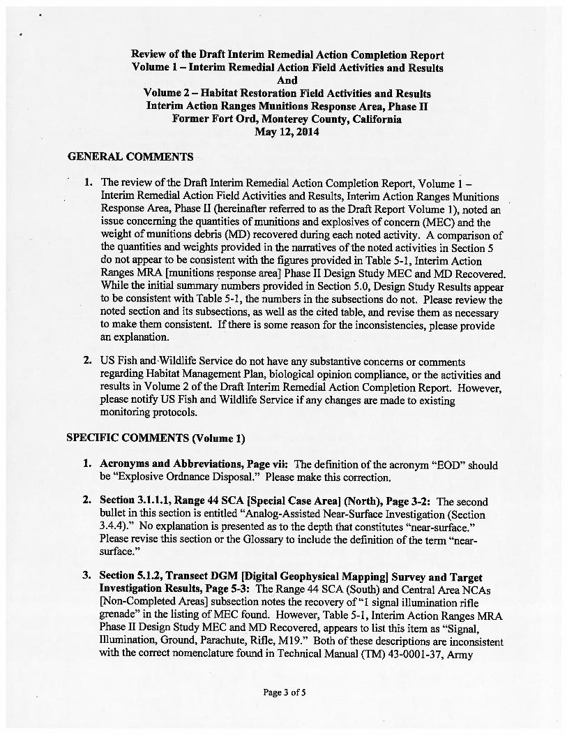
Review of the Draft Interim Remedial Action Completion ReportVolume 1 — Interim Remedial Action Field Activities and Results
AndVolume 2 — Habitat Restoration Field Activities and ResultsInterim Action Ranges Munitions Response Area, Phase II
Former Fort Ord, Monterey County, CaliforniaMay 12, 2014
GENERAL COMMENTS
1. The review of the Draft Interim Remedial Action Completion Report, Volume 1 —
Interim Remedial Action Field Activities and Results, Interim Action Ranges MunitionsResponse Area, Phase II (hereinafter referred to as the Draft Report Volume 1), noted anissue concerning the quantities of munitions and explosives of concern (MEC) and theweight of munitions debris (MD) recovered during each noted activity. A comparison ofthe quantities and weights provided in the narratives of the noted activities in Section 5do not appear to be consistent with the figures provided in Table 5-1, Interim ActionRanges MRA [munitions response areal Phase II Design Study MEC and MD Recovered.While the initial summary numbers provided in Section 5.0, Design Study Results appearto be consistent with Table 5-1, the numbers in the subsections do not. Please review thenoted section and its subsections, as well as the cited table, and revise them as necessaryto make them consistent. If there is some reason for the inconsistencies, please providean explanation.
2. US Fish and-Wildlife Service do not have any substantive concerns or commentsregarding Habitat Management Plan, biological opinion compliance, or the activities andresults in Volume 2 of the Draft Interim Remedial Action Completion Report. However,please notify US Fish and Wildlife Service if any changes are made to existingmonitoring protocols.
SPECIFIC COMMENTS (Volume 1)
1. Acronyms and Abbreviations, Page vii: The definition of the acronym “EOD” shouldbe “Explosive Ordnance Disposal.” Please make this correction.
2. Section 3.1.1.1, Range 44 SCA jSpecial Case Area] (North), Page 3-2: The secondbullet in this section is entitled “Analog-Assisted Near-Surface Investigation (Section3.4.4).” No explanation is presented as to the depth that constitutes “near-surface.”Please revise this section or the Glossary to include the definition of the term “nearsurface.”
3. Section 5.1.2, Transect DGM [Digital Geophysical Mapping] Survey and TargetInvestigation Results, Page 5-3: The Range 44 SCA (South) and Central Area NCAs[Non-Completed Areas] subsection notes the recovery of”l signal illumination riflegrenade” in the listing of MEC found. However, Table 5-1, Interim Action Ranges MRAPhase II Design Study MEC and MD Recovered, appears to list this item as “Signal,Illumination, Ground, Parachute, Rifle, Ml 9.” Both of these descriptions are inconsistentwith the correct nomenclature found in Technical Manual (TM) 43-0001-37, Army
Page 3 of5
Ammunition Data Sheets, Military Pyrotechnics. The item is listed there as “Signal,Illumination, Ground: Green Star, Parachute M19A2 and Ml 9A2B2.” The term “Ml 9series” is generally acceptable as a substitute for the M19A2 and Ml 9A2B2 terms.Please correct the noted portions of the Draft Report Volume 1 to be consistent with theterminology used in TM 43-0001-37.
4. Section 5.2.4, Transect Verification DGM Survey Target Investigation Results, Page5-7: The first paragraph of this section states that, “One MD item (fragment) and oneMEC item (faze, point-initiating, base detonating, M412) associated with a sensitivelyfuzed 66mm, HEAT [high explosive anti-tank], M72 series rocket, and one MEC (fragball) associated with a sensitively-flized 40mm high explosive (HE) projectile were foundduring the transect verification DGM survey operations.” This is followed by thestatement that, “These items do not indicate that intact sensitively-fuzed items remain inRange 44 SCA (North).” No further explanation for this determination is provided in thisparagraph, and the paragraph continues with a listing of the materials recovered duringthe investigation.
The following paragraph provides a statement that, “The transect verification DGM.survey and target investigation resulted in a lack of evidence for sensitively-fuzed itemsto remain in Range 44 SCA (North).” It then explains the additional investigationperformed and the logic behind this determination.
It would, therefore, seem that the initial statement that the results did not appear toindicate that intact sensitively-fuzed items remain in Range 44 SCA (North) is out ofplace without the further explanation and investigation noted in the second paragraphwhere this conclusion is restated and expanded in detail.
Please remove the statement that, “These items do not indicate that intact sensitively-.fuzed items remain in Range 44 SCA (North)” from the noted first paragraph.
5. Section 6.1 Soil Excavation and Sifting Results, Page 6-1: This section indicates that,“Soil was excavated from Range 47 SCA in the soil removal area shown on Figure 3-2 toa depth of 6 to 36 inches hgs, totaling approximately 37,000 cubic yards of soil.” Nobasis or other explanation is provided for the 6 to 36-inch depth diflèrential. Pleaserevise the section to include the reason for the noted depth differential.
6. Appendix H, Subsections H-2A, H-2B, and J1-2C: These appendices are somewhatdifficult to understand, as no legend is provided to explain some of the entries. Forexample, it is unclear what is intended by the term “(standard)” following entries in the“Item Category” column. Also, it is unclear what is meant by the term “363” in the “i OEModel ID” column, and what that column designation refers to. A final example is thatunits of measure (i.e., feet, inches, meters) are not defined in the “Depth” and “Weight”columns. Please provide a legend/explanation for the items listed and any other nonintuitive columns in the tables in these subsections.
Page 4 of 5
MINOR COMMENTS (Volume 1)
1. Executive Summary, Page xvii: The second paragraph of the Introduction and Purposesubsection states that, “Approximately 35 acres of SCAs and approximately 9 acres ofNCAs within MRS Ranges 43-48 are located within the boundaries of the TAR [InterimAction Ranges] MRA and are the subject of this IRACR [Interim Remedial ActionCompletion Report].” However, Section 2.4.2, Army Phase I Interim Action, indicatesthat, “Approximately 34 acres of SCAs and approximately 9 acres of NCAs within MRSRanges 43-48 are located within the boundaries of the TAR MRA and are the subject ofthis IRACR.” Please correct the two cited sentences as necessary to make the SCAacreage consistent.
2. Section 3.4.5.3, Excavation of DGM Anomaly Targets, Page 3-16: The Range 44SCA (South) and Central NCAs Design Study Transect Target Investigation subsectionnotes that, “No evidence of sensitively-fuzed munitions or related debris wereencountered in the transect targets; however, target investigation was increased to 50% ofthe transect targets (randomly selected) at and above the 5OmV target selection thresholdin 16 grid (Figure 3-4).” As currently constructed, the intent of this sentence is unclear.Please revise the sentence to clarify if the “...in 16 grid...” statement indicates that thischange was implemented in some unidentified 16 grids, or that it was accomplished in agrid somehow associated with the number 16.
3. Appendix J, MEC Photographs: There are minor issues with two of the photographs inthe appendix. These are:
• Photograph 11: The item in the photograph is identified as “Cartridge, 40mm, HE,M406.” Flowever, the photograph shows a projectile, not a cartridge, as there is nocartridge case attached.
• Photograph 12: The photo and the page present two different nomenclatures for theitem. The page title is correct, and the title in the photograph is incorrect.
Please correct Photograph 11 and note the error on the title in Photograph 12.
Page 5 of 5