Embed Size (px)
Citation preview
committed to our coast committed to our coast
Restoration in the Mississippi River Delta: Old River Control Structure to the Gulf of Mexico
A. Carol Parsons Richards Louisiana Coastal Protection and Restoration Authority (CPRA) CEER Conference, Session 61 July 31, 2014
Coastal Protection and Restoration Authority of Louisiana
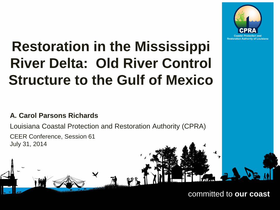
The Mississippi River Watershed
Coastal Protection and Restoration Authority of Louisiana
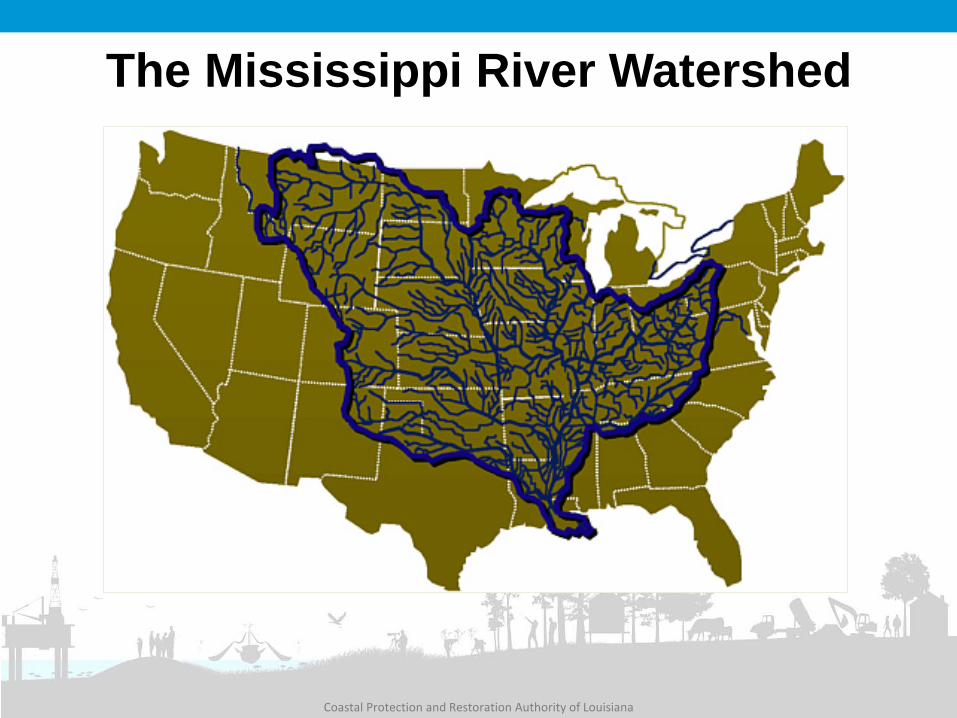
Louisiana is Experiencing a Coastal Crisis
1,880 square
miles lost since the
1930s
Coastal Protection and Restoration Authority of Louisiana
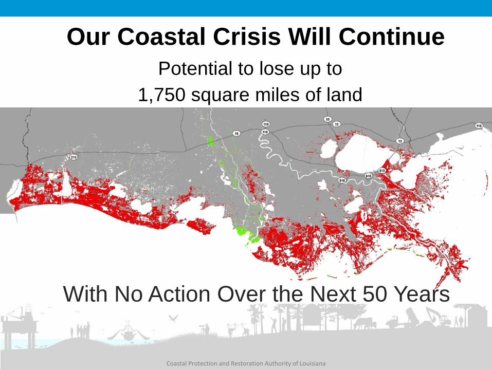
Our Coastal Crisis Will Continue
With No Action Over the Next 50 Years
Potential to lose up to 1,750 square miles of land
Coastal Protection and Restoration Authority of Louisiana
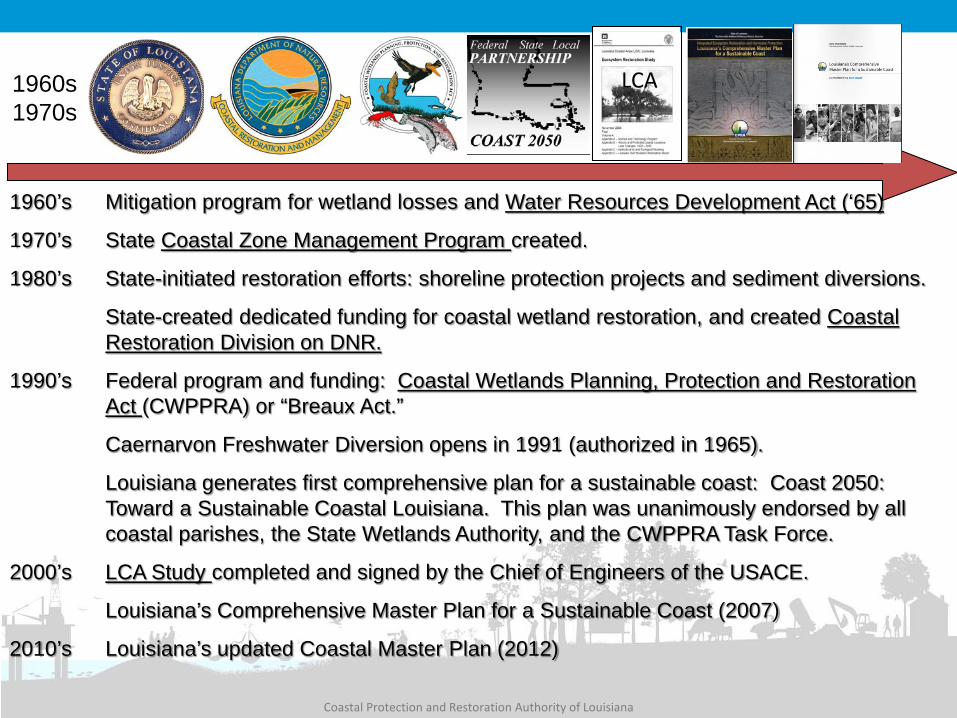
1960’s Mitigation program for wetland losses and Water Resources Development Act (‘65)
1970’s State Coastal Zone Management Program created.
1980’s State-initiated restoration efforts: shoreline protection projects and sediment diversions.
State-created dedicated funding for coastal wetland restoration, and created Coastal Restoration Division on DNR.
1990’s Federal program and funding: Coastal Wetlands Planning, Protection and Restoration Act (CWPPRA) or “Breaux Act.”
Caernarvon Freshwater Diversion opens in 1991 (authorized in 1965).
Louisiana generates first comprehensive plan for a sustainable coast: Coast 2050: Toward a Sustainable Coastal Louisiana. This plan was unanimously endorsed by all coastal parishes, the State Wetlands Authority, and the CWPPRA Task Force.
2000’s LCA Study completed and signed by the Chief of Engineers of the USACE.
Louisiana’s Comprehensive Master Plan for a Sustainable Coast (2007)
2010’s Louisiana’s updated Coastal Master Plan (2012)
1989 1980s 1990 1998 2005 2012 2007
1960s 1970s
LCA
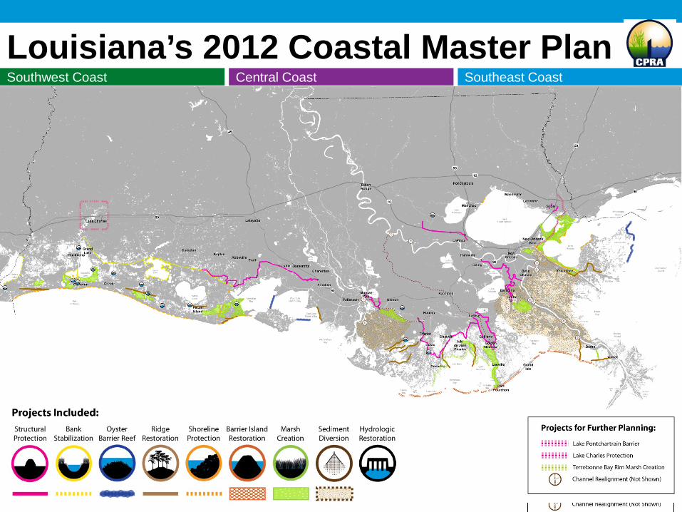
Louisiana’s 2012 Coastal Master Plan Southwest Coast Southeast Coast Central Coast
Coastal Protection and Restoration Authority of Louisiana
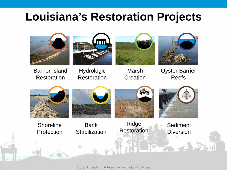
Louisiana’s Restoration Projects
Ridge Restoration
Bank Stabilization
Sediment Diversion
Barrier Island Restoration
Oyster Barrier Reefs
Marsh Creation
Hydrologic Restoration
Shoreline Protection
Coastal Protection and Restoration Authority of Louisiana
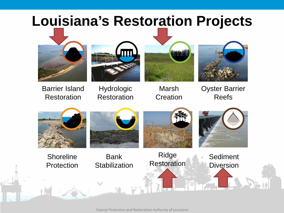
Louisiana’s Restoration Projects
Ridge Restoration
Bank Stabilization
Sediment Diversion
Barrier Island Restoration
Oyster Barrier Reefs
Marsh Creation
Hydrologic Restoration
Shoreline Protection
Coastal Protection and Restoration Authority of Louisiana
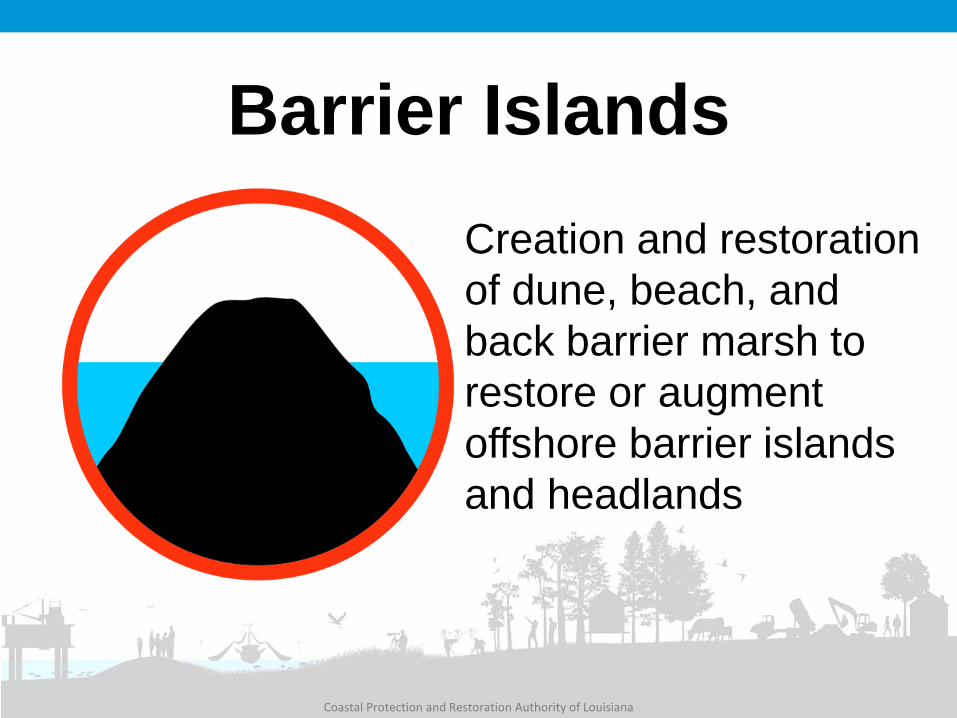
Barrier Islands Creation and restoration of dune, beach, and back barrier marsh to restore or augment offshore barrier islands and headlands

West Belle Pass Barrier Headland Restoration (TE-52)
Total Project Budget $33.5 million Acres Benefited 596 Construction Completion Date December 2012 Funding Program CWPPRA
Coastal Protection and Restoration Authority of Louisiana
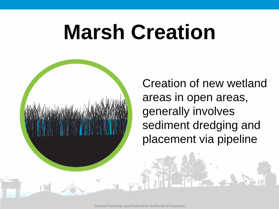
Marsh Creation
Creation of new wetland areas in open areas, generally involves sediment dredging and placement via pipeline
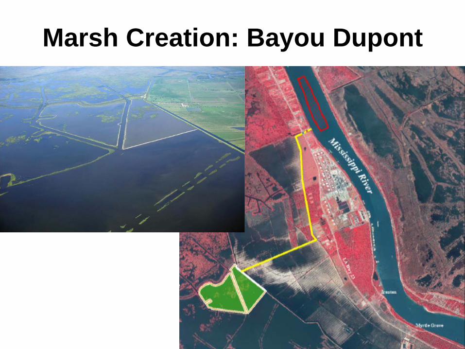
Marsh Creation: Bayou Dupont
Coastal Protection and Restoration Authority of Louisiana
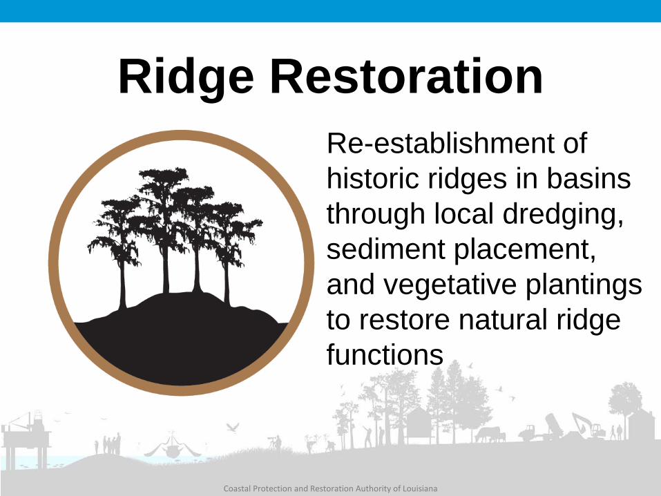
Ridge Restoration Re-establishment of historic ridges in basins through local dredging, sediment placement, and vegetative plantings to restore natural ridge functions
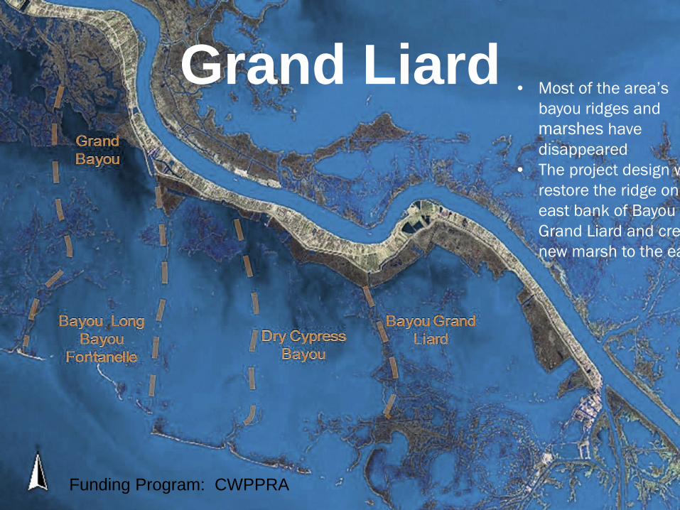
• Most of the area’s bayou ridges and marshes have disappeared
• The project design w restore the ridge on east bank of Bayou Grand Liard and cre new marsh to the ea
Grand Liard
Funding Program: CWPPRA
Coastal Protection and Restoration Authority of Louisiana
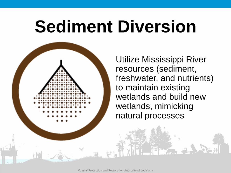
Sediment Diversion Utilize Mississippi River resources (sediment, freshwater, and nutrients) to maintain existing wetlands and build new wetlands, mimicking natural processes
Coastal Protection and Restoration Authority of Louisiana
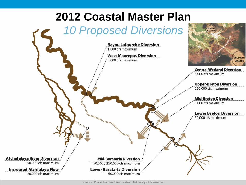
2012 Coastal Master Plan 10 Proposed Diversions
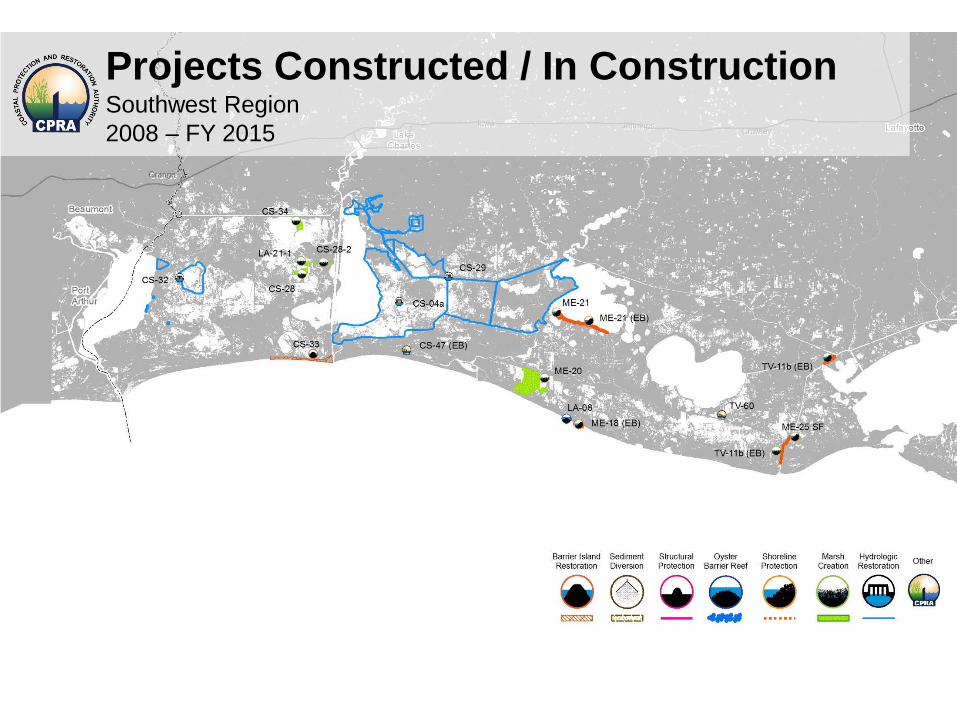
Projects Constructed / In Construction Southwest Region 2008 – FY 2015
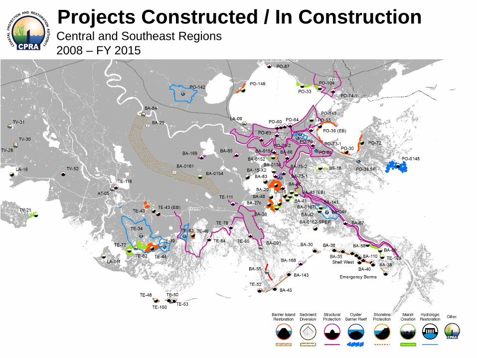
Projects Constructed / In Construction Central and Southeast Regions 2008 – FY 2015
Coastal Protection and Restoration Authority of Louisiana
Moving Forward
Sediment • Availability • Effects on navigation Water • Availability • Effects in receiving basin: hydrology,
salinity, nutrients, vegetation, fisheries, socioeconomics
Coastal Protection and Restoration Authority of Louisiana
Questions? Carol Parsons Richards
225-342-9430
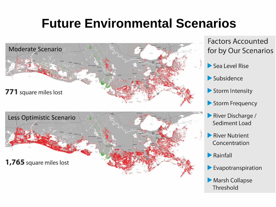
Future Environmental Scenarios
Moderate Scenario
Less Optimistic Scenario
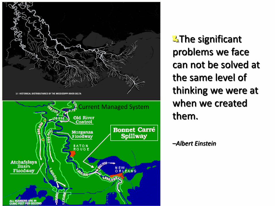
Historical Distributaries of Mississippi River
By Jakob Rosenweig, Tulane University
Current Managed System
The significant problems we face can not be solved at the same level of thinking we were at when we created them.
–Albert Einstein
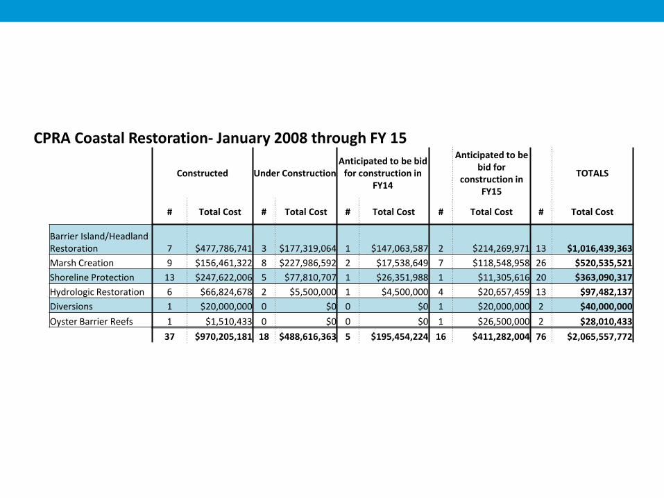
CPRA Coastal Restoration- January 2008 through FY 15
Constructed Under Construction Anticipated to be bid
for construction in FY14
Anticipated to be bid for
construction in FY15
TOTALS
# Total Cost # Total Cost # Total Cost # Total Cost # Total Cost
Barrier Island/Headland Restoration 7 $477,786,741 3 $177,319,064 1 $147,063,587 2 $214,269,971 13 $1,016,439,363 Marsh Creation 9 $156,461,322 8 $227,986,592 2 $17,538,649 7 $118,548,958 26 $520,535,521 Shoreline Protection 13 $247,622,006 5 $77,810,707 1 $26,351,988 1 $11,305,616 20 $363,090,317 Hydrologic Restoration 6 $66,824,678 2 $5,500,000 1 $4,500,000 4 $20,657,459 13 $97,482,137 Diversions 1 $20,000,000 0 $0 0 $0 1 $20,000,000 2 $40,000,000 Oyster Barrier Reefs 1 $1,510,433 0 $0 0 $0 1 $26,500,000 2 $28,010,433
37 $970,205,181 18 $488,616,363 5 $195,454,224 16 $411,282,004 76 $2,065,557,772
Coastal Protection and Restoration Authority of Louisiana
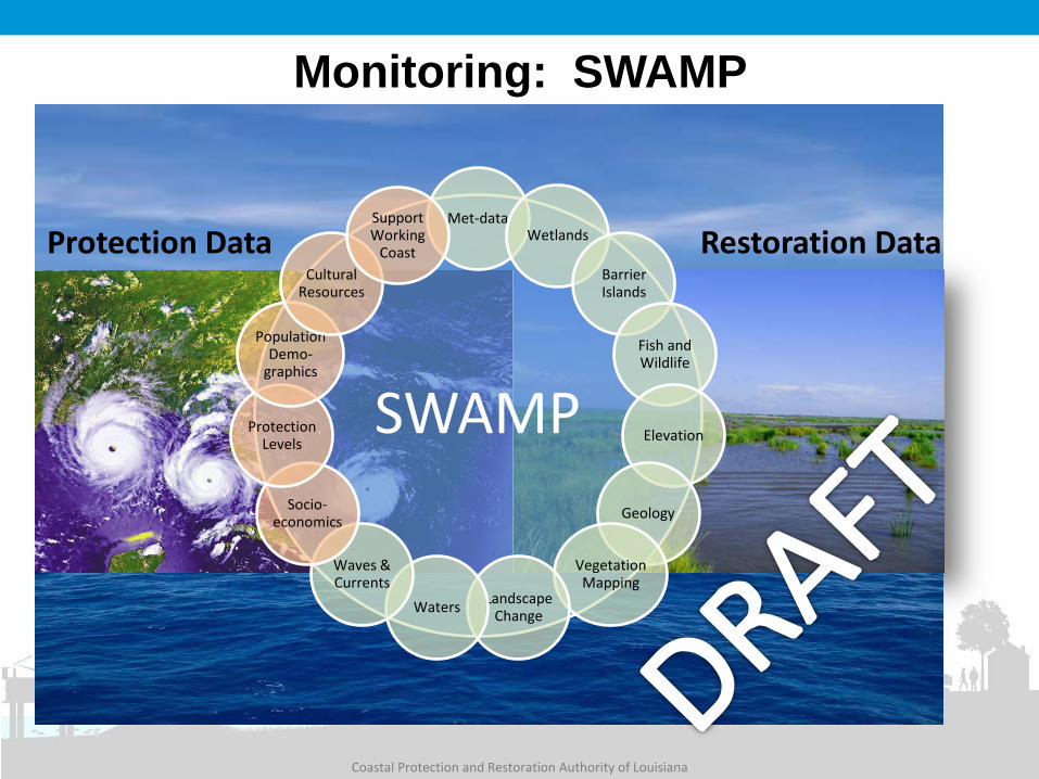
Monitoring: SWAMP
Protection Data Restoration Data
SWAMP
Met-data Wetlands
Barrier Islands
Fish and Wildlife
Elevation
Geology
Vegetation Mapping
Landscape Change Waters
Waves & Currents
Socio-economics
Protection Levels
Population Demo-
graphics
Cultural Resources
Support Working
Coast
Project-Level E&D,
Construction, and OM&M
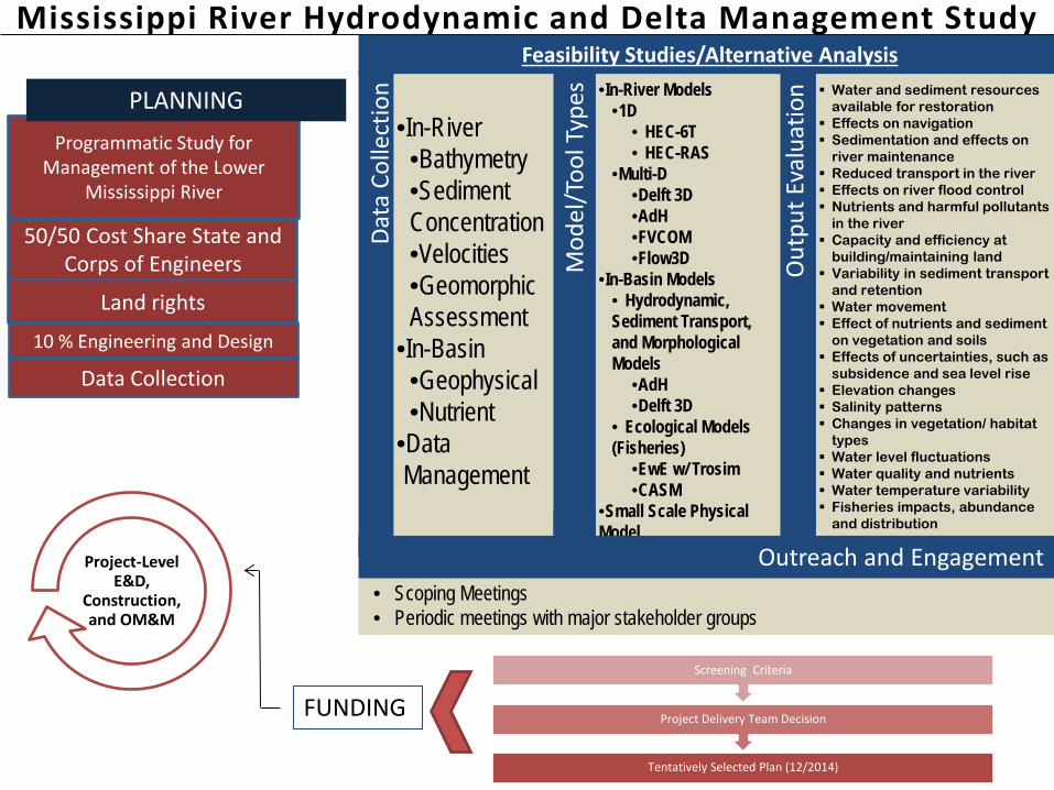
Mississippi River Hydrodynamic and Delta Management Study
50/50 Cost Share State and Corps of Engineers
Tentatively Selected Plan (12/2014)
Project Delivery Team Decision
Screening Criteria
FUNDING
Programmatic Study for Management of the Lower
Mississippi River
PLANNING
• Scoping Meetings • Periodic meetings with major stakeholder groups
Outreach & Engagement
Land rights
10 % Engineering and Design
Data Collection
Water and sediment resources available for restoration
Effects on navigation Sedimentation and effects on
river maintenance Reduced transport in the river Effects on river flood control Nutrients and harmful pollutants
in the river Capacity and efficiency at
building/maintaining land Variability in sediment transport
and retention Water movement Effect of nutrients and sediment
on vegetation and soils Effects of uncertainties, such as
subsidence and sea level rise Elevation changes Salinity patterns Changes in vegetation/ habitat
types Water level fluctuations Water quality and nutrients Water temperature variability Fisheries impacts, abundance
and distribution
Out
put E
valu
atio
n
•In-River Models
•1D • HEC-6T • HEC-RAS
•Multi-D •Delft 3D •AdH •FVCOM •Flow3D
•In-Basin Models • Hydrodynamic, Sediment Transport, and Morphological Models
•AdH •Delft 3D
• Ecological Models (Fisheries)
•EwE w/ Trosim •CASM
•Small Scale Physical Model
M
odel
/Too
l Typ
es
Data
Col
lect
ion
•In-River •Bathymetry •Sediment Concentration •Velocities •Geomorphic Assessment
•In-Basin •Geophysical •Nutrient
•Data Management
Feasibility Studies/Alternative Analysis
Outreach and Engagement
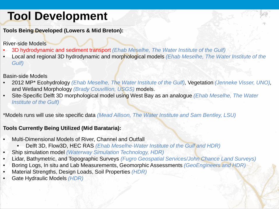
Tool Development Tools Being Developed (Lowers & Mid Breton): River-side Models • 3D hydrodynamic and sediment transport (Ehab Meselhe, The Water Institute of the Gulf) • Local and regional 3D hydrodynamic and morphological models (Ehab Meselhe, The Water Institute of the
Gulf) Basin-side Models • 2012 MP* Ecohydrology (Ehab Meselhe, The Water Institute of the Gulf), Vegetation (Jenneke Visser, UNO),
and Wetland Morphology (Brady Couvillion, USGS) models. • Site-Specific Delft 3D morphological model using West Bay as an analogue (Ehab Meselhe, The Water
Institute of the Gulf)
*Models runs will use site specific data (Mead Allison, The Water Institute and Sam Bentley, LSU) Tools Currently Being Utilized (Mid Barataria):
• Multi-Dimensional Models of River, Channel and Outfall • Delft 3D, Flow3D, HEC RAS (Ehab Meselhe-Water Institute of the Gulf and HDR)
• Ship simulation model (Waterway Simulation Technology, HDR) • Lidar, Bathymetric, and Topographic Surveys (Fugro Geospatial Services/John Chance Land Surveys) • Boring Logs, In situ and Lab Measurements, Geomorphic Assessments (GeoEngineers and HDR) • Material Strengths, Design Loads, Soil Properties (HDR) • Gate Hydraulic Models (HDR)
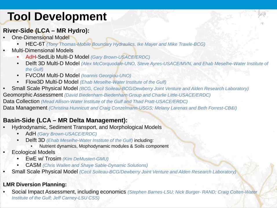
River-Side (LCA – MR Hydro): • One-Dimensional Model
• HEC-6T (Tony Thomas-Mobile Boundary Hydraulics, Ike Mayer and Mike Trawle-BCG) • Multi-Dimensional Models
• AdH-SedLib Multi-D Model (Gary Brown-USACE/ERDC) • Delft 3D Multi-D Model (Alex McCorquodale-UNO, Steve Ayres-USACE/MVN, and Ehab Meselhe-Water Institute of
the Gulf) • FVCOM Multi-D Model (Ioannis Georgiou-UNO) • Flow3D Multi-D Model (Ehab Meselhe-Water Institute of the Gulf)
• Small Scale Physical Model (BCG, Cecil Soileau-BCG/Dewberry Joint Venture and Alden Research Laboratory) Geomorphic Assessment (David Biedenharn-Biedenharn Group and Charlie Little-USACE/ERDC) Data Collection (Mead Allison-Water Institute of the Gulf and Thad Pratt-USACE/ERDC) Data Management (Christina Hunnicutt and Craig Conzelmann-USGS; Melany Larenas and Beth Forrest-CB&I) Basin-Side (LCA – MR Delta Management): • Hydrodynamic, Sediment Transport, and Morphological Models
• AdH (Gary Brown-USACE/ERDC) • Delft 3D (Ehab Meselhe-Water Institute of the Gulf) including:
• Nutrient dynamics, Mophodynamic modules & Soils component • Ecological Models
• EwE w/ Trosim (Kim DeMustert-GMU) • CASM (Chris Wallen and Shaye Sable-Dynamic Solutions)
• Small Scale Physical Model (Cecil Soileau-BCG/Dewberry Joint Venture and Alden Research Laboratory)
LMR Diversion Planning: • Social Impact Assessment, including economics (Stephen Barnes-LSU; Nick Burger- RAND; Craig Colten-Water
Institute of the Gulf; Jeff Carney-LSU CSS)
Tool Development