Embed Size (px)
Citation preview
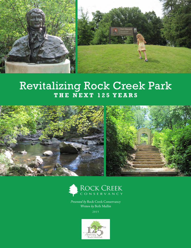
T H E N E X T 1 2 5 Y E A R SRevitalizing Rock Creek Park
Presented by Rock Creek ConservancyWritten by Beth Mullin
2015

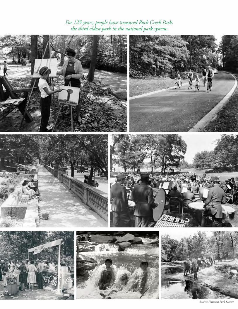
For 125 years, people have treasured Rock Creek Park, the third oldest park in the national park system.
Source: National Park Service
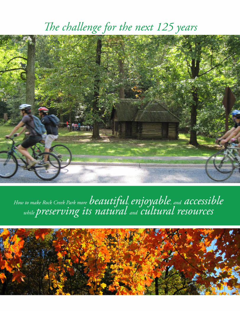
The challenge for the next 125 years
How to make Rock Creek Park more beautiful, enjoyable, and accessible while preserving its natural and cultural resources
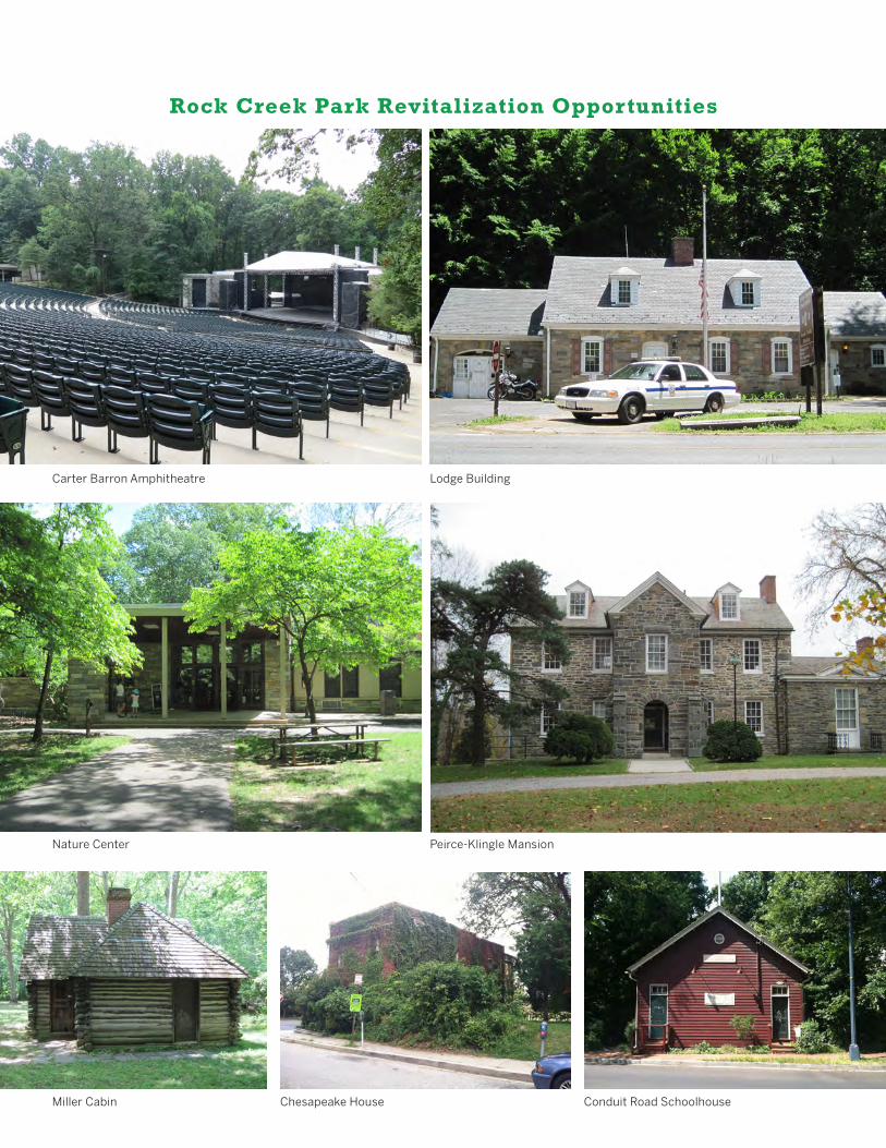
Rock Creek Park Revitalization Opportunities
Carter Barron Amphitheatre Lodge Building
Nature Center Peirce-Klingle Mansion
Miller Cabin Chesapeake House Conduit Road Schoolhouse
This paper was made possible through the generous support of the Jean T. and Heyward G. Pelham Foundation.
Revitalizing Rock Creek Park: The Next 125 Years was commissioned by Rock Creek Conservancy on the occasion of the 125th Anniversary of Rock Creek Park. The report is intended to offer a state-of-the-park evaluation and make general recommendations for protecting and improving Rock Creek Park. It is based on site visits, a review of existing literature, and interviews with
experts, including park personnel and others deeply familiar with Rock Creek Park.
The Conservancy convened a Green Ribbon Panel of twenty-three leaders in the environment; education; local and federal government; urban planning; water management; arts and humanities; natural resources, wildlife, and park management fields. Their reviews of the draft paper resulted in important revisions that
are incorporated in this final version. The paper will be shared with the National Park Service and park partners, and will inform the 2016 strategic plan for Rock Creek Conservancy.
A condensed version of this report is available as a brochure from Rock Creek Conservancy.
GREEN RIBBON PANEL Lisa Alexander, Executive Director, Audubon Naturalist Society
Doug Barker, President, Barker + Scott ConsultingHedrick Belin, President, Potomac ConservancyMark Buscaino, Executive Director, Casey Trees
Jim Foster, President, Anacostia Watershed SocietyDenis Galvin, Board, National Parks Conservation Association.; Dep. Dir., National Park Service (fmr)
Rachel Goslins, Executive Director, President’s Committee on the Arts and HumanitiesGeorge Hawkins, Chief Executive Officer and General Manager, DC Water and Sewer
Jerry Johnson, Chief Executive Officer and General Manager, Washington Suburban Sanitary CommissionLori Kaplan, President and Chief Executive Officer, Latin American Youth Center
Greg Kats, President, Capital EIsiah Leggett, Montgomery County Executive, Montgomery County, Maryland
Stephanie Meeks, President and Chief Executive Officer, National Trust for Historic PreservationMichelle Moore, Chief Executive Officer, Groundswell
Eleanor Holmes Norton, U.S. Congresswoman, District of ColumbiaAri Novy, Executive Director, United States Botanic GardensAudrey Peterman, Founding Director, Earthwise Productions
Carter Roberts, President and Chief Executive Officer, World Wildlife FundDavid Rogner, Executive Director, Harvest CollectiveLex Sant, Managing Director, Persimmon Tree Capital
Chris Van Hollen, U.S. Congressman, MarylandTommy Wells, Director, District Department of the Environment
Edward O. Wilson, Professor Emeritus, Harvard, Pulitzer Prize winning author
See profiles of Green Ribbon Panel Members on Page 79
Summary . . . . . . . . . . . . . . . . . . . . . . . . . . . . . . . . . . . . . . . . . . . . . . . . . . . . . . . . . . . . . 1
Introduction . . . . . . . . . . . . . . . . . . . . . . . . . . . . . . . . . . . . . . . . . . . . . . . . . . . . . . . . . . . 7
What Makes It Great . . . . . . . . . . . . . . . . . . . . . . . . . . . . . . . . . . . . . . . . . . . . . . . . . . . 8Park Management and Planning . . . . . . . . . . . . . . . . . . . . . . . . . . . . . . . . . . . . . . . . . . . 9Looking Ahead . . . . . . . . . . . . . . . . . . . . . . . . . . . . . . . . . . . . . . . . . . . . . . . . . . . . . . . . 13
Protecting the Park’s Natural and Cultural Resources . . . . . . . . . . . . . . . . . . . . 15
Lands and Vegetation . . . . . . . . . . . . . . . . . . . . . . . . . . . . . . . . . . . . . . . . . . . . . . . . . . . 16Waters . . . . . . . . . . . . . . . . . . . . . . . . . . . . . . . . . . . . . . . . . . . . . . . . . . . . . . . . . . . . . . 19Wildlife . . . . . . . . . . . . . . . . . . . . . . . . . . . . . . . . . . . . . . . . . . . . . . . . . . . . . . . . . . . . . . 25Scenic Beauty and Cultural Landscapes . . . . . . . . . . . . . . . . . . . . . . . . . . . . . . . . . . . . . 28
Scenic Beauty in Natural Areas . . . . . . . . . . . . . . . . . . . . . . . . . . . . . . . . . . . . . . . . . . . 30Battleground National Cemetery . . . . . . . . . . . . . . . . . . . . . . . . . . . . . . . . . . . . . . . . . . 31Civil War Forts . . . . . . . . . . . . . . . . . . . . . . . . . . . . . . . . . . . . . . . . . . . . . . . . . . . . . . . 31Dumbarton Oaks Park . . . . . . . . . . . . . . . . . . . . . . . . . . . . . . . . . . . . . . . . . . . . . . . . . 32Francis Scott Key Park . . . . . . . . . . . . . . . . . . . . . . . . . . . . . . . . . . . . . . . . . . . . . . . . . . 32Georgetown Waterfront Park . . . . . . . . . . . . . . . . . . . . . . . . . . . . . . . . . . . . . . . . . . . . . 32Meridian Hill (Malcolm X) Park . . . . . . . . . . . . . . . . . . . . . . . . . . . . . . . . . . . . . . . . . . 33Montrose Park . . . . . . . . . . . . . . . . . . . . . . . . . . . . . . . . . . . . . . . . . . . . . . . . . . . . . . . 33Old Stone House Garden . . . . . . . . . . . . . . . . . . . . . . . . . . . . . . . . . . . . . . . . . . . . . . . . 34Rock Creek and Potomac Parkway . . . . . . . . . . . . . . . . . . . . . . . . . . . . . . . . . . . . . . . . . 34Traffic Circles and Small Parks . . . . . . . . . . . . . . . . . . . . . . . . . . . . . . . . . . . . . . . . . . . 36
Other Cultural Resources . . . . . . . . . . . . . . . . . . . . . . . . . . . . . . . . . . . . . . . . . . . . . . . . 37Park Boundaries . . . . . . . . . . . . . . . . . . . . . . . . . . . . . . . . . . . . . . . . . . . . . . . . . . . . . . . 37
Enhancing the Experience of Park Users . . . . . . . . . . . . . . . . . . . . . . . . . . . . . . . . 39
Recreation . . . . . . . . . . . . . . . . . . . . . . . . . . . . . . . . . . . . . . . . . . . . . . . . . . . . . . . . . . . . 40Driving and Road Usage . . . . . . . . . . . . . . . . . . . . . . . . . . . . . . . . . . . . . . . . . . . . . . . . 42Trails . . . . . . . . . . . . . . . . . . . . . . . . . . . . . . . . . . . . . . . . . . . . . . . . . . . . . . . . . . . . . 43Bicycling . . . . . . . . . . . . . . . . . . . . . . . . . . . . . . . . . . . . . . . . . . . . . . . . . . . . . . . . . . . . 45Park Amenities . . . . . . . . . . . . . . . . . . . . . . . . . . . . . . . . . . . . . . . . . . . . . . . . . . . . . . . 46
Park Buildings and Facilities . . . . . . . . . . . . . . . . . . . . . . . . . . . . . . . . . . . . . . . . . . . . . . 49Battleground National Cemetery Superintendent’s Lodge . . . . . . . . . . . . . . . . . . . . . . . . . 50Carter Barron Amphitheatre Complex . . . . . . . . . . . . . . . . . . . . . . . . . . . . . . . . . . . . . . 50Chesapeake House . . . . . . . . . . . . . . . . . . . . . . . . . . . . . . . . . . . . . . . . . . . . . . . . . . . . 53Conduit Road Schoolhouse . . . . . . . . . . . . . . . . . . . . . . . . . . . . . . . . . . . . . . . . . . . . . . 54Linnaean Hill Complex . . . . . . . . . . . . . . . . . . . . . . . . . . . . . . . . . . . . . . . . . . . . . . . . 55Lodge Building (Park Police Substation) . . . . . . . . . . . . . . . . . . . . . . . . . . . . . . . . . . . . . 56Miller Cabin . . . . . . . . . . . . . . . . . . . . . . . . . . . . . . . . . . . . . . . . . . . . . . . . . . . . . . . . 57Nature Center and Planetarium . . . . . . . . . . . . . . . . . . . . . . . . . . . . . . . . . . . . . . . . . . 58Old Stone House . . . . . . . . . . . . . . . . . . . . . . . . . . . . . . . . . . . . . . . . . . . . . . . . . . . . . . 60Peirce Mill Complex . . . . . . . . . . . . . . . . . . . . . . . . . . . . . . . . . . . . . . . . . . . . . . . . . . . 61Rock Creek Golf Course . . . . . . . . . . . . . . . . . . . . . . . . . . . . . . . . . . . . . . . . . . . . . . . . . 62Summary . . . . . . . . . . . . . . . . . . . . . . . . . . . . . . . . . . . . . . . . . . . . . . . . . . . . . . . . . . 65
Programming . . . . . . . . . . . . . . . . . . . . . . . . . . . . . . . . . . . . . . . . . . . . . . . . . . . . . . . . . 66
Table of Contents
Index of Tables
Table 1: Rock Creek Park Areas . . . . . . . . . . . . . . . . . . . . . . . . . . . . . . . . . . . . . . . . . . . . 9Table 2: Pollutants in Rock Creek Park Streams and their Sources . . . . . . . . . . . . . . . . . . 21Table 3: Threats to Rock Creek Park Wildlife . . . . . . . . . . . . . . . . . . . . . . . . . . . . . . . . . 26Table 4: Rock Creek Park Landscaping and Features . . . . . . . . . . . . . . . . . . . . . . . . . . . . 28Table 5: Activities of Rock Creek Park Users . . . . . . . . . . . . . . . . . . . . . . . . . . . . . . . . . . 40Table 6: Facilities for Park Recreational Use . . . . . . . . . . . . . . . . . . . . . . . . . . . . . . . . . . 41Table 7: Potential Uses for Park Buildings and the Golf Course . . . . . . . . . . . . . . . . . . . . 65
Index of Figures
Figure 1: Park Location Map . . . . . . . . . . . . . . . . . . . . . . . . . . . . . . . . . . . . . . . . . . . . . 10Figure 2: Rock Creek Golf Course Usage, 1992-2013 . . . . . . . . . . . . . . . . . . . . . . . . . . . 63Figure 3: Rock Creek Park Trail Heads . . . . . . . . . . . . . . . . . . . . . . . . . . . . . . . . . . . . . . 73
Improving Access to the Park . . . . . . . . . . . . . . . . . . . . . . . . . . . . . . . . . . . . . . . 69Understanding and Appreciation of the Park . . . . . . . . . . . . . . . . . . . . . . . . . . . . . . . . . . 70Finding Park Resources . . . . . . . . . . . . . . . . . . . . . . . . . . . . . . . . . . . . . . . . . . . . . . . . . 70Community Connections . . . . . . . . . . . . . . . . . . . . . . . . . . . . . . . . . . . . . . . . . . . . . . . . 72Physical Access . . . . . . . . . . . . . . . . . . . . . . . . . . . . . . . . . . . . . . . . . . . . . . . . . . . . . . . . 73
Funding and Philanthropy . . . . . . . . . . . . . . . . . . . . . . . . . . . . . . . . . . . . . . . . . . . . . 75
Conclusion . . . . . . . . . . . . . . . . . . . . . . . . . . . . . . . . . . . . . . . . . . . . . . . . . . . . . . . . . . . . 77
Green Ribbon Panel Profiles . . . . . . . . . . . . . . . . . . . . . . . . . . . . . . . . . . . . . . . . . . . 79
1R E V I T A L I Z I N G R O C K C R E E K PA R K
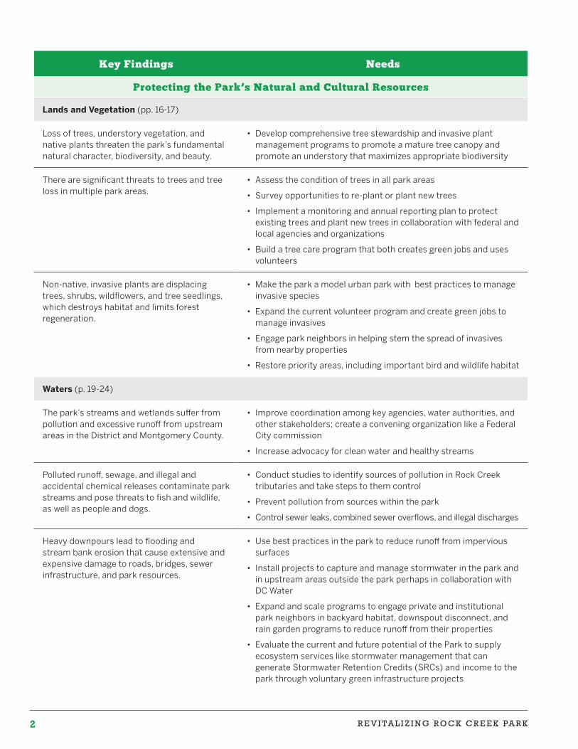
Rock Creek Park is a multi-unit national park in Washington, D.C. managed by the National Park Service.
Rock Creek Park—an iconic and treasured national park in the nation’s capital—marks its 125th Anniversary in 2015. Created by an act of Congress in 1890, it is one of the country’s largest naturalistic parks in an urban setting. Since 1890, the park has grown to include new areas that bring nature, history, and beauty into many Washington neighborhoods. These stretch from a one-room schoolhouse in the Palisades to Barnard Hill Park near Mount Rainier, and from a small Civil War cemetery on upper Georgia Avenue to the magnificent Georgetown Waterfront Park.
The National Park Service faces immense challenges in managing the park for the benefit and enjoyment of millions of people while striving to preserve its forests, streams, landscapes, and historical features. The 125th Anniversary is an appropriate time to evaluate these challenges and identify ways to address them.
This report describes:
• Threats to park’s lands, waters, wildlife, scenic beauty, and cultural landscapes;
• Ways to enhance the recreational experience of park users, the use of park buildings, and programming; and
• Steps to improve access to the park and its resources.
• The report highlights a range of recommendations and opportunities to make the park more sustainable, beautiful, and enjoyable. The overarching goals are to create a model urban park in Rock Creek Park and embrace the concept of the park itself as a science center by Protecting park trees, managing non-native invasive plants, conserving bird and wildlife habitat, and reducing runoff and water pollution, and encouraging use of the park for scientific inquiry;
• Restoring and maintaining the beauty of park landscapes in all park areas;
• Making the park more enjoyable by improving park trails, enhancing park amenities, making better use of existing park buildings, enlivening the park’s small areas, and providing more robust programming and scientific research that takes advantage of the unique opportunities presented by a large nature preserve in the heart of the nation’s capital; and
• Improving access to the park by increasing understanding and appreciation of the park, making it easier to find and use park resources, enhancing community connections to the park, and improving physical access.
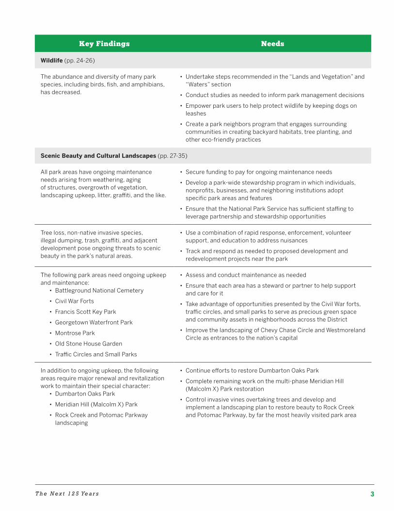
The following table highlights key findings and steps to address the issues identified.
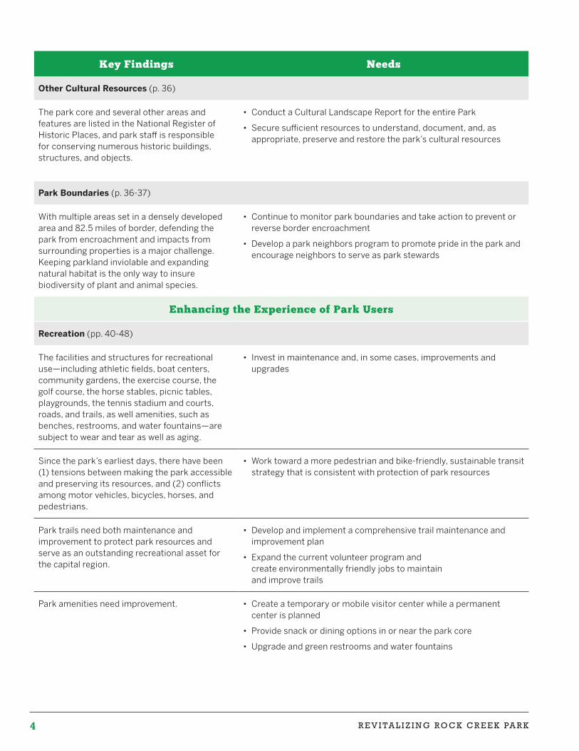
Summary
2 R E V I TA L I Z I N G R O C K C R E E K PA R K
Key Findings Needs
Protecting the Park’s Natural and Cultural Resources
Lands and Vegetation (pp. 16-17)
Loss of trees, understory vegetation, and native plants threaten the park’s fundamental natural character, biodiversity, and beauty.
• Develop comprehensive tree stewardship and invasive plant management programs to promote a mature tree canopy and promote an understory that maximizes appropriate biodiversity
There are significant threats to trees and tree loss in multiple park areas.
• Assess the condition of trees in all park areas
• Survey opportunities to re-plant or plant new trees
• Implement a monitoring and annual reporting plan to protect existing trees and plant new trees in collaboration with federal and local agencies and organizations
• Build a tree care program that both creates green jobs and uses volunteers
Non-native, invasive plants are displacing trees, shrubs, wildflowers, and tree seedlings, which destroys habitat and limits forest regeneration.
• Make the park a model urban park with best practices to manage invasive species
• Expand the current volunteer program and create green jobs to manage invasives
• Engage park neighbors in helping stem the spread of invasives from nearby properties
• Restore priority areas, including important bird and wildlife habitat
Waters (p. 19-24)
The park’s streams and wetlands suffer from pollution and excessive runoff from upstream areas in the District and Montgomery County.
• Improve coordination among key agencies, water authorities, and other stakeholders; create a convening organization like a Federal City commission
• Increase advocacy for clean water and healthy streams
Polluted runoff, sewage, and illegal and accidental chemical releases contaminate park streams and pose threats to fish and wildlife, as well as people and dogs.
• Conduct studies to identify sources of pollution in Rock Creek tributaries and take steps to them control
• Prevent pollution from sources within the park
• Control sewer leaks, combined sewer overflows, and illegal discharges
Heavy downpours lead to flooding and stream bank erosion that cause extensive and expensive damage to roads, bridges, sewer infrastructure, and park resources.
• Use best practices in the park to reduce runoff from impervious surfaces
• Install projects to capture and manage stormwater in the park and in upstream areas outside the park perhaps in collaboration with DC Water
• Expand and scale programs to engage private and institutional park neighbors in backyard habitat, downspout disconnect, and rain garden programs to reduce runoff from their properties
• Evaluate the current and future potential of the Park to supply ecosystem services like stormwater management that can generate Stormwater Retention Credits (SRCs) and income to the park through voluntary green infrastructure projects
3T h e N e x t 1 2 5 Ye a r s
Key Findings Needs
Wildlife (pp. 24-26)
The abundance and diversity of many park species, including birds, fish, and amphibians, has decreased.
• Undertake steps recommended in the “Lands and Vegetation” and “Waters” section
• Conduct studies as needed to inform park management decisions
• Empower park users to help protect wildlife by keeping dogs on leashes
• Create a park neighbors program that engages surrounding communities in creating backyard habitats, tree planting, and other eco-friendly practices
Scenic Beauty and Cultural Landscapes (pp. 27-35)
All park areas have ongoing maintenance needs arising from weathering, aging of structures, overgrowth of vegetation, landscaping upkeep, litter, graffiti, and the like.
• Secure funding to pay for ongoing maintenance needs
• Develop a park-wide stewardship program in which individuals, nonprofits, businesses, and neighboring institutions adopt specific park areas and features
• Ensure that the National Park Service has sufficient staffing to leverage partnership and stewardship opportunities
Tree loss, non-native invasive species, illegal dumping, trash, graffiti, and adjacent development pose ongoing threats to scenic beauty in the park’s natural areas.
• Use a combination of rapid response, enforcement, volunteer support, and education to address nuisances
• Track and respond as needed to proposed development and redevelopment projects near the park
The following park areas need ongoing upkeep and maintenance:
• Battleground National Cemetery
• Civil War Forts
• Francis Scott Key Park
• Georgetown Waterfront Park
• Montrose Park
• Old Stone House Garden
• Traffic Circles and Small Parks
• Assess and conduct maintenance as needed
• Ensure that each area has a steward or partner to help support and care for it
• Take advantage of opportunities presented by the Civil War forts, traffic circles, and small parks to serve as precious green space and community assets in neighborhoods across the District
• Improve the landscaping of Chevy Chase Circle and Westmoreland Circle as entrances to the nation’s capital
In addition to ongoing upkeep, the following areas require major renewal and revitalization work to maintain their special character:
• Dumbarton Oaks Park
• Meridian Hill (Malcolm X) Park
• Rock Creek and Potomac Parkway landscaping
• Continue efforts to restore Dumbarton Oaks Park
• Complete remaining work on the multi-phase Meridian Hill (Malcolm X) Park restoration
• Control invasive vines overtaking trees and develop and implement a landscaping plan to restore beauty to Rock Creek and Potomac Parkway, by far the most heavily visited park area
4 R E V I TA L I Z I N G R O C K C R E E K PA R K
Key Findings Needs
Other Cultural Resources (p. 36)
The park core and several other areas and features are listed in the National Register of Historic Places, and park staff is responsible for conserving numerous historic buildings, structures, and objects.
• Conduct a Cultural Landscape Report for the entire Park
• Secure sufficient resources to understand, document, and, as appropriate, preserve and restore the park’s cultural resources
Park Boundaries (p. 36-37)
With multiple areas set in a densely developed area and 82.5 miles of border, defending the park from encroachment and impacts from surrounding properties is a major challenge. Keeping parkland inviolable and expanding natural habitat is the only way to insure biodiversity of plant and animal species.
• Continue to monitor park boundaries and take action to prevent or reverse border encroachment
• Develop a park neighbors program to promote pride in the park and encourage neighbors to serve as park stewards
Enhancing the Experience of Park Users
Recreation (pp. 40-48)
The facilities and structures for recreational use—including athletic fields, boat centers, community gardens, the exercise course, the golf course, the horse stables, picnic tables, playgrounds, the tennis stadium and courts, roads, and trails, as well amenities, such as benches, restrooms, and water fountains—are subject to wear and tear as well as aging.
• Invest in maintenance and, in some cases, improvements and upgrades
Since the park’s earliest days, there have been (1) tensions between making the park accessible and preserving its resources, and (2) conflicts among motor vehicles, bicycles, horses, and pedestrians.
• Work toward a more pedestrian and bike-friendly, sustainable transit strategy that is consistent with protection of park resources
Park trails need both maintenance and improvement to protect park resources and serve as an outstanding recreational asset for the capital region.
• Develop and implement a comprehensive trail maintenance and improvement plan
• Expand the current volunteer program and create environmentally friendly jobs to maintain and improve trails
Park amenities need improvement. • Create a temporary or mobile visitor center while a permanent center is planned
• Provide snack or dining options in or near the park core
• Upgrade and green restrooms and water fountains
5T h e N e x t 1 2 5 Ye a r s
Key Findings Needs
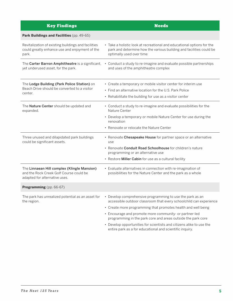
Park Buildings and Facilities (pp. 49-65)
Revitalization of existing buildings and facilities could greatly enhance use and enjoyment of the park.
• Take a holistic look at recreational and educational options for the park and determine how the various building and facilities could be optimally used over time
The Carter Barron Amphitheatre is a significant, yet underused asset, for the park.
• Conduct a study to re-imagine and evaluate possible partnerships and uses of the amphitheatre complex
The Lodge Building (Park Police Station) on Beach Drive should be converted to a visitor center.
• Create a temporary or mobile visitor center for interim use
• Find an alternative location for the U.S. Park Police
• Rehabilitate the building for use as a visitor center
The Nature Center should be updated and expanded.
• Conduct a study to re-imagine and evaluate possibilities for the Nature Center
• Develop a temporary or mobile Nature Center for use during the renovation
• Renovate or relocate the Nature Center
Three unused and dilapidated park buildings could be significant assets.
• Renovate Chesapeake House for partner space or an alternative use
• Renovate Conduit Road Schoolhouse for children’s nature programming or an alternative use
• Restore Miller Cabin for use as a cultural facility
The Linnaean Hill complex (Klingle Mansion) and the Rock Creek Golf Course could be adapted for alternative uses.
• Evaluate alternatives in connection with re-imagination of possibilities for the Nature Center and the park as a whole
Programming (pp. 66-67)
The park has unrealized potential as an asset for the region.
• Develop comprehensive programming to use the park as an accessible outdoor classroom that every schoolchild can experience
• Create more programming that promotes health and well being
• Encourage and promote more community- or partner-led programming in the park core and areas outside the park core
• Develop opportunities for scientists and citizens alike to use the entire park as a for educational and scientific inquiry.
6 R E V I TA L I Z I N G R O C K C R E E K PA R K
Key Findings Needs
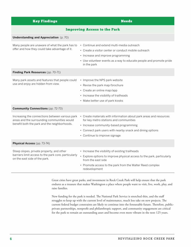
Improving Access to the Park
Understanding and Appreciation (p. 70)
Many people are unaware of what the park has to offer and how they could take advantage of it.
• Continue and extend multi-media outreach
• Create a visitor center or conduct mobile outreach
• Increase and improve programming
• Use volunteer events as a way to educate people and promote pride in the park
Finding Park Resources (pp. 70-71)
Many park assets and features that people could use and enjoy are hidden from view.
• Improve the NPS park website
• Revise the park map/brochure
• Create an online map/app
• Increase the visibility of trailheads
• Make better use of park kiosks
Community Connections (pp. 72-73)
Increasing the connections between various park areas and the surrounding communities would benefit both the park and the neighborhoods.
• Create materials with information about park areas and resources for key metro stations and communities
• Increase community-based programming
• Connect park users with nearby snack and dining options
• Continue to improve signage
Physical Access (pp. 73-74)
Steep slopes, private property, and other barriers limit access to the park core, particularly on the east side of the park.
• Increase the visibility of existing trailheads
• Explore options to improve physical access to the park, particularly from the east side
• Promote access to the park from the Walter Reed complex redevelopment
Great cities have great parks, and investment in Rock Creek Park will help ensure that the park endures as a treasure that makes Washington a place where people want to visit, live, work, play, and raise families.
New funding for the park is needed. The National Park Service is stretched thin, and the staff struggles to keep up with the current level of maintenance, much less take on new projects. The current federal budget constraints are likely to continue into the foreseeable future. Therefore, public-private partnerships, nonprofit and philanthropic support, and community engagement are critical for the park to remain an outstanding asset and become even more vibrant in the next 125 years.
7R E V I T A L I Z I N G R O C K C R E E K PA R K
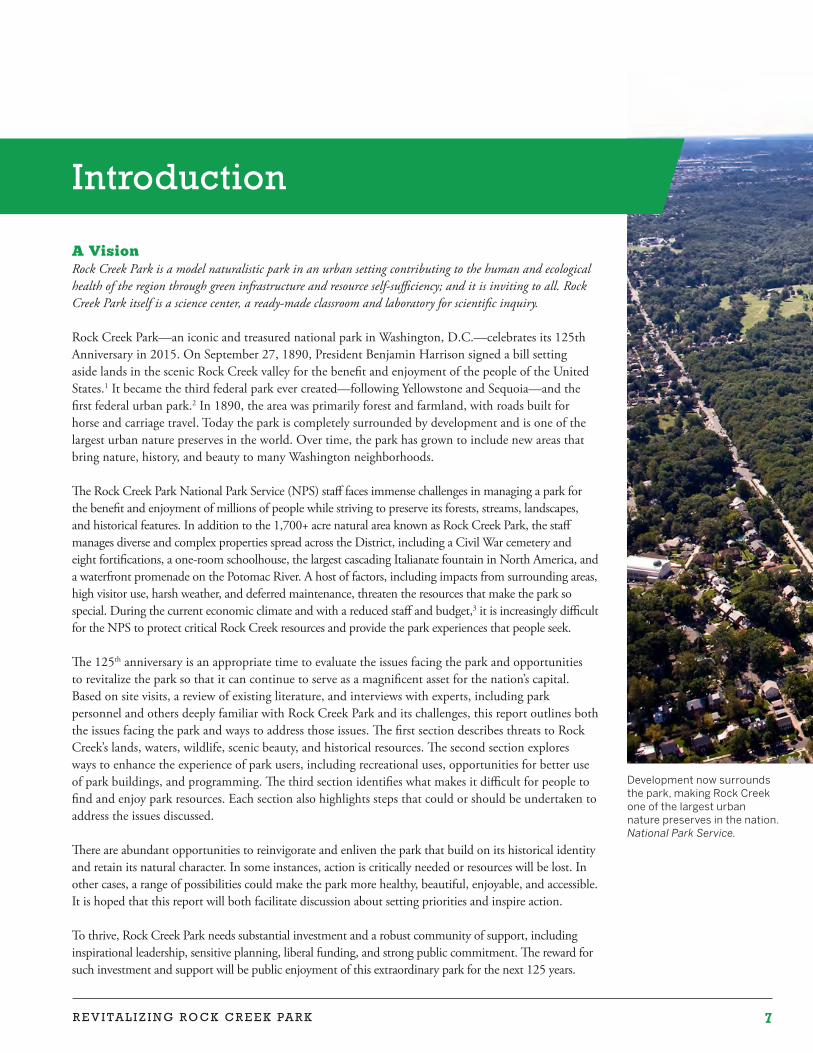
Development now surrounds the park, making Rock Creek one of the largest urban nature preserves in the nation. National Park Service.
A VisionRock Creek Park is a model naturalistic park in an urban setting contributing to the human and ecological health of the region through green infrastructure and resource self-sufficiency; and it is inviting to all. Rock Creek Park itself is a science center, a ready-made classroom and laboratory for scientific inquiry.
Rock Creek Park—an iconic and treasured national park in Washington, D.C.—celebrates its 125th Anniversary in 2015. On September 27, 1890, President Benjamin Harrison signed a bill setting aside lands in the scenic Rock Creek valley for the benefit and enjoyment of the people of the United States.1 It became the third federal park ever created—following Yellowstone and Sequoia—and the first federal urban park.2 In 1890, the area was primarily forest and farmland, with roads built for horse and carriage travel. Today the park is completely surrounded by development and is one of the largest urban nature preserves in the world. Over time, the park has grown to include new areas that bring nature, history, and beauty to many Washington neighborhoods.
The Rock Creek Park National Park Service (NPS) staff faces immense challenges in managing a park for the benefit and enjoyment of millions of people while striving to preserve its forests, streams, landscapes, and historical features. In addition to the 1,700+ acre natural area known as Rock Creek Park, the staff manages diverse and complex properties spread across the District, including a Civil War cemetery and eight fortifications, a one-room schoolhouse, the largest cascading Italianate fountain in North America, and a waterfront promenade on the Potomac River. A host of factors, including impacts from surrounding areas, high visitor use, harsh weather, and deferred maintenance, threaten the resources that make the park so special. During the current economic climate and with a reduced staff and budget,3 it is increasingly difficult for the NPS to protect critical Rock Creek resources and provide the park experiences that people seek.
The 125th anniversary is an appropriate time to evaluate the issues facing the park and opportunities to revitalize the park so that it can continue to serve as a magnificent asset for the nation’s capital. Based on site visits, a review of existing literature, and interviews with experts, including park personnel and others deeply familiar with Rock Creek Park and its challenges, this report outlines both the issues facing the park and ways to address those issues. The first section describes threats to Rock Creek’s lands, waters, wildlife, scenic beauty, and historical resources. The second section explores ways to enhance the experience of park users, including recreational uses, opportunities for better use of park buildings, and programming. The third section identifies what makes it difficult for people to find and enjoy park resources. Each section also highlights steps that could or should be undertaken to address the issues discussed.
There are abundant opportunities to reinvigorate and enliven the park that build on its historical identity and retain its natural character. In some instances, action is critically needed or resources will be lost. In other cases, a range of possibilities could make the park more healthy, beautiful, enjoyable, and accessible. It is hoped that this report will both facilitate discussion about setting priorities and inspire action.
To thrive, Rock Creek Park needs substantial investment and a robust community of support, including inspirational leadership, sensitive planning, liberal funding, and strong public commitment. The reward for such investment and support will be public enjoyment of this extraordinary park for the next 125 years.
Introduction
8 R E V I TA L I Z I N G R O C K C R E E K PA R K
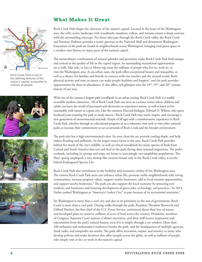
Rock Creek Park is one of the defining features of the nation’s capital, accessible to millions of people.
What Makes It Great
Rock Creek Park shapes the character of the nation’s capital. Located in the heart of the Washington area, the wild, scenic landscape with woodlands, meadows, valleys, and streams creates a sharp contrast with the surrounding cityscape. For those who pass through the Rock Creek valley, the Rock Creek and Potomac Parkway provides a scenic gateway to the National Mall and downtown Washington. Extensions of the park are found in neighborhoods across Washington, bringing vital green space or a window into history to many parts of the nation’s capital.
The extraordinary combination of natural splendor and proximity make Rock Creek Park both unique and critical to the quality of life in the capital region. Its outstanding recreational opportunities are a walk, bike ride, or bus or Metro trip away for millions of people who live in, work in, or visit the Washington area. As an urban oasis, the park offers exceptional beauty and tranquility, as well as a chance for families and friends to connect with one another and the natural world. Both physical activity and time in nature can make people healthier and happier,4 and the park provides opportunities for these in abundance. It also offers rich glimpses into the 18th, 19th, and 20th century history of our area.
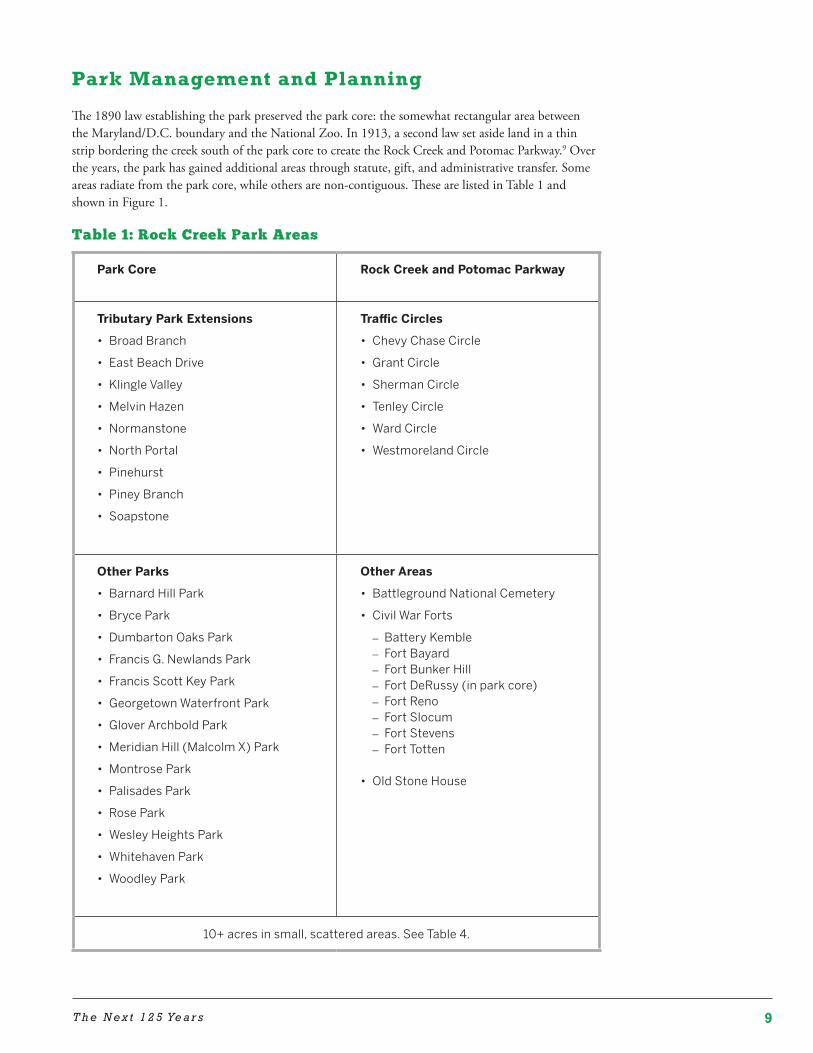
With one of the country’s largest park woodlands in an urban setting, Rock Creek Park is a readily accessible outdoor classroom. All of Rock Creek Park can serve as a science center where children and adults can leave the world of pavement and electronics to experience nature, as well as learn to live sustainably with nature in a great city. Like the eminent Harvard biologist, Edward O. Wilson, who spent boyhood years roaming the park to study insects,5 Rock Creek Park may teach, inspire, and encourage a new generation of environmental stewards. People of all ages with a transformative experience in Rock Creek Park, whether through an educational program or as a volunteer, may seek to visit other national parks or increase their commitment to act as stewards of Rock Creek and the broader environment.
The park also has a high environmental value. Its trees clean the air, provide cooling shade, and help reduce flooding and pollution. As the largest intact forest in the area, Rock Creek Park provides habitat for much of the city’s wildlife, as well as critical woodlands for many species of birds from Central and South America that rest and feed in the park during their seasonal migrations. The park’s wetlands, including its springs and seeps, are home to increasingly rare amphibian populations. The Hay’s spring amphipod, a tiny shrimp-like creature found only in the Rock Creek valley, is on the federal Endangered Species List.
Rock Creek Park also contributes to the livability and economic vitality of the Washington area. The various Rock Creek Park areas can enhance urban life, promote stable neighborhoods with strong communities, increase property values, support nearby businesses, add to local tourism opportunities, and support nearby businesses.6 The park can also support the local economy by attracting new residents and businesses and fostering development of green jobs, technology, and practices.7 In 2014, Forbes ranked Washington as “America’s Coolest City” in part because of its recreational amenities.8
Yet Washington is more than a cool city, and due to its proximity to the seat of government, Rock Creek is more than a cool park. During walks through the park, President Theodore Roosevelt and Gifford Pinchot, the first chief of the U.S. Forest Service, reminisced about their love of nature and developed plans to conserve millions of acres of land across the country. Presidents, members of Congress, Supreme Court justices, Cabinet secretaries, and their staff receive inspiration and rejuvenation from the park’s natural beauty, even if it is simply through a car window. More than 100 embassies and ambassador’s residences border the park, and the headquarters of multiple agencies, think tanks, and nonprofits are nearby. The park offers recreation, respite, and serenity to many who develop policies and make decisions that affect people across the globe, as well as millions of people who simply visit or live or work in the nation’s capital.
9T h e N e x t 1 2 5 Ye a r s
Park Management and Planning
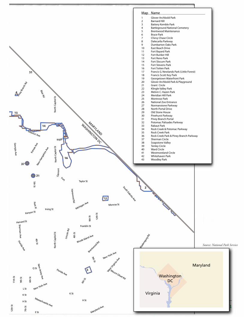
The 1890 law establishing the park preserved the park core: the somewhat rectangular area between the Maryland/D.C. boundary and the National Zoo. In 1913, a second law set aside land in a thin strip bordering the creek south of the park core to create the Rock Creek and Potomac Parkway.9 Over the years, the park has gained additional areas through statute, gift, and administrative transfer. Some areas radiate from the park core, while others are non-contiguous. These are listed in Table 1 and shown in Figure 1.
Table 1: Rock Creek Park Areas
Park Core Rock Creek and Potomac Parkway
Tributary Park Extensions
• Broad Branch
• East Beach Drive
• Klingle Valley
• Melvin Hazen
• Normanstone
• North Portal
• Pinehurst
• Piney Branch
• Soapstone
Traffic Circles
• Chevy Chase Circle
• Grant Circle
• Sherman Circle
• Tenley Circle
• Ward Circle
• Westmoreland Circle
Other Parks
• Barnard Hill Park
• Bryce Park
• Dumbarton Oaks Park
• Francis G. Newlands Park
• Francis Scott Key Park
• Georgetown Waterfront Park
• Glover Archbold Park
• Meridian Hill (Malcolm X) Park
• Montrose Park
• Palisades Park
• Rose Park
• Wesley Heights Park
• Whitehaven Park
• Woodley Park
Other Areas
• Battleground National Cemetery
• Civil War Forts – Battery Kemble – Fort Bayard – Fort Bunker Hill – Fort DeRussy (in park core) – Fort Reno – Fort Slocum – Fort Stevens – Fort Totten
• Old Stone House
10+ acres in small, scattered areas. See Table 4.
10 R E V I TA L I Z I N G R O C K C R E E K PA R K
Walter Reed ArmyMedical Center
NATIONALZOOLOGICALPARK
NAVALOBSERVATORY
GEORGETOWNUNIVERSITY
13
8
11
7
31
24
17
30
4
14
16
2
12
5
3
6
1
12th
St
7th
St
19th
St
20th
St
4th
St
E St
L StL St
I StI St
K StK St
H St
Q St
6th
St
9th
St
Nor
th C
apito
l St
11th
St
15th
St
13th
St
17th
St
18th
St
22nd
St
23rd
St
K St
Florida Ave
Florida Ave
New
Jersey Ave
4th St
Sherman A
ve
6th
St
Wes
t Virg
inia
AveNew York Ave
Mount Olivet Rd
Bren
twoo
d RdRhode Isla
nd Ave
Linc
oln
Rd
Franklin St
Irving St
Park Pl
Harew
ood Rd
Monroe St
South Dakota Ave
Blad
ensg
urg
Rd
H St
Maryland Ave
Massachusetts Ave
Massachusetts Ave
New York Ave
Pennsylvania AveVirginia Ave
Taylor St
Michigan Ave
12th
St
9th
St
5th St
New
Ham
pshi
re A
ve
Kans
as A
ve
Georgia A
ve
tS l oti paC htr oN
14th
St
16th
St
Tilden St
Reno Rd
Nebr
aska
Ave
Massachusetts Ave
River Rd
Military Rd41
st S
t
Alas
ka A
veA
rkan
sas A
ve
Pine
y Br
anch
Rd
Blair Rd
Nor
th C
apito
l St
Missouri Ave
Riggs Rd
Clem
ont
Fort
Beac
h Dr
Porter St
34th
St
Wisconsin A
ve
Cleveland Ave
New
Mexico A
ve
Foxhall Rd
Arizon
a Ave
Dal
ecar
ilia
Pky
Chain Brg
Clara Barton Pky
Canal Rd
Reservoir Rd
Q StQ St
Q St
P St
M St
Tunlaw Rd
Florid
a Ave
18th St
Columbia Rd
Calvert St13
th S
t
Kenyon St
Harvard St
Adams M
ill Rd
Park Rd
R St
Q St
U St
New H
amps
hire
Ave
9th St
MacArthur
Whitehurst Fwy
MARYLA
ND
MARYLAND
WASH
INGTO
N DC
WASHINGTON DC
VIRGIN
IAW
ASHIN
GTO
N D
C
Nature Center
TennisStadium
PeirceMill
Map Name 1 Glover Archbold Park 2 Barnard Hill 3 Battery Kemble Park 4 Battleground National Cemetery 5 Brentwood Maintenance 6 Bryce Park 7 Chevy Chase Circle 8 Dalecarlia Parkway 9 Dumbarton Oaks Park 10 East Beach Drive 11 Fort Bayard Park 12 Fort Bunker Hill 13 Fort Reno Park 14 Fort Slocum Park 15 Fort Stevens Park 16 Fort Totten Park 17 Francis G. Newlands Park (Little Forest)
19 Georgetown Waterfront Park 18 Francis Scott Key Park
20 Glover Archbold Park & Playground 21 Grant Circle 22 Klingle Valley Park 23 Melvin C. Hazen Park 24 Meridian Hill Park 25 Montrose Park 26 National Zoo Entrance 27 Normanstone Parkway 28 North Portal Drive 29 Old Stone House 30 Pinehurst Parkway 31 Piney Branch Portal 32 Potomac Palisades Parkway 33 Rabaut Park 34 Rock Creek & Potomac Parkway 35 Rock Creek Park 36 Rock Creek Park & Piney Branch Parkway 37 Sherman Circle 38 Soapstone Valley 39 Tenley Circle 40 Ward Circle 41 Westmoreland Circle 42 Whitehaven Park 43 Woodley Park
Figure 1. Park Location Map
Park Boundary
District Boundary
Interstate
Major Road
Maryland
Virginia
WashingtonDC
Rock Creek Park Core
District of Columbia
9
2633
36
10
38
23
22
43
27 34
25
42
20
40
39
32
3515
41
29
19
18
28
31
37
21
11T h e N e x t 1 2 5 Ye a r s
Walter Reed ArmyMedical Center
NATIONALZOOLOGICALPARK
NAVALOBSERVATORY
GEORGETOWNUNIVERSITY
13
8
11
7
31
24
17
30
4
14
16
2
12
5
3
6
1
12th
St
7th
St
19th
St
20th
St
4th
St
E St
L StL St
I StI St
K StK St
H St
Q St
6th
St
9th
St
Nor
th C
apito
l St
11th
St
15th
St
13th
St
17th
St
18th
St
22nd
St
23rd
St
K St
Florida Ave
Florida Ave
New
Jersey Ave
4th St
Sherman A
ve
6th
St
Wes
t Virg
inia
AveNew York Ave
Mount Olivet Rd
Bren
twoo
d RdRhode Isla
nd Ave
Linc
oln
Rd
Franklin St
Irving StPark Pl
Harew
ood Rd
Monroe St
South Dakota Ave
Blad
ensg
urg
Rd
H St
Maryland Ave
Massachusetts Ave
Massachusetts Ave
New York Ave
Pennsylvania AveVirginia Ave
Taylor St
Michigan Ave
12th
St
9th
St
5th St
New
Ham
pshi
re A
ve
Kans
as A
ve
Georgia A
ve
tS l oti paC htr oN
14th
St
16th
St
Tilden St
Reno Rd
Nebr
aska
Ave
Massachusetts Ave
River Rd
Military Rd
41st
St
Alas
ka A
veA
rkan
sas A
ve
Pine
y Br
anch
Rd
Blair Rd
Nor
th C
apito
l St
Missouri Ave
Riggs Rd
Clem
ont
Fort
Beac
h Dr
Porter St
34th
St
Wisconsin A
ve
Cleveland Ave
New
Mexico A
ve
Foxhall Rd
Arizon
a Ave
Dal
ecar
ilia
Pky
Chain Brg
Clara Barton Pky
Canal Rd
Reservoir Rd
Q StQ St
Q St
P St
M St
Tunlaw Rd
Florid
a Ave
18th St
Columbia Rd
Calvert St
13th
St
Kenyon St
Harvard St
Adams M
ill Rd
Park Rd
R St
Q St
U St
New H
amps
hire
Ave
9th St
MacArthur
Whitehurst Fwy
MARYLA
ND
MARYLAND
WASH
INGTO
N DC
WASHINGTON DC
VIRGIN
IAW
ASHIN
GTO
N D
C
Nature Center
TennisStadium
PeirceMill
Map Name 1 Glover Archbold Park 2 Barnard Hill 3 Battery Kemble Park 4 Battleground National Cemetery 5 Brentwood Maintenance 6 Bryce Park 7 Chevy Chase Circle 8 Dalecarlia Parkway 9 Dumbarton Oaks Park 10 East Beach Drive 11 Fort Bayard Park 12 Fort Bunker Hill 13 Fort Reno Park 14 Fort Slocum Park 15 Fort Stevens Park 16 Fort Totten Park 17 Francis G. Newlands Park (Little Forest)
19 Georgetown Waterfront Park 18 Francis Scott Key Park
20 Glover Archbold Park & Playground 21 Grant Circle 22 Klingle Valley Park 23 Melvin C. Hazen Park 24 Meridian Hill Park 25 Montrose Park 26 National Zoo Entrance 27 Normanstone Parkway 28 North Portal Drive 29 Old Stone House 30 Pinehurst Parkway 31 Piney Branch Portal 32 Potomac Palisades Parkway 33 Rabaut Park 34 Rock Creek & Potomac Parkway 35 Rock Creek Park 36 Rock Creek Park & Piney Branch Parkway 37 Sherman Circle 38 Soapstone Valley 39 Tenley Circle 40 Ward Circle 41 Westmoreland Circle 42 Whitehaven Park 43 Woodley Park
Figure 1. Park Location Map
Park Boundary
District Boundary
Interstate
Major Road
Maryland
Virginia
WashingtonDC
Rock Creek Park Core
District of Columbia
9
2633
36
10
38
23
22
43
27 34
25
42
20
40
39
32
3515
41
29
19
18
28
31
37
21
Source: National Park Service
12 R E V I TA L I Z I N G R O C K C R E E K PA R K
Changing park management, trends in park design, and influential individuals have influenced the park over time.10 From 1890 to 1933, a combination of the U.S. Army Corps of Engineers, District of Columbia commissioners, and an independent federal office managed the park and made key decisions that shape the use of the park today.11 In 1933, President Franklin D. Roosevelt signed an executive order transferring administration of Rock Creek Park to the NPS,12 and his administration fielded multiple New Deal era construction and preservation projects in the park.13 Federal law, executive orders, and NPS policies now govern the use and management of Rock Creek Park, as they do in national parks across the country.
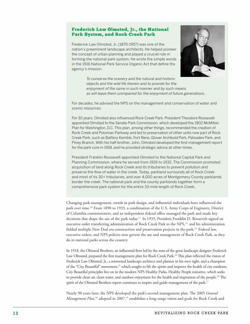
In 1918, the Olmsted Brothers, an influential firm led by the sons of the great landscape designer Frederick Law Olmsted, prepared the first management plan for Rock Creek Park.14 This plan reflected the vision of Frederick Law Olmsted, Jr., a renowned landscape architect and planner in his own right, and a champion of the “City Beautiful” movement,15 which sought to lift the spirits and improve the health of city residents. City Beautiful principles live on in the modern NPS Healthy Parks, Healthy People initiative, which seeks to provide clean air, clean water, and outdoor enjoyment for the health and inspiration of the people.16 The spirit of the Olmsted Brothers report continues to inspire and guide management of the park.17
Nearly 90 years later, the NPS developed the park’s second management plan. The 2005 General Management Plan,18 adopted in 2007,19 establishes a long-range vision and goals for Rock Creek and
Frederick Law Olmsted, Jr ., the National Park System, and Rock Creek Park
Frederick Law Olmsted, Jr. (1870-1957) was one of the nation’s preeminent landscape architects. He helped pioneer the concept of urban planning and played a crucial role in forming the national park system. He wrote the simple words in the 1916 National Park Service Organic Act that define the agency’s mission:
To conserve the scenery and the natural and historic objects and the wild life therein and to provide for the enjoyment of the same in such manner and by such means as will leave them unimpaired for the enjoyment of future generations.
For decades, he advised the NPS on the management and conservation of water and scenic resources.
For 30 years, Olmsted also influenced Rock Creek Park. President Theodore Roosevelt appointed Olmsted to the Senate Park Commission, which developed the 1902 McMillan Plan for Washington, D.C. This plan, among other things, recommended the creation of Rock Creek and Potomac Parkway and led to preservation of other units now part of Rock Creek Park, such as Battery Kemble, Fort Reno, Glover Archbold Park, Palisades Park, and Piney Branch. With his half-brother, John, Olmsted developed the first management report for the park core in 1918, and he provided strategic advice at other times.
President Franklin Roosevelt appointed Olmsted to the National Capital Park and Planning Commission, where he served from 1926 to 1932. The Commission promoted acquisition of land along Rock Creek and its tributaries to prevent pollution and preserve the flow of water in the creek. Today, parkland surrounds all of Rock Creek and most of its 30+ tributaries, and over 4,000 acres of Montgomery County parklands border the creek. The national park and the county parklands together form a comprehensive park system for the entire 33-mile length of Rock Creek.
13T h e N e x t 1 2 5 Ye a r s
Potomac Parkway and most of the park core, as well as prescriptions for resource management and visitor experience. Some plan elements, such as rehabilitation of Peirce Mill, have been completed, but much of this plan has yet to be implemented. For example, the plan calls for upgrading the park’s Nature Center, turning the U.S. Park Police station on Beach Drive into a visitor center, restoring Miller Cabin, and adapting the Peirce-Klingle Mansion for public use. As discussed below, none of these projects has been initiated.
The General Management Plan is not a comprehensive plan for the park as a whole. It excludes areas outside Rock Creek and Potomac Parkway and the park core,20 and it does not cover the entire park core.
There are separate planning documents for the Rock Creek Tennis Center complex and the Civil War Defenses of Washington as a whole, as well as reports pertaining to important parks, such as Dumbarton Oaks Park and Meridian Hill Park. There are no comprehensive plans, however, for key areas and features, such as the Carter Barron Amphitheatre complex, the Conduit Road Schoolhouse, traffic circles, community gardens, and the park areas in and near Georgetown. These are present opportunities that could in some cases substantially enhance the park’s value and need management direction.
Looking Ahead
A number of factors will shape and influence park management decisions in the coming years. These include legal requirements and NPS policies, funding, climate change, and community interests.
Legal Requirements and NPS Policies. Any decisions on ongoing management and park revitalization must be made in the context of legal requirements and NPS policies. Two broad goals, derived from both federal requirements and NPS policy, will guide park management decisions. These are:
• Preservation of the park’s ecological health, historical resources, and scenic beauty for this and future generations; and
• Provision of opportunities for people to experience, enjoy, understand, and appreciate the park, consistent with preservation of its resources.21
A challenge, recognized from the park’s earliest days, is how best to meet both goals when they may be in conflict.
In addition, under the National Environmental Policy Act and the National Historic Preservation Act, the NPS must evaluate the effects of its actions. Major federal actions that could significantly affect the environment, including park management decisions, must be evaluated through an environmental impact statement or assessment. The NPS must also take into account the effects of its undertakings on historic properties, and much of Rock Creek Park is considered historic. These statutes will affect many of the recommendations discussed throughout this report and may make their implementation more costly and time-consuming.
Funding. The availability of funding is also critical. It was recognized from the earliest days that the park was a public investment and that there would be both development and maintenance costs. Much of the park remains relatively undeveloped, in keeping with the park’s preservation mandate. Yet, as discussed below, even without new development, the renovation, rehabilitation, and revitalization of existing facilities would cost many millions of dollars. These facilities, other park infrastructure, and even management and upkeep of the undeveloped lands have ongoing costs.
Climate Change. The changing climate is likely to affect park management far into the future. It is anticipated that temperatures will continue to increase, precipitation will arrive in heavier downpours with longer dry periods between storms, and carbon dioxide levels will continue to rise.
14 R E V I TA L I Z I N G R O C K C R E E K PA R K
These will affect park vegetation, streams, and wildlife. Flooding along the creek and its tributaries is likely to damage park resources as well as development, including roads, trails, bridges, historic buildings, and picnic areas located in the floodplain.
Sea level rise is likely to affect the areas of the park closest to the Potomac River. “Climate Central” provides submergence forecasts and maps for the District of Columbia, including the Rock Creek area, that indicate the mouth of the creek would widen, with possible impacts on the Thompson Boat Center and Georgetown Waterfront Park.22 The District Department of the Environment Flood Zone map shows similar areas of risk.23
Community Interests. Community engagement is also critical. As a linear park with extensions and areas throughout the District and adjacent to Maryland neighborhoods, it has many neighbors who see the park on a daily basis. The park receives roughly two million recreational visits a year. Over half of the visitors are in the park once a week or more, with many returning to the same park locations again and again. Millions also drive through the park, with over 12 million vehicle trips a year. Regular park users often view part of Rock Creek as “their” park, and many neighbors, users, and commuters have views, some of them quite strong, on how the park should be managed. These groups need to be part of a conversation about a vibrant future for the park.
The inherent value of the naturalistic ‘undeveloped’ qualities of this Park cannot be overestimated. For in these qualities lies the essential justification for all that has been done and spent, for all that will be done and spent to give this great Park to the people. In its development the guiding policy should be distinctly one of restraint; in its maintenance the policy should be liberal, in order to meet the continuously increasing needs of the patrons and still more to protect and ensure the permanent values of a great public investment.
– Olmsted Brothers, Report on Rock Creek Park, 1918
15R E V I T A L I Z I N G R O C K C R E E K PA R K
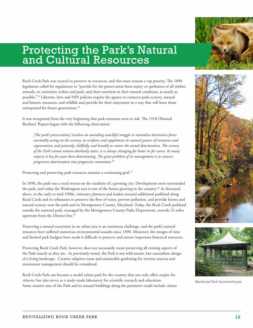
Montrose Park Summerhouse
Rock Creek Park was created to preserve its resources, and this must remain a top priority. The 1890 legislation called for regulations to “provide for the preservation from injury or spoliation of all timber, animals, or curiosities within said park, and their retention in their natural condition, as nearly as possible.”24 Likewise, laws and NPS policies require the agency to conserve park scenery, natural and historic resources, and wildlife and provide for their enjoyment in a way that will leave them unimpaired for future generations.25
It was recognized from the very beginning that park resources were at risk. The 1918 Olmsted Brothers’ Report began with the following observation:
[The park’s preservation] involves an unending watchful struggle to neutralize destructive forces inevitably acting on the scenery; to reinforce and supplement its natural powers of resistance and regeneration; and patiently, skillfully, and humbly to restore the actual deterioration. The scenery of the Park cannot remain absolutely static; it is always changing for better or for worse. In many respects it has for years been deteriorating. The great problem of its management is to convert progressive deterioration into progressive restoration.26
Protecting and preserving park resources remains a continuing goal.27
In 1890, the park was a rural retreat on the outskirts of a growing city. Development soon surrounded the park, and today the Washington area is one of the fastest growing in the country.28 As discussed above, in the early to mid-1900s, visionary planners and leaders secured additional parkland along Rock Creek and its tributaries to preserve the flow of water, prevent pollution, and provide forests and natural scenery near the park and in Montgomery County, Maryland. Today, the Rock Creek parkland outside the national park, managed by the Montgomery County Parks Department, extends 22 miles upstream from the District line.29
Preserving a natural ecosystem in an urban area is an enormous challenge, and the park’s natural resources have suffered numerous environmental assaults since 1890. Moreover, the ravages of time and limited park budgets have made it difficult to preserve and restore important historical resources.
Protecting Rock Creek Park, however, does not necessarily mean preserving all existing aspects of the Park exactly as they are. As previously noted, the Park is not wild nature, but naturalistic design of a living landscape. Creative adaptive reuse and sustainable gardening for revenue sources and stormwater management should be considered.
Rock Creek Park can become a model urban park for the country that not only offers respite for citizens, but also serves as a ready-made laboratory for scientific research and education. Some creative uses of the Park and its unused buildings along the perimeter could include citizen
Protecting the Park’s Natural and Cultural Resources
16 P R O T E C T I N G N A T U R A L A N D C U L T U R A L R E S O U R C E S
science areas, community garden trading posts, and sustainable agroforestry cultivation including edible mushrooms and strawbale mushrooms which also serve as a way to clean stormwater. These are all potential revenue sources and education opportunities as well.
As Edward O. Wilson observed in his 2015 Berkeley address to the Science for Parks, Parks for Science: The Next Century summit, national parks and other reserves are the logical centers for fundamental research. Many areas of scientific inquiry may be pursued, but especially and critically biodiversity and conservation of the living environment. Rock Creek Park can offer educational and scientific opportunities far beyond its current scope while still preserving the park.
Protecting the park’s lands, waters, wildlife, designed landscapes, and other resources will require a substantial commitment. The following section describes key issues and makes recommendations for addressing them. As detailed below, park staff cannot do it alone. Key agencies in the District and Montgomery County, nonprofit and community organizations, and park neighbors and users must take steps individually and collectively to preserve Rock Creek’s rich resources. Collective efforts must be organized by creating a Federal City committee or council-of-governments approach to the multi-jurisdictional issues.
Lands and Vegetation
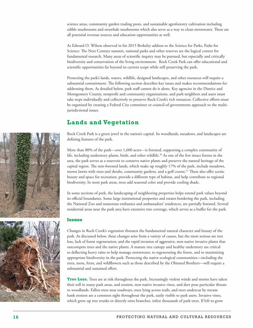
Rock Creek Park is a green jewel in the nation’s capital. Its woodlands, meadows, and landscapes are defining features of the park.
More than 80% of the park—over 1,600 acres—is forested, supporting a complex community of life, including understory plants, birds, and other wildlife.30 As one of the few intact forests in the area, the park serves as a reservoir to conserve native plants and preserve the natural heritage of the capital region. The non-forested lands, which make up roughly 17% of the park, include meadows, mown lawns with trees and shrubs, community gardens, and a golf course.31 These also offer scenic beauty and space for recreation, provide a different type of habitat, and help contribute to regional biodiversity. In most park areas, trees add seasonal color and provide cooling shade.
In some sections of park, the landscaping of neighboring properties helps extend park values beyond its official boundaries. Some large institutional properties and estates bordering the park, including the National Zoo and numerous embassies and ambassadors’ residences, are partially forested. Several residential areas near the park area have extensive tree coverage, which serves as a buffer for the park.
Issues
Changes in Rock Creek’s vegetation threaten the fundamental natural character and beauty of the park. As discussed below, these changes arise from a variety of causes, but the most serious are tree loss, lack of forest regeneration, and the rapid invasion of aggressive, non-native invasive plants that outcompete trees and the native plants. A mature tree canopy and healthy understory are critical to deflecting heavy rains to help manage stormwater, to regenerating the forest, and to maximizing appropriate biodiversity in the park. Protecting the native ecological communities—including the trees, moss, ferns, and wildflowers such as those described by the Olmsted Brothers—will require a substantial and sustained effort.
Tree Loss. Trees are at risk throughout the park. Increasingly violent winds and storms have taken their toll in many park areas, and erosion, non-native invasive vines, and deer pose particular threats to woodlands. Fallen trees near roadways, trees lying across trails, and trees undercut by stream bank erosion are a common sight throughout the park, easily visible to park users. Invasive vines, which grow up tree trunks or directly onto branches, infest thousands of park trees. If left to grow
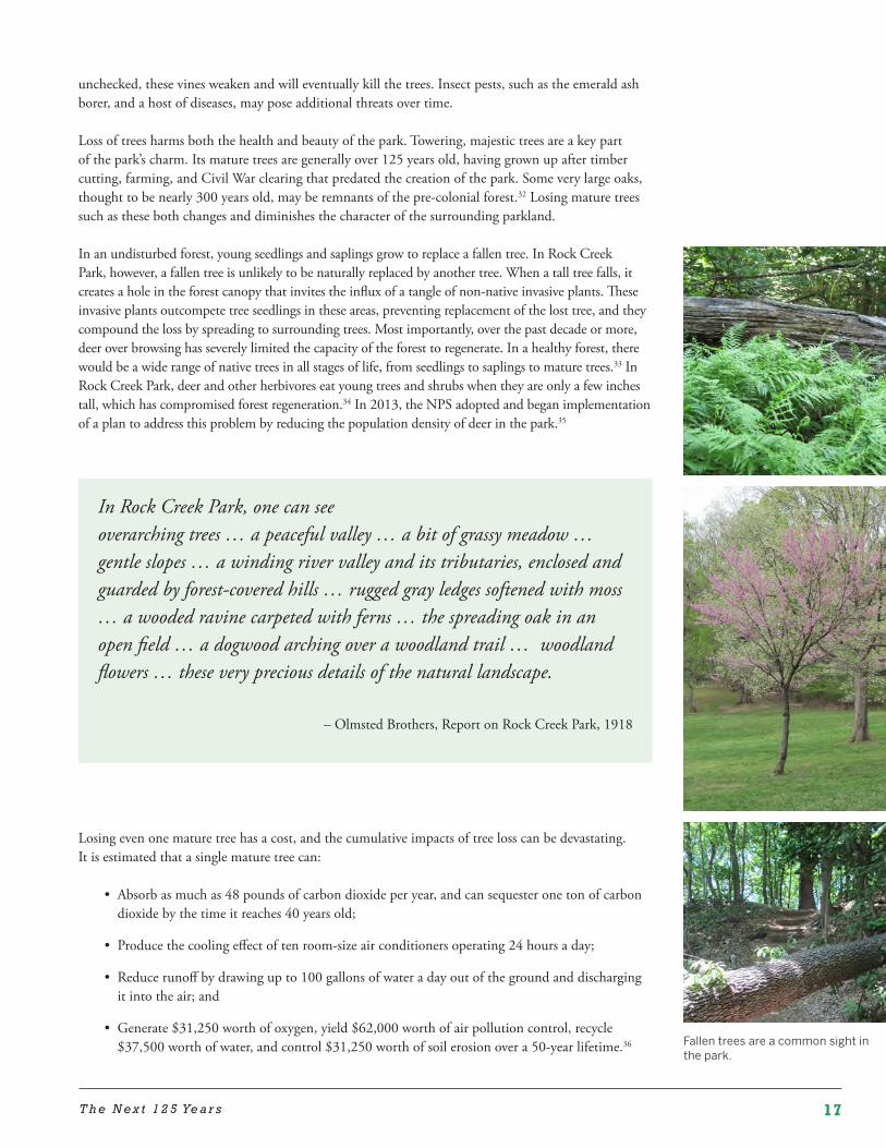
17T h e N e x t 1 2 5 Ye a r s
unchecked, these vines weaken and will eventually kill the trees. Insect pests, such as the emerald ash borer, and a host of diseases, may pose additional threats over time.
Loss of trees harms both the health and beauty of the park. Towering, majestic trees are a key part of the park’s charm. Its mature trees are generally over 125 years old, having grown up after timber cutting, farming, and Civil War clearing that predated the creation of the park. Some very large oaks, thought to be nearly 300 years old, may be remnants of the pre-colonial forest.32 Losing mature trees such as these both changes and diminishes the character of the surrounding parkland.
In an undisturbed forest, young seedlings and saplings grow to replace a fallen tree. In Rock Creek Park, however, a fallen tree is unlikely to be naturally replaced by another tree. When a tall tree falls, it creates a hole in the forest canopy that invites the influx of a tangle of non-native invasive plants. These invasive plants outcompete tree seedlings in these areas, preventing replacement of the lost tree, and they compound the loss by spreading to surrounding trees. Most importantly, over the past decade or more, deer over browsing has severely limited the capacity of the forest to regenerate. In a healthy forest, there would be a wide range of native trees in all stages of life, from seedlings to saplings to mature trees.33 In Rock Creek Park, deer and other herbivores eat young trees and shrubs when they are only a few inches tall, which has compromised forest regeneration.34 In 2013, the NPS adopted and began implementation of a plan to address this problem by reducing the population density of deer in the park.35
Losing even one mature tree has a cost, and the cumulative impacts of tree loss can be devastating. It is estimated that a single mature tree can:
• Absorb as much as 48 pounds of carbon dioxide per year, and can sequester one ton of carbon dioxide by the time it reaches 40 years old;
• Produce the cooling effect of ten room-size air conditioners operating 24 hours a day;
• Reduce runoff by drawing up to 100 gallons of water a day out of the ground and discharging it into the air; and
• Generate $31,250 worth of oxygen, yield $62,000 worth of air pollution control, recycle $37,500 worth of water, and control $31,250 worth of soil erosion over a 50-year lifetime.36 Fallen trees are a common sight in
the park.
In Rock Creek Park, one can seeoverarching trees … a peaceful valley … a bit of grassy meadow … gentle slopes … a winding river valley and its tributaries, enclosed and guarded by forest-covered hills … rugged gray ledges softened with moss … a wooded ravine carpeted with ferns … the spreading oak in an open field … a dogwood arching over a woodland trail … woodland flowers … these very precious details of the natural landscape.
– Olmsted Brothers, Report on Rock Creek Park, 1918
18 P R O T E C T I N G N A T U R A L A N D C U L T U R A L R E S O U R C E S
People have a profound and deep attachment to individual park trees, as well as the park in its entirety, and the forest ecosystem provides a myriad of benefits to both wildlife and people in the Washington area.37 Trees in the small non-contiguous park areas create vital green spaces that help shape the character of individual neighborhoods and the District as a whole.38 Indeed, Washington is known as the “City of Trees.”39
Preserving trees has been a high priority in other major parks in urban areas. The Central Park Conservancy has begun a $45 million Woodlands Initiative to care for its 80 acres of woodlands (Rock Creek Park has 1,600 acres of forest). The project, which addresses both water flow and landscape issues, will restore three woodland areas and protect and enhance wildlife habitat as a living classroom.40 In Boston, the Emerald Necklace Conservancy’s Olmsted Tree Society has raised nearly $1 million to assess the condition of trees in the multi-unit Emerald Necklace park system and plan for their protection.41
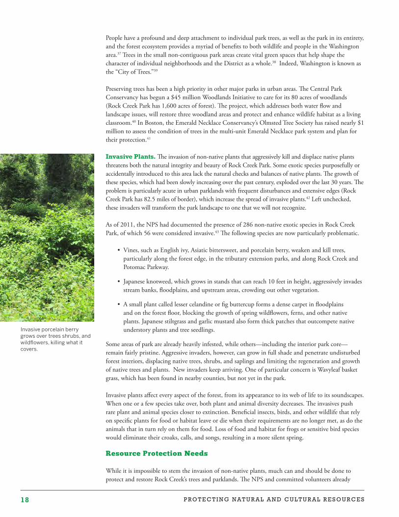
Invasive Plants. The invasion of non-native plants that aggressively kill and displace native plants threatens both the natural integrity and beauty of Rock Creek Park. Some exotic species purposefully or accidentally introduced to this area lack the natural checks and balances of native plants. The growth of these species, which had been slowly increasing over the past century, exploded over the last 30 years. The problem is particularly acute in urban parklands with frequent disturbances and extensive edges (Rock Creek Park has 82.5 miles of border), which increase the spread of invasive plants.42 Left unchecked, these invaders will transform the park landscape to one that we will not recognize.
As of 2011, the NPS had documented the presence of 286 non-native exotic species in Rock Creek Park, of which 56 were considered invasive.43 The following species are now particularly problematic.
• Vines, such as English ivy, Asiatic bittersweet, and porcelain berry, weaken and kill trees, particularly along the forest edge, in the tributary extension parks, and along Rock Creek and Potomac Parkway.
• Japanese knotweed, which grows in stands that can reach 10 feet in height, aggressively invades stream banks, floodplains, and upstream areas, crowding out other vegetation.
• A small plant called lesser celandine or fig buttercup forms a dense carpet in floodplains and on the forest floor, blocking the growth of spring wildflowers, ferns, and other native plants. Japanese stiltgrass and garlic mustard also form thick patches that outcompete native understory plants and tree seedlings.
Some areas of park are already heavily infested, while others—including the interior park core—remain fairly pristine. Aggressive invaders, however, can grow in full shade and penetrate undisturbed forest interiors, displacing native trees, shrubs, and saplings and limiting the regeneration and growth of native trees and plants. New invaders keep arriving. One of particular concern is Wavyleaf basket grass, which has been found in nearby counties, but not yet in the park. Invasive plants affect every aspect of the forest, from its appearance to its web of life to its soundscapes. When one or a few species take over, both plant and animal diversity decreases. The invasives push rare plant and animal species closer to extinction. Beneficial insects, birds, and other wildlife that rely on specific plants for food or habitat leave or die when their requirements are no longer met, as do the animals that in turn rely on them for food. Loss of food and habitat for frogs or sensitive bird species would eliminate their croaks, calls, and songs, resulting in a more silent spring.
Resource Protection Needs
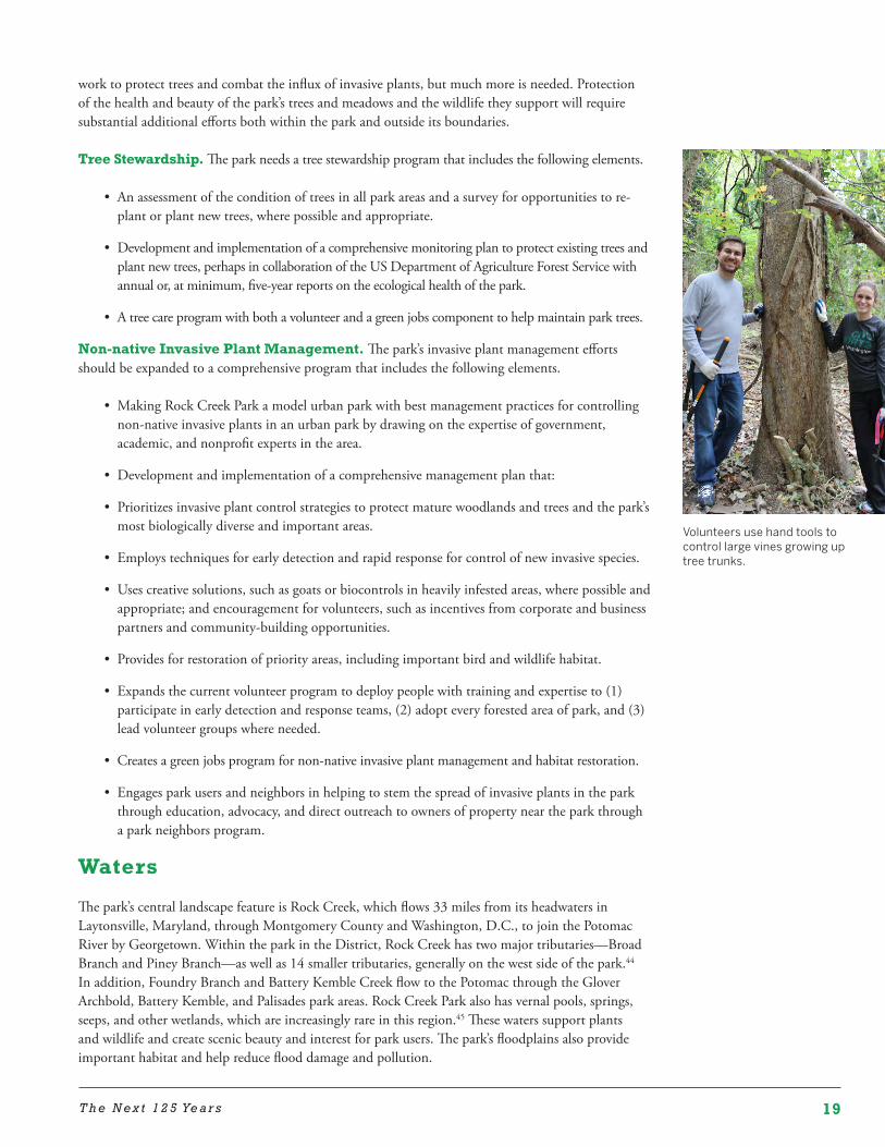
While it is impossible to stem the invasion of non-native plants, much can and should be done to protect and restore Rock Creek’s trees and parklands. The NPS and committed volunteers already
Invasive porcelain berry grows over trees shrubs, and wildflowers, killing what it covers.
19T h e N e x t 1 2 5 Ye a r s
Volunteers use hand tools to control large vines growing up tree trunks.
work to protect trees and combat the influx of invasive plants, but much more is needed. Protection of the health and beauty of the park’s trees and meadows and the wildlife they support will require substantial additional efforts both within the park and outside its boundaries.
Tree Stewardship. The park needs a tree stewardship program that includes the following elements.
• An assessment of the condition of trees in all park areas and a survey for opportunities to re-plant or plant new trees, where possible and appropriate.
• Development and implementation of a comprehensive monitoring plan to protect existing trees and plant new trees, perhaps in collaboration of the US Department of Agriculture Forest Service with annual or, at minimum, five-year reports on the ecological health of the park.
• A tree care program with both a volunteer and a green jobs component to help maintain park trees.
Non-native Invasive Plant Management. The park’s invasive plant management efforts should be expanded to a comprehensive program that includes the following elements.
• Making Rock Creek Park a model urban park with best management practices for controlling non-native invasive plants in an urban park by drawing on the expertise of government, academic, and nonprofit experts in the area.
• Development and implementation of a comprehensive management plan that:
• Prioritizes invasive plant control strategies to protect mature woodlands and trees and the park’s most biologically diverse and important areas.
• Employs techniques for early detection and rapid response for control of new invasive species.
• Uses creative solutions, such as goats or biocontrols in heavily infested areas, where possible and appropriate; and encouragement for volunteers, such as incentives from corporate and business partners and community-building opportunities.
• Provides for restoration of priority areas, including important bird and wildlife habitat.
• Expands the current volunteer program to deploy people with training and expertise to (1) participate in early detection and response teams, (2) adopt every forested area of park, and (3) lead volunteer groups where needed.
• Creates a green jobs program for non-native invasive plant management and habitat restoration.
• Engages park users and neighbors in helping to stem the spread of invasive plants in the park through education, advocacy, and direct outreach to owners of property near the park through a park neighbors program.
Waters
The park’s central landscape feature is Rock Creek, which flows 33 miles from its headwaters in Laytonsville, Maryland, through Montgomery County and Washington, D.C., to join the Potomac River by Georgetown. Within the park in the District, Rock Creek has two major tributaries—Broad Branch and Piney Branch—as well as 14 smaller tributaries, generally on the west side of the park.44 In addition, Foundry Branch and Battery Kemble Creek flow to the Potomac through the Glover Archbold, Battery Kemble, and Palisades park areas. Rock Creek Park also has vernal pools, springs, seeps, and other wetlands, which are increasingly rare in this region.45 These waters support plants and wildlife and create scenic beauty and interest for park users. The park’s floodplains also provide important habitat and help reduce flood damage and pollution.
20 P R O T E C T I N G N A T U R A L A N D C U L T U R A L R E S O U R C E S
Issues
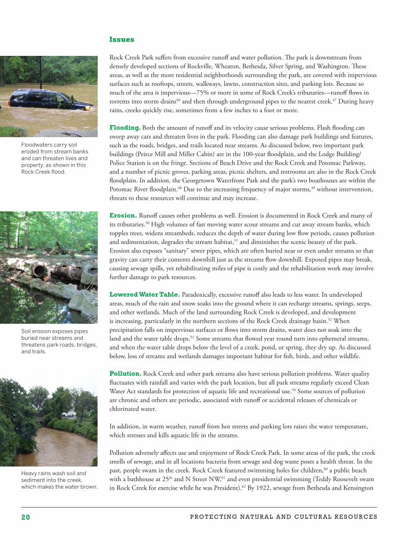
Rock Creek Park suffers from excessive runoff and water pollution. The park is downstream from densely developed sections of Rockville, Wheaton, Bethesda, Silver Spring, and Washington. These areas, as well as the more residential neighborhoods surrounding the park, are covered with impervious surfaces such as rooftops, streets, walkways, lawns, construction sites, and parking lots. Because so much of the area is impervious—75% or more in some of Rock Creek’s tributaries—runoff flows in torrents into storm drains46 and then through underground pipes to the nearest creek.47 During heavy rains, creeks quickly rise, sometimes from a few inches to a foot or more.
Flooding. Both the amount of runoff and its velocity cause serious problems. Flash flooding can sweep away cars and threaten lives in the park. Flooding can also damage park buildings and features, such as the roads, bridges, and trails located near streams. As discussed below, two important park buildings (Peirce Mill and Miller Cabin) are in the 100-year floodplain, and the Lodge Building/Police Station is on the fringe. Sections of Beach Drive and the Rock Creek and Potomac Parkway, and a number of picnic groves, parking areas, picnic shelters, and restrooms are also in the Rock Creek floodplain. In addition, the Georgetown Waterfront Park and the park’s two boathouses are within the Potomac River floodplain.48 Due to the increasing frequency of major storms,49 without intervention, threats to these resources will continue and may increase.
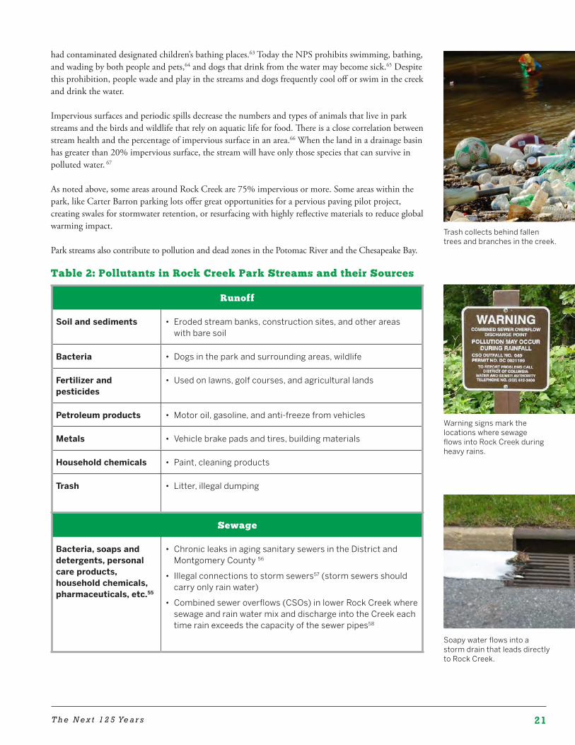
Erosion. Runoff causes other problems as well. Erosion is documented in Rock Creek and many of its tributaries.50 High volumes of fast moving water scour streams and cut away stream banks, which topples trees, widens streambeds, reduces the depth of water during low flow periods, causes pollution and sedimentation, degrades the stream habitat,51 and diminishes the scenic beauty of the park. Erosion also exposes “sanitary” sewer pipes, which are often buried near or even under streams so that gravity can carry their contents downhill just as the streams flow downhill. Exposed pipes may break, causing sewage spills, yet rehabilitating miles of pipe is costly and the rehabilitation work may involve further damage to park resources.
Lowered Water Table. Paradoxically, excessive runoff also leads to less water. In undeveloped areas, much of the rain and snow soaks into the ground where it can recharge streams, springs, seeps, and other wetlands. Much of the land surrounding Rock Creek is developed, and development is increasing, particularly in the northern sections of the Rock Creek drainage basin.52 When precipitation falls on impervious surfaces or flows into storm drains, water does not soak into the land and the water table drops.53 Some streams that flowed year round turn into ephemeral streams, and when the water table drops below the level of a creek, pond, or spring, they dry up. As discussed below, loss of streams and wetlands damages important habitat for fish, birds, and other wildlife.
Pollution. Rock Creek and other park streams also have serious pollution problems. Water quality fluctuates with rainfall and varies with the park location, but all park streams regularly exceed Clean Water Act standards for protection of aquatic life and recreational use.54 Some sources of pollution are chronic and others are periodic, associated with runoff or accidental releases of chemicals or chlorinated water.
In addition, in warm weather, runoff from hot streets and parking lots raises the water temperature, which stresses and kills aquatic life in the streams.
Pollution adversely affects use and enjoyment of Rock Creek Park. In some areas of the park, the creek smells of sewage, and in all locations bacteria from sewage and dog waste poses a health threat. In the past, people swam in the creek. Rock Creek featured swimming holes for children,60 a public beach with a bathhouse at 25th and N Street NW,61 and even presidential swimming (Teddy Roosevelt swam in Rock Creek for exercise while he was President).62 By 1922, sewage from Bethesda and Kensington
Floodwaters carry soil eroded from stream banks and can threaten lives and property, as shown in this Rock Creek flood.
Soil erosion exposes pipes buried near streams and threatens park roads, bridges, and trails.
Heavy rains wash soil and sediment into the creek, which makes the water brown.
21T h e N e x t 1 2 5 Ye a r s
Trash collects behind fallen trees and branches in the creek.
had contaminated designated children’s bathing places.63 Today the NPS prohibits swimming, bathing, and wading by both people and pets,64 and dogs that drink from the water may become sick.65 Despite this prohibition, people wade and play in the streams and dogs frequently cool off or swim in the creek and drink the water.
Impervious surfaces and periodic spills decrease the numbers and types of animals that live in park streams and the birds and wildlife that rely on aquatic life for food. There is a close correlation between stream health and the percentage of impervious surface in an area.66 When the land in a drainage basin has greater than 20% impervious surface, the stream will have only those species that can survive in polluted water. 67
As noted above, some areas around Rock Creek are 75% impervious or more. Some areas within the park, like Carter Barron parking lots offer great opportunities for a pervious paving pilot project, creating swales for stormwater retention, or resurfacing with highly reflective materials to reduce global warming impact.
Park streams also contribute to pollution and dead zones in the Potomac River and the Chesapeake Bay.
Table 2: Pollutants in Rock Creek Park Streams and their Sources
Runoff
Soil and sediments • Eroded stream banks, construction sites, and other areas with bare soil
Bacteria • Dogs in the park and surrounding areas, wildlife
Fertilizer and pesticides
• Used on lawns, golf courses, and agricultural lands
Petroleum products • Motor oil, gasoline, and anti-freeze from vehicles
Metals • Vehicle brake pads and tires, building materials
Household chemicals • Paint, cleaning products
Trash • Litter, illegal dumping
Sewage
Bacteria, soaps and detergents, personal care products, household chemicals, pharmaceuticals, etc.55
• Chronic leaks in aging sanitary sewers in the District and Montgomery County 56
• Illegal connections to storm sewers57 (storm sewers should carry only rain water)
• Combined sewer overflows (CSOs) in lower Rock Creek where sewage and rain water mix and discharge into the Creek each time rain exceeds the capacity of the sewer pipes58
Warning signs mark the locations where sewage flows into Rock Creek during heavy rains.
Soapy water flows into a storm drain that leads directly to Rock Creek.
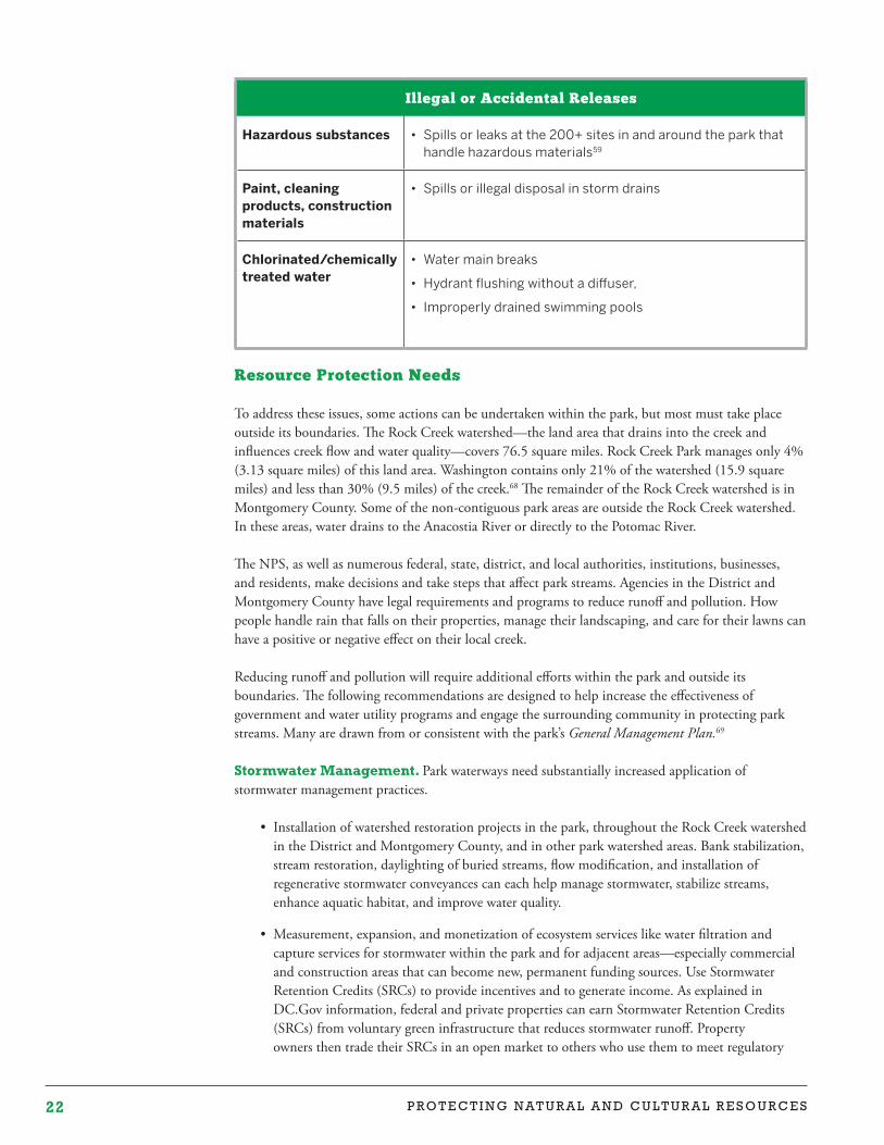
22 P R O T E C T I N G N A T U R A L A N D C U L T U R A L R E S O U R C E S
Illegal or Accidental Releases
Hazardous substances • Spills or leaks at the 200+ sites in and around the park that handle hazardous materials59
Paint, cleaning products, construction materials
• Spills or illegal disposal in storm drains
Chlorinated/chemically treated water
• Water main breaks
• Hydrant flushing without a diffuser,
• Improperly drained swimming pools
Resource Protection Needs
To address these issues, some actions can be undertaken within the park, but most must take place outside its boundaries. The Rock Creek watershed—the land area that drains into the creek and influences creek flow and water quality—covers 76.5 square miles. Rock Creek Park manages only 4% (3.13 square miles) of this land area. Washington contains only 21% of the watershed (15.9 square miles) and less than 30% (9.5 miles) of the creek.68 The remainder of the Rock Creek watershed is in Montgomery County. Some of the non-contiguous park areas are outside the Rock Creek watershed. In these areas, water drains to the Anacostia River or directly to the Potomac River.
The NPS, as well as numerous federal, state, district, and local authorities, institutions, businesses, and residents, make decisions and take steps that affect park streams. Agencies in the District and Montgomery County have legal requirements and programs to reduce runoff and pollution. How people handle rain that falls on their properties, manage their landscaping, and care for their lawns can have a positive or negative effect on their local creek.
Reducing runoff and pollution will require additional efforts within the park and outside its boundaries. The following recommendations are designed to help increase the effectiveness of government and water utility programs and engage the surrounding community in protecting park streams. Many are drawn from or consistent with the park’s General Management Plan.69
Stormwater Management. Park waterways need substantially increased application of stormwater management practices.
• Installation of watershed restoration projects in the park, throughout the Rock Creek watershed in the District and Montgomery County, and in other park watershed areas. Bank stabilization, stream restoration, daylighting of buried streams, flow modification, and installation of regenerative stormwater conveyances can each help manage stormwater, stabilize streams, enhance aquatic habitat, and improve water quality.
• Measurement, expansion, and monetization of ecosystem services like water filtration and capture services for stormwater within the park and for adjacent areas—especially commercial and construction areas that can become new, permanent funding sources. Use Stormwater Retention Credits (SRCs) to provide incentives and to generate income. As explained in DC.Gov information, federal and private properties can earn Stormwater Retention Credits (SRCs) from voluntary green infrastructure that reduces stormwater runoff. Property owners then trade their SRCs in an open market to others who use them to meet regulatory
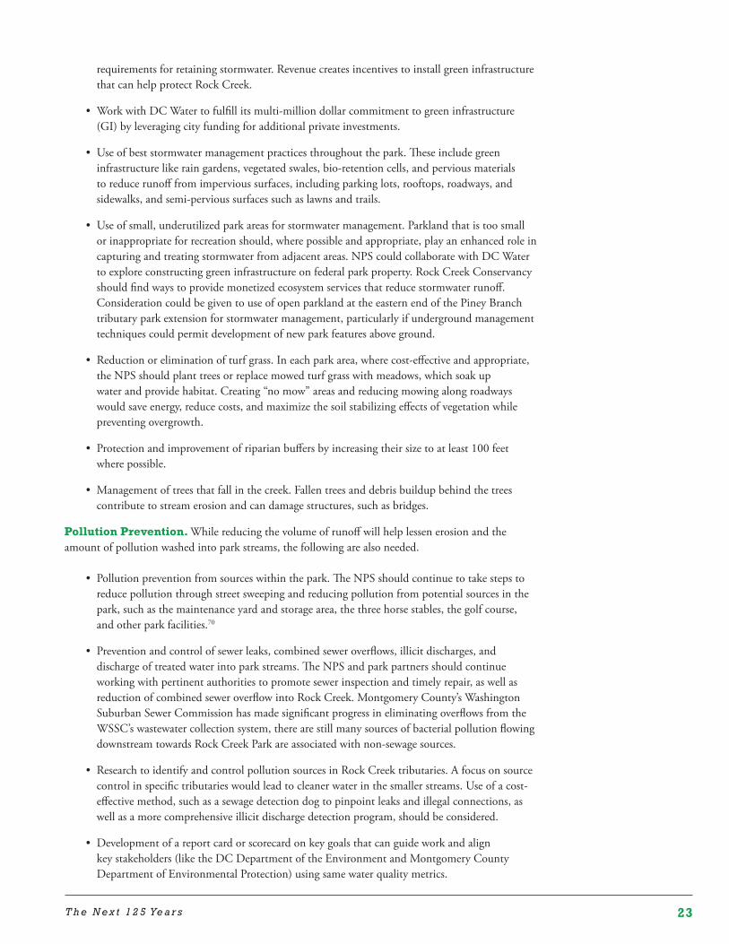
23T h e N e x t 1 2 5 Ye a r s
requirements for retaining stormwater. Revenue creates incentives to install green infrastructure that can help protect Rock Creek.
• Work with DC Water to fulfill its multi-million dollar commitment to green infrastructure (GI) by leveraging city funding for additional private investments.
• Use of best stormwater management practices throughout the park. These include green infrastructure like rain gardens, vegetated swales, bio-retention cells, and pervious materials to reduce runoff from impervious surfaces, including parking lots, rooftops, roadways, and sidewalks, and semi-pervious surfaces such as lawns and trails.
• Use of small, underutilized park areas for stormwater management. Parkland that is too small or inappropriate for recreation should, where possible and appropriate, play an enhanced role in capturing and treating stormwater from adjacent areas. NPS could collaborate with DC Water to explore constructing green infrastructure on federal park property. Rock Creek Conservancy should find ways to provide monetized ecosystem services that reduce stormwater runoff. Consideration could be given to use of open parkland at the eastern end of the Piney Branch tributary park extension for stormwater management, particularly if underground management techniques could permit development of new park features above ground.
• Reduction or elimination of turf grass. In each park area, where cost-effective and appropriate, the NPS should plant trees or replace mowed turf grass with meadows, which soak up water and provide habitat. Creating “no mow” areas and reducing mowing along roadways would save energy, reduce costs, and maximize the soil stabilizing effects of vegetation while preventing overgrowth.
• Protection and improvement of riparian buffers by increasing their size to at least 100 feet where possible.
• Management of trees that fall in the creek. Fallen trees and debris buildup behind the trees contribute to stream erosion and can damage structures, such as bridges.
Pollution Prevention. While reducing the volume of runoff will help lessen erosion and the amount of pollution washed into park streams, the following are also needed.
• Pollution prevention from sources within the park. The NPS should continue to take steps to reduce pollution through street sweeping and reducing pollution from potential sources in the park, such as the maintenance yard and storage area, the three horse stables, the golf course, and other park facilities.70
• Prevention and control of sewer leaks, combined sewer overflows, illicit discharges, and discharge of treated water into park streams. The NPS and park partners should continue working with pertinent authorities to promote sewer inspection and timely repair, as well as reduction of combined sewer overflow into Rock Creek. Montgomery County’s Washington Suburban Sewer Commission has made significant progress in eliminating overflows from the WSSC’s wastewater collection system, there are still many sources of bacterial pollution flowing downstream towards Rock Creek Park are associated with non-sewage sources.
• Research to identify and control pollution sources in Rock Creek tributaries. A focus on source control in specific tributaries would lead to cleaner water in the smaller streams. Use of a cost-effective method, such as a sewage detection dog to pinpoint leaks and illegal connections, as well as a more comprehensive illicit discharge detection program, should be considered.
• Development of a report card or scorecard on key goals that can guide work and align key stakeholders (like the DC Department of the Environment and Montgomery County Department of Environmental Protection) using same water quality metrics.
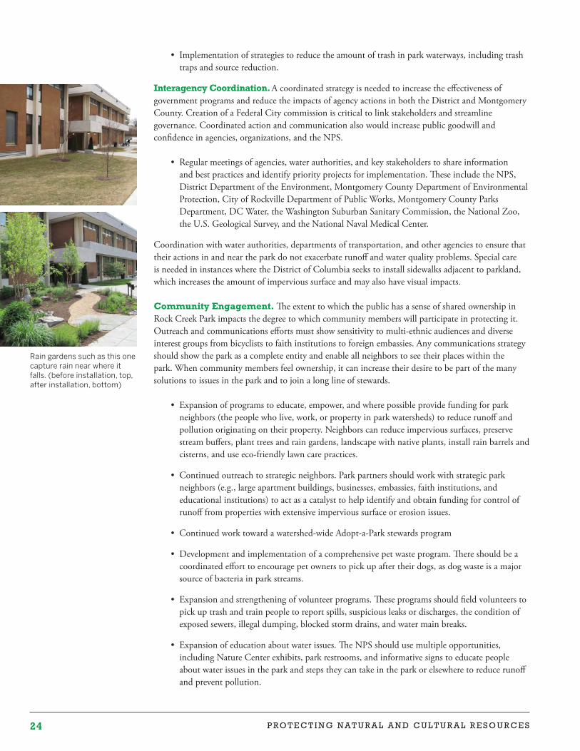
24 P R O T E C T I N G N A T U R A L A N D C U L T U R A L R E S O U R C E S
• Implementation of strategies to reduce the amount of trash in park waterways, including trash traps and source reduction.
Interagency Coordination. A coordinated strategy is needed to increase the effectiveness of government programs and reduce the impacts of agency actions in both the District and Montgomery County. Creation of a Federal City commission is critical to link stakeholders and streamline governance. Coordinated action and communication also would increase public goodwill and confidence in agencies, organizations, and the NPS.
• Regular meetings of agencies, water authorities, and key stakeholders to share information and best practices and identify priority projects for implementation. These include the NPS, District Department of the Environment, Montgomery County Department of Environmental Protection, City of Rockville Department of Public Works, Montgomery County Parks Department, DC Water, the Washington Suburban Sanitary Commission, the National Zoo, the U.S. Geological Survey, and the National Naval Medical Center.
Coordination with water authorities, departments of transportation, and other agencies to ensure that their actions in and near the park do not exacerbate runoff and water quality problems. Special care is needed in instances where the District of Columbia seeks to install sidewalks adjacent to parkland, which increases the amount of impervious surface and may also have visual impacts.
Community Engagement. The extent to which the public has a sense of shared ownership in Rock Creek Park impacts the degree to which community members will participate in protecting it. Outreach and communications efforts must show sensitivity to multi-ethnic audiences and diverse interest groups from bicyclists to faith institutions to foreign embassies. Any communications strategy should show the park as a complete entity and enable all neighbors to see their places within the park. When community members feel ownership, it can increase their desire to be part of the many solutions to issues in the park and to join a long line of stewards.
• Expansion of programs to educate, empower, and where possible provide funding for park neighbors (the people who live, work, or property in park watersheds) to reduce runoff and pollution originating on their property. Neighbors can reduce impervious surfaces, preserve stream buffers, plant trees and rain gardens, landscape with native plants, install rain barrels and cisterns, and use eco-friendly lawn care practices.
• Continued outreach to strategic neighbors. Park partners should work with strategic park neighbors (e.g., large apartment buildings, businesses, embassies, faith institutions, and educational institutions) to act as a catalyst to help identify and obtain funding for control of runoff from properties with extensive impervious surface or erosion issues.
• Continued work toward a watershed-wide Adopt-a-Park stewards program
• Development and implementation of a comprehensive pet waste program. There should be a coordinated effort to encourage pet owners to pick up after their dogs, as dog waste is a major source of bacteria in park streams.
• Expansion and strengthening of volunteer programs. These programs should field volunteers to pick up trash and train people to report spills, suspicious leaks or discharges, the condition of exposed sewers, illegal dumping, blocked storm drains, and water main breaks.
• Expansion of education about water issues. The NPS should use multiple opportunities, including Nature Center exhibits, park restrooms, and informative signs to educate people about water issues in the park and steps they can take in the park or elsewhere to reduce runoff and prevent pollution.
Rain gardens such as this one capture rain near where it falls. (before installation, top, after installation, bottom)
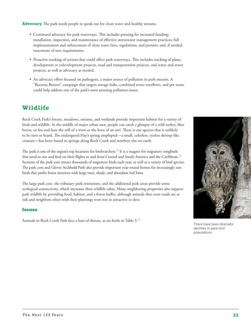
25T h e N e x t 1 2 5 Ye a r s
Advocacy. The park needs people to speak out for clean water and healthy streams.
• Continued advocacy for park waterways. This includes pressing for increased funding; installation, inspection, and maintenance of effective stormwater management practices; full implementation and enforcement of clean water laws, regulations, and permits; and, if needed, enactment of new requirements.
• Proactive tracking of actions that could affect park waterways. This includes tracking of plans, development or redevelopment projects, road and transportation projects, and water and sewer projects, as well as advocacy as needed.
• An advocacy effort focused on pathogens, a major source of pollution in park streams. A “Bacteria Busters” campaign that targets sewage leaks, combined sewer overflows, and pet waste could help address one of the park’s most pressing pollution issues.
Wildlife
Rock Creek Park’s forests, meadows, streams, and wetlands provide important habitat for a variety of birds and wildlife. In the middle of major urban area, people can catch a glimpse of a wild turkey, blue heron, or fox and hear the trill of a wren or the hoot of an owl. There is one species that is unlikely to be seen or heard. The endangered Hay’s spring amphipod—a small, colorless, eyeless shrimp-like creature—has been found in springs along Rock Creek and nowhere else on earth.
The park is one of the region’s top locations for birdwatchers.71 It is a magnet for migratory songbirds that need to rest and feed on their flights to and from Central and South America and the Caribbean.72 Sections of the park core attract thousands of migratory birds each year, as well as a variety of bird species. The park core and Glover Archbold Park also provide important year-round homes for increasingly rare birds that prefer forest interiors with large trees, shade, and abundant leaf litter.
The large park core, the tributary park extensions, and the additional park areas provide some ecological connectivity, which increases their wildlife value. Many neighboring properties also support park wildlife by providing food, habitat, and a forest buffer, although animals that cross roads are at risk and neighbors often wish their plantings were not so attractive to deer.
Issues
Animals in Rock Creek Park face a host of threats, as set forth in Table 3.73
There have been dramatic declines in park bird populations.
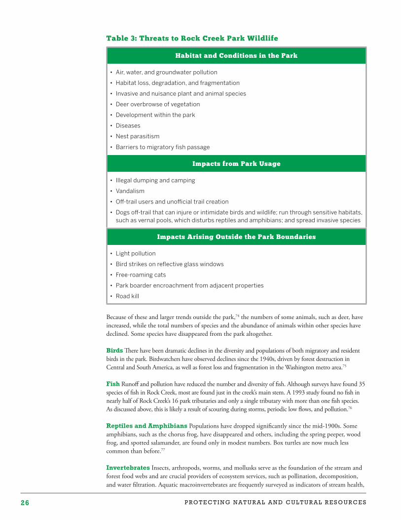
26 P R O T E C T I N G N A T U R A L A N D C U L T U R A L R E S O U R C E S
Table 3: Threats to Rock Creek Park Wildlife
Habitat and Conditions in the Park
• Air, water, and groundwater pollution
• Habitat loss, degradation, and fragmentation
• Invasive and nuisance plant and animal species
• Deer overbrowse of vegetation
• Development within the park
• Diseases
• Nest parasitism
• Barriers to migratory fish passage
Impacts from Park Usage
• Illegal dumping and camping
• Vandalism
• Off-trail users and unofficial trail creation
• Dogs off-trail that can injure or intimidate birds and wildlife; run through sensitive habitats, such as vernal pools, which disturbs reptiles and amphibians; and spread invasive species
Impacts Arising Outside the Park Boundaries
• Light pollution
• Bird strikes on reflective glass windows
• Free-roaming cats
• Park boarder encroachment from adjacent properties
• Road kill
Because of these and larger trends outside the park,74 the numbers of some animals, such as deer, have increased, while the total numbers of species and the abundance of animals within other species have declined. Some species have disappeared from the park altogether.
Birds There have been dramatic declines in the diversity and populations of both migratory and resident birds in the park. Birdwatchers have observed declines since the 1940s, driven by forest destruction in Central and South America, as well as forest loss and fragmentation in the Washington metro area.75
Fish Runoff and pollution have reduced the number and diversity of fish. Although surveys have found 35 species of fish in Rock Creek, most are found just in the creek’s main stem. A 1993 study found no fish in nearly half of Rock Creek’s 16 park tributaries and only a single tributary with more than one fish species. As discussed above, this is likely a result of scouring during storms, periodic low flows, and pollution.76
Reptiles and Amphibians Populations have dropped significantly since the mid-1900s. Some amphibians, such as the chorus frog, have disappeared and others, including the spring peeper, wood frog, and spotted salamander, are found only in modest numbers. Box turtles are now much less common than before.77
Invertebrates Insects, arthropods, worms, and mollusks serve as the foundation of the stream and forest food webs and are crucial providers of ecosystem services, such as pollination, decomposition, and water filtration. Aquatic macroinvertebrates are frequently surveyed as indicators of stream health,
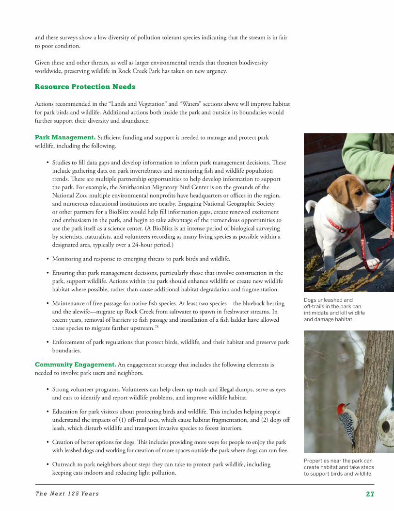
27T h e N e x t 1 2 5 Ye a r s
and these surveys show a low diversity of pollution tolerant species indicating that the stream is in fair to poor condition.
Given these and other threats, as well as larger environmental trends that threaten biodiversity worldwide, preserving wildlife in Rock Creek Park has taken on new urgency.
Resource Protection Needs
Actions recommended in the “Lands and Vegetation” and “Waters” sections above will improve habitat for park birds and wildlife. Additional actions both inside the park and outside its boundaries would further support their diversity and abundance.
Park Management. Sufficient funding and support is needed to manage and protect park wildlife, including the following.
• Studies to fill data gaps and develop information to inform park management decisions. These include gathering data on park invertebrates and monitoring fish and wildlife population trends. There are multiple partnership opportunities to help develop information to support the park. For example, the Smithsonian Migratory Bird Center is on the grounds of the National Zoo, multiple environmental nonprofits have headquarters or offices in the region, and numerous educational institutions are nearby. Engaging National Geographic Society or other partners for a BioBlitz would help fill information gaps, create renewed excitement and enthusiasm in the park, and begin to take advantage of the tremendous opportunities to use the park itself as a science center. (A BioBlitz is an intense period of biological surveying by scientists, naturalists, and volunteers recording as many living species as possible within a designated area, typically over a 24-hour period.)
• Monitoring and response to emerging threats to park birds and wildlife.
• Ensuring that park management decisions, particularly those that involve construction in the park, support wildlife. Actions within the park should enhance wildlife or create new wildlife habitat where possible, rather than cause additional habitat degradation and fragmentation.
• Maintenance of free passage for native fish species. At least two species—the blueback herring and the alewife—migrate up Rock Creek from saltwater to spawn in freshwater streams. In recent years, removal of barriers to fish passage and installation of a fish ladder have allowed these species to migrate farther upstream.78
• Enforcement of park regulations that protect birds, wildlife, and their habitat and preserve park boundaries.
Community Engagement. An engagement strategy that includes the following elements is needed to involve park users and neighbors.
• Strong volunteer programs. Volunteers can help clean up trash and illegal dumps, serve as eyes and ears to identify and report wildlife problems, and improve wildlife habitat.
• Education for park visitors about protecting birds and wildlife. This includes helping people understand the impacts of (1) off-trail uses, which cause habitat fragmentation, and (2) dogs off leash, which disturb wildlife and transport invasive species to forest interiors.
• Creation of better options for dogs. This includes providing more ways for people to enjoy the park with leashed dogs and working for creation of more spaces outside the park where dogs can run free.
• Outreach to park neighbors about steps they can take to protect park wildlife, including keeping cats indoors and reducing light pollution.
Properties near the park can create habitat and take steps to support birds and wildlife.
Dogs unleashed and off-trails in the park can intimidate and kill wildlife and damage habitat.
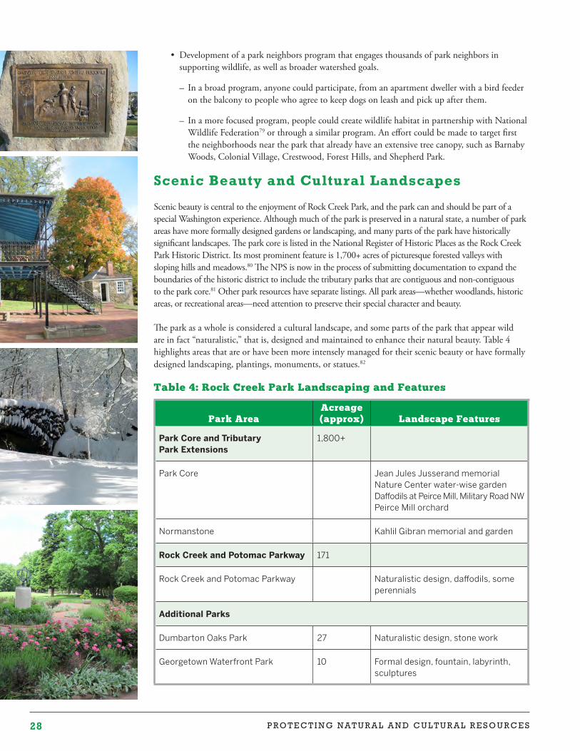
28 P R O T E C T I N G N A T U R A L A N D C U L T U R A L R E S O U R C E S
• Development of a park neighbors program that engages thousands of park neighbors in supporting wildlife, as well as broader watershed goals.
– In a broad program, anyone could participate, from an apartment dweller with a bird feeder on the balcony to people who agree to keep dogs on leash and pick up after them.
– In a more focused program, people could create wildlife habitat in partnership with National Wildlife Federation79 or through a similar program. An effort could be made to target first the neighborhoods near the park that already have an extensive tree canopy, such as Barnaby Woods, Colonial Village, Crestwood, Forest Hills, and Shepherd Park.
Scenic Beauty and Cultural Landscapes
Scenic beauty is central to the enjoyment of Rock Creek Park, and the park can and should be part of a special Washington experience. Although much of the park is preserved in a natural state, a number of park areas have more formally designed gardens or landscaping, and many parts of the park have historically significant landscapes. The park core is listed in the National Register of Historic Places as the Rock Creek Park Historic District. Its most prominent feature is 1,700+ acres of picturesque forested valleys with sloping hills and meadows.80 The NPS is now in the process of submitting documentation to expand the boundaries of the historic district to include the tributary parks that are contiguous and non-contiguous to the park core.81 Other park resources have separate listings. All park areas—whether woodlands, historic areas, or recreational areas—need attention to preserve their special character and beauty.
The park as a whole is considered a cultural landscape, and some parts of the park that appear wild are in fact “naturalistic,” that is, designed and maintained to enhance their natural beauty. Table 4 highlights areas that are or have been more intensely managed for their scenic beauty or have formally designed landscaping, plantings, monuments, or statues.82
Table 4: Rock Creek Park Landscaping and Features
Park AreaAcreage (approx) Landscape Features
Park Core and Tributary Park Extensions
1,800+
Park Core Jean Jules Jusserand memorialNature Center water-wise garden Daffodils at Peirce Mill, Military Road NWPeirce Mill orchard
Normanstone Kahlil Gibran memorial and garden
Rock Creek and Potomac Parkway 171
Rock Creek and Potomac Parkway Naturalistic design, daffodils, some perennials
Additional Parks
Dumbarton Oaks Park 27 Naturalistic design, stone work
Georgetown Waterfront Park 10 Formal design, fountain, labyrinth, sculptures
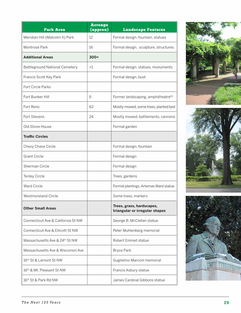
29T h e N e x t 1 2 5 Ye a r s
Park AreaAcreage (approx) Landscape Features
Meridian Hill (Malcolm X) Park 12 Formal design, fountain, statues
Montrose Park 16 Formal design, sculpture, structures
Additional Areas 300+
Battleground National Cemetery <1 Formal design, statues, monuments
Francis Scott Key Park Formal design, bust
Fort Circle Parks
Fort Bunker Hill 6 Former landscaping, amphitheatre83
Fort Reno 62 Mostly mowed, some trees, planted bed
Fort Stevens 24 Mostly mowed, battlements, cannons
Old Stone House Formal garden
Traffic Circles
Chevy Chase Circle Formal design, fountain
Grant Circle Formal design
Sherman Circle Formal design
Tenley Circle Trees, gardens
Ward Circle Formal plantings, Artemas Ward statue
Westmoreland Circle Some trees, markers
Other Small Areas Trees, grass, hardscapes, triangular or irregular shapes
Connecticut Ave & California St NW George B. McClellan statue
Connecticut Ave & Ellicott St NW Peter Muhlenberg memorial
Massachusetts Ave & 24th St NW Robert Emmet statue
Massachusetts Ave & Wisconsin Ave Bryce Park
16th St & Lamont St NW Guglielmo Marconi memorial
16th & Mt. Pleasant St NW Francis Asbury statue
16th St & Park Rd NW James Cardinal Gibbons statue
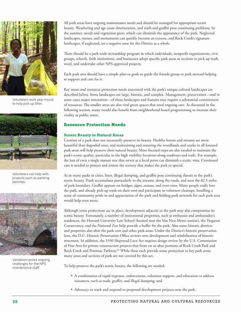
30 P R O T E C T I N G N A T U R A L A N D C U L T U R A L R E S O U R C E S
All park areas have ongoing maintenance needs and should be managed for appropriate scenic beauty. Weathering and age cause deterioration, and trash and graffiti pose continuing problems. In the summer, weeds and vegetation grow, which can diminish the appearance of the park. Neglected landscapes, statues, and monuments can quickly become an eyesore, and Rock Creek’s signature landscapes, if neglected, set a negative tone for the District as a whole.
There should be a park-wide stewardship program in which individuals, nonprofit organizations, civic groups, schools, faith institutions, and businesses adopt specific park areas or sections to pick up trash, weed, and undertake other NPS-approved projects.
Each park area should have a simple plan or goals to guide the friends group or park steward helping to support and care for it.
Key issues and resources protection needs associated with the park’s unique cultural landscapes are described below. Some landscapes are large, historic, and complex. Management, preservation—and in some cases major restoration—of these landscapes and features may require a substantial commitment of resources. The smaller areas are also vital green spaces that need ongoing care. As discussed in the following section, many would also benefit from neighborhood-based programming to increase their vitality as public assets.
Resource Protection Needs
Scenic Beauty in Natural Areas Creation of a park does not necessarily preserve its beauty. Healthy forests and streams are more beautiful than degraded ones, and maintaining and restoring the woodlands and creeks in all forested park areas will help preserve their natural beauty. More focused steps are also needed to maintain the park’s scenic quality, particular in the high visibility locations along roadways and trails. For example, the loss of even a single mature tree that serves as a focal point can diminish a scenic vista. Continued care is needed to protect and restore the scenery that makes the park so special.
As in many parks in cities, litter, illegal dumping, and graffiti pose continuing threats to the park’s scenic beauty. Trash accumulates particularly in the streams, along the roads, and near the 82.5 miles of park boundary. Graffiti appears on bridges, signs, statues, and even trees. Many people really love the park, and already pick up trash on their own and participate in volunteer cleanups. Instilling a sense of community pride in and appreciation of the park and fielding park stewards for each park area would help even more.
Although some protections are in place, development adjacent to the park may also compromise its scenic beauty. Fortunately, a number of institutional properties, such as embassies and ambassador’s residences, the Howard University Law School (located near the Van Ness Metro station), the Tregaron Conservancy, and the National Zoo help provide a buffer for the park. Also some historic districts and properties also abut the park core and other park areas. Under the District’s historic preservation laws, the D.C. Historic Preservation Office reviews new development and rehabilitation of historic structures. In addition, the 1930 Shipstead-Luce Act requires design review by the U.S. Commission of Fine Arts for private construction projects that front on or abut portions of Rock Creek Park and Rock Creek and Potomac Parkway.84 While these each provide some protection to key park areas, many areas and sections of park are not covered by this act.
To help preserve the park’s scenic beauty, the following are needed:
• A combination of rapid response, enforcement, volunteer support, and education to address nuisances, such as trash, graffiti, and illegal dumping; and
• Advocacy to track and respond to proposed development projects near the park.
Volunteers work year-round to help pick up litter.
Vandalism poses ongoing challenges for the NPS maintenance staff.
Volunteers can help with projects such as painting benches.
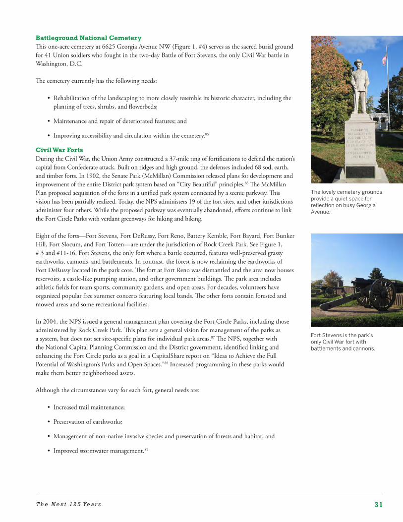
31T h e N e x t 1 2 5 Ye a r s
Battleground National CemeteryThis one-acre cemetery at 6625 Georgia Avenue NW (Figure 1, #4) serves as the sacred burial ground for 41 Union soldiers who fought in the two-day Battle of Fort Stevens, the only Civil War battle in Washington, D.C.
The cemetery currently has the following needs:
• Rehabilitation of the landscaping to more closely resemble its historic character, including the planting of trees, shrubs, and flowerbeds;
• Maintenance and repair of deteriorated features; and
• Improving accessibility and circulation within the cemetery.85
Civil War FortsDuring the Civil War, the Union Army constructed a 37-mile ring of fortifications to defend the nation’s capital from Confederate attack. Built on ridges and high ground, the defenses included 68 sod, earth, and timber forts. In 1902, the Senate Park (McMillan) Commission released plans for development and improvement of the entire District park system based on “City Beautiful” principles.86 The McMillan Plan proposed acquisition of the forts in a unified park system connected by a scenic parkway. This vision has been partially realized. Today, the NPS administers 19 of the fort sites, and other jurisdictions administer four others. While the proposed parkway was eventually abandoned, efforts continue to link the Fort Circle Parks with verdant greenways for hiking and biking.
Eight of the forts—Fort Stevens, Fort DeRussy, Fort Reno, Battery Kemble, Fort Bayard, Fort Bunker Hill, Fort Slocum, and Fort Totten—are under the jurisdiction of Rock Creek Park. See Figure 1, # 3 and #11-16. Fort Stevens, the only fort where a battle occurred, features well-preserved grassy earthworks, cannons, and battlements. In contrast, the forest is now reclaiming the earthworks of Fort DeRussy located in the park core. The fort at Fort Reno was dismantled and the area now houses reservoirs, a castle-like pumping station, and other government buildings. The park area includes athletic fields for team sports, community gardens, and open areas. For decades, volunteers have organized popular free summer concerts featuring local bands. The other forts contain forested and mowed areas and some recreational facilities.
In 2004, the NPS issued a general management plan covering the Fort Circle Parks, including those administered by Rock Creek Park. This plan sets a general vision for management of the parks as a system, but does not set site-specific plans for individual park areas.87 The NPS, together with the National Capital Planning Commission and the District government, identified linking and enhancing the Fort Circle parks as a goal in a CapitalShare report on “Ideas to Achieve the Full Potential of Washington’s Parks and Open Spaces.”88 Increased programming in these parks would make them better neighborhood assets.
Although the circumstances vary for each fort, general needs are:
• Increased trail maintenance;
• Preservation of earthworks;
• Management of non-native invasive species and preservation of forests and habitat; and
• Improved stormwater management.89
Fort Stevens is the park’s only Civil War fort with battlements and cannons.
The lovely cemetery grounds provide a quiet space for reflection on busy Georgia Avenue.
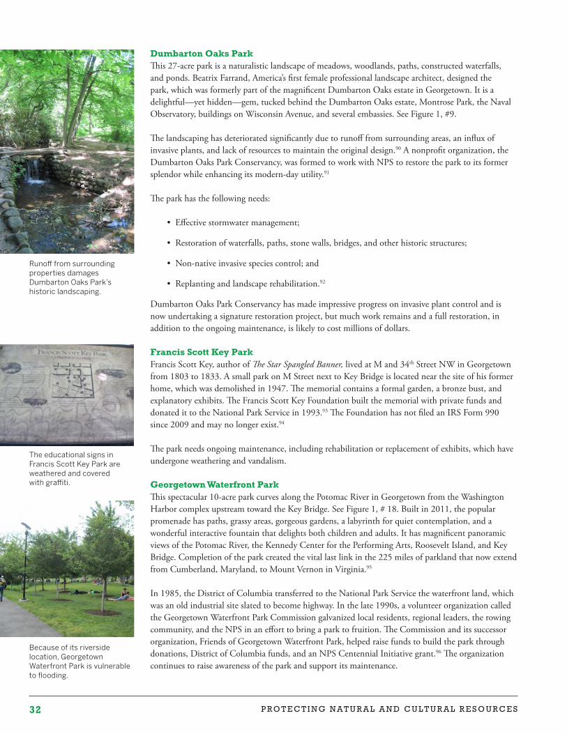
32 P R O T E C T I N G N A T U R A L A N D C U L T U R A L R E S O U R C E S
Dumbarton Oaks ParkThis 27-acre park is a naturalistic landscape of meadows, woodlands, paths, constructed waterfalls, and ponds. Beatrix Farrand, America’s first female professional landscape architect, designed the park, which was formerly part of the magnificent Dumbarton Oaks estate in Georgetown. It is a delightful—yet hidden—gem, tucked behind the Dumbarton Oaks estate, Montrose Park, the Naval Observatory, buildings on Wisconsin Avenue, and several embassies. See Figure 1, #9.
The landscaping has deteriorated significantly due to runoff from surrounding areas, an influx of invasive plants, and lack of resources to maintain the original design.90 A nonprofit organization, the Dumbarton Oaks Park Conservancy, was formed to work with NPS to restore the park to its former splendor while enhancing its modern-day utility.91
The park has the following needs:
• Effective stormwater management;
• Restoration of waterfalls, paths, stone walls, bridges, and other historic structures;
• Non-native invasive species control; and
• Replanting and landscape rehabilitation.92
Dumbarton Oaks Park Conservancy has made impressive progress on invasive plant control and is now undertaking a signature restoration project, but much work remains and a full restoration, in addition to the ongoing maintenance, is likely to cost millions of dollars.
Francis Scott Key ParkFrancis Scott Key, author of The Star Spangled Banner, lived at M and 34th Street NW in Georgetown from 1803 to 1833. A small park on M Street next to Key Bridge is located near the site of his former home, which was demolished in 1947. The memorial contains a formal garden, a bronze bust, and explanatory exhibits. The Francis Scott Key Foundation built the memorial with private funds and donated it to the National Park Service in 1993.93 The Foundation has not filed an IRS Form 990 since 2009 and may no longer exist.94
The park needs ongoing maintenance, including rehabilitation or replacement of exhibits, which have undergone weathering and vandalism.
Georgetown Waterfront ParkThis spectacular 10-acre park curves along the Potomac River in Georgetown from the Washington Harbor complex upstream toward the Key Bridge. See Figure 1, # 18. Built in 2011, the popular promenade has paths, grassy areas, gorgeous gardens, a labyrinth for quiet contemplation, and a wonderful interactive fountain that delights both children and adults. It has magnificent panoramic views of the Potomac River, the Kennedy Center for the Performing Arts, Roosevelt Island, and Key Bridge. Completion of the park created the vital last link in the 225 miles of parkland that now extend from Cumberland, Maryland, to Mount Vernon in Virginia.95
In 1985, the District of Columbia transferred to the National Park Service the waterfront land, which was an old industrial site slated to become highway. In the late 1990s, a volunteer organization called the Georgetown Waterfront Park Commission galvanized local residents, regional leaders, the rowing community, and the NPS in an effort to bring a park to fruition. The Commission and its successor organization, Friends of Georgetown Waterfront Park, helped raise funds to build the park through donations, District of Columbia funds, and an NPS Centennial Initiative grant.96 The organization continues to raise awareness of the park and support its maintenance.
Because of its riverside location, Georgetown Waterfront Park is vulnerable to flooding.
The educational signs in Francis Scott Key Park are weathered and covered with graffiti.
Runoff from surrounding properties damages Dumbarton Oaks Park’s historic landscaping.
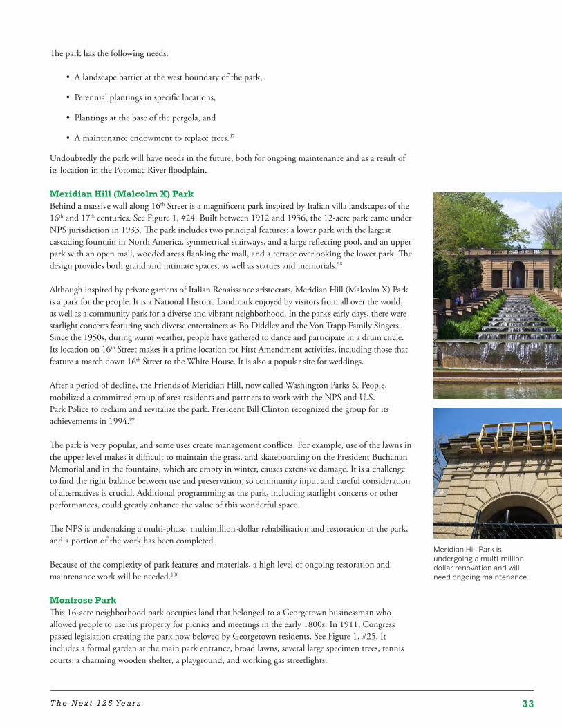
33T h e N e x t 1 2 5 Ye a r s
The park has the following needs:
• A landscape barrier at the west boundary of the park,
• Perennial plantings in specific locations,
• Plantings at the base of the pergola, and
• A maintenance endowment to replace trees.97
Undoubtedly the park will have needs in the future, both for ongoing maintenance and as a result of its location in the Potomac River floodplain.
Meridian Hill (Malcolm X) ParkBehind a massive wall along 16th Street is a magnificent park inspired by Italian villa landscapes of the 16th and 17th centuries. See Figure 1, #24. Built between 1912 and 1936, the 12-acre park came under NPS jurisdiction in 1933. The park includes two principal features: a lower park with the largest cascading fountain in North America, symmetrical stairways, and a large reflecting pool, and an upper park with an open mall, wooded areas flanking the mall, and a terrace overlooking the lower park. The design provides both grand and intimate spaces, as well as statues and memorials.98
Although inspired by private gardens of Italian Renaissance aristocrats, Meridian Hill (Malcolm X) Park is a park for the people. It is a National Historic Landmark enjoyed by visitors from all over the world, as well as a community park for a diverse and vibrant neighborhood. In the park’s early days, there were starlight concerts featuring such diverse entertainers as Bo Diddley and the Von Trapp Family Singers. Since the 1950s, during warm weather, people have gathered to dance and participate in a drum circle. Its location on 16th Street makes it a prime location for First Amendment activities, including those that feature a march down 16th Street to the White House. It is also a popular site for weddings.
After a period of decline, the Friends of Meridian Hill, now called Washington Parks & People, mobilized a committed group of area residents and partners to work with the NPS and U.S. Park Police to reclaim and revitalize the park. President Bill Clinton recognized the group for its achievements in 1994.99
The park is very popular, and some uses create management conflicts. For example, use of the lawns in the upper level makes it difficult to maintain the grass, and skateboarding on the President Buchanan Memorial and in the fountains, which are empty in winter, causes extensive damage. It is a challenge to find the right balance between use and preservation, so community input and careful consideration of alternatives is crucial. Additional programming at the park, including starlight concerts or other performances, could greatly enhance the value of this wonderful space.
The NPS is undertaking a multi-phase, multimillion-dollar rehabilitation and restoration of the park, and a portion of the work has been completed.
Because of the complexity of park features and materials, a high level of ongoing restoration and maintenance work will be needed.100
Montrose ParkThis 16-acre neighborhood park occupies land that belonged to a Georgetown businessman who allowed people to use his property for picnics and meetings in the early 1800s. In 1911, Congress passed legislation creating the park now beloved by Georgetown residents. See Figure 1, #25. It includes a formal garden at the main park entrance, broad lawns, several large specimen trees, tennis courts, a charming wooden shelter, a playground, and working gas streetlights.
Meridian Hill Park is undergoing a multi-million dollar renovation and will need ongoing maintenance.
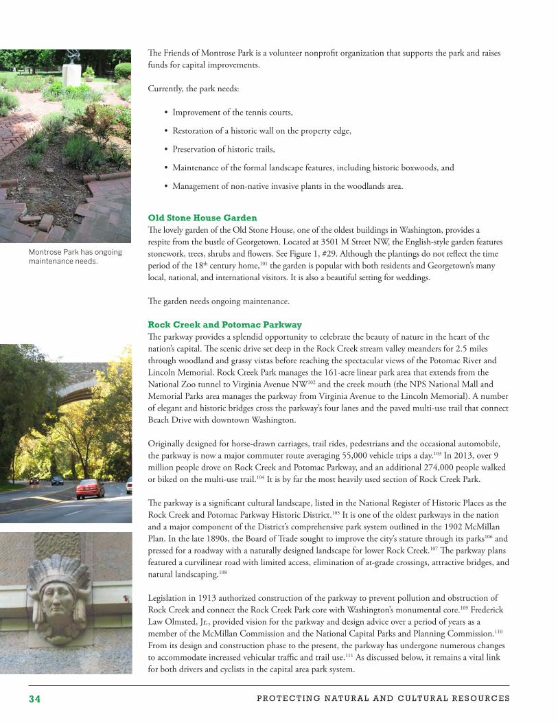
34 P R O T E C T I N G N A T U R A L A N D C U L T U R A L R E S O U R C E S
The Friends of Montrose Park is a volunteer nonprofit organization that supports the park and raises funds for capital improvements.
Currently, the park needs:
• Improvement of the tennis courts,
• Restoration of a historic wall on the property edge,
• Preservation of historic trails,
• Maintenance of the formal landscape features, including historic boxwoods, and
• Management of non-native invasive plants in the woodlands area.
Old Stone House GardenThe lovely garden of the Old Stone House, one of the oldest buildings in Washington, provides a respite from the bustle of Georgetown. Located at 3501 M Street NW, the English-style garden features stonework, trees, shrubs and flowers. See Figure 1, #29. Although the plantings do not reflect the time period of the 18th century home,101 the garden is popular with both residents and Georgetown’s many local, national, and international visitors. It is also a beautiful setting for weddings.
The garden needs ongoing maintenance.
Rock Creek and Potomac ParkwayThe parkway provides a splendid opportunity to celebrate the beauty of nature in the heart of the nation’s capital. The scenic drive set deep in the Rock Creek stream valley meanders for 2.5 miles through woodland and grassy vistas before reaching the spectacular views of the Potomac River and Lincoln Memorial. Rock Creek Park manages the 161-acre linear park area that extends from the National Zoo tunnel to Virginia Avenue NW102 and the creek mouth (the NPS National Mall and Memorial Parks area manages the parkway from Virginia Avenue to the Lincoln Memorial). A number of elegant and historic bridges cross the parkway’s four lanes and the paved multi-use trail that connect Beach Drive with downtown Washington.
Originally designed for horse-drawn carriages, trail rides, pedestrians and the occasional automobile, the parkway is now a major commuter route averaging 55,000 vehicle trips a day.103 In 2013, over 9 million people drove on Rock Creek and Potomac Parkway, and an additional 274,000 people walked or biked on the multi-use trail.104 It is by far the most heavily used section of Rock Creek Park.
The parkway is a significant cultural landscape, listed in the National Register of Historic Places as the Rock Creek and Potomac Parkway Historic District.105 It is one of the oldest parkways in the nation and a major component of the District’s comprehensive park system outlined in the 1902 McMillan Plan. In the late 1890s, the Board of Trade sought to improve the city’s stature through its parks106 and pressed for a roadway with a naturally designed landscape for lower Rock Creek.107 The parkway plans featured a curvilinear road with limited access, elimination of at-grade crossings, attractive bridges, and natural landscaping.108
Legislation in 1913 authorized construction of the parkway to prevent pollution and obstruction of Rock Creek and connect the Rock Creek Park core with Washington’s monumental core.109 Frederick Law Olmsted, Jr., provided vision for the parkway and design advice over a period of years as a member of the McMillan Commission and the National Capital Parks and Planning Commission.110 From its design and construction phase to the present, the parkway has undergone numerous changes to accommodate increased vehicular traffic and trail use.111 As discussed below, it remains a vital link for both drivers and cyclists in the capital area park system.
Montrose Park has ongoing maintenance needs.
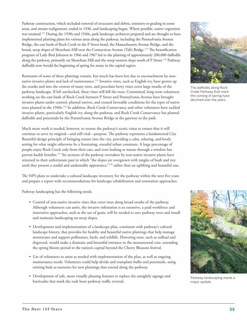
35T h e N e x t 1 2 5 Ye a r s
Parkway construction, which included removal of structures and debris, extensive re-grading in some areas, and stream realignment, ended in 1936, and landscaping began. Where possible, native vegetation was retained.112 During the 1930s and 1940s, park landscape architects prepared and are thought to have implemented planting plans for various areas along the parkway, including the Pennsylvania Avenue Bridge, the east bank of Rock Creek in the P Street bend, the Massachusetts Avenue Bridge, and the broad, steep slopes of Shoreham Hill near the Connecticut Avenue (Taft) Bridge.113 The beautification program of Lady Bird Johnson in 1966 and 1967 led to the planting of approximately 200,000 daffodils along the parkway, primarily on Shoreham Hill and the steep western slope south of P Street.114 Parkway daffodils now herald the beginning of spring for many in the capital region.
Remnants of some of these plantings remain, but much has been lost due to encroachment by non-native invasive plants and lack of maintenance.115 Invasive vines, such as English ivy, have grown up the trunks and into the crowns of many trees, and porcelain berry vines cover large swaths of the parkway landscape. If left unchecked, these vines will kill the trees. Committed, long-term volunteers working on the east bank of Rock Creek between P Street and Pennsylvania Avenue have brought invasive plants under control, planted natives, and created favorable conditions for the types of native trees planted in the 1940s.116 In addition, Rock Creek Conservancy and other volunteers have tackled invasive plants, particularly English ivy, along the parkway, and Rock Creek Conservancy has planted daffodils and perennials by the Pennsylvania Avenue Bridge at the gateway to the park.
Much more work is needed, however, to restore the parkway’s scenic vistas to ensure that it will continue to serve its original—and still vital—purpose. The parkway represents a fundamental City Beautiful design principle of bringing nature into the city, providing a calm, relaxing, and lovely setting for what might otherwise be a frustrating, stressful urban commute. A large percentage of people enjoy Rock Creek only from their cars, and even looking at nature through a window has proven health benefits.117 Yet sections of the parkway overtaken by non-native invasive plants have returned to their unfortunate past in which “the slopes are overgrown with tangles of bush and tree until they present a sordid and undesirable appearance,”118 rather than an uplifting and beautiful one.
The NPS plans to undertake a cultural landscape inventory for the parkway within the next five years and prepare a report with recommendations for landscape rehabilitation and restoration approaches.
Parkway landscaping has the following needs.
• Control of non-native invasive vines that cover trees along broad swaths of the parkway. Although volunteers can assist, the invasive infestation is so extensive, a paid workforce and innovative approaches, such as the use of goats, will be needed to save parkway trees and install and maintain landscaping on steep slopes.
• Development and implementation of a landscape plan, consistent with parkway’s cultural landscape history, that provides for healthy and beautiful native plantings that help manage stormwater and support pollinators, birds, and wildlife. Flowering trees, such as redbud and dogwood, would make a dramatic and beautiful entrance to the monumental core, extending the spring bloom period in the nation’s capital beyond the Cherry Blossom festival.
• Use of volunteers to assist as needed with implementation of the plan, as well as ongoing maintenance needs. Volunteers could help divide and transplant bulbs and perennials, using existing beds as nurseries for new plantings that extend along the parkway.
• Development of safe, more visually pleasing features to replace the unsightly signage and barricades that mark the rush hour parkway traffic reversal.
The daffodils along Rock Creek Parkway that mark the coming of spring have declined over the years.
Parkway landscaping needs a major update.
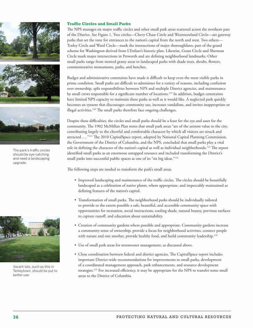
36 P R O T E C T I N G N A T U R A L A N D C U L T U R A L R E S O U R C E S
Traffic Circles and Small ParksThe NPS manages six major traffic circles and other small park areas scattered across the northern part of the District. See Figure 1. Two circles—Chevy Chase Circle and Westmoreland Circle—are gateway parks that set the tone for entrances to the nation’s capital from the north and west. Two others—Tenley Circle and Ward Circle—mark the intersections of major thoroughfares, part of the grand scheme for Washington derived from L’Enfant’s historic plan. Likewise, Grant Circle and Sherman Circle mark major intersections in Petworth and are defining neighborhood landmarks. Other small parks range from mowed grassy areas to landscaped parks with shade trees, shrubs, flowers, commemorative monuments, paths, and benches.
Budget and administrative constraints have made it difficult to keep even the most visible parks in prime condition. Small parks are difficult to administer for a variety of reasons, including confusion over ownership, split responsibilities between NPS and multiple District agencies, and maintenance by small crews responsible for a significant number of locations.119 In addition, budget constraints have limited NPS capacity to maintain these parks as well as it would like. A neglected park quickly becomes an eyesore that discourages community use, increases vandalism, and invites inappropriate or illegal activities.120 The small parks therefore face ongoing challenges.
Despite these difficulties, the circles and small parks should be a feast for the eye and asset for the community. The 1902 McMillan Plan notes that small park areas “are of the utmost value to the city, contributing largely to the cheerful and comfortable character by which all visitors are struck and attracted .…”121 The 2010 CapitalSpace report, adopted by National Capital Planning Commission, the Government of the District of Columbia, and the NPS, concluded that small parks play a vital role in defining the character of the nation’s capital as well as individual neighborhoods.122 The report identified small parks as an enormous untapped resource and included transforming the District’s small parks into successful public spaces as one of its “six big ideas.”123
The following steps are needed to transform the park’s small areas.
• Improved landscaping and maintenance of the traffic circles. The circles should be beautifully landscaped as a celebration of native plants, where appropriate, and impeccably maintained as defining features of the nation’s capital.
• Transformation of small parks. The neighborhood parks should be individually tailored to provide to the extent possible a safe, beautiful, and accessible community space with opportunities for recreation, social interactions, cooling shade, natural beauty, pervious surfaces to capture runoff, and education about sustainability.
• Creation of community gardens where possible and appropriate. Community gardens increase a community sense of ownership, provide a focus for neighborhood activities, connect people with nature and one another, provide healthy food, and build community leadership.124
• Use of small park areas for stormwater management, as discussed above.
• Close coordination between federal and district agencies. The CapitalSpace report includes important District-wide recommendations for improvements to small parks, development of a coordinated management approach, park enhancements, and resource development strategies.125 For increased efficiency, it may be appropriate for the NPS to transfer some small areas to the District of Columbia.
Vacant lots, such as this in Tenleytown, should be put to better use.
The park’s traffic circles should be eye-catching and need a landscaping upgrade.
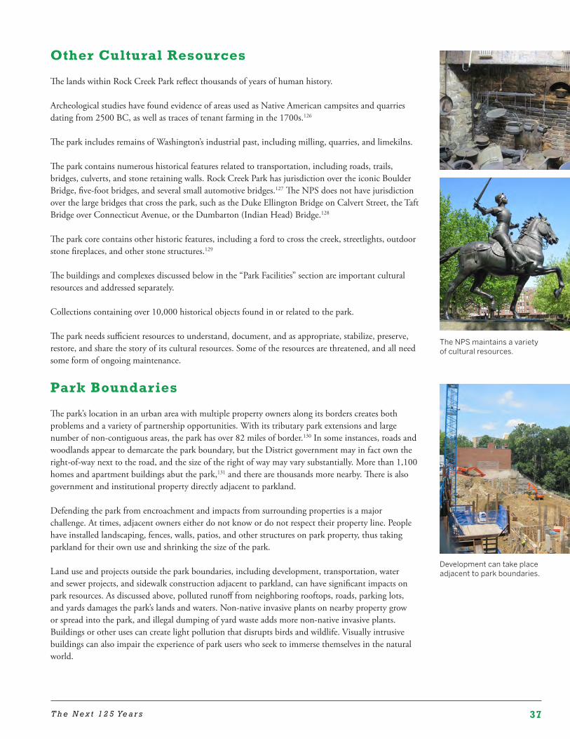
37T h e N e x t 1 2 5 Ye a r s
Other Cultural Resources
The lands within Rock Creek Park reflect thousands of years of human history.
Archeological studies have found evidence of areas used as Native American campsites and quarries dating from 2500 BC, as well as traces of tenant farming in the 1700s.126
The park includes remains of Washington’s industrial past, including milling, quarries, and limekilns.
The park contains numerous historical features related to transportation, including roads, trails, bridges, culverts, and stone retaining walls. Rock Creek Park has jurisdiction over the iconic Boulder Bridge, five-foot bridges, and several small automotive bridges.127 The NPS does not have jurisdiction over the large bridges that cross the park, such as the Duke Ellington Bridge on Calvert Street, the Taft Bridge over Connecticut Avenue, or the Dumbarton (Indian Head) Bridge.128
The park core contains other historic features, including a ford to cross the creek, streetlights, outdoor stone fireplaces, and other stone structures.129
The buildings and complexes discussed below in the “Park Facilities” section are important cultural resources and addressed separately.
Collections containing over 10,000 historical objects found in or related to the park.
The park needs sufficient resources to understand, document, and as appropriate, stabilize, preserve, restore, and share the story of its cultural resources. Some of the resources are threatened, and all need some form of ongoing maintenance.
Park Boundaries
The park’s location in an urban area with multiple property owners along its borders creates both problems and a variety of partnership opportunities. With its tributary park extensions and large number of non-contiguous areas, the park has over 82 miles of border.130 In some instances, roads and woodlands appear to demarcate the park boundary, but the District government may in fact own the right-of-way next to the road, and the size of the right of way may vary substantially. More than 1,100 homes and apartment buildings abut the park,131 and there are thousands more nearby. There is also government and institutional property directly adjacent to parkland.
Defending the park from encroachment and impacts from surrounding properties is a major challenge. At times, adjacent owners either do not know or do not respect their property line. People have installed landscaping, fences, walls, patios, and other structures on park property, thus taking parkland for their own use and shrinking the size of the park.
Land use and projects outside the park boundaries, including development, transportation, water and sewer projects, and sidewalk construction adjacent to parkland, can have significant impacts on park resources. As discussed above, polluted runoff from neighboring rooftops, roads, parking lots, and yards damages the park’s lands and waters. Non-native invasive plants on nearby property grow or spread into the park, and illegal dumping of yard waste adds more non-native invasive plants. Buildings or other uses can create light pollution that disrupts birds and wildlife. Visually intrusive buildings can also impair the experience of park users who seek to immerse themselves in the natural world.
The NPS maintains a variety of cultural resources.
Development can take place adjacent to park boundaries.
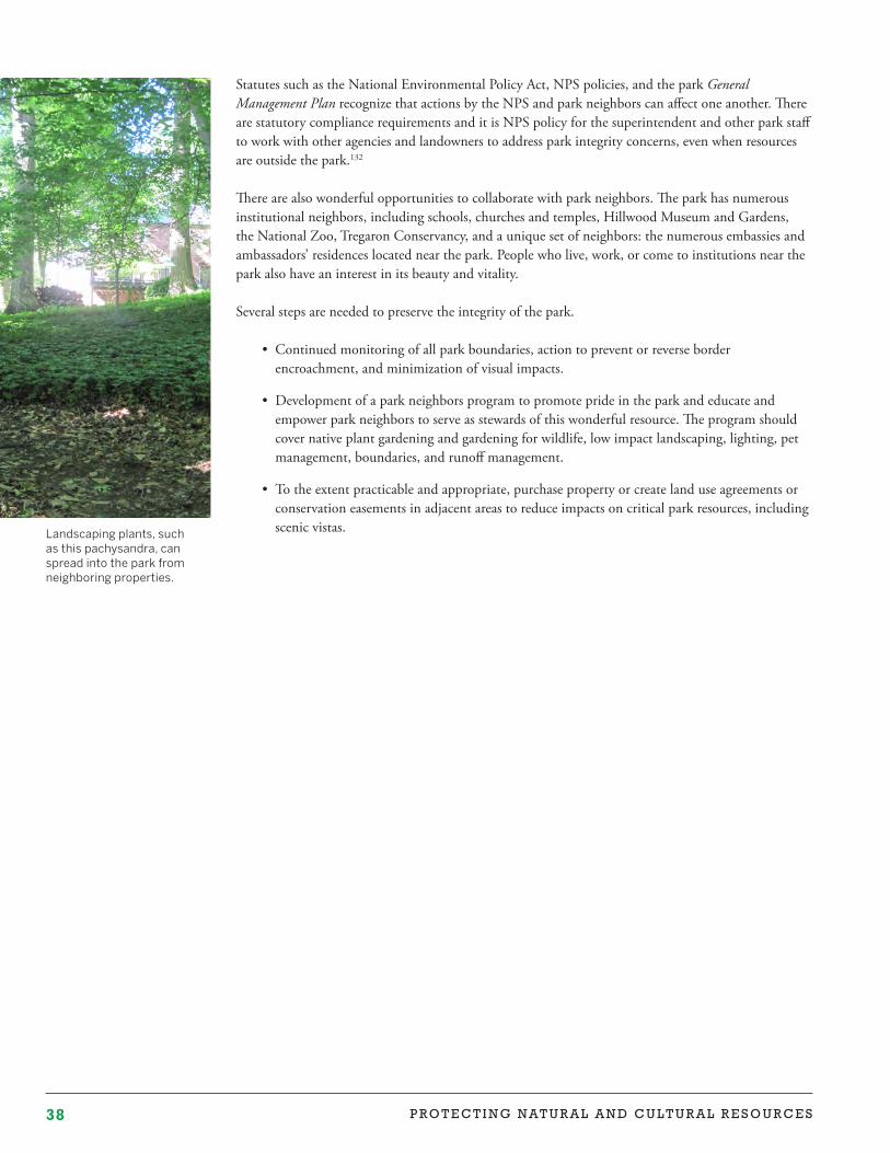
38 P R O T E C T I N G N A T U R A L A N D C U L T U R A L R E S O U R C E S
Statutes such as the National Environmental Policy Act, NPS policies, and the park General Management Plan recognize that actions by the NPS and park neighbors can affect one another. There are statutory compliance requirements and it is NPS policy for the superintendent and other park staff to work with other agencies and landowners to address park integrity concerns, even when resources are outside the park.132
There are also wonderful opportunities to collaborate with park neighbors. The park has numerous institutional neighbors, including schools, churches and temples, Hillwood Museum and Gardens, the National Zoo, Tregaron Conservancy, and a unique set of neighbors: the numerous embassies and ambassadors’ residences located near the park. People who live, work, or come to institutions near the park also have an interest in its beauty and vitality.
Several steps are needed to preserve the integrity of the park.
• Continued monitoring of all park boundaries, action to prevent or reverse border encroachment, and minimization of visual impacts.
• Development of a park neighbors program to promote pride in the park and educate and empower park neighbors to serve as stewards of this wonderful resource. The program should cover native plant gardening and gardening for wildlife, low impact landscaping, lighting, pet management, boundaries, and runoff management.
• To the extent practicable and appropriate, purchase property or create land use agreements or conservation easements in adjacent areas to reduce impacts on critical park resources, including scenic vistas. Landscaping plants, such
as this pachysandra, can spread into the park from neighboring properties.
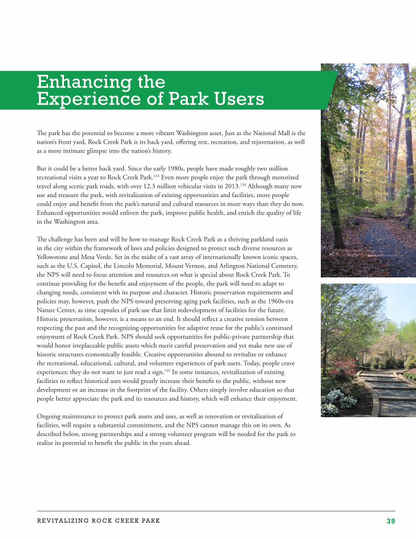
39R E V I T A L I Z I N G R O C K C R E E K PA R K
The park has the potential to become a more vibrant Washington asset. Just as the National Mall is the nation’s front yard, Rock Creek Park is its back yard, offering rest, recreation, and rejuvenation, as well as a more intimate glimpse into the nation’s history.
But it could be a better back yard. Since the early 1980s, people have made roughly two million recreational visits a year to Rock Creek Park.133 Even more people enjoy the park through motorized travel along scenic park roads, with over 12.3 million vehicular visits in 2013.134 Although many now use and treasure the park, with revitalization of existing opportunities and facilities, more people could enjoy and benefit from the park’s natural and cultural resources in more ways than they do now. Enhanced opportunities would enliven the park, improve public health, and enrich the quality of life in the Washington area.
The challenge has been and will be how to manage Rock Creek Park as a thriving parkland oasis in the city within the framework of laws and policies designed to protect such diverse resources as Yellowstone and Mesa Verde. Set in the midst of a vast array of internationally known iconic spaces, such as the U.S. Capitol, the Lincoln Memorial, Mount Vernon, and Arlington National Cemetery, the NPS will need to focus attention and resources on what is special about Rock Creek Park. To continue providing for the benefit and enjoyment of the people, the park will need to adapt to changing needs, consistent with its purpose and character. Historic preservation requirements and policies may, however, push the NPS toward preserving aging park facilities, such as the 1960s-era Nature Center, as time capsules of park use that limit redevelopment of facilities for the future. Historic preservation, however, is a means to an end. It should reflect a creative tension between respecting the past and the recognizing opportunities for adaptive reuse for the public’s continued enjoyment of Rock Creek Park. NPS should seek opportunities for public-private partnership that would honor irreplaceable public assets which merit careful preservation and yet make new use of historic structures economically feasible. Creative opportunities abound to revitalize or enhance the recreational, educational, cultural, and volunteer experiences of park users. Today, people crave experiences; they do not want to just read a sign.135 In some instances, revitalization of existing facilities to reflect historical uses would greatly increase their benefit to the public, without new development or an increase in the footprint of the facility. Others simply involve education so that people better appreciate the park and its resources and history, which will enhance their enjoyment.
Ongoing maintenance to protect park assets and uses, as well as renovation or revitalization of facilities, will require a substantial commitment, and the NPS cannot manage this on its own. As described below, strong partnerships and a strong volunteer program will be needed for the park to realize its potential to benefit the public in the years ahead.
Enhancing the Experience of Park Users
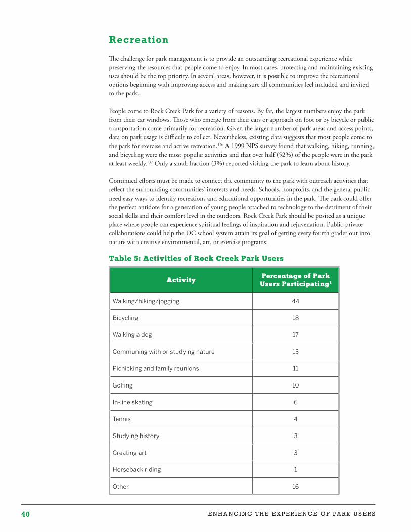
40 E N H A N C I N G T H E E X P E R I E N C E O F PA R K U S E R S
Recreation
The challenge for park management is to provide an outstanding recreational experience while preserving the resources that people come to enjoy. In most cases, protecting and maintaining existing uses should be the top priority. In several areas, however, it is possible to improve the recreational options beginning with improving access and making sure all communities feel included and invited to the park.
People come to Rock Creek Park for a variety of reasons. By far, the largest numbers enjoy the park from their car windows. Those who emerge from their cars or approach on foot or by bicycle or public transportation come primarily for recreation. Given the larger number of park areas and access points, data on park usage is difficult to collect. Nevertheless, existing data suggests that most people come to the park for exercise and active recreation.136 A 1999 NPS survey found that walking, hiking, running, and bicycling were the most popular activities and that over half (52%) of the people were in the park at least weekly.137 Only a small fraction (3%) reported visiting the park to learn about history.
Continued efforts must be made to connect the community to the park with outreach activities that reflect the surrounding communities’ interests and needs. Schools, nonprofits, and the general public need easy ways to identify recreations and educational opportunities in the park. The park could offer the perfect antidote for a generation of young people attached to technology to the detriment of their social skills and their comfort level in the outdoors. Rock Creek Park should be posited as a unique place where people can experience spiritual feelings of inspiration and rejuvenation. Public-private collaborations could help the DC school system attain its goal of getting every fourth grader out into nature with creative environmental, art, or exercise programs.
Table 5: Activities of Rock Creek Park Users
ActivityPercentage of Park
Users Participating1
Walking/hiking/jogging 44
Bicycling 18
Walking a dog 17
Communing with or studying nature 13
Picnicking and family reunions 11
Golfing 10
In-line skating 6
Tennis 4
Studying history 3
Creating art 3
Horseback riding 1
Other 16
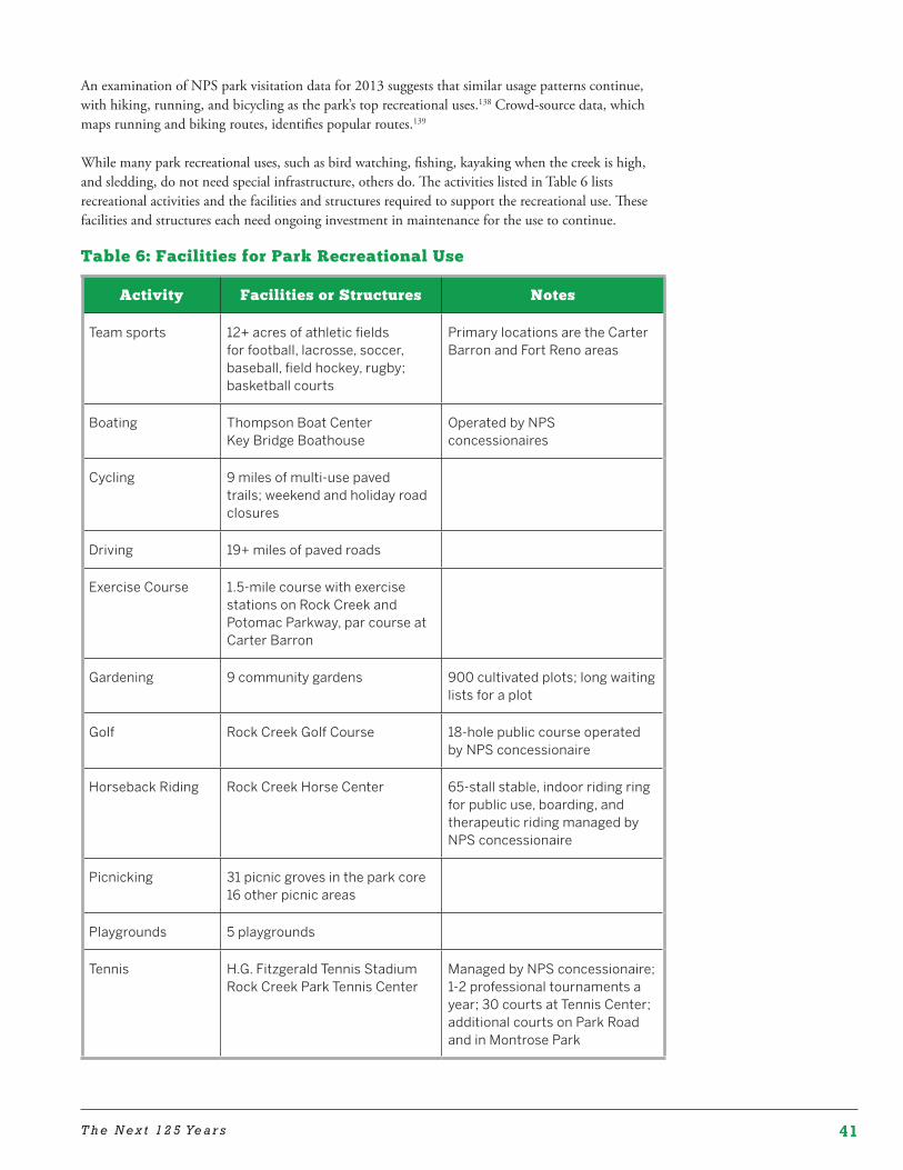
41T h e N e x t 1 2 5 Ye a r s
An examination of NPS park visitation data for 2013 suggests that similar usage patterns continue, with hiking, running, and bicycling as the park’s top recreational uses.138 Crowd-source data, which maps running and biking routes, identifies popular routes.139
While many park recreational uses, such as bird watching, fishing, kayaking when the creek is high, and sledding, do not need special infrastructure, others do. The activities listed in Table 6 lists recreational activities and the facilities and structures required to support the recreational use. These facilities and structures each need ongoing investment in maintenance for the use to continue.
Table 6: Facilities for Park Recreational Use
Activity Facilities or Structures Notes
Team sports 12+ acres of athletic fields for football, lacrosse, soccer, baseball, field hockey, rugby; basketball courts
Primary locations are the Carter Barron and Fort Reno areas
Boating Thompson Boat Center Key Bridge Boathouse
Operated by NPS concessionaires
Cycling 9 miles of multi-use paved trails; weekend and holiday road closures
Driving 19+ miles of paved roads
Exercise Course 1.5-mile course with exercise stations on Rock Creek and Potomac Parkway, par course at Carter Barron
Gardening 9 community gardens 900 cultivated plots; long waiting lists for a plot
Golf Rock Creek Golf Course 18-hole public course operated by NPS concessionaire
Horseback Riding Rock Creek Horse Center 65-stall stable, indoor riding ring for public use, boarding, and therapeutic riding managed by NPS concessionaire
Picnicking 31 picnic groves in the park core 16 other picnic areas
Playgrounds 5 playgrounds
Tennis H.G. Fitzgerald Tennis StadiumRock Creek Park Tennis Center
Managed by NPS concessionaire; 1-2 professional tournaments a year; 30 courts at Tennis Center; additional courts on Park Road and in Montrose Park
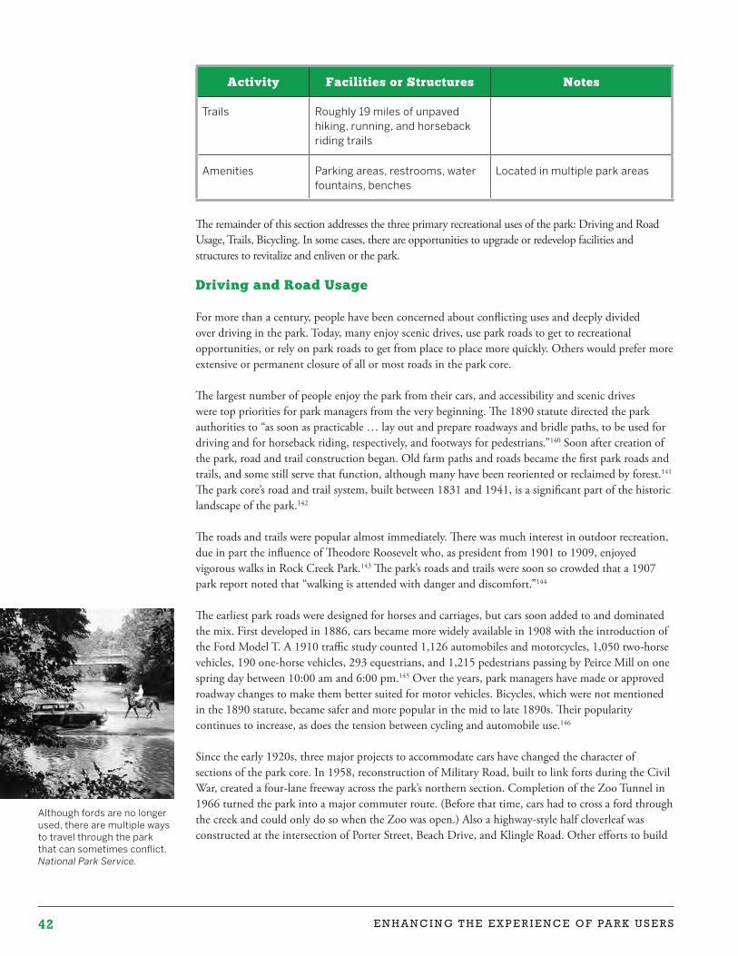
42 E N H A N C I N G T H E E X P E R I E N C E O F PA R K U S E R S
Although fords are no longer used, there are multiple ways to travel through the park that can sometimes conflict. National Park Service.
Activity Facilities or Structures Notes
Trails Roughly 19 miles of unpaved hiking, running, and horseback riding trails
Amenities Parking areas, restrooms, water fountains, benches
Located in multiple park areas
The remainder of this section addresses the three primary recreational uses of the park: Driving and Road Usage, Trails, Bicycling. In some cases, there are opportunities to upgrade or redevelop facilities and structures to revitalize and enliven or the park. Driving and Road Usage
For more than a century, people have been concerned about conflicting uses and deeply divided over driving in the park. Today, many enjoy scenic drives, use park roads to get to recreational opportunities, or rely on park roads to get from place to place more quickly. Others would prefer more extensive or permanent closure of all or most roads in the park core.
The largest number of people enjoy the park from their cars, and accessibility and scenic drives were top priorities for park managers from the very beginning. The 1890 statute directed the park authorities to “as soon as practicable … lay out and prepare roadways and bridle paths, to be used for driving and for horseback riding, respectively, and footways for pedestrians.”140 Soon after creation of the park, road and trail construction began. Old farm paths and roads became the first park roads and trails, and some still serve that function, although many have been reoriented or reclaimed by forest.141 The park core’s road and trail system, built between 1831 and 1941, is a significant part of the historic landscape of the park.142
The roads and trails were popular almost immediately. There was much interest in outdoor recreation, due in part the influence of Theodore Roosevelt who, as president from 1901 to 1909, enjoyed vigorous walks in Rock Creek Park.143 The park’s roads and trails were soon so crowded that a 1907 park report noted that “walking is attended with danger and discomfort.”144
The earliest park roads were designed for horses and carriages, but cars soon added to and dominated the mix. First developed in 1886, cars became more widely available in 1908 with the introduction of the Ford Model T. A 1910 traffic study counted 1,126 automobiles and motorcycles, 1,050 two-horse vehicles, 190 one-horse vehicles, 293 equestrians, and 1,215 pedestrians passing by Peirce Mill on one spring day between 10:00 am and 6:00 pm.145 Over the years, park managers have made or approved roadway changes to make them better suited for motor vehicles. Bicycles, which were not mentioned in the 1890 statute, became safer and more popular in the mid to late 1890s. Their popularity continues to increase, as does the tension between cycling and automobile use.146
Since the early 1920s, three major projects to accommodate cars have changed the character of sections of the park core. In 1958, reconstruction of Military Road, built to link forts during the Civil War, created a four-lane freeway across the park’s northern section. Completion of the Zoo Tunnel in 1966 turned the park into a major commuter route. (Before that time, cars had to cross a ford through the creek and could only do so when the Zoo was open.) Also a highway-style half cloverleaf was constructed at the intersection of Porter Street, Beach Drive, and Klingle Road. Other efforts to build

43T h e N e x t 1 2 5 Ye a r s
highways and highway structures through sections of the park were vigorously opposed and failed.147
Park managers have made two usage changes to accommodate demand. In 1937, the year after the Rock Creek and Potomac Parkway opened, the NPS began managing rush hour traffic by making the parkway one way and changing the traffic directions for the weekday morning and evening commutes. In 1966, the NPS initiated partial road closures in the park core on weekends and holidays to help make the park more accessible for recreational use.148 Walkers, runners, cyclists, and people on roller blades now enjoy the closed portion of Beach Drive, Bingham Drive, and Sherrill Drive, while traffic continues as usual on other park roads. Both before and during the environmental impact statement process for the park’s General Management Plan, the NPS evaluated alternatives for increasing or extending road closures.149 In 2007, the NPS reached a formal decision to retain the existing park roadway system, parkway traffic patterns, and road closures.150 The NPS is unlikely to reconsider this decision soon.
Issues
Transportation to and within the park continues to be a challenge. As discussed below, it is difficult to reach the park from some locations, use conflicts between vehicles and cyclists continue, and there are ongoing traffic management concerns.
Recreation Needs
The following steps could help improve park transportation options:
• Monitoring vehicle, bicycle, and pedestrian traffic patterns to inform future management decisions;
• Promoting pedestrian, bicycle, and green public transit access to the park, consistent with preservation of park resources;
• Implementing traffic calming measures described in the park’s General Management Plan;
• Working with federal, Montgomery County and District governments, nonprofit partners, and other stakeholders to ensure that the park is part of a comprehensive regional green transportation network, consistent with preservation of park resources; and
• Educating vehicle users about the park so they can enjoy their drives more, be more cognizant of bicyclists, and be inspired to explore the park in other ways.
Trails
The park’s trail system is an outstanding resource for the capital region. More than 40 miles of paved trails, hiking trails, and bridle trails provide opportunities for healthy and enjoyable exercise in a beautiful natural setting. Two main hiking trails—the Western Ridge Trail and the Valley Trail—run north to south on each side of the park core, and there are long north-south trails in the Glover Archbold and Battery Kemble/Palisades Park areas. Connector trails in the park core and other park areas create multiple options for loop hikes and connections between some park areas.
The park roads and trails are interconnected. Road closures serve as important extensions of the trail system for walking, running, and cycling on weekends and holidays. In the early 1900s, road construction in the park core provided increased public access to the walking trails and bridle paths.151 As discussed below, sections of the park are located in a gorge with deep valleys or bordered by private, institutional, or government property. From some neighborhoods, reaching the park would be a long
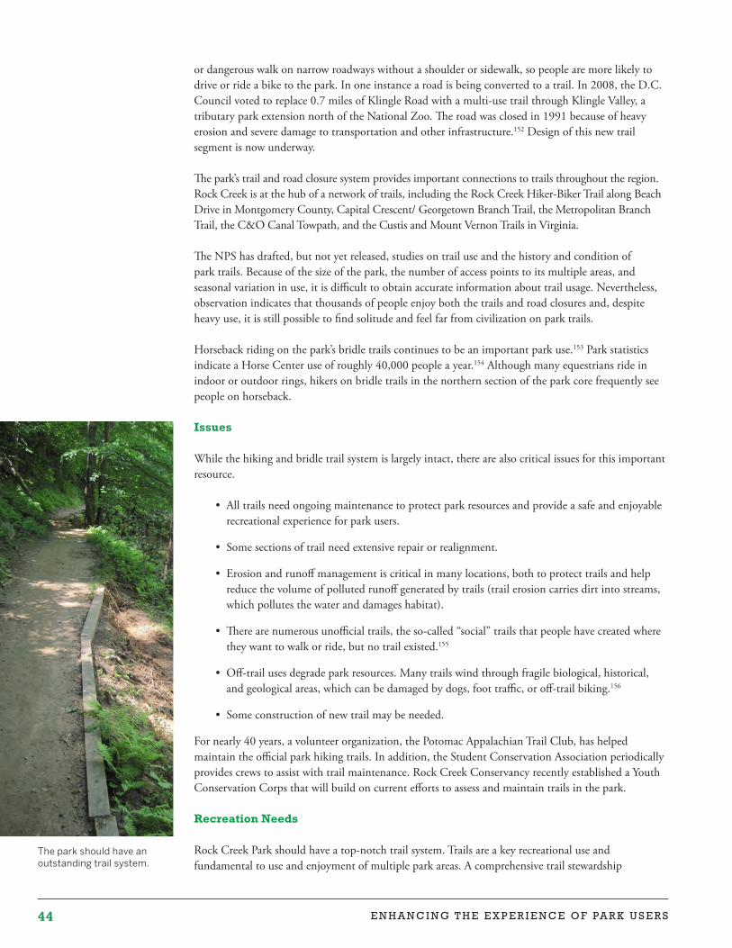
44 E N H A N C I N G T H E E X P E R I E N C E O F PA R K U S E R S
The park should have an outstanding trail system.
or dangerous walk on narrow roadways without a shoulder or sidewalk, so people are more likely to drive or ride a bike to the park. In one instance a road is being converted to a trail. In 2008, the D.C. Council voted to replace 0.7 miles of Klingle Road with a multi-use trail through Klingle Valley, a tributary park extension north of the National Zoo. The road was closed in 1991 because of heavy erosion and severe damage to transportation and other infrastructure.152 Design of this new trail segment is now underway.
The park’s trail and road closure system provides important connections to trails throughout the region. Rock Creek is at the hub of a network of trails, including the Rock Creek Hiker-Biker Trail along Beach Drive in Montgomery County, Capital Crescent/ Georgetown Branch Trail, the Metropolitan Branch Trail, the C&O Canal Towpath, and the Custis and Mount Vernon Trails in Virginia.
The NPS has drafted, but not yet released, studies on trail use and the history and condition of park trails. Because of the size of the park, the number of access points to its multiple areas, and seasonal variation in use, it is difficult to obtain accurate information about trail usage. Nevertheless, observation indicates that thousands of people enjoy both the trails and road closures and, despite heavy use, it is still possible to find solitude and feel far from civilization on park trails.
Horseback riding on the park’s bridle trails continues to be an important park use.153 Park statistics indicate a Horse Center use of roughly 40,000 people a year.154 Although many equestrians ride in indoor or outdoor rings, hikers on bridle trails in the northern section of the park core frequently see people on horseback.
Issues
While the hiking and bridle trail system is largely intact, there are also critical issues for this important resource.
• All trails need ongoing maintenance to protect park resources and provide a safe and enjoyable recreational experience for park users.
• Some sections of trail need extensive repair or realignment.
• Erosion and runoff management is critical in many locations, both to protect trails and help reduce the volume of polluted runoff generated by trails (trail erosion carries dirt into streams, which pollutes the water and damages habitat).
• There are numerous unofficial trails, the so-called “social” trails that people have created where they want to walk or ride, but no trail existed.155
• Off-trail uses degrade park resources. Many trails wind through fragile biological, historical, and geological areas, which can be damaged by dogs, foot traffic, or off-trail biking.156
• Some construction of new trail may be needed.
For nearly 40 years, a volunteer organization, the Potomac Appalachian Trail Club, has helped maintain the official park hiking trails. In addition, the Student Conservation Association periodically provides crews to assist with trail maintenance. Rock Creek Conservancy recently established a Youth Conservation Corps that will build on current efforts to assess and maintain trails in the park.
Recreation Needs
Rock Creek Park should have a top-notch trail system. Trails are a key recreational use and fundamental to use and enjoyment of multiple park areas. A comprehensive trail stewardship
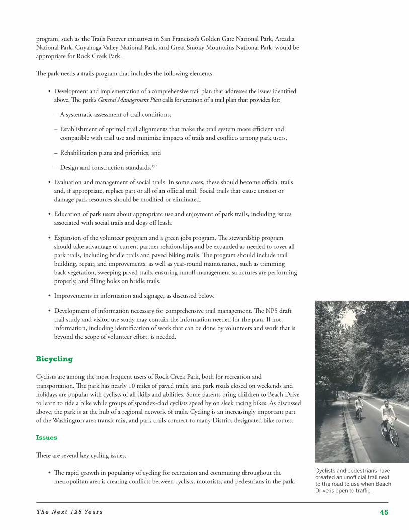
45T h e N e x t 1 2 5 Ye a r s
Cyclists and pedestrians have created an unofficial trail next to the road to use when Beach Drive is open to traffic.
program, such as the Trails Forever initiatives in San Francisco’s Golden Gate National Park, Arcadia National Park, Cuyahoga Valley National Park, and Great Smoky Mountains National Park, would be appropriate for Rock Creek Park.
The park needs a trails program that includes the following elements.
• Development and implementation of a comprehensive trail plan that addresses the issues identified above. The park’s General Management Plan calls for creation of a trail plan that provides for:
– A systematic assessment of trail conditions,
– Establishment of optimal trail alignments that make the trail system more efficient and compatible with trail use and minimize impacts of trails and conflicts among park users,
– Rehabilitation plans and priorities, and
– Design and construction standards.157
• Evaluation and management of social trails. In some cases, these should become official trails and, if appropriate, replace part or all of an official trail. Social trails that cause erosion or damage park resources should be modified or eliminated.
• Education of park users about appropriate use and enjoyment of park trails, including issues associated with social trails and dogs off leash.
• Expansion of the volunteer program and a green jobs program. The stewardship program should take advantage of current partner relationships and be expanded as needed to cover all park trails, including bridle trails and paved biking trails. The program should include trail building, repair, and improvements, as well as year-round maintenance, such as trimming back vegetation, sweeping paved trails, ensuring runoff management structures are performing properly, and filling holes on bridle trails.
• Improvements in information and signage, as discussed below.
• Development of information necessary for comprehensive trail management. The NPS draft trail study and visitor use study may contain the information needed for the plan. If not, information, including identification of work that can be done by volunteers and work that is beyond the scope of volunteer effort, is needed.
Bicycling
Cyclists are among the most frequent users of Rock Creek Park, both for recreation and transportation. The park has nearly 10 miles of paved trails, and park roads closed on weekends and holidays are popular with cyclists of all skills and abilities. Some parents bring children to Beach Drive to learn to ride a bike while groups of spandex-clad cyclists speed by on sleek racing bikes. As discussed above, the park is at the hub of a regional network of trails. Cycling is an increasingly important part of the Washington area transit mix, and park trails connect to many District-designated bike routes.
Issues
There are several key cycling issues.
• The rapid growth in popularity of cycling for recreation and commuting throughout the metropolitan area is creating conflicts between cyclists, motorists, and pedestrians in the park.
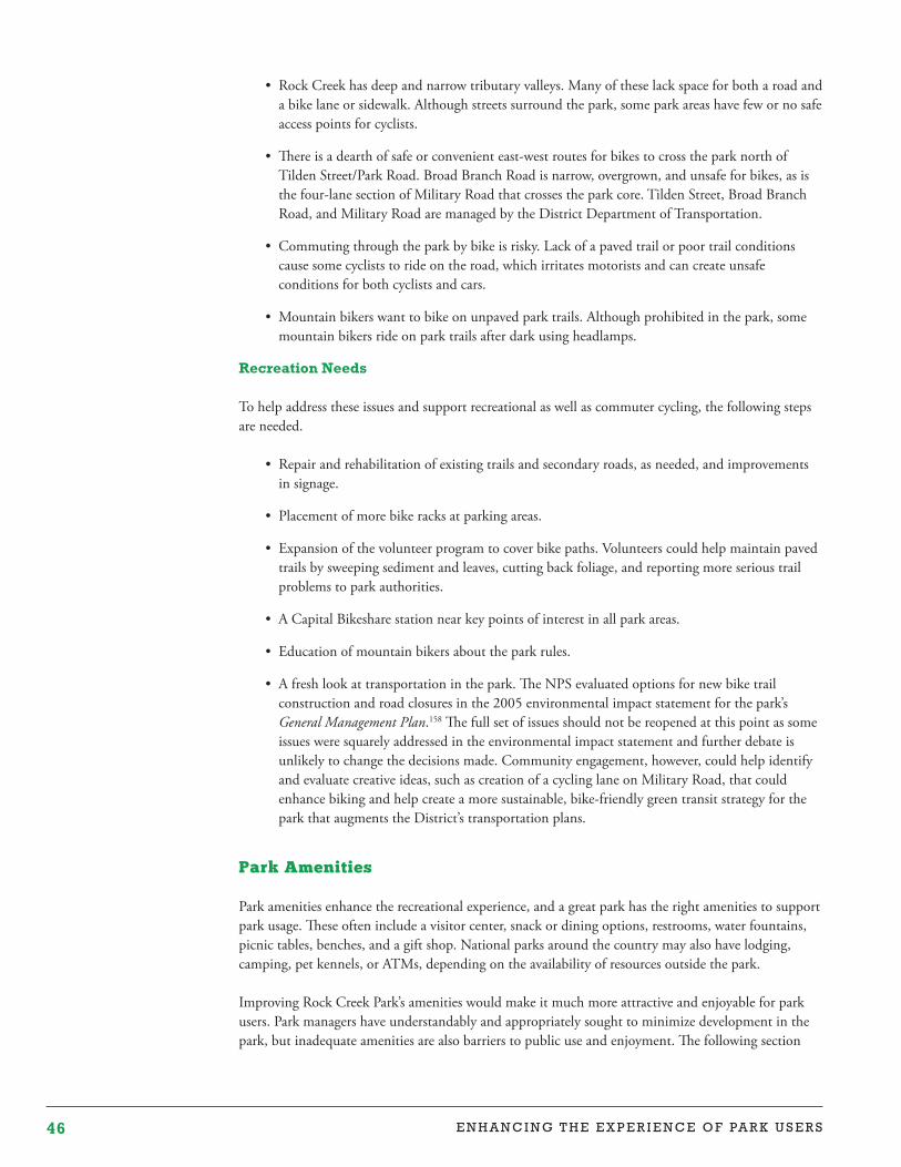
46 E N H A N C I N G T H E E X P E R I E N C E O F PA R K U S E R S
• Rock Creek has deep and narrow tributary valleys. Many of these lack space for both a road and a bike lane or sidewalk. Although streets surround the park, some park areas have few or no safe access points for cyclists.
• There is a dearth of safe or convenient east-west routes for bikes to cross the park north of Tilden Street/Park Road. Broad Branch Road is narrow, overgrown, and unsafe for bikes, as is the four-lane section of Military Road that crosses the park core. Tilden Street, Broad Branch Road, and Military Road are managed by the District Department of Transportation.
• Commuting through the park by bike is risky. Lack of a paved trail or poor trail conditions cause some cyclists to ride on the road, which irritates motorists and can create unsafe conditions for both cyclists and cars.
• Mountain bikers want to bike on unpaved park trails. Although prohibited in the park, some mountain bikers ride on park trails after dark using headlamps.
Recreation Needs
To help address these issues and support recreational as well as commuter cycling, the following steps are needed.
• Repair and rehabilitation of existing trails and secondary roads, as needed, and improvements in signage.
• Placement of more bike racks at parking areas.
• Expansion of the volunteer program to cover bike paths. Volunteers could help maintain paved trails by sweeping sediment and leaves, cutting back foliage, and reporting more serious trail problems to park authorities.
• A Capital Bikeshare station near key points of interest in all park areas.
• Education of mountain bikers about the park rules.
• A fresh look at transportation in the park. The NPS evaluated options for new bike trail construction and road closures in the 2005 environmental impact statement for the park’s General Management Plan.158 The full set of issues should not be reopened at this point as some issues were squarely addressed in the environmental impact statement and further debate is unlikely to change the decisions made. Community engagement, however, could help identify and evaluate creative ideas, such as creation of a cycling lane on Military Road, that could enhance biking and help create a more sustainable, bike-friendly green transit strategy for the park that augments the District’s transportation plans.
Park Amenities
Park amenities enhance the recreational experience, and a great park has the right amenities to support park usage. These often include a visitor center, snack or dining options, restrooms, water fountains, picnic tables, benches, and a gift shop. National parks around the country may also have lodging, camping, pet kennels, or ATMs, depending on the availability of resources outside the park.
Improving Rock Creek Park’s amenities would make it much more attractive and enjoyable for park users. Park managers have understandably and appropriately sought to minimize development in the park, but inadequate amenities are also barriers to public use and enjoyment. The following section
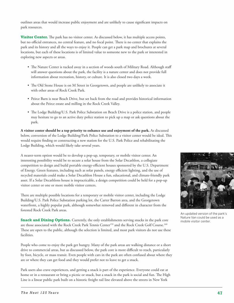
47T h e N e x t 1 2 5 Ye a r s
An updated version of the park’s Nature Van could be used as a mobile visitor center.
outlines areas that would increase public enjoyment and are unlikely to cause significant impacts on park resources.
Visitor Center. The park has no visitor center. As discussed below, it has multiple access points, but no official entrances, no central feature, and no focal point. There is no center that explains the park and its history and all the ways to enjoy it. People can get a park map and brochures at several locations, but each of these locations is of limited value to someone new to the park or interested in exploring new aspects or areas.
• The Nature Center is tucked away in a section of woods south of Military Road. Although staff will answer questions about the park, the facility is a nature center and does not provide full information about recreation, history, or culture. It is also closed two days a week.
• The Old Stone House is on M Street in Georgetown, and people are unlikely to associate it with other areas of Rock Creek Park.
• Peirce Barn is near Beach Drive, but set back from the road and provides historical information about the Peirce estate and milling in the Rock Creek Valley.
• The Lodge Building/U.S. Park Police Substation on Beach Drive is a police station, and people may hesitate to go to an active duty police station to pick up a map or ask questions about the park.
A visitor center should be a top priority to enhance use and enjoyment of the park. As discussed below, conversion of the Lodge Building/Park Police Substation to a visitor center would be ideal. This would require finding or constructing a new station for the U.S. Park Police and rehabilitating the Lodge Building, which would likely take several years.
A nearer-term option would be to develop a pop-up, temporary, or mobile visitor center. An interesting possibility would be to secure a solar house from the Solar Decathlon, a collegiate competition to design and build portable energy-efficient houses sponsored by the U.S. Department of Energy. Green features, including such as solar panels, energy efficient lighting, and the use of recycled materials could make a Solar Decathlon House a fun, educational, and climate-friendly park asset. If a Solar Decathlons house is impracticable, a design competition could be held for a pop-up visitor center or one or more mobile visitor centers.
There are multiple possible locations for a temporary or mobile visitor center, including the Lodge Building/U.S. Park Police Substation parking lot, the Carter Barron area, and the Georgetown waterfront, a highly popular park, although somewhat removed and different in character from the forested Rock Creek Park areas.
Snack and Dining Options. Currently, the only establishments serving snacks in the park core are those associated with the Rock Creek Park Tennis Center159 and the Rock Creek Golf Course.160 These are open to the public, although the selection is limited, and most park visitors do not use these facilities.
People who come to enjoy the park get hungry. Many of the park areas are walking distance or a short drive to commercial areas, but as discussed below, the park core is more difficult to reach, particularly by foot, bicycle, or mass transit. Even people with cars in the park are often confused about where they are or where they can get food and they would prefer not to leave to get a snack.
Park users also crave experiences, and getting a snack is part of the experience. Everyone could eat at home or in a restaurant or bring a picnic or snack, but a snack in the park is social and fun. The High Line is a linear public park built on a historic freight rail line elevated above the streets in New York
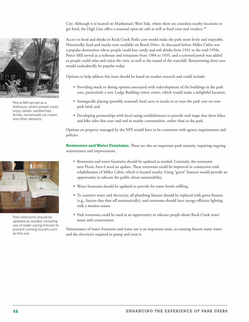
48 E N H A N C I N G T H E E X P E R I E N C E O F PA R K U S E R S
Park restrooms should be updated as needed, including use of water-saving fixtures to prevent running faucets such as this one.
Peirce Mill served as a teahouse, where people could enjoy salads, sandwiches, drinks, homemade ice cream, and other desserts.
City. Although it is located on Manhattan’s West Side, where there are countless nearby locations to get food, the High Line offers a seasonal open-air café as well as food carts and vendors.161
Access to food and drinks in Rock Creek Park’s core would make the park more lively and enjoyable. Historically, food and snacks were available on Beach Drive. As discussed below, Miller Cabin was a popular destination where people could buy candy and soft drinks from 1931 to the mid-1950s. Peirce Mill served as a teahouse and restaurant from 1904 to 1935, and a screened porch was added so people could relax and enjoy the view, as well as the sound of the waterfall. Reinstituting these uses would undoubtedly be popular today.
Options to help address this issue should be based on market research and could include:
• Providing snack or dining options associated with redevelopment of the buildings in the park core, particularly a new Lodge Building visitor center, which would make a delightful location;
• Strategically placing (possibly seasonal) food carts or trucks in or near the park core on non-park land; and
• Developing partnerships with local eating establishments to provide trail maps that show hikes and bike rides that start and end in nearby communities, rather than in the park.
Options on property managed by the NPS would have to be consistent with agency requirements and policies.
Restrooms and Water Fountains. These are also an important park amenity, requiring ongoing maintenance and improvement.
• Restrooms and water fountains should be updated as needed. Currently, the restrooms near Picnic Area 6 need an update. These restrooms could be improved in connection with rehabilitation of Miller Cabin, which is located nearby. Using “green” features would provide an opportunity to educate the public about sustainability.
• Water fountains should be updated to provide for water bottle refilling.
• To conserve water and electricity, all plumbing fixtures should be replaced with green fixtures (e.g., faucets that shut off automatically), and restrooms should have energy-efficient lighting with a motion sensor.
• Park restrooms could be used as an opportunity to educate people about Rock Creek water issues and conservation.
Maintenance of water fountains and water use is an important issue, as running faucets waste water and the electricity required to pump and treat it.
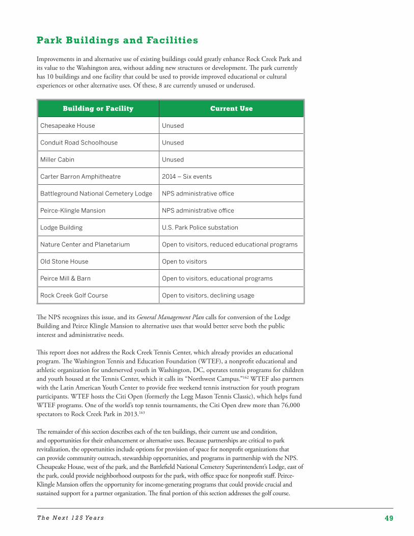
49T h e N e x t 1 2 5 Ye a r s
Park Buildings and Facilities
Improvements in and alternative use of existing buildings could greatly enhance Rock Creek Park and its value to the Washington area, without adding new structures or development. The park currently has 10 buildings and one facility that could be used to provide improved educational or cultural experiences or other alternative uses. Of these, 8 are currently unused or underused.
Building or Facility Current Use
Chesapeake House Unused
Conduit Road Schoolhouse Unused
Miller Cabin Unused
Carter Barron Amphitheatre 2014 – Six events
Battleground National Cemetery Lodge NPS administrative office
Peirce-Klingle Mansion NPS administrative office
Lodge Building U.S. Park Police substation
Nature Center and Planetarium Open to visitors, reduced educational programs
Old Stone House Open to visitors
Peirce Mill & Barn Open to visitors, educational programs
Rock Creek Golf Course Open to visitors, declining usage
The NPS recognizes this issue, and its General Management Plan calls for conversion of the Lodge Building and Peirce Klingle Mansion to alternative uses that would better serve both the public interest and administrative needs.
This report does not address the Rock Creek Tennis Center, which already provides an educational program. The Washington Tennis and Education Foundation (WTEF), a nonprofit educational and athletic organization for underserved youth in Washington, DC, operates tennis programs for children and youth housed at the Tennis Center, which it calls its “Northwest Campus.”162 WTEF also partners with the Latin American Youth Center to provide free weekend tennis instruction for youth program participants. WTEF hosts the Citi Open (formerly the Legg Mason Tennis Classic), which helps fund WTEF programs. One of the world’s top tennis tournaments, the Citi Open drew more than 76,000 spectators to Rock Creek Park in 2013.163
The remainder of this section describes each of the ten buildings, their current use and condition, and opportunities for their enhancement or alternative uses. Because partnerships are critical to park revitalization, the opportunities include options for provision of space for nonprofit organizations that can provide community outreach, stewardship opportunities, and programs in partnership with the NPS. Chesapeake House, west of the park, and the Battlefield National Cemetery Superintendent’s Lodge, east of the park, could provide neighborhood outposts for the park, with office space for nonprofit staff. Peirce-Klingle Mansion offers the opportunity for income-generating programs that could provide crucial and sustained support for a partner organization. The final portion of this section addresses the golf course.
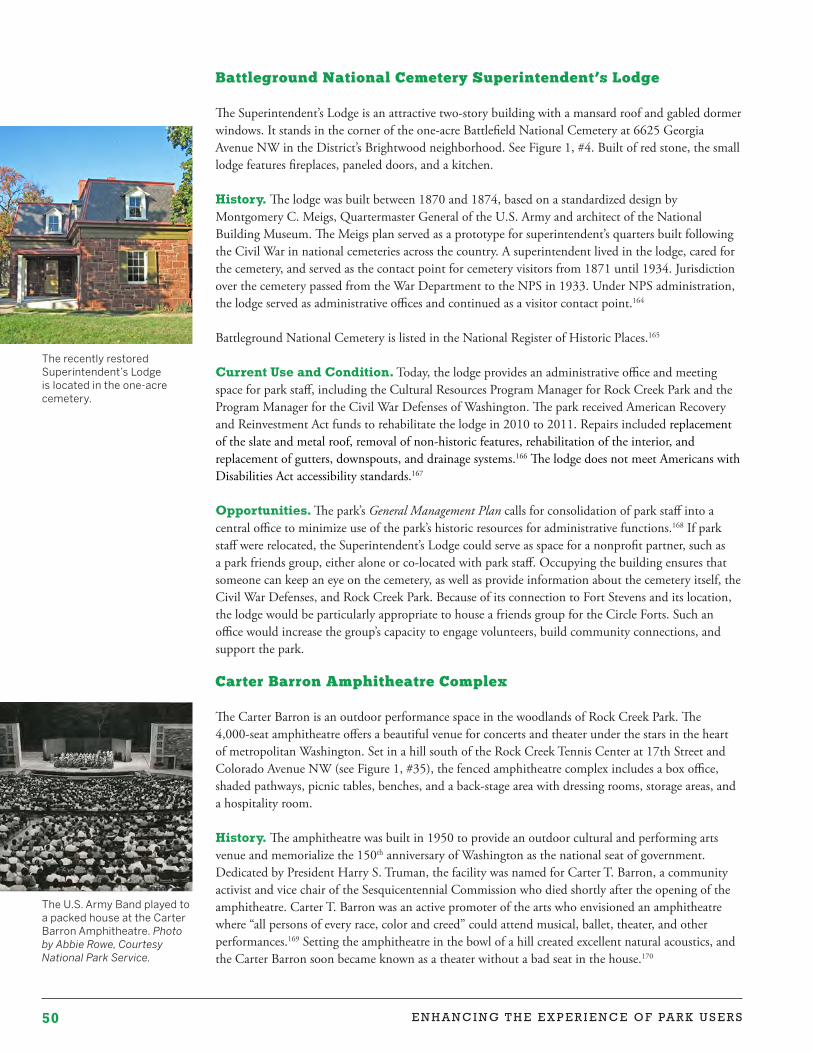
50 E N H A N C I N G T H E E X P E R I E N C E O F PA R K U S E R S
The U.S. Army Band played to a packed house at the Carter Barron Amphitheatre. Photo by Abbie Rowe, Courtesy National Park Service.
The recently restored Superintendent’s Lodge is located in the one-acre cemetery.
Battleground National Cemetery Superintendent’s Lodge
The Superintendent’s Lodge is an attractive two-story building with a mansard roof and gabled dormer windows. It stands in the corner of the one-acre Battlefield National Cemetery at 6625 Georgia Avenue NW in the District’s Brightwood neighborhood. See Figure 1, #4. Built of red stone, the small lodge features fireplaces, paneled doors, and a kitchen.
History. The lodge was built between 1870 and 1874, based on a standardized design by Montgomery C. Meigs, Quartermaster General of the U.S. Army and architect of the National Building Museum. The Meigs plan served as a prototype for superintendent’s quarters built following the Civil War in national cemeteries across the country. A superintendent lived in the lodge, cared for the cemetery, and served as the contact point for cemetery visitors from 1871 until 1934. Jurisdiction over the cemetery passed from the War Department to the NPS in 1933. Under NPS administration, the lodge served as administrative offices and continued as a visitor contact point.164
Battleground National Cemetery is listed in the National Register of Historic Places.165
Current Use and Condition. Today, the lodge provides an administrative office and meeting space for park staff, including the Cultural Resources Program Manager for Rock Creek Park and the Program Manager for the Civil War Defenses of Washington. The park received American Recovery and Reinvestment Act funds to rehabilitate the lodge in 2010 to 2011. Repairs included replacement of the slate and metal roof, removal of non-historic features, rehabilitation of the interior, and replacement of gutters, downspouts, and drainage systems.166 The lodge does not meet Americans with Disabilities Act accessibility standards.167
Opportunities. The park’s General Management Plan calls for consolidation of park staff into a central office to minimize use of the park’s historic resources for administrative functions.168 If park staff were relocated, the Superintendent’s Lodge could serve as space for a nonprofit partner, such as a park friends group, either alone or co-located with park staff. Occupying the building ensures that someone can keep an eye on the cemetery, as well as provide information about the cemetery itself, the Civil War Defenses, and Rock Creek Park. Because of its connection to Fort Stevens and its location, the lodge would be particularly appropriate to house a friends group for the Circle Forts. Such an office would increase the group’s capacity to engage volunteers, build community connections, and support the park.
Carter Barron Amphitheatre Complex
The Carter Barron is an outdoor performance space in the woodlands of Rock Creek Park. The 4,000-seat amphitheatre offers a beautiful venue for concerts and theater under the stars in the heart of metropolitan Washington. Set in a hill south of the Rock Creek Tennis Center at 17th Street and Colorado Avenue NW (see Figure 1, #35), the fenced amphitheatre complex includes a box office, shaded pathways, picnic tables, benches, and a back-stage area with dressing rooms, storage areas, and a hospitality room.
History. The amphitheatre was built in 1950 to provide an outdoor cultural and performing arts venue and memorialize the 150th anniversary of Washington as the national seat of government. Dedicated by President Harry S. Truman, the facility was named for Carter T. Barron, a community activist and vice chair of the Sesquicentennial Commission who died shortly after the opening of the amphitheatre. Carter T. Barron was an active promoter of the arts who envisioned an amphitheatre where “all persons of every race, color and creed” could attend musical, ballet, theater, and other performances.169 Setting the amphitheatre in the bowl of a hill created excellent natural acoustics, and the Carter Barron soon became known as a theater without a bad seat in the house.170
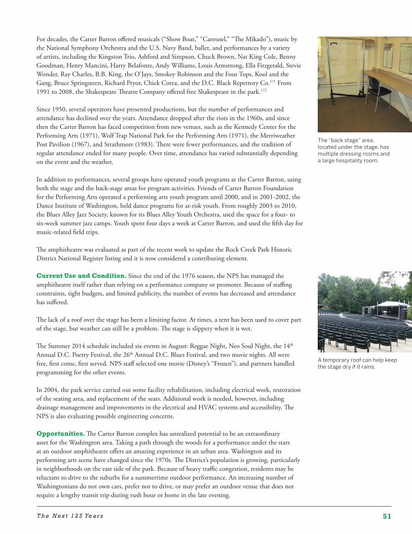
51T h e N e x t 1 2 5 Ye a r s
A temporary roof can help keep the stage dry if it rains.
For decades, the Carter Barron offered musicals (“Show Boat,” “Carousel,” “The Mikado”), music by the National Symphony Orchestra and the U.S. Navy Band, ballet, and performances by a variety of artists, including the Kingston Trio, Ashford and Simpson, Chuck Brown, Nat King Cole, Benny Goodman, Henry Mancini, Harry Belafonte, Andy Williams, Louis Armstrong, Ella Fitzgerald, Stevie Wonder, Ray Charles, B.B. King, the O’Jays, Smokey Robinson and the Four Tops, Kool and the Gang, Bruce Springsteen, Richard Pryor, Chick Corea, and the D.C. Black Repertory Co.171 From 1991 to 2008, the Shakespeare Theatre Company offered free Shakespeare in the park.172
Since 1950, several operators have presented productions, but the number of performances and attendance has declined over the years. Attendance dropped after the riots in the 1960s, and since then the Carter Barron has faced competition from new venues, such as the Kennedy Center for the Performing Arts (1971), Wolf Trap National Park for the Performing Arts (1971), the Merriweather Post Pavilion (1967), and Strathmore (1983). There were fewer performances, and the tradition of regular attendance ended for many people. Over time, attendance has varied substantially depending on the event and the weather.
In addition to performances, several groups have operated youth programs at the Carter Barron, using both the stage and the back-stage areas for program activities. Friends of Carter Barron Foundation for the Performing Arts operated a performing arts youth program until 2000, and in 2001-2002, the Dance Institute of Washington, held dance programs for at-risk youth. From roughly 2003 to 2010, the Blues Alley Jazz Society, known for its Blues Alley Youth Orchestra, used the space for a four- to six-week summer jazz camps. Youth spent four days a week at Carter Barron, and used the fifth day for music-related field trips.
The amphitheatre was evaluated as part of the recent work to update the Rock Creek Park Historic District National Register listing and it is now considered a contributing element.
Current Use and Condition. Since the end of the 1976 season, the NPS has managed the amphitheatre itself rather than relying on a performance company or promoter. Because of staffing constraints, tight budgets, and limited publicity, the number of events has decreased and attendance has suffered.
The lack of a roof over the stage has been a limiting factor. At times, a tent has been used to cover part of the stage, but weather can still be a problem. The stage is slippery when it is wet.
The Summer 2014 schedule included six events in August: Reggae Night, Neo Soul Night, the 14th Annual D.C. Poetry Festival, the 26th Annual D.C. Blues Festival, and two movie nights. All were free, first come, first served. NPS staff selected one movie (Disney’s “Frozen”), and partners handled programming for the other events.
In 2004, the park service carried out some facility rehabilitation, including electrical work, restoration of the seating area, and replacement of the seats. Additional work is needed, however, including drainage management and improvements in the electrical and HVAC systems and accessibility. The NPS is also evaluating possible engineering concerns.
Opportunities. The Carter Barron complex has unrealized potential to be an extraordinary asset for the Washington area. Taking a path through the woods for a performance under the stars at an outdoor amphitheatre offers an amazing experience in an urban area. Washington and its performing arts scene have changed since the 1970s. The District’s population is growing, particularly in neighborhoods on the east side of the park. Because of heavy traffic congestion, residents may be reluctant to drive to the suburbs for a summertime outdoor performance. An increasing number of Washingtonians do not own cars, prefer not to drive, or may prefer an outdoor venue that does not require a lengthy transit trip during rush hour or home in the late evening.
The “back stage” area, located under the stage, has multiple dressing rooms and a large hospitality room.
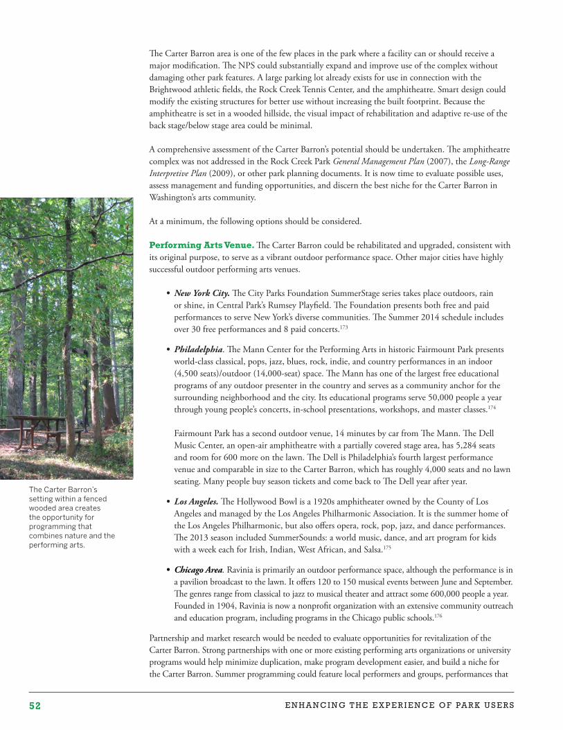
52 E N H A N C I N G T H E E X P E R I E N C E O F PA R K U S E R S
The Carter Barron area is one of the few places in the park where a facility can or should receive a major modification. The NPS could substantially expand and improve use of the complex without damaging other park features. A large parking lot already exists for use in connection with the Brightwood athletic fields, the Rock Creek Tennis Center, and the amphitheatre. Smart design could modify the existing structures for better use without increasing the built footprint. Because the amphitheatre is set in a wooded hillside, the visual impact of rehabilitation and adaptive re-use of the back stage/below stage area could be minimal.
A comprehensive assessment of the Carter Barron’s potential should be undertaken. The amphitheatre complex was not addressed in the Rock Creek Park General Management Plan (2007), the Long-Range Interpretive Plan (2009), or other park planning documents. It is now time to evaluate possible uses, assess management and funding opportunities, and discern the best niche for the Carter Barron in Washington’s arts community.
At a minimum, the following options should be considered.
Performing Arts Venue. The Carter Barron could be rehabilitated and upgraded, consistent with its original purpose, to serve as a vibrant outdoor performance space. Other major cities have highly successful outdoor performing arts venues.
• NewYorkCity. The City Parks Foundation SummerStage series takes place outdoors, rain or shine, in Central Park’s Rumsey Playfield. The Foundation presents both free and paid performances to serve New York’s diverse communities. The Summer 2014 schedule includes over 30 free performances and 8 paid concerts.173
• Philadelphia. The Mann Center for the Performing Arts in historic Fairmount Park presents world-class classical, pops, jazz, blues, rock, indie, and country performances in an indoor (4,500 seats)/outdoor (14,000-seat) space. The Mann has one of the largest free educational programs of any outdoor presenter in the country and serves as a community anchor for the surrounding neighborhood and the city. Its educational programs serve 50,000 people a year through young people’s concerts, in-school presentations, workshops, and master classes.174
Fairmount Park has a second outdoor venue, 14 minutes by car from The Mann. The Dell Music Center, an open-air amphitheatre with a partially covered stage area, has 5,284 seats and room for 600 more on the lawn. The Dell is Philadelphia’s fourth largest performance venue and comparable in size to the Carter Barron, which has roughly 4,000 seats and no lawn seating. Many people buy season tickets and come back to The Dell year after year.
• LosAngeles. The Hollywood Bowl is a 1920s amphitheater owned by the County of Los Angeles and managed by the Los Angeles Philharmonic Association. It is the summer home of the Los Angeles Philharmonic, but also offers opera, rock, pop, jazz, and dance performances. The 2013 season included SummerSounds: a world music, dance, and art program for kids with a week each for Irish, Indian, West African, and Salsa.175
• ChicagoArea. Ravinia is primarily an outdoor performance space, although the performance is in a pavilion broadcast to the lawn. It offers 120 to 150 musical events between June and September. The genres range from classical to jazz to musical theater and attract some 600,000 people a year. Founded in 1904, Ravinia is now a nonprofit organization with an extensive community outreach and education program, including programs in the Chicago public schools.176
Partnership and market research would be needed to evaluate opportunities for revitalization of the Carter Barron. Strong partnerships with one or more existing performing arts organizations or university programs would help minimize duplication, make program development easier, and build a niche for the Carter Barron. Summer programming could feature local performers and groups, performances that
The Carter Barron’s setting within a fenced wooded area creates the opportunity for programming that combines nature and the performing arts.
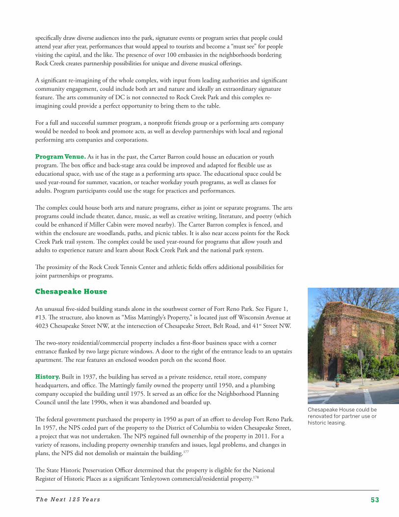
53T h e N e x t 1 2 5 Ye a r s
Chesapeake House could be renovated for partner use or historic leasing.
specifically draw diverse audiences into the park, signature events or program series that people could attend year after year, performances that would appeal to tourists and become a “must see” for people visiting the capital, and the like. The presence of over 100 embassies in the neighborhoods bordering Rock Creek creates partnership possibilities for unique and diverse musical offerings.
A significant re-imagining of the whole complex, with input from leading authorities and significant community engagement, could include both art and nature and ideally an extraordinary signature feature. The arts community of DC is not connected to Rock Creek Park and this complex re-imagining could provide a perfect opportunity to bring them to the table.
For a full and successful summer program, a nonprofit friends group or a performing arts company would be needed to book and promote acts, as well as develop partnerships with local and regional performing arts companies and corporations.
Program Venue. As it has in the past, the Carter Barron could house an education or youth program. The box office and back-stage area could be improved and adapted for flexible use as educational space, with use of the stage as a performing arts space. The educational space could be used year-round for summer, vacation, or teacher workday youth programs, as well as classes for adults. Program participants could use the stage for practices and performances.
The complex could house both arts and nature programs, either as joint or separate programs. The arts programs could include theater, dance, music, as well as creative writing, literature, and poetry (which could be enhanced if Miller Cabin were moved nearby). The Carter Barron complex is fenced, and within the enclosure are woodlands, paths, and picnic tables. It is also near access points for the Rock Creek Park trail system. The complex could be used year-round for programs that allow youth and adults to experience nature and learn about Rock Creek Park and the national park system.
The proximity of the Rock Creek Tennis Center and athletic fields offers additional possibilities for joint partnerships or programs.
Chesapeake House
An unusual five-sided building stands alone in the southwest corner of Fort Reno Park. See Figure 1, #13. The structure, also known as “Miss Mattingly’s Property,” is located just off Wisconsin Avenue at 4023 Chesapeake Street NW, at the intersection of Chesapeake Street, Belt Road, and 41st Street NW.
The two-story residential/commercial property includes a first-floor business space with a corner entrance flanked by two large picture windows. A door to the right of the entrance leads to an upstairs apartment. The rear features an enclosed wooden porch on the second floor.
History. Built in 1937, the building has served as a private residence, retail store, company headquarters, and office. The Mattingly family owned the property until 1950, and a plumbing company occupied the building until 1975. It served as an office for the Neighborhood Planning Council until the late 1990s, when it was abandoned and boarded up.
The federal government purchased the property in 1950 as part of an effort to develop Fort Reno Park. In 1957, the NPS ceded part of the property to the District of Columbia to widen Chesapeake Street, a project that was not undertaken. The NPS regained full ownership of the property in 2011. For a variety of reasons, including property ownership transfers and issues, legal problems, and changes in plans, the NPS did not demolish or maintain the building.177
The State Historic Preservation Officer determined that the property is eligible for the National Register of Historic Places as a significant Tenleytown commercial/residential property.178
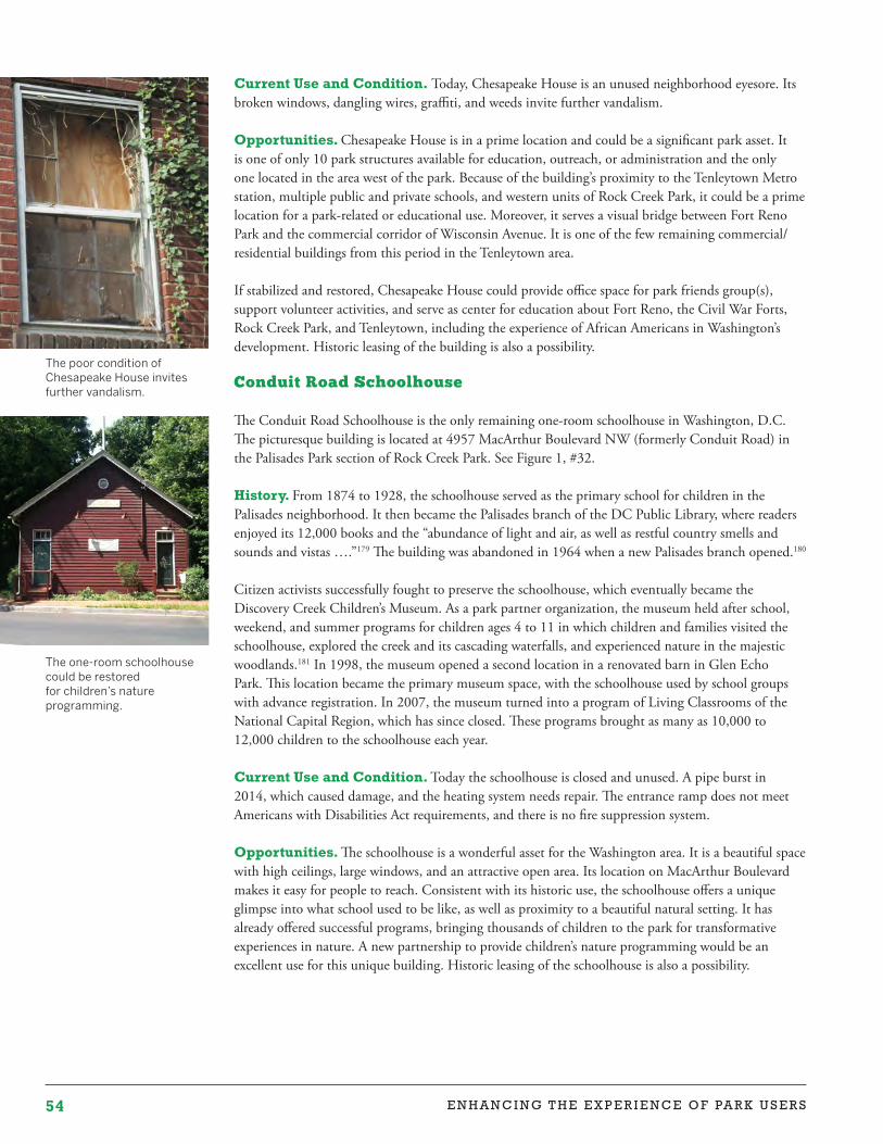
54 E N H A N C I N G T H E E X P E R I E N C E O F PA R K U S E R S
The one-room schoolhouse could be restored for children’s nature programming.
Current Use and Condition. Today, Chesapeake House is an unused neighborhood eyesore. Its broken windows, dangling wires, graffiti, and weeds invite further vandalism.
Opportunities. Chesapeake House is in a prime location and could be a significant park asset. It is one of only 10 park structures available for education, outreach, or administration and the only one located in the area west of the park. Because of the building’s proximity to the Tenleytown Metro station, multiple public and private schools, and western units of Rock Creek Park, it could be a prime location for a park-related or educational use. Moreover, it serves a visual bridge between Fort Reno Park and the commercial corridor of Wisconsin Avenue. It is one of the few remaining commercial/residential buildings from this period in the Tenleytown area.
If stabilized and restored, Chesapeake House could provide office space for park friends group(s), support volunteer activities, and serve as center for education about Fort Reno, the Civil War Forts, Rock Creek Park, and Tenleytown, including the experience of African Americans in Washington’s development. Historic leasing of the building is also a possibility.
Conduit Road Schoolhouse
The Conduit Road Schoolhouse is the only remaining one-room schoolhouse in Washington, D.C. The picturesque building is located at 4957 MacArthur Boulevard NW (formerly Conduit Road) in the Palisades Park section of Rock Creek Park. See Figure 1, #32.
History. From 1874 to 1928, the schoolhouse served as the primary school for children in the Palisades neighborhood. It then became the Palisades branch of the DC Public Library, where readers enjoyed its 12,000 books and the “abundance of light and air, as well as restful country smells and sounds and vistas ….”179 The building was abandoned in 1964 when a new Palisades branch opened.180
Citizen activists successfully fought to preserve the schoolhouse, which eventually became the Discovery Creek Children’s Museum. As a park partner organization, the museum held after school, weekend, and summer programs for children ages 4 to 11 in which children and families visited the schoolhouse, explored the creek and its cascading waterfalls, and experienced nature in the majestic woodlands.181 In 1998, the museum opened a second location in a renovated barn in Glen Echo Park. This location became the primary museum space, with the schoolhouse used by school groups with advance registration. In 2007, the museum turned into a program of Living Classrooms of the National Capital Region, which has since closed. These programs brought as many as 10,000 to 12,000 children to the schoolhouse each year.
Current Use and Condition. Today the schoolhouse is closed and unused. A pipe burst in 2014, which caused damage, and the heating system needs repair. The entrance ramp does not meet Americans with Disabilities Act requirements, and there is no fire suppression system.
Opportunities. The schoolhouse is a wonderful asset for the Washington area. It is a beautiful space with high ceilings, large windows, and an attractive open area. Its location on MacArthur Boulevard makes it easy for people to reach. Consistent with its historic use, the schoolhouse offers a unique glimpse into what school used to be like, as well as proximity to a beautiful natural setting. It has already offered successful programs, bringing thousands of children to the park for transformative experiences in nature. A new partnership to provide children’s nature programming would be an excellent use for this unique building. Historic leasing of the schoolhouse is also a possibility.
The poor condition of Chesapeake House invites further vandalism.
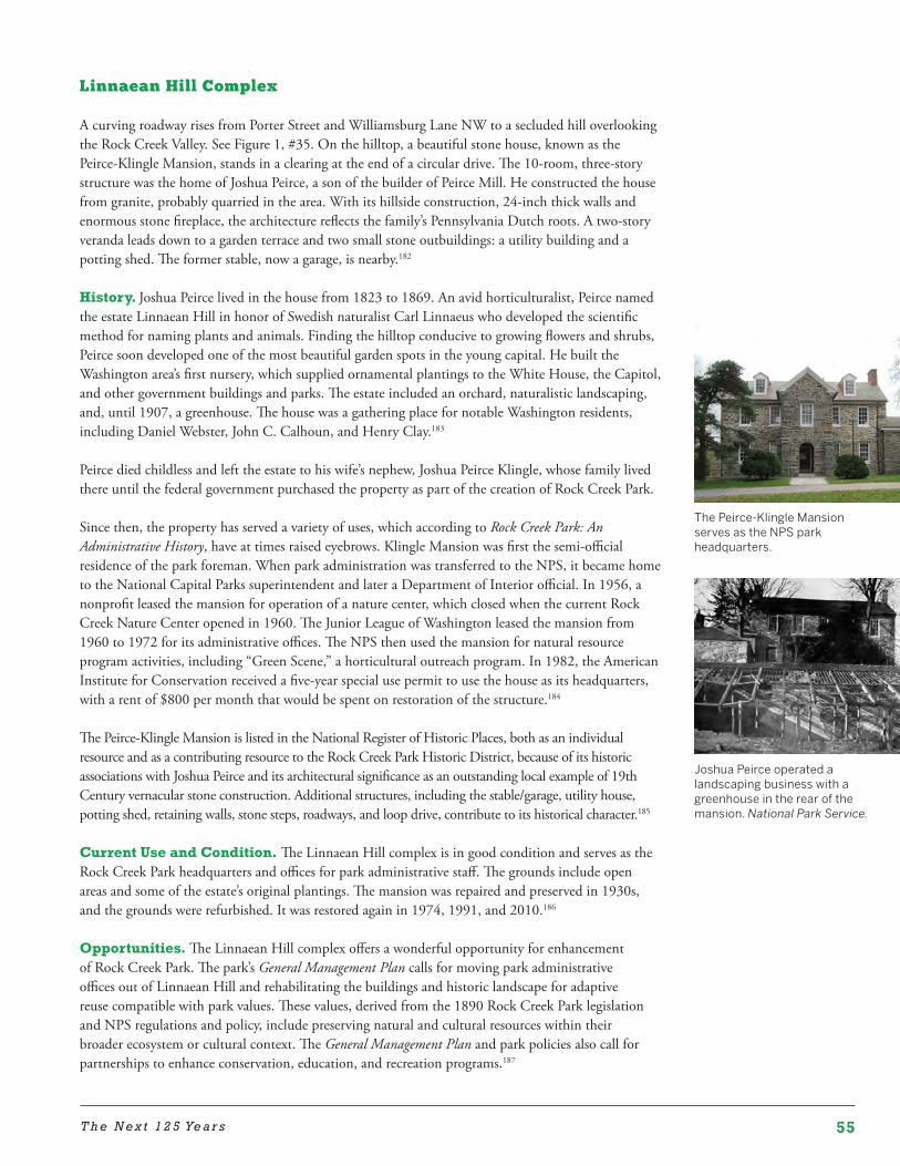
55T h e N e x t 1 2 5 Ye a r s
Joshua Peirce operated a landscaping business with a greenhouse in the rear of the mansion. National Park Service.
The Peirce-Klingle Mansion serves as the NPS park headquarters.
Linnaean Hill Complex
A curving roadway rises from Porter Street and Williamsburg Lane NW to a secluded hill overlooking the Rock Creek Valley. See Figure 1, #35. On the hilltop, a beautiful stone house, known as the Peirce-Klingle Mansion, stands in a clearing at the end of a circular drive. The 10-room, three-story structure was the home of Joshua Peirce, a son of the builder of Peirce Mill. He constructed the house from granite, probably quarried in the area. With its hillside construction, 24-inch thick walls and enormous stone fireplace, the architecture reflects the family’s Pennsylvania Dutch roots. A two-story veranda leads down to a garden terrace and two small stone outbuildings: a utility building and a potting shed. The former stable, now a garage, is nearby.182
History. Joshua Peirce lived in the house from 1823 to 1869. An avid horticulturalist, Peirce named the estate Linnaean Hill in honor of Swedish naturalist Carl Linnaeus who developed the scientific method for naming plants and animals. Finding the hilltop conducive to growing flowers and shrubs, Peirce soon developed one of the most beautiful garden spots in the young capital. He built the Washington area’s first nursery, which supplied ornamental plantings to the White House, the Capitol, and other government buildings and parks. The estate included an orchard, naturalistic landscaping, and, until 1907, a greenhouse. The house was a gathering place for notable Washington residents, including Daniel Webster, John C. Calhoun, and Henry Clay.183
Peirce died childless and left the estate to his wife’s nephew, Joshua Peirce Klingle, whose family lived there until the federal government purchased the property as part of the creation of Rock Creek Park.
Since then, the property has served a variety of uses, which according to Rock Creek Park: An Administrative History, have at times raised eyebrows. Klingle Mansion was first the semi-official residence of the park foreman. When park administration was transferred to the NPS, it became home to the National Capital Parks superintendent and later a Department of Interior official. In 1956, a nonprofit leased the mansion for operation of a nature center, which closed when the current Rock Creek Nature Center opened in 1960. The Junior League of Washington leased the mansion from 1960 to 1972 for its administrative offices. The NPS then used the mansion for natural resource program activities, including “Green Scene,” a horticultural outreach program. In 1982, the American Institute for Conservation received a five-year special use permit to use the house as its headquarters, with a rent of $800 per month that would be spent on restoration of the structure.184
The Peirce-Klingle Mansion is listed in the National Register of Historic Places, both as an individual resource and as a contributing resource to the Rock Creek Park Historic District, because of its historic associations with Joshua Peirce and its architectural significance as an outstanding local example of 19th Century vernacular stone construction. Additional structures, including the stable/garage, utility house, potting shed, retaining walls, stone steps, roadways, and loop drive, contribute to its historical character.185
Current Use and Condition. The Linnaean Hill complex is in good condition and serves as the Rock Creek Park headquarters and offices for park administrative staff. The grounds include open areas and some of the estate’s original plantings. The mansion was repaired and preserved in 1930s, and the grounds were refurbished. It was restored again in 1974, 1991, and 2010.186
Opportunities. The Linnaean Hill complex offers a wonderful opportunity for enhancement of Rock Creek Park. The park’s General Management Plan calls for moving park administrative offices out of Linnaean Hill and rehabilitating the buildings and historic landscape for adaptive reuse compatible with park values. These values, derived from the 1890 Rock Creek Park legislation and NPS regulations and policy, include preserving natural and cultural resources within their broader ecosystem or cultural context. The General Management Plan and park policies also call for partnerships to enhance conservation, education, and recreation programs.187
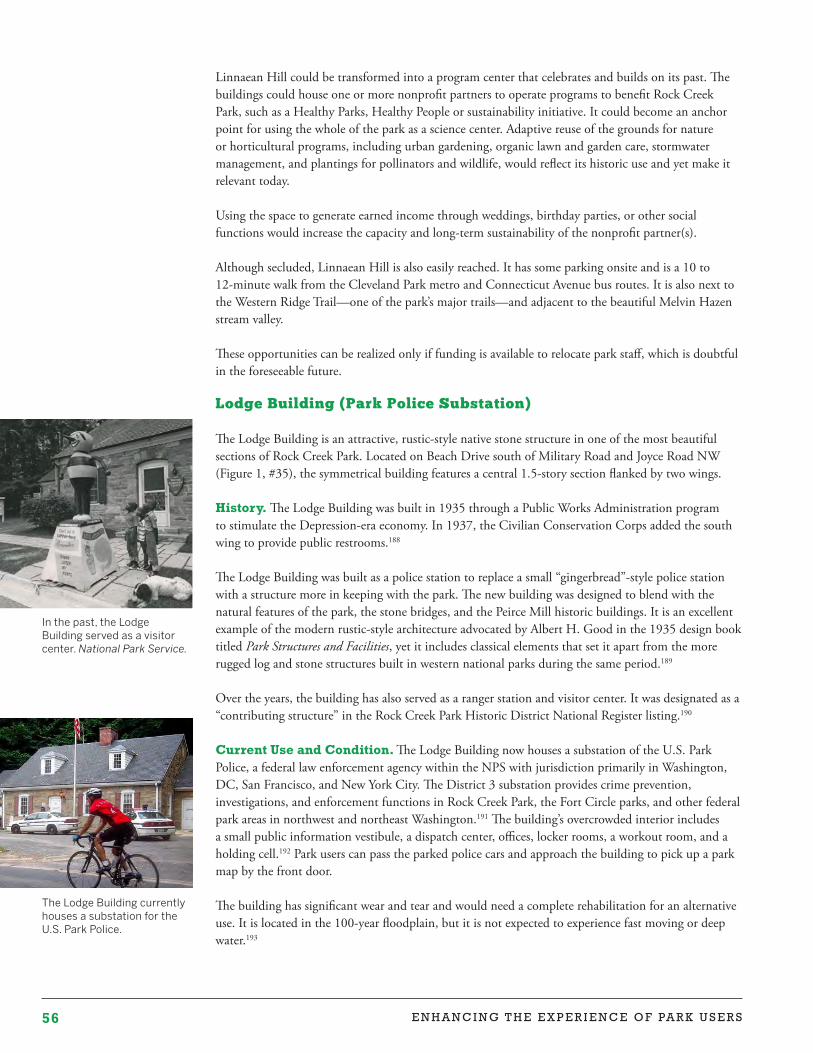
56 E N H A N C I N G T H E E X P E R I E N C E O F PA R K U S E R S
In the past, the Lodge Building served as a visitor center. National Park Service.
The Lodge Building currently houses a substation for the U.S. Park Police.
Linnaean Hill could be transformed into a program center that celebrates and builds on its past. The buildings could house one or more nonprofit partners to operate programs to benefit Rock Creek Park, such as a Healthy Parks, Healthy People or sustainability initiative. It could become an anchor point for using the whole of the park as a science center. Adaptive reuse of the grounds for nature or horticultural programs, including urban gardening, organic lawn and garden care, stormwater management, and plantings for pollinators and wildlife, would reflect its historic use and yet make it relevant today.
Using the space to generate earned income through weddings, birthday parties, or other social functions would increase the capacity and long-term sustainability of the nonprofit partner(s).
Although secluded, Linnaean Hill is also easily reached. It has some parking onsite and is a 10 to 12-minute walk from the Cleveland Park metro and Connecticut Avenue bus routes. It is also next to the Western Ridge Trail—one of the park’s major trails—and adjacent to the beautiful Melvin Hazen stream valley.
These opportunities can be realized only if funding is available to relocate park staff, which is doubtful in the foreseeable future.
Lodge Building (Park Police Substation)
The Lodge Building is an attractive, rustic-style native stone structure in one of the most beautiful sections of Rock Creek Park. Located on Beach Drive south of Military Road and Joyce Road NW (Figure 1, #35), the symmetrical building features a central 1.5-story section flanked by two wings.
History. The Lodge Building was built in 1935 through a Public Works Administration program to stimulate the Depression-era economy. In 1937, the Civilian Conservation Corps added the south wing to provide public restrooms.188
The Lodge Building was built as a police station to replace a small “gingerbread”-style police station with a structure more in keeping with the park. The new building was designed to blend with the natural features of the park, the stone bridges, and the Peirce Mill historic buildings. It is an excellent example of the modern rustic-style architecture advocated by Albert H. Good in the 1935 design book titled Park Structures and Facilities, yet it includes classical elements that set it apart from the more rugged log and stone structures built in western national parks during the same period.189
Over the years, the building has also served as a ranger station and visitor center. It was designated as a “contributing structure” in the Rock Creek Park Historic District National Register listing.190
Current Use and Condition. The Lodge Building now houses a substation of the U.S. Park Police, a federal law enforcement agency within the NPS with jurisdiction primarily in Washington, DC, San Francisco, and New York City. The District 3 substation provides crime prevention, investigations, and enforcement functions in Rock Creek Park, the Fort Circle parks, and other federal park areas in northwest and northeast Washington.191 The building’s overcrowded interior includes a small public information vestibule, a dispatch center, offices, locker rooms, a workout room, and a holding cell.192 Park users can pass the parked police cars and approach the building to pick up a park map by the front door.
The building has significant wear and tear and would need a complete rehabilitation for an alternative use. It is located in the 100-year floodplain, but it is not expected to experience fast moving or deep water.193
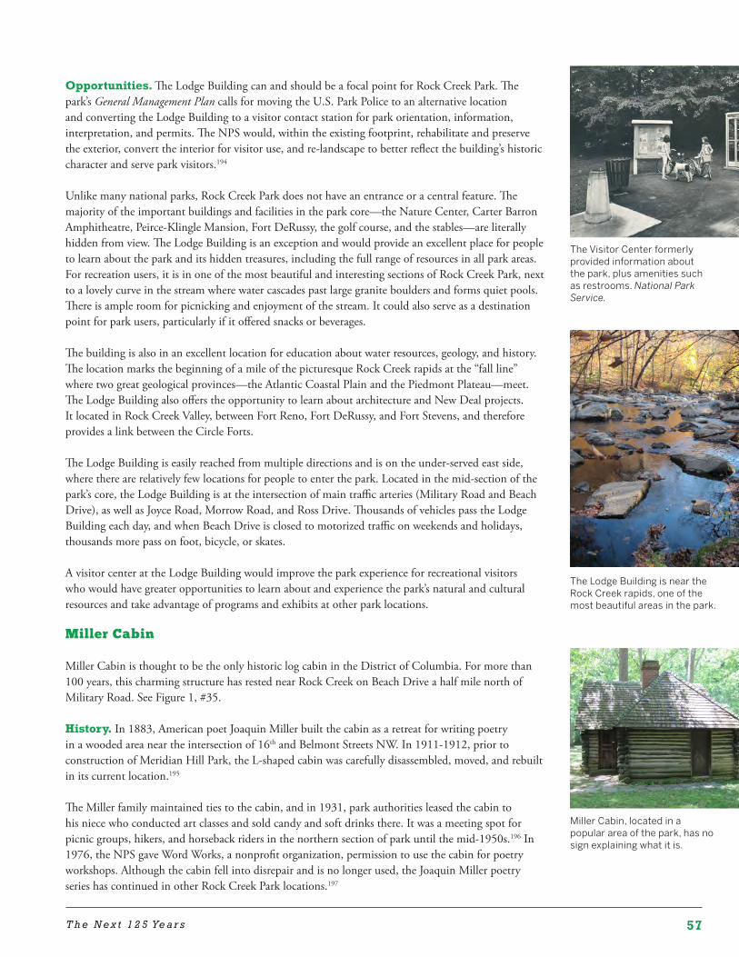
57T h e N e x t 1 2 5 Ye a r s
Miller Cabin, located in a popular area of the park, has no sign explaining what it is.
The Lodge Building is near the Rock Creek rapids, one of the most beautiful areas in the park.
Opportunities. The Lodge Building can and should be a focal point for Rock Creek Park. The park’s General Management Plan calls for moving the U.S. Park Police to an alternative location and converting the Lodge Building to a visitor contact station for park orientation, information, interpretation, and permits. The NPS would, within the existing footprint, rehabilitate and preserve the exterior, convert the interior for visitor use, and re-landscape to better reflect the building’s historic character and serve park visitors.194
Unlike many national parks, Rock Creek Park does not have an entrance or a central feature. The majority of the important buildings and facilities in the park core—the Nature Center, Carter Barron Amphitheatre, Peirce-Klingle Mansion, Fort DeRussy, the golf course, and the stables—are literally hidden from view. The Lodge Building is an exception and would provide an excellent place for people to learn about the park and its hidden treasures, including the full range of resources in all park areas. For recreation users, it is in one of the most beautiful and interesting sections of Rock Creek Park, next to a lovely curve in the stream where water cascades past large granite boulders and forms quiet pools. There is ample room for picnicking and enjoyment of the stream. It could also serve as a destination point for park users, particularly if it offered snacks or beverages.
The building is also in an excellent location for education about water resources, geology, and history. The location marks the beginning of a mile of the picturesque Rock Creek rapids at the “fall line” where two great geological provinces—the Atlantic Coastal Plain and the Piedmont Plateau—meet. The Lodge Building also offers the opportunity to learn about architecture and New Deal projects. It located in Rock Creek Valley, between Fort Reno, Fort DeRussy, and Fort Stevens, and therefore provides a link between the Circle Forts.
The Lodge Building is easily reached from multiple directions and is on the under-served east side, where there are relatively few locations for people to enter the park. Located in the mid-section of the park’s core, the Lodge Building is at the intersection of main traffic arteries (Military Road and Beach Drive), as well as Joyce Road, Morrow Road, and Ross Drive. Thousands of vehicles pass the Lodge Building each day, and when Beach Drive is closed to motorized traffic on weekends and holidays, thousands more pass on foot, bicycle, or skates.
A visitor center at the Lodge Building would improve the park experience for recreational visitors who would have greater opportunities to learn about and experience the park’s natural and cultural resources and take advantage of programs and exhibits at other park locations.
Miller Cabin
Miller Cabin is thought to be the only historic log cabin in the District of Columbia. For more than 100 years, this charming structure has rested near Rock Creek on Beach Drive a half mile north of Military Road. See Figure 1, #35.
History. In 1883, American poet Joaquin Miller built the cabin as a retreat for writing poetry in a wooded area near the intersection of 16th and Belmont Streets NW. In 1911-1912, prior to construction of Meridian Hill Park, the L-shaped cabin was carefully disassembled, moved, and rebuilt in its current location.195
The Miller family maintained ties to the cabin, and in 1931, park authorities leased the cabin to his niece who conducted art classes and sold candy and soft drinks there. It was a meeting spot for picnic groups, hikers, and horseback riders in the northern section of park until the mid-1950s.196 In 1976, the NPS gave Word Works, a nonprofit organization, permission to use the cabin for poetry workshops. Although the cabin fell into disrepair and is no longer used, the Joaquin Miller poetry series has continued in other Rock Creek Park locations.197
The Visitor Center formerly provided information about the park, plus amenities such as restrooms. National Park Service.
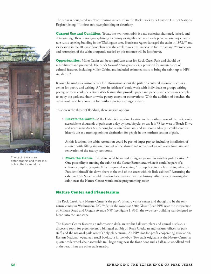
58 E N H A N C I N G T H E E X P E R I E N C E O F PA R K U S E R S
The cabin is designated as a “contributing structure” in the Rock Creek Park Historic District National Register listing.198 It does not have plumbing or electricity.
Current Use and Condition. Today, the two-room cabin is a sad curiosity: shuttered, locked, and deteriorating. There is no sign explaining its history or significance as an early preservation project and a rare rustic-style log building in the Washington area. Hurricane Agnes damaged the cabin in 1972,199 and its location in the 100-year floodplain near the creek makes it vulnerable to future damage.200 Protection and restoration of the cabin is urgently needed or this resource will be lost forever.
Opportunities. Miller Cabin can be a significant asset for Rock Creek Park and should be rehabilitated and preserved. The park’s General Management Plan provided for maintenance of cultural features, including Miller Cabin, and included estimated costs to bring the cabin up to NPS standards.201
It could be used as a visitor center for information about the park or a cultural resource, such as a center for poetry and writing. A “poet in residence” could work with individuals or groups writing poetry, or there could be a Poets Walk feature that provides paper and pencils and encourages people to enjoy the park and draw or write poetry, essays, or observations. With the addition of benches, the cabin could also be a location for outdoor poetry readings or slams.
To address the threat of flooding, there are two options.
• Elevate the Cabin. Miller Cabin is in a prime location in the northern core of the park, easily accessible to thousands of park users a day by foot, bicycle, or car. It is 75 feet west of Beach Drive and near Picnic Area 6, a parking lot, a water fountain, and restrooms. Ideally it could serve its historic use as a meeting point or destination for people in the northern section of park. At this location, the cabin restoration could be part of larger project including installation of a water bottle filling station, removal of the abandoned remains of an old water fountain, and renovation of the nearby restrooms.
• Move the Cabin. The cabin could be moved to higher ground in another park location.202 One possibility is moving the cabin to the Carter Barron area where it could be part of a cultural complex. Joaquin Miller is quoted as saying, “I sit up here in my fine cabin, while the President himself sits down there at the end of the street with his little cabinet.” Returning the cabin to 16th Street would therefore be consistent with its history. Alternatively, moving the cabin near the Nature Center would make programming easier.
Nature Center and Planetarium
The Rock Creek Park Nature Center is the park’s primary visitor center and thought to be the only nature center in Washington, DC.203 Set in the woods at 5200 Glover Road NW near the intersection of Military Road and Oregon Avenue NW (see Figure 1, #35), the two-story building was designed to blend into the landscape.
The Nature Center features an information desk, an exhibit hall with plant and animal displays, a discovery room for preschoolers, a bilingual exhibit on Rock Creek, an auditorium, offices for park staff, and the national park system’s only planetarium. An NPS not-for-profit cooperating association, Eastern National, operates a small bookstore in the lobby. Two trails originate at the Nature Center: a quarter-mile wheel-chair accessible trail beginning near the front door and a half-mile woodland trail at the rear. There are other trails nearby.
The cabin’s walls are deteriorating, and there is a hole in the locked door.
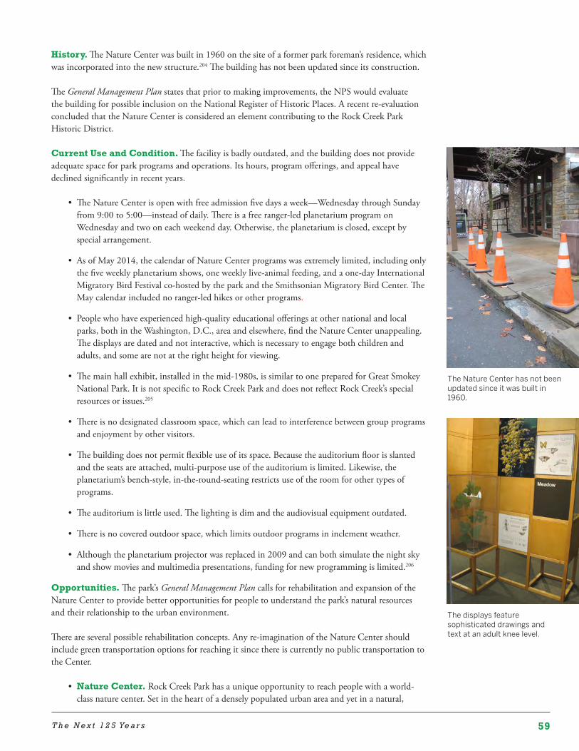
59T h e N e x t 1 2 5 Ye a r s
History. The Nature Center was built in 1960 on the site of a former park foreman’s residence, which was incorporated into the new structure.204 The building has not been updated since its construction.
The General Management Plan states that prior to making improvements, the NPS would evaluate the building for possible inclusion on the National Register of Historic Places. A recent re-evaluation concluded that the Nature Center is considered an element contributing to the Rock Creek Park Historic District.
Current Use and Condition. The facility is badly outdated, and the building does not provide adequate space for park programs and operations. Its hours, program offerings, and appeal have declined significantly in recent years.
• The Nature Center is open with free admission five days a week—Wednesday through Sunday from 9:00 to 5:00—instead of daily. There is a free ranger-led planetarium program on Wednesday and two on each weekend day. Otherwise, the planetarium is closed, except by special arrangement.
• As of May 2014, the calendar of Nature Center programs was extremely limited, including only the five weekly planetarium shows, one weekly live-animal feeding, and a one-day International Migratory Bird Festival co-hosted by the park and the Smithsonian Migratory Bird Center. The May calendar included no ranger-led hikes or other programs.
• People who have experienced high-quality educational offerings at other national and local parks, both in the Washington, D.C., area and elsewhere, find the Nature Center unappealing. The displays are dated and not interactive, which is necessary to engage both children and adults, and some are not at the right height for viewing.
• The main hall exhibit, installed in the mid-1980s, is similar to one prepared for Great Smokey National Park. It is not specific to Rock Creek Park and does not reflect Rock Creek’s special resources or issues.205
• There is no designated classroom space, which can lead to interference between group programs and enjoyment by other visitors.
• The building does not permit flexible use of its space. Because the auditorium floor is slanted and the seats are attached, multi-purpose use of the auditorium is limited. Likewise, the planetarium’s bench-style, in-the-round-seating restricts use of the room for other types of programs.
• The auditorium is little used. The lighting is dim and the audiovisual equipment outdated.
• There is no covered outdoor space, which limits outdoor programs in inclement weather.
• Although the planetarium projector was replaced in 2009 and can both simulate the night sky and show movies and multimedia presentations, funding for new programming is limited.206
Opportunities. The park’s General Management Plan calls for rehabilitation and expansion of the Nature Center to provide better opportunities for people to understand the park’s natural resources and their relationship to the urban environment.
There are several possible rehabilitation concepts. Any re-imagination of the Nature Center should include green transportation options for reaching it since there is currently no public transportation to the Center.
• Nature Center. Rock Creek Park has a unique opportunity to reach people with a world-class nature center. Set in the heart of a densely populated urban area and yet in a natural,
The Nature Center has not been updated since it was built in 1960.
The displays feature sophisticated drawings and text at an adult knee level.
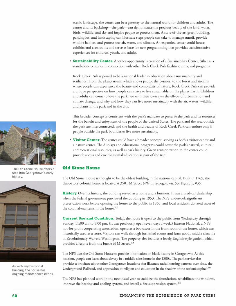
60 E N H A N C I N G T H E E X P E R I E N C E O F PA R K U S E R S
As with any historical building, the house has ongoing maintenance needs.
The Old Stone House offers a step into Georgetown’s early history.
scenic landscape, the center can be a gateway to the natural world for children and adults. The center and its backdrop—the park—can demonstrate the precious beauty of the land, water, birds, wildlife, and sky and inspire people to protect them. A state-of-the-art green building, parking lot, and landscaping can illustrate steps people can take to manage runoff, provide wildlife habitat, and protect our air, water, and climate. An expanded center could house exhibits and classrooms and serve as base for new programming that provides transformative experiences for children, youth, and adults.
• Sustainability Center. Another opportunity is creation of a Sustainability Center, either as a stand-alone center or in connection with other Rock Creek Park facilities, units, and programs. Rock Creek Park is poised to be a national leader in education about sustainability and resilience. From the planetarium, which shows people the cosmos, to the forest and streams where people can experience the beauty and complexity of nature, Rock Creek Park can provide a unique perspective on how people can strive to live sustainably on the planet Earth. Children and adults can come to love the park, see with their own eyes the effects of urbanization and climate change, and why and how they can live more sustainably with the air, waters, wildlife, and plants in the park and in the city. This broader concept is consistent with the park’s mandate to preserve the park and its resources for the benefit and enjoyment of the people of the United States. The park and the area outside the park are interconnected, and the health and beauty of Rock Creek Park can endure only if people outside the park boundaries live more sustainably.
• Visitor Center. The center could have a broader concept, serving as both a visitor center and a nature center. The displays and educational programs could cover the park’s natural, cultural, and recreational resources, as well as park history. Green transportation to the center could provide access and environmental education as part of the trip.
Old Stone House
The Old Stone House is thought to be the oldest building in the nation’s capital. Built in 1765, the three-story colonial home is located at 3501 M Street NW in Georgetown. See Figure 1, #35.
History. Over its history, the building served as a home and a business. It was a used-car dealership when the federal government purchased the building in 1953. The NPS undertook significant preservation work before opening the house to the public in 1960, and local residents donated most of the colonial-era items in the house.207
Current Use and Condition. Today, the house is open to the public from Wednesday through Sunday, 11:00 am to 5:00 pm. (It was previously open seven days a week.) Eastern National, a NPS not-for-profit cooperating association, operates a bookstore in the front room of the house, which was historically used as a store. Visitors can walk through furnished rooms and learn about middle class life in Revolutionary War-era Washington. The property also features a lovely English-style garden, which provides a respite from the bustle of M Street.208
The NPS uses the Old Stone House to provide information on black history in Georgetown. At this location, people can learn about slavery in a middle-class home in the 1800s. The park service also provides a brochure about other Georgetown locations that illustrate racial housing patterns over time, the Underground Railroad, and approaches to religion and education in the shadow of the nation’s capital.209
The NPS has planned work in the next fiscal year to stabilize the foundation, rehabilitate the windows, improve the heating and cooling system, and install a fire suppression system.210
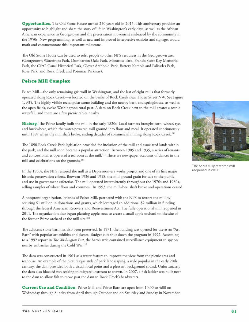
61T h e N e x t 1 2 5 Ye a r s
The beautifully restored mill reopened in 2011.
Opportunities. The Old Stone House turned 250 years old in 2015. This anniversary provides an opportunity to highlight and share the story of life in Washington’s early days, as well as the African American experience in Georgetown and the preservation movement embraced by the community in the 1950s. New programming, as well as new and improved interpretive exhibits and signage, would mark and commemorate this important milestone.
The Old Stone House can be used to refer people to other NPS resources in the Georgetown area (Georgetown Waterfront Park, Dumbarton Oaks Park, Montrose Park, Francis Scott Key Memorial Park, the C&O Canal Historical Park, Glover Archbold Park, Battery Kemble and Palisades Park, Rose Park, and Rock Creek and Potomac Parkway).
Peirce Mill Complex
Peirce Mill—the only remaining gristmill in Washington, and the last of eight mills that formerly operated along Rock Creek—is located on the banks of Rock Creek near Tilden Street NW. See Figure 1, #35. The highly visible rectangular stone building and the nearby barn and springhouse, as well as the open fields, evoke Washington’s rural past. A dam on Rock Creek next to the mill creates a scenic waterfall, and there are a few picnic tables nearby.
History. The Peirce family built the mill in the early 1820s. Local farmers brought corn, wheat, rye, and buckwheat, which the water-powered mill ground into flour and meal. It operated continuously until 1897 when the mill shaft broke, ending decades of commercial milling along Rock Creek.211
The 1890 Rock Creek Park legislation provided for inclusion of the mill and associated lands within the park, and the mill soon became a popular attraction. Between 1905 and 1935, a series of tenants and concessionaires operated a tearoom at the mill.212 There are newspaper accounts of dances in the mill and celebrations on the grounds.213
In the 1930s, the NPS restored the mill as a Depression-era works project and one of its first major historic preservation efforts. Between 1936 and 1958, the mill ground grain for sale to the public and use in government cafeterias. The mill operated intermittently throughout the 1970s and 1980s, selling samples of wheat flour and cornmeal. In 1993, the millwheel shaft broke and operations ceased.
A nonprofit organization, Friends of Peirce Mill, partnered with the NPS to restore the mill by securing $1 million in donations and grants, which leveraged an additional $2 million in funding through the federal American Recovery and Reinvestment Act. The fully operational mill reopened in 2011. The organization also began planting apple trees to create a small apple orchard on the site of the former Peirce orchard at the mill site.214
The adjacent stone barn has also been preserved. In 1971, the building was opened for use as an “Art Barn” with popular art exhibits and classes. Budget cuts shut down the program in 1992. According to a 1992 report in The Washington Post, the barn’s attic contained surveillance equipment to spy on nearby embassies during the Cold War.215
The dam was constructed in 1904 as a water feature to improve the view from the picnic area and teahouse. An example of the picturesque style of park landscaping, a style popular in the early 20th century, the dam provided both a visual focal point and a pleasant background sound. Unfortunately the dam also blocked fish seeking to migrate upstream to spawn. In 2007, a fish ladder was built next to the dam to allow fish to move past the dam to Rock Creek’s headwaters.
Current Use and Condition. Peirce Mill and Peirce Barn are open from 10:00 to 4:00 on Wednesday through Sunday from April through October and on Saturday and Sunday in November.
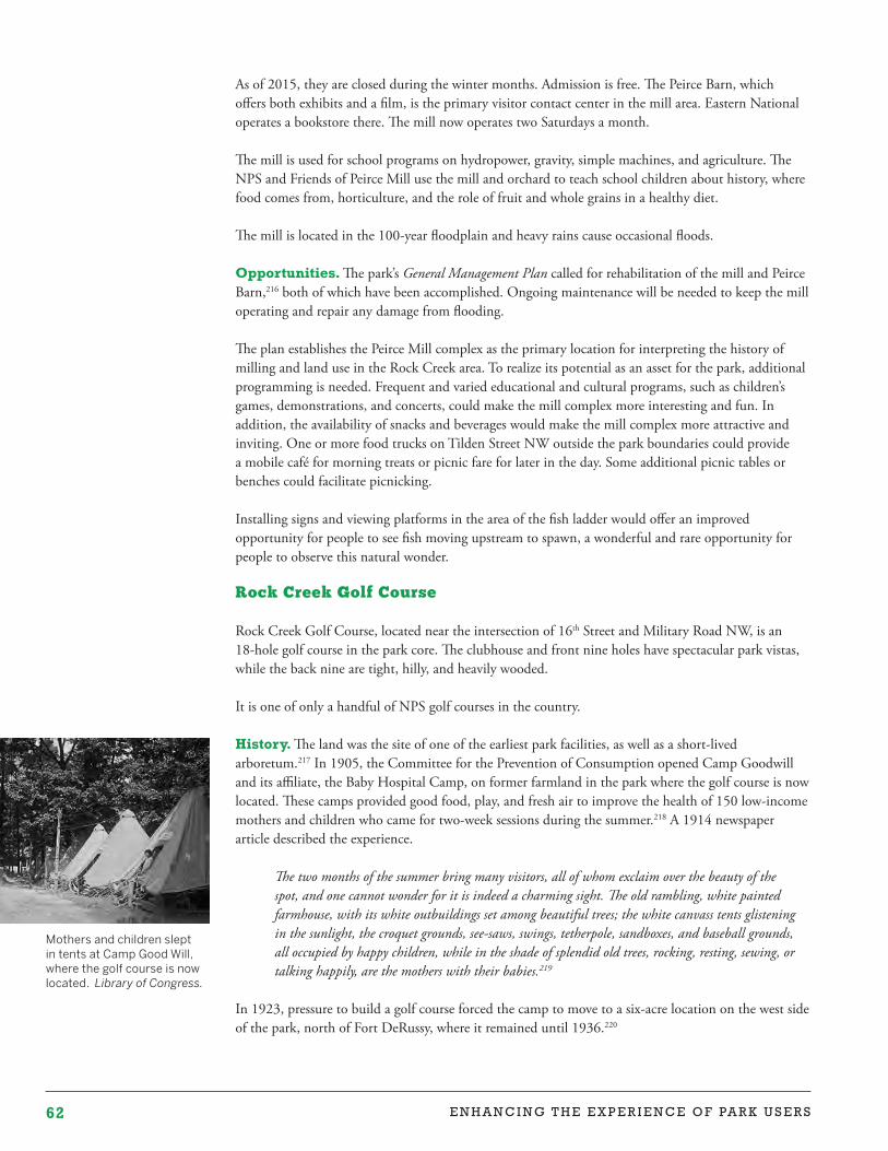
62 E N H A N C I N G T H E E X P E R I E N C E O F PA R K U S E R S
Mothers and children slept in tents at Camp Good Will, where the golf course is now located. Library of Congress.
As of 2015, they are closed during the winter months. Admission is free. The Peirce Barn, which offers both exhibits and a film, is the primary visitor contact center in the mill area. Eastern National operates a bookstore there. The mill now operates two Saturdays a month.
The mill is used for school programs on hydropower, gravity, simple machines, and agriculture. The NPS and Friends of Peirce Mill use the mill and orchard to teach school children about history, where food comes from, horticulture, and the role of fruit and whole grains in a healthy diet.
The mill is located in the 100-year floodplain and heavy rains cause occasional floods.
Opportunities. The park’s General Management Plan called for rehabilitation of the mill and Peirce Barn,216 both of which have been accomplished. Ongoing maintenance will be needed to keep the mill operating and repair any damage from flooding.
The plan establishes the Peirce Mill complex as the primary location for interpreting the history of milling and land use in the Rock Creek area. To realize its potential as an asset for the park, additional programming is needed. Frequent and varied educational and cultural programs, such as children’s games, demonstrations, and concerts, could make the mill complex more interesting and fun. In addition, the availability of snacks and beverages would make the mill complex more attractive and inviting. One or more food trucks on Tilden Street NW outside the park boundaries could provide a mobile café for morning treats or picnic fare for later in the day. Some additional picnic tables or benches could facilitate picnicking.
Installing signs and viewing platforms in the area of the fish ladder would offer an improved opportunity for people to see fish moving upstream to spawn, a wonderful and rare opportunity for people to observe this natural wonder.
Rock Creek Golf Course
Rock Creek Golf Course, located near the intersection of 16th Street and Military Road NW, is an 18-hole golf course in the park core. The clubhouse and front nine holes have spectacular park vistas, while the back nine are tight, hilly, and heavily wooded.
It is one of only a handful of NPS golf courses in the country.
History. The land was the site of one of the earliest park facilities, as well as a short-lived arboretum.217 In 1905, the Committee for the Prevention of Consumption opened Camp Goodwill and its affiliate, the Baby Hospital Camp, on former farmland in the park where the golf course is now located. These camps provided good food, play, and fresh air to improve the health of 150 low-income mothers and children who came for two-week sessions during the summer.218 A 1914 newspaper article described the experience.
The two months of the summer bring many visitors, all of whom exclaim over the beauty of the spot, and one cannot wonder for it is indeed a charming sight. The old rambling, white painted farmhouse, with its white outbuildings set among beautiful trees; the white canvass tents glistening in the sunlight, the croquet grounds, see-saws, swings, tetherpole, sandboxes, and baseball grounds, all occupied by happy children, while in the shade of splendid old trees, rocking, resting, sewing, or talking happily, are the mothers with their babies.219
In 1923, pressure to build a golf course forced the camp to move to a six-acre location on the west side of the park, north of Fort DeRussy, where it remained until 1936.220
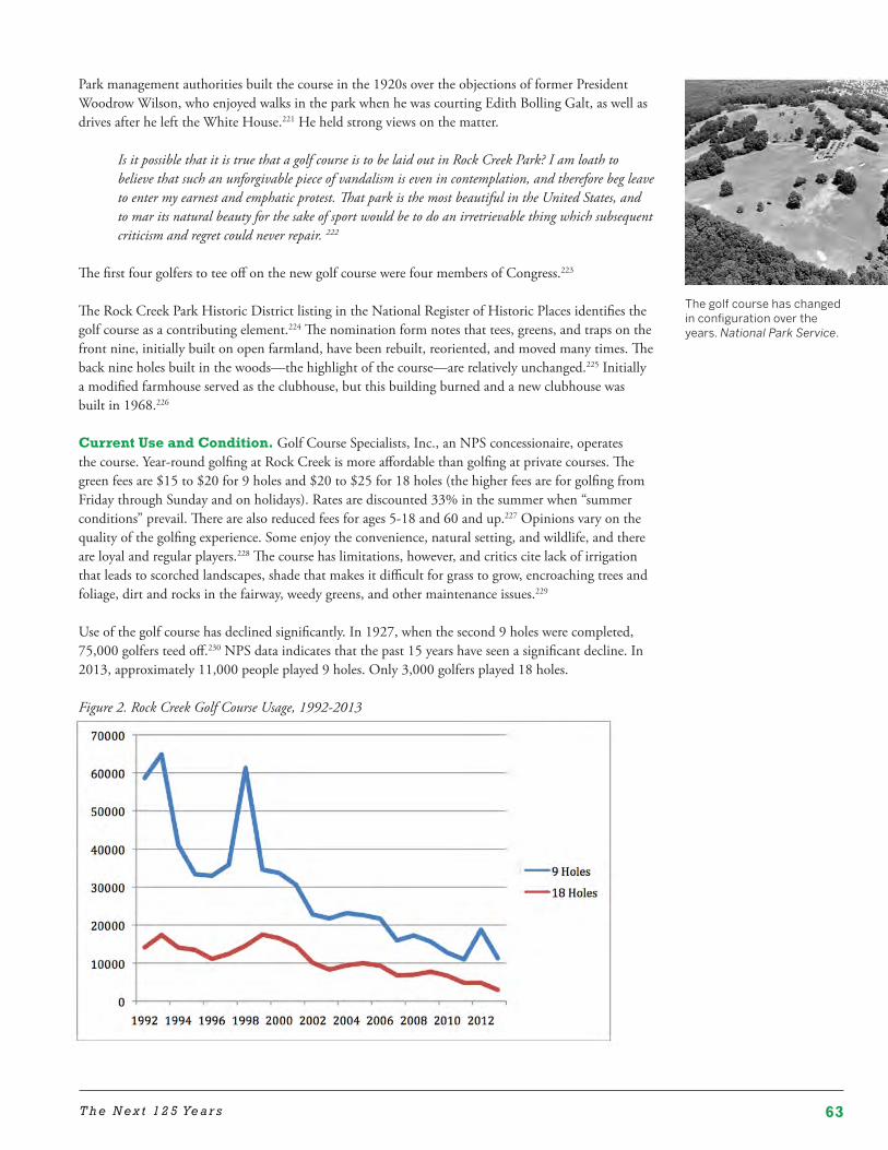
63T h e N e x t 1 2 5 Ye a r s
Park management authorities built the course in the 1920s over the objections of former President Woodrow Wilson, who enjoyed walks in the park when he was courting Edith Bolling Galt, as well as drives after he left the White House.221 He held strong views on the matter.
Is it possible that it is true that a golf course is to be laid out in Rock Creek Park? I am loath to believe that such an unforgivable piece of vandalism is even in contemplation, and therefore beg leave to enter my earnest and emphatic protest. That park is the most beautiful in the United States, and to mar its natural beauty for the sake of sport would be to do an irretrievable thing which subsequent criticism and regret could never repair. 222
The first four golfers to tee off on the new golf course were four members of Congress.223
The Rock Creek Park Historic District listing in the National Register of Historic Places identifies the golf course as a contributing element.224 The nomination form notes that tees, greens, and traps on the front nine, initially built on open farmland, have been rebuilt, reoriented, and moved many times. The back nine holes built in the woods—the highlight of the course—are relatively unchanged.225 Initially a modified farmhouse served as the clubhouse, but this building burned and a new clubhouse was built in 1968.226
Current Use and Condition. Golf Course Specialists, Inc., an NPS concessionaire, operates the course. Year-round golfing at Rock Creek is more affordable than golfing at private courses. The green fees are $15 to $20 for 9 holes and $20 to $25 for 18 holes (the higher fees are for golfing from Friday through Sunday and on holidays). Rates are discounted 33% in the summer when “summer conditions” prevail. There are also reduced fees for ages 5-18 and 60 and up.227 Opinions vary on the quality of the golfing experience. Some enjoy the convenience, natural setting, and wildlife, and there are loyal and regular players.228 The course has limitations, however, and critics cite lack of irrigation that leads to scorched landscapes, shade that makes it difficult for grass to grow, encroaching trees and foliage, dirt and rocks in the fairway, weedy greens, and other maintenance issues.229
Use of the golf course has declined significantly. In 1927, when the second 9 holes were completed, 75,000 golfers teed off.230 NPS data indicates that the past 15 years have seen a significant decline. In 2013, approximately 11,000 people played 9 holes. Only 3,000 golfers played 18 holes.
Figure 2. Rock Creek Golf Course Usage, 1992-2013
The golf course has changed in configuration over the years. National Park Service.
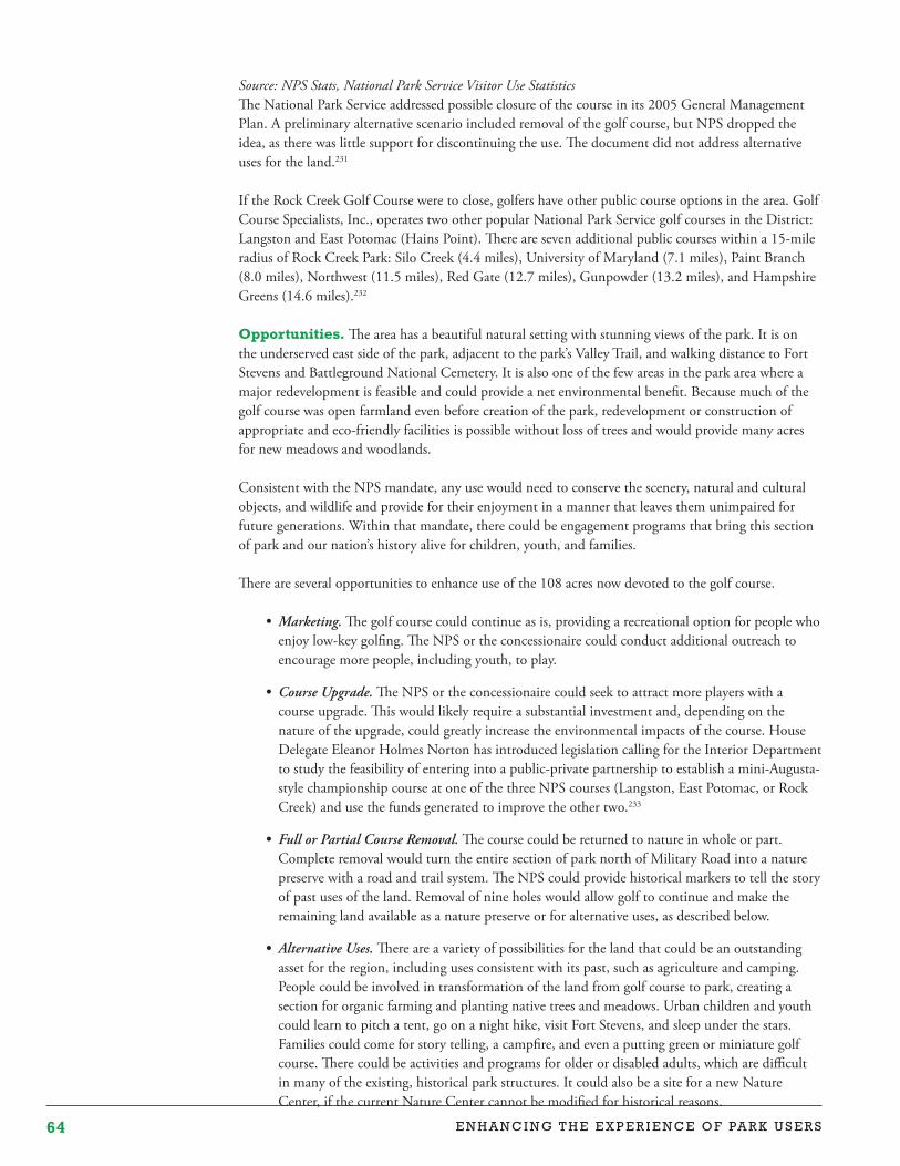
64 E N H A N C I N G T H E E X P E R I E N C E O F PA R K U S E R S
Source: NPS Stats, National Park Service Visitor Use StatisticsThe National Park Service addressed possible closure of the course in its 2005 General Management Plan. A preliminary alternative scenario included removal of the golf course, but NPS dropped the idea, as there was little support for discontinuing the use. The document did not address alternative uses for the land.231
If the Rock Creek Golf Course were to close, golfers have other public course options in the area. Golf Course Specialists, Inc., operates two other popular National Park Service golf courses in the District: Langston and East Potomac (Hains Point). There are seven additional public courses within a 15-mile radius of Rock Creek Park: Silo Creek (4.4 miles), University of Maryland (7.1 miles), Paint Branch (8.0 miles), Northwest (11.5 miles), Red Gate (12.7 miles), Gunpowder (13.2 miles), and Hampshire Greens (14.6 miles).232
Opportunities. The area has a beautiful natural setting with stunning views of the park. It is on the underserved east side of the park, adjacent to the park’s Valley Trail, and walking distance to Fort Stevens and Battleground National Cemetery. It is also one of the few areas in the park area where a major redevelopment is feasible and could provide a net environmental benefit. Because much of the golf course was open farmland even before creation of the park, redevelopment or construction of appropriate and eco-friendly facilities is possible without loss of trees and would provide many acres for new meadows and woodlands.
Consistent with the NPS mandate, any use would need to conserve the scenery, natural and cultural objects, and wildlife and provide for their enjoyment in a manner that leaves them unimpaired for future generations. Within that mandate, there could be engagement programs that bring this section of park and our nation’s history alive for children, youth, and families.
There are several opportunities to enhance use of the 108 acres now devoted to the golf course.
• Marketing.The golf course could continue as is, providing a recreational option for people who enjoy low-key golfing. The NPS or the concessionaire could conduct additional outreach to encourage more people, including youth, to play.
• CourseUpgrade. The NPS or the concessionaire could seek to attract more players with a course upgrade. This would likely require a substantial investment and, depending on the nature of the upgrade, could greatly increase the environmental impacts of the course. House Delegate Eleanor Holmes Norton has introduced legislation calling for the Interior Department to study the feasibility of entering into a public-private partnership to establish a mini-Augusta-style championship course at one of the three NPS courses (Langston, East Potomac, or Rock Creek) and use the funds generated to improve the other two.233
• FullorPartialCourseRemoval.The course could be returned to nature in whole or part. Complete removal would turn the entire section of park north of Military Road into a nature preserve with a road and trail system. The NPS could provide historical markers to tell the story of past uses of the land. Removal of nine holes would allow golf to continue and make the remaining land available as a nature preserve or for alternative uses, as described below.
• AlternativeUses. There are a variety of possibilities for the land that could be an outstanding asset for the region, including uses consistent with its past, such as agriculture and camping. People could be involved in transformation of the land from golf course to park, creating a section for organic farming and planting native trees and meadows. Urban children and youth could learn to pitch a tent, go on a night hike, visit Fort Stevens, and sleep under the stars. Families could come for story telling, a campfire, and even a putting green or miniature golf course. There could be activities and programs for older or disabled adults, which are difficult in many of the existing, historical park structures. It could also be a site for a new Nature Center, if the current Nature Center cannot be modified for historical reasons.
65T h e N e x t 1 2 5 Ye a r s
Summary
The following table summarizes the potential uses for the park buildings and facilities discussed above.
Table 7: Potential Uses for Park Buildings and Facilities
Building Current Use Potential Uses
Chesapeake House Unused Restore for • Partner space, volunteer center
• Education and outreach
• Historic leasing
Conduit Road Schoolhouse Unused Restore for• Educational programs
• Historic leasing
Miller Cabin Unused Elevate or move and restore for• Cultural programs
Carter Barron 2014 Season – Six performances
Redevelop for• Enhanced performance venue
• Cultural programs
• Youth programs (performing arts/nature)
Battleground Cemetery Lodge
Park administrative office Use for• Partner space
• Fort Circle Parks focus
Peirce-Klingle Mansion Park administrative office Adapt or redevelop for• Partner space/earned income
• Sustainability/garden/other program
Lodge Building Park police substation Restore and redevelop for• Visitor center
• Education and outreach
• Snacks
Nature Center and Planetarium
Open to visitors, educational programs,Park staff offices
Redevelop for• Improved education and expanded programs
Old Stone House Open to visitors Use for• Expanded programs
Peirce Mill & Barn Open to visitors, educational programs
Use for• Expanded programs
• Cultural programs
Rock Creek Golf Course Golf (18 holes) Use for• Golf with a course upgrade
• 9-hole course
• Nature preserve
• Nature education and programming for all ages
• Alternative location for Nature Center
66 E N H A N C I N G T H E E X P E R I E N C E O F PA R K U S E R S
Programming
Over the years, Rock Creek Park has offered a variety of educational and cultural programs and activities, such as ranger-led hikes, horseback rides, planetarium shows, Nature Center education programs, milling demonstrations at Pierce Mill, and performances at the Carter Barron Amphitheatre. In addition, outside entities hold events in the park with a special use permit from the NPS, and friends groups such Friends of Peirce Mill and the Alice Ferguson Foundation’s “Bridging the Watershed” program offer educational programming.
Issues
Due to budget constraints, NPS offerings in the park have declined. The 2005 General Management Plan included the following text.
Over the past two decades, recreational visitation to Rock Creek Park has almost doubled while the park’s visitor services have been severely reduced because of funding limitations. This has resulted in a substantial decline in visitation to the main interpretive sites in the park, which consist of the Rock Creek Nature Center and Planetarium and Peirce Mill.234
It further noted that some sites were open on a limited schedule because of a lack of personnel.235
The park’s 2010 Long-Range Interpretive Plan stated that between 1979 and 2008,
• The education and interpretation staff was reduced from 12 to five, and these staff members have additional duties as well;
• Nature Center visitation decreased by one third;
• The three primary visitor contact points (the Nature Center, Peirce Mill, and the Old Stone House) were closed two days a week; and
• There was a reduction in scheduled programming and a loss of flexibility in roving interpretation throughout the park.236
The tight budget and staffing pressure continues. The plan sets forth excellent recommendations and priorities, many of which have not been implemented due to budgetary constraints. Understandably, the park calendar now offers minimal NPS-led programming.
As discussed above, partner programming is also more limited. The Carter Barron has relatively few performances, there is no youth performing arts program at the amphitheatre complex, and the Conduit Road Schoolhouse is not used for children’s nature programs.
Opportunities
Rock Creek Park has vast, rich potential as an asset for the capital region. A full assessment of programming opportunities is beyond the scope of this report, but improvements in recreational resources and better use of park facilities would draw more people to more park areas. With or without these improvements, outstanding events, activities, and programs are key to realization of the park’s greatness. The park could and should have a calendar of varied, wonderful, well-promoted educational, recreational, and cultural opportunities for diverse people of all ages to experience and enjoy.
The park is uniquely situated for programming. As one of the largest natural urban parks in the country with sections spread across the District, the park’s meadows, forests, and streams could be

67T h e N e x t 1 2 5 Ye a r s
an amazing outdoor classroom that every school child can experience. As discussed above, from the planetarium that reveals the cosmos to the tiny creatures that live under rocks in the creek, Rock Creek Park can provide a unique perspective on the wonder of nature and how people can live more sustainably in cities on our planet.
As noted earlier, Edward Wilson sees national park ecosystems as by far the most open and effective door to science education. Rock Creek Park can be among the best places to introduce students at all levels to science in areas of geology, earth chemistry, and water systems studies. Wilson believes it will soon be true also for studies of the living environment. Students and teachers will have the advantage of hands-on science at all levels. National parks are the logical centers for fundamental scientific research; and involvement even at the most elementary level can lead to important discoveries through citizen science.
Park areas outside the park core can also play a vital role. For example, Fort Bunker Hill in the District’s Brookland neighborhood formerly featured trails, fountains, picnic tables, and an amphitheatre. From 1936 to the late 1970s, some 200 people could sit on log seats at the amphitheatre and enjoy musical performances and the theatrical performances by local college students and others, as well as ranger-led NPS educational programs.237
As the park budget is unlikely to increase in the foreseeable future, partners and volunteers could take on a greater role in programming. Given the park’s location in the center of a major metropolitan area and the number of areas, there are dozens of partnership opportunities and a large pool of potential volunteers. The park already has models of rich and successful non-NPS programming. For decades, the Meridian Hill (Malcolm X) Park drum circle and Fort Reno summer indie rock concert series have provided highly popular cultural offerings in two park areas. This model should be celebrated, promoted, and expanded.
Partners, volunteers, and businesses could, and in some cases already do, provide programming in the park core and various park areas to:
• Promote physical, mental, and spiritual well-being including opportunities for people with disabilities;
• Encourage people to learn about and experience the natural world;
• Tell the story of the area’s rich history, including the wonderful variety of landscape design found in the park;
• Celebrate America’s evolving ideas of parks as places not only for respite and recreation, but for public art, for education and research, and for stewardship opportunities;
• Educate park users about environmental health of the park with programs about
– the role of trees in removing pollutants from air and lowering the threat of climate change,
– the importance of reducing runoff and consequent soil erosion,
– the importance of natural habitat for wildlife,
– and creative, revenue-generating ventures like a native plant program with microenterprise opportunities;
• Provide diverse cultural and performing arts experiences;
• Invite young people, African American, Latino, and other underrepresented communities into the park through specific print, broadcast, and online outreach in languages other than English;
A rustic amphitheatre at Fort Bunker Hill provided space for education programs and performances. National Park Service.

68 E N H A N C I N G T H E E X P E R I E N C E O F PA R K U S E R S
• Promote stewardship of the park;
• Help people get to know, use, and have fun in the park in a variety of ways.
More programming is needed, and the NPS cannot do it alone. The staff is stretched thin, and the park is big, complicated, and widespread. The NPS will need to align itself with volunteers, partners, and the community to move forward. To leverage volunteer and partnership opportunities effectively, the NPS will need to devote staff resources to partnership identification, cultivation, management, and support rather than seek to do much programming itself.
It will be a particular challenge, given the park’s location in a region with a history of community activism, Congressional scrutiny, and proximity to the national NPS office, which places park management under a microscope. Yet, at the same time, community ties and connections can make the park stronger and promote enjoyment and stewardship for its multiple park areas in the years to come.
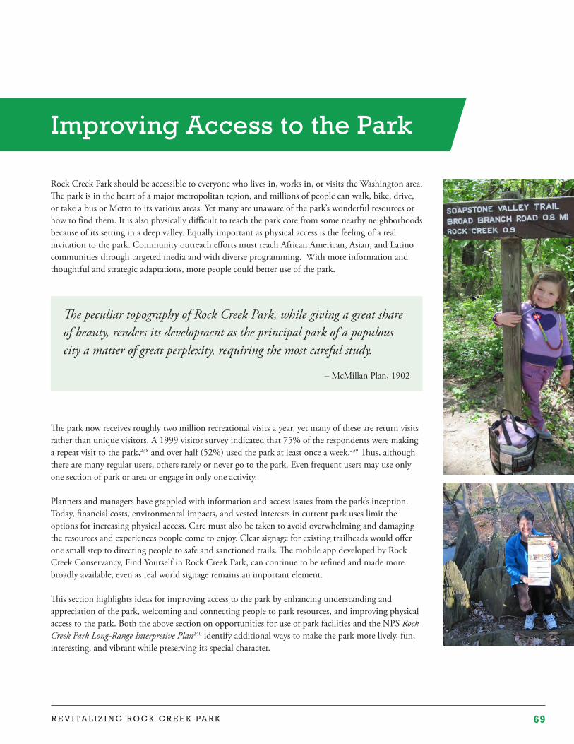
69R E V I T A L I Z I N G R O C K C R E E K PA R K
Rock Creek Park should be accessible to everyone who lives in, works in, or visits the Washington area. The park is in the heart of a major metropolitan region, and millions of people can walk, bike, drive, or take a bus or Metro to its various areas. Yet many are unaware of the park’s wonderful resources or how to find them. It is also physically difficult to reach the park core from some nearby neighborhoods because of its setting in a deep valley. Equally important as physical access is the feeling of a real invitation to the park. Community outreach efforts must reach African American, Asian, and Latino communities through targeted media and with diverse programming. With more information and thoughtful and strategic adaptations, more people could better use of the park.
The park now receives roughly two million recreational visits a year, yet many of these are return visits rather than unique visitors. A 1999 visitor survey indicated that 75% of the respondents were making a repeat visit to the park,238 and over half (52%) used the park at least once a week.239 Thus, although there are many regular users, others rarely or never go to the park. Even frequent users may use only one section of park or area or engage in only one activity.
Planners and managers have grappled with information and access issues from the park’s inception. Today, financial costs, environmental impacts, and vested interests in current park uses limit the options for increasing physical access. Care must also be taken to avoid overwhelming and damaging the resources and experiences people come to enjoy. Clear signage for existing trailheads would offer one small step to directing people to safe and sanctioned trails. The mobile app developed by Rock Creek Conservancy, Find Yourself in Rock Creek Park, can continue to be refined and made more broadly available, even as real world signage remains an important element.
This section highlights ideas for improving access to the park by enhancing understanding and appreciation of the park, welcoming and connecting people to park resources, and improving physical access to the park. Both the above section on opportunities for use of park facilities and the NPS Rock Creek Park Long-Range Interpretive Plan240 identify additional ways to make the park more lively, fun, interesting, and vibrant while preserving its special character.
Improving Access to the Park
The peculiar topography of Rock Creek Park, while giving a great share of beauty, renders its development as the principal park of a populous city a matter of great perplexity, requiring the most careful study.
– McMillan Plan, 1902
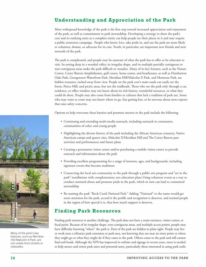
70 I M P R OV I N G A C C E S S T O T H E PA R K
Many of the park’s key features, such as Meridian Hill/Malcolm X Park, are not visible from streets or sidewalks.
Understanding and Appreciation of the Park
More widespread knowledge of the park is the first step toward increased appreciation and enjoyment of the park, as well as commitment to park stewardship. Developing a strategy to show the park’s core and its outlying units as a complete entity can help people see their places in it and may require a public awareness campaign. People who know, love, take pride in, and use the park are more likely to volunteer, donate, or advocate for its care. Youth, in particular, are important new friends and next stewards of the park.
The park is complicated, and people may be unaware of what the park has to offer or be reluctant to visit. Its setting deep in a wooded valley, its irregular shape, and its multiple partially contiguous or non-contiguous areas make the park difficult to visualize. Many of its key features, such as the Nature Center, Carter Barron Amphitheatre, golf course, horse center, and boathouses, as well as Dumbarton Oaks Park, Georgetown Waterfront Park, Meridian Hill/Malcolm X Park, and Montrose Park, are hidden treasures, tucked away from view. People on the park core’s main roads can easily see the forest, Peirce Mill, and picnic areas, but not the trailheads. Those who see the park only through a car, residence, or office window may not know about its rich history, wonderful resources, or what they could do there. People may also come from families or cultures that lack a tradition of park use. Some who may want to come may not know where to go, fear getting lost, or be nervous about news reports that raise safety concerns.
Options to help overcome these barriers and promote interest in the park include the following.
• Continuing and extending multi-media outreach, including outreach to commuters, communities of color, and young people
• Highlighting the diverse history of the park including the African American cemetery, Native American camps and quarry sites, Malcolm X/Meridian Hill and The Carter Barron past activities and performances and future plans
• Creating a permanent visitor center and/or purchasing a mobile visitor center to provide outreach and information about the park
• Providing excellent programming for a range of interests, ages, and backgrounds, including signature events that become traditions
• Connecting the local arts community to the park through a public arts program and “art in the park” installations with complementary arts education plans Using volunteer events as a way to conduct outreach about and promote pride in the park, which in turn can lead to committed stewardship
• Re-naming the park “Rock Creek National Park.” Adding “National” to the name would get more attention for the park, accord it the profile and recognition it deserves, and remind people in the region of how special it is, thus how much support it deserves.
Finding Park Resources
Finding park resources is another challenge. The park does not have a main entrance, visitor center, or focal point. Because of its irregular shape, non-contiguous areas, and multiple access points, people may have difficulty knowing “where” the park is. Parts of the park are hidden in plain sight. People may live or work near a tributary park extension or park area, not knowing they are near an entry point or where they might go or what they might do if they came to the park. Others come to the park and still cannot find trail heads. Although the NPS has improved its website and signage in recent years, more is needed to help attract and orient park users and potential users, particularly those interested in using park trails.
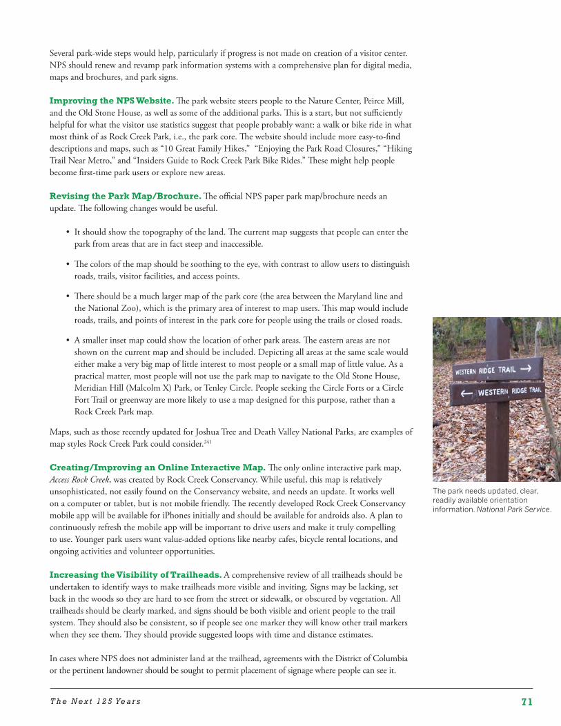
71T h e N e x t 1 2 5 Ye a r s
The park needs updated, clear, readily available orientation information. National Park Service.
Several park-wide steps would help, particularly if progress is not made on creation of a visitor center. NPS should renew and revamp park information systems with a comprehensive plan for digital media, maps and brochures, and park signs.
Improving the NPS Website. The park website steers people to the Nature Center, Peirce Mill, and the Old Stone House, as well as some of the additional parks. This is a start, but not sufficiently helpful for what the visitor use statistics suggest that people probably want: a walk or bike ride in what most think of as Rock Creek Park, i.e., the park core. The website should include more easy-to-find descriptions and maps, such as “10 Great Family Hikes,” “Enjoying the Park Road Closures,” “Hiking Trail Near Metro,” and “Insiders Guide to Rock Creek Park Bike Rides.” These might help people become first-time park users or explore new areas.
Revising the Park Map/Brochure. The official NPS paper park map/brochure needs an update. The following changes would be useful.
• It should show the topography of the land. The current map suggests that people can enter the park from areas that are in fact steep and inaccessible.
• The colors of the map should be soothing to the eye, with contrast to allow users to distinguish roads, trails, visitor facilities, and access points.
• There should be a much larger map of the park core (the area between the Maryland line and the National Zoo), which is the primary area of interest to map users. This map would include roads, trails, and points of interest in the park core for people using the trails or closed roads.
• A smaller inset map could show the location of other park areas. The eastern areas are not shown on the current map and should be included. Depicting all areas at the same scale would either make a very big map of little interest to most people or a small map of little value. As a practical matter, most people will not use the park map to navigate to the Old Stone House, Meridian Hill (Malcolm X) Park, or Tenley Circle. People seeking the Circle Forts or a Circle Fort Trail or greenway are more likely to use a map designed for this purpose, rather than a Rock Creek Park map.
Maps, such as those recently updated for Joshua Tree and Death Valley National Parks, are examples of map styles Rock Creek Park could consider.241
Creating/Improving an Online Interactive Map. The only online interactive park map, Access Rock Creek, was created by Rock Creek Conservancy. While useful, this map is relatively unsophisticated, not easily found on the Conservancy website, and needs an update. It works well on a computer or tablet, but is not mobile friendly. The recently developed Rock Creek Conservancy mobile app will be available for iPhones initially and should be available for androids also. A plan to continuously refresh the mobile app will be important to drive users and make it truly compelling to use. Younger park users want value-added options like nearby cafes, bicycle rental locations, and ongoing activities and volunteer opportunities.
Increasing the Visibility of Trailheads. A comprehensive review of all trailheads should be undertaken to identify ways to make trailheads more visible and inviting. Signs may be lacking, set back in the woods so they are hard to see from the street or sidewalk, or obscured by vegetation. All trailheads should be clearly marked, and signs should be both visible and orient people to the trail system. They should also be consistent, so if people see one marker they will know other trail markers when they see them. They should provide suggested loops with time and distance estimates.
In cases where NPS does not administer land at the trailhead, agreements with the District of Columbia or the pertinent landowner should be sought to permit placement of signage where people can see it.
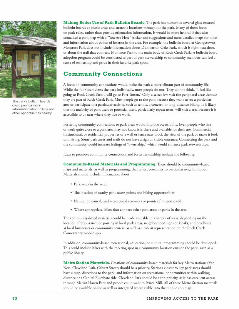
72 I M P R OV I N G A C C E S S T O T H E PA R K
Making Better Use of Park Bulletin Boards. The park has numerous covered glass-encased bulletin boards at picnic areas and strategic locations throughout the park. Many of them focus on park rules, rather than provide orientation information. It would be more helpful if they also contained a park map with a “You Are Here” sticker and suggestions and more detailed maps for hikes and information about points of interest in the area. For example, the bulletin board at Georgetown’s Montrose Park does not include information about Dumbarton Oaks Park, which is right next door, or about the trail that connects Montrose Park to the main body of Rock Creek Park. A bulletin board adoption program could be considered as part of park stewardship so community members can feel a sense of ownership and pride in their favorite park spots.
Community Connections
A focus on community connections would make the park a more vibrant part of community life. While the NPS staff views the park holistically, most people do not. They do not think, “I feel like going to Rock Creek Park. I will go to Fort Totten.” Only a select few visit the peripheral areas because they are part of Rock Creek Park. Most people go to the park because they want to see a particular area or participate in a particular activity, such as tennis, a concert, or long-distance biking. It is likely that the majority of park users or potential users, particularly repeat users, will visit a area because it is accessible to or near where they live or work.
Fostering community connections to park areas would improve accessibility. Even people who live or work quite close to a park area may not know it is there and available for their use. Commercial, institutional, or residential properties or a wall or fence may block the view of the park or make it look uninviting. Some park areas and trails do not have a sign or visible entrance. Connecting the park and the community would increase feelings of “ownership,” which would enhance park stewardships.
Ideas to promote community connections and foster stewardship include the following.
Community-Based Materials and Programming. There should be community-based maps and materials, as well as programming, that reflect proximity to particular neighborhoods. Materials should include information about:
• Park areas in the area;
• The location of nearby park access points and hiking opportunities;
• Natural, historical, and recreational resources or points of interests; and
• Where appropriate, hikes that connect other park areas or parks in the area.
The community-based materials could be made available in a variety of ways, depending on the location. Options include posting in local park areas, neighborhood signs or kiosks, and brochures at local businesses or community centers, as well as a robust representation on the Rock Creek Conservancy mobile app.
In addition, community-based recreational, education, or cultural programming should be developed. This could include hikes with the meeting spot in a community location outside the park, such as a public library.
Metro Station Materials. Creations of community-based materials for key Metro stations (Van Ness, Cleveland Park, Calvert Street) should be a priority. Stations closest to key park areas should have a map, directions to the park, and information on recreational opportunities within walking distance or a Capital Bikeshare ride. Cleveland Park should be a top priority, as it has excellent access through Melvin Hazen Park and people could walk to Peirce Mill. All of these Metro Station materials should be available online as well as integrated where viable into the mobile app map.
The park’s bulletin boards could provide more information about hiking and other opportunities nearby.
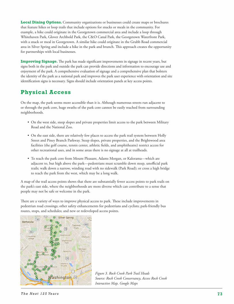
73T h e N e x t 1 2 5 Ye a r s
Local Dining Options. Community organizations or businesses could create maps or brochures that feature hikes or loop trails that include options for snacks or meals in the community. For example, a hike could originate in the Georgetown commercial area and include a loop through Whitehaven Park, Glover Archbold Park, the C&O Canal Park, the Georgetown Waterfront Park, with a snack or meal in Georgetown. A similar hike could originate in the Grubb Road commercial area in Silver Spring and include a hike in the park and brunch. This approach creates the opportunity for partnerships with local businesses.
Improving Signage. The park has made significant improvements in signage in recent years, but signs both in the park and outside the park can provide directions and information to encourage use and enjoyment of the park. A comprehensive evaluation of signage and a comprehensive plan that bolsters the identity of the park as a national park and improves the park user experience with orientation and site identification signs is necessary. Signs should include orientation panels at key access points.
Physical Access
On the map, the park seems more accessible than it is. Although numerous streets run adjacent to or through the park core, huge swaths of the park core cannot be easily reached from surrounding neighborhoods.
• On the west side, steep slopes and private properties limit access to the park between Military Road and the National Zoo.
• On the east side, there are relatively few places to access the park trail system between Holly Street and Piney Branch Parkway. Steep slopes, private properties, and the Brightwood area facilities (the golf course, tennis center, athletic fields, and amphitheatre) restrict access for other recreational uses, and in some areas there is no signage at all at trailheads.
• To reach the park core from Mount Pleasant, Adams Morgan, or Kalorama—which are adjacent to, but high above the park—pedestrians must scramble down steep, unofficial park trails; walk down a narrow, winding road with no sidewalk (Park Road); or cross a high bridge to reach the park from the west, which may be a long walk.
A map of the trail access points shows that there are substantially fewer access points to park trails on the park’s east side, where the neighborhoods are more diverse which can contribute to a sense that people may not be safe or welcome in the park.
There are a variety of ways to improve physical access to park. These include improvements in pedestrian road crossings; other safety enhancements for pedestrians and cyclists; park-friendly bus routes, stops, and schedules; and new or redeveloped access points.
Figure 3. Rock Creek Park Trail HeadsSource: Rock Creek Conservancy, Access Rock Creek Interactive Map, Google Maps
74 I M P R OV I N G A C C E S S T O T H E PA R K
Ideas to increase physical access include the following. Porter-Klingle Interchange. The District’s plans to replace the damaged section of Klingle Road with a multi-use trail did not include changes to the half cloverleaf at the intersection of Porter Street, Klingle Road, and Beach Drive. A careful redesign of the traffic configuration in this location could enhance accessibility to the park for cars, cyclists, and pedestrians from both sides of the park and make better environmental or recreational use of land.
Walter Reed. Redevelopment of the Walter Reed creates an important opportunity to promote park accessibility from neighborhoods east of the park.
Connecticut Avenue at Klingle. Looking down into Klingle Valley from the high Connecticut Avenue bridge is a magical sight. People walking over the bridge can see the leafy valley far below and yearn to be there. It would be wonderful if there were a creative way to let people walk down to the park from the bridge. There are relatively few Metro stops near the park, and this would be provide an easy access point to the park core from the Cleveland Park Metro station.
Adams Morgan. Options to create an official pedestrian access point from Adams Morgan should be explored.
Golf Course Redevelopment. If the golf course were redeveloped or partially redeveloped, as discussed above, this could increase recreational options for the east side of the park.
Any increase in physical access to the park may harm the resources that people come to enjoy. The words of the Olmsted Brothers still hold true today.
The dominant consideration, never to be subordinated to any other purpose in dealing with Rock Creek Park, is the permanent preservation of its wonderful natural beauty and the making of that beauty accessible to the people without spoiling the scenery in the process.
– Olmsted Brothers, Report on Rock Creek Park, 1918
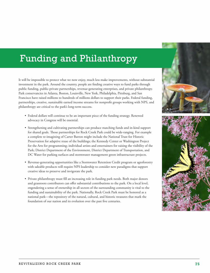
75R E V I T A L I Z I N G R O C K C R E E K PA R K
It will be impossible to protect what we now enjoy, much less make improvements, without substantial investment in the park. Around the country, people are finding creative ways to fund parks through public funding, public-private partnerships, revenue-generating enterprises, and private philanthropy. Park conservancies in Atlanta, Boston, Louisville, New York, Philadelphia, Pittsburg, and San Francisco have raised millions to hundreds of millions dollars to support their parks. Federal funding, partnerships, creative, sustainable earned income streams for nonprofit groups working with NPS, and philanthropy are critical to the park’s long-term success.
• Federal dollars will continue to be an important piece of the funding strategy. Renewed advocacy in Congress will be essential.
• Strengthening and cultivating partnerships can produce matching funds and in-kind support for shared goals. Those partnerships for Rock Creek Park could be wide-ranging. For example a complete re-imagining of Carter Barron might include the National Trust for Historic Preservation for adaptive reuse of the buildings; the Kennedy Center or Washington Project for the Arts for programming; individual artists and entertainers for raising the visibility of the Park; District Department of the Environment, District Department of Transportation, and DC Water for parking surfaces and stormwater management green infrastructure projects.
• Revenue-generating opportunities like a Stormwater Retention Credit program or agroforestry with saleable products will require NPS leadership to consider new paradigms that support creative ideas to preserve and invigorate the park.
• Private philanthropy must fill an increasing role in funding park needs. Both major donors and grassroots contributors can offer substantial contributions to the park. On a local level, engendering a sense of ownership in all sectors of the surrounding community is vital to the funding and sustainability of the park. Nationally, Rock Creek Park must be honored as a national park—the repository of the natural, cultural, and historic treasures that mark the foundation of our nation and its evolution over the past five centuries.
Funding and Philanthropy
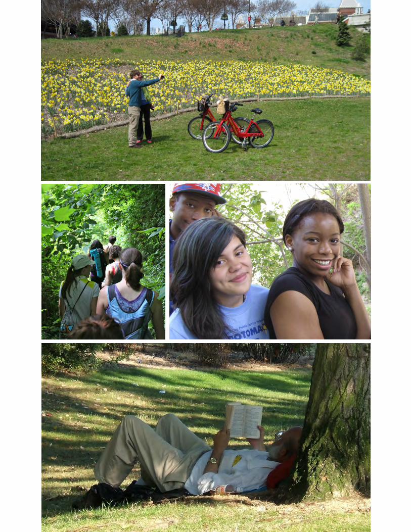
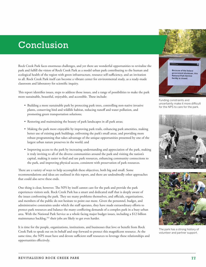
77R E V I T A L I Z I N G R O C K C R E E K PA R K
The park has a strong history of volunteer and partner support.
Funding constraints and uncertainty make it more difficult for the NPS to care for the park.
Conclusion
Rock Creek Park faces enormous challenges, and yet there are wonderful opportunities to revitalize the park and fulfill the vision of Rock Creek Park as a model urban park contributing to the human and ecological health of the region with green infrastructure, resource self-sufficiency, and an invitation to all. Rock Creek Park itself can become a vibrant center for environmental study, as a ready-made classroom and laboratory for scientific inquiry.
This report identifies issues, steps to address those issues, and a range of possibilities to make the park more sustainable, beautiful, enjoyable, and accessible. These include:
• Building a more sustainable park by protecting park trees, controlling non-native invasive plants, conserving bird and wildlife habitat, reducing runoff and water pollution, and promoting green transportation solutions;
• Restoring and maintaining the beauty of park landscapes in all park areas;
• Making the park more enjoyable by improving park trails, enhancing park amenities, making better use of existing park buildings, enlivening the park’s small areas, and providing more robust programming that takes advantage of the unique opportunities presented by one of the largest urban nature preserves in the world; and
• Improving access to the park by increasing understanding and appreciation of the park, making it truly inviting to all of the diverse communities around the park and visiting the nation’s capital, making it easier to find and use park resources, enhancing community connections to the park, and improving physical access, consistent with preservation of park resources.
There are a variety of ways to help accomplish these objectives, both big and small. Some recommendations and ideas are outlined in this report, and there are undoubtedly other approaches that could also serve these ends.
One thing is clear, however. The NPS by itself cannot care for the park and provide the park experiences visitors seek. Rock Creek Park has a smart and dedicated staff that is deeply aware of the issues confronting the park. They see many problems themselves, and officials, organizations, and members of the public do not hesitate to point out more. Given the personnel, budget, and administrative constraints under which the staff operates, they have made extraordinary efforts to protect park resources and balance the many conflicting demands of a complex park in a busy urban area. With the National Park Service as a whole facing major budget issues, including a $12 billion maintenance backlog,242 their jobs are likely to get even harder.
It is time for the people, organizations, institutions, and businesses that love or benefit from Rock Creek Park to speak out on its behalf and step forward to protect this magnificent resource. At the same time, the NPS must have and devote sufficient staff resources to leverage these relationships and opportunities effectively.
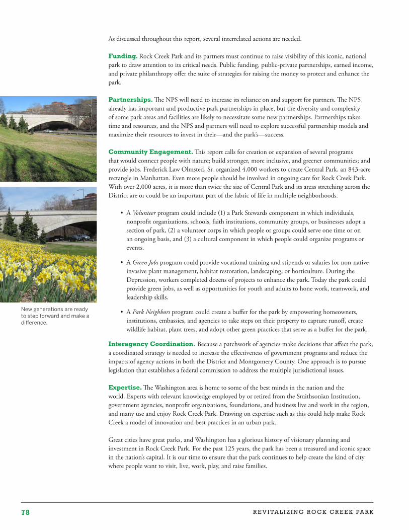
78 R E V I TA L I Z I N G R O C K C R E E K PA R K
New generations are ready to step forward and make a difference.
As discussed throughout this report, several interrelated actions are needed.
Funding. Rock Creek Park and its partners must continue to raise visibility of this iconic, national park to draw attention to its critical needs. Public funding, public-private partnerships, earned income, and private philanthropy offer the suite of strategies for raising the money to protect and enhance the park.
Partnerships. The NPS will need to increase its reliance on and support for partners. The NPS already has important and productive park partnerships in place, but the diversity and complexity of some park areas and facilities are likely to necessitate some new partnerships. Partnerships takes time and resources, and the NPS and partners will need to explore successful partnership models and maximize their resources to invest in their—and the park’s—success.
Community Engagement. This report calls for creation or expansion of several programsthat would connect people with nature; build stronger, more inclusive, and greener communities; and provide jobs. Frederick Law Olmsted, Sr. organized 4,000 workers to create Central Park, an 843-acre rectangle in Manhattan. Even more people should be involved in ongoing care for Rock Creek Park. With over 2,000 acres, it is more than twice the size of Central Park and its areas stretching across the District are or could be an important part of the fabric of life in multiple neighborhoods.
• A Volunteer program could include (1) a Park Stewards component in which individuals, nonprofit organizations, schools, faith institutions, community groups, or businesses adopt a section of park, (2) a volunteer corps in which people or groups could serve one time or on an ongoing basis, and (3) a cultural component in which people could organize programs or events.
• A Green Jobs program could provide vocational training and stipends or salaries for non-native invasive plant management, habitat restoration, landscaping, or horticulture. During the Depression, workers completed dozens of projects to enhance the park. Today the park could provide green jobs, as well as opportunities for youth and adults to hone work, teamwork, and leadership skills.
• A Park Neighbors program could create a buffer for the park by empowering homeowners, institutions, embassies, and agencies to take steps on their property to capture runoff, create wildlife habitat, plant trees, and adopt other green practices that serve as a buffer for the park.
Interagency Coordination. Because a patchwork of agencies make decisions that affect the park, a coordinated strategy is needed to increase the effectiveness of government programs and reduce the impacts of agency actions in both the District and Montgomery County. One approach is to pursue legislation that establishes a federal commission to address the multiple jurisdictional issues. Expertise. The Washington area is home to some of the best minds in the nation and the world. Experts with relevant knowledge employed by or retired from the Smithsonian Institution, government agencies, nonprofit organizations, foundations, and business live and work in the region, and many use and enjoy Rock Creek Park. Drawing on expertise such as this could help make Rock Creek a model of innovation and best practices in an urban park.
Great cities have great parks, and Washington has a glorious history of visionary planning and investment in Rock Creek Park. For the past 125 years, the park has been a treasured and iconic space in the nation’s capital. It is our time to ensure that the park continues to help create the kind of city where people want to visit, live, work, play, and raise families.
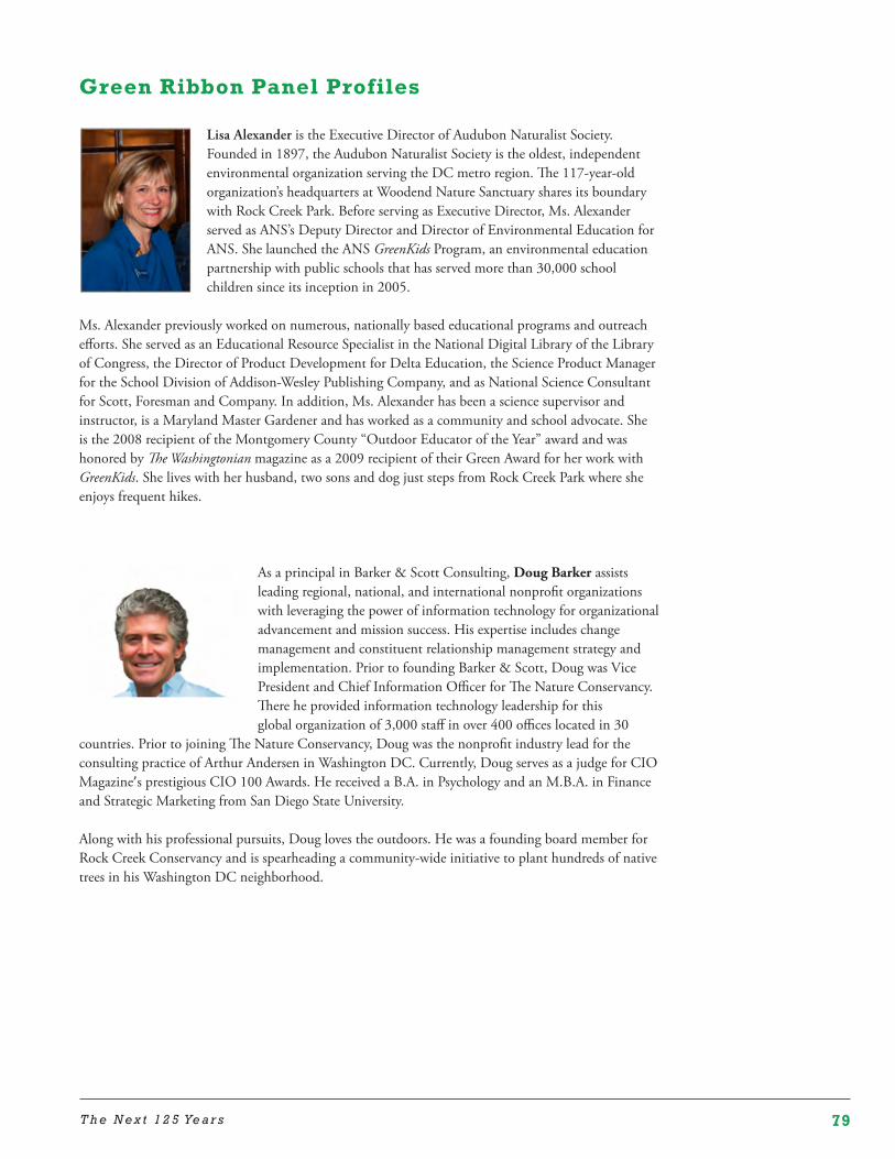
79T h e N e x t 1 2 5 Ye a r s
Green Ribbon Panel Profiles
Lisa Alexander is the Executive Director of Audubon Naturalist Society. Founded in 1897, the Audubon Naturalist Society is the oldest, independent environmental organization serving the DC metro region. The 117-year-old organization’s headquarters at Woodend Nature Sanctuary shares its boundary with Rock Creek Park. Before serving as Executive Director, Ms. Alexander served as ANS’s Deputy Director and Director of Environmental Education for ANS. She launched the ANS GreenKids Program, an environmental education partnership with public schools that has served more than 30,000 school children since its inception in 2005.
Ms. Alexander previously worked on numerous, nationally based educational programs and outreach efforts. She served as an Educational Resource Specialist in the National Digital Library of the Library of Congress, the Director of Product Development for Delta Education, the Science Product Manager for the School Division of Addison-Wesley Publishing Company, and as National Science Consultant for Scott, Foresman and Company. In addition, Ms. Alexander has been a science supervisor and instructor, is a Maryland Master Gardener and has worked as a community and school advocate. She is the 2008 recipient of the Montgomery County “Outdoor Educator of the Year” award and was honored by The Washingtonian magazine as a 2009 recipient of their Green Award for her work with GreenKids. She lives with her husband, two sons and dog just steps from Rock Creek Park where she enjoys frequent hikes.
As a principal in Barker & Scott Consulting, Doug Barker assists leading regional, national, and international nonprofit organizations with leveraging the power of information technology for organizational advancement and mission success. His expertise includes change management and constituent relationship management strategy and implementation. Prior to founding Barker & Scott, Doug was Vice President and Chief Information Officer for The Nature Conservancy. There he provided information technology leadership for this global organization of 3,000 staff in over 400 offices located in 30
countries. Prior to joining The Nature Conservancy, Doug was the nonprofit industry lead for the consulting practice of Arthur Andersen in Washington DC. Currently, Doug serves as a judge for CIO Magazine’s prestigious CIO 100 Awards. He received a B.A. in Psychology and an M.B.A. in Finance and Strategic Marketing from San Diego State University.
Along with his professional pursuits, Doug loves the outdoors. He was a founding board member for Rock Creek Conservancy and is spearheading a community-wide initiative to plant hundreds of native trees in his Washington DC neighborhood.
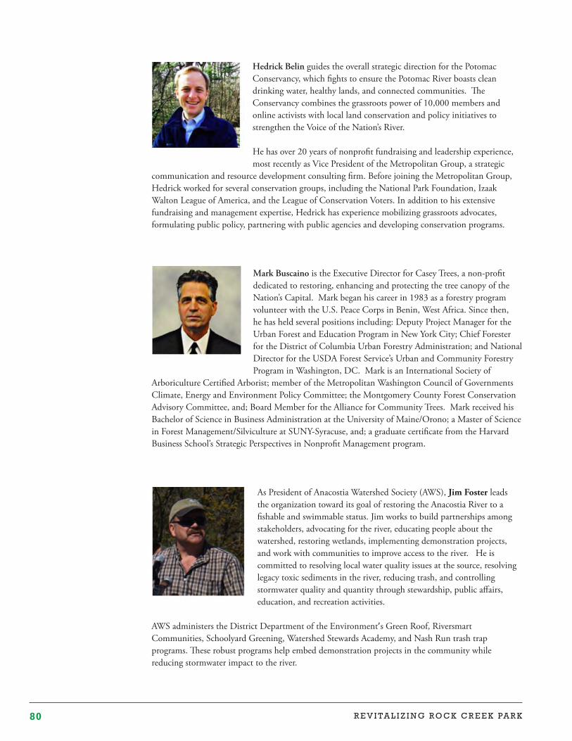
80 R E V I TA L I Z I N G R O C K C R E E K PA R K
Hedrick Belin guides the overall strategic direction for the Potomac Conservancy, which fights to ensure the Potomac River boasts clean drinking water, healthy lands, and connected communities. The Conservancy combines the grassroots power of 10,000 members and online activists with local land conservation and policy initiatives to strengthen the Voice of the Nation’s River.
He has over 20 years of nonprofit fundraising and leadership experience, most recently as Vice President of the Metropolitan Group, a strategic
communication and resource development consulting firm. Before joining the Metropolitan Group, Hedrick worked for several conservation groups, including the National Park Foundation, Izaak Walton League of America, and the League of Conservation Voters. In addition to his extensive fundraising and management expertise, Hedrick has experience mobilizing grassroots advocates, formulating public policy, partnering with public agencies and developing conservation programs.
Mark Buscaino is the Executive Director for Casey Trees, a non-profit dedicated to restoring, enhancing and protecting the tree canopy of the Nation’s Capital. Mark began his career in 1983 as a forestry program volunteer with the U.S. Peace Corps in Benin, West Africa. Since then, he has held several positions including: Deputy Project Manager for the Urban Forest and Education Program in New York City; Chief Forester for the District of Columbia Urban Forestry Administration; and National Director for the USDA Forest Service’s Urban and Community Forestry Program in Washington, DC. Mark is an International Society of
Arboriculture Certified Arborist; member of the Metropolitan Washington Council of Governments Climate, Energy and Environment Policy Committee; the Montgomery County Forest Conservation Advisory Committee, and; Board Member for the Alliance for Community Trees. Mark received his Bachelor of Science in Business Administration at the University of Maine/Orono; a Master of Science in Forest Management/Silviculture at SUNY-Syracuse, and; a graduate certificate from the Harvard Business School’s Strategic Perspectives in Nonprofit Management program.
As President of Anacostia Watershed Society (AWS), Jim Foster leads the organization toward its goal of restoring the Anacostia River to a fishable and swimmable status. Jim works to build partnerships among stakeholders, advocating for the river, educating people about the watershed, restoring wetlands, implementing demonstration projects, and work with communities to improve access to the river. He is committed to resolving local water quality issues at the source, resolving legacy toxic sediments in the river, reducing trash, and controlling stormwater quality and quantity through stewardship, public affairs, education, and recreation activities.
AWS administers the District Department of the Environment’s Green Roof, Riversmart Communities, Schoolyard Greening, Watershed Stewards Academy, and Nash Run trash trap programs. These robust programs help embed demonstration projects in the community while reducing stormwater impact to the river.

81T h e N e x t 1 2 5 Ye a r s
After serving in the first Peace Corps group in Tanganyika, Denis Galvin joined the National Park Service at Sequoia National Park in 1963 as a Civil Engineer. In a 38 year career he served in parks, regional offices, training centers, and service centers and concluded his career with 16years in the Washington office. For nine of those years he was Deputy Director, serving in the Reagan, Clinton and Bush administrations. As the highest ranking career official he represented the National Park Service in over 200 Congressional hearings. In 1991 he was awarded the Pugsley medal for outstanding service to parks and conservation. In 2001 he was given the Presidential Rank Award
for exceptional achievement in the career senior executive service. Since retiring in 2002 Mr. Galvin has continued in the conservation field. He served as a member of the Second Century Commission co chaired by Senators Howard Baker and Bennett Johnson. He was a consultant on the Ken Burns’ film ‘The National Parks: America’s Best Idea’. In 2011 he was elected a Fellow of the National Academy of Public Administrators. In 2013 he received the George Melendez Wright award for his, ‘distinguished lifetime record...on behalf of America’s national parks’. Currently he serves on the Board of the National Parks Conservation Association and is an Advisor to the Coalition of National Park Service retirees.
Rachel Goslins accepted President Obama’s appointed as executive director of the President’s Committee on the Arts and the Humanities in 2009. Prior to her appointment, she worked in the fields of documentary film, arts administration, and copyright law.
Her award-winning feature films include ’Bama Girl, a documentary following a black woman running for homecoming queen at the University of Alabama, and Besa: The Promise, a film about Albanian Muslims who saved Jews during WWII. Rachel’s work also includes television productions for PBS, National Geographic, Discovery, and the History Channel. She served as the
programming director for the Impact Film Festival at the 2008 Democratic and Republican National Conventions, and as the director of the Independent Digital Distribution Lab, a joint PBS/ITVS project focused on distributing independent films online. Prior to her film career, Rachel was an international copyright attorney in the office of Policy and International Affairs in the U.S. Copyright Office and a litigator for the law firm of Gibson Dunn & Crutcher. In 2012 she was awarded a Henry Crown Fellowship at the Aspen Institute.
George Hawkins serves as General Manager of the District of Columbia Water and Sewer Authority (DC Water). On his arrival in 2009, Mr. Hawkins launched an ambitious agenda to transform DC Water into a customer-oriented enterprise that is driving innovation and delivering improved value to its ratepayers.
The core goal is to improve aging infrastructure while complying with stringent regulatory requirements. DC Water is implementing the $2.6 billion Clean Rivers Project to nearly eliminate overflows of sewage and stormwater to the Anacostia and Potomac Rivers and Rock Creek. DC Water is also nearing completion of
a $470 million waste-to-energy program to help manage solids being removed from reclaimed water while generating 13 megawatts of green power. DC Water is also driving industry-leading efforts in customer engagement, including a vibrant social media presence, in science and engineering research and
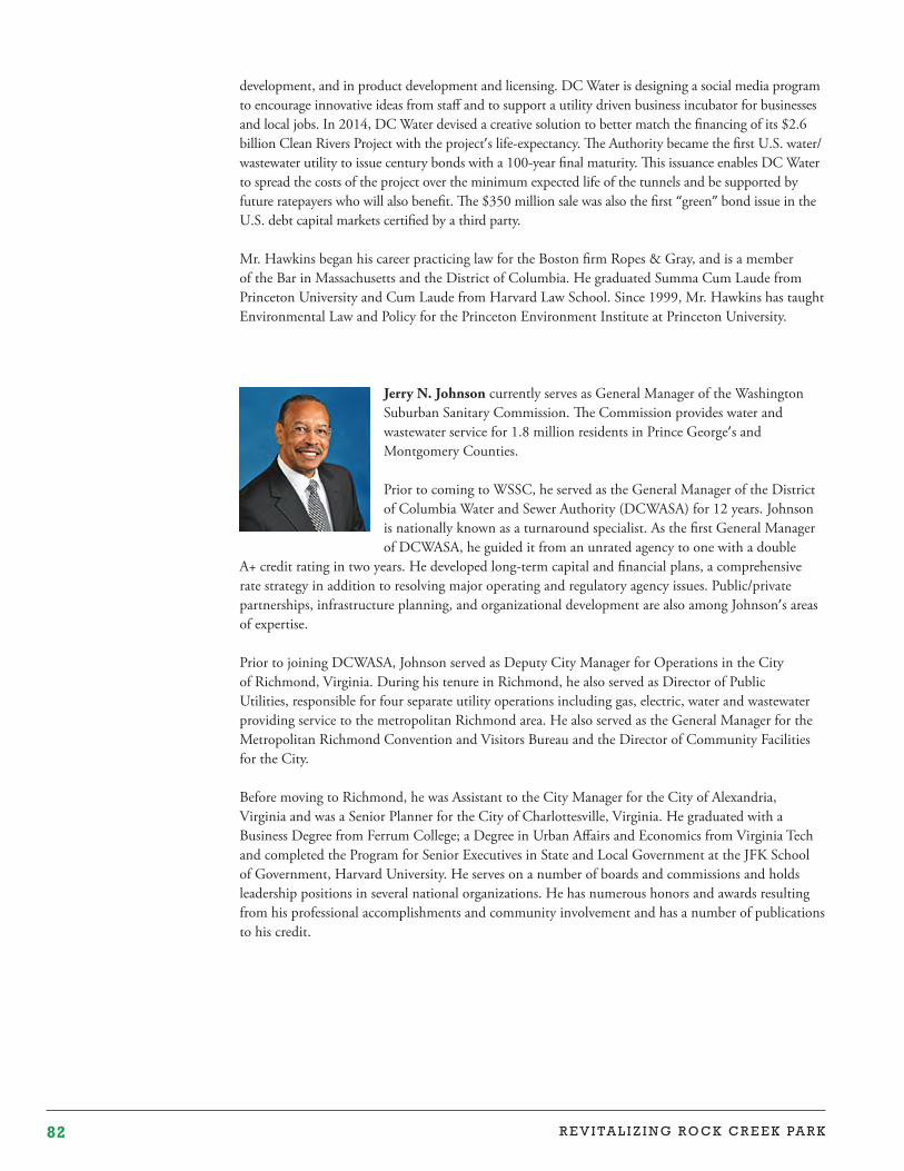
82 R E V I TA L I Z I N G R O C K C R E E K PA R K
development, and in product development and licensing. DC Water is designing a social media program to encourage innovative ideas from staff and to support a utility driven business incubator for businesses and local jobs. In 2014, DC Water devised a creative solution to better match the financing of its $2.6 billion Clean Rivers Project with the project’s life-expectancy. The Authority became the first U.S. water/ wastewater utility to issue century bonds with a 100-year final maturity. This issuance enables DC Water to spread the costs of the project over the minimum expected life of the tunnels and be supported by future ratepayers who will also benefit. The $350 million sale was also the first “green” bond issue in the U.S. debt capital markets certified by a third party.
Mr. Hawkins began his career practicing law for the Boston firm Ropes & Gray, and is a member of the Bar in Massachusetts and the District of Columbia. He graduated Summa Cum Laude from Princeton University and Cum Laude from Harvard Law School. Since 1999, Mr. Hawkins has taught Environmental Law and Policy for the Princeton Environment Institute at Princeton University.
Jerry N. Johnson currently serves as General Manager of the Washington Suburban Sanitary Commission. The Commission provides water and wastewater service for 1.8 million residents in Prince George’s and Montgomery Counties.
Prior to coming to WSSC, he served as the General Manager of the District of Columbia Water and Sewer Authority (DCWASA) for 12 years. Johnson is nationally known as a turnaround specialist. As the first General Manager of DCWASA, he guided it from an unrated agency to one with a double
A+ credit rating in two years. He developed long-term capital and financial plans, a comprehensive rate strategy in addition to resolving major operating and regulatory agency issues. Public/private partnerships, infrastructure planning, and organizational development are also among Johnson’s areas of expertise.
Prior to joining DCWASA, Johnson served as Deputy City Manager for Operations in the City of Richmond, Virginia. During his tenure in Richmond, he also served as Director of Public Utilities, responsible for four separate utility operations including gas, electric, water and wastewater providing service to the metropolitan Richmond area. He also served as the General Manager for the Metropolitan Richmond Convention and Visitors Bureau and the Director of Community Facilities for the City.
Before moving to Richmond, he was Assistant to the City Manager for the City of Alexandria, Virginia and was a Senior Planner for the City of Charlottesville, Virginia. He graduated with a Business Degree from Ferrum College; a Degree in Urban Affairs and Economics from Virginia Tech and completed the Program for Senior Executives in State and Local Government at the JFK School of Government, Harvard University. He serves on a number of boards and commissions and holds leadership positions in several national organizations. He has numerous honors and awards resulting from his professional accomplishments and community involvement and has a number of publications to his credit.

83T h e N e x t 1 2 5 Ye a r s
Lori Kaplan is the President & CEO of the Latin American Youth Center (LAYC). She has lead LAYC to its national prominence as an award-winning network of youth programs in Washington DC since 1987. Under Kaplan’s direction, LAYC has helped guide thousands of low-income youth to better opportunity, while creating pioneering organizations and schools. Kaplan serves on the board of DC Alliance for Youth Advocates, and Youth Radio and Youth Media International, and she has served on the board of Leadership Washington, the
Nonprofit Roundtable, and served as an advisor to the Clinton Global Initiative conference and as a panelist on the Reconnecting Youth work group. Kaplan has received numerous awards including Washingtonian of the Year in 1997, the Lewis Hine Award for her work on child labor issues, and most recently the Community Champion Award from the Hispanic Heritage Foundation and being named one of Washington’s 50 influencers by the Washington Informer Charities.
Greg Kats has played substantial roles in developing the energy efficiency and green building industries, and is a long-time thought leader, innovator and investor in the transition to a low carbon economy. He is President of Capital E which works with cities, corporations and financial institutions to design, scale and implement clean energy and low carbon strategies. Capital E invests in early stage cleantech/green firms, and Greg is a partner in Cleanfeet, funding innovative green energy and agricultural projects.
Greg previously served as Managing Director of Good Energies, a multi-billion dollar global clean energy PE/VC fund, where he led investments in smart grid, energy efficiency, green materials and green buildings. He served for 5 years as the Director of Financing for Energy Efficiency and Renewable Energy at the US Department of Energy. Greg was the Founding Chairman of IPMVP and built it into the international energy and water efficiency design and verification standard for >$50 billion in building efficiency upgrades. He recently helped design the World Bank’s large new green building financing program. Greg is a founder of both the American Council on Renewable Energy (ACORE) and the country’s first green bank. In 2011 he was the first recipient of the US Green Building Council’s Lifetime Achievement Award.
Greg Chairs the congressionally established board guiding the greening of 430,000 federal buildings, serves on the Mayor’s Green Ribbon Committee guiding the greening of the District of Columbia, and served on a National Academy of Sciences board on strengthening US global competitiveness. He earned an MBA from Stanford University and a BA from UNC as a Morehead Scholar, and is the author of Greening Our Built World. Greg serves on a half dozen boards and regularly testifies on clean energy/green/financing issues. A solar PV system powers his family DC home and an electric hybrid car.
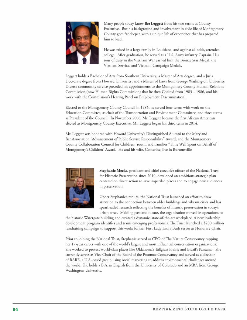
84 R E V I TA L I Z I N G R O C K C R E E K PA R K
Many people today know Ike Leggett from his two terms as County Executive. But his background and involvement in civic life of Montgomery County goes far deeper, with a unique life of experience that has prepared him to lead.
He was raised in a large family in Louisiana, and against all odds, attended college. After graduation, he served as a U.S. Army infantry Captain. His tour of duty in the Vietnam War earned him the Bronze Star Medal, the Vietnam Service, and Vietnam Campaign Medals.
Leggett holds a Bachelor of Arts from Southern University; a Master of Arts degree, and a Juris Doctorate degree from Howard University; and a Master of Laws from George Washington University. Diverse community service preceded his appointments to the Montgomery County Human Relations Commission (now Human Rights Commission) that he then Chaired from 1983 – 1986, and his work with the Commission’s Hearing Panel on Employment Discrimination.
Elected to the Montgomery County Council in 1986, he served four terms with work on the Education Committee, as chair of the Transportation and Environment Committee, and three terms as President of the Council. In November 2006, Mr. Leggett became the first African American elected as Montgomery County Executive. Mr. Leggett began his third term in 2014.
Mr. Leggett was honored with Howard University’s Distinguished Alumni to the Maryland Bar Association “Advancement of Public Service Responsibility” Award, and the Montgomery County Collaboration Council for Children, Youth, and Families “Time Well Spent on Behalf of Montgomery’s Children” Award. He and his wife, Catherine, live in Burtonsville
Stephanie Meeks, president and chief executive officer of the National Trust for Historic Preservation since 2010, developed an ambitious strategic plan centered on direct action to save imperiled places and to engage new audiences in preservation.
Under Stephanie’s tenure, the National Trust launched an effort to draw attention to the connection between older buildings and vibrant cities and has spearheaded research reflecting the benefits of historic preservation in today’s urban areas. Melding past and future, the organization moved its operations to
the historic Watergate building and created a dynamic, state-of-the-art workplace. A new leadership development program identifies and trains emerging professionals. The Trust launched a $200 million fundraising campaign to support this work; former First Lady Laura Bush serves as Honorary Chair.
Prior to joining the National Trust, Stephanie served as CEO of The Nature Conservancy capping her 17-year career with one of the world’s largest and most influential conservation organizations. She worked to protect world-class places like Oklahoma’s Tallgrass Prairie and Brazil’s Pantanal. She currently serves as Vice Chair of the Board of the Potomac Conservancy and served as a director of RARE, a U.S.-based group using social marketing to address environmental challenges around the world. She holds a B.A. in English from the University of Colorado and an MBA from George Washington University.

85T h e N e x t 1 2 5 Ye a r s
Michelle Moore, CEO of Groundswell, is a social enterprise entrepreneur and former White House official who helped build the global green building movement as a senior executive at the U.S. Green Building Council. McGraw-Hill’s GreenSource magazine called Michelle a “relentless agent for change.” Michelle has developed and launched new global climate programs for the Clinton Foundation, created multi-billion dollar public-private partnerships for the Obama Administration, and cut red tape and bureaucracy to get legacy infrastructure projects built. Michelle is a Track Advisor for Clinton Global Initiative on city and state infrastructure, a Senior Fellow at the Council on Competitiveness, and serves on the Board of Directors of the
Smithsonian Science Education Center. Michelle holds a Bachelor of Arts from Emory University and Master of Science in Foreign Service from Georgetown University.
Congresswoman Eleanor Holmes Norton, now in her twelfth term as the Congresswoman for the District of Columbia, came to Congress as a national figure who had been a civil rights and feminist leader, tenured professor of law, and board member at three Fortune 500 companies. Named one of the 100 most important American women in Washington, the Congresswoman’s work for congressional voting representation and for full democracy for the people of the D.C. continues her lifelong struggle for universal human and civil rights.
Congresswoman Norton’s accomplishments for her district include establishing economic benefits like a $10,000 per year credit for all D.C. high
school graduates to attend any U.S. college or university; a $5,000 D.C. homebuyer tax credit which increased home ownership and helped stabilize the city’s population; and D.C. business tax incentives.
Congresswoman Norton worked successfully to relocate two U.S. Department headquarters to D.C.; to develop the 55-acre Southeast Federal Center; to bring 6,000 jobs to the Washington Navy Yard; and to build a new Metro station at New York Avenue helping revitalize the NOMA area.
A full-time law professor before being elected, the Congresswoman is a tenured professor of law at Georgetown University. After receiving her bachelor’s degree from Antioch College in Ohio, she simultaneously earned her law degree and a master’s degree in American Studies from Yale University.
Executive Director of the U.S. Botanic Garden (USBG) Dr. Ari Novy promotes the cultural, economic, therapeutic, and ecological importance of plants to the well being of humankind. He oversees a staff of 65 that stewards USBG plant collections and facilitates visitor services and education. Dr. Novy champions innovative partnerships like the highly regarded Landscape for Life and Sustainable SITES programs that seek to make plant science relevant and accessible to everyone, and a Kennedy Center program to develop botanically-themed educational theater for young audiences.
Dr. Novy is a plant biologist who worked as an estate gardener in Italy, researched sustainable agriculture in the Philippines, and served as an environmental consultant in the United States. In 2006, Dr. Novy began research in areas including plant population genetics, invasive species, beekeeping management, and agricultural economics at Rutgers University where he garnered several awards for excellence in research and teaching. He joined the USBG Staff in 2012.
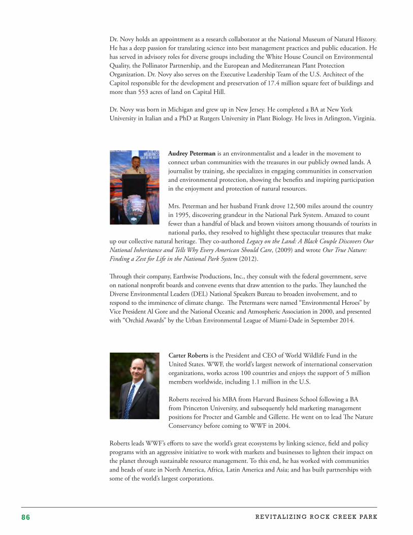
86 R E V I TA L I Z I N G R O C K C R E E K PA R K
Dr. Novy holds an appointment as a research collaborator at the National Museum of Natural History. He has a deep passion for translating science into best management practices and public education. He has served in advisory roles for diverse groups including the White House Council on Environmental Quality, the Pollinator Partnership, and the European and Mediterranean Plant Protection Organization. Dr. Novy also serves on the Executive Leadership Team of the U.S. Architect of the Capitol responsible for the development and preservation of 17.4 million square feet of buildings and more than 553 acres of land on Capital Hill.
Dr. Novy was born in Michigan and grew up in New Jersey. He completed a BA at New York University in Italian and a PhD at Rutgers University in Plant Biology. He lives in Arlington, Virginia.
Audrey Peterman is an environmentalist and a leader in the movement to connect urban communities with the treasures in our publicly owned lands. A journalist by training, she specializes in engaging communities in conservation and environmental protection, showing the benefits and inspiring participation in the enjoyment and protection of natural resources.
Mrs. Peterman and her husband Frank drove 12,500 miles around the country in 1995, discovering grandeur in the National Park System. Amazed to count fewer than a handful of black and brown visitors among thousands of tourists in national parks, they resolved to highlight these spectacular treasures that make
up our collective natural heritage. They co-authored Legacy on the Land: A Black Couple Discovers Our National Inheritance and Tells Why Every American Should Care, (2009) and wrote Our True Nature: Finding a Zest for Life in the National Park System (2012).
Through their company, Earthwise Productions, Inc., they consult with the federal government, serve on national nonprofit boards and convene events that draw attention to the parks. They launched the Diverse Environmental Leaders (DEL) National Speakers Bureau to broaden involvement, and to respond to the imminence of climate change. The Petermans were named “Environmental Heroes” by Vice President Al Gore and the National Oceanic and Atmospheric Association in 2000, and presented with “Orchid Awards” by the Urban Environmental League of Miami-Dade in September 2014.
Carter Roberts is the President and CEO of World Wildlife Fund in the United States. WWF, the world’s largest network of international conservation organizations, works across 100 countries and enjoys the support of 5 million members worldwide, including 1.1 million in the U.S.
Roberts received his MBA from Harvard Business School following a BA from Princeton University, and subsequently held marketing management positions for Procter and Gamble and Gillette. He went on to lead The Nature Conservancy before coming to WWF in 2004.
Roberts leads WWF’s efforts to save the world’s great ecosystems by linking science, field and policy programs with an aggressive initiative to work with markets and businesses to lighten their impact on the planet through sustainable resource management. To this end, he has worked with communities and heads of state in North America, Africa, Latin America and Asia; and has built partnerships with some of the world’s largest corporations.
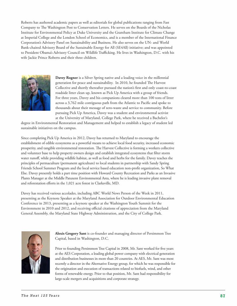
87T h e N e x t 1 2 5 Ye a r s
Roberts has authored academic papers as well as editorials for global publications ranging from Fast Company to The Washington Post to Conservation Letters. He serves on the Boards of the Nicholas Institute for Environmental Policy at Duke University and the Grantham Institute for Climate Change at Imperial College and the London School of Economics, and is a member of the International Finance Corporation’s Advisory Panel on Sustainability and Business. He also serves on the UN- and World Bank-chaired Advisory Board of the Sustainable Energy for All (SE4All) initiative; and was appointed to President Obama’s Advisory Council on Wildlife Trafficking. He lives in Washington, D.C. with his wife Jackie Prince Roberts and their three children.
Davey Rogner is a Silver Spring native and a leading voice in the millennial generation for peace and sustainability. In 2010, he founded The Harvest Collective and shortly thereafter pursued the nation’s first and only coast-to-coast roadside litter clean up, known as Pick Up America with a group of friends. For three years, Davey and his companions cleared more than 100 tons of litter across a 3,762 mile contiguous path from the Atlantic to Pacific and spoke to thousands about their message of zero-waste and service to community. Before pursuing Pick Up America, Davey was a student and environmental activist at the University of Maryland, College Park, where he received a Bachelor’s
degree in Environmental Restoration and Management and helped to establish a legacy of student led sustainable initiatives on the campus.
Since completing Pick Up America in 2012, Davey has returned to Maryland to encourage the establishment of edible ecosystems as a powerful means to achieve local food security, increased economic prosperity, and tangible environmental restoration. The Harvest Collective is forming a workers collective and volunteer base to help property owners design and establish integrated ecosystems that filter storm water runoff, while providing wildlife habitat, as well as food and herbs for the family. Davey teaches the principles of permaculture (permanent agriculture) to local students in partnership with Sandy Spring Friends School Summer Program and the local service based education non-profit organization, So What Else. Davey presently holds a part time position with Howard County Recreation and Parks as an Invasive Plants Manager at the Middle Patuxent Environmental Area, where he is leading invasive plant removal and reforestation efforts in the 1,021 acre forest in Clarksville, MD.
Davey has received various accolades, including ABC World News Person of the Week in 2011, presenting as the Keynote Speaker at the Maryland Association for Outdoor Environmental Education Conference in 2013, presenting as a keynote speaker at the Washington Youth Summit for the Environment in 2010 and 2012, and receiving official citations of appreciation from the Maryland General Assembly, the Maryland State Highway Administration, and the City of College Park.
Alexis Gregory Sant is co-founder and managing director of Persimmon Tree Capital, based in Washington, D.C.
Prior to founding Persimmon Tree Capital in 2008, Mr. Sant worked for five years at the AES Corporation, a leading global power company with electrical generation and distribution businesses in more than 20 countries. At AES, Mr. Sant was most recently a director in the Alternative Energy group, for which he was responsible for the origination and execution of transactions related to biofuels, wind, and other forms of renewable energy. Prior to that position, Mr. Sant had responsibility for large-scale mergers and acquisitions and corporate strategy.
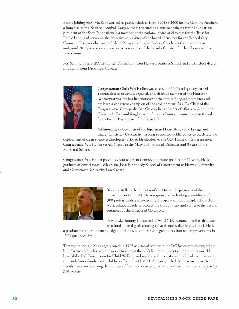
88 R E V I TA L I Z I N G R O C K C R E E K PA R K
Before joining AES, Mr. Sant worked in public relations from 1994 to 2000 for the Carolina Panthers, a franchise of the National Football League. He is treasurer and trustee of the Summit Foundation; president of the Sant Foundation; is a member of the national board of directors for the Trust for Public Land; and serves on the executive committee of the board of trustees for the Federal City Council. He is past chairman of Island Press, a leading publisher of books on the environment and, until 2014, served on the executive committee of the board of trustees for the Chesapeake Bay Foundation.
Mr. Sant holds an MBA with High Distinction from Harvard Business School and a bachelor’s degree in English from Dickinson College.
Congressman Chris Van Hollen was elected in 2002 and quickly earned a reputation as an active, engaged, and effective member of the House of Representatives. He is a key member of the House Budget Committee and has been a consistent champion of the environment. As a Co-Chair of the Congressional Chesapeake Bay Caucus, he is a leader of efforts to clean up the Chesapeake Bay, and fought successfully to obtain a historic boost in federal funds for the Bay as part of the Farm Bill.
Additionally, as Co-Chair of the bipartisan House Renewable Energy and Energy Efficiency Caucus, he has long supported public policy to accelerate the
deployment of clean energy technologies. Prior to his election to the U.S. House of Representatives, Congressman Van Hollen served 4 years in the Maryland House of Delegates and 8 years in the Maryland Senate.
Congressman Van Hollen previously worked as an attorney in private practice for 10 years. He is a graduate of Swarthmore College, the John F. Kennedy School of Government at Harvard University, and Georgetown University Law Center.
Tommy Wells is the Director of the District Department of the Environment (DDOE). He is responsible for leading a workforce of 300 professionals and overseeing the operations of multiple offices that work collaboratively to protect the environment and conserve the natural resources of the District of Columbia.
Previously, Tommy had served as Ward 6 DC Councilmember dedicated to a fundamental goal: creating a livable and walkable city for all. He is
a passionate student of cuttng- edge solutions who can translate great ideas into real improvements in DC’s quality of life.
Tommy started his Washington career in 1983 as a social worker in the DC foster care system, where he led a successful class action lawsuit to address the city’s failure to protect children in its care. He headed the DC Consortium for Child Welfare, and was the architect of a groundbreaking program to match foster families with children affected by HIV/AIDS. Later, he led the drive to create the DC Family Court—increasing the number of foster children adopted into permanent homes every year by 300 percent.
Tommy Wells is the Director of the District Department of the Environment (DDOE). He is responsible for leading a workforce of 300 professionals and overseeing the operations of multiple offices that work collaboratively to protect the environment and conserve the natural resources of the District of Columbia.
Previously, Tommy had served as Ward 6 DC Councilmember dedicated to a fundamental goal: creating a livable and walkable city for all. He is a passionate student of cuttng- edge solutions who can translate great ideas into real improvements in DC’s quality of life.
Tommy started his Washington career in 1983 as a social worker in the DC foster care system, where he led a successful class action lawsuit to address the city’s failure to protect children in its care. He headed the DC Consortium for Child Welfare, and was the architect of a groundbreaking program to match foster families with children affected by HIV/AIDS. Later, he led the drive to create the DC Family Court—increasing the number of foster children adopted into permanent homes every year by 300 percent.
Tommy has worked with the leadership and citizens in every corner of Ward 6 to guide development that focuses on neighborhood needs. He has championed the next generation of public transit and spearheaded environmental efforts including craling a landmark bill to charge a nominal fee on disposable bags and establishing a fund to clean up the Anacostia River.
Tommy graduated from the Columbus School of Law at Catholic University in 1991 and earned a master’s degree in social work from the University of Minnesota in 1983. He is married to Barbara Wells, a writer and arts enthusiast.
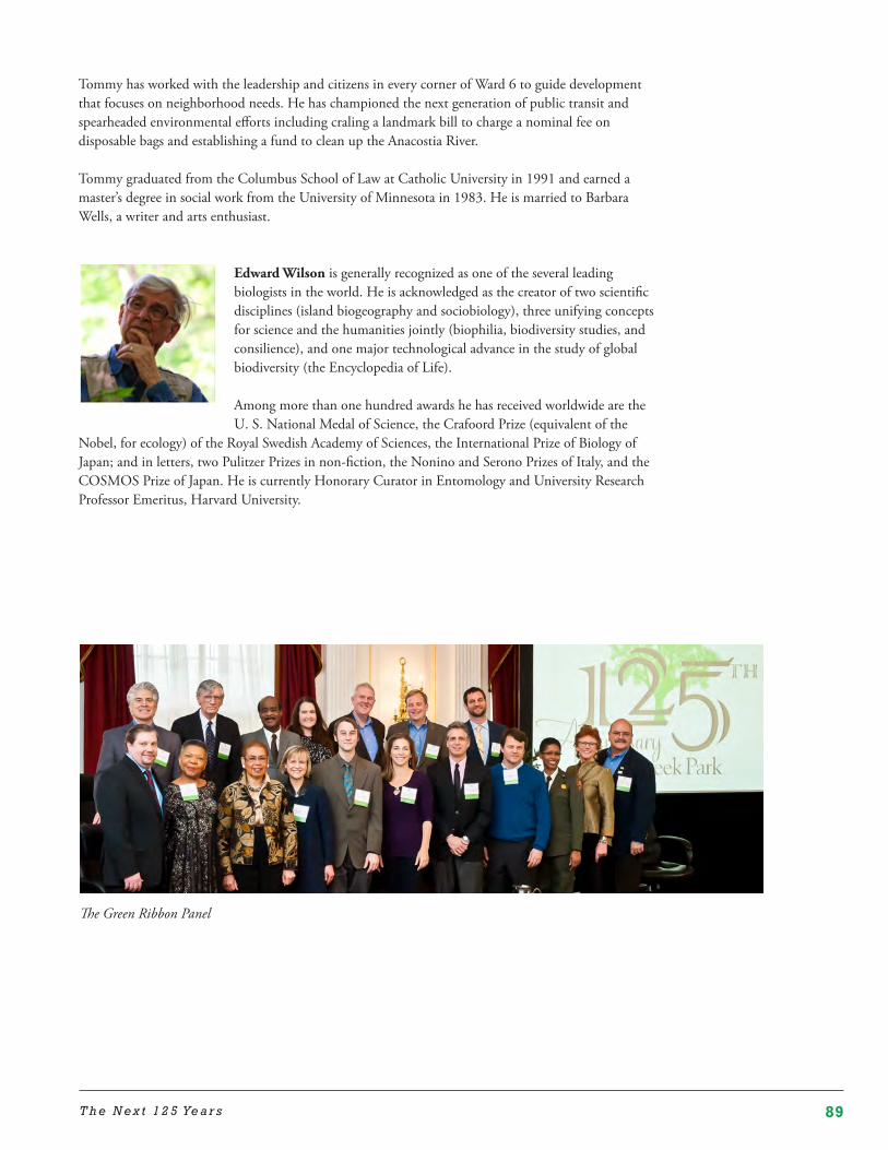
89T h e N e x t 1 2 5 Ye a r s
Tommy has worked with the leadership and citizens in every corner of Ward 6 to guide development that focuses on neighborhood needs. He has championed the next generation of public transit and spearheaded environmental efforts including craling a landmark bill to charge a nominal fee on disposable bags and establishing a fund to clean up the Anacostia River.
Tommy graduated from the Columbus School of Law at Catholic University in 1991 and earned a master’s degree in social work from the University of Minnesota in 1983. He is married to Barbara Wells, a writer and arts enthusiast.
Edward Wilson is generally recognized as one of the several leading biologists in the world. He is acknowledged as the creator of two scientific disciplines (island biogeography and sociobiology), three unifying concepts for science and the humanities jointly (biophilia, biodiversity studies, and consilience), and one major technological advance in the study of global biodiversity (the Encyclopedia of Life).
Among more than one hundred awards he has received worldwide are the U. S. National Medal of Science, the Crafoord Prize (equivalent of the
Nobel, for ecology) of the Royal Swedish Academy of Sciences, the International Prize of Biology of Japan; and in letters, two Pulitzer Prizes in non-fiction, the Nonino and Serono Prizes of Italy, and the COSMOS Prize of Japan. He is currently Honorary Curator in Entomology and University Research Professor Emeritus, Harvard University.
The Green Ribbon Panel
90 R E V I TA L I Z I N G R O C K C R E E K PA R K
Notes
1 The Rock Creek Park Authorization, ch. 1001, 26 Stat. 492-95 (1890).2 Barry Mackintosh, “Success,” Rock Creek Park: An Administrative History (National Park Service, 1985), http://www.NPS.gov/rocr/historyculture/adhi1b.htm.3 National Parks Conservation Association, National Park Service Funding Fact Sheet, http://www.npca.org/assets/pdf/NPCA-park-funding-fact-sheet-3-11-14.pdf.4 Erica Gies, The Health Benefits of Parks: How Parks Help Keep Americans and Their Communities Fit and Healthy (The Trust for Public Land, 2006), http://www.tpl.org/sites/default/files/cloud.tpl.org/pubs/benefits_HealthBenefitsReport.pdf.5 NPR Books, Edward O. Wilson Reflects on Insect Societies (Dec. 5, 2008), http://www.npr.org/templates/story/story.php?storyId=97848794.6 Paul M. Sherer, The Benefits of Parks: Why America Needs More City Parks and Open Space (The Trust for Public Land, 2006), http://www.eastshorepark.org/benefits_of_parks%20tpl.pdf; CapitalSpace, A Park System for the Nation’s Capital, Ideas to Achieve the Full Potential of Washington’s Parks and Open Space (National Capital Planning Commission, Government of the District of Columbia, & National Park Service, 2010), 16-18.7 CapitalSpace, note 6, 16.8 Forbes.com, America’s Coolest Cities 2014, No. 1: Washington, DC, http://www.forbes.com/pictures/emeg45kmll/no-1-washington-d-c/.9 Public Buildings Act of March 4, 1913, sec. 22, 37 Stat. 885.10 See generally Mackintosh, note 2.11 Ibid., “Under Military Rule,” http://www.NPS.gov/rocr/historyculture/adhit.htm.12 Ibid., “The Changing of the Guard,” http://www.NPS.gov/rocr/historyculture/adhi4.htm.13 Ibid., “Under the Park Service,” http://www.NPS.gov/rocr/historyculture/adhi4.htm; Scott Einberger, A History of Rock Creek Park: Wilderness & Washington, D.C. (2014), 148-153.14 Rock Creek Park, A Report by Olmsted Brothers (1918), http://www.NPS.gov/history/history/online_books/rocr/olmsted_brothers.pdf.15 Gail Spilsbury, Rock Creek Park (2003), 6-8.16 National Park Service, Healthy Parks, Healthy People Strategic Action Plan (2011), 4, http://www.nps.gov/public_health/hp/hphp/press/1012-955-WASO.pdf.17 National Park Service, Rock Creek Park and the Rock Creek and Potomac Parkway, Final General Management Plan Environmental Impact Statement, Vol. 1, 4 (2005).18 Ibid.19 National Park Service, Record of Decision, Rock Creek Park and the Rock Creek and Potomac Parkway Final General Management Plan, Environmental Impact Statement (Approved 6/6/2007).20 General Management Plan, note 18, 10-11.21 See General Management Plan, note 15, 12.22 Surging Seas, climatecentral.org, Risk Finder: Washington, D.C.23 District Department of the Environment, Resources, View Detailed Flood Zones in Your Area, http://green.dc.gov/service/view-detailed-flood-zones-your-area.24 The Rock Creek Park Authorization, ch. 1001, 26 Stat. 492-95, Sec. 7 (1890).25 National Park Service Organic Act, Ch. 1, 39 Stat. 535 (1916).26 Olmsted Brothers Report, note 14, 1-2.27 General Management Plan, note 17, 13-14. 28 Forbes, “America’s 20 Fastest Growing Cities,” http://www.forbes.com/pictures/mhj45mhlf/11-washington-dc/
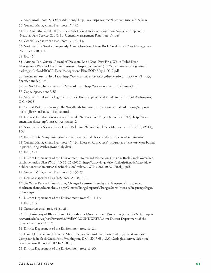
91T h e N e x t 1 2 5 Ye a r s
29 Mackintosh, note 2, “Other Additions,” http://www.nps.gov/rocr/historyculture/adhi3a.htm.30 General Management Plan, note 17, 142.31 Tim Carruthers et al., Rock Creek Park Natural Resource Condition Assessment, pp. xi, 28 (National Park Service, 2009), 10; General Management Plan, note 15, 143.32 General Management Plan, note 17, 142-43.33 National Park Service, Frequently Asked Questions About Rock Creek Park’s Deer Management Plan (Dec. 2103), 1.34 Ibid., 6.35 National Park Service, Record of Decision, Rock Creek Park Final White-Tailed Deer Management Plan and Final Environmental Impact Statement (2012), http://www.nps.gov/rocr/parkmgmt/upload/ROCR-Deer-Management-Plan-ROD-May-1-2012.pdf.36 American Forests, Tree Facts, http://www.americanforests.org/discover-forests/tree-facts/#_ftn3; Sherer, note 6, p. 19.37 See SavATree, Importance and Value of Trees, http://www.savatree.com/whytrees.html.38 CapitalSpace, note 6, 81.49 Melanie Choukas-Bradley, City of Trees: The Complete Field Guide to the Trees of Washington, D.C. (2008).40 Central Park Conservancy, The Woodlands Initiative, http://www.centralparknyc.org/support/major-gifts/woodlands-initiative.html.41 Emerald Necklace Conservancy, Emerald Necklace Tree Project (visited 6/11/14), http://www.emeraldnecklace.org/olmsted-tree-society-2/.42 National Park Service, Rock Creek Park Final White-Tailed Deer Management Plan/EIS, (2011), 104.43 Ibid., 105-6. Many non-native species have natural checks and are not considered invasive.44 General Management Plan, note 17, 134. Most of Rock Creek’s tributaries on the east were buried in pipes during Washington’s early days.45 Ibid., 141.46 District Department of the Environment, Watershed Protection Division, Rock Creek Watershed Implementation Plan (WIP), 10-16, 25 (2010), http://ddoe.dc.gov/sites/default/files/dc/sites/ddoe/publication/attachments/A%20Rock%20Creek%20WIP%202010%20Final_0.pdf.47 General Management Plan, note 15, 135-37.48 Deer Management Plan/EIS, note 35, 109, 112.49 See Water Research Foundation, Changes in Storm Intensity and Frequency http://www.theclimatechangeclearinghouse.org/ClimateChangeImpacts/ChangesStormIntensityFrequency/Pages/default.aspx.50 District Department of the Environment, note 46, 11-16.51 Ibid., 108.52 Carruthers et al., note 31, xi, 28.53 The University of Rhode Island, Groundwater Movement and Protection (visited 6/3/14), http://www.uri.edu/ce/wq/has/Private%20Wells/GROUNDWATER.htm; District Department of the Environment, note 46, 25.54 District Department of the Environment, note 46, 24.55 Daniel J. Phelan and Cherie V. Miller, Occurrence and Distribution of Organic Wastewater Compounds in Rock Creek Park, Washington, D.C., 2007-08, (U.S. Geological Survey Scientific Investigations Report 2010-5162, 2010).56 District Department of the Environment, note 46, 30.
92 R E V I TA L I Z I N G R O C K C R E E K PA R K
57 Ibid., 30.58 District of Columbia Water and Sewer Authority, Combined Sewer System Long Term Control Plan Final Report (2002), 3-8, http://www.dcwater.com/workzones/projects/pdfs/ltcp/Complete%20LTCP%20For%20CD.pdf. 59 Carruthers, note 31, 31.60 Einberger, note 13, 105-07.61 District of Columbia Water and Sewer Authority, note 58, at 2-19.62 Carruthers, note 31, 1.63 Ibid., 2.64 National Park Service, Rock Creek Park, Frequently Asked Questions, http://www.nps.gov/rocr/faqs.htm#CP_JUMP_69611.65 Popville, Is It Safe to Swim/Wade in Rock Creek? (July 31, 2012http://www.popville.com/2012/07/dear-popville-is-it-safe-to-swimwade-in-rock-creek/ ) (individuals report dogs becoming sick after drinking Rock Creek water).65 District of Columbia Water and Sewer Authority, note 58, 2-19.66 See Maryland.gov, StreamHealth, How Impervious Surface Impacts Stream Health, http://streamhealth.maryland.gov/how-impervious-surface-impacts-stream-health.67 See, for example, Mary Battiata, Silent Streams, Washingtonpost.com, Post Business (Nov. 27, 2005), http://www.washingtonpost.com/wp-dyn/content/article/2005/11/22/AR2005112202165.html.68 District Department of the Environment, note 46, 8-9.69 General Management Plant, note 17, 193-95.70 National Park Service, Reconstruction and Rehabilitation of Rock Creek & Potomac Parkway at Waterside Drive Environmental Assessment, (2012), 53.71 National Park Service, IRMA Portal (visited 6/20/14), https://irma.nps.gov/NPSpecies/Search/SpeciesList/ROCR (listing 175 species of birds as present or probably present in the park); The Maryland Ornithological Society, A Capital Experience … Birding in Washington, D.C., http://www.mdbirds.org/sites/dcsites/dcbirds.html.72 General Management Plan, note 17, 146-47; Green Urban Birder, Fall Songbird Migration in Rock Creek Park, Washington, DC – August & September 2011, http://greenurbanbirder.wordpress.com/2011/10/28/fall-songbird-migration-in-rock-creek-park-august-september-2011/73 See generally Deer Management Plan EIS, note 42, 165-67.74 Audubon, The Missing Birds of Rock Creek Park, http://policy.audubon.org/missing-birds-rock-creek-park. 75 Ibid.76 Deer Management EIS, note 42, 122.77 Ibid., 117.78 Personal communication with Bill Yeaman, Natural Resource Specialist, Rock Creek Park (April 2014).79 National Wildlife Federation, Garden for Wildlife, Community Habitats (visited 7/1/14), http://www.nwf.org/How-to-Help/Garden-for-Wildlife/Community-Habitats/How-To-Get-Community-Certified/Register-Your-Community.aspx80 National Park Service, National Register of Historic Places Registration Form, Rock Creek Park Historic District (certified 10/23/1991), http://pdfhost.focus.NPS.gov/docs/NRHP/Text/91001524.pdf.81 Personal communication with Simone Monteleone, Cultural Resource Program Manager, Rock Creek Park (Sept. 4, 2014).
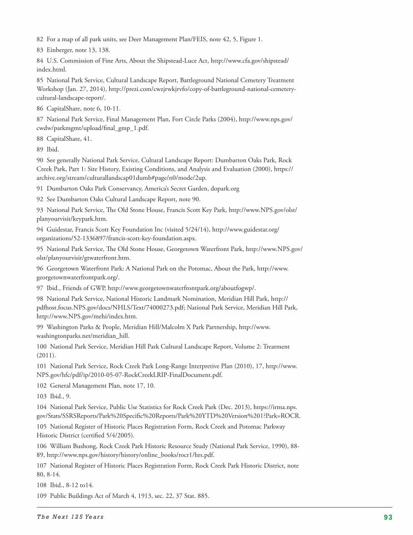
93T h e N e x t 1 2 5 Ye a r s
82 For a map of all park units, see Deer Management Plan/FEIS, note 42, 5, Figure 1.83 Einberger, note 13, 138.84 U.S. Commission of Fine Arts, About the Shipstead-Luce Act, http://www.cfa.gov/shipstead/index.html.85 National Park Service, Cultural Landscape Report, Battleground National Cemetery Treatment Workshop (Jan. 27, 2014), http://prezi.com/cwzjrwkjrvfo/copy-of-battleground-national-cemetery-cultural-landscape-report/.86 CapitalShare, note 6, 10-11.87 National Park Service, Final Management Plan, Fort Circle Parks (2004), http://www.nps.gov/cwdw/parkmgmt/upload/final_gmp_1.pdf.88 CapitalShare, 41.89 Ibid.90 See generally National Park Service, Cultural Landscape Report: Dumbarton Oaks Park, Rock Creek Park, Part 1: Site History, Existing Conditions, and Analysis and Evaluation (2000), https://archive.org/stream/culturallandscap01dumb#page/n0/mode/2up.91 Dumbarton Oaks Park Conservancy, America’s Secret Garden, dopark.org92 See Dumbarton Oaks Cultural Landscape Report, note 90.93 National Park Service, The Old Stone House, Francis Scott Key Park, http://www.NPS.gov/olst/planyourvisit/keypark.htm.94 Guidestar, Francis Scott Key Foundation Inc (visited 5/24/14), http://www.guidestar.org/organizations/52-1336897/francis-scott-key-foundation.aspx.95 National Park Service, The Old Stone House, Georgetown Waterfront Park, http://www.NPS.gov/olst/planyourvisit/gtwaterfront.htm.96 Georgetown Waterfront Park: A National Park on the Potomac, About the Park, http://www.georgetownwaterfrontpark.org/.97 Ibid., Friends of GWP, http://www.georgetownwaterfrontpark.org/aboutfogwp/.98 National Park Service, National Historic Landmark Nomination, Meridian Hill Park, http://pdfhost.focus.NPS.gov/docs/NHLS/Text/74000273.pdf; National Park Service, Meridian Hill Park, http://www.NPS.gov/mehi/index.htm.99 Washington Parks & People, Meridian Hill/Malcolm X Park Partnership, http://www.washingtonparks.net/meridian_hill. 100 National Park Service, Meridian Hill Park Cultural Landscape Report, Volume 2: Treatment (2011).101 National Park Service, Rock Creek Park Long-Range Interpretive Plan (2010), 17, http://www.NPS.gov/hfc/pdf/ip/2010-05-07-RockCreekLRIP-FinalDocument.pdf.102 General Management Plan, note 17, 10. 103 Ibid., 9.104 National Park Service, Public Use Statistics for Rock Creek Park (Dec. 2013), https://irma.nps.gov/Stats/SSRSReports/Park%20Specific%20Reports/Park%20YTD%20Version%201?Park=ROCR.105 National Register of Historic Places Registration Form, Rock Creek and Potomac Parkway Historic District (certified 5/4/2005).106 William Bushong, Rock Creek Park Historic Resource Study (National Park Service, 1990), 88-89, http://www.nps.gov/history/history/online_books/rocr1/hrs.pdf.107 National Register of Historic Places Registration Form, Rock Creek Park Historic District, note 80, 8-14.108 Ibid., 8-12 to14.109 Public Buildings Act of March 4, 1913, sec. 22, 37 Stat. 885.
94 R E V I TA L I Z I N G R O C K C R E E K PA R K
110 National Register of Historic Places Registration Form, Rock Creek Park Historic District, note 80, 8-21 to 24, 31-33.111 For a history of the parkway, see Einberger, note 13, 139-145.112 National Register of Historic Places Registration Form, Rock Creek Park Historic District, note 80, 7-21.113 Ibid., 7-21 to 24.114 Ibid., 7-22 to 23.115 Ibid., 7- 21.116 Einberger, note 13, 205-07.117 Sherer, note 6, 15.118 Mackintosh, note 2, “Parkway and Other Additions,” quoting Report of the Rock Creek and Potomac Parkway Commission: 1916 House Doc. 1114, 64th Congress, 10-17, http://www.nps.gov/rocr/historyculture/adhi3.htm.119 CapitalSpace, note 6, 84.120 Ibid., 15.121 57th Congress, 1st Session, Senate Report No. 166, Report of the Park Commission to the Senate Committee on the District of Columbia, The Improvement of the Park System of the District of Columbia, (1902), 80-81 (the McMillan Plan).122 Ibid., 85.123 CapitalSpace, note 6, 5.124 Scherer, note 6, 22-23.125 CapitalSpace, note 6, 88-89.126 National Park Service, Archeology Program, Archeology and History in Rock Creek Park, http://www.cr.nps.gov/archeology/sites/npSites/rockCreek.htm.127 National Park Service, List of Classified Structures, Rock Creek Park, http://www.hscl.cr.nps.gov/insidenps/summary.asp.128 Daniel Beekman Myer, Bridges and the City of Washington (U.S. Commission of Fine Arts, 1974).129 Ibid.130 Deer Management Plan EIS, note 42, 7.131 Ibid.132 General Management Plan, note 17, 28.133 NPS Stats, Park Reports, Rock Creek Park (ROCR) Reports (visited 6/24/14), https://irma.nps.gov/Stats/SSRSReports/Park%20Specific%20Reports/Annual%20Park%20Recreation%20Visitation%20(1904%20-%20Last%20Calendar%20Year)?Park=ROCR.134 Ibid.135 Joseph Pine, TED Talk, What Consumers Want (2004), http://www.ted.com/talks/joseph_pine_on_what_consumers_want.136 General Management Plan, note 17, 162.137 Ibid.138 NPS Stats, National Park Service Visitor Use Statistics, Park Reports, Rock Creek Park Reports, https://irma.nps.gov/Stats/SSRSReports/Park%20Specific%20Reports/Park%20YTD%20Version%201?Park=ROCR.139 Strava Labs, Global Heatmap, http://labs.strava.com/heatmap/#12/-77.04884/38.94196/.140 The Rock Creek Park Authorization, ch. 1001, § 7, 26 Stat. 492-95 (1890).141 National Register of Historic Places Registration Form, Rock Creek Park Historic District, note
95T h e N e x t 1 2 5 Ye a r s
80, 7-2, 8-54.142 Ibid., 7-24 to 25.143 Ibid., 8-53 to 54.144 Ibid., 8-54.145 Ibid.146 Mackintosh, note 2, “An Administrative History-Bicycling.”147 Ibid.,“Under the Park Service, The Park and the Automobile;” Bushong, note 92, 146-47.148 General Management Plan Record of Decision, note 19, 2.149 Mackintosh, note 2, An Administrative History-Bicycling; General Management Plan, note 17 (Alternatives C and D).150 General Management Plan Record of Decision, note 19, 3.151 National Register of Historic Places Registration Form, Rock Creek Park Historic District, note 80, 8-53.152 District Department of Transportation, Klingle Valley Trail, Final Environmental Assessment (Dec. 2010), S-1 to -2, https://comp.ddot.dc.gov/Documents/Klingle%20Valley%20Trail%20-%20Final%20Environmental%20Assessment.pdf.153 Macintosh, note 2, An Administrative History-Equestrian Use.154 NPS Stats, Park Reports, Rock Creek Park (ROCR) Reports (v9s9ted 6/24/14), https://irma.nps.gov/Stats/SSRSReports/Park%20Specific%20Reports/Annual%20Park%20Recreation%20Visitation%20(1904%20-%20Last%20Calendar%20Year)?Park=ROCR. https://irma.nps.gov/Stats/SSRSReports/Park%20Specific%20Reports/Park%20YTD%20Version%201?Park=ROCR.155 Personal Communication with Ken Ferebee, Natural Resource Management Specialist, Rock Creek Park (6/30/14).156 National Park Service, Rock Creek Park Geologic Resources Inventory Report, Natural Resources Report NPS/NRPC/CRD/NRR—2009/146, 7.157 See General Management Plan, note 17, 46, 84-85.158 See generally ibid.159 Rock Creek Tennis Center, Rock Creek Park Tennis Services, http://www.rockcreektennis.com/rock-creek-park-tennis-services.htm.160 Rock Creek Golf Course, Snack Bar, http://rockcreekgolfcourse.com/-snack-bar.161 High Line, About, High Line Food, http://www.thehighline.org/about/high-line-food.162 Washington Tennis & Education Foundation, Annual Report, 2013-2014, 12, http://www.wtef.org/files/7414/0898/1068/WTEF_2013_2014_Annual_report-Proof_FINAL.pdf. 163 Ibid.164 National Park Service, List of Classified Structures, Battleground Cemetery; Lodge Building Structure Number 568-01, http://www.hscl.cr.nps.gov/insidenps/report.asp?STATE=DC&PARK=ROCR&STRUCTURE=&SORT=3&RECORDNO=19.165 National Park Service, National Register of Historic Places Inventory – Nomination Form, Battleground National Cemetery, Certified 4/4/80 http://pdfhost.focus.nps.gov/docs/NRHP/Text/66000032.pdf.166 Beyer Blinder Belle, Architects & Planners LLP, Battleground National Cemetery Project (visited April 14, 2014) http://www.beyerblinderbelle.com/?ID=490; National Park Service, Battleground National Cemetery Restoration Project, Historic Preservation Work), http://www.nps.gov/cwdw/historyculture/upload/Restoration-Sign_BNC.pdf.167 Personal communication with Simone Monteleone, Cultural Resources Program Manager for Rock Creek Park (Sept. 4, 2014).168 General Management Plan, note 17, 82.

96 R E V I TA L I Z I N G R O C K C R E E K PA R K
169 National Park Service, Rock Creek Park, Carter Barron History, http://www.nps.gov/rocr/planyourvisit/cbhistory.htm.170 Ibid.171 Ibid.172 Shakespeare Theatre Company, The 2014 Free For All, http://www.shakespearetheatre.org/about/ffa/.173 City Parks Foundation, About SummerStage, http://www.summerstage.org/summerstage/about/, http://www.brooklynvegan.com/archives/2014/04/central_park_su_4.html.174 The Mann, What Summer Sounds Like, About, http://www.manncenter.org/about/mission-and-history.175 Hollywood Bowl, Season Schedule, 2014 Season, (http://www.hollywoodbowl.com/tickets/calendar-fullseason.176 Ravinia, Ravinia Festival, About, https://www.ravinia.org/Page/AboutUs.177 Taylor Agostino Real Estate Group Website, Tenleytown Mystery Building (posted Mar 24, 2014), http://tayloragostino.com/tenleytown-mystery-building/.178 National Park Service, List of Classified Structures, 4023 Chesapeake Street NW, Structure Number 470-01, http://www.hscl.cr.nps.gov/insidenps/report.asp?STATE=DC&PARK=ROCR&STRUCTURE=&SORT=5&RECORDNO=21.179 DC Public Library Website, Palisades Library History, http://dclibrary.org/node/732.180 National Park Service, List of Classified Structures, Rock Creek Park; Conduit Road Schoolhouse, Structure Number 404, http://www.hscl.cr.nps.gov/insidenps/report.asp?STATE=DC&PARK=ROCR&STRUCTURE=&SORT=1&RECORDNO=24.181 District of Columbia Zoning Commission Public Hearing, Text and Map Amendments, Petition to adopt and map a Chain Bridge Road/University Terrace Overlay, Case No. 97-6, 59-60 (May 18, 1998), http://dcoz.dc.gov/trans/980518zc2.pdf.182 National Register of Historic Places Inventory – Nomination Form for Federal Properties, Pierce-Klingle Mansion, http://pdfhost.focus.nps.gov/docs/NRHP/Text/73000223.pdf; Steve Dryden, Peirce Mill: Two Hundred Years in the Nation’s Capital (2009), 27-32.183 National Register of Historic Places Inventory – Nomination Form for Federal Properties, Pierce-Klingle Mansion, note 182.184 Macintosh, note 2, An Administrative History-The Pierce-Klingle House and the Nature Center; National Register of Historic Places Inventory – Nomination Form for Federal Properties, Pierce-Klingle Mansion, note 182.185 National Park Service, List of Classified Structures, Peirce-Klingle Mansion, http://www.hscl.cr.nps.gov/insidenps/report.asp?STATE=DC&PARK=&STRUCTURE=&SORT=3&RECORDNO=436.186 Ibid.187 General Management Plan Record of Decision, note 19.188 Macintosh, note 2, 133-36, 171-72; National Park Service, List of Classified Structures, Rock Creek Park: US Park Police Substation, Structure No. 339-15, http://www.hscl.cr.nps.gov/insidenps/report.asp?STATE=DC&PARK=ROCR&STRUCTURE=&SORT=2&RECORDNO=83.189 Macintosh, note 2, 133-36, 171-72.190 National Register of Historic Places Registration Form, Rock Creek Park Historic District, note 80, 17-18.191 Rachel Cooper, U.S. Park Police – About the United States Park Police, About.com, Washington DC, http://dc.about.com/od/publicsafety/a/U-S-Park-Police-About-The-United-States-Park-Police.htm.
97T h e N e x t 1 2 5 Ye a r s
192 National Park Service, Rock Creek Park Long-Range Interpretive Plan (March 2010), 22.193 General Management Plan, note 17, 142.194 Ibid, 1, 37, 80-81, 87, 216; General Management Plan Record of Decision, note 19. 195 Bushong, note 106, 119-20, 170-71; National Park Service, List of Classified Structures, Rock Creek Park; Miller Cabin, Structure Number 339-17, http://www.hscl.cr.nps.gov/insidenps/report.asp?STATE=DC&PARK=ROCR&STRUCTURE=&SORT=2&RECORDNO=84; The House History Man, A log cabin in Meridian Hill Park? It’s True!, http://househistoryman.blogspot.com/2012/02/log-cabin-in-meridian-hill-park-its.html196 Macintosh, note 2, An Administrative History-Camp Good Will, Golf, and the Miller Cabin, http://www.nps.gov/rocr/historyculture/adhi2d.htm.197 The Word Works, The Joaquin Miller Poetry Series, Joaquin Miller and the Cabin, http://www.wordworksdc.com/miller_cabin.html.198 National Register of Historic Places Registration Form, Rock Creek Park Historic District, note 80, 16-17.199 Bushong, note 106, 120. 200 General Management Plan, note 17, 142.201 Ibid., 78, 87.202 Bushong, note 106, 120.203 The Natural Capital, Nature Centers in the DC Area (post dated 1/12/2011), http://www.thenaturalcapital.com/2011/01/nature-centers-in-dc-area.html. 204 Bushong, note 106, 149, 185.205 Rock Creek Park Long-Range Interpretive Plan, note 192, 14.206 Ibid.207 National Park Service, Old Stone House Bulletin, http://www.nps.gov/olst/historyculture/upload/Old-Stone-House-Brochure.pdf; National Park Serve, List of Classified Structures, Old Stone House, http://www.hscl.cr.nps.gov/insidenps/report.asp?STATE=DC&PARK=ROCR&STRUCTURE=&SORT=&RECORDNO=265.208 Rock Creek Park Long-Range Interpretive Plan, note 192, 16-17.209 National Park Service, The Old Stone House Black Georgetown Bulletin, http://www.nps.gov/olst/planyourvisit/blkgt.htm.210 Personal communication with Simone Monteleone, Rock Creek Park (5/30/2014).211 See Bushong, note 106, 25-29, 165-70; Dryden, note 182; Friends of Peirce Mill, Peirce Mill: A Flourishing Industrial Complex, http://www.peircemill-friends.org/history.html; National Park Service, Peirce Mill Complex, Cultural Landscape Report (July 2009) http://www.nps.gov/pimi/historyculture/upload/Pages-from-Peirce-Mill-Cultural-Landscape-Report-2009-Part-1.pdf; National Register of Historic Places Registration Form, Pierce Mill (expanded nomination), certified 4/26/2012, http://www.nps.gov/nr/feature/weekly_features/2012/DC_69000014.pdf; List of Classified Structures http://www.hscl.cr.nps.gov/insidenps/report.asp?STATE=DC&PARK=&STRUCTURE=&SORT=3&RECORDNO=436; Macintosh, note 2, “The Pierce-Klingle House and the Nature Center” http://www.nps.gov/rocr/historyculture/adhi4e.htm.212 Peirce Mill Cultural Landscape Report, note 211, 2.16.213 Ibid., ch. 2.214 Friends of Peirce Mill, Peirce Mill: A Flourishing Industrial Complex, http://www.peircemill-friends.org/history.html.215 The Tech Online Edition, Washington Gallery a U.S. Spy Center (Dec. 1, 1992), http://tech.mit.edu/V112/N61/spy.61w.html.216 General Management Plan Record of Decision, note 19.
98 R E V I TA L I Z I N G R O C K C R E E K PA R K
217 National Park Service, National Register of Historic Places Registration Form, Rock Creek Park Historic District, note 80, 8-64 to 65.218 Bushong, note 2, 115.219 Evening Star (Washington), July 16, 1914, quoted in ibid.220 Ibid., 116.221 Einberger, note 13, 121.222 Woodrow Wilson to Colonel Clarence S. Sherrill, June 21, 1921. Entry 303, RG 42, Records of the Office of Public Buildings and Public Works of the National Capital. NARA, Washington, D.C., cited in Bushong, note 106, 118.223 “Rock Creek’s Links Are Opened,” Washington Post (April 3, 1926), cited in Rock Creek Park Golf Course, Wikipedia.224 National Park Service, National Register of Historic Places Registration Form, Rock Creek Park Historic District, note 80, 7-25 to 26.225 Ibid., 7-26.226 Ibid., 8-83.227 Rock Creek Golf Course, http://www2.cybergolf.com/sites/courses/layout11.asp?id=694&page=38723228 “D.C. golf may go upscale, The Washington Post (May 21, 1914), B1-B2.229 Yelp, Rock Creek Golf Course, http://www.yelp.com/biz/rock-creek-golf-course-washington (searched 6/27/14).230 Bushong, note 106, 119.231 General Management Plan, note 17, 35.232 Google Maps, (searched 3/10/14).233 D.C. golf may go upscale, note 228, B2.234 General Management Plan, note 17, 31.235 Ibid.236 Rock Creek Park Long-Range Interpretive Plan, note 192, 8-9.237 Einbeger, note 13, 138.238 Rock Creek Park Long-Range Interpretive Plan, note 192, 10.239 General Management Plan, note 17, 162.240 See generally Rock Creek Park Long-Range Interpretive Plan, note 192.241 Personal communication with Scott Einberger, Interpretive Park Ranger, Rock Creek Park (6/1/2014).242 ABC 7 News, National Park Service suffers $12 billion maintenance backlog, http://www.wjla.com/articles/2014/04/national-park-service-suffers-18-billion-maintenance-backlog-101856.html.

99T h e N e x t 1 2 5 Ye a r s
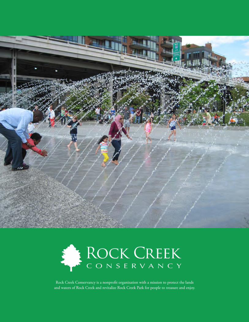
100 R E V I TA L I Z I N G R O C K C R E E K PA R K
Rock Creek Conservancy is a nonprofit organization with a mission to protect the lands and waters of Rock Creek and revitalize Rock Creek Park for people to treasure and enjoy.