Embed Size (px)
Citation preview
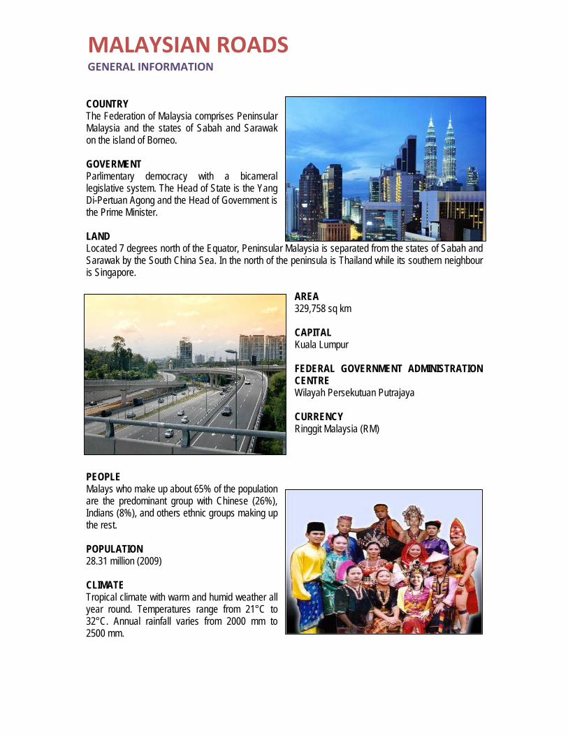
COUNTRY The Federation of Malaysia comprises Peninsular Malaysia and the states of Sabah and Sarawak on the island of Borneo. GOVERMENT Parlimentary democracy with a bicameral legislative system. The Head of State is the Yang Di-Pertuan Agong and the Head of Government is the Prime Minister. LAND Located 7 degrees north of the Equator, Peninsular Malaysia is separated from the states of Sabah and Sarawak by the South China Sea. In the north of the peninsula is Thailand while its southern neighbour is Singapore.
AREA 329,758 sq km CAPITAL Kuala Lumpur FEDERAL GOVERNMENT ADMINISTRATION CENTRE Wilayah Persekutuan Putrajaya CURRENCY Ringgit Malaysia (RM)
PEOPLE Malays who make up about 65% of the population are the predominant group with Chinese (26%), Indians (8%), and others ethnic groups making up the rest. POPULATION 28.31 million (2009) CLIMATE Tropical climate with warm and humid weather all year round. Temperatures range from 21°C to 32°C. Annual rainfall varies from 2000 mm to 2500 mm.
MALAYSIAN ROADSGENERAL INFORMATION
1.0 ROAD DEVELOPMENT
In Malaysia, road constructions has begun since before independence. Before 1957, there has been a road system linking Johor Bahru in the south with Kangar in the north and Kota Bharu in the East Coast, connecting main cities between the other cities. After the country gained independence in 1957, efforts to improve the road system has been done properly and through the rapid development planning, especially Malaysia Plan every five years which was launched by the Federal Government.
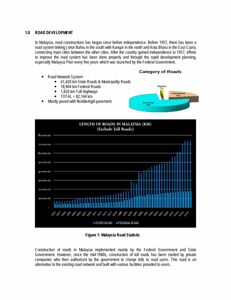
Road Network System 61,420 km State Roads & Municipality Roads 18,904 km Federal Roads 1,820 km Toll Highways TOTAL = 82,144 km
Mostly paved with flexible/rigid pavement
Figure 1: Malaysia Road Statistic
Construction of roads in Malaysia implemented mainly by the Federal Government and State Government. However, since the mid-1980s, construction of toll roads has been started by private companies who then authorized by the government to charge tolls to road users. This road is an alternative to the existing road network and built with various facilities provided to users.
Federal Road22%
State Road76%
Highway1%
Category of Roads
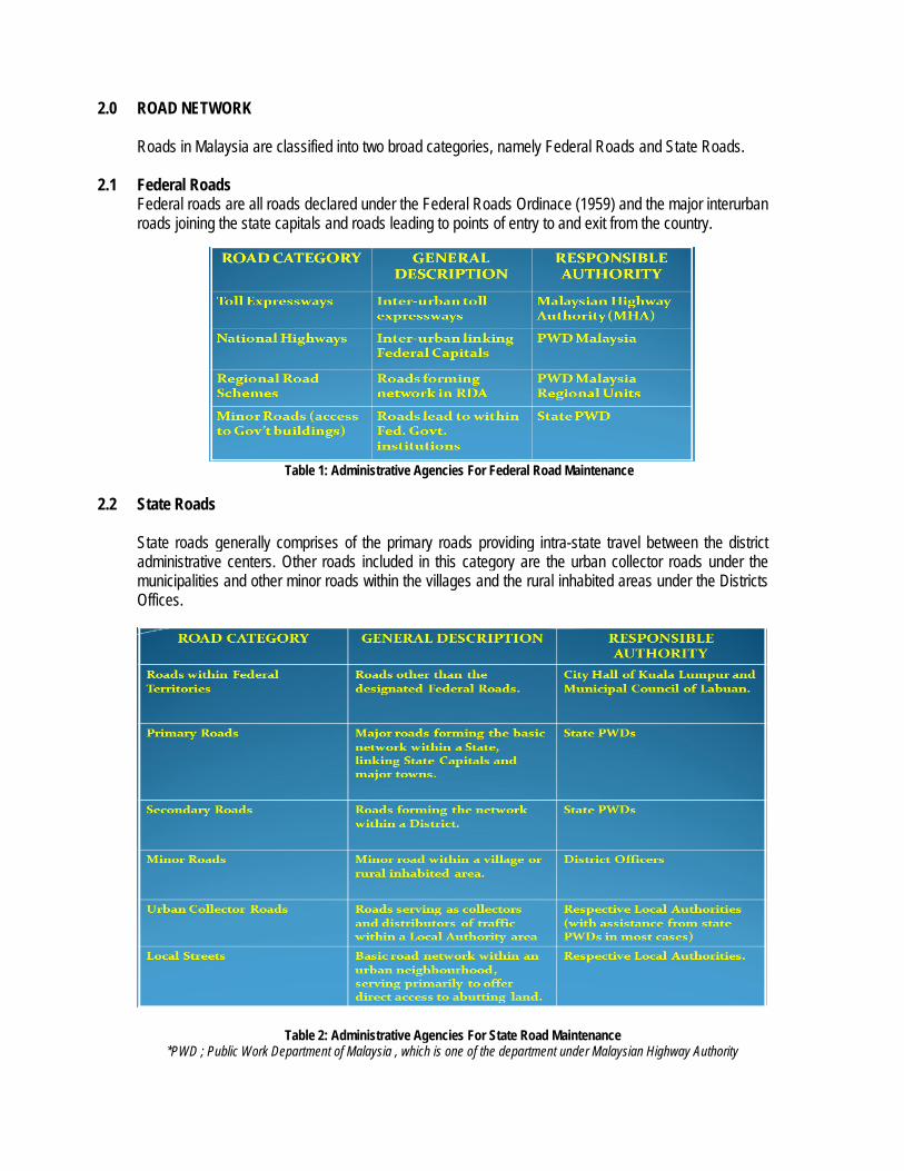
2.0 ROAD NETWORK Roads in Malaysia are classified into two broad categories, namely Federal Roads and State Roads.
2.1 Federal Roads Federal roads are all roads declared under the Federal Roads Ordinace (1959) and the major interurban roads joining the state capitals and roads leading to points of entry to and exit from the country.
Table 1: Administrative Agencies For Federal Road Maintenance
2.2 State Roads State roads generally comprises of the primary roads providing intra-state travel between the district administrative centers. Other roads included in this category are the urban collector roads under the municipalities and other minor roads within the villages and the rural inhabited areas under the Districts Offices.
Table 2: Administrative Agencies For State Road Maintenance
*PWD ; Public Work Department of Malaysia , which is one of the department under Malaysian Highway Authority
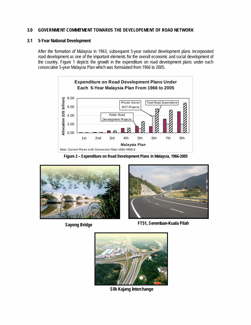
3.0 GOVERNMENT COMMITMENT TOWARDS THE DEVELOPEMENT OF ROAD NETWORK
3.1 5-Year National Development After the formation of Malaysia in 1963, subsequent 5-year national development plans incorporated road development as one of the important elements for the overall economic and social development of the country. Figure 1 depicts the growth in the expenditure on road development plans under each consecutive 5-year Malaysia Plan which was formulated from 1966 to 2005.
Expenditure on Road Development Plans Under Each 5-Year Malaysia Plan From 1966 to 2005
0.00
2.00
4.00
6.00
8.00
1st 2nd 3rd 4th 5th 6th 7th 8th
Malaysia Plan
Allo
catio
n (U
S bi
llion
)
Note: Current Prices w ith Conversion Rate US$1=RM3.8
Public Road Development Projects
Private Sector BOT Projects
Total Road Expenditure
Figure 2 – Expenditure on Road Development Plans in Malaysia, 1966-2005
Sayong Bridge FT51, Seremban-Kuala Pilah
Silk Kajang Interchange
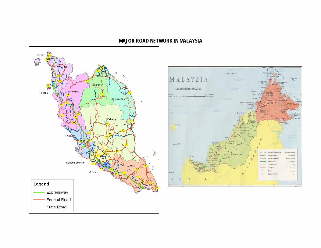
MAJOR ROAD NETWORK IN MALAYSIA
MALAYSIAN ROADS
FOR MORE INFORMATION
Website http://www.jkr.gov.my/app-jkr/index.php?setlang=en Contact [email protected]