Embed Size (px)
Citation preview
Robbie Hood
Office of Oceanic and Atmospheric Research
21 June 2011
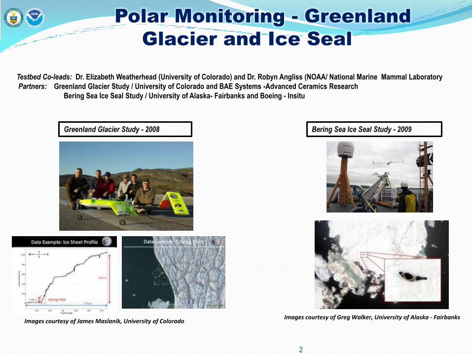
Polar Monitoring - Greenland
Glacier and Ice Seal
Testbed Co-leads: Dr. Elizabeth Weatherhead (University of Colorado) and Dr. Robyn Angliss (NOAA/ National Marine Mammal Laboratory
Partners: Greenland Glacier Study / University of Colorado and BAE Systems -Advanced Ceramics Research
Bering Sea Ice Seal Study / University of Alaska- Fairbanks and Boeing - Insitu
Images courtesy of James Maslanik, University of Colorado Images courtesy of Greg Walker, University of Alaska - Fairbanks
Greenland Glacier Study - 2008 Bering Sea Ice Seal Study - 2009
2
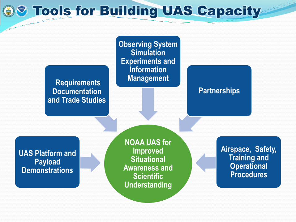
Tools for Building UAS Capacity
NOAA UAS for Improved
Situational Awareness and
Scientific Understanding
UAS Platform and Payload
Demonstrations
Requirements Documentation
and Trade Studies
Observing System Simulation
Experiments and Information
Management
Partnerships
Airspace, Safety, Training and Operational Procedures
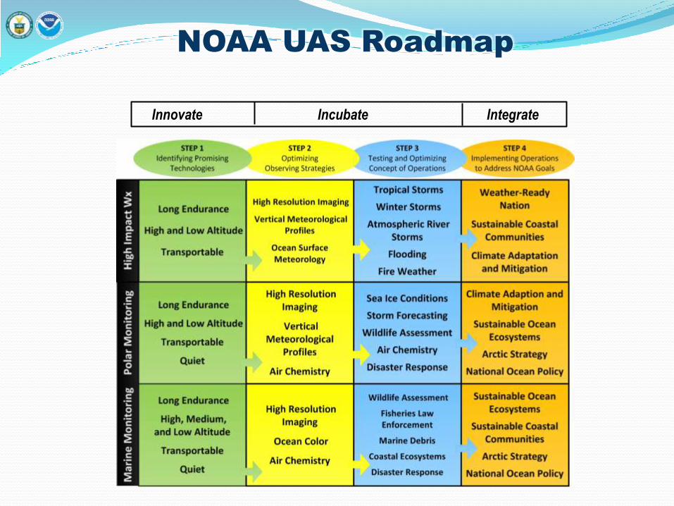
NOAA UAS Roadmap
Innovate Incubate Integrate
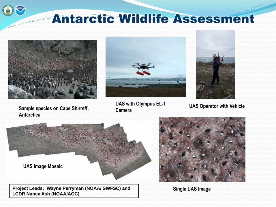
Antarctic Wildlife Assessment
Sample species on Cape Shirreff,
Antarctica
UAS with Olympus EL-1
Camera UAS Operator with Vehicle
UAS Image Mosaic
Single UAS Image Project Leads: Wayne Perryman (NOAA/ SWFSC) and
LCDR Nancy Ash (NOAA/AOC)
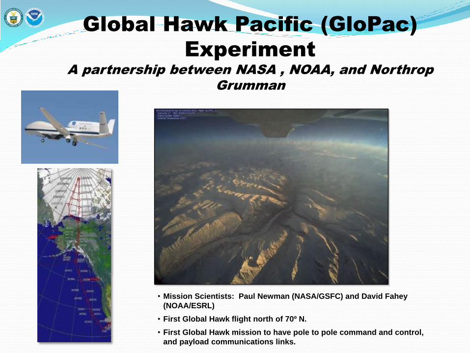
• Mission Scientists: Paul Newman (NASA/GSFC) and David Fahey
(NOAA/ESRL)
• First Global Hawk flight north of 70º N.
• First Global Hawk mission to have pole to pole command and control,
and payload communications links.
Global Hawk Pacific (GloPac)
Experiment
A partnership between NASA , NOAA, and Northrop
Grumman
One Mission – Two Oceans
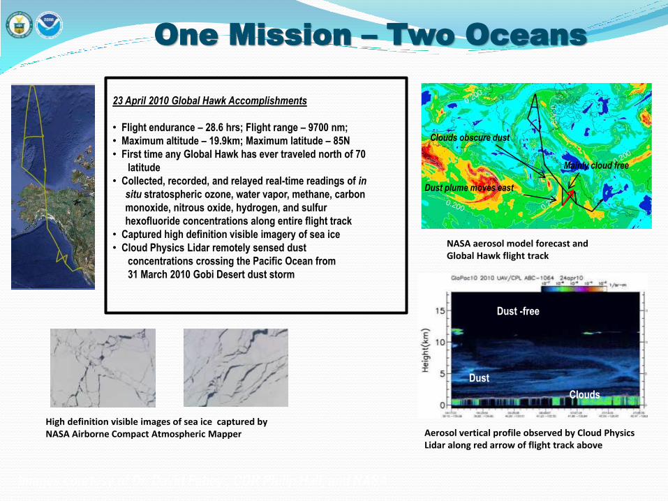
High definition visible images of sea ice captured by NASA Airborne Compact Atmospheric Mapper
23 April 2010 Global Hawk Accomplishments
• Flight endurance – 28.6 hrs; Flight range – 9700 nm;
• Maximum altitude – 19.9km; Maximum latitude – 85N
• First time any Global Hawk has ever traveled north of 70
latitude
• Collected, recorded, and relayed real-time readings of in
situ stratospheric ozone, water vapor, methane, carbon
monoxide, nitrous oxide, hydrogen, and sulfur
hexofluoride concentrations along entire flight track
• Captured high definition visible imagery of sea ice
• Cloud Physics Lidar remotely sensed dust
concentrations crossing the Pacific Ocean from
31 March 2010 Gobi Desert dust storm
Dust
Dust -free
Clouds
Clouds obscure dust
Dust plume moves east
Mainly cloud free
NASA aerosol model forecast and Global Hawk flight track
Aerosol vertical profile observed by Cloud Physics Lidar along red arrow of flight track above
Images courtesy of Dr. David Fahey , CDR Philip Hall, and NASA
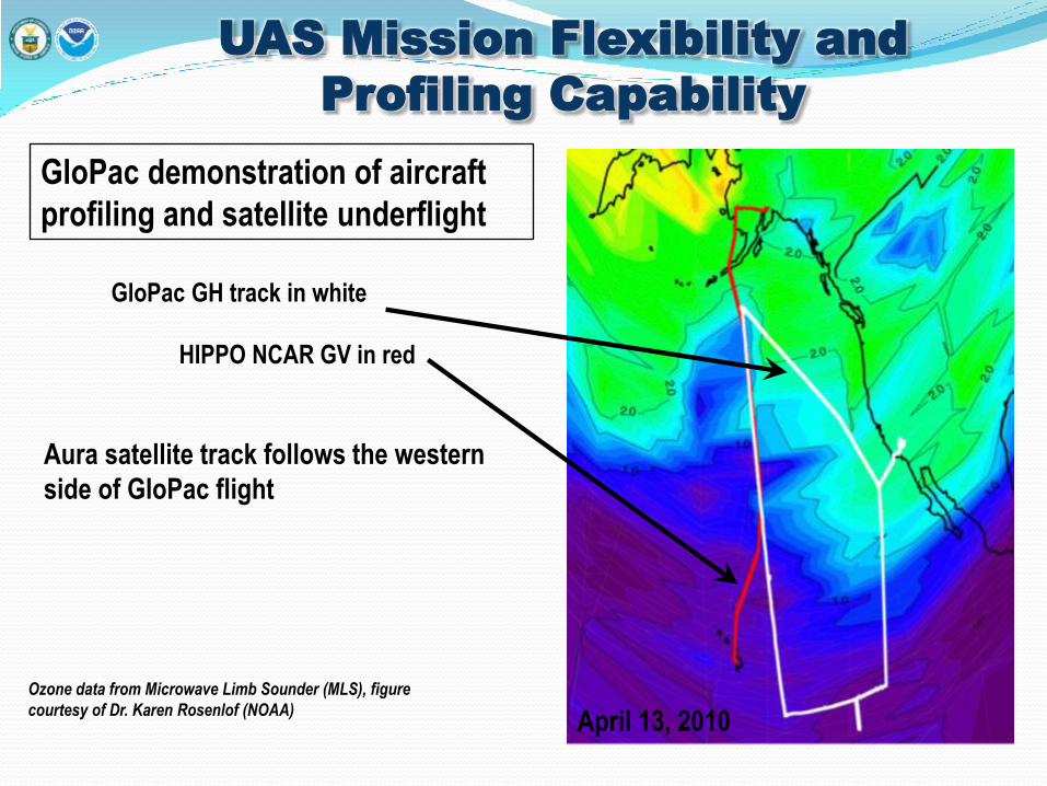
UAS Mission Flexibility and
Profiling Capability
GloPac GH track in white
HIPPO NCAR GV in red
Aura satellite track follows the western
side of GloPac flight
April 13, 2010
Ozone data from Microwave Limb Sounder (MLS), figure
courtesy of Dr. Karen Rosenlof (NOAA)
GloPac demonstration of aircraft
profiling and satellite underflight
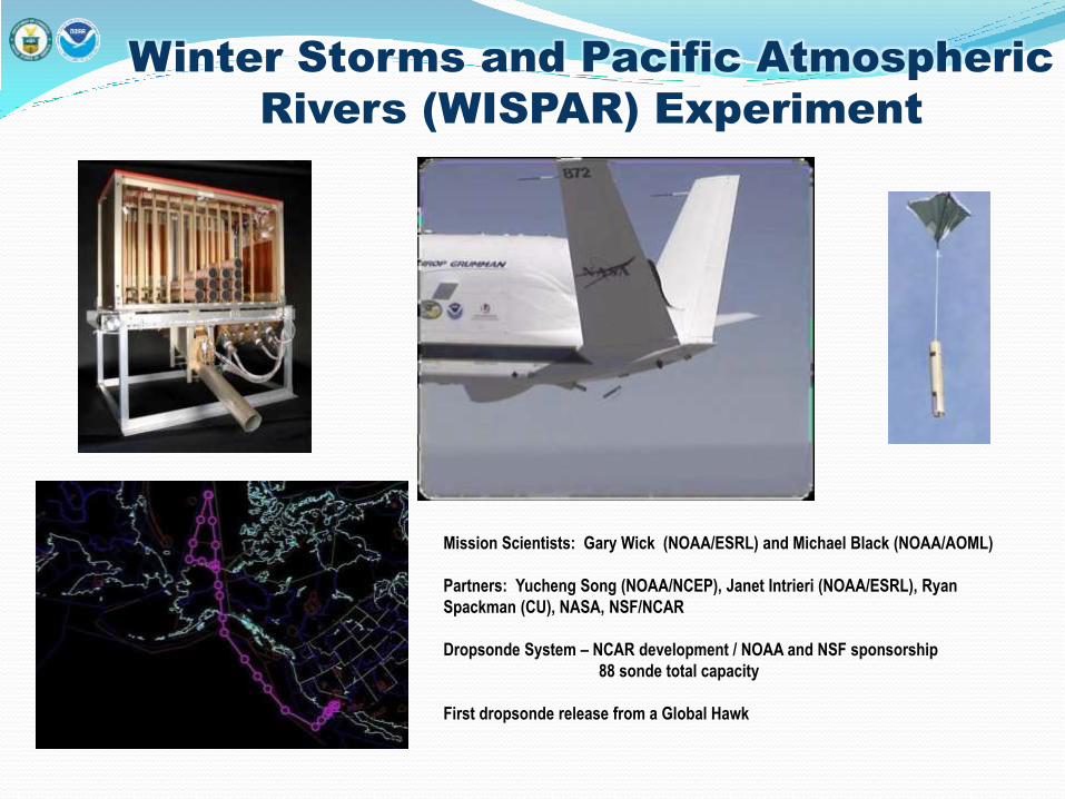
Winter Storms and Pacific Atmospheric
Rivers (WISPAR) Experiment
Mission Scientists: Gary Wick (NOAA/ESRL) and Michael Black (NOAA/AOML)
Partners: Yucheng Song (NOAA/NCEP), Janet Intrieri (NOAA/ESRL), Ryan
Spackman (CU), NASA, NSF/NCAR
Dropsonde System – NCAR development / NOAA and NSF sponsorship
88 sonde total capacity
First dropsonde release from a Global Hawk
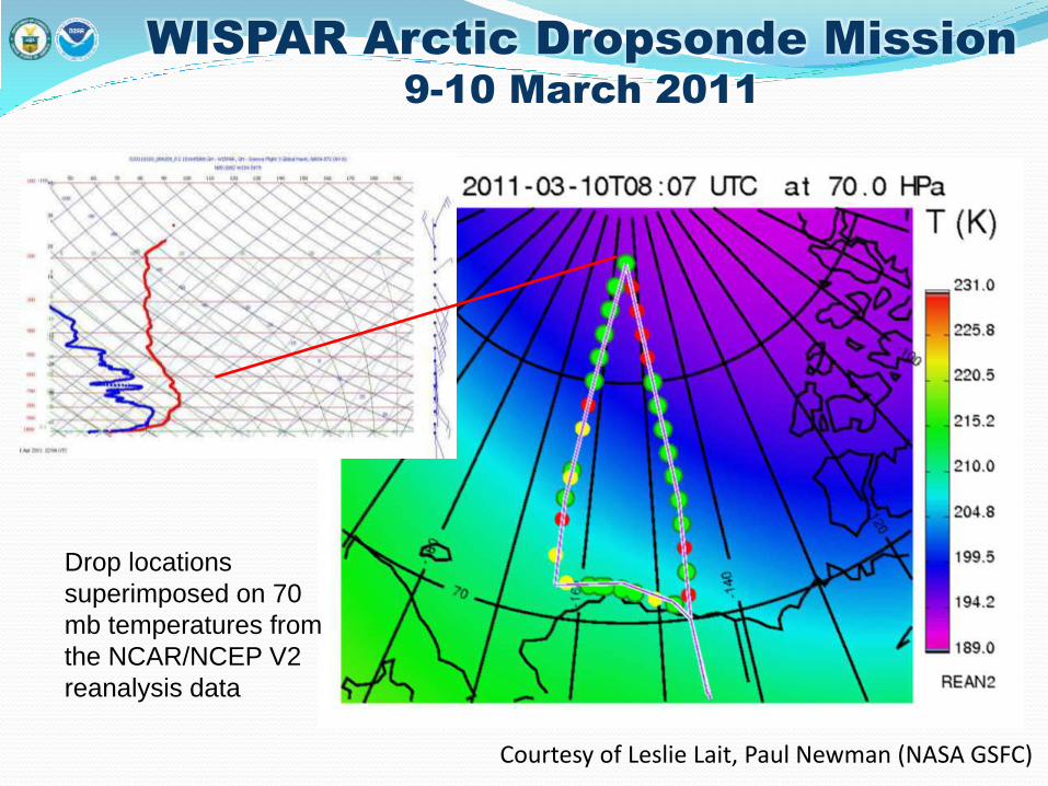
WISPAR Arctic Dropsonde Mission
9-10 March 2011
Courtesy of Leslie Lait, Paul Newman (NASA GSFC)
Drop locations
superimposed on 70
mb temperatures from
the NCAR/NCEP V2
reanalysis data
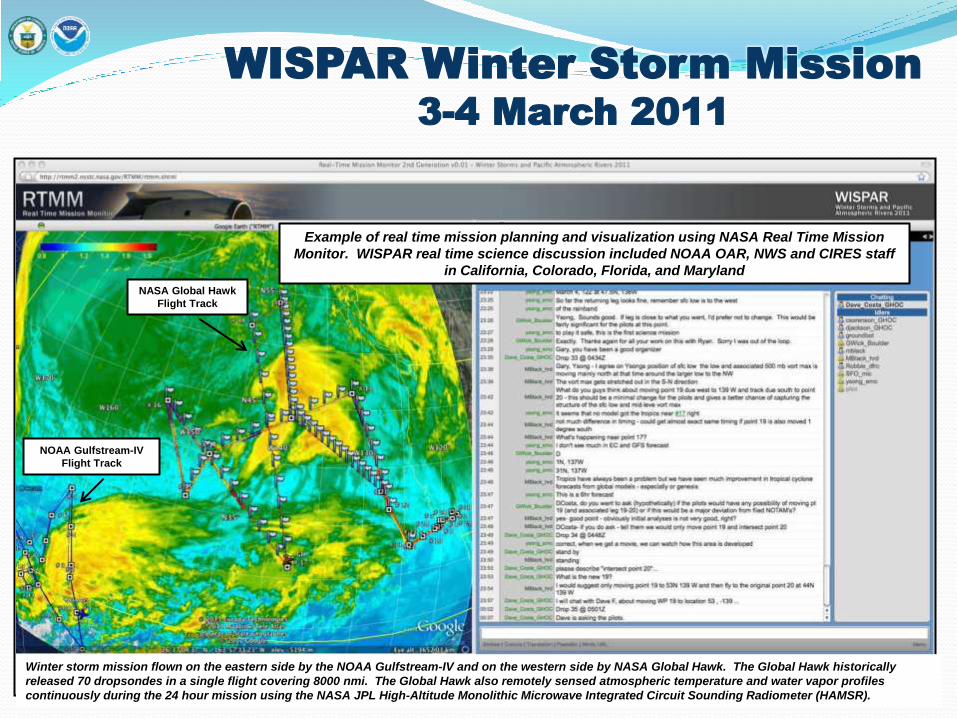
WISPAR Winter Storm Mission
3-4 March 2011
NOAA Gulfstream-IV
Flight Track
NASA Global Hawk
Flight Track
Example of real time mission planning and visualization using NASA Real Time Mission
Monitor. WISPAR real time science discussion included NOAA OAR, NWS and CIRES staff
in California, Colorado, Florida, and Maryland
Winter storm mission flown on the eastern side by the NOAA Gulfstream-IV and on the western side by NASA Global Hawk. The Global Hawk historically
released 70 dropsondes in a single flight covering 8000 nmi. The Global Hawk also remotely sensed atmospheric temperature and water vapor profiles
continuously during the 24 hour mission using the NASA JPL High-Altitude Monolithic Microwave Integrated Circuit Sounding Radiometer (HAMSR).
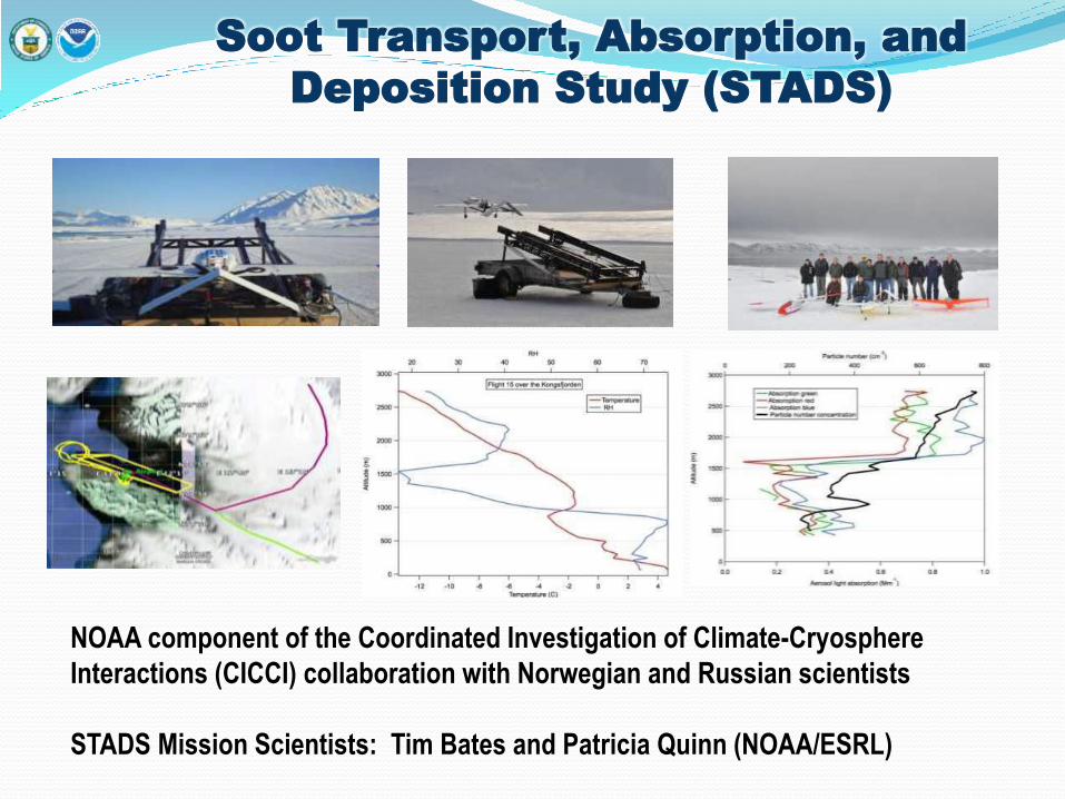
Soot Transport, Absorption, and
Deposition Study (STADS)
NOAA component of the Coordinated Investigation of Climate-Cryosphere
Interactions (CICCI) collaboration with Norwegian and Russian scientists
STADS Mission Scientists: Tim Bates and Patricia Quinn (NOAA/ESRL)
Next Steps
• Optimizing UAS observing strategies for: • Sea ice information
• Wildlife assessments
• Air quality and atmospheric chemistry process studies
• Oceanic meteorological information
• Real-time data delivery
• Fast, effective image processing
• Identifying promising UAS technologies for: • Methane impact studies
• Gravity and elevation information
• Coastal mapping
• Inland flooding and meteorological information
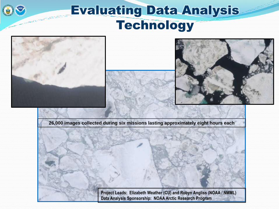
Evaluating Data Analysis
Technology
26,000 images collected during six missions lasting approximately eight hours each
Project Leads: Elizabeth Weather (CU) and Robyn Angliss (NOAA / NMML)
Data Analysis Sponsorship: NOAA Arctic Research Program
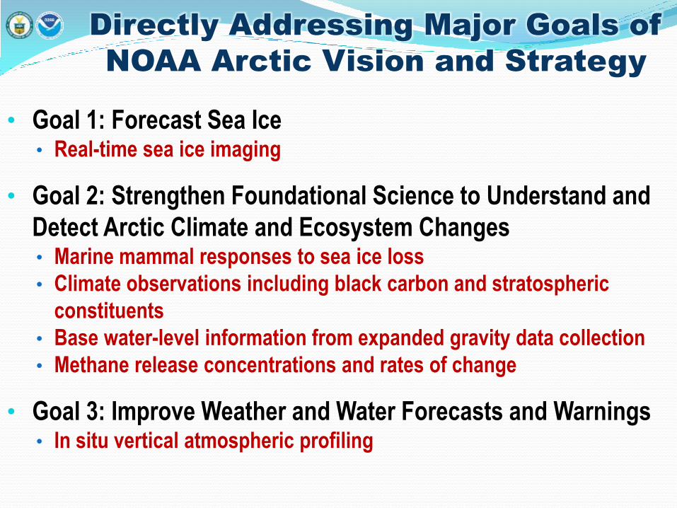
Directly Addressing Major Goals of
NOAA Arctic Vision and Strategy
• Goal 1: Forecast Sea Ice • Real-time sea ice imaging
• Goal 2: Strengthen Foundational Science to Understand and
Detect Arctic Climate and Ecosystem Changes • Marine mammal responses to sea ice loss
• Climate observations including black carbon and stratospheric
constituents
• Base water-level information from expanded gravity data collection
• Methane release concentrations and rates of change
• Goal 3: Improve Weather and Water Forecasts and Warnings • In situ vertical atmospheric profiling
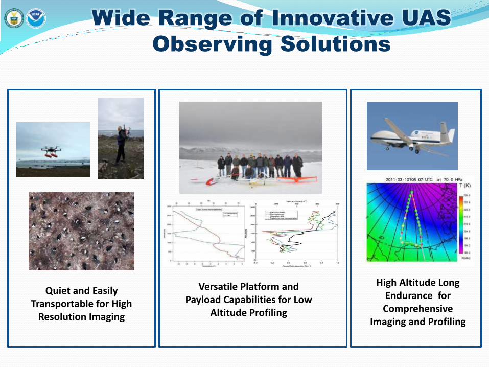
Wide Range of Innovative UAS
Observing Solutions
Quiet and Easily Transportable for High
Resolution Imaging
Versatile Platform and Payload Capabilities for Low
Altitude Profiling
High Altitude Long Endurance for Comprehensive
Imaging and Profiling