Embed Size (px)
Citation preview
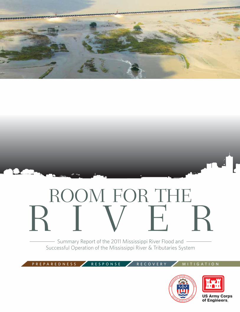
Room foR the
R I V e RP r e P a r e d n e s s r e s P O n s e r e C O V e r Y M I T I G a T I O n
Summary Report of the 2011 Mississippi River Flood and Successful Operation of the Mississippi River & Tributaries System
1
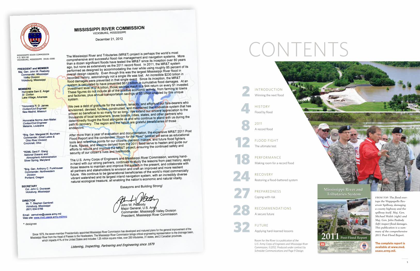
2 IntroductIon
Winning the next flood
8 2011
A record flood
18 Performance
Making room for a record flood
27 PreParedness
Coping with risk
4 HIstory
Flood by flood
12 flood fIgHt
The ultimate test
24 recovery
Restoring a flood-battered system
28 recommendatIons
A secure future
32 future
Applying hard-learned lessons
CONTENTS
From Top: The flood over-tops the Wappapello res-ervoir Spillway, damaging a county highway and the spillway itself. maj. Gen. michael Walsh (right) and maj. Gen. John peabody (left) inspect flood damages. This publication is a sum-mary of the comprehensive 2011 post-Flood report.
The complete report is available at www.mvd.usace.army.mil.
Room for the River is a publication of the U.S. Army Corps of Engineers and Mississippi River Commission, ©2012. Produced under contract by Schneider Communications and Page 9 Design.
ROOM FOR THE RIVER / 2011 Post-flood summary rePort
2
INTRODUCTION: WInnInG The nexT flOOd
From the earliest days of mississippi river settlement, the desire to protect river towns and industries from floods has proven a daunting and often controversial challenge. When protection was needed, residents, local levee boards and eventually the federal government would build the banks ever higher, using horse-drawn equipment that evolved into increasingly sophisticated engineering designs and construction methods.
more than construction methods changed in the 1920s, spurred in part by the thinking of then Chief of engineers maj. Gen. edgar Jadwin. A massive and tragic flood in 1927 sent shockwaves through the valley—right behind the raging floodwaters that inundated 16 million acres of cities and farms—when Jadwin shaped national policy to direct the mississippi River Commission to change its flood prevention philosophy.
Levees would remain the system’s backbone, but the proposed system authorized by the flood Control Act of 1928 would also make room for the river and its natural tendencies. In extreme flood years, and only then, floodways would divert flows into areas designed to be inundat-ed—areas in some cases populated by homes, farms and wildlife but where flooding has been negotiated through purchased easements—and thus keep even peak floods contained within the walls of main channel levees.
the mississippi River & tributaries System, the name given to the resulting system, has become one of the world’s most comprehensive and success-ful flood control and navigation systems. the enhanced levees and floodwalls—along with new flood-ways, reservoirs, backwater areas, river cutoffs, tributary improvements, pumping stations and more—were designed to operationally complement one another and significantly augment the capacity of the river to safely convey floodwaters and commercial/recreational navigation. (see scHematIcs, PP.15, 20).
the new system also veered from long-held practices in another key way. Instead of planning and designing from the perspective of the last great flood, the integrated system was developed to contain the “Project Design flood,” the largest flood considered to have a reasonable probability of occurrence.
that, to some minds, was perilously close to what hit in early spring 2011, when torrential rains fell in the central mississippi and ohio river valleys, adding fury to a river swollen from a massive upper river snow melt (see raInfall graPHIc, P.9). the timing could not have been worse.
that spring, the rapidly melting record snows and unprecedented rainfall, from six to 10 times higher than normal, in late April created a convergence of floodwaters that delivered the system’s larg-est test to date, damaging property and the flood control system itself. Yet that flood control system prevented hundreds of billions of dollars in damages and confronted a record flood without the loss of a single human life. that compares to the 500 killed and 700,000 left homeless in the comparable 1927 flood. All told, experts estimate the 2011 flood was approximately 85 percent of the project design flood.
Leading the flood fight were maj. Gen. michael Walsh, then president of the mississippi River Commission and Commanding General of the Corps’ mississippi Valley Division, and maj. Gen. John Peabody, also a river commission member and then Commanding General of the Corps’ Great Lakes and ohio River Division.
As maj. Gen. Peabody sought to hold floodwaters back through reservoirs on the ohio River tribu-taries, Walsh relied heavily on the wisdom of the system’s creators. he followed carefully prescribed operational manuals built around lessons hard-learned from repeated flooding. Just as those past les-sons have been integrated into the system’s development and operation, this report similarly seeks to inform those who will be at the decision-making helm in future flood fights.
The post-flood evaluation, summarized by “Room for the River,” seeks to answer three main questions. How did the Mississippi River & Tributaries System perform during the record Mississippi River flood of 2011? How might it perform in its post-flood condition? What might it need to protect lives and livelihoods into the future?
“As changes happen in the system, from the ever-changing river and chang-ing land use patterns, we need to track and learn from them in order to know if we have to modify the system to address those changes,” said hank Dehaan, Regional Project manager for the mississippi River & tributar-ies (mR&t) Post-flood evaluation. “If we just operate the system as we’ve done in the past, we won’t be doing the best we can to fight floods in the future.”
Post-flood evaluation in brief Since its inception in 1928, the mississippi River & tributaries System has evolved from a philosophical concept to a multi-faceted flood control and navigation system. Its backbone lies in the 3,787 miles of levees and floodwalls on the river’s main stem, backwaters and tributaries, dwarfing in magnitude those built in the early to middle part of the 20th century.
the flood of 2011 tested the system like none before. flow and stage (height) levels broke records at dozens of river gages from Cairo, Ill., to Baton Rouge, La. And, for the first time, three of the system’s four floodways—Birds Point–New madrid, morganza and Bon-net Carré, were all operated during a single flood event.
the comprehensive post-flood analysis indicates great success by any measure. River flow levels exceeded all previous major floods of 1927, 1937 and 1973, but the 2011 flood was contained within the system to a much greater extent. And although the 2011 flood caused extensive damages to many mR&t components, the system performed as designed.
Collaborations with local and state partners were key in both planning and ex-ecution of flood fight measures—ringing sand boils, constructing water berms, block-ing culverts and ditches, and even raising deficient sections of the mississippi River levees to authorized and safer grade. floodwaters still weakened or damaged the flood control system itself, with preliminary damage estimates in the $2 billion range. the flood also deposited sediment in unwanted places, restricting the nation’s economically critical navigation system and impacting some of its most fertile agricultural lands. Although harm occurred, the system prevented more than $234 billion in damages that would have resulted due to flooding of large portions of the mississippi River Valley.
A dedicated, multidisciplinary cohort of engineers, biologists, economists, GIS technicians, project and emergency managers and other scientists worked on the post-flood evaluation effort via mR&t component teams assigned to study and assess system elements like levees, reservoirs and floodways. through operation Watershed Recovery operations, work began immediately to fix critical high-risk damages and will gradually shift to repair of less critical items until the system is brought back to pre-2011 conditions. the system will still contain pre-flood deficiencies, some of which were not tested by the flood and remain a risk. for example, 11 percent of the mR&t System is not yet complete, a construction effort that may continue for decades.
“What we’re looking at is how well we did in fighting the 2011 flood, how well the system performed, and what we can do better next time,” Dehaan said. “We have developed a roadmap here for future leaders and decision makers.”
“We have developed a roadmap here for future leaders and
decision makers.”
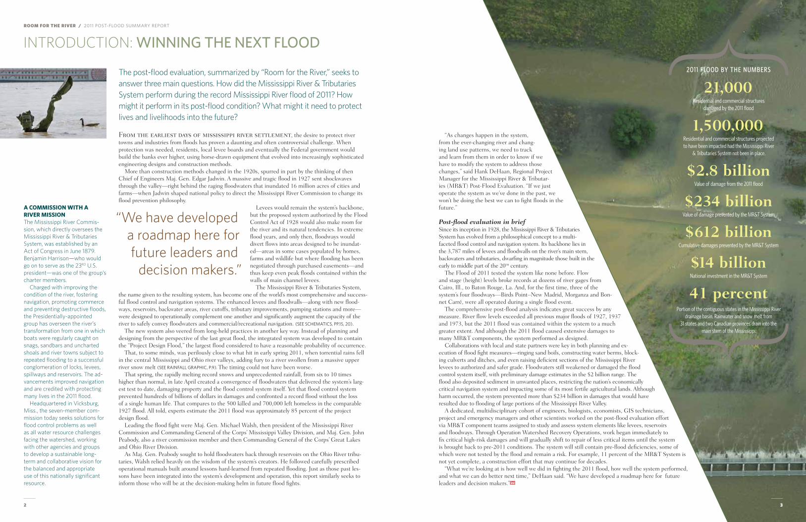
2011 FLOOD BY THE NUMBERS
21,000Residential and commercial structures
damaged by the 2011 flood
1,500,000Residential and commercial structures projected to have been impacted had the Mississippi River
& Tributaries System not been in place.
$2.8 billionValue of damage from the 2011 flood
$234 billionValue of damage prevented by the MR&T System
$612 billionCumulative damages prevented by the MR&T System
$14 billionNational investment in the MR&T System
41 percentPortion of the contiguous states in the Mississippi River
drainage basin. Rainwater and snow melt from 31 states and two Canadian provinces drain into the
main stem of the Mississippi.
3
A Commission wiTh A RiveR missionThe Mississippi River Commis-sion, which directly oversees the Mississippi River & Tributaries System, was established by an Act of Congress in June 1879. Benjamin Harrison—who would go on to serve as the 23RD U.S. president—was one of the group’s charter members.
Charged with improving the condition of the river, fostering navigation, promoting commerce and preventing destructive floods, the Presidentially-appointed group has overseen the river’s transformation from one in which boats were regularly caught on snags, sandbars and uncharted shoals and river towns subject to repeated flooding to a successful conglomeration of locks, levees, spillways and reservoirs. The ad-vancements improved navigation and are credited with protecting many lives in the 2011 flood.
Headquartered in Vicksburg, Miss., the seven-member com-mission today seeks solutions for flood control problems as well as all water resource challenges facing the watershed, working with other agencies and groups to develop a sustainable long-term and collaborative vision for the balanced and appropriate use of this nationally significant resource.
ROOM FOR THE RIVER / 2011 Post-flood summary rePort
5
HISTORY: flOOd BY flOOd
Nearly all civilizations have settled along rivers first, due to the natural source of transportation and water supply, often relying for flood protection on banks raised a yard or two by the rivers’ natural processes.
In 1717, the french sought to protect their investment in the then-new settlement of New orleans by ordering construction of the first manmade levee (derived from the french, “to raise”) along the mississippi River. It was three feet high and 5,400 feet long.
Under french law, landowners on the mississippi’s west bank were required to keep those levees maintained or forfeit valuable land, and compliance hastened even more development. Westward expansion further led to a growth in commerce, as did the coming of the steamboat. Residents built homes and farms and industries until, by the 1850s, New orleans was the nation’s fourth largest city. It was booming with port trade and Parisian fashion—growth mainly attributed to the mighty river along whose banks it sat.
But the river still flooded regularly, as did others across the mississippi River Valley. In 1849, major flooding prompted the Swamp Act, which transferred low-lying lands to the states, funded levee con-struction and set up levee boards. A valley survey followed, and findings would prompt a lively debate over whether levees alone could control the river or if man-made outlets and floodways were a neces-sary addition.
the levee system eventually came under the purview of the seven-member mississippi River Commission, appointed by the President in 1879. over the next 40 years, the commission worked with states and local levee districts to set standards and improve the system. for half of that time, federal law prohibited the expenditure of federal funds for the protection of private property for flood control. then, after deadly floods in 1912, 1913 and 1916, Congress passed the flood Control Act of 1917, authorizing flood control on the mississippi River and elsewhere as a federal mission, and hundreds of miles of levees were raised and strengthened as a result. By the mid-1920s, the commis-sion believed the levee system to be “now in condition to prevent the destructive effects of floods.”
then it started raining in the spring of 1927, and to quote one flood observer at the time, “it just never did stop.”
the flood overwhelmed the levee system. When the damage was tallied, more than 40,000 buildings were destroyed and many times that rendered unlivable. Also destroyed were industries, transportation systems, crops and other farm products—1.2 million chickens, 271,000 livestock and more than 6 mil-lion muskrats, those a key income source for the Louisiana Cajun population. the estimated loss of $1 billion was a third of the federal budget at the time.
the tragedy drove home the fact that walls of earth would never keep the river completely con-strained, no matter how high. With the flood Control Act of 1928, Congress directed the Corps to develop a flood control system that would prevent a repeat of the tragedy.
of the 300 competing plans put forth, Congress preferred and adopted the one known as the Jadwin Plan and its two principal innovations that would evolve over time into today’s more compre-hensive system. floodways would make room for the river by diverting peak flows and holding down stages in the main channel. the system also would be designed to protect against a “Project Design
Flood management philosophy evolves, flood by flood.
flood” (PDf), the largest hypothetical flood likely to occur based on a meteorological examination of historic rainfall and runoff patterns.
As noted in December 1927, the mississippi River & tributaries System developed from the act was “designed to conform to the natural tendencies of the river; it is not forced or driven.”
Levees remained the system’s first line of defense in protecting the vast river valley from the most fre-quent periodic overflows of the mississippi. Such a defense certainly was needed in the world’s third largest drainage basin—exceeded in size by only the Amazon and the Congo. Runoff from as far east as New York and as far west as montana contributes to flows that make their way down the river, into the Gulf of mexico.
But under the plan, excess water, during extreme events, would be allowed to spill out of the main channel into carefully prescribed floodplains. those so-called floodways would be operated only, as in the case of the Birds Point–New madrid floodway, when river gages reach a carefully designated height.
that location, near the confluence of the ohio and mississippi, is the system’s first check. When the river reaches a critical stage on the Cairo gage, the Birds Point–New madrid floodway—one of four system floodways—would be activated to divert up to 550,000 cubic feet per second (cfs) and prevent floods from overtopping levees in the mississippi-ohio confluence area, along and immediately down-stream of the Birds Point–New madrid floodway.
Across a broad geographical landscape, the mR&t System, in addition to levees, uses a combination of flood control reservoirs, backwater areas and channel improvements to help manage floods. the back-waters of the St. francis, White, Yazoo and Red Rivers assist the Birds Point–New madrid floodway in
The lower river is basically a funnel for the world’s third largest drainage basin—exceeded in size by only the Amazon and the Congo.
To diveRT oR noT To diveRT The 1927 flood demonstrated that the confined channel along the Mississippi River didn’t have the capacity to pass great floods without considerably increasing levee height. Original plans for the Mississippi River & Tributar-ies System thus provided for five floodways (four of which were eventually constructed) designed to safely divert excess floodwaters past critical reaches in the levee system to keep major floods from overtopping the most vulnerable levees.
The five proposed floodways were Birds Point–New Madrid (SE Mo.); Boeuf (SE Ark./N. La.), Morganza and West Atchafalaya (paralleling the Atchafalaya River), and the Bonnet Carré Spillway (near New Orleans).
It was generally accepted that floodway inclusion was a neces-sary turning point from pre-1927 engineering policy, but the reality of their implementation proved a tough political sell. Private land once protected by levees would in some cases be subject to inunda-tion to benefit more largely popu-lated areas farther downstream. It was a controversial concept, though less so where the govern-ment was agreeing to compensate floodway landowners.
President Calvin Coolidge ap-proved the federal acquisition of land and payments to floodway landowners for flowage ease-ments within the Bonnet Carré Spillway and Birds Point–New Madrid Floodway. Controversy arose when Coolidge acquired a right of way for construction in the Boeuf and Atchafalaya flood-ways but didn’t include similar flowage easements, claiming the protection level wouldn’t change.
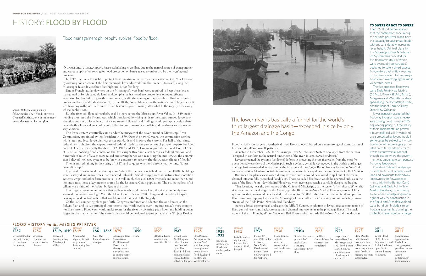
above: refugee camp set up following the 1927 flood. opposite: Greenville, miss., one of many river towns devastated by that flood.
event
1782Greatest flood in the first century of Louisiana settlement.
resPonse
1782Crevasses repaired, no serious loss by planters.
event
1849, 1850Repeated flooding along mississippi Valley.
resPonse
1849Swamp Act represents first steps toward federalizing flood control.
event
1861–1865Civil War leaves levees in disrepair.
resPonse
1879mississippi River Commission (mRC) created. flood control, through levees-only policy, seen as integral part of river navigation.
event
1890flood
resPonse
1890efforts initiated to raise levees from 38 to 46 feet.
event
1927Great flood: 27,000 square miles of lower river flooded, up to 500 dead, $1 billion economic losses equaled a third of federal budget.
resPonse
1928flood Control Act implements Jadwin Plan/adds floodways to supplement levees. Project flood developed by mRC and Weather Bureau.
event
1929–1932Boeuf and Atchafalaya floodways challenged in court.
resPonse
1932Cutoffs added; significantly lowered flood stages in 1937, beyond.
event
1937flood: 365 die, $500 million in losses; New madrid floodway and Bonnet Carré Spillway opened for first time.
resPonse
1938flood Control Act adds reservoir construction and headwaters projects.
event
1940sStudies indicates potential of Atchafalaya capturing mississippi River flow.
resPonse
1963old River Control Complex construction completed
event
1973Largest water volume flows down mississippi since 1927 flood; Bonnet Carré Spillway and morganza floodway both activated.
resPonse
1973flood Disaster Protection Act makes purchase of flood insurance mandatory in some cases; floodplain mapping gets more sophisticated.
event
2011Great flood of 2011 flows largest on record; 3 of 4 floodways open for first time in history; no deaths.
resPonse
2011Supplemental appropriation funds flood damage repairs; post-flood report documents system performance/improvements.
flOOd hIsTOr Y on the MIssIssIPPI rIVer
4
6 7
1844 1882 1914 1928 1942–1972ENLARGEMENT
1973–presentTYPICAL ENLARGEMENT
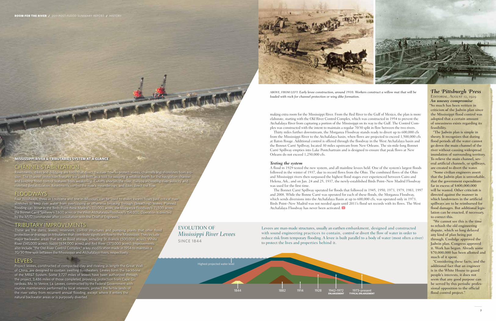
EVOLUTION OF MISSISSIPPI RIVER LEVEES
Highest projected water level
making extra room for the mississippi River. from the Red River to the Gulf of mexico, the plan is more elaborate, starting with the old River Control Complex, which was constructed in 1954 to prevent the Atchafalaya River from capturing a portion of the mississippi on its way to the Gulf. the Control Com-plex was constructed with the intent to maintain a regular 70/30 split in flow between the two rivers.
thirty miles further downstream, the morganza floodway stands ready to divert up to 600,000 cfs from the mississippi River to the Atchafalaya basin, when flows are projected to exceed 1,500,000 cfs at Baton Rouge. Additional control is offered through the floodway in the West Atchafalaya basin and the Bonnet Carré Spillway, located 30 miles upstream from New orleans. the six-mile-long Bonnet Carré Spillway empties into Lake Pontchartrain and is designed to ensure that peak flows at New orleans do not exceed 1,250,000 cfs.
Testing the system A flood in 1929 tested the new system, and all mainline levees held. one of the system’s largest floods followed in the winter of 1937, due to record flows from the ohio. the combined flows of the ohio and mississippi rivers then surpassed the highest flood stages ever experienced between Cairo and helena, Ark., and on Jan. 24 and 25, 1937, the newly-established Birds Point–New madrid floodway was used for the first time.
the Bonnet Carré Spillway operated for floods that followed in 1945, 1950, 1973, 1979, 1983, 1997 and 2008. While the Bonne Carré was operated for each of these floods, the morganza floodway, which sends diversions into the Atchafalaya Basin at up to 600,000 cfs, was operated only in 1973. Birds Point–New madrid was not needed again until 2011’s flood set records with its flows. the West Atchafalaya floodway has never been activated.
The Pittsburgh PressEditorial, August 12, 1929An uneasy compromise
“So much has been written in criticism of the Jadwin plan since the Mississippi flood control was adopted that a certain amount of uneasiness exists regarding its feasibility.
“The Jadwin plan is simple in theory. It recognizes that during flood periods all the water cannot go down the main channel of the river without causing widespread inundation of surrounding territory. To relieve the main channel, sev-eral artificial channels, or spillways, are created to divert the water.
“Some civilian engineers assert that the Jadwin plan is unworkable, that the government expenditure far in excess of $400,000,000 will be wasted. Other criticism is directed against the manner in which landowners in the artificial spillways are to be reimbursed for flood damages. But additional legis-lation can be enacted, if necessary, to correct this.
“We cannot see this is the time to rehash the old engineering dispute, which so long delayed any kind of plan being put through. Coolidge approved the Jadwin plan. Congress approved it. Work has begun. Already some $70,000,000 has been allotted and much of it spent.
“Considering these facts, and the additional fact that an engineer is in the White House to guard people’s interests, it does not seem that any good purpose can be served by this periodic profes-sional opposition to the official flood control project.”
mississippi RiveR & TRibuTARies sysTem AT A glAnCe
cHannel stabIlIzatIonrevetments, dikes and dredging are tools that direct the river flow to protect levees, channels and shorelines from ero-sion. the channel protection features are used both as a tool for keeping a reliable depth for the navigation channel and keeping flood control features from weakening. cutoffs shorten the river, thereby increasing river velocity and riverbed destabilization. revetments control the river’s meanderings, and dikes direct the flow.
floodwaysfour floodways, three in louisiana and one in missouri, can be used to divert excess flows past critical river stretches to keep river water from overtopping or otherwise breaking through (breaching) levees. Planned flooding can occur in the birds Point–new madrid’s 133,000 acres; the morganza floodway’s 71,500 acres; the bonnet carré spillway’s 7,600 acres or the west atchafalaya floodway’s 154,000. operation is directed by the mvd commander after consultation with the chief of engineers.
trIbutary ImProvementsthese are the dams, levees, reservoirs, control structures and pumping plants that offer flood protection or drainage on tributaries that contribute significant flow to the mississippi. they include major backwater areas that act as flood storage, including st. francis (500,000 acres); white river (145,000 acres), yazoo (634,000 acres) and red river (373,000 acres). Improvements also include “the old river control complex,” a key modification made in 1954 to maintain a 70/30 flow split between the mississippi and atchafalaya rivers, respectively.
leveesProject levees, constructed of compacted clay and rivaling in length the great wall of china, are designed to contain swelling floodwaters. levees form the backbone of the mr&t system. some 3,727 miles of levees have been authorized through the project, 3,486 miles of those completed, providing protection from cape gi-rardeau, mo. to venice, la. levees, constructed by the federal government with routine maintenance performed by local interests, protect the fertile lands of the river valley from recurrent annual flooding, except where it enters the natural backwater areas or is purposely diverted.
Levees are man-made structures, usually an earthen embankment, designed and constructed with sound engineering practices to contain, control or divert the flow of water in order to reduce risk from temporary flooding. A levee is built parallel to a body of water (most often a river) to protect the lives and properties behind it.
EvolutioN oF Mississippi River LeveessInCe 1844
Above, From LeFT: early levee construction, around 1910. Workers construct a willow mat that will be loaded with rock for channel protection or wing dike formation.
ROOM FOR THE RIVER / 2011 Post-flood summary rePort / HIstory
ROOM FOR THE RIVER / 2011 Post-flood summary rePort
8 9
2011: a reCOrd flOOd
the first ingredients of the Great Flood of 2011 were an unseasonably wet autumn of 2010 and a record snowfall in Iowa, minnesota and Wisconsin.
frigid cold followed, and severe winter storms piled even more snow across the Upper mississippi River states and the ohio River Valley. By mid-february, far more snow cover than typical extended across large sections of the mississippi River basin, upstream of Cairo, Ill., where the ohio River joins the mississippi. Up to 40 inches of snow fell in some areas in a single month.
In essence, nature had created a massive reservoir of frozen water, one that would quickly make its presence felt as soon as temperatures started to rise.
that would not be long. Spring thaw began in february in the middle mississippi and ohio River valleys. Unseasonably warm temperatures and heavy rainfall rapidly melted the remaining ohio Valley snowpack in less than 48 hours, releasing up to four additional inches of water as runoff. the one-two punch—rapidly melted snow, combined with sudden new rainstorms—caused widespread but minor flooding along the ohio River and Upper mississippi. there was much more to come.
By mid-April, flood waters on the upper mississippi and ohio rivers were bearing down on Cairo, Ill. Complicating matters, another massive storm system packing torrential rains was heading toward the region. Combined, these ingredients equalled a recipe for disaster.
Reducing the creston April 21, forecasters predicted the mississippi River could rise to 61.1 feet at the Cairo gage—21.1 feet above flood stage—by the first week of may.
that forecast prompted Army Corps officials to take the first of what would become a series of deci-sive actions to manage a massive river that was growing larger by the day.
As the first line of protection, Corps-operated reservoirs along tributaries of the ohio and missis-sippi Rivers were used to capture extensive stormwater runoff. filling some reservoirs to historic or near-historic levels helped keep the lower river’s crests from overtopping the flood control structures authorized in 1928 as part of the ambitious mississippi River & tributaries System.
Convinced that the flood had the potential to reach record levels, maj. Gen. John Peabody issued overarching guidance to senior leaders and district commanders in the ohio basin. Peabody directed that flood duty missions took priority over everything else his staff was working on; he also wanted his staff to consider all alternatives, including those outside of the division’s normal operating procedures,
to contain the flood on the ohio River and its tributaries.“We must do every single thing we possibly can do—no matter how small or seemingly insignifi-
cant—to reduce the projected maximum crest at Cairo,” maj. Gen. Peabody wrote in his order. “It is essential that we pull out the stops to fight the peak river crest for this event.”
It was a tall order: the city of Cairo, at the confluence of the ohio and mississippi rivers, was nearly an island because a vast area of land around Cairo was underwater. Standing water already covered low-lying farmland in the four-state area of Illinois, missouri, Kentucky and tennessee.
Water levels were so high in the mississippi River’s main stem that excess water had nowhere to go but up; all of the river’s natural relief valves for flooding and several levee districts were already inundated. Rising floodwaters from St. John’s Bayou in missouri began to encroach upon Interstate 55, the major north-south thoroughfare in the mississippi Valley, and levee conditions were deteriorating around Cairo.
The 2011 Mississippi River flood played out over the course of several weeks in April and May, but U.S. Army Corps of En-gineers officials already suspected in late March there might be trouble ahead.
It was a tall order: The city of Cairo, at the confluence of the Ohio and Mississippi rivers, was nearly an island.
Although no improved mR&t dams or levees have ever failed, small boils of water began showing up on the land side of levees across the region. the boils, caused by the immense pressure exerted by the river, were a major con-cern. When river levels rise, the additional weight of the water creates pressure that tries to find an escape route through the founda-tion of the levee system. Water essentially finds conduits under the levees and boils up through the ground on the land side of the levee.
the boils can carry sand, clay and other founda-tion materials from beneath a levee, weakening the structure’s foundation. Left unchecked, a sand boil can increase in flow and undermine the protective levee, caus-ing it to fall, often with catastrophic consequences.
A Flood FoReCAsTing Fusionthe national weather service forecasts the weather, while the u.s. army corps of engineers
translates what that weather’s likely to mean, particularly if it involves heavy rain and snow, to the levels of the mississippi river and those who live along it.
river forecasting plays such a key role in how society responds to flooding that a fusion team was formed in 2008 to improve interagency synchronization and use of river and
rainfall observations and related river forecasts. the team includes representatives of three agencies—the national weather service, the corps and the u.s. geological
survey. the team works collaboratively to identify improvements, develop plans, innovate and implement new flood forecast tools. the ultimate goal is to opti-
mize accuracy and usability of forecasts they send out to the public.forecasts were especially key in the 2011 flood because projected
heights at river gages trigger operation of floodways and other aspects of the flood control system. It’s a dynamic process that kept changing in
the midst of heavy, unexpected rainfall. the fusion team was key in improving collaboration, leading to improved forecasting and informa-
tion dissemination.
Glossary of flood Termsfloodplain: Area along the banks of a river or stream which is in-undated during a flood. May con-sist of backwaters, woodlands, farms or homes and businesses.
floodway: A designated area which diverts flows from the main river, thus reducing the risk of overtopping of other flood control structures and providing flood protection to people and property.
flowlines: The MR&T Project Flowline is the level or stage of the water surface for the project’s design flood at every point along the system, i.e., the maximum flood event for which the project is designed. When plotted on a graph of stage versus river length, it shows as a flowline.
revetment: A hard substrate like rock or concrete that helps ‘revet’ or retain an embankment to protect it from getting eaten away by a strong river current.
sand boil: An eruption of water and foundational material through a bed of sand, such as occurs when pressurized water pen-etrates beneath a levee and comes out on the landward side.
spillway: A structure in a dam or levee used to safely allow flood flows to pass downstream or into a side channel while protecting the dam or levee from overtopping
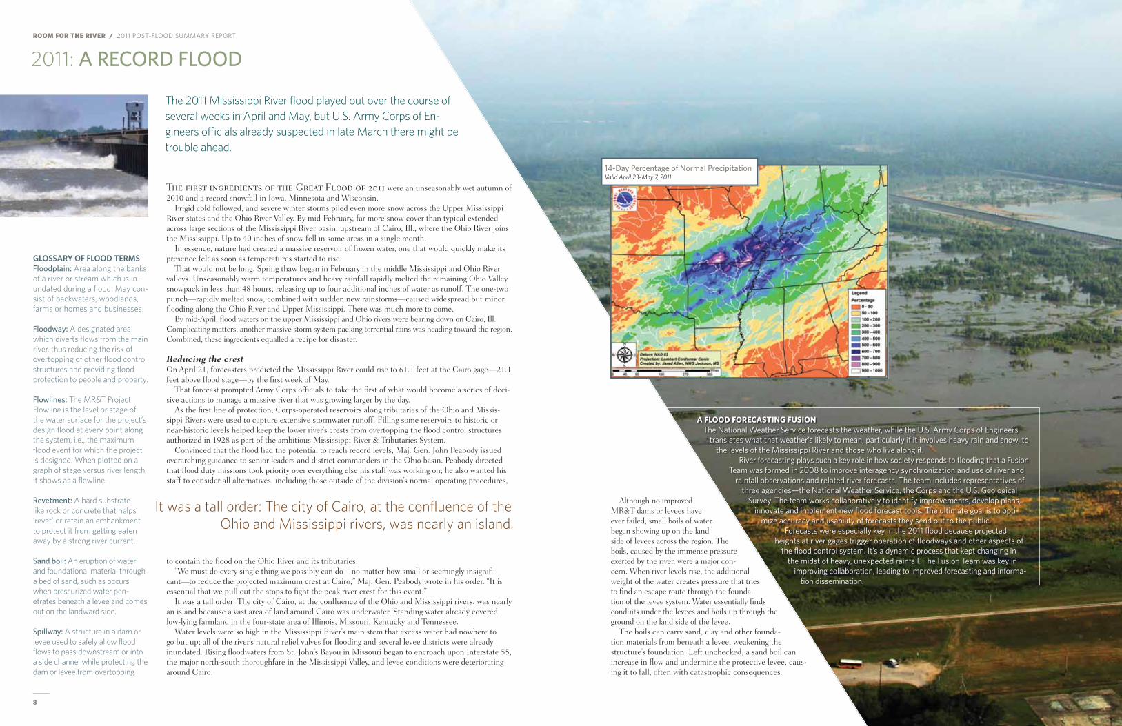
14-day Percentage of normal PrecipitationValid April 23–May 7, 2011
10 11
ROOM FOR THE RIVER / 2011 Post-flood summary rePort / 2011 flood
Staving off catastrophefaced with the prospect of a bad flood potentially becoming a catastrophic event, maj. Gen. Peabody and Deborah Lee, chief of water management in the Corps’ Great Lakes and ohio River Division, sought to hold back the worst of the ohio River flood waters with flood control reservoirs under their control.
Gen. Peabody directed that many of the ohio basin dams hold additional water above their normal operating levels but still within their safe operating bands—a deviation from the approved Water Control plan.
the river’s level at Cairo was at 57.9 feet on April 26, and the rising waters were projected to stop at a height of 60.5 feet within five days. the goal was to keep the river from rising above 60 feet, a level that signaled an approximate trigger point for activation of the Birds Point–New madrid floodway.
Army Corps officials who participated in a surveillance flight over the region around Cairo on April 26 were stunned by what they saw: Water was everywhere and, in some areas, extended as far as the eye could see. the volume of water was almost beyond comprehension.
Between April 20 and April 27, at least six inches of rain had fallen over a huge section of Illinois, Indiana, Kentucky, tennessee, Arkansas and mississippi. that was the minimum amount. most areas received a foot or more and, in some cases, 10 times the typical rainfall. the town of Springdale, Ark., recorded 19.7 inches.
But the rains stopped on April 27, and there was a glimmer of hope. members of the mississippi River Commission believed that if the rain held off, and waters could be held back at the flood control reservoirs along the ohio, northern tributaries of the mississippi and the missouri rivers, the flood might be manageable. But the weather didn’t cooperate. heavy rains returned on April 30, and water levels began to rise again across the mississippi River valley.
Uncharted territoryBy may 1 it was obvious that reservoirs and levees alone would not stem the steadily rising river. the river gage at Cairo, Ill., was at 60.5 feet and rising, a key decisional trigger point that signaled the need to call into use a rarely used flood relief valve: the Birds Point–New madrid floodway. It would need to be activated for the first time since 1937, a decision that meant the additional flooding of farmland and homes lying in the floodway.
RiveR gAges pRovide dATA needed To mAnAge FloodsStructures called river gages played a key role in how the U.S.
Army Corps of Engineers managed the Mississippi River flood of 2011. Gages throughout the Mississippi River Valley are operated and
maintained through cooperative efforts between the Corps, U.S. Geological Survey (USGS) and NOAA/National Weather Service (HttP://waterdata.usgs.gov/nwIs/rt). The National Weather Service then uses the data in concert with weather patterns to make fore-casts that inform the public, emergency managers, and some of the Corps’ most important river management decisions.
Some 50 gages are located on the main stem of the Mississippi River and near the mouths of major tributaries to the Mississippi, south of the conflu-ence of the Ohio River. Each gage measures stream stage, in most cases flow, and in some cases water quality as well, at that strategic river point.
Traditional gages are stone or concrete structures, generally located above the 100- or 200-year floodplain so they don’t become inundated by the floods they’re designed to monitor. Gages are connected to the river by pipes (or intakes), and the movement of floats and wires within the stilling well turns wheels and dials that measure water surface elevation and flow, according to Robert Hainly, Acting Deputy Chief of the USGS Office of Surface Water. Newer gages use more advanced electronic and pressure sens-ing systems to make similar readings. Rapid deployment gages also were used during the flood when there was need for additional measurement at an ungaged location if there was a question about the reliability of a given reading.
The gage readings are provided in real time, allowing anyone—in-cluding those who live along the river—to monitor actual and fore-casted flood stages. The Corps site, rivergages.com, includes a custom reference table that equates stage and flow to potential inundation of affected local landmarks like highways. The readings are also key to the operation of the MR&T System, where specific river elevation and flows determine when to operate floodways or other components. Without them, the Corps and other agencies “would essentially be operating blindly, unaware both of the river’s stage at a certain point or flood-control structure and also of what’s coming downstream,” Hainly said.
The long-developed flood management plan, for example, calls for the operation of the Birds Point–New Madrid Floodway when a certain level is reached on the gage in Cairo, Ill. That was surpassed on May 2, 2011.
the Corps was in uncharted territory. Never before had water levels at the Cairo gage risen to 61 feet. the volume of water flow-ing down the middle mississippi River in 2011 surpassed even the historic floods of 1927 and 1937.
the river continued to rise on may 2 as heavy rains pelted the mississippi River Valley. that day, maj. Gen michael Walsh, the president of the mississippi River Commission and mississippi Valley Division commander, was surrounded by mRC commission-ers and his command staff aboard the mVD command flagship, the mV Mississippi, and pondered what lay ahead for the river and the communities that lined its banks.
During that somber moment of reflection, Walsh said he told himself: “this is the big one, the flood we’ve always feared.”
the Corps of engineers had spent several decades designing and building the mississippi River & tributaries System, an elaborate net-work of levees, floodways, backwaters, reservoirs, relief wells and flood control structures. It was designed to handle more water than had ever flowed down the mississippi River in recorded history. then nature came with a formidable challenge in 2011, adding an unprecedented amount of precipitation on top of already swollen rivers. Rainfall mea-sured 600 percent to 1,000 percent above average (see graPHIc, P.9).
Near the end of the flood, mississippi Gov. haley Barbour said the bulge of floodwater that passed through the mississippi River system was like “a pig moving through a python.”
As the flood progressed, the big question remained: Could the Army Corps safely shepherd that proverbial pig (the floodwaters) through the proverbial python (the mR&t System) and out to sea without tremendous loss of life and property? the stakes could not have been higher.
The magnitude of water was almost bey ond comprehension.
above, from left: Deer flee to higher ground in the Atchafalaya basin, following the opening of the morganza Floodway. A mid-flood algae bloom in Lake pontchartrain. Flooded grain bins in a barge load-ing terminal.
ROOM FOR THE RIVER / 2011 Post-flood summary rePort
12 13
FLOOD FIGHT: The UlTIMaTe TesT
the 2011 Mississippi River flood tested the mississippi River & tributaries System—and those who manage it—as never before.
River stages and flow rates broke records up and down the river during what was the largest flood in recorded history on the mississippi River. the flood was contained within the system to a greater ex-tent than earlier comparable floods, but not without a battle fought on numerous fronts, by a multitude of partners.
the flood fight began early with the implementation of emergency operation and Action Plans maintained by each district within the mississippi River & tributary System—St. Louis, memphis, Vicksburg and New orleans.
the staff at the river’s U.S. Army Corps of engineers Districts and area levee boards knew from past floods where trouble spots might pop up, and that’s where monitoring started. Action plans also detailed the specific operational requirements of the components within each district. those plans outline a district’s roles and responsibilities, decision criteria for operating various aspects of the sys-tem, communications guidance and detailed information addressing trouble spots. Similarly, local levee districts, states, counties and other authorities—working in close coordination with the Corps and each other—relied on their flood plans, which were used, adapted and adjusted for each flood event to ensure appropriate warnings and evacuations or flood fight measures.
Still, it took a determined and coordinated effort by thousands of individuals to guide the severely swollen river from Cairo, Ill., to the Gulf of mexico—through the mR&t System’s thousands of miles of authorized embankments, levees and floodwalls—while preventing the loss of life, maintaining navigation on the river and limiting property damage. Working with local and state agencies across the lower mississippi River basin, the Corps fought the 2011 flood for six months, from march to August.
The fightthe Corps’ memphis District declared a flood emergency on march 14. others further downriver soon followed suit. By early April, it was obvious that the 2011 flood could reach record-setting proportions.
As the first line of protection, Corps-operated flood control reservoirs along tributaries of the ohio and mississippi rivers captured some of the flow. maximizing the holding capacity of the reservoirs helped delay and lower the river crests as they met the lower mississippi. But the reservoirs alone would not control the steadily rising river.
hundreds of sand boils, ranging from the size of a baseball to one that was large enough to swallow a large sedan, were developing all along the mississippi River, on the landward side of levees. It was a major concern, particularly near Cairo, Ill., located at the lowest elevation of any location within Il-linois and totally surrounded by levees.
Crews fought thousands of sand boils along the river, using sandbags, plastic and rock to build circular rings around the boils as a barrier. encircling the sand boils halted the movement of sand and soil, thereby reducing the risk of the boils causing levee failure. the strategy worked; not one mainline mR&t levee along the mississippi failed.
In late April, the Army Corps’ division commanders—maj. Gen. michael Walsh and maj. Gen. John Peabody—went to Cairo to inspect a mega boil that had developed near the floodwall where the ohio River joins the mississippi. they were stunned by what they saw. It was the largest sand boil ring that they, or even the most seasoned and experienced flood fighters, had ever seen.
the river rose six feet in six days at Cairo, Ill. on the morning of may 2, the river gage at Cairo
A system successfully passes a record flood.
passed 60.5 feet and was still rising, a tipping point that signaled the need to use explosives and oper-ate another key feature in the flood control project. the Birds Point–New madrid floodway would need to be activated for the first time since 1937, a decision that meant intentionally increasing the flooding farmland and homes lying in the spillway.
that afternoon (may 2), Walsh issued the order to breach the Birds Point Levee. It wasn’t an order hastily made. In his brief the day before, memphis District Commander Col. Vernon Reichling had requested permission to move into position barges laden with explosives needed to fill pipes within the earthen levee, an 18-hour process, saying the situation had become a “when” and no longer an “if.”
But Gen. Walsh was still holding a slim hope that rains would subside. they didn’t, and the river continued the steady climb that had raised water levels six feet in six days. “Sometimes people cel-ebrate records—but not this time,” Walsh said. “making this decision is not easy or hard—it’s simply grave—because the decision leads to economic hardship and damage to affected property owners … I don’t have to like it, but we must use everything we have in our possession in the system to prevent a more catastrophic event.”
over the course of several hours, crews working in a driving rain pumped 115 tons of binary blasting agents into 27,000 linear feet of buried pipes within the center of the levee. the project was delayed
Technology key in flood risk sharingThere are a few refinements yet to be worked out, but social media, smart phones and custom-designed apps that allow for instant field reporting are clearly here to stay after offering valuable and real-time communication sharing for river managers and decision-makers during the 2011 flood fight.
The Mississippi Valley Division Public Affairs Offices and the Joint Information Center used Facebook, Twitter, YouTube and Flickr as ways to post information updates as flood waters both grew and subsided, as well as to dispel rumors. A Facebook page devoted to the Birds Point–New Madrid floodway, for ex-ample, peaked at 16,500 fans who turned to the site to learn about operation timing, condition of setback levees and current floodway status.
But one of the most promising technologies was developed by the U.S. Army Corps Engineer Research and Development Center in Vicksburg, Miss. A new smart phone application provided real-time GPS pinpointing of flood-fight progress and related issues in the field, giving trained floodfighters the ability to use a phone to upload images, descriptions of flood damage and other critical data to the Command Center. The experimental technology was employed by the Memphis District in the flood’s early stages as one of the first true field tests of this technology. These devices were later transferred to New Orleans and Missouri flood fighters. Enhancements and refinements of this new flood fight tool were made from these field tests, ensuring this tool will be even more useful for the next flood fight.
toP: This explosion lights the sky during the late evening activation of the Upper Crevasse at birds point–New madrid. High winds and lightning prevented daytime activation. maP graPHIcs:
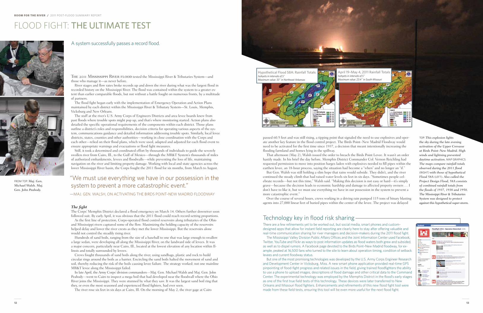
The maps compare rainfall totals observed during the 2011 flood (rIgHt) with those of hypothetical Flood 58A (left). Also called the project Design Flood, 58A consists of combined rainfall totals from the floods of 1937, 1938 and 1950. The mississippi river & Tributaries System was designed to protect against this hypothetical super-storm.
“We must use everything we have in our possession in the system to prevent a more catastrophic event.”
—MAJ. GEN. WALSH, ON ACTIVATING THE BIRDS POINT–NEW MADRID FLOODWAY
hypothetical flood 58a: rainfall TotalsIsohyets in intervals of 5˝Maximum value: 33˝ in Northeast Arkansas
april 19–May 4, 2011 rainfall TotalsIsohyets in intervals of 5˝Maximum value: 23.4˝ in South Missouri
from toP: maj. Gen. michael Walsh. maj. Gen. John peabody.
14 15
ROOM FOR THE RIVER / 2011 Post-flood summary rePort / flood fIgHt
for 12 hours by a powerful storm that buffeted the region with 70 mph winds and numerous lightning strikes, conditions that made a potentially dangerous operation even more challenging.
At 10 p.m. on may 2, after the thunderstorm cleared, the order was given to explosively remove the upper fuseplug (nearly one mile in length). A series of massive explosions shook the ground and lit up the night sky. People reported hearing the explosions 50 miles away, in Cape Girardeau, mo.
earlier that day, the National Weather Service predicted the ohio River would crest at 63.5 feet on the Cairo gage on may 5. But on may 5, three days after the Birds Point levee was breached, the Cairo gage read 59.6 feet—several feet lower than it would have read without operation of the levee.
With the Birds Point–New madrid floodway in operation, some 130,000 acres of farmland and a limited number of buildings and homes were further inundated with floodwaters, but the mighty river began to recede. the mR&t System was performing as designed: It gave the river room to move later-ally, which reduced flooding downstream and eased pressure on the mainline levees.
By may 4, river levels on the Cairo gage dropped below 60 feet, and flood fight teams in the memphis District began reporting that conditions in all sectors, though still grave, had stabilized. But the flood fight was far from over. much work remained downstream to prevent flooding in the many river-based indus-tries, property and cities lining the river’s floodplain to the Gulf.
In mississippi, the mainline levee at Buck Chute (near eagle Lake) threatened rich farmland and numerous occupants of the Yazoo Delta. If that levee failed, the delta would see flooding not experienced
S
TT
Cairo
E S T I M A T E D I N U N D A T I O N E X T E N T S
Background Image from ESRI Online - World Street Map
Map prepared by Mapping, Modeling, & Consequences Production Center
MR&TPost Flood Report
Mississippi RiverNormal Inundation
August 6, 2012
US Army Corpsof Engineers®
USACE
US
AR
MY
CO
RP
S O
F EN
GIN
EER
S
les
N
The bATTle RhyThmDuring the month of May, Maj. Gen. Michael Walsh led what could have been called the Battle of the Mississippi. That he was in a conference room rather than a bunker, or that his “soldiers” were local flood fighters armed with sandbags, plastic sheeting and bulldozers as weapons of defense, doesn’t change one fact: the complexities of decisions and potential consequences to human life make a flood fight as close to a real battle as one can come in civil works.
From a flood fight command center, run around the clock, the Major General and his senior advisers held twice-daily regional teleconferences with his front line commanders to gauge the “battle rhythm” and key decision points. These important meetings discussed weather forecasts, reservoir releases, projected river stages, inundation scenarios, trigger points, floodway activation timing, yield points, interagency coordination and more. The in- between times were filled with more focused evaluations and decision making, coupled with regular communications and personal calls—to governors, members of congress, Corps head-quarters, levee districts, mayors and members of the media.
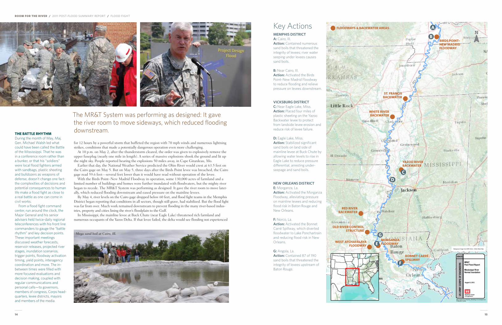
Key Actionsmemphis disTricTa: Cairo, Ill.action: Contained numerous sand boils that threatened the integrity of levees; river water seeping under levees causes sand boils. B: Near Cairo, Ill.action: Activated the Birds Point–New Madrid Floodway to reduce flooding and relieve pressure on levees downstream.
VicksBurG disTricTc: Near Eagle Lake, Miss.action: Placed four miles of plastic sheeting on the Yazoo Backwater levee to protect from landside levee erosion and reduce risk of levee failure. d: Eagle Lake, Miss.action: Stabilized significant sand boils on land side of mainline levee at Buck Chute by allowing water levels to rise in Eagle Lake to reduce pressure differential, arresting under-seepage and sand boils.
New orleaNs disTricTe: Morganza, La.action: Activated the Morganza Floodway, alleviating pressure on mainline levees and reducing flood risk in Baton Rouge and New Orleans. f: Norco, La.action: Activated the Bonnet Carré Spillway, which diverted floodwater to Lake Ponchartrain and reducing flood risk in New Orleans. G: Angola, La.action: Contained 87 of 190 sand boils that threatened the integrity of levees upstream of Baton Rouge.
The MR&T System was performing as designed: It gave the river room to move sideways, which reduced flooding downstream.
mega sand boil at Cairo, Ill.
A
b
d
g
C
e
F
biRds poinT–new mAdRidFloodwAy
sT. FRAnCis bACKwATeR
yAzoo RiveR bACKwATeR
whiTe RiveR bACKwATeR
Red RiveR bACKwATeR
old RiveR ConTRol sTRuCTuRe
wesT ATChAFAlAyA FloodwAy
moRgAnzA FloodwAy
bonneT CARRé spillwAy
FloodwAys & bACKwATeR AReAs
16 17
ROOM FOR THE RIVER / 2011 Post-flood summary rePort / flood fIgHt
Located in SE Missouri below the confluence of the Mississippi and Ohio rivers and designed to be operated at specific conditions to pass extreme floods that would otherwise exceed system capacity. Prior to 2011, operated only once, during severe flooding in 1937. It’s operated by detonating explosives within fuseplug pipes installed in three sections of the frontline river levee. Explosives create crevasses to divert up to 550,000 cfs from the Mississippi River through the floodway. When operated, inundates 130,000 acres along the west flank of the Mississippi River. Operation lowers the flood stage by up to 7 feet near Cairo, Ill. and lowers the risk of a catastrophic failure or overtopping of mainline levees protecting more than 2.5 million acres.
The mainline levee at Buck Chute is located near Eagle Lake, Miss., 15 miles northwest of Vicksburg, part of a sub-system that protects over 1,400 square miles in the lower Mississippi River Delta from flooding but is a chronic problem area with underseepage and sand boils commonly forming at low flood stages. Massive sinkholes were detected, and sand boils developed at low flood stages, indicating a significant problem. Repairs from prior floods had not yet begun, and temporary measures installed in March 2011 were not sufficient for forecasted flood stages. By April, Buck Chute was considered a critical flood fight area and deviation from the Muddy Bayou Water Control plan was considered as an emergency measure to keep the mainsteam levee from failing in the 2011 flood.
Located 10 miles north of Vicksburg, Miss. and extending 28 miles from the Mississippi River mainline levee along the west bank of the Yazoo River to Yazoo City, it’s one of four backwater levees in the MR&T System designed to slowly overtop and take pressure off the system during extremely high flood stages (approaching Project Design Flood elevations). The 1941 Flood Control Act authorized the Yazoo Backwater Levee to be built to a height equivalent to 56.5 feet on the Vicksburg gage (which is what exists today), as long as the levee did not push river levels to within five feet of the top of mainline MR&T levees. Subsequent authorization allows for an additional six feet of height on Yazoo Backwater levee to ensure it performs in concert with the MR&T System.
Located in central Louisiana near river mile 280 on the western bank of the Mississippi River, the Morganza Floodway begins at the river, extends southward to the East Atchafalaya River levee and joins the Atchafalaya River Basin Floodway near Krotz Springs, La. The purpose of the floodway, in conjunction with the Atchafalaya Basin Floodway, is to operate during extreme flood events to carry flood water from the Mississippi River to the Gulf of Mexico via the lower Atchafalaya River and the Wax Lake Outlet. Designed to pass up to 600,000 cfs of water to the Gulf, alleviating stress for mainline levees downstream along the Mississippi River. Prior to 2011, operated only once, during severe flooding in 1973, passing approximately 170,000 to 180,000 cfs at its peak operation.
Operation began April 25 with the loading of barges with materials, equipment and personnel and culminated with floodway activation on May 2 and successful passage of the flood through this constricted reach. Factors considered included: the floodway operating plan; actual and forecasted flood crests at Cairo, Ill.; potential damages caused by operating the floodway and effects on future MR&T System performance; significant precipitation/saturated hydraulic conditions throughout the basin; use of all available reservoir storage capacity to reduce the flood crest at Cairo; deteriorating conditions of levees near Cairo, Ill., and in Fulton County, Ky.; and the time needed to prepare the floodway for operation.
Approval to deviate from the Muddy Bayou Operating Plan was given by the MVD commander on April 28 and resulted in successful passage of the 2011 flood waters through this part of the MR&T System. Many factors were considered in making this key operational decision. Some of the most prominent include: actual and forecasted flood crests at Vicksburg, Miss.; the significant underseepage issues of mainline levee at Buck Chute and impacts of levee failure; potential emergency measures to reduce the risk of failure of the Buck Chute Levee and the possible impacts of deviating from the Muddy Bayou Operating Plan.
Approval to perform flood fight measures along a four-mile stretch of the Yazoo Backwater Levee (forecasted to overtop) was given by the MVD commander on May 4. Approved flood fight measures included filling deficient low spots to authorized levels and armoring the landside of the levee with polyethylene plastic sheeting to reduce the risk of erosion and potential levee failure. Considered factors included: authorized flood fight activities for this backwater levee; actual and forecasted flood crests at Vicksburg, Miss.; potential impacts of full levee failure compared to levee overtopping without failure; 2008 flood data and observations; additional flood fight measure effects on mainstem levels.
Operation was initiated at 3 p.m. on May 14 and resulted in successful passage of 2011 flood waters through this part of the MR&T System with a peak flow of 186,000 cfs through the floodway. Many factors considered, including: the floodway water control plan; discharges at Red River Landing, La.; stages and remaining freeboard at the Morganza Spillway structure; flow conditions at the Old River Control Complex; potential impacts of activating the structure on the floodway; potential impacts of not activating the structure on MR&T mainline levees and the areas they protect; and potential impacts based on how quickly the floodway is operated.
Per the 1986 Operating Plan, the floodway normally will not be operated until flood stages exceeding 60 feet (or 58 if the system is in danger of failing) are predicted on the Mississippi River gage at Cairo. Then, the upper fuseplug section will be prepared for operation, with the lower fuseplug section to follow. Operation requires 150 people, specialized equipment.
Developed as a fish and wildlife mitigation feature for the Yazoo Basin Project to prevent agricultural runoff from Steele Bayou from entering Eagle Lake. The operating plan allows for water level management of Eagle Lake January to June to support fish and wildlife. Raising waters higher than the prescribed level in Eagle Lake to protect the Buck Chute Levee required plan deviation.
Backwater levee systems are meant to take pressure off the MR&T System mainline levees by overtopping during extreme flood events. The Yazoo Backwater Levee was designed to overtop when the Vicksburg gage reached 56.2 to 56.6 feet. Further analysis by the Vicksburg District refined this estimate to 56.3 feet using updated data collected during the 2008 Mississippi River flood.
The plan is based on the Morganza Floodway design and Water Control Plan. Through that, the central Louisiana Floodway is slated to be operated when the flow of the Mississippi River at Red River Landing, La., (located 20 miles north of Morganza) reaches 1,500,000 cfs and is rising.
If and when to operate the Birds Point–New Madrid Floodway
Whether to deviate from the Muddy Bayou Water Control Plan to help protect the Buck Chute Mainline levee
Whether or not to perform flood fight measures at the Yazoo Backwater Levee
If and when to operate the Morganza Floodway in conjunction with conditions at Bonnet Carré spillway and Old River control structure
KEY DEciSiON
LOcATiON
BAcKGROUND
OPERATiNG PLAN
DiLEMMA FAcED
THE DEciSiON
Muddy BayouBirds Point–New Madrid Floodway
Yazoo Backwater Levee Morganza Floodway
Operating the floodway requires evacuating 230 residents and explosively removing the crevasse portions of the frontline levee which would then need to be repaired after the flood. Operation also inundates homes, structures, and increases the level of flooding in up to 130,000 acres of agricultural land. Not operating the floodway, on the other hand, can result in other mainline levees overtopping or failing with much more significant damages and potential loss of life.
Deviating from the water control plan to raise the level of Eagle Lake would reduce the risk of levee failure at Buck Chute, but it would also potentially impact 800 residents and properties along Eagle Lake. Not deviating from the plan would result in much higher head differential between the wet/dry sides of the weakened mainline levee at Buck Chute and high risk of levee failure, potentially inundating 1,450 square miles and impacting up to 3,000 homes.
Up to 300,000 cfs of water would need to be diverted through the floodway based on the water control plan and forecasted Mississippi River flow. Forecasted flow conditions on the Atchafalaya River (760,000 cfs) combined with floodway operation could impact 2,500 people and 2,000 homes and up to 22,500 people in the floodway and 11,000 homes in backwater areas. Not operating could mean other mainline levees overtopping or failing with more significant damages and potential loss of life.
Forecasted flood stages in early May indicated possibility of levee overtopping by a foot of water for up to 10 days, putting the levee at high risk of failure. If the levee overtopped and did not fail, some 450 square miles would be inundated. If it failed, that would increase to 1,900 square miles and affect 3,000 people. Flood fighting could reduce failure risk but might increase risk to mainline MR&T levees. In addition, there was a question as to type and extent of authorized flood fighting options.
Key operational decisions
since 1927. About 3,000 homes and 1,450 square miles of land faced inundation.
to reduce pressure on the levee, the Corps deviated from its usual muddy Bayou water control plan, inten-tionally allowing water to be diverted into eagle Lake. the strategy resulted in the successful passage of the floodwaters through that section of the mR&t System.
In Louisiana, the operation of morganza and Bonnet Carré lowered the flood crest at New orleans and Baton Rouge by 2.5 feet, protecting a 200-mile-long corridor of levees and floodwalls and sparing those cities from a massive flood. Before floodway activation, flood fighters in the New orleans District found 190 sand boils in just the Angola area; 122,000 sandbags were placed at Duncan Point to form a berm and address seepage.
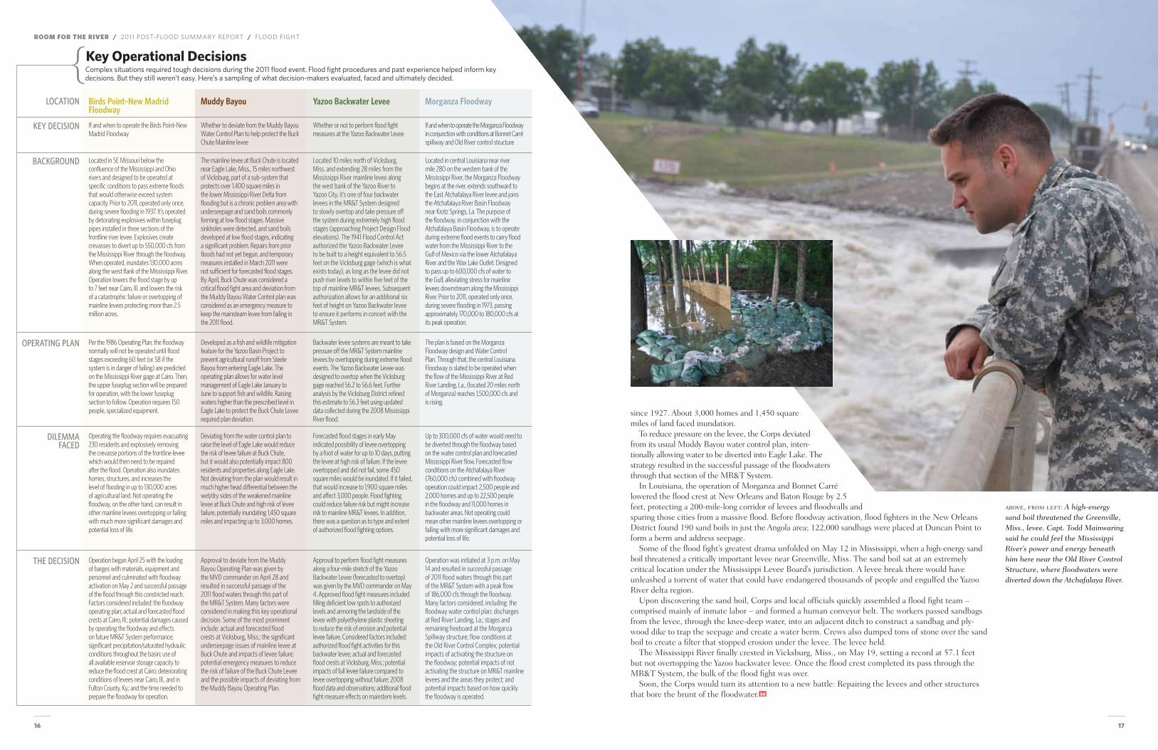
Some of the flood fight’s greatest drama unfolded on may 12 in mississippi, when a high-energy sand boil threatened a critically important levee near Greenville, miss. the sand boil sat at an extremely critical location under the mississippi Levee Board’s jurisdiction. A levee break there would have unleashed a torrent of water that could have endangered thousands of people and engulfed the Yazoo River delta region.
Upon discovering the sand boil, Corps and local officials quickly assembled a flood fight team – comprised mainly of inmate labor – and formed a human conveyor belt. the workers passed sandbags from the levee, through the knee-deep water, into an adjacent ditch to construct a sandbag and ply-wood dike to trap the seepage and create a water berm. Crews also dumped tons of stone over the sand boil to create a filter that stopped erosion under the levee. the levee held.
the mississippi River finally crested in Vicksburg, miss., on may 19, setting a record at 57.1 feet but not overtopping the Yazoo backwater levee. once the flood crest completed its pass through the mR&t System, the bulk of the flood fight was over.
Soon, the Corps would turn its attention to a new battle: Repairing the levees and other structures that bore the brunt of the floodwater.
above, from left: A high-energy sand boil threatened the Greenville, miss., levee. Capt. Todd mainwaring said he could feel the mississippi river’s power and energy beneath him here near the old river Control Structure, where floodwaters were diverted down the Atchafalaya river.
complex situations required tough decisions during the 2011 flood event. flood fight procedures and past experience helped inform key decisions. but they still weren’t easy. Here’s a sampling of what decision-makers evaluated, faced and ultimately decided.
ROOM FOR THE RIVER / 2011 Post-flood summary rePort
18 19
the 2011 flood may have come as close as the mississippi River has reached to the act of Divine Providence prophesied in 1927 by maj. Gen. edgar Jadwin, then Chief of engineers.
Were those provided floodways adequate for floodwater passage? Did it succeed in its ultimate test?By all accounts, yes. But the flood nonetheless left significant economic, environmental and struc-
tural damages and exposed vulnerabilities in portions of system components. It also identified areas for improvement in some decision-making tools, process documents and emergency action, water control and communications plans.
Passing the Project Design FloodAssessing performance requires a little history on the basis of design and operation plans. the missis-sippi River & tributaries System was constructed to protect against the “Project Design flood” (PDf) or maximum flood with a reasonable chance of occurrence. even when not reached (the 2011 flood peak flows were about 85 percent of the Project Design flows), the Project Design flood remains key to system operation by dictating levee heights and requirements as well as dozens of trigger points for activation of various mR&t System features.
those trigger points were originally established based on a hypothetical “super storm” modeled in 1954 by the U.S. Weather Bureau and Corps hydrologists. System components and activation points were based on that hypothetical storm and related flows.
how much flow each mR&t component could handle safely during such a storm prompts activation of floodway and backwater storage areas and lowers risks across the system. operating a floodway basi-cally floods an area designed and compensated for that likelihood to lower the risk of more catastrophic damages elsewhere.
for the first time in the mR&t project’s history, the Birds Point–New madrid and morganza flood-ways and the Bonnet Carré Spillway were placed into operation during a single flood event. emergency
flood fight measures, synchronized with partner agencies, levee districts and municipalities, were also needed, primarily at weak points identified before 2011 or spots where the mR&t System is not yet complete. Communication with those other agencies was accomplished via direct liaison, new internal and external websites, social media and regular meetings and conference calls.
Floodways: Activating 3 of the system’s 4 the Birds Point–New madrid floodway was operated as the system’s upper floodway which directly impacts the area around the mississippi and ohio River junction or “confluence area.” If not oper-ated when needed here, a mainline levee break or overtopping could have inundated 2.5 million acres across parts of missouri and Arkansas, as it did in 1927.
While the other floodways are designed to be opened in a slow, sequential manner, Birds Point—due to its infrequent usage—is designed with earthen fuseplugs instead of gates. originally designed to degrade naturally by the river’s forces at a certain flood stage, the floodway is now activated by detonating explo-sives within fuseplug wells and lateral pipes installed in the 1980s at three sections of the frontline levee. the floodway creates a 30-mile bypass which diverts up to 550,000 cfs from the river, inundating about 130,000 acres for which the Corps had secured permanent flowage easements from landowners.
experts concluded that the Commerce mainline levee would have also been overtopped without the operation of Birds Point–New madrid. Using lessons learned from 2011, the U.S. Army Corps of en-gineers studied the operational features, including potential methods to activate the floodway without the use of explosives.
Should Divine Providence ever send a flood of the maximum predicted by meteorological and flood experts as a remote probability (but not beyond the bounds of ultimate possibility), the floodways provided in the plan are still normally adequate for its passage without having its predicted heights exceed those of the strengthened levees. —MAJ. GEN. EDGAR JADWIN, DEC. 1, 1927
PERFORMANCE: MakInG rOOM fOr a reCOrd flOOd
… for the first time, all three floodways would be activated in the same flood event.
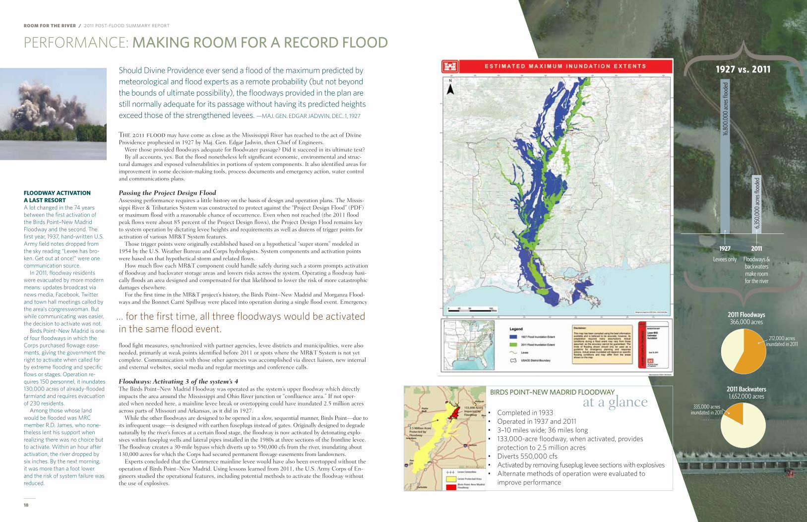
1927 vs. 2011
16,8
00,0
00 ac
res fl
oode
d
1927
Levees only
2011
Floodways & backwaters make room for the river
6,35
0,00
0 ac
res fl
oode
d
212,000 acresinundated in 2011
2011 Backwaters1,652,000 acres
2011 Floodways366,000 acres
335,000 acresinundated in 2011
FloodwAy ACTivATion A lAsT ResoRT A lot changed in the 74 years between the first activation of the Birds Point–New Madrid Floodway and the second. The first year, 1937, hand-written U.S. Army field notes dropped from the sky reading “Levee has bro-ken. Get out at once!” were one communication source.
In 2011, floodway residents were evacuated by more modern means: updates broadcast via news media, Facebook, Twitter and town hall meetings called by the area’s congresswoman. But while communicating was easier, the decision to activate was not.
Birds Point–New Madrid is one of four floodways in which the Corps purchased flowage ease-ments, giving the government the right to activate when called for by extreme flooding and specific flows or stages. Operation re-quires 150 personnel, it inundates 130,000 acres of already-flooded farmland and requires evacuation of 230 residents.
Among those whose land would be flooded was MRC member R.D. James, who none-theless lent his support when realizing there was no choice but to activate. Within an hour after activation, the river dropped by six inches. By the next morning, it was more than a foot lower and the risk of system failure was reduced.
BIrds POInT–neW MadrId flOOdWaY
at a glance• Completed in 1933• Operated in 1937 and 2011• 3–10 miles wide; 36 miles long• 133,000-acre floodway, when activated, provides
protection to 2.5 million acres• Diverts 550,000 cfs• Activated by removing fuseplug levee sections with explosives• Alternate methods of operation were evaluated to
improve performance
20 21
ROOM FOR THE RIVER / 2011 Post-flood summary rePort / Performance
This graphic represents the Project Design Flood, developed to depict worst-case-scenario flows generated from a hypothetical super storm 58A conceived by the Weather Bureau (now National Weather Service). The current Project Design Flood was adopted in 1956 and used as the basis for operation of the various features of the MR&T System. Starting with 35 hypothetical combinations of storms and related runoff, the Weather Bureau ended up combining three severe storms (from 1937, 1950 and 1938) and related flood flows to determine the peak discharge at key locations. A post-1973 flood review determined the Project Design Flood metrics and trigger points were further validated.
Lessons also were learned from the opening of the morganza floodway, operated only one other time in floodway history, 1973. An extensive public notification and coordination effort ensued in this flood-way, where operation affects some 22,000 residents including nearby Butte La Rose and morgan City. It also affected a variety of wildlife, including the endangered Louisiana black bear. Detailed maps were generated to show residents how much floodwater they could expect, and were also useful in planning potential evacuation. extensive coordination was also done with state/local officials and other federal agencies, including the fish and Wildlife Service and U.S. environmental Protection Agency, to limit effects on wildlife and fisheries.
the operation of Bonnet Carré (see tImelIne, Page 20) similarly prevented catastrophic flooding of river communities and cities, such as Baton Rouge and New orleans, and offers a peek into the tricky intricacies of floodway operations.
Navigation Navigation continued largely uninterrupted by the 2011 flood with only minor brief restrictions in certain stretches of the river. Important trade commodities were able to reach their export or import locations nearly unimpeded. Ports, harbors and areas where sediments accumulated during high water were identified in damage assessments and addressed without any further delays to traffic.
Cultural and environmental factorsthe strongest environmental concerns centered around water quality, sedimentation, erosion and wildlife impact issues.
Interagency teams convened while floodwaters rose, established monitoring protocols and made contacts to initiate background research and sampling during the flood. Water quality studies were conducted, one focused at several sites along the Atchafalaya and mississippi, the second on movement of water from the Bonnet Carré Spillway through Lake Pontchartrain. there, despite the high amounts of nutrient-rich water that created swirls of duckweed, no anticipated nutrient-infused algal blooms were observed.
monitoring teams from the U.S. Geological Survey also surveyed for oil and grease in the Atchafalaya Basin, where spillway waters rushed over hundreds of gas and oil wells. only a few samples showed any hydrocarbons and they were at very low concentrations.
Cultural concerns centered around the activation of the Birds Point–New madrid floodway, well known as an area with a high density of Native American sites on the National Register of historic Places.
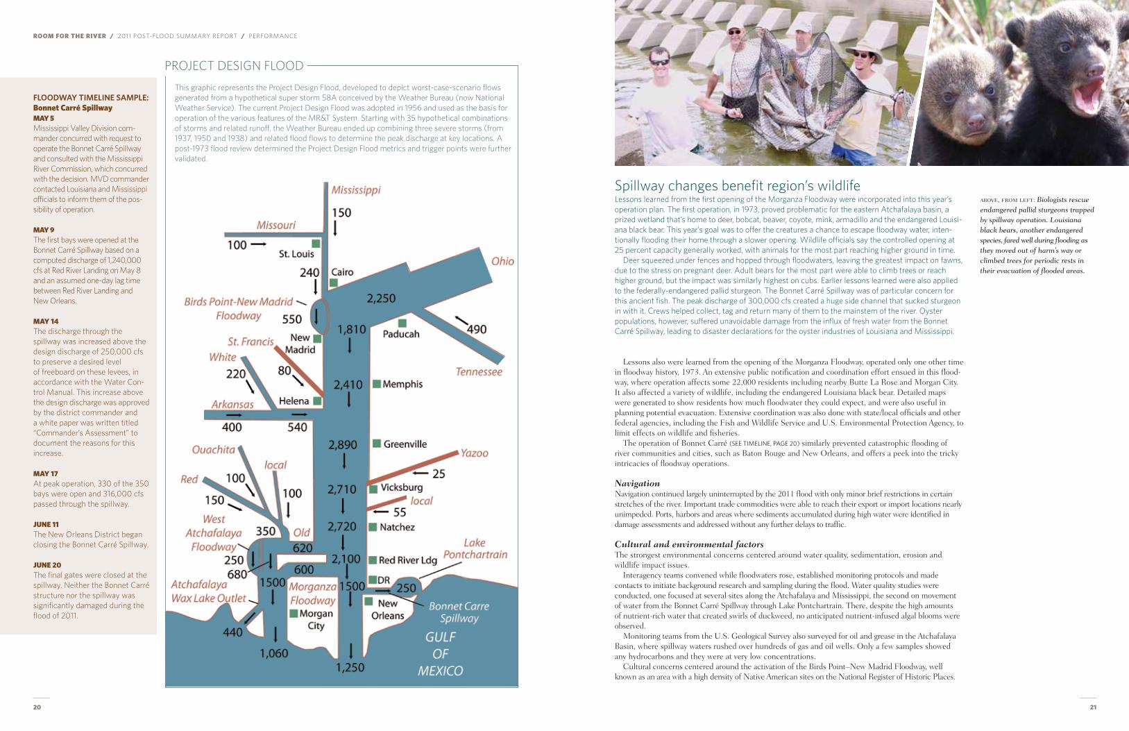
Spillway changes benefit region’s wildlifeLessons learned from the first opening of the Morganza Floodway were incorporated into this year’s operation plan. The first operation, in 1973, proved problematic for the eastern Atchafalaya basin, a prized wetland that’s home to deer, bobcat, beaver, coyote, mink, armadillo and the endangered Louisi-ana black bear. This year’s goal was to offer the creatures a chance to escape floodway water, inten-tionally flooding their home through a slower opening. Wildlife officials say the controlled opening at 25 percent capacity generally worked, with animals for the most part reaching higher ground in time.
Deer squeezed under fences and hopped through floodwaters, leaving the greatest impact on fawns, due to the stress on pregnant deer. Adult bears for the most part were able to climb trees or reach higher ground, but the impact was similarly highest on cubs. Earlier lessons learned were also applied to the federally-endangered pallid sturgeon. The Bonnet Carré Spillway was of particular concern for this ancient fish. The peak discharge of 300,000 cfs created a huge side channel that sucked sturgeon in with it. Crews helped collect, tag and return many of them to the mainstem of the river. Oyster populations, however, suffered unavoidable damage from the influx of fresh water from the Bonnet Carré Spillway, leading to disaster declarations for the oyster industries of Louisiana and Mississippi.
above, from left: biologists rescue endangered pallid sturgeons trapped by spillway operation. Louisiana black bears, another endangered species, fared well during flooding as they moved out of harm’s way or climbed trees for periodic rests in their evacuation of flooded areas.
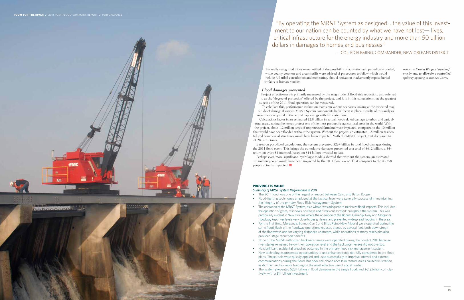
floodway TimeliNe sample:Bonnet Carré SpillwayMay 5 Mississippi Valley Division com-mander concurred with request to operate the Bonnet Carré Spillway and consulted with the Mississippi River Commission, which concurred with the decision. MVD commander contacted Louisiana and Mississippi officials to inform them of the pos-sibility of operation.
May 9 The first bays were opened at the Bonnet Carré Spillway based on a computed discharge of 1,240,000 cfs at Red River Landing on May 8 and an assumed one-day lag time between Red River Landing and New Orleans.
May 14 The discharge through the spillway was increased above the design discharge of 250,000 cfs to preserve a desired level of freeboard on these levees, in accordance with the Water Con-trol Manual. This increase above the design discharge was approved by the district commander and a white paper was written titled “Commander’s Assessment” to document the reasons for this increase.
May 17 At peak operation, 330 of the 350 bays were open and 316,000 cfs passed through the spillway.
JunE 11 The New Orleans District began closing the Bonnet Carré Spillway.
JunE 20 The final gates were closed at the spillway. Neither the Bonnet Carré structure nor the spillway was significantly damaged during the flood of 2011.
PROJECT DESIGN FLOOD
22 23
pRoving iTs vAlueSummary of MR&T System Performance in 2011• The 2011 flood was one of the largest on record between Cairo and Baton Rouge. • Flood-fighting techniques employed at the tactical level were generally successful in maintaining
the integrity of the primary Flood Risk Management System.• The operation of the MR&T System, as a whole, was adequate to minimize flood impacts. This includes
the operation of gates, reservoirs, spillways and diversions located throughout the system. This was particularly evident in New Orleans where the operation of the Bonnet Carré Spillway and Morganza Floodway kept river levels very close to design levels and prevented widespread flooding in the area.
• For the first time, Morganza, Bonnet Carré and Birds Point–New Madrid were operated during the same flood. Each of the floodway operations reduced stages by several feet, both downstream of the floodways and for varying distances upstream, while operations at many reservoirs also provided stage reduction benefits.
• None of the MR&T authorized backwater areas were operated during the flood of 2011 because river stages remained below their operation level and the backwater levees did not overtop.
• No significant accidental breaches occurred in the primary flood risk management system.• New technologies presented opportunities to use enhanced tools not fully considered in pre-flood
plans. These tools were quickly applied and used successfully to improve internal and external communications during the flood. But poor cell phone access in remote areas caused frustration, as did the need for more training on the most effective use of social media.
• The system prevented $234 billion in flood damages in the single flood, and $612 billion cumula-tively, with a $14 billion investment.
federally recognized tribes were notified of the possibility of activation and periodically briefed, while county coroners and area sheriffs were advised of procedures to follow which would include full tribal consultation and monitoring, should activation inadvertently expose buried artifacts or human remains.
Flood damages preventedProject effectiveness is primarily measured by the magnitude of flood risk reduction, also referred to as the “degree of protection” offered by the project, and it is in this calculation that the greatest
success of the 2011 flood operation can be measured.to calculate this, performance evaluation teams ran various scenarios looking at the expected mag-
nitude of damage if various mR&t System components hadn’t been in place. Results of this analysis were then compared to the actual happenings with full system use.
Calculations factor in an estimated $2.8 billion in actual flood-related damage to urban and agricul-tural areas, noting the levees protect one of the most productive agricultural areas in the world. With the project, about 1.2 million acres of unprotected farmland were impacted, compared to the 10 million
that would have been flooded without the system. Without the project, an estimated 1.5 million residen-tial and commercial structures would have been impacted. With the mR&t project, that decreased to 21,203 structures.
Based on post-flood calculations, the system prevented $234 billion in total flood damages during the 2011 flood event. this brings the cumulative damages prevented to a total of $612 billion, a $44 return on every $1 invested, based on $14 billion invested to date.
Perhaps even more significant, hydrologic models showed that without the system, an estimated 3.6 million people would have been impacted by the 2011 flood event. that compares to the 43,358 people actually impacted.
opposite: Cranes lift gate “needles,” one by one, to allow for a controlled spillway opening at bonnet Carré.
“By operating the MR&T System as designed… the value of this invest-ment to our nation can be counted by what we have not lost— lives,
critical infrastructure for the energy industry and more than 50 billion dollars in damages to homes and businesses.”
—COL. ED FLEMING, COMMANDER, NEW ORLEANS DISTRICT
ROOM FOR THE RIVER / 2011 Post-flood summary rePort / Performance
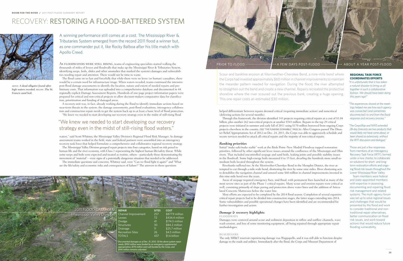
ROOM FOR THE RIVER / 2011 Post-flood summary rePort
24 25
RECOVERY: resTOrInG a flOOd-BaTTered sYsTeM
As floodwaters were still rising, teams of engineering specialists started walking the thousands of miles of levees and floodwalls that make up the mississippi River & tributaries System, identifying seeps, boils, slides and other anomalies that marked the system’s damages and vulnerabili-ties needing repair and attention. there would not be time to waste.
the flood came on so fast and forcefully that while there were no levee (or human) casualties, there would be a certain need for infrastructure triage. When waters receded, teams continued the intensive post-flood damage assessments to identify the location, nature and extent of needed repairs and pre-liminary costs. that information was uploaded into a comprehensive database and documented in 44 regionally explicit Damage Assessment Reports. hundreds of one-page project information papers were prepared for critical and non-critical projects to allow decision-makers comparative data for classifica-tion, prioritization and funding of damaged areas.
A recovery unit was, in fact, already working during the flood to identify immediate actions based on near-term threats to the system: the damage assessments, post-flood evaluations, interagency collabora-tion and construction repair needs to get the system back up to at least a basic level of flood protection.
“We knew we needed to start developing our recovery strategy even in the midst of still-rising flood
waters,” said Scott Whitney, the mississippi Valley Division’s Regional flood Risk manager. As damage assessment teams worked in the field, state and federal partners were assembled into an interagency recovery task force that helped formulate a comprehensive and collaborative regional recovery strategy.
the mississippi Valley Division grouped repair projects into four categories, based on risk posed to human life and the river economy, with Class 1 representing the highest human life/safety threat. While some seeps and boils were expected and treated as routine, others—particularly those demonstrating the movement of “material”—were signs of a potentially dangerous situation that needed to be addressed.
the immediate questions and concerns, Whitney said, were “Can we flood fight it again?” and “What are the life/safety and economic risks and consequences of failure?” the answers to those questions
A winning performance still comes at a cost. The Mississippi River & Tributaries System emerged from the record 2011 flood a winner but, as one commander put it, like Rocky Balboa after his title match with Apollo Creed.
RegionAl TAsK FoRCe CooRdinATes eFFoRTs
“It is unfortunate that it has taken a natural disaster to bring us all together in such a collaborative fashion. We should have been doing this years ago!”
“The experiences shared at the meet-ings helped me see how each agency was connected (and sometimes disconnected) to and from the flood response and recovery process.”
“The CorpsMap and NWS extended 28-day forecasts are two products that would likely not have come about, or been shared as extensively, without the IRTF discussion and dialogue.”
Those are just a few responses from members of an Interagency Recovery Task Force (IRTF), formed under a new charter, to collaborate on solutions for short- and long-term restoration efforts and ongo-ing flood risk issues throughout the Lower Mississippi River Valley.
Team members were federal and state-appointed members with expertise in assessing, documenting and repairing flood risk management and related systems. The multi-agency forum was set up to solve regional issues and challenges that would be presented by the flood and work to consider traditional and non-traditional repair alternatives, better communication on flood risk issues, and work toward actions that would reduce future flooding vulnerability.
Scour and bankline erosion at Merriwether-Cherokee Bend, a nine-mile bend where the Corps had invested approximately $60 million in channel improvements to maintain the meander pattern needed for navigation. During the flood, the river attempted to straighten out the bend and create a new channel. Repairs recreated the protective shoreline where the river scoured out the previous bank, creating a huge opening. This one repair costs an estimated $30 million.
above: A dead alligator found after high waters receded. below: The St. Francis sand boil.
helped differentiate between repairs deemed critical (requiring immediate action) and noncritical (deferring actions for several months).
through this framework, the division identified 143 projects requiring critical repairs at a cost of $1.04 billion, plus another 262 non-critical projects at another $543 million. Repairs to the top 29 critical projects were initiated in summer and early fall of 2011 using $170 million borrowed from ongoing Corps projects elsewhere in the country. (see “tHe fundIng scramble,” Page 26.) After Congress passed the Disas-ter Relief Appropriations Act of 2012 on Dec. 24, 2011, the Corps was able to aggressively schedule and secure services needed to attack all critical repairs and the majority of non-critical repairs.
Ranking prioritiesInitial “make-safe/make stable” work at the Birds Point–New madrid floodway topped restoration priorities, followed by other significant levee issues around the confluence of the mississippi and ohio rivers. that included uncontrolled seepage and sand boils, leaking joints and possible stability issues in the floodwall. Some high-energy boils measured 8 to 15 feet, dwarfing the hundreds more small-to-medium boils located throughout the system.
Riverbanks suffered too. At the merriwether-Cherokee Bend in the memphis District, the river at-tempted to cut through a mile-wide bend, shortening the river by some nine miles. River shortening acts to destabilize the navigation channel and unravel some $60 million in channel improvements invested in this nine-mile bend over the years.
Areas of seepage required emergency fixes, mid-flood, with permanent fixes launched at many of the most severe sites as part of the Phase 1 critical repairs. many scour and erosion repairs were critical as well, consisting primarily of slope paving and protection above water lines and the addition of Articu-lated Concrete mattresses below the water line.
most efforts are expected to be completed by the 2014 flood season. Completion of several expansive critical repair projects had to be divided into construction stages, the latter stages extending into 2014. Some vulnerabilities and possible operational changes have been identified and are recommended for further investigation and action.
Damage & recovery highlights: fLooDWAYSDamages were centered around scour and sediment deposition in inflow and outflow channels, wave wash erosion, and loss of some monitoring equipment, all being repaired through appropriate repair methodologies.
ReSeRVoIRSthe only mR&t reservoir experiencing damage was Wappapello, and it was still able to function despite damage to the roads and utilities. Immediately after the flood, the Corps and missouri Department of
repair siTes cosTchannel Improvement 257 $877.9 millionlevees 72 $434.4 milliondredge 41 $174.5 millionstructures 30 $84.2 milliondrainage 11 $25.7 million recreation sites 26 $4.5 milliontotals 437 $1.6 billion
*Documented damages as of Dec. 31, 2012. Of the above system repair needs, $990 million were funded by an emergency supplemental appropriation, $170 million were self-funded by the Corps, and $441 million remains unfunded.
2011 flood damages*mississippi valley division
“We knew we needed to start developing our recovery strategy even in the midst of still-rising flood waters.”
PrIor to flood a few days Post-flood about a year Post-flood
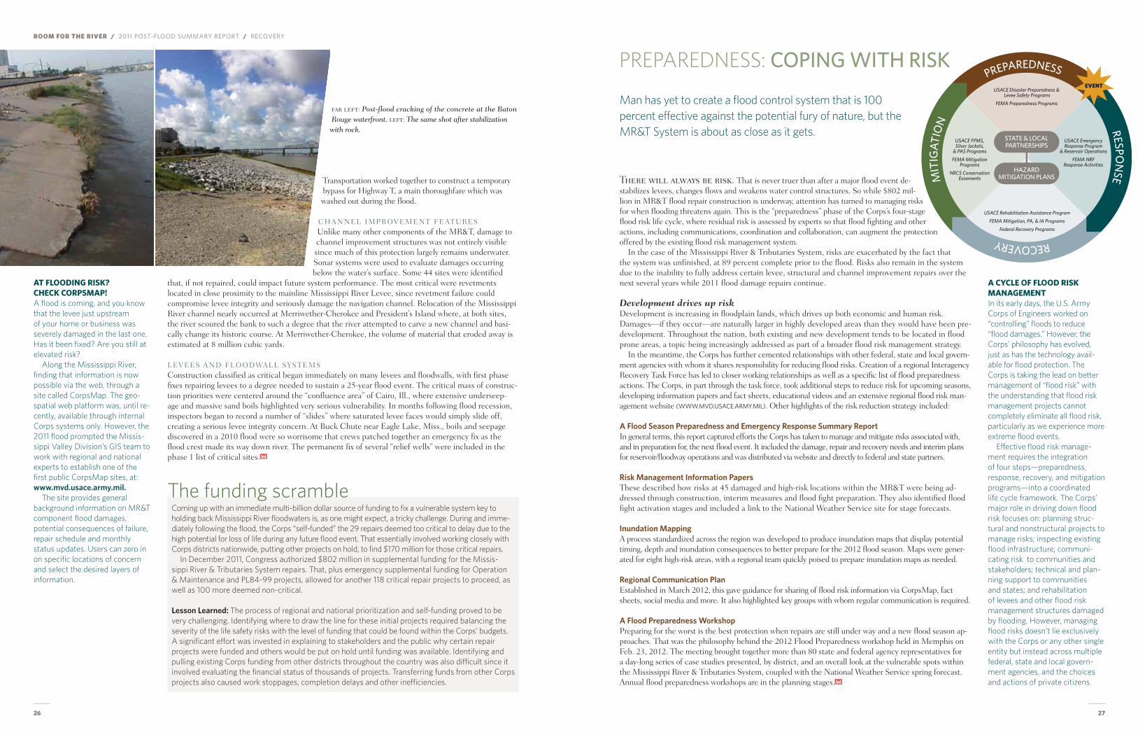
26 27
ROOM FOR THE RIVER / 2011 Post-flood summary rePort / recovery
there will always be risk. that is never truer than after a major flood event de-stabilizes levees, changes flows and weakens water control structures. So while $802 mil-lion in mR&t flood repair construction is underway, attention has turned to managing risks for when flooding threatens again. this is the “preparedness” phase of the Corps’s four-stage flood risk life cycle, where residual risk is assessed by experts so that flood fighting and other actions, including communications, coordination and collaboration, can augment the protection offered by the existing flood risk management system.
In the case of the mississippi River & tributaries System, risks are exacerbated by the fact that the system was unfinished, at 89 percent complete prior to the flood. Risks also remain in the system due to the inability to fully address certain levee, structural and channel improvement repairs over the next several years while 2011 flood damage repairs continue.
Development drives up riskDevelopment is increasing in floodplain lands, which drives up both economic and human risk. Damages—if they occur—are naturally larger in highly developed areas than they would have been pre-development. throughout the nation, both existing and new development tends to be located in flood prone areas, a topic being increasingly addressed as part of a broader flood risk management strategy.
In the meantime, the Corps has further cemented relationships with other federal, state and local govern-ment agencies with whom it shares responsibility for reducing flood risks. Creation of a regional Interagency Recovery task force has led to closer working relationships as well as a specific list of flood preparedness actions. the Corps, in part through the task force, took additional steps to reduce risk for upcoming seasons, developing information papers and fact sheets, educational videos and an extensive regional flood risk man-agement website (www.mvd.usace.army.mIl). other highlights of the risk reduction strategy included:
a flood season preparedness and emergency response summary report In general terms, this report captured efforts the Corps has taken to manage and mitigate risks associated with, and in preparation for, the next flood event. It included the damage, repair and recovery needs and interim plans for reservoir/floodway operations and was distributed via website and directly to federal and state partners.
risk management information papers these described how risks at 45 damaged and high-risk locations within the mR&t were being ad-dressed through construction, interim measures and flood fight preparation. they also identified flood fight activation stages and included a link to the National Weather Service site for stage forecasts.
inundation mappingA process standardized across the region was developed to produce inundation maps that display potential timing, depth and inundation consequences to better prepare for the 2012 flood season. maps were gener-ated for eight high-risk areas, with a regional team quickly poised to prepare inundation maps as needed.
regional communication planestablished in march 2012, this gave guidance for sharing of flood risk information via Corpsmap, fact sheets, social media and more. It also highlighted key groups with whom regular communication is required.
a flood preparedness workshop Preparing for the worst is the best protection when repairs are still under way and a new flood season ap-proaches. that was the philosophy behind the 2012 flood Preparedness workshop held in memphis on feb. 23, 2012. the meeting brought together more than 80 state and federal agency representatives for a day-long series of case studies presented, by district, and an overall look at the vulnerable spots within the mississippi River & tributaries System, coupled with the National Weather Service spring forecast. Annual flood preparedness workshops are in the planning stages.
A CyCle oF Flood RisK mAnAgemenTIn its early days, the U.S. Army Corps of Engineers worked on “controlling” floods to reduce “flood damages.” However, the Corps’ philosophy has evolved, just as has the technology avail-able for flood protection. The Corps is taking the lead on better management of “flood risk” with the understanding that flood risk management projects cannot completely eliminate all flood risk, particularly as we experience more extreme flood events.
Effective flood risk manage-ment requires the integration of four steps—preparedness, response, recovery, and mitigation programs—into a coordinated life cycle framework. The Corps’ major role in driving down flood risk focuses on: planning struc-tural and nonstructural projects to manage risks; inspecting existing flood infrastructure; communi-cating risk to communities and stakeholders; technical and plan-ning support to communities and states; and rehabilitation of levees and other flood risk management structures damaged by flooding. However, managing flood risks doesn’t lie exclusively with the Corps or any other single entity but instead across multiple federal, state and local govern-ment agencies, and the choices and actions of private citizens.
AT Flooding RisK? CheCK CoRpsmAp! A flood is coming, and you know that the levee just upstream of your home or business was severely damaged in the last one. Has it been fixed? Are you still at elevated risk?
Along the Mississippi River, finding that information is now possible via the web, through a site called CorpsMap. The geo-spatial web platform was, until re-cently, available through internal Corps systems only. However, the 2011 flood prompted the Missis-sippi Valley Division’s GIS team to work with regional and national experts to establish one of the first public CorpsMap sites, at: www.mvd.usace.army.mil.
The site provides general background information on MR&T component flood damages, potential consequences of failure, repair schedule and monthly status updates. Users can zero in on specific locations of concern and select the desired layers of information.
PREPAREDNESS: COPInG WITh rIsk
Man has yet to create a flood control system that is 100 percent effective against the potential fury of nature, but the MR&T System is about as close as it gets.
transportation worked together to construct a temporary bypass for highway t, a main thoroughfare which was washed out during the flood.
ChANNeL ImPRoVemeNt feAtUReSUnlike many other components of the mR&t, damage to channel improvement structures was not entirely visible since much of this protection largely remains underwater. Sonar systems were used to evaluate damages occurring below the water’s surface. Some 44 sites were identified
that, if not repaired, could impact future system performance. the most critical were revetments located in close proximity to the mainline mississippi River Levee, since revetment failure could compromise levee integrity and seriously damage the navigation channel. Relocation of the mississippi River channel nearly occurred at merriwether-Cherokee and President’s Island where, at both sites, the river scoured the bank to such a degree that the river attempted to carve a new channel and basi-cally change its historic course. At merriwether-Cherokee, the volume of material that eroded away is estimated at 8 million cubic yards.
LeVeeS AND fLooDWALL SYStemSConstruction classified as critical began immediately on many levees and floodwalls, with first phase fixes repairing levees to a degree needed to sustain a 25-year flood event. the critical mass of construc-tion priorities were centered around the “confluence area” of Cairo, Ill., where extensive underseep-age and massive sand boils highlighted very serious vulnerability. In months following flood recession, inspectors began to record a number of “slides” where saturated levee faces would simply slide off, creating a serious levee integrity concern. At Buck Chute near eagle Lake, miss., boils and seepage discovered in a 2010 flood were so worrisome that crews patched together an emergency fix as the flood crest made its way down river. the permanent fix of several “relief wells” were included in the phase 1 list of critical sites.
PREPAREDNESS RESPON
SE RECOVERY
M
ITIG
AT
ION
STATE & LOCALPARTNERSHIPS
HAZARDMITIGATION PLANS
EVENTUSACE Disaster Preparedness &
Levee Safety Programs
FEMA Preparedness Programs
USACE EmergencyResponse Program
& Reservoir Operations
FEMA NRFResponse Activities
USACE Rehabilitation Assistance Program
FEMA Mitigation, PA, & IA Programs
Federal Recovery Programs
USACE FPMS,Silver Jackets,
& PAS Programs
FEMA MitigationPrograms
NRCS ConservationEasements
far left: post-flood cracking of the concrete at the baton rouge waterfront. left: The same shot after stabilization with rock.
Coming up with an immediate multi-billion dollar source of funding to fix a vulnerable system key to holding back Mississippi River floodwaters is, as one might expect, a tricky challenge. During and imme-diately following the flood, the Corps “self-funded” the 29 repairs deemed too critical to delay due to the high potential for loss of life during any future flood event. That essentially involved working closely with Corps districts nationwide, putting other projects on hold, to find $170 million for those critical repairs.
In December 2011, Congress authorized $802 million in supplemental funding for the Missis-sippi River & Tributaries System repairs. That, plus emergency supplemental funding for Operation & Maintenance and PL84-99 projects, allowed for another 118 critical repair projects to proceed, as well as 100 more deemed non-critical.
lesson learned: The process of regional and national prioritization and self-funding proved to be very challenging. Identifying where to draw the line for these initial projects required balancing the severity of the life safety risks with the level of funding that could be found within the Corps’ budgets. A significant effort was invested in explaining to stakeholders and the public why certain repair projects were funded and others would be put on hold until funding was available. Identifying and pulling existing Corps funding from other districts throughout the country was also difficult since it involved evaluating the financial status of thousands of projects. Transferring funds from other Corps projects also caused work stoppages, completion delays and other inefficiencies.
The funding scramble
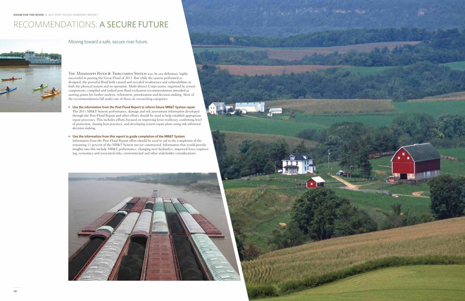
ROOM FOR THE RIVER / 2011 Post-flood summary rePort
28 29
RECOMMENDATIONS: a seCUre fUTUre
the Mississippi River & tributaries System was, by any definition, highly successful in passing the Great flood of 2011. But while the system performed as designed, the powerful flood both caused and revealed weaknesses and vulnerabilities in both the physical system and its operation. multi-district Corps teams, organized by system components, compiled and ranked post-flood evaluation recommendations intended as starting points for further analysis, refinement, prioritization and decision-making. most of the recommendations fall under one of these six overarching categories:
• use the information from the post flood report to inform future mr&T system repairthe 2011 mR&t System performance, damage and risk assessment information developed through the Post-flood Report and other efforts should be used to help establish appropriate repair processes. this includes efforts focused on improving levee resiliency, confirming level of protection, sharing best practices, and developing system repair plans using risk-informed decision making.
• use the information from this report to guide completion of the mr&T systemInformation from the Post-flood Report effort should be used to aid in the completion of the remaining 11 percent of the mR&t System not yet constructed. Information that would provide insights into this include mR&t performance, changing river hydraulics, improved levee engineer-ing, economics and associated risks, environmental and other stakeholder considerations.
Moving toward a safe, secure river future.
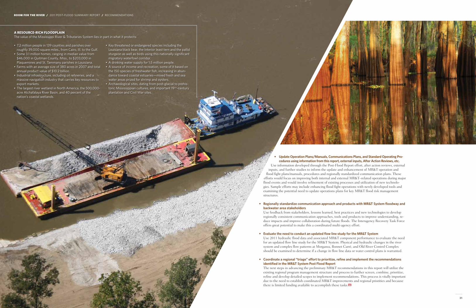
30 31
• update operation plans/manuals, communications plans, and standard operating pro-cedures using information from this report, external inputs, after action reviews, etc.
Use information developed through the Post-flood Report effort, after action reviews, external inputs, and further studies to inform the update and enhancement of mR&t operation and
flood fight plans/manuals, procedures and regionally standardized communication plans. these efforts would focus on improving both internal and external mR&t–related operations during major flood events and would involve refinement of existing processes and utilization of new technolo-gies. Sample efforts may include enhancing flood fight operations with newly developed tools and examining the potential need to update operations plans for key mR&t flood risk management structures.
• regionally standardize communication approach and products with mr&T system floodway and backwater area stakeholdersUse feedback from stakeholders, lessons learned, best practices and new technologies to develop regionally consistent communication approaches, tools and products to improve understanding, re-duce impacts and improve collaboration during future floods. the Interagency Recovery task force offers great potential to make this a coordinated multi-agency effort.
• evaluate the need to conduct an updated flow line study for the mr&T system Use 2011 hydraulic flood data and associated mR&t component performance to evaluate the need for an updated flow line study for the mR&t System. Physical and hydraulic changes in the river system and complex flow patterns at morganza, Bonnet Carré, and old River Control Complex should be examined to determine if a change in flow line data or water control plans is warranted.
• coordinate a regional “triage” effort to prioritize, refine and implement the recommendations identified in the mr&T system post flood report the next steps in advancing the preliminary mR&t recommendations in this report will utilize the existing regional program management structure and process to further screen, combine, prioritize, refine and develop detailed scopes to implement recommendations. this process is vitally important due to the need to establish coordinated mR&t improvements and regional priorities and because there is limited funding available to accomplish these tasks.
A ResouRCe-RiCh FloodplAin the value of the mississippi river & tributaries system lies in part in what it protects:
• 7.2 million people in 139 counties and parishes over roughly 39,000 square miles., from cairo, Ill. to the gulf.
• some 3.1 million homes, ranging in median value from $46,000 in Quitman county, miss., to $203,000 in Plaquemines and st. tammany parishes in louisiana.
• farms with an average size of 380 acres in 2007 and total annual product value of $10.2 billion.
• Industrial infrastructure, including oil refineries, and a massive navigation industry that carries key resources to export markets.
• the largest river wetland in north america, the 500,000-acre atchafalaya river basin, and 40 percent of the nation’s coastal wetlands.
• Key threatened or endangered species including the louisiana black bear, the Interior least tern and the pallid sturgeon as well as birds using this nationally significant migratory waterfowl corridor.
• a drinking water supply for 1.5 million people.• a source of income and recreation, some of it based on
the 150 species of freshwater fish, increasing in abun-dance toward coastal estuaries—mixed fresh and sea water areas prized for shrimp and oysters.
• archaeological sites, dating from post-glacial to prehis-toric mississippian cultures, and important 19tH-century plantation and civil war sites.
ROOM FOR THE RIVER / 2011 Post-flood summary rePort / recommendatIons
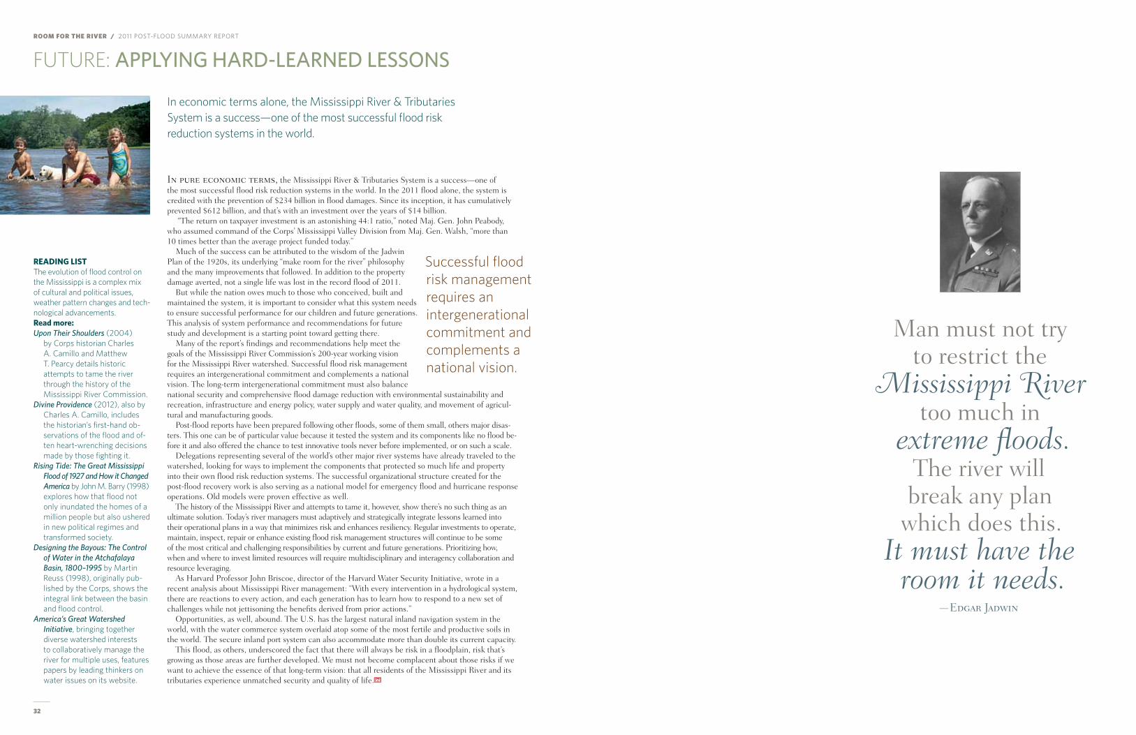
ROOM FOR THE RIVER / 2011 Post-flood summary rePort
32
FUTURE: aPPlYInG hard-learned lessOns
In economic terms alone, the Mississippi River & Tributaries System is a success—one of the most successful flood risk reduction systems in the world.
in pure economic terms, the mississippi River & tributaries System is a success—one of the most successful flood risk reduction systems in the world. In the 2011 flood alone, the system is credited with the prevention of $234 billion in flood damages. Since its inception, it has cumulatively prevented $612 billion, and that’s with an investment over the years of $14 billion.
“the return on taxpayer investment is an astonishing 44:1 ratio,” noted maj. Gen. John Peabody, who assumed command of the Corps’ mississippi Valley Division from maj. Gen. Walsh, “more than 10 times better than the average project funded today.”
much of the success can be attributed to the wisdom of the Jadwin Plan of the 1920s, its underlying “make room for the river” philosophy and the many improvements that followed. In addition to the property damage averted, not a single life was lost in the record flood of 2011.
But while the nation owes much to those who conceived, built and maintained the system, it is important to consider what this system needs to ensure successful performance for our children and future generations. this analysis of system performance and recommendations for future study and development is a starting point toward getting there.
many of the report’s findings and recommendations help meet the goals of the mississippi River Commission’s 200-year working vision for the mississippi River watershed. Successful flood risk management requires an intergenerational commitment and complements a national vision. the long-term intergenerational commitment must also balance national security and comprehensive flood damage reduction with environmental sustainability and recreation, infrastructure and energy policy, water supply and water quality, and movement of agricul-tural and manufacturing goods.
Post-flood reports have been prepared following other floods, some of them small, others major disas-ters. this one can be of particular value because it tested the system and its components like no flood be-fore it and also offered the chance to test innovative tools never before implemented, or on such a scale.
Delegations representing several of the world’s other major river systems have already traveled to the watershed, looking for ways to implement the components that protected so much life and property into their own flood risk reduction systems. the successful organizational structure created for the post-flood recovery work is also serving as a national model for emergency flood and hurricane response operations. old models were proven effective as well.
the history of the mississippi River and attempts to tame it, however, show there’s no such thing as an ultimate solution. today’s river managers must adaptively and strategically integrate lessons learned into their operational plans in a way that minimizes risk and enhances resiliency. Regular investments to operate, maintain, inspect, repair or enhance existing flood risk management structures will continue to be some of the most critical and challenging responsibilities by current and future generations. Prioritizing how, when and where to invest limited resources will require multidisciplinary and interagency collaboration and resource leveraging.
As harvard Professor John Briscoe, director of the harvard Water Security Initiative, wrote in a recent analysis about mississippi River management: “With every intervention in a hydrological system, there are reactions to every action, and each generation has to learn how to respond to a new set of challenges while not jettisoning the benefits derived from prior actions.”
opportunities, as well, abound. the U.S. has the largest natural inland navigation system in the world, with the water commerce system overlaid atop some of the most fertile and productive soils in the world. the secure inland port system can also accommodate more than double its current capacity.
this flood, as others, underscored the fact that there will always be risk in a floodplain, risk that’s growing as those areas are further developed. We must not become complacent about those risks if we want to achieve the essence of that long-term vision: that all residents of the mississippi River and its tributaries experience unmatched security and quality of life.
Successful flood risk management requires an intergenerational commitment and complements a national vision.
ReAding lisTThe evolution of flood control on the Mississippi is a complex mix of cultural and political issues, weather pattern changes and tech-nological advancements. Read more:Upon Their Shoulders (2004)
by Corps historian Charles A. Camillo and Matthew T. Pearcy details historic attempts to tame the river through the history of the Mississippi River Commission.
Divine Providence (2012), also by Charles A. Camillo, includes the historian’s first-hand ob-servations of the flood and of-ten heart-wrenching decisions made by those fighting it.
Rising Tide: The Great Mississippi Flood of 1927 and How it Changed America by John M. Barry (1998) explores how that flood not only inundated the homes of a million people but also ushered in new political regimes and transformed society.
Designing the Bayous: The Control of Water in the Atchafalaya Basin, 1800–1995 by Martin Reuss (1998), originally pub-lished by the Corps, shows the integral link between the basin and flood control.
America’s Great Watershed Initiative, bringing together diverse watershed interests to collaboratively manage the river for multiple uses, features papers by leading thinkers on water issues on its website.
man must not try to restrict the
Mississippi River too much in
extreme floods. the river will break any plan
which does this. It must have the
room it needs.—Edgar Jadwin

f O r M O r e I n f O r M aT I O n
usACe mississippi valley division public affairs office 601-634-5760 or 601-634-7783
www.mvd.usace.army.mil Click on Missions/regional flood risk Management.