Embed Size (px)
Citation preview

Townsville City Ross Creek Marine Plant Management Guideline Version 1 1
ROSS CREEK MARINE PLANT MANAGEMENT GUIDELINE
VERSION 1
Townsville City Ross Creek Marine Plant Management Guideline Version 122
This is a technical document for Townsville City Council purposes.
DOCUMENT CHANGE HISTORYVersion Author Issue Purpose Date0.1 Amanda Rebgetz Draft for review by council 17/11/20150.2 Amanda Rebgetz Preliminary DAFF Issue 21/03/20160.3 Amanda Rebgetz Revised Daff Issue 19/05/20161 Amanda Rebgetz Final Approved by DAFF 02/09/2016
Townsville City Ross Creek Marine Plant Management Guideline Version 1 3
Table of Contents 3
Introduction 4
Aims 5
Section 1 6
Background 6
Guideline details 11
References 14
Section 2 15
Objectives 15
Categories of Marine Plant Management 16
Precinct Management Strategies 17
Precinct 1 – City Waterfront Gateway 17
Precinct 2 and 3 21
Precinct 4 – Hanran Park 25
Precinct 5 – Central 30
Precinct 6 – Tomlins and Wickham 34
Precinct 7 – Maritime Mixed Use 38
Appendix 1 Photo reference points 41
Appendix 2 List of properties in the guideline area 65
Appendix 3 Summary of all stormwater outfalls in guideline area 66
Contents
3
Townsville City Ross Creek Marine Plant Management Guideline Version 14
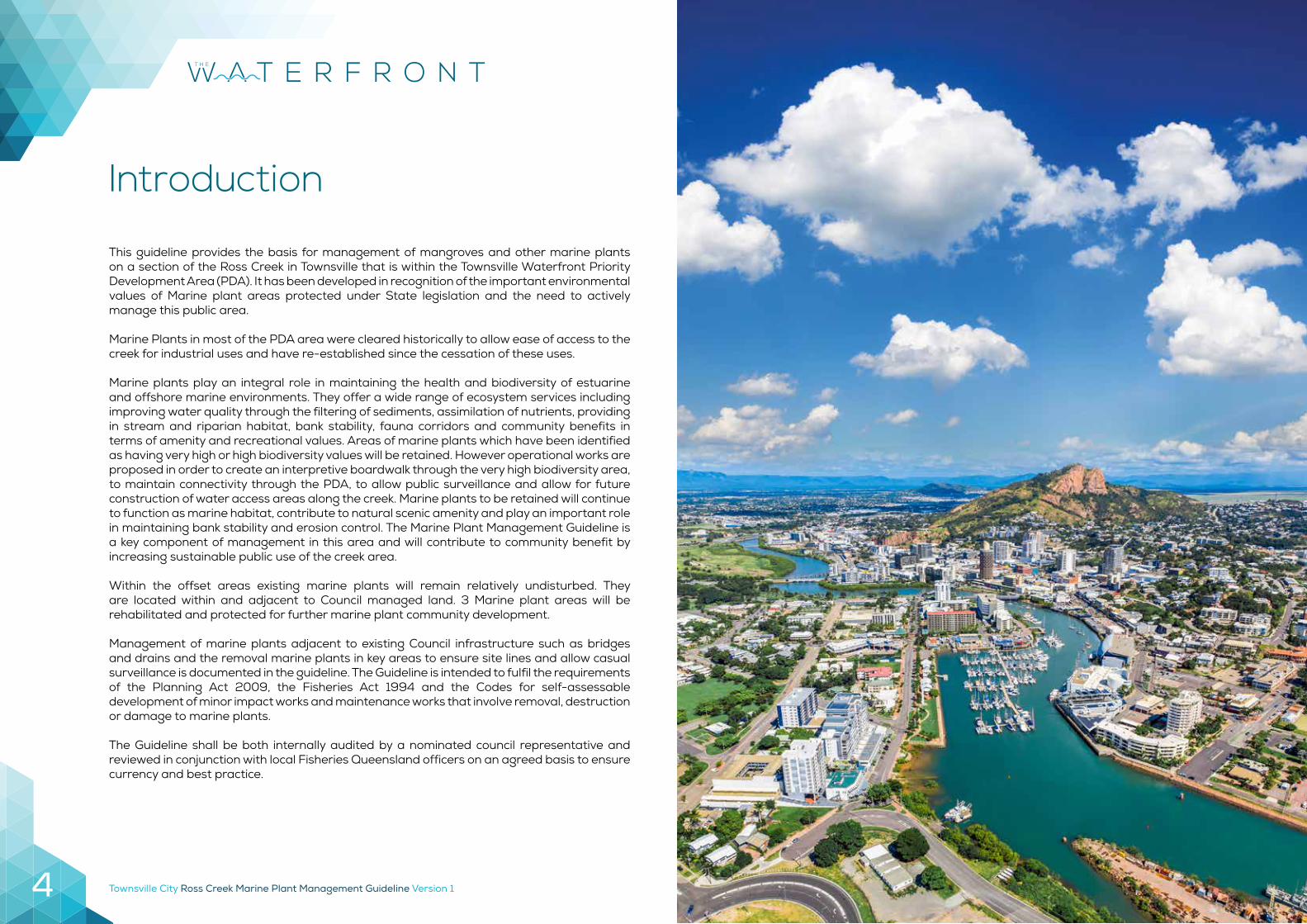
This guideline provides the basis for management of mangroves and other marine plants on a section of the Ross Creek in Townsville that is within the Townsville Waterfront Priority Development Area (PDA). It has been developed in recognition of the important environmental values of Marine plant areas protected under State legislation and the need to actively manage this public area.
Marine Plants in most of the PDA area were cleared historically to allow ease of access to the creek for industrial uses and have re-established since the cessation of these uses.
Marine plants play an integral role in maintaining the health and biodiversity of estuarine and offshore marine environments. They offer a wide range of ecosystem services including improving water quality through the filtering of sediments, assimilation of nutrients, providing in stream and riparian habitat, bank stability, fauna corridors and community benefits in terms of amenity and recreational values. Areas of marine plants which have been identified as having very high or high biodiversity values will be retained. However operational works are proposed in order to create an interpretive boardwalk through the very high biodiversity area, to maintain connectivity through the PDA, to allow public surveillance and allow for future construction of water access areas along the creek. Marine plants to be retained will continue to function as marine habitat, contribute to natural scenic amenity and play an important role in maintaining bank stability and erosion control. The Marine Plant Management Guideline is a key component of management in this area and will contribute to community benefit by increasing sustainable public use of the creek area.
Within the offset areas existing marine plants will remain relatively undisturbed. They are located within and adjacent to Council managed land. 3 Marine plant areas will be rehabilitated and protected for further marine plant community development.
Management of marine plants adjacent to existing Council infrastructure such as bridges and drains and the removal marine plants in key areas to ensure site lines and allow casual surveillance is documented in the guideline. The Guideline is intended to fulfil the requirements of the Planning Act 2009, the Fisheries Act 1994 and the Codes for self-assessable development of minor impact works and maintenance works that involve removal, destruction or damage to marine plants.
The Guideline shall be both internally audited by a nominated council representative and reviewed in conjunction with local Fisheries Queensland officers on an agreed basis to ensure currency and best practice.
Introduction
Townsville City Ross Creek Marine Plant Management Guideline Version 1 5
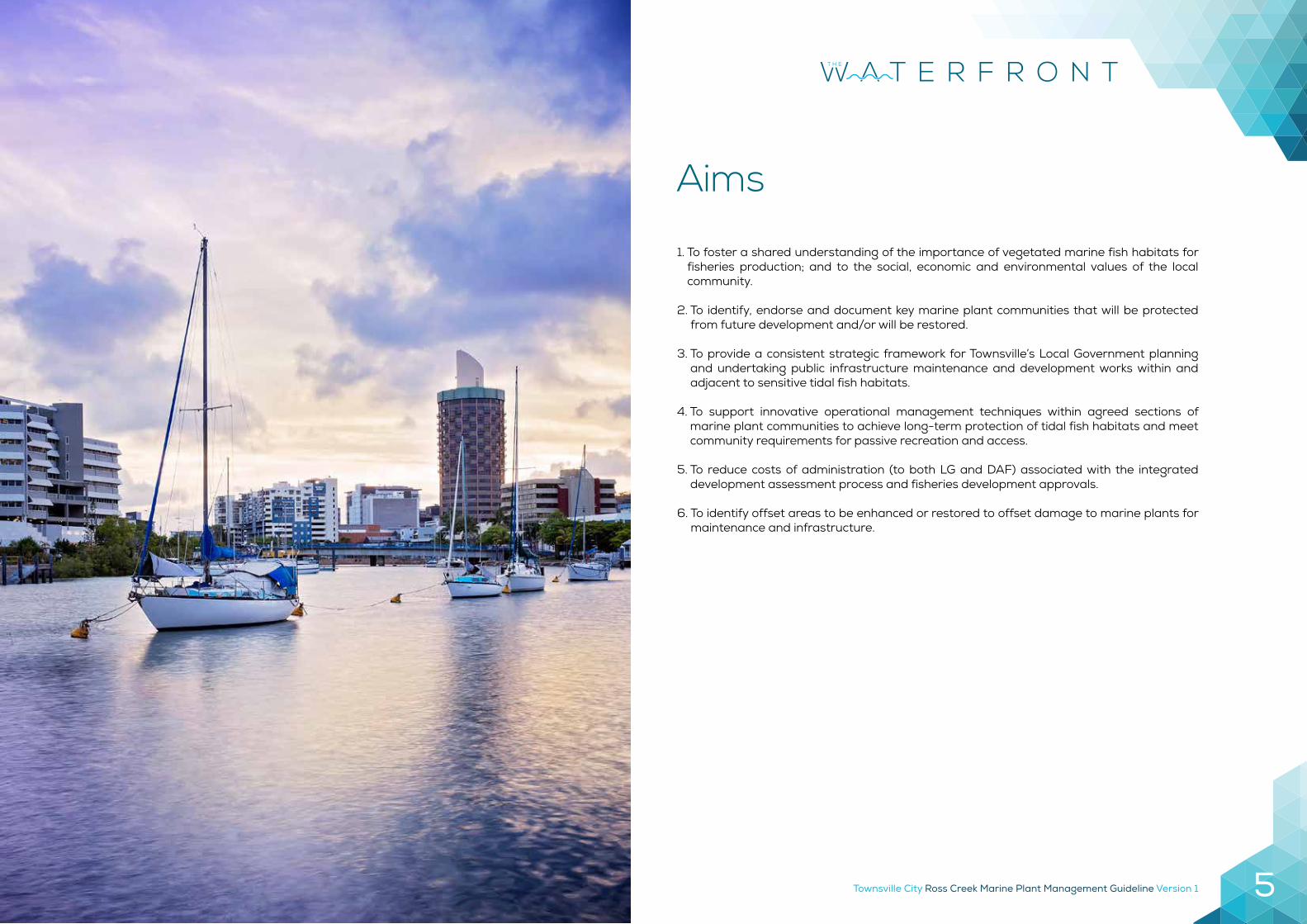
1. To foster a shared understanding of the importance of vegetated marine fish habitats for fisheries production; and to the social, economic and environmental values of the local community.
2. To identify, endorse and document key marine plant communities that will be protected from future development and/or will be restored.
3. To provide a consistent strategic framework for Townsville’s Local Government planning and undertaking public infrastructure maintenance and development works within and adjacent to sensitive tidal fish habitats.
4. To support innovative operational management techniques within agreed sections of marine plant communities to achieve long-term protection of tidal fish habitats and meet community requirements for passive recreation and access.
5. To reduce costs of administration (to both LG and DAF) associated with the integrated development assessment process and fisheries development approvals.
6. To identify offset areas to be enhanced or restored to offset damage to marine plants for maintenance and infrastructure.
Aims
Townsville City Ross Creek Marine Plant Management Guideline Version 16
The Department of Agriculture and Fisheries Queensland is responsible for implementing the provisions of the Fisheries Act 1994 (Fisheries Act). This guideline is a joint project between Townsville City Council and Fisheries Queensland and is intended to fulfil requirements under the Fisheries Act and the Planning Act 2016. The guideline has been developed with the aim of meeting the policy target of Fish Habitat Management Operational Policy FHMOP 001 to:
Maintain the relative distribution of each of the components of the marine plant community state-wide to 90% or greater of the distribution levels that existed in 1990.
Maintain the extent of marine plant distribution within local government areas at 80% or greater of the level that existed in 1990 for all natural areas and to 50% or greater of 1990 levels for constructed areas.
Marine plant communities have an important role as fisheries habitat through structural complexity, shelter for food organisms and for juvenile and forage fishes at high tide and feeding opportunities for fish, crabs and molluscs (Couchman et al., 2006). Along Ross Creek the mangroves also provide a rookery for migratory bird species and provide habitat for native mammals. Marine plants also have other values, they assist with improved water quality by supporting nutrient uptake and assist with erosion control by stabilising creek banks (Bell 2013) The main guideline area stretches from the mouth of the Ross Creek to the new railway station. This area is within the Central Business District and is part of the Townsville City Waterfront PDA. The vision for the PDA is to transform Townsville’s city heart into a lively urban destination where the city and nature come together through an interconnected series of vibrant and active experiences anchored by a focus on the water’s edge. It will provide an exciting mix of recreation, culture, tourism, eco-tourism and urban lifestyle choices along with residential, commercial and business uses.
Section 1BACKGROUND
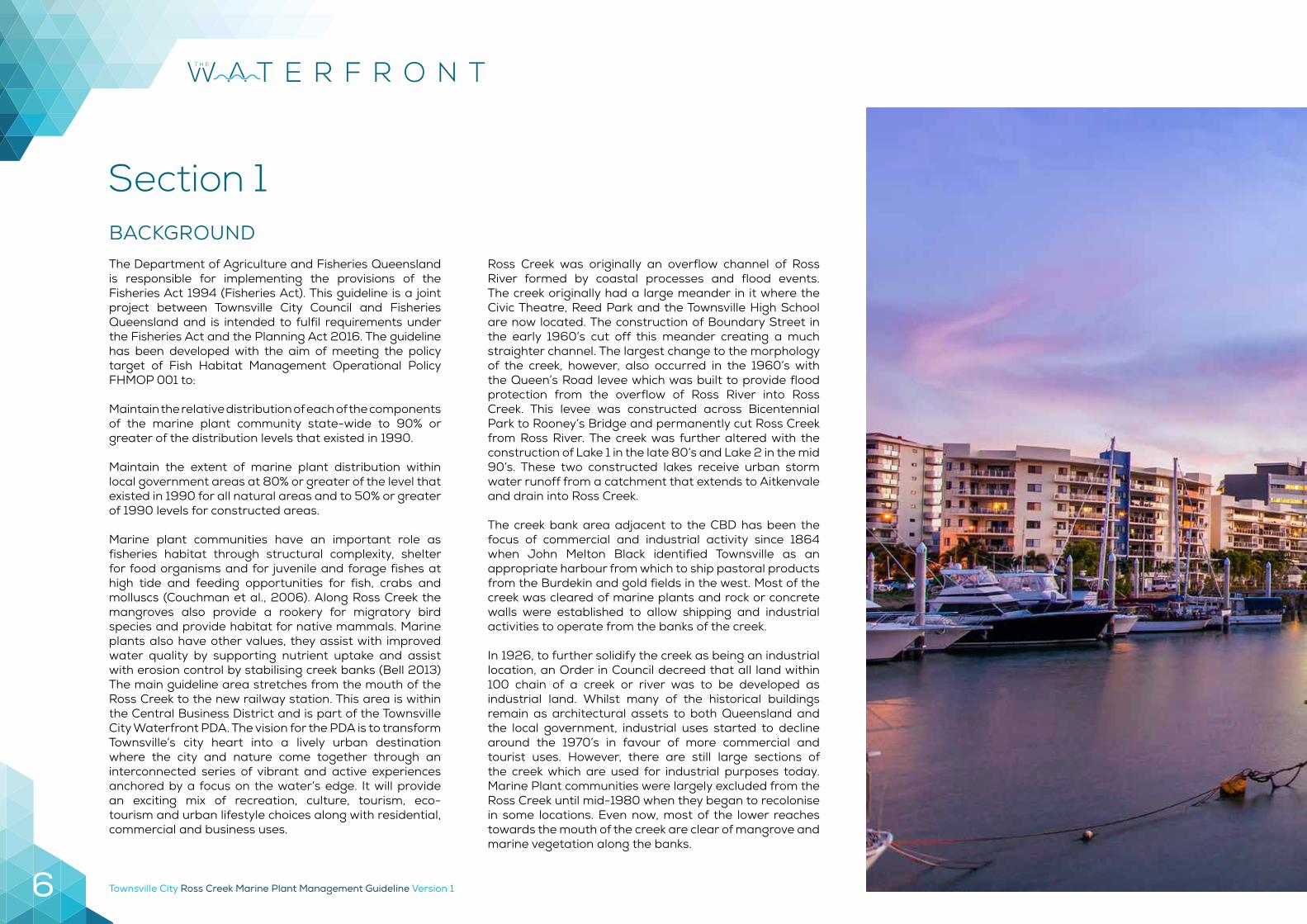
Ross Creek was originally an overflow channel of Ross River formed by coastal processes and flood events. The creek originally had a large meander in it where the Civic Theatre, Reed Park and the Townsville High School are now located. The construction of Boundary Street in the early 1960’s cut off this meander creating a much straighter channel. The largest change to the morphology of the creek, however, also occurred in the 1960’s with the Queen’s Road levee which was built to provide flood protection from the overflow of Ross River into Ross Creek. This levee was constructed across Bicentennial Park to Rooney’s Bridge and permanently cut Ross Creek from Ross River. The creek was further altered with the construction of Lake 1 in the late 80’s and Lake 2 in the mid 90’s. These two constructed lakes receive urban storm water runoff from a catchment that extends to Aitkenvale and drain into Ross Creek.
The creek bank area adjacent to the CBD has been the focus of commercial and industrial activity since 1864 when John Melton Black identified Townsville as an appropriate harbour from which to ship pastoral products from the Burdekin and gold fields in the west. Most of the creek was cleared of marine plants and rock or concrete walls were established to allow shipping and industrial activities to operate from the banks of the creek.
In 1926, to further solidify the creek as being an industrial location, an Order in Council decreed that all land within 100 chain of a creek or river was to be developed as industrial land. Whilst many of the historical buildings remain as architectural assets to both Queensland and the local government, industrial uses started to decline around the 1970’s in favour of more commercial and tourist uses. However, there are still large sections of the creek which are used for industrial purposes today. Marine Plant communities were largely excluded from the Ross Creek until mid-1980 when they began to recolonise in some locations. Even now, most of the lower reaches towards the mouth of the creek are clear of mangrove and marine vegetation along the banks.
Townsville City Ross Creek Marine Plant Management Guideline Version 1 7
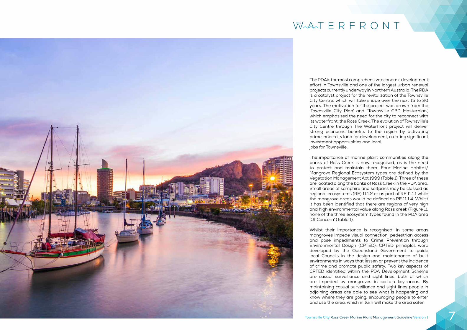
The PDA is the most comprehensive economic development effort in Townsville and one of the largest urban renewal projects currently underway in Northern Australia. The PDA is a catalyst project for the revitalization of the Townsville City Centre, which will take shape over the next 15 to 20 years. The motivation for the project was drawn from the ‘Townsville City Plan’ and “Townsville CBD Masterplan’, which emphasized the need for the city to reconnect with its waterfront, the Ross Creek. The evolution of Townsville’s City Centre through The Waterfront project will deliver strong economic benefits to the region by activating prime inner-city land for development, creating significant investment opportunities and localjobs for Townsville.
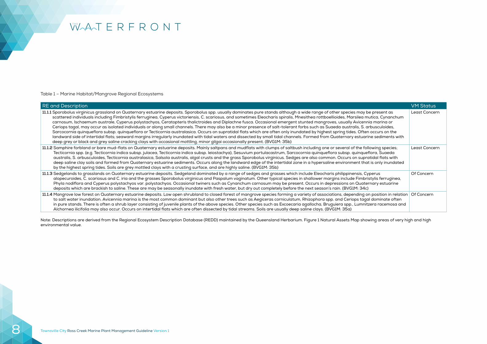
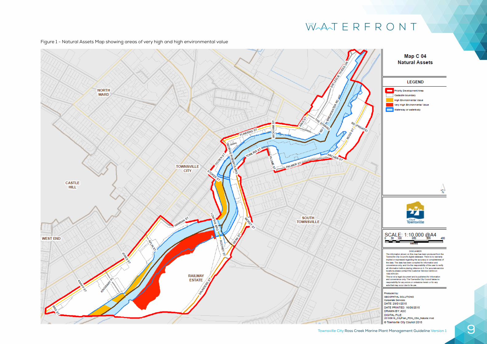
The importance of marine plant communities along the banks of Ross Creek is now recognised, as is the need to protect and maintain them. Four Marine Habitat/Mangrove Regional Ecosystem types are defined by the Vegetation Management Act 1999 (Table 1). Three of these are located along the banks of Ross Creek in the PDA area. Small areas of samphire and saltpans may be classed as regional ecosystems (RE) 11.1.2 or as part of RE 11.1.1 while the mangrove areas would be defined as RE 11.1.4. Whilst it has been identified that there are regions of very high and high environmental value along Ross creek (Figure 1), none of the three ecosystem types found in the PDA area ‘Of Concern’ (Table 1).
Whilst their importance is recognised, in some areas mangroves impede visual connection, pedestrian access and pose impediments to Crime Prevention through Environmental Design (CPTED). CPTED principles were developed by the Queensland Government to guide local Councils in the design and maintenance of built environments in ways that lessen or prevent the incidence of crime and promote public safety. Two key aspects of CPTED identified within the PDA Development Scheme are casual surveillance and sight lines, both of which are impeded by mangroves in certain key areas. By maintaining casual surveillance and sight lines people in adjoining areas are able to see what is happening and know where they are going, encouraging people to enter and use the area, which in turn will make the area safer.
Townsville City Ross Creek Marine Plant Management Guideline Version 18
RE and Description VM Status11.1.1 Sporobolus virginicus grassland on Quaternary estuarine deposits. Sporobolus spp. usually dominates pure stands although a wide range of other species may be present as
scattered individuals including Fimbristylis ferruginea, Cyperus victoriensis, C. scariosus, and sometimes Eleocharis spiralis, Mnesithea rottboellioides, Marsilea mutica, Cynanchum carnosum, Ischaemum australe, Cyperus polystachyos, Ceratopteris thalictroides and Diplachne fusca. Occasional emergent stunted mangroves, usually Avicennia marina or Ceriops tagal, may occur as isolated individuals or along small channels. There may also be a minor presence of salt-tolerant forbs such as Suaeda australis, S. arbusculoides, Sarcocornia quinqueflora subsp. quinqueflora or Tecticornia australasica. Occurs on supratidal flats which are often only inundated by highest spring tides. Often occurs on the landward side of intertidal flats; seaward margins irregularly inundated with tidal waters and dissected by small tidal channels. Formed from Quaternary estuarine sediments with deep grey or black and grey saline cracking clays with occasional mottling, minor gilgai occasionally present. (BVG1M: 35b)
Least Concern
11.1.2 Samphire forbland or bare mud-flats on Quaternary estuarine deposits. Mainly saltpans and mudflats with clumps of saltbush including one or several of the following species; Tecticornia spp. (e.g. Tecticornia indica subsp. julacea, Tecticornia indica subsp. leiostachya), Sesuvium portulacastrum, Sarcocornia quinqueflora subsp. quinqueflora, Suaeda australis, S. arbusculoides, Tecticornia australasica, Salsola australis, algal crusts and the grass Sporobolus virginicus. Sedges are also common. Occurs on supratidal flats with deep saline clay soils and formed from Quaternary estuarine sediments. Occurs along the landward edge of the intertidal zone in a hypersaline environment that is only inundated by the highest spring tides. Soils are grey mottled clays with a crusting surface, and are highly saline. (BVG1M: 35b)
Least Concern
11.1.3 Sedgelands to grasslands on Quaternary estuarine deposits. Sedgeland dominated by a range of sedges and grasses which include Eleocharis philippinensis, Cyperus alopecuroides, C. scariosus and C. iria and the grasses Sporobolus virginicus and Paspalum vaginatum. Other typical species in shallower margins include Fimbristylis ferruginea, Phyla nodiflora and Cyperus polystachyos var. polystachyos. Occasional twiners such as Cynanchum carnosum may be present. Occurs in depressions on Quaternary estuarine deposits which are brackish to saline. These are may be seasonally inundate with fresh water, but dry out completely before the next season’s rain. (BVG1M: 34c)
Of Concern
11.1.4 Mangrove low forest on Quaternary estuarine deposits. Low open shrubland to closed forest of mangrove species forming a variety of associations, depending on position in relation to salt water inundation. Avicennia marina is the most common dominant but also other trees such as Aegiceras corniculatum, Rhizophora spp. and Ceriops tagal dominate often in pure stands. There is often a shrub layer consisting of juvenile plants of the above species. Other species such as Excoecaria agallocha, Bruguiera spp., Lumnitzera racemosa and Alchornea ilicifolia may also occur. Occurs on intertidal flats which are often dissected by tidal streams. Soils are usually deep saline clays. (BVG1M: 35a)
Of Concern
Note: Descriptions are derived from the Regional Ecosystem Description Database (REDD) maintained by the Queensland Herbarium. Figure 1 Natural Assets Map showing areas of very high and high environmental value.
Table 1 – Marine Habitat/Mangrove Regional Ecosystems
Townsville City Ross Creek Marine Plant Management Guideline Version 1 9
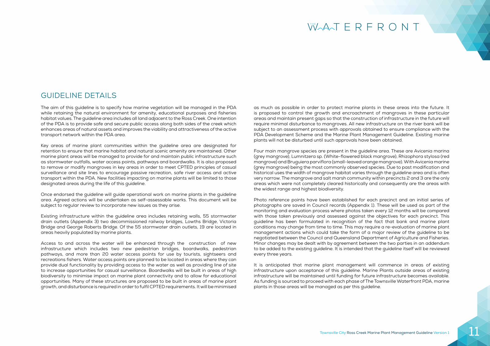
Figure 1 - Natural Assets Map showing areas of very high and high environmental value
Townsville City Ross Creek Marine Plant Management Guideline Version 110
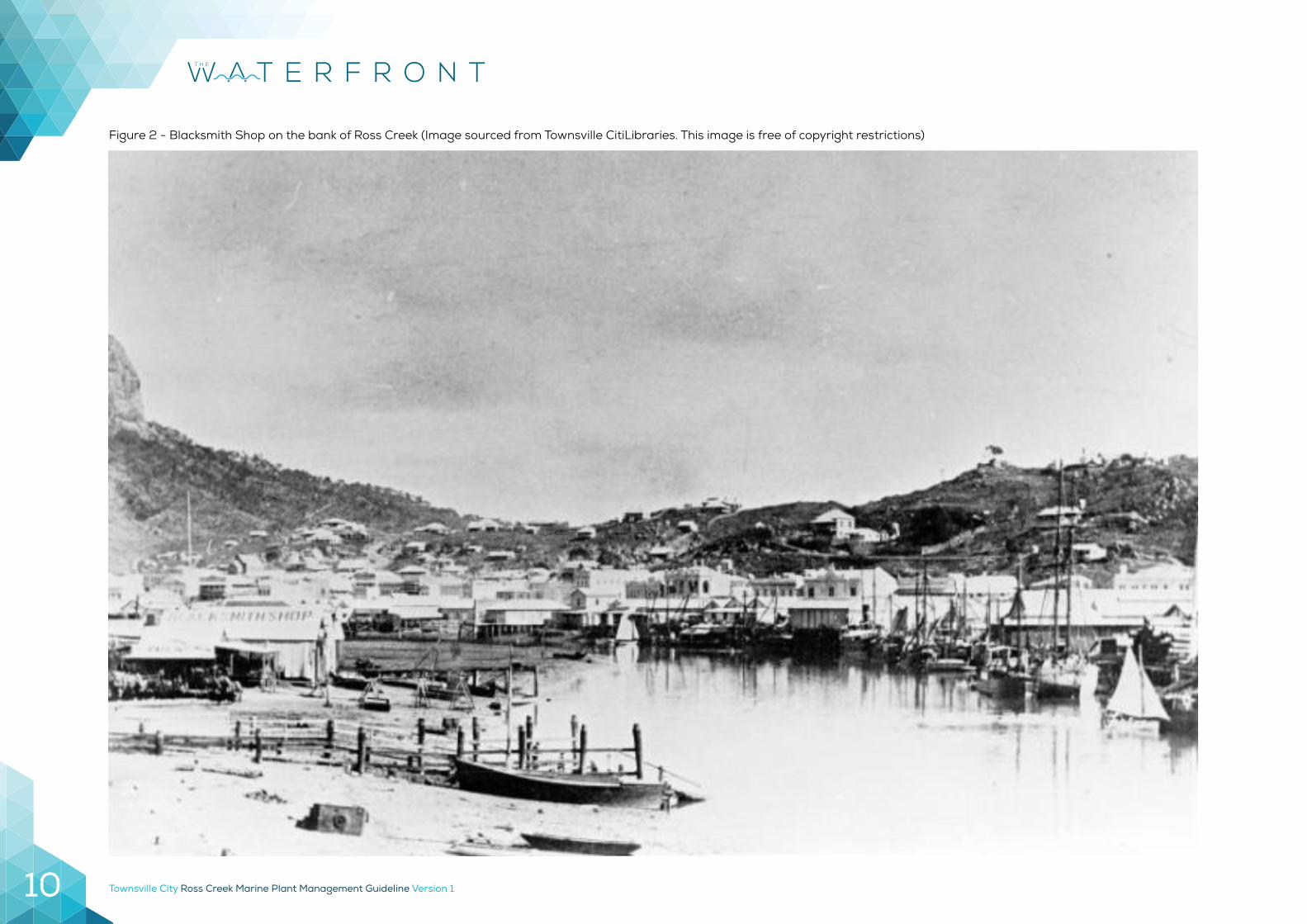
Figure 2 - Blacksmith Shop on the bank of Ross Creek (Image sourced from Townsville CitiLibraries. This image is free of copyright restrictions)
Townsville City Ross Creek Marine Plant Management Guideline Version 1 11
The aim of this guideline is to specify how marine vegetation will be managed in the PDA while retaining the natural environment for amenity, educational purposes and fisheries habitat values. The guideline area includes all land adjacent to the Ross Creek. One intention of the PDA is to provide safe and secure public access along both sides of the creek which enhances areas of natural assets and improves the viability and attractiveness of the active transport network within the PDA area.
Key areas of marine plant communities within the guideline area are designated for retention to ensure that marine habitat and natural scenic amenity are maintained. Other marine plant areas will be managed to provide for and maintain public infrastructure such as stormwater outfalls, water access points, pathways and boardwalks. It is also proposed to remove or modify mangroves in key areas in order to meet CPTED principles of casual surveillance and site lines to encourage passive recreation, safe river access and active transport within the PDA. New facilities impacting on marine plants will be limited to those designated areas during the life of this guideline.
Once endorsed the guideline will guide operational work on marine plants in the guideline area. Agreed actions will be undertaken as self-assessable works. This document will be subject to regular review to incorporate new issues as they arise.
Existing infrastructure within the guideline area includes retaining walls, 55 stormwater drain outlets (Appendix 3) two decommissioned railway bridges, Lowths Bridge, Victoria Bridge and George Roberts Bridge. Of the 55 stormwater drain outlets, 19 are located in areas heavily populated by marine plants.
Access to and across the water will be enhanced through the construction of new infrastructure which includes two new pedestrian bridges, boardwalks, pedestrian pathways, and more than 20 water access points for use by tourists, sightseers and recreations fishers. Water access points are planned to be located in areas where they can provide dual functionality by providing access to the water as well as providing line of site to increase opportunities for casual surveillance. Boardwalks will be built in areas of high biodiversity to minimise impact on marine plant connectivity and to allow for educational opportunities. Many of these structures are proposed to be built in areas of marine plant growth, and disturbance is required in order to fulfil CPTED requirements. It will be minimised
as much as possible in order to protect marine plants in these areas into the future. It is proposed to control the growth and encroachment of mangroves in these particular areas and maintain present gaps so that the construction of infrastructure in the future will require minimal disturbance to mangroves. All new infrastructure on the river bank will be subject to an assessment process with approvals obtained to ensure compliance with the PDA Development Scheme and the Marine Plant Management Guideline. Existing marine plants will not be disturbed until such approvals have been obtained.
Four main mangrove species are present in the guideline area. These are Avicenia marina (grey mangrove), Lumnitzera sp. (White-flowered black mangrove), Rhizophora stylosa (red mangrove) and Bruguiera parviflora (small-leaved orange mangrove). With Avicenia marine (grey mangrove) being the most commonly observed species. Due to past modification and historical uses the width of mangrove habitat varies through the guideline area and is often very narrow. The mangrove and salt marsh community within precincts 2 and 3 are the only areas which were not completely cleared historically and consequently are the areas with the widest range and highest biodiversity.
Photo reference points have been established for each precinct and an initial series of photographs are saved in Council records (Appendix 1). These will be used as part of the monitoring and evaluation process where photos taken every 12 months will be compared with those taken previously and assessed against the objectives for each precinct. This guideline has been formulated in recognition of the fact that bank and marine plant conditions may change from time to time. This may require a re-evaluation of marine plant management actions which could take the form of a major review of the guideline to be negotiated between the Council and Queensland Department of Agriculture and Fisheries. Minor changes may be dealt with by agreement between the two parties in an addendum to be added to the existing guideline. It is intended that the guideline itself will be reviewed every three years.
It is anticipated that marine plant management will commence in areas of existing infrastructure upon acceptance of this guideline. Marine Plants outside areas of existing infrastructure will be maintained until funding for future infrastructure becomes available. As funding is sourced to proceed with each phase of The Townsville Waterfront PDA, marine plants in those areas will be managed as per this guideline.
GUIDELINE DETAILS
Townsville City Ross Creek Marine Plant Management Guideline Version 112
'PM' + 'RM' PROTECT MARINE PLANTSMARINE PLANT LEGEND
'MM' MODIFY MARINE PLANTS'MF' MARINE PLANT FREE'PM' + 'RM' PROTECT SALT COUCH
#EXISTING INFRASTRUCTUREPHOTO REFERENCE POINT
REALIGN OF DESIGN CONCEPTPASSIVE SURVEILLANCE
TOWNSVILLE CITY COUNCILMARINE PLANT STRATEGY OVERALLOVERALL PDA
00.01 4
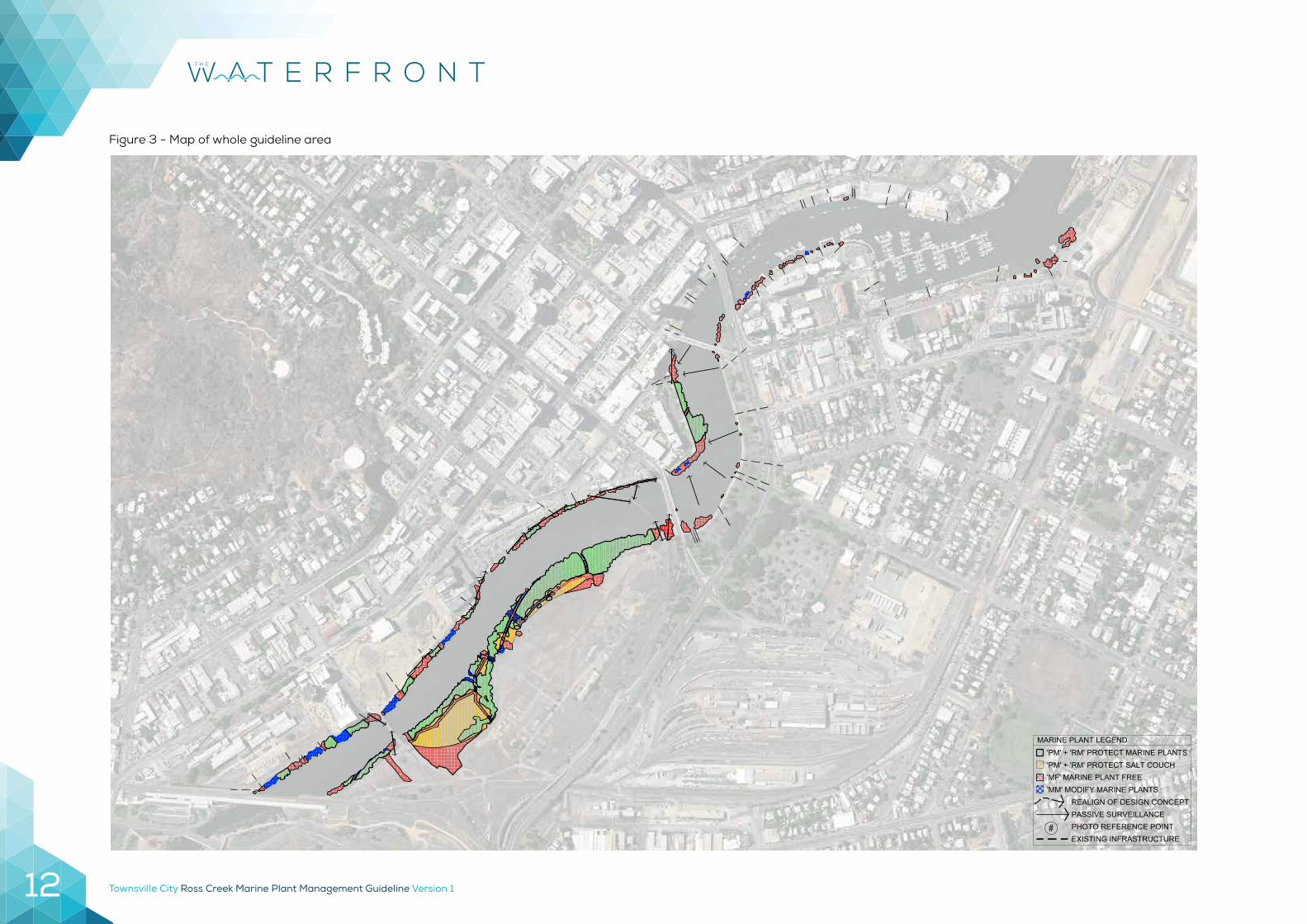
Figure 3 - Map of whole guideline area
Townsville City Ross Creek Marine Plant Management Guideline Version 1 13
PDA BOUNDARY
PDA
BOU
ND
ARY
PDA
BOU
ND
ARY
PDA BOUNDARY
PDA BOUNDARY
PDA BOUNDARY
PDA BOUNDARY
PDA BOUNDARY
PDA BOUNDARY
PDA
BOU
ND
ARY
PDA BOUNDARY
'PM' + 'RM' PROTECT MARINE PLANTSMARINE PLANT LEGEND
'MM' MODIFY MARINE PLANTS'MF' MARINE PLANT FREE'PM' + 'RM' PROTECT SALT COUCH
#EXISTING INFRASTRUCTUREPHOTO REFERENCE POINT
REALIGN OF DESIGN CONCEPTPASSIVE SURVEILLANCE
TOWNSVILLE CITY COUNCILMARINE PLANT STRATEGY OVERALLOVERALL PDA
00.02 4
Townsville City Ross Creek Marine Plant Management Guideline Version 114
REFERENCESQueensland Primary Industries and Fisheries. Strategic marine plant management in Queensland: A partnership approach. Fact Sheet.
The State of Queensland. 2007. CPTED Guidelines for Queensland: Brisbane. http://www.police.qld.gov.au/programs/crimeprevention/
The State of Queensland, Department of Employment, Economic Development and Innovation. 2009. Code for self-assessable development,
Maintenance works on existing lawful structures (other than powerlines and on-farm drains) in a declared fish habitat area or involving the removal, destruction or damage of marine plants. Code number: MP02 April 2013.
The State of Queensland, Department of Employment, Economic Development and Innovation. 2009. Code for self-assessable development,
Minor impact works in a declared fish habitat area or involving the removal, destruction or damage of marine plants. Code number: MP06 July 2013.
Townsville City Council. 2015. Draft Townsville City Waterfront Priority Development Area.
Townsville City Ross Creek Marine Plant Management Guideline Version 1 15
Objective 1 – Monitor extent and height of marine plant growth to record baseline data to: determine if remedial actions are required to address threatening processes; protected areas are being maintained or enhanced; and to determine if marine plants in multiple use zones will need modification i.e. will impede infrastructure or passive surveillance within the following 12 months.
1.1 Take photos from photo reference points every 12 months prior to planning of works in marine areas.
1.2 Undertake GIS analysis as aerial photography is updated to determine changes in extent of marine plant areas and remap marine plant areas if required to improve accuracy of mapping layer records.
Objective 2 – Preserve identified areas of marine plants to ensure no net loss through protection and enhancement of designated marine plant areas in order to offset losses due to modification and maintenance of passive surveillance and riverbank amenities.
2.1 Identify areas of natural marine plant growth to be retained. 2.2 Aim for nil net loss of marine plants, from 1990 conditions, through promotion of
growth in natural areas to offset losses due to maintenance, public safety and amenities.
Objective 3 – Maintain passive surveillance sightlines of the river from key areas of the riverbank to maintain passive surveillance to increase public safety as identified in the PDA.
The river and its natural features were noted as a key environmental attraction. A balance will be established between the need to retain marine plant features in their natural form and to provide opportunities for the public to safely enjoy all of the natural amenity features of the creek.
3.1 To undertake strategic marine plant management to create sightlines in key areas of marine plants for public safety.
3.2 A map of works is included for each precinct. All works to be carried out according to these plans to ensure compliance with the 2009 Codes for self-assessable development (MP02 and MP06).
Objective 4 – Provide access to river for recreational uses at strategic locations to ensure liveability and provide economic and social prosperity. This includes access to the river for recreational fishing, tourist visitation and passive recreation.
4.1 Undertake marine plant management to as create areas for future viewing and fishing platforms.
4.2 Undertake marine plant management when required to allow for construction and maintenance of an extended walkway and boardwalk.
4.3 All works to be carried out according to these plans to ensure compliance with the 2009 Codes for self-assessable development (MP02 and MP06).
4.4 Install educational signage in high use areas where marine plants are retained and managed in order to inform recreational users of mangrove distribution, values and management arrangements. The aim is to highlight the presence of marine plants as a positive and necessary component of a natural and attractive experience of the Ross Creek bank.
4.5 Provide for surveillance from the river bank to ensure compliance with Crime Prevention Through Environmental Design (CPTED) principles.
Objective 5 – Protect Council assets and provide access to these assets by maintaining clear areas around existing and future approved assets including jetties, pontoons, stormwater drain outlets, boardwalk and walkways.
5.1 The area subject to works in this guideline is not within a declared Fish Habitat Area however works will involve the removal, damage or destruction of marine plants.
5.2 All maintenance works to be carried out in compliance with Code for self-assessable development maintenance works on existing lawful structures (other than powerlines and on-farm drains) in a declared fish habitat area or involving the removal, destruction or damage of marine plants (MP02).
Section 2
OBJECTIVES
Townsville City Ross Creek Marine Plant Management Guideline Version 116
Protect Marine Plants – Management Code ‘PM’The objective of ‘Protect Marine Plants’ is to retain the existing marine plant community distribution and diversity and to allow natural processes of further colonisation and marine plant community development to occur. Ideally these areas would benefit from being linked to terrestrial vegetated buffers to provide long-term protection.
Restore Marine Plants – Management Code ‘RM’The objective of ‘Restore Marine Plants’ is to enhance degraded marine plant communities by removing or reducing threatening processes such as exotic weeds and facilitating natural colonisation by allowing passive regeneration. Areas where there are opportunities to enhance existing marine plant communities through active restoration will also be considered.
Marine Plant Free – Management Code ‘MF’The objective of ‘Marine Plant Free’ is to maintain the existing situation where areas are kept free of marine plants through maintenance activities and there is no encouragement of
CATEGORIES OF MARINE PLANT MANAGEMENTmarine plant colonisation. This may be a result of bank engineering design, reduced hydraulic capacity, treatment or maintenance not specifically allowing for marine plant establishment i.e. concrete lined drain. Where areas are kept marine plant free, maintenance activities may include the strategic removal of marine plant propagates for restoration purposes, prior to maintenance works being conducted.
Modify Marine Plants – Management Code ‘MM’The objective of ‘Modify Marine Plants’ is to minimise impacts to marine plant communities while continuing to meet maintenance or public use requirements. Marine plant modification techniques include trimming via boat, hedging to a height of 1.5m, selective species removal, thinning, crown lifting or replacement of taller varieties with low growing forms. The MPM guideline aims to identify innovative marine plant treatment techniques that support the retention of marine plants but allow necessary maintenance works to be conducted for public use or to provide flood immunity. For example, marine plants could be trimmed to allow access to the waterway for maintenance purposes i.e. dredging or for rubbish removal.
Townsville City Ross Creek Marine Plant Management Guideline Version 1 17
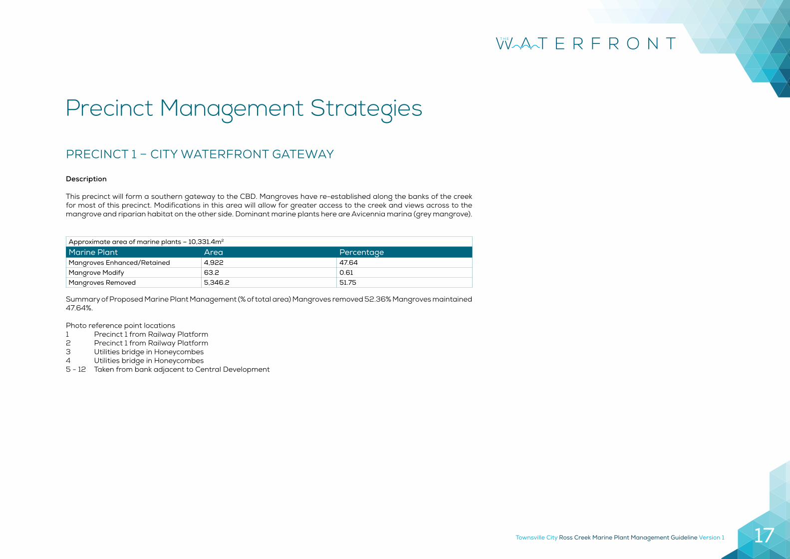
PRECINCT 1 – CITY WATERFRONT GATEWAY
Description
This precinct will form a southern gateway to the CBD. Mangroves have re-established along the banks of the creek for most of this precinct. Modifications in this area will allow for greater access to the creek and views across to the mangrove and riparian habitat on the other side. Dominant marine plants here are Avicennia marina (grey mangrove).
Approximate area of marine plants – 10,331.4m2
Marine Plant Area PercentageMangroves Enhanced/Retained 4,922 47.64Mangrove Modify 63.2 0.61Mangroves Removed 5,346.2 51.75
Summary of Proposed Marine Plant Management (% of total area) Mangroves removed 52.36% Mangroves maintained 47.64%.
Photo reference point locations1 Precinct 1 from Railway Platform2 Precinct 1 from Railway Platform3 Utilities bridge in Honeycombes4 Utilities bridge in Honeycombes5 - 12 Taken from bank adjacent to Central Development
Precinct Management Strategies
Townsville City Ross Creek Marine Plant Management Guideline Version 118
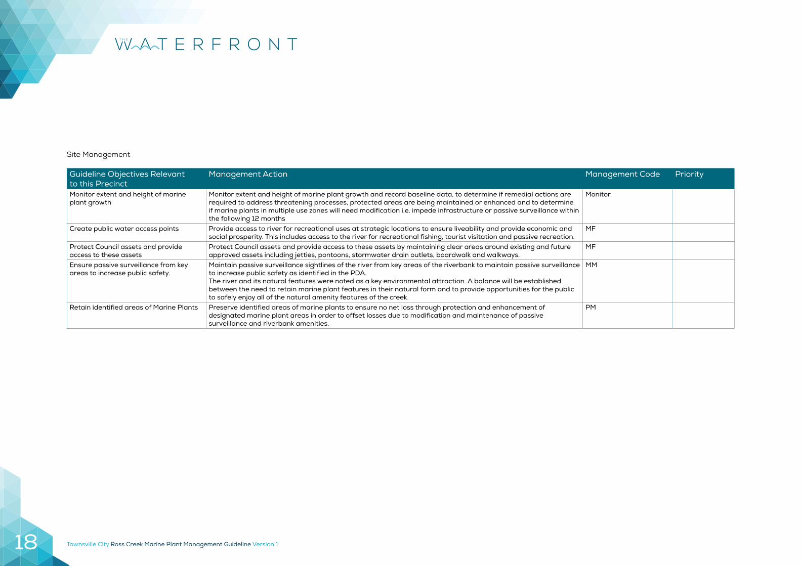
Guideline Objectives Relevantto this Precinct
Management Action Management Code Priority
Monitor extent and height of marine plant growth
Monitor extent and height of marine plant growth and record baseline data, to determine if remedial actions are required to address threatening processes, protected areas are being maintained or enhanced and to determine if marine plants in multiple use zones will need modification i.e. impede infrastructure or passive surveillance within the following 12 months
Monitor
Create public water access points Provide access to river for recreational uses at strategic locations to ensure liveability and provide economic and social prosperity. This includes access to the river for recreational fishing, tourist visitation and passive recreation.
MF
Protect Council assets and provide access to these assets
Protect Council assets and provide access to these assets by maintaining clear areas around existing and future approved assets including jetties, pontoons, stormwater drain outlets, boardwalk and walkways.
MF
Ensure passive surveillance from key areas to increase public safety.
Maintain passive surveillance sightlines of the river from key areas of the riverbank to maintain passive surveillance to increase public safety as identified in the PDA. The river and its natural features were noted as a key environmental attraction. A balance will be established between the need to retain marine plant features in their natural form and to provide opportunities for the public to safely enjoy all of the natural amenity features of the creek.
MM
Retain identified areas of Marine Plants Preserve identified areas of marine plants to ensure no net loss through protection and enhancement of designated marine plant areas in order to offset losses due to modification and maintenance of passive surveillance and riverbank amenities.
PM
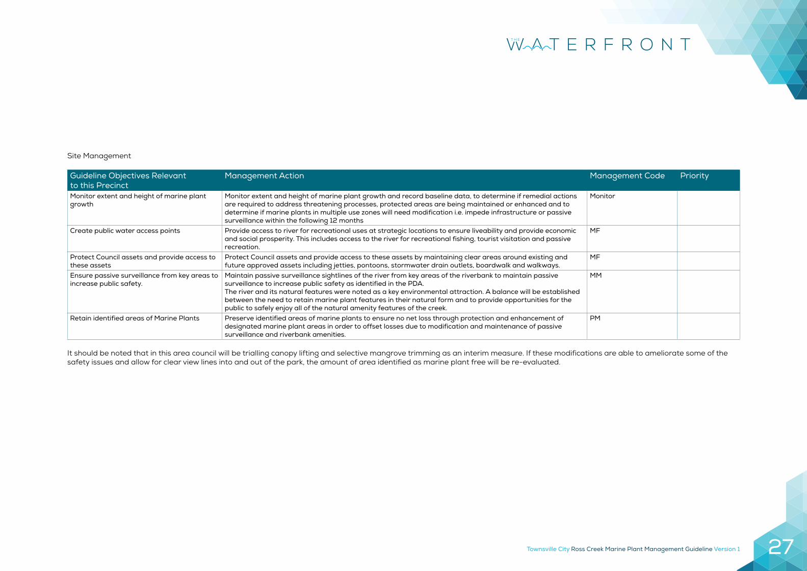
Site Management
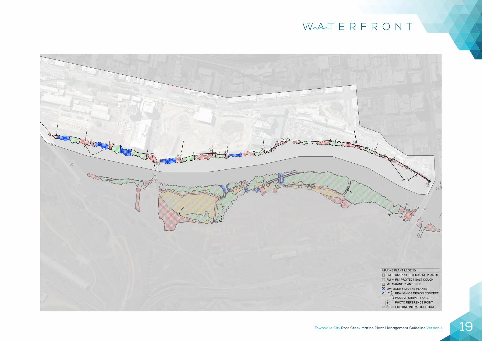
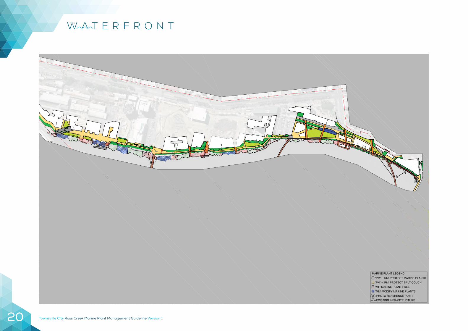
Townsville City Ross Creek Marine Plant Management Guideline Version 1 19
2
1 3
4
5
67
8
910
11
1213
'PM' + 'RM' PROTECT MARINE PLANTSMARINE PLANT LEGEND
'MM' MODIFY MARINE PLANTS'MF' MARINE PLANT FREE'PM' + 'RM' PROTECT SALT COUCH
#EXISTING INFRASTRUCTUREPHOTO REFERENCE POINT
REALIGN OF DESIGN CONCEPTPASSIVE SURVEILLANCE
TOWNSVILLE CITY COUNCILMARINE PLANT STRATEGYPRECINCT 1
01.01 4
Townsville City Ross Creek Marine Plant Management Guideline Version 120
PDA BOUNDARY
PDA BOUNDARY
2
1 3
4
5
67
8
910
11
1213
'PM' + 'RM' PROTECT MARINE PLANTS
MARINE PLANT LEGEND
'MM' MODIFY MARINE PLANTS'MF' MARINE PLANT FREE'PM' + 'RM' PROTECT SALT COUCH
#EXISTING INFRASTRUCTURE PHOTO REFERENCE POINT
TOWNSVILLE CITY COUNCILMARINE PLANT STRATEGYPRECINCT 1
02.01 1
Townsville City Ross Creek Marine Plant Management Guideline Version 1 21
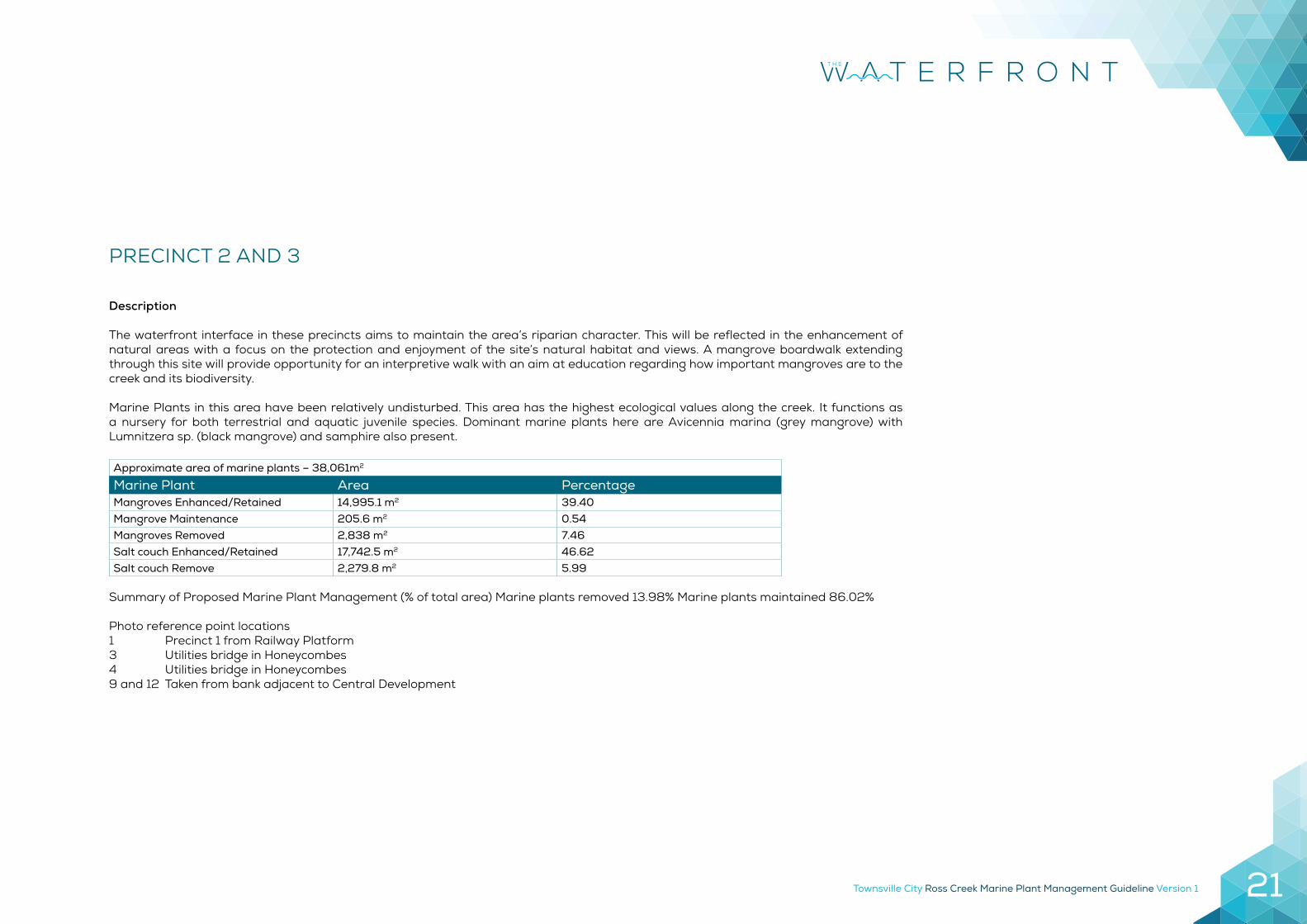
PRECINCT 2 AND 3
Description
The waterfront interface in these precincts aims to maintain the area’s riparian character. This will be reflected in the enhancement of natural areas with a focus on the protection and enjoyment of the site’s natural habitat and views. A mangrove boardwalk extending through this site will provide opportunity for an interpretive walk with an aim at education regarding how important mangroves are to the creek and its biodiversity.
Marine Plants in this area have been relatively undisturbed. This area has the highest ecological values along the creek. It functions as a nursery for both terrestrial and aquatic juvenile species. Dominant marine plants here are Avicennia marina (grey mangrove) with Lumnitzera sp. (black mangrove) and samphire also present.
Approximate area of marine plants – 38,061m2
Marine Plant Area PercentageMangroves Enhanced/Retained 14,995.1 m2 39.40Mangrove Maintenance 205.6 m2 0.54Mangroves Removed 2,838 m2 7.46Salt couch Enhanced/Retained 17,742.5 m2 46.62Salt couch Remove 2,279.8 m2 5.99
Summary of Proposed Marine Plant Management (% of total area) Marine plants removed 13.98% Marine plants maintained 86.02%
Photo reference point locations1 Precinct 1 from Railway Platform3 Utilities bridge in Honeycombes4 Utilities bridge in Honeycombes9 and 12 Taken from bank adjacent to Central Development
Townsville City Ross Creek Marine Plant Management Guideline Version 122
Guideline Objectives Relevantto this Precinct
Management Action Management Code Priority
Monitor extent and height of marine plant growth
Monitor extent and height of marine plant growth and record baseline data, to determine if remedial actions are required to address threatening processes, protected areas are being maintained or enhanced and to determine if marine plants in multiple use zones will need modification i.e. impede infrastructure or passive surveillance within the following 12 months
Monitor
Create public water access points Provide access to river for recreational uses at strategic locations to ensure liveability and provide economic and social prosperity. This includes access to the river for recreational fishing, tourist visitation and passive recreation.
MF
Protect Council assets and provide access to these assets
Protect Council assets and provide access to these assets by maintaining clear areas around existing and future approved assets including jetties, pontoons, stormwater drain outlets, boardwalk and walkways.
MF
Ensure passive surveillance from key areas to increase public safety.
Maintain passive surveillance sightlines of the river from key areas of the riverbank to maintain passive surveillance to increase public safety as identified in the PDA. The river and its natural features were noted as a key environmental attraction. A balance will be established between the need to retain marine plant features in their natural form and to provide opportunities for the public to safely enjoy all of the natural amenity features of the creek.
MM
Retain identified areas of Marine Plants Preserve identified areas of marine plants to ensure no net loss through protection and enhancement of designated marine plant areas in order to offset losses due to modification and maintenance of passive surveillance and riverbank amenities.
PM
Site Management

Townsville City Ross Creek Marine Plant Management Guideline Version 1 23
3
4
5
67
8
910
11
12
'PM' + 'RM' PROTECT MARINE PLANTSMARINE PLANT LEGEND
'MM' MODIFY MARINE PLANTS'MF' MARINE PLANT FREE'PM' + 'RM' PROTECT SALT COUCH
#EXISTING INFRASTRUCTUREPHOTO REFERENCE POINT
REALIGN OF DESIGN CONCEPTPASSIVE SURVEILLANCE
TOWNSVILLE CITY COUNCILMARINE PLANT STRATEGYPRECINCT 2 + 3
01.02 4
Townsville City Ross Creek Marine Plant Management Guideline Version 124
PDA BOUNDARY
PDA BOUNDARY
3
4
5
67
8
910
11
12
'PM' + 'RM' PROTECT MARINE PLANTS
MARINE PLANT LEGEND
'MM' MODIFY MARINE PLANTS'MF' MARINE PLANT FREE'PM' + 'RM' PROTECT SALT COUCH
#EXISTING INFRASTRUCTURE PHOTO REFERENCE POINT
TOWNSVILLE CITY COUNCILMARINE PLANT STRATEGYPRECINCT 2 + 3
02.02 1
Townsville City Ross Creek Marine Plant Management Guideline Version 1 25
Townsville City Ross Creek Marine Plant Management Guideline Version 126
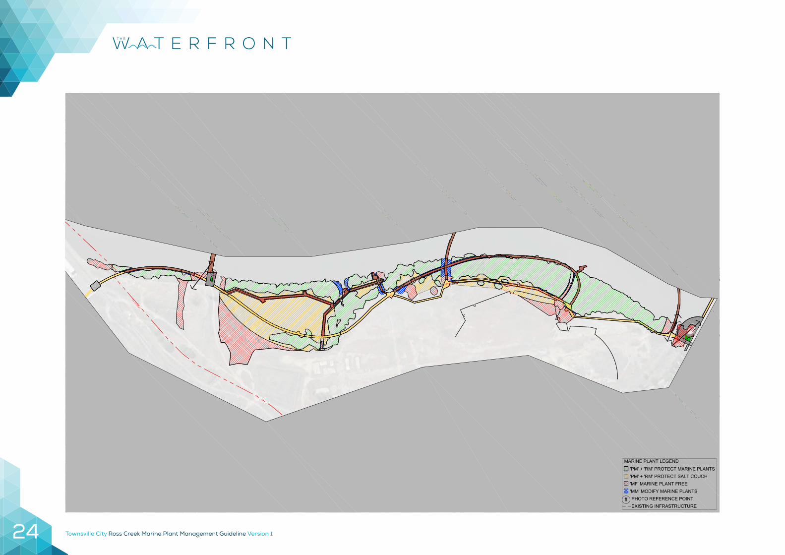
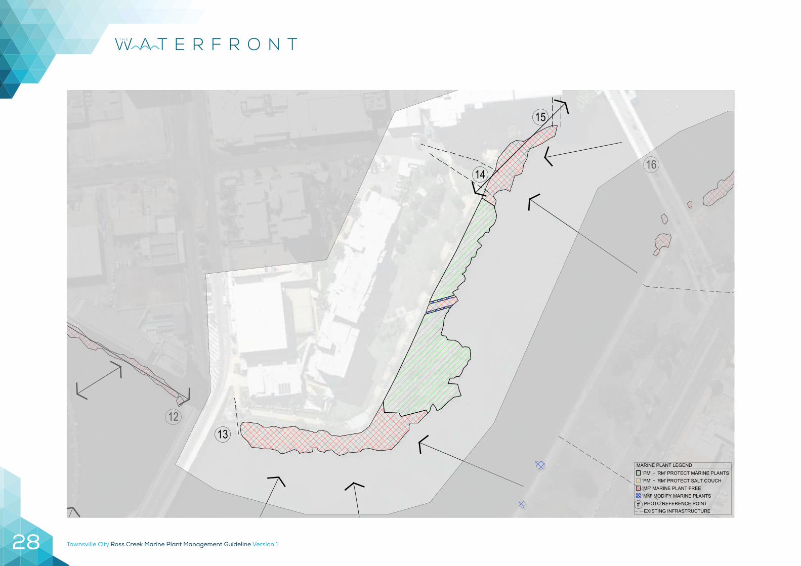
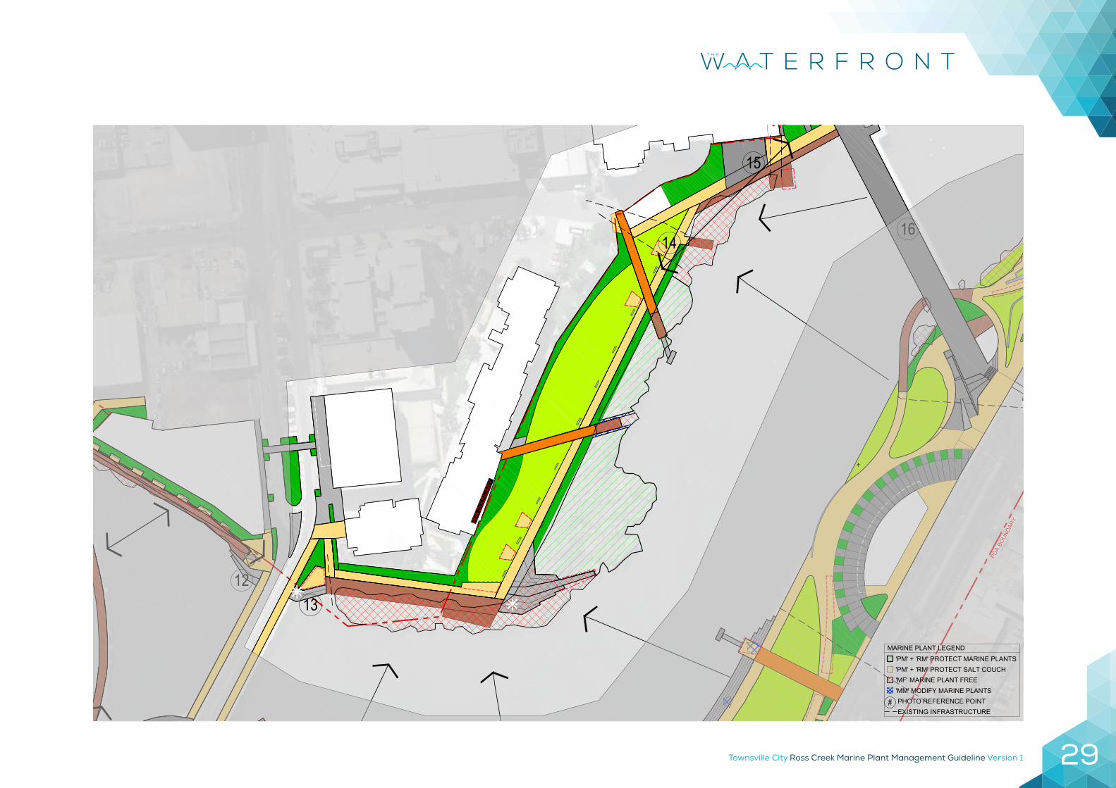
PRECINCT 4 – HANRAN PARK
Description
Hanran Park celebrates the area’s historic role as the city’s port. Mangroves in this area were cleared historically but have recolonised since the late 1980’s.
Mangroves in this area are important for habitat connectivity of estuarine species as it is the only area of marine plant growth in this reach of the Ross Creek. Marine plant species here are Avicennia marina (gray mangrove), Lumnitzera sp. (White-flowered black Mangrove), Rhyzophora stylosa (red mangrove) and Bruguiera parviflora (small-leafed orange mangrove). Although the dominant species is Avicennia marina (gray mangrove).
Approximate area of marine plants – 4,676.3m2
Marine Plant Area PercentageMangroves Enhanced/Retained 2,232.8 47.75Mangrove Maintenance 48.9 1.05Mangroves Removed 2,394 51.21
Summary of Proposed Marine Plant Management (% of total Area) Mangroves removed 52.25% Mangroves maintained 47.75%
Photo reference point locations13 Taken within Hanran Park14 Taken within Hanran Park15 Taken within Hanran Park
Townsville City Ross Creek Marine Plant Management Guideline Version 1 27
Guideline Objectives Relevantto this Precinct
Management Action Management Code Priority
Monitor extent and height of marine plant growth
Monitor extent and height of marine plant growth and record baseline data, to determine if remedial actions are required to address threatening processes, protected areas are being maintained or enhanced and to determine if marine plants in multiple use zones will need modification i.e. impede infrastructure or passive surveillance within the following 12 months
Monitor
Create public water access points Provide access to river for recreational uses at strategic locations to ensure liveability and provide economic and social prosperity. This includes access to the river for recreational fishing, tourist visitation and passive recreation.
MF
Protect Council assets and provide access to these assets
Protect Council assets and provide access to these assets by maintaining clear areas around existing and future approved assets including jetties, pontoons, stormwater drain outlets, boardwalk and walkways.
MF
Ensure passive surveillance from key areas to increase public safety.
Maintain passive surveillance sightlines of the river from key areas of the riverbank to maintain passive surveillance to increase public safety as identified in the PDA. The river and its natural features were noted as a key environmental attraction. A balance will be established between the need to retain marine plant features in their natural form and to provide opportunities for the public to safely enjoy all of the natural amenity features of the creek.
MM
Retain identified areas of Marine Plants Preserve identified areas of marine plants to ensure no net loss through protection and enhancement of designated marine plant areas in order to offset losses due to modification and maintenance of passive surveillance and riverbank amenities.
PM
It should be noted that in this area council will be trialling canopy lifting and selective mangrove trimming as an interim measure. If these modifications are able to ameliorate some of the safety issues and allow for clear view lines into and out of the park, the amount of area identified as marine plant free will be re-evaluated.
Site Management
Townsville City Ross Creek Marine Plant Management Guideline Version 128
1213
14
15
16
'PM' + 'RM' PROTECT MARINE PLANTS
MARINE PLANT LEGEND
'MM' MODIFY MARINE PLANTS'MF' MARINE PLANT FREE'PM' + 'RM' PROTECT SALT COUCH
#EXISTING INFRASTRUCTURE PHOTO REFERENCE POINT
TOWNSVILLE CITY COUNCILMARINE PLANT STRATEGYHANRAN PARK
01.03 3
Townsville City Ross Creek Marine Plant Management Guideline Version 1 29
PDA
BOUN
DARYPD
A BO
UN
DAR
Y
1213
14
15
16
'PM' + 'RM' PROTECT MARINE PLANTS
MARINE PLANT LEGEND
'MM' MODIFY MARINE PLANTS'MF' MARINE PLANT FREE'PM' + 'RM' PROTECT SALT COUCH
#EXISTING INFRASTRUCTURE PHOTO REFERENCE POINT
TOWNSVILLE CITY COUNCILMARINE PLANT STRATEGYHANRAN PARK
02.03 1
Townsville City Ross Creek Marine Plant Management Guideline Version 130
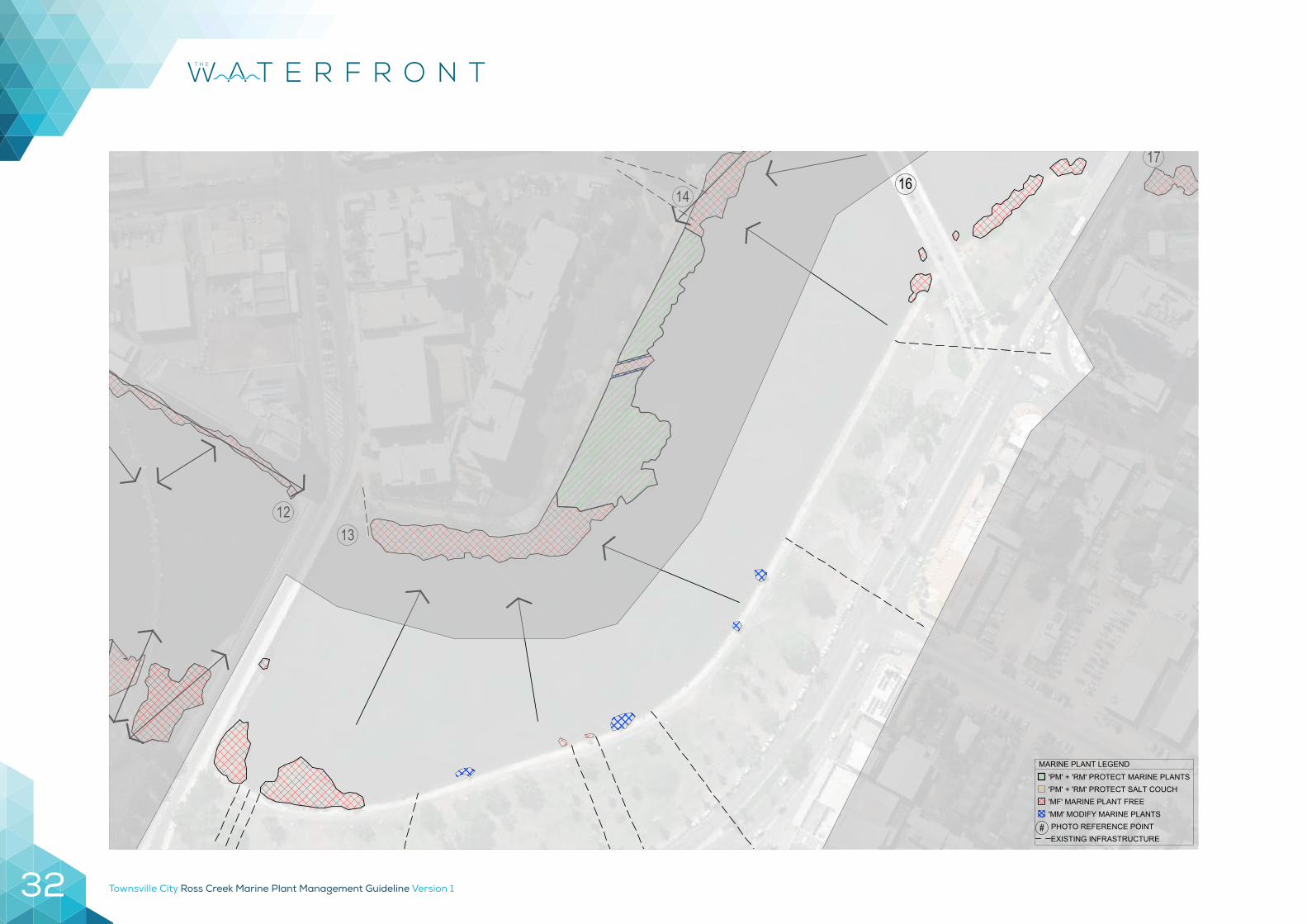
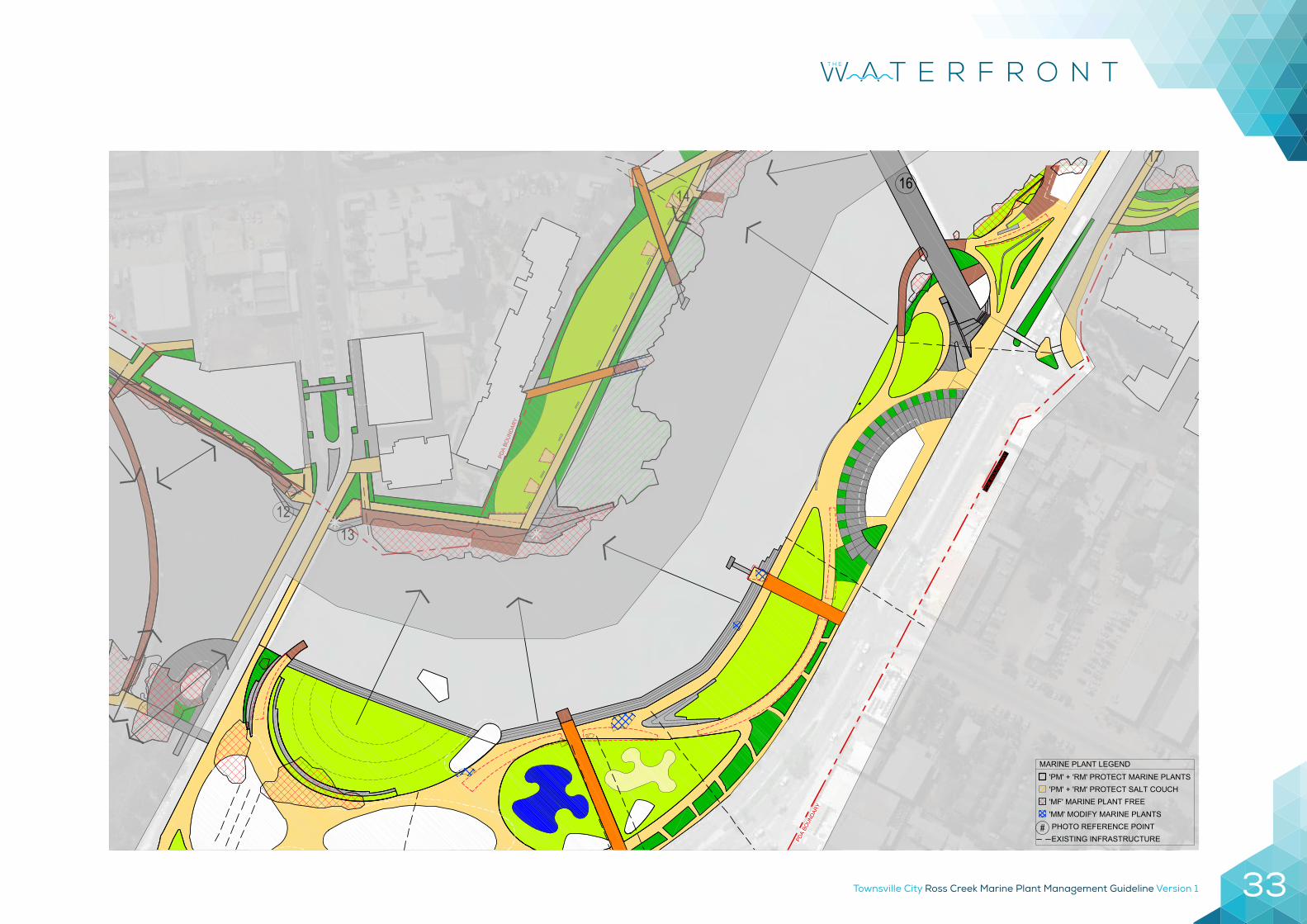
PRECINCT 5 – CENTRAL
Description
The Central Precinct is a mixed use area which accommodates residential and short-term accommodation alongside existing tropical, marine and research-based tourism activities.
Marine plants in this area were historically cleared and rock retaining walls built. Very few marine plants are present in this precinct. The existing marine plants are primarily growing from the concrete retaining walls.
Approximate area of marine plants – 1,485.7m2
Marine Plant Area PercentageMangroves Enhanced/RetainedMangrove Maintenance 221Mangroves Removed 1264.3
Summary of Proposed Mangrove Management (% of total area): Mangroves removed – 100%
Photo reference point locations16 Taken from Victoria Bridge

Townsville City Ross Creek Marine Plant Management Guideline Version 1 31
Guideline Objectives Relevantto this Precinct
Management Action Management Code Priority
Monitor extent and height of marine plant growth
Monitor extent and height of marine plant growth and record baseline data, to determine if remedial actions are required to address threatening processes, protected areas are being maintained or enhanced and to determine if marine plants in multiple use zones will need modification i.e. impede infrastructure or passive surveillance within the following 12 months
Monitor
Create public water access points Provide access to river for recreational uses at strategic locations to ensure liveability and provide economic and social prosperity. This includes access to the river for recreational fishing, tourist visitation and passive recreation.
MF
Protect Council assets and provide access to these assets
Protect Council assets and provide access to these assets by maintaining clear areas around existing and future approved assets including jetties, pontoons, stormwater drain outlets, boardwalk and walkways.
MF
Retain identified areas of Marine Plants Preserve identified areas of marine plants to ensure no net loss through protection and enhancement of designated marine plant areas in order to offset losses due to modification and maintenance of passive surveillance and riverbank amenities.
PM
Site Management
Townsville City Ross Creek Marine Plant Management Guideline Version 132
1213
1416
17
'PM' + 'RM' PROTECT MARINE PLANTS
MARINE PLANT LEGEND
'MM' MODIFY MARINE PLANTS'MF' MARINE PLANT FREE'PM' + 'RM' PROTECT SALT COUCH
#EXISTING INFRASTRUCTURE PHOTO REFERENCE POINT
TOWNSVILLE CITY COUNCILMARINE PLANT STRATEGYCENTRAL PARK
01.04 3
Townsville City Ross Creek Marine Plant Management Guideline Version 1 33
PDA
BOUN
DARY
PDA
BOUN
DARYPD
A BO
UN
DAR
Y
PDA BOUNDARY
1213
1416
17
'PM' + 'RM' PROTECT MARINE PLANTS
MARINE PLANT LEGEND
'MM' MODIFY MARINE PLANTS'MF' MARINE PLANT FREE'PM' + 'RM' PROTECT SALT COUCH
#EXISTING INFRASTRUCTURE PHOTO REFERENCE POINT
TOWNSVILLE CITY COUNCILMARINE PLANT STRATEGYCENTRAL PARK
02.04 1
Townsville City Ross Creek Marine Plant Management Guideline Version 134
PRECINCT 6 – TOMLINS AND WICKHAM
Description
This precinct is to provide a significant area for well-designed residential and commercial uses, including a range of supportive service-orientated land uses.
As with precinct 5 this area also was historically cleared of marine plants and rock retaining walls built. Very few marine plants are present in this precinct. The existing marine plants are primarily growing from the concrete retaining walls.
Approximate area of marine plants – 1,232.8m2
Marine Plant Area PercentageMangroves Enhanced/RetainedMangrove Maintenance 205.4Mangroves Removed 1027.4
Summary of Proposed Mangrove Management (% of total area): Mangroves removed – 100%
Photo reference point locations18 Taken from Tomlins Street19 Taken from Tomlins Street20 Taken from George Roberts Bridge21 Taken from George Roberts Bridge

Townsville City Ross Creek Marine Plant Management Guideline Version 1 35
Guideline Objectives Relevantto this Precinct
Management Action Management Code Priority
Monitor extent and height of marine plant growth
Monitor extent and height of marine plant growth and record baseline data, to determine if remedial actions are required to address threatening processes, protected areas are being maintained or enhanced and to determine if marine plants in multiple use zones will need modification i.e. impede infrastructure or passive surveillance within the following 12 months
Monitor
Create public water access points Provide access to river for recreational uses at strategic locations to ensure liveability and provide economic and social prosperity. This includes access to the river for recreational fishing, tourist visitation and passive recreation.
MF
Protect Council assets and provide access to these assets
Protect Council assets and provide access to these assets by maintaining clear areas around existing and future approved assets including jetties, pontoons, stormwater drain outlets, boardwalk and walkways.
MF
Retain identified areas of Marine Plants Preserve identified areas of marine plants to ensure no net loss through protection and enhancement of designated marine plant areas in order to offset losses due to modification and maintenance of passive surveillance and riverbank amenities.
PM
Site Management
Townsville City Ross Creek Marine Plant Management Guideline Version 136
'PM' + 'RM' PROTECT MARINE PLANTS
MARINE PLANT LEGEND
'MM' MODIFY MARINE PLANTS'MF' MARINE PLANT FREE'PM' + 'RM' PROTECT SALT COUCH
#EXISTING INFRASTRUCTURE PHOTO REFERENCE POINT
TOWNSVILLE CITY COUNCILMARINE PLANT STRATEGYTOMLINS & WICKHAM STREETS
01.05 3
Townsville City Ross Creek Marine Plant Management Guideline Version 1 37
PDA BOUNDARY
PDA BOUNDARY
'PM' + 'RM' PROTECT MARINE PLANTS
MARINE PLANT LEGEND
'MM' MODIFY MARINE PLANTS'MF' MARINE PLANT FREE'PM' + 'RM' PROTECT SALT COUCH
#EXISTING INFRASTRUCTURE PHOTO REFERENCE POINT
TOWNSVILLE CITY COUNCILMARINE PLANT STRATEGYTOMLINS & WICKHAM STREETS
02.05 1
Townsville City Ross Creek Marine Plant Management Guideline Version 138
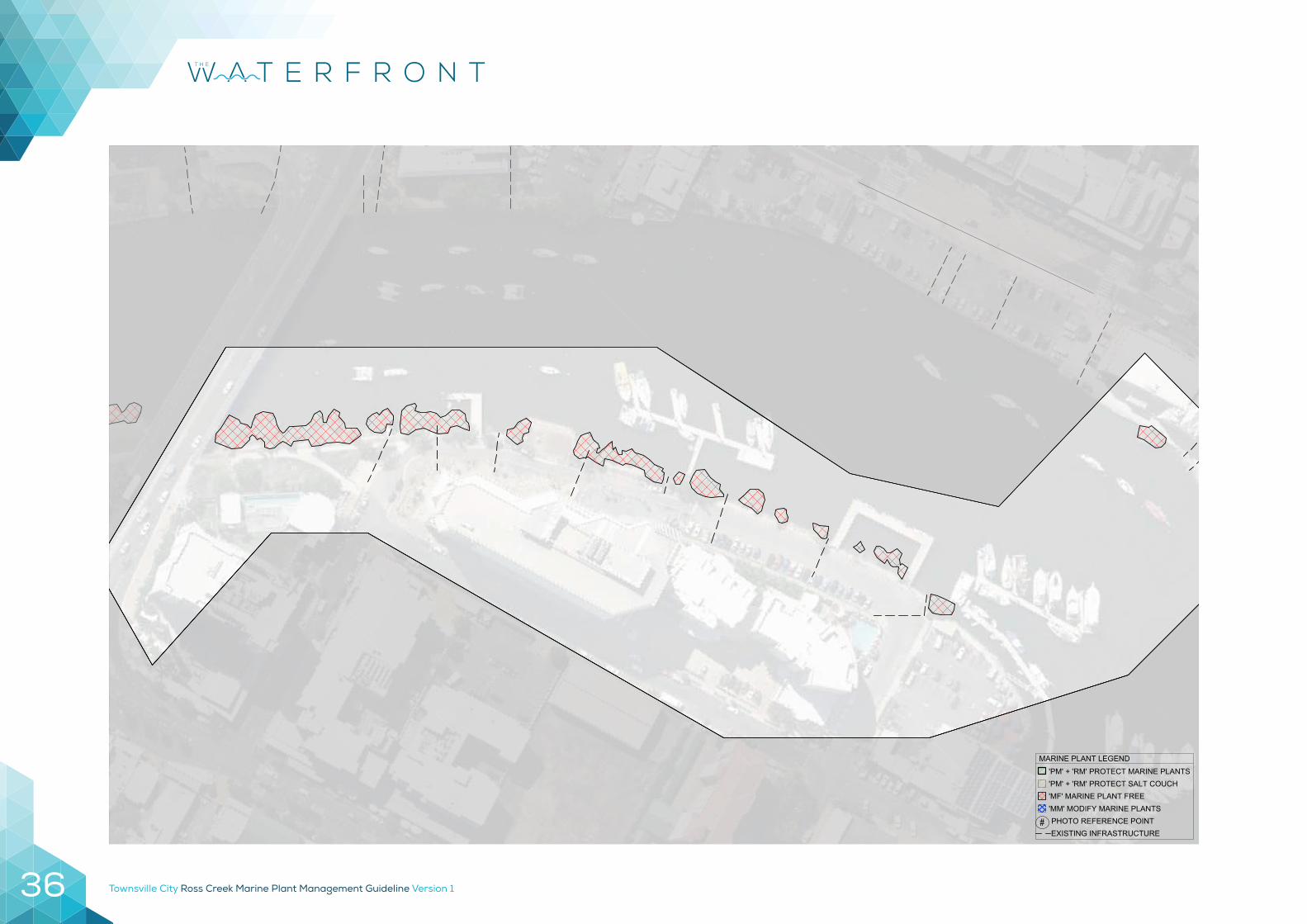
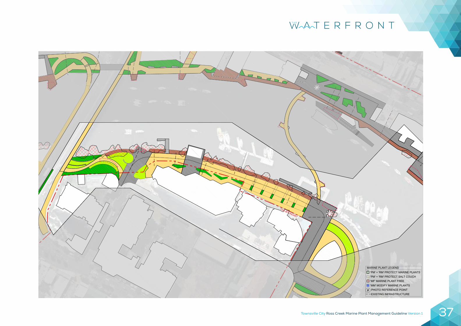
PRECINCT 7 – MARITIME MIXED USE
Description
This precinct accommodates marine transport infrastructure, State maritime infrastructure and marine-based commercial uses.
This area was historically cleared of marine plants and rock retaining walls built in many places. Many of the marine plants present are growing from rock retaining walls however, some mangroves have begun to recolonise in the few areas of undisturbed bank.
Approximate area of marine plants – 1,456.4m2
Marine Plant Area PercentageMangroves Enhanced/RetainedMangrove MaintenanceMangroves Removed 1,456.4 100%
Summary of Proposed Mangrove Management (% of total area): Mangroves removed – 100%
Photo reference point locations17 Taken from Palmer Street
Townsville City Ross Creek Marine Plant Management Guideline Version 1 39
Guideline Objectives Relevantto this Precinct
Management Action Management Code Priority
Monitor extent and height of marine plant growth
Monitor extent and height of marine plant growth and record baseline data, to determine if remedial actions are required to address threatening processes, protected areas are being maintained or enhanced and to determine if marine plants in multiple use zones will need modification i.e. impede infrastructure or passive surveillance within the following 12 months
Monitor
Create public water access points Provide access to river for recreational uses at strategic locations to ensure liveability and provide economic and social prosperity. This includes access to the river for recreational fishing, tourist visitation and passive recreation.
MF
Protect Council assets and provide access to these assets
Protect Council assets and provide access to these assets by maintaining clear areas around existing and future approved assets including jetties, pontoons, stormwater drain outlets, boardwalk and walkways.
MF
Retain identified areas of Marine Plants Preserve identified areas of marine plants to ensure no net loss through protection and enhancement of designated marine plant areas in order to offset losses due to modification and maintenance of passive surveillance and riverbank amenities.
PM
Site Management
Townsville City Ross Creek Marine Plant Management Guideline Version 140
'PM' + 'RM' PROTECT MARINE PLANTS
MARINE PLANT LEGEND
'MM' MODIFY MARINE PLANTS'MF' MARINE PLANT FREE'PM' + 'RM' PROTECT SALT COUCH
#EXISTING INFRASTRUCTURE PHOTO REFERENCE POINT
TOWNSVILLE CITY COUNCILMARINE PLANT STRATEGYPRECINCT 7
01.06 3
Townsville City Ross Creek Marine Plant Management Guideline Version 1 41
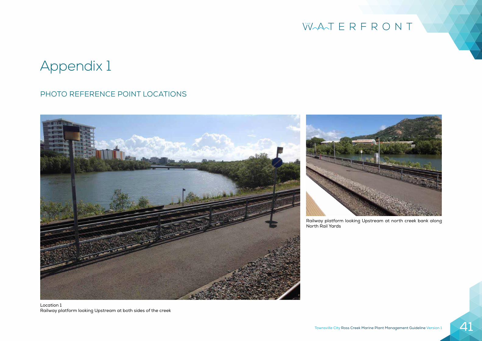
PHOTO REFERENCE POINT LOCATIONS
Location 1Railway platform looking Upstream at both sides of the creek
Railway platform looking Upstream at north creek bank along North Rail Yards
Appendix 1
Townsville City Ross Creek Marine Plant Management Guideline Version 142
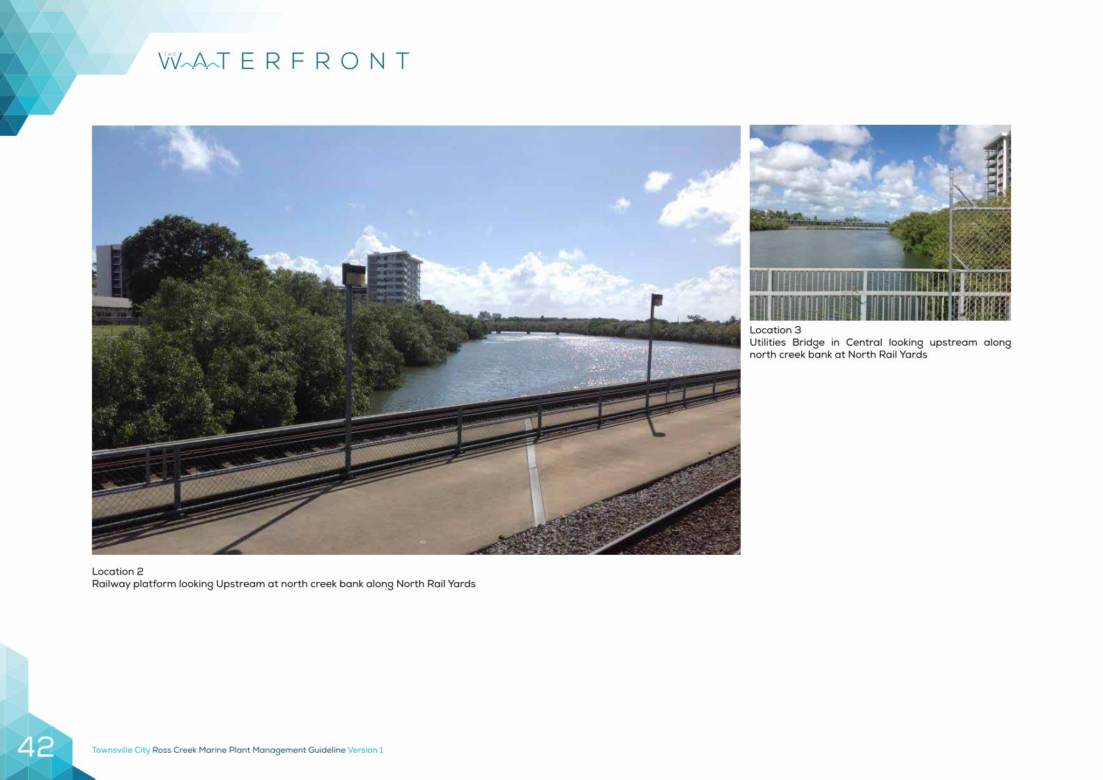
Location 2Railway platform looking Upstream at north creek bank along North Rail Yards
Location 3Utilities Bridge in Central looking upstream along north creek bank at North Rail Yards
Townsville City Ross Creek Marine Plant Management Guideline Version 1 43
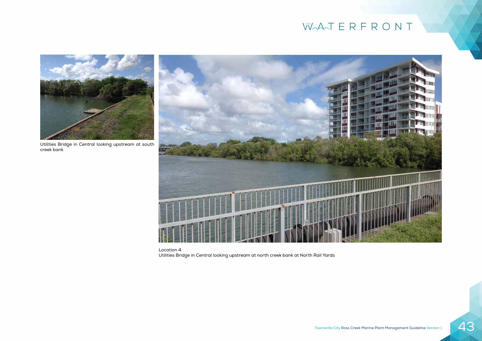
Utilities Bridge in Central looking upstream at south creek bank
Location 4Utilities Bridge in Central looking upstream at north creek bank at North Rail Yards
Townsville City Ross Creek Marine Plant Management Guideline Version 144
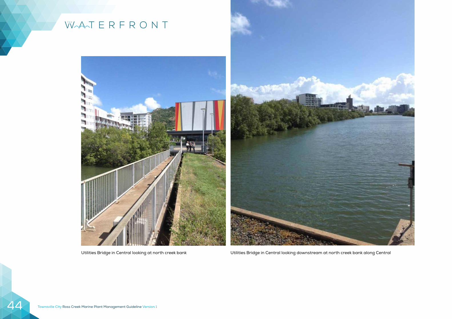
Utilities Bridge in Central looking downstream at north creek bank along CentralUtilities Bridge in Central looking at north creek bank
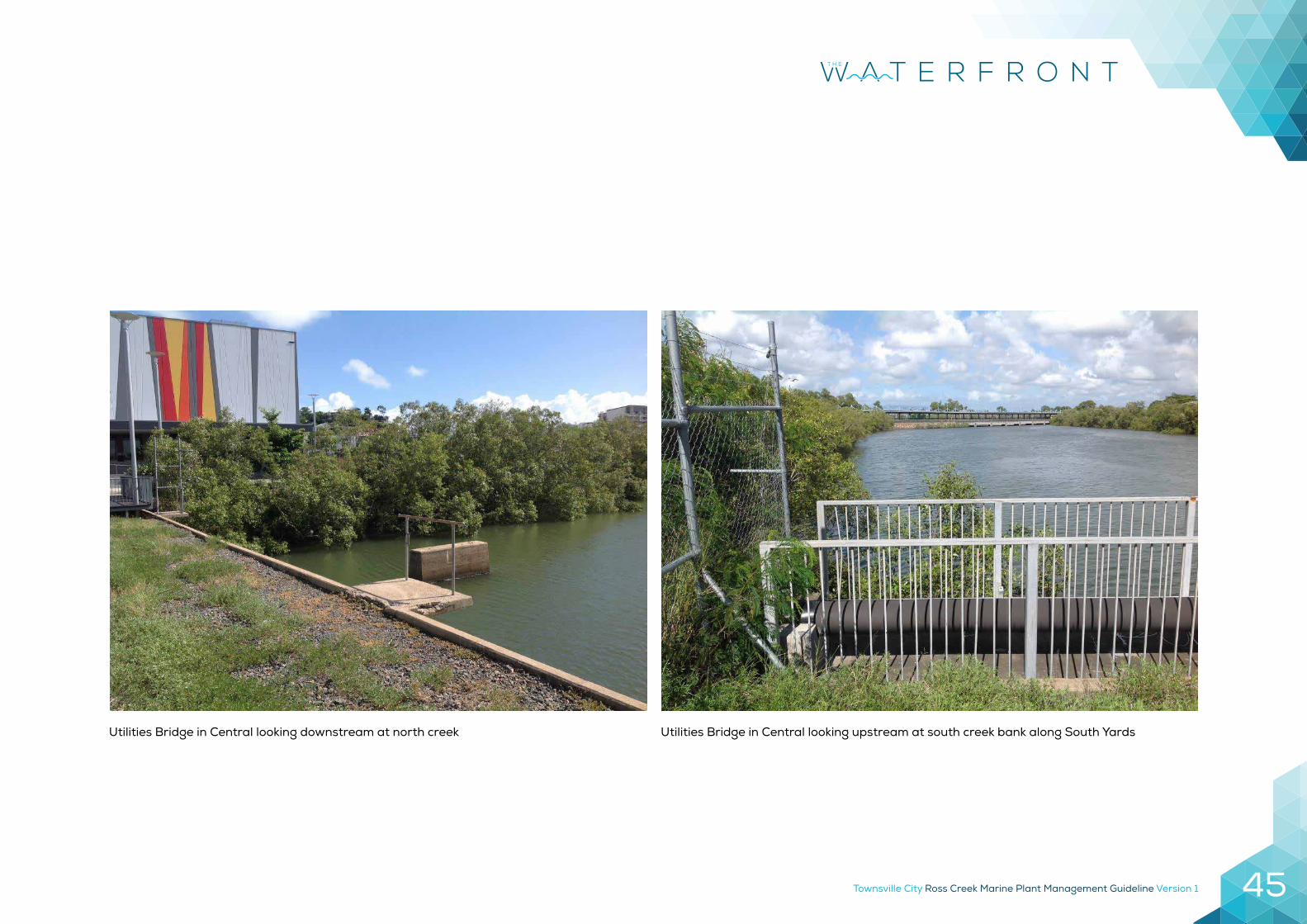
Townsville City Ross Creek Marine Plant Management Guideline Version 1 45
Utilities Bridge in Central looking upstream at south creek bank along South YardsUtilities Bridge in Central looking downstream at north creek
Townsville City Ross Creek Marine Plant Management Guideline Version 146
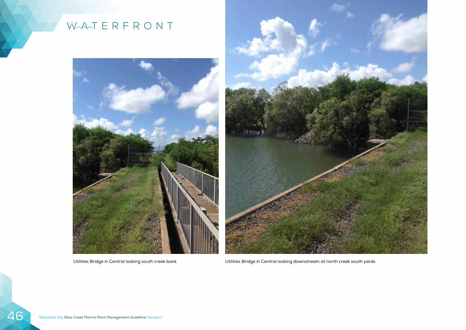
Utilities Bridge in Central looking downstream at north creek south yardsUtilities Bridge in Central looking south creek bank
Townsville City Ross Creek Marine Plant Management Guideline Version 1 47
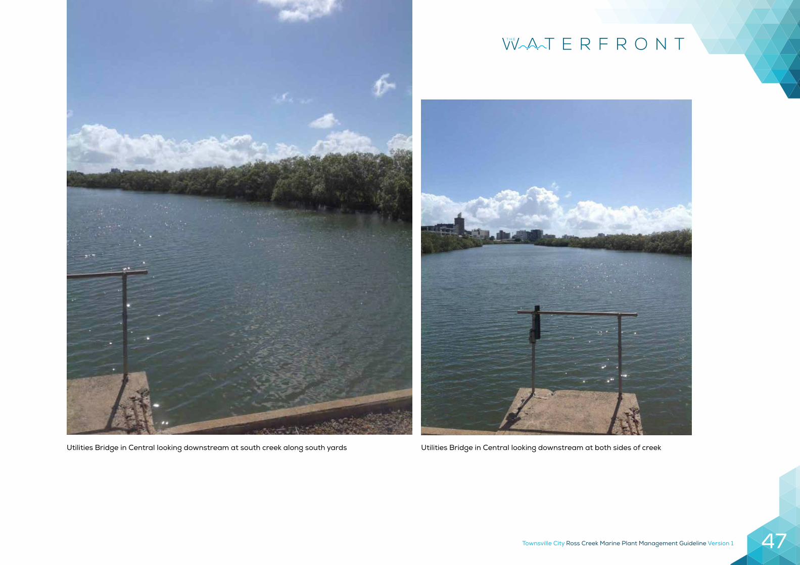
Utilities Bridge in Central looking downstream at both sides of creekUtilities Bridge in Central looking downstream at south creek along south yards
Townsville City Ross Creek Marine Plant Management Guideline Version 148
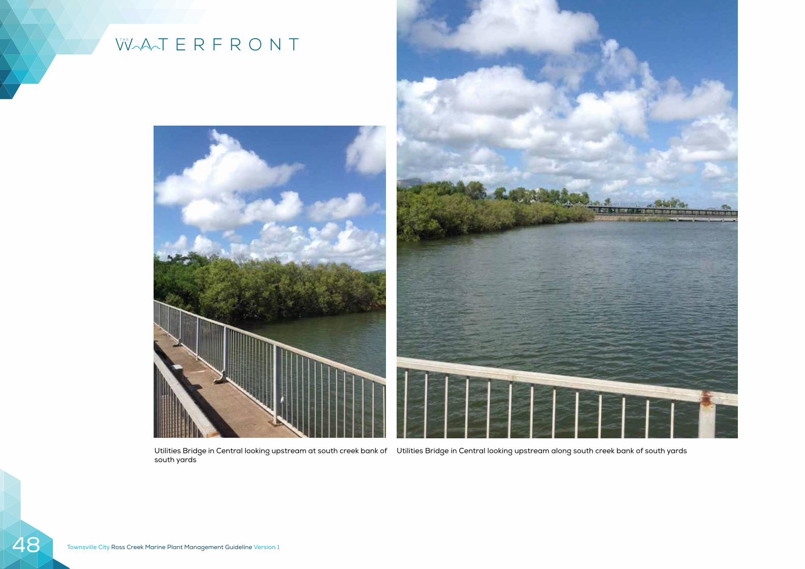
Utilities Bridge in Central looking upstream along south creek bank of south yardsUtilities Bridge in Central looking upstream at south creek bank of south yards
Townsville City Ross Creek Marine Plant Management Guideline Version 1 49
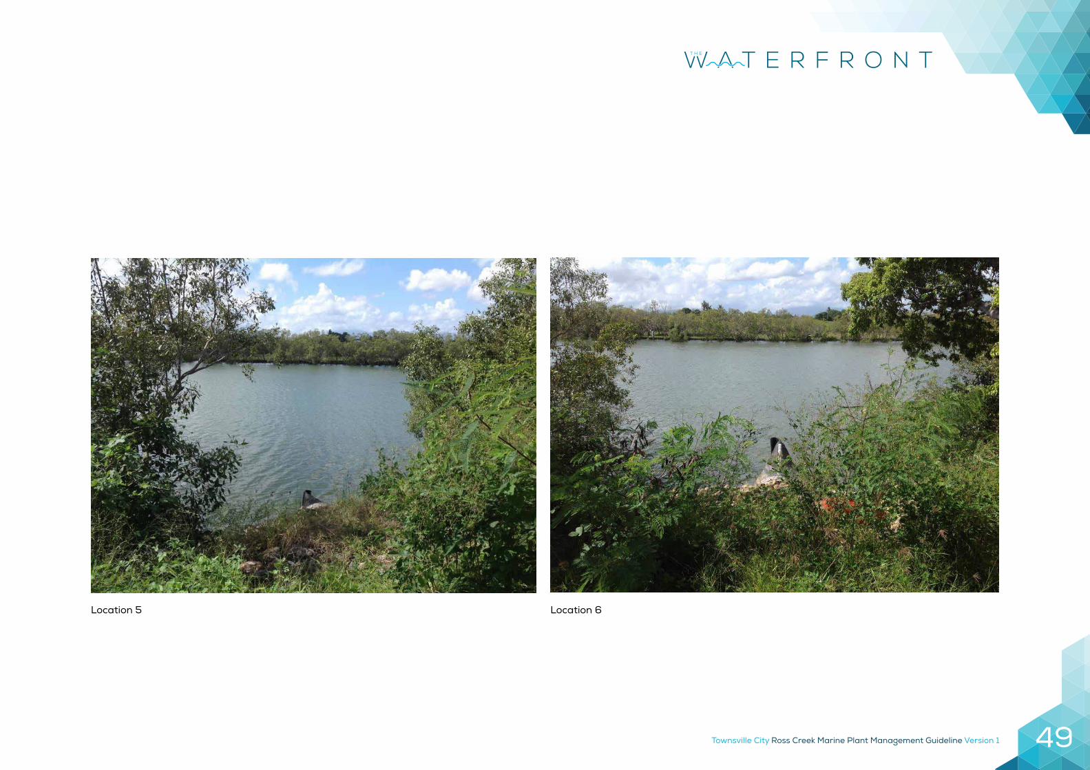
Location 5 Location 6
Townsville City Ross Creek Marine Plant Management Guideline Version 150
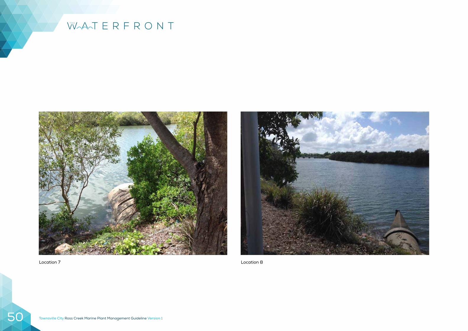
Location 7 Location 8
Townsville City Ross Creek Marine Plant Management Guideline Version 1 51
Townsville City Ross Creek Marine Plant Management Guideline Version 152
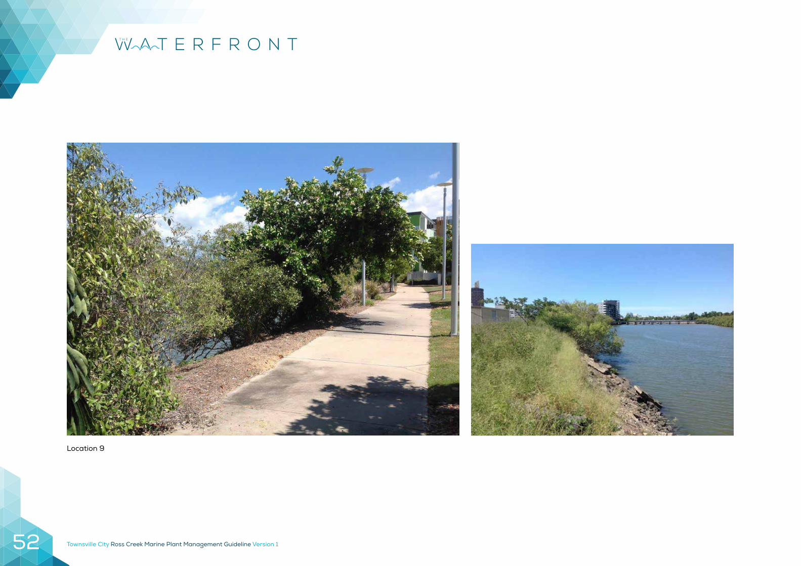
Location 9
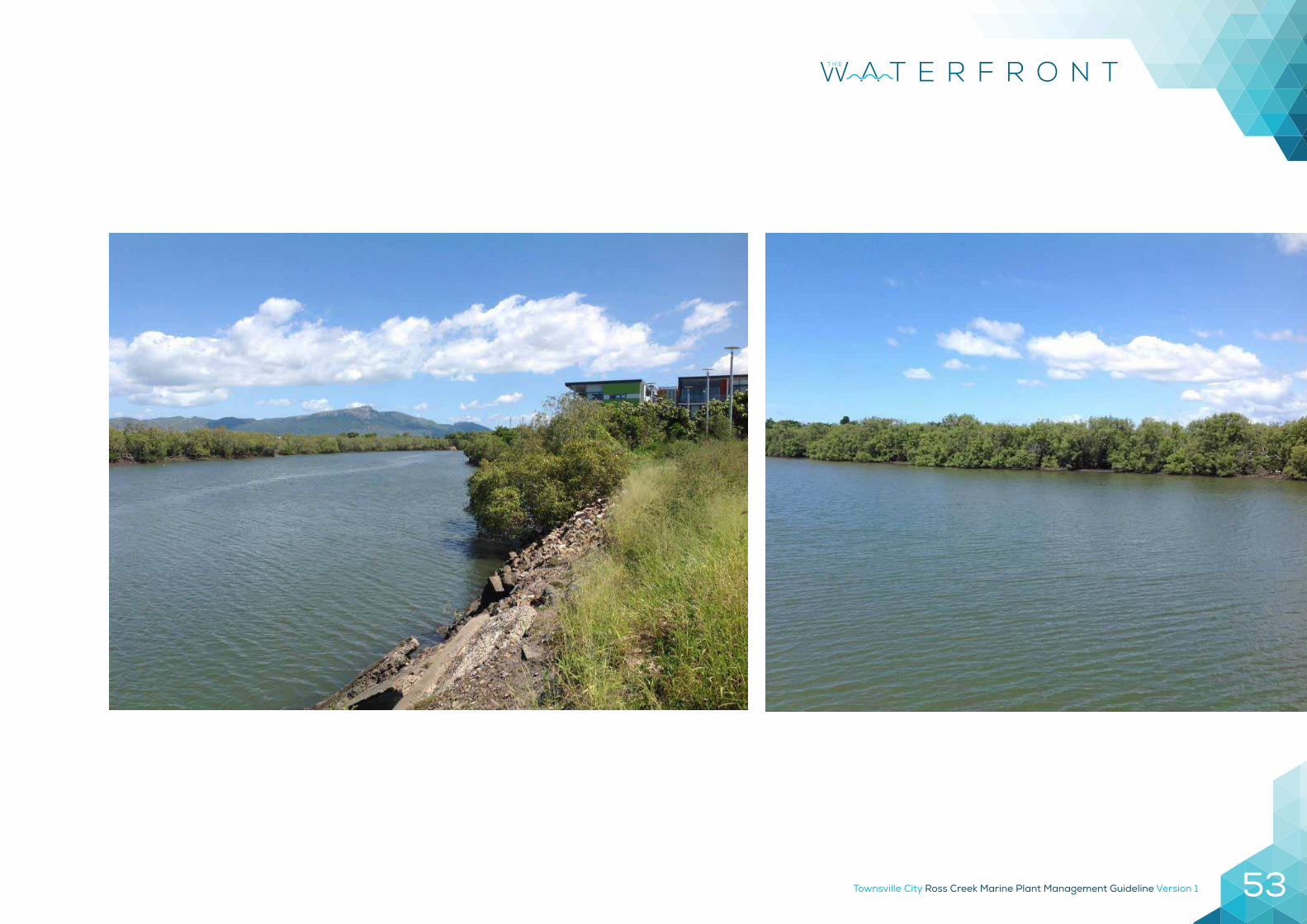
Townsville City Ross Creek Marine Plant Management Guideline Version 1 53
Townsville City Ross Creek Marine Plant Management Guideline Version 154
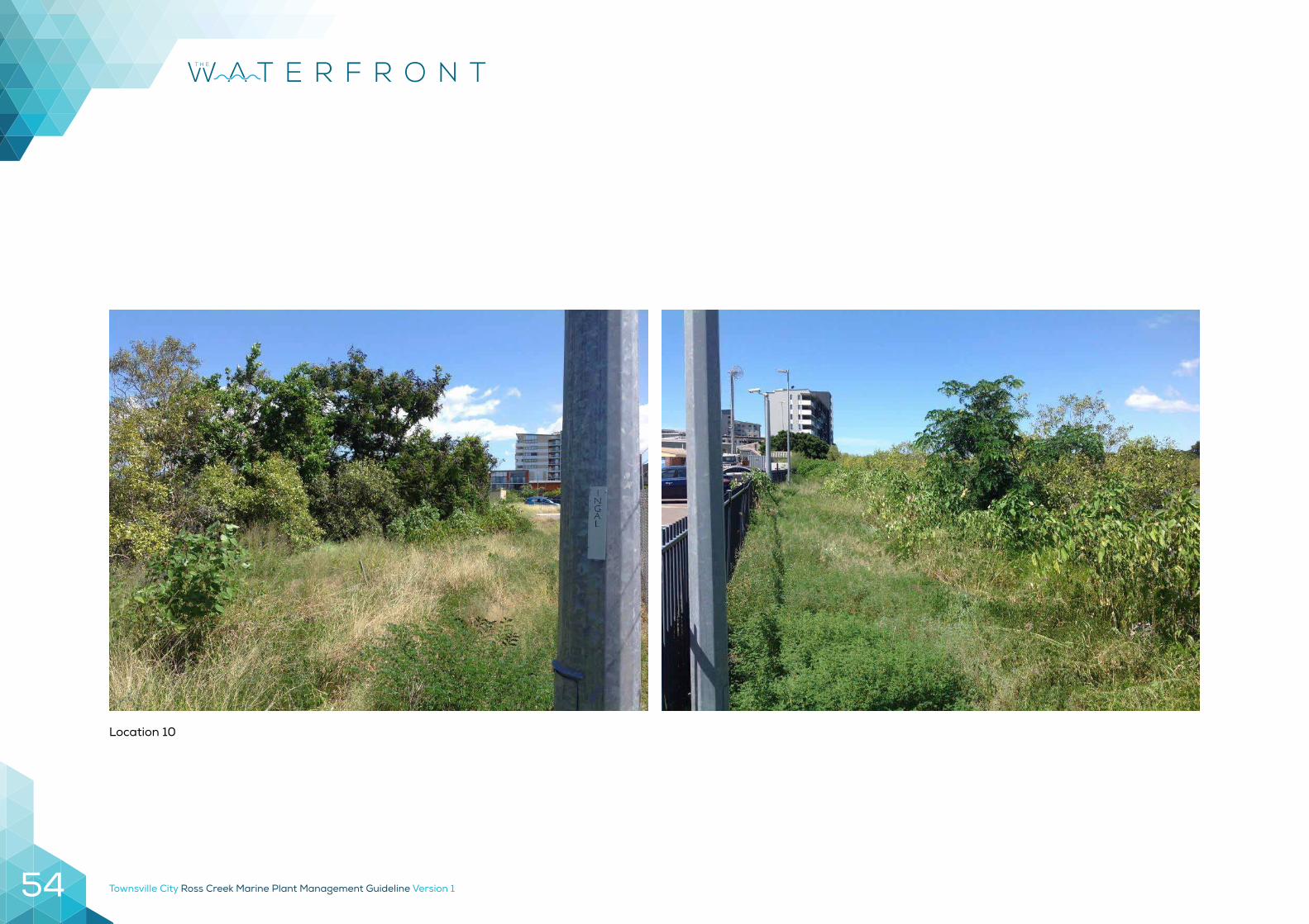
Location 10
Townsville City Ross Creek Marine Plant Management Guideline Version 1 55
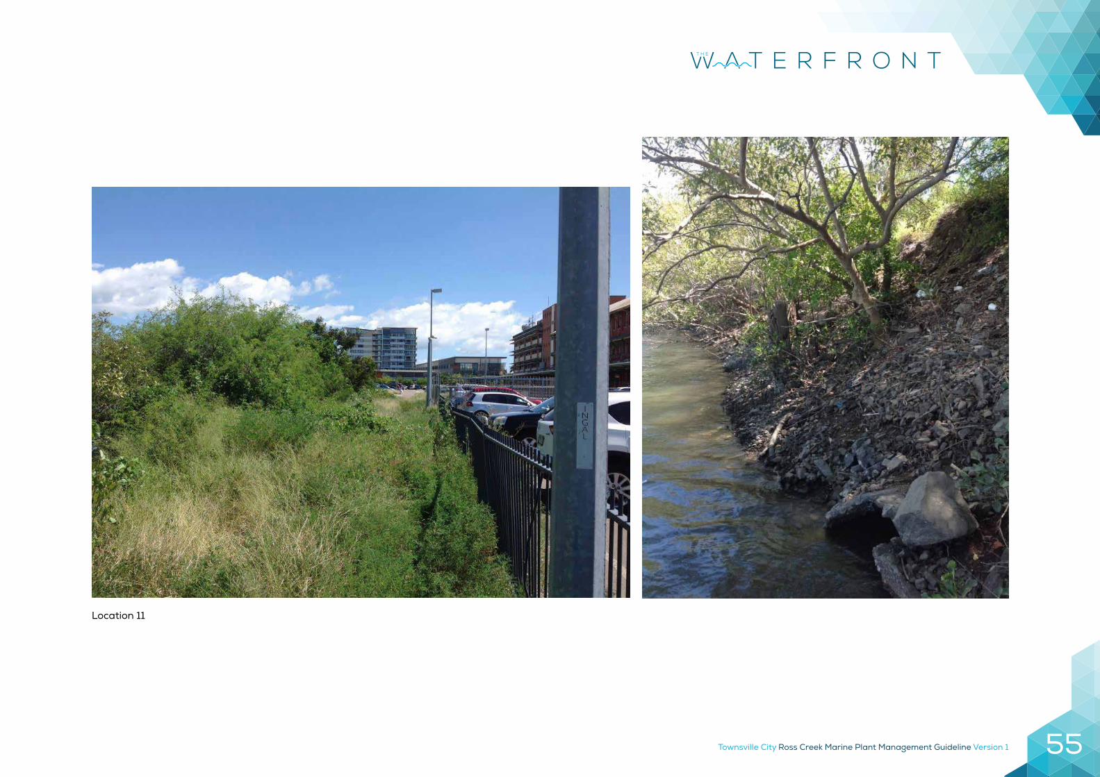
Location 11
Townsville City Ross Creek Marine Plant Management Guideline Version 156
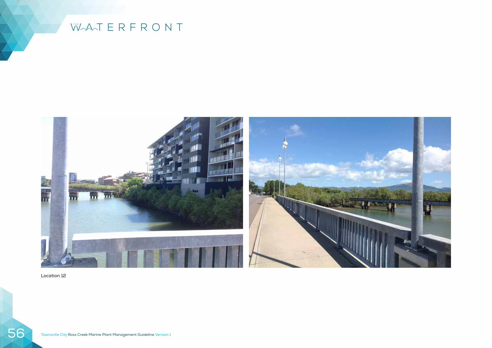
Location 12
Townsville City Ross Creek Marine Plant Management Guideline Version 1 57
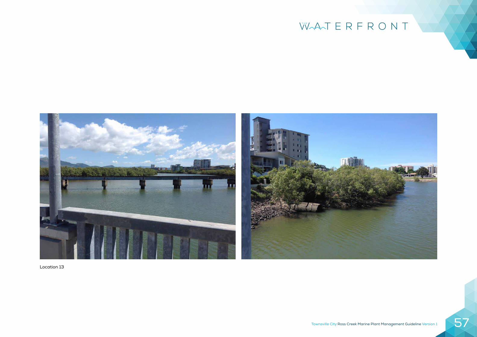
Location 13
Townsville City Ross Creek Marine Plant Management Guideline Version 158
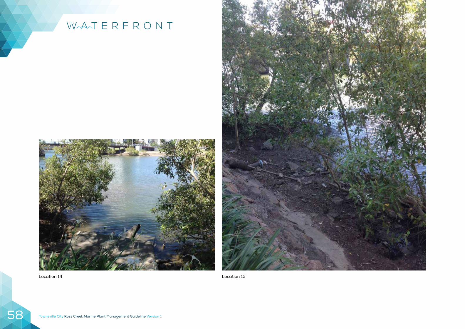
Location 15Location 14
Townsville City Ross Creek Marine Plant Management Guideline Version 1 59
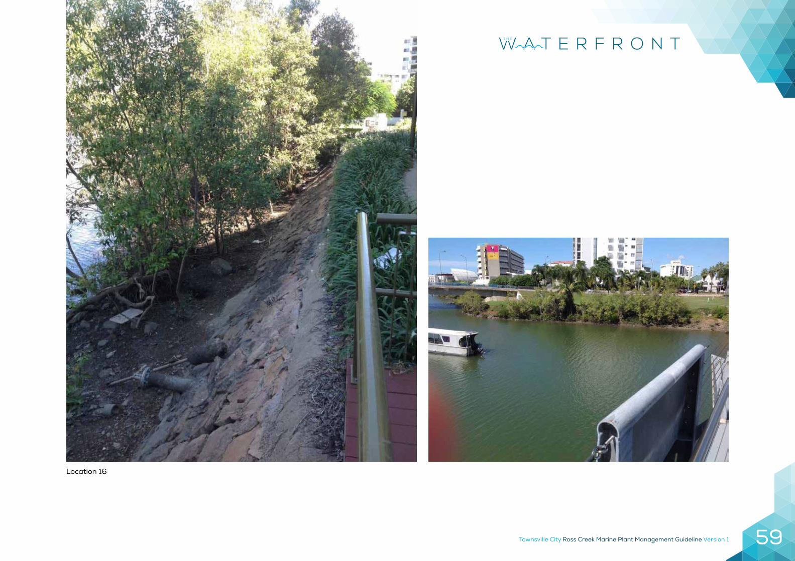
Location 16
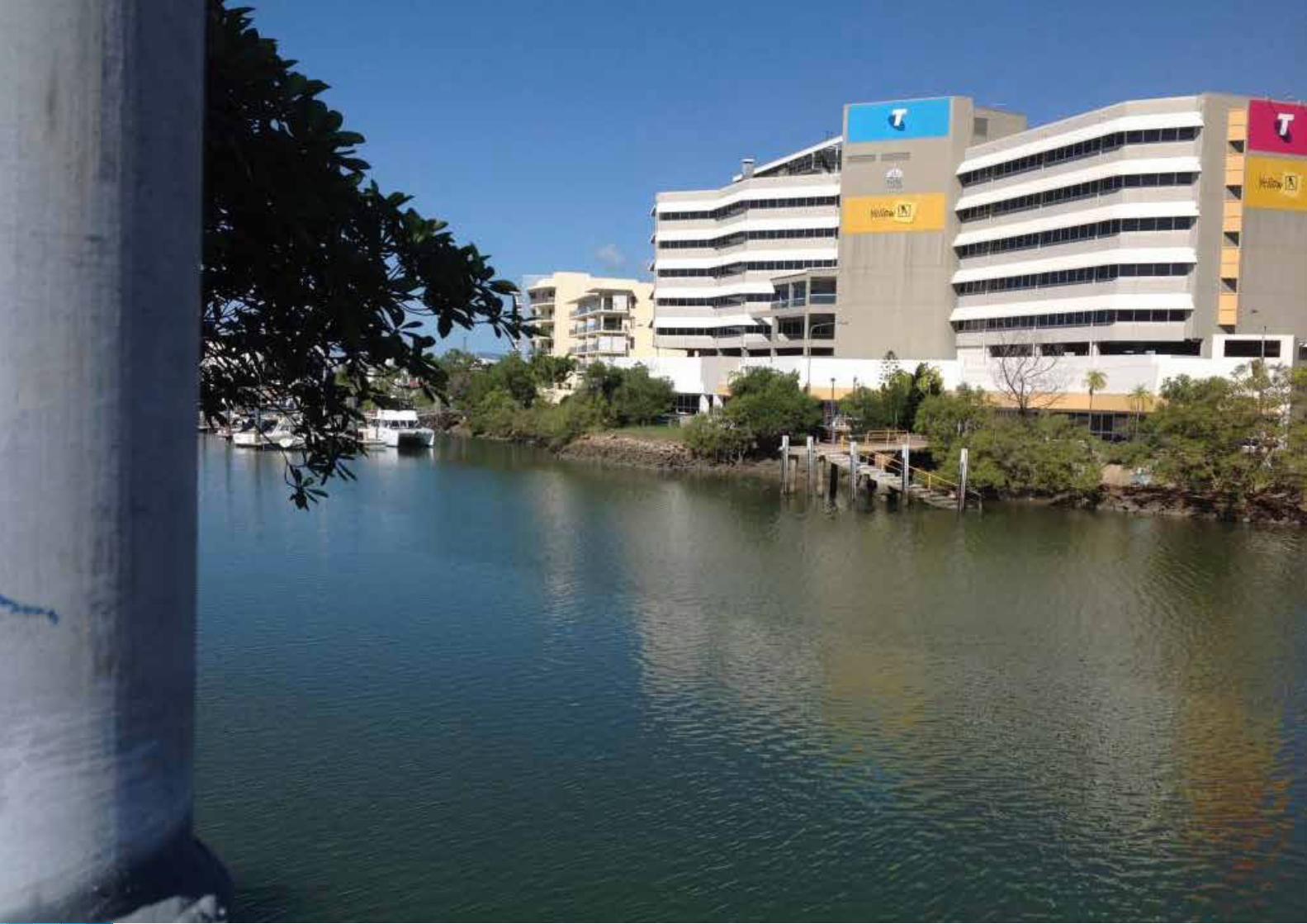
Townsville City Ross Creek Marine Plant Management Guideline Version 160
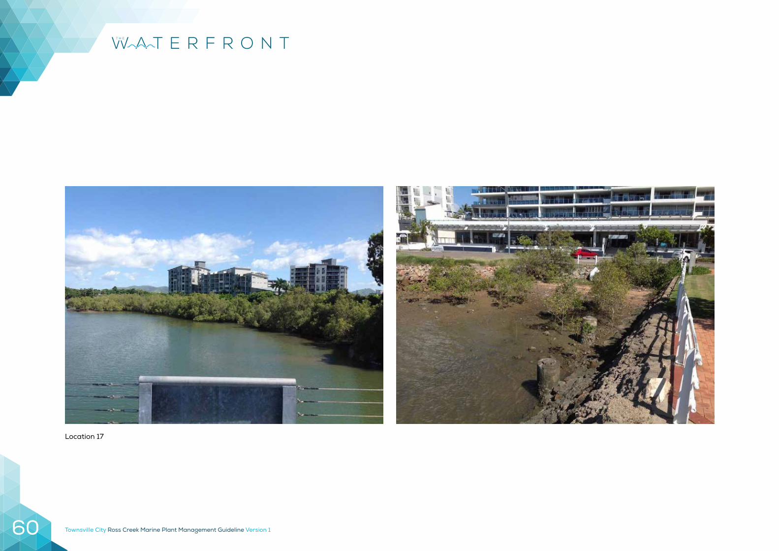
Location 17
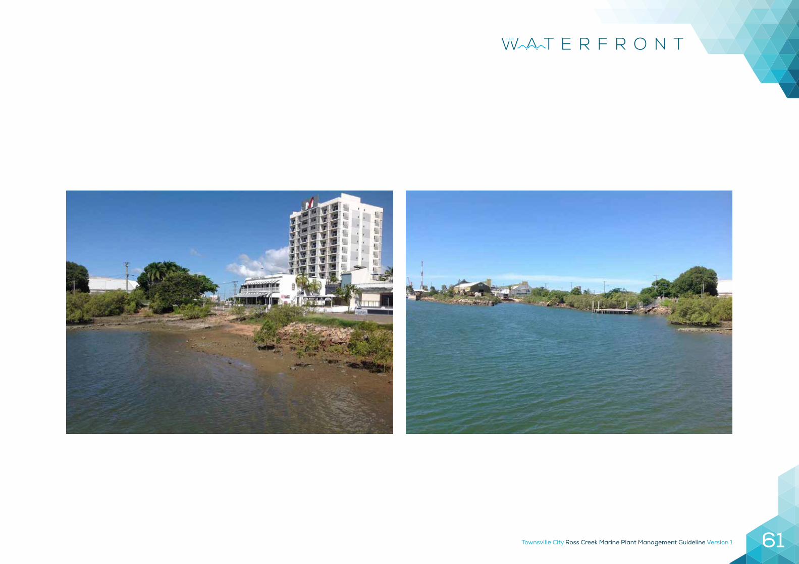
Townsville City Ross Creek Marine Plant Management Guideline Version 1 61
Townsville City Ross Creek Marine Plant Management Guideline Version 162
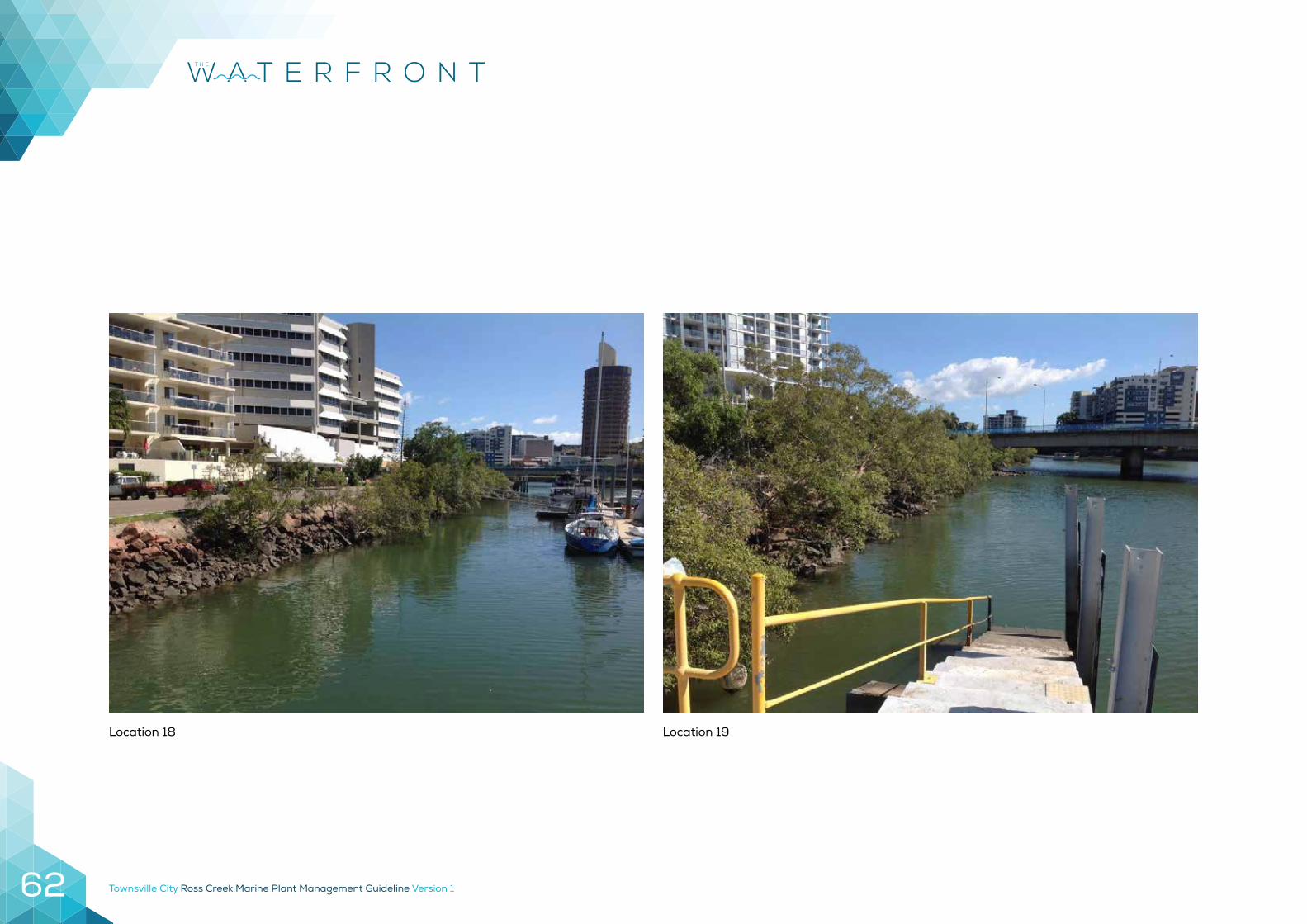
Location 18 Location 19
Townsville City Ross Creek Marine Plant Management Guideline Version 1 63
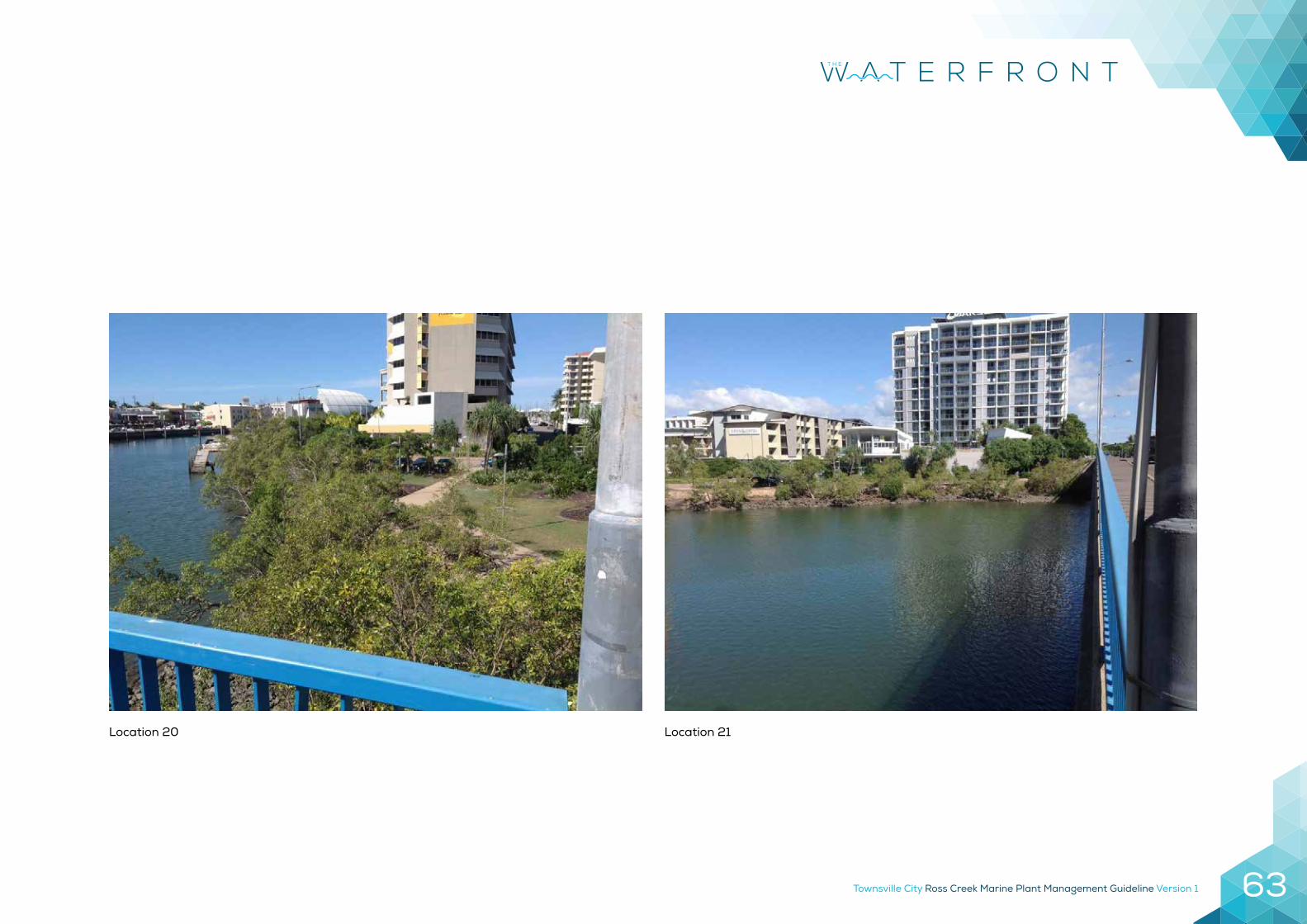
Location 20 Location 21
Townsville City Ross Creek Marine Plant Management Guideline Version 164
Townsville City Ross Creek Marine Plant Management Guideline Version 1 65
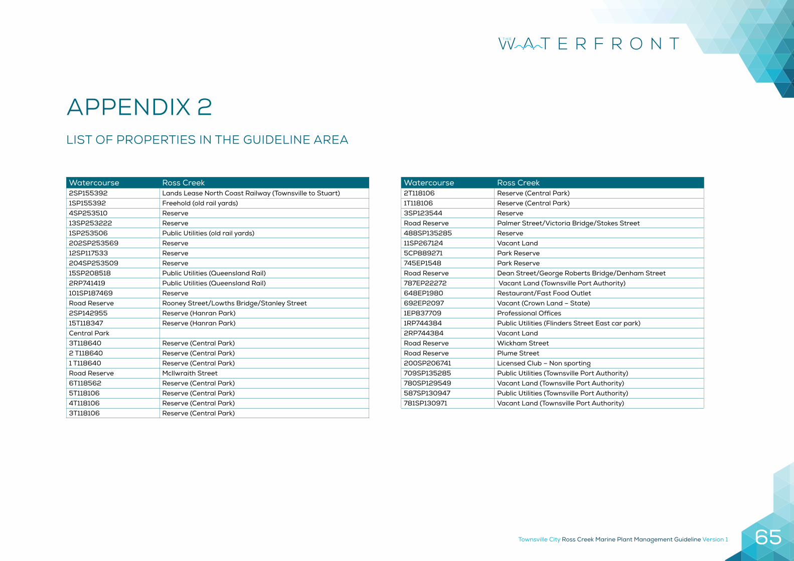
Watercourse Ross Creek2SP155392 Lands Lease North Coast Railway (Townsville to Stuart)1SP155392 Freehold (old rail yards)4SP253510 Reserve13SP253222 Reserve1SP253506 Public Utilities (old rail yards)202SP253569 Reserve12SP117533 Reserve204SP253509 Reserve15SP208518 Public Utilities (Queensland Rail)2RP741419 Public Utilities (Queensland Rail)101SP187469 ReserveRoad Reserve Rooney Street/Lowths Bridge/Stanley Street2SP142955 Reserve (Hanran Park)15T118347 Reserve (Hanran Park)Central Park3T118640 Reserve (Central Park)2 T118640 Reserve (Central Park)1 T118640 Reserve (Central Park)Road Reserve McIlwraith Street6T118562 Reserve (Central Park)5T118106 Reserve (Central Park)4T118106 Reserve (Central Park)3T118106 Reserve (Central Park)
Watercourse Ross Creek2T118106 Reserve (Central Park)1T118106 Reserve (Central Park)3SP123544 ReserveRoad Reserve Palmer Street/Victoria Bridge/Stokes Street488SP135285 Reserve11SP267124 Vacant Land5CP889271 Park Reserve745EP1548 Park ReserveRoad Reserve Dean Street/George Roberts Bridge/Denham Street787EP22272 Vacant Land (Townsville Port Authority)648EP1980 Restaurant/Fast Food Outlet692EP2097 Vacant (Crown Land – State)1EP837709 Professional Offices1RP744384 Public Utilities (Flinders Street East car park)2RP744384 Vacant LandRoad Reserve Wickham StreetRoad Reserve Plume Street200SP206741 Licensed Club – Non sporting709SP135285 Public Utilities (Townsville Port Authority)780SP129549 Vacant Land (Townsville Port Authority)587SP130947 Public Utilities (Townsville Port Authority)781SP130971 Vacant Land (Townsville Port Authority)
APPENDIX 2 LIST OF PROPERTIES IN THE GUIDELINE AREA
Townsville City Ross Creek Marine Plant Management Guideline Version 166
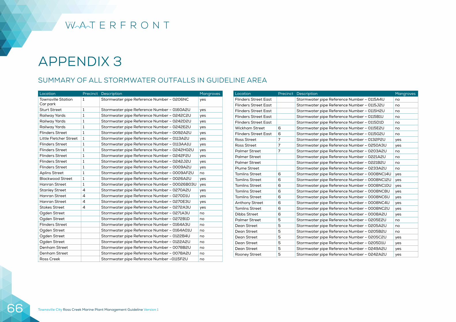
APPENDIX 3
SUMMARY OF ALL STORMWATER OUTFALLS IN GUIDELINE AREA
Location Precinct Description MangrovesTownsville Station Car park
1 Stormwater pipe Reference Number – 0206NC yes
Sturt Street 1 Stormwater pipe Reference Number – 0160A2U yesRailway Yards 1 Stormwater pipe Reference Number – 0242C2U yesRailway Yards 1 Stormwater pipe Reference Number – 0242D2U yesRailway Yards 1 Stormwater pipe Reference Number – 0242E2U yesFlinders Street 1 Stormwater pipe Reference Number – 0092A2U yesLittle Fletcher Street 1 Stormwater pipe Reference Number – 0113A2U yesFlinders Street 1 Stormwater pipe Reference Number – 0113AA1U yesFlinders Street 1 Stormwater pipe Reference Number – 0242H02U yesFlinders Street 1 Stormwater pipe Reference Number – 0242F2U yesFlinders Street 1 Stormwater pipe Reference Number – 0242J2U yesFlinders Street 1 Stormwater pipe Reference Number – 0009A2U yes Aplins Street 1 Stormwater pipe Reference Number – 0009AF2U no Blackwood Street 1 Stormwater pipe Reference Number – 0026A2U yes Hanran Street 1 Stormwater pipe Reference Number – 00026B03U yes Stanley Street 4 Stormwater pipe Reference Number – 0270A2U yes Hanran Street 4 Stormwater pipe Reference Number – 0270D1U yes Hanran Street 4 Stormwater pipe Reference Number – 0270E3U yes Stokes Street 4 Stormwater pipe Reference Number – 0272A3U yes Ogden Street Stormwater pipe Reference Number – 0271A3U no Ogden Street Stormwater pipe Reference Number – 0272B1D no Flinders Street Stormwater pipe Reference Number – 0164A3U no Ogden Street Stormwater pipe Reference Number – 0164A01U no Ogden Street Stormwater pipe Reference Number – 0122B4U no Ogden Street Stormwater pipe Reference Number – 0122A2U noDenham Street Stormwater pipe Reference Number – 0078B2U noDenham Street Stormwater pipe Reference Number – 0078A2U noRoss Creek Stormwater pipe Reference Number –0115F2U no
Location Precinct Description MangrovesFlinders Street East Stormwater pipe Reference Number – 0115A4U noFlinders Street East Stormwater pipe Reference Number – 0115J2U noFlinders Street East Stormwater pipe Reference Number – 0115H2U noFlinders Street East Stormwater pipe Reference Number – 0115B1U noFlinders Street East Stormwater pipe Reference Number – 0115D1D noWickham Street 6 Stormwater pipe Reference Number – 0115E2U noFlinders Street East 6 Stormwater pipe Reference Number – 0115G2U noRoss Street 7 Stormwater pipe Reference Number – 0132P2U yesRoss Street 7 Stormwater pipe Reference Number – 0250A3U yesPalmer Street 7 Stormwater pipe Reference Number – 0203A2U noPalmer Street Stormwater pipe Reference Number – 0221A2U noPalmer Street Stormwater pipe Reference Number – 0221B2U noPlume Street Stormwater pipe Reference Number – 0233A2U noTomlins Street 6 Stormwater pipe Reference Number – 0008NC14U yesTomlins Street 6 Stormwater pipe Reference Number – 0008NC12U yesTomlins Street 6 Stormwater pipe Reference Number – 0008NC10U yesTomlins Street 6 Stormwater pipe Reference Number – 0008NC8U yesTomlins Street 6 Stormwater pipe Reference Number – 0008NC6U yesAnthony Street 6 Stormwater pipe Reference Number – 0008NC4U yesTomlins Street 6 Stormwater pipe Reference Number – 0008NC2U yesDibbs Street 6 Stormwater pipe Reference Number – 0008A2U yesPalmer Street 5 Stormwater pipe Reference Number – 0205E2U noDean Street 5 Stormwater pipe Reference Number – 0205A2U noDean Street 5 Stormwater pipe Reference Number – 0205B2U noDean Street 5 Stormwater pipe Reference Number – 0205C2U yesDean Street 5 Stormwater pipe Reference Number – 0205D1U yesDean Street 5 Stormwater pipe Reference Number – 0249A2U yesRooney Street 5 Stormwater pipe Reference Number – 0242A2U yes
Townsville City Ross Creek Marine Plant Management Guideline Version 1 67
Townsville City Ross Creek Marine Plant Management Guideline Version 168
13 48 10www.townsville.qld.gov.au