Embed Size (px)
Citation preview
Runoff Estimation, and Surface Runoff Estimation, and Surface Erosion and ControlErosion and Control
Ali Fares, PhDNREM 600, Evaluation of
Natural Resources Management
Runoff Estimation, and Runoff Estimation, and Surface Erosion and ControlSurface Erosion and Control
Ali Fares, PhD
Watershed Hydrology, NREM662
UHM-CTAHR-NREM
Runoff EstimationRunoff Estimation
What are the factors that affect runoff?
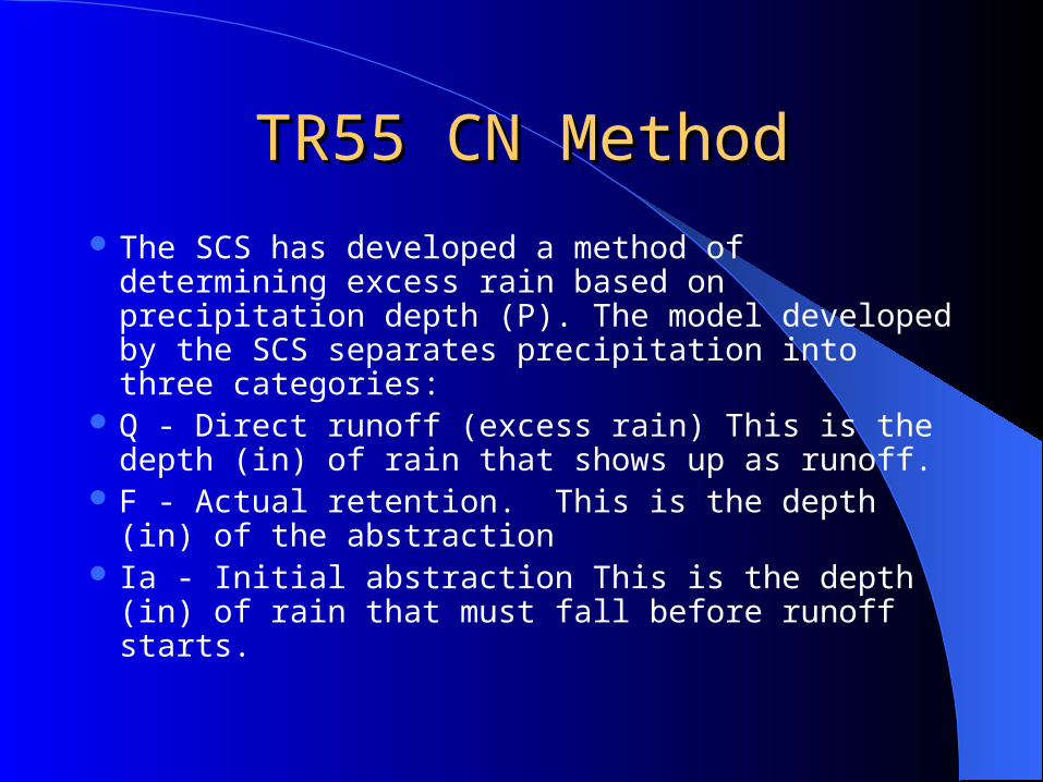
TR55 CN MethodTR55 CN Method
The SCS has developed a method of determining excess rain based on precipitation depth (P). The model developed by the SCS separates precipitation into three categories:
Q - Direct runoff (excess rain) This is the depth (in) of rain that shows up as runoff.
F - Actual retention. This is the depth (in) of the abstraction
Ia - Initial abstraction This is the depth (in) of rain that must fall before runoff starts.
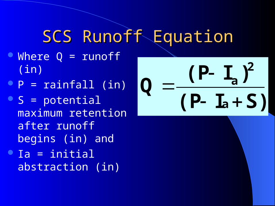
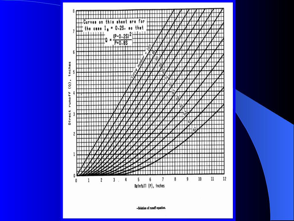
SCS Runoff EquationSCS Runoff Equation Where Q = runoff (in) P = rainfall (in) S = potential maximum
retention after runoff begins (in) and
Ia = initial abstraction (in)
S)I(P
)I(PQ
a
2a
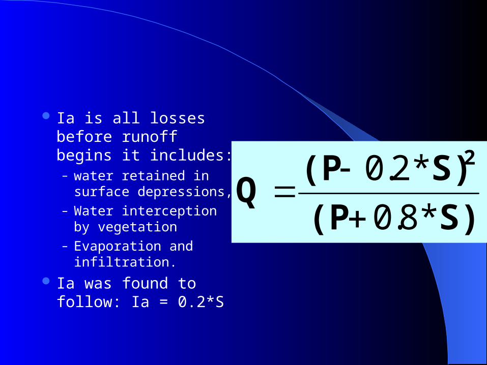
Ia is all losses before runoff begins it includes:– water retained in surface
depressions,– Water interception by
vegetation– Evaporation and
infiltration.
Ia was found to follow: Ia = 0.2*S
S)(P
S)(PQ
2
*8.0
*2.0
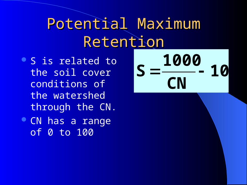
Potential Maximum RetentionPotential Maximum Retention
S is related to the soil cover conditions of the watershed through the CN.
CN has a range of 0 to 100
10CN
1000S
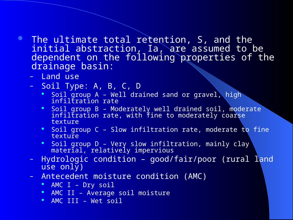
The ultimate total retention, S, and the initial abstraction, Ia, are assumed to be dependent on the following properties of the drainage basin:
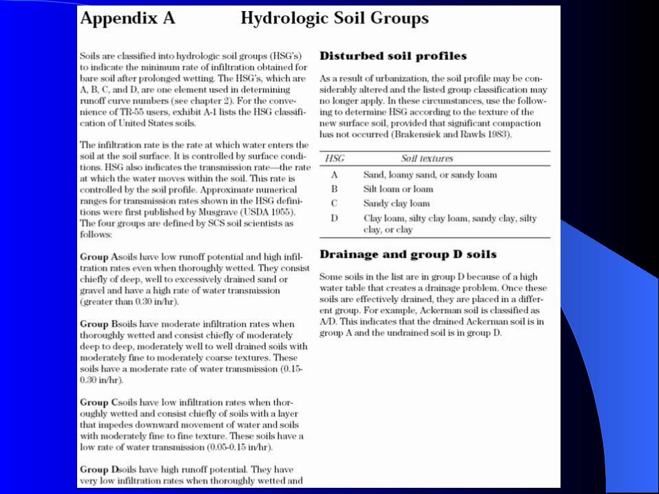
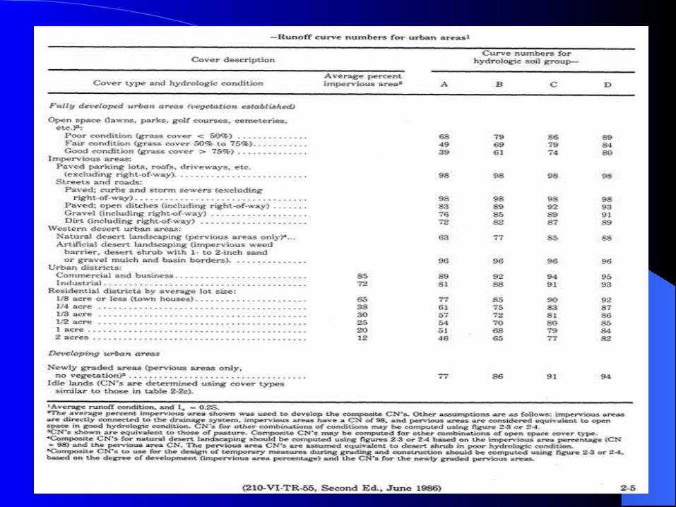
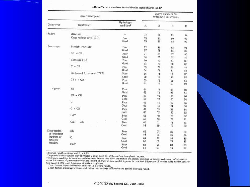
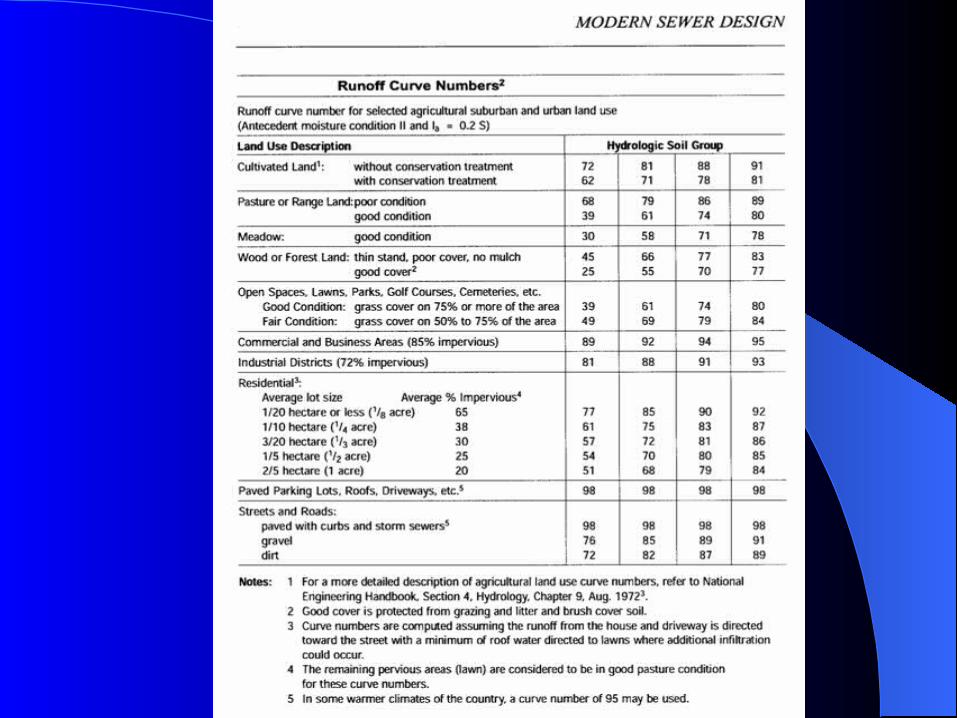
– Land use– Soil Type: A, B, C, D
Soil group A – Well drained sand or gravel, high infiltration rate Soil group B – Moderately well drained soil, moderate infiltration
rate, with fine to moderately coarse texture Soil group C – Slow infiltration rate, moderate to fine texture Soil group D – Very slow infiltration, mainly clay material,
relatively impervious– Hydrologic condition – good/fair/poor (rural land use
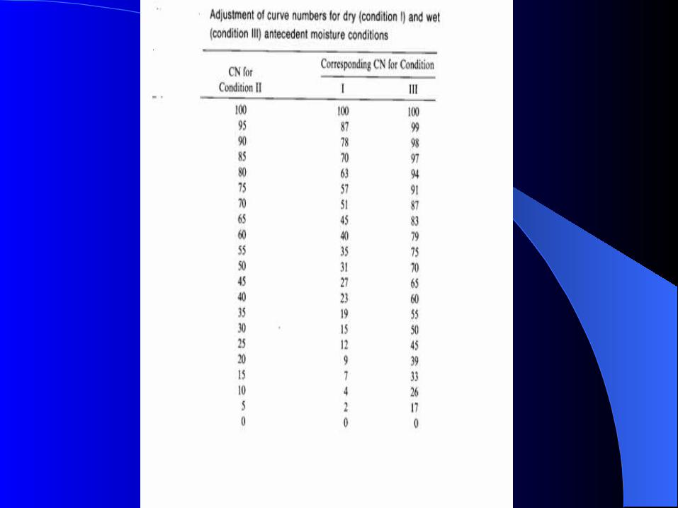
only)– Antecedent moisture condition (AMC)
AMC I – Dry soil AMC II – Average soil moisture AMC III – Wet soil
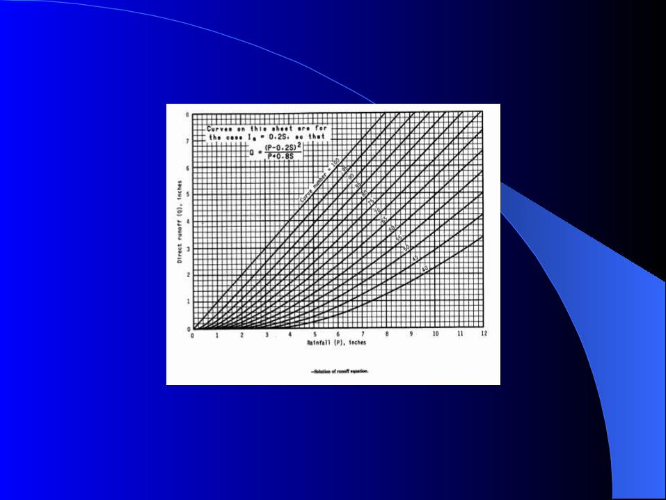
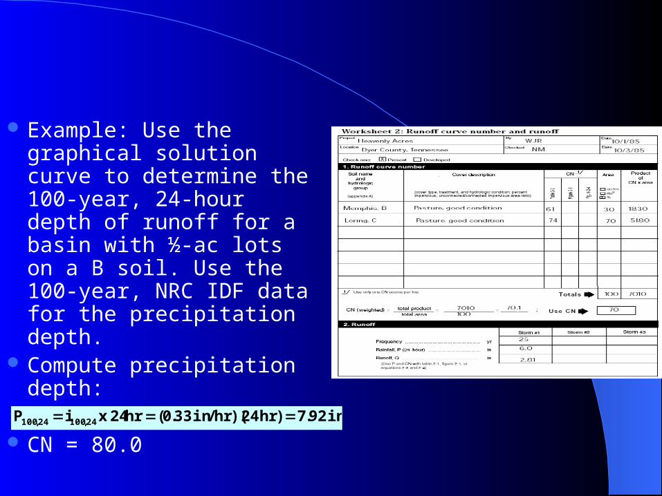
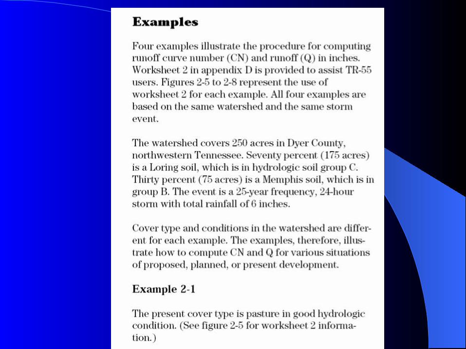
Example: Use the graphical solution curve to determine the 100-year, 24-hour depth of runoff for a basin with ½-ac lots on a B soil. Use the 100-year, NRC IDF data for the precipitation depth.
Compute precipitation depth:
CN = 80.0
in92.7)hr24)(hr/in33.0(hr24xiP 24,10024,100