Embed Size (px)
Citation preview
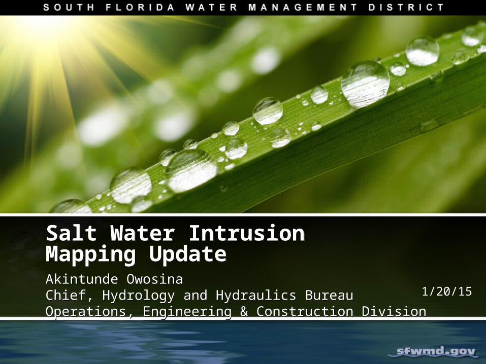
Salt Water Intrusion Mapping Update Salt Water Intrusion Mapping Update Akintunde OwosinaChief, Hydrology and Hydraulics BureauOperations, Engineering & Construction Division
Akintunde OwosinaChief, Hydrology and Hydraulics BureauOperations, Engineering & Construction Division
1/20/15
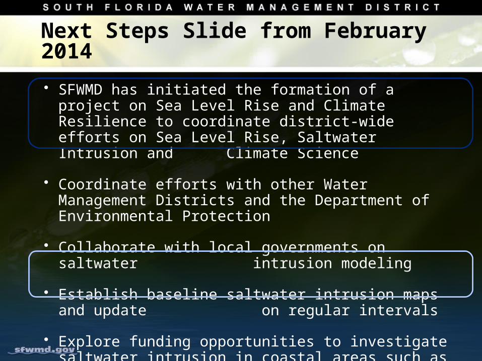
Next Steps Slide from February 2014
• SFWMD has initiated the formation of a project on Sea Level Rise and Climate Resilience to coordinate district-wide efforts on Sea Level Rise, Saltwater Intrusion and Climate Science
• Coordinate efforts with other Water Management Districts and the Department of Environmental Protection
• Collaborate with local governments on saltwater intrusion modeling
• Establish baseline saltwater intrusion maps and update on regular intervals
• Explore funding opportunities to investigate saltwater intrusion in coastal areas such as BCB
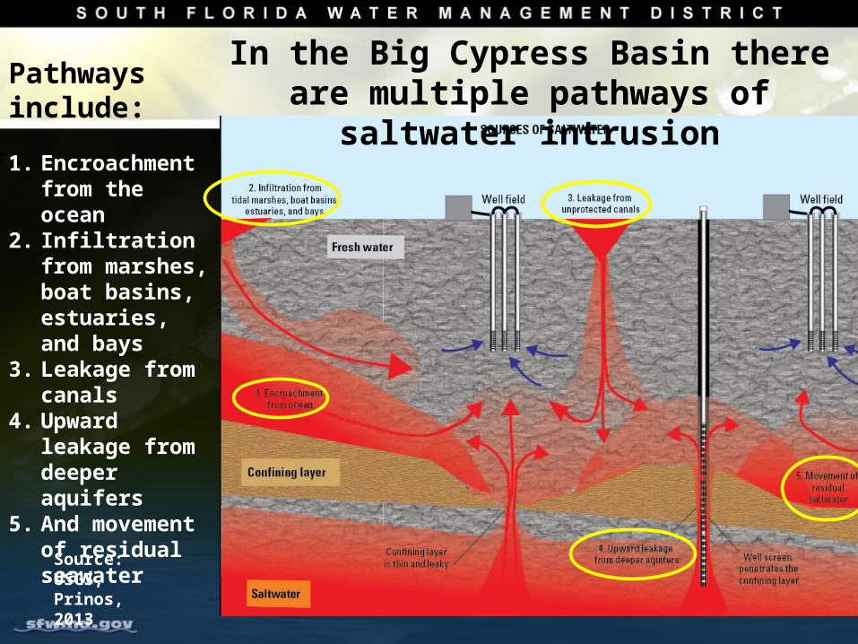
In the Big Cypress Basin there are multiple pathways of saltwater intrusion
Pathways include:
1. Encroachment from the ocean
2. Infiltration from marshes, boat basins, estuaries, and bays
3. Leakage from canals
4. Upward leakage from deeper aquifers
5. And movement of residual seawater
Source: USGS, Prinos, 2013
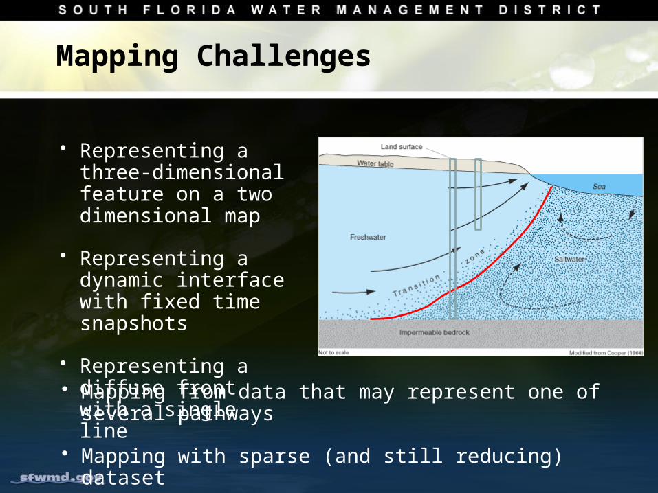
Mapping Challenges
• Representing a three-dimensional feature on a two dimensional map
• Representing a dynamic interface with fixed time snapshots
• Representing a diffuse front with a single line
• Mapping from data that may represent one of several pathways
• Mapping with sparse (and still reducing) dataset
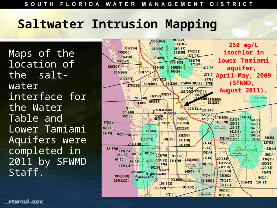
Saltwater Intrusion Mapping
Maps of the location of the salt-water interface for the Water Table and Lower Tamiami Aquifers were completed in 2011 by SFWMD Staff.
250 mg/L isochlor in lower Tamiami aquifer, April-May,
2009 (SFWMD, August 2011).
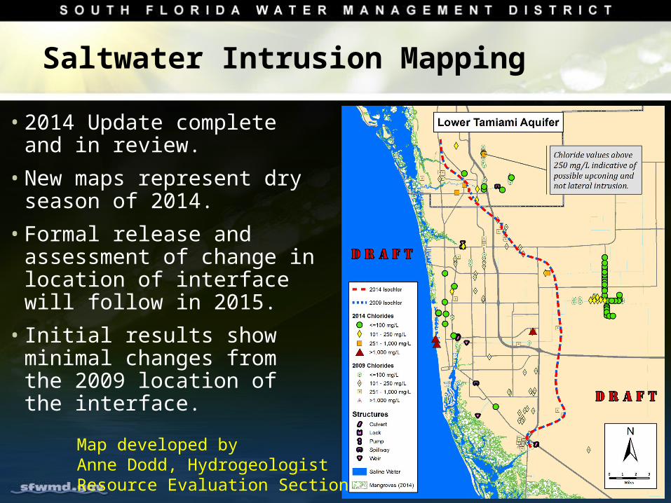
Saltwater Intrusion Mapping
• 2014 Update complete and in review.
• New maps represent dry season of 2014.
• Formal release and assessment of change in location of interface will follow in 2015.
• Initial results show minimal changes from the 2009 location of the interface.
Map developed byAnne Dodd, HydrogeologistResource Evaluation Section
Flood Protection Level-of-Service: District-Wide Assessment Program
Evaluate the state and performance of our water management and flood control assets
Support the capital program with hydrologic and hydraulic assessment to allow informed decision making
Develop tools and techniques for assessing the level of service provided by water management district assets and infrastructure including canals
Standardize approach for District Wide application.
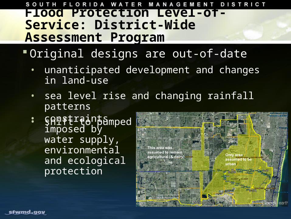
Flood Protection Level-of-Service: District-Wide Assessment Program
Original designs are out-of-date• unanticipated development and changes in land-use
• sea level rise and changing rainfall patterns
• shift to pumped drainage
• constraints imposed by water supply, environmental and ecological protection
Program Elements
• LOS Fundamentals
• Assessment Procedure
• Sea Level Rise
• Changing Rainfall
• Basin-Scale Assessment Projects:• LOS modeling for Basin
• Basin Atlas
Status
Identified a basin for a Pilot Implementation
Initiated work on each of the identified program elements
Completed early milestones including Basin Atlas
Documenting issues, challenges, data and analyses requirements for the purpose of standards and scope development for other basins across the District
Scheduled to complete in second quarter of 2015.
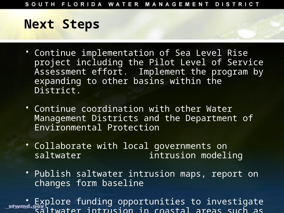
Next Steps
• Continue implementation of Sea Level Rise project including the Pilot Level of Service Assessment effort. Implement the program by expanding to other basins within the District.
• Continue coordination with other Water Management Districts and the Department of Environmental Protection
• Collaborate with local governments on saltwater intrusion modeling
• Publish saltwater intrusion maps, report on changes form baseline
• Explore funding opportunities to investigate saltwater intrusion in coastal areas such as BCB
Questions and DiscussionQuestions and Discussion