Embed Size (px)
Citation preview
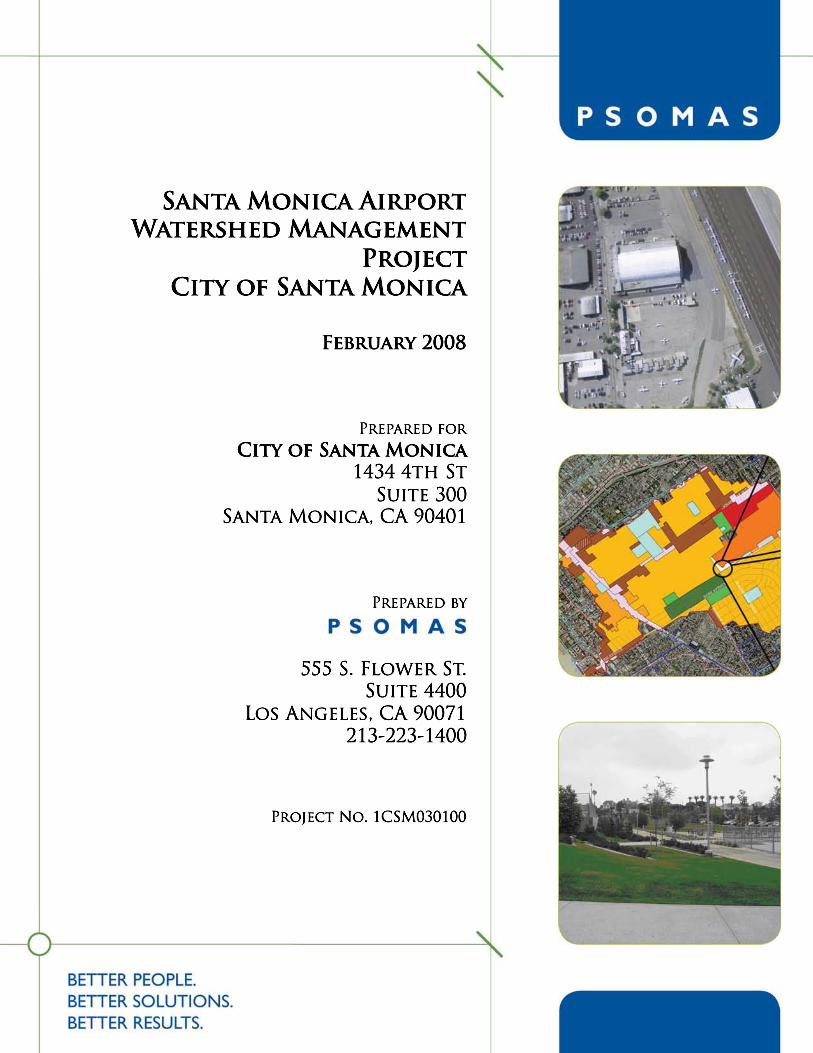
Santa Monica Airport Watershed Management Project City of Santa Monica
Project No. 1CSM030100
February 2008
Prepared for:
City of Santa Monica
1437 4th St.
Suite 300 Santa Monica, CA 90401
Prepared by:
555 S. Flower Street, Suite 4400
Los Angeles, CA 90071
Catherine Tyrrell
with
GeoSyntec Consultants
2566 Overland Avenue, Suite 670
Los Angeles, CA 90064
Ken Susilo
Santa Monica Airport Watershed Management Project
February 2008 i
TABLE OF CONTENTS
TABLE OF CONTENTS .................................................................................................. i
TABLES.............................................................................................................................. i
FIGURES............................................................................................................................ i
APPENDICES.................................................................................................................. iii
1.0 Introduction and Summary .............................................................................. 1-1 1.1 Approach.......................................................................................................... 1-1
1.2 City of Santa Monica Airport Watershed Project Site Description .............. 1-2
1.3 Drainage Areas and Land Use Opportunities and Constraints ........................ 1-4
1.4 Key BMPs and Treatment Trains .................................................................... 1-5
2.0 Pollutants of Concern ........................................................................................ 2-5 2.1 Pollutants and Beneficial Uses in Receiving Waters....................................... 2-5
2.2 Land Uses and Associated Pollutants .............................................................. 2-6
3.0 Airport Watershed Description ...................................................................... 3-11 3.1 Physical Description of Watershed................................................................ 3-11
3.2 Drainage Sub-Areas ....................................................................................... 3-13
3.3 Land Uses, Pollutants, and BMP Opportunities and Constraints .................. 3-15
4.0 BMPs Evaluated............................................................................................... 4-59 4.1 Stakeholder Workshop................................................................................... 4-59
4.2 BMP List for Further Analysis ...................................................................... 4-59
4.3 Worksheets and Photos—Feasibility at a Planning Scale.............................. 4-61
4.3.1 AIRPORT PROPERTY......................................................................... 4-61
4.3.2 RESIDENTIAL AREA.......................................................................... 4-64
4.3.3 BUSINESS PARK................................................................................. 4-69
4.3.4 OTHER .................................................................................................. 4-70
4.4 Amounts and values of Avoided Potable Water Use..................................... 4-71
5.0 Next Steps ......................................................................................................... 5-71 5.1 Capital Improvement Plan ............................................................................. 5-71
6.0 Conclusion ........................................................................................................ 6-71
TABLES
Table 2-1 Land Uses and Associated Pollutants.............................................................. 2-6
Table 2-2 BMPs and Targeted Pollutants ........................................................................ 2-9
Table 3-1 Sub-Drainage Description and Tributary Areas ............................................ 3-13
Table 3-2 LAND USE BMP ASSESSMENT: ISSUES AND OPPORTUNITIES ...... 3-16
Table 4-1 Water Quality Calculations Summary........................................................... 4-60
FIGURES
Figure 1-1......................................................................................................................... 1-2
Figure 1-2......................................................................................................................... 1-3
Figure 1-3......................................................................................................................... 1-4
Figure 3-1....................................................................................................................... 3-11
Santa Monica Airport Watershed Management Project
February 2008 ii
Figure 3-2....................................................................................................................... 3-12
Figure 3-3....................................................................................................................... 3-14
Figure 3-4....................................................................................................................... 3-15
Figure 3-5....................................................................................................................... 3-23
Figure 3-6....................................................................................................................... 3-23
Figure 3-7....................................................................................................................... 3-24
Figure 3-8....................................................................................................................... 3-24
Figure 3-9....................................................................................................................... 3-25
Figure 3-10..................................................................................................................... 3-25
Figure 3-11..................................................................................................................... 3-26
Figure 3-12..................................................................................................................... 3-26
Figure 3-13..................................................................................................................... 3-27
Figure 3-14..................................................................................................................... 3-27
Figure 3-15..................................................................................................................... 3-28
Figure 3-16..................................................................................................................... 3-28
Figure 3-17..................................................................................................................... 3-29
Figure 3-18..................................................................................................................... 3-29
Figure 3-19..................................................................................................................... 3-30
Figure 3-20..................................................................................................................... 3-30
Figure 3-21..................................................................................................................... 3-31
Figure 3-22..................................................................................................................... 3-32
Figure 3-23..................................................................................................................... 3-33
Figure 3-24..................................................................................................................... 3-33
Figure 3-25..................................................................................................................... 3-34
Figure 3-26..................................................................................................................... 3-34
Figure 3-27..................................................................................................................... 3-35
Figure 3-28..................................................................................................................... 3-35
Figure 3-29..................................................................................................................... 3-36
Figure 3-30..................................................................................................................... 3-36
Figure 3-31..................................................................................................................... 3-37
Figure 3-32..................................................................................................................... 3-37
Figure 3-33..................................................................................................................... 3-38
Figure 3-34..................................................................................................................... 3-38
Figure 3-35..................................................................................................................... 3-39
Figure 3-36..................................................................................................................... 3-39
Figure 3-37..................................................................................................................... 3-40
Figure 3-38..................................................................................................................... 3-40
Figure 3-39..................................................................................................................... 3-41
Figure 3-40..................................................................................................................... 3-41
Figure 3-41..................................................................................................................... 3-42
Figure 3-42..................................................................................................................... 3-42
Figure 3-43..................................................................................................................... 3-43
Figure 3-44..................................................................................................................... 3-43
Figure 3-45..................................................................................................................... 3-44
Figure 3-46..................................................................................................................... 3-44
Figure 3-47..................................................................................................................... 3-45
Santa Monica Airport Watershed Management Project
February 2008 iii
Figure 3-48..................................................................................................................... 3-45
Figure 3-49..................................................................................................................... 3-46
Figure 3-50..................................................................................................................... 3-46
Figure 3-51..................................................................................................................... 3-47
Figure 3-52..................................................................................................................... 3-47
Figure 3-53..................................................................................................................... 3-48
Figure 3-54..................................................................................................................... 3-48
Figure 3-55..................................................................................................................... 3-49
Figure 3-56..................................................................................................................... 3-49
Figure 3-57..................................................................................................................... 3-50
Figure 3-58..................................................................................................................... 3-50
Figure 3-59..................................................................................................................... 3-51
Figure 3-60..................................................................................................................... 3-51
Figure 3-61..................................................................................................................... 3-52
Figure 3-62..................................................................................................................... 3-52
Figure 3-63..................................................................................................................... 3-53
Figure 3-64..................................................................................................................... 3-53
Figure 3-65..................................................................................................................... 3-54
Figure 3-66..................................................................................................................... 3-54
Figure 3-67..................................................................................................................... 3-55
Figure 3-68..................................................................................................................... 3-55
Figure 3-69..................................................................................................................... 3-56
Figure 3-70..................................................................................................................... 3-56
Figure 3-71..................................................................................................................... 3-57
Figure 3-72..................................................................................................................... 3-58
Figure 4-1....................................................................................................................... 4-61
Figure 4-2....................................................................................................................... 4-62
Figure 4-3....................................................................................................................... 4-63
Figure 4-4....................................................................................................................... 4-65
Figure 4-5....................................................................................................................... 4-66
Figure 4-6....................................................................................................................... 4-67
Figure 4-7....................................................................................................................... 4-69
Figure 4-8....................................................................................................................... 4-70
APPENDICES
Appendix A Technical Memorandum
Appendix B Penmar Water Quality Improvement and Runoff Reuse Project
Appendix C County Department of Health and Services and City Building and
Safety Division Health Standards
Appendix D Recommended BMPs Design Performance
Appendix E Workshop Presentation – 6/20/2007
Santa Monica Airport Watershed Management Project
February 2008 iv
Santa Monica Airport Watershed Management Project
1-1 February 2008
1.0 Introduction and Summary
This report builds upon the City of Santa Monica’s citywide Watershed Management
Plan focusing on a priority watershed, the Santa Monica Airport Watershed, creating a
more detailed Airport Watershed Management Plan with the following goals:
♦ Recommend implementable BMPs consistent with the City’s Hierarchy of BMPs:
◊ Harvest, treat and reuse
◊ Harvest and infiltrate
◊ Treat and release
♦ Support the restoration of a healthier balance between the urban environment and the natural ecosystem, including the Santa Monica Bay;
♦ Be consistent with the City’s guiding principles for sustainability.
Specifically the report is based on the following tasks:
• Evaluate and develop alternative solutions for runoff management and present and discuss these alternatives in a workshop coordinated by city staff; opportunities
for reuse will be included.
• Based on feedback from the workshop, provide an analysis of up to 10 BMPs in terms of construction constraints and costs, pollutants targeted, site feasibility
based on information available (planning level). At least one of the BMPs will
include down stream reuse opportunities.
• For the pertinent BMPs, provide information on treatment design and performance.
• Present information on the volume of water that can be reused and the avoided cost of potable water that it is replacing.
1.1 Approach
To initiate the project, background information was provided by the City of Santa
Monica, including the 1998 Hydrology Study, 1985 Master Plan of Drainage for the
Santa Monica Municipal Airport, the 2005 Draft Santa Monica Airport Watershed
Management Plan, and the Airport SWPPP and Monitoring Program. Information on soil
type and porosity was provided in the Santa Monica Municipal Airport Master Plan of
Drainage. FAA rules and regulations were considered in assessing potential best
management practices BMPs for the airport drainage area. Specifically, the 1984 Santa
Monica Airport Agreement with the Federal Aviation Administration (FAA) was
reviewed for regulations on the types of improvements that may take place on the airport
runway area. Restrictions include the runway/taxiway configuration, aircraft parking and
tie-down space, and fixed base operator space, among others.
Santa Monica Airport Watershed Management Project
February 2008 1-2
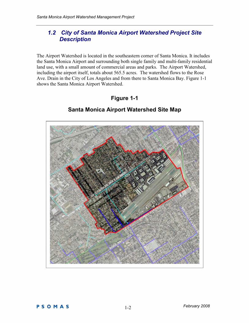
1.2 City of Santa Monica Airport Watershed Project Site Description
The Airport Watershed is located in the southeastern corner of Santa Monica. It includes
the Santa Monica Airport and surrounding both single family and multi-family residential
land use, with a small amount of commercial areas and parks. The Airport Watershed,
including the airport itself, totals about 565.5 acres. The watershed flows to the Rose
Ave. Drain in the City of Los Angeles and from there to Santa Monica Bay. Figure 1-1
shows the Santa Monica Airport Watershed.
Figure 1-1
Santa Monica Airport Watershed Site Map
Santa Monica Airport Watershed Management Project
February 2008 1-3
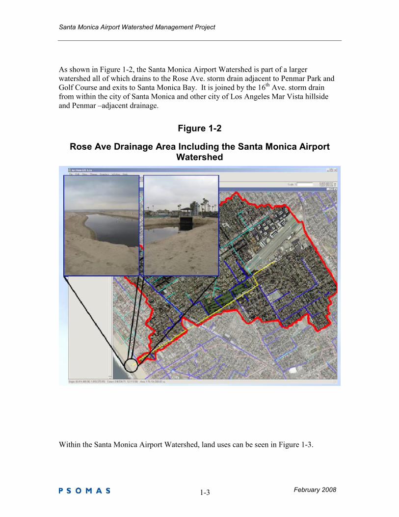
As shown in Figure 1-2, the Santa Monica Airport Watershed is part of a larger
watershed all of which drains to the Rose Ave. storm drain adjacent to Penmar Park and
Golf Course and exits to Santa Monica Bay. It is joined by the 16th Ave. storm drain
from within the city of Santa Monica and other city of Los Angeles Mar Vista hillside
and Penmar –adjacent drainage.
Figure 1-2
Rose Ave Drainage Area Including the Santa Monica Airport Watershed
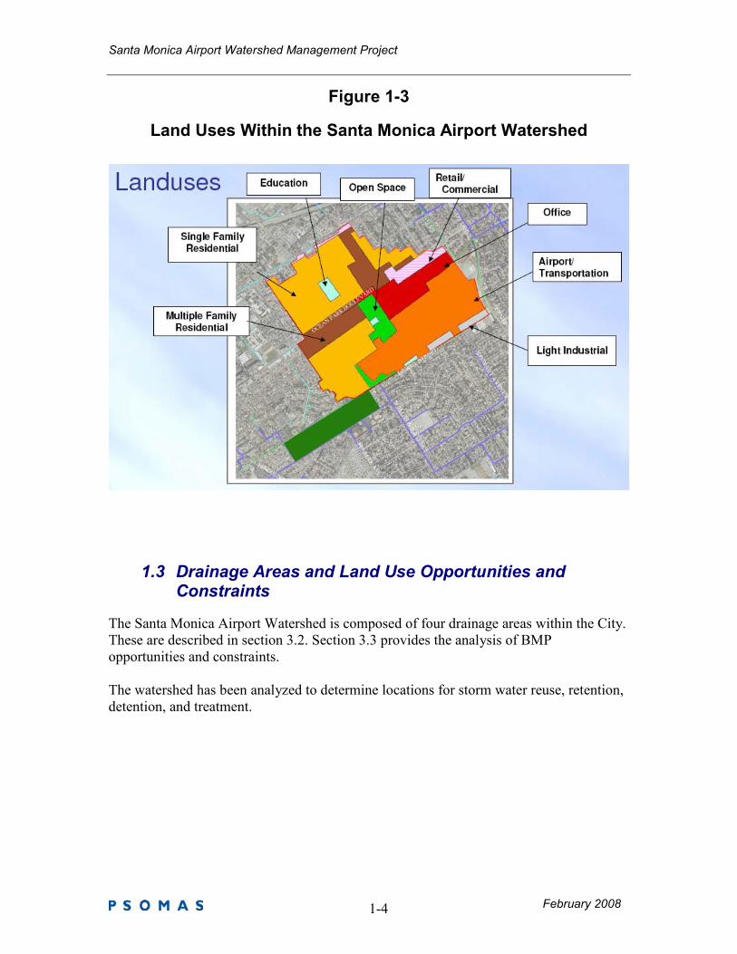
Within the Santa Monica Airport Watershed, land uses can be seen in Figure 1-3.
Santa Monica Airport Watershed Management Project
February 2008 1-4
Figure 1-3
Land Uses Within the Santa Monica Airport Watershed
1.3 Drainage Areas and Land Use Opportunities and Constraints
The Santa Monica Airport Watershed is composed of four drainage areas within the City.
These are described in section 3.2. Section 3.3 provides the analysis of BMP
opportunities and constraints.
The watershed has been analyzed to determine locations for storm water reuse, retention,
detention, and treatment.
Santa Monica Airport Watershed Management Project
February 2008 2-5
1.4 Key BMPs and Treatment Trains
Based on a stakeholder workshop held on June 20, 2007, 10 BMPs were chosen for more
detailed analysis. They are:
Airport Property:
1. Airport Avenue Landscaping 2. SMC Parking Lot Underground Retention 3. Zinc Hangar Runoff Management
Residential Area:
4. Traffic Calming Landscape Modification 5. Pearl Street Rain Gardens 6. Grant Elementary School Underground Retention 7. Clover Park Underground Retention 8. Pico Boulevard Porous Pavement
Business Park:
9. Business Park Bioretention Retrofit
Other:
10. Penmar Water Quality Improvement and Runoff Reuse
2.0 Pollutants of Concern
2.1 Pollutants and Beneficial Uses in Receiving Waters
The Santa Monica Airport Watershed is part of the greater Rose Ave. Watershed which,
in turn, is part of the 414 square-mile Santa Monica Bay Watershed. The Santa Monica
Bay Watershed reaches from the crest of the Santa Monica Mountains on the north from
the Ventura-Los Angeles County line to downtown Los Angeles. From there it extends
south and west across the Los Angeles plain to include the area east of Ballona Creek and
north of Baldwin Hills. South of Ballona Creek, the natural drainage area is a narrow
strip between Playa del Rey and Palos Verdes.
The Santa Monica Bay has many beneficial uses, including fishing, swimming, surfing,
diving and other REC-1 classified activities. Santa Monica Bay Beaches also have
separate beneficial uses. The Los Angeles Regional Water Quality Control Board’s 2002
Clean Water Act Section 303(d) List includes the Santa Monica Bay Offshore/Nearshore.
The pollutants listed for this area include:
◊ Chlordane (sediment)
Santa Monica Airport Watershed Management Project
February 2008 2-6
◊ DDT (tissue & sediment)
◊ Debris
◊ Fish Consumption Advisory
◊ PAHs (Sediment)
◊ PCBs Polychlorinated biphenyls (tissue & sediment)
◊ Sediment Toxicity
All are listed as low TMDL priority, with the exception of Chlordane which is listed as
medium.
The Santa Monica Bay Offshore/Nearshore pollutants listed on the 2006 303 (d) list
includes a shorter list of the following pollutants: DDT (tissue and sediment), Debris,
Fish Consumption Advisory, PCBs (Polychlorinated biphenyls) (tissue and sediment),
and Sediment Toxicity.
The beaches of Santa Monica Bay are listed separately from the receiving waters. The
key pollutant listed is coliform (bacteria).The Santa Monica Bay Beaches Bacteria Total
Maximum Daily Load (TMDL) was adopted on December 12, 2002 by the Regional
Board (Resolution No. 2002-022).
As a result of these listings, the pollutant of greatest concern is bacteria.
2.2 Land Uses and Associated Pollutants
Typical pollutants are associated with types of development (land use) that contribute to urban runoff. Table 2-1 below provides an overview of various land use classifications and the degree to
which specified pollutants may be expected as a result of each land use.
Table 2-1 Land Uses and Associated Pollutants
Type of
Development
(Land Use)
Sediment/
Turbidity
Nutrients Organic
Compounds
Trash
&
Debris
Oxygen
Demanding
Substances
Bacteria
&
Viruses
Oil &
Grease
Pesticides Metals
Detached
Residential
Development
E E N E E E E E N
Attached
Residential
Development
E E N E P (1) P P (2) E N
Commercial/
Industrial
P (1) P (1) P(5) E P (1) P(3) E P (1) P
Automotive
Repair Shops
N N E(4,5) E N N E N P
Restaurants N N N E E E E N N
Hillside
Development
E E N E E E E E N
Santa Monica Airport Watershed Management Project
February 2008 2-7
Parking Lots P(1) P(1) E(4) E P(1) P(6) E P(1) E
Streets,
Highways &
Freeways
E P(1) E(4) E P(1) P(6) E P(1) E
Parks and
Open Space
E E N N E N N E N
Source: Riverside County Flood Control and Conservation District, Riverside County Water Quality
Management Plan for Urban Runoff (September 17, 2004).
Abbreviations:
E = Expected P = Potential N=Not expected
Notes:
(1) A potential pollutant if landscaping or an open area exists. (2) A potential pollutant if area includes uncovered parking areas. (3) A potential pollutant is land use involves animal waste. (4) Specifically, petroleum hydrocarbons. (5) Specifically, solvents. (6) Bacterial indicators are routinely detected in pavement runoff.
The following descriptions are provided for each pollutant identified in Table 2-1 above:
� Sediments – Sediments are soils or other surficial materials eroded and then transported or
deposited by the action of wind, water, ice, or gravity. Sediments can increase turbidity, clog
fish gills, reduce spawning habitat, lower young aquatic organisms survival rates, smother
bottom dwelling organisms, and suppress aquatic vegetation growth.
� Nutrients – Nutrients are inorganic substances, such as nitrogen and phosphorus. They
commonly exist in the form of mineral salts that are either dissolved or suspended in water.
Primary sources of nutrients in urban runoff are fertilizers and eroded soils. Excessive
discharge of nutrients to water bodies and streams can cause excessive aquatic algae and
plant growth. Such excessive production, referred to as cultural eutrophication, may lead to
excessive decay of organic matter in the water body, loss of oxygen in the water, release of
toxins in sediment, and the eventual death of aquatic organisms.
� Organic Compounds – Organic compounds are carbon-based. Commercially available or
naturally occurring organic compounds are found in pesticides, solvents, and hydrocarbons.
Organic compounds can, at certain concentrations, indirectly or directly constitute a hazard to
life or health. When rinsing off objects, toxic levels of solvents and cleaning compounds can
be discharged to the MS4. Dirt, grease, and grime retained in the cleaning fluid or rinse water
may also adsorb levels of organic compounds that are harmful or hazardous to aquatic life.
Pesticides (including herbicides) are chemical compounds commonly used to control
nuisance growth or prevalence of organisms. Excessive or improper application of a pesticide
may result in runoff containing toxic levels of its active ingredient.
� Trash and Debris – Trash (such as paper, plastic, polystyrene packing foam, and aluminum
materials) and biodegradable organic matter (such as leaves, grass cuttings, and food waste)
are general waste products on the landscape. The presence of trash and debris may have a
significant impact on the recreational value of a water body and aquatic habitat. Excess
organic matter can create a high biochemical oxygen demand in a stream and thereby lower
its water quality. In addition, in areas where stagnant water exists, the presence of excess
Santa Monica Airport Watershed Management Project
February 2008 2-8
organic matter can promote septic conditions resulting in the growth of undesirable
organisms and the release of odorous and hazardous compounds such as hydrogen sulfide.
� Oxygen-Demanding Substances – This category includes biodegradable organic material as
well as chemicals that react with dissolved oxygen in water to form other compounds.
Proteins, carbohydrates, and fats are examples of biodegradable organic compounds.
Compounds such as ammonia and hydrogen sulfide are examples of oxygen-demanding
compounds. The oxygen demand of a substance can lead to depletion of dissolved oxygen in
a water body and possibly the development of septic conditions.
� Pathogens – Pathogens and viruses ( measured by bacteria indicators) are ubiquitous
microorganisms that thrive under certain environmental conditions. Their proliferation is
typically caused by the transport of animal or human fecal wastes from the watershed. Water,
containing excessive bacteria and viruses can alter the aquatic habitat and create a harmful
environment for humans and aquatic life. Also, the decomposition of excess organic waste
causes increased growth of undesirable organisms in the water.
� Metals – The primary source of metal pollution in urban runoff is typically commercially
available metals and metal products. Metals of concern include cadmium, chromium, copper,
lead, mercury, and zinc. Lead and chromium have been used as corrosion inhibitors in primer
coatings and cooling tower systems. Metals are also raw material components in non-metal
products such as fuels, adhesives, paints, and other coatings. At low concentrations naturally
occurring in soil, metals may not be toxic. However, at higher concentrations, certain metals
can be toxic to aquatic life. Humans can be impacted from contaminated groundwater
resources, and bioaccumulation of metals in fish and shellfish. Environmental concerns,
regarding the potential for release of metals to the environment, have already led to restricted
metal usage in certain applications.
A comparison of the pollutants existing in the Santa Monica Watershed and receiving
waters of the Santa Monica Bay with pollutants associated with land use activity in the
Santa Monica Airport Watershed shows an overlap of common pollutants.
Because of the wide range of land uses in the Santa Monica Airport Watershed, all of the
pollutants listed can be considered of concern in the Watershed. However as BMPs are
identified by location, one or another of the land uses and their specific pollutants of
concern will dominate. In general the strategy is as follows: 1) where reuse is possible,
treat to remove all pollutants to a Title 24 equivalency; 2) otherwise provide filtration or
infiltration to remove bacteria and other pollutants in storm water.
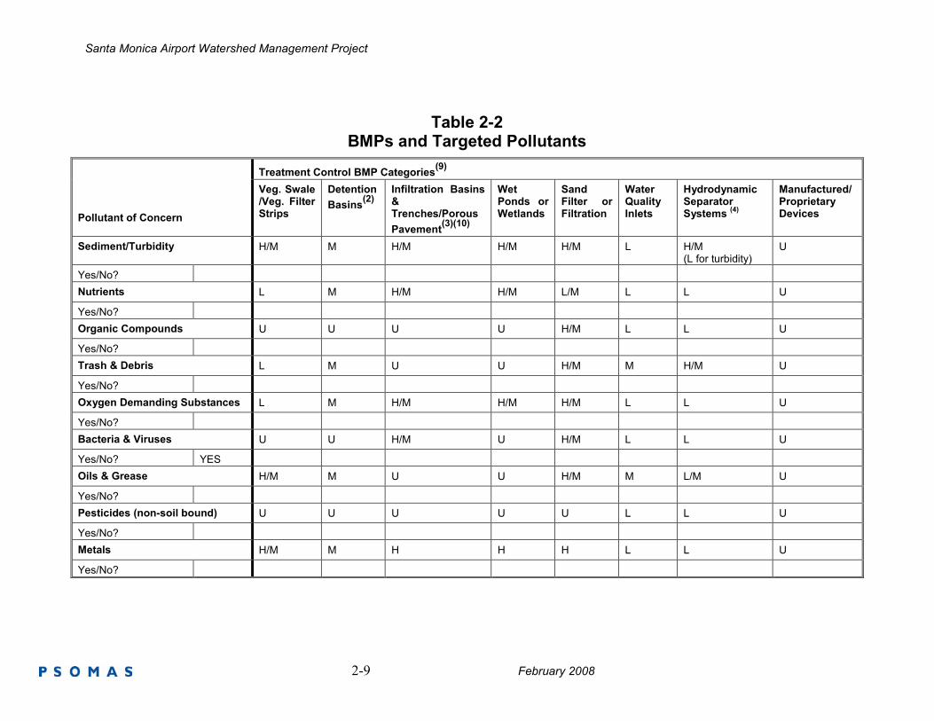
Table 2-2 provides a list of treatment control BMP categories identifying their
effectiveness in treating various pollutants of concern.
Santa Monica Airport Watershed Management Project
2-9 February 2008
Table 2-2 BMPs and Targeted Pollutants
Treatment Control BMP Categories(9)
Pollutant of Concern
Veg. Swale /Veg. Filter Strips
Detention
Basins(2)
Infiltration Basins & Trenches/Porous
Pavement(3)(10)
Wet Ponds or Wetlands
Sand Filter or Filtration
Water Quality Inlets
Hydrodynamic Separator Systems
(4)
Manufactured/ Proprietary Devices
Sediment/Turbidity H/M M H/M H/M H/M L H/M (L for turbidity)
U
Yes/No?
Nutrients L M H/M H/M L/M L L U
Yes/No?
Organic Compounds U U U U H/M L L U
Yes/No?
Trash & Debris L M U U H/M M H/M U
Yes/No?
Oxygen Demanding Substances L M H/M H/M H/M L L U
Yes/No?
Bacteria & Viruses U U H/M U H/M L L U
Yes/No? YES
Oils & Grease H/M M U U H/M M L/M U
Yes/No?
Pesticides (non-soil bound) U U U U U L L U
Yes/No?
Metals H/M M H H H L L U
Yes/No?
Santa Monica Airport Watershed Management Project
2-10 February 2008
Abbreviations: L: Low removal efficiency M: Medium removal efficiency H: High removal efficiency U: Unknown removal efficiency
Notes: (1) Periodic performance assessment and updating of the guidance provided by this table may be necessary. (2) Includes grass swales, grass strips, wetland vegetation swales, and bioretention. (3) Includes extended/dry detention basins with grass lining and extended/dry detention basins with impervious lining. Effectiveness based upon minimum 36-48-hour
drawdown time. (4) Includes infiltration basins, infiltration trenches, and porous pavements. (5) Includes permanent pool wet ponds and constructed wetlands. (6) Includes sand filters and media filters. (7) Also known as hydrodynamic devices, baffle boxes, swirl concentrators, or cyclone separators. (8) Includes proprietary stormwater treatment devices as listed in the CASQA Stormwater Best Management Practices Handbooks, other stormwater treatment BMPs not
specifically listed in this report or newly developed/emerging stormwater treatment technologies. (9) Project proponents should base BMP designs on the Los Angeles County Stormwater Quality Best Management Practice Design Handbook. However, project
proponents may also wish to reference the California Stormwater BMP Handbook – New Development and Redevelopment (www.cabmphandbooks.com). The Handbook contains additional information on BMP operation and maintenance.
(10) Note: Projects that will utilize infiltration-based Treatment Control BMPs (e.g., Infiltration Basins, Infiltration Trenches, Porous Pavement) without an underdrain will need to demonstrate with a property/project specific soils report that the soils are of the appropriate porousity. The selection of a Treatment Control BMP (or BMPs) for the project must specifically consider the effectiveness of the Treatment Control BMP for pollutants identified as causing an impairment of Receiving Waters to which the project will discharge Urban Runoff.
Santa Monica Airport Watershed Management Project
3-11 February 2008
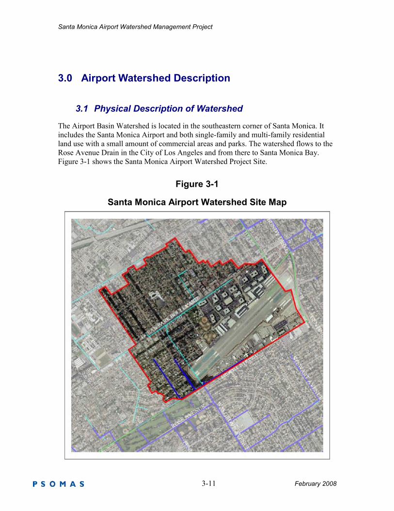
3.0 Airport Watershed Description
3.1 Physical Description of Watershed
The Airport Basin Watershed is located in the southeastern corner of Santa Monica. It
includes the Santa Monica Airport and both single-family and multi-family residential
land use with a small amount of commercial areas and parks. The watershed flows to the
Rose Avenue Drain in the City of Los Angeles and from there to Santa Monica Bay.
Figure 3-1 shows the Santa Monica Airport Watershed Project Site.
Figure 3-1
Santa Monica Airport Watershed Site Map
Santa Monica Airport Watershed Management Project
February 2008 3-12
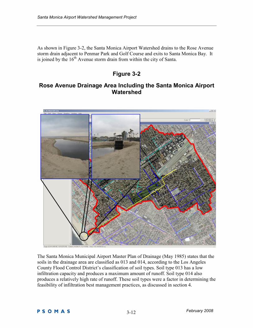
As shown in Figure 3-2, the Santa Monica Airport Watershed drains to the Rose Avenue
storm drain adjacent to Penmar Park and Golf Course and exits to Santa Monica Bay. It
is joined by the 16th Avenue storm drain from within the city of Santa.
Figure 3-2
Rose Avenue Drainage Area Including the Santa Monica Airport Watershed
The Santa Monica Municipal Airport Master Plan of Drainage (May 1985) states that the
soils in the drainage area are classified as 013 and 014, according to the Los Angeles
County Flood Control District’s classification of soil types. Soil type 013 has a low
infiltration capacity and produces a maximum amount of runoff. Soil type 014 also
produces a relatively high rate of runoff. These soil types were a factor in determining the
feasibility of infiltration best management practices, as discussed in section 4.
Santa Monica Airport Watershed Management Project
February 2008 3-13
3.2 Drainage Sub-Areas
The Santa Monica Airport Watershed is composed of four drainage areas.
Table 3-1 Sub-Drainage Description and Tributary Areas
Sub-Area Description Area [ac]
DA 1 - 25th-S Airport 156.0
DA 2 - 25th-N Northern Residential and Business Park 207.6
DA 3 – 23rd Cloverfield / 23
rd Street Residential 161.8
DA 4 – 21st Western Reidential 40.2
Total - 565.5
Santa Monica Airport Watershed Management Project
February 2008 3-14
Figure 3-3
Santa Monica Airport Watershed Drainage Areas
Santa Monica Airport Watershed Management Project
February 2008 3-15
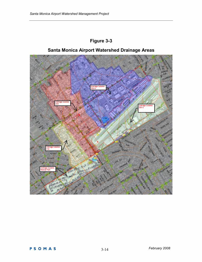
3.3 Land Uses, Pollutants, and BMP Opportunities and Constraints
Figure 3-4 shows the Airport Watershed land uses.
Figure 3-4
Santa Monica Airport Watershed Land Uses
Santa Monica Airport Watershed Management Project
3-16 February 2008
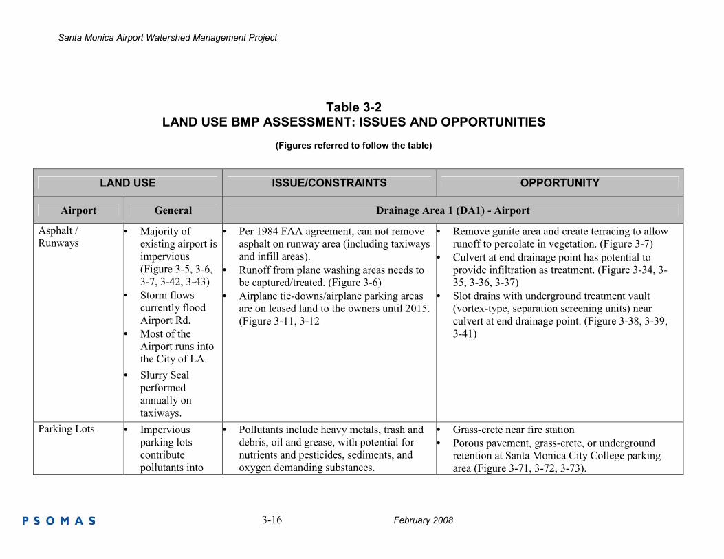
Table 3-2 LAND USE BMP ASSESSMENT: ISSUES AND OPPORTUNITIES
(Figures referred to follow the table)
LAND USE ISSUE/CONSTRAINTS OPPORTUNITY
Airport General Drainage Area 1 (DA1) - Airport
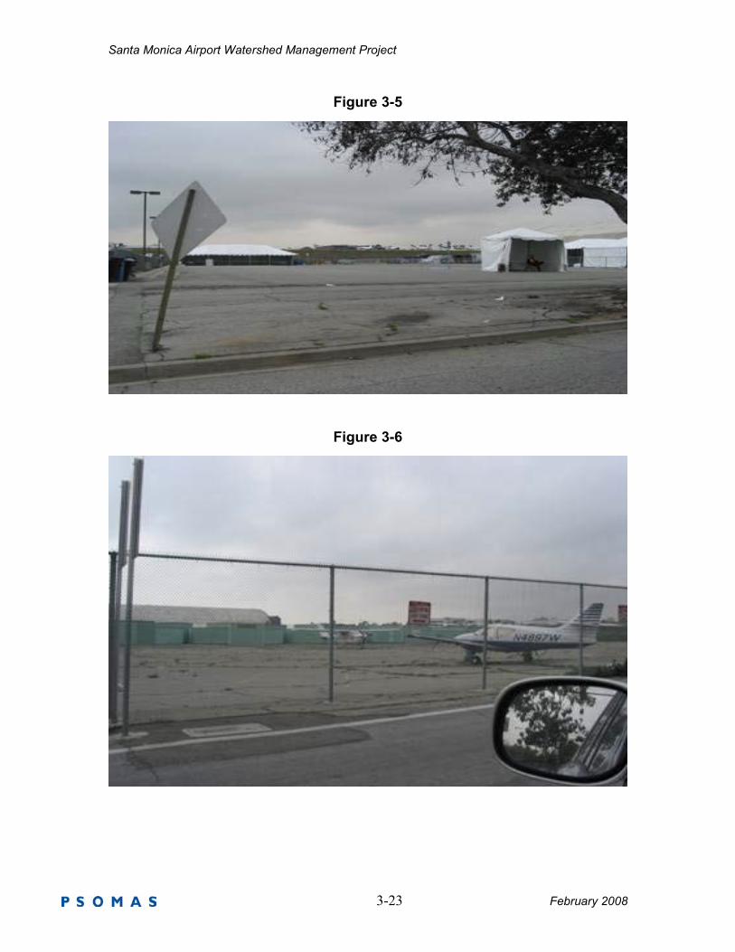
Asphalt /
Runways • Majority of
existing airport is
impervious
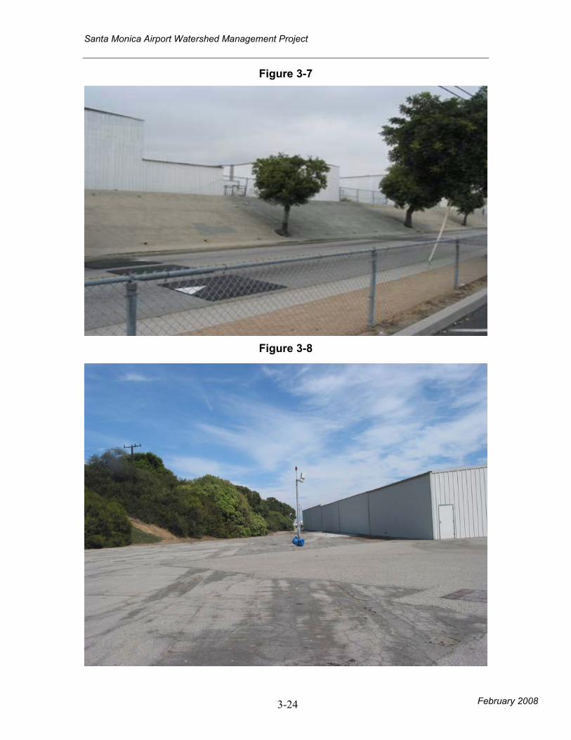
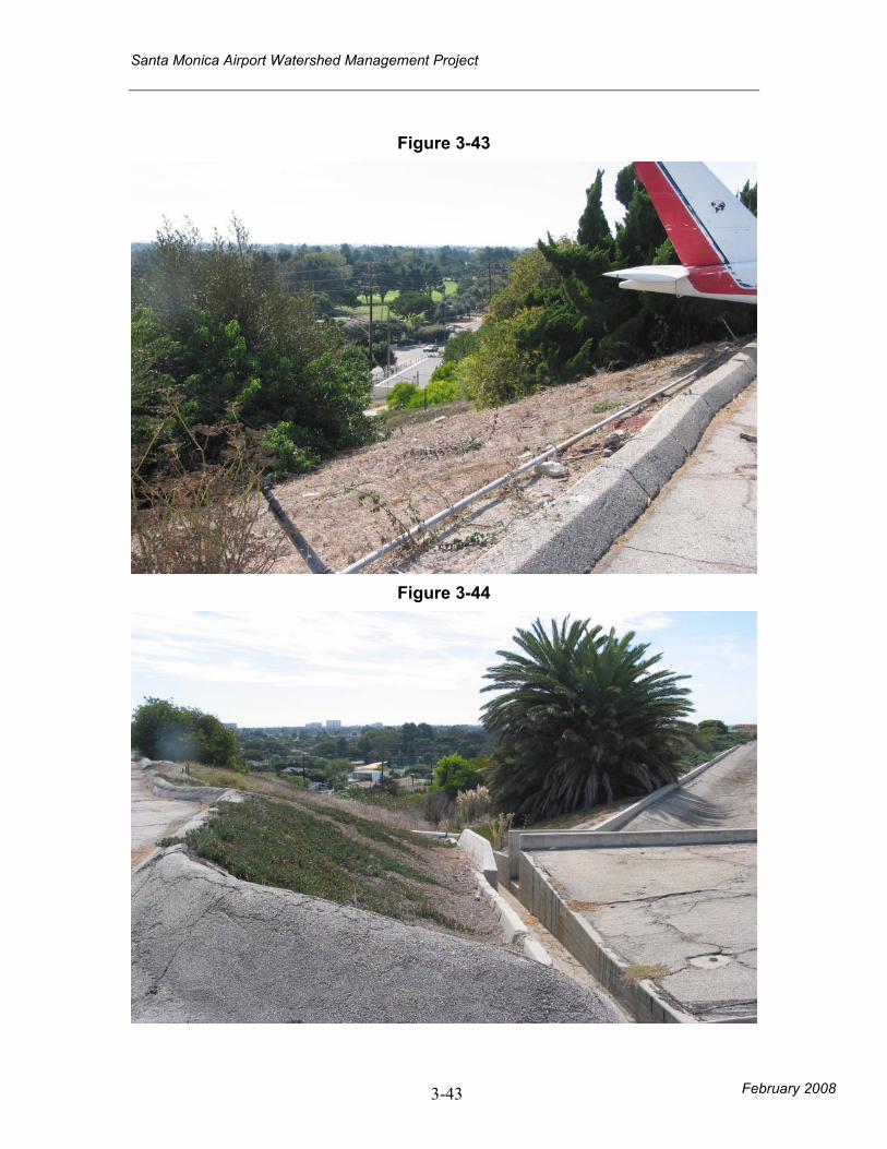
(Figure 3-5, 3-6,
3-7, 3-42, 3-43)
• Storm flows
currently flood
Airport Rd.
• Most of the
Airport runs into
the City of LA.
• Slurry Seal
performed
annually on
taxiways.
• Per 1984 FAA agreement, can not remove
asphalt on runway area (including taxiways
and infill areas).
• Runoff from plane washing areas needs to
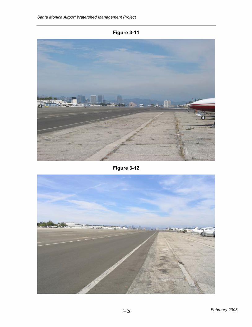
be captured/treated. (Figure 3-6)
• Airplane tie-downs/airplane parking areas
are on leased land to the owners until 2015.
(Figure 3-11, 3-12
• Remove gunite area and create terracing to allow
runoff to percolate in vegetation. (Figure 3-7)
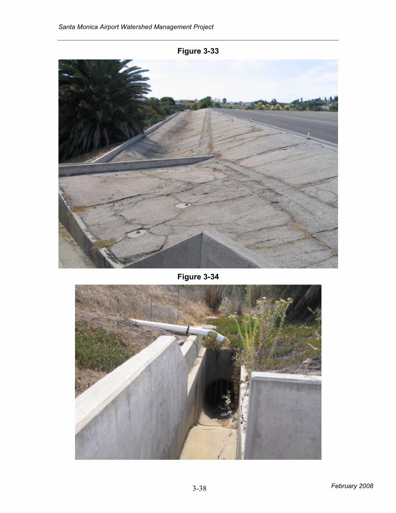
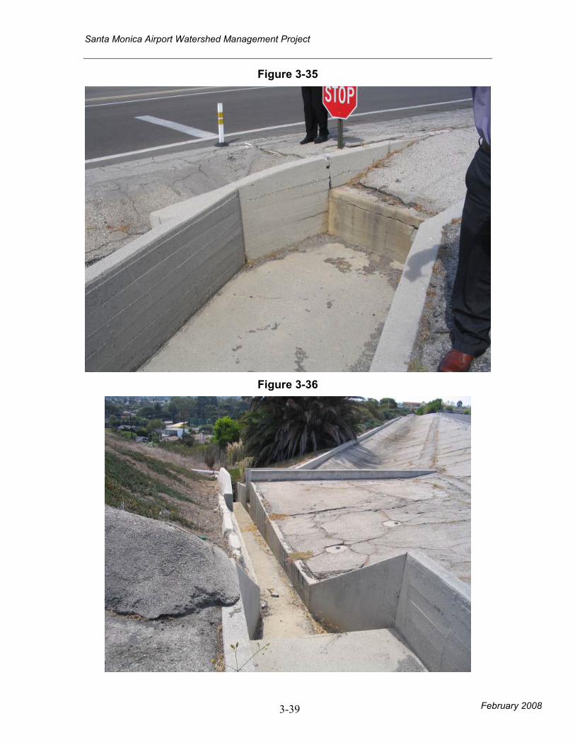
• Culvert at end drainage point has potential to
provide infiltration as treatment. (Figure 3-34, 3-
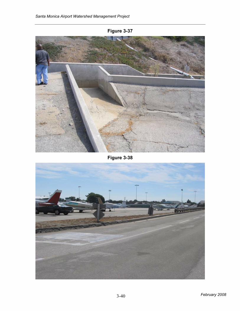
35, 3-36, 3-37)
• Slot drains with underground treatment vault
(vortex-type, separation screening units) near
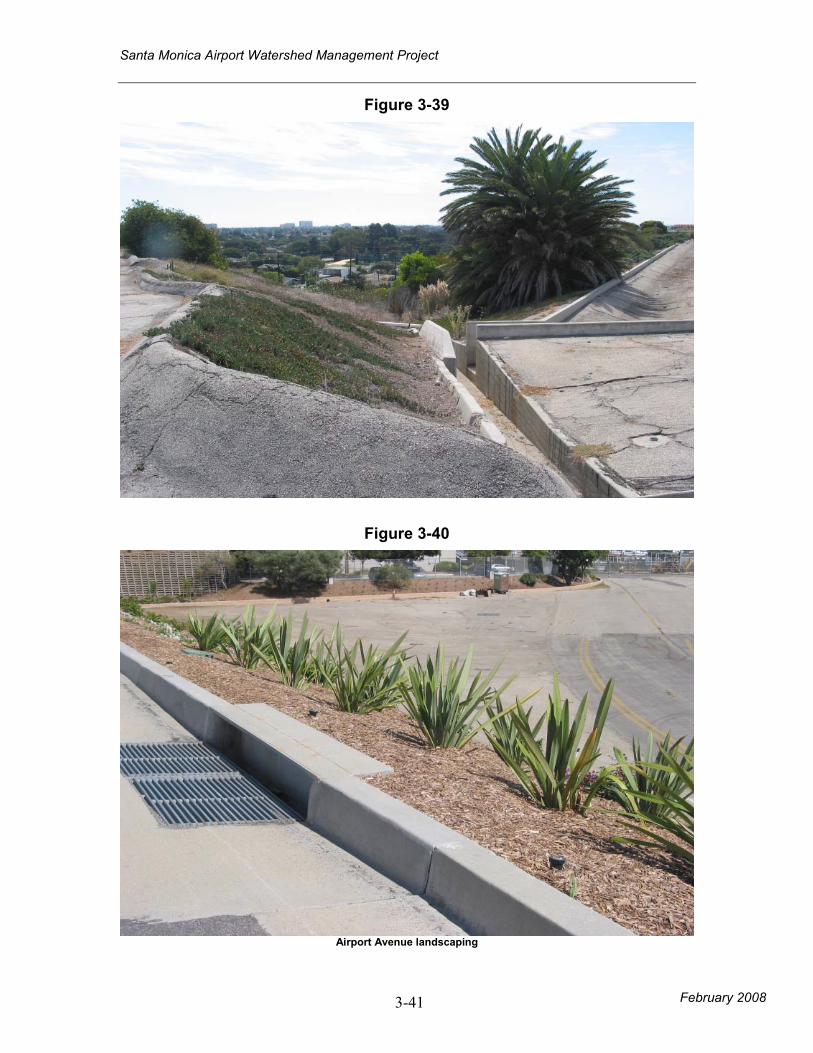
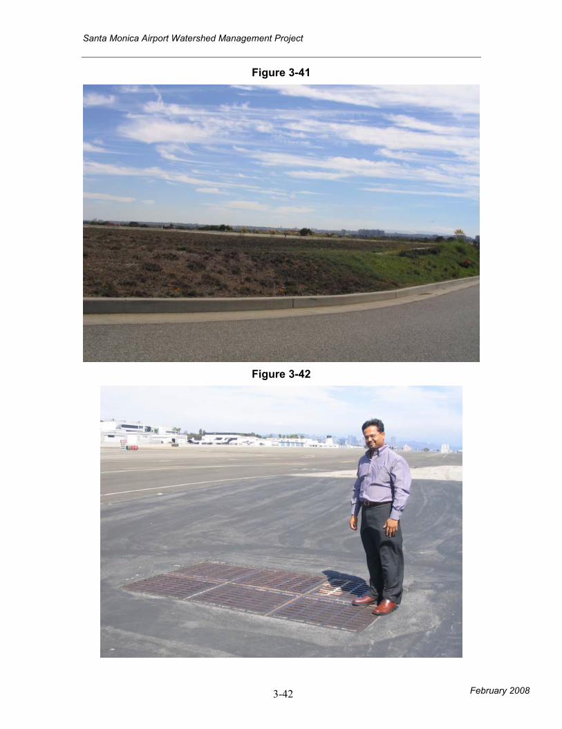
culvert at end drainage point. (Figure 3-38, 3-39,
3-41)
Parking Lots • Impervious
parking lots
contribute
pollutants into
• Pollutants include heavy metals, trash and
debris, oil and grease, with potential for
nutrients and pesticides, sediments, and
oxygen demanding substances.
• Grass-crete near fire station
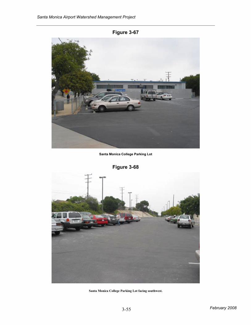
• Porous pavement, grass-crete, or underground
retention at Santa Monica City College parking
area (Figure 3-71, 3-72, 3-73).
Santa Monica Airport Watershed Management Project
February 2008 3-17
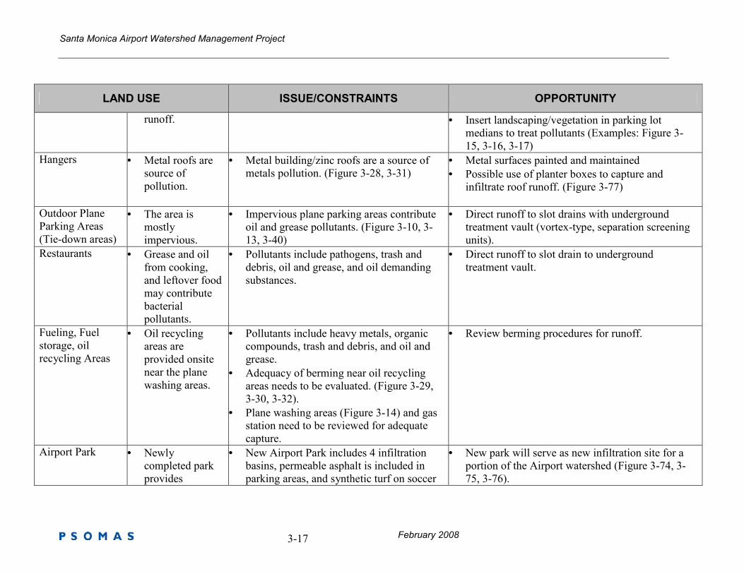
LAND USE ISSUE/CONSTRAINTS OPPORTUNITY
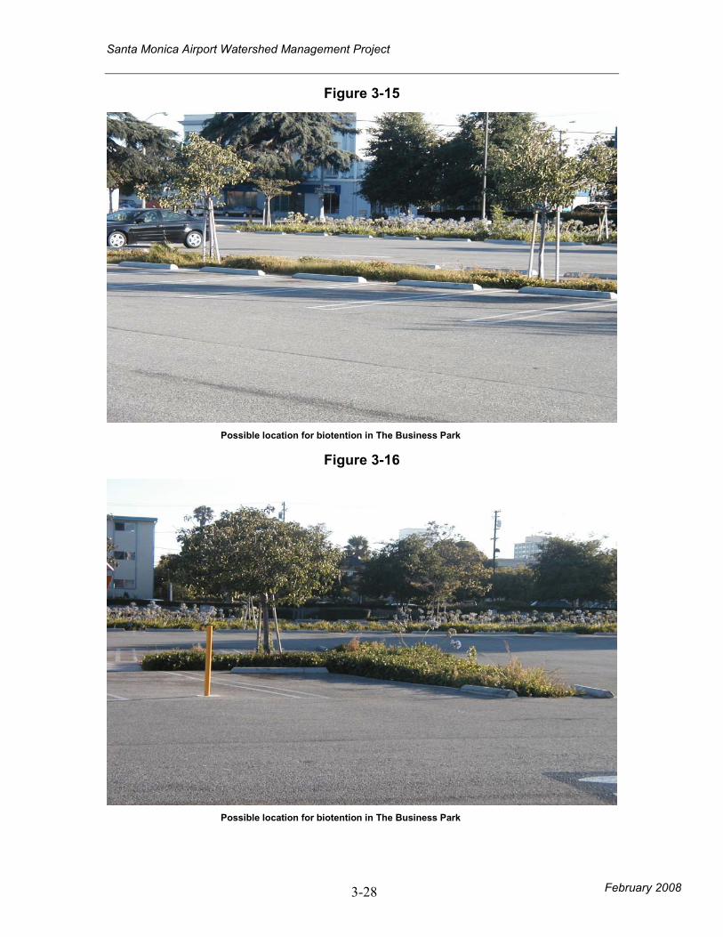
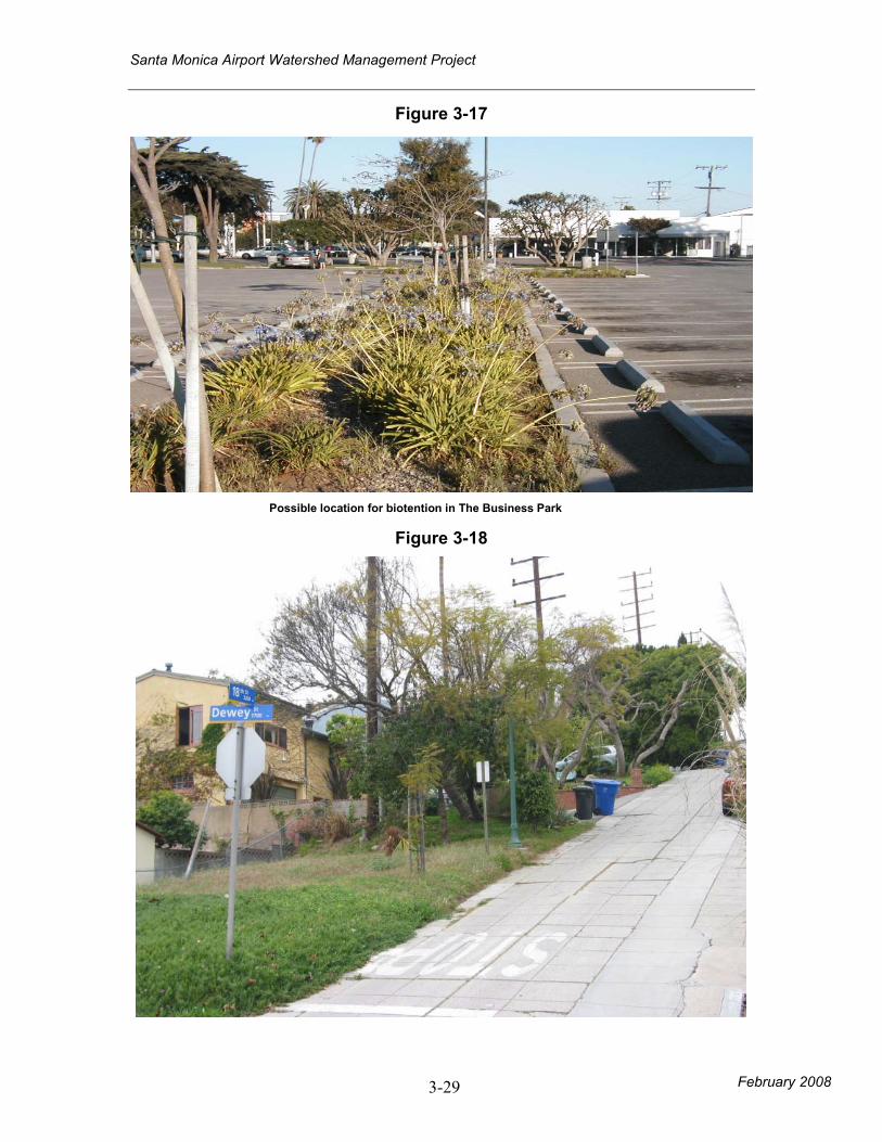
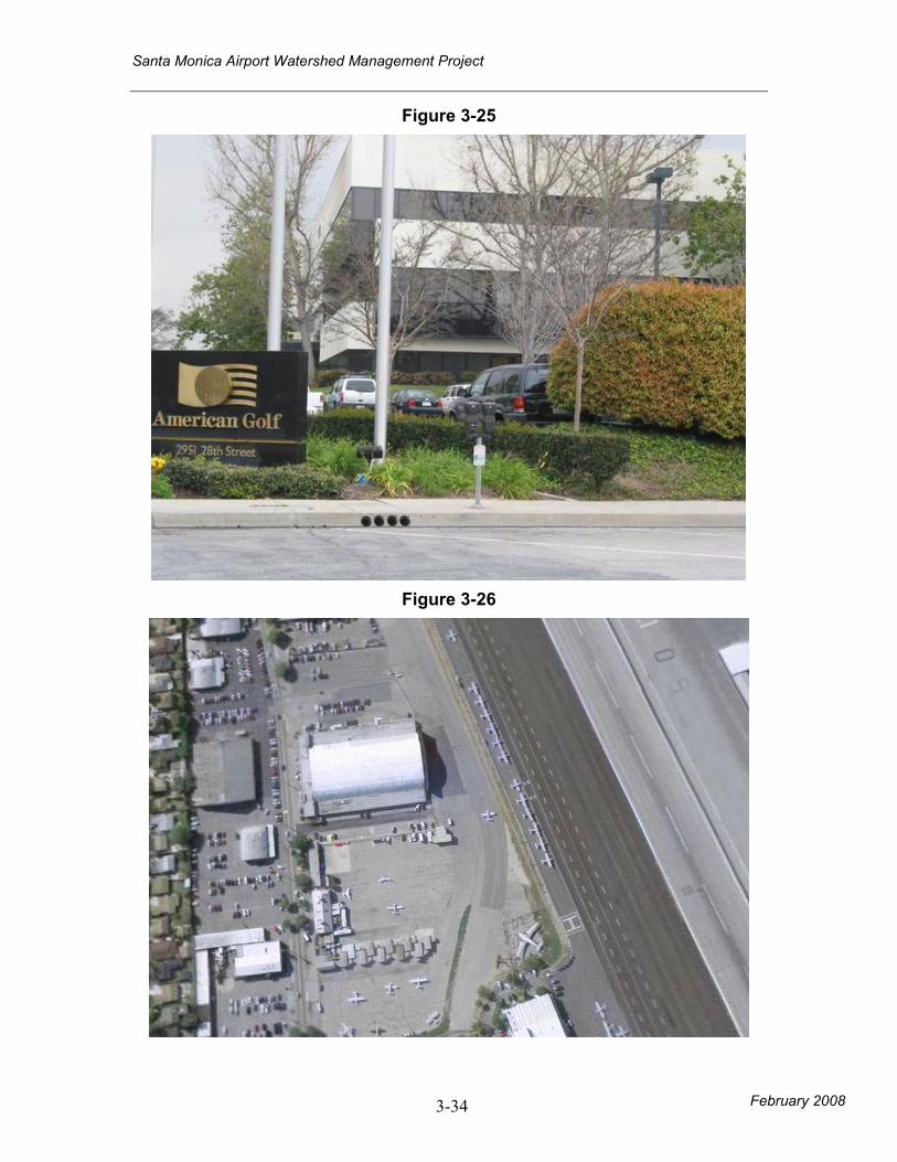
runoff. • Insert landscaping/vegetation in parking lot
medians to treat pollutants (Examples: Figure 3-
15, 3-16, 3-17)
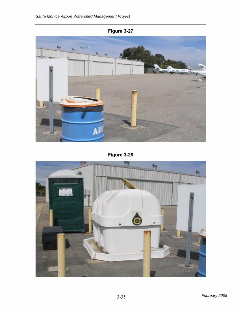
Hangers • Metal roofs are
source of
pollution.
• Metal building/zinc roofs are a source of
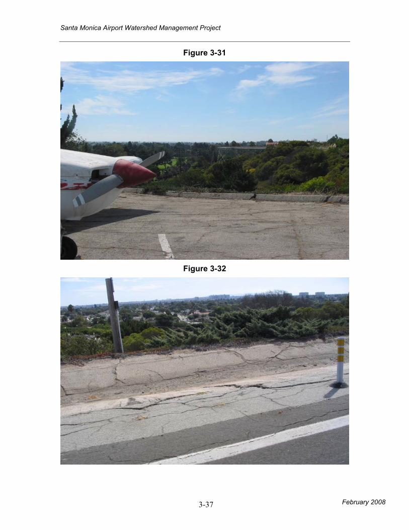
metals pollution. (Figure 3-28, 3-31)
• Metal surfaces painted and maintained
• Possible use of planter boxes to capture and
infiltrate roof runoff. (Figure 3-77)
Outdoor Plane
Parking Areas
(Tie-down areas)
• The area is
mostly
impervious.
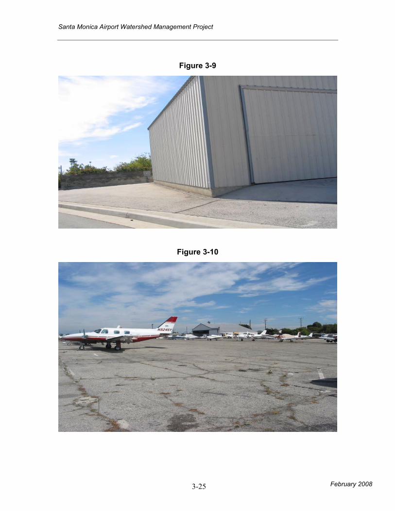
• Impervious plane parking areas contribute
oil and grease pollutants. (Figure 3-10, 3-
13, 3-40)
• Direct runoff to slot drains with underground
treatment vault (vortex-type, separation screening
units).
Restaurants • Grease and oil
from cooking,
and leftover food
may contribute
bacterial
pollutants.
• Pollutants include pathogens, trash and
debris, oil and grease, and oil demanding
substances.
• Direct runoff to slot drain to underground
treatment vault.
Fueling, Fuel
storage, oil
recycling Areas
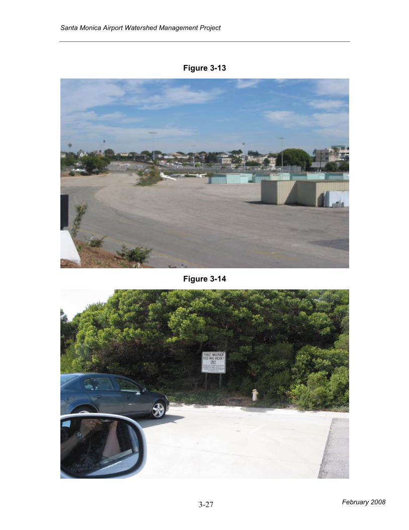
• Oil recycling
areas are
provided onsite
near the plane
washing areas.
• Pollutants include heavy metals, organic
compounds, trash and debris, and oil and
grease.
• Adequacy of berming near oil recycling
areas needs to be evaluated. (Figure 3-29,
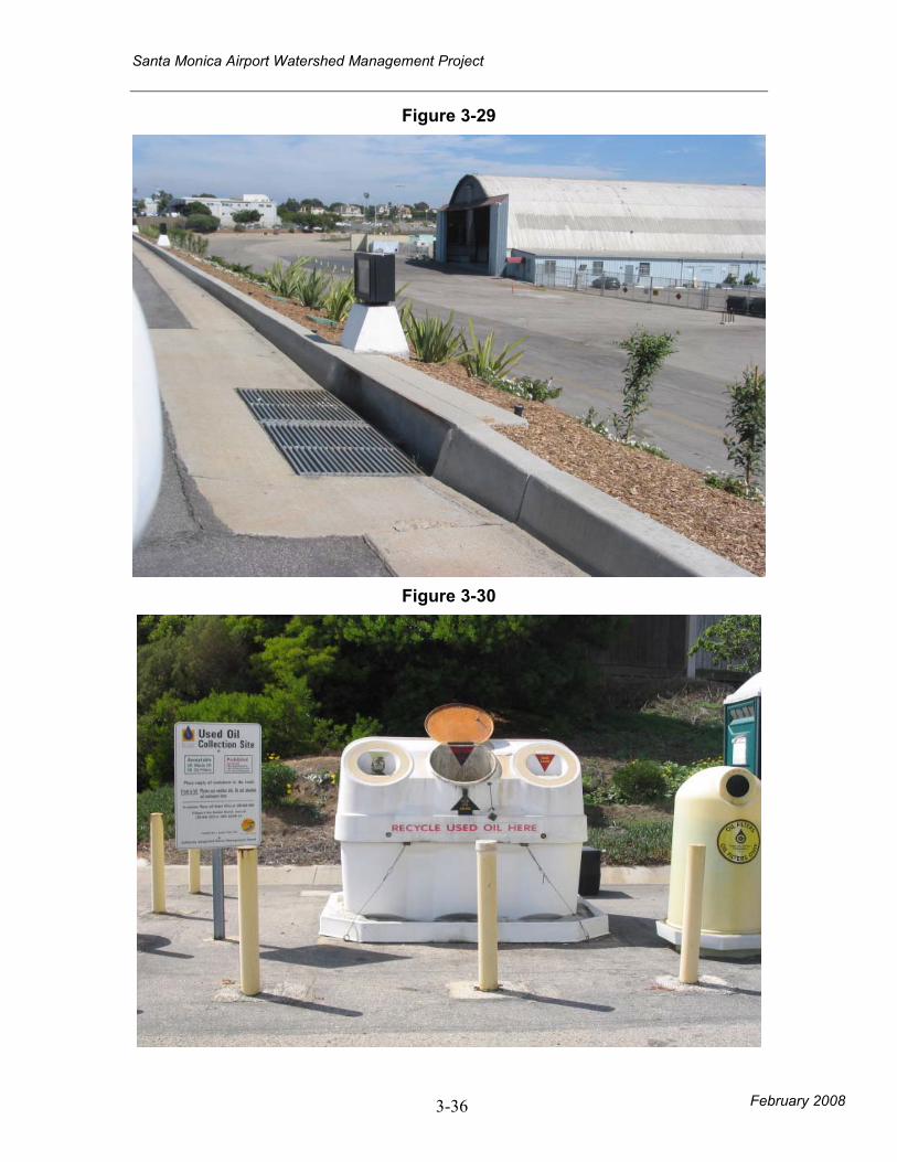
3-30, 3-32).
• Plane washing areas (Figure 3-14) and gas
station need to be reviewed for adequate
capture.
• Review berming procedures for runoff.
Airport Park • Newly
completed park
provides
• New Airport Park includes 4 infiltration
basins, permeable asphalt is included in
parking areas, and synthetic turf on soccer
• New park will serve as new infiltration site for a
portion of the Airport watershed (Figure 3-74, 3-
75, 3-76).
Santa Monica Airport Watershed Management Project
February 2008 3-18
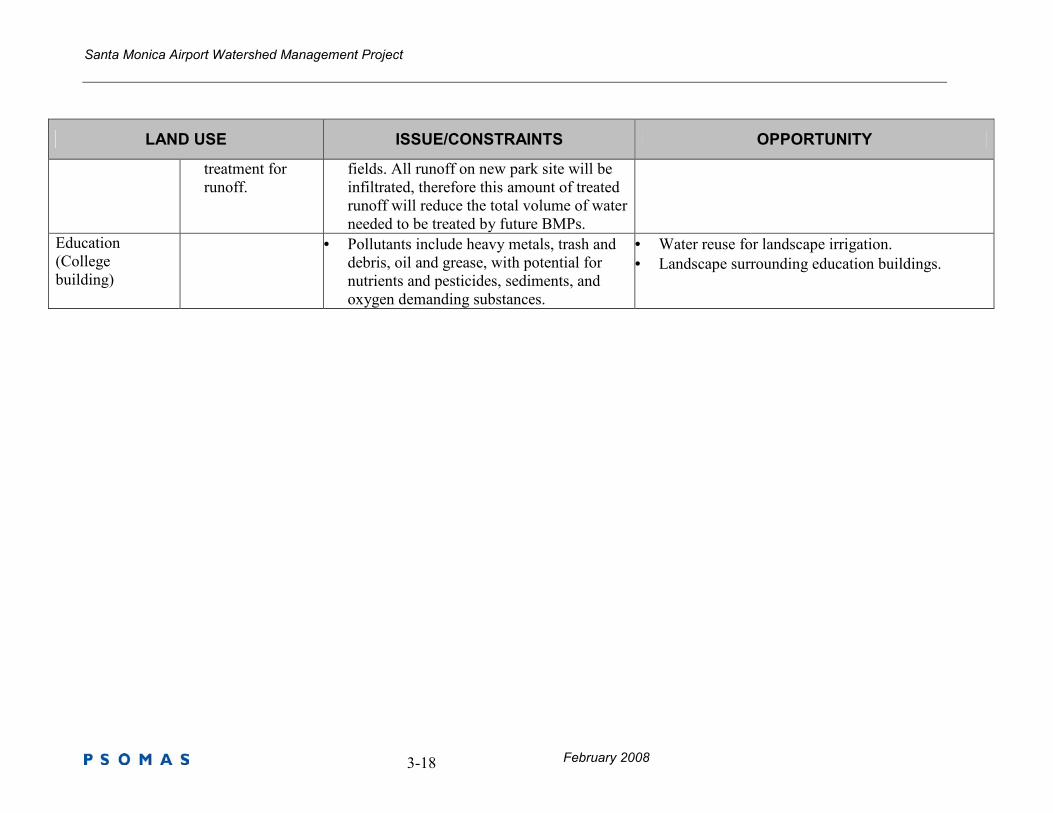
LAND USE ISSUE/CONSTRAINTS OPPORTUNITY
treatment for
runoff.
fields. All runoff on new park site will be
infiltrated, therefore this amount of treated
runoff will reduce the total volume of water
needed to be treated by future BMPs.
Education
(College
building)
• Pollutants include heavy metals, trash and
debris, oil and grease, with potential for
nutrients and pesticides, sediments, and
oxygen demanding substances.
• Water reuse for landscape irrigation.
• Landscape surrounding education buildings.
Santa Monica Airport Watershed Management Project
February 2008 3-19
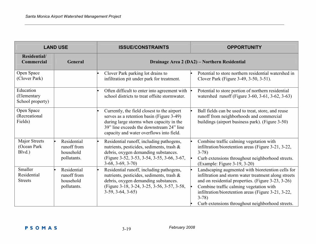
LAND USE ISSUE/CONSTRAINTS OPPORTUNITY
Residential/
Commercial
General Drainage Area 2 (DA2) – Northern Residential
Open Space
(Clover Park)
• Clover Park parking lot drains to
infiltration pit under park for treatment.
• Potential to store northern residential watershed in
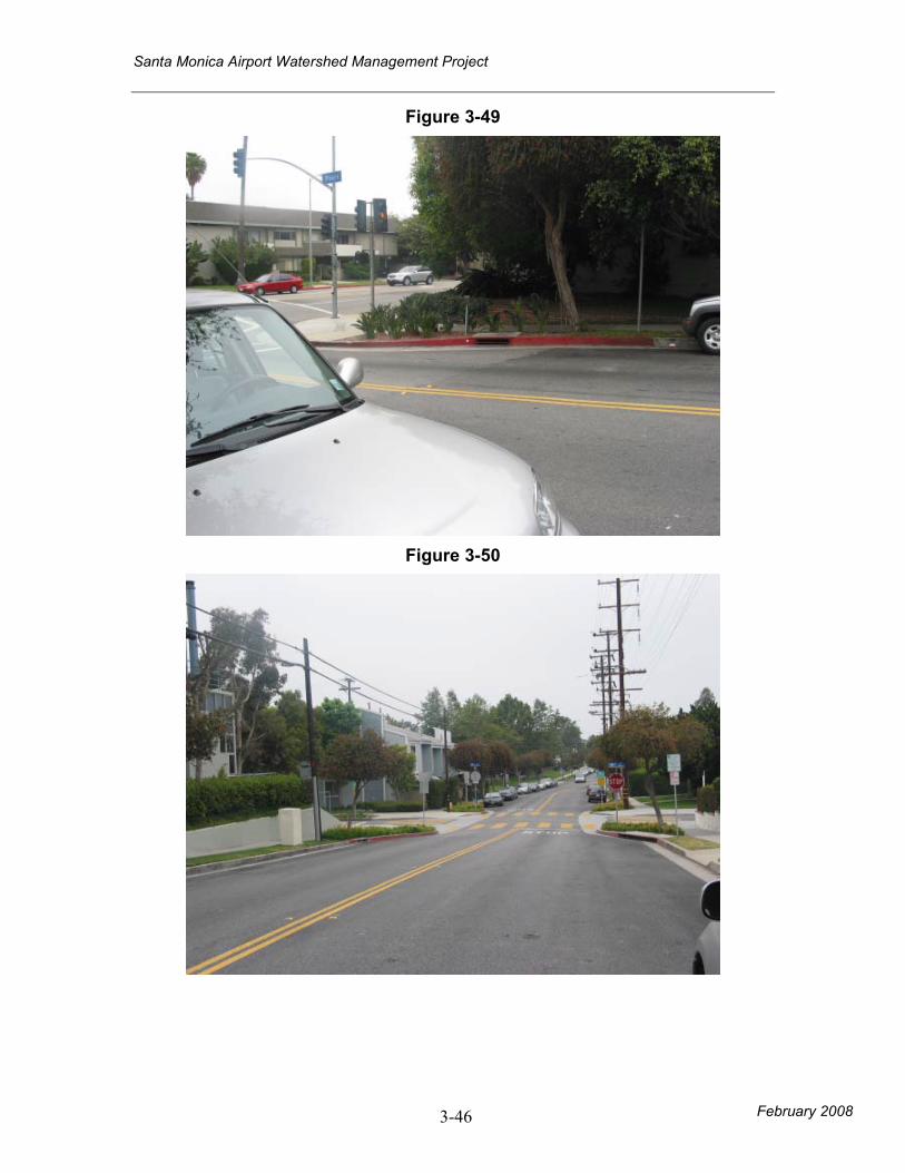
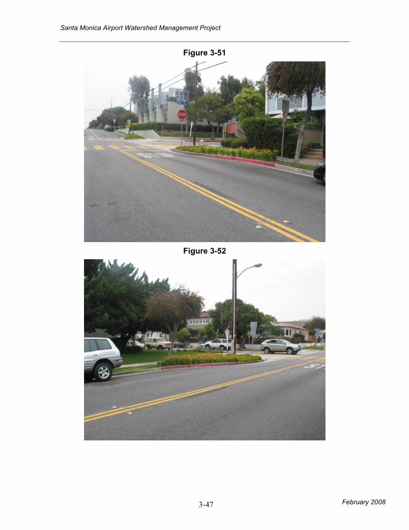
Clover Park (Figure 3-49, 3-50, 3-51).
Education
(Elementary
School property)
• Often difficult to enter into agreement with
school districts to treat offsite stormwater.
• Potential to store portion of northern residential
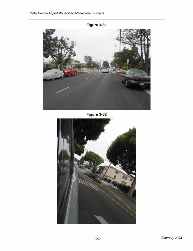
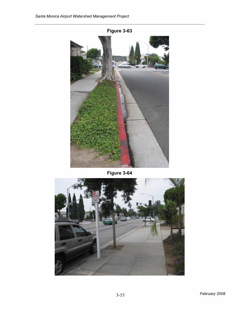
watershed runoff (Figure 3-60, 3-61, 3-62, 3-63)
Open Space
(Recreational
Fields)
• Currently, the field closest to the airport
serves as a retention basin (Figure 3-49)
during large storms when capacity in the
39” line exceeds the downstream 24” line
capacity and water overflows into field.
• Ball fields can be used to treat, store, and reuse
runoff from neighborhoods and commercial
buildings (airport business park). (Figure 3-50)
Major Streets
(Ocean Park
Blvd.)
• Residential
runoff from
household
pollutants.
• Residential runoff, including pathogens,
nutrients, pesticides, sediments, trash &
debris, oxygen demanding substances.
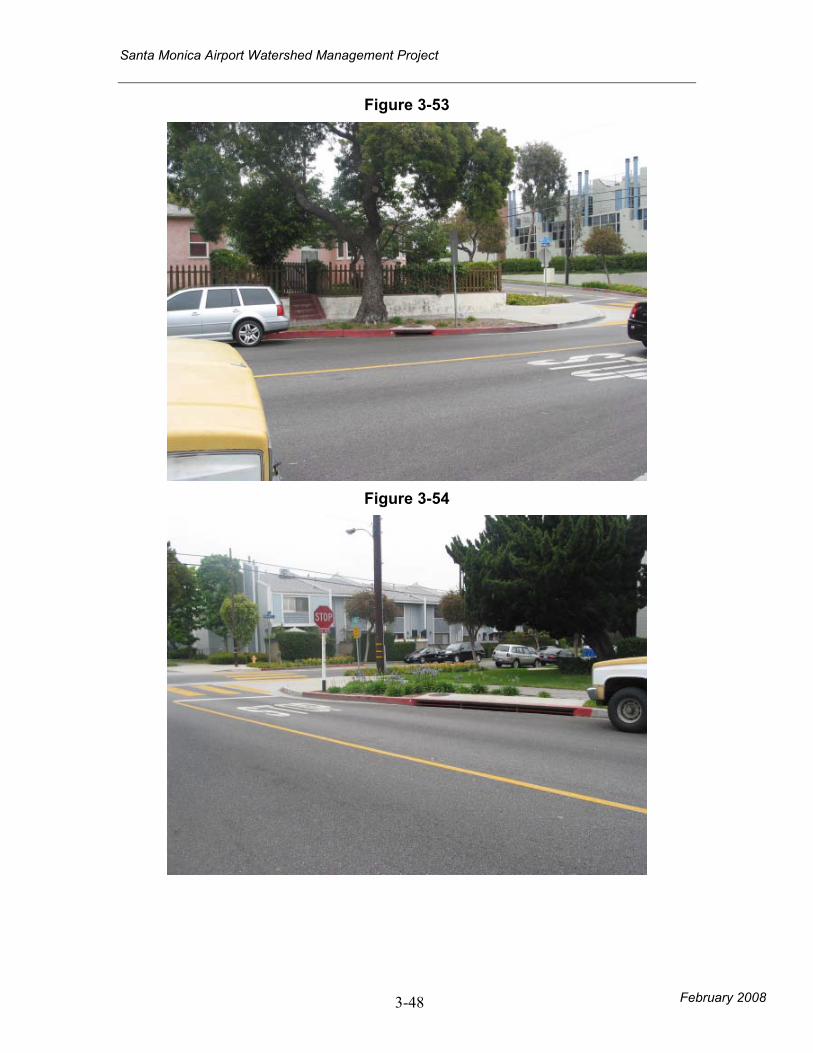
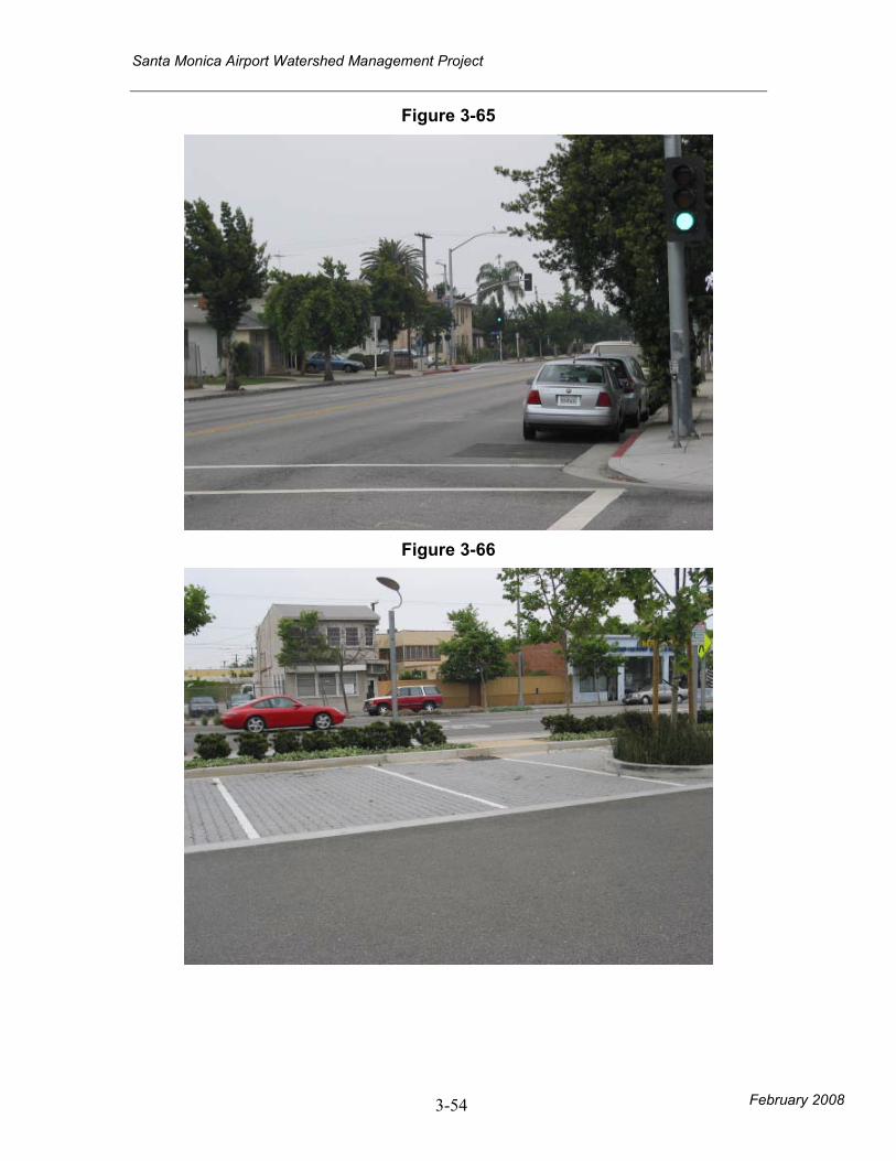
(Figure 3-52, 3-53, 3-54, 3-55, 3-66, 3-67,
3-68, 3-69, 3-70)
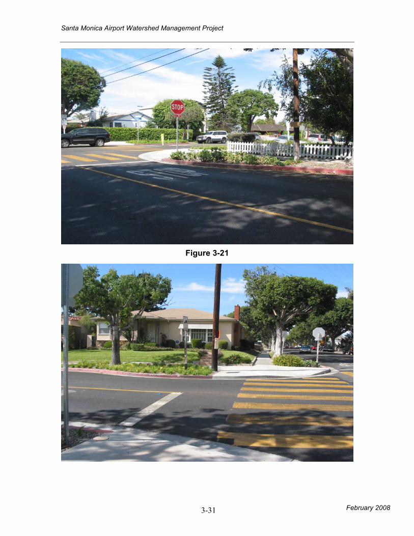
• Combine traffic calming vegetation with
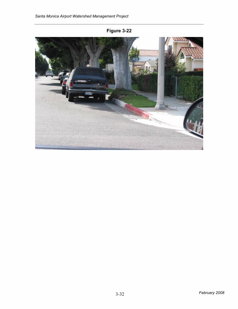
infiltration/bioretention areas (Figure 3-21, 3-22,
3-78)
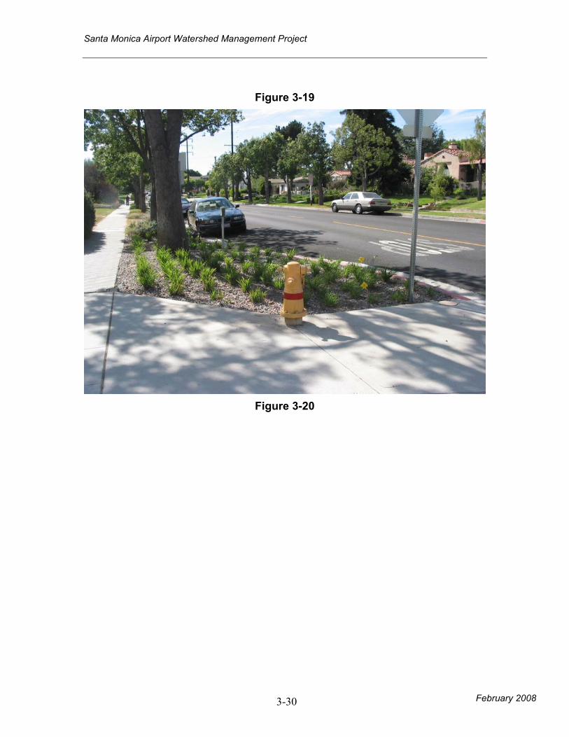
• Curb extensions throughout neighborhood streets.
(Example: Figure 3-19, 3-20)
Smaller
Residential
Streets
• Residential
runoff from
household
pollutants.
• Residential runoff, including pathogens,
nutrients, pesticides, sediments, trash &
debris, oxygen demanding substances.
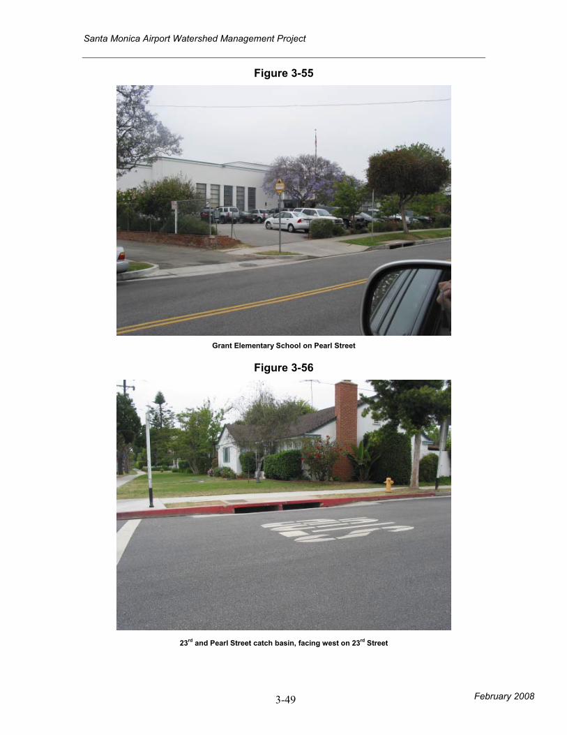
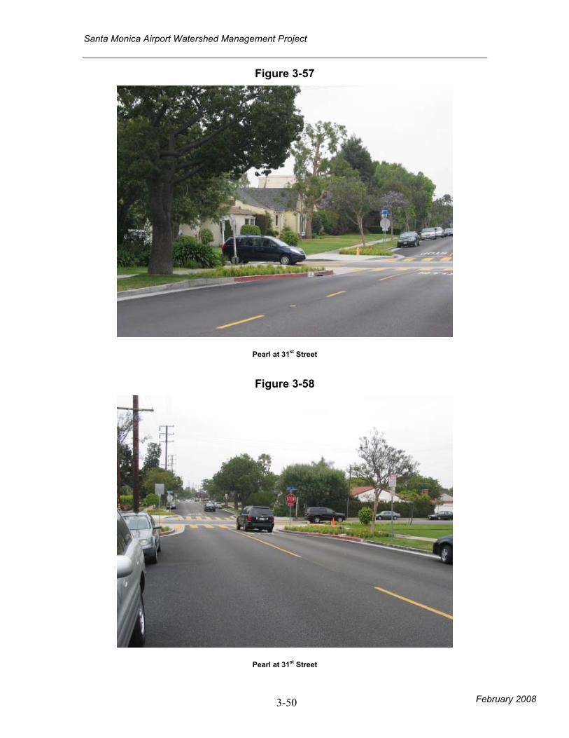
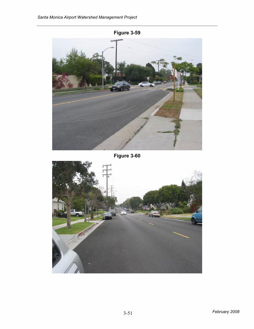
(Figure 3-18, 3-24, 3-25, 3-56, 3-57, 3-58,
3-59, 3-64, 3-65)
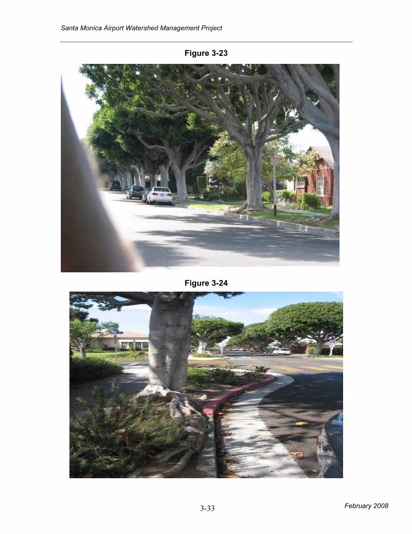
• Landscaping augmented with bioretention cells for
infiltration and storm water treatment along streets
and on residential properties. (Figure 3-23, 3-26)
• Combine traffic calming vegetation with
infiltration/bioretention areas (Figure 3-21, 3-22,
3-78)
• Curb extensions throughout neighborhood streets.
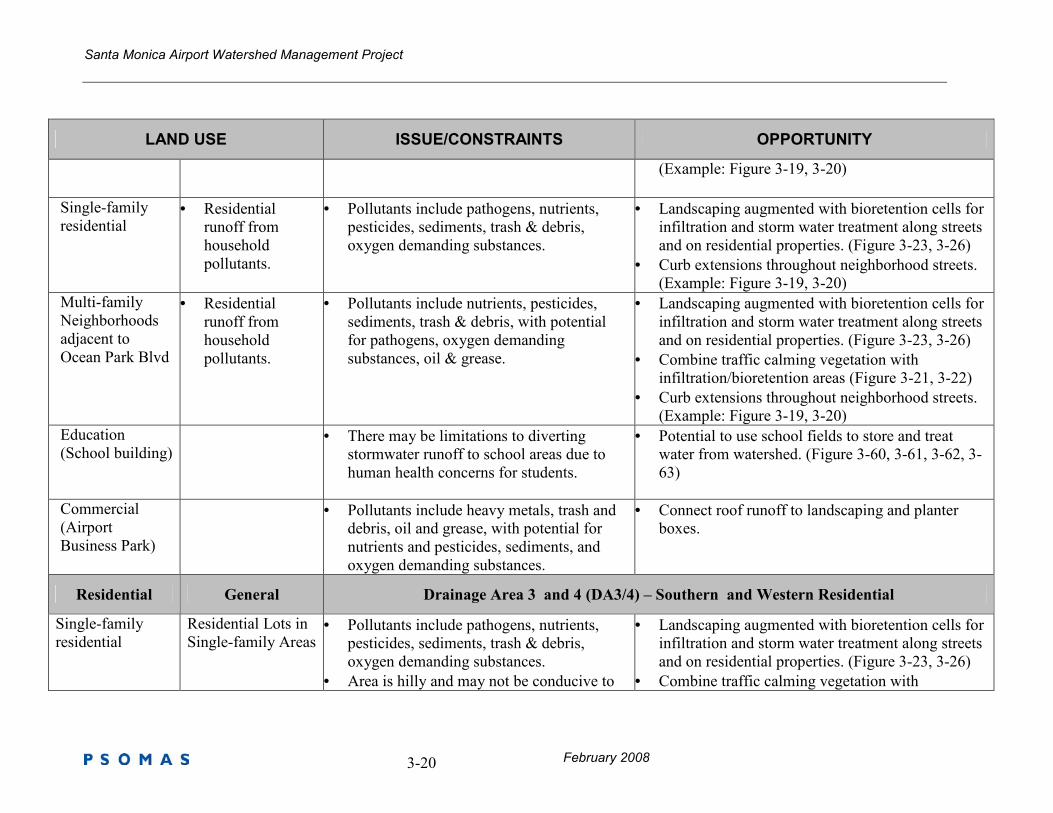
Santa Monica Airport Watershed Management Project
February 2008 3-20
LAND USE ISSUE/CONSTRAINTS OPPORTUNITY
(Example: Figure 3-19, 3-20)
Single-family
residential
• Residential
runoff from
household
pollutants.
• Pollutants include pathogens, nutrients,
pesticides, sediments, trash & debris,
oxygen demanding substances.
• Landscaping augmented with bioretention cells for
infiltration and storm water treatment along streets
and on residential properties. (Figure 3-23, 3-26)
• Curb extensions throughout neighborhood streets.
(Example: Figure 3-19, 3-20)
Multi-family
Neighborhoods
adjacent to
Ocean Park Blvd
• Residential
runoff from
household
pollutants.
• Pollutants include nutrients, pesticides,
sediments, trash & debris, with potential
for pathogens, oxygen demanding
substances, oil & grease.
• Landscaping augmented with bioretention cells for
infiltration and storm water treatment along streets
and on residential properties. (Figure 3-23, 3-26)
• Combine traffic calming vegetation with
infiltration/bioretention areas (Figure 3-21, 3-22)
• Curb extensions throughout neighborhood streets.
(Example: Figure 3-19, 3-20)
Education
(School building)
• There may be limitations to diverting
stormwater runoff to school areas due to
human health concerns for students.
• Potential to use school fields to store and treat
water from watershed. (Figure 3-60, 3-61, 3-62, 3-
63)
Commercial
(Airport
Business Park)
• Pollutants include heavy metals, trash and
debris, oil and grease, with potential for
nutrients and pesticides, sediments, and
oxygen demanding substances.
• Connect roof runoff to landscaping and planter
boxes.
Residential General Drainage Area 3 and 4 (DA3/4) – Southern and Western Residential
Single-family
residential
Residential Lots in
Single-family Areas • Pollutants include pathogens, nutrients,
pesticides, sediments, trash & debris,
oxygen demanding substances.
• Area is hilly and may not be conducive to
• Landscaping augmented with bioretention cells for
infiltration and storm water treatment along streets
and on residential properties. (Figure 3-23, 3-26)
• Combine traffic calming vegetation with
Santa Monica Airport Watershed Management Project
February 2008 3-21
LAND USE ISSUE/CONSTRAINTS OPPORTUNITY
treatment approaches infiltration/bioretention areas (Figure 3-21, 3-22,
3-78)
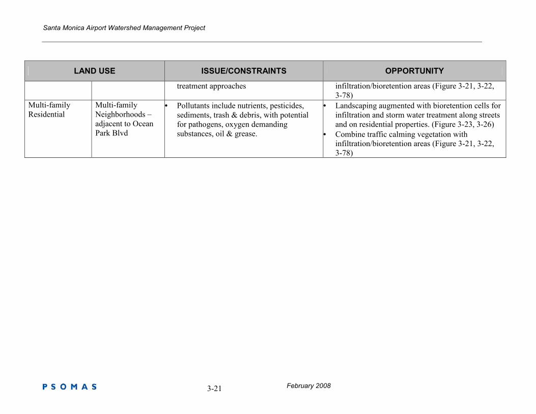
Multi-family
Residential
Multi-family
Neighborhoods –
adjacent to Ocean
Park Blvd
• Pollutants include nutrients, pesticides,
sediments, trash & debris, with potential
for pathogens, oxygen demanding
substances, oil & grease.
• Landscaping augmented with bioretention cells for
infiltration and storm water treatment along streets
and on residential properties. (Figure 3-23, 3-26)
• Combine traffic calming vegetation with
infiltration/bioretention areas (Figure 3-21, 3-22,
3-78)
Santa Monica Airport Watershed Management Project
February 2008 3-22
LAND USE ISSUE/CONSTRAINTS OPPORTUNITY
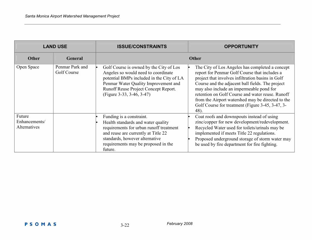
Other General Other
Open Space Penmar Park and
Golf Course • Golf Course is owned by the City of Los
Angeles so would need to coordinate
potential BMPs included in the City of LA
Penmar Water Quality Improvement and
Runoff Reuse Project Concept Report.
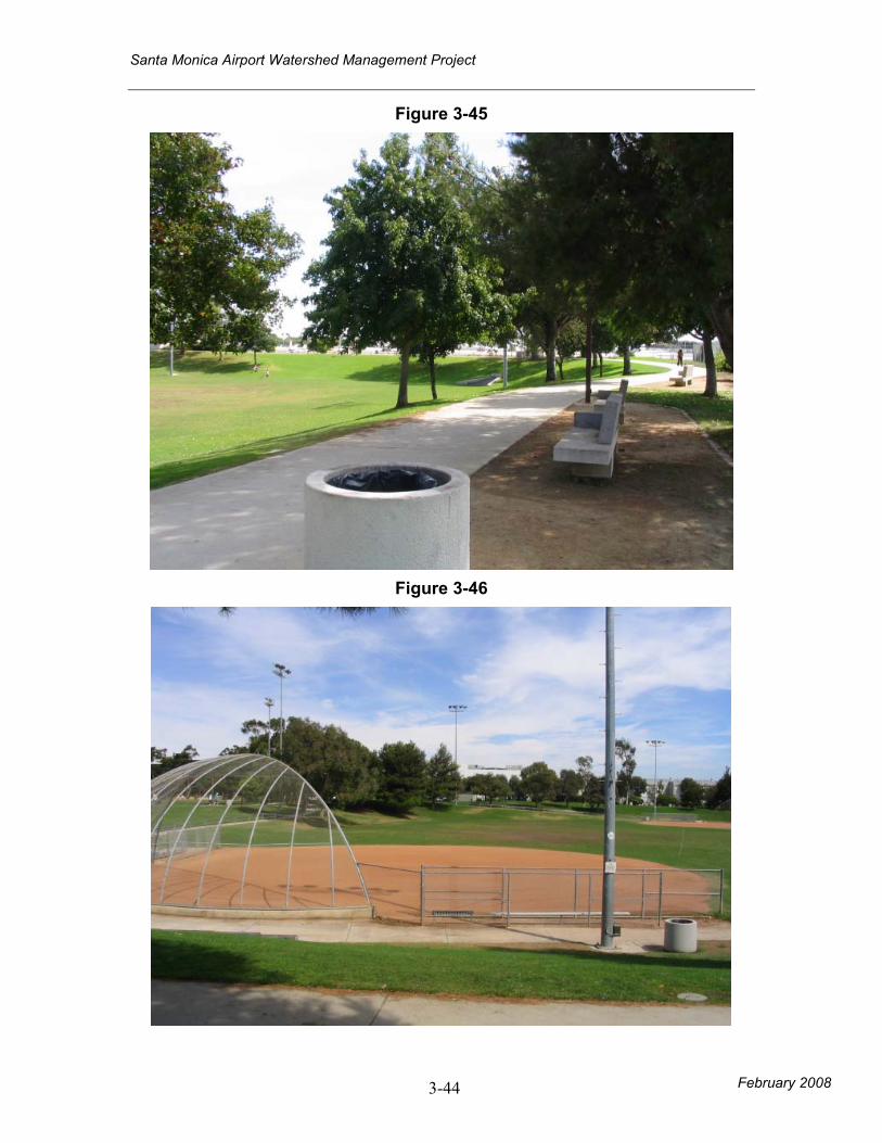
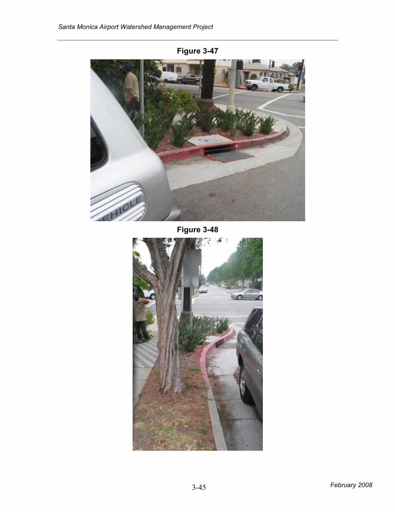
(Figure 3-33, 3-46, 3-47)
• The City of Los Angeles has completed a concept
report for Penmar Golf Course that includes a
project that involves infiltration basins in Golf
Course and the adjacent ball fields. The project
may also include an impermeable pond for
retention on Golf Course and water reuse. Runoff
from the Airport watershed may be directed to the
Golf Course for treatment (Figure 3-45, 3-47, 3-
48).
Future
Enhancements/
Alternatives
• Funding is a constraint.
• Health standards and water quality
requirements for urban runoff treatment
and reuse are currently at Title 22
standards, however alternative
requirements may be proposed in the
future.
• Coat roofs and downspouts instead of using
zinc/copper for new development/redevelopment.
• Recycled Water used for toilets/urinals may be
implemented if meets Title 22 regulations.
• Proposed underground storage of storm water may
be used by fire department for fire fighting.
Santa Monica Airport Watershed Management Project
3-23 February 2008
Figure 3-5
Figure 3-6
Santa Monica Airport Watershed Management Project
February 2008 3-24
Figure 3-7
Figure 3-8
Santa Monica Airport Watershed Management Project
February 2008 3-25
Figure 3-9
Figure 3-10
Santa Monica Airport Watershed Management Project
February 2008 3-26
Figure 3-11
Figure 3-12
Santa Monica Airport Watershed Management Project
February 2008 3-27
Figure 3-13
Figure 3-14
Santa Monica Airport Watershed Management Project
February 2008 3-28
Figure 3-15
Possible location for biotention in The Business Park
Figure 3-16
Possible location for biotention in The Business Park
Santa Monica Airport Watershed Management Project
February 2008 3-29
Figure 3-17
Possible location for biotention in The Business Park
Figure 3-18
Santa Monica Airport Watershed Management Project
February 2008 3-30
Figure 3-19
Figure 3-20
Santa Monica Airport Watershed Management Project
February 2008 3-31
Figure 3-21
Santa Monica Airport Watershed Management Project
February 2008 3-32
Figure 3-22
Santa Monica Airport Watershed Management Project
February 2008 3-33
Figure 3-23
Figure 3-24
Santa Monica Airport Watershed Management Project
February 2008 3-34
Figure 3-25
Figure 3-26
Santa Monica Airport Watershed Management Project
February 2008 3-35
Figure 3-27
Figure 3-28
Santa Monica Airport Watershed Management Project
February 2008 3-36
Figure 3-29
Figure 3-30
Santa Monica Airport Watershed Management Project
February 2008 3-37
Figure 3-31
Figure 3-32
Santa Monica Airport Watershed Management Project
February 2008 3-38
Figure 3-33
Figure 3-34
Santa Monica Airport Watershed Management Project
February 2008 3-39
Figure 3-35
Figure 3-36
Santa Monica Airport Watershed Management Project
February 2008 3-40
Figure 3-37
Figure 3-38
Santa Monica Airport Watershed Management Project
February 2008 3-41
Figure 3-39
Figure 3-40
Airport Avenue landscaping
Santa Monica Airport Watershed Management Project
February 2008 3-42
Figure 3-41
Figure 3-42
Santa Monica Airport Watershed Management Project
February 2008 3-43
Figure 3-43
Figure 3-44
Santa Monica Airport Watershed Management Project
February 2008 3-44
Figure 3-45
Figure 3-46
Santa Monica Airport Watershed Management Project
February 2008 3-45
Figure 3-47
Figure 3-48
Santa Monica Airport Watershed Management Project
February 2008 3-46
Figure 3-49
Figure 3-50
Santa Monica Airport Watershed Management Project
February 2008 3-47
Figure 3-51
Figure 3-52
Santa Monica Airport Watershed Management Project
February 2008 3-48
Figure 3-53
Figure 3-54
Santa Monica Airport Watershed Management Project
February 2008 3-49
Figure 3-55
Grant Elementary School on Pearl Street
Figure 3-56
23rd and Pearl Street catch basin, facing west on 23
rd Street
Santa Monica Airport Watershed Management Project
February 2008 3-50
Figure 3-57
Pearl at 31st Street
Figure 3-58
Pearl at 31st Street
Santa Monica Airport Watershed Management Project
February 2008 3-51
Figure 3-59
Figure 3-60
Santa Monica Airport Watershed Management Project
February 2008 3-52
Figure 3-61
Figure 3-62
Santa Monica Airport Watershed Management Project
February 2008 3-53
Figure 3-63
Figure 3-64
Santa Monica Airport Watershed Management Project
February 2008 3-54
Figure 3-65
Figure 3-66
Santa Monica Airport Watershed Management Project
February 2008 3-55
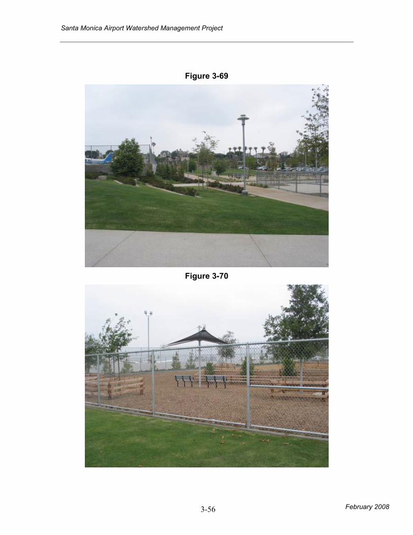
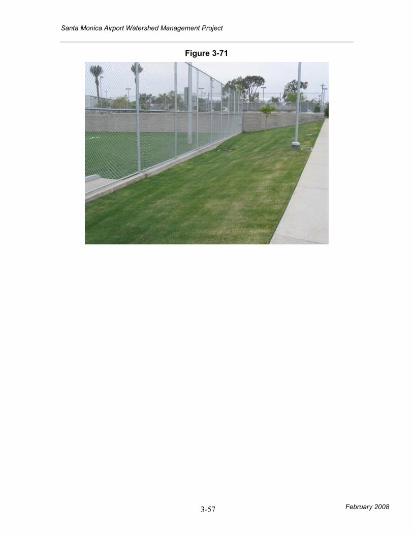
Figure 3-67
Santa Monica College Parking Lot
Figure 3-68
Santa Monica College Parking Lot facing southwest.
Santa Monica Airport Watershed Management Project
February 2008 3-56
Figure 3-69
Figure 3-70
Santa Monica Airport Watershed Management Project
February 2008 3-57
Figure 3-71
Santa Monica Airport Watershed Management Project
February 2008 3-58
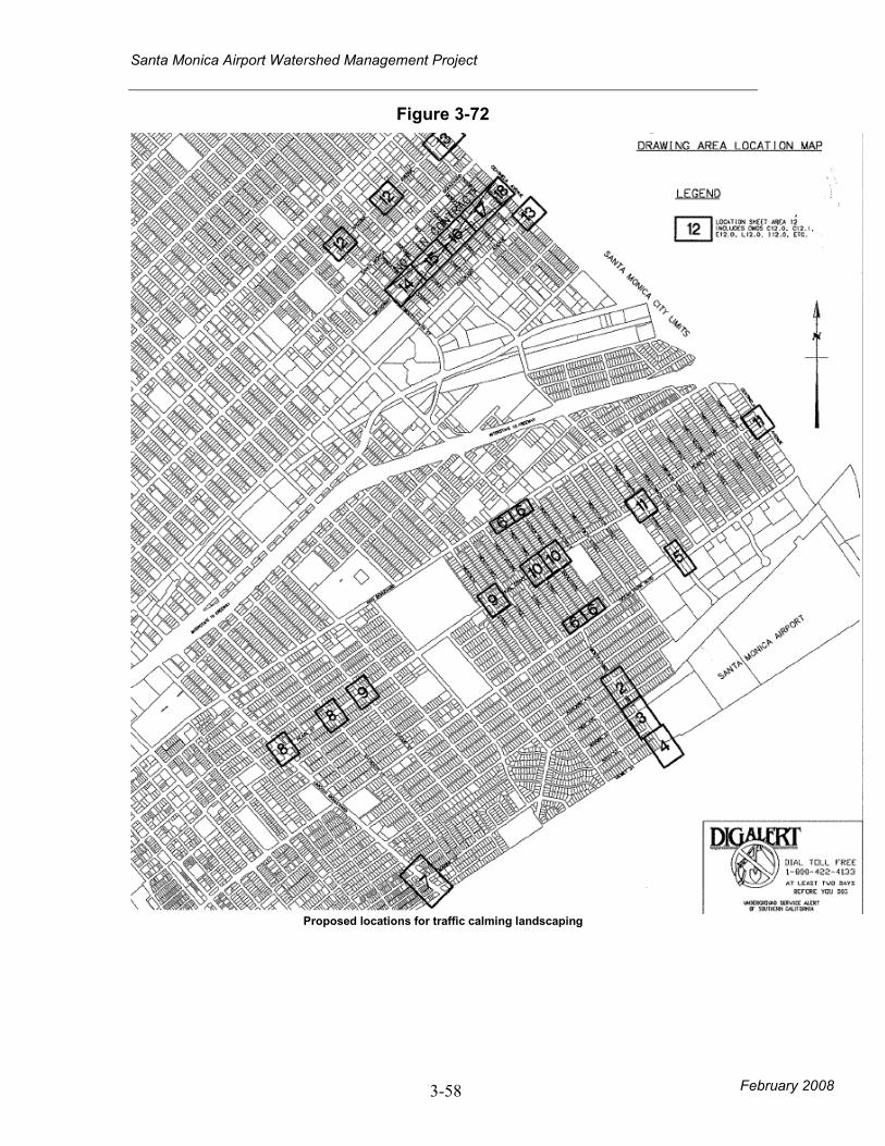
Figure 3-72
Proposed locations for traffic calming landscaping
Santa Monica Airport Watershed Management Project
February 2008 4-59
4.0 BMPs Evaluated
4.1 Stakeholder Workshop
A workshop was held on June 20, 2007 convened by the City. At the workshop, the information included in Appendix E was presented. Based on feedback from the workshop a shortlist of BMPs was chosen for further analysis. These are described in section 4.2 below.
4.2 BMP List for Further Analysis
A total of 10 BMPs was identified in this process that can be categorized into the following areas: Airport Property:
1. Airport Avenue Landscaping 2. SMC Parking Lot Underground Retention 3. Zinc Hangar Runoff Management
Residential Area:
4. Traffic Calming Landscape Modification 5. Pearl Street Rain Gardens 6. Grant Elementary School Underground Retention 7. Clover Park Underground Retention 8. Pico Boulevard Porous Pavement
Business Park:
9. Business Park Bioretention Retrofit Other:
10. Penmar Water Quality Improvement and Runoff Reuse Water quality calculations were performed based on the City of Los Angeles SUSMP (Standard Urban Stormwater Management Plan) methodology to provide design guidance on BMPs. This method determines the peak flow (QPM) or stormwater volume (VPM) that should be mitigated as a result of ¾” of rainfall. Water quality calculations are summarized in Table 4-1 below.
Santa Monica Airport Watershed Management Project
February 2008 4-60
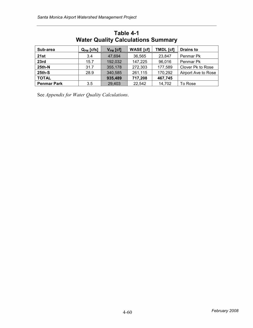
Table 4-1 Water Quality Calculations Summary
Sub-area QPM [cfs] VPM [cf] WASE [cf] TMDL [cf] Drains to
21st 3.4 47,694 36,565 23,847 Penmar Pk
23rd 15.7 192,032 147,225 96,016 Penmar Pk
25th-N 31.7 355,178 272,303 177,589 Clover Pk to Rose
25th-S 28.9 340,585 261,115 170,292 Airport Ave to Rose
TOTAL 935,489 717,208 467,745
Penmar Park 3.5 29,403 22,542 14,702 To Rose
See Appendix for Water Quality Calculations.
Santa Monica Airport Watershed Management Project
February 2008 4-61
4.3 Worksheets and Photos—Feasibility at a Planning Scale
4.3.1 AIRPORT PROPERTY
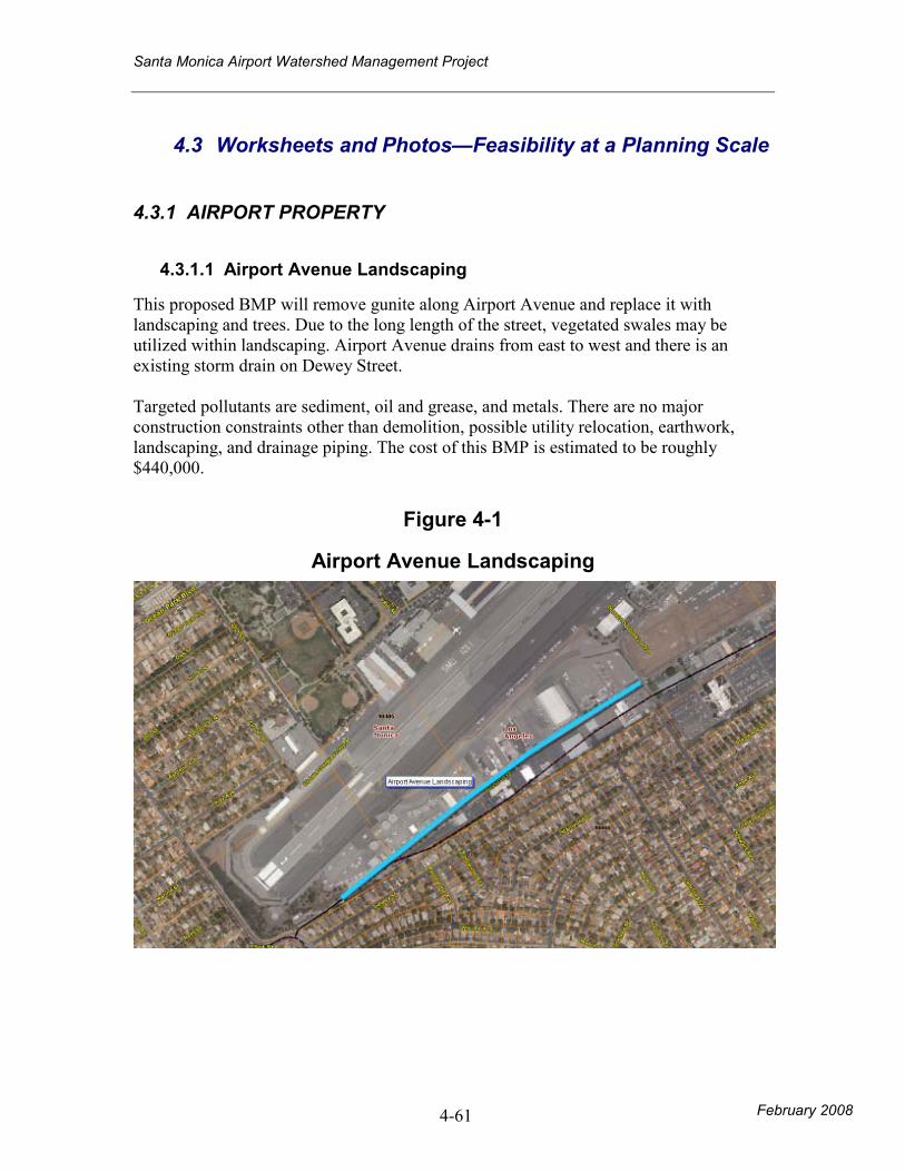
4.3.1.1 Airport Avenue Landscaping
This proposed BMP will remove gunite along Airport Avenue and replace it with landscaping and trees. Due to the long length of the street, vegetated swales may be utilized within landscaping. Airport Avenue drains from east to west and there is an existing storm drain on Dewey Street. Targeted pollutants are sediment, oil and grease, and metals. There are no major construction constraints other than demolition, possible utility relocation, earthwork, landscaping, and drainage piping. The cost of this BMP is estimated to be roughly $440,000.
Figure 4-1
Airport Avenue Landscaping
Santa Monica Airport Watershed Management Project
February 2008 4-62
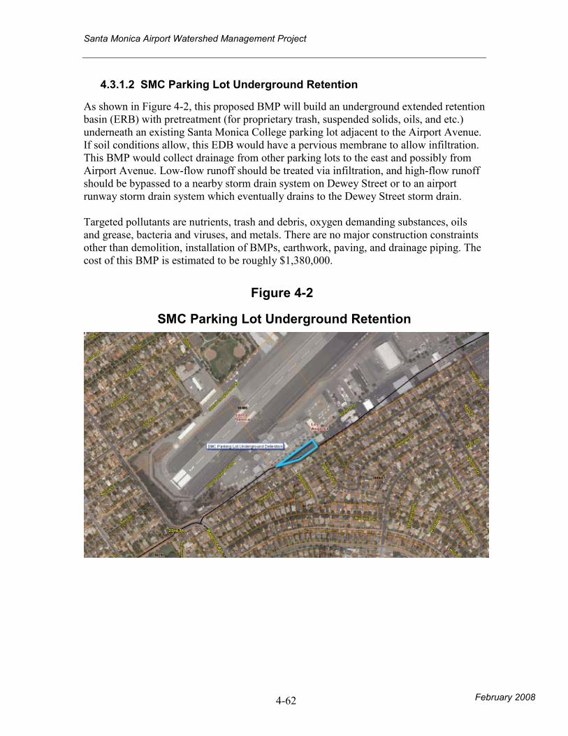
4.3.1.2 SMC Parking Lot Underground Retention
As shown in Figure 4-2, this proposed BMP will build an underground extended retention basin (ERB) with pretreatment (for proprietary trash, suspended solids, oils, and etc.) underneath an existing Santa Monica College parking lot adjacent to the Airport Avenue. If soil conditions allow, this EDB would have a pervious membrane to allow infiltration. This BMP would collect drainage from other parking lots to the east and possibly from Airport Avenue. Low-flow runoff should be treated via infiltration, and high-flow runoff should be bypassed to a nearby storm drain system on Dewey Street or to an airport runway storm drain system which eventually drains to the Dewey Street storm drain. Targeted pollutants are nutrients, trash and debris, oxygen demanding substances, oils and grease, bacteria and viruses, and metals. There are no major construction constraints other than demolition, installation of BMPs, earthwork, paving, and drainage piping. The cost of this BMP is estimated to be roughly $1,380,000.
Figure 4-2
SMC Parking Lot Underground Retention
Santa Monica Airport Watershed Management Project
February 2008 4-63
4.3.1.3 Zinc Hangar Management
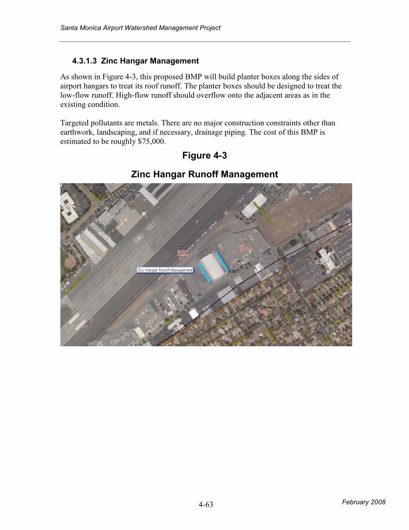
As shown in Figure 4-3, this proposed BMP will build planter boxes along the sides of airport hangars to treat its roof runoff. The planter boxes should be designed to treat the low-flow runoff. High-flow runoff should overflow onto the adjacent areas as in the existing condition. Targeted pollutants are metals. There are no major construction constraints other than earthwork, landscaping, and if necessary, drainage piping. The cost of this BMP is estimated to be roughly $75,000.
Figure 4-3
Zinc Hangar Runoff Management
Santa Monica Airport Watershed Management Project
February 2008 4-64
4.3.2 RESIDENTIAL AREA
4.3.2.1 Traffic Calming Landscape Modification
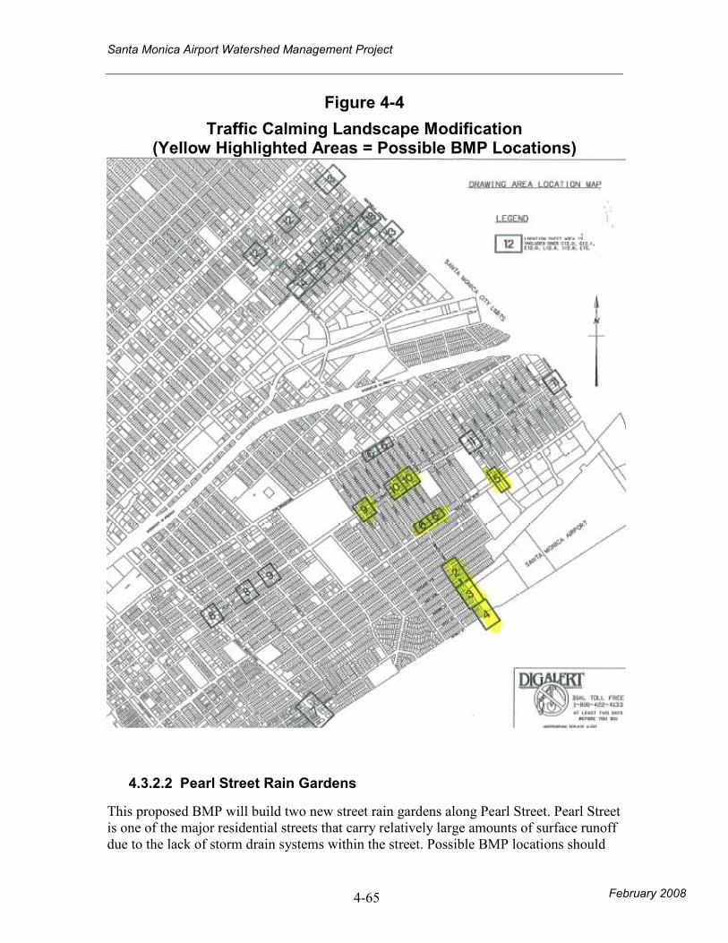
As shown in Figure 4-4, this proposed BMP will modify existing traffic calming devices into street rain gardens. The existing landscape will be sunken into the ground to provide storage for water quality treatment. Curb cuts should be made so that the street surface flow would be directed into the rain gardens. The depth of depression for each rain garden should be determined by the water quality mitigation volume (VPM) of its tributary area. There are total of nine possible locations identified in Figure 4-4. Targeted pollutants are sediment, oil and grease, and metals. There are no major construction constraints other than earthwork, landscaping, and if necessary, drainage piping and relocation of existing utilities. The cost of this BMP (for all nine locations) is estimated to be roughly $450,000.
Santa Monica Airport Watershed Management Project
February 2008 4-65
Figure 4-4
Traffic Calming Landscape Modification (Yellow Highlighted Areas = Possible BMP Locations)
4.3.2.2 Pearl Street Rain Gardens
This proposed BMP will build two new street rain gardens along Pearl Street. Pearl Street is one of the major residential streets that carry relatively large amounts of surface runoff due to the lack of storm drain systems within the street. Possible BMP locations should
Santa Monica Airport Watershed Management Project
February 2008 4-66
be identified so that the proposed location is strategic from a drainage point of view (i.e. downstream portion of street where surface flow is most concentrated) and is acceptable in terms of traffic and safety. Targeted pollutants are sediment, oil and grease, and metals. There are no major construction constraints other than earthwork, possible utility relocation, landscaping, and if necessary, drainage piping. The cost of this BMP is estimated to be roughly $200,000.
4.3.2.3 Grant Elementary School Underground Retention
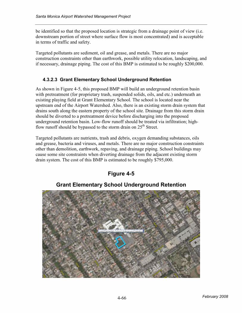
As shown in Figure 4-5, this proposed BMP will build an underground retention basin with pretreatment (for proprietary trash, suspended solids, oils, and etc.) underneath an existing playing field at Grant Elementary School. The school is located near the upstream end of the Airport Watershed. Also, there is an existing storm drain system that drains south along the eastern property of the school site. Drainage from this storm drain should be diverted to a pretreatment device before discharging into the proposed underground retention basin. Low-flow runoff should be treated via infiltration; high-flow runoff should be bypassed to the storm drain on 25th Street. Targeted pollutants are nutrients, trash and debris, oxygen demanding substances, oils and grease, bacteria and viruses, and metals. There are no major construction constraints other than demolition, earthwork, repaving, and drainage piping. School buildings may cause some site constraints when diverting drainage from the adjacent existing storm drain system. The cost of this BMP is estimated to be roughly $795,000.
Figure 4-5
Grant Elementary School Underground Retention
Santa Monica Airport Watershed Management Project
February 2008 4-67
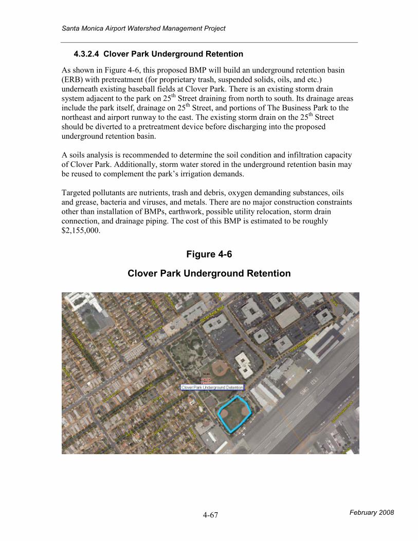
4.3.2.4 Clover Park Underground Retention
As shown in Figure 4-6, this proposed BMP will build an underground retention basin (ERB) with pretreatment (for proprietary trash, suspended solids, oils, and etc.) underneath existing baseball fields at Clover Park. There is an existing storm drain system adjacent to the park on 25th Street draining from north to south. Its drainage areas include the park itself, drainage on 25th Street, and portions of The Business Park to the northeast and airport runway to the east. The existing storm drain on the 25th Street should be diverted to a pretreatment device before discharging into the proposed underground retention basin. A soils analysis is recommended to determine the soil condition and infiltration capacity of Clover Park. Additionally, storm water stored in the underground retention basin may be reused to complement the park’s irrigation demands. Targeted pollutants are nutrients, trash and debris, oxygen demanding substances, oils and grease, bacteria and viruses, and metals. There are no major construction constraints other than installation of BMPs, earthwork, possible utility relocation, storm drain connection, and drainage piping. The cost of this BMP is estimated to be roughly $2,155,000.
Figure 4-6
Clover Park Underground Retention
Santa Monica Airport Watershed Management Project
February 2008 4-68
4.3.2.5 Pico Boulevard Porous Pavement
This proposed BMP will repave pedestrian crossings at one or more of the intersections along Pico Boulevard with porous pavement. Along Pico Boulevard, stormwater runoff flows from east to west at the sides of the street via gutter usually. Thus, porous pavements at the pedestrian crossings would be ineffective since it would have minimal contact area with the runoff. Targeted pollutants are sediment, oils and grease, and metals. There are no major construction constraints other than paving. The cost of this BMP is estimated to be roughly $180,000.
Santa Monica Airport Watershed Management Project
February 2008 4-69
4.3.3 BUSINESS PARK
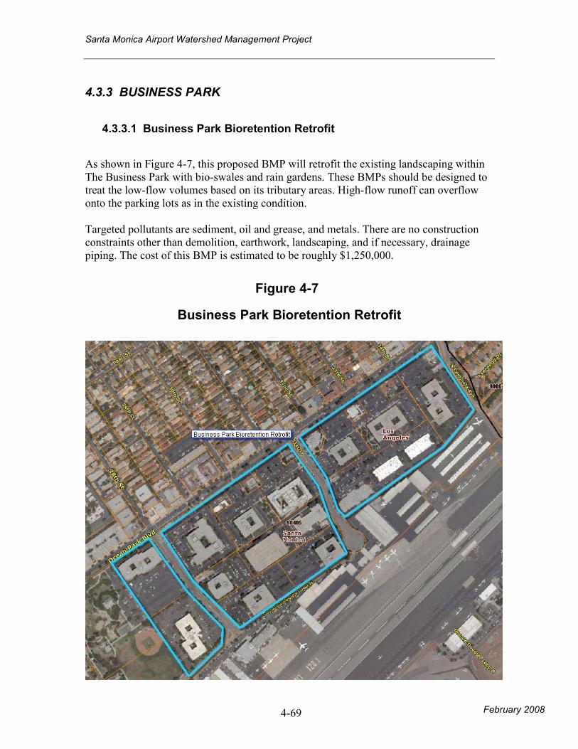
4.3.3.1 Business Park Bioretention Retrofit
As shown in Figure 4-7, this proposed BMP will retrofit the existing landscaping within The Business Park with bio-swales and rain gardens. These BMPs should be designed to treat the low-flow volumes based on its tributary areas. High-flow runoff can overflow onto the parking lots as in the existing condition. Targeted pollutants are sediment, oil and grease, and metals. There are no construction constraints other than demolition, earthwork, landscaping, and if necessary, drainage piping. The cost of this BMP is estimated to be roughly $1,250,000.
Figure 4-7
Business Park Bioretention Retrofit
Santa Monica Airport Watershed Management Project
February 2008 4-70
4.3.4 OTHER
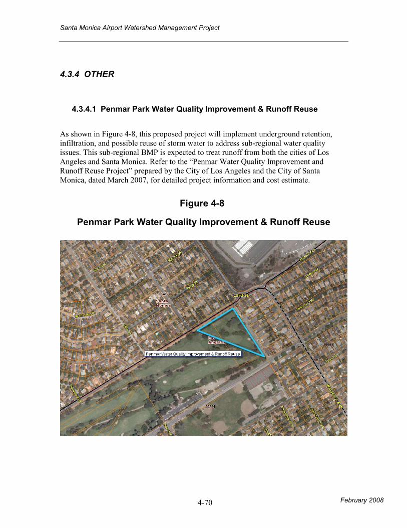
4.3.4.1 Penmar Park Water Quality Improvement & Runoff Reuse
As shown in Figure 4-8, this proposed project will implement underground retention, infiltration, and possible reuse of storm water to address sub-regional water quality issues. This sub-regional BMP is expected to treat runoff from both the cities of Los Angeles and Santa Monica. Refer to the “Penmar Water Quality Improvement and Runoff Reuse Project” prepared by the City of Los Angeles and the City of Santa Monica, dated March 2007, for detailed project information and cost estimate.
Figure 4-8
Penmar Park Water Quality Improvement & Runoff Reuse
Santa Monica Airport Watershed Management Project
February 2008 6-71
4.4 Amounts and values of Avoided Potable Water Use
In the scenarios above, avoided potable water use as a result of reuse occurs within the City of Los Angeles at Penmar Golf Course. As a result, no savings in dollars to the City of Santa Monica will occur.
5.0 Next Steps
5.1 Capital Improvement Plan
Based on costs of BMPs, work with City staff to allocate costs by fiscal year.
6.0 Conclusion
The intent of this report is to identify possible BMPs that will help improve the overall storm water quality of the Airport Watershed in the City of Santa Monica. Total of ten BMPs were identified and analyzed in terms of construction constraints and costs, pollutants targeted, and site feasibility at a planning level. A detailed engineering analysis is recommended for prospective BMPs to determine design-specific information. A cost-benefit analysis should be conducted for the proposed BMPs to help determine priority for each of the BMPs. The cost-benefit analysis should take into consideration, at the least, the drainage area, capacity, and cost of the BMPs. The prioritizing of BMPs should consider, at the least, the results of the cost-benefit analysis, existing BMPs, financial and timing logistics, and the City’s needs.
It is important to note that the entire Airport Watershed is one of the tributary areas of the Penmar Water Quality Improvement and Runoff Reuse Project, which is a sub-regional storm water quality improvement project. Thus, the Penmar Project is designed to mitigate much of the Airport Watershed’s storm water runoff (VPM). However, implementation of the recommended BMPs would improve the storm water quality closer to the pollutant source. Moreover, implementation of the recommended BMPs would likely reduce the design capacity and construction cost of the Penmar Project. Therefore, additional study is recommended to analyze the impacts of proposed BMPs on the design and cost of the Penmar Project.
Santa Monica Airport Watershed Management Project
6-1 February 2008
APPENDIX A
Technical Memorandum
Santa Monica Airport Watershed Management Project
APPENDIX B Penmar Water Quality Improvement and Runoff Project

Santa Monica Airport Watershed Management Project
APPENDIX C
County Department of Health Services Health Standards

Santa Monica Airport Watershed Management Project
February 2008
APPENDIX D Recommended BMPs Design Performance
Santa Monica Airport Watershed Management Project
February 2008
APPENDIX E Workshop Presentation – June 20, 2007