Embed Size (px)
Citation preview
Satellite Data and Oil Spill Modeling to Serve the Energy Sector
Han Wensink, Oliver Muellenhoff and Jean Paul Lindeboom
Frascati , Italy8th December 2011
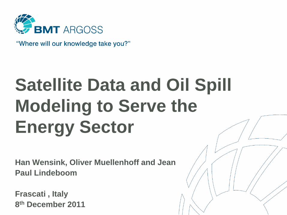
Offshore oil pollution preparedness, monitoring and response
Content
• Introduction BMT ARGOSS
• Phases and Market Requirements
• Oil Pollution Preparedness & Response
• BMT ARGOSS Support Centre & Examples
• Observations
• Recommendations of Working Team
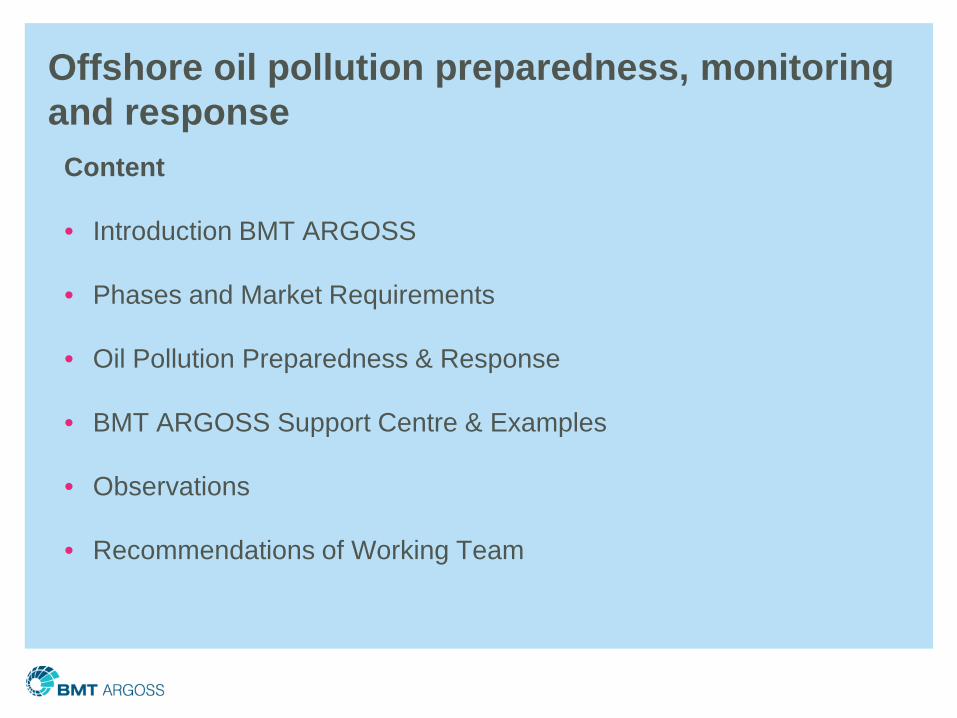
Ports & Environment
Shipping&
Environment
Energy & environment
Solutions where the environment have impact on human activities/operations or where human activities/operations have impact on the environment
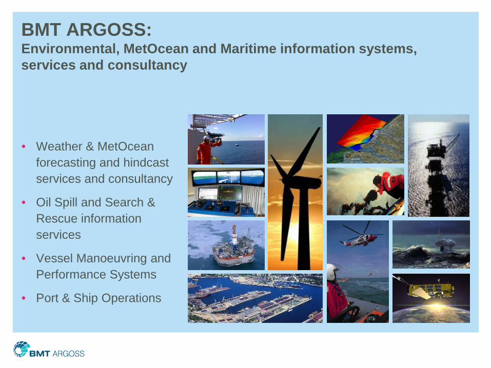
• Weather & MetOceanforecasting and hindcastservices and consultancy
• Oil Spill and Search & Rescue information services
• Vessel Manoeuvring and Performance Systems
• Port & Ship Operations
BMT ARGOSS: Environmental, MetOcean and Maritime information systems, services and consultancy
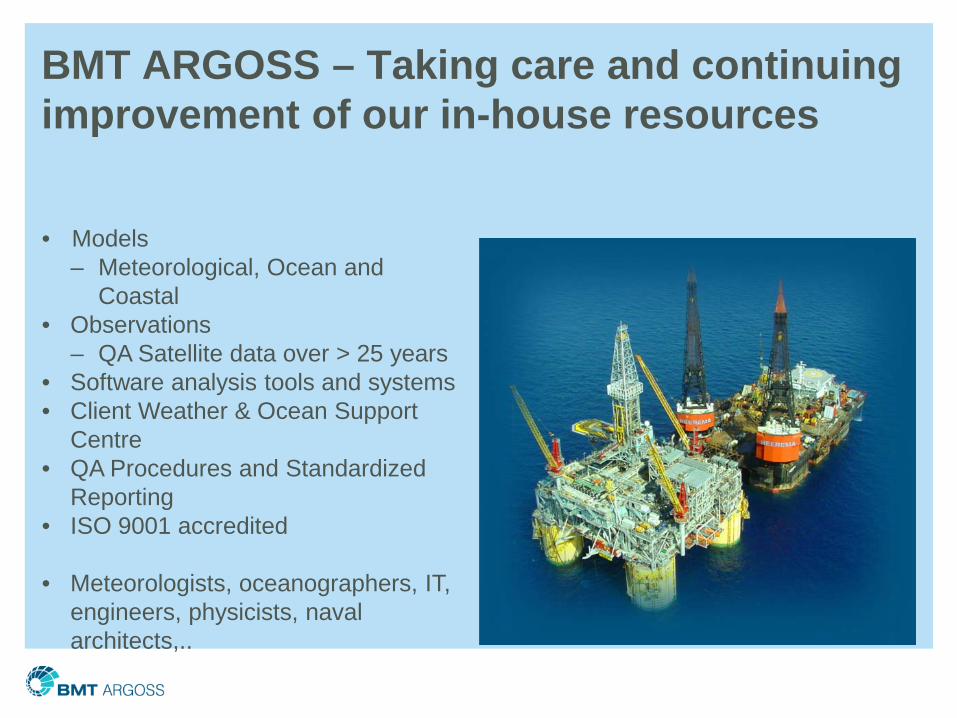
BMT ARGOSS – Taking care and continuing improvement of our in-house resources
• Models – Meteorological, Ocean and
Coastal• Observations
– QA Satellite data over > 25 years• Software analysis tools and systems• Client Weather & Ocean Support
Centre• QA Procedures and Standardized
Reporting• ISO 9001 accredited
• Meteorologists, oceanographers, IT, engineers, physicists, naval architects,..
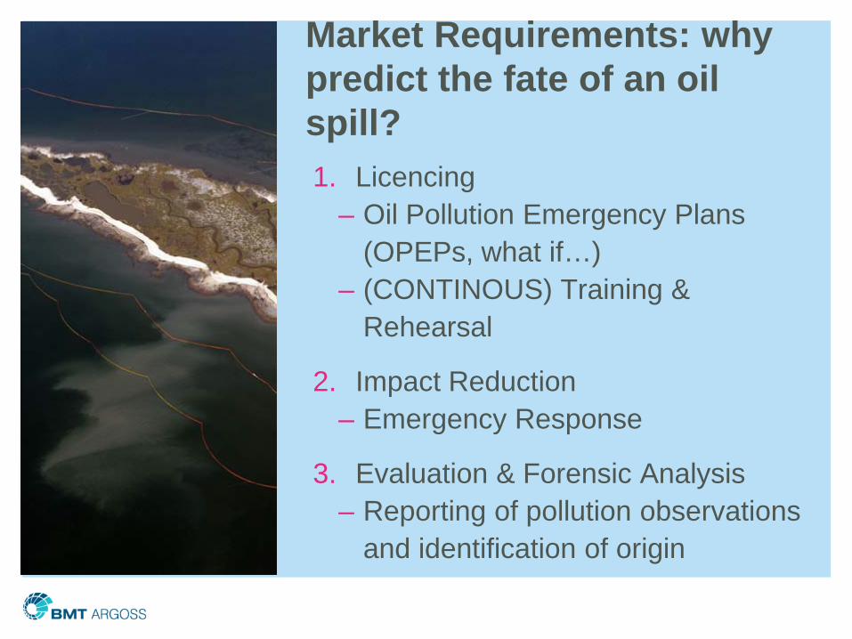
Market Requirements: why predict the fate of an oil spill?1. Licencing
– Oil Pollution Emergency Plans (OPEPs, what if…)
– (CONTINOUS) Training & Rehearsal
2. Impact Reduction – Emergency Response
3. Evaluation & Forensic Analysis– Reporting of pollution observations
and identification of origin
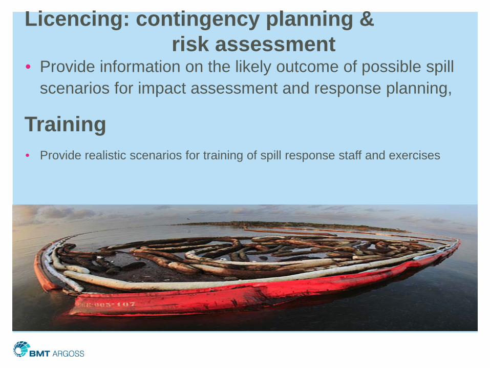
Licencing: contingency planning &risk assessment
• Provide information on the likely outcome of possible spill scenarios for impact assessment and response planning,
Training• Provide realistic scenarios for training of spill response staff and exercises
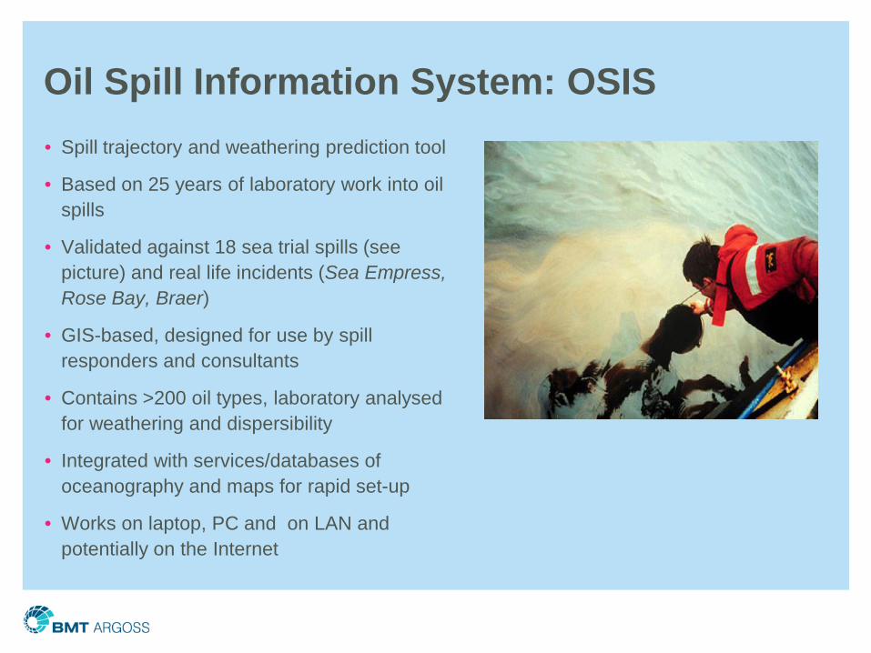
Oil Spill Information System: OSIS• Spill trajectory and weathering prediction tool
• Based on 25 years of laboratory work into oil spills
• Validated against 18 sea trial spills (see picture) and real life incidents (Sea Empress, Rose Bay, Braer)
• GIS-based, designed for use by spill responders and consultants
• Contains >200 oil types, laboratory analysed for weathering and dispersibility
• Integrated with services/databases of oceanography and maps for rapid set-up
• Works on laptop, PC and on LAN and potentially on the Internet
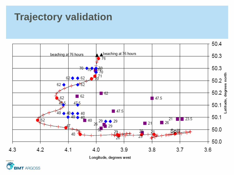
Trajectory validation
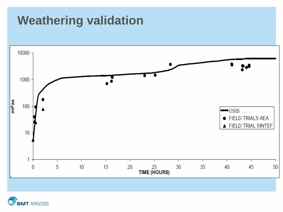
Weathering validation
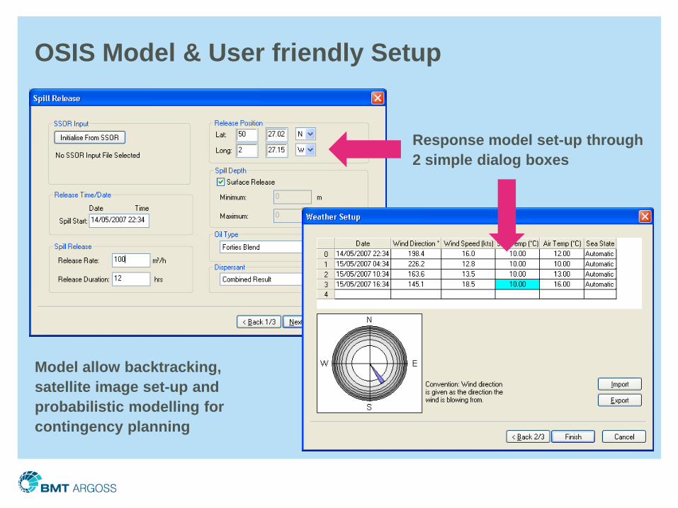
OSIS Model & User friendly Setup
Response model set-up through 2 simple dialog boxes
Model allow backtracking, satellite image set-up and probabilistic modelling for contingency planning
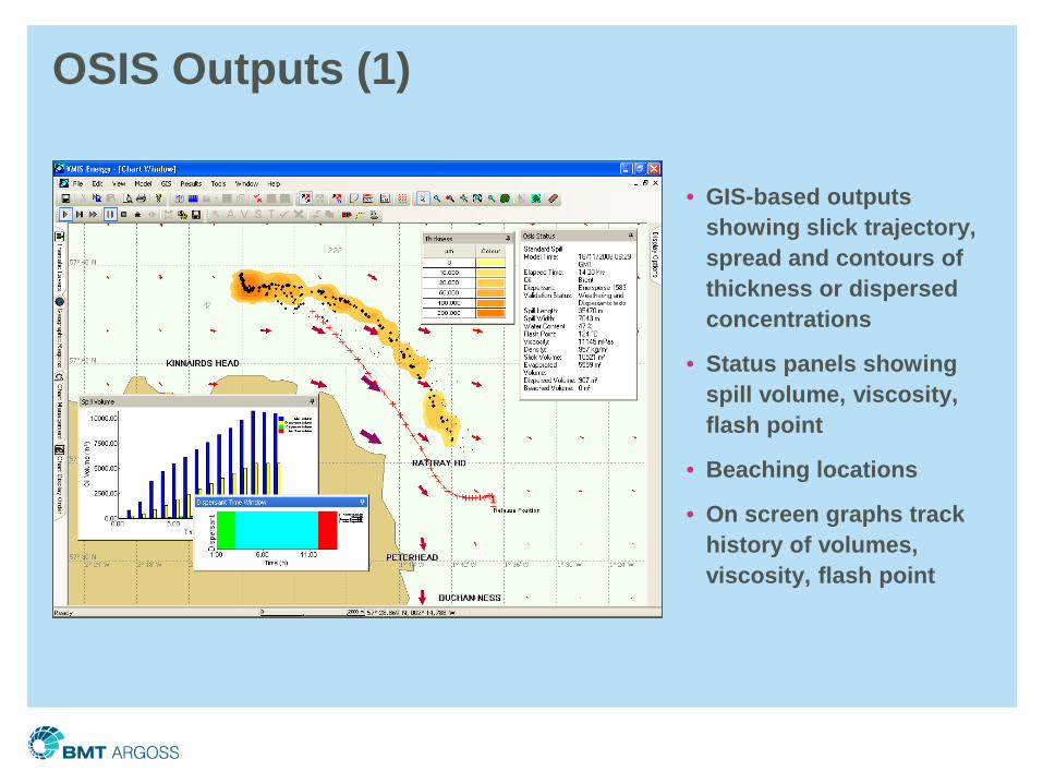
OSIS Outputs (1)
• GIS-based outputs showing slick trajectory, spread and contours of thickness or dispersed concentrations
• Status panels showing spill volume, viscosity, flash point
• Beaching locations
• On screen graphs track history of volumes, viscosity, flash point
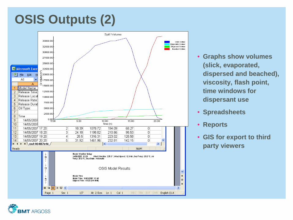
OSIS Outputs (2)
• Graphs show volumes (slick, evaporated, dispersed and beached), viscosity, flash point, time windows for dispersant use
• Spreadsheets
• Reports
• GIS for export to third party viewers
More than 80 active OSIS Licences Globally
• Oil companies, including:• BP (UK, Caspian, Black Sea, Indonesia)• Shell (UK, Philippines, Malaysia)• Total (UK, Indonesia)• Talisman (UK)• ConocoPhillips (UK)
• Government and regional authorities, including: • UK (DTI and Maritime and Coastguard Agency)• MEMAC (Iran, Iraq, Kuwait, Saudi Arabia, Qatar, Bahrain, UAE)• Malaysian Government• California Maritime Academy
• Spill responders and consultancies, including:• Oil Spill Response Ltd• Briggs Group• RPS Energy • Castalia Ecolmar (Italy)• CP&E (Brazil)
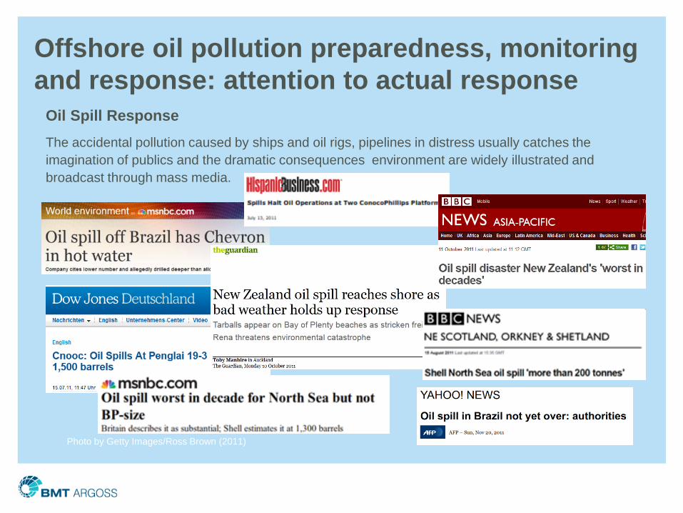
Offshore oil pollution preparedness, monitoring and response: attention to actual response
Oil Spill ResponseThe accidental pollution caused by ships and oil rigs, pipelines in distress usually catches the imagination of publics and the dramatic consequences environment are widely illustrated and broadcast through mass media.
Photo by Getty Images/Ross Brown (2011)
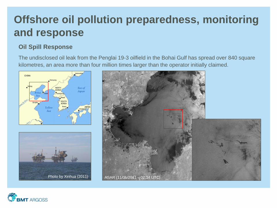
Oil Spill ResponseThe undisclosed oil leak from the Penglai 19-3 oilfield in the Bohai Gulf has spread over 840 square kilometres, an area more than four million times larger than the operator initially claimed.
Offshore oil pollution preparedness, monitoring and response
ASAR (11/06/2011 – 02:14 UTC)Photo by Xinhua (2011)
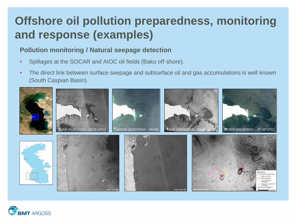
Offshore oil pollution preparedness, monitoring and response (examples)
Pollution monitoring / Natural seepage detection• Spillages at the SOCAR and AIOC oil fields (Baku off-shore).
• The direct link between surface seepage and subsurface oil and gas accumulations is well known (South Caspian Basin).
ASAR (31/07/2010 - 18:31 UTC) ASAR (04/08/2010 – 06:47 UTC)MODIS (31/07/2010 – 09:45) MODIS (04/08/2010 – 07:40 UTC)
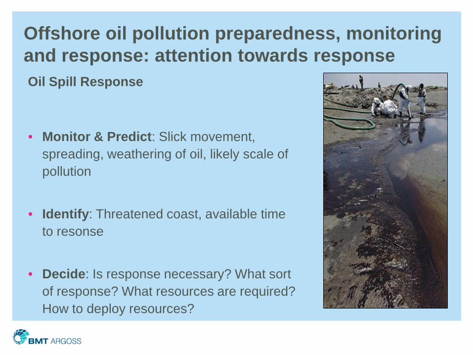
Offshore oil pollution preparedness, monitoring and response: attention towards responseOil Spill Response
• Monitor & Predict: Slick movement, spreading, weathering of oil, likely scale of pollution
• Identify: Threatened coast, available time to resonse
• Decide: Is response necessary? What sort of response? What resources are required? How to deploy resources?
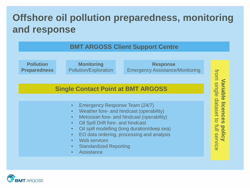
Offshore oil pollution preparedness, monitoring and response
BMT ARGOSS Client Support Centre
PollutionPreparedness
MonitoringPollution/Exploration
ResponseEmergency Assistance/Monitoring
Variable licences policyfrom
single dataset to full service
Single Contact Point at BMT ARGOSS
• Emergency Response Team (24/7)• Weather fore- and hindcast (operability)• Metocean fore- and hindcast (operability)• Oil Spill Drift fore- and hindcast• Oil spill modelling (long duration/deep sea)• EO data ordering, processing and analysis• Web services• Standardized Reporting• Assistance
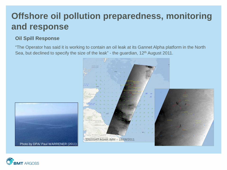
Oil Spill Response“The Operator has said it is working to contain an oil leak at its Gannet Alpha platform in the North Sea, but declined to specify the size of the leak” - the guardian, 12th August 2011.
Offshore oil pollution preparedness, monitoring and response
Photo by DPA/ Paul WARRENER (2011)ENVISAT ASAR IMM – 18/08/2011
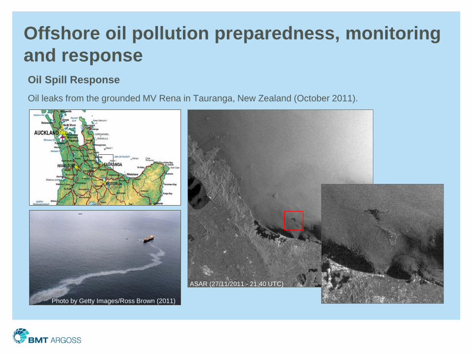
Offshore oil pollution preparedness, monitoring and responseOil Spill ResponseOil leaks from the grounded MV Rena in Tauranga, New Zealand (October 2011).
Photo by Getty Images/Ross Brown (2011)
ASAR (27/11/2011 - 21:40 UTC)
• Market Requirements are moving beyond OPEPS (Licencing)
• A general consensus exist in the industry to improve “oil spill services”.
• Initiatives have been taken by different players in the industry and regulators to improve oil spill services;
• First Working Teams (players from the oil and gas industry, transportation industry (ports , vessel charterers & operators as well as service industry(consultants)) have met to develop a working plan to improve oil spill services.
• A User driven priority plan has been developed and is under discussion
Observations
• Modelling:
• Integrated and improved subsea oil release modules
• Oil In Ice module
• Optimized models to enable long-term spill runs
• Common Picture for Operations & Response
• Improved Metocean linkages including live access to online sources
• Enhanced communications & displays
• (NRT) Satellite Data
• More up to data information on oil type
• New Business Models for Services
Recommendations of Working Team
Thank you
Han Wensink
BMT ARGOSS
Marknesse, Southampton, Abderdeen, Gdansk and Atyrau
www.bmtargoss.com