Embed Size (px)
Citation preview
Geodetic Research Laboratory • Department of Geodesy and Geomatics Engineering • University of New Brunswick
RBL/NSTS30 Jun. 01
Satellite Navigation:GPS Modernization and R&D in
the Academic Sector
Richard B. Langley
National Sector Team for Space Annual Meeting, Canadian Space AgencySt-Hubert, QC. • 3-4 July 2001
Geodetic Research LaboratoryDepartment of Geodesy and Geomatics Engineering
University of New BrunswickFredericton, N.B.
Geodetic Research Laboratory • Department of Geodesy and Geomatics Engineering • University of New Brunswick
RBL/NSTS30 Jun. 01
Outline
• GPS Weaknesses
• GPS Modernization
• The Shrinking GPS Receiver
• GPS and E-911
• The Future of GPS Technology
• GPS R&D at Canadian Universities
Geodetic Research Laboratory • Department of Geodesy and Geomatics Engineering • University of New Brunswick
RBL/NSTS30 Jun. 01
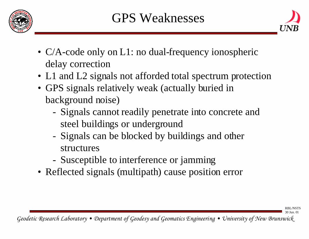
GPS Weaknesses
• C/A-code only on L1: no dual-frequency ionosphericdelay correction
• L1 and L2 signals not afforded total spectrum protection• GPS signals relatively weak (actually buried in
background noise)- Signals cannot readily penetrate into concrete and
steel buildings or underground- Signals can be blocked by buildings and other
structures- Susceptible to interference or jamming
• Reflected signals (multipath) cause position error
Geodetic Research Laboratory • Department of Geodesy and Geomatics Engineering • University of New Brunswick
RBL/NSTS30 Jun. 01
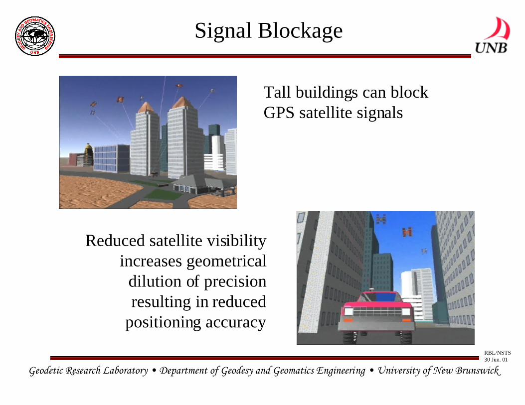
Signal Blockage
Tall buildings can blockGPS satellite signals
Reduced satellite visibilityincreases geometrical
dilution of precisionresulting in reduced
positioning accuracy
Geodetic Research Laboratory • Department of Geodesy and Geomatics Engineering • University of New Brunswick
RBL/NSTS30 Jun. 01
GPS Modernization
• One goal is enhanced capabilities for civil users of GPS
• Civil benefits include:
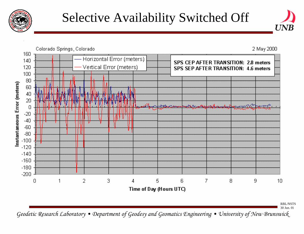
– Selective Availability (SA) turned off on 2 May 2000
– Second civil frequency for ionospheric correction andredundancy
– Third civil signal for “safety of life” applications inprotected spectrum; more robust; also provides highaccuracy and benefits real-time applications
Geodetic Research Laboratory • Department of Geodesy and Geomatics Engineering • University of New Brunswick
RBL/NSTS30 Jun. 01
Selective Availability Switched Off
Geodetic Research Laboratory • Department of Geodesy and Geomatics Engineering • University of New Brunswick
RBL/NSTS30 Jun. 01
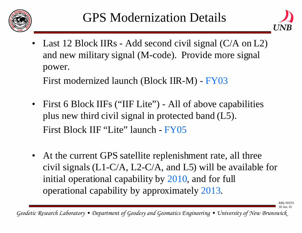
GPS Modernization Details
• Last 12 Block IIRs - Add second civil signal (C/A on L2)and new military signal (M-code). Provide more signalpower.
First modernized launch (Block IIR-M) - FY03
• First 6 Block IIFs (“IIF Lite”) - All of above capabilitiesplus new third civil signal in protected band (L5).
First Block IIF “Lite” launch - FY05
• At the current GPS satellite replenishment rate, all threecivil signals (L1-C/A, L2-C/A, and L5) will be available forinitial operational capability by 2010, and for fulloperational capability by approximately 2013.
Geodetic Research Laboratory • Department of Geodesy and Geomatics Engineering • University of New Brunswick
RBL/NSTS30 Jun. 01
Block IIR Satellite
Geodetic Research Laboratory • Department of Geodesy and Geomatics Engineering • University of New Brunswick
RBL/NSTS30 Jun. 01
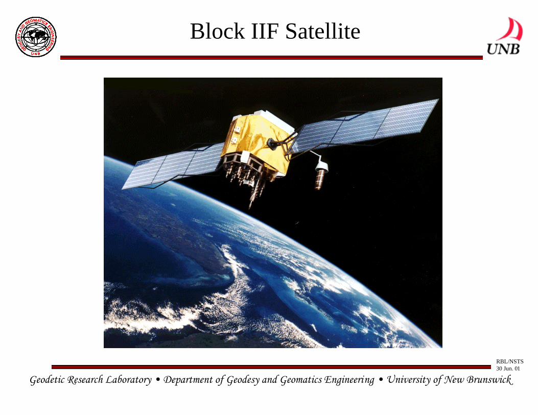
Block IIF Satellite
Geodetic Research Laboratory • Department of Geodesy and Geomatics Engineering • University of New Brunswick
RBL/NSTS30 Jun. 01
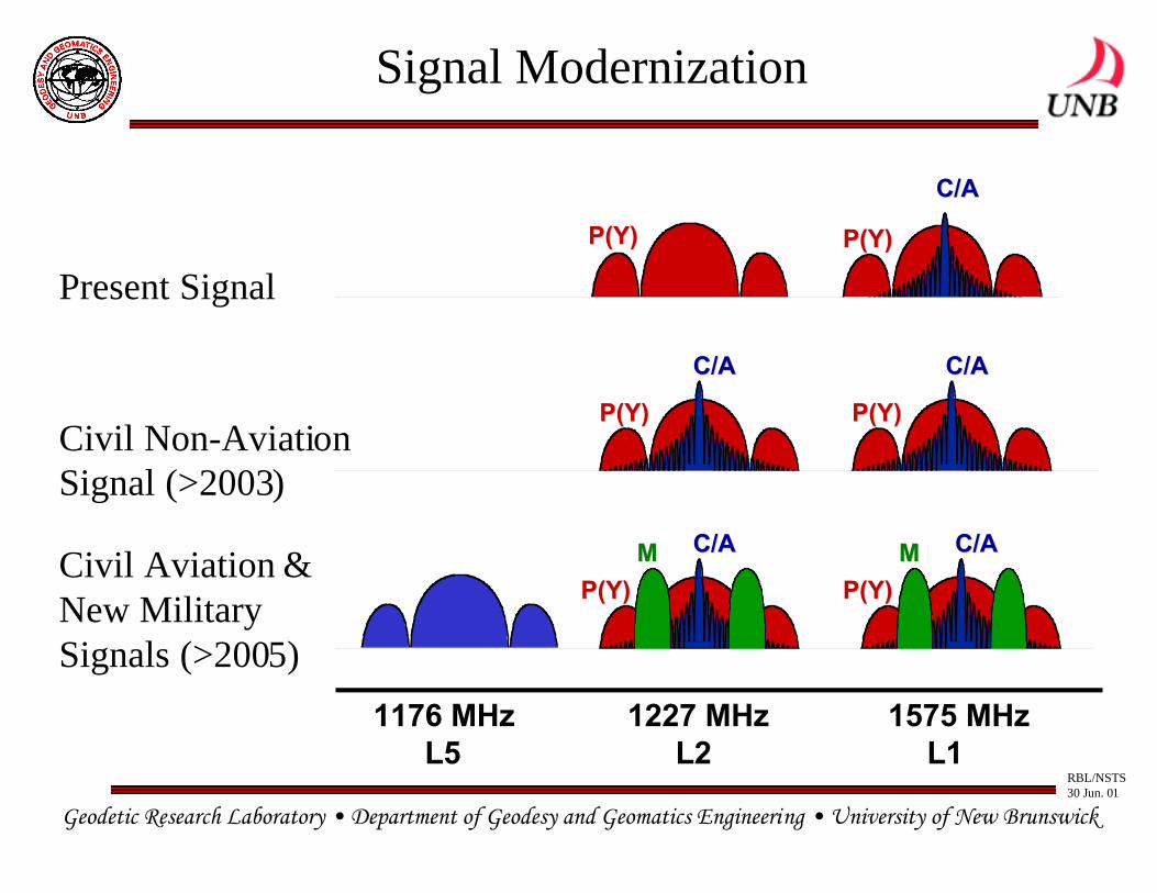
Signal Modernization
1227 MHz 1575 MHz1176 MHzL2 L1L5
P(Y)P(Y)
C/AC/A
P(Y)P(Y)
C/AC/A
P(Y)P(Y)
P(Y)P(Y)
C/AC/A
P(Y)P(Y)
C/AC/A
P(Y)P(Y)
C/AC/AMM MM
Present Signal
Civil Non-AviationSignal (>2003)
Civil Aviation &New MilitarySignals (>2005)
Geodetic Research Laboratory • Department of Geodesy and Geomatics Engineering • University of New Brunswick
RBL/NSTS30 Jun. 01
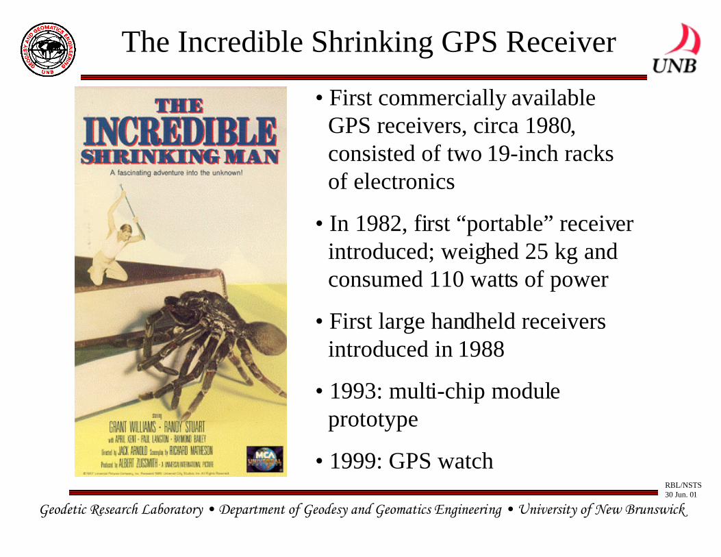
The Incredible Shrinking GPS Receiver
• First commercially availableGPS receivers, circa 1980, consisted of two 19-inch racksof electronics
• In 1982, first “portable” receiverintroduced; weighed 25 kg andconsumed 110 watts of power
• First large handheld receiversintroduced in 1988
• 1993: multi-chip module prototype
• 1999: GPS watch
Geodetic Research Laboratory • Department of Geodesy and Geomatics Engineering • University of New Brunswick
RBL/NSTS30 Jun. 01
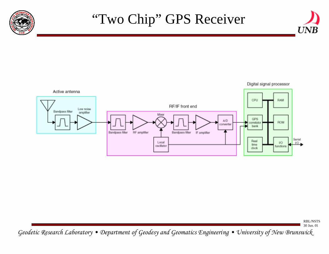
“Two Chip” GPS Receiver
Geodetic Research Laboratory • Department of Geodesy and Geomatics Engineering • University of New Brunswick
RBL/NSTS30 Jun. 01
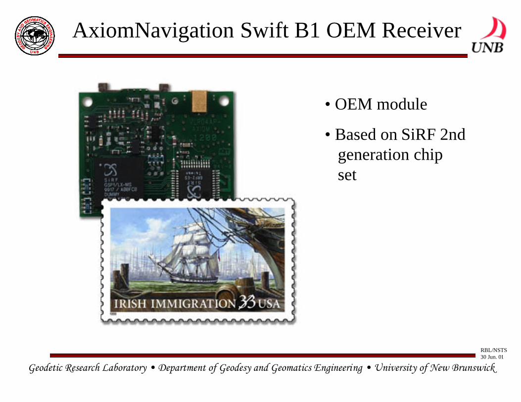
AxiomNavigation Swift B1 OEM Receiver
• OEM module
• Based on SiRF 2ndgeneration chipset

Geodetic Research Laboratory • Department of Geodesy and Geomatics Engineering • University of New Brunswick
RBL/NSTS30 Jun. 01
iTrax02 GPS Receiver Module
|----------25 mm---------|
|----
----
--25
mm
----
----
--|
Geodetic Research Laboratory • Department of Geodesy and Geomatics Engineering • University of New Brunswick
RBL/NSTS30 Jun. 01
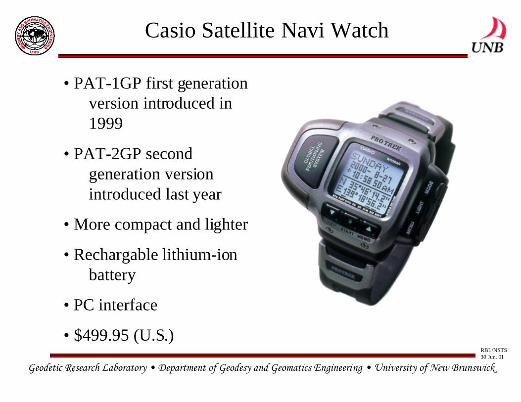
Casio Satellite Navi Watch
• PAT-1GP first generationversion introduced in1999
• PAT-2GP second generation versionintroduced last year
• More compact and lighter
• Rechargable lithium-ionbattery
• PC interface
• $499.95 (U.S.)
Geodetic Research Laboratory • Department of Geodesy and Geomatics Engineering • University of New Brunswick
RBL/NSTS30 Jun. 01
FCC E-911 Requirements
• FCC issued a Report and Order in October 1996 requiringU.S. network operators to implement an E-911 locationcapability by October 2001
• Phase I: Pass caller’s phone number, cell-site, and cell-sector location information to public safety answering point(PSAP) by April 1998
• Phase II: Provide caller’s location (latitude and longitude)to appropriate PSAP by October 2001 – automatic locationidentification (ALI)
• 2 major solution technologies: network-based andhandset-based
Geodetic Research Laboratory • Department of Geodesy and Geomatics Engineering • University of New Brunswick
RBL/NSTS30 Jun. 01
Networked-based Location Technologies
– provides the location of wireless 911 callers usinghardware and/or software in the wireless network and/oranother fixed infrastructure
– does not require the use of special location determininghardware and/or software in the caller’s portable or mobilephone
– e.g., time-difference of arrival (TDOA), angle of arrival(AOA), hybrid systems, RF “fingerprinting”
Geodetic Research Laboratory • Department of Geodesy and Geomatics Engineering • University of New Brunswick
RBL/NSTS30 Jun. 01
Handset-based Location Technologies
– provides the location of wireless 911 callers using speciallocation-determining hardware and/or software in thecaller’s portable or mobile phone
– may employ additional location-determining hardwareand/or software in the wireless network and/or anotherfixed infrastructure
– e.g., GPS, Loran-C
– GPS: standalone and network-assisted (e.g. SnapTrack)
Geodetic Research Laboratory • Department of Geodesy and Geomatics Engineering • University of New Brunswick
RBL/NSTS30 Jun. 01
Phase II Accuracy Standards
• For network-based solutions: 100 metres for 67% of calls;300 meters for 95% of calls
• For handset-based solutions: 50 metres for 67% of calls;150 metres for 95% of calls
Geodetic Research Laboratory • Department of Geodesy and Geomatics Engineering • University of New Brunswick
RBL/NSTS30 Jun. 01
GPS-capable Handsets
• First sets introduced in 1999
• Several manufacturers currently selling GPS-equippedhandsets, mostly in Europe (GSM)
• SiRF Technology recently signed major contracts withboth Nokia and Ericsson
Geodetic Research Laboratory • Department of Geodesy and Geomatics Engineering • University of New Brunswick
RBL/NSTS30 Jun. 01
The Future of GPS Technology
• Further miniaturization of the technology
• Integration of GPS receivers into PDAs, cameras, sportsequipment, etc., etc.
• Pet, child, and disabled tracking systems and services
• Other location-based services such as L-commerce
• Network-assisted GPS (permits weaker signal use)
• Bluetooth (short range RF) connectivity between GPSreceivers and other Bluetooth-equipped devices(GPS + Bluetooth = positioning inside buildings?)
• New GPS signals; higher power signals
• GPS + GLONASS + Galileo
Geodetic Research Laboratory • Department of Geodesy and Geomatics Engineering • University of New Brunswick
RBL/NSTS30 Jun. 01
GPS R&D at Canadian Universities
• Main research labs:– Geodetic Research Laboratory, Dept. of Geodesy and Geomatics
Engineering, University of New Brunswick (Langley, Santos,Dare)
– Satellite-based Positioning and Navigation Group, Dept. ofGeomatics Engineering, The University of Calgary (Lachapelle,Cannon)
– Equipe GPS, Centre de Recherche en Géomatique, UniversitéLaval (Santerre)
Geodetic Research Laboratory • Department of Geodesy and Geomatics Engineering • University of New Brunswick
RBL/NSTS30 Jun. 01
University GPS R&D Themes
• Physical and mathematical modelling of GPS observables(both functional and stochastic models)
• Development of new techniques and procedures for GPSpositioning and navigation and the enhancement ofexisting techniques
• Assessment of accuracy and integrity of positionalinformation
Geodetic Research Laboratory • Department of Geodesy and Geomatics Engineering • University of New Brunswick
RBL/NSTS30 Jun. 01
University of New Brunswick
• Modelling the neutral-atmosphere propagation effects inradiometric space techniques
• Improved modelling of data from the Western CanadaDeformation Array
• Development of a low-cost GPS-based vehicle trackingsystem
• Automatic daily assessment of the GPS broadcastephemerides
• Automatic daily assessment of WAAS corrections andWAAS performance in eastern Canada
• Development of precise point positioning algorithms andsoftware
Geodetic Research Laboratory • Department of Geodesy and Geomatics Engineering • University of New Brunswick
RBL/NSTS30 Jun. 01
University of New Brunswick, cont’d.
• Geometric tracking of GPS-equipped low earth orbiters
• Automated cycle slip correction
• Stochastic modelling of GPS observations
• Improvement of precise and reliable kinematic GPSpositioning in real time
• Optimal techniques for GPS ambiguity resolution
• Development of multipath mitigation techniques
• Ionospheric effects on Galileo
• Establishment of reference sites and control networks
• GPS equipment and site testing
Geodetic Research Laboratory • Department of Geodesy and Geomatics Engineering • University of New Brunswick
RBL/NSTS30 Jun. 01
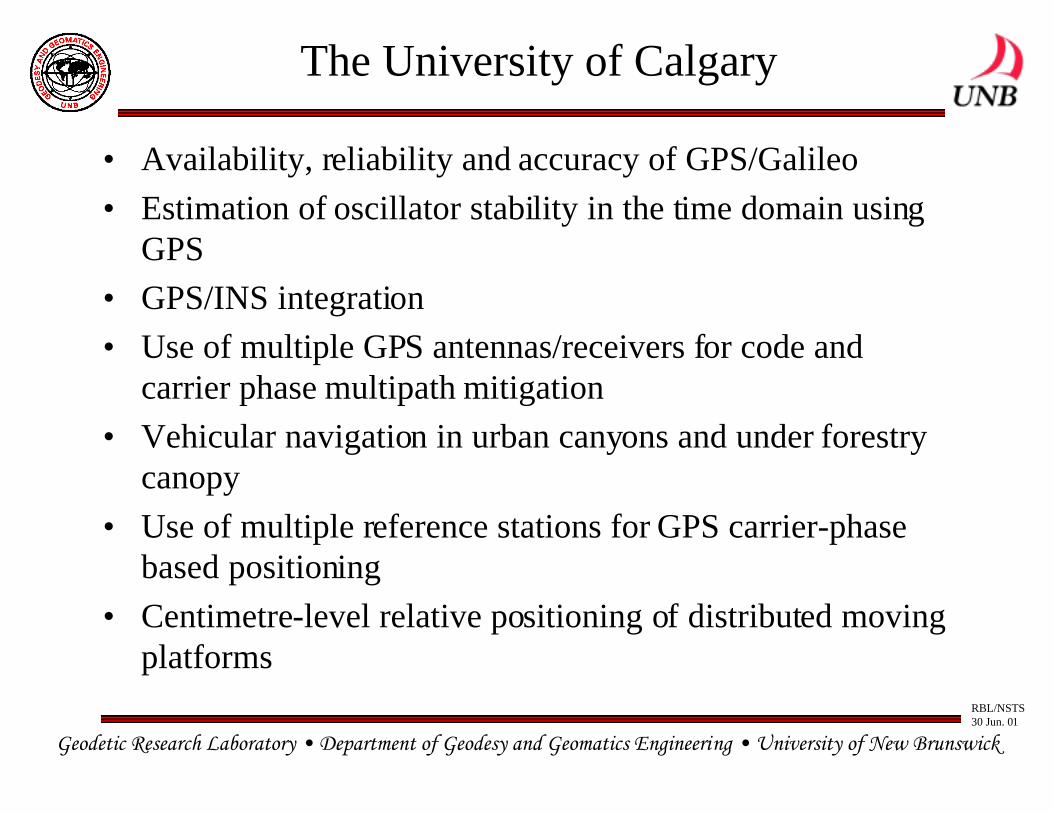
The University of Calgary
• Availability, reliability and accuracy of GPS/Galileo
• Estimation of oscillator stability in the time domain usingGPS
• GPS/INS integration
• Use of multiple GPS antennas/receivers for code andcarrier phase multipath mitigation
• Vehicular navigation in urban canyons and under forestrycanopy
• Use of multiple reference stations for GPS carrier-phasebased positioning
• Centimetre-level relative positioning of distributed movingplatforms
Geodetic Research Laboratory • Department of Geodesy and Geomatics Engineering • University of New Brunswick
RBL/NSTS30 Jun. 01
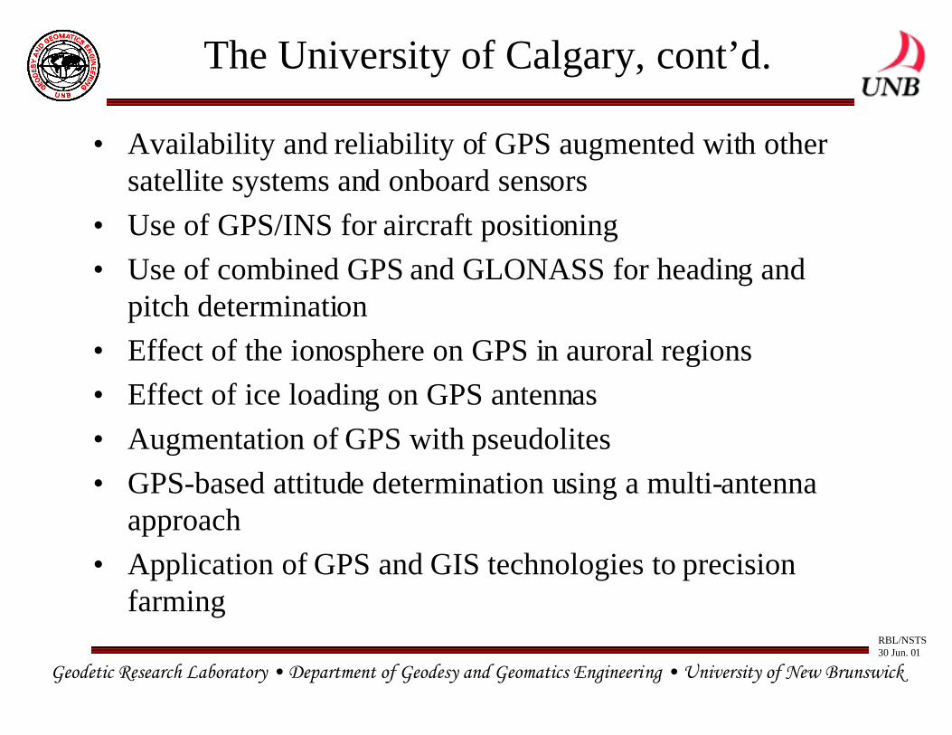
The University of Calgary, cont’d.
• Availability and reliability of GPS augmented with othersatellite systems and onboard sensors
• Use of GPS/INS for aircraft positioning
• Use of combined GPS and GLONASS for heading andpitch determination
• Effect of the ionosphere on GPS in auroral regions
• Effect of ice loading on GPS antennas
• Augmentation of GPS with pseudolites
• GPS-based attitude determination using a multi-antennaapproach
• Application of GPS and GIS technologies to precisionfarming
Geodetic Research Laboratory • Department of Geodesy and Geomatics Engineering • University of New Brunswick
RBL/NSTS30 Jun. 01
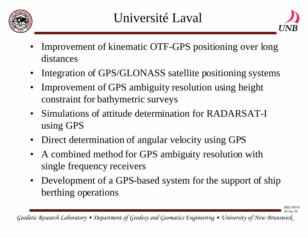
Université Laval
• Improvement of kinematic OTF-GPS positioning over longdistances
• Integration of GPS/GLONASS satellite positioning systems
• Improvement of GPS ambiguity resolution using heightconstraint for bathymetric surveys
• Simulations of attitude determination for RADARSAT-Iusing GPS
• Direct determination of angular velocity using GPS
• A combined method for GPS ambiguity resolution withsingle frequency receivers
• Development of a GPS-based system for the support of shipberthing operations
Geodetic Research Laboratory • Department of Geodesy and Geomatics Engineering • University of New Brunswick
RBL/NSTS30 Jun. 01
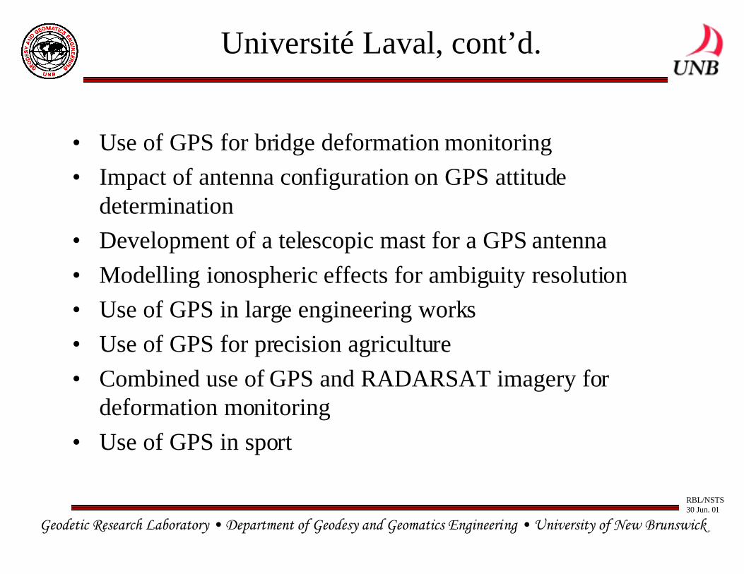
Université Laval, cont’d.
• Use of GPS for bridge deformation monitoring
• Impact of antenna configuration on GPS attitudedetermination
• Development of a telescopic mast for a GPS antenna
• Modelling ionospheric effects for ambiguity resolution
• Use of GPS in large engineering works
• Use of GPS for precision agriculture
• Combined use of GPS and RADARSAT imagery fordeformation monitoring
• Use of GPS in sport
Geodetic Research Laboratory • Department of Geodesy and Geomatics Engineering • University of New Brunswick
RBL/NSTS30 Jun. 01
Back-up slides
Geodetic Research Laboratory • Department of Geodesy and Geomatics Engineering • University of New Brunswick
RBL/NSTS30 Jun. 01
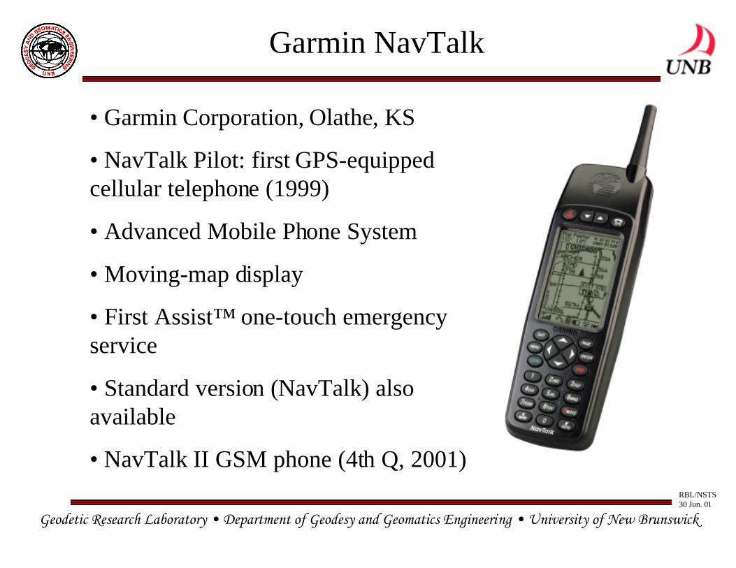
Garmin NavTalk
• Garmin Corporation, Olathe, KS
• NavTalk Pilot: first GPS-equippedcellular telephone (1999)
• Advanced Mobile Phone System
• Moving-map display
• First Assist™ one-touch emergencyservice
• Standard version (NavTalk) alsoavailable
• NavTalk II GSM phone (4th Q, 2001)
Geodetic Research Laboratory • Department of Geodesy and Geomatics Engineering • University of New Brunswick
RBL/NSTS30 Jun. 01
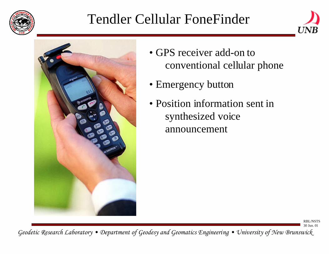
Tendler Cellular FoneFinder
• GPS receiver add-on to conventional cellular phone
• Emergency button
• Position information sent in synthesized voice announcement
Geodetic Research Laboratory • Department of Geodesy and Geomatics Engineering • University of New Brunswick
RBL/NSTS30 Jun. 01
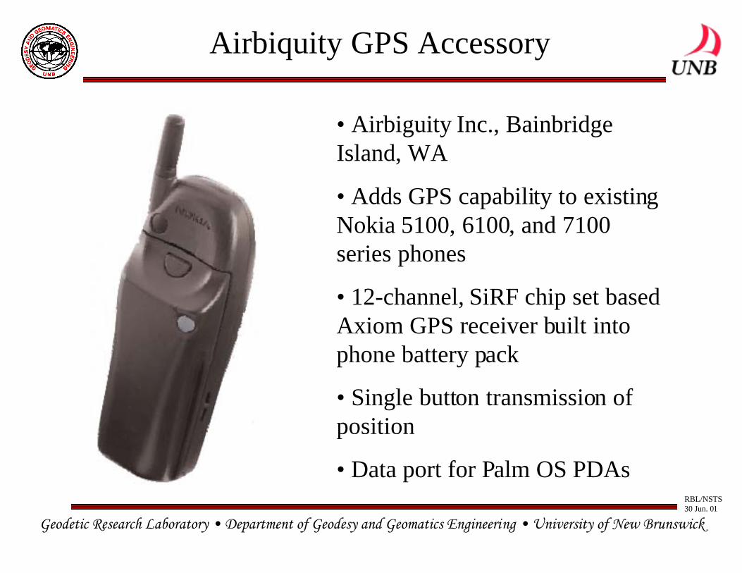
Airbiquity GPS Accessory
• Airbiguity Inc., BainbridgeIsland, WA
• Adds GPS capability to existingNokia 5100, 6100, and 7100series phones
• 12-channel, SiRF chip set basedAxiom GPS receiver built intophone battery pack
• Single button transmission ofposition
• Data port for Palm OS PDAs
Geodetic Research Laboratory • Department of Geodesy and Geomatics Engineering • University of New Brunswick
RBL/NSTS30 Jun. 01
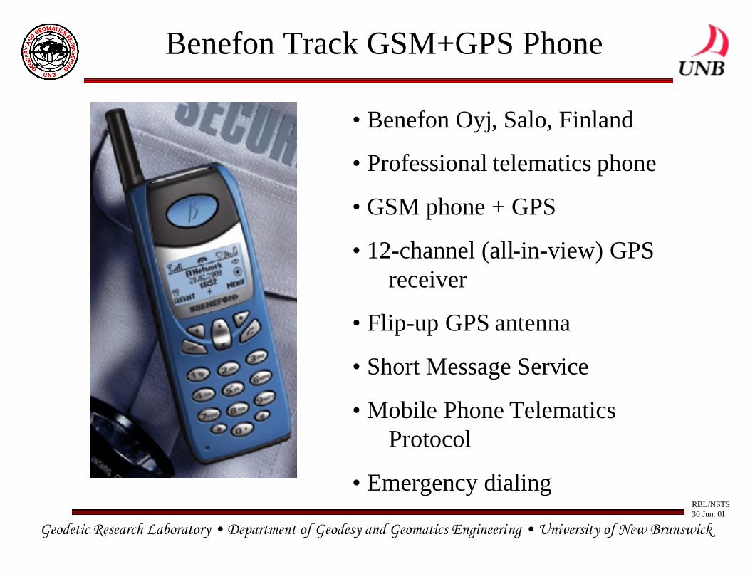
Benefon Track GSM+GPS Phone
• Benefon Oyj, Salo, Finland
• Professional telematics phone
• GSM phone + GPS
• 12-channel (all-in-view) GPSreceiver
• Flip-up GPS antenna
• Short Message Service
• Mobile Phone Telematics Protocol
• Emergency dialing
Geodetic Research Laboratory • Department of Geodesy and Geomatics Engineering • University of New Brunswick
RBL/NSTS30 Jun. 01
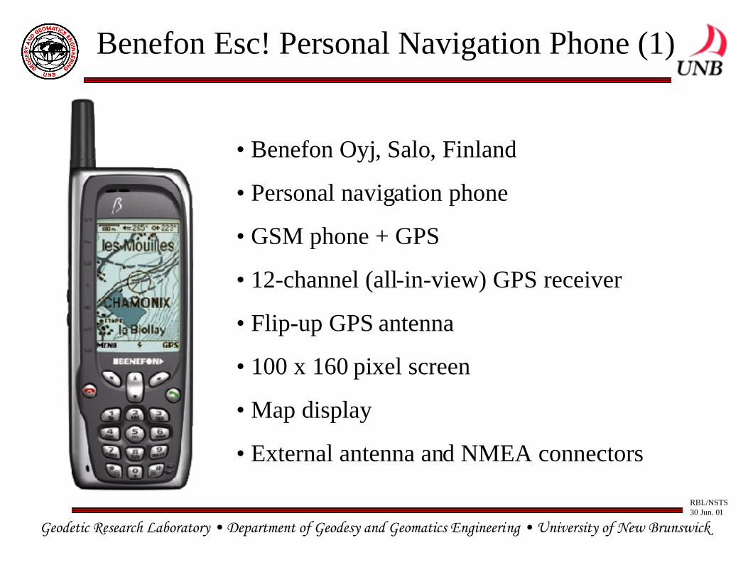
Benefon Esc! Personal Navigation Phone (1)
• Benefon Oyj, Salo, Finland
• Personal navigation phone
• GSM phone + GPS
• 12-channel (all-in-view) GPS receiver
• Flip-up GPS antenna
• 100 x 160 pixel screen
• Map display
• External antenna and NMEA connectors
Geodetic Research Laboratory • Department of Geodesy and Geomatics Engineering • University of New Brunswick
RBL/NSTS30 Jun. 01
Benefon Esc! Personal Navigation Phone (2)
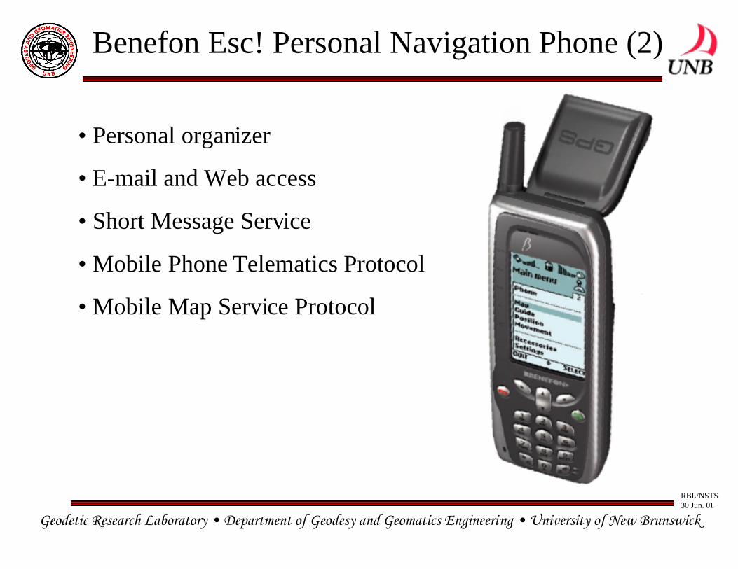
• Personal organizer
• E-mail and Web access
• Short Message Service
• Mobile Phone Telematics Protocol
• Mobile Map Service Protocol


![[Libro] Thomas de Quincey Theological Essays and other papers.pdf](https://img.pdfslide.net/doc/110x75/577cd20a1a28ab9e78952782/libro-thomas-de-quincey-theological-essays-and-other-paperspdf.jpg)