Embed Size (px)
Citation preview
TREATIES AND OTHER INTERNATIONAL ACTS SERIES 16-709 ________________________________________________________________________
SCIENTIFIC AND TECHNOLOGICAL COOPERATION Land Remote Sensing Satellite Data Memorandum of Understanding
between the
UNITED STATES OF AMERICA
and INDIA
Signed at Reston and Bangalore June 4 and July 9, 2016 with Annexes
NOTE BY THE DEPARTMENT OF STATE
Pursuant to Public Law 89—497, approved July 8, 1966 (80 Stat. 271; 1 U.S.C. 113)— “. . .the Treaties and Other International Acts Series issued under the authority of the Secretary of State shall be competent evidence . . . of the treaties, international agreements other than treaties, and proclamations by the President of such treaties and international agreements other than treaties, as the case may be, therein contained, in all the courts of law and equity and of maritime jurisdiction, and in all the tribunals and public offices of the United States, and of the several States, without any further proof or authentication thereof.”
INDIA
Scientific and Technological Cooperation:
Land Remote Sensing Satellite Data Memorandum of understanding signed at Reston and Bangalore June 4 and July 9, 2016;
Entered into force July 9, 2016. With annexes.
MEMORANDUM OF UNDERSTANDING
BETWEEN THE
UNITED STATES GEOLOGICAL SURVEY OF THE DEPARTMENT OF THE INTERIOR
AND THE
INDIAN SPACE RESEARCH ORGANISATION (ISRO) OF DEPARTMENT OF SPACE
FOR COOPERATION IN THE EXCHANGE AND USE OF U.S. LAND REMOTE SENSING SATELLITE DATA
Page 1 of8
IN-23.0000
IN-23.0000
PREAMBLE
The United States Geological Survey of the United States Department of the Interior and the Indian Space Research Organisation (ISRO), (hereinafter referred to as "the Parties"),
RECOGNIZING their mutual interest in the use of space technology for peaceful purposes;
NOTING the value of the United States Landsat satellite missions to cooperation among governments in space~based remote sensing of the Earth's surface;
DESIRING to establish an overall legal framework for cooperation in future land remote sensing satellite missions;
HAVE AGREED as follows:
ARTICLE 1- PURPOSE AND SCOPE OF COOPERATION
This Memorandum of Understanding (MOU) establishes the terms and conditions under which the United States Geological Survey (USGS) will provide United States~owned land remote sensing satellite data and ISRO will receive, process, archive, distribute, and exchange such data in cooperation with the USGS. This MOU consists of a main text, a definition of terms annex, and rnission~specific annexes. The annexes are an integral part ofthisMOU.
ARTICLE 2- SCIENCE AND TECHNOLOGY AGREEMENT
This MOU is subject to the Agreement on Science and Technology Cooperation between the Government of the United States of America and the Government of the Republic of India (hereinafter "S & T Agreement") signed October 17, 2005.
ARTICLE 3- RESPONSIBILITIES OF THE PARTIES
A. The USGS shall endeavor to provide operational land remote sensing satellite service under the terms of this MOU and shall:
1. Program land remote sensing satellites to collect and provide remote sensing data of areas within the acquisition radius of ISRO's ground station(s) to the extent that such requests can be accommodated by the spacecraft. The USGS will endeavor to schedule satellite downlink resources to meet requests from all participating International Cooperators (ICs) in an equitable and balanced manner, subject to conflict~resolution guidelines to be provided to all stations. Programming details to meet such requests will be arranged by mutual decision of the Parties' technical
Page 2 of8
IN-23.0000
representatives.
2. Provide ISRO with orbital elements for calculating the antenna pointing angles necessary to acquire the satellite-transmitted signals and with the necessary ancillary and calibration information for processing the data acquired.
3. Reserve the right to curtail or terminate transmission of satellite data to ISRO for reasons of (1) spacecraft or USGS ground equipment limitations, or (2) non-payment of annual access fee as agreed in any mission-specific Annex to this MOU. In these cases, the USGS will notify ISRO and discuss the planned action in the most expeditious manner possible.
4. Provide to ISRO, upon request by ISRO, reasonable quantities of raw USGS land remote sensing satellite data extracted from the USGS archive in an agreed-upon format and delivered electronically or on media at a price to be negotiated.
5. Provide support for anomaly resolution for USGS land remote sensing satellite missions.
6. Endeavour to ensure that any radio frequency problem occurring in relation to data reception by ISRO's ground station(s) is resolved to the satisfaction of the Parties.
B. ISRO shall:
1. Operate (a) ground station(s) for the reception, processing, archiving, distribution, and exchange of USGS land remote sensing satellite data at its own expense, including the cost of establishing and operating the necessary communication links with the USGS's Mission Operations Center (MOC) and the USGS's data center located at the Earth Resources Observation and Science (EROS) Center.
2. Produce land remote sensing satellite data products in accordance with agreed-upon USGS-sponsored distribution formats.
3. Ensure that all USGS land remote sensing satellite data acquired by ISRO are available for sale or distribution on a public, nondiscriminatory basis. This applies to all USGS land remote sensing satellite data acquired under this and previous Landsat MOUs signed with U.S. Government agencies.
4. Make available to the USGS, upon request, English-language copies of any arrangements signed by ISRO concerning the distribution of USGS land remote sensing satellite data from ISRO. Such arrangements shall be consistent with this MOU.
Page 3 of8
IN-23.0000
5. Maintain a current inventory of its USGS land remote sensing satellite data holdings and provide at le~t monthly updates of its metadata to the USGS in an agreed-upon format, electronically or on agreed-upon media, once the ground station(s) is (are) operational. These metadata may be made available publicly through USGS data facilities.
6. Establish and maintain a computer-accessible electronic system, with external public access, of browse imagery for its USGS land remote sensing satellite data holdings, or provide browse data at least monthly to the USGS in an agreed-upon format and on agreed-upon media, once the ground station(s) is (are) operational. ISRO browse imagery may be made available publicly through USGS data facilities.
7. Maintain USGS land remote sensing satellite data that have met ISRO quality standards in ISRO's archive for at least 10 years following data acquisition, using accepted archive management practices. If ISRO plans to discard data, it will issue a purge alert to the USGS, which will be given first right of refusal to acquire the data at a price to be negotiated.
8. Endeavor to ensure that any radio frequency problem occurring in relation to data reception by ISRO's ground station(s) is resolved to the satisfaction of the Parties. Questions concerning radio frequency interference by the USGS land remote sensing spacecraft raised by entities in third countries will be referred to the USGS.
9. When requested by the USGS in support of key U.S. Government programs, provide reasonable quantities ofiSRO-held USGS land remote sensing satellite data, in an agreed-upon format, electronically or on media, and at a price to be negotiated.
10. Repatriate to the USGS, within 30 days of downlink, any USGS land remote sensing satellite data received which is unique to ISRO's archive.
11. For purposes of validating data quality, exchange limited amounts of ISRO-held USGS land remote sensing satellite data, in an agreed-upon format, electronically or on media, when requested by the USGS. Data for this purpose shall be exchanged annually, at no cost to the USGS.
12. When requested by the USGS in response to a significant loss of spacecraft capability to record data for the USGS archive, routinely provide sufficient quantities of newly acquired USGS land remote sensing satellite data to meet U.S. Government mission requirements, in an agreed-upon format, electronically or on media, at a cost to be negotiated.
· For any support necessary to ISRO beyond providing USGS land remote sensing satellite data to the USGS as described above, the Parties will negotiate specific financial terms.
Page 4 of8
IN-23.0000
13. Communicate with the MOC on spacecraft information, in order to maximize data collection and efficiency of spacecraft operations.
14. Provide support for anomaly resolution of USGS land remote sensing satellite missions.
ARTICLE 4- INTERNATIONAL MISSION COORDINATION
A. Each Party shall designate program representatives to be responsible for the implementation of this MOU. Supplemental meetings between the Parties will be held by mutual agreement.
B. Program management representatives from the Parties will participate in annual meetings of the Landsat Ground Station Operations Working Group (LGSOWG). This group, chaired by the USGS, will serve as a forum for the exchange of policy, programmatic and management information among station operators and the USGS.
C. Technical representatives from the Parties will participate in annual meetings of the Landsat Technical Working Group (LTWG). This group, also chaired by the USGS, will review and coordinate technical and operational aspects of USGS international mission support.
ARTICLE 5- SCIENCE AND APPLICATIONS DEVELOPMENT
1. The Parties will seek to identify opportunities for cooperation in improved land remote sensing satellite data collection, user accessibility, and data distribution.
2. The Parties will seek to identify opportunities to support new research in the use of land remote sensing satellite data, and the development of related applications to enhance land use practices, ecosystems management, climate change research, and other areas of Earth systems science.
3. The Parties will seek to cooperate in the support of global observation and science programs involving the use of land remote sensing satellite data.
4. The Parties will consult with one another on best practices and improved means of cooperation in the long-term archiving and preservation of land remote sensing satellite data.
5. The Parties will share information and consider opportunities for training and capacity building in the use of land remote sensing satellite data.
Page 5 of8
IN-23.0000
6. Subject to the provisions of Article 11, the Parties will share information on their respective development and potential for cooperation in their respective land remote sensing satellite missions.
ARTICLE 6- USER SERVICE ARRANGEMENTS
The USGS reserves the right to service the land remote sensing satellite data requests of all users affiliated with U.S. Government programs.
ARTICLE 7- FINANCIAL ARRANGEMENTS AND LEGAL AUTHORIZATION
I. The Parties shall be responsible for funding their respective activities under this MOU. Additionally, ISRO, or its designated agent, shall pay to the USGS, or ensure the appropriate authorities ofiSRO's government pay to the USGS, in a timely manner, any access fees described in any mission-specific Annex(es). These fees are required to enable the USGS to administer all operations in support of a global network of cooperating ground receiving stations.
2. Obligations under this MOU and any Implementing Annexes shall be subject to the availability of funding obtained through each Party's funding procedures.
3. Should either Party encounter budgetary problems that may affect the activities carried out under this MOU that Party shall notify and consult with the other Party in a timely manner in order to minimize the negative impact of such problems on the cooperation.
ARTICLE 8- DUTIES, FEES, AND TAXES
In accordance with its national laws and regulations, each Party shall seek to ensure free customs clearance and waiver of all applicable duties, fees, and taxes for the import or export of goods necessary for the implementation of this MOU. In the event that any duties, fees, or taxes of any kind are nonetheless levied on such goods, such duties, fees, or taxes shall be borne by the Party of the country levying them.
ARTICLE 9- ENTRY AND EXiT OF PERSONNEL
On a reciprocal basis, each Party shall use reasonable efforts to facilitate, in accordance with its laws and regulations, the entry to and exit from its territory of personnel engaged in joint activities pursuant to this MOU.
Page 6 of8
IN-23.0000
ARTICLE 10- LAWS, WARRANTIES, RIGHTS, AND LIABILITY
1. The activities under this MOU will be conducted in accordance with the applicable laws and regulations of the Parties' countries, respectively, and shall be subject to the availability of appropriate funds.
2. The USGS does not warrant the suitability of its land remote sensing data for any purpose and shall not be liable for any damage or injury brought about by use of USGS land remote sensing satellite systems and their data.
3. The USGS retains the ownership right to all raw land remote sensing data acquired by its satellites. Beyond the provisions of Article 3.B.3, the USGS places no restrictions on ISRO to disclose, use, manipulate, generate products from, distribute, or sell USGS land remote sensing satellite data.
ARTICLE 11- EXCHANGE OF TECHNICAL INFORMATION
1. Technical information exchanged between the Parties will be subject to the applicable laws, regulations, and policies of the Parties' countries, respectively. In the event it is necessary to exchange technical information and the furnishing Party considers that such technical information is to be protected for proprietary or export control purposes, such information must be clearly marked with a legend indicating the country of origin, the conditions of release, that the information relates to this MOU, and that it is furnished in confidence.
2. The USGS and ISRO will take all lawful steps available to prevent disclosure of such protected or proprietary technical information without the consent of the other Party and to ensure that it is used only for the purposes of this MOU.
3. The USGS and ISRO may release to the public other general, non-technical information regarding each other's programs or operations after ensuring, through consultation with each other when necessary, that this information is fairly and accurately represented.
4. The USGS and ISRO may exchange appropriate technical information and documentation for the purposes of downlinking, processing, and archiving USGS land remote sensing satellite data as well as for generating and distributing products from that data.
ARTICLE 12- CONSULTATIONS AND SETTLEMENT OF DISPUTES
1. The Parties shall consult, as appropriate, to review the implementation of activities undertaken pursuant to this MOU, and to exchange views on potential areas of future cooperation.
Page 7 ofS
IN-23.0000
2. In the event questions arise regarding the interpretation, application, or implementation of activities under this MOU, the Program Managers of the Parties shall endeavor to resolve the questions. If the Program Managers are unable to reach an agreement, then the matter will be referred to a more senior level of the Parties for joint resolution.
ARTICLE 13- ENTRY INTO FORCE, DURATION, AND TERMINATION
I. This MOU shall enter into force upon signature by both Parties and remain in force through the operational lifetime ofthe USGS land remote sensing spacecraft(s) from which ISRO receives USGS land remote sensing data. This MOU may be amended by mutual agreement of the Parties.
2. In the event that either of the Parties is unable to comply with any provision of this MOU, either Party, after consultation with the other, shall have the option of terminating this MOU, providing at least 30 days' notice of such action, forwarded in writing by one Party to the other.
3. Notwithstanding termination or expiration of this MOU, the obligations of the Parties set forth in Article 3.B.3, Article 3.B.7, Article 10.2, Article 10.3, and Article 11 of this MOU shall continue to apply.
ARTICLE 14- SIGNATURE
IN WITNESS THEREOF, respective representatives oflhe Parties have signed this Memorandum of Understanding.
For the United States Geological Survey of the Department of the Interior:
Reston, Virginia
Place
Page 8 of8
For the Indian Space Research Organization of Department of Space:
01?_~ Dr. V K Dadhwal Director National Remote Sensing Centre ISRO, Bangalore, India
.9 -::1 ~ ' 20 lk Date
ANNEX I
TO THE
MEMORANDUM OF UNDERSTANDING
BETWEEN THE
UNITED STATES GEOLOGICAL SURVEY OF THE DEPARTMENT OF THE INTERIOR
IN-23.0000
AND THE
INDIAN SPACE RESEARCH ORGANISATION (ISRO) OF DEPARTMENT OF SPACE
FOR COOPERATION IN THE EXCHANGE AND USE OF U.S. LAND REMOTE SENSING SATELLITE DATA
DEFINITION OF TERMS
Page 1 of 3
Acquisition Radius:
An International Cooperator's (IC's} acquisition radius is that portion of the Earth over which the satellite can communicate with an IC's ground station.
Browse:
Browse is a full resolution or sub-sampled Level OR or Level 1 digital image of the Earth that can be viewed on a scene basis to quickly assess general ground area coverage, data quality, and the spatial relationships between ground area coverage and cloud coverage. A browse is an image with a reduced data volume to facilitate screening of archived Land Remote Sensing Satellite Data. Specifications regarding browse images are documented in the appropriate mission Data Format Control Book (DFCB) and made available by the USGS.
Data Format:
The Landsat Technical Working Group (LTWG) recommends the archive data format for exchanging data between an International Cooperator and USGS archives. The archive data exchange format for purposes of quality assessment and key government programs is typically the lowest level of processed data available (i.e. Mission or Raw Computer Compatible [RCC] Data) and is transferred electronically or on media. The archive data exchange format is documented in the appropriate mission Data Validation and Exchange Plan and associated Data Format Control Book (DFCB) and made available by the USGS.
Data Products Distribution Format:
The USGS Land Remote Sensing Satellite Data products are Level-ORp (Level Zero Reformatted Product) in HDF format and Level-IT (terrain corrected) in Geo-TIFF format. International Cooperators may produce data products of their choice. ICs are encouraged, but not required to produce Level ORp data products in HDF format, but are required to distribute Level-l T data products in Geo-TIFF format. Specifications regarding Level-ORp and Level-l T data products are documented in the appropriate mission Data Format Control Book (DFCB) and made available by the USGS.
International Cooperator (IC):
An International Cooperator (IC) is any non-U.S. Government agency or commercial organization acting on behalf of or in cooperation with a foreign government or international organization, which enters into an agreement with the USGS for purposes of receiving or exchanging Land Remote Sensing Satellite Data.
Key U.S. Government Programs:
Key U.S. Government Programs are any U.S. Government agencies and U.S. Government ·contractors, other U.S. and foreign researchers and entities involved in the United States Global Change Research Program, and U.S. and foreign researchers and foreign and international entities having signed a cooperative agreement with the United States
Page 2 of 3
Government involving the use of USGS Land Remote Sensing Satellite Data for noncommercial purposes.
The United States Global Change Research Program is the Executive Branch program responding to Public Law 101-606, the Global Change Research Act of 1990, and most recently described in the annual report accompanying the President's budget entitled "Our Changing Planet: The U.S. Climate Change Science Program for Fiscal Year 2012."
International counterpart programs of the U.S. Global Change Research Program are discussed in Section V of"Our Changing Planet." These include the Intergovernmental Panel on Climate Change, the World Climate Research Program, the International Council on Science, and the Group on Earth Observations.
Mission Operations Center (MOC):
The Mission Operations Center (MOC) consists of the people, procedures, and hardware/software systems used for the successful execution of real-time spacecraft operations and off-line scheduling and analysis activities. All command and control functions of the spacecraft performed by the Flight Operations Team (FOT) will take place from the MOC.
Metadata:
Metadata is descriptive information pertaining to the USGS Land Remote Sensing Satellite Data, including such information as location and acquisition date, compiled for Level OR and Level-l data, and made available through the USGS user interface. Specifications regarding the metadata are documented in the Landsat Metadata Description Document (LMDD) and made available by the USGS.
Raw Data:
Raw Data is the USGS Land Remote Sensing Satellite Data in the form of wide band telemetry transmitted by the satellite.
U.S. Government and Affiliated Users:
U.S. Government and Affiliated Users are any federal, state or local government agency personnel and personnel from any organization performing cooperative work with or for these government agencies.
USGS Land Remote Sensing Satellites:
USGS Land Remote Sensing Satellites are any satellites owned and operated by the USGS for the purposes of this agreement. These satellites may include, but are not limited to, the Landsat missions.
Page 3 of 3
ANNEX II
TO THE
MEMORANDUM OF UNDERSTANDING
BETWEEN THE
UNITED STATES GEOLOGICAL SURVEY OF THE DEPARTMENT OF THE INTERIOR
AND THE
INDIAN SPACE RESEARCH ORGANISATION (ISRO) OF DEPARTMENT OF SPACE
FOR COOPERATION IN THE EXCHANGE AND USE OF U.S. LAND REMOTE SENSING SATELLITE DATA
LANDSAT7 ANNUAL ACCESS FEE AGREEMENT
Page 1 of4
IN-23.0000
INTRODUCTION
Pursuant to Article 7 of the Memorandum ofUnderstanding (MOU) between the United States Geological Survey of the Department of the Interior and Indian Space Research Organisation (ISRO) for Cooperation in the Exchange and Use of U.S. Land Remote Sensing Satellite Data; U.S. Presidential Decision Directive/National Science and Technology Council-3, as amended on October 16, 2000; and the Land Remote Sensing Policy Act of 1992, the USGS has established a fee structure to enable it to administer all operations in support of a global network of cooperating ground receiving stations for direct reception of data from the Landsat 7 mission. This Annex sets forth the related financial and administrative terms and conditions for Landsat 7 cooperation between the USGS and ISRO.
ARTICLE 1-FEE STRUCTURE
This agreement calls for each party to contribute equal services in kind, and therefore shall require no exchange of funds between the USGS and ISRO. ISRO will provide historical data available in its archive at National Remote Sensing Centre (NRSC), from Landsat 4 and 5 Multi-Spectral Scanner (MSS) and Thematic Mapper (TM) data from 1984 through 2001 to the USGS, and in return the USGS will provide a no-charge Landsat 7 downlink and Levell Terrain-corrected (LIT) products to ISRO. The in kind services are described in more detail below.
Background The United States has been operating its Landsat series of remote sensing satellites since 1972, collecting an unprecedented record of the Earth's landmasses. Over the past 43 years, literally millions of images have been collected at both U.S. and international ground stations to be stored in disparate archives around the globe. As time passes, the importance of maintaining this historical record grows. While any single image can provide insight into an area's land cover and land use, it takes a time-series of images to determine land changes. No other program has the historical synoptic coverage provided by the Landsat MSS, TM and ETM+ datasets. Unfortunately, a significant portion of this legacy is being lost to aging media and archaic technology. These historical views of the Earth are irreplaceable.
The Landsat Global Archive Consolidation (LGAC) initiative is attempting to catalog the extent of the Landsat historical record. The intent is to work with the International Cooperator network, both current and historical, to establish the content and condition of the global archive of Landsat data. The near-term goal is to build a complete metadata record of the global archive and, eventually, physically consolidate a copy of all data within the USGS National Satellite Land Remote Sensing Data Archive (NSLRSDA) to better enable global end-user access to the Landsat data. ISRO, as a strong international partner and historical Landsat station operator, has access to Landsat data from 1984 through 200 I that does not exist in the USGS archives. All data exchanged will be nonproprietary and will be made available by USGS at no cost to users in the public domain.
Page 2 of4
Description of Data Exchange ISRO will provide to the USGS:
• A complete copy of the entire Landsat archive from 1984-2001. • Downlinked Landsat 7 data shall be provided electronically to the USGS within
thirty (30) days of acquisition. • Data shall be provided in the format available in NRSC archives, on mutually
agreed-to media. • Initial representative samples shall be provided to validate data format(s) and
media compatibility. • Upon validation, subsequent media shipments will be made in batches. • Media shipments shall include Landsat scene content information including path,
row, and acquisition date.
USGS will provide to ISRO:
• The USGS will extract the data upon receipt of the media from ISRO. • The USGS will ingest and convert the Landsat data to Raw Computer Compatible
(RCC) for archival purposes. • The USGS will process the Landsat RCC data to aLl T product for non
proprietary, no cost availability to users in the public domain. • A copy of the Landsat Ll Tproducts will be placed on external hard drives for
shipment to ISRO. • The USGS will be responsible for shipping all media to and from ISRO. • The USGS will provide a no-charge Landsat 7 downlink and access to the USGS
developed standard ground processing software to ISRO in return for a copy of all Landsat data in ISRO archives.
Pursuant to Article 3.B.10 of the MOU, ISRO will coordinate downlink requests and ground station operations with the USGS Landsat Project Mission Operations Center (MOC). ISRO will archive all telemetry captured at its station near Shadnagar, India, maintain an archive inventory, and electronically deliver a copy of the raw telemetry received at its receiving stations to the USGS Earth Resources Observation and Science (EROS) Center on at least a monthly basis. The USGS reserves the right to terminate transmission of Landsat 7 data to ISRO at any time that ISRO is delinquent in regularlyscheduled electronic delivery of raw telemetry data to the USGS.
ARTICLE 2- DURATION AND AMENDMENT
This Annex will remain in effect as long as the MOU remains in force, and it may be amended by mutual consent ofUSGS and ISRO through an Exchange of Letters. At the beginning of each new USG Fiscal Year, the USGS and ISRO will review this Annex and revise it if necessary.
Page 3 of4
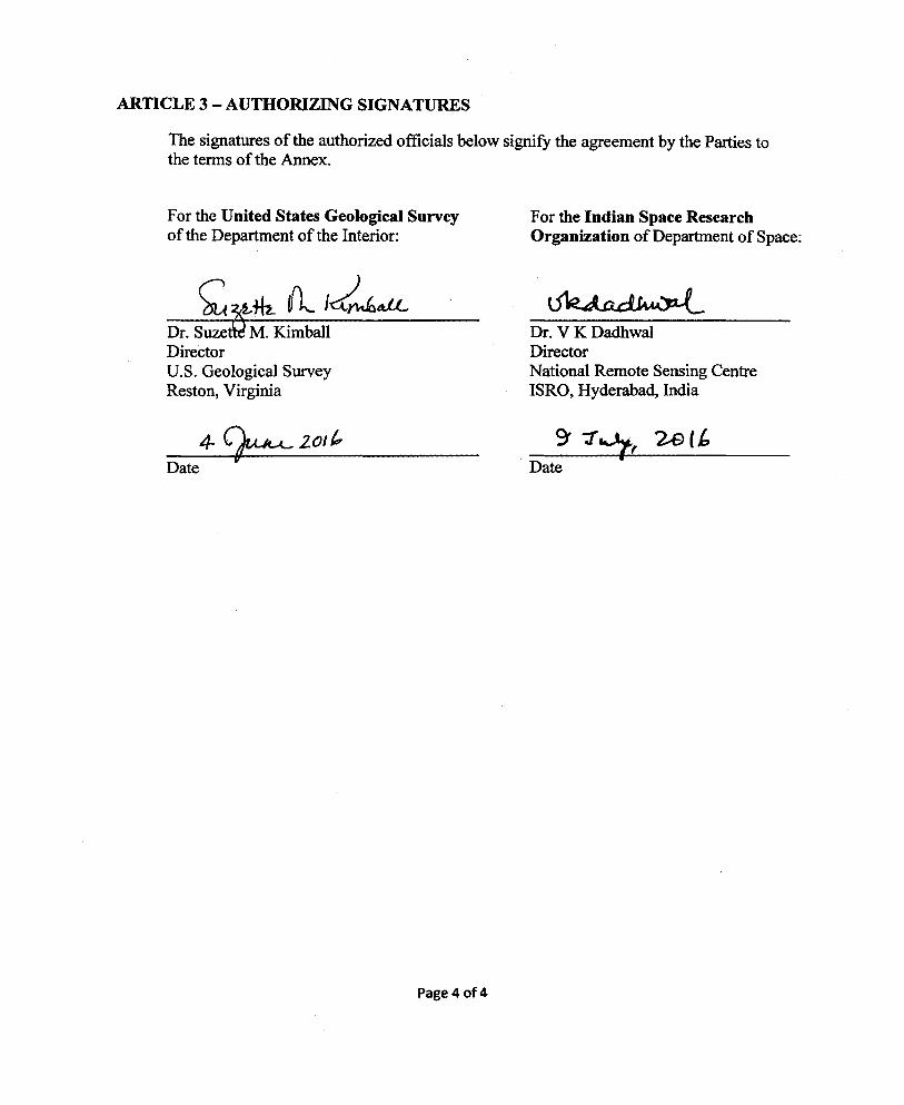
ARTICLE 3- AUTHORIZING SIGNATURES
The signatures of the authorized officials below signify the agreement by the Parties to the terms of the Annex.
For the United States Geological Survey of the Department of the Interior:
Director U.S. Geological Survey Reston, Virginia
Date
4- ~201/,
Page4of4
For the Indian Space Research Organization of Department of Space:
Dr. V K Dadhwal Director National Remote Sensing Centre ISRO, Hyderabad, India
ANNEX III
TO THE
MEMORANDUM OF UNDERSTANDING
BETWEEN THE
UNITED STATES GEOLOGICAL SURVEY OF THE DEPARTMENT OF THE INTERIOR
AND THE
INDIAN SPACE RESEARCH ORGANISATION (ISRO) OF DEPARTMENT OF SPACE
FOR COOPERATION IN THE EXCIJANGE AND USE OF U.S. LAND REMOTE SENSING SATELLITE DATA
USGS's LANDSAT 8 AND ISRO's RESOURCESAT-2 DATA EXCHANGE
Page 1 of4
IN-23.0000
INTRODUCTION
Pursuant to Article 7 of the Memorandum of Understanding (MOU) between the United States Geological Survey of the Department of the Interior and Indian Space Research Organisation (ISRO) for the Cooperation in the Exchange and Use of U.S. Land Remote Sensing Satellite Data; U.S. Presidential Decision Directive/National Science and Technology Council-3, as amended on October 16, 2000; and the Land Remote Sensing Policy Act of 1992, the USGS has established a fee structure to enable it to administer all operations in support of a global network of cooperating ground receiving stations for direct reception of data from the Landsat 8 mission. This Annex sets forth the related financial and administrative terms and conditions for Landsat 8 cooperation between the USGS and ISRO.
ARTICLE 1- FEE STRUCTURE
This agreement calls for each party to contribute equal services in kind, and therefore shall require no exchange of funds between the USGS and ISRO. ISRO will provide Resourcesat-2 data, and in return the USGS will provide a no-charge Landsat 8 downlink to ISRO. The in-kind services are described in more detail below.
Description of in-kind Services ISRO will provide to the USGS:
• Full Resourcesat-2 data coverage over the U.S. (including Alaska and Hawaii) by means of the Resourcesat-2 onboard recorder to include the Advanced Wide-Field Sensor (A WiFS) 56 meter and the Linear Imaging Self-Scanning Sensor III (LISS-III) 23.5 meter sensor data
o To the extent that such requests can be accommodated by the spacecraft, ISRO will acquire all U.S. images at all opportunities, unless emergency or other high priority image acquisitions will not allow it
• Access to high-speed electronic data transfer of the raw data to the USGS Earth Resources Observation and Science (EROS) Center in Sioux Falls, South Dakota following Resourcesat-2 data downlink at the ISRO ground station in Shadnagar
o A 3-10 hour latency is anticipated between acquisition and data availability
• On-site software installation and training along with associated license and documentation for Resourcesat-2 data acquisition as well as Level-0 and image data processing systems
o USGS to provide the hardware o USGS to subsequently ingest, archive, process, and distribute the
Resourcesat-2 data o USGS may redistribute the Resourcesat-2 data on a public,
nondiscriminatory basis without restrictions On-site software installation and training along with associated license and
Page 2 of4
documentation to process USGS/EROS historical archive ofResourcesat-1 (IRSP6) data
o USGS to provide the hardware o USGS to subsequently ingest, archive, process, and distribute the
Resourcesat-1 (IRS-P6) data o USGS may redistribute the Resourcesat-1 (IRS-P6) data on a public,
nondiscriminatory basis without restrictions
USGS will provide to ISRO:
• •
•
Access to the Landsat 8 data stream at no charge In accordance with MOU Article 3.A.l, program Landsat 8 to collect and provide direct reception for areas within the acquisition radius of the ISRO ground station in Shadnagar
o To the extent that such requests can be accommodated by the spacecraft, USGS will acquire all images at all opportunities, unless emergency or other high priority image acquisitions will not allow it
Access to the USGS-developed Landsat 8 ground processing software and associated documentation, along with on-site installation support and training
o ISRO to provide the hardware o ISRO to subsequently ingest, archive, process, and distribute the Landsat
.8 data o ISRO may redistribute the Landsat 8 data on a public, nondiscriminatory
basis without restrictions
Pursuant to Article 3.B.l0 of the MOU, ISRO will coordinate downlink requests and ground station operations with the USGS Landsat Project Mission Operations Center (MOC). ISRO will archive all Landsat 8 telemetry captured at the ISRO ground station in Shadnagar and maintain an archive inventory.
ARTICLE 2- CONTINGENCIES
ISRO, in consultation with the USGS, may curtail or suspend the transfer of Resourcesat-2 data if ISRO is unable to satisfy data requests due to spacecraft system capability limitations or ground receiving station conflicts. In this event, ISRO would supply Resourcesat-2A data in lieu ofResourcesat-2, and the USGS would continue to supply Landsat 8 data for up to one year while the conditions of an updated Annex are determined. ISRO reserves the right to curtail or suspend the transfer ofResourcesat-2 data to the USGS at any time that the USGS is delinquent in the transmission of Landsat 8 data to ISRO, while the Landsat 8 spacecraft is functioning normally.
The USGS, in consultation with ISRO, may curtail or suspend the transmission of Landsat 8 data if the USGS is unable to satisfy data requests due to spacecraft system capability limitations or ground receiving station conflicts. In this event, ISRO would continue to supply the Resourcesat-2/2A data for up to one year while the conditions of an updated Annex are determined. The USGS reserves the right to suspend transmission
Page 3 of4
of Landsat 8 data to ISRO at any time that ISRO is delinquent in regularly-scheduled electronic delivery ofResourcesat-2 data to the USGS, while the Resourcesat-2 spacecraft is functioning normally.
ARTICLE 3- DURATION AND AMENDMENT
This Annex will remain in effect as long as the MOU remains in force, and it may be amended by mutual consent of USGS and ISRO through an Exchange of Letters. At the beginning of each new USG Fiscal Year, the USGS and ISRO will review this Annex and revise it if necessary.
ARTICLE 4- AUTHORIZING SIGNATURES
The signatures of the authorized officials below signify the agreement by the Parties to the terms of the annex.
For the United States Geological Survey of the Department of the Interior:
Director U.S. Geological Survey Reston, Virginia
Date
Page4 of4
For the Indian Space Research Organization of Department of Space:
Dr. V K Dadhwal Director National Remote Sensing Centre ISRO, Bangalore, India


![Efficiency of Cooperation between Remote Robot Systems ...Remote robot systems with force feedback have been actively researched [1]-[9]. Especially, many researchers are paying attention](https://img.pdfslide.net/doc/110x75/5f100df57e708231d447382f/efficiency-of-cooperation-between-remote-robot-systems-remote-robot-systems.jpg)