Embed Size (px)
Citation preview

Secondary & Cumulative Effects Analysis Training
ProgramModule 4: How to Develop SCEA Land Use Information
How to Develop Land Use InformationHow to Develop Land Use Information

Secondary & Cumulative Effects Analysis Training
ProgramModule 4: How to Develop SCEA Land Use Information
DetermineLevel of SCEA
Analysis
CollectResource
Data
IdentifyRegulatoryPrograms
MapResources &
Land Use
IdentifyMethodologies/
ConductAnalysis
Factors to ConsiderFactors to Consider
• Developing and mapping land use information is part of the analysis section of conducting a SCEA.
• Because of its importance to the analysis process, the development of land use is being treated as a separate section in the training seminar.
• Developing and mapping land use information is part of the analysis section of conducting a SCEA.
• Because of its importance to the analysis process, the development of land use is being treated as a separate section in the training seminar.
SCEA DOBe aware of how the development and mapping of land use information fits into the overall analysis of resources. Note that the analysis section of conducting a SCEA is discussed in detail in Module 5.
SCEA DOBe aware of how the development and mapping of land use information fits into the overall analysis of resources. Note that the analysis section of conducting a SCEA is discussed in detail in Module 5.

Secondary & Cumulative Effects Analysis Training
ProgramModule 4: How to Develop SCEA Land Use Information
• Agricultural
• Residential
• Commercial
• Industrial
• Open Space
• Parkland
• Other
• Agricultural
• Residential
• Commercial
• Industrial
• Open Space
• Parkland
• Other
Land Use Types Generally ConsideredLand Use Types Generally Considered

Secondary & Cumulative Effects Analysis Training
ProgramModule 4: How to Develop SCEA Land Use Information
Land Use Considerations
• Past Land Use
• Present Land Use
• Future Land Use
Land Use Considerations
• Past Land Use
• Present Land Use
• Future Land Use
Land Use ConsiderationsLand Use Considerations

Secondary & Cumulative Effects Analysis Training
ProgramModule 4: How to Develop SCEA Land Use Information
Why Develop Land Use Information
• Past Land Use- Provides a baseline from which trends
can be developed.
• Present Land Use- Provides an intermediate year from
which trends can be determined.- Provides a current analysis year to
conduct overlay analysis.
• Future Land Use- Provides a build-out analysis year to
conduct overlay analysis.
Land Use ConsiderationsLand Use Considerations

Secondary & Cumulative Effects Analysis Training
ProgramModule 4: How to Develop SCEA Land Use Information
Mapping Land UseMapping Land UseSCEA DO
As part of the process for developing land use, map any available data sources. This will be
helpful in preparing the data for the analysis
methodologies that will be presented in Module 5. Be sure to map land use once all available
data sources have been collected. Only land use
information within the SCEA geographic
boundary should be mapped.
SCEA DOAs part of the process
for developing land use, map any available data sources. This will be
helpful in preparing the data for the analysis
methodologies that will be presented in Module 5. Be sure to map land use once all available
data sources have been collected. Only land use
information within the SCEA geographic
boundary should be mapped.

Secondary & Cumulative Effects Analysis Training
ProgramModule 4: How to Develop SCEA Land Use Information
Past Land UsePast Land Use
Key Past Land Use Data Sources
Key Data Source DescriptionSHA
Availability
Aerial Photography
Digital Orthophotagraphy from DNR, USGS or county government, Spot satelite imagery and SHA Project Planning archived aerial photography
4
State Roads Commission Annual Highway Improvement Records 4
EPA Region III/DOTPast NEPA documents disclose the impacts of past projects
SHA's Regional Intermodal Planning Division (RIPD)
Past Master Plans and Major Development Matrices
4
Maryland Office of Planning Land Use Maps
MOP mapping provides Anderson Classification land use mapping for past years.
4
ACOE Permit FilesProvides way of tracking development through Army Corps of Engineers permit files
MDE Permit FilesProvides way of tracking development through Maryland Department of Environment permit files
Metropolitan Planning Organizations
Used to identify land use trends through past Long Range Plans (LRP) and Transportation Improvement Plans (TIP)
4

Secondary & Cumulative Effects Analysis Training
ProgramModule 4: How to Develop SCEA Land Use Information
Key Present Land Use Data Sources
Present Land UsePresent Land Use
NOTE: Near future (1 - 5 years) counts in present time period for land use.
Key Data Source DescriptionSHA
Availability
Local PlannersLocal/Private development proposed for the "near future" (Within 1 - 5 years)
Regional Intermodal Planning Division (RIPD)
Major Development Projects 4
SHA Access Permits Additional screening for local development 4
SHA Projects having received location approval
Provides insight to land use that will potentially change due to a future SHA project.
4
ACOE Permit FilesProvides way of tracking development through Army Corps of Engineers permit files
MDE Permit FilesProvides way of tracking development through Maryland Department of Environment permit files
EPA Region IIINEPA documents for all federally funded projects, including non-highway
Aerial Photography
Digital Orthophotagraphy from DNR, USGS or county government, Spot and other current satelite imagery that is readily available
4
Maryland Office of Planning land use/cover maps
Digital or paper county-wide land use/cover maps published by the Maryland Office of Planning
4
Travel ForecastingUsed to determine what impacts existing travel patterns and volumes have on land use.
4
Secondary & Cumulative Effects Analysis Training
ProgramModule 4: How to Develop SCEA Land Use Information
Present Land UsePresent Land Use
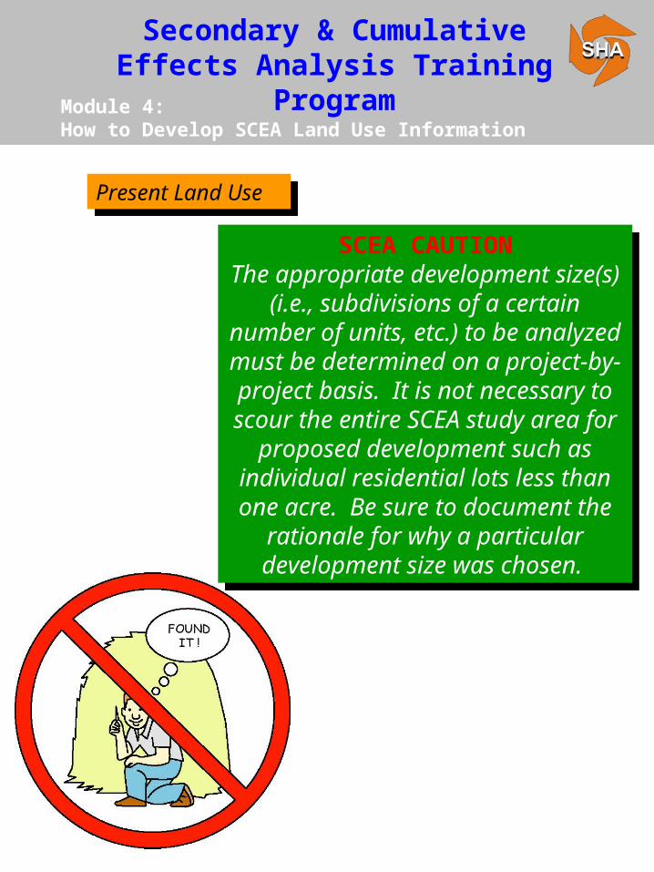
SCEA CAUTIONThe appropriate development size(s)
(i.e., subdivisions of a certain number of units, etc.) to be analyzed must be determined on a project-by-project basis. It is not necessary to
scour the entire SCEA study area for proposed development such as
individual residential lots less than one acre. Be sure to document the
rationale for why a particular development size was chosen.

Secondary & Cumulative Effects Analysis Training
ProgramModule 4: How to Develop SCEA Land Use Information
• Urban Developments - 500 units residential, 5,000 square feet commercial and 1,000,000 square feet industrial.
• Rural developments - 250 units residential, 2500 square feet commercial and 500,000 square feet industrial.
• Urban Developments - 500 units residential, 5,000 square feet commercial and 1,000,000 square feet industrial.
• Rural developments - 250 units residential, 2500 square feet commercial and 500,000 square feet industrial.
SHA Regional & Intermodal Planning Division (RIPD) Major Development Matrix
Present Land UsePresent Land Use

Secondary & Cumulative Effects Analysis Training
ProgramModule 4: How to Develop SCEA Land Use Information
Key Future Land Use Data Sources
Future Land UseFuture Land Use
Key Data Source DescriptionSHA
AvailabilityMetropolitan Planning Organizations (MPO's)
Constrained Long Range Plan (CLRP) 4
Regional Intermodal Planning Division (RIPD)
Major Development Matrix and local Master Plans
4
Travel Forecastng
Used to determine what impacts existing travel patterns and volumes have on land use and also source of land use data since there are specific land use assumptions used to develop no-build, ADTs.
4
Local Planners Local/Private proposed development
Local Master PlansProvide insight to areas designated for growth and also general trends for population and employment growth
SHA Access Permits Additional screening for local development 4
SHA Projects having received location approval
Provides insight to land use that will potentially change do to a future SHA project.
4
Federal RegisterAnnounces EIS, NOI's and public hearings for 404 permits
EPAMaryland Office of Planning Land Use Forecast Maps
Chesapeake Bay FoundationProvide data on proposed major works /development projects
Sierra ClubProvide data on proposed major projects/development works

Secondary & Cumulative Effects Analysis Training
ProgramModule 4: How to Develop SCEA Land Use Information
Development of future land use scenarios (done for each alternative including the no-build) for SCEA is primarily based on two sources:
• Travel Forecasts - Review and map future land uses with assumptions based on travel forecasts.
• Local/Regional Planning Resources - Meet with local planners and utilize planning resources such as the Regional & Intermodal Planning Division (RIPD), Metropolitan Planning Organizations, the Constrained Long Range Plan (CLRP) and local master plans to develop future land use scenarios.
Future Land UseFuture Land Use
Secondary & Cumulative Effects Analysis Training
ProgramModule 4: How to Develop SCEA Land Use Information
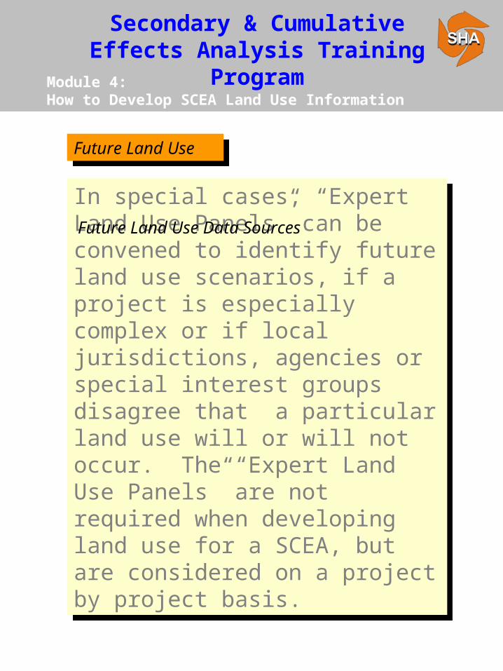
In special cases, “Expert Land Use Panels” can be convened to identify future land use scenarios, if a project is especially complex or if local jurisdictions, agencies or special interest groups disagree that a particular land use will or will not occur. The “Expert Land Use Panels” are not required when developing land use for a SCEA, but are considered on a project by project basis.
In special cases, “Expert Land Use Panels” can be convened to identify future land use scenarios, if a project is especially complex or if local jurisdictions, agencies or special interest groups disagree that a particular land use will or will not occur. The “Expert Land Use Panels” are not required when developing land use for a SCEA, but are considered on a project by project basis.
Future Land Use Data Sources
Future Land UseFuture Land Use

Secondary & Cumulative Effects Analysis Training
ProgramModule 4: How to Develop SCEA Land Use Information
SCEA DOIn situations where two or more different future land use scenarios are predicted for a project alternative:• Determine the scenario that will most likely
reflect future land use.• Try to come to an agreement; if you can’t,
determine how to proceed on a project by project basis.
SCEA DOIn situations where two or more different future land use scenarios are predicted for a project alternative:• Determine the scenario that will most likely
reflect future land use.• Try to come to an agreement; if you can’t,
determine how to proceed on a project by project basis.
Key Future Land Use Data SourcesKey Future Land Use Data Sources

Secondary & Cumulative Effects Analysis Training
ProgramModule 4: How to Develop SCEA Land Use Information
Middle River Employment Center Access Study (MRECAS)
Middle River Employment Center Access Study (MRECAS)
• Baltimore County originally performed an economic Analysis for properties designated for development under the county's economic development plan.
- This analysis was originally used to support SHA's Project Purpose and Need
Statement.
- In general, the study was based upon projections of new business types and potential employee base associated with these businesses.
- The study determined that approximately 50% of the developable land would be developed.
• The Environmental Resources Agencies requested that an independent study be performed to confirm the County’s findings prior to concurring upon the project purpose and need.
MRECAS Expert Land Use Team
NOTE: The MRECAS expert land use panel considered the development of land use within the area where secondary effect were expected to occur; not the whole SCEA geographic boundary.

Secondary & Cumulative Effects Analysis Training
ProgramModule 4: How to Develop SCEA Land Use Information
• The independent study was performed by a team of real estate, development and engineering professionals.
- Environmental resources (wetlands, stream buffers, cemeteries, parks and schools) were subtracted out of the land designated for development to determine the total amount of actual developable land.
- The results of the analysis projected that the economic development plan would create 13,830 jobs and would require 7,274,520 s.f. (approximately 170 acres) of new development that may potentially be built-out over a 10-year period.
- It was therefore determined that the projected economic development could be
accommodated within the county's developable land envelope (this includes consideration of environmental resources).
• The study was found to be acceptable by the resource agencies and concurrence on the project purpose and need was attained.
MD 43 Expert Land Use Team (continued)
Middle River Employment Center Access Study (MRECAS)
Middle River Employment Center Access Study (MRECAS)

Secondary & Cumulative Effects Analysis Training
ProgramModule 4: How to Develop SCEA Land Use Information
The cumulative impact analysis must account for the secondary development resulting from a project alternative, plus any additional development within the SCEA geographical boundary that is not dependent upon a/the project alternative.
The cumulative impact analysis must account for the secondary development resulting from a project alternative, plus any additional development within the SCEA geographical boundary that is not dependent upon a/the project alternative.
Assessing Land Use for Cumulative Impacts
Future Land UseFuture Land Use

Secondary & Cumulative Effects Analysis Training
ProgramModule 4: How to Develop SCEA Land Use Information
• Secondary Impacts - Land use changes that occur because of a Project Alternative.
• Cumulative Impacts - Land use changes that would occur or have occurred regardless of a Project Alternative.
• Secondary Impacts - Land use changes that occur because of a Project Alternative.
• Cumulative Impacts - Land use changes that would occur or have occurred regardless of a Project Alternative.
Types of Impacts That Cause Land Use Change Within a SCEA Boundary
Land usechanges
caused bysecondary project
impacts
Cumulative landuse changesresulting fromnon-project
related impacts
Total landuse change
in the SCEA geographicboundary
+ =
Future Land UseFuture Land Use

Secondary & Cumulative Effects Analysis Training
ProgramModule 4: How to Develop SCEA Land Use Information
Coordination with local governments and/or developers should indicate planned development that will not proceed without approval of a specific transportation alternative.
Coordination with local governments and/or developers should indicate planned development that will not proceed without approval of a specific transportation alternative.
Coordination with Local Planning Officials
NOTE: Planned development may be unique to each project alternative.
Future Land UseFuture Land Use

Secondary & Cumulative Effects Analysis Training
ProgramModule 4: How to Develop SCEA Land Use Information
Identify any local zoning implications and identify changes in land use or level of development that may occur as the result of each project alternative.
Identify any local zoning implications and identify changes in land use or level of development that may occur as the result of each project alternative.
Coordination with Local Planning Officials
Future Land UseFuture Land Use

Secondary & Cumulative Effects Analysis Training
ProgramModule 4: How to Develop SCEA Land Use Information
SCEA DOYour meeting with the local planners may be your most important coordination in developing your future land use scenario, especially in respect to secondary development. It is important to present alternatives mapping when identifying potential secondary impacts with local planners. This will help illustrate differences in land use changes that may result from two or more alternatives.
SCEA DOYour meeting with the local planners may be your most important coordination in developing your future land use scenario, especially in respect to secondary development. It is important to present alternatives mapping when identifying potential secondary impacts with local planners. This will help illustrate differences in land use changes that may result from two or more alternatives.
Future Land UseFuture Land Use
Secondary & Cumulative Effects Analysis Training
ProgramModule 4: How to Develop SCEA Land Use Information
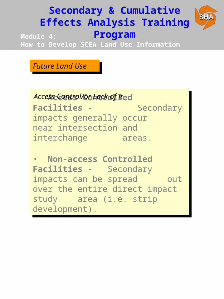
• Access Controlled Facilities -Secondary impacts generally occur near intersection and interchange areas.
• Non-access Controlled Facilities - Secondary impacts can be spread out over the entire direct impact
study area (i.e. strip development).
• Access Controlled Facilities -Secondary impacts generally occur near intersection and interchange areas.
• Non-access Controlled Facilities - Secondary impacts can be spread out over the entire direct impact
study area (i.e. strip development).
Access Control/or Lack of it
Future Land UseFuture Land Use

Secondary & Cumulative Effects Analysis Training
ProgramModule 4: How to Develop SCEA Land Use Information
MD 5 - Hughesville Transportation Improvement Project
MD 5 - Hughesville Transportation Improvement Project
MD 5 Land Use Development
Yes No
Past 4MOP land use maps, Charles Co. Master Plan, Charles Co. Planning Office
Base past land use scenario for certain resources
Present 4
Alternative Retained for Detailed Study ROW, 1994 MOP Land use maps, 1993 DNR Aerial Photos, Charles Co. Master Plan, CTP
Impacts from Alternatives, base land use classifications, near future development
Future 4
Proposed Major Developments (Charles County), Charles County Master Plan, CTP, Charles County Planning Office
Growth in specialized land use districts, proposed transportation plans, zoning implications, proposed major developments, population forecasts.
Time FrameConsidered
Data Source Land Use Development From Data Sources
Note that future development, as analyzed in the MD 5 EA, generally falls within a 1 -5 year timeframe. Under current SHA Guidelines, this development would be interpreted as being within the “present” time frame.
MD 5 LandUse Note

Secondary & Cumulative Effects Analysis Training
ProgramModule 4: How to Develop SCEA Land Use Information
Proposed Major Developments in the SCEA Boundary
NAME ID # ACRES LOTS SFD APPROVED
Major Subdivis ions with Final Plat Approval
Benedict Plantation 88-183 359.25 89 89 3/20/89
Old Blanford Estates II 91-011 46.6 14 14 12/6/93
Peach Tree Hollow XPN970005 53.25 43 43 10/6/97
Woodlawn Manor 91-235 73.3 17 17 9/14/92
Swanson Creek Landing III
92-038 34.91 7 7 1/3/94
Carriage Cross ing (Deer Run)
92-152 363 106 106 11/2/92
Trentino Estates 92-160 60 18 18 11/16/92
Murphy, Section II 94-070 40.5 15 15 12/4/95
Preliminaries Subject to New Subdivis ion Regulations
Harvest Ridge XPN960012 42.78 13 13 11/3/97
Valid Preliminary Subdivis ion Plans
Eastern Hills XPN950081 137.18 27 27 9/23/96
All proposed developments are s ingle family detached res idential subdivis ions
Source: CCPO-PGM. August 1998.
MD 5 - Hughesville Transportation Improvement Project
MD 5 - Hughesville Transportation Improvement Project

Secondary & Cumulative Effects Analysis Training
ProgramModule 4: How to Develop SCEA Land Use Information
Proposed Development and CTP areas in the SCEA Boundary
MD 5 - Hughesville Transportation Improvement Project
MD 5 - Hughesville Transportation Improvement Project

Secondary & Cumulative Effects Analysis Training
ProgramModule 4: How to Develop SCEA Land Use Information
MD 5 - Hughesville Transportation Improvement Project
MD 5 - Hughesville Transportation Improvement Project
SCEA Guidelines recommend that land use from all three time frames be developed and mapped. Below are two main decisions in the SCEA process for MD 5 that are not consistent with SHA’s SCEA Guidelines.
• Only some of the information for the present time frame existed as readily available. Based on current SHA Guidelines the MD 5 SCEA should document map development for all three time frames including rationale for not mapping existing readily available land use.
• Some of the analysis methodologies used in determining secondary and cumulative effects did not necessitate mapping past, present or future land use. (It is good practice not to select analysis methodologies prior to completing acquisition of all land use materials. The availability of land use mapping should guide the rationale for which analysis methodologies to use).