Embed Size (px)
Citation preview
WATERSHED MANAGEMENT PLAN M A Y 2 0 0 9 Metropolitan North Georgia Water Planning District 5-1
OVERVIEW The local management measures in this Section are the activities to be performed at the local level by the Metro Water District’s member local governments. These local management measures form a comprehensive program for addressing watershed issues within the Metro Water District, including the protection of water quality and designated uses as well as improving the health of impacted waterbodies. Through the Georgia EPD audit process, local jurisdictions will be held accountable for implementation of these local management measures.
The 2003 Watershed Management Plan looked at an exhaustive list of stormwater and watershed best management practices and programs, and crafted a strong foundation of strategies and management measures for meeting watershed management goals. Since 2003, local jurisdictions in the Metro Water District have been actively implementing these measures as well as meeting their local permit requirements.
Starting with the foundation of the 2003 Watershed Management Plan, the plan update process focused on adapting the original Plan’s management measures to better help local governments to address the watershed management needs outlined in Section 2 of this Plan, the regulatory requirements found in Section 3, and the basin-specific issues and priorities identified in Section 4.
Based on the evaluation of the 2003 Plan, each of the local measures was rewritten and formatted to provide more background, implementation guidance and resources for local programs. In addition, the measures were placed into functional categories and a local implementation responsibility box was added as a guide to assist local governments. A number of local management measures were clarified and some new measures were added to the Plan. These separate or new measures primarily address gaps from the original Plan:
• Model Ordinance Support Activities – Several of the model ordinances developed as part of the original planning process require specific local actions to support and enforce the ordinance provisions. Three of these activities have been categorized as separate local measures, including Floodplain Mapping and Delineation (Measure 5.B.2), Integrated Development Review Process (Measure 5.C.1), and Stormwater Management Design Review Criteria and Standards (Measure 5.C.2)
• Regulatory Gaps – There are two areas subject to both federal and state laws and regulatory programs that were not adequately addressed in the 2003 Plan. Construction Erosion and Sedimentation Control (Measure 5.C.3) and Endangered Species Protection (Measure 5.H.3) have been added as local management measures to help local governments integrate these requirements into their watershed management programs.
Section 4: RIVER BASIN PROFILES
WATERSHED MANAGEMENT PLAN M A Y 2 0 0 9 Metropolitan North Georgia Water Planning District 5-2
Section 5: LOCAL MANAGEMENT MEASURES
• Local Coordination – Land use planning is integral to effective watershed management and requires coordination with community development staff. Comprehensive Land Use Planning (Measure 5.B.1) was added to ensure that watershed management issues are considered in local government land use decision making. Sanitary Sewer and Septic System Coordination (Measure 5.B.3) encourages intra-governmental and inter-governmental coordination on wastewater service issues within a community that can impact both development patterns and water quality issues.
The local management measures are organized into eight functional categories. These functional categories group similar management measures together to facilitate implementation and inter-departmental coordination within a local jurisdiction:
A. Legal Authority – Stormwater and watershed protection model ordinances.
5.A.1 – Post-Development Stormwater Management Ordinance
5.A.2 – Floodplain Management / Flood Damage Prevention Ordinance
5.A.3 – Stream Buffer Protection Ordinance
5.A.4 – Illicit Discharge and Illegal Connection Ordinance
5.A.5 – Litter Control Ordinance
B. Watershed Planning – Community-wide and inter-jurisdictional planning efforts and activities at the watershed scale.
5.B.1 – Comprehensive Land Use Planning
5.B.2 – Floodplain Delineation and Map Maintenance
5.B.3 – Sanitary Sewer and Septic System Coordination
C. Land Development – Programs and activities focused on the site-level impacts of development projects.
5.C.1 – Integrated Development Review Process
5.C.2 – Stormwater Management Design Review Criteria and Standards
5.C.3 – Construction Erosion and Sedimentation Control
D. Asset Management – Ongoing management, operations and maintenance of stormwater system assets.
5.D.1 – Stormwater Infrastructure Inventory
5.D.2 – Extent and Level of Service Policy
5.D.3 – Stormwater System Inspections
5.D.4 – Stormwater Maintenance Program
5.D.5 – Capital Improvement Plan
Section 4: RIVER BASIN PROFILES
WATERSHED MANAGEMENT PLAN M A Y 2 0 0 9 Metropolitan North Georgia Water Planning District 5-3
Section 5: LOCAL MANAGEMENT MEASURES
E. Pollution Prevention – Programs that reduce or eliminate potential pollutants to the stormwater system and downstream receiving waters.
5.E.1 – Pollution Prevention / Good Housekeeping for Local Operations
5.E.2 – Illicit Discharge Detection and Elimination Program
F. Watershed Conditions Assessment – Chemical, biological, and habitat monitoring of streams.
5.F.1 – Long-term Ambient Trend Monitoring
5.F.2 – Habitat and Biological Monitoring
G. Education and Public Awareness – Public education and involvement programs related to stormwater and nonpoint source pollution.
5.G.1 – Local Education and Public Awareness Program
H. Resource-specific Measures – Programs based on conditions within a local watershed that necessitate additional protection.
5.H.1 – Source Water Supply Watershed Protection
5.H.2 – TMDL Management
5.H.3 – Endangered Species Protection
5.H.4 – Watershed Improvement Projects
Each local management measure includes the required action item(s), objective, description of measure and detailed guidance on implementing each measure. In addition, some of the measures also include optional considerations and resources, including website links.
Section 4: RIVER BASIN PROFILES
WATERSHED MANAGEMENT PLAN M A Y 2 0 0 9 Metropolitan North Georgia Water Planning District 5-4
Section 5: LOCAL MANAGEMENT MEASURES
[This page intentionally left blank]
Section 4: RIVER BASIN PROFILES
WATERSHED MANAGEMENT PLAN M A Y 2 0 0 9 Metropolitan North Georgia Water Planning District 5-5
Section 5: LOCAL MANAGEMENT MEASURES LEGAL AUTHORITY .
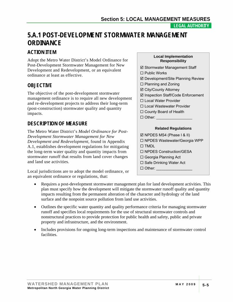
5.A.1 POST-DEVELOPMENT STORMWATER MANAGEMENT ORDINANCE ACTION ITEM Adopt the Metro Water District’s Model Ordinance for Post-Development Stormwater Management for New Development and Redevelopment, or an equivalent ordinance at least as effective.
OBJECTIVE The objective of the post-development stormwater management ordinance is to require all new development and re-development projects to address their long-term (post-construction) stormwater quality and quantity impacts.
DESCRIPTION OF MEASURE The Metro Water District’s Model Ordinance for Post-Development Stormwater Management for New Development and Redevelopment, found in Appendix A.1, establishes development regulations for mitigating the long-term water quality and quantity impacts from stormwater runoff that results from land cover changes and land use activities.
Local jurisdictions are to adopt the model ordinance, or an equivalent ordinance or regulations, that:
• Requires a post-development stormwater management plan for land development activities. This plan must specify how the development will mitigate the stormwater runoff quality and quantity impacts resulting from the permanent alteration of the character and hydrology of the land surface and the nonpoint source pollution from land use activities.
• Outlines the specific water quantity and quality performance criteria for managing stormwater runoff and specifies local requirements for the use of structural stormwater controls and nonstructural practices to provide protection for public health and safety, public and private property and infrastructure, and the environment.
• Includes provisions for ongoing long-term inspections and maintenance of stormwater control facilities.
Local Implementation Responsibility
Stormwater Management Staff Public Works Development/Site Planning Review Planning and Zoning City/County Attorney Inspection Staff/Code Enforcement Local Water Provider Local Wastewater Provider County Board of Health Other: _________________
Related Regulations
NPDES MS4 (Phase I & II) NPDES Wastewater/Georgia WPP TMDL NPDES Construction/GESA Georgia Planning Act Safe Drinking Water Act Other: _________________
Section 4: RIVER BASIN PROFILES
WATERSHED MANAGEMENT PLAN M A Y 2 0 0 9 Metropolitan North Georgia Water Planning District 5-6
Section 5: LOCAL MANAGEMENT MEASURES LEGAL AUTHORITY .
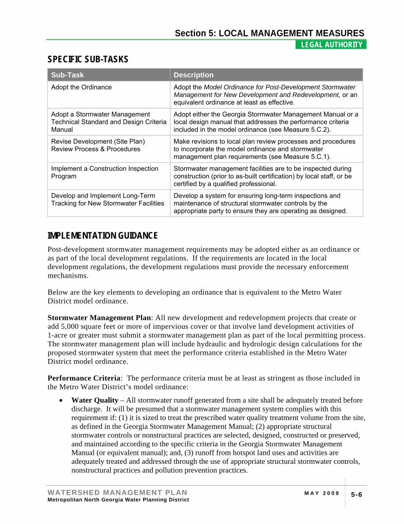
SPECIFIC SUB-TASKS Sub-Task Description Adopt the Ordinance Adopt the Model Ordinance for Post-Development Stormwater
Management for New Development and Redevelopment, or an equivalent ordinance at least as effective.
Adopt a Stormwater Management Technical Standard and Design Criteria Manual
Adopt either the Georgia Stormwater Management Manual or a local design manual that addresses the performance criteria included in the model ordinance (see Measure 5.C.2).
Revise Development (Site Plan) Review Process & Procedures
Make revisions to local plan review processes and procedures to incorporate the model ordinance and stormwater management plan requirements (see Measure 5.C.1).
Implement a Construction Inspection Program
Stormwater management facilities are to be inspected during construction (prior to as-built certification) by local staff, or be certified by a qualified professional.
Develop and Implement Long-Term Tracking for New Stormwater Facilities
Develop a system for ensuring long-term inspections and maintenance of structural stormwater controls by the appropriate party to ensure they are operating as designed.
IMPLEMENTATION GUIDANCE Post-development stormwater management requirements may be adopted either as an ordinance or as part of the local development regulations. If the requirements are located in the local development regulations, the development regulations must provide the necessary enforcement mechanisms.
Below are the key elements to developing an ordinance that is equivalent to the Metro Water District model ordinance.
Stormwater Management Plan: All new development and redevelopment projects that create or add 5,000 square feet or more of impervious cover or that involve land development activities of 1-acre or greater must submit a stormwater management plan as part of the local permitting process. The stormwater management plan will include hydraulic and hydrologic design calculations for the proposed stormwater system that meet the performance criteria established in the Metro Water District model ordinance.
Performance Criteria: The performance criteria must be at least as stringent as those included in the Metro Water District’s model ordinance:
• Water Quality – All stormwater runoff generated from a site shall be adequately treated before discharge. It will be presumed that a stormwater management system complies with this requirement if: (1) it is sized to treat the prescribed water quality treatment volume from the site, as defined in the Georgia Stormwater Management Manual; (2) appropriate structural stormwater controls or nonstructural practices are selected, designed, constructed or preserved, and maintained according to the specific criteria in the Georgia Stormwater Management Manual (or equivalent manual); and, (3) runoff from hotspot land uses and activities are adequately treated and addressed through the use of appropriate structural stormwater controls, nonstructural practices and pollution prevention practices.
Section 4: RIVER BASIN PROFILES
WATERSHED MANAGEMENT PLAN M A Y 2 0 0 9 Metropolitan North Georgia Water Planning District 5-7
Section 5: LOCAL MANAGEMENT MEASURES LEGAL AUTHORITY .
• Stream Channel Protection – Protection of stream channels through: (1) preservation, restoration and/or reforestation (with natural vegetation) of the applicable stream buffer; (2) 24-hour extended detention of the 1-year, 24-hour return frequency storm event; and (3) erosion prevention measures such as energy dissipation and velocity control.
• Overbank Flooding Protection – Attenuate the post-development peak discharge rate to the pre-development rate for the 25-year, 24-hour return frequency storm event. If stream channel protection is exempted, then peak rate attenuation of the 2-year through the 25-year return frequency storm event must be provided.
• Extreme Flooding Protection – Control and/or adequate conveyance of the 100-year, 24-hour return frequency storm event such that flooding is not exacerbated.
Stormwater Design Manual: Technical criteria and standards to support the ordinance are adopted by reference through the use of the Georgia Stormwater Management Manual or other local stormwater management design manual. This manual must be referenced in the local ordinance or regulations. This requirement is discussed further in Stormwater Management Design Criteria and Standards (see Measure 5.C.2).
Long-Term Maintenance Tracking: All privately-maintained structural stormwater controls approved under this ordinance must have a maintenance agreement that outlines the inspection responsibilities and routine maintenance activities that must be performed. The local jurisdiction is required, at a minimum, to track stormwater facilities covered by maintenance agreements to ensure that inspections and proper maintenance is occurring. Compliance may be verified by local staff or through certification by a qualified design professional.
Enforcement: A method for enforcement of the ordinance provisions, including appropriate violations and penalties, must be provided consistent with other local regulations. During the construction phase, enforcement methods for failure to comply with the approved stormwater management plan might include stop work orders, withholding the certificate of occupancy, and/or suspension/revocation/modification of the permit. Long-term maintenance violations may result in civil or criminal penalties and enforcement actions.
OPTIONAL CONSIDERATIONS Redevelopment Projects: Redevelopment sites that create or replace 5,000 square feet of impervious area or more are subject to the requirements of the post-development stormwater management ordinance. Meeting these requirements may be a challenge for redevelopment and infill development sites.
From a watershed perspective, redevelopment activities are often preferred over new (greenfield) development as they often involve less land disturbance and fewer construction phase impacts, but also provide an opportunity to address previous stormwater quality and quantity impacts. Retrofitting existing detention facilities is one way to provide for both channel protection and water quality on a redevelopment site.
A challenge associated with redevelopment, particularly on smaller sites, is having sufficient land or space for stormwater facilities. One potential alternative for meeting the stormwater management requirements is through allowing the use of regional stormwater facilities that serve several parcels or projects. Regional stormwater facilities can be developed either privately or
Section 4: RIVER BASIN PROFILES
WATERSHED MANAGEMENT PLAN M A Y 2 0 0 9 Metropolitan North Georgia Water Planning District 5-8
Section 5: LOCAL MANAGEMENT MEASURES LEGAL AUTHORITY .
publicly, and a development will typically “buy in” to the regional facility based upon the amount of runoff from the project being treated and/or controlled.
Residential Stormwater Maintenance: The model ordinance requires that structural stormwater controls for new residential subdivisions be located on an individual lot of record. Typically, these structural facilities will be the responsibility of a homeowners association. Due to issues with the nature of homeowner associations, local jurisdictions may want to consider alternate arrangements for ensuring long-term inspection and maintenance including accepting maintenance responsibility.
Section 4: RIVER BASIN PROFILES
WATERSHED MANAGEMENT PLAN M A Y 2 0 0 9 Metropolitan North Georgia Water Planning District 5-9
Section 5: LOCAL MANAGEMENT MEASURES LEGAL AUTHORITY .
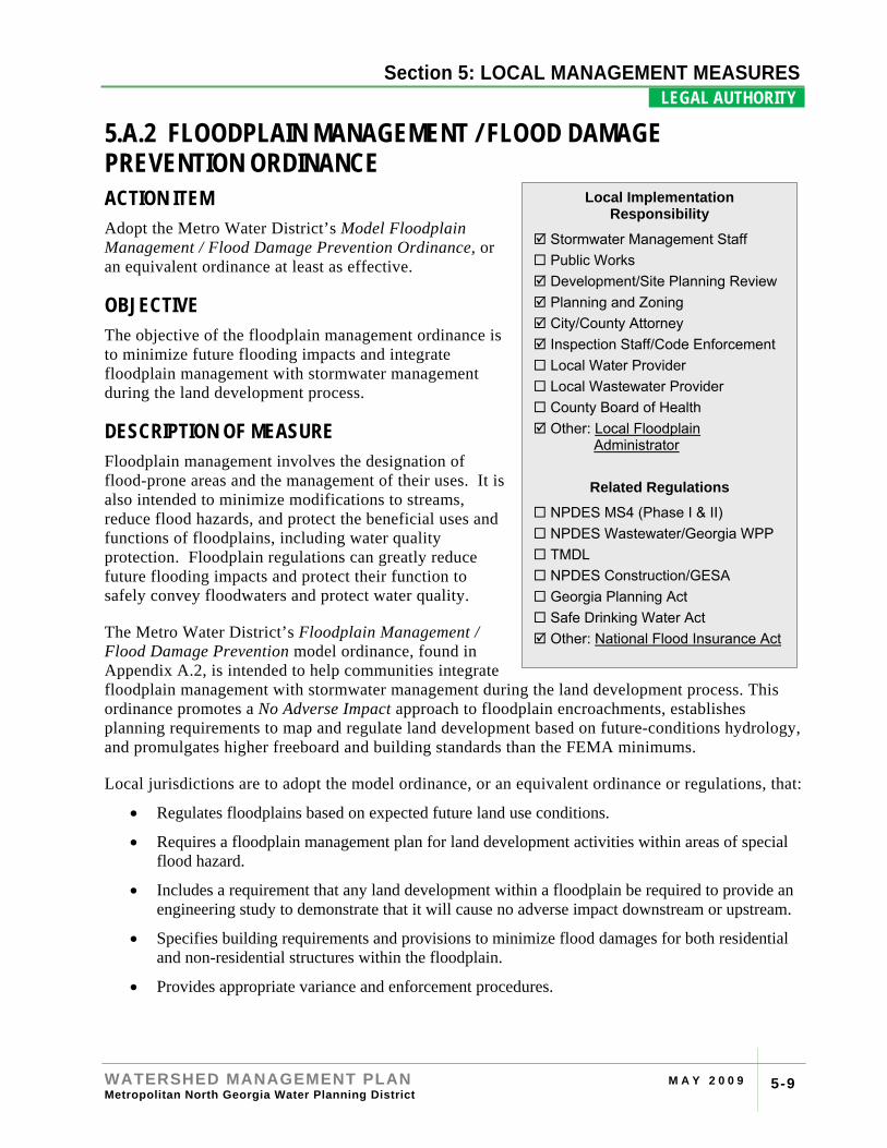
5.A.2 FLOODPLAIN MANAGEMENT / FLOOD DAMAGE PREVENTION ORDINANCE ACTION ITEM Adopt the Metro Water District’s Model Floodplain Management / Flood Damage Prevention Ordinance, or an equivalent ordinance at least as effective.
OBJECTIVE The objective of the floodplain management ordinance is to minimize future flooding impacts and integrate floodplain management with stormwater management during the land development process.
DESCRIPTION OF MEASURE Floodplain management involves the designation of flood-prone areas and the management of their uses. It is also intended to minimize modifications to streams, reduce flood hazards, and protect the beneficial uses and functions of floodplains, including water quality protection. Floodplain regulations can greatly reduce future flooding impacts and protect their function to safely convey floodwaters and protect water quality.
The Metro Water District’s Floodplain Management / Flood Damage Prevention model ordinance, found in Appendix A.2, is intended to help communities integrate floodplain management with stormwater management during the land development process. This ordinance promotes a No Adverse Impact approach to floodplain encroachments, establishes planning requirements to map and regulate land development based on future-conditions hydrology, and promulgates higher freeboard and building standards than the FEMA minimums.
Local jurisdictions are to adopt the model ordinance, or an equivalent ordinance or regulations, that:
• Regulates floodplains based on expected future land use conditions.
• Requires a floodplain management plan for land development activities within areas of special flood hazard.
• Includes a requirement that any land development within a floodplain be required to provide an engineering study to demonstrate that it will cause no adverse impact downstream or upstream.
• Specifies building requirements and provisions to minimize flood damages for both residential and non-residential structures within the floodplain.
• Provides appropriate variance and enforcement procedures.
Local Implementation Responsibility
Stormwater Management Staff Public Works Development/Site Planning Review Planning and Zoning City/County Attorney Inspection Staff/Code Enforcement Local Water Provider Local Wastewater Provider County Board of Health Other: Local Floodplain
Administrator
Related Regulations
NPDES MS4 (Phase I & II) NPDES Wastewater/Georgia WPP TMDL NPDES Construction/GESA Georgia Planning Act Safe Drinking Water Act Other: National Flood Insurance Act
Section 4: RIVER BASIN PROFILES
WATERSHED MANAGEMENT PLAN M A Y 2 0 0 9 Metropolitan North Georgia Water Planning District 5-10
Section 5: LOCAL MANAGEMENT MEASURES LEGAL AUTHORITY .
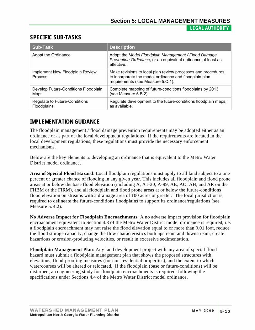
SPECIFIC SUB-TASKS Sub-Task Description Adopt the Ordinance Adopt the Model Floodplain Management / Flood Damage
Prevention Ordinance, or an equivalent ordinance at least as effective.
Implement New Floodplain Review Process
Make revisions to local plan review processes and procedures to incorporate the model ordinance and floodplain plan requirements (see Measure 5.C.1).
Develop Future-Conditions Floodplain Maps
Complete mapping of future-conditions floodplains by 2013 (see Measure 5.B.2).
Regulate to Future-Conditions Floodplains
Regulate development to the future-conditions floodplain maps, as available.
IMPLEMENTATION GUIDANCE The floodplain management / flood damage prevention requirements may be adopted either as an ordinance or as part of the local development regulations. If the requirements are located in the local development regulations, these regulations must provide the necessary enforcement mechanisms.
Below are the key elements to developing an ordinance that is equivalent to the Metro Water District model ordinance.
Area of Special Flood Hazard: Local floodplain regulations must apply to all land subject to a one percent or greater chance of flooding in any given year. This includes all floodplain and flood prone areas at or below the base flood elevation (including A, A1-30, A-99, AE, AO, AH, and AR on the FHBM or the FIRM), and all floodplain and flood prone areas at or below the future-conditions flood elevation on streams with a drainage area of 100 acres or greater. The local jurisdiction is required to delineate the future-conditions floodplains to support its ordinance/regulations (see Measure 5.B.2).
No Adverse Impact for Floodplain Encroachments: A no adverse impact provision for floodplain encroachment equivalent to Section 4.3 of the Metro Water District model ordinance is required, i.e. a floodplain encroachment may not raise the flood elevation equal to or more than 0.01 foot, reduce the flood storage capacity, change the flow characteristics both upstream and downstream, create hazardous or erosion-producing velocities, or result in excessive sedimentation.
Floodplain Management Plan: Any land development project with any area of special flood hazard must submit a floodplain management plan that shows the proposed structures with elevations, flood-proofing measures (for non-residential properties), and the extent to which watercourses will be altered or relocated. If the floodplain (base or future-conditions) will be disturbed, an engineering study for floodplain encroachments is required, following the specifications under Sections 4.4 of the Metro Water District model ordinance.
Section 4: RIVER BASIN PROFILES
WATERSHED MANAGEMENT PLAN M A Y 2 0 0 9 Metropolitan North Georgia Water Planning District 5-11
Section 5: LOCAL MANAGEMENT MEASURES LEGAL AUTHORITY .
Standards for Development: Local floodplain regulations must provide building standards for residential structures, non-residential structures, accessory structures and facilities, recreational vehicles, and manufactured homes that are no less stringent than those in the Metro Water District model ordinance.
Variance Procedures: Variance provisions may only address cases of exceptional hardship.
Enforcement: Some method for enforcement of the ordinance provisions, including appropriate violations and penalties, must be provided consistent with other local regulations.
OPTIONAL CONSIDERATIONS Critical Facilities: For some activities and facilities, the consequences of the facility being flooded are so severe that additional flood protection may be needed. Typical critical facilities include hospitals, fire stations, police stations, water and wastewater facilities, storage of critical records, and similar facilities. These facilities may be given special consideration when formulating regulatory alternatives and floodplain management plans. A critical facility should not be located in a floodplain if at all possible. If a critical facility must be located in a floodplain it should be provided a higher level of protection so that it can continue to function and provide services after the flood. Communities may develop emergency plans to continue to provide these services in the event of a flood. Under Executive Order 11988, Floodplain Management, Federal agencies funding and/or permitting critical facilities are required to avoid the 0.2% (500-year) floodplain or protect the facilities to the 0.2% chance flood level.
FEMA Community Rating System: The National Flood Insurance Program's (NFIP) Community Rating System (CRS) is a voluntary incentive program that recognizes and encourages community floodplain management activities that exceed the minimum NFIP requirements.
By participating in the CRS program, flood insurance premium rates are discounted for residents of a local jurisdiction to reflect the reduced flood risk resulting from the community actions in meeting the three goals of the CRS: reducing flood losses, facilitating accurate insurance ratings, and promoting the awareness of flood insurance. Adopting and enforcing the Metro Water District’s higher regulatory floodplain management standards will help a local jurisdiction to receive CRS credit points and premium reductions for its citizens. Metro Water District communities who are in compliance with this measure and Measure 5.B.2 should be able to receive CRS credits under Activity 400 (Mapping and Regulations) and Activity 500 (Flood Damage Prevention) sections of the CRS program.
RESOURCES FEMA Community Rating System Resource Center: FEMA has a Community Rating System Resource Center on its website which provides information on the CRS program as well as tools to develop a local program to increase the CRS rating for a community.
This website is located at http://training.fema.gov/EMIWeb/CRS/
FEMA Hazard Mitigation Planning: FEMA has created a series of “how to” guides that are located on their website to help municipalities plan for and respond to emergencies. The guides focus on initiating and maintaining a planning process that will result in safer communities, and they are
Section 4: RIVER BASIN PROFILES
WATERSHED MANAGEMENT PLAN M A Y 2 0 0 9 Metropolitan North Georgia Water Planning District 5-12
Section 5: LOCAL MANAGEMENT MEASURES LEGAL AUTHORITY .
applicable to jurisdictions of all sizes and all resource and capability levels. Some of the guides focus on mandatory planning requirements however several show best practices beyond regulatory requirements.
This website is located at http://www.fema.gov/plan/mitplanning/index.shtm
Section 4: RIVER BASIN PROFILES
WATERSHED MANAGEMENT PLAN M A Y 2 0 0 9 Metropolitan North Georgia Water Planning District 5-13
Section 5: LOCAL MANAGEMENT MEASURES LEGAL AUTHORITY .
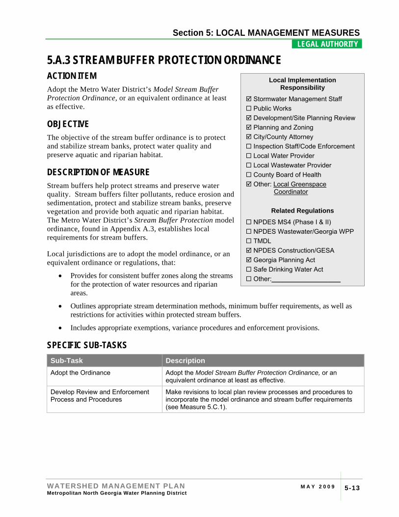
5.A.3 STREAM BUFFER PROTECTION ORDINANCE ACTION ITEM Adopt the Metro Water District’s Model Stream Buffer Protection Ordinance, or an equivalent ordinance at least as effective.
OBJECTIVE The objective of the stream buffer ordinance is to protect and stabilize stream banks, protect water quality and preserve aquatic and riparian habitat.
DESCRIPTION OF MEASURE Stream buffers help protect streams and preserve water quality. Stream buffers filter pollutants, reduce erosion and sedimentation, protect and stabilize stream banks, preserve vegetation and provide both aquatic and riparian habitat. The Metro Water District’s Stream Buffer Protection model ordinance, found in Appendix A.3, establishes local requirements for stream buffers.
Local jurisdictions are to adopt the model ordinance, or an equivalent ordinance or regulations, that:
• Provides for consistent buffer zones along the streams for the protection of water resources and riparian areas.
• Outlines appropriate stream determination methods, minimum buffer requirements, as well as restrictions for activities within protected stream buffers.
• Includes appropriate exemptions, variance procedures and enforcement provisions.
SPECIFIC SUB-TASKS Sub-Task Description Adopt the Ordinance Adopt the Model Stream Buffer Protection Ordinance, or an
equivalent ordinance at least as effective.
Develop Review and Enforcement Process and Procedures
Make revisions to local plan review processes and procedures to incorporate the model ordinance and stream buffer requirements (see Measure 5.C.1).
Local Implementation Responsibility
Stormwater Management Staff Public Works Development/Site Planning Review Planning and Zoning City/County Attorney Inspection Staff/Code Enforcement Local Water Provider Local Wastewater Provider County Board of Health Other: Local Greenspace
Coordinator
Related Regulations
NPDES MS4 (Phase I & II) NPDES Wastewater/Georgia WPP TMDL NPDES Construction/GESA Georgia Planning Act Safe Drinking Water Act Other:___________________
Section 4: RIVER BASIN PROFILES
WATERSHED MANAGEMENT PLAN M A Y 2 0 0 9 Metropolitan North Georgia Water Planning District 5-14
Section 5: LOCAL MANAGEMENT MEASURES LEGAL AUTHORITY .
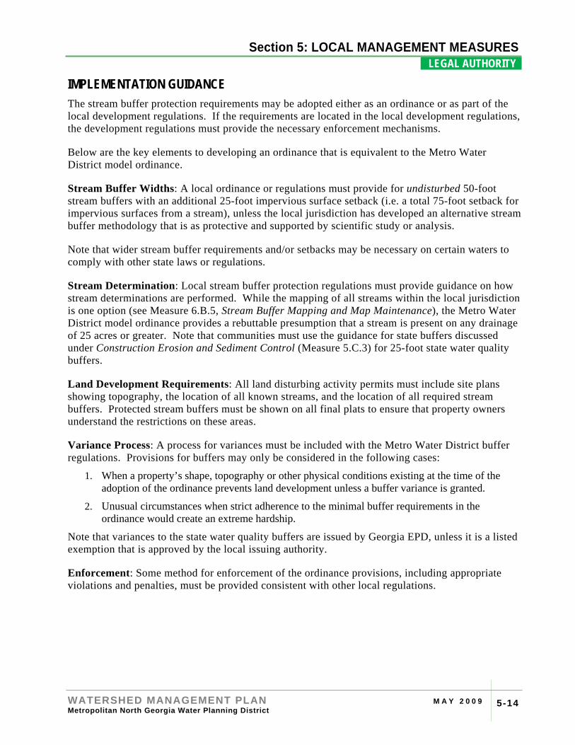
IMPLEMENTATION GUIDANCE The stream buffer protection requirements may be adopted either as an ordinance or as part of the local development regulations. If the requirements are located in the local development regulations, the development regulations must provide the necessary enforcement mechanisms.
Below are the key elements to developing an ordinance that is equivalent to the Metro Water District model ordinance.
Stream Buffer Widths: A local ordinance or regulations must provide for undisturbed 50-foot stream buffers with an additional 25-foot impervious surface setback (i.e. a total 75-foot setback for impervious surfaces from a stream), unless the local jurisdiction has developed an alternative stream buffer methodology that is as protective and supported by scientific study or analysis.
Note that wider stream buffer requirements and/or setbacks may be necessary on certain waters to comply with other state laws or regulations.
Stream Determination: Local stream buffer protection regulations must provide guidance on how stream determinations are performed. While the mapping of all streams within the local jurisdiction is one option (see Measure 6.B.5, Stream Buffer Mapping and Map Maintenance), the Metro Water District model ordinance provides a rebuttable presumption that a stream is present on any drainage of 25 acres or greater. Note that communities must use the guidance for state buffers discussed under Construction Erosion and Sediment Control (Measure 5.C.3) for 25-foot state water quality buffers.
Land Development Requirements: All land disturbing activity permits must include site plans showing topography, the location of all known streams, and the location of all required stream buffers. Protected stream buffers must be shown on all final plats to ensure that property owners understand the restrictions on these areas.
Variance Process: A process for variances must be included with the Metro Water District buffer regulations. Provisions for buffers may only be considered in the following cases:
1. When a property’s shape, topography or other physical conditions existing at the time of the adoption of the ordinance prevents land development unless a buffer variance is granted.
2. Unusual circumstances when strict adherence to the minimal buffer requirements in the ordinance would create an extreme hardship.
Note that variances to the state water quality buffers are issued by Georgia EPD, unless it is a listed exemption that is approved by the local issuing authority.
Enforcement: Some method for enforcement of the ordinance provisions, including appropriate violations and penalties, must be provided consistent with other local regulations.
Section 4: RIVER BASIN PROFILES
WATERSHED MANAGEMENT PLAN M A Y 2 0 0 9 Metropolitan North Georgia Water Planning District 5-15
Section 5: LOCAL MANAGEMENT MEASURES LEGAL AUTHORITY .
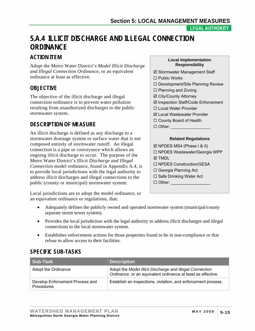
5.A.4 ILLICIT DISCHARGE AND ILLEGAL CONNECTION ORDINANCE ACTION ITEM Adopt the Metro Water District’s Model Illicit Discharge and Illegal Connection Ordinance, or an equivalent ordinance at least as effective.
OBJECTIVE The objective of the illicit discharge and illegal connection ordinance is to prevent water pollution resulting from unauthorized discharges to the public stormwater system.
DESCRIPTION OF MEASURE An illicit discharge is defined as any discharge to a stormwater drainage system or surface water that is not composed entirely of stormwater runoff. An illegal connection is a pipe or conveyance which allows an ongoing illicit discharge to occur. The purpose of the Metro Water District’s Illicit Discharge and Illegal Connection model ordinance, found in Appendix A.4, is to provide local jurisdictions with the legal authority to address illicit discharges and illegal connections to the public (county or municipal) stormwater system.
Local jurisdictions are to adopt the model ordinance, or an equivalent ordinance or regulations, that:
• Adequately defines the publicly owned and operated stormwater system (municipal/county separate storm sewer system).
• Provides the local jurisdiction with the legal authority to address illicit discharges and illegal connections to the local stormwater system.
• Establishes enforcement actions for those properties found to be in non-compliance or that refuse to allow access to their facilities.
SPECIFIC SUB-TASKS Sub-Task Description Adopt the Ordinance Adopt the Model Illicit Discharge and Illegal Connection
Ordinance, or an equivalent ordinance at least as effective.
Develop Enforcement Process and Procedures
Establish an inspections, violation, and enforcement process.
Local Implementation Responsibility
Stormwater Management Staff Public Works Development/Site Planning Review Planning and Zoning City/County Attorney Inspection Staff/Code Enforcement Local Water Provider Local Wastewater Provider County Board of Health Other: _________________
Related Regulations
NPDES MS4 (Phase I & II) NPDES Wastewater/Georgia WPP TMDL NPDES Construction/GESA Georgia Planning Act Safe Drinking Water Act Other: _________________
Section 4: RIVER BASIN PROFILES
WATERSHED MANAGEMENT PLAN M A Y 2 0 0 9 Metropolitan North Georgia Water Planning District 5-16
Section 5: LOCAL MANAGEMENT MEASURES LEGAL AUTHORITY .
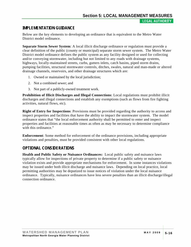
IMPLEMENTATION GUIDANCE Below are the key elements to developing an ordinance that is equivalent to the Metro Water District model ordinance.
Separate Storm Sewer System: A local illicit discharge ordinance or regulation must provide a clear definition of the public (county or municipal) separate storm sewer system. The Metro Water District model ordinance defines the public system as any facility designed or used for collecting and/or conveying stormwater, including but not limited to any roads with drainage systems, highways, locally-maintained streets, curbs, gutters inlets, catch basins, piped storm drains, pumping facilities, structural stormwater controls, ditches, swales, natural and man-made or altered drainage channels, reservoirs, and other drainage structures which are:
1. Owned or maintained by the local jurisdiction;
2. Not a combined sewer; and
3. Not part of a publicly-owned treatment work.
Prohibition of Illicit Discharges and Illegal Connections: Local regulations must prohibit illicit discharges and illegal connections and establish any exemptions (such as flows from fire fighting activities, natural flows, etc).
Right of Entry for Inspections: Provisions must be provided regarding the authority to access and inspect properties and facilities that have the ability to impact the stormwater system. The model ordinance states that “the local enforcement authority shall be permitted to enter and inspect properties and facilities at reasonable times as often as may be necessary to determine compliance with this ordinance.”
Enforcement: Some method for enforcement of the ordinance provisions, including appropriate violations and penalties, must be provided consistent with other local regulations.
OPTIONAL CONSIDERATIONS Health and Public Safety or Nuisance Ordinances: Local public safety and nuisance laws typically allow for inspections of private property to determine if a public safety or nuisance violation exists and provide appropriate mechanisms for enforcement. In some instances violations may be issued under both illicit discharge and nuisance laws. Depending on local practice, local permitting authorities may be deputized to issue notices of violation under the local nuisance ordinance. Typically, nuisance ordinances have less severe penalties than an illicit discharge/illegal connection ordinance.
Section 4: RIVER BASIN PROFILES
WATERSHED MANAGEMENT PLAN M A Y 2 0 0 9 Metropolitan North Georgia Water Planning District 5-17
Section 5: LOCAL MANAGEMENT MEASURES LEGAL AUTHORITY .
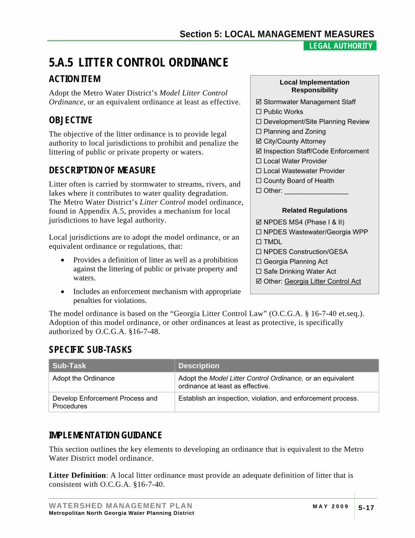
5.A.5 LITTER CONTROL ORDINANCE ACTION ITEM Adopt the Metro Water District’s Model Litter Control Ordinance, or an equivalent ordinance at least as effective.
OBJECTIVE The objective of the litter ordinance is to provide legal authority to local jurisdictions to prohibit and penalize the littering of public or private property or waters.
DESCRIPTION OF MEASURE Litter often is carried by stormwater to streams, rivers, and lakes where it contributes to water quality degradation. The Metro Water District’s Litter Control model ordinance, found in Appendix A.5, provides a mechanism for local jurisdictions to have legal authority.
Local jurisdictions are to adopt the model ordinance, or an equivalent ordinance or regulations, that:
• Provides a definition of litter as well as a prohibition against the littering of public or private property and waters.
• Includes an enforcement mechanism with appropriate penalties for violations.
The model ordinance is based on the “Georgia Litter Control Law” (O.C.G.A. § 16-7-40 et.seq.). Adoption of this model ordinance, or other ordinances at least as protective, is specifically authorized by O.C.G.A. §16-7-48.
SPECIFIC SUB-TASKS Sub-Task Description Adopt the Ordinance Adopt the Model Litter Control Ordinance, or an equivalent
ordinance at least as effective.
Develop Enforcement Process and Procedures
Establish an inspection, violation, and enforcement process.
IMPLEMENTATION GUIDANCE This section outlines the key elements to developing an ordinance that is equivalent to the Metro Water District model ordinance.
Litter Definition: A local litter ordinance must provide an adequate definition of litter that is consistent with O.C.G.A. §16-7-40.
Local Implementation Responsibility
Stormwater Management Staff Public Works Development/Site Planning Review Planning and Zoning City/County Attorney Inspection Staff/Code Enforcement Local Water Provider Local Wastewater Provider County Board of Health Other: _________________
Related Regulations
NPDES MS4 (Phase I & II) NPDES Wastewater/Georgia WPP TMDL NPDES Construction/GESA Georgia Planning Act Safe Drinking Water Act Other: Georgia Litter Control Act
Section 4: RIVER BASIN PROFILES
WATERSHED MANAGEMENT PLAN M A Y 2 0 0 9 Metropolitan North Georgia Water Planning District 5-18
Section 5: LOCAL MANAGEMENT MEASURES LEGAL AUTHORITY .
Enforcement: Some method for enforcement of the ordinance provisions, including appropriate violations and penalties, must be provided consistent with other local regulations.
OPTIONAL CONSIDERATIONS Enforcement Delegation: The model ordinance provides enforcement authority to law enforcement personnel as well as anyone “authorized, empowered and directed to enforce compliance with this article.” Many communities delegate authority to code enforcement officers, environmental compliance officers, inspections staff, stormwater enforcement personnel, and others to issue warnings and citations for littering. To officially delegate authority, the local police department deputizes local jurisdiction employees, thereby authorizing them to enforce certain aspects of local code.
Section 4: RIVER BASIN PROFILES
WATERSHED MANAGEMENT PLAN M A Y 2 0 0 9 Metropolitan North Georgia Water Planning District 5-19
Section 5: LOCAL MANAGEMENT MEASURES WATERSHED PLANNING .
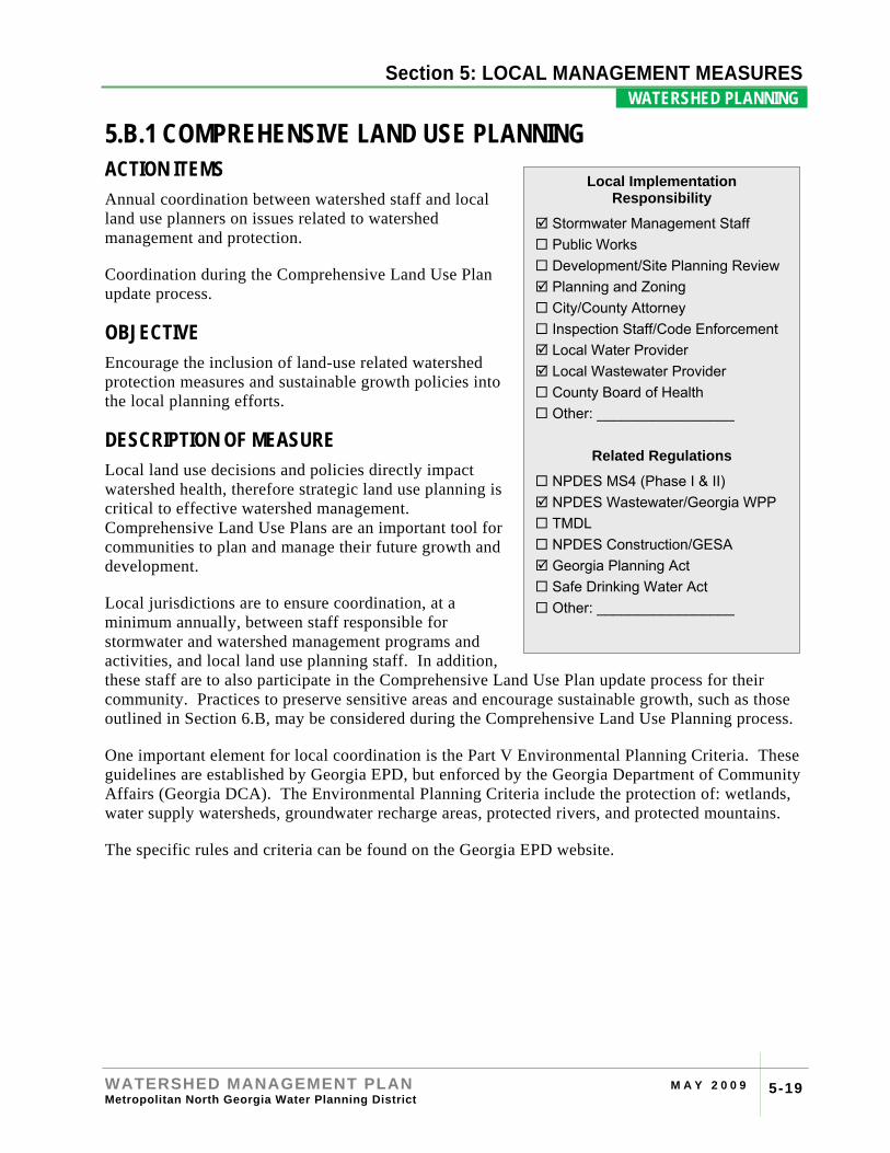
5.B.1 COMPREHENSIVE LAND USE PLANNING ACTION ITEMS Annual coordination between watershed staff and local land use planners on issues related to watershed management and protection.
Coordination during the Comprehensive Land Use Plan update process.
OBJECTIVE Encourage the inclusion of land-use related watershed protection measures and sustainable growth policies into the local planning efforts.
DESCRIPTION OF MEASURE Local land use decisions and policies directly impact watershed health, therefore strategic land use planning is critical to effective watershed management. Comprehensive Land Use Plans are an important tool for communities to plan and manage their future growth and development.
Local jurisdictions are to ensure coordination, at a minimum annually, between staff responsible for stormwater and watershed management programs and activities, and local land use planning staff. In addition, these staff are to also participate in the Comprehensive Land Use Plan update process for their community. Practices to preserve sensitive areas and encourage sustainable growth, such as those outlined in Section 6.B, may be considered during the Comprehensive Land Use Planning process.
One important element for local coordination is the Part V Environmental Planning Criteria. These guidelines are established by Georgia EPD, but enforced by the Georgia Department of Community Affairs (Georgia DCA). The Environmental Planning Criteria include the protection of: wetlands, water supply watersheds, groundwater recharge areas, protected rivers, and protected mountains.
The specific rules and criteria can be found on the Georgia EPD website.
Local Implementation Responsibility
Stormwater Management Staff Public Works Development/Site Planning Review Planning and Zoning City/County Attorney Inspection Staff/Code Enforcement Local Water Provider Local Wastewater Provider County Board of Health Other: _________________
Related Regulations
NPDES MS4 (Phase I & II) NPDES Wastewater/Georgia WPP TMDL NPDES Construction/GESA Georgia Planning Act Safe Drinking Water Act Other: _________________
Section 4: RIVER BASIN PROFILES
WATERSHED MANAGEMENT PLAN M A Y 2 0 0 9 Metropolitan North Georgia Water Planning District 5-20
Section 5: LOCAL MANAGEMENT MEASURES WATERSHED PLANNING .
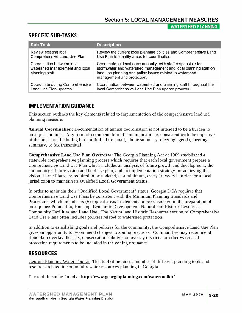
SPECIFIC SUB-TASKS Sub-Task Description Review existing local Comprehensive Land Use Plan
Review the current local planning policies and Comprehensive Land Use Plan to identify areas for coordination.
Coordination between local watershed management and local planning staff
Coordinate, at least once annually, with staff responsible for stormwater and watershed management and local planning staff on land use planning and policy issues related to watershed management and protection.
Coordinate during Comprehensive Land Use Plan updates
Coordination between watershed and planning staff throughout the local Comprehensive Land Use Plan update process
IMPLEMENTATION GUIDANCE This section outlines the key elements related to implementation of the comprehensive land use planning measure.
Annual Coordination: Documentation of annual coordination is not intended to be a burden to local jurisdictions. Any form of documentation of communication is consistent with the objective of this measure, including but not limited to: email, phone summary, meeting agenda, meeting summary, or fax transmittal.
Comprehensive Land Use Plan Overview: The Georgia Planning Act of 1989 established a statewide comprehensive planning process which requires that each local government prepare a Comprehensive Land Use Plan which includes an analysis of future growth and development, the community’s future vision and land use plan, and an implementation strategy for achieving that vision. These Plans are required to be updated, at a minimum, every 10 years in order for a local jurisdiction to maintain its Qualified Local Government Status.
In order to maintain their “Qualified Local Government” status, Georgia DCA requires that Comprehensive Land Use Plans be consistent with the Minimum Planning Standards and Procedures which include six (6) topical areas or elements to be considered in the preparation of local plans: Population, Housing, Economic Development, Natural and Historic Resources, Community Facilities and Land Use. The Natural and Historic Resources section of Comprehensive Land Use Plans often includes policies related to watershed protection.
In addition to establishing goals and policies for the community, the Comprehensive Land Use Plan gives an opportunity to recommend changes to zoning practices. Communities may recommend floodplain overlay districts, conservation subdivision overlay districts, or other watershed protection requirements to be included in the zoning ordinance.
RESOURCES Georgia Planning Water Toolkit: This toolkit includes a number of different planning tools and resources related to community water resources planning in Georgia.
The toolkit can be found at http://www.georgiaplanning.com/watertoolkit/
Section 4: RIVER BASIN PROFILES
WATERSHED MANAGEMENT PLAN M A Y 2 0 0 9 Metropolitan North Georgia Water Planning District 5-21
Section 5: LOCAL MANAGEMENT MEASURES WATERSHED PLANNING .
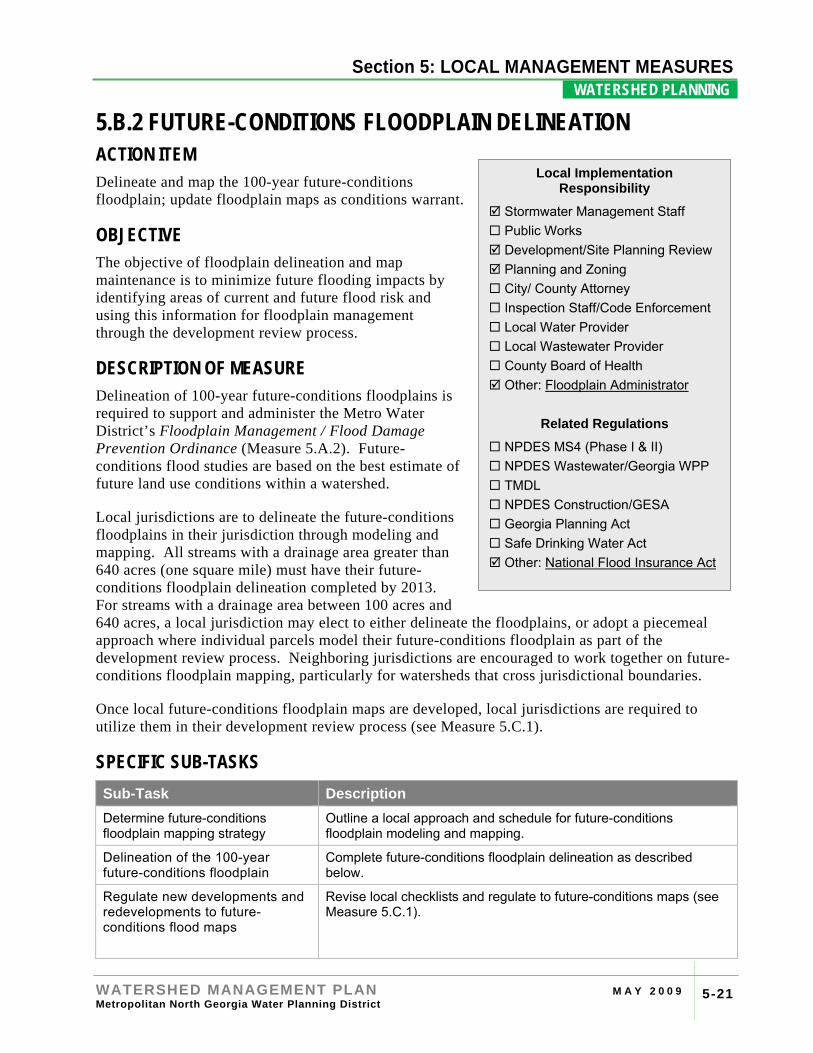
5.B.2 FUTURE-CONDITIONS FLOODPLAIN DELINEATION ACTION ITEM Delineate and map the 100-year future-conditions floodplain; update floodplain maps as conditions warrant.
OBJECTIVE The objective of floodplain delineation and map maintenance is to minimize future flooding impacts by identifying areas of current and future flood risk and using this information for floodplain management through the development review process.
DESCRIPTION OF MEASURE Delineation of 100-year future-conditions floodplains is required to support and administer the Metro Water District’s Floodplain Management / Flood Damage Prevention Ordinance (Measure 5.A.2). Future-conditions flood studies are based on the best estimate of future land use conditions within a watershed.
Local jurisdictions are to delineate the future-conditions floodplains in their jurisdiction through modeling and mapping. All streams with a drainage area greater than 640 acres (one square mile) must have their future-conditions floodplain delineation completed by 2013. For streams with a drainage area between 100 acres and 640 acres, a local jurisdiction may elect to either delineate the floodplains, or adopt a piecemeal approach where individual parcels model their future-conditions floodplain as part of the development review process. Neighboring jurisdictions are encouraged to work together on future-conditions floodplain mapping, particularly for watersheds that cross jurisdictional boundaries.
Once local future-conditions floodplain maps are developed, local jurisdictions are required to utilize them in their development review process (see Measure 5.C.1).
SPECIFIC SUB-TASKS Sub-Task Description Determine future-conditions floodplain mapping strategy
Outline a local approach and schedule for future-conditions floodplain modeling and mapping.
Delineation of the 100-year future-conditions floodplain
Complete future-conditions floodplain delineation as described below.
Regulate new developments and redevelopments to future-conditions flood maps
Revise local checklists and regulate to future-conditions maps (see Measure 5.C.1).
Local Implementation Responsibility
Stormwater Management Staff Public Works Development/Site Planning Review Planning and Zoning City/ County Attorney Inspection Staff/Code Enforcement Local Water Provider Local Wastewater Provider County Board of Health Other: Floodplain Administrator
Related Regulations
NPDES MS4 (Phase I & II) NPDES Wastewater/Georgia WPP TMDL NPDES Construction/GESA Georgia Planning Act Safe Drinking Water Act Other: National Flood Insurance Act
Section 4: RIVER BASIN PROFILES
WATERSHED MANAGEMENT PLAN M A Y 2 0 0 9 Metropolitan North Georgia Water Planning District 5-22
Section 5: LOCAL MANAGEMENT MEASURES WATERSHED PLANNING .
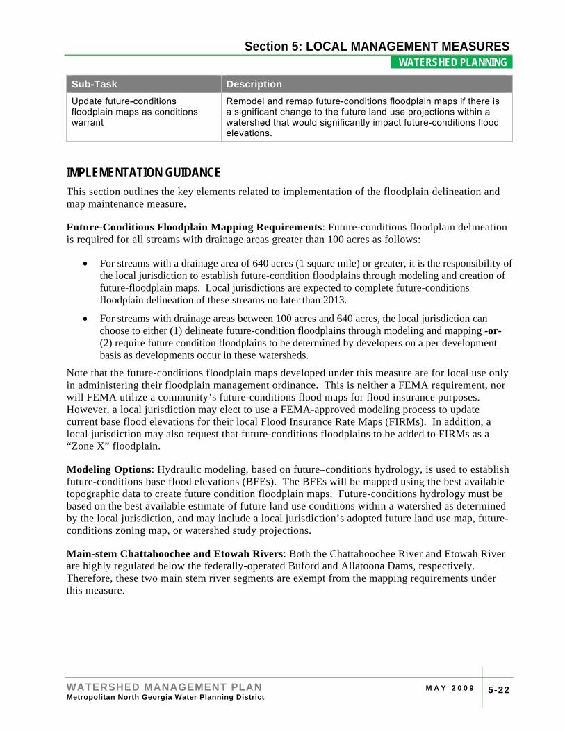
Sub-Task Description Update future-conditions floodplain maps as conditions warrant
Remodel and remap future-conditions floodplain maps if there is a significant change to the future land use projections within a watershed that would significantly impact future-conditions flood elevations.
IMPLEMENTATION GUIDANCE This section outlines the key elements related to implementation of the floodplain delineation and map maintenance measure.
Future-Conditions Floodplain Mapping Requirements: Future-conditions floodplain delineation is required for all streams with drainage areas greater than 100 acres as follows:
• For streams with a drainage area of 640 acres (1 square mile) or greater, it is the responsibility of the local jurisdiction to establish future-condition floodplains through modeling and creation of future-floodplain maps. Local jurisdictions are expected to complete future-conditions floodplain delineation of these streams no later than 2013.
• For streams with drainage areas between 100 acres and 640 acres, the local jurisdiction can choose to either (1) delineate future-condition floodplains through modeling and mapping -or- (2) require future condition floodplains to be determined by developers on a per development basis as developments occur in these watersheds.
Note that the future-conditions floodplain maps developed under this measure are for local use only in administering their floodplain management ordinance. This is neither a FEMA requirement, nor will FEMA utilize a community’s future-conditions flood maps for flood insurance purposes. However, a local jurisdiction may elect to use a FEMA-approved modeling process to update current base flood elevations for their local Flood Insurance Rate Maps (FIRMs). In addition, a local jurisdiction may also request that future-conditions floodplains to be added to FIRMs as a “Zone X” floodplain.
Modeling Options: Hydraulic modeling, based on future–conditions hydrology, is used to establish future-conditions base flood elevations (BFEs). The BFEs will be mapped using the best available topographic data to create future condition floodplain maps. Future-conditions hydrology must be based on the best available estimate of future land use conditions within a watershed as determined by the local jurisdiction, and may include a local jurisdiction’s adopted future land use map, future-conditions zoning map, or watershed study projections.
Main-stem Chattahoochee and Etowah Rivers: Both the Chattahoochee River and Etowah River are highly regulated below the federally-operated Buford and Allatoona Dams, respectively. Therefore, these two main stem river segments are exempt from the mapping requirements under this measure.
Section 4: RIVER BASIN PROFILES
WATERSHED MANAGEMENT PLAN M A Y 2 0 0 9 Metropolitan North Georgia Water Planning District 5-23
Section 5: LOCAL MANAGEMENT MEASURES WATERSHED PLANNING .
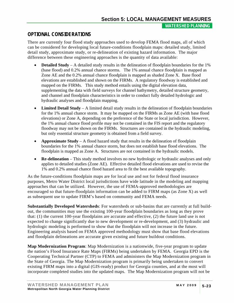
OPTIONAL CONSIDERATIONS There are currently four flood study approaches used to develop FEMA flood maps, all of which can be considered for developing local future-conditions floodplain maps: detailed study, limited detail study, approximate study, or re-delineation of existing hazard information. The major difference between these engineering approaches is the quantity of data available:
• Detailed Study – A detailed study results in the delineation of floodplain boundaries for the 1% (base flood) and 0.2% annual chance storms. The 1% annual chance floodplain is mapped as Zone AE and the 0.2% annual chance floodplain is mapped as shaded Zone X. Base flood elevations are established and shown on the FIRMs. A regulatory floodway is established and mapped on the FIRMs. This study method entails using the digital elevation data, supplementing the data with field surveys for channel bathymetry, detailed structure geometry, and channel and floodplain characteristics in order to conduct fully detailed hydrologic and hydraulic analyses and floodplain mapping.
• Limited Detail Study – A limited detail study results in the delineation of floodplain boundaries for the 1% annual chance storm. It may be mapped on the FIRMs as Zone AE (with base flood elevations) or Zone A, depending on the preference of the State or local jurisdiction. However, the 1% annual chance flood profile may not be contained in the FIS report and the regulatory floodway may not be shown on the FIRMs. Structures are contained in the hydraulic modeling, but only essential structure geometry is obtained from a field survey.
• Approximate Study – A flood hazard study that results in the delineation of floodplain boundaries for the 1% annual chance storm, but does not establish base flood elevations. The floodplain is mapped as Zone A. Structures are not contained in the hydraulic models.
• Re-delineation – This study method involves no new hydrologic or hydraulic analyses and only applies to detailed studies (Zone AE). Effective detailed flood elevations are used to revise the 1% and 0.2% annual chance flood hazard area to fit the best available topography.
As the future-conditions floodplain maps are for local use and not for federal flood insurance purposes, Metro Water District local jurisdictions have wide latitude in the modeling and mapping approaches that can be utilized. However, the use of FEMA-approved methodologies are encouraged so that future-floodplain information can be added to FIRM maps (as Zone X) as well as subsequent use to update FIRM’s based on community and FEMA needs.
Substantially Developed Watersheds: For watersheds or sub-basins that are currently at full build-out, the communities may use the existing 100-year floodplain boundaries as long as they prove that: (1) the current 100-year floodplains are accurate and effective, (2) the future land use is not expected to change significantly due to new development or re-development, and (3) hydraulic and hydrologic modeling is performed to show that the floodplain will not increase in the future. Engineering analysis based on FEMA approved methodology must show that base flood elevations and floodplain delineations are accurate given existing and future buildout conditions.
Map Modernization Program: Map Modernization is a nationwide, five-year program to update the nation’s Flood Insurance Rate Maps (FIRMs) being undertaken by FEMA. Georgia EPD is the Cooperating Technical Partner (CTP) to FEMA and administers the Map Modernization program in the State of Georgia. The Map Modernization program is primarily being undertaken to convert existing FIRM maps into a digital (GIS-ready) product for Georgia counties, and at the most will incorporate completed studies into the updated maps. The Map Modernization program will not be
Section 4: RIVER BASIN PROFILES
WATERSHED MANAGEMENT PLAN M A Y 2 0 0 9 Metropolitan North Georgia Water Planning District 5-24
Section 5: LOCAL MANAGEMENT MEASURES WATERSHED PLANNING .
undertaking new studies or restudies of existing floodplains, and therefore this effort is complementary to the Metro Water District mapping requirements.
Section 4: RIVER BASIN PROFILES
WATERSHED MANAGEMENT PLAN M A Y 2 0 0 9 Metropolitan North Georgia Water Planning District 5-25
Section 5: LOCAL MANAGEMENT MEASURES WATERSHED PLANNING .
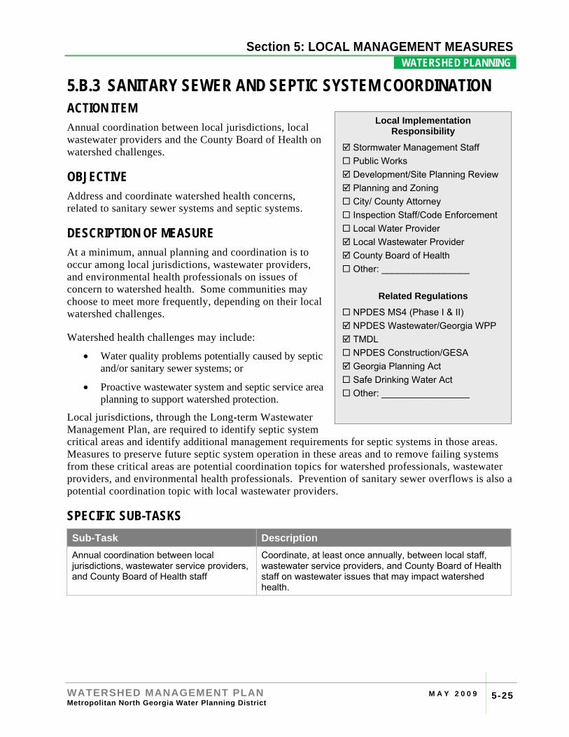
5.B.3 SANITARY SEWER AND SEPTIC SYSTEM COORDINATION ACTION ITEM Annual coordination between local jurisdictions, local wastewater providers and the County Board of Health on watershed challenges.
OBJECTIVE Address and coordinate watershed health concerns, related to sanitary sewer systems and septic systems.
DESCRIPTION OF MEASURE At a minimum, annual planning and coordination is to occur among local jurisdictions, wastewater providers, and environmental health professionals on issues of concern to watershed health. Some communities may choose to meet more frequently, depending on their local watershed challenges.
Watershed health challenges may include:
• Water quality problems potentially caused by septic and/or sanitary sewer systems; or
• Proactive wastewater system and septic service area planning to support watershed protection.
Local jurisdictions, through the Long-term Wastewater Management Plan, are required to identify septic system critical areas and identify additional management requirements for septic systems in those areas. Measures to preserve future septic system operation in these areas and to remove failing systems from these critical areas are potential coordination topics for watershed professionals, wastewater providers, and environmental health professionals. Prevention of sanitary sewer overflows is also a potential coordination topic with local wastewater providers.
SPECIFIC SUB-TASKS Sub-Task Description Annual coordination between local jurisdictions, wastewater service providers, and County Board of Health staff
Coordinate, at least once annually, between local staff, wastewater service providers, and County Board of Health staff on wastewater issues that may impact watershed health.
Local Implementation Responsibility
Stormwater Management Staff Public Works Development/Site Planning Review Planning and Zoning City/ County Attorney Inspection Staff/Code Enforcement Local Water Provider Local Wastewater Provider County Board of Health Other: _________________
Related Regulations
NPDES MS4 (Phase I & II) NPDES Wastewater/Georgia WPP TMDL NPDES Construction/GESA Georgia Planning Act Safe Drinking Water Act Other: _________________
Section 4: RIVER BASIN PROFILES
WATERSHED MANAGEMENT PLAN M A Y 2 0 0 9 Metropolitan North Georgia Water Planning District 5-26
Section 5: LOCAL MANAGEMENT MEASURES WATERSHED PLANNING .
IMPLEMENTATION GUIDANCE This section outlines the key elements related to implementation of the sanitary sewer and septic system coordination measure.
Annual Coordination: Documentation of annual coordination is not intended to be a burden to local jurisdictions. Any form of documentation of communication is consistent with the objective of this measure, including but not limited to: email, phone summary, meeting agenda, meeting summary, or fax transmittal.
Critical Areas Determination: Critical areas are those areas where the risks and/or potential impacts of septic system failures are higher. Each local jurisdiction must identify critical areas that are either current problems or could possibly cause problems in the future as required in Section 8 of the Long-term Wastewater Management Plan. In determining critical areas for septic systems the following areas will be considered:
• Septic systems in small drinking water supply watersheds;
• Septic systems found around lakes or other water features;
• Areas with high failure rates;
• Areas with limited soil conditions, rock, steep slopes, or high groundwater levels; and
• Other problem areas as defined by County Board of Health and/or local jurisdictions.
The identification of critical areas will be in coordination with the County Board of Health, local wastewater providers, and the Comprehensive Land Use Plan (see Measure 5.B.1).
OPTIONAL CONSIDERATIONS Planning Challenges: Availability of water and sewer service influences growth patterns as development frequently follows infrastructure extensions. In particular, sewered areas allow higher density developments. The unavailability of sewer service also influences the need for septic systems and other onsite treatment systems. The Long-term Wastewater Management Plan requires septic system planning, including identification of where and under what conditions septic systems are appropriate considering long-term water quality and quantity concerns. Coordination of watershed planning and septic system planning with comprehensive land use planning can protect watershed health.
Watershed Conditions Assessments: Watershed monitoring results from Measure 5.F.1 may show areas that do not meet State standards for fecal coliform bacteria. Sampling data may be shared with the local wastewater providers and/or County Board of Health staff so that they can look for any potential bacteria sources such as sanitary sewer overflows or failed septic systems.
Section 4: RIVER BASIN PROFILES
WATERSHED MANAGEMENT PLAN M A Y 2 0 0 9 Metropolitan North Georgia Water Planning District 5-27
Section 5: LOCAL MANAGEMENT MEASURES WATERSHED PLANNING .
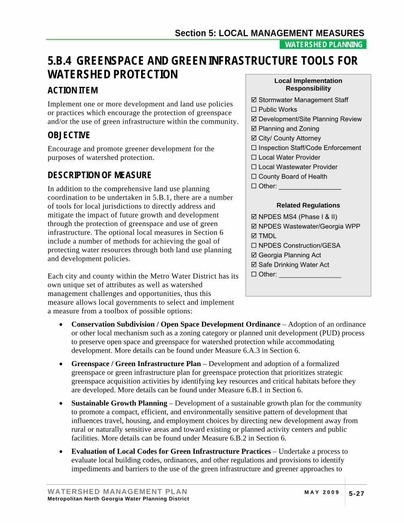
5.B.4 GREENSPACE AND GREEN INFRASTRUCTURE TOOLS FOR WATERSHED PROTECTION ACTION ITEM Implement one or more development and land use policies or practices which encourage the protection of greenspace and/or the use of green infrastructure within the community.
OBJECTIVE Encourage and promote greener development for the purposes of watershed protection.
DESCRIPTION OF MEASURE In addition to the comprehensive land use planning coordination to be undertaken in 5.B.1, there are a number of tools for local jurisdictions to directly address and mitigate the impact of future growth and development through the protection of greenspace and use of green infrastructure. The optional local measures in Section 6 include a number of methods for achieving the goal of protecting water resources through both land use planning and development policies. Each city and county within the Metro Water District has its own unique set of attributes as well as watershed management challenges and opportunities, thus this measure allows local governments to select and implement a measure from a toolbox of possible options:
• Conservation Subdivision / Open Space Development Ordinance – Adoption of an ordinance or other local mechanism such as a zoning category or planned unit development (PUD) process to preserve open space and greenspace for watershed protection while accommodating development. More details can be found under Measure 6.A.3 in Section 6.
• Greenspace / Green Infrastructure Plan – Development and adoption of a formalized greenspace or green infrastructure plan for greenspace protection that prioritizes strategic greenspace acquisition activities by identifying key resources and critical habitats before they are developed. More details can be found under Measure 6.B.1 in Section 6.
• Sustainable Growth Planning – Development of a sustainable growth plan for the community to promote a compact, efficient, and environmentally sensitive pattern of development that influences travel, housing, and employment choices by directing new development away from rural or naturally sensitive areas and toward existing or planned activity centers and public facilities. More details can be found under Measure 6.B.2 in Section 6.
• Evaluation of Local Codes for Green Infrastructure Practices – Undertake a process to evaluate local building codes, ordinances, and other regulations and provisions to identify impediments and barriers to the use of the green infrastructure and greener approaches to
Local Implementation Responsibility
Stormwater Management Staff Public Works Development/Site Planning Review Planning and Zoning City/ County Attorney Inspection Staff/Code Enforcement Local Water Provider Local Wastewater Provider County Board of Health Other: _________________
Related Regulations
NPDES MS4 (Phase I & II) NPDES Wastewater/Georgia WPP TMDL NPDES Construction/GESA Georgia Planning Act Safe Drinking Water Act Other: _________________
Section 4: RIVER BASIN PROFILES
WATERSHED MANAGEMENT PLAN M A Y 2 0 0 9 Metropolitan North Georgia Water Planning District 5-28
Section 5: LOCAL MANAGEMENT MEASURES WATERSHED PLANNING .
growth—including the use of infiltration, reuse and evapotranspiration - and the development site planning and design approaches described under Measure 6.B.3 in Section 6.
• Locally Developed Program – Other local management program for protecting watershed health through land use and/or growth management mechanisms.
SPECIFIC SUB-TASKS Sub-Task Description Implementation of greenspace/green infrastructure option for watershed protection
Selection and implementation of one of the toolbox options for addressing growth management for the protection of water resources through encouraging the protection of open space, greenspace and the use of green infrastructure.
IMPLEMENTATION GUIDANCE Local jurisdictions are required to implement at least one of the toolbox options listed above. See Section 6 for more information and details on several of these options.
Section 4: RIVER BASIN PROFILES
WATERSHED MANAGEMENT PLAN M A Y 2 0 0 9 Metropolitan North Georgia Water Planning District
5-29
Section 5: LOCAL MANAGEMENT MEASURES LAND DEVELOPMENT .
5.C.1 INTEGRATED DEVELOPMENT REVIEW PROCESS ACTION ITEM Develop a site development plan review process and checklist(s) that lists stormwater and watershed management related requirements.
OBJECTIVE An integrated site development plan review process consolidates watershed and stormwater-related regulations to assist a local jurisdiction in streamlining the development review process and help permit applicants to better understand the local requirements and expectations.
DESCRIPTION OF MEASURE Several of the Local Management Measures in this Plan include development submittals that must be reviewed by the local jurisdiction or other issuing authority during the local plan review process, including:
• Post-development stormwater management plan (5.A.1);
• Floodplain management / flood damage prevention plan (5.A.2);
• Appropriate stream buffer protection areas, including local buffer requirements (5.A.3), and all state-mandated buffers for water supply watershed protection, river protection, and erosion and sedimentation control;
• Erosion and sedimentation control plan (5.C.3);
• Project compliance with the local comprehensive land use plan (5.B.1); and
• Local sanitary sewer or septic tank requirements (5.B.3).
The goal of an integrated review process is to help local jurisdictions streamline watershed and stormwater related regulations to provide for the efficient and timely review of development site plans and permit requests. In addition, an integrated review process and checklist will provide a clearer understanding of local permitting requirements and submittal expectations to the development community.
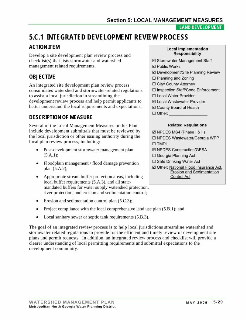
Local Implementation Responsibility
Stormwater Management Staff Public Works Development/Site Planning Review Planning and Zoning City/ County Attorney Inspection Staff/Code Enforcement Local Water Provider Local Wastewater Provider County Board of Health Other: _________________
Related Regulations
NPDES MS4 (Phase I & II) NPDES Wastewater/Georgia WPP TMDL NPDES Construction/GESA Georgia Planning Act Safe Drinking Water Act Other: National Flood Insurance Act,
Erosion and Sedimentation Control Act
Section 4: RIVER BASIN PROFILES
WATERSHED MANAGEMENT PLAN M A Y 2 0 0 9 Metropolitan North Georgia Water Planning District
5-30
Section 5: LOCAL MANAGEMENT MEASURES LAND DEVELOPMENT .
SPECIFIC SUB-TASKS Sub-Task Description Develop a site development plan review process
Develop a process for reviewing local site development plans.
Develop a plan review checklist(s) Ensure that all required elements of the plan review process are included in either one or more checklists.
Update checklist(s) as needed Update and revise the checklist as needed to address new or updated regulatory requirements.
IMPLEMENTATION GUIDANCE A number of local departments are traditionally involved in the site development plan review process; engineering, planning and zoning, public safety, public utilities, transportation, building services, licensing, environmental health, and parks and recreation.
A formal plan review process and checklist(s) for watershed and stormwater management compliance must include the staff members and/or department responsible for each review element/step and the order in which plans will be reviewed. Each local jurisdiction is required to develop an internal plan review checklist(s) appropriate for their local jurisdiction which includes all of the plan submittal requirements from the local management measures included in this Plan as well as any other local, State and Federal regulations and requirements, as appropriate.
OPTIONAL CONSIDERATIONS Permit Coordination Alternatives: To facilitate the effective processing of applications, communities may want to consider the coordinated review processes outlined below.
• One Stop Permit Shop: Typically the one-stop permit shop concept co-locates all of the departments and agencies with input in the permit process in the same building to increase communications. Some one-stop communities will hold regularly scheduled meetings, allowing the development community access to representatives from each department.
• Online Permit Tracking Systems: Permit tracking links departments and agencies electronically through a common computer program and a common database to facilitate processing of applications for permits. The common tracking system allows agencies to freely share information and comments both with the other departments and agencies and with the developers.
Integrated development reviews are typically more efficient and provide a better opportunity to mitigate conflicting comments.
External Checklist: In addition to internal checklist, local jurisdictions may also develop an external checklist and instructions for the development community. This checklist can provide clarity on local permitting requirement and permit submittal expectations to parties engaged in land development activities. Communities may choose to post the checklist on the website and/or attach to permit application forms.
Section 4: RIVER BASIN PROFILES
WATERSHED MANAGEMENT PLAN M A Y 2 0 0 9 Metropolitan North Georgia Water Planning District
5-31
Section 5: LOCAL MANAGEMENT MEASURES LAND DEVELOPMENT .
5.C.2 STORMWATER MANAGEMENT DESIGN CRITERIA AND STANDARDS ACTION ITEM Adopt the Georgia Stormwater Management Manual or an equivalent local design manual.
OBJECTIVE The objective of stormwater management design criteria is to provide guidance to the development community related to the proper management of stormwater runoff to address the water quantity and quality impacts from new development and redevelopment projects.
DESCRIPTION OF MEASURE As specified under Post-Development Stormwater Management Ordinance (see Measure 5.A.1), local jurisdictions are to adopt a local stormwater design manual, either the Georgia Stormwater Management Manual (GSMM) or an equivalent local design manual. The stormwater management design manual must include technical specifications and standards to ensure proper design and sizing of long-term (post-development) stormwater management non-structural and structural facilities and practices. Local jurisdictions are required to review stormwater management plan submittals for land development projects against their locally adopted design manual.
SPECIFIC SUB-TASKS Sub-Task Description Adopt a Stormwater Management Technical Standard and Design Criteria Manual
Adopt either the Georgia Stormwater Management Manual or a local design manual that is as protective of water quality & quantity.
Revise Development (Site Plan) Review Process & Procedures
Make revisions to local processes and procedures to incorporate the model ordinance & design manual elements.
IMPLEMENTATION GUIDANCE Georgia Stormwater Management Manual (Blue Book): The GSMM is used by most local jurisdictions in the Metro Water District as the local Stormwater Management Technical Standards and Design Criteria Manual. The Manual is available online for download at the GSMM website located at http://www.georgiastormwater.com
Local Implementation Responsibility
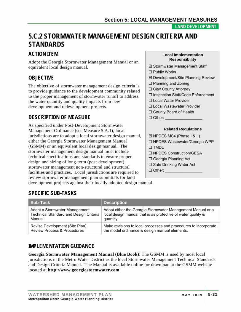
Stormwater Management Staff Public Works Development/Site Planning Review Planning and Zoning City/ County Attorney Inspection Staff/Code Enforcement Local Water Provider Local Wastewater Provider County Board of Health Other: _________________
Related Regulations
NPDES MS4 (Phase I & II) NPDES Wastewater/Georgia WPP TMDL NPDES Construction/GESA Georgia Planning Act Safe Drinking Water Act Other: _________________
Section 4: RIVER BASIN PROFILES
WATERSHED MANAGEMENT PLAN M A Y 2 0 0 9 Metropolitan North Georgia Water Planning District
5-32
Section 5: LOCAL MANAGEMENT MEASURES LAND DEVELOPMENT .
GSMM Addenda: The Georgia Stormwater Management Manual can be adopted “as is” by a local jurisdiction, or with a local addendum which may supplement or provide additional technical criteria, details, or guidance.
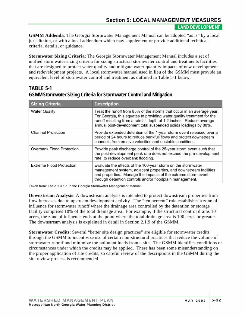
Stormwater Sizing Criteria: The Georgia Stormwater Management Manual includes a set of unified stormwater sizing criteria for sizing structural stormwater control and treatments facilities that are designed to protect water quality and mitigate water quantity impacts of new development and redevelopment projects. A local stormwater manual used in lieu of the GSMM must provide an equivalent level of stormwater control and treatment as outlined in Table 5-1 below.
TABLE 5-1 GSMM Stormwater Sizing Criteria for Stormwater Control and Mitigation Sizing Criteria Description Water Quality Treat the runoff from 85% of the storms that occur in an average year.
For Georgia, this equates to providing water quality treatment for the runoff resulting from a rainfall depth of 1.2 inches. Reduce average annual post-development total suspended solids loadings by 80%.
Channel Protection Provide extended detention of the 1-year storm event released over a period of 24 hours to reduce bankfull flows and protect downstream channels from erosive velocities and unstable conditions.
Overbank Flood Protection Provide peak discharge control of the 25-year storm event such that the post-development peak rate does not exceed the pre-development rate, to reduce overbank flooding.
Extreme Flood Protection Evaluate the effects of the 100-year storm on the stormwater management system, adjacent properties, and downstream facilities and properties. Manage the impacts of the extreme storm event through detention controls and/or floodplain management.
Taken from: Table 1.3.1-1 in the Georgia Stormwater Management Manual
Downstream Analysis: A downstream analysis is intended to protect downstream properties from flow increases due to upstream development activity. The “ten percent” rule establishes a zone of influence for stormwater runoff where the drainage area controlled by the detention or storage facility comprises 10% of the total drainage area. For example, if the structural control drains 10 acres, the zone of influence ends at the point where the total drainage area is 100 acres or greater. The downstream analysis is explained in detail in Section 2.1.9 of the GSMM.
Stormwater Credits: Several “better site design practices” are eligible for stormwater credits through the GSMM to incentivize use of certain non-structural practices that reduce the volume of stormwater runoff and minimize the pollutant loads from a site. The GSMM identifies conditions or circumstances under which the credits may be applied. There has been some misunderstanding on the proper application of site credits, so careful review of the descriptions in the GSMM during the site review process is recommended.
Section 4: RIVER BASIN PROFILES
WATERSHED MANAGEMENT PLAN M A Y 2 0 0 9 Metropolitan North Georgia Water Planning District
5-33
Section 5: LOCAL MANAGEMENT MEASURES LAND DEVELOPMENT .
5.C.3 CONSTRUCTION EROSION AND SEDIMENT CONTROL ACTION ITEM Comply with the requirements of the Georgia Erosion and Sedimentation Control Act.
OBJECTIVE The objective is to reduce soil erosion from active development sites and to enforce applicable erosion and sedimentation control provisions to reduce impacts to watershed health.
DESCRIPTION OF MEASURE Georgia’s Erosion and Sedimentation Control Act (ESCA) includes provisions to protect Georgia’s waters from soil and erosion and sediment deposition. The Act requires permits for land-disturbing activities on sites 1.0 acres or larger as well as an approved erosion and sedimentation control plan for the activity. In addition, the regulations require undisturbed buffers that, for all projects, prohibit most development activity within 25 feet of most streams and 50 feet for streams classified as trout streams.
Local jurisdictions with Local Issuing Authority (LIA) status are to review local land disturbance permits and enforce erosion and sedimentation control requirements at the local level, including:
• Educate applicants of the Notice of Intent (NOI) requirement under the NPDES Construction Permit;
• Collect the mandatory fee per disturbed acre (half of the fee stays with the LIA and half of the fee is sent to Georgia EPD to fund enforcement programs);
• Ensure that erosion and sedimentation control measures are properly designed, installed, and maintained;
• Verify that site personnel involved with the project are certified to perform land disturbance activities; and
• Identify deficiencies and take enforcement actions where necessary.
LIAs are audited periodically for compliance by the Georgia Soil and Water Conservation Commission (Georgia SWCC). Communities passing these local LIA audits are considered in compliance with this management measure (The most recent letter of compliance received from the Georgia SWCC is adequate to ensure compliance).
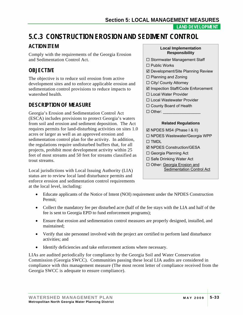
Local Implementation Responsibility
Stormwater Management Staff Public Works Development/Site Planning Review Planning and Zoning City/ County Attorney Inspection Staff/Code Enforcement Local Water Provider Local Wastewater Provider County Board of Health Other: _________________
Related Regulations
NPDES MS4 (Phase I & II) NPDES Wastewater/Georgia WPP TMDL NPDES Construction/GESA Georgia Planning Act Safe Drinking Water Act Other: Georgia Erosion and
Sedimentation Control Act
Section 4: RIVER BASIN PROFILES
WATERSHED MANAGEMENT PLAN M A Y 2 0 0 9 Metropolitan North Georgia Water Planning District
5-34
Section 5: LOCAL MANAGEMENT MEASURES LAND DEVELOPMENT .
Communities that are not LIA’s must ensure that local public projects are properly permitted with the Georgia SWCC and Georgia EPD. Efforts will be employed to ensure that locally-funded projects comply with all erosion and sediment control requirements.
SPECIFIC SUB-TASKS Sub-Task Description Perform local issuing authority requirements under Georgia ESCA (if an LIA)
Review erosion,sedimentation and pollution control (ES&PC) plans in compliance with Georgia ESCA.
If not an LIA--Review local government projects for compliance
Ensure local government projects comply with ESCA best practices.
IMPLEMENTATION GUIDANCE Stream Determination Methodology: Under the Georgia Erosion and Sedimentation Control Act, local issuing authorities are required to make stream determinations on development sites to determine the type of stream, the buffer required, and whether a State variance is required for any buffer encroachment. Georgia EPD provides guidance on making stream determinations available on their website. In general, the guidance states that if base flows are present during the site inspection, the stream is either perennial or intermittent and will require a buffer. If the site is visited during a dry phase and base flows are not evident, the drainage may be ephemeral or intermittent. If there is no flowing water within 24 hours of a rain event, then the drainage feature is probably ephemeral. A trained professional familiar with stream determination methods will perform this investigation. It is recommended that determinations, once completed, be documented in writing.
For difficult stream determinations, the Georgia EPD protocols refer to the North Carolina Division of Water Quality Stream Identification Method (most current version), which includes greater detail on verifying the presence of baseflow. The North Carolina Identification Method has a more detailed process for identification of streams that may help make final determinations, especially for ephemeral streams in the Georgia Piedmont ecoregion.
Note that the Metro Water District model stream buffer protection ordinance (Appendix A.3) provides a rebuttable presumption that a stream is present on any drainage area of 25 acres or greater. This rebuttable presumption only applies to the wider Metro Water District buffers required under Measure 5.A.3. The guidance provided above must be used for the State buffers.
RESOURCES Manual for Erosion and Sedimentation Control in Georgia (Green Book): This manual is available online for download and provides details on the proper design of erosion and sedimentation control methods. The Georgia Soil and Water Conservation Commission also publishes a plan review checklist related to erosion and sedimentation control requirements.
Both the Manual and checklist, as well as other resources, can be found at http://gaswcc.georgia.gov
Section 4: RIVER BASIN PROFILES
WATERSHED MANAGEMENT PLAN M A Y 2 0 0 9 Metropolitan North Georgia Water Planning District
5-35
Section 5: LOCAL MANAGEMENT MEASURES LAND DEVELOPMENT .
Erosion and Sedimentation Control Training Courses: There are several organizations and groups that offer the state-mandated training and certifications courses on erosion and sedimentation control to professionals involved with land disturbance.
Field Guide for Determining the Presence of State Waters That Require a Buffer: This field guidance document is available on the Georgia EPD website.
North Carolina Division of Water Quality Identification Methods for the Origins of Intermittent and Perennial Streams: This manual for stream identification is available on the North Carolina Division of Water Quality website.
The website is located at http://h2o.enr.state.nc.us/ncwetlands/intermittent_perennial.html

Section 4: RIVER BASIN PROFILES
WATERSHED MANAGEMENT PLAN M A Y 2 0 0 9 Metropolitan North Georgia Water Planning District
5-36
Section 5: LOCAL MANAGEMENT MEASURES LAND DEVELOPMENT .
[This page intentionally left blank]
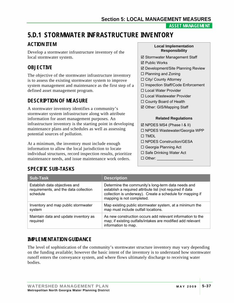
Section 4: RIVER BASIN PROFILES
WATERSHED MANAGEMENT PLAN M A Y 2 0 0 9 Metropolitan North Georgia Water Planning District
5-37
Section 5: LOCAL MANAGEMENT MEASURES ASSET MANAGEMENT .
5.D.1 STORMWATER INFRASTRUCTURE INVENTORY ACTION ITEM Develop a stormwater infrastructure inventory of the local stormwater system.
OBJECTIVE The objective of the stormwater infrastructure inventory is to assess the existing stormwater system to improve system management and maintenance as the first step of a defined asset management program.
DESCRIPTION OF MEASURE A stormwater inventory identifies a community’s stormwater system infrastructure along with attribute information for asset management purposes. An infrastructure inventory is the starting point in developing maintenance plans and schedules as well as assessing potential sources of pollution.
At a minimum, the inventory must include enough information to allow the local jurisdiction to locate individual structures, record inspection results, prioritize maintenance needs, and issue maintenance work orders.
SPECIFIC SUB-TASKS Sub-Task Description Establish data objectives and requirements, and the data collection schedule
Determine the community’s long-term data needs and establish a required attribute list (not required if data collection is underway). Create a schedule for mapping if mapping is not completed.
Inventory and map public stormwater system
Map existing public stormwater system, at a minimum the map must include outfall locations.
Maintain data and update inventory as required
As new construction occurs add relevant information to the map; if existing outfalls/intakes are modified add relevant information to map.
IMPLEMENTATION GUIDANCE The level of sophistication of the community’s stormwater structure inventory may vary depending on the funding available; however the basic intent of the inventory is to understand how stormwater runoff enters the conveyance system, and where flows ultimately discharge to receiving water bodies.
Local Implementation Responsibility
Stormwater Management Staff Public Works Development/Site Planning Review Planning and Zoning City/ County Attorney Inspection Staff/Code Enforcement Local Water Provider Local Wastewater Provider County Board of Health Other: GIS/Mapping Staff
Related Regulations
NPDES MS4 (Phase I & II) NPDES Wastewater/Georgia WPP TMDL NPDES Construction/GESA Georgia Planning Act Safe Drinking Water Act Other: _________________
Section 4: RIVER BASIN PROFILES
WATERSHED MANAGEMENT PLAN M A Y 2 0 0 9 Metropolitan North Georgia Water Planning District
5-38
Section 5: LOCAL MANAGEMENT MEASURES ASSET MANAGEMENT .
There are several methods for developing an infrastructure inventory. In smaller communities, the system may be mapped by walking from catch basins or other inlets to the outfalls, marking the location of each structure on a paper map. In some communities, development as-built drawings can be used to develop the inventory that may be updated based on field-verified location information. More comprehensive field surveys may use geographic positioning system (GPS) to gather the exact location of the infrastructure components and document asset attributes including digital photos.
Inventories are typically illustrated on a map linked to details of the assets, the level of detail and accuracy of which is dependent on a community’s resources. A basic infrastructure inventory may be hand drawn on a local base map with accompanying paper records of system assets. A more advanced inventory would include all of the drainage system components (inlets, conveyance pipes, ditches and swales) in a Geographic Information System (GIS) spatial database linked to local maps with more detailed descriptions including material-type, elevation, and condition.
OPTIONAL CONSIDERATIONS Pre-inventory Preparations: The collection of data for an infrastructure inventory can be a significant undertaking for local communities. Taking the time to properly prepare for data collection upfront can avoid the costly mistake of duplicating data collection later, either because only a portion of the needed data was collected or because field protocols were not clearly established.
Data Use Objectives: The level of detail of data collected will depend on the long-term local use of the data. Some communities may only use the maps to facilitate outfall inspections, therefore require minimal data collection. Some communities may choose to model the hydraulics of the existing drainage system and therefore will need much more detailed information. Communities developing an asset management-based inspection program will need to collect more than base level data, such as condition and criticality of the infrastructure components.
Inventory Elements: Stormwater system components that are commonly included in infrastructure inventories are listed below. Local knowledge of the stormwater system, system size, and available funding will determine the elements included in a local inventory (note that outfall locations are required under the NPDES MS4 program).
• Inlets
• Catch Basins
• Stormwater Drainage Pipes and Conveyances
• Swales and Drainage Ditches
• Culverts
• Outfalls
• Streams and Receiving Water Bodies
• Structural Stormwater Controls (Water Quality Treatment or Quantity Control)
• Headwalls
• Manholes
• Spillways
• Weirs
• Energy Dissipaters
Section 4: RIVER BASIN PROFILES
WATERSHED MANAGEMENT PLAN M A Y 2 0 0 9 Metropolitan North Georgia Water Planning District
5-39
Section 5: LOCAL MANAGEMENT MEASURES ASSET MANAGEMENT .
Data Attributes: Some of the information often collected for stormwater inventories includes the following:
• Locations
• Elevations
• Contributing Drainage
• Receiving Drainage
• Outfalls
• Control Structures
• Age / History
• Condition Description / Rating
• Material Types
• Vegetative Species
• Ownership
• Maintenance Requirements
• Maintenance Responsibility
• Digital Photos
Database Development and Organization: Communities should create a database for attributes that will be captured during data collection. This database organization will establish the attribute, field name and data type. This step is very important for communities who may have multiple teams collecting data simultaneously, as the data will be integrated into one database.
Data Collection Methods: There are a number of different options for data collection. Some communities have purchased GPS equipment and completed the inventory with in-house GIS and survey staff or with college interns. Some communities have elected to hire private firms to collect the data. These decisions often are based on funding as well as the level of accuracy desired by the local jurisdiction. Communities with limited funding may also choose to digitize as-built plans or draw stormwater structures on paper maps.
Data Collection Guidelines: Written procedures for data collection will improve the consistency and accuracy of the collected data. Some communities have developed “picture cards” that clearly show the definition of different assets or provide guidelines for rating the condition of specific attributes.
Data Review: The collected data should be periodically inspected and reviewed for accuracy regardless of whether data is being collected by staff or a private firm.
Data Maintenance: Long-term data maintenance will require some staff time to update the inventory as new construction activity occurs and as existing structures are repaired or replaced. Communities may consider the cost of long-term data maintenance as a component of the annual operations and maintenance budget.

Section 4: RIVER BASIN PROFILES
WATERSHED MANAGEMENT PLAN M A Y 2 0 0 9 Metropolitan North Georgia Water Planning District
5-40
Section 5: LOCAL MANAGEMENT MEASURES ASSET MANAGEMENT .
[This page intentionally left blank]
Section 4: RIVER BASIN PROFILES
WATERSHED MANAGEMENT PLAN M A Y 2 0 0 9 Metropolitan North Georgia Water Planning District
5-41
Section 5: LOCAL MANAGEMENT MEASURES ASSET MANAGEMENT .
5.D.2 EXTENT AND LEVEL OF SERVICE POLICY ACTION ITEM Develop a stormwater management Extent and Level of Service policy.
OBJECTIVE Define the responsibilities of the local jurisdiction with respect to the stormwater management infrastructure within the community.
DESCRIPTION OF MEASURE A local extent of service policy identifies the publicly-maintained and privately-maintained portions of the stormwater system. Stormwater infrastructure components can be owned, operated and/or maintained either publicly (i.e. by the local jurisdiction) or by private entities (e.g., businesses, land owners, home owner associations, etc). Therefore, after completing a stormwater inventory, the next step is to define the extent (or “where”) of local government responsibility, also known as the extent of service. At a minimum, local jurisdictions are responsible for stormwater infrastructure located on locally-owned property. The right-of-way for state roads is maintained by the Georgia DOT.
A local jurisdiction must also determine the specific types and frequencies of operations and maintenance activities that will be provided for the various components of the stormwater infrastructure within the extent of service. A local level of service policy is defined as the types of services a community will provide to different parts of the stormwater system or by the specific condition of the system. By defining the maintenance tasks that the local jurisdiction will perform, it will be easier to identify those tasks and responsibilities that need to be addressed by other parties.
SPECIFIC SUB-TASKS Sub-Task Description Develop an EOS/LOS Policy Develop a local extent of service policy which identifies the publicly-
maintained and privately-maintained portions of the stormwater system, as well as a level of service policy which details the types of services a community will provide to different parts of the stormwater system or by the specific condition of the system.
Local Implementation Responsibility
Stormwater Management Staff Public Works Development/Site Planning Review Planning and Zoning City/ County Attorney Inspection Staff/Code Enforcement Local Water Provider Local Wastewater Provider County Board of Health Other: GIS/Mapping Staff
Related Regulations
NPDES MS4 (Phase I & II) NPDES Wastewater/Georgia WPP TMDL NPDES Construction/GESA Georgia Planning Act Safe Drinking Water Act Other: _________________
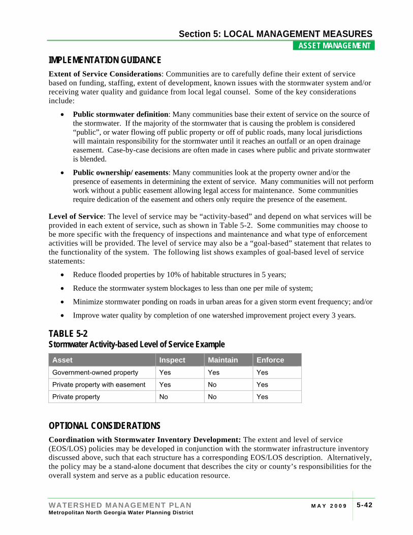
Section 4: RIVER BASIN PROFILES
WATERSHED MANAGEMENT PLAN M A Y 2 0 0 9 Metropolitan North Georgia Water Planning District
5-42
Section 5: LOCAL MANAGEMENT MEASURES ASSET MANAGEMENT .
IMPLEMENTATION GUIDANCE Extent of Service Considerations: Communities are to carefully define their extent of service based on funding, staffing, extent of development, known issues with the stormwater system and/or receiving water quality and guidance from local legal counsel. Some of the key considerations include:
• Public stormwater definition: Many communities base their extent of service on the source of the stormwater. If the majority of the stormwater that is causing the problem is considered “public”, or water flowing off public property or off of public roads, many local jurisdictions will maintain responsibility for the stormwater until it reaches an outfall or an open drainage easement. Case-by-case decisions are often made in cases where public and private stormwater is blended.
• Public ownership/ easements: Many communities look at the property owner and/or the presence of easements in determining the extent of service. Many communities will not perform work without a public easement allowing legal access for maintenance. Some communities require dedication of the easement and others only require the presence of the easement.
Level of Service: The level of service may be “activity-based” and depend on what services will be provided in each extent of service, such as shown in Table 5-2. Some communities may choose to be more specific with the frequency of inspections and maintenance and what type of enforcement activities will be provided. The level of service may also be a “goal-based” statement that relates to the functionality of the system. The following list shows examples of goal-based level of service statements:
• Reduce flooded properties by 10% of habitable structures in 5 years;
• Reduce the stormwater system blockages to less than one per mile of system;
• Minimize stormwater ponding on roads in urban areas for a given storm event frequency; and/or
• Improve water quality by completion of one watershed improvement project every 3 years.
TABLE 5-2 Stormwater Activity-based Level of Service Example Asset Inspect Maintain Enforce Government-owned property Yes Yes Yes
Private property with easement Yes No Yes
Private property No No Yes
OPTIONAL CONSIDERATIONS Coordination with Stormwater Inventory Development: The extent and level of service (EOS/LOS) policies may be developed in conjunction with the stormwater infrastructure inventory discussed above, such that each structure has a corresponding EOS/LOS description. Alternatively, the policy may be a stand-alone document that describes the city or county’s responsibilities for the overall system and serve as a public education resource.
Section 4: RIVER BASIN PROFILES
WATERSHED MANAGEMENT PLAN M A Y 2 0 0 9 Metropolitan North Georgia Water Planning District
5-43
Section 5: LOCAL MANAGEMENT MEASURES ASSET MANAGEMENT .
Advanced Level of Service Policies: An advanced level of service policy sets performance goals for elements of the system. Comprehensive level of service policies also establish criteria for maintenance of the infrastructure to ensure the system functions properly. For example, within the right-of-way and in critical areas highly susceptible to flood damages, the maintenance level of service might include periodic inspection, priority cleaning and the highest level of emergency response. In similar right-of-way areas not susceptible to flooding, the level of service for maintenance might be much lower.
Public Education: It is recommended that each local jurisdiction have a clear written EOS/LOS policy easily available to the public, preferably on their city or county website. This will help to inform citizens and property owners of the local jurisdiction’s responsibilities as well as their own responsibilities in maintaining a working stormwater management system.

Section 4: RIVER BASIN PROFILES
WATERSHED MANAGEMENT PLAN M A Y 2 0 0 9 Metropolitan North Georgia Water Planning District
5-44
Section 5: LOCAL MANAGEMENT MEASURES ASSET MANAGEMENT .
[This page intentionally left blank]
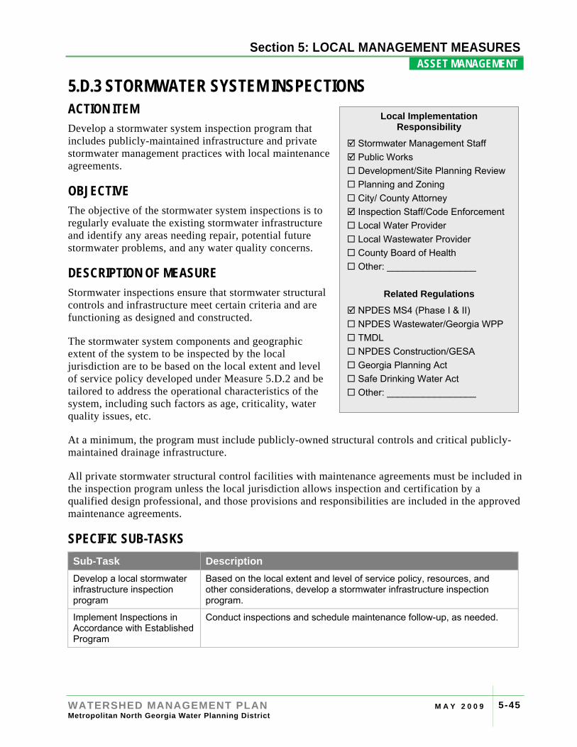
Section 4: RIVER BASIN PROFILES
WATERSHED MANAGEMENT PLAN M A Y 2 0 0 9 Metropolitan North Georgia Water Planning District
5-45
Section 5: LOCAL MANAGEMENT MEASURES ASSET MANAGEMENT .
5.D.3 STORMWATER SYSTEM INSPECTIONS ACTION ITEM Develop a stormwater system inspection program that includes publicly-maintained infrastructure and private stormwater management practices with local maintenance agreements.
OBJECTIVE The objective of the stormwater system inspections is to regularly evaluate the existing stormwater infrastructure and identify any areas needing repair, potential future stormwater problems, and any water quality concerns.
DESCRIPTION OF MEASURE Stormwater inspections ensure that stormwater structural controls and infrastructure meet certain criteria and are functioning as designed and constructed.
The stormwater system components and geographic extent of the system to be inspected by the local jurisdiction are to be based on the local extent and level of service policy developed under Measure 5.D.2 and be tailored to address the operational characteristics of the system, including such factors as age, criticality, water quality issues, etc.
At a minimum, the program must include publicly-owned structural controls and critical publicly-maintained drainage infrastructure.
All private stormwater structural control facilities with maintenance agreements must be included in the inspection program unless the local jurisdiction allows inspection and certification by a qualified design professional, and those provisions and responsibilities are included in the approved maintenance agreements.
SPECIFIC SUB-TASKS Sub-Task Description Develop a local stormwater infrastructure inspection program
Based on the local extent and level of service policy, resources, and other considerations, develop a stormwater infrastructure inspection program.
Implement Inspections in Accordance with Established Program
Conduct inspections and schedule maintenance follow-up, as needed.
Local Implementation Responsibility
Stormwater Management Staff Public Works Development/Site Planning Review Planning and Zoning City/ County Attorney Inspection Staff/Code Enforcement Local Water Provider Local Wastewater Provider County Board of Health Other: _________________
Related Regulations
NPDES MS4 (Phase I & II) NPDES Wastewater/Georgia WPP TMDL NPDES Construction/GESA Georgia Planning Act Safe Drinking Water Act Other: _________________
Section 4: RIVER BASIN PROFILES
WATERSHED MANAGEMENT PLAN M A Y 2 0 0 9 Metropolitan North Georgia Water Planning District
5-46
Section 5: LOCAL MANAGEMENT MEASURES ASSET MANAGEMENT .
IMPLEMENTATION GUIDANCE The intensity and frequency of the inspection program will vary among communities based on a number of factors, including the size of the community and storm sewer system, age of the system and constituent components, system criticality, staff availability, funding levels, and extent of ongoing issues. In addition, the intensity and frequency of inspections may vary from season to season or year-to-year, depending on the particular issues present for a community at any point in time. Many communities will integrate customer service requests into the scheduled inspections program.
Timing of routine inspections may be scheduled on a calendar basis or based on the criticality of the infrastructure. Visual inspections of the infrastructure will at a minimum include inspection of catch basins and other inlet structures for debris blockages and inspections of outfalls. Data collected during routine inspections can be used to update and expand the stormwater infrastructure inventory (see Measure 5.D.2) and GIS database, if available.
Structural stormwater controls constructed after local adoption of the post-development stormwater management ordinance (see Measure 5.A.1) will have ongoing maintenance agreements in place. Periodic inspection of these private structural controls can ensure the maintenance agreement is being followed. In areas with water quality or quantity challenges, local jurisdictions may choose to inspect other private structural controls (see Measure 6.D.3). Homeowners are often not aware of their maintenance responsibility for stormwater structures, so these structures are often not well maintained.
OPTIONAL CONSIDERATIONS Criticality-Based Inspections Program: A criticality-based inspection program is an asset management approach that prioritizes the frequency of inspections based on the criticality that any system failure might have on the system. For example, a culvert collapse could have public safety, infrastructure, and flooding repercussions. Therefore regular inspections of culverts would be prioritized over inspection of catch basins in non-critical areas. This approach is often associated with water and wastewater infrastructure and is often selected because it tends to yield the most benefit for available funds.
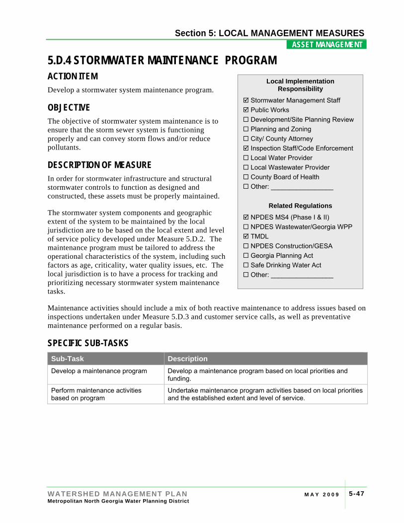
Section 4: RIVER BASIN PROFILES
WATERSHED MANAGEMENT PLAN M A Y 2 0 0 9 Metropolitan North Georgia Water Planning District
5-47
Section 5: LOCAL MANAGEMENT MEASURES ASSET MANAGEMENT .
5.D.4 STORMWATER MAINTENANCE PROGRAM ACTION ITEM Develop a stormwater system maintenance program.
OBJECTIVE The objective of stormwater system maintenance is to ensure that the storm sewer system is functioning properly and can convey storm flows and/or reduce pollutants.
DESCRIPTION OF MEASURE In order for stormwater infrastructure and structural stormwater controls to function as designed and constructed, these assets must be properly maintained.
The stormwater system components and geographic extent of the system to be maintained by the local jurisdiction are to be based on the local extent and level of service policy developed under Measure 5.D.2. The maintenance program must be tailored to address the operational characteristics of the system, including such factors as age, criticality, water quality issues, etc. The local jurisdiction is to have a process for tracking and prioritizing necessary stormwater system maintenance tasks.
Maintenance activities should include a mix of both reactive maintenance to address issues based on inspections undertaken under Measure 5.D.3 and customer service calls, as well as preventative maintenance performed on a regular basis.
SPECIFIC SUB-TASKS Sub-Task Description Develop a maintenance program Develop a maintenance program based on local priorities and
funding.
Perform maintenance activities based on program
Undertake maintenance program activities based on local priorities and the established extent and level of service.
Local Implementation Responsibility
Stormwater Management Staff Public Works Development/Site Planning Review Planning and Zoning City/ County Attorney Inspection Staff/Code Enforcement Local Water Provider Local Wastewater Provider County Board of Health Other: _________________
Related Regulations
NPDES MS4 (Phase I & II) NPDES Wastewater/Georgia WPP TMDL NPDES Construction/GESA Georgia Planning Act Safe Drinking Water Act Other: _________________
Section 4: RIVER BASIN PROFILES
WATERSHED MANAGEMENT PLAN M A Y 2 0 0 9 Metropolitan North Georgia Water Planning District
5-48
Section 5: LOCAL MANAGEMENT MEASURES ASSET MANAGEMENT .
IMPLEMENTATION GUIDANCE Reactive versus Preventative Maintenance: There are two kinds of maintenance activities: reactive and preventive.
Reactive maintenance is a response to a particular issue, such as a collapse of a stormwater pipe or a crushed catch basin, and can be more expensive to repair than proactive maintenance activities. Reactive maintenance will most often be determined by stormwater system inspections (see Measure 5.D.3) as well as customer service calls and requests to the local jurisdiction.
Preventive maintenance is intended to ensure that a stormwater system component or structural control is functioning as designed and constructed, as well as to minimize the need for major maintenance actions and capital projects by addressing smaller, critical issues on a regular basis. Typical preventive maintenance activities may include removal of sediment build-up in catch basins, removal of sediment from detention basins, vegetation maintenance, and street-sweeping.
Each jurisdiction will determine the most suitable blend of reactive and preventive maintenance regimes to enable the most effective and affordable lifecycle duration of the infrastructure.
OPTIONAL CONSIDERATIONS Staff and Funding Considerations: Most communities employ stormwater maintenance staff to perform stormwater infrastructure maintenance tasks. If the community is small, the stormwater maintenance staff might consist of personnel shared with other municipal departments. Some maintenance activities may require outside contractors or professional services, particularly large repair actions; these projects may be identified as capital improvement projects if they are outside of the regular maintenance budget. For some communities, sediment removal from catch basins and detention ponds may also require hiring a contractor with specialized equipment, such as large excavation equipment or vacuum equipment. For larger communities, it may be more beneficial to purchase such equipment and obtain training on its operation, if these services are needed frequently.
Preventative Maintenance Activity Examples: Tasks and frequencies for preventative stormwater maintenance will vary greatly depending on the specific community and local resources. Typically, preventative maintenance is tied to specific maintenance goals as well as the jurisdiction’s level of service policy. It is recommended that a local jurisdiction explicitly define these maintenance goals for both public and private systems.
Table 5-3 provides some example stormwater system maintenance activities, including tasks and frequencies. These are intended for illustration only and are not intended as specific requirements under this Plan.
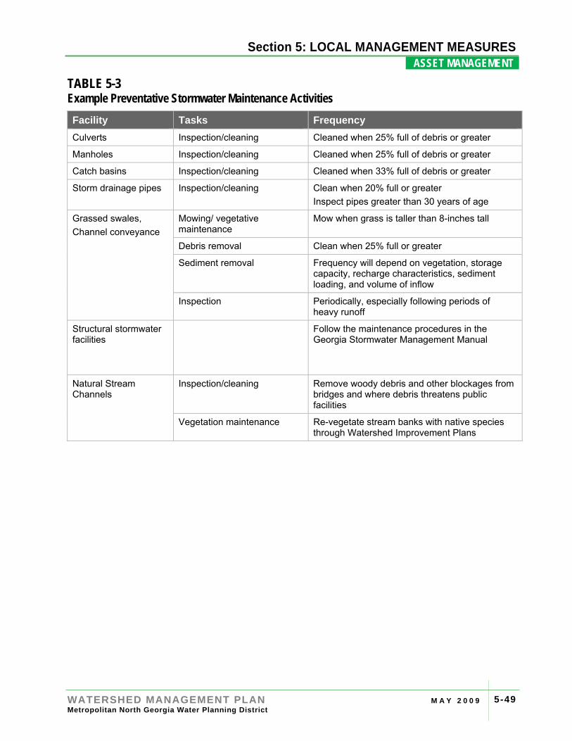
Section 4: RIVER BASIN PROFILES
WATERSHED MANAGEMENT PLAN M A Y 2 0 0 9 Metropolitan North Georgia Water Planning District
5-49
Section 5: LOCAL MANAGEMENT MEASURES ASSET MANAGEMENT .
TABLE 5-3 Example Preventative Stormwater Maintenance Activities Facility Tasks Frequency Culverts Inspection/cleaning Cleaned when 25% full of debris or greater
Manholes Inspection/cleaning Cleaned when 25% full of debris or greater
Catch basins Inspection/cleaning Cleaned when 33% full of debris or greater
Storm drainage pipes Inspection/cleaning Clean when 20% full or greater Inspect pipes greater than 30 years of age
Grassed swales, Channel conveyance
Mowing/ vegetative maintenance
Mow when grass is taller than 8-inches tall
Debris removal Clean when 25% full or greater
Sediment removal Frequency will depend on vegetation, storage capacity, recharge characteristics, sediment loading, and volume of inflow
Inspection Periodically, especially following periods of heavy runoff
Structural stormwater facilities
Follow the maintenance procedures in the Georgia Stormwater Management Manual
Natural Stream Channels
Inspection/cleaning Remove woody debris and other blockages from bridges and where debris threatens public facilities
Vegetation maintenance Re-vegetate stream banks with native species through Watershed Improvement Plans

Section 4: RIVER BASIN PROFILES
WATERSHED MANAGEMENT PLAN M A Y 2 0 0 9 Metropolitan North Georgia Water Planning District
5-50
Section 5: LOCAL MANAGEMENT MEASURES ASSET MANAGEMENT .
[This page intentionally left blank]
Section 4: RIVER BASIN PROFILES
WATERSHED MANAGEMENT PLAN M A Y 2 0 0 9 Metropolitan North Georgia Water Planning District
5-51
Section 5: LOCAL MANAGEMENT MEASURES ASSET MANAGEMENT .
5.D.5 CAPITAL IMPROVEMENT PLAN ACTION ITEM Develop a list of capital improvement projects to address stormwater infrastructure needs. The list may include watershed improvement projects.
OBJECTIVE Identify and prioritize projects necessary to improve stormwater infrastructure to address drainage, flooding or water quality issues.
DESCRIPTION OF MEASURE A Capital Improvement Plan (CIP) is composed of projects that exceed typical maintenance activities, internal capabilities of the stormwater personnel, and/or the typical operating budget. CIPs may include repairs or replacement of existing infrastructure, studies, design and construction of projects to address water quality or water quantity concerns. CIPs may also include identified Watershed Improvement Projects being performed under Measure 5.H.4, or the acquisition of greenspace, such as floodplains and wetlands. A quantitative ranking process should be developed to prioritize projects as funding permits.
Each local jurisdiction is to appropriately define “capital improvement project” to conform to their jurisdiction’s accounting practices, funding sources, and local needs. For example, some communities may consider only infrastructure projects as capital improvements, while others may include planning and studies under their definition.
SPECIFIC SUB-TASKS Sub-Task Description Develop List of Capital Improvement Projects
Identify desired capital improvement projects based on an infrastructure inventory, level of service goals, inspections, and known problems/issues.
Prioritize List Create a method to rank projects in order of necessity and urgency based on cost and benefits, and apply method.
Update Capital Improvement Projects, as needed
Based on stormwater inspections and customer service requests, update the CIP list as needed.
Local Implementation Responsibility
Stormwater Management Staff Public Works Development/Site Planning Review Planning and Zoning City/ County Attorney Inspection Staff/Code Enforcement Local Water Provider Local Wastewater Provider County Board of Health Other: _________________
Related Regulations
NPDES MS4 (Phase I & II) NPDES Wastewater/Georgia WPP TMDL NPDES Construction/GESA Georgia Planning Act Safe Drinking Water Act Other: _________________
Section 4: RIVER BASIN PROFILES
WATERSHED MANAGEMENT PLAN M A Y 2 0 0 9 Metropolitan North Georgia Water Planning District
5-52
Section 5: LOCAL MANAGEMENT MEASURES ASSET MANAGEMENT .
OPTIONAL CONSIDERATIONS Capital improvement projects may be prioritized based on a number of factors, such as:
• Cost/ benefit analysis
• Benefits to the natural environment
• Flood reduction or mitigation
• Severity and/or urgency of the problem
• Criticality of the infrastructure
• Impact of the problem on the overall storm drainage system
• Length of time the problem has existed
• Community-specific criteria.
Many communities will create a matrix that assigns a weight related to the importance of the above factors. Every project would then be rated for each factor. A total score that accounts for the individual scores and the weight assigned to the category would provide the basis for prioritization of projects.
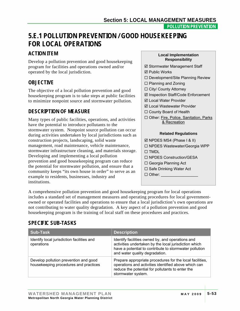
Section 4: RIVER
WATERSHED MANAGEMENT PLAN M A Y 2 0 0 9 Metropolitan North Georgia Water Planning District
5-53
Section 5: LOCAL MANAGEMENT MEASURES POLLUTION PREVENTION .
5.E.1 POLLUTION PREVENTION / GOOD HOUSEKEEPING FOR LOCAL OPERATIONS ACTION ITEM Develop a pollution prevention and good housekeeping program for facilities and operations owned and/or operated by the local jurisdiction.
OBJECTIVE The objective of a local pollution prevention and good housekeeping program is to take steps at public facilities to minimize nonpoint source and stormwater pollution.
DESCRIPTION OF MEASURE Many types of public facilities, operations, and activities have the potential to introduce pollutants to the stormwater system. Nonpoint source pollution can occur during activities undertaken by local jurisdictions such as construction projects, landscaping, solid waste management, road maintenance, vehicle maintenance, stormwater infrastructure cleaning, and materials storage. Developing and implementing a local pollution prevention and good housekeeping program can reduce the potential for stormwater pollution, and ensure that a community keeps “its own house in order” to serve as an example to residents, businesses, industry and institutions.
A comprehensive pollution prevention and good housekeeping program for local operations includes a standard set of management measures and operating procedures for local government-owned or operated facilities and operations to ensure that a local jurisdiction’s own operations are not contributing to water quality degradation. A key aspect of a pollution prevention and good housekeeping program is the training of local staff on these procedures and practices.
SPECIFIC SUB-TASKS Sub-Task Description Identify local jurisdiction facilities and operations
Identify facilities owned by, and operations and activities undertaken by the local jurisdiction which have a potential to contribute to stormwater pollution and water quality degradation.
Develop pollution prevention and good housekeeping procedures and practices
Prepare appropriate procedures for the local facilities, operations and activities identified above which can reduce the potential for pollutants to enter the stormwater system.
Local Implementation Responsibility
Stormwater Management Staff Public Works Development/Site Planning Review Planning and Zoning City/ County Attorney Inspection Staff/Code Enforcement Local Water Provider Local Wastewater Provider County Board of Health Other: Fire, Police, Sanitation, Parks
& Recreation
Related Regulations
NPDES MS4 (Phase I & II) NPDES Wastewater/Georgia WPP TMDL NPDES Construction/GESA Georgia Planning Act Safe Drinking Water Act Other: _________________
Section 4: RIVER BASIN PROFILES
WATERSHED MANAGEMENT PLAN M A Y 2 0 0 9 Metropolitan North Georgia Water Planning District
5-54
Section 5: LOCAL MANAGEMENT MEASURES POLLUTION PREVENTION .
Sub-Task Description Conduct training for local jurisdiction employees
Provide education and training to local employees on general and job-specific pollution prevention and good housekeeping procedures and practices as needed.
IMPLEMENTATION GUIDANCE The U.S. EPA recommends that, at a minimum, local jurisdictions consider the following when developing their stormwater pollution prevention and good housekeeping program:
• Equipment and facility maintenance activities and schedules;
• Controls for reducing or eliminating the discharge of pollutants from:
o Streets, roads, and highways (locally-maintained)
o Municipal parking lots
o Maintenance and storage yards
o Fleet or maintenance shops with outdoor storage areas
o Salt/sand storage locations and snow disposal areas operated by the municipality
o Waste transfer stations
• Procedures for properly disposing of waste removed from the separate storm water sewers and areas listed above (such as dredge spoil, accumulated sediments, floatables, and other debris).
Industrial Stormwater Permits: Some local jurisdictions’ facilities may be covered under the Industrial Stormwater NPDES permit and require a Stormwater Pollution Prevention Plan (SWPPP), similar to other commercial and industrial facilities. These facilities must have a Notice of Intent (NOI) filed with Georgia EPD to be covered under the general NPDES permit. Facilities that may be regulated under the NPDES Industrial Stormwater program include: wastewater treatment facilities, landfills, recycling facilities, fueling stations, and garages.
OPTIONAL CONSIDERATIONS Stormwater Pollution Prevention and Good Housekeeping Examples: Table 5.4 provides some example “best” procedures and practices for local consideration.
Employee Training and Education: Employee engagement is an important component of municipal good housekeeping. Training and empowering staff to identify and correct or report potential pollution sources as part of their daily routine is a good first step. Training can include distribution of Standard Operating Procedure (SOPs), on-the-job training activities, formal training classes or conferences, or another form of employee education appropriate for the community.
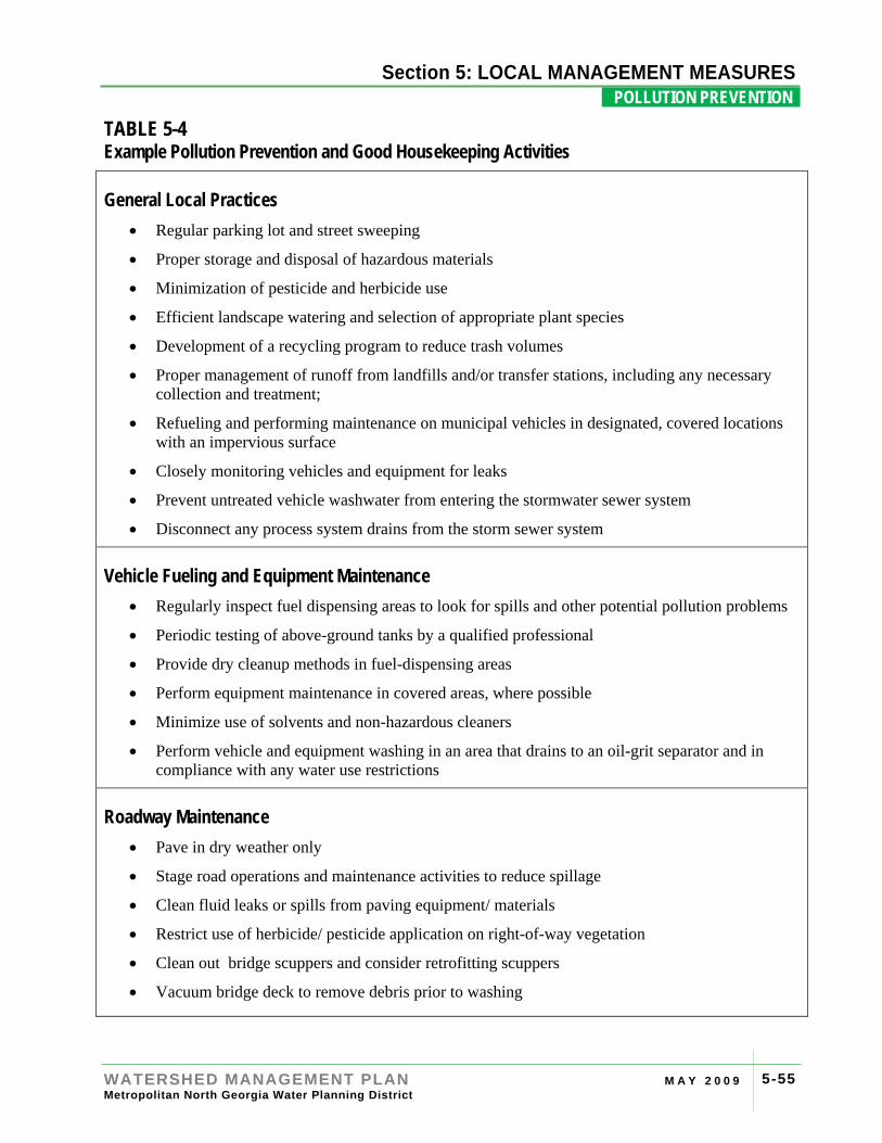
Section 4: RIVER BASIN PROFILES
WATERSHED MANAGEMENT PLAN M A Y 2 0 0 9 Metropolitan North Georgia Water Planning District
5-55
Section 5: LOCAL MANAGEMENT MEASURES POLLUTION PREVENTION .
TABLE 5-4 Example Pollution Prevention and Good Housekeeping Activities
General Local Practices • Regular parking lot and street sweeping
• Proper storage and disposal of hazardous materials
• Minimization of pesticide and herbicide use
• Efficient landscape watering and selection of appropriate plant species
• Development of a recycling program to reduce trash volumes
• Proper management of runoff from landfills and/or transfer stations, including any necessary collection and treatment;
• Refueling and performing maintenance on municipal vehicles in designated, covered locations with an impervious surface
• Closely monitoring vehicles and equipment for leaks
• Prevent untreated vehicle washwater from entering the stormwater sewer system
• Disconnect any process system drains from the storm sewer system
Vehicle Fueling and Equipment Maintenance • Regularly inspect fuel dispensing areas to look for spills and other potential pollution problems
• Periodic testing of above-ground tanks by a qualified professional
• Provide dry cleanup methods in fuel-dispensing areas
• Perform equipment maintenance in covered areas, where possible
• Minimize use of solvents and non-hazardous cleaners
• Perform vehicle and equipment washing in an area that drains to an oil-grit separator and in compliance with any water use restrictions
Roadway Maintenance • Pave in dry weather only
• Stage road operations and maintenance activities to reduce spillage
• Clean fluid leaks or spills from paving equipment/ materials
• Restrict use of herbicide/ pesticide application on right-of-way vegetation
• Clean out bridge scuppers and consider retrofitting scuppers
• Vacuum bridge deck to remove debris prior to washing
Section 4: RIVER BASIN PROFILES
WATERSHED MANAGEMENT PLAN M A Y 2 0 0 9 Metropolitan North Georgia Water Planning District
5-56
Section 5: LOCAL MANAGEMENT MEASURES POLLUTION PREVENTION .
Hazardous Material Storage • Properly train personnel in hazardous substance management
• Properly store hazardous materials and provide secondary containment where needed
• Properly handle hazardous materials during all stages of development, use and disposal
• Cover or enclose material storage areas to reduce potential contact with stormwater and wind
• Retrofit existing hazardous material storage areas, giving priority to the most hazardous materials, to make sure there is no potential of release to the environment
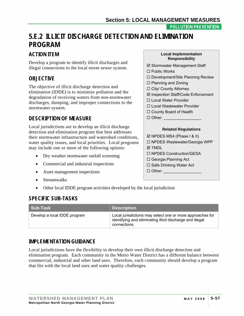
Section 4: RIVER BASIN PROFILES
WATERSHED MANAGEMENT PLAN M A Y 2 0 0 9 Metropolitan North Georgia Water Planning District
5-57
Section 5: LOCAL MANAGEMENT MEASURES POLLUTION PREVENTION .
5.E.2 ILLICIT DISCHARGE DETECTION AND ELIMINATION PROGRAM ACTION ITEM Develop a program to identify illicit discharges and illegal connections to the local storm sewer system.
OBJECTIVE The objective of illicit discharge detection and elimination (IDDE) is to minimize pollution and the degradation of receiving waters from non-stormwater discharges, dumping, and improper connections to the stormwater system.
DESCRIPTION OF MEASURE Local jurisdictions are to develop an illicit discharge detection and elimination program that best addresses their stormwater infrastructure and watershed conditions, water quality issues, and local priorities. Local programs may include one or more of the following options:
• Dry weather stormwater outfall screening
• Commercial and industrial inspections
• Asset management inspections
• Streamwalks
• Other local IDDE program activities developed by the local jurisdiction
SPECIFIC SUB-TASKS Sub-Task Description Develop a local IDDE program Local jurisdictions may select one or more approaches for
identifying and eliminating illicit discharge and illegal connections.
IMPLEMENTATION GUIDANCE Local jurisdictions have the flexibility to develop their own illicit discharge detection and elimination program. Each community in the Metro Water District has a different balance between commercial, industrial and other land uses. Therefore, each community should develop a program that fits with the local land uses and water quality challenges.
Local Implementation Responsibility
Stormwater Management Staff Public Works Development/Site Planning Review Planning and Zoning City/ County Attorney Inspection Staff/Code Enforcement Local Water Provider Local Wastewater Provider County Board of Health Other: _________________
Related Regulations
NPDES MS4 (Phase I & II) NPDES Wastewater/Georgia WPP TMDL NPDES Construction/GESA Georgia Planning Act Safe Drinking Water Act Other: _________________
Section 4: RIVER BASIN PROFILES
WATERSHED MANAGEMENT PLAN M A Y 2 0 0 9 Metropolitan North Georgia Water Planning District
5-58
Section 5: LOCAL MANAGEMENT MEASURES POLLUTION PREVENTION .
Potential program elements may include one or more of the following approaches:
• Dry Weather Outfall Screening – Dry weather screening involves inspecting stormwater outfalls for flows during dry periods (when no stormwater runoff has occurred) which may indicate illicit discharges upstream of the outfall. Inspecting approximately 10% of stormwater outfalls annually is recommended for communities who only employ dry weather screening for their IDDE program. The recommended program may be adjusted based on screening results. A local jurisdiction may wish to focus on priority areas with a history of dry weather flows and/or illicit discharges, as well as outfalls draining to 303(d) listed waters. Priority areas may also include specific land uses (such as commercial/industrial areas), older portions of the community, or other local areas of concern. As outfall screening only reactively identifies an illicit discharge once it has occurred and reached a waterbody, communities are encourage to consider other IDDE program elements in lieu or in addition to this option.
Specific guidance with approved procedures for performing dry weather screenings can be found in the most recent edition of the Metro Water District’s Standards and Methodologies for Surface Water Monitoring.
• Commercial and Industrial Inspections – Inspecting certain commercial and industrial facilities can help to identify existing and potential illicit discharges and illegal connections. Facilities with a potential to cause stormwater pollution include; manufacturing facilities, industrial facilities, vehicle service facilities (may include auto parts stores), food service facilities, gas stations, and nurseries. Inspecting 5% of the identified commercial and industrial facilities annually is recommended for communities who employ commercial and industrial inspections as the only element of their IDDE program. Each community will develop a list of facilities that are considered potential pollutant sources and the inspection frequency. The inspection frequency may be based on site conditions such as; high facility personnel turnover, facility location to sensitive waterbodies, and high volume of potentially hazardous substances used on a regular basis.
Local commercial and industrial site inspections typically include a tour of the facility and inspections of the grounds surrounding the building with a visual inspection of the site outfall locations that discharge either to the local stormwater system or to waters of the state. If deemed necessary, field testing, sample collection, and laboratory analysis of any flows may be performed. Site deficiencies identified during the inspection must be corrected and a follow up inspection performed to document site compliance.
• Asset Management Inspections – Inspections for IDDE may be performed in conjunction with stormwater system inspections performed under Measure 5.D.3. A local jurisdiction may opt to cross train inspections staff to look for illicit discharges and illegal connections as part of their routine system inspections. Inspections of catch basins can look for dry weather flows and staining that might indicate an illicit discharge. As inspections take place throughout the community, it may be easier to identify and track the source of an illicit discharge. Inspecting 10% of the stormwater system annually is recommended for communities who will utilize asset management inspections as the only option for their IDDE program.
• Stream Walks – Routine stream walks can also be used to identify illicit discharges with the added benefit of greater understanding of local water resources. Some communities may elect to perform stream walks of 10% of wadeable streams annually for their IDDE program. The
Section 4: RIVER BASIN PROFILES
WATERSHED MANAGEMENT PLAN M A Y 2 0 0 9 Metropolitan North Georgia Water Planning District
5-59
Section 5: LOCAL MANAGEMENT MEASURES POLLUTION PREVENTION .
survey should specifically look at outfalls under dry weather conditions and similar to outfall screenings investigate any flows during dry conditions.
• Other Local IDDE Program Activities Developed by the Local Jurisdiction
Note: Each community is responsible for coordinating their IDDE program with NPDES MS4 permit requirements. Communities are encouraged to rotate inspections so that all areas of the local stormwater system are inspected, while recognizing that some areas may have greater potential for illicit discharges and therefore will be inspected more regularly.
Addressing Illicit Discharges: If an illicit discharge is found by any of the methods above, an investigation of the drainage area upstream of the outfall should be performed to look for the source. Methods to identify sources include mapping evaluations, windshield surveys, stream walks, smoke testing, dye testing, CCTV, and septic system investigations. The appropriate investigation method(s) will depend on watershed and land use conditions, drainage system characteristics, available resources and the nature of the discharge and screening results.
RESOURCES Center for Watershed Protection’s Illicit Discharge Detection and Elimination: A Guidance Manual for Program Development and Technical Assessments, available from the Center for Watershed Protection website at http://www.cwp.org

Section 4: RIVER BASIN PROFILES
WATERSHED MANAGEMENT PLAN M A Y 2 0 0 9 Metropolitan North Georgia Water Planning District
5-60
Section 5: LOCAL MANAGEMENT MEASURES POLLUTION PREVENTION .
[This page intentionally left blank]
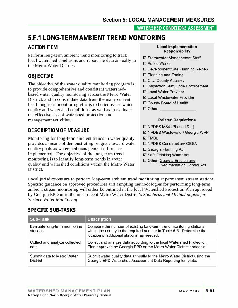
Section 4: RIVER
WATERSHED MANAGEMENT PLAN M A Y 2 0 0 9 Metropolitan North Georgia Water Planning District
5-61
Section 5: LOCAL MANAGEMENT MEASURES WATERSHED CONDITIONS ASSESSMENT .
5.F.1 LONG-TERM AMBIENT TREND MONITORING ACTION ITEM Perform long-term ambient trend monitoring to track local watershed conditions and report the data annually to the Metro Water District.
OBJECTIVE The objective of the water quality monitoring program is to provide comprehensive and consistent watershed-based water quality monitoring across the Metro Water District, and to consolidate data from the many current local long-term monitoring efforts to better assess water quality and watershed conditions, as well as to evaluate the effectiveness of watershed protection and management activities.
DESCRIPTION OF MEASURE Monitoring for long-term ambient trends in water quality provides a means of demonstrating progress toward water quality goals as watershed management efforts are implemented. The objective of the long-term trend monitoring is to identify long-term trends in water quality and watershed conditions within the Metro Water District.
Local jurisdictions are to perform long-term ambient trend monitoring at permanent stream stations. Specific guidance on approved procedures and sampling methodologies for performing long-term ambient stream monitoring will either be outlined in the local Watershed Protection Plan approved by Georgia EPD or in the most recent Metro Water District’s Standards and Methodologies for Surface Water Monitoring.
SPECIFIC SUB-TASKS Sub-Task Description Evaluate long-term monitoring stations
Compare the number of existing long-term trend monitoring stations within the county to the required number in Table 5-5. Determine the location of additional stations, as needed.
Collect and analyze collected data
Collect and analyze data according to the local Watershed Protection Plan approved by Georgia EPD or the Metro Water District protocols.
Submit data to Metro Water District
Submit water quality data annually to the Metro Water District using the Georgia EPD Watershed Assessment Data Reporting template.
Local Implementation Responsibility
Stormwater Management Staff Public Works Development/Site Planning Review Planning and Zoning City/ County Attorney Inspection Staff/Code Enforcement Local Water Provider Local Wastewater Provider County Board of Health Other: _________________
Related Regulations
NPDES MS4 (Phase I & II) NPDES Wastewater/ Georgia WPP TMDL NPDES Construction/ GESA Georgia Planning Act Safe Drinking Water Act Other: Georgia Erosion and
Sedimentation Control Act
Section 4: RIVER BASIN PROFILES
WATERSHED MANAGEMENT PLAN M A Y 2 0 0 9 Metropolitan North Georgia Water Planning District
5-62
Section 5: LOCAL MANAGEMENT MEASURES WATERSHED CONDITIONS ASSESSMENT .
IMPLEMENTATION GUIDANCE Long-term monitoring involves water quality sampling at permanent stream sampling stations. The long-term ambient trend monitoring within each county can follow the Georgia EPD monitoring requirements for an established and approved Watershed Protection Plan(s). Those without an approved Watershed Protection Plan or Watershed Monitoring Plan are to develop a monitoring plan which includes the following three components:
1. Wet Weather Monitoring: A minimum of three wet weather samples will be required during both the summer and winter seasons (May-October and November-April) – for a total of six wet weather samples annually.
2. Dry Weather (Baseflow) Monitoring: A minimum of one dry weather (baseflow) sample will be required during both the summer and winter seasons (May-October and November-April) – for a total of two samples annually.
3. Bacteria monitoring: A minimum of two geometric means of bacteria grab sampling for fecal coliform bacteria annually for the period of May to October.
Monitoring parameters, collection methods, sample handling, sample documentation procedures, and laboratory analysis methods may follow either the approved local Watershed Protection Plan or the Metro Water District’s Standards and Methodologies document.
Number of Long-term Monitoring Stations: The number of required long-term trend stream monitoring stations is based on county population. One station is required per 50,000 persons (rounded to the nearest 50,000), as shown in Table 5-5.
Note that long-term trend monitoring is intended to be county-based under this Plan. Therefore, local jurisdictions in each Metro Water District county will need to coordinate in terms of local responsibility, financial obligations, and appropriate siting of monitoring stations for their county. In the event that communities within a county cannot agree on a monitoring program, each community will be responsible for the number of stations, rounded up to the nearest whole number, based on their community population. As each local jurisdiction and the unincorporated areas will round the population based sampling stations up to the nearest whole number, an increased number of stations will be required under this alternative.

Section 4: RIVER BASIN PROFILES
WATERSHED MANAGEMENT PLAN M A Y 2 0 0 9 Metropolitan North Georgia Water Planning District
5-63
Section 5: LOCAL MANAGEMENT MEASURES WATERSHED CONDITIONS ASSESSMENT .
TABLE 5-5 Long-term Trend Monitoring Stations based on Population
County Population (2006)* Number of Stations Bartow 91,300 2
Cherokee 183,700 4
Clayton 266,400 5
Cobb 648,800 13
Coweta 107,300 2
DeKalb 704,900 14
Douglas 119,600 2
Fayette 102,600 2
Forsyth 151,000 3
Fulton (North) 310,041 6
Fulton (South) 152,706 3
City of Atlanta 450,560 9
Gwinnett 707,100 14
Hall 173,300 3
Henry 171,100 3
Paulding 121,500 2
Rockdale 80,300 2
* Population estimates from U.S. Census Bureau
Selecting Long-term Trend Monitoring Stations: Communities can use existing Watershed Protection Plan monitoring locations to meet the long-term trend monitoring station requirements in Table 5-5. If additional long-term trend monitoring stations are required, they may be selected to meet multiple requirements including TMDLs, or to track the impacts of specific land use categories on water quality.
When developing a county long-term trend monitoring site network, local jurisdictions should consider the following steps:
Step 1: Identify Watershed Protection Plan monitoring locations (if applicable).
Step 2: Identify any 303(d) listed waters to see if trend monitoring stations are applicable on 303(d) listed segments.
Step 3: Look at the local land use map to identify areas of changing land use that might be appropriate for long-term trend monitoring.
Step 4: Add additional sites as needed to provide good coverage of local conditions.
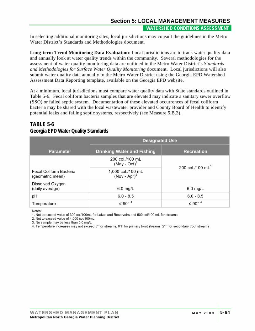
Section 4: RIVER BASIN PROFILES
WATERSHED MANAGEMENT PLAN M A Y 2 0 0 9 Metropolitan North Georgia Water Planning District
5-64
Section 5: LOCAL MANAGEMENT MEASURES WATERSHED CONDITIONS ASSESSMENT .
In selecting additional monitoring sites, local jurisdictions may consult the guidelines in the Metro Water District’s Standards and Methodologies document.
Long-term Trend Monitoring Data Evaluation: Local jurisdictions are to track water quality data and annually look at water quality trends within the community. Several methodologies for the assessment of water quality monitoring data are outlined in the Metro Water District’s Standards and Methodologies for Surface Water Quality Monitoring document. Local jurisdictions will also submit water quality data annually to the Metro Water District using the Georgia EPD Watershed Assessment Data Reporting template, available on the Georgia EPD website.
At a minimum, local jurisdictions must compare water quality data with State standards outlined in Table 5-6. Fecal coliform bacteria samples that are elevated may indicate a sanitary sewer overflow (SSO) or failed septic system. Documentation of these elevated occurrences of fecal coliform bacteria may be shared with the local wastewater provider and County Board of Health to identify potential leaks and failing septic systems, respectively (see Measure 5.B.3).
TABLE 5-6 Georgia EPD Water Quality Standards
Parameter
Designated Use
Drinking Water and Fishing Recreation
Fecal Coliform Bacteria (geometric mean)
200 col./100 mL (May - Oct)1
200 col./100 mL1 1,000 col./100 mL
(Nov - Apr)2
Dissolved Oxygen (daily average) 6.0 mg/L 6.0 mg/L
pH 6.0 - 8.5 6.0 - 8.5
Temperature ≤ 90° 4 ≤ 90° 4
Notes: 1. Not to exceed value of 300 col/100mL for Lakes and Reservoirs and 500 col/100 mL for streams 2. Not to exceed value of 4,000 col/100mL 3. No sample may be less than 5.0 mg/L 4. Temperature increases may not exceed 5° for streams, 0°F for primary trout streams, 2°F for secondary trout streams
Section 4: RIVER BASIN PROFILES
WATERSHED MANAGEMENT PLAN M A Y 2 0 0 9 Metropolitan North Georgia Water Planning District
5-65
Section 5: LOCAL MANAGEMENT MEASURES WATERSHED CONDITIONS ASSESSMENT .
5.F.2 HABITAT AND BIOLOGICAL MONITORING ACTION ITEM Perform habitat and biological monitoring to track local watershed conditions.
OBJECTIVE The objective of habitat and biological monitoring is to identify long-term trends in water quality and watershed conditions across the Metro Water District.
DESCRIPTION OF MEASURE Biological monitoring is important for identifying trends in stream and watershed integrity. Biological monitoring includes both habitat assessments and benthic macroinvertebrates sampling. Specific guidance on approved procedures and sampling methodologies for performing biological monitoring will either be outlined in the local Watershed Protection Plan approved by Georgia EPD or in the most recent edition of the Metro Water District’s Standards and Methodologies for Surface Water Monitoring for communities without a local Watershed Protection Plan or Watershed Monitoring Plan.
SPECIFIC SUB-TASKS Sub-Task Description Collect and review data Collect and analyze habitat and benthic macroinvertebrate data
according to the local Watershed Protection Plan approved by Georgia EPD or the Metro Water District protocols.
IMPLEMENTATION GUIDANCE Local jurisdictions with an approved Watershed Protection Plan (or an approved Watershed Monitoring Plan if the Watershed Protection Plan is not yet approved) will follow the biennial habitat and biological monitoring within the approved Watershed Protection Plan. Local jurisdictions that do not have an approved Watershed Protection Plan will perform biennial habitat and biological monitoring at the same number of stations as required for long-term ambient trend monitoring (see Table 5-5) and include the following components.
1. Habitat Assessments: Habitat assessments will be conducted following the latest Georgia EPD Standard Operating Procedure (SOP), which include an evaluation of the immediate watershed area, substrates (stream bed material), stream width, and general water quality conditions for riffle/run and glide/pool prevalent systems.
Local Implementation Responsibility
Stormwater Management Staff Public Works Development/Site Planning Review Planning and Zoning City/ County Attorney Inspection Staff/Code Enforcement Local Water Provider Local Wastewater Provider County Board of Health Other: _________________
Related Regulations
NPDES MS4 (Phase I & II) NPDES Wastewater/ Georgia WPP TMDL NPDES Construction/ GESA Georgia Planning Act Safe Drinking Water Act Other: _________________
Section 4: RIVER BASIN PROFILES
WATERSHED MANAGEMENT PLAN M A Y 2 0 0 9 Metropolitan North Georgia Water Planning District
5-66
Section 5: LOCAL MANAGEMENT MEASURES WATERSHED CONDITIONS ASSESSMENT .
2. Benthic Macroinvertebrate Sampling: Benthic macroinvertebrate sampling will follow the latest Georgia EPD Standard Operating Procedure (SOP). The major habitat types (undercut banks, rocks, vegetation, sand, riffles, runs, and pools) at each site as well as the proportion of each habitat type sampled, will be recorded for each station. Samples will be preserved and sent to a laboratory for enumeration and identification.
Benthic data will be analyzed based on assessment metrics, metric evaluation criteria, and scores for the Georgia Piedmont or Ridge and Valley ecoregion. The metrics include parameters such as:
• Taxa richness
• Ephemeroptera, Plecoptera, Trichoptera (EPT) Index
• Indicator Assemblage Index (IAI)
• Percent contribution of dominant taxon
• North Carolina biotic index
• Percent shredders
• Total habitat score
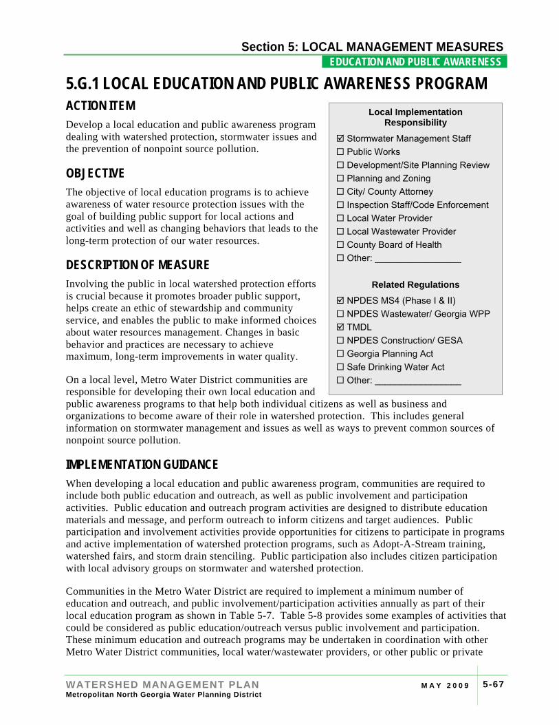
Section 4: RIVER
WATERSHED MANAGEMENT PLAN M A Y 2 0 0 9 Metropolitan North Georgia Water Planning District
5-67
Section 5: LOCAL MANAGEMENT MEASURES EDUCATION AND PUBLIC AWARENESS .
5.G.1 LOCAL EDUCATION AND PUBLIC AWARENESS PROGRAM ACTION ITEM Develop a local education and public awareness program dealing with watershed protection, stormwater issues and the prevention of nonpoint source pollution.
OBJECTIVE The objective of local education programs is to achieve awareness of water resource protection issues with the goal of building public support for local actions and activities and well as changing behaviors that leads to the long-term protection of our water resources.
DESCRIPTION OF MEASURE Involving the public in local watershed protection efforts is crucial because it promotes broader public support, helps create an ethic of stewardship and community service, and enables the public to make informed choices about water resources management. Changes in basic behavior and practices are necessary to achieve maximum, long-term improvements in water quality.
On a local level, Metro Water District communities are responsible for developing their own local education and public awareness programs to that help both individual citizens as well as business and organizations to become aware of their role in watershed protection. This includes general information on stormwater management and issues as well as ways to prevent common sources of nonpoint source pollution.
IMPLEMENTATION GUIDANCE When developing a local education and public awareness program, communities are required to include both public education and outreach, as well as public involvement and participation activities. Public education and outreach program activities are designed to distribute education materials and message, and perform outreach to inform citizens and target audiences. Public participation and involvement activities provide opportunities for citizens to participate in programs and active implementation of watershed protection programs, such as Adopt-A-Stream training, watershed fairs, and storm drain stenciling. Public participation also includes citizen participation with local advisory groups on stormwater and watershed protection.
Communities in the Metro Water District are required to implement a minimum number of education and outreach, and public involvement/participation activities annually as part of their local education program as shown in Table 5-7. Table 5-8 provides some examples of activities that could be considered as public education/outreach versus public involvement and participation. These minimum education and outreach programs may be undertaken in coordination with other Metro Water District communities, local water/wastewater providers, or other public or private
Local Implementation Responsibility
Stormwater Management Staff Public Works Development/Site Planning Review Planning and Zoning City/ County Attorney Inspection Staff/Code Enforcement Local Water Provider Local Wastewater Provider County Board of Health Other: _________________
Related Regulations
NPDES MS4 (Phase I & II) NPDES Wastewater/ Georgia WPP TMDL NPDES Construction/ GESA Georgia Planning Act Safe Drinking Water Act Other: _________________
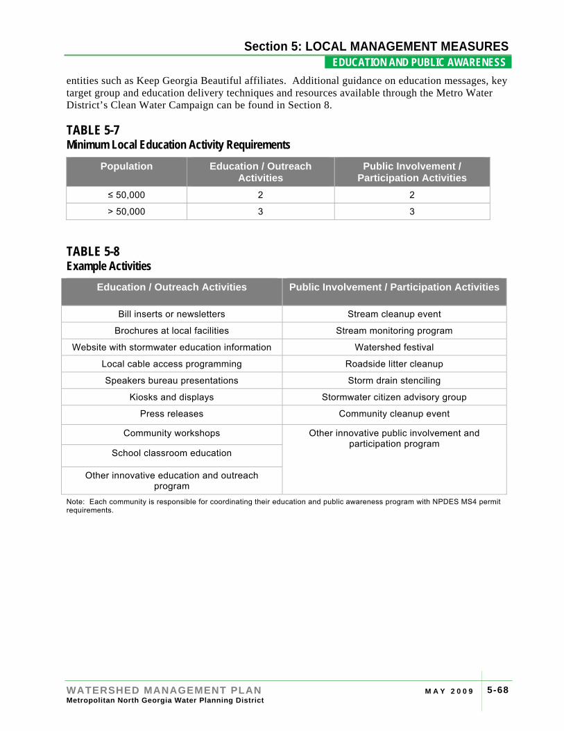
Section 4: RIVER BASIN PROFILES
WATERSHED MANAGEMENT PLAN M A Y 2 0 0 9 Metropolitan North Georgia Water Planning District
5-68
Section 5: LOCAL MANAGEMENT MEASURES EDUCATION AND PUBLIC AWARENESS .
entities such as Keep Georgia Beautiful affiliates. Additional guidance on education messages, key target group and education delivery techniques and resources available through the Metro Water District’s Clean Water Campaign can be found in Section 8.
TABLE 5-7 Minimum Local Education Activity Requirements
Population Education / Outreach Activities
Public Involvement / Participation Activities
≤ 50,000 2 2
> 50,000 3 3
TABLE 5-8 Example Activities
Education / Outreach Activities Public Involvement / Participation Activities
Bill inserts or newsletters Stream cleanup event
Brochures at local facilities Stream monitoring program
Website with stormwater education information Watershed festival
Local cable access programming Roadside litter cleanup
Speakers bureau presentations Storm drain stenciling
Kiosks and displays Stormwater citizen advisory group
Press releases Community cleanup event
Community workshops Other innovative public involvement and participation program
School classroom education
Other innovative education and outreach program
Note: Each community is responsible for coordinating their education and public awareness program with NPDES MS4 permit requirements.
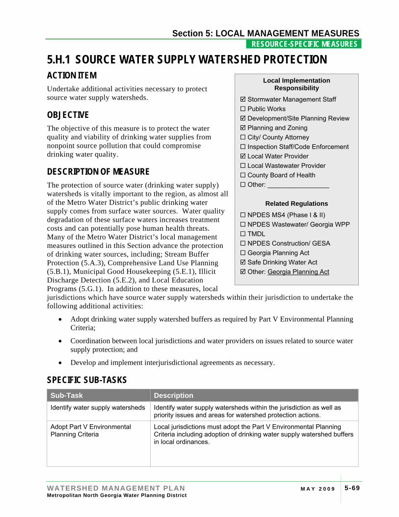
Section 4: RIVER
WATERSHED MANAGEMENT PLAN M A Y 2 0 0 9 Metropolitan North Georgia Water Planning District
5-69
Section 5: LOCAL MANAGEMENT MEASURES RESOURCE-SPECIFIC MEASURES .
5.H.1 SOURCE WATER SUPPLY WATERSHED PROTECTION ACTION ITEM Undertake additional activities necessary to protect source water supply watersheds.
OBJECTIVE The objective of this measure is to protect the water quality and viability of drinking water supplies from nonpoint source pollution that could compromise drinking water quality.
DESCRIPTION OF MEASURE The protection of source water (drinking water supply) watersheds is vitally important to the region, as almost all of the Metro Water District’s public drinking water supply comes from surface water sources. Water quality degradation of these surface waters increases treatment costs and can potentially pose human health threats. Many of the Metro Water District’s local management measures outlined in this Section advance the protection of drinking water sources, including; Stream Buffer Protection (5.A.3), Comprehensive Land Use Planning (5.B.1), Municipal Good Housekeeping (5.E.1), Illicit Discharge Detection (5.E.2), and Local Education Programs (5.G.1). In addition to these measures, local jurisdictions which have source water supply watersheds within their jurisdiction to undertake the following additional activities:
• Adopt drinking water supply watershed buffers as required by Part V Environmental Planning Criteria;
• Coordination between local jurisdictions and water providers on issues related to source water supply protection; and
• Develop and implement interjurisdictional agreements as necessary.
SPECIFIC SUB-TASKS Sub-Task Description Identify water supply watersheds Identify water supply watersheds within the jurisdiction as well as
priority issues and areas for watershed protection actions.
Adopt Part V Environmental Planning Criteria
Local jurisdictions must adopt the Part V Environmental Planning Criteria including adoption of drinking water supply watershed buffers in local ordinances.
Local Implementation Responsibility
Stormwater Management Staff Public Works Development/Site Planning Review Planning and Zoning City/ County Attorney Inspection Staff/Code Enforcement Local Water Provider Local Wastewater Provider County Board of Health Other: _________________
Related Regulations
NPDES MS4 (Phase I & II) NPDES Wastewater/ Georgia WPP TMDL NPDES Construction/ GESA Georgia Planning Act Safe Drinking Water Act Other: Georgia Planning Act
Section 4: RIVER BASIN PROFILES
WATERSHED MANAGEMENT PLAN M A Y 2 0 0 9 Metropolitan North Georgia Water Planning District
5-70
Section 5: LOCAL MANAGEMENT MEASURES RESOURCE-SPECIFIC MEASURES .
Sub-Task Description Coordination on watershed protection
Local jurisdictions must coordinate at least annually with water supply providers to discuss local issues and priorities for water supply watershed protection as well as other challenges.
IMPLEMENTATION GUIDANCE Environmental Planning Criteria: The Part V Environmental Planning Criteria established by Georgia EPD and enforced by the Georgia Department of Community Affairs (DCA) include buffer and lake management requirements intended to protect drinking water supplies. Local jurisdictions must adopt the stream buffers and other measures in compliance with the environmental planning criteria. Communities which are in compliance with these environmental planning criteria are in compliance with this requirement. New water supply sources planned or recommended in the Water Supply and Water Conservation Management Plan must be protected as they are formalized.
Coordination with Water Supply Utilities: Annual coordination is required with all water suppliers with source water watersheds within the local jurisdiction to discuss any challenges or opportunities related to source water supply protection. Source water supply watershed challenges vary throughout the Metro Water District, therefore a one size-fits all solution is not advisable. Table 5-9 provides some common parameters of concern, possible sources, and possible actions to address these sources. These are guidelines and must be measured with local knowledge of source water and watershed conditions. Annual coordination meetings may include discussion of possible local actions based on the challenges and parameters of concern for the community.
Documentation of annual coordination is not intended to be a burden to local jurisdictions. Any form of documentation of communication is consistent with the objective of this measure, including but not limited to: email, phone summary, meeting agenda, meeting summary, or fax transmittal. Coordination requirements with water suppliers for small drinking water supply watersheds, include all upstream communities. For large drinking water supply watersheds, coordination requirements include all communities in the watershed within a seven-mile radius upstream of the intake location.
OPTIONAL CONSIDERATIONS Management Measure Coordination: Local jurisdictions may consider prioritizing source water supply watershed protection through other local management measures. Under the TMDL program (Measure 5.H.2) and the Watershed Improvement Plans (Measure 5.H.4), communities may choose to prioritize projects in Source Water Supply Watersheds over projects in other areas, where practical.
Source Water Assessment Plans (SWAPs): SWAPs were completed for public water systems as required by the Safe Drinking Water Act. The SWAPs include an assessment of the susceptibility of each drinking water supply watershed to sources of potential contamination and provide each supply watershed with a risk-based score. The SWAP plans may be a starting point for identification of potential parameters of concern.
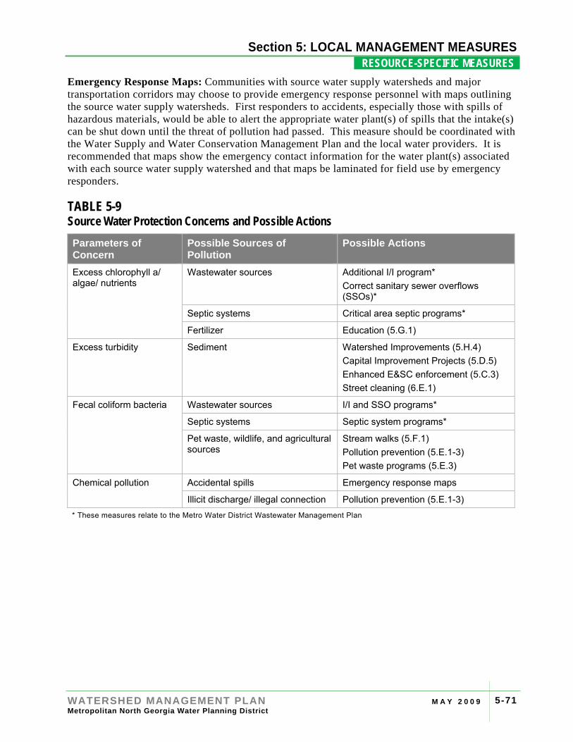
Section 4: RIVER BASIN PROFILES
WATERSHED MANAGEMENT PLAN M A Y 2 0 0 9 Metropolitan North Georgia Water Planning District
5-71
Section 5: LOCAL MANAGEMENT MEASURES RESOURCE-SPECIFIC MEASURES .
Emergency Response Maps: Communities with source water supply watersheds and major transportation corridors may choose to provide emergency response personnel with maps outlining the source water supply watersheds. First responders to accidents, especially those with spills of hazardous materials, would be able to alert the appropriate water plant(s) of spills that the intake(s) can be shut down until the threat of pollution had passed. This measure should be coordinated with the Water Supply and Water Conservation Management Plan and the local water providers. It is recommended that maps show the emergency contact information for the water plant(s) associated with each source water supply watershed and that maps be laminated for field use by emergency responders.
TABLE 5-9 Source Water Protection Concerns and Possible Actions Parameters of Concern
Possible Sources of Pollution
Possible Actions
Excess chlorophyll a/ algae/ nutrients
Wastewater sources Additional I/I program* Correct sanitary sewer overflows (SSOs)*
Septic systems Critical area septic programs*
Fertilizer Education (5.G.1)
Excess turbidity Sediment Watershed Improvements (5.H.4) Capital Improvement Projects (5.D.5) Enhanced E&SC enforcement (5.C.3) Street cleaning (6.E.1)
Fecal coliform bacteria Wastewater sources I/I and SSO programs*
Septic systems Septic system programs*
Pet waste, wildlife, and agricultural sources
Stream walks (5.F.1) Pollution prevention (5.E.1-3) Pet waste programs (5.E.3)
Chemical pollution Accidental spills Emergency response maps
Illicit discharge/ illegal connection Pollution prevention (5.E.1-3) * These measures relate to the Metro Water District Wastewater Management Plan

Section 4: RIVER BASIN PROFILES
WATERSHED MANAGEMENT PLAN M A Y 2 0 0 9 Metropolitan North Georgia Water Planning District
5-72
Section 5: LOCAL MANAGEMENT MEASURES RESOURCE-SPECIFIC MEASURES .
[This page intentionally left blank]
Section 4: RIVER BASIN PROFILES
WATERSHED MANAGEMENT PLAN M A Y 2 0 0 9 Metropolitan North Georgia Water Planning District
5-73
Section 5: LOCAL MANAGEMENT MEASURES RESOURCE-SPECIFIC MEASURES .
5.H.2 TOTAL MAXIMUM DAILY LOAD (TMDL) MANAGEMENT ACTION ITEMS Develop a sampling program for assessing waterbodies that do not meet State water quality standards.
Participate in the development of TMDL implementation plans.
OBJECTIVE Address water quality in waterbodies not meeting water quality standards for their designated use.
DESCRIPTION OF MEASURE Federal law requires a TMDL be developed for all waterbodies not meeting their designated use. In Georgia, TMDLs for impaired waterbodies have, and will continue to be, prepared by Georgia EPD on a rotating river basin planning cycle. TMDLs are calculated as the sum of load allocations (non-point sources) plus the sum of wasteload allocations (point sources) with a margin of safety. This calculation represents the maximum level of a specific pollutant that the waterbody can accept and still achieve state water quality standards.
TMDL implementation plans outline activities that can be undertaken by stakeholders within a watershed to address the water quality impairment. Non-point source pollution is the major cause of water quality impairment in the Metro Water District, and addressing these impairments will rely heavily on measures outlined in this Plan, and any additional best management practices put into action on a local level through the implementation plan. Copies of TMDLs and TMDL implementation plans for the Metro Water District impaired waterbodies can be found on the Georgia EPD website.
SPECIFIC SUB-TASKS Sub-Task Description Evaluate existing impaired waters Determine impaired waters from 303(d) list and review existing
TMDLs and TMDL implementation plans.
Investigate potential pollutant sources
Develop a monitoring plan for 303(d) listed waters as required under existing permits and current TMDL implementation plans.
Participate in TMDL implementation plan process
Participate in the TMDL implementation plan preparation and revision process.
Local Implementation Responsibility
Stormwater Management Staff Public Works Development/Site Planning Review Planning and Zoning City/ County Attorney Inspection Staff/Code Enforcement Local Water Provider Local Wastewater Provider County Board of Health Other: _________________
Related Regulations
NPDES MS4 (Phase I & II) NPDES Wastewater/ Georgia WPP TMDL NPDES Construction/ GESA Georgia Planning Act Safe Drinking Water Act Other: _________________
Section 4: RIVER BASIN PROFILES
WATERSHED MANAGEMENT PLAN M A Y 2 0 0 9 Metropolitan North Georgia Water Planning District
5-74
Section 5: LOCAL MANAGEMENT MEASURES RESOURCE-SPECIFIC MEASURES .
IMPLEMENTATION GUIDANCE TMDL Monitoring Activities: Local jurisdictions are required to develop a strategy for assessing and improving water quality in streams with TMDLs. At a minimum, communities will develop a monitoring plan for assessments of streams with TMDLs. TMDL monitoring may be used to track the sources of pollution (monitoring several places along a stream to narrow potential sources), and/or performed with the intent of de-listing the waterbody through an approved SQAP plan. The TMDL monitoring plan may be integrated with long-term trend monitoring. Local jurisdictions must also identify stormwater outfalls that discharge to 303(d) listed waters. In coordination with the illicit discharge/ illegal connection management measure (see Measure 5.E.2) communities may prioritize dry weather screenings for these outfalls.
Participate in TMDL Implementation Plan Development: The Georgia EPD, and in some instances the EPA, is responsible for developing TMDLs for 303(d) listed impaired waterbodies in Georgia. Upon completion of a TMDL and with the State acting as lead, local jurisdiction are to participate in the development of an implementation plan for executing measures necessary to achieve required reductions in non-point source loads entering impaired waterbodies.
The TMDL implementation plans are intended to: verify significant sources of the pollutant of concern through local monitoring; determine management practices and activities required to attain the load allocations calculated in the TMDL; and, develop recommendations for future monitoring to assess responses to management. TMDL implementation plans should not be considered universal to multiple impaired waterbodies located within a single political jurisdiction. Rather, they must be tailored to the conditions, and pollutant(s) of concern, specific to each site. Table 5-10, provided as guidance, provides some common pollutants of concern, possible sources, and possible actions to address these sources that may be included in TMDL implementation plans.
When deciding how to allocate resources and time between multiple sites, where appropriate, local jurisdictions may elect to prioritize Watershed Improvement Projects (see Measure 5.H.4) on TMDL streams and prioritize TMDL projects that fall in drinking water supply watersheds (see Measure 5.H.1) or that benefit endangered and threatened species (see Measure 5.H.3).
Schedule for Preparation or Revision of Plans for the Metro Water District:
• Ocmulgee and Oconee – Fall 2008
• Chattahoochee and Flint – Fall 2009
• Coosa and Tallapoosa – Fall 2010
OPTIONAL CONSIDERATIONS Sampling Quality Assurance Plan: Georgia EPD has developed a procedure for removing streams from the 303(d) list based on water quality monitoring that shows the stream is meeting state water quality standards and is no longer impaired. Local jurisdictions wishing to remove streams from the impaired waters list must first develop a local Sampling and Quality Assurance Plan (SQAP) for approval by Georgia EPD. Guidance on development of a SQAP is available on the Georgia EPD website
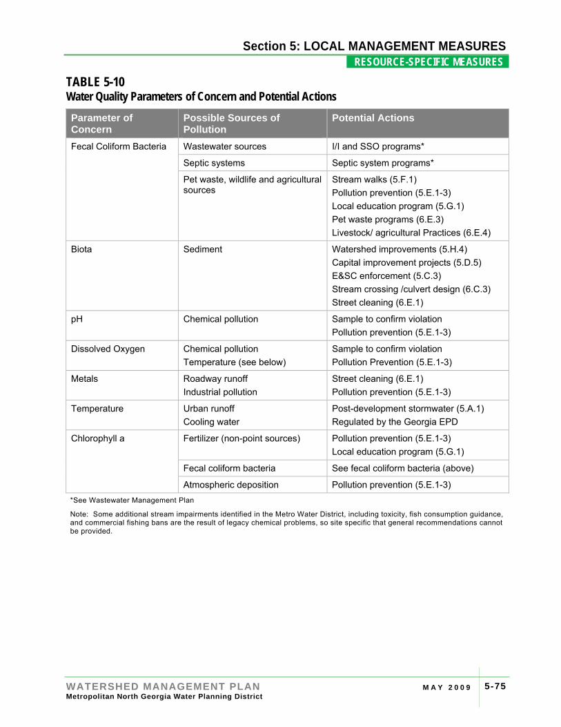
Section 4: RIVER BASIN PROFILES
WATERSHED MANAGEMENT PLAN M A Y 2 0 0 9 Metropolitan North Georgia Water Planning District
5-75
Section 5: LOCAL MANAGEMENT MEASURES RESOURCE-SPECIFIC MEASURES .
TABLE 5-10 Water Quality Parameters of Concern and Potential Actions Parameter of Concern
Possible Sources of Pollution
Potential Actions
Fecal Coliform Bacteria Wastewater sources I/I and SSO programs*
Septic systems Septic system programs*
Pet waste, wildlife and agricultural sources
Stream walks (5.F.1) Pollution prevention (5.E.1-3) Local education program (5.G.1) Pet waste programs (6.E.3) Livestock/ agricultural Practices (6.E.4)
Biota Sediment
Watershed improvements (5.H.4) Capital improvement projects (5.D.5) E&SC enforcement (5.C.3) Stream crossing /culvert design (6.C.3) Street cleaning (6.E.1)
pH Chemical pollution Sample to confirm violation Pollution prevention (5.E.1-3)
Dissolved Oxygen Chemical pollution Temperature (see below)
Sample to confirm violation Pollution Prevention (5.E.1-3)
Metals Roadway runoff Industrial pollution
Street cleaning (6.E.1) Pollution prevention (5.E.1-3)
Temperature Urban runoff Cooling water
Post-development stormwater (5.A.1) Regulated by the Georgia EPD
Chlorophyll a Fertilizer (non-point sources) Pollution prevention (5.E.1-3) Local education program (5.G.1)
Fecal coliform bacteria See fecal coliform bacteria (above)
Atmospheric deposition Pollution prevention (5.E.1-3) *See Wastewater Management Plan
Note: Some additional stream impairments identified in the Metro Water District, including toxicity, fish consumption guidance, and commercial fishing bans are the result of legacy chemical problems, so site specific that general recommendations cannot be provided.

Section 4: RIVER BASIN PROFILES
WATERSHED MANAGEMENT PLAN M A Y 2 0 0 9 Metropolitan North Georgia Water Planning District
5-76
Section 5: LOCAL MANAGEMENT MEASURES RESOURCE-SPECIFIC MEASURES .
[This page intentionally left blank]
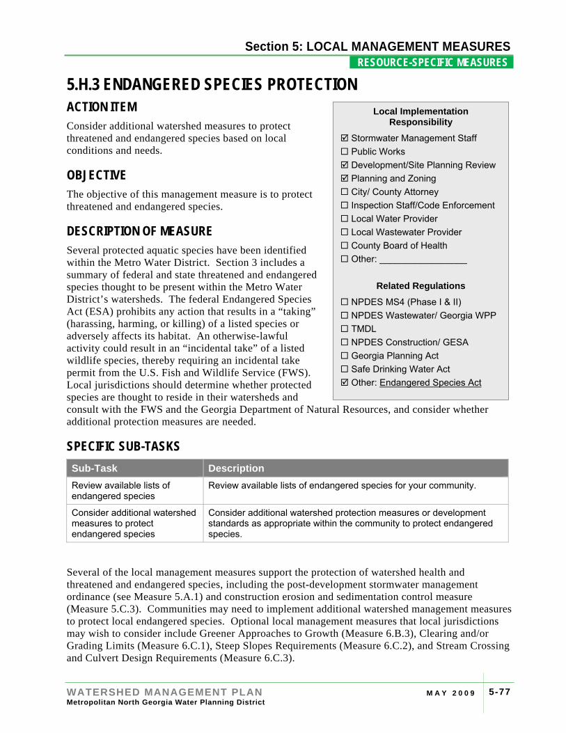
Section 4: RIVER BASIN PROFILES
WATERSHED MANAGEMENT PLAN M A Y 2 0 0 9 Metropolitan North Georgia Water Planning District
5-77
Section 5: LOCAL MANAGEMENT MEASURES RESOURCE-SPECIFIC MEASURES .
5.H.3 ENDANGERED SPECIES PROTECTION ACTION ITEM Consider additional watershed measures to protect threatened and endangered species based on local conditions and needs.
OBJECTIVE The objective of this management measure is to protect threatened and endangered species.
DESCRIPTION OF MEASURE Several protected aquatic species have been identified within the Metro Water District. Section 3 includes a summary of federal and state threatened and endangered species thought to be present within the Metro Water District’s watersheds. The federal Endangered Species Act (ESA) prohibits any action that results in a “taking” (harassing, harming, or killing) of a listed species or adversely affects its habitat. An otherwise-lawful activity could result in an “incidental take” of a listed wildlife species, thereby requiring an incidental take permit from the U.S. Fish and Wildlife Service (FWS). Local jurisdictions should determine whether protected species are thought to reside in their watersheds and consult with the FWS and the Georgia Department of Natural Resources, and consider whether additional protection measures are needed.
SPECIFIC SUB-TASKS Sub-Task Description Review available lists of endangered species
Review available lists of endangered species for your community.
Consider additional watershed measures to protect endangered species
Consider additional watershed protection measures or development standards as appropriate within the community to protect endangered species.
Several of the local management measures support the protection of watershed health and threatened and endangered species, including the post-development stormwater management ordinance (see Measure 5.A.1) and construction erosion and sedimentation control measure (Measure 5.C.3). Communities may need to implement additional watershed management measures to protect local endangered species. Optional local management measures that local jurisdictions may wish to consider include Greener Approaches to Growth (Measure 6.B.3), Clearing and/or Grading Limits (Measure 6.C.1), Steep Slopes Requirements (Measure 6.C.2), and Stream Crossing and Culvert Design Requirements (Measure 6.C.3).
Local Implementation Responsibility
Stormwater Management Staff Public Works Development/Site Planning Review Planning and Zoning City/ County Attorney Inspection Staff/Code Enforcement Local Water Provider Local Wastewater Provider County Board of Health Other: _________________
Related Regulations
NPDES MS4 (Phase I & II) NPDES Wastewater/ Georgia WPP TMDL NPDES Construction/ GESA Georgia Planning Act Safe Drinking Water Act Other: Endangered Species Act
Section 4: RIVER BASIN PROFILES
WATERSHED MANAGEMENT PLAN M A Y 2 0 0 9 Metropolitan North Georgia Water Planning District
5-78
Section 5: LOCAL MANAGEMENT MEASURES RESOURCE-SPECIFIC MEASURES .
[This page intentionally left blank]
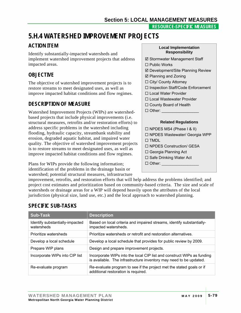
Section 4: RIVER BASIN PROFILES
WATERSHED MANAGEMENT PLAN M A Y 2 0 0 9 Metropolitan North Georgia Water Planning District
5-79
Section 5: LOCAL MANAGEMENT MEASURES RESOURCE-SPECIFIC MEASURES .
5.H.4 WATERSHED IMPROVEMENT PROJECTS ACTION ITEM Identify substantially-impacted watersheds and implement watershed improvement projects that address impacted areas.
OBJECTIVE The objective of watershed improvement projects is to restore streams to meet designated uses, as well as improve impacted habitat conditions and flow regimes.
DESCRIPTION OF MEASURE Watershed Improvement Projects (WIPs) are watershed-based projects that include physical improvements (i.e. structural measures, retrofits and/or restoration efforts) to address specific problems in the watershed including flooding, hydraulic capacity, streambank stability and erosion, degraded aquatic habitat, and impaired water quality. The objective of watershed improvement projects is to restore streams to meet designated uses, as well as improve impacted habitat conditions and flow regimes.
Plans for WIPs provide the following information; identification of the problems in the drainage basin or watershed; potential structural measures, infrastructure improvement, retrofits, and restoration efforts that will help address the problems identified; and project cost estimates and prioritization based on community-based criteria. The size and scale of watersheds or drainage areas for a WIP will depend heavily upon the attributes of the local jurisdiction (physical size, land use, etc.) and the local approach to watershed planning.
SPECIFIC SUB-TASKS Sub-Task Description Identify substantially-impacted watersheds
Based on local criteria and impaired streams, identify substantially-impacted watersheds.
Prioritize watersheds Prioritize watersheds or retrofit and restoration alternatives.
Develop a local schedule Develop a local schedule that provides for public review by 2009.
Prepare WIP plans Design and prepare improvement projects.
Incorporate WIPs into CIP list Incorporate WIPs into the local CIP list and construct WIPs as funding is available. The infrastructure inventory may need to be updated.
Re-evaluate program Re-evaluate program to see if the project met the stated goals or if additional restoration is required.
Local Implementation Responsibility
Stormwater Management Staff Public Works Development/Site Planning Review Planning and Zoning City/ County Attorney Inspection Staff/Code Enforcement Local Water Provider Local Wastewater Provider County Board of Health Other: _________________
Related Regulations
NPDES MS4 (Phase I & II) NPDES Wastewater/ Georgia WPP TMDL NPDES Construction/ GESA Georgia Planning Act Safe Drinking Water Act Other: _________________
Section 4: RIVER BASIN PROFILES
WATERSHED MANAGEMENT PLAN M A Y 2 0 0 9 Metropolitan North Georgia Water Planning District
5-80
Section 5: LOCAL MANAGEMENT MEASURES RESOURCE-SPECIFIC MEASURES .
IMPLEMENTATION GUIDANCE Each local jurisdiction must identify the substantially-impacted watersheds within their community and prepare WIPs based on local needs and priorities. These impacted watersheds at a minimum include areas with water quality impairment including waterbodies on the 303(d) list and waterbodies with TMDLs. Local jurisdictions may choose to add watersheds with high levels of impervious area, areas with flooding problems, streambank erosion and sedimentation, aging or degraded infrastructure, or other aquatic habitat degradation. These watersheds may be prioritized and are intended to be flexible based on local community priorities. Streams listed for fecal coliform bacteria may be excluded from the list of substantially-impacted watersheds so long as they are addressed in a TMDL program (see Measure 5.H.2).
WIPs can include a number of different retrofit or restoration strategies based on the problems within the sub-watershed area. Retrofit measures can include modifying existing stormwater structures, such as detention/retention ponds, to provide water quality treatment and/or improve hydrologic function. Restoration measures can include stream restoration, wetland enhancements, re-planting riparian corridors and other projects to restore habitat and improve the hydrologic regime. Protection of sensitive resources can also be considered a watershed improvement project.
Due to the high cost associated with development and implementation of watershed improvement plans, this measure has a long-term and systematic approach. An adaptive management approach to restoration plans is recommended. Adjustments to local watershed improvement plans will be made regularly as new information is collected, data on restoration technologies become available, and new technologies emerge.
There are six steps for creating a Watershed Improvement Plan to address impacted water quality, as outlined below.
1. Identify the substantially-impacted watersheds within the community. At a minimum this includes all watersheds with a non-fecal coliform bacteria water quality impairment or TMDL. It may also include any area, stream reach, or water body with significant impacts such as:
• Flooding and property damage
• Streambank erosion and sedimentation
• Aging/degraded stormwater infrastructure and/or hydraulic capacity issues
• Aquatic habitat degradation
• Fecal coliform bacteria impairment
• High percentage of impervious area
The following sources of information may be used to determine and assess the substantially-impacted watersheds in the community:
• Existing watershed studies prepared by a local jurisdiction, or regional, state or federal agency, including Watershed Assessment and Protection plans prepared for Georgia EPD under the NPDES regulations for surface water intakes and wastewater discharges
• State 303(d)/305(b) designations of impaired waters
Section 4: RIVER BASIN PROFILES
WATERSHED MANAGEMENT PLAN M A Y 2 0 0 9 Metropolitan North Georgia Water Planning District
5-81
Section 5: LOCAL MANAGEMENT MEASURES RESOURCE-SPECIFIC MEASURES .
• State TMDL designations and local TMDL assessment and implementation plans
• Local stormwater management system and infrastructure inventories
• Stormwater or drainage system master plans
• Results of water quality monitoring activities, biological and habitat assessments, streamwalks, and other field work or data collection
• GIS and/or computer modeling analyses
• Drainage and stormwater calls and complaints to the community related to flooding, streambank erosion, and water quality
• Other information sources including staff knowledge of problems, impervious cover assessments, land use and redevelopment planning, etc.
2. Prioritize watersheds or specific areas of the community for developing WIPs based on locally-developed criteria or priorities. These criteria might include:
• Number and/or magnitude of existing or future problems in a drainage area or watershed
• Level of existing or future development or redevelopment, land use activities or population in a drainage area or watershed
• Other programs, activities or funding that would influence the implementation of watershed improvement projects
• Provide for public review of prioritized watersheds, specific target areas, or projects by the public as appropriate.
3. Develop a local schedule for preparing WIP plans based on the prioritization completed above. The schedule will include all substantially-impacted watersheds in the community and provide specific planning horizon for completion of the WIP plans. The schedule for WIP planning is 2009.
4. Prepare designs for WIPs for each of the substantially-impacted watersheds in the community following the locally-developed schedule.
5. Each WIP plan will include the following elements, as necessary:
• Introduction – Brief overview of the watershed being addressed, including watershed delineation and drainage area maps.
• Problem Identification – Assessment of watershed impairments including flooding, bank/channel erosion and stability, hydraulic capacity, aquatic habitat/biological, and water quality. Field sampling, data collection and/or modeling may be used to evaluate existing or potential problems and impairments.
• Mitigation / Improvement Projects – Potential structural measures, infrastructure improvements, retrofits, and restoration efforts that will help address the problems identified in the watershed. Include conceptual plans and/or designs with a level of detail sufficient to prepare planning level cost estimates. Modeling can be used to evaluate the potential projects to meet the proposed objectives.
• Project Cost Estimates – Cost estimates for the potential projects.
Section 4: RIVER BASIN PROFILES
WATERSHED MANAGEMENT PLAN M A Y 2 0 0 9 Metropolitan North Georgia Water Planning District
5-82
Section 5: LOCAL MANAGEMENT MEASURES RESOURCE-SPECIFIC MEASURES .
• Project Ranking and Prioritization – Evaluation of the potential project based upon a set of criteria.
• Capital Improvement Plan – Final recommended list of watershed improvement projects which includes the rationale for inclusion, overall potential to address objectives, estimated project costs, funding potential and preliminary schedule for implementation.
6. Incorporate WIP capital improvements into the overall community capital improvement plan(s) and implement as funding permits.