Embed Size (px)
Citation preview
Seismic Refraction Survey along U.S. 160 near Wolf Creek Pass, South Fork, Colorado
Jim Pfeiffer, Sr GeophysicistJim Hild, Sr GeophysicistKanaan Hanna, Sr Engineer
9th Annual Technical Forum – Geohazards in TransportationAugust 4-6, 2009, Lexington, Kentucky,
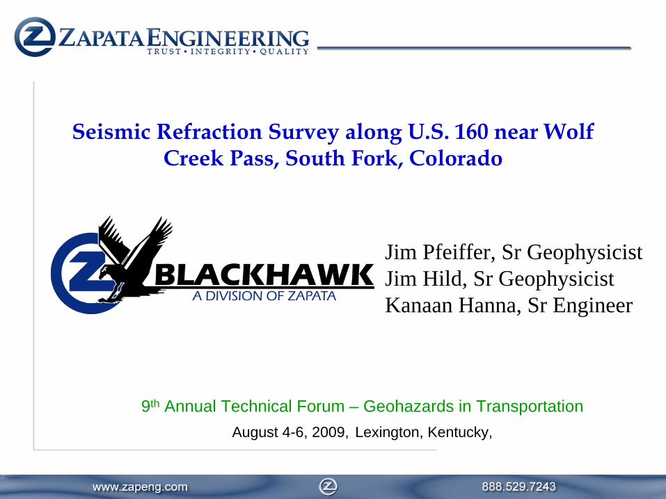
Survey Location
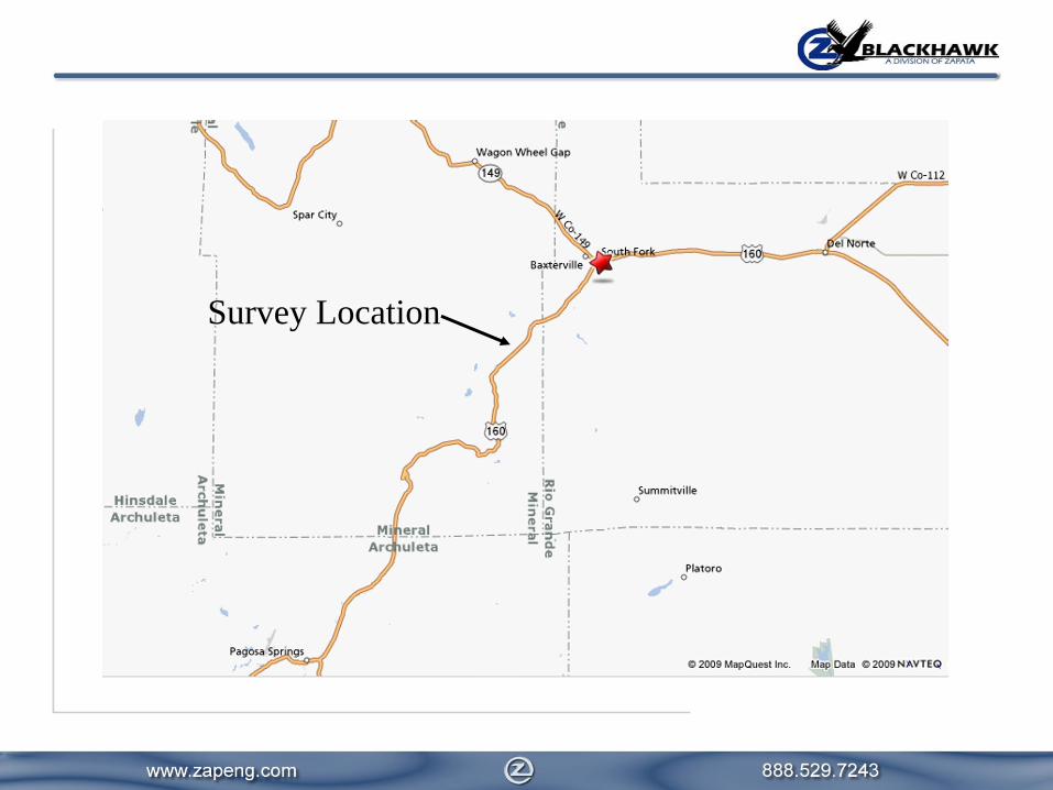
Survey Location

Geophysical Survey Objective
1. Determine thickness of alluvium in gully.
2. Determine bedrock P-wave velocity.
This information was used to aid in the design a hill slopestabilization and remediation plan.
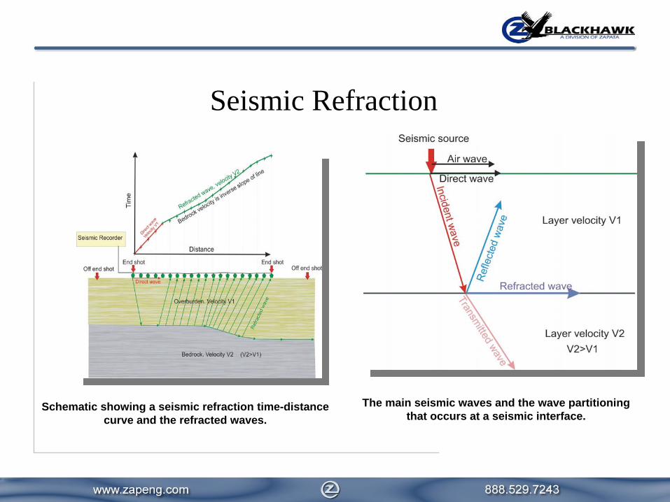
Seismic Refraction
The main seismic waves and the wave partitioningthat occurs at a seismic interface.
Schematic showing a seismic refraction time-distancecurve and the refracted waves.

•
The seismic refraction survey was conducted on a steep, south facing, hill slope on the north side of U.S. 160.
•
Slope angle averaged 31°
(60% grade) with some areas greater than 40 °.
•
The sides of the gully were bound by volcanic rocks forming steep cliffs (Fish Canyon Tuff).
•
The lower half of the hill slope had failed within the alluvial/colluvial
material leaving a near vertical scarp
up to 15 ft high crossing the gully.•
Poorly graded alluvial/colluvial
materials ranging
from clay to boulders.
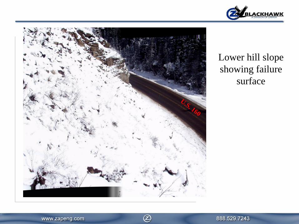
Lower hill slopeshowing failure
surface
U.S. 160
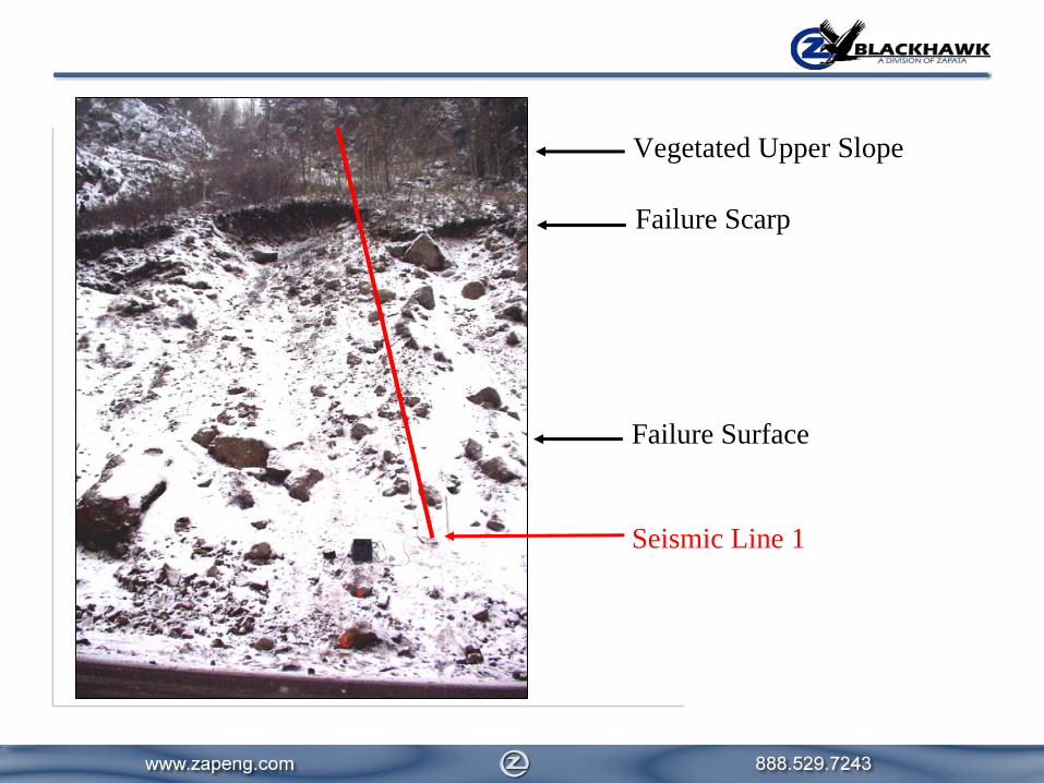
Vegetated Upper Slope
Failure Scarp
Failure Surface
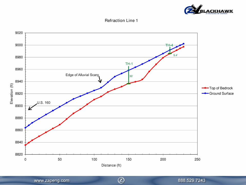
Seismic Line 1
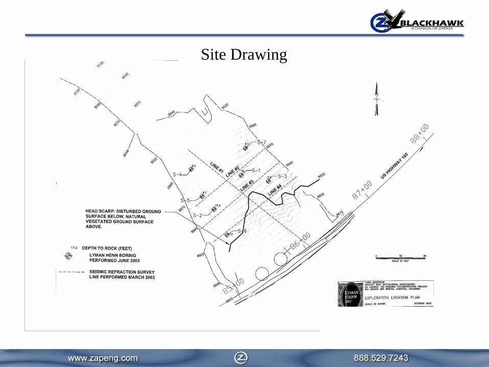
Site Drawing
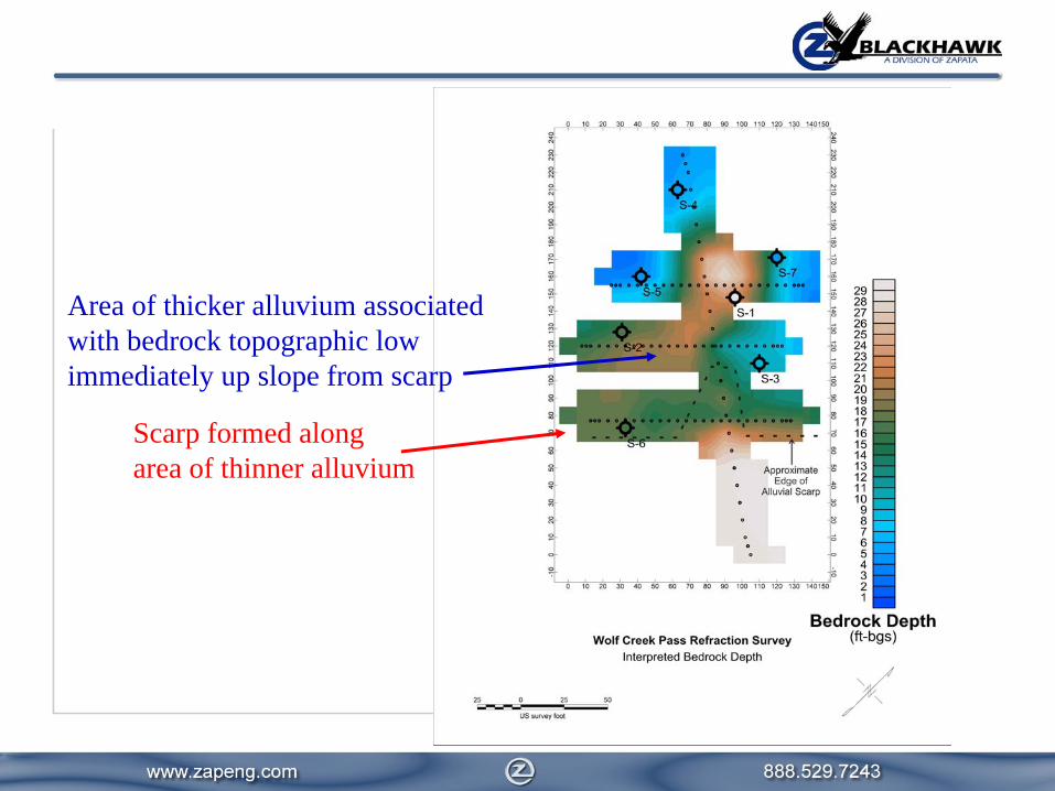
Scarp formed alongarea of thinner alluvium
Area of thicker alluvium associatedwith bedrock topographic lowimmediately up slope from scarp

Scarp formed along bedrock elevation contour
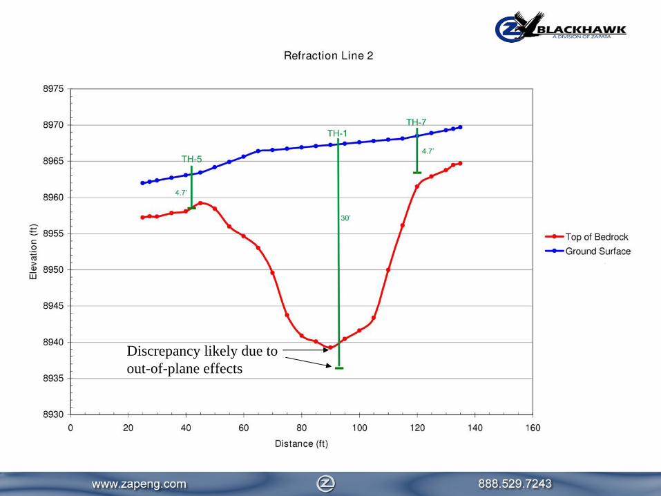
Discrepancy likely due toout-of-plane effects
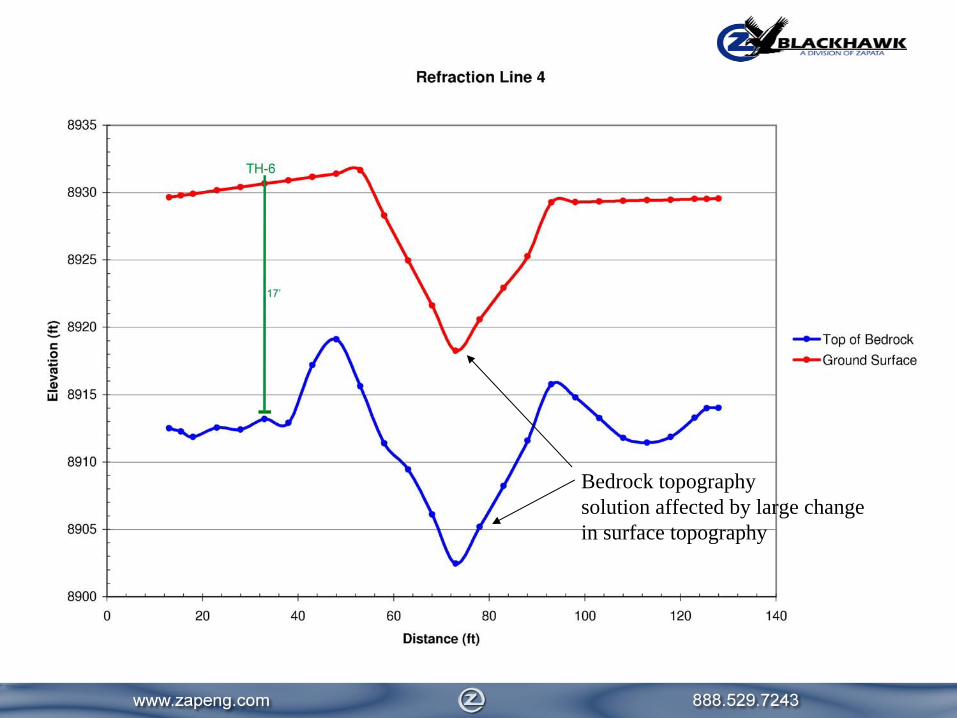
Bedrock topographysolution affected by large change in surface topography
P-wave velocity in alluvium/colluvium rangedfrom 1,600 ft/s to 4,000 ft/s.
P-wave velocity in bedrock ranged from 7,000 ft/s to 13,000 ft/s
Depth to bedrock (Fish Canyon Tuff) ranged from < 5 ft to 30 ft.
Seismic Refraction Results

Summary and Conclusions
•Steep surface and bedrock topography (>20°) can limit the accuracy of the seismic refraction method.
•Borehole ground truth is important for constraining the refraction solution.
•The refraction solution can be used to fill in bedrock topography between boreholes, which can provide better accuracy than simple interpolation/extrapolation using only borehole data.
•Refraction tomography processing may enhance the standard refraction interpretation.
Gravity: Friend?
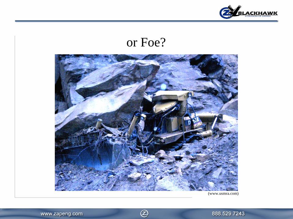
or Foe?
(www.usmra.com)

Questions
Thank You