Embed Size (px)
Citation preview

Sensors
•High spatial resolution
– Quickbird, IKONOS, OrbView-3, SPOT-5 PAN, IRS-P6
• Medium spatial resolution
– Landsat-5 TM, Landsat-7 ETM+, ASTER, SPOT
• Low spatial resolution
– MODIS, ENVISAT, GOES, AVHRR, MSS

•Pushbroom (along track) vs. Whiskbroom (across track)
• SPOT and IKONOS: Pushbroom
• Landsat: Whiskbroom
•Pushbroom scanners generally have higher radiometric resolution because they have longer “dwell time” than across-track scanners, which move laterally across landscape as they also move forward

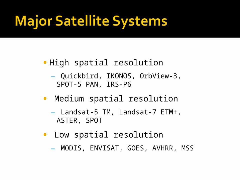
• Most of these satellites are in sun-synchronous orbit
• The satellite passes over the same part of the Earth at roughly the same local time each day
• Its “inclination” is about 8 degrees off of polar orbit
• The fact that the earth is not a perfect sphere makes the orbital plane rotate slowly around the earth (this would not happen if it were perfectly polar)
• Slow motion of orbital plane matches the latitudinal motion of the sun in the sky over the year
• Maintains similar sun angles along its ground trace for all orbits
• That means that a given location always gets the same mean sunlight angle, which provides consistent lighting
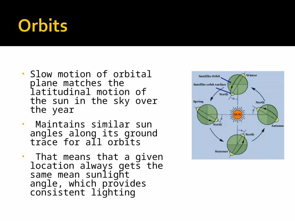
• First started by NASA in 1972; later turned over to NOAA
• Since 1984 satellite operation and data handling are managed by a commercial company EOSAT
• LANDSAT-7 launched in 1999; developed scan line error in 2003
• Only 5 is still working; outdated

Several sensor types Multi-spectral scanner
(MSS) – LANDSAT-1 through LANDSAT-5
Thematic Mapper (TM) – LANDSAT-4 and -5
Enhanced Thematic Mapper (ETM+) – LANDSAT-7
Thematic Mapper spectral resolution

• Slightly different bands than TM; otherwise similar, stressing continuity
• Check out the movie LANDSAT-7 ETM+ BAND CHARACTERISTICS
Band Number
Nominal spectrum
Spectral Range (µ)
Ground Resolution
(m)
Data Lines Per Scan
Data Line Length (bytes)
1 Blue .450 to .515 30 16 6,600
2 green .525 to .605 30 16 6,600
3 red .630 to .690 30 16 6,600
4 Near IR .775 to .900 30 16 6,600
5 mid IR 1.550 to 1.750 30 16 6,600
6 Thermal IR 10.40 to 12.50 60 8 3,300
7 mid IR 2.090 to 2.35 30 16 6,600
8 panchromatic .520 to .900 15 32 13,200
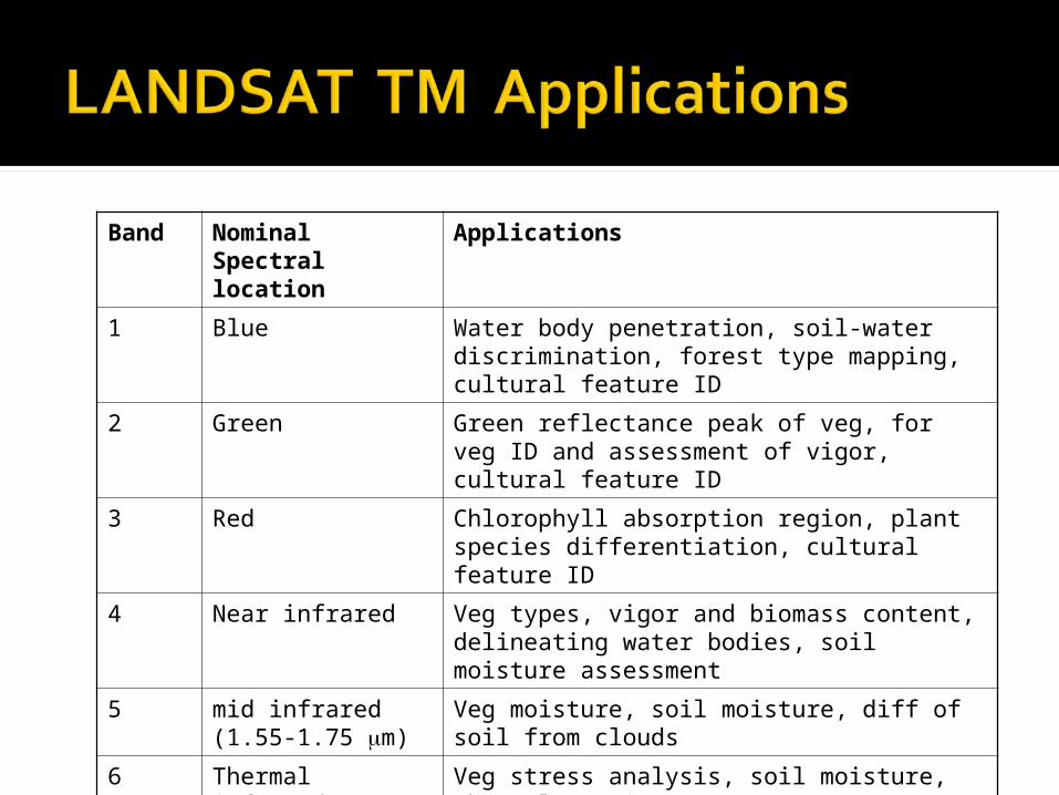
Band Nominal Spectral location
Applications
1 Blue Water body penetration, soil-water discrimination, forest type mapping, cultural feature ID
2 Green Green reflectance peak of veg, for veg ID and assessment of vigor, cultural feature ID
3 Red Chlorophyll absorption region, plant species differentiation, cultural feature ID
4 Near infrared Veg types, vigor and biomass content, delineating water bodies, soil moisture assessment
5 mid infrared (1.55-1.75 m)
Veg moisture, soil moisture, diff of soil from clouds
6 Thermal infrared Veg stress analysis, soil moisture, thermal mapping
7 mid infrared(2.08-2.35 m)
Discriminating mineral and rock types, veg moisture
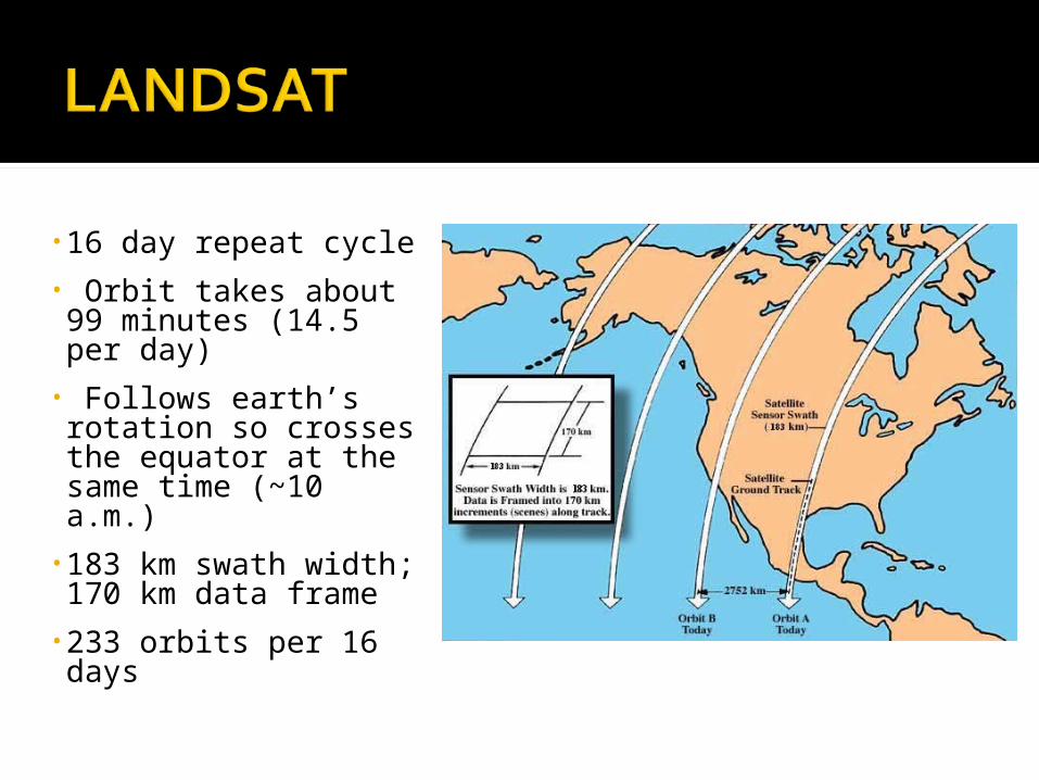
•16 day repeat cycle• Orbit takes about 99 minutes (14.5 per day)
• Follows earth’s rotation so crosses the equator at the same time (~10 a.m.)
•183 km swath width; 170 km data frame
•233 orbits per 16 days
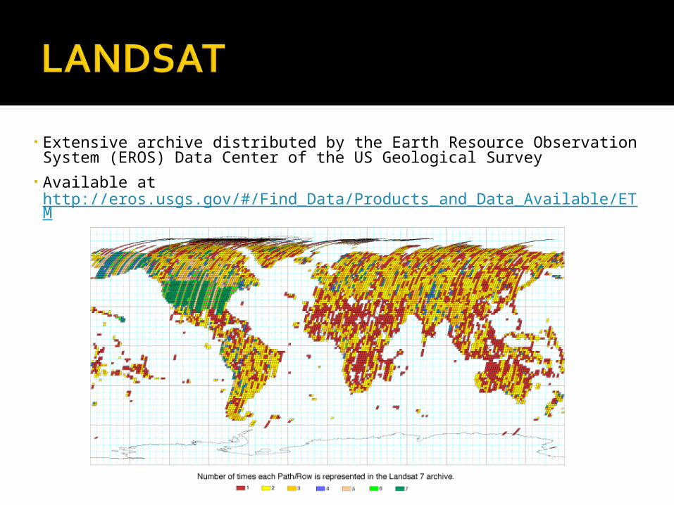
• Extensive archive distributed by the Earth Resource Observation System (EROS) Data Center of the US Geological Survey
• Available at http://eros.usgs.gov/#/Find_Data/Products_and_Data_Available/ETM


•Satellite Pour l'Observation de la Terre operated by the French Space Agency, Centre National d'Etudes Spatiales (CNES).
•5 satellites launched 1986-2002 (several are still operational)
•Each has 2 High Resolution Visible (HRV) sensors constructed with multilinear array detectors, or “Pushbroom scanners” that record multispectral data along a wide swath
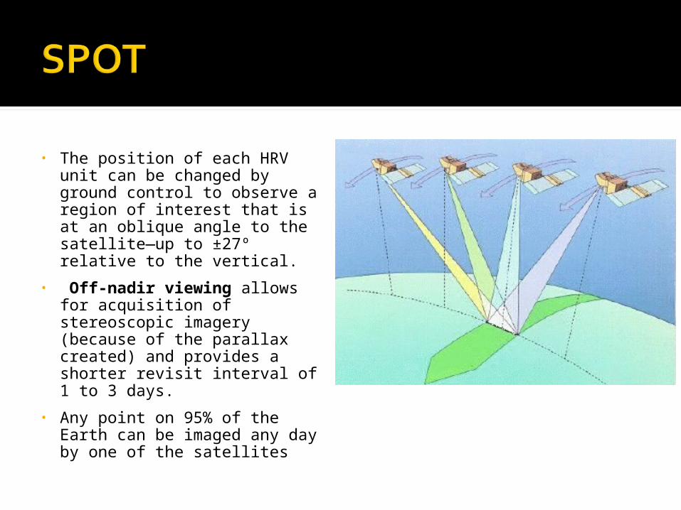
• The position of each HRV unit can be changed by ground control to observe a region of interest that is at an oblique angle to the satellite—up to ±27º relative to the vertical.
• Off-nadir viewing allows for acquisition of stereoscopic imagery (because of the parallax created) and provides a shorter revisit interval of 1 to 3 days.
• Any point on 95% of the Earth can be imaged any day by one of the satellites

• Two modes: panchromatic and multispectral

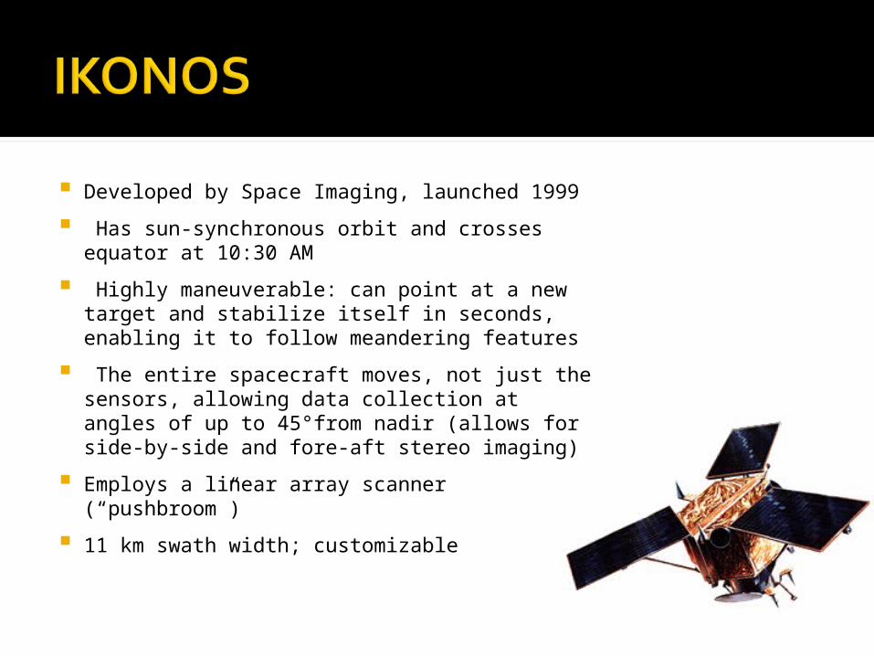
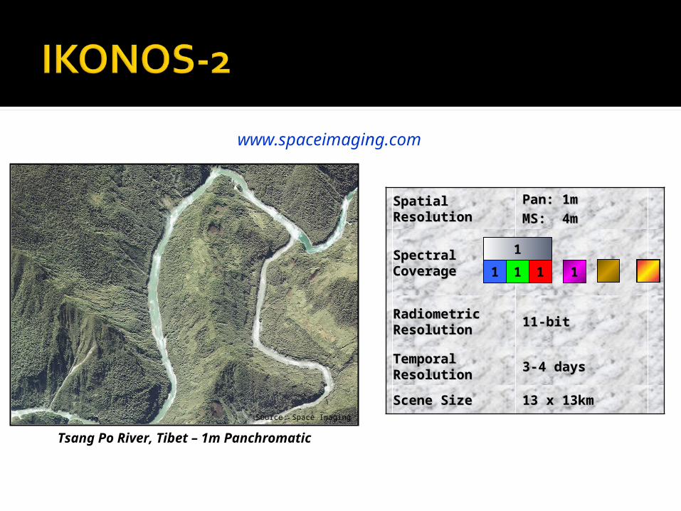
Developed by Space Imaging, launched 1999
Has sun-synchronous orbit and crosses equator at 10:30 AM
Highly maneuverable: can point at a new target and stabilize itself in seconds, enabling it to follow meandering features
The entire spacecraft moves, not just the sensors, allowing data collection at angles of up to 45°from nadir (allows for side-by-side and fore-aft stereo imaging)
Employs a linear array scanner (“pushbroom”)
11 km swath width; customizable
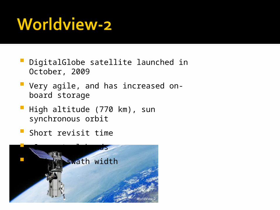
DigitalGlobe satellite launched in October, 2009
Very agile, and has increased on-board storage
High altitude (770 km), sun synchronous orbit
Short revisit time
8 spectral bands
16.4 km swath width

SourceSource VT VT OrthophotosOrthophotos
SensorSensor FilmFilm
Spatial Spatial ResolutionResolution
0.5m0.5m
Spectral Spectral CoverageCoverage
Radiometric Radiometric ResolutionResolution
8-bit8-bit
1
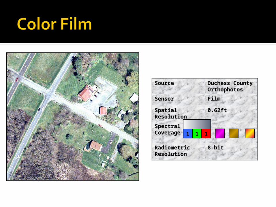
SourceSource Duchess Duchess County County OrthophotosOrthophotos
SensorSensor FilmFilm
Spatial Spatial ResolutionResolution
0.62ft0.62ft
Spectral Spectral CoverageCoverage
Radiometric Radiometric ResolutionResolution
8-bit8-bit
1 1 1
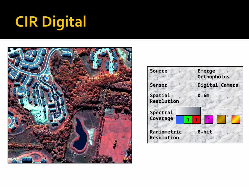
SourceSource Emerge Emerge OrthophotosOrthophotos
SensorSensor Digital CameraDigital Camera
Spatial Spatial ResolutionResolution
0.6m0.6m
Spectral Spectral CoverageCoverage
Radiometric Radiometric ResolutionResolution
8-bit8-bit
1 1 1

Imagery © Pictometery, 2007
38ft38ft64ft64ft
Spatial Spatial ResolutionResolution
Pan: 1mPan: 1m
MS: 4mMS: 4m
Spectral Spectral CoverageCoverage
Radiometric Radiometric ResolutionResolution 11-bit11-bit
Temporal Temporal ResolutionResolution 3-4 days3-4 days
Scene SizeScene Size 13 x 13km13 x 13km
1 1 1 1
1
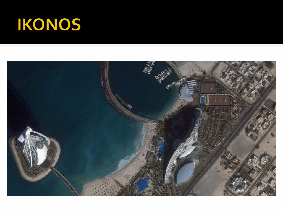
Source: Space Imaging
www.spaceimaging.com
Tsang Po River, Tibet – 1m Panchromatic

Woodstock, VT– 1m Panchromatic Waitsfield, VT– 4m Multispectral
© Space Imaging© Space Imaging
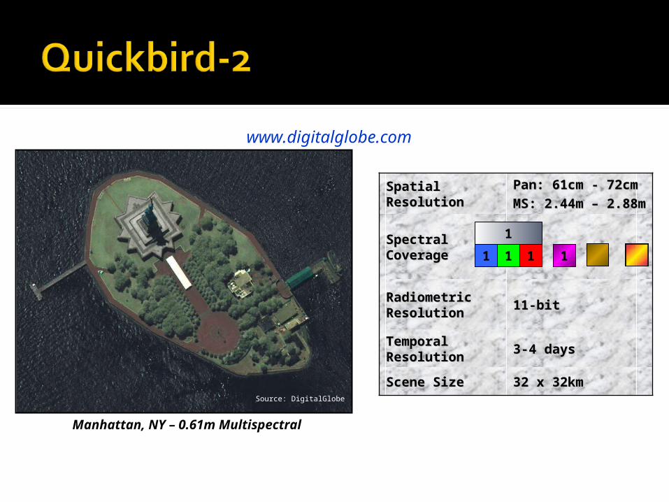
Spatial Spatial ResolutionResolution
Pan: 61cm - 72cmPan: 61cm - 72cm
MS: 2.44m – MS: 2.44m – 2.88m2.88m
Spectral Spectral CoverageCoverage
Radiometric Radiometric ResolutionResolution 11-bit11-bit
Temporal Temporal ResolutionResolution 3-4 days3-4 days
Scene SizeScene Size 32 x 32km32 x 32km
1 1 1 1
1
www.digitalglobe.com
Source: DigitalGlobe
Manhattan, NY – 0.61m Multispectral

Source: DigitalGlobe
Source: DigitalGlobe
Boston, MA – 0.61m Panchromatic
Mauritius – 2.44m Multispectral
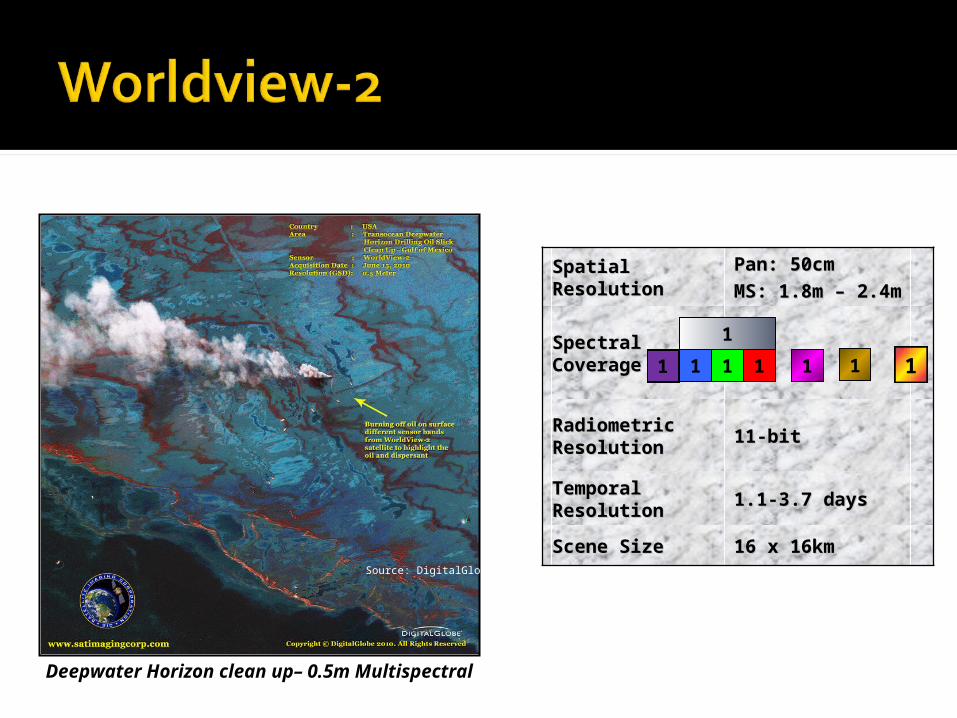
Spatial Spatial ResolutionResolution
Pan: 50cmPan: 50cm
MS: 1.8m – 2.4mMS: 1.8m – 2.4m
Spectral Spectral CoverageCoverage
Radiometric Radiometric ResolutionResolution 11-bit11-bit
Temporal Temporal ResolutionResolution 1.1-3.7 days1.1-3.7 days
Scene SizeScene Size 16 x 16km16 x 16km
1 1 1 11 1
1
Source: DigitalGlobe
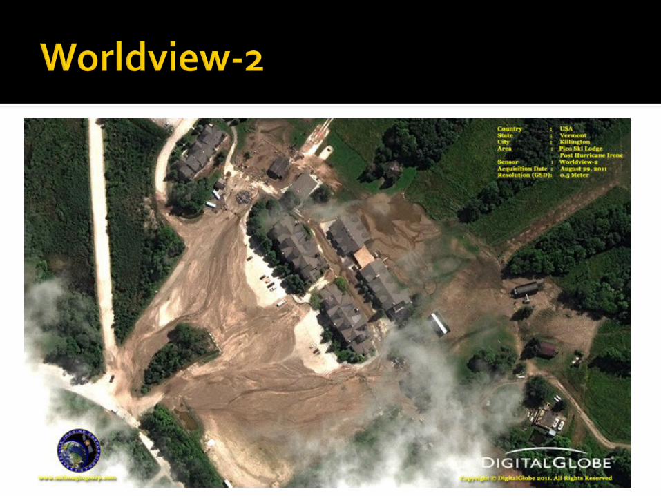
Deepwater Horizon clean up– 0.5m Multispectral
1
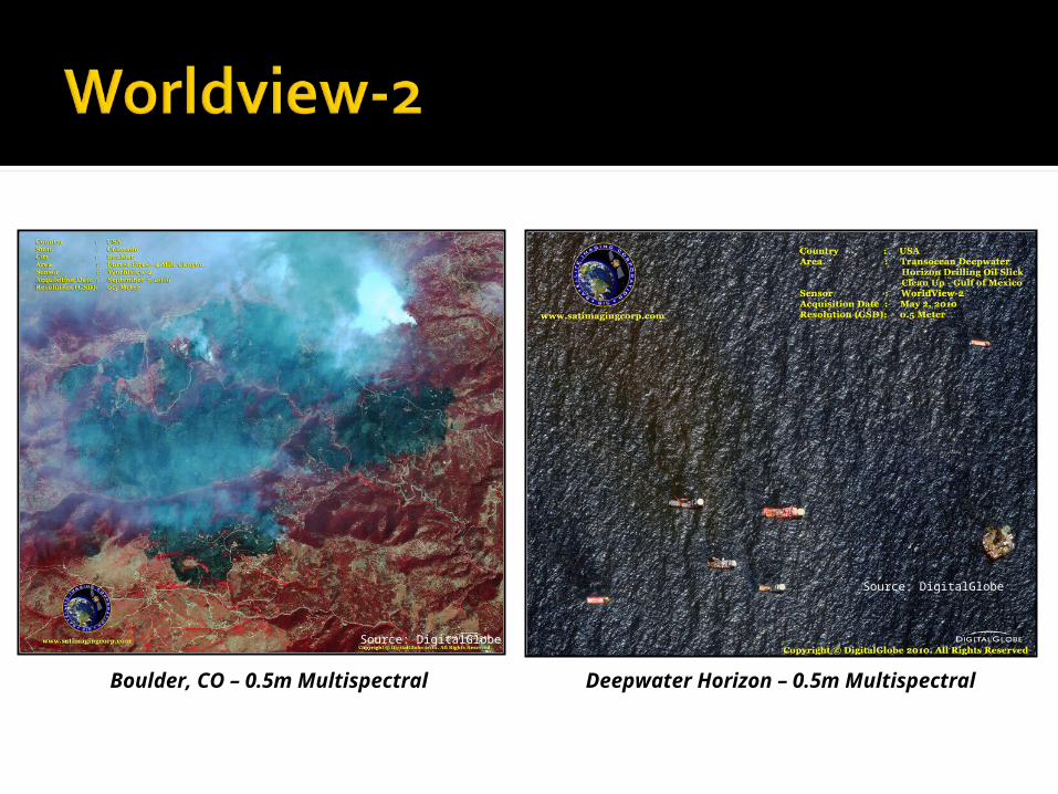
Source: DigitalGlobe
Source: DigitalGlobe
Boulder, CO – 0.5m Multispectral Deepwater Horizon – 0.5m Multispectral
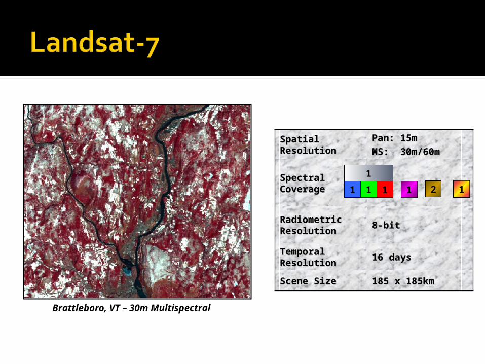
Spatial Spatial ResolutionResolution
Pan: 15mPan: 15m
MS: 30m/60mMS: 30m/60m
Spectral Spectral CoverageCoverage
Radiometric Radiometric ResolutionResolution 8-bit8-bit
Temporal Temporal ResolutionResolution 16 days16 days
Scene SizeScene Size 185 x 185km185 x 185km
1 1 1 11 2
1
Brattleboro, VT – 30m Multispectral
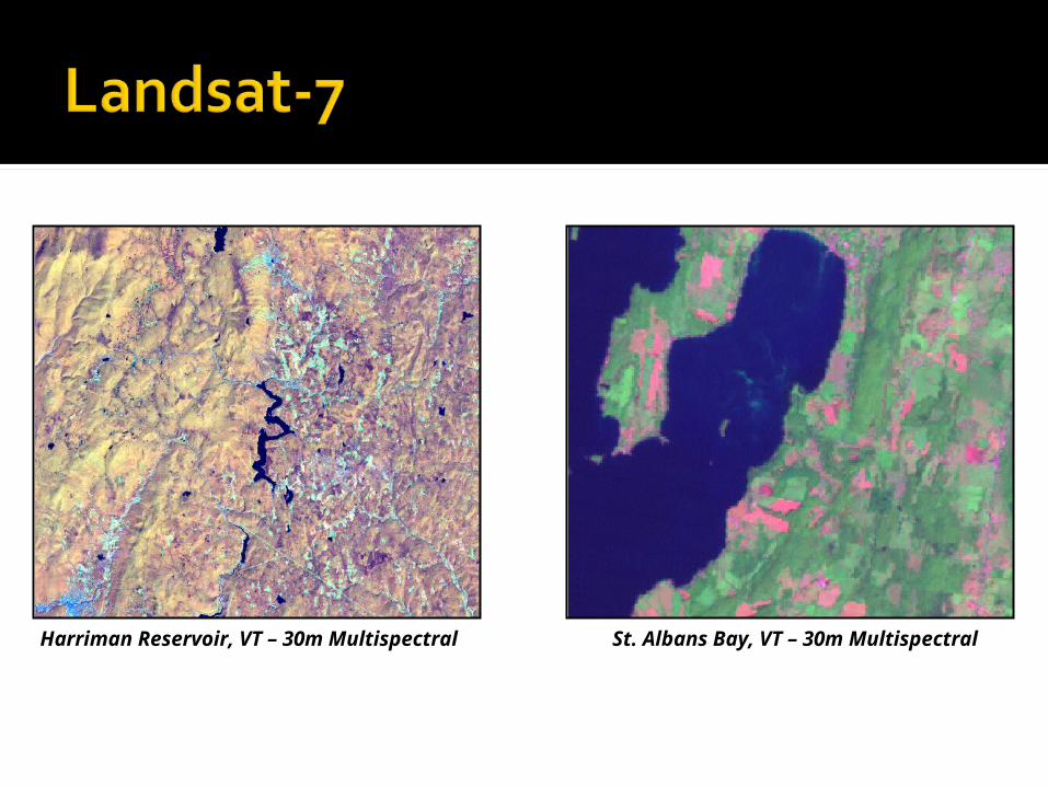
Harriman Reservoir, VT – 30m Multispectral St. Albans Bay, VT – 30m Multispectral

Spatial Spatial ResolutionResolution MS: 15m/30m/90mMS: 15m/30m/90m
Spectral Spectral CoverageCoverage
Radiometric Radiometric ResolutionResolution 8-bit/12-bit8-bit/12-bit
Temporal Temporal ResolutionResolution VariesVaries
Scene SizeScene Size 60x 60km60x 60km
1 1 51 6
Boston, MA – 90m Thermal

Winooski River, VT – 15m Multispectral Otter Creek, VT – 15m Multispectral