Embed Size (px)
Citation preview

REPORT TO
THE SPACE INDUSTRY ASSOCIATION OF AUSTRALIA
SEPTEMBER 2016
SBAS AND AUSTRALIA
POTENTIAL APPLICATIONS OF AN SBAS IN AUSTRALIA

ACIL ALLEN CONSULTING PTY LTD
ABN 68 102 652 148
LEVEL FIFTEEN
127 CREEK STREET
BRISBANE QLD 4000
AUSTRALIA
T+61 7 3009 8700
F+61 7 3009 8799
LEVEL ONE
15 LONDON CIRCUIT
CANBERRA ACT 2600
AUSTRALIA
T+61 2 6103 8200
F+61 2 6103 8233
LEVEL NINE
60 COLLINS STREET
MELBOURNE VIC 3000
AUSTRALIA
T+61 3 8650 6000
F+61 3 9654 6363
LEVEL ONE
50 PITT STREET
SYDNEY NSW 2000
AUSTRALIA
T+61 2 8272 5100
F+61 2 9247 2455
LEVEL TWELVE, BGC CENTRE
28 THE ESPLANADE
PERTH WA 6000
AUSTRALIA
T+61 8 9449 9600
F+61 8 9322 3955
161 WAKEFIELD STREET
ADELAIDE SA 5000
AUSTRALIA
T +61 8 8122 4965
ACILALLEN.COM.AU
SUGGESTED CITATION FOR THIS REPORT
ACIL ALLEN CONSULTING (SEPTEMBER 2016), POTENTIAL APPLICATIONS OF AN SBAS IN AUSTRALIA
© ACIL ALLEN CONSULTING 2016
SBAS AND AUSTRALIA POTENTIAL APPLICATIONS OF AN SBAS IN AUSTRALIA ii
G L O S S A R Y O F T E R M S
AACN Advanced Automatic Collision Notification
ACNS Automated Collision Notification Systems
ADS-B automatic dependent surveillance—broadcast
AIS Automatic Identification System
AMSA Australian Maritime Safety Authority
APV Approach procedures with Vertical Guidance
ARTC Australian Rail Track Corporation
ATMS Automatic Train Management Systems
Baro-VNAV barometric vertical navigation
BTM Balise Transmission Module
CASA Civil Aviation Safety Authority.
C-ITS Cooperative Intelligent Transport Systems
COMPASS China’s Beidou Satellite Constellation
CORS Continuously Operating Reference Stations
CTF Controlled Traffic Farming
DDCs delays, diversions and cancellations
DGNSS Differential Global National Satellite Systems
DGPS Differential Global Positioning Systems
DOT Department of Transport (USA)
EC European Commission
EGNOS European Geostationary Navigation Overlay Service
SBAS AND AUSTRALIA POTENTIAL APPLICATIONS OF AN SBAS IN AUSTRALIA iii
EPIRB Emergency Position Indicating Radio Beacons
ERSAT EAV Satellite Enabling Application and Validation Project
ERTMS European Rail Traffic Management System
ETCS European Train Control System
EU European Union
FAA Federal Aviation Authority (USA)
FCC Federal Communications Commission (USA)
GAGAN India’s GPS Aided GEO Augmented Navigation
GBAS Ground Based Augmentation Systems
GDP Gross Domestic Product
GIS Geographic Information Systems
GLONASS Russian global navigation satellite system
GNSS Global Navigational Satellite Systems
GPS Global Positioning System
GSA Global Navigation Satellite Systems Agency
GSM Global System for Mobile
I2V Infrastructure to vehicle
IALA International Association of Lighthouse Authorities
ICAO International Civil Aviation Organisation
ILS Instrument Landing System
IMO International Maritime Organisation
IRNSS Indian Regional Navigational Satellite System
ISCM Intergovernmental Committee of Surveying and Mapping
ITS Intelligent Transport Systems
LEX L-band Experimental Signal
LRIT Long Range Identification and Tracking
MDGPS Maritime Differential Global Positioning System
MOPS Minimum Operational Performance Standards
MSAS Japanese MTSAT Satellite Based Augmentation System
MSC Maritime Safety Committee
NDGPS Nationwide Differential Global Positioning System
PBN Performance Based Navigation
PLB Personal Location Beacons
SBAS AND AUSTRALIA POTENTIAL APPLICATIONS OF AN SBAS IN AUSTRALIA iv
PNT position, navigation and timing
PPP Precise Point Positioning
PTC Positive Train Control
QZSS Japan’s Quasi Zenith Satellite System
RAIM Receiver Autonomous Integrity Monitoring
RNSS Regional Navigational Satellite Services
RPT regional regular public transport
RTCA Radio Technical Commission for Aeronautics
RTK Real Time Kinematic
SARPS Standards and Recommended Practices
SBAS Satellite Based Augmentation System
SOLAS International Convention for Safety of Life at Sea
TTFF The Time To First Fix
UAV Unmanned Aerial Vehicles
USCG US Coast Guard
V2I Vehicle to infrastructure
V2V Vehicle to vehicle
WAAS Wide Area Augmentation System (USA)
C O N T E N T S
GLOSSARY OF TERMS II
EXECUTIVE SUMMARY I
1
Introduction 1
2
Global Navigational Satellite System (GNSS) 3 2.1 Global Navigation Satellite System (GNSS) 3 2.2 Augmented GNSS 4 2.3 Findings 8
3
Aviation 10 3.1 Introduction 10 3.2 International Experience 11 3.3 Implications for Australia 12 3.4 Findings 12
4
Road Transport and Logistics 13 4.1 Road transport 13 4.2 Logistics 19 4.3 Findings 21
5
Maritime 22 5.1 Introduction 22 5.2 Policies and standards for positioning and navigation 23 5.3 Overseas experience 24 5.4 Implications for Australia 25 5.5 Findings 25
6
Rail 26 6.1 Background 26 6.2 Recent developments overseas 27 6.3 Developments in Australia - Automatic Train Management Systems 28 6.4 Findings 29
7
Agriculture 30 7.1 Background 30 Recent developments overseas 31
C O N T E N T S
7.3 Applications for SBAS in Australian agriculture 32 7.4 Controlled traffic farming 32 7.5 Findings 35
8
Surveying and Mapping and Location Based Services 36 8.1 Introduction 36 8.2 International experience 36 8.3 Implications for applications in Australia 38 8.4 Findings 38
9
Findings and Conclusions 39 9.1 Overview 39 9.2 Issues for a benefit cost analysis 40 9.3 Conclusion 42
BIBLIOGRAPHY 44
FIGURES FIGURE 2.1 SBAS INFRASTRUCTURE 6 FIGURE 2.2 CURRENT SBAS SYSTEMS 7
TABLES TABLE 5.1 IALA VIEW OF FUTURE OF AUGMENTED GNSS 23 TABLE 9.1 MATRIX OF APPLICATIONS 40
BOXES BOX 4.1 KEY EU FINDINGS IN THE C-ITS AREA 14 BOX 4.2 STRATEGIC THEMES OF ITS IN THE USA 16 BOX 4.3 POTENTIAL APPLICATIONS OF SBAS IN TRANSPORT 18 BOX 7.1 SBAS AND LIVESTOCK MANAGEMENT 35 BOX 9.1 PUBLIC GOODS AND MARKET GOODS 42
SBAS AND AUSTRALIA POTENTIAL APPLICATIONS OF AN SBAS IN AUSTRALIA i
E X E C U T I V E S U M M A R Y
Introduction
This report has been prepared for the Space Industry Association of Australia. It reviews the applications that utilise Satellite Based Augmentation Systems (SBAS) in the United States (US) and the European Union (EU) and considers the implications for applications that might arise in Australia should an SBAS be established there.
Global Navigational Satellite Positioning Systems (GNSS) have become widely adopted around the world as a key input into location based services for governments, industry and society in general. Basic GNSS is subject to a number of errors that degrade the accuracy and integrity of the signal owing to a range of factors including ionospheric transmission delays, clock synchronisation, satellite position error, tropospheric transmission delays, receiver error and other transmission delays. Position error can be around 5 to 10 metres for basic GNSS.
GNSS can be augmented to higher levels of accuracy and integrity through a number of methods. The main ones are differential GNSS (DGNSS), real time kinematics (RTK), Continuously Operating Reference Stations (CORS) networks to provide network RTK correction data, precise point positioning (PPP) and SBAS. Each service offers different properties in terms of accuracy, integrity1, availability, coverage, and time to first fix.
SBAS is a ground based network of reference stations delivering GNSS corrections with integrity over a wide area by space based payload. SBAS systems operate in the European Union, the United States, China, Japan and India.
SBAS provides greater accuracy than basic GNSS, high levels of integrity, reliability and availability and nation-wide coverage in those countries where it operates. Integrity is an important criteria for many applications including safety. Australia does not have an SBAS. A network of around 50 stations could, for example, provide consistent accuracy, availability and integrity over a footprint covering Australia and New Zealand.
A review of the case for an SBAS in Australia was undertaken by The Department of Infrastructure, Tourism, Regional Development and Local Government in 2011. The review concluded that implementation of an SBAS for the aviation sector alone was not justified on economic grounds. The report noted however that other sectors would benefit and that any future review would need to consider the potential benefits across other industry sectors in addition to aviation. A second study of the case for an SBAS also undertaken by the CRC for Spatial Information around that time. It drew similar conclusions to the Airservices study.
1 Integrity is a term that effectively means knowing that the GNSS satellites are working properly and includes concepts such as the time to alert when the GNSS satellites are not working properly. For an explanation of integrity see http://www.navipedia.net/index.php/Integrity
SBAS AND AUSTRALIA POTENTIAL APPLICATIONS OF AN SBAS IN AUSTRALIA ii
The Civil Aviation Authority of New Zealand in conjunction with the Ministry of Transport and Land Information New Zealand undertook an economic examination of an SBAS in 2015. This study found that the benefit cost ratio for application in aviation in New Zealand was around 0.76. The study came to a similar conclusion as the earlier Australian study. That is a full evaluation would need to examine the economic impacts in other sectors as well as aviation.
There has been no further published benefit cost analysis of an SBAS for Australia and New Zealand. If such a study were to be undertaken it would be necessary to first establish the likely sectors that would use such a service. This report examines the applications that might be considered in any future economic evaluation of the wider use of an SBAS in Australia drawing on evidence from the United States (US) and the European Union (EU) to assist in consideration of the case for an economic analysis of an SBAS for Australia.
Sector reviews
Aviation
An SBAS in Australia (possibly linked with New Zealand) would create benefits for the aviation sector, principally for regional commercial civil airline operations and for emergency and search and rescue operations. It would be difficult to extrapolate the benefit cost ratio of 0.75 calculated in New Zealand to Australia. A similar study undertaken of the US WAAS undertaken in 2009 found a benefit cost ratio of 1.78 in 2009. The characteristics of the aviation sector in Australia are quite different to New Zealand and the United States.
The potential benefits to explore in Australia would include reduced delays and cancellations, reduced accidents, improved search and rescue and emergency responses, fuel savings and emissions reductions and reduced future costs of terrestrial navigation aids. In addition important benefits to assess would be the safety of aviation across all of Australia.
Transport and logistics
Augmented GNSS is expected to play an increasingly important role in the road transport and logistics sectors. Augmented GNSS has the potential to be an important enabling technology for Cooperative Intelligent Transport System (C-ITS) applications along with technologies such as vehicle sensors, vehicle to vehicle communication and vehicle to infrastructure communication. It would also be important for road safety, accident prevention and management, congestion management and congestion pricing. SBAS would provide a positioning and navigation component to intelligent vehicles which would be beneficial in rural Australia where other navigation aids are intermittent or otherwise unavailable.
There are other augmented GNSS options that might meet the requirements of C-ITS. However SBAS is currently considered to be the option with the most economic potential. It meets the needs of accuracy, integrity, availability and continuity for a number of applications. In addition it is likely that future imported vehicles from Europe, the US and Asia will be SBAS enabled. This would facilitate the early adoption of SBAS enabled technologies for C-ITS applications.
Development of automated handling of containers at ports and tracking of containers through the transport network already employ augmented GNSS in some parts of the supply chain. SBAS could similarly provide an augmentation that meets accuracy, integrity requirements as well as provide continuity and availability for transport routes and transport nodes. Many road applications are being developed in Europe and elsewhere including: road user charging: pay as you drive insurance: hazardous material tracking: and fleet management. These are enabled by SBAS because of its high availability and coverage.
Maritime
The maritime sector in Australia has depended on Differential Global National Satellite Systems (DGNSS) augmentation services in port approaches and confined waters for around 20 years. Resolutions of the International Maritime Organisation also recognise the potential for SBAS an augmentation system.
SBAS AND AUSTRALIA POTENTIAL APPLICATIONS OF AN SBAS IN AUSTRALIA iii
While SBAS offers a comprehensive solution to the provision of augmentation to GNSS signals, the possibility of retiring the DGNSS beacons in the short term in the US, and the EU appears remote. This is also likely to be the case if an SBAS were introduced in Australia. Consideration is being given to integrating SBAS signals with DGPS beacons in the EU. This could be an option in Australia in the longer term if an SBAS were established in Australia.
Rail
Augmented GNSS is already used in track surveying, asset management and in the management of rail operations. Track surveying requires two centimetre accuracy usually supplied by RTK augmentation. The European Rail Track Management System (ERTMS) is exploring replacement of signalling equipment with digitised signalling and a European standard for train control and command. The program aims to modernise signalling using the European SBAS system EGNOS2.
The use of the national Differential Global Positioning Service (DGPS) service in the US has fallen away in part because of the availability of the US Wide Area Augmentation System (WAAS)3. Consideration is being given to closing down the 62 DGPS inland beacons that provide this service.
Management of rail operations such as automatic train management systems (ATMS) do not require two centimetre accuracy but would require high levels of continuity, availability and integrity. Consideration is being given in Europe to using EGNOS as one of the enabling technologies for ATMS. Economic studies carried out in Bocconi University in Milan suggest potential net benefits of such a system if it were utilised in ATMS in the European rail network.
The most immediate area of benefit of an SBAS in Australia would potentially be in an ATMS in intercity and remote rail operations. ATMS has been considered by the Australian Rail Transport Corporation (ARTC) for this purpose.
Metropolitan operations would take longer to adopt SBAS approaches because of legacy systems based on the European Train Control System. However in the longer term this may change should the European Train Management System being developed in Europe integrates with EGNOS.
Agriculture
The evidence from the US and the EU indicates that agricultural production benefits from the use of augmented GNSS for a range of activities. Sixty percent of farmers in Europe use EGNOS as a base support service for precision farming4.
In general controlled traffic farming requires accuracies at the two centimetre to decimetre level. Commercial services provide this level of accuracy in Australia. This can be from PPP Services, RTK systems or CORS networks5. RTK and CORS networks rely on radio signals or the mobile networks to transmit the correction signal to the receiver. They do not cover all of Australia. PPP services provide correction data by satellite or ground based communication and can provide national coverage.
However experience from the EU and the US suggests that such accuracy is not necessary for all agricultural applications including as general production management, yield monitoring of crops and livestock, livestock tracking, biosecurity management and safety of farming operations.
Agricultural equipment manufacturers in the US and Europe have started to install SBAS enabled receivers in their farming equipment. The growing availability of SBAS enabled receivers in imported farming equipment means that many Australian farmers would be able to use SBAS technology should it become available in Australia.
A key advantage of SBAS would be its continuity of coverage for farming operations across Australia. Many of these applications relate to safety of farm operations as well as to improved productivity of broad acre agriculture, livestock and biosecurity management.
2 European Geostationary Navigation Overlay Service 3 The Wide Area Augmentation System is the US SBAS. 4 Recent reports suggest that the figure is now 80 per cent of European farmers using SBAS. 5 CORS stands for continuously operating reference stations. RTK stands for Real Time Kinematics. For more information, see http://gnss.curtin.edu.au/research/cors/
SBAS AND AUSTRALIA POTENTIAL APPLICATIONS OF AN SBAS IN AUSTRALIA iv
Surveying, mapping and location based services
Surveying, mapping and geodesy require positioning accuracies at the centimetre to decimetre level. However general mapping and location based services, such as those required by the insurance sector, property sector, ambulance, emergency services, and search and rescue, do not require this level of accuracy. Nevertheless basic GNSS is not sufficient to meet their needs. Surveying and mapping are also reported to be one of the largest users of SBAS (WAAS) in the United States6. Integrity, availability, continuity of service and national coverage of SBAS are important for such applications.
Findings
In this report we have reviewed experience in the use and application of SBAS in the US (WAAS) and the EU (EGNOS). An in important aspect of the use of these services is national coverage and high integrity. The availability of commercial SBAS enabled receivers has also been an important factor in wide spread adoption of SBAS in these countries.
There appears to be three markets emerging for augmented positioning services in the US and the EU:
— Standard (unaugmented) GNSS – accuracy of between 5 to 10 metres without integrity
— Augmented GNSS – accuracy of about one to three metres with high integrity, availability and continuity – and compliance with ICAO requirements in the case of aviation
— Augmented GNSS – accuracy of one centimetre to one decimetre with integrity, usually supplied on a fee for service basis.
The second market area is where transport, agriculture and safety services might experience early adoption if an SBAS to be established in Australia (and New Zealand).
Adoption in mapping and location based services is also likely particularly in industries such as insurance, asset management, ambulance and emergency and search and rescue services.
Safety is an important area that would benefit from SBAS services. Safety applies across all of the above mentioned sectors but is very important in all forms of transport, ambulance and emergency services and primary health care in remote areas.
Adoption in the rail and maritime sectors is also a possibility although the existence of legacy systems in the case of rail and regulatory processes in the case of the maritime sector, could result in a slower level of uptake. Early adoption of SBAS technologies would be a possibility in regional and long distance rail.
There appears to be an emerging market for augmented GNSS services at around the one metre to three metre level of accuracy with high integrity, availability, and continuity. SBAS would meet the requirements of this market segment as well as meeting ICAO requirements for aviation.
If an economic evaluation were to be undertaken it would need to be at the national level and take into account the potential for joint funding with New Zealand. To be effective the benefit cost analysis would need to:
— be multi sectoral in approach
― because of the potential spill over benefits to other sectors
— take into account network effects
― particularly the relative availability of SBAS enabled receivers in devices, vehicles and farm machinery
— include non-market benefits
― to incorporate safety, emergency services factors and broader societal factors from more accurate and continuous positioning services.
6 Personal communication based on report in GPS World.
SBAS AND AUSTRALIA POTENTIAL APPLICATIONS OF AN SBAS IN AUSTRALIA v
Conclusion
For the reasons set out above, ACIL Allen considers that there is sufficient evidence to support a benefit cost assessment of the application of an SBAS in Australia. If one were to be undertaken it would need to be an assessment across a portfolio of applications rather than examining an application in one sector. The sectors that could be part of the portfolio would include:
— Aviation
— Transport and logistics
— Agriculture
— Maritime
— Rail
The most prospective areas are likely to be aviation, transport and logistics and agriculture. Safety is also an area that is important to these sectors and would also need to be addressed in any future evaluation.
SBAS AND AUSTRALIA POTENTIAL APPLICATIONS OF AN SBAS IN AUSTRALIA 1
1 I N T R O D U C T I O N
1 Introduction
This report has been prepared for the Space Industry Association of Australia. It reviews the applications that have adopted SBAS in the United States (US) and the European Union (EU) and considers the implications for applications in Australia should an SBAS be established in Australia.
The possibility of establishing an SBAS in Australia has been the subject of discussion between Australian government agencies and industry for some time. A review, undertaken by the Department of Infrastructure, Transport, Regional Development and Local Government in 2011 concluded that it was difficult to justify investment involved in establishing SBAS in Australia to cover aviation operations at smaller aerodromes at that time (DITRDLG, 2011).
The review noted:
— A number of new satellites and augmentation systems would be launched in the future, that were predicted to increase satellite coverage over Australia. These advances will have implications for future requirements and costs of SBAS in Australia and may provide access to other alternative systems.
— Consideration of any future investment in SBAS would need to be a part of a whole of Government approach with the significant cost considered against potential benefits across a range of industries.
There has been significant developments in technology and in usage of geospatial referenced systems globally since the last review and increased adoption of SBAS in devices and control systems in North America, Europe and parts of Asia. Increasingly GNSS devices in the market are SBAS enabled. The operating environment for positioning technologies is changing.
There has been no publicly released economic analysis of an SBAS in Australia since the 2011 study. The New Zealand Government undertook an economic study into the value of an SBAS for New Zealand in 2013. This study estimated that the benefit cost ratio to the aviation sector would be 0.75 (Castalia, 2011).
In 2009, the US Federal Aviation Authority undertook a benefit cost analysis of the then next stage of the WAAS and found a benefit cost ration of 1.79 (Federal Aviation Administration, 2009).
If the economic benefit cost analysis of an SBAS for Australia were to be undertaken, it would need to address benefits accruing to more than just the aviation sector. Furthermore any future economic study would need to take into account the economic benefits that might otherwise arise under a counterfactual scenario. That is what is likely to accrue in the absence of an SBAS.
As a precursor to any economic study it would be necessary to understand how the world would be different in Australia with an SBAS compared to the situation under a counterfactual. This report addresses this point. It looks at what has happened in the US, Europe and Asia following the introduction of SBAS systems and examines these in relation to what might be expected if an SBAS were introduced in Australia.
SBAS AND AUSTRALIA POTENTIAL APPLICATIONS OF AN SBAS IN AUSTRALIA 2
Chapter 2 provides a brief description of the GNSS environment and SBAS systems.
Chapter 3 outlines the implications for aviation.
Chapter 4 outlines the implications for road transport.
Chapter’s 5 and 6 examine the issues for maritime and rail.
Chapter 7 discusses the implications for agriculture.
Chapter 8 discusses implications for mapping and location based services
Chapter 9 discusses some policy and economic issues that could be expected to frame an economic impact assessment if one were to be undertaken on an Australian SBAS.
SBAS AND AUSTRALIA POTENTIAL APPLICATIONS OF AN SBAS IN AUSTRALIA 3
2 G L O B A L N A V I G A T I O N A L S A T E L L I T E S Y S T E M ( G N S S )
2 Global Navigational Satell ite System (GNSS)
2.1 Global Navigation Satellite System (GNSS)
Global Navigational Satellite Systems (GNSS) are satellite based navigation systems. The signal from positioning satellites is becoming part of an underlying infrastructure position, navigation and timing (PNT). In a growing interconnected world, society’s reliance on high quality PNT data is growing.
There are currently four GNSS and two Regional Navigational Satellite Systems (RNSS) that are operational or under development. These include:
— The US global positioning system (GPS)
― The first GNSS was initially developed by the US military as a military system but was later extended to "dual-use" for both military and civilian applications.
— The Russian global navigation satellite system (GLONASS)
— The European Union’s Galileo System
— China’s Beidou Satellite Constellation (COMPASS)
— Japan’s Quasi Zenith Satellite System (QZSS)
— The Indian Regional Navigational Satellite System (IRNSS)
GNSS receivers obtain a position on the earth’s surface by calculating the distance between the receiver and GNSS satellites. It requires at least three satellites to obtain a position.
The distance between a receiver and each GNSS satellite can be calculated from either a carrier wave or a binary code that is transmitted by the satellite. Position can be calculated from either the carrier wave or the binary code. The GNSS carrier wave is in sinusoidal form with a wave length of 20 centimetres while the binary code is dimensioned in 300 metres. A calculation made from the carrier wave is more accurate than one made from binary code because of its shorter wave length.
Errors can arise from a number of factors:
— satellite position error
— atmospheric interference (ionosphere and troposphere)
— radio-frequency interference
— false signals reflected from surrounding buildings, terrain or flora (multipath signals)
— satellite and receiver clock errors
— GPS receiver noise
— multipath transmission delays
— intentional jamming.
SBAS AND AUSTRALIA POTENTIAL APPLICATIONS OF AN SBAS IN AUSTRALIA 4
In general a position from a basic GNSS receiver that is able to see a minimum of four satellites has a horizontal position error of 95 per cent which corresponds to about five to ten metres. This position is subject to any of the above errors including specific satellite or atmospheric interference events that can result in larger errors in position.
2.2 Augmented GNSS
Many applications of positioning require higher levels of accuracy, reliability, timeliness and availability. Such applications include geodesy, surveying, marine and aviation navigation, asset management, intelligent transport systems, logistics, and emergency response.
Performance criteria for GNSS services include:
— accuracy
— integrity
— availability
— continuity
— interoperability
— timeliness.
Operating requirements for GNSS services vary between applications. For example surveying and geodesy require centimetre accuracy but timeliness, continuity and integrity are not as critical. Air and sea navigation on the other hand require less accuracy but high levels of integrity, continuity and availably as navigation decisions are being made by aircraft pilots and ships masters continuously.
Both the International Civil Aviation Organisation (ICAO) and the International Maritime Organisation (IMO) have established performance criteria for the use of GNSS for navigation purposes.
Augmentation methods have been developed to provide correction values to errors and meet more demanding requirements for the positioning performance of GNSS systems including standards requiring greater accuracy and integrity. There are broadly four main approaches to improving the performance of GNSS. Each approach provides different improvements depending on the techniques applied and the technology of receivers.
2.2.1 Differential GNSS (DGNSS)
DGNSS uses differential processing of information from a fixed reference point. A base reference station is typically located in a fixed or semi-permanent location and consists of a GNSS receiver, radio and radio antenna. The base station provides a point from where the difference between the positions indicated by the satellites and the known fixed position can be calculated. This difference is then transmitted to user receivers usually by radio signal that are equipped to correct for the errors. Differential corrections can give accuracies of around one metre. DGNSS is a local augmentation system (providing augmentation usually about 20 km around the reference station).
2.2.2 Real Time Kinematics (RTK)
RTK technologies use a different approach to modelling the corrections based on the characteristics of the carrier signal from the satellite. It uses measurements of the phase of the signal's carrier wave, rather than the information content of the signal, and relies on a single reference station or interpolated virtual station to provide real-time corrections. It can provide up to centimetre-level accuracy.
RTK corrections can be delivered immediately to the receiver or are applied for post applications such as surveying and mapping where immediate corrections are not required. The correction signal is generally transmitted to the user’s receiver through the internet via mobile phone transmitter stations. Transmission therefore depends on availability of mobile phone signals.
Stand-alone RTK services are already being provided by private companies to service specific regions mainly for agriculture enterprises, mining and state and local government. RTK is a local
SBAS AND AUSTRALIA POTENTIAL APPLICATIONS OF AN SBAS IN AUSTRALIA 5
augmentation system (less than 5 to 10 km cell around the base station) using a single or dual frequency receiver.
RTK corrections can be provided using networks of Continuously Operating Reference Stations (CORS). Networked RTK systems do not rely on corrections from a single reference station. Instead they rely on corrections from several reference stations and models of satellite and atmospheric errors. RTK systems can provide cm accuracy when within range of reference stations.
2.2.3 Precise point positioning (PPP)
PPP systems utilise worldwide reference stations and do not require the same density of ground stations as DGNSS or RTK. PPP systems calculate corrections by combining precise satellite positions and clocks with dual-frequency GNSS receivers. Their position calculations are based on carrier wave characteristics. These corrections are generally transmitted by ground or satellite communications to the user’s receiver. The accuracy of these systems varies according to location due to the ionospheric effect but ranges from ten centimetres to one centimetre in certain locations.
PPP services generally require around 20 minutes to converge to a position fix. However if the GNSS signal is lost temporarily, PPP techniques must refix the position with the same 20 minute delay to first fix.
2.2.4 Satellite Based Augmentation Systems (SBAS)
The concept of space based augmentation refers to the manner in which correction values to the errors are calculated and then transmitted to the GNSS receiver. In an SBAS system, the correction signal is broadcast from a satellite. Technically PPP techniques are space based systems. However PPP is not certified under ICAO standards.
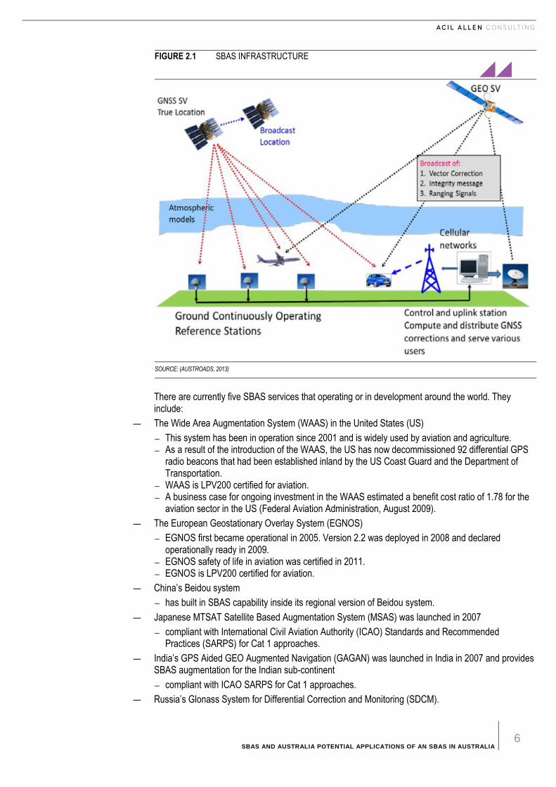
The SBAS concept is based on GNSS measurements from accurately-located ground reference stations deployed across an entire continent. The GNSS errors are then transferred to a master control centre, where differential corrections and integrity states are calculated. The parameters that are calculated include vector corrections, integrity measures and ranging signals. These are then uplinked to geostationary satellites and broadcast to the user’s receiver.
The general configuration of the satellites, master control centre and uplinks is shown in Figure 2.1.
SBAS AND AUSTRALIA POTENTIAL APPLICATIONS OF AN SBAS IN AUSTRALIA 6
FIGURE 2.1 SBAS INFRASTRUCTURE
SOURCE: (AUSTROADS, 2013)
There are currently five SBAS services that operating or in development around the world. They include:
— The Wide Area Augmentation System (WAAS) in the United States (US)
― This system has been in operation since 2001 and is widely used by aviation and agriculture. ― As a result of the introduction of the WAAS, the US has now decommissioned 92 differential GPS
radio beacons that had been established inland by the US Coast Guard and the Department of Transportation.
― WAAS is LPV200 certified for aviation. ― A business case for ongoing investment in the WAAS estimated a benefit cost ratio of 1.78 for the
aviation sector in the US (Federal Aviation Administration, August 2009).
— The European Geostationary Overlay System (EGNOS)
― EGNOS first became operational in 2005. Version 2.2 was deployed in 2008 and declared operationally ready in 2009.
― EGNOS safety of life in aviation was certified in 2011. ― EGNOS is LPV200 certified for aviation.
— China’s Beidou system
― has built in SBAS capability inside its regional version of Beidou system.
— Japanese MTSAT Satellite Based Augmentation System (MSAS) was launched in 2007
― compliant with International Civil Aviation Authority (ICAO) Standards and Recommended Practices (SARPS) for Cat 1 approaches.
— India’s GPS Aided GEO Augmented Navigation (GAGAN) was launched in India in 2007 and provides SBAS augmentation for the Indian sub-continent
― compliant with ICAO SARPS for Cat 1 approaches.
— Russia’s Glonass System for Differential Correction and Monitoring (SDCM).

SBAS AND AUSTRALIA POTENTIAL APPLICATIONS OF AN SBAS IN AUSTRALIA 7
The general overage of these systems is illustrated in Figure 2.2 below.
FIGURE 2.2 CURRENT SBAS SYSTEMS
SOURCE: BASED ON CHART PUBLISHED BY GENEQ INCORPORATED
Not all SBAS constellations are equal. For example Glonass and Beidou may not be supportable in some regions and some do not update the ephemeris regularly7.
SBAS is generally based on the L1 carrier code offered by existing GNSS services. Plans are in place to introduce dual band receivers that will be able to receive both L1 and L5 signals.
SBAS provides
— greater accuracy than basic GNSS
— high levels of integrity
— reliability
— availability
— nationwide coverage.
Integrity is an important characteristic for many applications including safety. Integrity is a term that effectively means knowing that the GNSS satellites are working properly and includes concepts such as the time to alert when the GNSS satellites are not working properly8.
The accuracy of SBAS depends on the performance characteristics of the receivers. SBAS can achieve accuracies of less than 2 to 7 metres depending on the country and receiver9. However recent publications report accuracies at the metre to sub metre from newer receivers with higher performance antennae and electronics10.
Another development that will improve accuracy will be the introduction of multi-constellation receivers. This will improve availability and continuity of signal which is particularly important for users that are moving such as planes, ships, cars and trucks.
2.2.5 Augmented GNSS services available in Australia
There is a number of GNSS augmentation services currently operating in Australia. These include:
7 Ephemeris means a table of the positions of celestial bodies. 8 For an explanation of integrity see http://www.navipedia.net/index.php/Integrity 9 Estimates of accuracy depend on the probability that the position will be within the specified accuracy. For details of accuracies of WAAS
and SBAS see https://www.egnos-portal.eu/discover-egnos/about-egnos/benefits, http://www.faa.gov/about/office_org/headquarters_offices/ato/service_units/techops/navservices/gnss/waas/benefits/and (Federal Aviation Administration, August 2009), page A-11.
10 See for example http://www.igage.com/mp/MagProGPSAccuracy.htm and Bunce, D (2015)
SBAS AND AUSTRALIA POTENTIAL APPLICATIONS OF AN SBAS IN AUSTRALIA 8
— Differential GPS service operated by the Australian Maritime Safety Authority at 16 locations around the Australian Coast providing accuracies of around one to ten metres depending on distance from the transmitter.
— A network of Continuously Operating Reference Stations (CORS) operated by both Government and the Private Sector supplying RTK corrections mainly used for centimetre accuracy.
— Ground Based Augmentation Systems at Sydney and Melbourne Airports for aviation
— Privately owned ground stations operated by farmers and some mining companies seeking centimetre accuracy
— Commercial PPP services offered on a commercial basis to users which provide decimetre accuracy. These services are used heavily in the agriculture sector for controlled traffic farming and precision agriculture generally.
There is no ICAO compliant SBAS service currently operating in Australia.
The emergence of dual band receivers and multi constellation receivers will improve the accuracy of raw GNSS. However this will be without integrity monitoring which is required for many safety of life and operational applications in agriculture, transport and navigation.
The CRC for Spatial Information (CRCSI) has undertaken research into the potential to augment the Japanese QZSS constellation to investigate the use of the QZSS LEX signal for delivering high accuracy real-time positioning on a national basis. In addition to conventional GNSS signals, QZSS transmits an augmentation signal called LEX (L‐band Experimental Signal). The aim of the research was to investigate the use of the LEX signal to transmit corrections and avoid the limitations of the mobile phone network as a vehicle for transmitting corrections to GNSS receivers.
The use of the LEX signal was demonstrated in a trial of a self-steering tractor in 2013 giving five centimetre accuracy. The system, if fully implemented, could provide nation-wide augmentation. However to achieve instantaneous correction at this level of accuracy would require some level of CORS infrastructure. Slower convergence time would arise in areas where there is insufficient CORS infrastructure. The system if implemented would not meet ICAO standards for aviation.
Research undertaken in Europe to allow PPP broadcasts to take advantage of SBAS architecture. Has shown early results that suggest levels of absolute accuracy to around 3 cm and relative accuracy to around 1 cm. Such research is indicative of moves to take advantage of the two systems. However this development would not be compliant with safety of life uses or ICAO requirements11.
SBAS systems have a high level of availability providing a consistent and continuous signal over a wide area. The signal is immediate with high integrity - alerts of faults are delivered within six seconds12. It is also robust against system failures. SBAS systems are usually based on around 50 ground stations with two master control stations. The system has sufficient redundancy to maintain performance if one of the ground stations drops out temporarily.
Availability and continuity are high within the operating area that could cover Australia and New Zealand. An SBAS in Australia would not be dependent on the mobile phone network.
2.3 Findings
The use of precise positioning is becoming increasingly important as an enabling technology to a wide range of activities. Australia’s major trading partners the US, the EU, China, Japan and India have established or are developing SBAS systems that are broadcast free to air. There is a growing trend for GNSS receivers developed for a wide range of uses to be SBAS enabled. Many vehicles for example will have SBAS enabled GNSS receivers installed.
GNSS technologies are constantly evolving multi-constellation and dual band receivers coming on to the market, improving availability and accuracy. However raw GNSS cannot on its own provide the levels of integrity required of applications where safety of life is important.
11 Personal communication (Thales) 12 https://www.egnos-portal.eu/developer-platform/developer-toolkit/egnos-s-integrity-mechanisms-safety-life-applications
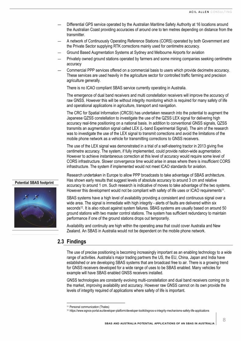
Potential SBAS footprint

SBAS AND AUSTRALIA POTENTIAL APPLICATIONS OF AN SBAS IN AUSTRALIA 9
There are a number of ways in which the raw GNSS signal can be augmented to provide greater accuracy and integrity. The main methods include DGNSS, RTK, PPP and SBAS.
DGNSS and RTK systems rely on ground reference stations or a network of ground reference stations in the general vicinity of the receiver and corrections are transmitted by radio signal or mobile phone channels.
The ground reference stations for PPP and SBAS are more far more widely spaced and generally transmit corrections by satellite over a wider area providing greater coverage. An SBAS could for example cover both Australia and New Zealand. SBAS systems overseas have been developed to be ICAO compliant for aviation.

SBAS AND AUSTRALIA POTENTIAL APPLICATIONS OF AN SBAS IN AUSTRALIA 10
3 A V I A T I O N
3 Aviat ion
3.1 Introduction
GNSS technologies have become a key aid to navigation for aviation around the world as well as in Australia. The use of augmented GNSS is finding application in guiding aircraft approaches. The International Civil Aviation Organisation (ICAO) has recommended to member states implementation of Performance Based Navigation (PBN) and a regulatory framework for Area Navigation and Approach procedures with Vertical Guidance (APV) either as the primary approach or as back up to precision approaches. Australia has agreed to these recommendations (CASA, 2010).
ICAO Resolution A36-23 urged member States to complete a performance based navigation implementation plan by 2009 for implementation of Approach with Vertical Guidance (APV) by barometric vertical navigation (Baro-VNAV) and/or GNSS such as SBAS for all instrument runway that serve aircraft of 57,000 kilograms or more by 2016 13.
In 2010 ICAO superseded its initial resolution on APV to urge member states to introduce straight-in approaches to mitigate against controlled flight into terrains risk if they do not have the capability to implement Baro-VNAV or augmented GNSS in the first instance. Australia has straight-in approaches for at least one runway at around 260 aerodromes.
In response the Civil Aviation Safety Authority (CASA) supported the implementation of Baro-VNAV to provide an immediate safety benefit to airline customers noting that a majority of domestic and regional regular public transport (RPT) aircraft were fitted with Baro-VNAV equipment.
However it noted that Baro-VNAV does not cover all regular public transport (RPT) aircraft because some aircraft were not or could not be fitted with Baro-VNAV equipment. Accordingly CASA commissioned a study into the benefits and costs of establishing an SBAS capability for Australia. This cost benefit study was completed in 2011 and found that while there were benefits to the aviation sector it was difficult to justify the investment in an SBAS to cover aviation operations at smaller regional airports. It also concluded that any future investment in an SBAS should be part of a whole of Government approach and should consider potential benefits across a range of industries. No assessment of the benefits and costs for Australia as a whole has been undertaken since that time.
13 RNAV means area navigation. RNP means required navigation performance. LNAV/VNAV again is a non-precision approach. It provides
lateral guidance from a GPS or WAAS receiver and vertical guidance from a barometric altimeter or the WAAS. Without WAAS, you must have a VNAV altimeter. LPV is a non-precision approach. It stands for Localizer Performance with Vertical Guidance and uses WAAS. BaroVNAV means Barometric height measurement – a component of APV
SBAS AND AUSTRALIA POTENTIAL APPLICATIONS OF AN SBAS IN AUSTRALIA 11
3.2 International Experience
3.2.1 US - WAAS
The US Federal Aviation Administration (FAA) and Department of Transportation activated the WAAS in 2008.14 The WAAS differential correction system draws on a network of 25 ground-based reference stations that relay GPS determined locations to a master station. The master station calculates a correction factor that is transmitted to geostationary satellites. WAAS-enabled GPS units receive the corrected signal from two geostationary satellites located over the East and West coasts of the United States.15
The WAAS enables more accurate lateral position with vertical guidance (LPV) approaches allowing descent minimums to as low as 250 feet. WAAS accuracy is within one to 1.5 metres.
The Federal Aviation Authority (FAA) is now working on delivery of the NextGen National Airspace
System16. NextGen will move away from traditional ground based radar navigation aids and be built
on new navigation technologies incorporating WAAS as a key piece of navigation infrastructure.
The FAA implementation plan documents benefits include:
— improved safety
— reduced environmental impacts
— increased system capacity
It is also evident that other sectors of the economy have also benefited from the WAAS. The Coast Guard NGPS system of DGPS beacons that had been extended inland were closed following the introduction of WAAS which provided wider coverage for rail and other uses (see Chapter 6 for further discussion).
The WAAS, as with all SBAS systems worldwide, are designed so that the Signal-In-Space (SIS) is compliant to the ICAO standards and recommended practices (SARPs) for SBAS17. Since SBAS standards have been derived to meet the stringent navigation performance requirements applicable to civil aviation approach and landing operations, the reference SBAS receiver standards have also been developed by the civil aviation community. These receiver standards are referred to as SBAS Minimum Operational Performance Standards (MOPS) and are published by the Radio Technical Commission for Aeronautics (RTCA) under the reference DO-229 (RTCA MOPS DO 229 (Revisions C or D Change 1)).
3.2.2 EU-EGNOS
EGNOS (European Geostationary Navigation Overlay Service) is the European satellite-based augmentation service (SBAS) that complements the existing satellite navigation services provided by the US Global Positioning System (GPS).
EGNOS provides augmented GNSS services to European users. EGNOS together with Galileo are the two major initiatives in Europe in terms of satellite navigation.18
As with the WAAS, EGNOS is compliant with ICAO SARPS. EGNOS contributes to a twostep strategy for civil aviation in Europe:
— by 2018 EGOS will be used for approaches to secondary airports which will provide LPV 200 capability
― helping to meet noise reduction objectives ― achieving lower costs by reducing the need for terrestrial navigation aids.
— By 2023 the use of Galileo, GPS and EGNOS will improve robustness of positioning supporting Category 1 auto landing approaches.
14 R.D. Till, W. Wanner, J.R. Evangelos, Wide Area Augmentation System (WAAS) test and evaluation concepts, in: Proceedings of the
IEEE Aerospace and Electronics Conference, vol. 1, FAA Tech. Center, USA, 1995, pp. 169–174 15 http://articles.extension.org/pages/9672/gps-applications-in-crop-production 16 www.faa.go/nextgen 17 ICAO Standards and Recommended Practices (SARPS) Annex10 Volume I (Radio Navigation Aids) 18 http://www.navipedia.org/index.php/EGNOS_General_Introduction
SBAS AND AUSTRALIA POTENTIAL APPLICATIONS OF AN SBAS IN AUSTRALIA 12
― optimising the conventional navigation aid network ― lowering overall costs.
Civil aviation authorities in Europe are conducting an ILS Cat 1 rationalisation plan reducing the number of airports that need ILS. These airports will then adopt performance based navigation (PBN) using EGNOS for APV approaches.
3.3 Implications for Australia
Delivery of SBAS in Australia would potentially benefit all aviation operations. However in particular it would benefit regional airlines, general aviation, emergency management services and operators such as rescue helicopters, the Royal Flying Doctors Service and Angel Flights (medical non-emergency flights. The major airports operate instrument landing systems. In addition Ground Based Augmentation Systems (GBAS) are being rolled out at major airports. Sydney already has a GBAS and another is being installed at Melbourne airport.
This does not mean that SBAS would not deliver benefits in the longer term. For example a recent study by the Federal Aviation Authority in the United States suggested that one carrier had cut as much as 25 per cent off its flight times for certain city-pairs WAAS in its Cessna fleet. Reduced flying times improved navigation at regional airports would be possible with an SBAS (Croft, 2013).
Airservices Australia has now retired 180 terrestrial navigation aids in Australia in part because of the potential for use of GNSS navigation en route. The additions of SBAS augmentation would provide greater precision for en route flight as well as safer landings for aircraft landing at regional airports without ILS capability.
Air search and rescue, rescue helicopter operations and emergency services operations would benefit from the greater accuracy and integrity of an SBAS across Australia. Such operations are often undertaken in bad weather where landings at regional airports and other regional locations are required. Australian Search and Rescue services depend on air searching in emergencies where an SBAS would provide greater safety.
In addition New Zealand is also interested in the potential of implementing an SBAS. A recent cost benefit analysis found a benefit cost ratio of 0.75 for the aviation sector in New Zealand. The benefits were found to be in:
— reduced delays, diversions and cancellations (DDCs)
— reduced accidents
— reductions in emissions due to fuel savings (not included in the analysis)
— decommissioning of and reduction in the need for conventional navaids (Castalia 2011).
The New Southern Sky programme proposes that aircraft will need to be equipped with automatic dependent surveillance—broadcast (ADS-B) technology by 2021. This will require aircraft to have a SBAS capable GPS receiver on board. It is reasonable to assume that if SBAS is not implemented, the full capacity of available and equipped technology will go unused in New Zealand.
The New Zealand Government has informally expressed interest in joining with Australia in investing in an SBAS for Australia and New Zealand.
3.4 Findings
An SBAS in Australia (possibly linked with New Zealand) would create benefits for the aviation sector principally for regional commercial civil airline operations and for emergency and search and rescue operations. It would be difficult to extrapolate the benefit cost ratio of 0.75 calculated in New Zealand to Australia. The characteristics of the aviation sector in Australia are quite different with longer distances and a greater number of regional airports.
That said, the potential benefit areas to explore would include reduced delays and cancellations, reduced accidents, improved search and rescue and emergency responses, fuel savings and emissions reductions and reduced future costs in terrestrial navaids.
SBAS AND AUSTRALIA POTENTIAL APPLICATIONS OF AN SBAS IN AUSTRALIA 13
4 R O A D T R A N S P O R T A N D L O G I S T I C S
4 Road Transport and Logistics
Road transport and logistics sectors contributed around $23 billion and $28 billion to GDP respectively in 2012-13 – together comprising around 3 per cent of GDP. There are over 820,000 km of roads in Australia. These two sectors play an important role in supporting the rest of the economy as well as society in general.
The National Road Safety Strategy 2011-2020 determined the annual social and economic costs to the Australian economy from road crashes resulting in approximately 1,200 deaths and 30,000 serious injuries has been estimated to be $27 billion (Australian Transport Commission, 2011).
From both an economic and safety perspective better management of road transport activities is important to Australia.
4.1 Road transport
The main transport challenges currently facing the road transport sector in developed countries including Australia are to:
— reduce trauma due to vehicle crashes,
— improve transport efficiency, and
— reduce the environmental impacts of transport
— improve road safety
— manage congestion
— address road user charging including congestion charging.
One of the major emerging developments in these sectors is the development of Intelligent Transport Systems (ITS) and Co-operative Intelligent Transport Systems (C-ITS). These systems employ a broad range of communications based information and electronics technologies in the area of advanced driver assistance, traffic control and safety systems. These include road departure and lane change collision avoidance.
ITS systems
ITS systems facilitate the connection of road users to their road environment via the connection and exchange of real-time information about the road environment, such as:
— vehicles
— infrastructure
— non-infrastructure features and other objects
— road and traffic conditions
— events, threats and potential hazards.
SBAS AND AUSTRALIA POTENTIAL APPLICATIONS OF AN SBAS IN AUSTRALIA 14
The exact positioning requirements that have been broken down are:
— road-level applications – metre level positioning at approximately 1 sec (1 Hz)
— lane-level applications – sub metre level positioning at approximately 1 Hz
— in-lane level applications – decimetre level positioning at 0.1 sec (10 Hz).
Cooperative ITS (C-ITS)
C-ITS refers to the use of wireless communications to share information in near real-time from vehicle-to-vehicle (V2V), vehicle-to-infrastructure (V2I) and infrastructure to-vehicle (I2V) (ACIL Allen, 2013).
The sharing of information provides an additional layer of control relevant data that augments the data obtained from ITS technologies. Currently, these systems are being realised in Europe, Japan and USA where they have access to an SBAS that can fulfil the positioning requirements of the systems.
Potential
ITS and C-ITS developments have the potential to deliver major improvements in road transport and logistics including better management of congestion, greater fuel efficiency, lower emissions, improved road safety, more efficient movements of goods through the economy, more efficient port operations and ultimately autonomous vehicles.
4.1.2 Recent developments overseas
European Union (EU)
As part of the Digital Single Market Strategy the European Commission (EC) is working to make ITS the solution to more efficient management of the transport network for passengers and business. ITS will be used to improve journeys and operations on specific and combined modes of transport (European Commission, 2016a, 2016b).
The EC is also laying the groundwork for the next generation of ITS solutions, through the deployment of C-ITS, to automate the transport sector. C-ITS using EGNOS will allow data exchange through wireless technologies so that vehicles communicate position, direction and speed between each other as well as with related road infrastructure (European Commission, 2016).
In November 2014, the EC services (DG MOVE) established up a C-ITS Platform. The EC published a report in January 2016 on the use and application of C-ITS. Some key findings are detailed in box 4.1 below.
BOX 4.1 KEY EU FINDINGS IN THE C-ITS AREA
The C-ITS Platform recommends the Commission to encourage the exchange on technical, organisational and political learnings coming out of pilots in different regions, while other aspects more closely linked to commercial issues could be addressed by the private sector in parallel. The C-ITS Platform also recommends the Commission to enlarge cooperation on deployment practices at government level with other regions, such as Canada, Australia, South Korea and other countries, as well as closely follow international developments in this field, in coordination with other initiatives, on-going or to come, in the field of automation…. A first general conclusion to be drawn from the activities of the C-ITS Platform is that a coordinated action for the deployment of C-ITS in the EU is paramount: a unique legal and technical framework is essential and coordinated efforts to ensure quick uptake of C-ITS are requested. A second general conclusion is urgency: the technology is ready, the industry is already deploying C-ITS equipped vehicles in other parts of the world and announced to be ready to deploy in the EU by 2019, provided that the above-mentioned framework is in place sufficiently in time.
C-ITS Platform, Final Report, January 2016.
SOURCE: EUROPEAN COMMISSION (2016), ITS PLATFORM REPORT, AVAILABLE AT: HTTP://EC.EUROPA.EU/TRANSPORT/THEMES/ITS/DOC/C-ITS-PLATFORM-FINAL-REPORT-JANUARY-2016.PDF (BOLD ADDED FOR EMPHASIS).
SBAS AND AUSTRALIA POTENTIAL APPLICATIONS OF AN SBAS IN AUSTRALIA 15
Further developments in C-ITS in the EU have led to the introduction of Automated Collision Notification Systems (ACNS) and more recently, Advanced Automatic Collision Notification (AACN) to assist emergency medical responders to better and more quickly determine if motorists or passengers need care after a crash.
By using EGNOS and a collection of sensors, vehicle telemetry systems like AACN send data to an advisor if a vehicle is involved in a ‘significant’ crash. Depending on the type of system, the data include information about crash severity, the direction of impact, air bag deployment, multiple impacts, and rollovers (if equipped with appropriate sensors). Advisors provide information to emergency services assisting with dispatch and helping determine the appropriate combination of emergency personnel, equipment, and medical facilities.
The system, known as eCall in EU provides dial back to emergency services if the vehicle crash is likely to have endangered human life (Kaminski et al, 2011, EC, 2009). On 28 April 2015 the European Parliament voted in favour of eCall regulation which requires all new cars be equipped with eCall technology from April 2018 (EC, 2015a). This means that all new cars in the EU must have SBAS receivers and cellular connection by 2018.
USA
The new ITS Strategic Plan 2015-2019 (US Department of Transport, 2015) outlined the direction and goals of the US Department of Transport’s ITS Program using WAAS which is built around two key ITS Program priorities:
— realising connected vehicle implementation building on the substantial progress made on design, testing, and planning for deployment of connected vehicles across the nation
— Advancing automation which looks at transferring some amount of vehicle control from the driver to the vehicle and is supported by research, development, and adoption of automation-related technologies as they emerge.
In addition, the ITS Strategic Plan includes program categories to provide the necessary structure for research, development, and adoption of ITS technologies. These include:
— adoption and eventual deployment of connected vehicles in the system
— emerging capabilities of future generations of transportation systems
— capturing operational data from stationary sensors, mobile devices, and connected vehicles
— ensuring interoperability through effective connectivity among devices and systems
— advancing the work from adoption to wider-scale deployment in coordination with other agencies (US Department of Transport, 2015).
Box 4.2 below details the strategic themes of ITS in the USA.

SBAS AND AUSTRALIA POTENTIAL APPLICATIONS OF AN SBAS IN AUSTRALIA 16
BOX 4.2 STRATEGIC THEMES OF ITS IN THE USA
— enable safer vehicles and roadways by developing better crash avoidance, performance measures, and other
notification mechanisms; commercial motor vehicle safety considerations; and infrastructure-based and
cooperative safety systems
— enhance mobility by exploring methods and management strategies that increase system efficiency and
improve individual mobility
— limit environmental impacts by better managing traffic flow, speeds, and congestion, and using technology to
address other vehicle and roadway operational practices
— promote Innovation by fostering technological advancement and innovation across the ITS Program;
continuously pursuing a visionary/exploratory research agenda; and aligning the pace of technology
development, adoption, and deployment to meet future transportation needs
— support transportation connectivity through the development of standards and systems architectures, and the
application of advanced wireless technologies that enable communication among and between vehicles of all
types, the infrastructure, and portable devices.
SOURCE: HTTP://WWW.ITS.DOT.GOV/FACTSHEETS/PDF/ITS_JPO_STRATPLAN.PDF
Further, in the US, Advanced Automatic Collision Notification (AACN) systems have been developed to enable earlier notification of a motor vehicle crash to Public Safety Answering Points (PSAPs) using WAAS19 (US National Highway and Traffic Safety Administration). This helps emergency medical responders to be able to better and more quickly determine if health care is required after a road crash.20
New and enhanced rules to help emergency responders better locate wireless 911 callers were adopted by the Federal Communications Commission (FCC) on 29 January 2015 and published on 4 February 2015. The FCC highlight the role of GPS and assisted GNSS technologies while boosting the use of alternative positioning technologies in indoor locations and explicitly avoided a decision on the use of GNSS systems other than GPS.21
Recent US research (2015) shows that earlier crash notification associated with Automatic Crash Notification (ACN) systems could save approximately 177 to 244 motor vehicle occupant lives per year (approximately one and a half per cent to two per cent fatality reduction)(Wu et al, 2015).22
4.1.3 Implications for Australia
The availability and accuracy of augmented GNSS offers potential for increased efficiencies and safety for vehicles using roads and mass transit systems. Many of the problems associated with the routing and dispatch of commercial vehicles, mass transit systems, maintenance crews and emergency services are significantly reduced or eliminated with the help of augmented GNSS.
In its 2013 report Austroads outlined five infrastructure options necessary to meet a C-ITS roll out on Australian roads. The options were:
— Technique A: Standalone (Global Navigation Satellite System) GNSS absolute positioning and vehicle to vehicle (V2V) relative positioning with low cost GNSS receivers
― This approach requires dedicated short range communication (DSRC) between vehicles and does not necessarily provide a high level of integrity in the position of the vehicle.
— Technique B: Space Based Augmentation System (SBAS) absolute positioning and/or V2V relative positioning with low cost GNSS receivers
19 Back in 2002, two wireless phone makers selected WAAS for the positioning solution that the Federal Communications Commission
(FCC) requires for emergency 911 use. “It was selected because you can pick up signals even in the canyons of high-rise buildings," Britigan explains. "And, at the World Trade Center, rescue teams used WAAS to survey the site during the recovery program," he adds, referring to the aftermath of the Sept. 11 terrorist attacks.- See more at: http://www.aviationtoday.com/av/commercial/WAAS-Back-in-Step_12571.html#.V0P02pF96Uk
20 The US equivalent of eCall is Next Generation 9-1-1. 21 See: http://www.insidegnss.com/node/4419 22 Note that: a time window of six hours after crash is considered, and the research population is targeted at ‘Incapacitating Injury’ and ‘Fatal
Injury’ only, and other confounding factors may also contribute to occupant survival probabilities.
SBAS AND AUSTRALIA POTENTIAL APPLICATIONS OF AN SBAS IN AUSTRALIA 17
― This approach was thought to be the most cost effective in countries where SBAS was available. ― It would meet positioning, integrity, coverage and availability requirements.
— Technique C: Smoothed Differential GNSS (DGNSS) absolute positioning and/or V2V relative positioning with low cost GNSS receivers
― This technique could be an alternative if no SBAS is available. It is a code based but carrier phase smoothed differential GPS that requires communication links to ground stations. It could be applied where sufficient CORS stations are available to provide corrections via terrestrial data links. This system may not be suitable for safety of life applications due to relative positioning errors varying between vehicles. It would also be dependent on cellular mobile data links that are not uniform in regional areas.
— Technique D: Real Time Kinematic (RTK) positioning with dual-frequency receivers
― RTK requires a fairly dense CORS network. This technique was considered a relatively expensive option that would only give continuity of coverage where such networks existed. However it could meet the most demanding C-ITS applications where the network existed.
— Technique E: Precise Point Positioning (PPP) and V2V relative positioning with high-end GNSS receivers.
― This system would complement an RTK system in regional areas where there was insufficient CORS ground stations.
Since this report was released, there has been the development and introduction of two Australian positioning standards for intelligent transport vehicles. These are plus or minus one metre with 95 per cent confidence limits. There are no Australian devices currently on the market that meets these requirements. However the standards have been published and car manufacturers have indicated they will be fitting cars with that meet these standards by the end of decade (Ballingall, 2016).
In 2012 Australia imported nearly 600,000 completely built up passenger motor vehicles, all of which would be GNSS capable, representing a five per cent share of the total registered passenger vehicle market (Department of Industry, 2012).
The trends in vehicle purchase suggest that over the last ten years passenger vehicles are replaced on average before they reach ten years of age and commercial vehicles replaced before 12 years of age (Department of Industry, 2012). Given cars have been GPS enabled since the 1990s and with increasing trends in imported vehicles as well as the reduction in age of the vehicle fleet in Australia, it could be reasonably be expected that within ten years that a large proportion of passenger and light commercial vehicle in Australia will be fitted with GNSS receivers and SBAS functionality.
This has significant implications for the likely speed of adoption of SBAS enabled applications should an SBAS become available in Australia. The underutilisation of all new passenger and light commercial vehicles is seen to be one of the biggest costs of not having an operational SBAS in Australia (Ballingall, 2016).
SBAS would allow the next generation of vehicle and transport systems that work together cooperatively to deliver safety and mobility outcomes. Applications that could be supported by SBAS are listed in Box 4.3.
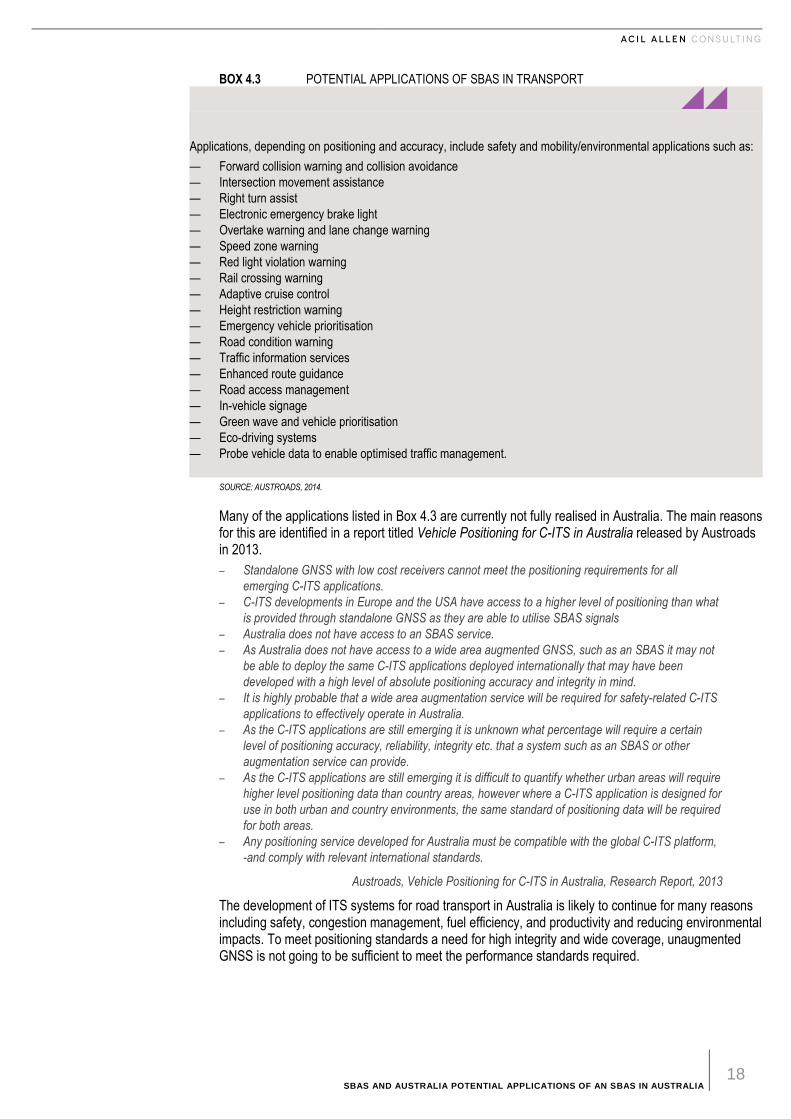
SBAS AND AUSTRALIA POTENTIAL APPLICATIONS OF AN SBAS IN AUSTRALIA 18
BOX 4.3 POTENTIAL APPLICATIONS OF SBAS IN TRANSPORT
Applications, depending on positioning and accuracy, include safety and mobility/environmental applications such as:
— Forward collision warning and collision avoidance
— Intersection movement assistance
— Right turn assist
— Electronic emergency brake light
— Overtake warning and lane change warning
— Speed zone warning
— Red light violation warning
— Rail crossing warning
— Adaptive cruise control
— Height restriction warning
— Emergency vehicle prioritisation
— Road condition warning
— Traffic information services
— Enhanced route guidance
— Road access management
— In-vehicle signage
— Green wave and vehicle prioritisation
— Eco-driving systems
— Probe vehicle data to enable optimised traffic management.
SOURCE: AUSTROADS, 2014.
Many of the applications listed in Box 4.3 are currently not fully realised in Australia. The main reasons for this are identified in a report titled Vehicle Positioning for C-ITS in Australia released by Austroads in 2013.
– Standalone GNSS with low cost receivers cannot meet the positioning requirements for all
emerging C-ITS applications.
– C-ITS developments in Europe and the USA have access to a higher level of positioning than what
is provided through standalone GNSS as they are able to utilise SBAS signals
– Australia does not have access to an SBAS service.
– As Australia does not have access to a wide area augmented GNSS, such as an SBAS it may not
be able to deploy the same C-ITS applications deployed internationally that may have been
developed with a high level of absolute positioning accuracy and integrity in mind.
– It is highly probable that a wide area augmentation service will be required for safety-related C-ITS
applications to effectively operate in Australia.
– As the C-ITS applications are still emerging it is unknown what percentage will require a certain
level of positioning accuracy, reliability, integrity etc. that a system such as an SBAS or other
augmentation service can provide.
– As the C-ITS applications are still emerging it is difficult to quantify whether urban areas will require
higher level positioning data than country areas, however where a C-ITS application is designed for
use in both urban and country environments, the same standard of positioning data will be required
for both areas.
– Any positioning service developed for Australia must be compatible with the global C-ITS platform,
-and comply with relevant international standards.
Austroads, Vehicle Positioning for C-ITS in Australia, Research Report, 2013
The development of ITS systems for road transport in Australia is likely to continue for many reasons including safety, congestion management, fuel efficiency, and productivity and reducing environmental impacts. To meet positioning standards a need for high integrity and wide coverage, unaugmented GNSS is not going to be sufficient to meet the performance standards required.
SBAS AND AUSTRALIA POTENTIAL APPLICATIONS OF AN SBAS IN AUSTRALIA 19
While there are a number of options that could be drawn on to achieve this level of positioning performance, SBAS is an option that meets all of the requirements. Given that new vehicles in Australia will be SBAS enabled, the value of providing an SBAS in Australia would be worth assessing.
4.2 Logistics
Positioning technology has been implemented in a number of logistics applications overseas and in Australia to facilitate, manage and forecast the movement of freight, bulk materials handling and haulage. There are numerous examples of standalone GNSS integration amongst logistic management systems. Such positioning information generally only requires accuracies at the metre level and positional updates are not critically reliant on timing (ACIL Allen, 2013a).
However, provision of greater precision and integrity will facilitate further applications in managing fleets of trucks and in tracking movement of goods being transported. This is what SBAS provides.
The benefits of positioning across freight and logistics are:
— reduction in fuel consumption
— increase in driver productivity from improved logistics management
— minimises idle time to ensure continuity of operations
— improved fleet efficiency (identifying areas of underperformance)
— improved customer service
— more efficient time management, and
— route optimisation (ACIL Allen, 2013a).
4.2.1 Developments overseas
European Union
EGNOS is reported to be a key tool for better managing land transport in Europe, increasing both capacity and safety, whether by road or rail. Goods managers can know exactly when a consignment has been held up and its exact location. This improves customer service, as clients can be notified of delays and the reasons for them (ESAb).
UAVs are becoming more widely utilised in Europe and further applications are coming online due to the existence of EGNOS (Aguilera, 2015). Several drone applications have already been realised in agriculture and several companies have delivery services in operation. See Box 4.4 below for details.
UAVs can be directed by a number of GNSS augmentation techniques. However to be effective the techniques need to have high levels of integrity, availability and continuity. This would most likely rule out techniques that do not have an instantaneous fix.
SBAS AND AUSTRALIA POTENTIAL APPLICATIONS OF AN SBAS IN AUSTRALIA 20
BOX 4.4 UNMANNED AERIAL VEHICLE DEVELOPMENTS IN THE EU DH
DHL - Germany
First autonomous delivery flights by parcelcopter in Europe authorized in 2014 with regular flights to the North
Sea Island of Juist providing emergency delivery of medications and other urgently needed goods.
La Poste – France
In 2014, GeoPost, part of the international group. La Poste, tested the conditions for delivery drone utilisation
in France.
FPS - UK
In March 2015, FPS, a UK supply chain solution provider, completed what is believed to be the first UK B2B
delivery to be made by a drone.
SOURCE: WIKIPEDIA AND VARIOUS MEDIA SOURCES
USA
GPS technology can help track and forecast the movement of freight has made a logistical revolution, including an application known as time-definite delivery.
Time-definite delivery, transport companies use GPS for tracking to guarantee pickup and delivery at a specified time, whether over short distances or across time zones. When an order comes in, a dispatcher enters a transport request, and a list of trucks appears on the screen, displaying a full array of detailed information on the status of each of them. If a truck is running late or strays off route, an alert is sent to the dispatcher (Qian, not dated).
Currently, the use of UAVs in the USA for commercial purposes is illegal under FAA regulations (Orsini, 2013). However, various companies are looking at developments and application of UAV technology. See Box 4.5 below.
BOX 4.5 UNMANNED AERIAL VEHICLE DEVELOPMENTS IN THE USA
Amazon Prime Air
Amazon Prime Air, announced in December 2013, will use multirotor Miniature Unmanned Air Vehicle
(Miniature UAV, otherwise known as drone) technology to autonomously fly individual packages to customers’
doorsteps within 30 minutes of ordering.
Google X – Project Wing
Project Wing, announced August 2014, is a project that aims to rapidly deliver products across a city by using
flying vehicles, similar to the Amazon Prime Air concept. Full-scale testing has been carried out in Australia.
The flying vehicles take off vertically, then rotate to a horizontal position for flying around. For delivery, it
hovers and winches packages down to the ground. At the end of the tether is a little bundle of electronics
which detects that the package has hit the ground, detaches from the delivery, and is pulled back up into the
body of the vehicle. Dropping the cargo or landing were found to be unfeasible, as users compromised the
safety.
USPS and
USPS has been testing delivery systems with HorseFly Drones.
FedEx
FedEx is reported to be testing integration of drone delivery with their existing logistics model.
SOURCE: WIKIPEDIA AND VARIOUS MEDIA SOURCES
SBAS AND AUSTRALIA POTENTIAL APPLICATIONS OF AN SBAS IN AUSTRALIA 21
There are many positioning technologies that would be suitable for drone operations, such as differential GNSS, RTK and PPP options. High levels of integrity, continuity and availability would indicate that some form of augmentation would be required for navigation of drones in operational environments.
4.2.2 Implications for Australia
GNSS positioning technologies is being used by a number of logistics companies including Toll Holdings, Linfox and Pacific Rail for tracking containers. Augmented GNSS is being used by companies such as Asciano for automated handling of containers at Ports in Australia.
Enquiries of these companies indicate that one metre position accuracy with high integrity is important to their automated operations. The expansion of autonomous operations at ports and transport hubs will require this level of accuracy and integrity. This may be provided by a number of augmentation systems of which SBAS is one option.
4.3 Findings
Augmented GNSS is expected to play an increasingly important role in the road transport and logistics sectors. Augmented GNSS will be an important enabling technology for C-ITS applications along with technologies such as vehicle sensors, vehicle to vehicle communication and vehicle to infrastructure communication. It will also be important for road safety, accident prevention and management, congestion management and congestion pricing.
There are a number of augmented GNSS options that might meet the requirements of C-ITS. However SBAS is currently considered to be the option with most economic potential. It meets the needs of accuracy (one metre), integrity, availability and continuity for many applications. In addition it is likely that future imported vehicles from Europe, the US and Asia will be SBAS enabled. This would speed the adoption of SBAS enabled technologies for C-ITS applications.
Development of automated handling of containers at ports and tracking of containers through the transport network already employ augmented GNSS in some parts of the supply chain. SBAS could similarly provide an augmentation that meets the accuracy, integrity requirements as well as provide continuity and availability for transport routes as well as transport nodes

SBAS AND AUSTRALIA POTENTIAL APPLICATIONS OF AN SBAS IN AUSTRALIA 22
5 M A R I T I M E
5 Marit ime
5.1 Introduction
Australia has the fifth largest shipping task in the world. Australian ports handle 10 per cent of the world’s seaborne trade. In 2013-14, over $400 billion worth of international cargo was transported of which 99 per cent was handed by the maritime sector in Australia. At any one time there are some 7,000 ships in Australia’s Extended Economic Zone (EEZ)
The maritime sector has been a significant user of GNSS and augmented GNSS technologies as an aid to navigation for over 20 years. The shipping industry is a global operation where navigation safety standards are set by the International Maritime Organisation (IMO).
According to IMO resolution A915 (22) GNSS applications are split between navigation and positioning:
— Navigation
― Sea
− Solas vessels23 : − All passenger ships and cargo ships larger than 500 gross tonnage are regulated and rely
heavily on GNSS for navigation. − Non SOLAS vessels: GNSS systems for maritime navigation are wide spread across
commercial and recreational vessels.
― Inland waterways: GNSS is also used to ensure safe navigation in inland waterways.
— Positioning
― Traffic management and surveillance are supported by GNSS based systems including Automatic Identification System (AIS) and Long Range Identification and Tracking (LRIT)
― Search and rescue
− Different types of GNSS devises are used in Emergency Position Indicating Radio Beacons (EPIRB) and Personal Location Beacons (PLB)
− When triggered AIS search and rescue transmitters continuously transit an alert message that includes GNSS based location.
― Fishing vessel control
− GNSS is used in vessel monitoring systems
― Port operations
− Transit progress, docking and loading and unloading are monitored through GNSS based technologies
23 SOLAS stands for the International Convention for Safety of Life at Sea
SBAS AND AUSTRALIA POTENTIAL APPLICATIONS OF AN SBAS IN AUSTRALIA 23
― Marine engineering
− GNSS is used to support marine construction activities such as cable and pipeline laying.
The requirements for GNSS accuracy and integrity are set out in IMO Resolution A1046 (27)24. These are:
— Navigation in ocean waters should provide positional accuracy with an error not greater than 100 metres with a probability of 95 per cent.
― With an update rate of no longer than two seconds ― Signal availability should exceed 99.8 per cent.
— Navigation in harbour entrances, approaches and coastal waters should provide positional information with an error of no greater than ten metres with a probability of 95 per cent
― The update rate should be no longer than two seconds ― Signal availability should exceed 99.8 per cent ― An integrity waring system should be provided to users within ten seconds ― Availability should match the integrity for a given accuracy level.
5.2 Policies and standards for positioning and navigation
Policies and standards on navigational aids are formulated through the Maritime Safety Committee (MSC) of the IMO. The MSC is also advised the International Association of Lighthouse Authorities (IALA). Under these arrangements IALA developed policies for a DGNSS augmentation system for all IMO member countries which were implemented over time commencing in the 1990’s. The system provided differential corrections to GNSS using terrestrial DGNSS beacons that were integrated with eLoran25 and AIS26. This has been adopted by all nations and is often referred to as the IALA DGPS System.
In 2008 IALA developed recommendations in Resolution-135 which set out the future of Augmented GNSS. The comparisons that IALA made at the time are summarised in Table 5.1.
TABLE 5.1 IALA VIEW OF FUTURE OF AUGMENTED GNSS
System Accuracy Coverage Integrity/continuity
IALA DGNSS 1-3 m Local/regional Yes/high
SBAS 1-3 m Regional/global Yes/high
AIS 1-3 m Local Yes/moderate
Pseudolites Sub metre Local Yes/moderate
eLoran 1-3 m regional Yes/high
RTK Sub metre Local X/Low
SOURCE: (IALA, 2008)
The recommendation noted that integration with an existing SBAS would offer a low-cost solution to service providers. This could be achieved in various ways ranging from the use of SBAS receivers on each IALA DGNSS site to direct data links with the SBAS control centre.
The recommendation also noted that there would be two ways to use the SBAS data:
— Reprocessing the data at the beacon site and transmitting legacy beacon messages. In this case the user’s receiver would not need to be changed.
— Using SBAS data in its existing format. In this case the IALA DGNSS stations would become terrestrial alternatives to the geostationary satellites. The user’s receiver would have be changed but the GNSS receiver’s software could perform the normal SBAS operations.
25 eLoran is a low frequency terrestrial navigation system based on a number of transmission stations, which emit precisely timed and
shaped radio pulses centred at 100 kHz radio frequency. 26 AIS stands for Automating Identification System

SBAS AND AUSTRALIA POTENTIAL APPLICATIONS OF AN SBAS IN AUSTRALIA 24
The document recommended that investigations of alternative development routes for IALA DGNSS and that SBAS integration should be considered in terms of cost, technical and regulatory suitability.
5.3 Overseas experience
As indicated above, the provision of augmented GNSS to the maritime sector is subject to uniform international standards and technologies. Any change requires extensive consultation on standards and performance by IALA and IMO.
5.3.1 USA
Marine navigation requirements in the USA depend on four phases of operation: inland waterways, harbour entrance and approach, coastal and ocean navigation. Positioning accuracy requirements for large ships for navigation purposes vary from two to five metres for inland waters, eight to 20 metres for harbour entrances and approaches to 25 nautical miles for coastal navigation. Availability varies from 99.9 per cent for inland waters to 99.7 per cent for port approaches and coastal navigation.
The Coast Guard (USCG) began development of the Maritime Differential Global Positioning System (MDGPS) in the late 1980s to meet requirements for coastal and harbor entrance and approach phases of navigation found in the International Association of Marine Aids to Navigation and Lighthouse Authorities (IALA) R-121 and International Maritime Organization (IMO) A.953(23) the IALA and IMO resolutions.
This service was subsequently extended inland in cooperation with the Department of Transportation and the United States Army Corps of Engineers to create the Nationwide Differential Global Positioning System (NDGPS) service based on the IALA differential GPS beacon technology. This technology provided improved horizontal positioning accuracy of better than ten meters, integrity (signal accuracy and continuity of delivery checking) alarms for GPS, and DGPS out-of-tolerance conditions within ten seconds of detection.
By 2015 there were a total of 22 DGPS beacons at marine sites and 62 DGPS beacons at inland sites. In recent years however the usage of the inland sites had declined significantly. In August 2015 the Government issued a request for comment on a proposal to shut down and decommission 62 of the DGPS sites leaving 22 coastal sites operating.
Among the reasons for the decline in usage were cited as:
— USCG changes in policy to allow aids to navigation to be positioned with a GPS receiver using Receiver Autonomous Integrity Monitoring (RAIM)
— increased use of Wide Area Augmentation System (WAAS) in commercial maritime applications,
— limited availability of consumer-grade NDGPS receivers
— continuing GPS modernization
— the DOT Federal Railroad Administration's determination that NDGPS is not a requirement for the successful implementation of Positive Train Control (PTC), which provides the railway system the capability to positively enforce movement authorities along railroad systems.
As at 30 June 2016, the US Government has made no announcement on the decommissioning plans.
5.3.2 Europe
The EU countries also use the IALA DGNSS beacons for augmentation. However there have been studies into integrating these beacons with EGNOS. The proposals for the use of the current EGNOS service in Europe in the maritime domain is twofold:
— Transmission of EGNOS v2 corrections through the existing maritime shore infrastructure (AIS & IALA beacons).
— Provision of EGNOS service for maritime use according to IMO resolution A 1046 requirements
Both proposals are being discussed and assessed between EGNOS and the maritime regulators and authorities (Rebollo 2015).

SBAS AND AUSTRALIA POTENTIAL APPLICATIONS OF AN SBAS IN AUSTRALIA 25
5.4 Implications for Australia
The Australian Maritime Safety Authority (AMSA) is responsible for the management of the IALA DGNSS service to commercial shipping. The AMSA service comprises a network of 16 radio beacons around the main port and heavily trafficked areas such as the Great Barrier Reef Marine Park. AMSA’s service also monitors the integrity of the GNSS signal and notifies users of any signals outside specification.
An Australian SBAS could potentially make the AMSA DGNSS service redundant. However given the international developments discussed above it is unlikely that this would result in the service being decommissioned in the short to medium term. If anything an SBAS correction signal could be integrated into the AMSA service as is likely to occur in Europe.
5.5 Findings
The maritime sector has depended on DGNSS augmentation services in port approaches and confined waters for around 20 years. IMO resolutions recognise the potential for SBAS applications as a source of augmentation.
While SBAS offers a comprehensive solution to the provision of augmentation to GNSS signals and could potentially replace the existing DGNSS beacons, the possibility of this happening in the short term is remote. Such a development would require the adoption of SBAS enabled receivers on ships as well as regulatory change that could take time. However were an SBAS introduced may be possible that it could be integrated into the existing DGPS beacons operated by AMSA in the longer term if the European trials are successful.
SBAS AND AUSTRALIA POTENTIAL APPLICATIONS OF AN SBAS IN AUSTRALIA 26
6 R A I L
6 Rail
6.1 Background
The rail industry in Australia contributed around $ 6,706 million to Australia’s GDP in 2012-13 – around 0.4 per cent of GDP. The sector which relies on around 41,461 km of track in Australia has 3 distinct sectors:
— bulk freight (ores, minerals and grains),
— non-bulk and break-bulk freight (containerised goods, non-containerised manufactured goods), and
— passenger transport (mainly urban and regional).
The sector is characterised by long term investments and in many cases legacy systems that determine the train control and train tracking technologies that are used to manage the various systems.
At present the main use of augmented, high resolution, positioning in the rail industry is track surveying. Modern train management requires accurate maps of the railway (centre line, curvature and gradient), and location of signalling infrastructure. Positioning of track is typically required to be accurate within a few centimetres. Historical maps of asset locations are not sufficiently accurate for some modern applications and so an exercise of remapping (and recording new track placements) is underway in many states (ACIL Allen, 2013b)
GNSS applications in rail have helped to improve asset management, the efficiency of asset use and provide improved customer services by tracking trains.
Rail networks can benefit from systems such as Positive Train Control (PTC) and the European Train Control (ETC) which are processor /communication-based train control systems designed to prevent train accidents. These systems can improve rail safety, increase rail efficiency and also reduce maintenance costs.
Accurate and reliable GNSS could facilitate the opening up of further value-adding services, such as driverless trains, advanced forms of train protection and control and improved maintenance and track monitoring. However the existence of significant legacy investments combined with cost has resulted in alternative approaches to precise GNSS in most urban rail systems (ACIL Allen, 2013b).
Lack of precision and reliability in basic GNSS services in the past has resulted in adoption of alternative or parallel technologies to establish train position. Any positioning system must also be able to track trains passing through tunnels or passing through remote areas (such as the Nullarbor Plain) and operate in an environment of possible interference from overhead electrical cables or proximate steel surfaces (ACIL Allen, 2013b).
SBAS AND AUSTRALIA POTENTIAL APPLICATIONS OF AN SBAS IN AUSTRALIA 27
6.2 Recent developments overseas
EU
The EU has developed a European Rail Traffic Management System (ERTMS) as a framework to enhance safety, increase efficiency of trains and enhance cross-border interoperability of rail transport. Two main components of ERTMS are the European Train Control System (ETCS), a standard for in-cab train control, and GSM-R, the GSM mobile communications standard for railway operations.
The ETCS standard has been based in the past on the use of in track transponders, referred to as balises, to locate the position of a train. Under this system, the position of a train is established mechanically and transmitted to a signal control centre for the purpose of signal operations.
A key objective of the ERTMS program is the replacement of signalling equipment with digitized mostly wireless signalling and by creating a single Europe-wide standard for train control and command systems. In the short and medium terms the program aims at modernising signalling infrastructure using EGNOS.
A potential development in the ERTMS is development of on board train control using EGNOS to replace the balise transmission module in train control systems. GNSS modernisation of the European regional network will significantly improve signal system optimisation and a reduction in maintenance costs.
GNSS is presented in the EU documentation as an innovative solution capable of decreasing costs, and for that reason been included in the ERTMS roadmap. Shift2Rail, the first European Joint Undertaking initiative for railways, was established to accelerate the integration of technologies, including the use of GNSS, into rail solutions.27
The European EGNSS R&D Programme is also supporting a number of initiatives to integrate GNSS and EGNOS into the ERTMS. For example the GaLoROI project developed a safety relevant, satellite based on-board train locator unit to be used on low density railway lines.
The ERTMS on Satellite Enabling Application and Validation Project (ERSAT EAV) was also launched in March 2015. The objectives of this two year project are to verify the suitability of European Global Satellite Navigation System which includes Galileo and EGNOS, as an enabler of an economically sustainable ERTMS signalling solution for safety applications in regional railway lines.
Ovinto, a telemetry company specialising in monitoring of goods, transport announced in November 2015 that SBIC, a supplier of petrochemicals will equip its entire European Fleet of 500 rail tank cars with satellite based tracking and monitoring technology. A key aspect of this development was the integration of EGNOS into its tracking system.
The emergence of a multi-constellation environment, with interoperability of Galileo with GPS and EGNOS augmenting both systems is reported to enhance currently achievable performance such as signal availability in difficult environments and final position accuracy. This is expected to reinforce the use of GNSS in rail applications in the future (European Global Navigation Satellite Agency, 2015).
The EU is exploring areas in which EGNOS, as part of the EGNSS can improve the productivity, operations and safety of European railways. However the full integration of EGNOS into the ERTMS is still a prospect for the future.
USA
In the USA Positive Train Control (PTC) systems (mandated from 2015) are now in operation to manage train movements, prevent collisions, derailments, work zone incursions, and passage through switches in the wrong position. The prevention of rail accidents through the use of PTC is estimated to save the USA $60 million per year (US Department of Homeland Security, un-dated).
PTC is the combination of real-time location information and command and control systems to monitor and control train movements and used Nationwide Differential Global Positioning System based on
27 Excerpt from the GNSS MARKET REPORT, ISSUE 4 (2015)

SBAS AND AUSTRALIA POTENTIAL APPLICATIONS OF AN SBAS IN AUSTRALIA 28
local beacons. However as discussed below these beacons are scheduled for decommissioning and will be replaced by the WAAS. The accuracy is suitable for determining if a train changed tracks after going through a switch (US Department of Homeland Security, not dated).
Benefits of PTC systems are reported to include:
— varying train speeds automatically to reduce fuel consumption
— re-routing traffic efficiently
— safely directing maintenance crews onto and off tracks
— increasing track capacity by maintaining a constantly updated operating plan that optimises rail use and flow (US Department of Homeland Security, not dated).
By 2020, PTC is expected to be operable across approximately 70,000 miles of track and involve approximately 20,000 locomotives (US Department of Transport, not dated).
In the past, the US rail industry relied on the National Differential Global Positioning System (NDGPS) for rail track and rail operations. This network of radio beacon based DGPS was operated by the US Coast Guard and the Department of Transportation. They were free to air inland versions of the IALA DGPS beacon service that provided augmented GPS signals around the US coast for maritime navigation purposes.
As discussed in Section 5.3.1 above the rail industry sees no need for the NDGPS and the 62 NDGPS beacons are scheduled to be shut down (Departments of Defense, Homeland Security and Transportation, 2014).
6.3 Developments in Australia - Automatic Train Management Systems
Augmented GNSS in the rail sector currently has applications in surveying track, locating infrastructure, managing train movements (mainly in long distance applications) and in management of rail operations at ports.
It is increasingly being used in track surveying and location of infrastructure which requires precision of around 2 cm accuracy. This applies to all sectors – long distance, mining and metropolitan systems.
There is potential for augmented GNSS to be used in Automated Train Management Systems (ATMS) that require accurate and reliable positioning systems to identify the leading and trailing edge of trains and relay its position to a central train control systems.
Automated Train Management Systems (ATMS) can replace track side signalling with in cab displays to provide precise location of trains, to support digital network control centres and other train control mechanisms for use by both drivers and controllers. The advantage of ATMS is that it can increase rail capacity through closer train operations, improved reliability, efficiency and flexibility and increased safety through better management of speed limits.
Accurate and reliable positioning from augmented GNSS could also facilitate the opening up of further value-adding services, such as driverless trains, advanced forms of train protection and control, improved maintenance and track monitoring.
Consultations with regional rail operators indicated that augmented positioning is used for monitoring train movements where it is available. National coverage at around the 1 metre level would extend this application to all tracks and would also be valuable in management of shunting yards and facilities in remote areas28.
ATMS is likely to find application in long distance systems but metropolitan systems are more likely to adopt European Train Control Systems (ETCS) that rely on track transponders rather than GNSS systems. Metropolitan systems in Australia are likely to follow Europe rather than lead in the integration of augmented GNSS in train control systems. As Europe integrates SBAS into its train control systems, Australian metropolitan rail operators may follow but the existence of legacy systems most likely means that any such move would be many years in the future.
28 Personal communication – John Holland

SBAS AND AUSTRALIA POTENTIAL APPLICATIONS OF AN SBAS IN AUSTRALIA 29
Positioning technology is being developed for automatic train management, which will allow wayside signals to largely be replaced by in-cab signalling. Most of this (outside metropolitan areas) will require augmented GNSS for integrity monitoring and reliability criteria.
Allowing trains to be safely operated closer together would have system wide capacity benefits. Such developments were still some way off in the Australian rail sector (ACIL Allen, 2013b).
Automatic Train Management Systems (ATMS) under Australian Rail Track Corporation (ARTC) are currently in Phase 3 roll out stage. The first roll out is known as ATMS Implementation Stage One and involves a series of trials before commissioning ATMS for live operations between Port Augusta and Whyalla in 2016 (ARTCa). Following completion of Implementation Stage 1, ARTC will then consider further rollout across the ARTC Managed Rail Network from the end of 2016.
ATMS will be a communication based train management system which utilises GPS for its Location Determination System (LDS). The system will communicate via both voice and data between the Network Control Centres and locomotives operating on the ARTC National Network. The communications are to be provided by a wireless interface by Telstra (Australian Rail Track Corporation b).
The benefit of SBAS would reduce reliance on mobile communications provision by a single supplier and allow for increased coverage and integrity across Australia.
Potential operational and economic benefits of SBAS applications in the rail sector ae likely to include:
— infrastructure costs savings
— increase in capacity
— service improvements including time performance
— preserving or improving safety (GSA, 2015).
For example, the Balise Transmission Module (BTM), which is currently used in the metropolitan rail network in Sydney, requires maintenance three days per year in comparison to an SBAS enabled GNSS antenna which will only require one day of maintenance every three years (Comby D, 2015).
6.4 Findings
Augmented GNSS is already used in track surveying, asset management and in the management of rail operations. Track surveying requires 2 cm accuracy usually supplied by RTK augmentation. However signal maintenance has utilised EGNOS in Europe. The use of the national DGPS service in the US has fallen away in part because of the availability of WAAS and consideration is being given to shut down the 62 DGPS inland beacons that provide this service.
Management of rail operations such as automatic train management systems (ATMS) do not require 2 cm accuracy but would require high levels of continuity, availability and integrity. Consideration is being given in Europe to using EGNOS as one of the enabling technologies for ATMS.
The most immediate area of benefit of an SBAS in Australia would potentially be in ATMS in intercity and remote rail operations. ATMS has been considered by the ARTC for this purpose.
Metropolitan operations would take longer to adopt SBAS approaches because of legacy systems based on the European Train Control System. However in the longer term this may change should the European Train Management System being explored in Europe integrates with EGNOS.
SBAS AND AUSTRALIA POTENTIAL APPLICATIONS OF AN SBAS IN AUSTRALIA 30
7 A G R I C U L T U R E
7 Agriculture
7.1 Background
Satellite navigation is now being used in agricultural applications for crop and soil monitoring as well as monitoring the fertility of agricultural fields in order to optimise the application of chemicals and fertilisers. The global market size for precision farming has been estimated to grow by over $6.34 billion by 2022 at an estimated compound annual growth rate of 13.09 per cent from 2015 to 2022 (BIS Research, 2014).
Precision agriculture is about collecting timely geospatial information on soil-plant-animal requirements and prescribing and applying site-specific treatments to increase agricultural production and protect the environment. Precision agriculture is increasing in popularity largely due to the introduction of high technology tools that are more accurate, cost effective, and user friendly. Many of the new innovations rely on the integration of on-board computers, data collection sensors, GNSS time and position reference systems and control systems.
Precision agriculture or site-specific farming has been made possible by combining GNSS and geographic information systems (GIS). GNSS units for precision agriculture applications require greater accuracy, availability, continuity and integrity than can be provided by basic GNSS.
Accuracy at the cm level has been typically applied high value crop cultivation such as horticulture or precision operations such as sowing and transplanting either by PPP or RTK methods. Other activities, such as yield monitoring, variable rate fertiliser application, low value crop cultivation like cereals, and agro-logistic applications such as land parcel identification or field measurement, can operate at the 1 to 2 metre level of accuracy but they require high integrity, availability and continuity.29
SBAS based agricultural applications will often integrate information data with position data making these systems more effective and has application in three key areas (ESAc):
— Farm machinery guidance or controlled traffic farming applications uses GNSS positioning to assist drivers in following the optimal path, thus minimising risks of overlaps and automatic steering completely takes over the steering of farm equipment
— Production management applications including the use of spatial data to improve production decisions such as yield mapping, livestock management, soil measurements and the variable rate application of fertilisers and other chemicals
— Supply chain management applications such as geo-tracking to maintain integrity in the food chain from farm to fork.
29 (ESCa) http://www.navipedia.net/index.php/Precision_Agriculture,

SBAS AND AUSTRALIA POTENTIAL APPLICATIONS OF AN SBAS IN AUSTRALIA 31
7.2 Recent developments overseas
7.2.1 Precision agriculture in the USA
According to the US Department of Agriculture, the introduction of the WAAS has dramatically changed agricultural operations in the USA. The National Program Leader of Agricultural and Biosystems Engineering at the US Department of Agriculture’s National Institute of Food and Agriculture, described WAAS as “almost a Godsend for agriculture” (Thomson, 2016). In the USA, WAAS is widely used in broad acre agriculture, the major crops include corn, soybeans, wheat and alfalfa.30
GPS equipment manufacturers have developed different tools to help farmers and agribusinesses become more productive and efficient in their precision farming activities. Location information is collected by augmented GPS receivers for mapping field boundaries, roads, irrigation systems, and problem areas in crops such as weeds or disease. Augmented GPS has allowed farmers to create farm maps with precise field areas, road locations and distances. It also enables farmers to accurately collect soil samples or monitor crop conditions at the same site year on year.31
WAAS enabled GPS provides accurate positioning that assists with biosecurity management and integrated pest management. Pest and weed problem areas in crops can be pinpointed and mapped for future management decisions and input recommendations (Suprem et al, 2013).
The same field data can also be used by aircraft sprayers, enabling accurate swathing of fields without use of humans on land to guide them. Crop dusters equipped with WAAS enabled GPS receivers are able to fly accurate swaths over the field, applying chemicals only where necessary, limiting chemical drift and reducing the amount of chemicals needed.
North America is the most technologically advanced region, accounting for 57 per cent of all GNSS devices in 2013 these can be found across 2.5 million farms across the United States and Canada. Farms are typically large and utilise machine intensive techniques due to relatively high costs of labour to capital (GSA, 2015). Farm equipment originating from the United States is likely to include WAAS enabled receivers in future.
7.2.2 EGNOS and agriculture in the EU
In Europe 60 per cent of the farmers using GNSS use EGNOS to provide their differential GNSS signal (recent reports suggest that this figure is now 80 per cent). It is reported that EGNOS saves around 4 per cent of total crop production costs across the EU through saving in fertiliser and pesticide applications and a reduction in overlap, as well as savings in fuel use and time. This equates to approximately 16,000 euro per year for each 1,000 hectares cropped. EGNOS is reported to provide benefits to farmers (increased profits) and society (increased food supply and more environmentally friendly agriculture) (Comby, 2015).
EGNOS is an affordable solution for precision agriculture, helping farmers improve yields, increase labour productivity and reduce driver fatigue. EGNOS supports machine guidance solutions with sub-metre level accuracy, which is suitable for basic-value crop cultivation (e.g. cereals).
It also provides more efficient management of such farming activities as spreading, spraying and harvesting. As a result, the optimised use of seeds, fertilizers and herbicides – as well as a reduction of fuel and driver fatigue – leads to increased productivity. Coupled with multi-constellation technology like Galileo further improvements will be seen across the EU (GSA, 2015).
ESSP, the operator of EGNOS reported that current EGNOS version provides sub-meter accuracy that translates into the farmers’ way of measuring accuracy, of around 15-20 cm pass-to-pass”.
This accuracy is suitable for certain cropping activities (mainly cereals) but it is not accurate enough for horticulture crops which require typically between 2 and 5 cm pass-to-pass. Agriculture in Europe is most demanding market segment in terms of accuracy. Manufacturers of harvesters and tractors (CLAAS, NewHolland, and Massey Ferguson) provide a wide range of products depending on the
30 http://www.gps.gov/applications/agriculture/ 31 http://www.gps.gov/applications/agriculture/
SBAS AND AUSTRALIA POTENTIAL APPLICATIONS OF AN SBAS IN AUSTRALIA 32
farmers’ needs and the crop and soil conditions they face. This can include: RTK, DGPS, private services (Omnistar, StarFire etic) and EGNOS.
EGNOS version 2 can be used to help farmers reduce fertilisers, herbicides and phytochemical products in general, reduces investment tractor driver fatigue and work in difficult atmospheric conditions (fog, night). The equipment needed to use EGNOS version 2 is less expensive than other options. It is difficult to generalise on what services will be used by farmers. As a general rule it is likely that if the tractor is to be used for cereal crops, the manufactures will install SBAS. Other crops or soils (wet or very wet ones) demand more accuracy than the one provided by EGNOS version 2, and other positioning services will be used by farmers/ installed in the tractors or harvesters
7.3 Applications for SBAS in Australian agriculture
Agriculture in Australia is following a similar path to that in the US and Europe with respect to the application and use of augmented GNSS in precision farming. However augmentation has been provided by a mix of RTK augmentation and CORS networks where available, farmer installed base stations and commercially provided precise positioning services. CORS services are dependent on available internet for corrections. Internet in rural and remote areas of Australia is often unreliable and black spots or drop outs can cause a loss or disruption of service.
7.4 Controlled traffic farming
Agriculture machinery guidance technology is one of precision agriculture’s important technologies. Based on GNSS and GIS, it can increase efficiency, improve quality, reduce production costs and reduce driver working difficulty. In 2013, tractor guidance remained the most widespread GNSS based application in agriculture, accounting 54 per cent of all GNSS devices (GSA, 2015).
This technology is essential to the implementation of Controlled Traffic Farming (CTF), a technique that involves constraining the movement of tractors to permanent wheel tracks to support all load bearing machinery wheels year after year by fitting tractors with GNSS steering guidance. The aim is to minimise the area of permanent wheel tracks. Some machinery configurations in some industries can achieve a wheel track area as low as 10 per cent, with the rest of the soil never carrying a load bearing wheel. This maintains the soil in the best possible condition for maximum crop performance. CTF has been adopted by many farmers in Australia and around the world in the grain, horticulture, forage, sugar and cotton industries (ACTFA, not dated, Sugar Research Corporation, 2014, Tullberg et al, not dated).32
Apart from optimum crop production the other benefits of CTF are reported to include (Tullberg et al, not dated):
— greater cropping frequency and reliability due to enhanced timeliness
— more efficient use of nutrients and water
— reduced erosion, compaction and water logging
— better fuel and pesticide utilisation
— reduced capital costs for machinery, and
— establishment of a spatial framework for crop and paddock management.33
CTF requires a good guidance system to help establish evenly spaced permanent traffic lanes to minimise compaction and overlap. For this reason applications of CTF in Australia are based on commercially delivered RTK, base stations or precise point positioning.34
The Controlled Traffic Farming Manual goes on to further note, that CTF with steering guidance using DGPS can provide a steering accuracy of +/- 10–90 cm (sub metre). These are not as accurate as the high quality base station systems (RTK) with specs of +/- 2 cm with little drift. However, the RTK systems have a shorter range (approximately 20 km) and most use radios, which require line of sight
32 A study from the early 2000s suggests that CTF is used on more than 1 million hectares of land Australia wide. 33 Ibid. and Tullberg et al. “On Track” to Sustainable Cropping Systems for Australia, undated. 34 Continuously Operating Reference Station (CORS) networks are also available through many parts of Australia and can provide RTK level
accuracies without the need to purchase a base station (Isbister et al, p 40).
SBAS AND AUSTRALIA POTENTIAL APPLICATIONS OF AN SBAS IN AUSTRALIA 33
to transmit their correction signals or the mobile phone network in the case of CORS. An SBAS could provide up to one metre accuracy with newer receivers and technology with integrity and continuity without reliance on the mobile phone network.
SBAS and PPP are able to be transmit correction messages without line of sight and in areas where mobile and internet communications are unavailable, that is, it has better coverage which allows for use in more remote areas. PPP requires around 20 minutes to converge on a position whereas SBAS is instantaneous.
7.4.1 Production and supply chain management
There are a variety of agricultural uses of augmented GNSS besides navigation. A common thread amongst all of these activities is the use of spatial data.
Spatial data and production management
Previously, it was hard for farmers to correlate production techniques and crop yields with land variability. This limited the development of the most effective soil/plant treatment strategies that could enhance production.
Spatial technologies have enabled the integration of real-time data collection with accurate position information, resulting in a more efficient manipulation and analysis of large amounts of geospatial data. GPS based applications in agriculture and farming are being used for:
— farm planning
— field mapping
— soil sampling
— time crop applications and crop scouting
— variable rate applications such as for sprayers, planters, fertilisers and irrigation systems
— yield mapping, and
— enables farmers to work during low visibility field conditions such as rain, dust, fog, and darkness.35
Spatial data allows for more precise application of pesticides, herbicides, and fertilisers, and better control of the dispersion of those chemicals is possible through precision agriculture leading to a reduction in expenses, increasing yields, and more sustainable farming.
Other production applications that can be provided to one metre accuracy through the use of SBAS can provide:
— Livestock tracking and virtual fencing uses augmented GNSS to track animals and provide virtual fencing (Tomkiewicz et al, 2010), (See Box 7.1 below for more details).
— Biomass monitoring enables site-specific monitoring of biomass in an agricultural field, providing up-to-date information on crop development (GSA, 2015).
— Detailed information about fields, help create new maps, verify existing maps or add information to existing maps. The maps will have a number of features such as soil conductivity to identify differences within field soils (ESAc).
— Altitude mapping assists drainage and crop plans. Farmers need to be able to map the high and low-yield areas of fields so that a varying application of chemicals can improve the yield with minimum environmental impact and cost (ESAc).
— Soil sampling and nutrient mapping applications: help to map where the fertilisers are needed, as well as the exact quantities to be applied in each area. The knowledge of soil characteristics will be improved and fertiliser costs may be reduced (ESAc).
— Crop surface measurements: allow farmers to declare their actual cropped area, for insurance claims, without relying on historical cadaster documents that show property lines, not the actual agricultural parcels that change every season (ESAc).
35 http://www.gps.gov/applications/agriculture/
SBAS AND AUSTRALIA POTENTIAL APPLICATIONS OF AN SBAS IN AUSTRALIA 34
Spatial data and supply chain management
The use of SBAS in supply management can include the monitoring of food from farm to fork. Geo-traceability enhances the effectiveness of food, animal and product traceability by using transponders on animals and vehicle GNSS trackers, as well as by geo-referencing location and size of land parcels (ESAc).
This provides integrity of the food supply chain and limits the transmission of pathogens and minimises food safety outbreaks. An example of this is the monitoring of food during refrigerated transportation to ensure optimal temperature and that the product does not degrade or perish on route. See Box 7.1 below for more information on the use of SBAS in integrity of the meat supply chain.
The use of spatial data collected through SBAS can be utilised by farmers, food processors and food retailers. There are clearly elements of public good provision in ensuring safe transportation and storage of food products.
There is further potential within the agriculture sector for the application of SBAS in other areas including:
— Agricultural safety is an area where the integrity and safety of life is key is in agricultural safety. Quad bike tracking for example can benefit not only from the increased accuracy of SBAS over basic GNSS but also from the integrity and continuity that a satellite based communication signal can provide.36
— Agri-logistic applications such as farm machinery monitoring and asset management use real-time GNSS information to monitor the location and mechanical status of equipment and to efficiently manage workflows (ESAc).
— Unmanned Aerial Vehicles (UAVs or drones) are being used in the USA on the WAAS network to provide remote sensing images to show the growth of the crops and also differentiate healthy from diseased plants. An UAV can also measure moisture level in the soil, the amount of plant life, or insect damage (ESAc). Drones up to 25kg will be legal for use on farm in Australia from October this year – an SBAS is critical from the point of view of integrity and safety.37
36 Personal communication with Professor David Lamb, UNE, 20 May 2016. 37 Personal communication with Professor David Lamb, UNE, 20 May 2016.
SBAS AND AUSTRALIA POTENTIAL APPLICATIONS OF AN SBAS IN AUSTRALIA 35
BOX 7.1 SBAS AND LIVESTOCK MANAGEMENT
An area of great potential for the use of SBAS in Australia is livestock management and health.
There are currently 27 million head of cattle in Australia worth on average $1,000 per head. Asset
management of livestock for farmers is a key issue.
The use of SBAS will allow for animals to be tracked with up to one metre accuracy. The benefits of tracking
livestock include:
— Better farm management: Using tracking devices (such as ear tags or collars which are SBAS enabled)
farmers can see in real time where the animals are located and where they feed. Understanding where
animals feed within a paddock can assist with fertiliser application only to areas with depleted nutrients.
Currently, pasture use efficiency is just 30 per cent in Australia – the introduction of SBAS would allow this to
increase significantly. The possibility of other technological advancements such as virtual fencing can also be
used if animals can be tracked.
— Improved animal health and wellbeing: Tracking can also provide a farmer with the ability to better
understand herd dynamics, identify relationships (e.g., between mother and baby) and to better monitor animal
health.
— Improved ‘yield’ productivity: By understanding the environment an animal thrives in can better enable
‘fattening’ of livestock and assist breeders in producing breeds that are more adaptable to certain climates or
environments.
— Human health and wellbeing: Integrity in the food supply chain can also be addressed by using livestock
tracking. If integrated with the National Livestock Identification system every movement of the animal can be
tracked from birth to abattoir. Further, the use of SBAS could provide tracking from processing through to the
retailer and the consumer. This would clearly allow for better management of food safety outbreaks and
mitigate against issues such as the variant BSE cases in the UK in the mid-1990s.
SOURCE: PERSONAL COMMUNICATION WITH PROFESSOR DAVID LAMB, UNIVERSITY OF NEW ENGLAND, MAY 2016
7.5 Findings
The evidence from the US and the EU indicates that agricultural production benefits from the use of augmented GNSS for a range of activities. In general controlled traffic farming requires accuracies down to the 2 cm level. The current commercial services provided in Australia meet this level of accuracy requirement. Local base stations and the RTK networks rely on radio signals or the mobile network and do not cover all of Australia. Commercially provided PPP systems can also provide national coverage.
However the level of accuracy supplied by these services is not necessary for other agricultural applications such as general production management, yield monitoring of crops and livestock, livestock tracking, biosecurity management and safety of farming operations.
Overseas experience shows that the equipment manufacturers and suppliers are able to respond to the needs of farmers by installing equipment that meets the needs of different technologies. The availability of SBAS enabled positioning systems would mean that farmers would not be limited by technology options should an SBAS be made available in Australia.
A key advantage of SBAS would be its continuity of coverage for all Australian farming operations across Australia for approximately metre level applications. Many of these applications relate to safety of farm operations as well as to better operations and production of both broad acre agriculture, livestock and biosecurity management.

SBAS AND AUSTRALIA POTENTIAL APPLICATIONS OF AN SBAS IN AUSTRALIA 36
8 S U R V E Y I N G A N D M A P P I N G A N D L O C A T I O N B A S E D S E R V I C E S
8
Surveying and Mapping and Location Based Services
8.1 Introduction
Location and mapping services cover a wide range of activities including geodesy and surveying, mapping and charting, application of geographic information systems (GIS), geophysical applications, meteorological applications, timing and frequency and location based services in general.
The accuracy requirements for GNNS positioning in these applications can be as high as one cm for some applications. Surveying and geodesy generally have high accuracy requirements to the centimetre level. Cadastral surveying generally requires accuracy from the centimetre to decimetre level. Other map based applications may only require accuracy of around 1 metre or more.
Accuracy requirements for geophysical and meteorological applications also varies depending on the application. GNSS accuracy requirements can vary from high precision to basic GNSS.
Accuracy requirements can be less for location based services including infrastructure asset management, risk management in the insurance industry, loan financing of rural properties, ambulance and emergency services, search and rescue, tourism, general navigation, and 3D mapping of the urban and rural landscape. These activities could use accuracies at around the 1 to 2 metre level according to industry consultations. However more important is integrity, availability and continuity for these purposes.
8.2 International experience
There are reported to be over 2 billion location based services (LBS) receivers globally of which over 70 per cent are SBAS enabled. This has led to a wide spread adoption of SBAS in the US and the EU in LBS38.
8.2.1 USA
Surveying and mapping
The surveying and geodesy community use GPS almost exclusively to establish geodetic reference networks. This is provided through the management of the US CORS network. GPS and augmented GPS is also used in support of reference system densification, mapping control, cadastral surveys, engineering projects and terrain mapping.
Accuracy requirements for these activities range from one to ten millimetres for topographic mapping and cadastral surveys, to one metre for ground control points, and three metres for hydrographic
38 Personal communication based on report in GPS World.
SBAS AND AUSTRALIA POTENTIAL APPLICATIONS OF AN SBAS IN AUSTRALIA 37
surveys. Availability requirements are generally 99 per cent (Departments of Defense, Homeland Security and Transportation, 2014).
Location base services
Location based services are one of the largest users of the WAAS in the United States. The reasons being accuracy and integrity, national coverage, no additional hardware required and the free service.
GIS related applications also require varying levels of accuracy. Search and rescue applications and law enforcement activities generally require one to five metre accuracy, resource management 0.2 to two metre accuracy and wildlife studies and tracking around one to ten metres. Many natural resource applications use code range and real-time differential solutions. Applications requiring greater accuracy use carrier phase solutions with post processing or augmentation with real time high accuracy differential services (Departments of Defense, Homeland Security and Transportation, 2014).
Location based services draw on GPS for emergency services, search and rescue and location of infrastructure as well as use in cell phones. It is likely in the near future that cell phones will be SBAS enabled further extending the use of the WAAS.
Nearly all GPS chip set manufactures come with the SBAS algorithm and therefore provide SBAS capabilities for users in SBAS regions. Most of the receivers for aviation, automotive, maritime, agriculture and rail are SBAS enabled receivers.
The role of location based services in the economy and society is an important and growing one and is worthy of further research in the future.
8.2.2 Europe
Surveying and mapping
As in the US, GNSS applications have become an integral part of surveying and mapping. For surveying various GNSS technologies are employed for cadastral and construction surveying, 3D design, machine guidance to as built surveys. It is used in mapping to define specific location points for mapping and points of interest.
Key trends in Europe are growing urbanisation increasing the demand for surveying and building services, construction applications of GNSS including machine control and developing more accurate mapping from user inputs.
This is leading to demands for greater accuracy ranging from cm level for control survey to metre level for construction. These applications require fast time to fix and time to convergence for efficiency reasons.
In this environment EGNOS satisfies both entry level and advanced application requirements.
Location based services
According to documentation from the European Global Navigation Satellite Systems Agency (GSA), the development of location based services is driven by different needs depending on the application, mobility, productivity and safety requirements (GSA, 2015). Key requirements for GNSS for these purposes are the time to first fix (TTFF), accuracy and availability. GSA documentation reports that the availability of Galileo GNSS satellites will improve availability which in turn will further improve continuity in urban and challenging environments. The availability of multi-constellation solutions helps to satisfy TTFF and accuracy requirements of applications such as personal tracking, emergency services. Availability and continuity is important to many such activities. In challenging environments where signals may be lost temporarily, fast TTFF is critical to continuity and availability for tracking mobile activities.
Member States of the EU are required to ensure that caller location information is available free of charge to authorities handling emergency calls with location criteria to be set by competent authorities. The EU is evaluating the possibility of requiring portable devises to be equipped with Galileo and
SBAS AND AUSTRALIA POTENTIAL APPLICATIONS OF AN SBAS IN AUSTRALIA 38
EGNOS chipsets to enable devises to automatically send accurate location data as apart of emergency calls.
8.3 Implications for applications in Australia
Surveying and geodesy in Australia will require cm accuracy to support cadastral and construction activities. Under the oversight of the Intergovernmental Committee of Surveying and Mapping (ISCM) Australia’s Geocentric Datum 1994 (GDA94) will be modernised in a two staged approach. The first stage will deliver a new and more homogenous static datum with defining coordinates projected forward to a reference data of 2020 (GDA2020). The second stage will modernise the Australian Terrestrial Reference Frame (ATRF).
These changes will primarily affect existing spatial data sets and precise positioning systems with absolute accuracies of better than three metres. GDA2020 coordinates will be immediately compatible at the decimetre level with GNSS derived coordinates. This will increase compatibility with mapping data and precise GNSS data at accuracies between one decimetre and three metres.
In future, these developments will increase the demand for higher accuracy in positioning services as location services, location analytics, 3D design, automated construction vehicles and autonomous vehicles generally. However not all of the future applications in the mapping field will require cm accuracy.
If the experience in the US and Europe were to be translated into Australia then it is possible that an SBAS would find applications in areas such as insurance, emergency services, ambulance services, and other safety related service activities.
Consultation with the insurance sector for example confirmed that one metre accuracy would be valuable for both insurance pricing and claims management. The insurance industry is in discussions with the Public Sector Mapping Authority to develop a 3D data set of Australia at the 1 metre accuracy level. The aim of this data set is to improve the ability of the industry to price risk as well as to manage claims. It will facilitate better flood and peril risk mapping which will benefit both insurers as well as local government in managing flood damage risk in new developments.
Part of the aim of the insurance industry is to improve the customer experience by providing customers with simpler web based application for property insurance. A requirement of this system is to enable a customer to report the coordinates of the property in question to around 1 meter accuracy for input into a web based insurance application. A GNSS device with this level of accuracy might prove to be a valuable tool as a quick means of identifying the georeferenced for the application.
Ambulance and emergency services require positioning accuracy of better than 5 metres to locate premises in the event of emergency ambulance needs or evacuation from threats to safety such as floods and fire. Precise location of accidents in remote areas such as those that occasionally occur on safety benefits to be realised is the availability of receivers that have SBAS capable chipsets already installed. There is increasing evidence that receivers from the USA and from the EU will soon include SBAS capability as well as multichannel capability. Should this eventuate, a rapid adoption of SBAS enabled technologies could be expected if an SBAS became available across the nation. The same could be concluded for New Zealand if an SBAS were made available across both continents.
8.4 Findings
Surveying, mapping and geodesy require positioning accuracies at the cm to decimetre level. General location based services such as required by the insurance and finance industries, ambulance and emergency services, and search and rescue do not require this level of accuracy although basic GNSS accuracy is not sufficient to meet their needs. That said integrity, availability and continuity of service is very important for such applications.
SBAS AND AUSTRALIA POTENTIAL APPLICATIONS OF AN SBAS IN AUSTRALIA 39
9 F I N D I N G S A N D C O N C L U S I O N S
9 Findings and Conclusions
9.1 Overview
The 2001 SBAS review undertaken by the Commonwealth Government concluded:
“If strong multi-sectoral demand were to emerge over the coming decades and SBAS coverage
provided by other administrations were to expand significantly in the region then the efficacy of
establishing an SBAS capability in Australia could be further examined”.(DITRDLG, 2011)
The Benefit Cost Analysis undertaken by the New Zealand Government into an investment in an SBAS jointly funded by Australia and New Zealand did not quantify benefits beyond those accruing to aviation in New Zealand. But it noted that benefits in transport, agriculture and surveying and mapping could be the main beneficiaries. It went on to say that other applications may well emerge with time.
In this report we have reviewed experience in the use and application of WAAS and EGNOS in the US and the EU respectively across a number of sectors and found that the most likely sectors to benefit initially would be road transport and logistics and agriculture.
Mapping and location based services are also areas where adoption could be relatively rapid, particularly in industries such as insurance, planning and construction, asset management, ambulance and emergency services and search and rescue.
Safety is an important area that could benefit from SBAS services. Safety applies across all of the above mentioned sectors but is very important in all forms of transport. This includes the direct provision of transport for ambulance, emergency services and primary health care in remote areas.
Adoption in the rail and maritime sectors is also a possibility although the existence of legacy systems in the case of rail and regulatory processes in the maritime sector could result in a slower uptake. Early adoption of SBAS technologies is a possibility in long distance rail.
While it is too early to predict the precise path that the market for GNSS services might take in the future, from the experience in the US and EU, it seems that three markets may emerge in the near term as GNSS services and receiver technology evolve. These three markets are:
— standard (unaugmented) GNSS – accuracy to between five and ten metres without integrity – available free
— augmented GNSS – accuracy of about one to three metres with high integrity, availability and continuity – available free – including services complaint with ICAO requirements for aviation
— augmented GNSS – accuracy of one centimetre to one decimetre, with integrity, usually supplied on a fee for service basis.
The second market is where transport, agriculture and safety services might reveal the most potential benefits of an SBAS if it were to be established in Australia and New Zealand. Table 9.1 lists a matrix of applications by market and by key characteristic. The table is provided as a general overview from
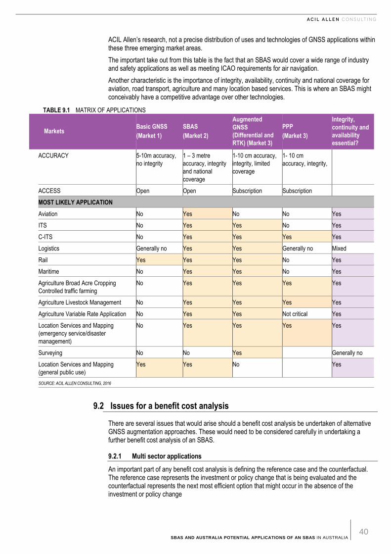
SBAS AND AUSTRALIA POTENTIAL APPLICATIONS OF AN SBAS IN AUSTRALIA 40
ACIL Allen’s research, not a precise distribution of uses and technologies of GNSS applications within these three emerging market areas.
The important take out from this table is the fact that an SBAS would cover a wide range of industry and safety applications as well as meeting ICAO requirements for air navigation.
Another characteristic is the importance of integrity, availability, continuity and national coverage for aviation, road transport, agriculture and many location based services. This is where an SBAS might conceivably have a competitive advantage over other technologies.
TABLE 9.1 MATRIX OF APPLICATIONS
Markets Basic GNSS
(Market 1)
SBAS
(Market 2)
Augmented
GNSS
(Differential and
RTK) (Market 3)
PPP
(Market 3)
Integrity,
continuity and
availability
essential?
ACCURACY
5-10m accuracy,
no integrity
1 – 3 metre
accuracy, integrity
and national
coverage
1-10 cm accuracy,
integrity, limited
coverage
1- 10 cm
accuracy, integrity,
ACCESS Open Open Subscription Subscription
MOST LIKELY APPLICATION
Aviation No Yes No No Yes
ITS No Yes Yes No Yes
C-ITS No Yes Yes Yes Yes
Logistics Generally no Yes Yes Generally no Mixed
Rail Yes Yes Yes No Yes
Maritime No Yes Yes No Yes
Agriculture Broad Acre Cropping
Controlled traffic farming
No Yes Yes Yes Yes
Agriculture Livestock Management No Yes Yes Yes Yes
Agriculture Variable Rate Application No Yes Yes Not critical Yes
Location Services and Mapping
(emergency service/disaster
management)
No Yes Yes Yes Yes
Surveying No No Yes
Generally no
Location Services and Mapping
(general public use)
Yes Yes No
Yes
SOURCE: ACIL ALLEN CONSULTING, 2016
9.2 Issues for a benefit cost analysis
There are several issues that would arise should a benefit cost analysis be undertaken of alternative GNSS augmentation approaches. These would need to be considered carefully in undertaking a further benefit cost analysis of an SBAS.
9.2.1 Multi sector applications
An important part of any benefit cost analysis is defining the reference case and the counterfactual. The reference case represents the investment or policy change that is being evaluated and the counterfactual represents the next most efficient option that might occur in the absence of the investment or policy change
SBAS AND AUSTRALIA POTENTIAL APPLICATIONS OF AN SBAS IN AUSTRALIA 41
The potential for multi sector use of augmented GNSS creates a challenge for defining the reference case and counterfactual and hence a challenge for undertaking a benefit cost analysis of different augmented GNSS options including an SBAS. This arises because the benefits (and costs) will be spread over a portfolio of sectors.
In such cases a benefit cost framed against one sector could potentially produce results that are not optimal for the economy as a whole.
9.2.2 Network effects
Network effects refer to the interaction between related and supporting products and services or infrastructures. For example the development of geographic information systems (GIS) has created new market opportunities for GNSS services. Development of smart phone and tablet technologies has created further potential applications and uses of both GNSS and GIS products and services and so on.
Network effects can also influence the relative economics and competitiveness of different technologies. For example the wide availability of SBAS enabled GNSS receivers would improve the rate of adoption of SBAS. The same would also apply to other technologies.
Network effects can be very important for innovation in use and application of products and services as well as in innovation in the products and services themselves.
9.2.3 Non market impacts
Many of the benefits that arise from the use and application of augmented GNSS services are intangible for which there is no market price. Public safety is a non-market benefit that would require careful consideration when documenting benefits and costs. The value of improvements in provision of ambulance and emergency services can also be difficult to quantify directly.
There are techniques in economics to quantify such non-market impacts but generally they require extensive analysis of the expected costs of harmful outcomes that would otherwise be mitigated. This can be both time and cost intensive.
In such cases it is often more efficient to describe benefits (and costs) in qualitative terms. In so doing, it is important that qualitative benefits are properly documented for a balanced assessment of the quantified and qualitative socio-economic impacts.
9.2.4 Market failure
There are aspects of the provision of a GNSS services where market failure occurs. This for example arises with the provision of free basic GNSS services. This creates a form of public good which, if not treated with care, can distort assessments of benefits. Aspects of public good characteristics are outlined in Box 9.1.
GNSS services are similar to a private good as they can be excludable (that is it can be provided though a subscription service). However they are non-rival (that is, through use by one consumer does not restrict consumption by another). The SBAS services in the US and the EU are public goods creating non-excludable external benefits for which preferences are not revealed by the market.
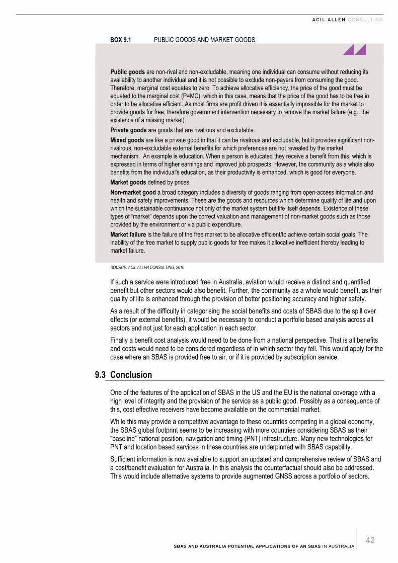
SBAS AND AUSTRALIA POTENTIAL APPLICATIONS OF AN SBAS IN AUSTRALIA 42
BOX 9.1 PUBLIC GOODS AND MARKET GOODS
Public goods are non-rival and non-excludable, meaning one individual can consume without reducing its
availability to another individual and it is not possible to exclude non-payers from consuming the good.
Therefore, marginal cost equates to zero. To achieve allocative efficiency, the price of the good must be
equated to the marginal cost (P=MC), which in this case, means that the price of the good has to be free in
order to be allocative efficient. As most firms are profit driven it is essentially impossible for the market to
provide goods for free, therefore government intervention necessary to remove the market failure (e.g., the
existence of a missing market).
Private goods are goods that are rivalrous and excludable.
Mixed goods are like a private good in that it can be rivalrous and excludable, but it provides significant non-
rivalrous, non-excludable external benefits for which preferences are not revealed by the market
mechanism. An example is education. When a person is educated they receive a benefit from this, which is
expressed in terms of higher earnings and improved job prospects. However, the community as a whole also
benefits from the individual's education, as their productivity is enhanced, which is good for everyone.
Market goods defined by prices.
Non-market good a broad category includes a diversity of goods ranging from open-access information and
health and safety improvements. These are the goods and resources which determine quality of life and upon
which the sustainable continuance not only of the market system but life itself depends. Existence of these
types of “market” depends upon the correct valuation and management of non-market goods such as those
provided by the environment or via public expenditure.
Market failure is the failure of the free market to be allocative efficient/to achieve certain social goals. The
inability of the free market to supply public goods for free makes it allocative inefficient thereby leading to
market failure.
SOURCE: ACIL ALLEN CONSULTING, 2016
If such a service were introduced free in Australia, aviation would receive a distinct and quantified benefit but other sectors would also benefit. Further, the community as a whole would benefit, as their quality of life is enhanced through the provision of better positioning accuracy and higher safety.
As a result of the difficulty in categorising the social benefits and costs of SBAS due to the spill over effects (or external benefits), it would be necessary to conduct a portfolio based analysis across all sectors and not just for each application in each sector.
Finally a benefit cost analysis would need to be done from a national perspective. That is all benefits and costs would need to be considered regardless of in which sector they fell. This would apply for the case where an SBAS is provided free to air, or if it is provided by subscription service.
9.3 Conclusion
One of the features of the application of SBAS in the US and the EU is the national coverage with a high level of integrity and the provision of the service as a public good. Possibly as a consequence of this, cost effective receivers have become available on the commercial market.
While this may provide a competitive advantage to these countries competing in a global economy, the SBAS global footprint seems to be increasing with more countries considering SBAS as their “baseline” national position, navigation and timing (PNT) infrastructure. Many new technologies for PNT and location based services in these countries are underpinned with SBAS capability.
Sufficient information is now available to support an updated and comprehensive review of SBAS and a cost/benefit evaluation for Australia. In this analysis the counterfactual should also be addressed. This would include alternative systems to provide augmented GNSS across a portfolio of sectors.
SBAS AND AUSTRALIA POTENTIAL APPLICATIONS OF AN SBAS IN AUSTRALIA 43
ACIL Allen suggests that any benefit cost assessment of the application of an SBAS should be undertaken across a portfolio of applications rather than examining an application in one sector alone. If such an analysis were undertaken, the sectors that could be part of the portfolio as early adopters would include:
— Aviation
— Transport and logistics
— Agriculture
— Maritime
— Rail
The most prospective areas are likely to be aviation, transport and agriculture. Safety is also an area that is important to these sectors and would also need to be addressed in any future evaluation.
SBAS AND AUSTRALIA POTENTIAL APPLICATIONS OF AN SBAS IN AUSTRALIA 44
B I B L I O G R A P H Y
ACIL Allen Consulting, (2013a), The Value of Augmented GNSS in Australia – Series of Reports, Prepared for the Department of Industry, Innovation, Climate Change, Science, Research and Tertiary Education.
ACIL Allen Consulting, (2013b) Precise positioning services in the rail sector, Prepared for the Department of Industry, Innovation, Climate Change, Science, Research and Tertiary Education.
ACIL Allen Consulting, (2013c) Precise positioning in the agricultural sector, Prepared for the Department of Industry, Innovation, Climate Change, Science, Research and Tertiary Education.
ACIL Tasman, (2008), The Value of Spatial Information, Prepared for the CRC for Spatial Information & ANZLIC – the Spatial Information Council.
Australian Controlled Traffic Farming Association (ACTFA) (not dated), Benefits of Controlled Traffic Farming.
Australian Rail Track Corporation Ltd., (not dated (a)), Advanced Train Management System – Key Features.
Australian Rail Track Corporation Ltd., (not dated (b)), Advanced Train Management System - Schedule.
Australian Transport Commission, (2011), National Road Safety Strategy 2011-2020, Canberra, Australia
Austroads, (2013), Vehicle Positioning for C-ITS in Australia, Research Report, Victoria, Australia.
Austroads, (2014), Austroads’ Submission to the 2014 Review of the Motor Vehicles Standards Act, Victoria, Australia.
Austroads. (2013). Vehicle positioning for C-ITS in Austraila. Sydney: Austroads.
BIS Research, (2014), Global Precision Agriculture Market Analysis & Forecast (2015-2022).
CASA. (2010). PBN Implementation Plan. Sydney: Civil Aviation Safety Authority.
Castalia (2011) Economic Anaysis for the Aviation Sector of the Proposed Satellite Based Augmentation System.
Croft, J. (2013, June 7). Cape air flight times down. Aviation Week, p. 5.
Department of Industry, (2012), Key Automotive Statistics 2012. Australian Government, Canberra.
Departments of Defense, Homeland Security and Transportation. (2014). Federal Radio Navigation Plan. Washington: Department of Defence.
SBAS AND AUSTRALIA POTENTIAL APPLICATIONS OF AN SBAS IN AUSTRALIA 45
DITRDLG. (2011). SBAS review. Canberra: Department of Infrastructure, Transport, Regional Development and Local Government.
European Commission, (2002), Galilieo Applications.
European Commission, (2009), Impact assessment on the introduction of the eCall service in all new type-approved vehicles in Europe, including liability / legal issues, Final Report Issue 2.
European Commission, (2015), eCall in all new cars from April 2018.
European Commission, (2016a ), C-ITS Platform, Final Report.
European Commission, (2016b), Digital Single Market.
European Global Navigation Satellite Agency. (2015). GNSS market report - rail. Lyon: European Global Navigation Satellite Agency.
European Global Navigation Satellite Systems Agency (GSA), (2015), The GNSS Market Report, Issue 4, 2015.
European Space Agency (ESAb), EGNOS Applications, Navipedia.
European Space Agency (ESAc), Precision Agriculture, Navipedia.
European Space Agency, (ESAa) EGNOS – General Introduction, Navipedia.
Federal Aviation Administration. (August 2009). Wide Area Augmentation - Business Case Analysis Report. Wachington: Federal Department of Transportation.
GSA. (2015). GNSS Market Report - Location Based Services. Holsovice, Czech Republic: European Global Navigation Satellite Systems Agency.
IALA. (2008). Recommedation R-135 on the future of GNSS. Paris: International Association of Lighthouse Authorities.
Isbister et al, (2004), Controlled Farming Technical Manual, Western Australian Agriculture Authority.
Kaminski, T., Ucinska, M and Kaminski, E., (2011), Effect Analysis on the Implementation of Automatic Emergency Call System eCall, Journal of KONES Powertrain and Transport, 18(4).
Karsky, D., (2004), Comparing Four Methods of Correcting GPS Data: DGPS, WAAS, L-Band, and Postprocessing, United States Department of Agriculture, Forest Service.
Lamb, D and Collier, P. (2015). Positioning Australia for its farming future: Utilising the Japanese Satellite Navigation System (QZSS) to deliver centimetre positioning accuracy across Australia, Precision Agriculture Symposium.
Local Land Services, Riverina, GPS Wild Dog Monitoring Project, 2015.
Naesset, E., Bjerke, T., Ovsredal, O. and Ryan, L. (2010), Contributions of Differential GPS and GLONASS Observations to Point Accuracy under Forest Canopies, Journal of Photogrammetric Engineering and Remote Sensing, 66(4), 2010.
Nowatzki, J., Hoffman, V, Disrud, L. and Nelson, K., (2011), GPS applications in crop management.
Orsini, L, (2013), to deliver with prime air drones, Amazon has to solve these 3 problems.
Qian, M. (not dated) Application of GNSS in Road Traffic and Construction.
Sugar Research Australia, (2014), GPS/GNSS for Agriculture, Information Sheet IS14014.
Suprem et al, (2013), A Review on Application of technology systems, standards and interfaces for agriculture and food sector, Computer Standards and Interfaces, Volume 35.
The Official US Government Information about GPS and related topics (GPS). Agriculture.
The Official US Government Information about GPS and related topics (GPS). Rail.
The Official US Government Information about GPS and related topics (GPS). Roads.
SBAS AND AUSTRALIA POTENTIAL APPLICATIONS OF AN SBAS IN AUSTRALIA 46
Till, R.D., Wanner, W. and Evangelos, J.R., (1995), Wide Area Augmentation System (WAAS) test and evaluation concepts, Proceedings of the IEEE Aerospace and Electronics Conference, Volume 1, FAA Technology Center, USA.
Tomkiewicz, S., Fuller, M, Kie, J. and Bates, K. (2010), Global positioning system and associated technologies in animal behaviour and ecological research, Philosophical Transactions, 365(1550).
Tullberg et al. (not rated), “On Track” to Sustainable Cropping Systems for Australia.
UN Office for Outer Space Affairs. (2010). Current and Planned Global and Regional Navigational Satellite Syetems and Satellite-based Augmentation Systems. New York: United Nations.
United States Department of Transport, (2015), ITS Strategic Plan 2015-2019.
United States Department of Transport, Positive Train Control Information (Railroad Safety).
US National Highway Traffic Safety Administration, Advanced Automatic Collision Notification.
Valbuena,R., Mauro, F., Rodriguez-Solano, R. and Manzanera, J. (2010), Accuracy and precision of GPS recievers under forest canopies in a mountainous environment, Spanish Journal of Agricultural Research, 8(40).
Wu et al, (2015), Updated Estimates of Potential Traffic Fatality Reductions With Automatic Collision Notification, Research Paper Number 15-0269 , National Highway Traffic Safety Administration (NHTSA), Washington, DC.
Presentations
Aguilera, C. (2015), EGNOS Adoption in Aviation: Strategy and Main Achievements, EGNOS Service Provision Workshop Copenagen.
Bunce, D (2015), Wide Area Augmentation System (WAAS) Overview, Presentation to EGNOS on WAAS successful implementation and return on experience in the US, FAA Headquarters.
Comby, D. (2015), Benefits of EGNOS - point of view of the French Authorities, SBAS Workshop Australia. US Department of Homeland Security, Navigation Center, (not rated), Nationwide Differential Global Positioning System. Rebollo, JF (2015) Strategy for EGNOS use in maritime aids to navigation and potential use in ports and other maritime operations, EGNOS Service Provision Workshop (Copenhagen), 30 September 2015.
Personal Communication
Ballingall, Stuart, Austroads (April 2016)
Lamb, David, University of New England (May 2016)
Thomson, Steven, USDA, National Institute of Food and Agriculture (May 2016).
ACIL ALLEN CONSULTING PTY LTD
ABN 68 102 652 148
ACILALLEN.COM.AU
ABOUT ACIL ALLEN CONSULTING
ACIL ALLEN CONSULTING IS ONE OF
THE LARGEST INDEPENDENT,
ECONOMIC, PUBLIC POLICY, AND
PUBLIC AFFAIRS MANAGEMENT
CONSULTING FIRMS IN AUSTRALIA.
WE ADVISE COMPANIES,
INSTITUTIONS AND GOVERNMENTS
ON ECONOMICS, POLICY AND
CORPORATE PUBLIC AFFAIRS
MANAGEMENT.
WE PROVIDE SENIOR ADVISORY
SERVICES THAT BRING
UNPARALLELED STRATEGIC
THINKING AND REAL WORLD
EXPERIENCE TO BEAR ON PROBLEM
SOLVING AND STRATEGY
FORMULATION.


![SBAS DFMC SIS ICD EPO Inputs to IWG#26 [from Pro-SBAS studies]](https://img.pdfslide.net/doc/110x75/568145f5550346895db2fb3e/sbas-dfmc-sis-icd-epo-inputs-to-iwg26-from-pro-sbas-studies.jpg)