Embed Size (px)
Citation preview

Service Learningand Local
Hydrogeology in the Classroom
An example from Anchorage, Alaska
LeeAnn Munk
University of Alaska Anchorage

Goals of Service Learning
• Involve students with community – Agencies– Community councils, etc.
• Students utilize fundamental knowledge learned throughout course and apply it to their surrounding environment
• Students are exposed to “real world” problems and are required to interact with consultants, agencies, and the public
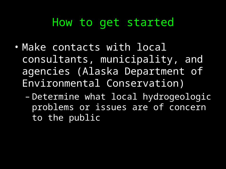
How to get started
• Make contacts with local consultants, municipality, and agencies (Alaska Department of Environmental Conservation)– Determine what local hydrogeologic
problems or issues are of concern to the public
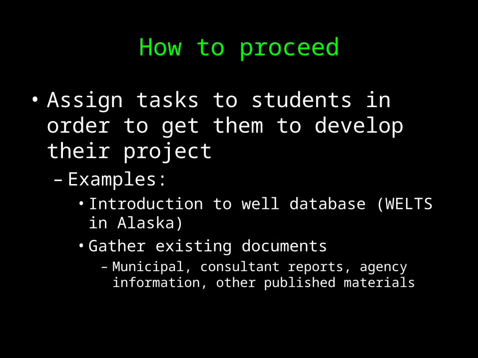
How to proceed
• Assign tasks to students in order to get them to develop their project– Examples:
• Introduction to well database (WELTS in Alaska)
• Gather existing documents– Municipal, consultant reports, agency information,
other published materials

Case Study: Sand Lake Gravel Pits, Anchorage, Alaska
• Problem or Issue– A proposed 700 home subdivision in a
previously mined gravel pit surrounded by communities on private wells and septic
– Aquifer geology = glacial outwash – Community concerned about degradation
of water quality due to new subdivision– Developer’s consultant puts forth the idea
that the aquifer is completely confined and “cannot be contaminated”

Brief summary of sequence of events
• Local community counsel hired a consulting hydrogeologist to review groundwater studies
• Municipality reluctant to address concerns raised by citizens hydrogeologist
• Citizens continue to press the issue at platting board meetings and with the mayor
• The city and the mayor “ignore” concerns• Legislature provides funding for independent
review by university faculty and students

What we did
• Read all consultant reports• Site visit• Consultation with all involved parties• Develop an understanding of hydrogeology
and hydrostratigraphy based on existing well logs
• Assess potential contaminants to groundwater from subdivision (soil characteristics)
• Present results to community and provide suggestions to municipality
• Final product = 100 page report

sand
silt
gravel
silt
sand
silt
sand and gravel
Site Visit

Cross Section A-A’
Sea level
•High and low permeability
•Water levels•Sea level
•Topography
•Drillers’ logs
• Estimated BCF interval

Topsoil: A Groundwater-Protecting Sponge…

Summary of Conclusions
• Need aquifer test to investigate connectivity of upper and lower aquifer
• Properly designed topsoil will minimize contamination
• Developer should monitor groundwater quality before during and after development

Incorporation into the classroom
• Adapt project to be suitable for undergraduates and 15 week semester

Assignments for 15 week semester course
• Week 1– Introduce the problem, have discussions, find
out what the students already know about the issue
– assign or form research teams of 3-4 students• Week 2-4
– Students gather existing data, reports, well logs, etc.
– Students turn in a summary of the problem and the existing information
• Week 5– Students develop a proposal of how they will
attempt to address the problem• Including a time line for the rest of the semester with
dates of when they will provide reports, cross sections, and assessments
• Week 6-9– Students work in groups to develop first
assessment and report– Student groups meet with instructor to present
their preliminary report
• Week 10-12– Students refine their report and investigate
further based on consultation with instructor
• Week 13-15– Students prepare oral presentation and final
written report– Students will present their findings to their
peers and invite interested parties from the community

Grading
• Proposal 20%• Preliminary Assessment 20%• Final Written Report 25%• Presentation 25%• Peer evaluation 10%