Embed Size (px)
Citation preview
1
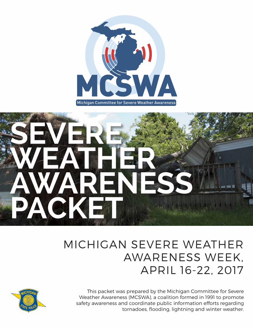
SEVEREWEATHER AWARENESSPACKET
MICHIGAN SEVERE WEATHER AWARENESS WEEK,
APRIL 16-22, 2017
This packet was prepared by the Michigan Committee for Severe Weather Awareness (MCSWA), a coalition formed in 1991 to promote
safety awareness and coordinate public information efforts regarding tornadoes, flooding, lightning and winter weather.
2
TABLE OF CONTENTS
SEVERE WEATHER AWARENESS PACKET
Michigan Committee for Severe Weather Awareness Contacts 3
Michigan Statewide Tornado Drill 4
2016 Severe Weather Review 5
Michigan Tornado History by County 8
Tornado and Thunderstorm Safety 9
Tornado and Thunderstorm Facts 10
Flood Preparation and Planning 12
Flood Insurance 14
Lightning Safety 16
Disaster Preparedness for Pets 17
Weather Warning Systems 18
National Weather Service Contacts 19
3
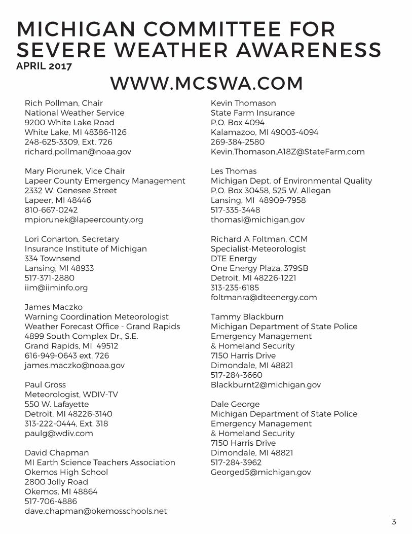
Rich Pollman, ChairNational Weather Service9200 White Lake RoadWhite Lake, MI 48386-1126248-625-3309, Ext. [email protected]
Mary Piorunek, Vice ChairLapeer County Emergency Management2332 W. Genesee StreetLapeer, MI [email protected]
Lori Conarton, SecretaryInsurance Institute of Michigan334 TownsendLansing, MI [email protected]
James MaczkoWarning Coordination MeteorologistWeather Forecast Office - Grand Rapids4899 South Complex Dr., S.E.Grand Rapids, MI 49512616-949-0643 ext. [email protected]
Paul GrossMeteorologist, WDIV-TV550 W. LafayetteDetroit, MI 48226-3140313-222-0444, Ext. [email protected]
David ChapmanMI Earth Science Teachers AssociationOkemos High School2800 Jolly RoadOkemos, MI 48864517-706-4886 [email protected]
Kevin ThomasonState Farm InsuranceP.O. Box 4094Kalamazoo, MI [email protected]
Les ThomasMichigan Dept. of Environmental QualityP.O. Box 30458, 525 W. AlleganLansing, MI [email protected]
Richard A Foltman, CCMSpecialist-MeteorologistDTE EnergyOne Energy Plaza, 379SBDetroit, MI 48226-1221 313-235-6185 [email protected]
Tammy BlackburnMichigan Department of State PoliceEmergency Management& Homeland Security 7150 Harris DriveDimondale, MI [email protected]
Dale GeorgeMichigan Department of State PoliceEmergency Management& Homeland Security 7150 Harris DriveDimondale, MI [email protected]
MICHIGAN COMMITTEE FOR SEVERE WEATHER AWARENESSAPRIL 2017
WWW.MCSWA.COM
4
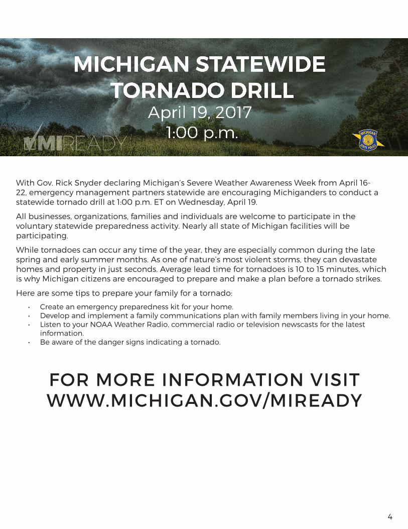
With Gov. Rick Snyder declaring Michigan’s Severe Weather Awareness Week from April 16-22, emergency management partners statewide are encouraging Michiganders to conduct a statewide tornado drill at 1:00 p.m. ET on Wednesday, April 19.
All businesses, organizations, families and individuals are welcome to participate in the voluntary statewide preparedness activity. Nearly all state of Michigan facilities will be participating.
While tornadoes can occur any time of the year, they are especially common during the late spring and early summer months. As one of nature’s most violent storms, they can devastate homes and property in just seconds. Average lead time for tornadoes is 10 to 15 minutes, which is why Michigan citizens are encouraged to prepare and make a plan before a tornado strikes.
Here are some tips to prepare your family for a tornado:
• Create an emergency preparedness kit for your home.• Develop and implement a family communications plan with family members living in your home.• Listen to your NOAA Weather Radio, commercial radio or television newscasts for the latest
information. • Be aware of the danger signs indicating a tornado.
FOR MORE INFORMATION VISIT WWW.MICHIGAN.GOV/MIREADY
5
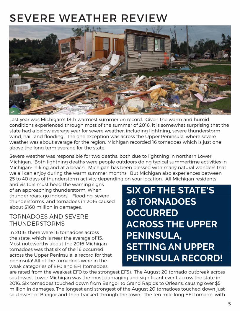
Last year was Michigan’s 18th warmest summer on record. Given the warm and humid conditions experienced through most of the summer of 2016, it is somewhat surprising that the state had a below average year for severe weather, including lightning, severe thunderstorm wind, hail, and flooding. The one exception was across the Upper Peninsula, where severe weather was about average for the region. Michigan recorded 16 tornadoes which is just one above the long term average for the state.
Severe weather was responsible for two deaths, both due to lightning in northern Lower Michigan. Both lightning deaths were people outdoors doing typical summertime activities in Michigan: hiking and at a beach. Michigan has been blessed with many natural wonders that we all can enjoy during the warm summer months. But Michigan also experiences between 25 to 40 days of thunderstorm activity depending on your location. All Michigan residents and visitors must heed the warning signs of an approaching thunderstorm. When thunder roars, go indoors! Flooding, severe thunderstorms, and tornadoes in 2016 caused about $160 million in damages.
TORNADOES AND SEVERE THUNDERSTORMSIn 2016, there were 16 tornadoes across the state, which is near the average of 15. Most noteworthy about the 2016 Michigan tornadoes was that six of the 16 occurred across the Upper Peninsula, a record for that peninsula! All of the tornadoes were in the weak categories of EF0 and EF1 (tornadoes are rated from the weakest EF0 to the strongest EF5). The August 20 tornado outbreak across southwest Lower Michigan was the most damaging and significant event across the state in 2016. Six tornadoes touched down from Bangor to Grand Rapids to Orleans, causing over $5 million in damages. The longest and strongest of the August 20 tornadoes touched down just southwest of Bangor and then tracked through the town. The ten mile long EF1 tornado, with
SEVERE WEATHER REVIEW
SIX OF THE STATE’S 16 TORNADOES OCCURRED ACROSS THE UPPER PENINSULA, SETTING AN UPPER PENINSULA RECORD!
6
winds estimated up to 110 mph, caused the entire city to lose power and downed hundreds of trees. Multiple structures in Bangor were damaged, including the police department. The outbreak also produced two EF0 tornadoes in the metro Grand Rapids area. The first hit Grandville and Wyoming, and the second was in Grand Rapids. Both of these tornadoes downed trees, some onto homes.
The severe weather season across Michigan got off to a slow start with just isolated reports of severe thunderstorm wind gusts, a few downed limbs and trees, and large hail like the golf ball sized hail that fell in Allegan County on April 25. On May 24, two EF1 tornadoes (90 mph)
from the same parent storm, touched down in western Marquette County. The tornadoes occurred just as schools were being dismissed causing several schools to go into ‘lockdown’ until the threat passed.
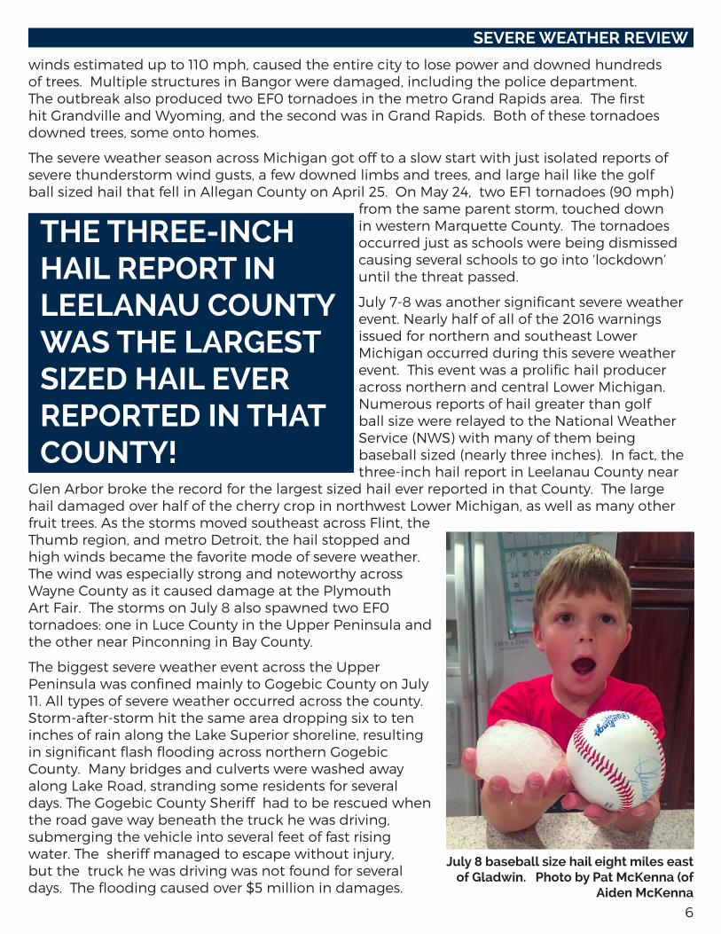
July 7-8 was another significant severe weather event. Nearly half of all of the 2016 warnings issued for northern and southeast Lower Michigan occurred during this severe weather event. This event was a prolific hail producer across northern and central Lower Michigan. Numerous reports of hail greater than golf ball size were relayed to the National Weather Service (NWS) with many of them being baseball sized (nearly three inches). In fact, the three-inch hail report in Leelanau County near
Glen Arbor broke the record for the largest sized hail ever reported in that County. The large hail damaged over half of the cherry crop in northwest Lower Michigan, as well as many other fruit trees. As the storms moved southeast across Flint, the Thumb region, and metro Detroit, the hail stopped and high winds became the favorite mode of severe weather. The wind was especially strong and noteworthy across Wayne County as it caused damage at the Plymouth Art Fair. The storms on July 8 also spawned two EF0 tornadoes: one in Luce County in the Upper Peninsula and the other near Pinconning in Bay County.
The biggest severe weather event across the Upper Peninsula was confined mainly to Gogebic County on July 11. All types of severe weather occurred across the county. Storm-after-storm hit the same area dropping six to ten inches of rain along the Lake Superior shoreline, resulting in significant flash flooding across northern Gogebic County. Many bridges and culverts were washed away along Lake Road, stranding some residents for several days. The Gogebic County Sheriff had to be rescued when the road gave way beneath the truck he was driving, submerging the vehicle into several feet of fast rising water. The sheriff managed to escape without injury, but the truck he was driving was not found for several days. The flooding caused over $5 million in damages.
SEVERE WEATHER REVIEW
THE THREE-INCH HAIL REPORT IN LEELANAU COUNTY WAS THE LARGEST SIZED HAIL EVER REPORTED IN THAT COUNTY!
July 8 baseball size hail eight miles east of Gladwin. Photo by Pat McKenna (of
Aiden McKenna
7
Then a squall line of thunderstorms moved through during the overnight hours, spawning two EF1 tornadoes (90 mph). One occurred a few miles south of Ironwood. The other touched down a few miles south of Bessemer. Other than some property damage to a barn and a couple of houses, most of the damage was confined to trees. Then the squall line intensified as it moved through Wakefield, MI, sending a wide swath of 90 mph wind through the city. Hundreds of trees were snapped and uprooted, RVs were flipped, and a roof was ripped off an ice rink and thrown into Sunday Lake.
Another squall line surged across the western U.P. around daybreak on July 21. Straight line winds toppled thousands of trees from the Porcupine Mountain State Park through Ontonagon and into Houghton County. One of the hardest hit areas was Emily Lake Campground in Twin Lakes State Park. Several trees smashed through campers. While there were some very close calls, there were no injuries.
August and September saw more isolated severe weather events across Michigan. The severe weather season ended on November 18. Record high temperatures in the 70s helped to spawn a squall line that moved from Jackson through Howell and Flint into the Thumb region. Winds were measured up to 78 mph with widespread trees blown down despite not having any leaves on them.
FLOODING
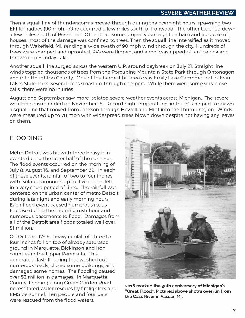
Metro Detroit was hit with three heavy rain events during the latter half of the summer. The flood events occurred on the morning of July 8, August 16, and September 29. In each of these events, rainfall of two to four inches with isolated amounts up to five inches fell in a very short period of time. The rainfall was centered on the urban center of metro Detroit during late night and early morning hours. Each flood event caused numerous roads to close during the morning rush hour and numerous basements to flood. Damages from all of the Detroit area floods totaled well over $1 million.
On October 17-18, heavy rainfall of three to four inches fell on top of already saturated ground in Marquette, Dickinson and Iron counties in the Upper Peninsula. This generated flash flooding that washed out numerous roads, closed some buildings, and damaged some homes. The flooding caused over $2 million in damages. In Marquette County, flooding along Green Garden Road necessitated water rescues by firefighters and EMS personnel. Ten people and four pets were rescued from the flood waters.
SEVERE WEATHER REVIEW
2016 marked the 30th anniversary of Michigan’s “Great Flood”. Pictured above shows overrun from the Cass River in Vassar, MI.

8
County 1950-2016 2016 County 1950-2016 2016
Alcona 11 0 Lake 2 0
Alger 6 0 Lapeer 21 0
Allegan 33 4 Leelanau 4 0
Alpena 14 0 Lenawee 32 0
Antrim 9 0 Livingston 26 0
Arenac 7 0 Luce 4 1
Baraga 2 0 Mackinac 6 0
Barry 18 0 Macomb 21 0
Bay 14 1 Manistee 2 0
Benzie 4 0 Marquette 11 2
Berrien 31 0 Mason 5 0
Branch 17 0 Mecosta 9 0
Calhoun 16 0 Menominee 9 1
Cass 17 1 Midland 10 0
Charlevoix 4 0 Missaukee 8 0
Cheboygan 7 0 Monroe 34 1
Chippewa 6 0 Montcalm 12 1
Clare 8 0 Montmorency 6 0
Clinton 19 0 Muskegon 8 0
Crawford 12 0 Newaygo 13 0
Delta 11 0 Oakland 32 0
Dickinson 9 0 Oceana 5 0
Eaton 25 0 Ogemaw 15 0
Emmet 5 0 Ontonagon 3 0
Genesee 45 0 Osceola 16 0
Gladwin 9 0 Oscoda 5 0
Gogebic 5 2 Otsego 5 0
Grand Traverse 4 0 Ottawa 20 1
Gratiot 15 0 Presque Isle 6 0
Hillsdale 24 0 Roscommon 8 0
Houghton 1 0 Saginaw 25 0
Huron 15 0 Sanilac 17 0
Ingham 28 0 Schoolcraft 3 0
Ionia 21 1 Shiawassee 29 0
Iosco 13 0 St. Clair 23 0
Iron 7 0 St. Joseph 11 0
Isabella 13 0 Tuscola 19 0
Jackson 17 0 Van Buren 20 1
Kalamazoo 25 0 Washtenaw 28 0
Kalkaska 8 0 Wayne 30 0
Kent 35 2 Wexford 8 0
Keweenaw 2 0
The following is a list of tornadoes experienced by each county in Michigan.
A single tornado can cross county lines. Therefore, the sum of the counties will not equal the total number of tornadoes statewide.
9
Preparing for a tornado or thunderstorm:• Plan ahead. Be sure everyone in your household knows where to go and what to do in case of a
tornado or thunderstorm warning.• Know the safest location for shelter in your home, workplace and school. Load-bearing walls near
the center of the basement or lowest level generally provide the greatest protection.• Know the location of designated shelter areas in local public facilities, such as schools, shopping
centers and other public buildings.• Have emergency supplies on hand, including a battery-operated NOAA Weather Radio, flashlight,
and a supply of fresh batteries, first-aid kit, water, and cell phone.• Keep a three-day supply of food on hand. Keep some food in your supply kit that doesn’t require
refrigeration. • Make an inventory of household furnishings and other possessions. Supplement it with
photographs of each room and keep them in a safe place.• Sign up to receive text or e-mail alerts from your local media, weather provider, or through an app.
What to do when a thunderstorm approaches your area:• Stay tuned to your weather radio or local news station for the latest updates from the National
Weather Service or go to the National Weather Service website, www.weather.gov.• Seek safe shelter when you first hear thunder, when you see dark threatening clouds developing
overhead, or see lightning. Stay inside until 30 minutes after you last hear thunder or see lightning. Remember, lightning can strike more than ten miles away from any rainfall.
• When you hear thunder, run to the nearest large building or a fully enclosed vehicle (soft-topped convertibles are not safe). It is not safe anywhere outside.
• If you are boating or swimming, get to land and seek shelter immediately.• Telephone lines and metal pipes can conduct electricity. Any item plugged into an electrical
outlet may cause a hazard during a tornado or thunderstorm. Do not use corded (plug-in) telephones except in an emergency.
What to do when a tornado warning is issued for your area:• Quickly move to shelter in the basement or lowest floor of a permanent structure.• In homes and small buildings, go to the basement and get under something sturdy, like a
workbench or stairwell. If a basement is not available, go to an interior part of the home on the lowest level. A good rule of thumb is to put as many walls between you and the tornado as possible.
• In schools, hospitals and public places, move to the designated shelter areas. Interior hallways on the lowest floors are generally best.
• Stay away from windows, doors and outside walls. Broken glass and wind blown projectiles cause more injuries and deaths than collapsed buildings. Protect your head with a pillow, blanket, or mattress.
• If you are caught outdoors, a sturdy shelter is the only safe location in a tornado.• If you are boating or swimming, get to land and seek shelter immediately.
After a tornado or thunderstorm:• Inspect your property and motor vehicles for damage. Write down the date and list the damages
for insurance purposes. Check for electrical problems and gas leaks, and report them to the utility company at once.
• Watch out for fallen power lines. Stay out of damaged buildings until you are sure they are safe and will not collapse. Secure your property from further damage or theft.
• Use only chlorinated or bottled supplies of drinking water. • Check on your food supply. Food stored in a refrigerator or freezer can spoil when the power
goes out.
TORNADO AND THUNDERSTORM SAFETY
10
1. What is a severe thunderstorm? A severe thunderstorm produces large hail that is one inch in diameter or larger, damaging
winds of 58 mph or greater, and/or a tornado.
2. What is a tornado? A tornado is a column of violently rotating winds extending down from a thunderstorm
cloud and touching the surface of the earth.
3. Whatisthedifferencebetweenatornadoandafunnelcloud? A funnel cloud is also a column of violently rotating winds extending down from a
thunderstorm; however, it does not touch the earth as a tornado does.
4. How many tornadoes usually occur in Michigan every year? Michigan experiences an average of 15 tornadoes annually. Since 1950, 243 people have
been killed due to tornadoes. During this same time, Michigan has experienced 1025 tornadoes.
5. When do tornadoes generally occur? Most tornadoes occur during the months of May, June, July, and August primarily in the
late afternoon and evening hours. However, tornadoes can occur anytime of the day or night in almost any month during the year.
6. How fast do tornadoes travel? Tornadoes generally travel from the southwest at an average speed of 30 mph. However,
some tornadoes have very erratic paths, with speeds approaching 70 mph.
TORNADO AND THUNDERSTORM FACTS
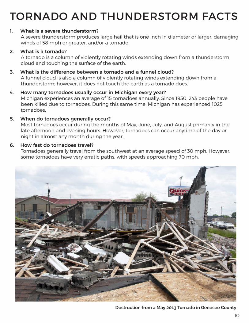
Destruction from a May 2013 Tornado in Genesee County
11
7. How far do tornadoes travel once they touch the ground? The average Michigan tornado is on the ground for less than 10 minutes and travels a
distance of about five miles. However, they do not always follow the norm and have been known to stay on the ground for more than an hour and travel more than 100 miles.
8. When is a tornado or severe thunderstorm watch issued? A tornado or severe thunderstorm watch is issued whenever conditions exist for severe
weather to develop. Watches are usually for large areas about two-thirds the size of Lower Michigan and are usually two-to-six hours long. Watches give you time to plan and prepare.
9. When is a tornado or severe thunderstorm warning issued? The local National Weather Service (NWS) office issues a tornado warning whenever NWS
Doppler Radar indicates a thunderstorm is capable of producing a tornado, or when a tornado has been sighted by a credible source. A severe thunderstorm warning is issued whenever a severe thunderstorm is observed, or NWS Doppler Radar indicates a thunderstorm is capable of producing damaging winds or large hail.
Warnings are issued specifically for areas expected to be impacted by a severe storm. These “storm-based” NWS warnings are issued for the threatened area in a shape of a polygon. The “polygon” warnings only include sections of a county or group of counties and usually last for 30 to 90 minutes in length. You must act immediately when you first hear the warning. If severe weather is near you, seek shelter immediately. If not, keep a constant lookout for severe weather and stay near a shelter.
10. What is a special marine warning? The NWS will issue a special marine warning for the Great Lakes and the connecting
waterways when a strong or severe thunderstorm develops or moves over the water. The special marine warning is issued for boaters, both recreational and commercial. For residents and visitors of Michigan’s many coastal communities, the special marine warning provides valuable information about a storm that is about to move onshore.
11. HowdoIfindoutaboutawarningifmyelectricityisalreadyout? A NOAA Weather Radio All-Hazards with battery back-up capability is your best source to
receive the warning. In some areas, civil emergency sirens may be your first official warning, but it is important to remember that those sirens were designed to warn people outdoors about an approaching tornado or high-end severe thunderstorm…you may not hear your local siren inside your home. In addition, if your television or radio has battery back-up capability, you may receive NOAA’s National Weather Service warnings from local media, the internet or a smartphone app.
TORNADO AND THUNDERSTORM FACTS
12
STEPS TO PREPARE FOR A FLOOD
Flooding can occur during any season in Michigan. Planning in advance can afford you extra critical time when a flood is coming, and can help you increase the odds of protecting your valuable documents, your real estate and your personal property – including cherished belongings. Developing a flood plan is one of the advance methods your family, business or community can put together to help you respond quickly in the event of a flood near your property. A “rapid-response” plan can be as simple as a one-page plan that answers the following questions:
1.Howwillwefindoutaboutacomingflood?The first part of a Flood Plan is putting yourself in a position to get some advance warning of an unfolding situation. Large-scale flooding on the main stem of a river may occur over many hours or several days, but flash floods can strike in minutes. Important steps you can take include signing up for flood alerts and monitoring weather patterns and local conditions. Flooding in Michigan can happen any time of year.
• Sign up for NOAA National Weather Service Flood Alerts at www.focusonfloods.org/flood-alerts• Monitor river levels from NOAA National Weather Service at
www.water.weather.gov/ahps/region.php?state=mi.• Determine your property’s proximity to waterways by learning about and reviewing flood hazard
maps at www.floodsmart.gov/floodsmart/pages/flooding_flood_risks/understanding_flood_maps.jsp.
2.Atwhatriverleveldoesourpropertybegintoflood?First, determine “What’s Your Number?” by learning the flood stage at the stream gage nearest you. This information is available through the National Weather Service’s Advanced Hydrologic Prediction Services website at www.water.weather.gov/ahps. Then, determine the level at which floodwaters begin to affect your property. This step may take research or personal experience to determine, such as talking to neighbors to find out how high the river was during recent floods, and at what point flooding began in your neighborhood. Each neighborhood and each property has its own unique terrain and placement to consider when determining this factor, and it is safest to err on the side of caution.
3.Howcanweprepareforfloods?Preparing your household for a flood involves steps that will improve your readiness for many different types of disasters. Give yourself plenty of time to evacuate by developing an emergency kit including first aid supplies, a three-day supply of non-perishable food, bottled water, a battery-powered radio, flashlights and extra batteries. Also, have personal items ready like rubber boots, a rain jacket, warm clothes, and hygiene and sanitation products. Learn additional ways to prepare at www.ready.gov/floods.
4. How will we learn about evacuation orders? Contact your local emergency management office to find out how your community notifies residents of floods and how it will issue evacuation orders. Make a commitment to follow evacuation orders the first time to help prevent emergency personnel from having to return to the affected area for a rescue when travel is no longer safe.
FLOOD PREPARATION AND PLANNING
13
5. What access roads can we use to evacuate in the case of rising waters? Research indicates the majority of flood-related fatalities occur when cars become trapped on roads that are known to flood. To prevent this, follow instructions from emergency personnel and before a flood happens talk to neighbors, emergency personnel and others to determine when and where flooding typically occurs on access roads leading to your home. Know what roads you regularly travel and whether they will flood, and plan alternate routes when needed.
6. What steps should we take to prepare our property? Research the flood-proofing options available to you. Can you install a quick-disconnect furnace, or elevate electrical and mechanical equipment? Are there steps you can take to alleviate pressure on your structure and to prevent extensive damage to doors and windows if flooding does occur? For additional information about protecting your property from floods, please visit www.mcswa.com.
7.Whereshouldourfamilymeetifweareseparatedduringafloodevent?Before a flood or other emergency strikes, designate a safe place away from your home where your family members can all meet. Make sure that all family members know the location, you have a plan for contacting each other, and you have an emergency kit ready to take with you. In addition, it is important to know whether your child’s school or family members’ work place is in a flood zone. If so, what provisions are in place to ensure their safety?
8.HowdoIkeepmyfamilysafeduringaflood?Floods are among the most frequent and costly natural disasters. For information on keeping your family safe before, during, and after a flood, please visit: www.mcswa.com.
Other Considerations
• A written plan is essential for helping individuals and household members to think through important issues in advance. You should also research whether there are similar plans in place for your place of work and your children’s daycare and school and see how they work with your plan.
• Expect roadways to be blocked during a flood. Contact your friends and family to ensure they are safely sheltered. Listen to local media for flooding on roads as well as making contact with neighbors in your area.
• Remember, some of the most common things people regret not planning to protect during an emergency include pets, photographs and computers. Can you pack all these in a vehicle and drive to higher ground in time? Ensure you have a plan in place to protect your pets and keepsakes before an emergency.
Helpful Flood Terms
• Flood Watch: Flooding is possible. Tune in to your NOAA Weather Radio, local radio or television for information and check the flood alert sites on the Internet.
• Flash Flood Watch: Flash flooding is possible. Be prepared to move to higher ground and tune in to your NOAA Weather Radio, commercial radio or television for information.
• Flood Warning: Flooding is occurring or will occur soon. If advised to evacuate, do so immediately.• Flash Flood Warning: A flash flood is occurring. Seek higher ground immediately.
FLOOD PREPARATION AND PLANNING
14
Why Buy Flood Insurance?Flooding can occur during any season in Michigan. The National Flood Insurance Program (NFIP) estimates that 90 percent of all natural disasters involve flooding. A small amount of water can bring a tremendous amount of damage, and many property owners are unaware that their properties are at risk for flooding. A home located in the floodplain has a four times greater risk for flood damage than fire damage during the course of a 30-year mortgage.
Many property owners don’t realize that their homeowners’ or property owners’ insurance doesn’t cover flood damage. To be covered from flood damage, one must purchase National Flood Insurance through an insurance agent. Consider that even just an inch of water can require a property to replace carpet, drywall, floor boards, moldings, doors and other belongings. Additionally, clean-up of mud and residue can be costly, as can repairing any mold and mildew damage that may occur.
To help calculate flood damage that could occur to your home, visit www.floodsmart.gov and click on the link to learn more about “What Could Flooding Cost Me?”
FLOOD INSURANCE
1.Isflooddamagecoveredbymyhomeownersinsurance?Flood damage is excluded in nearly all homeowners and renters insurance policies can be purchased as a separate policy.
2.WheredoIgetfloodinsurance?Any licensed property/casualty insurance agent can sell a flood insurance policy. If you experience trouble in locating an agent, contact the National Flood Insurance Program’s agent referral program at 1-888-CALL-FLOOD. You can also locate an agent by filling out your “One-Step Flood Risk Profile” at www.floodsmart.gov.
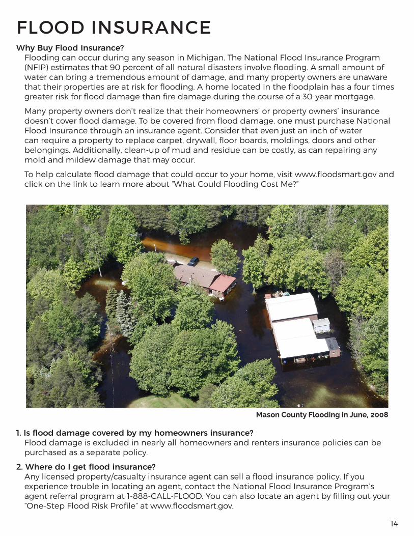
Mason County Flooding in June, 2008
15
FLOOD INSURANCE
3.Isthereawaitingperiodbeforemyfloodinsurancepolicybecomeseffective?There is a 30-day waiting period before a new or modified flood insurance policy becomes effective. You can also locate an agent by completing your “One-step risk profile” at www.floodsmart.gov.
4.DoIneedtoliveinafloodplaintogetfloodinsurance?It is important to note that nearly 30 percent of all flood claims come from outside the “100-year-floodplain” as determined by the National Flood Insurance Program (NFIP). The fact that a property is outside of the “legal” floodplain does not mean that the river or stream cannot still reach that property. You do not need to live in a floodplain to purchase flood insurance. Coverage is available to any building located in a community that has qualified for the National Flood Insurance Program. For a listing of Michigan communities participating in the NFIP, you may visit www.fema.gov/cis/MI.html%20.
5.Iswaterbackupinbasementscoveredbyafloodinsurancepolicy?Coverage for water backup in basements (drains/sewers) is excluded from the flood insurance policy.
6. Can I get coverage for water back up in basements?Although basement water back up is excluded under most homeowners’ insurance policies, coverage can be obtained by purchasing an endorsement. Most insurance companies offer sewer and drain backup as optional coverage. Coverage and limits vary by insurance company, so check with your agent/company about specifics. Some insurers include full coverage for sump pump failure while others specify items that are covered.
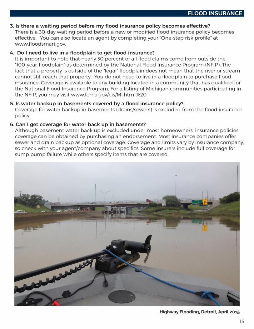
Highway Flooding, Detroit, April 2015
16
LIGHTNING SAFETYLightning can provide a spectacular display of light in the nighttime sky, but this awesome show of nature can also cause destruction and/or death. Lightning is the visible discharge of electrical energy. It is often accompanied by thunder, which is a sonic boom created by the same discharge. It is important to remember that if you hear thunder, a storm is close enough for lightning to strike you, even if the storm seems miles away and the sky is blue.
SAFETY TIPS
1. Plan your evacuation and safety measures. At the first sign of lightning or thunder, activate your emergency plan. Lightning often precedes rain, so do not wait for the rain to begin before suspending activities. No place is absolutely safe from lightning; however, some places are much safer than others. The safest location during lightning activity is a large enclosed building. The second safest location is an enclosed metal topped vehicle, but NOT a convertible, bike, or other topless or soft-top vehicle.
2. If outdoors, get inside a suitable shelter IMMEDIATELY. Your only safe choice is to get to a protected building or vehicle. Avoid seeking shelter under a tree as a tree can attract lightning. In the event you are outdoors without a safe vehicle or shelter, follow outdoor safety tips provided at www.lightningsafety.noaa.gov/outdoors.shtml. Although these tips will not prevent you from being hit, they can help lessen the odds.
3. If indoors, avoid water, doors, windows, and using the telephone and headsets. Lightning could strike exterior wires, inducing shocks to inside equipment. Any item plugged into an electrical outlet may cause a hazard.
4. Do not resume activities until 30 minutes following the last observed lightning or thunder.
5. Injured persons do not carry an electrical charge and can be handled safely. If you are qualified to do so, apply first aid procedures to a lightning victim. Call 9-1-1 or send for help immediately.
For additional information, visit NOAA’s lightning safety Web site: www.lightningsafety.noaa.gov.
17
DISASTER PREPAREDNESS FOR PETSThe following information, prepared by the Humane Society of the United States, will help you become better prepared to care for your pets in a disaster or emergency.
Don’tForgetIdentification• Your pets should be wearing up-to-date identification at all times. • Put your cell phone number on your pet’s tag. It may also be a good idea to include the phone
number of a friend or relative outside your immediate area—in case you have to evacuate.
Find a Safe Place Ahead of Time• Don’t wait until a disaster strikes to do your research. • Evacuation shelters do not generally accept pets, except for service animals. Plan ahead to ensure
your family and pets will have a safe place to stay.• If you have more than one pet, you may have to prepare to board them separately. Make a list of
boarding facilities and veterinary offices that might be able to shelter animals, including 24-hour telephone numbers.
• Ask your local animal shelter if it provides foster care or shelter for pets during an emergency. Animal shelters have limited resources so this should be your last resort.
• Contact hotels and motels outside of your immediate area to check policies on accepting pets. Ask about any restrictions on number of animals, size, and species, as well as whether a “no pet” policy would be waived during an emergency.
• Make a list of pet-friendly places and keep it handy. Call ahead for a reservation as soon as you think you might have to leave your home.
• Check with friends, relatives or others outside of your immediate area. Ask if they would be able to shelter you and/or your animals, if necessary.
If You Evacuate, Take Your Pets• The single most important thing you can do to protect your pets if you evacuate is to take them
with you. If it is not safe for you to stay in the disaster area, then it is not safe for your pets. • Animals left behind in a disaster can easily be injured, lost or killed. • Animals left inside your home can escape through storm-damaged areas, such as broken
windows. • Animals turned loose to fend for themselves are likely to become victims of exposure, starvation,
predators, contaminated food or water or other accidents. • Do not leave your animals tied or chained outside during a disaster; this can be deadly. • If you leave, even if only for a few hours, take your animals. You have no way of knowing if you will
be allowed back into the area to care for your pet.• Leave early; don’t wait for a mandatory evacuation order. An unnecessary trip is better than
waiting too long, making it unsafe to leave. • Take pet food, medications, and special items with you such as leashes, toys, or a litter box.
In Case You Are Not Home• An evacuation order may be issued, or a disaster may strike, when you’re at work or out of the
house. Make arrangements well in advance for a trusted neighbor to take your pets and meet you at a specified location.
• If you arrange for someone to take your pets, be sure the person is comfortable with your pets, knows where your animals are likely to be, knows where your disaster supplies are kept, and has a way to access your home.
• If you use a pet sitting service, discuss the possibility of getting their assistance well in advance.
18
WEATHER WARNING SYSTEMSNOAA Weather Radio All-HazardsVoice of NOAA’s National Weather Service
NOAA Weather Radio All-Hazards is a service provided by the National Weather Service (NWS). It provides continuous broadcasts of the latest weather information and forecasts from your local NWS office. NOAA Weather Radio All-Hazards broadcasts important forecast and warning information as quick as possible.
With NOAA Weather Radio All-Hazards, you will always have access to potentially life-saving emergency information. During severe weather, NWS personnel can interrupt routine weather broadcasts and insert warning messages concerning immediate threats to life and property. A special alert tone can also be activated that triggers an alerting feature on specifically equipped receivers. In the simplest case, this signal activates audible or visual alarms indicating that an emergency condition exists within the broadcast area of the station. In the most sophisticated alerting system, receivers equipped with Specific Area Message Encoding (SAME) technology allow listeners to choose which counties and for what events their radio will sound an alarm when official NWS watches and warnings are issued.
NOAA Weather Radio All-Hazards broadcasts warning and post-event information for all types of emergencies, both natural and technological. Working with other federal and local agencies, NOAA Weather Radio is an “all-hazards” radio network. This makes NOAA Weather Radio All Hazards the single source for the most comprehensive weather and emergency information available to the public.
NOAA Weather Radio All Hazards is the voice of the NWS and is provided as a public service by the U.S. Department of Commerce’s National Oceanic and Atmospheric Administration (NOAA). These life-saving receivers, that should be as common as home smoke detectors, can be purchased at many retail stores and through web sites that sell electronic merchandise. It provides the timeliest forecast and warning information from your local NWS office. This information can save your life.
For more information, including where you can buy a NOAA Weather Radio, visit www.nws.noaa.gov/nwr.
Wireless Emergency Alerts (WEAs)Automatic weather warnings on your smart phone: no matter where you are
Imagine being on vacation when a tornado warning is issued for your area. How would you find out? If you own a smart phone or any other cellular phone purchased after January 1, 2013, you no longer have to worry. The Federal Emergency Management Agency, the Federal Communications Commission, the National Weather Service, and CITA-The Wireless Association have developed a cell phone emergency alert system that will automatically notify you through a text-like message about urgent weather warnings, emergency messages from the President of the United States, and amber alerts. If you have a WEA enabled phone, you don’t have to sign up or do anything, you already have it. If you are not sure if your phone supports this new technology, then check with your cell phone carrier. In some cases, all you may need to do is update your device’s software.
Wireless Emergency Alerts are a point-to-multipoint system, which means alert messages will be sent to those within a targeted area, unlike text messages which are not location aware. For example, if a person with a WEA-capable device from Michigan happened to be in Minnesota when a flash flood threatens in that area, they would receive an “Imminent Threat Alert” on their device.
While these alerts will appear on a person’s mobile device similar to a text message, Wireless Emergency Alerts are not text messages. Instead, WEAs use a different kind of technology to ensure they are delivered immediately and are not subjected to potential congestion (or delays) on wireless networks.
You can see additional information on Wireless Emergency Alerts from the NWS at http://www.nws.noaa.gov/com/weatherreadynation/wea.html.
19
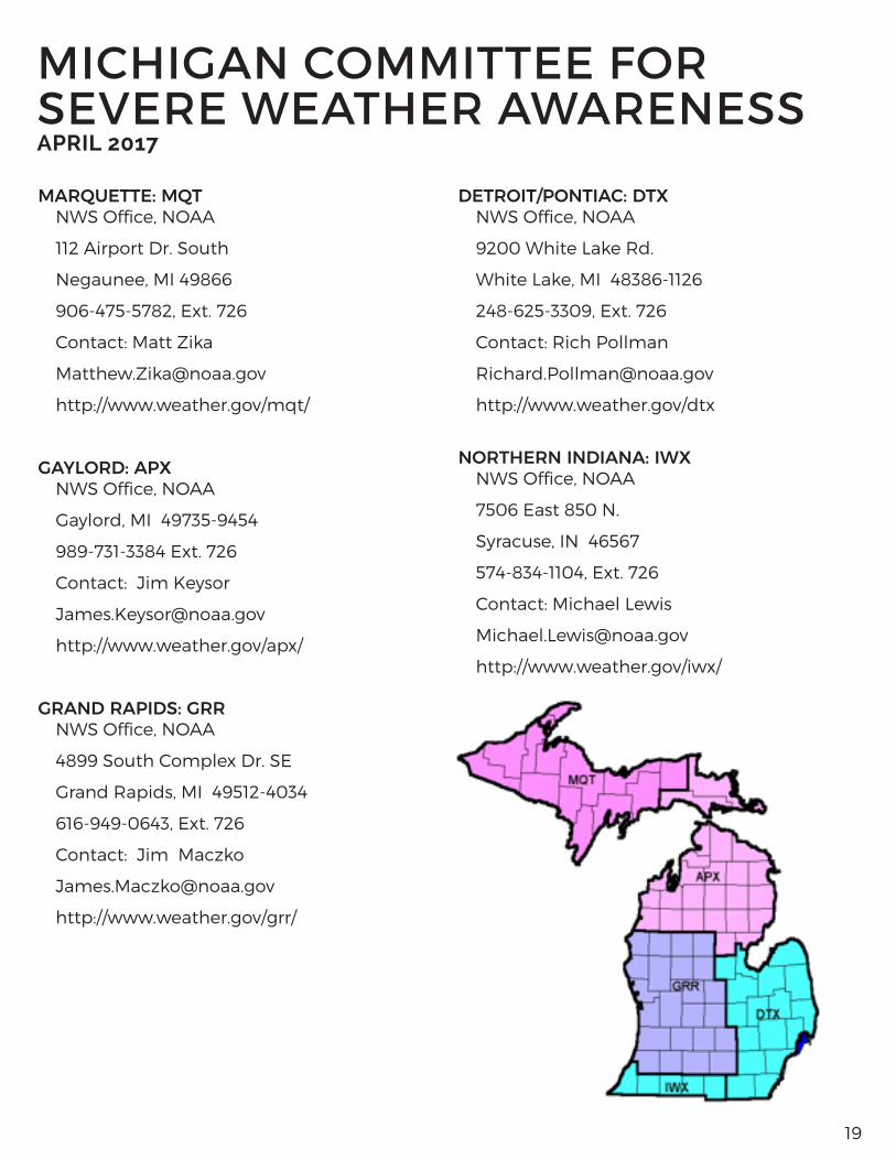
MARQUETTE: MQT NWS Office, NOAA
112 Airport Dr. South
Negaunee, MI 49866
906-475-5782, Ext. 726
Contact: Matt Zika
http://www.weather.gov/mqt/
GAYLORD: APXNWS Office, NOAA
Gaylord, MI 49735-9454
989-731-3384 Ext. 726
Contact: Jim Keysor
http://www.weather.gov/apx/
GRAND RAPIDS: GRRNWS Office, NOAA
4899 South Complex Dr. SE
Grand Rapids, MI 49512-4034
616-949-0643, Ext. 726
Contact: Jim Maczko
http://www.weather.gov/grr/
DETROIT/PONTIAC: DTX NWS Office, NOAA
9200 White Lake Rd.
White Lake, MI 48386-1126
248-625-3309, Ext. 726
Contact: Rich Pollman
http://www.weather.gov/dtx
NORTHERN INDIANA: IWX NWS Office, NOAA
7506 East 850 N.
Syracuse, IN 46567
574-834-1104, Ext. 726
Contact: Michael Lewis
http://www.weather.gov/iwx/
MICHIGAN COMMITTEE FOR SEVERE WEATHER AWARENESSAPRIL 2017