Embed Size (px)
Citation preview
2005 Core Knowledge® National Conference, Geography Alive, 1st Grade
1
Geography Alive! Grade Level or Special Area: 1st Grade Geography Written by: Shannon Shelton and Jodene Muñiz, Cesar Chavez Academy Cesar Chavez Academy, Pueblo, CO Length of Unit: Eight lessons, 50 minute segments I. ABSTRACT
A. This unit provides first grade students an opportunity to learn, or review, the location of the Earth’s seven continents, the four major oceans, cardinal directions of North, South, West and East, and map symbols and legends; as well as an introduction to geographic terms through activities that target different learning modalities. The title Geography Alive! represents the idea that geography does not just consist of the color-coding of maps. Geography, like all other subjects, should be taught in ways that meet as many different learning styles as possible. This unit suggests instructional techniques for teaching geography to primary aged children using Howard Gardner’s Multiple Intelligences; kinesthetic, mathematical, musical, linguistic, spatial, interpersonal, naturalistic and intrapersonal. Teachers may select only few lessons or may choose to use the entire unit.
II. OVERVIEW
A. Concept Objectives 1. Colorado Geography Standard 1: Students know how to use and construct maps,
globes and other geographic tools to locate and derive information about people, places and environments.
2. Colorado Geography Standard 2: Students know the physical and human characteristics of places, and use this knowledge to define and study regions and their pattern changes.
3. Colorado Reading and Writing Standard 2: Students read and write for a variety of purposes and audiences.
4. Colorado Reading and Writing Standard 3: Students write and speak using conventional grammar, usage, sentence structure, punctuation, capitalization and spelling.
5. Colorado Art Standard 1: Students recognize and use the visual arts as a form of communication.
6. Colorado Art Standard 4: Students relate the visual arts to various historical and cultural traditions.
7. Colorado Music Standard 4: Students will listen to, analyze, evaluate, and describe music.
8. Colorado Music Standard 5: Students will relate music to various historical and cultural traditions.
9. Colorado Science Standard 3: Students will understand the characteristics and structure of living things, the processes of life, and how living things interact with each other and their environment.
10. Colorado Math Standard 3: Students will use data collection and analysis, statistics and probability in problem solving situations and communicate the reasoning used in solving these problems.
B. Content from the Core Knowledge Sequence 1. Maps and globes: what they represent and how they are used (review from
Kindergarten).

2005 Core Knowledge® National Conference, Geography Alive, 1st Grade
2
2. Review seven continents of Asia, Europe, Africa, North America, South America, Antarctica, and Australia.
3. Locate major oceans: Pacific, Atlantic, Indian, and Arctic. 4. Identify personal continent, country, state and city. 5. Locate Canada, United States, Mexico and Central America. 6. Identify Equator, Northern Hemisphere, Southern Hemisphere, North Pole and
South Pole. 7. Learn geographic term: island. 8. Find directions on a map: East, West, North, and South. 9. Understand map keys/legends and symbols. 10. Classification of animals: herbivores, carnivores, and omnivores. 11. Recognize a steady beat. 12. Moving to a beat and moving responsively to music. 13. Create and respond to simple pictorial and bar graphs.
C. Skill Objectives 1. Students will review map and globe uses and representations (review from
Kindergarten.) 2. Students will be introduced to the skill of compare and contrast. 3. Students will locate and identify the seven continents and four major oceans on a
flat world map. 4. Students will be introduced to geographic terms of continent, country, state, city,
and island. 5. Students will be introduced to the three countries in North America; Canada,
United States, Mexico and the location of Central America. 6. Students will be introduced to the Equator, Northern Hemisphere, Southern
Hemisphere, North Pole and South Pole. 7. Students will locate and identify cardinal directions of North, South, West, and
East on a map. 8. Students will identify specific animals that are indigenous to each of the
continents. 9. Students will learn animal classifications of carnivore, herbivore, and omnivore. 10. Students will identify the points on a compass rose. 11. Students will identify classroom cardinal directions. 12. Students will graph animal classification data. 13. Students will write sentences in the geography content area. 14. Students will respond orally to literature based in the geography content area. 15. Students will review the parts of a friendly letter. 16. Students will move and respond to music. 17. Students will analyze and respond to graphs in writing. 18. Students will practice using story element skills.
III. BACKGROUND KNOWLEDGE
A. For Teachers 1. Core Knowledge Foundation. Core knowledge sequence: Content guidelines for
grades K-8, Charlottesville, VA: Core Knowledge Foundation, 1999. 1-890517-20-8.
2. Gardner, H. Frames of Mind: The Theory of Multiple Intelligences (Tenth Anniversary Edition). New York: Basic Books, 1993. 0465025102.
2005 Core Knowledge® National Conference, Geography Alive, 1st Grade
3
3. Hirsch, Jr., E.D. “World History and Geography,” What Your First Grader Needs to Know: Preparing Your Child For a Lifetime of Learning. 0385318413 New York: Delta Books, 1997.
4. “Multiple Intelligences Defined,” The Hummingbird Project [On-line]. Available URL: http://www.rubythroat.org/MultipleIntelligencesDefin.html.
5. “Subject Guides: Education,” National Geographic [On-line]. Available URL: http://www.nationalgeographic.com/education.
6. Benchmark Education Company. Rand McNally Primary Atlas. Skokie, IL: Rand McNally, 2002. 106-50018-6.
7. Wicklander, C. Teaching Guide, Rand McNally Primary Atlas. Skokie, IL: Rand McNally, 2000. 528-50018-T.
B. For Students 1. Introduced to seven continents in Kindergarten. 2. Introduced to similarities and differences of a world map and a globe. 3. Introduced to Earth is made up of land and water.
IV. RESOURCES A. “Compass Rose: A Dance and a Quilt Piece”. Kennedy Center ArtsEdge [On-line].
Available URL: http://www.artsedge.kennedy-center.org. B. “Try This: Compass Points”. National Geographic Kids Magazine Activities and
Experiments. [On-line]. Available URL: http://www.nationalgeographic.com/ngkids/trythis/tryfun2.html.
C. “Geography”. Enchanted Learning. [On-line]. Available at URL: http://www.enchantedlearning.com/geography/misc/
D. “Microsoft ClipArt”. Microsoft Office Online. [On-line] Available URL: http://office.microsoft.com/clipart/default.aspx?lc=en-us.
E. Leedy, L. Blast Off to Earth! A Look at Geography. New York: Holiday House, 1992. 0-8234-1409-4.
F. “Make a Relief Map Jigsaw Puzzle”, National Aeronautics and Space Administration Space Place. [On-line]. Available URL: http://spaceplace.jpl.nasa.gov/en/kids/srtm_make1.shtml.
G. “Creating an Edible Map”. CanTeach: Social Studies: Environment. [On-Line] Available at URL: http://www.canteach.ca/elementary/wenviron1.html.
H. “CopyCat”. National Geographic Kids. [On-Line]. Available at URL: http://www.nationalgeographic.com/ngkids/games/games_main.html.
I. “GeoSpy”. National Geographic Kids. [On-Line]. Available at URL: “CopyCat”. National Geographic Kids. [On-Line]. Available at URL: http://www.nationalgeographic.com/ngkids/games/games_main.html.
V. LESSONS
Lesson One: Our Orange Earth! (Interpersonal) A. Daily Objectives
1. Concept Objective(s) a. Colorado Geography Standard 1: Students know how to use and
construct maps, globes and other geographic tools to locate and derive information about people, places and environments.
b. Colorado Reading and Writing Standard 3: Students write and speak using conventional grammar, usage, sentence structure, punctuation, capitalization and spelling.

2005 Core Knowledge® National Conference, Geography Alive, 1st Grade
4
2. Lesson Content a. Maps and globes: what they represent and how they are used (review
from Kindergarten). b. Identify Equator, Northern Hemisphere, Southern Hemisphere, North
Pole and South Pole. 3. Skill Objective(s)
a. Students will review map and globe uses and representations (review from Kindergarten.)
b. Students will be introduced to the skill of compare and contrast. c. Students will be introduced to the equator, Northern Hemisphere,
Southern Hemisphere, North Pole and South Pole. d. Students will write sentences in the geography content area.
B. Materials 1. One orange 2. Paring knife (to only be handled by teacher – keep stored away from students) 3. Permanent marker (to only be handled by teacher – keep stored away from
students) 4. Small piece of dark colored string or yarn 5. World globe 6. World continent map
C. Key Vocabulary 1. Map – A map is a picture with symbols to show places on Earth. 2. Globe – A globe is a spherical model of the Earth. 3. Compare – Compare means to describe how two or more things are the same. 4. Contrast – Contrast means to describe how two or more things are different. 5. Equator – The equator is the imaginary line that divides the Earth into two
hemispheres. 6. Hemisphere – A hemisphere is a half portion of a sphere.
D. Procedures/Activities 1. Before lesson, use a permanent marker to draw rough estimations of continents
on the surface of the orange. 2. To begin lesson, review content covered in Kindergarten. Show students a globe.
Ask students to popcorn out facts they know about a globe: it is a sphere, it spins, it is three dimensional, it shows land on the earth, it shows water on the earth, it is color-coded, it shows where specific areas are, give word definition, etc.
3. Show students a world map. Ask students to popcorn out facts they know about a map: it is flat, it shows land on earth, it shows water on earth it is color-coded, it shows where specific areas are, give word definition, etc.
4. Ask content questions to review background knowledge such as: Why do we see different colors on a globe and on a map? (Shows land boundaries) What are the large land masses called? (Continents) Why are maps and globes helpful tools? (Maps and globes show where specific land and water is located. Maps show details of smaller areas – such as how to get from one state to another or how to find a specific street in a town). Have you or your family ever used a map? (Families use maps when going on a trip).
5. Pose the question of which world representation, a map or a globe, shows the earth in a more exact form. Students should respond the globe does. Then ask, “But can we easily take a globe everywhere we go? Can we put a globe in our
2005 Core Knowledge® National Conference, Geography Alive, 1st Grade
5
pocket, backpack or glove compartment?” Students should reply that it would be difficult to take a globe everywhere we go. Then explain to students that since it is difficult to carry around a globe as well as find small areas, maps are used more often. A map is the surface of a globe flattened out.
6. Show students the orange with the continents on it and explain that the orange is like a globe. “To make a map the surface of the globe is taken off and flattened out.”
7. Using the knife, make a few vertical rounded slits in the rind. Carefully, peel off the rind, making sure to keep it all in one piece.
8. Once removed, flatten out the rind and demonstrate that the continents have not moved, but they are represented on a flat surface that is easier to handle.
9. Make a special note that on the globe, North America and Asia are located next to each other. On a map, they are shown on opposite sides – when going over continents in the next lessons, remind students that Asia wraps around to meet North America even though it doesn’t look like it.
10. Using the peeled orange, show students what the equator, North and South hemispheres are.
11. Explain, “We have pretended that this orange is a globe. I am going to use a string to make a horizontal line all the way around the globe. This line is called the Equator.”
12. Using a piece of string, make a horizontal line around the orange to show students the location of the Equator.
13. Explain, “The Equator is an imaginary line that marks the middle of the Earth and divides it into halves. Areas near the Equator are very warm. Turn toward a partner and tell them what the Equator is.”
14. Explain, “We can also split the globe into halves along the Equator.” 15. Cut the orange horizontally to create two hemispheres. 16. Explain, “We now have two halves of the globe or hemispheres. The word
hemisphere means a half of a sphere. The top hemisphere is called the Northern Hemisphere. The North Pole is located in the Northern Hemisphere. The bottom hemisphere is called the Southern Hemisphere. The South Pole is located in the Southern Hemisphere.”
E. Assessment/Evaluation 1. To close the lesson, have students pair up with a partner and discuss two things
they know about a map, a globe, Equator or hemisphere. The teacher should circulate around the room listening to answers.
2. To asses individually, have students write one or two sentences about what they learned and then draw a picture of a globe or map (these can be added to continent books you might make). To be proficient, the child should have at least one sentence with a capital, period and one fact. To be advanced, the child should have two sentences with a capital, period and one fact.
3. To assess as a class and to teach the skill compare and contrast, draw a Venn diagram (two intertwined circles) (See Appendix A) and label one side ‘globe’, the other side ‘map’, and the middle football shape ‘both’ on the board. Explain to students that today they compared and contrasted a map and a globe. Define compare. Define contrast. Explain that the graphic organizer on the board will be used to show in words the map and globe comparisons and contrasts the class discussed. Ask students to popcorn out what is unique to a globe, what is unique to a map, and what characteristics both share. Note answers in correct areas.

2005 Core Knowledge® National Conference, Geography Alive, 1st Grade
6
Lesson Two: Living Continents! (Kinesthetic) A. Daily Objectives
1. Concept Objective(s) a. Colorado Geography Standard 1: Students know how to use and
construct maps, globes and other geographic tools to locate and derive information about people, places and environments.
b. Colorado Geography Standard 2: Students know the physical and human characteristics of places, and use this knowledge to define and study regions and their pattern changes.
2. Lesson Content a. Review seven continents of Asia, Europe, Africa, North America, South
America, Antarctica, and Australia. b. Identify major oceans: Pacific, Atlantic, Indian, and Arctic. c. Identify personal continent, country, state and city. d. Lean geographic term; island. e. Locate Canada, United States, Mexico and Central America.
3. Skill Objective(s) a. Students will locate and identify the seven continents and four oceans on
a flat world map. b. Students will be introduced to geographic terms of continent, country,
state, city, and island. c. Students will be introduced to the three countries in North America;
Canada, United States, Mexico and the location of Central America.
B. Materials
1. Large 6’x10’ blue classroom carpet (if possible, if not just large area in front of class room)
2. Large world map in front of classroom 3. Seven students to volunteer to serve as actors for lesson 4. Seven pre-made signs with the name of one continent on each one. 5. Copy of Continent and Ocean Assessment Check Off Grid (Appendix B)
C. Key Vocabulary 1. Continent – A continent is a large land area on the Earth. 2. Ocean – An ocean is a large body of salt water that surrounds a continent 3. Island – An island is a piece of land that is surrounded by water.
D. Procedures/Activities 1. To open lesson, review ideas discussed in previous lesson. Ask students to
popcorn out what they learned regarding maps, globes, uses for maps and globes, land, and water.
2. Explain to students that today they will review the names and locations of the continents and oceans in a way that will help them remember easier.
3. Using a large blue carpet or area, set the stage that the carpet is the world covered with water, which we call oceans. Explain “Oceans are large bodies of salt water that surround the continents. The Earth is mainly covered in water; however, we can only drink certain types of water. Ocean water cannot be drunk because it contains salt. We can only drink water that comes from fresh water sources such as lakes and rivers, which do not contain salt. Water is cleaned and pumped into
2005 Core Knowledge® National Conference, Geography Alive, 1st Grade
7
our homes and community buildings. There are four major oceans: the Pacific, the Atlantic, the Indian, and the Arctic.”
4. Direct the students’ attention to the map at the front of the classroom. Note that the large areas of blue are oceans; the smaller areas of blue are lakes and rivers. At this time, you may briefly show where each of the oceans are located. Ask, “How many oceans are there?” “What are the oceans names?”
5. Explain to the class that there are seven continents. “A continent is a large area of land.” Ask, “How many continents are there?”
6. Call one student up to the front and have him or her stand in the upper corner of the carpet.
7. Tell the class that this child is North America. Give the student the sign titled ‘North America.’ Have the class greet North America. Ask, “Does anyone know why this continent is important to us?” (We live on this continent.) Have them repeat the name North America.
8. Explain, “In North America, we live in the country of the United States. The United States is located here on the map. Within the United States there are individual states. Our state is named Colorado. We live on the continent of North America, in the country of the United States, and in the state of Colorado. In the state of Colorado there are many cities. The name of our city is Pueblo.”
9. Note: The terms country, state, city, and specific names are only mentioned in this lesson so as not to overload students with geographic terms and names which may be confusing. Other lessons and assessments will need to be conducted to ensure students understand those concepts.
10. Call a second child up, have him or her stand in front of North America, and ask them to hold hands.
11. Tell the class that this child is South America. Give the student the sign titled ‘South America.’ Have the class greet South America. Explain, “South America is our neighboring continent.” Ask, “Do you see the two continents are holding hands? The reason they are is because these two continents are connected by a skinny piece of land called Central America.” Have them repeat the names of continents as you point. “This is North America, South America and Central America. Central America is NOT a continent. It is just the skinny piece of land that connects the two.” Ask, “How many continents have we discussed? If there are seven, how many more do we need to discuss?”
12. Call a third child up (A BOY who is not easily embarrassed) and have him stand to the left of North America.
13. Explain this is Europe. Have students greet Europe. Give the student the sign titled ‘Europe.’ Ask, “What is this continent named?” Once again, go through the procession of naming all continents placed so far on the carpet. Also, go through the names of the oceans, you will show placement later.
14. Call a fourth child up (A GIRL who is not easily embarrassed) and have her stand to the left of Europe.
15. Explain that this is Asia. Give the student the sign titled ‘Asia.’ Explain, “Asia is the largest of all the continents. Europe and Asia are connected.” Have students hook arms. Explain “An easy way to remember this is that they are pretending (you will want to stress PRETENDING) to be married.” (Yes, this brings out giggles for several minutes – but it works). “When two people get married they become one unit – just like Europe and Asia. The only thing that separates them is a mountain range – this stands as the border between the two. These mountains are called the Ural (yoor’ul) Mountains. They are connected forever.”
2005 Core Knowledge® National Conference, Geography Alive, 1st Grade
8
16. Once again, ask the class continents names, Central America, and ocean names. Also, ask, “Which two continents pretend to be married? What mountain range separates Europe and Asia and serves as a border? Which is largest continent?”
17. Call a fifth child up and have him or her stand directly in front of Europe. Give the student the sign titled ‘Africa’. Explain, “This is Africa.” Have the class greet Africa. “Africa is a large, dry and hot continent. It has zebras and giraffes running around on it.” (If student is willing have him or her pantomime wiping sweat from their brow – the more you can act out the better the students will retain the information.)
18. Again, review the names and information discussed so far in the lesson. 19. Call a sixth student up (one that likes to be a bit wild now and then). Have him
or her stand below and to the right of Africa. Try to place so the student looks somewhat separated from the group. Explain, “This is Crocodile Hunter!” (The students will look confused.) “Crocodile Hunter likes to wrestle crocs! He/She is crazy and needs to be way down there by himself/herself! Crocodile Hunter’s real name is Australia. Australia is the smallest continent.” (Some kids will now make the connection of the Australian Crocodile Hunter Steve Irwin on the Animal Planet station.) Have the class greet Australia by saying “G’Day!” Ask, “Which continent is named Crocodile Hunter? What continent is the largest? What continent is the smallest?”
20. Explain, “Australia is also an island. An island is a piece of land that is surrounded by water.”
21. Call a seventh student up. Have him or her stand at the very front center of the carpet. Explain, “This is Penguin Land! Penguin Land is located at the very bottom of the globe, which is called the South Pole.” Have child lay down flat on his or her back parallel with the edge of the carpet. “Penguin Land’s real name is Antarctica. Antarctica is very cold and frozen, the perfect place for penguins to live. Let’s now take a poll. Those of you who think polar bears eat penguins put your thumbs up, those who do not put your thumbs down. Good guesses! It is impossible for polar bears to eat penguins because penguins live at the South Pole in Antarctica in the Southern Hemisphere, and polar bears live with Santa Clause at the North Pole, in the Northern Hemisphere.” You may illustrate this on an actual globe. Animals will be discussed later when students study animals indigenous to specific continents.
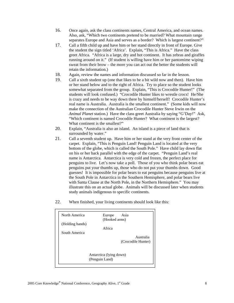
22. When finished, your living continents should look like this:
North America Europe Asia (Hooked arms) (Holding hands)
Africa South America Australia (Crocodile Hunter) Antarctica (lying down) (Penguin Land)

2005 Core Knowledge® National Conference, Geography Alive, 1st Grade
9
One final time, go through all the names of the continents. Ask review globe, map, and continent questions. 23. You can now point out among the living continents where each of the oceans are
located in relation to the continents. Explain, “The Earth has four major oceans named Atlantic, Pacific, Indian and Arctic. The Atlantic and Pacific are east and west coasts of North America. The Atlantic is shaped like a letter. See how it curves like the letter ‘s’. It is on the east coast of North America and on the east coast the United States. The Pacific is named for “peaceful waters, and is the largest ocean. It is located on the west coast of North America and on the west coast of the United States. Since these two oceans border our country it is important that we know where they are located. The Pacific is on the left side of the map, the Atlantic is on the right side of the map. If you take the first two letters of each ocean and put them together in order from left to right it says PA. The PA is the system that our principal announces the morning announcements over. So think about a PA system and you will be able to remember which ocean is on which side of North America. In our Living Continents, the Pacific is located here (show there and on the map) and the Atlantic is located here (show there and on the map.) The Artic Ocean is located at the top of the globe and surrounds the North Pole where the polar bears and Santa live. It is cold and icy just like Antarctica, but it is at the top in the Northern Hemisphere, not the bottom like Antarctica. The Arctic Ocean is here (show there and on map). The last major ocean is the Indian Ocean. The Indian is located at the bottom of Asia near the country to India, which is how it got its name. It is located here (show there and on map.)
E. Assessment/Evaluation 1. To close the lesson, have students turn to a partner and tell the names of the
seven continents and four oceans they learned today. 2. After children have had enough practice with continent and ocean locations, use
one of the following assessments to check for understanding. These ideas can be used on an ongoing basis to re-evaluate the students’ retention of information throughout the school year. Use the Continent and Ocean Assessment Check Off Grid (Appendix B) to track performance. a. For the formal assessment, Carson Delosa publishes a jumbo sized
(15”x11”) pad of blank world maps (#CD3093 at http: www.carsondelosa.com). There are 30 maps in each pad for about $5. There are several ways you can use these jumbo maps to assess your students’ understanding of the location of the continents and oceans. . To be proficient, the child must identify 8 out of the 11 locations, to be partially proficient, the child must identify 7 out of the 11 locations. Six and below is unsatisfactory and 9 and above is advanced. Make sure to save the maps to “show off” to parents! Below are suggestions for the assessment: 1. Using Microsoft Word “Tools”, “Envelopes and Labels”,
“Labels”, and then click on the label picture and choose Avery Return Address 5267. You can then type in the names of each continent and allow the kids to stick the label on the appropriate continent on the jumbo map instead of writing it out. Using this kinesthetic method relieves the stress of writing in a small area and spelling for very young children.
2. Using the jumbo maps, instruct students to “Color North America orange…” “Color South America green…” etc. Using
2005 Core Knowledge® National Conference, Geography Alive, 1st Grade
10
this spatial method helps children review color words while assessing. To practice number words, use the same method, except instruct students “Write the number three on North America…” “Write the number seven on South America…” etc. To save the maps for later use, laminate and allow the kids to use Vis-à-vis markers, check and then wash clean for a follow up or quarterly assessment. You can also laminate color coded maps for students to keep and use as a desk reference.
3. Using the jumbo maps, use a laminated map and individually call students over to your desk. Instruct the student, “Point to North America.” “Point to Africa” etc.
b. When students have demonstrated they know the location of the continents after several successful assessments, reward each child with a completion certificate. You can also have a continent party! Use a flavored blue type of drink for Ocean Water, and packaged brownies with frosting and nuts on top for Continent Crusts (looks like land.)
Lesson Three: Quilting Directions! (Spatial) A. Daily Objectives
1. Concept Objective(s) a. Colorado Geography Standard 1: Students know how to use and
construct maps, globes and other geographic tools to locate and derive information about people, places and environments.
b. Colorado Art Standard 1: Students recognize and use the visual arts as a form of communication.
c. Colorado Art Standard 4: Students relate the visual arts to various historical and cultural traditions.
2. Lesson Content a. Find directions on a map: east, west, north, and south. b. Understand map keys/legends and symbols.
3. Skill Objective(s) a. Students will locate and identify cardinal directions of north, south, west,
and east on a map. b. Students will identify the points on a compass rose. c. Students will identify classroom cardinal directions.
B. Materials 1. Compass (if possible) 2. One pre-printed signs of each – “North”, “South”, “West”, “East” 3. One 5” square of white construction paper for each child 4. Two 3” square of construction paper for each child (any color) 5. Glue stick for each child 6. Magic markers for each child 7. Color print out of compass rose picture. This can be found at
http://www.enchantedlearning.com/geography/misc/. 8. Map of continents with a compass rose 9. One quilt (if possible)
C. Key Vocabulary 1. Compass rose – A compass rose is a map symbol that shows north, south, west,
and east.

2005 Core Knowledge® National Conference, Geography Alive, 1st Grade
11
2. Cardinal directions – Cardinal directions are the directions of north, south, west and east and noted on maps be a compass rose.
3. Compass – A compass is a tool with an arrow that always points north. 4. Quilt square – A quilt square is a stitched piece of fabric that is sewn to other
fabric squares to form a quilt. D. Procedures/Activities
1. Define cardinal directions to the class. 2. Explain, “Directions help us find where we are going. Without directions, people
would not be able to explain where they were or how to get to someplace else. We also would not be able to find information on a map or globe.”
3. Explain, “Even our classroom has directions.” At this point, hang up the North, South, West, and East signs in the appropriate places in the classroom. Tell students that if you walk this direction in the classroom, (towards the window, table or other landmark) you are going in the direction called North, which is seen on a map as going up (towards the North Pole where Santa and the Polar Bears live.) Continue to tell students the correction directions in regard to the classroom. Also, tell students that South is down on a map or globe, West is to the left on a map, and East is to the right. You can use the old acronyms of Never Eat Shredded Wheat, West and East spell the word ‘we’ etc.
4. Explain, “On a map or globe, the symbol that shows us each direction is called a compass rose. This word comes from the word ‘compass.’
5. Show the compass rose symbol on the continent map – point out how the rose notes each of the correct directions on the map. Show the printout of a compass rose.
6. Show students a compass. Explain, “A compass is a tool to help you understand which way is which when you don’t have any landmarks. A compass will only point North. It has a magnet inside of it that always lines up with the North and South Poles. It is very useful if you get lost someplace like a forest. If you know your camp is North, you can just follow the compass arrow until you get back to camp.”
7. Explain, “Today you will make your own compass rose in the form of a quilt square. Throughout time, people have created quilts (show if you have one) by making identical or different patterns on squares and then sewing the squares together. Many times quilts were created to tell stories. Today the quilt squares will tell the story of directions.”
8. Give each child one 5” square and two 3” squares. Have them set the 5” square squarely on the desk.
9. Instruct the students to glue one of the 3” squares onto the larger square so it looks like a diamond.
10. Next, glue the other 3” square squarely on top of the diamond shape. The two 3” squares should form eight points – like the eight points on a compass rose.
11. Assist students with labeling the North, South, West and East points on the rose. Explain that at times you can’t just move North, South, West or East. “Sometimes you need to move in two directions at the same time, such as Northeast, Northwest, Southwest, or Southeast. The straight points, up, down, left and right point in straight directions. The diagonal points show Northeast, Northwest, Southwest and Southeast.”
12. Allow students to decorate the middle of their compass rose like the one in the picture. Remind them not to cover up the direction labels on the rose.

2005 Core Knowledge® National Conference, Geography Alive, 1st Grade
12
E. Assessment/Evaluation a. To close the lesson with students, review the names of each direction and
where each direction is in the classroom. b. As an informal assessment, the teacher should observe if child has
labeled each of the compass points correctly. A formal assessment will be done in a later lesson.
c. Display the quilt blocks together to form a geography quilt.
Lesson Four: Stand in the Place Where We Live! (Musical) A. Daily Objectives
1. Concept Objective(s) a. Colorado Music Standard 4: Students will listen to, analyze, evaluate,
and describe music. b. Colorado Music Standard 5: Students will relate music to various
historical and cultural traditions. 2. Lesson Content
a. Find directions on a map: East, West, North, and South. b. Recognize a steady beat. c. Moving to a beat and moving responsively to music.
3. Skill Objective(s) a. Students will identify classroom cardinal directions. b. Students will move and respond to music.
B. Materials 1. Audio recording of Stand by R.E.M. 2. One copy of Stand by R.E.M. song lyrics for each student (see Appendix C)
C. Key Vocabulary 1. Lyrics – Lyrics are the words that are sung in a song. 2. Verse – A verse is a stanza/paragraph in a song.
D. Procedures/Activities 1. Instruct your students, “Tell your partner the four different cardinal directions we
learned yesterday.” 2. Explain, “Just like our quilt squares from yesterday, we are going to tell the story
of directions, but instead of doing it through art, we are going to tell the story through music and dance. The song we are going to dance to is called Stand, by a group called R.E.M, which I listened to while I was in college. It tells the story of people going in different directions in life. Here is how the song and dance steps go.”
3. Explain, “We are going to move to the music’s beat and lyrics. 4. Show the students the dance moves they do for each of the lyrics in the song. 5. Give students a copy of the lyrics (some won’t be able to read them – but they
will get the idea) and have them go through the steps and lyrics without the music. Explain, “The words on this page are called lyrics. Lyrics are the words sung in a song. On the lyric page you will see the word verse. A verse is like a paragraph in a story or a stanza in a poem.”
6. Once the students know the lyrics and movements turn on the music and let them dance!
E. Assessment/Evaluation

2005 Core Knowledge® National Conference, Geography Alive, 1st Grade
13
1. To close the lesson, have students quiz each other on the cardinal directions in the classroom, i.e.: “Which direction is North in our classroom? Etc.
2. No formal assessment is needed. This lesson familiarizes students with cardinal directions in their classroom.
Lesson Five: Corky Directions! (Intrapersonal) A. Daily Objectives
a. Colorado Geography Standard 1: Students know how to use and construct maps, globes and other geographic tools to locate and derive information about people, places and environments.
b. Colorado Reading and Writing Standard 3: Students write and speak using conventional grammar, usage, sentence structure, punctuation, capitalization and spelling.
2. Lesson Content a. Find directions on a map: East, West, North, and South. b. Understand map keys/legends and symbols.
3. Skill Objective(s) a. Students will identify classroom cardinal directions. b. Students will write sentences in the geography content area. c. Students will locate and identify cardinal directions of North, South,
West, and East on a map. d. Students will identify the points on a compass rose.
B. Materials 1. Clear glass 2. Water 3. Bottle cork 4. Sharp knife 5. Magnet 6. Large sewing needle 7. One copy of compass rose print out for each child from:
http://www.enchantedlearning.com/geography/label/labelcontinents.shtml C. Key Vocabulary
1. Magnet – A magnet is an object surrounded by a magnetic field that attracts iron or steel.
D. Procedures/Activities 1. Review the cardinal directions in the classroom again with children. Review
what a compass rose is used for and where it is found, and how directions are noted on a compass rose. Review what type of tool a compass is and how it works and what it shows.
2. Explain, “We have learned in our previous lessons that a compass is a tool that consistently shows the direction of North. We have also learned that a compass can help find their way when they are lost. Today, we will make our own class compass and test it to see if it points North.
3. Fill a clear glass with water. 4. Cut a ¼” slice from the end of a bottle cork and float the slice in the water. 5. Explain, “A compass has a magnet inside of it which forces the pointer to line up
with the Earth’s North and South poles. We can make our own magnetized pointer and then test it to see if it will point North.
6. Show students how you magnetize the needle by rubbing it over the magnet in the same direction about 50 times.

2005 Core Knowledge® National Conference, Geography Alive, 1st Grade
14
7. Place the needle pointing North on top of the cork slice floating on the water. 8. The needle should slowly turn and point in the same direction; no matter how
many times the glass is turned in other directions. 9. Explain, “We know that a compass always points North. I want to now pretend
that you have a magic compass that not only points North, but points in any direction you would like it to and can magically take you there. You can tell your compass to point to the direction of your favorite place to read, and it will magically transport you to your reading spot. If you tell it to point to a quiet mountain stream, it will take you to a quiet mountain stream.”
10. Explain, “I want you to close your eyes and imagine that your compass is taking you on a journey any place you would like to go. This is your journey and you can go anyplace you wish. Picture the place in your mind. Think about what the place looks like, what you hear, what you smell, the actions you are doing. Also, think about why you enjoy this place. Why does this place bring you joy?”
11. Explain, “Now, I am going to give you a blank piece of paper and I want you to draw a picture of the place your magic compass will take you and write a sentence about where you are. Remember, you can travel anywhere you would like.”
E. Assessment/Evaluation 1. To close the lesson have students popcorn out their ideas about the places they
traveled to and why. 2. Quickly review cardinal directions on a compass rose again and give each child a
copy of the compass rose printout from: http://www.enchantedlearning.com/geography/printouts/compassrose.shtml.
3. Have students fill out points on the compass. To be proficient, the child should have labeled (North – which is already given to them), South, West and East on the compass rose. To be advanced, the child should have labeled at least two of the following: Northwest, Northeast, Southwest or Southeast.
Lesson Six: Creature Continents! (Naturalistic – Day 1) A. Daily Objectives
1. Concept Objective(s) a. Colorado Science Standard 3: Students will understand the
characteristics and structure of living things, the processes of life, and how living things interact with each other and their environment.
b. Colorado Math Standard 3: Students will use data collection and analysis, statistics and probability in problem solving situations and communicate the reasoning used in solving these problems.
c. Colorado Geography Standard 2: Students know the physical and human characteristics of places, and use this knowledge to define and study regions and their pattern changes.
d. Colorado Reading and Writing Standard 3: Students write and speak using conventional grammar, usage, sentence structure, punctuation, capitalization and spelling.
2. Lesson Content a. Review seven continents of Asia, Europe, Africa, North America, South
America, Antarctica, and Australia. b. Students will be introduced to animal classifications of carnivore,
herbivore, and omnivore.

2005 Core Knowledge® National Conference, Geography Alive, 1st Grade
15
c. Students will be introduced to the three countries in North America; Canada, United States.
3. Skill Objective(s)
a. Students will be introduced to animal classifications of carnivore, herbivore, and omnivore.
b. Students will classify indigenous animals on a continent map. c. Students will be introduced to the three countries in North America;
Canada, United States. d. Students will graph animal classification data. e. Students will analyze and respond to graphs in writing. f. Students will write sentences in the geography content area.
B. Materials 1. One thumbnail picture of each of the following animals for each child from:
http://office.microsoft.com/clipart/default.aspx?lc=en-us, panda, reindeer, giraffe, koala bear, buffalo, llama, penguin
2. Glue stick for each child 3. Enlarged blank world map from:
http://www.enchantedlearning.com/geography/label/labelcontinents.shtml C. Key Vocabulary
1. Indigenous – Indigenous means an animal originated naturally in a specific area. 2. Captivity – Captivity means to be confined to a specific area. 3. Bamboo – Bamboo is a tropical grass that has a hard hollow stem that can be
used as tools or building material. 4. Eucalyptus – Eucalyptus is a tall gum tree native to Australia 5. Herbivore – An herbivore is an animal that eats plants. 6. Carnivore – A carnivore is an animal that eats meat. 7. Omnivore – An omnivore is an animal that eats both plants and meat
D. Procedures/Activities Day 1 1. Explain, “We have been reviewing the location of the seven continents and four
oceans for the past several days. Turn to a partner and say the names of the seven continents and four oceans.”
2. After students review those names explain, “Today, we will learn which animals are indigenous to each of the continents. Indigenous means an animal that originated naturally in a specific area.
3. We will also discuss whether the animal is an herbivore, a carnivore, or an omnivore. An herbivore is an animal that eats plants. A carnivore is an animal that eats meat. An omnivore is an animal that eats both plants and meat.
4. Give each child scissors, glue stick, animal pictures and a copy of the continent map. Explain, “Put your finger on the continent of North America. North America is the continent we live on. The animal that is indigenous to North America is the buffalo. At one time, the buffalo roamed in vast herds across the plains of North America. Cut out the picture of the buffalo, color it and paste it on North America. A buffalo is an herbivore; it only eats plants.” Some students may have trouble identifying the buffalo – assist if needed.
5. Explain, “North America has three countries in it. Canada is in the northern portion of the continent near the North Pole.” Show this on the map. “We know where the United States is.” Show this on the map. “Mexico is located in the

2005 Core Knowledge® National Conference, Geography Alive, 1st Grade
16
southern portion of the continent near Central America where it is very warm.” Show this on the map.
6. Note: Canada and Mexico are only mentioned in this lesson to avoid confusion with continent names. Other lessons and assessments need to be used to ensure students’ understanding of these concepts.
7. Explain, “Put your finger on the continent of South America. South America is our neighboring continent. The animal that is indigenous to South America is the llama. The llama is used to transport items by people who live in the Andes Mountains. Llama wool is also used to make warm sweaters for people. Cut out the picture of the llama, color it and paste it on South America. The llama is also an herbivore; it only eats plants.” Some students may have trouble identifying the llama – assist if needed.
8. Explain, Put your finger on the continent of Europe. Europe is connected to Asia. The animal that is indigenous to Europe is the reindeer. The reindeer lives in the Northern portion of the continent near Norway. We also know that reindeer live at the North Pole with Santa Claus; however, the North Pole is not part of Europe. Cut out the picture of the reindeer, color it and paste in on Europe. The reindeer is also an herbivore; it eats only plants.” Some students may have trouble identifying the reindeer – assist if needed.
9. Explain, “Put your finger on the continent of Asia. Asia is located next to Europe and is the largest continent. The animal that is indigenous to Asia is the panda. To help protect pandas, many live in captivity. The panda loves to eat bamboo. The panda only eats plants like bamboo so it is an herbivore. Cut out the picture of the panda, color it and paste in on Asia.”
10. Explain, “Put your finger on the continent of Africa. Africa is located south of Europe and is a very dry hot continent. The animal that is indigenous to Africa is the zebra. Zebras look like a striped horse. Cut out the picture of the zebra and paste it on Africa. Zebras are herbivores.”
11. Explain, “Put your finger on the continent of Australia. Australia is the smallest continent. The animal that is indigenous to Australia is the koala bear. The koala bear eats the leaves from the Australian eucalyptus tree so it is an herbivore as well. Cut out the picture of the koala bear, color it and paste it on Australia. Some students may have trouble identifying the koala bear – assist if needed.
12. Explain, “Put your finger on the continent of Antarctica. Antarctica is located at the South Pole and is very cold and icy. Antarctica’s climate is the perfect habitat for the penguin. And remember, polar bears don’t eat penguins; these two animals live at opposite poles. Cut out the picture of the penguin, and paste it on Antarctica. Penguins eat both plants and meat; it is an omnivore.”
13. Explain, “Tomorrow we will do another activity using the animals that are indigenous to the seven continents and our graphing skills
E. Assessment/Evaluation 1. To close the lesson, have students describe the animals that are indigenous to the
continents. 2. Assessment will be done in the following lesson.
Lesson Seven: Creature Continents! (Mathematical – Day 2) A. Daily Objectives
3. Concept Objective(s)

2005 Core Knowledge® National Conference, Geography Alive, 1st Grade
17
a. Colorado Science Standard 3: Students will understand the characteristics and structure of living things, the processes of life, and how living things interact with each other and their environment.
b. Colorado Math Standard 3: Students will use data collection and analysis, statistics and probability in problem solving situations and communicate the reasoning used in solving these problems.
c. Colorado Reading and Writing Standard 2: Students read and write for a variety of purposes and audiences.
4. Lesson Content a. Review seven continents of Asia, Europe, Africa, North America, South
America, Antarctica, and Australia. b. Students will be introduced to animal classifications of carnivore,
herbivore, and omnivore. c. Create and respond to simple pictorial and bar graphs.
5. Skill Objective(s) a. Students will be introduced to animal classifications of carnivore,
herbivore, and omnivore. b. Students will classify indigenous animals on a continent map. c. Students will graph animal classification data. d. Students will analyze and respond to graphs in writing.
B. Materials 1. Each child’s Indigenous animal continent map from last lesson. 2. Pencil for each child 3. Crayons for each child 4. Copy of Animal Classification Graph (Appendix D) for each child. 5. Copy of Creature Continents Assessment Sheet (Appendix E) for each child.
C. Key Vocabulary 1. Data – Data is factual information. 2. Graph – A graph is a diagram used to show information.
D. Procedures/Activities 1. Explain, “Yesterday we reviewed the seven continents and the animals that are
indigenous to each of the continents. We also discussed whether animals were herbivores, omnivores, or carnivores. Turn to a partner and explain in a complete sentence what indigenous means.”
2. Explain, “We are now going to make a graph to discuss the types of indigenous animals we have learned about.” Give each student a copy of the Animal Classification Graph (Appendix D).
3. Ask, “How many of the continent animals are omnivore? How many continent animals are herbivores? How many continent animals are carnivores? Color in the appropriate number of graph boxes to show the classification data. Use the graph data to answer the questions below the graph. Students may work in pairs if teacher chooses.
4. This graph can be used as an assessment. To be advanced, the student must complete the graph correctly and have five or more sentences written with a capital letter, period and correct answer. To be proficient, the student must complete the graph correctly and have four sentences written with a capital letter, period and correct answer. To be partially proficient, the student may have two mistakes on the graph and have three sentences written with a capital letter, period and correct answer. For an unsatisfactory mark, the student has three or

2005 Core Knowledge® National Conference, Geography Alive, 1st Grade
18
more mistakes on the graph and two or less sentences written with a capital letter, period and correct answer.
E. Assessment 1. To close lesson and assess students, give each child a copy of the Creature
Continents Assessment (Appendix E). 2. Read the assessment to students and have them match the continent to the correct
indigenous animal. They may use the continent maps if you choose. For the bonus question, students should choose the letter that notes the correct definition of the word indigenous in regard to animals.
3. To be advanced, the student must match six or more correctly. To be proficient, the student must match 5 correctly. To be partially proficient, the student must match 4 correctly. To receive an unsatisfactory mark, the student matches three or less correctly. The bonus questions may be used to replace an incorrect match.
Lesson Eight: Where In the World Is Earth?! (Linguistic) A. Daily Objectives
1. Concept Objective(s) a. Colorado Reading and Writing Standard 2: Students read and write for a
variety of purposes and audiences. b. Colorado Reading and Writing Standard 3: Students write and speak
using conventional grammar, usage, sentence structure, punctuation, capitalization and spelling.
c. Colorado Geography Standard 1: Students know how to use and construct maps, globes and other geographic tools to locate and derive information about people, places and environments.
d. Colorado Geography Standard 2: Students know the physical and human characteristics of places, and use this knowledge to define and study regions and their pattern changes.
2. Lesson Content a. Maps and globes: what they represent and how they are used (review
from Kindergarten). b. Review seven continents of Asia, Europe, Africa, North America, South
America, Antarctica, and Australia. c. Identify Equator, Northern Hemisphere, Southern Hemisphere, North
Pole and South Pole. 3. Skill Objective(s)
a. Students will write sentences in the geography content area. b. Students will respond orally to literature based in the geography content
area. c. Students will review the parts of a friendly letter. d. Students will be introduced to the Equator, Northern Hemisphere,
Southern Hemisphere, North Pole and South Pole. e. Students will practice using story element skills.
B. Materials 1. Copy of Blast Off To Earth! By Loreen Leedy 2. Copy of Continent postcard for each student (Appendix F) 3. Pencil for each child 4. Crayons for each child
C. Key Vocabulary
2005 Core Knowledge® National Conference, Geography Alive, 1st Grade
19
1. Geography – Geography is the study of the Earth and its land and water features. 2. Map legend – A map legend explains what the different colors or symbols on a
map mean D. Procedures/Activities
1. Instruct students to come to a common read aloud area and to get ready to read a story together.
2. Ask students to turn to the child sitting next to them and name as many of the seven continents or four oceans as they can.
3. Explain, “Today we are going to read a story about continents and directions. The last few days we have heard stories about directions through quilt squares and through songs. Today’s story is the story of continents, but it is being told by a group of aliens that are visiting the planet Earth. The title of this book is Blast Off to Geography. Geography is the study of the Earth and its land and water features. These aliens are studying the geography of Earth and are learning many interesting facts about the seven continents and oceans.”
4. Instruct, “As we read I want you to pay special attention when we come to the page that your favorite continent is on. As I read to you about that continent, I want you to remember at least two of the facts I read to you. You will use the facts to do a writing project later on today.”
5. Show the class the book cover and discuss the author, illustrator and the books cover: What do you think is going to happen in this story? Why do you think the author gave the book that title? Who is the author? Who is the illustrator? What do you notice on the front cover? What is happening?
6. Begin to read the story out loud to students, stopping occasionally to ask the following questions after reading the pages: a. Pages 1-2: What is the setting of this page of the story? Where are the
aliens going? b. Pages 3-4: This page says the Earth is made up of 70% land and 30%
water. What does that mean? Is there more land or more water? Can we prove this statement by looking at the picture?
c. Pages 5-6: Turn to your partner. What type of climate or weather do we find near the North and South poles? Do we know any of the continents located near the North or South Poles? What is the climate or weather like near the equator? Which continents does the equator run through?
d. Pages 7-8: What are the aliens learning about now? Have you learned any of this information yet?
e. Pages 9-10: Turn to your partner. Tell your partner whether we can drink ocean water or not. Why or why not?
f. Pages 11-12: On this map of Asia we see that the map is more than one color. Does anyone know what these new colors mean? To find out, we can look at the map legend. A map legend is small chart that tells you want the different colors and symbols mean on a map. On this map, the different colors tell the different types of land forms found on the continent. Blue means that this land is covered with snow and ice. The darker green means the land is covered with trees. The lighter lime green shows grass. Orange shows desert areas and the small triangles show where mountain ranges are. What types of food are grown in Asia? Can you recall the name of an animal indigenous to this continent from yesterday? Which continent is the largest? Over half of the human beings on Earth live on the continent of Asia.

2005 Core Knowledge® National Conference, Geography Alive, 1st Grade
20
g. Pages 13-14: On this map of Africa do we see any cold tundra areas like there are in Asia? Look at the picture, what type of animals live on this continent? What is the name of the longest river in the world? It is the Nile. We will study this river and the first people in Africa later on this year during our Ancient Egypt studies.
h. Pages 15-16: What three countries are located in North America? Which of these countries do you live on? What new type of land do we find in North America? Use the map legend and the person sitting next to you for help. North America has many different types of land - from ice to deserts. Do you notice the picture of the polar bear? We don’t see any penguins for him to eat near the North Pole. We will also study the ancient ruins shown in Mexico in our next unit.
i. Pages 17-18: On the continent of South America, what types of languages do they speak? Which large mountain range runs through the continent of South America? Which animal is indigenous to this mountain range?
j. Pages 19-20: On the continent of Antarctica, what types of animals live there? Why do you think the map legend missing? Which Pole is found in Antarctica?
k. Pages 21-22: How many mountain ranges do you see in Europe? How do you know? Why do you think the illustrator drew various pictures of people at the top of the page? Which continent is Europe attached to? What mountain range separates the two continents?
l. Pages 23-24: Which is the smallest continent? Using the map legend, turn to your partner and figure out what type of land is mainly found in Australia. Which direction is Australia from the equator? Tell your partner your favorite Australian animal.
m. Pages 27-28: This is a scrap book page from the aliens’ trip to Earth. They photographed several interesting places around the world. Which place would you like to visit if we had our magic compass again?
E. Assessment/Evaluation 1. To close and assess the students individually, give each student a copy of the
postcard found in Appendix F. 2. Explain, “You are now going to pretend you are one of the aliens that just
traveled to Earth. You are sending a postcard to someone back on your home planet. On your postcard, write two new facts you learned about the continent you enjoyed visiting the most. Remember these sentences need to be complete; they need a capital letter, an end mark, and a complete thought. On your postcard you will also sketch the shape of your favorite continent and draw a picture of one of the animals that lives on this continent. When finished, design a stamp from your planet and draw a picture of it where the stamp goes.”
3. Explain, “Also make up a pretend name for yourself and the person you are sending the postcard to. You will also need to make up an address on some other planet to send it to.”
4. To be proficient, the child must write two sentences with a capital, period and one fact. To be partially proficient, the child must write one sentence with a capital, period and one fact. The drawings, address, stamp and names are not assessed.
VI. CULMINATING ACTIVITY (Optional)

2005 Core Knowledge® National Conference, Geography Alive, 1st Grade
21
A. Turn your geography studies into a school wide event by painting or chalking a giant world map on the playground blacktop. Stencils for a giant map project can be purchased at: http://www.gymgeography.com/playground/index.htm. Permanent painted maps can reinforce continent and ocean knowledge throughout the year as children play during recess. You will find children playing the Living Continents game all on their own!
B. To connect further with map legends detailing topography, create a relief map jigsaw puzzle using cardboard, clay and paint. Directions and patterns for this activity can be found at: http://spaceplace.jpl.nasa.gov/en/kids/srtm_make1.shtml. Use the same idea and pattern from the above activity, but create an edible map using dough, icing, and candies to represent topographical areas. Directions and recipe for map dough and can be found at: http://www.canteach.ca/elementary/wenviron1.html.
C. To integrate technology into your unit, allow children to play Continent Copy Cat at: http://www.nationalgeographic.com/ngkids/games/games_main.html. This is a computer generated memory game to help children retain the placement and shape of continents. For a more challenging game, have students play GeoSpy. This game is a fast paced map challenge and can be played at: http://www.nationalgeographic.com/kids/games/index.html.
VII. HANDOUTS/WORKSHEETS
1. Map and Globe Venn Diagram (Appendix A) 2. Continent Assessment Check Off Grid (Appendix B) 3. Stand Lyric Sheet (Appendix C) 4. Animal Classification Graph (Appendix D) 4. Creature Continents Assessment Sheet (Appendix E) 5. Continent Postcard (Appendix F) 6. Animal Classification Graph Answer Key (Appendix G) 7. Creature Continents! Assessment Sheet Key (Appendix H)
VIII. BIBLIOGRAPHY
A. Benchmark Education Company. Rand McNally Primary Atlas. Skokie, IL: Rand McNally, 2002. 106-50018-6.
B. Core Knowledge Foundation. Core knowledge sequence: Content guidelines for grades K-8, Charlottesville, VA: Core Knowledge Foundation, 1999. 1-890517-20-8.
C. “Creating an Edible Map”. CanTeach: Social Studies: Environment. [On-Line] Available at URL: http://www.canteach.ca/elementary/wenviron1.html.
D. “Compass Rose: A Dance and a Quilt Piece.” Kennedy Center ArtsEdge [On-line]. Available URL: http://www.artsedge.kennedy-center.org.
E. “CopyCat”. National Geographic Kids. [On-Line]. Available at URL: http://www.nationalgeographic.com/ngkids/games/games_main.html.
F. Hirsch, Jr., E.D. “World History and Geography,” What Your First Grader Needs to Know: Preparing Your Child For a Lifetime of Learning. 0385318413 New York: Delta Books, 1997.
G. Gardner, H. Frames of Mind: The Theory of Multiple Intelligences (Tenth Anniversary Edition). New York, NY: Basic Books, 1993. 0465025102.
H. “Geography.” Enchanted Learning. [On-line]. Available at URL: http://www.enchantedlearning.com/geography/misc/

2005 Core Knowledge® National Conference, Geography Alive, 1st Grade
22
I. “GeoSpy”. National Geographic Kids. [On-Line]. Available at URL: “CopyCat”. National Geographic Kids. [On-Line]. Available at URL: http://www.nationalgeographic.com/ngkids/games/games_main.html.
J. Leedy, L. Blast Off to Earth! A Look at Geography. New York: Holiday House, 1992. 0-8234-1409-4.
K. “Make a Relief Map Jigsaw Puzzle”, National Aeronautics and Space Administration Space Place. [On-line]. Available URL: http://spaceplace.jpl.nasa.gov/en/kids/srtm_make1.shtml.
L. “Microsoft ClipArt.” Microsoft Office Online. [On-line] Available URL: http://office.microsoft.com/clipart/default.aspx?lc=en-us.
M. “Multiple Intelligences Defined,” The Hummingbird Project [On-line]. Available URL: http://www.rubythroat.org/MultipleIntelligencesDefin.html.
N. “Subject Guides: Education,” National Geographic [On-line]. Available URL: http://www.nationalgeographic.com/education.
O. “Try This: Compass Points”, National Geographic Kids Magazine Activities and Experiments. [On-line]. Available URL: http://www.nationalgeographic.com/ngkids/trythis/tryfun2.html.
P. Wicklander, C. Teaching Guide, Rand McNally Primary Atlas. Skokie, IL: Rand McNally, 2000. 528-50018-T.

2005 Core Knowledge® National Conference, Geography Alive, 1st Grade
23
Appendices
Appendix A Map and Globe Venn Diagram Example
Map
Both
Flat Easy to carry Show
s a flat version of w
here the continents are
Color C
oded Show
s equator Show
s hem
ispheres Show
s continents Show
s oceans
Globe
Sphere H
ard to carry Show
s exactly w
here locations are R
eplica of the Earth

2005 Core Knowledge® National Conference, Geography Alive, 1st Grade
24
Appendix B Continent and Ocean Assessment Check Off Grid
Name Date NA SA E Asia Af Aus Ant Pac Atl Arc Ind % Grade

2005 Core Knowledge® National Conference, Geography Alive, 1st Grade
25
Appendix C Stand Lyric Sheet
☺ Stand by R.E.M☺
Lyrics Dance Directions Chorus Stand in the place where you live, (stand up straight facing east) Now face North, (jump and turn to the North) Think about direction, (point to head with finger) Wonder why we have it now. (shrug your shoulders) Stand in the place where you were, (jump and turn back to the East) Now face West, (jump and turn to the West) Think about the place where you live. (point to head with finger) Wonder why you haven’t before. (shrug shoulders) First Verse If you are confused, (put hands head and shake head) Check with the sun. (point to ceiling) Carry a compass, to help you along. (look at your palm) You feet are going to be on the ground. (march in place) Your head is there to move you around. (march, with both hands on head)
Repeat the Chorus Second Verse Your feet are going to be on the ground. (march in place) Your head is there to move you around. (march, with both hands on head) If wishes were trees, (arm across chest with one hand up) The trees would be falling. (your raised hand falls down) Listen to reason, (cup your hand to your ear) The reason is calling. (move you hand to beckon someone) Repeat the Chorus Third Verse If wishes were trees, (arm across chest with one hand up) The trees would be falling. (your raised hand falls down) Listen to reason, (cup your hand to your ear) Your feet are going to be on the ground. (march in place) Your head is there to move you around. (march with both hands on head) Repeat the Chorus Repeat the Chorus (end repeats 4 times, stop on ‘stand’)

2005 Core Knowledge® National Conference, Geography Alive, 1st Grade
26
Appendix D Animal Classification Graph
Name: ________________________ With your teacher, count the number of herbivores, carnivores and omnivores on your continent map. Enter the number of each on the graph and use the data to answer the questions below. Answer each question in a complete sentence with a capital, period, and Correct answer.
1. How many animals are classified as herbivores?
_________________________________
_________________________________
2. How many animals are classified as carnivores? _____________________________________________________________________________
3. How many animals are classified as omnivores?
______________________________________________________________________________
4. Which classification do most of the animals have? _________________________________________________________________________________ 5. Which classification has the least amount of animals? _________________________________________________________________________________ 6. How many more herbivores are there than omnivores? _________________________________________________________________________________
7
6
5
4
3
2
1
Herbivore Carnivore Omnivore

2005 Core Knowledge® National Conference, Geography Alive, 1st Grade
27
Appendix E
Creature Continents! Assessment Sheet Creature Continents! Name: ______________________________________________________ Match the indigenous animal to the correct continent. Panda South America Koala bear Australia Buffalo Asia Penguin Europe Reindeer North America Zebra Africa Llama Antarctica Bonus Question! Circle the meaning, or definition, of indigenous.
a. Indigenous means animals that live in captivity. b. Indigenous means animals have a tail. c. Indigenous means an animal originated naturally in a specific area.

2005 Core Knowledge® National Conference, Geography Alive, 1st Grade
28
Appendix F Continent Postcard
Dear ________________________________________________
_____________________________________________________
_____________________________________________________ _____________________________________________________
TO
: ______________________
_____________________________________________________
______________________
_____________________________________________________
______________________
_____________________________________________________
Here is a picture of an anim
al from m
y favorite continent:
Here is the shape of m
y favorite continent:
See You Soon!

2005 Core Knowledge® National Conference, Geography Alive, 1st Grade
29
Appendix G Animal Classification Graph Answer Key
Name: ________________________ With your teacher, count the number of herbivores, carnivores and omnivores on your continent map. Enter the number of each on the graph and use the data to answer the questions below. Answer each question in a complete sentence with a capital, period and correct Answer.
4. How many animals are classified as herbivores?
Six animals are classified as herbivores.
5. How many animals are classified as carnivores? Zero animals are classified as carnivores.
6. How many animals are classified as omnivores?
One animal is classified as omnivore.
4. Which classification do most of the animals have? The classification of herbivore has the most animals. 5. Which classification has the least amount of animals? The classification of carnivore has the least animals. 6. How many more herbivores are there than omnivores? There are five more herbivores than omnivores.
7
6 X
5 X
4 X
3 X
2 X
1 X X
Herbivore Carnivore Omnivore

2005 Core Knowledge® National Conference, Geography Alive, 1st Grade
30
Appendix H Creature Continents! Assessment Sheet Answer Key
Creature Continents!! Name: ______________________________________________________ Match the indigenous animal to the correct continent. Panda South America Koala Bear Australia Buffalo Asia Penguin Europe Reindeer North America Zebra Africa Llama Antarctica Bonus Question! Circle the meaning, or definition, of indigenous.
d. Indigenous means animals that live in captivity. e. Indigenous means animals have a tail. f. Indigenous means an animal originated naturally in a specific area.