Embed Size (px)
Citation preview
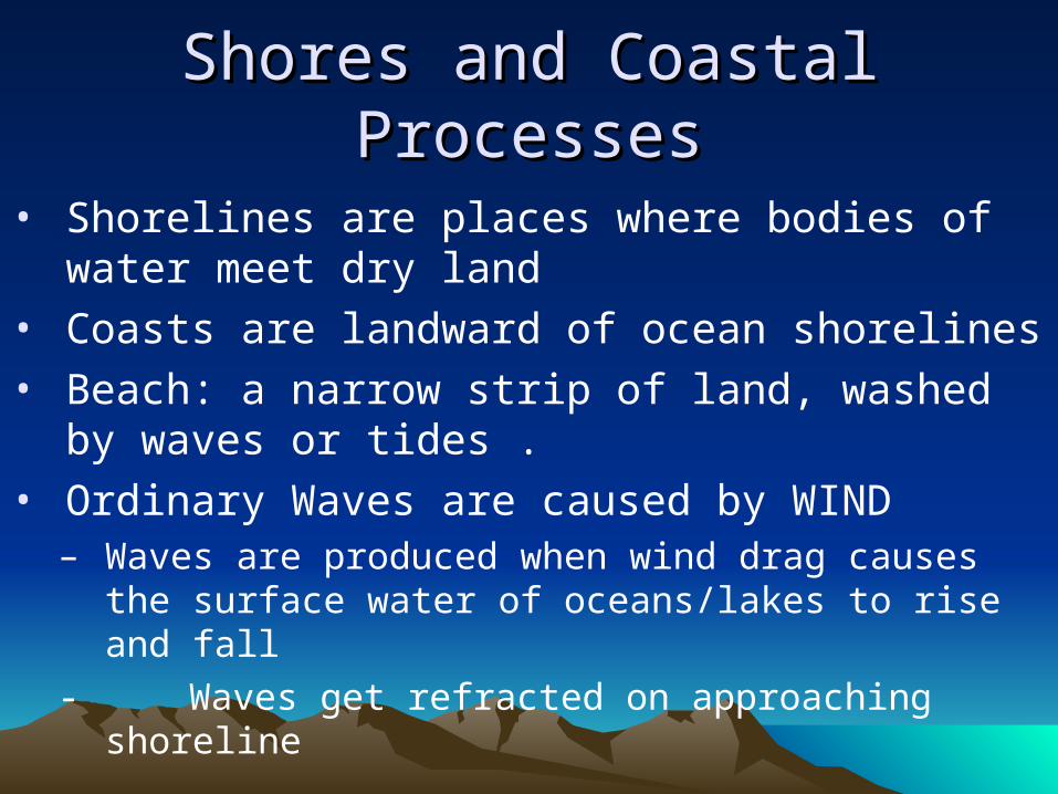
Shores and Coastal ProcessesShores and Coastal Processes
Shores and Coastal ProcessesShores and Coastal Processes
• Shorelines are places where bodies of water meet dry land
• Coasts are landward of ocean shorelines
• Beach: a narrow strip of land, washed by waves or tides .
• Ordinary Waves are caused by WIND– Waves are produced when wind drag causes the
surface water of oceans/lakes to rise and fall
- Waves get refracted on approaching shoreline
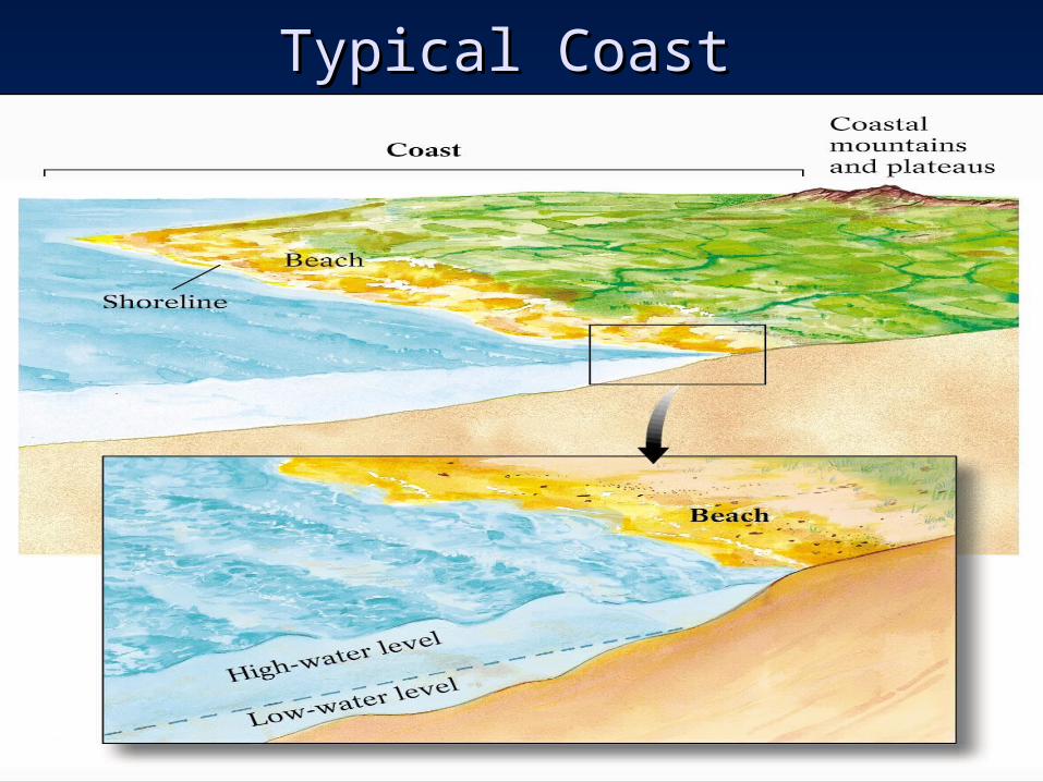
Typical CoastTypical Coast
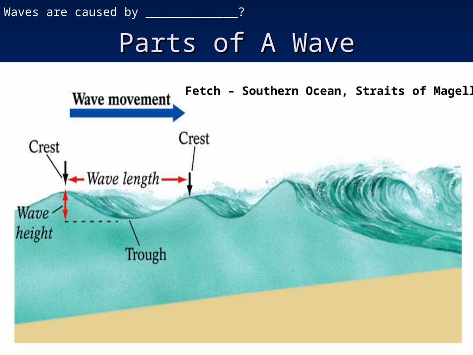
Parts of A WaveParts of A WaveWaves are caused by _____________?
Fetch – Southern Ocean, Straits of Magellan
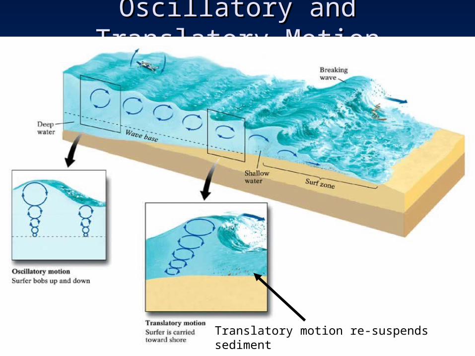
Oscillatory and Translatory MotionOscillatory and Translatory Motion
Translatory motion re-suspends sediment
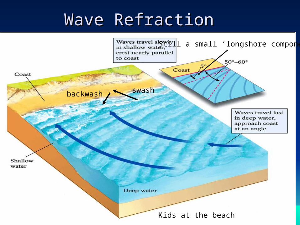
Wave RefractionWave RefractionStill a small ‘longshore component
swashbackwash
Kids at the beach
Shores and Coastal ProcessesShores and Coastal Processes
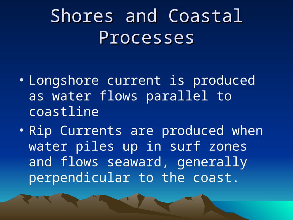
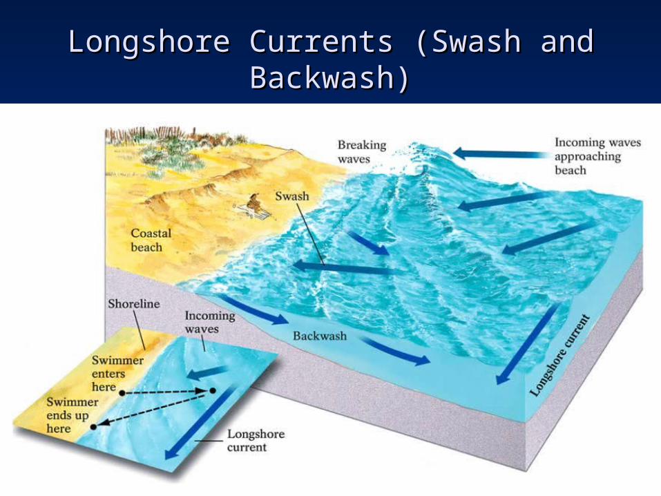
• Longshore current is produced as water flows parallel to coastline
• Rip Currents are produced when water piles up in surf zones and flows seaward, generally perpendicular to the coast.
Longshore Currents (Swash and Longshore Currents (Swash and Backwash)Backwash)
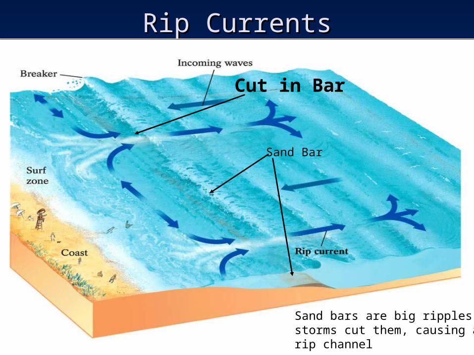
Rip CurrentsRip Currents
Sand Bar
Cut in Bar
Sand bars are big ripplesstorms cut them, causing arip channel
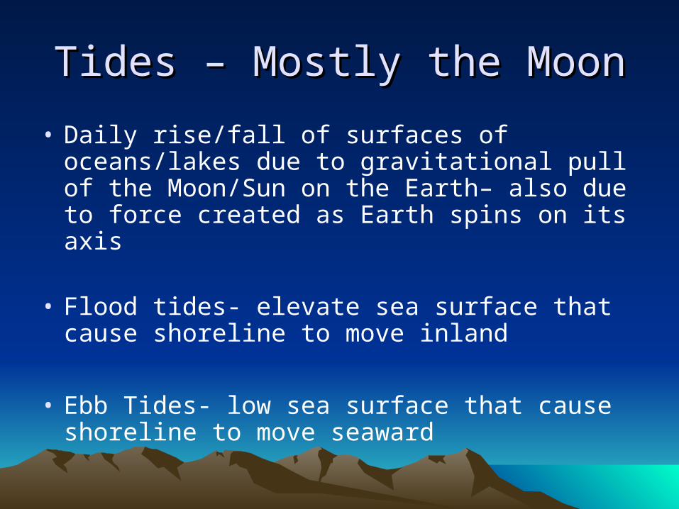
Tides – Mostly the MoonTides – Mostly the Moon
• Daily rise/fall of surfaces of oceans/lakes due to gravitational pull of the Moon/Sun on the Earth– also due to force created as Earth spins on its axis
• Flood tides- elevate sea surface that cause shoreline to move inland
• Ebb Tides- low sea surface that cause shoreline to move seaward
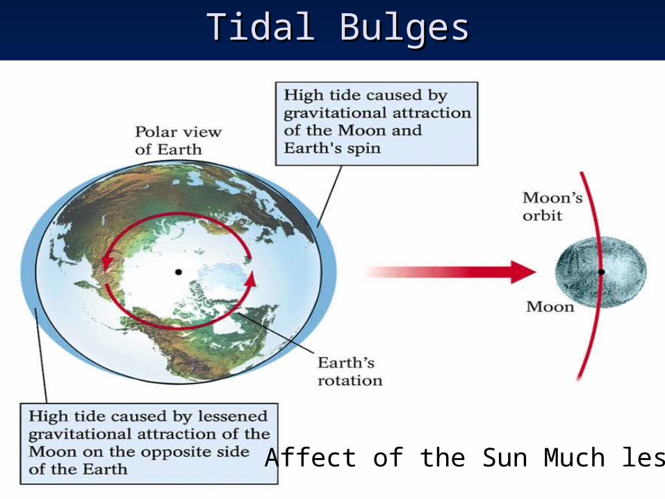
Tidal BulgesTidal Bulges
Affect of the Sun Much less
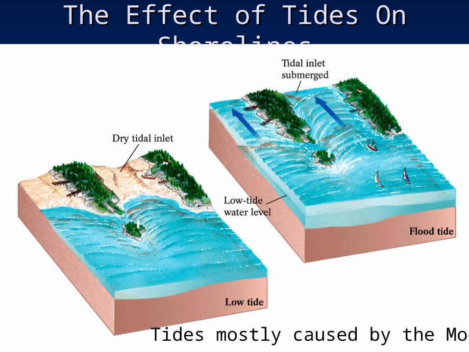
The Effect of Tides On ShorelinesThe Effect of Tides On Shorelines
Tides mostly caused by the Moon
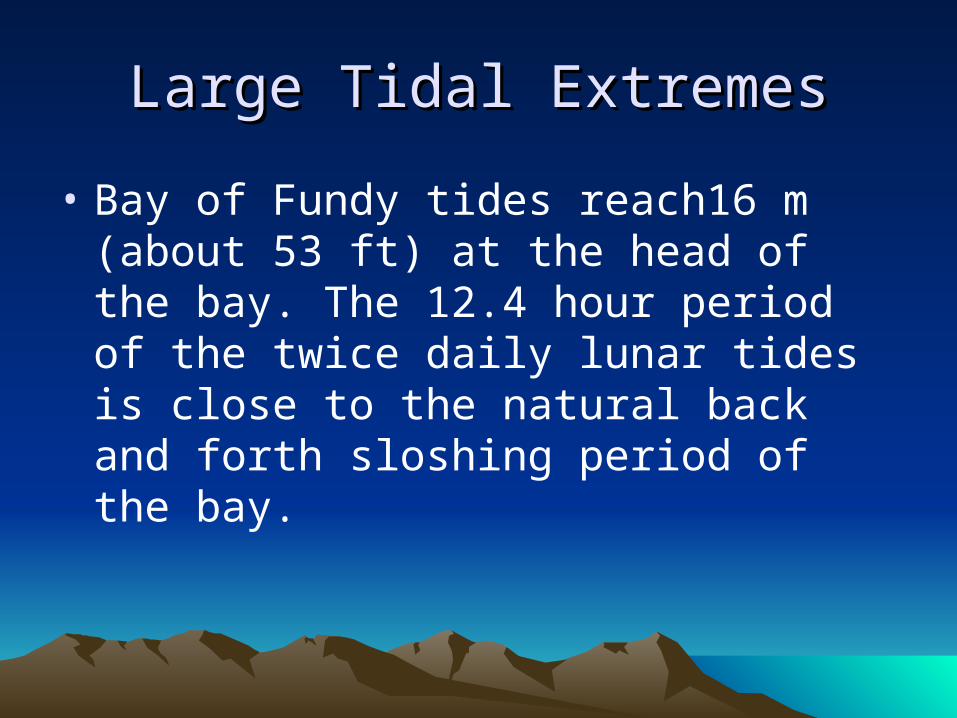
Large Tidal ExtremesLarge Tidal Extremes
• Bay of Fundy tides reach16 m (about 53 ft) at the head of the bay. The 12.4 hour period of the twice daily lunar tides is close to the natural back and forth sloshing period of the bay.
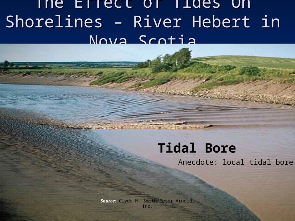
The Effect of Tides On Shorelines The Effect of Tides On Shorelines – – River Hebert in Nova ScotiaRiver Hebert in Nova Scotia
Source: Clyde H. Smith/Peter Arnold, Inc.
Tidal BoreAnecdote: local tidal bore
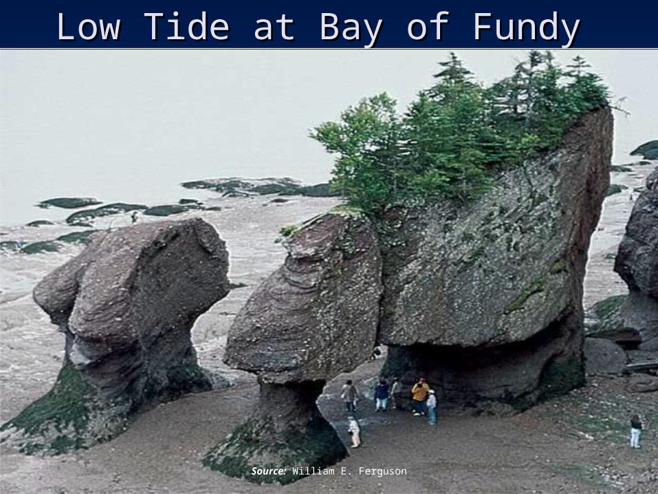
Low Tide at Bay of FundyLow Tide at Bay of Fundy
Source: William E. Ferguson
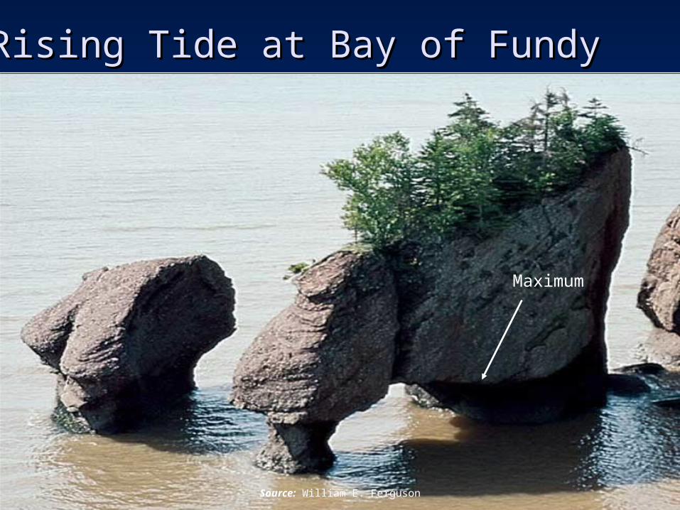
Rising Tide at Bay of Fundy Rising Tide at Bay of Fundy
Source: William E. Ferguson
Maximum
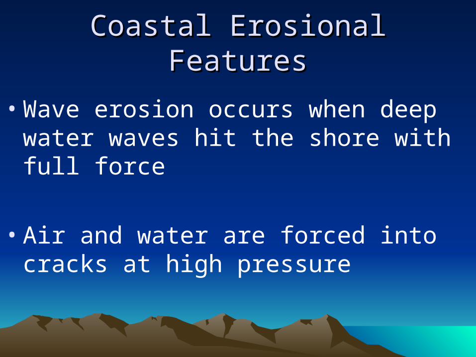
Coastal Erosional FeaturesCoastal Erosional Features
• Wave erosion occurs when deep water waves hit the shore with full force
• Air and water are forced into cracks at high pressure
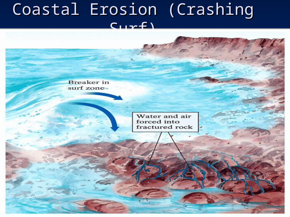
Coastal Erosion (Crashing Surf)Coastal Erosion (Crashing Surf)
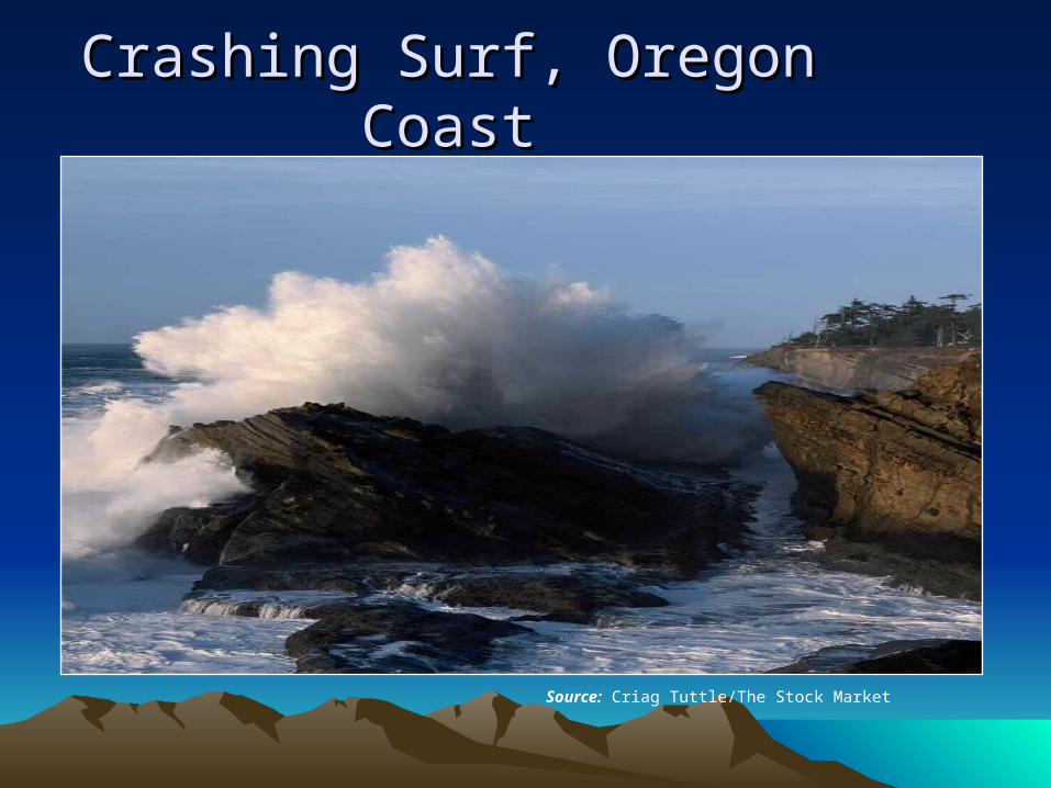
Crashing Surf, Oregon CoastCrashing Surf, Oregon Coast
Source: Criag Tuttle/The Stock Market
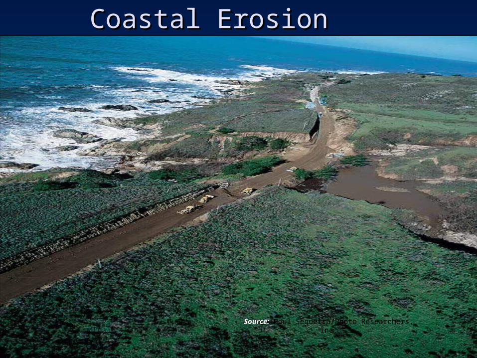
Coastal ErosionCoastal Erosion
Source: Paul Sequeira/Photo Researchers, Inc.
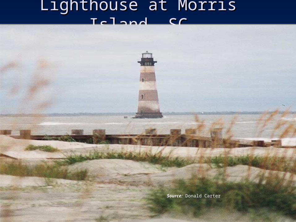
Lighthouse at Morris Island, SCLighthouse at Morris Island, SC
Source: Donald Carter
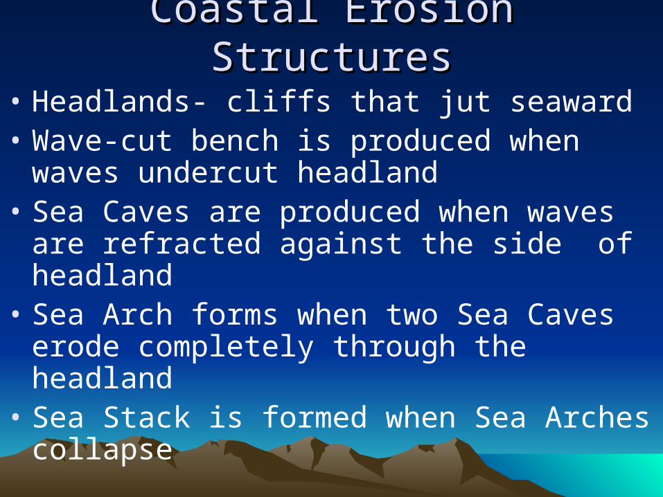
Coastal Erosion StructuresCoastal Erosion Structures
• Headlands- cliffs that jut seaward• Wave-cut bench is produced when waves
undercut headland• Sea Caves are produced when waves are
refracted against the side of headland• Sea Arch forms when two Sea Caves erode
completely through the headland• Sea Stack is formed when Sea Arches collapse
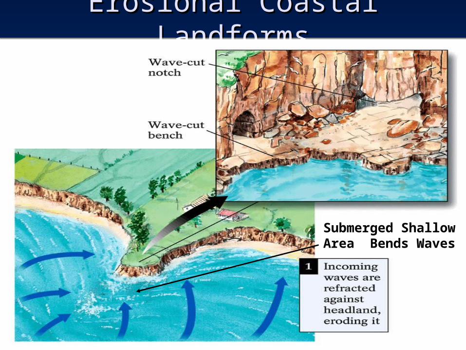
Erosional Coastal LandformsErosional Coastal Landforms
Submerged Shallow Area Bends Waves
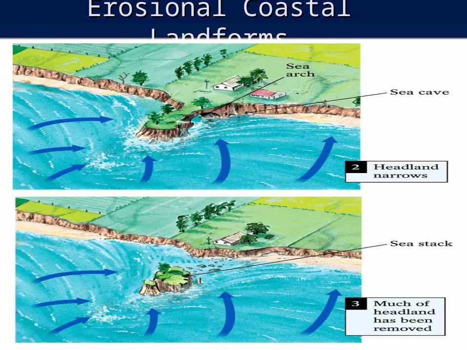
Erosional Coastal LandformsErosional Coastal Landforms
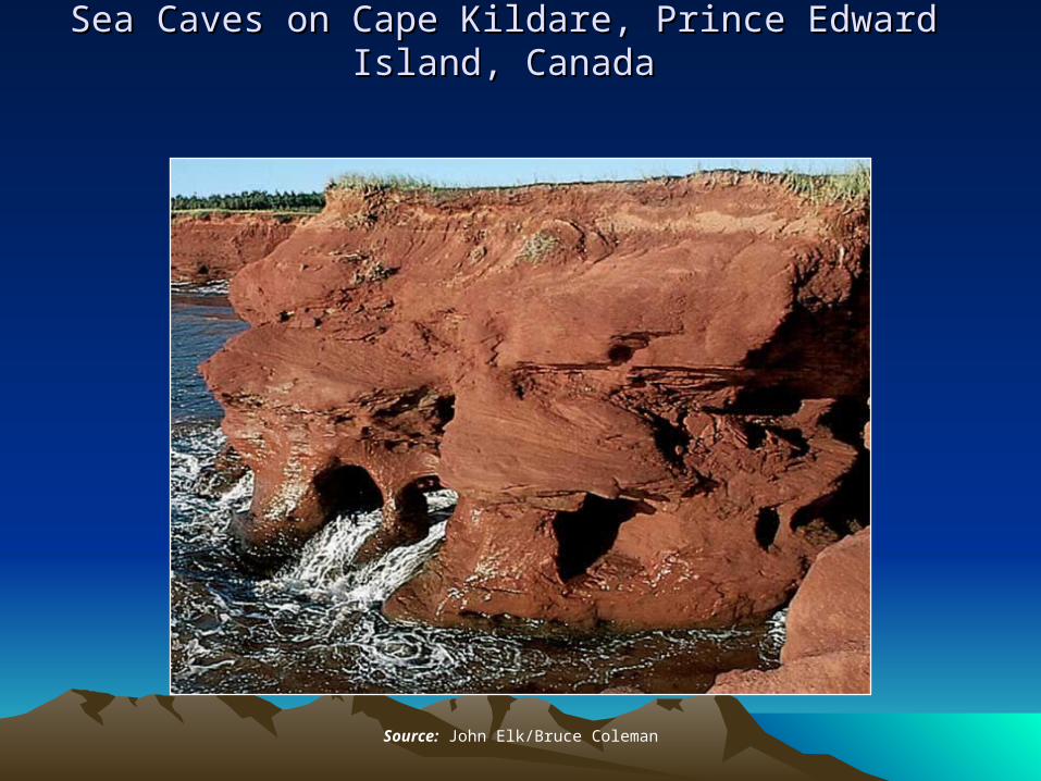
Sea Caves on Cape Kildare, Prince Edward Island, CanadaSea Caves on Cape Kildare, Prince Edward Island, Canada
Source: John Elk/Bruce Coleman
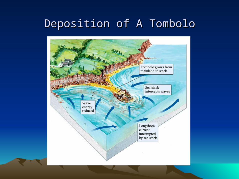
Deposition of A TomboloDeposition of A Tombolo
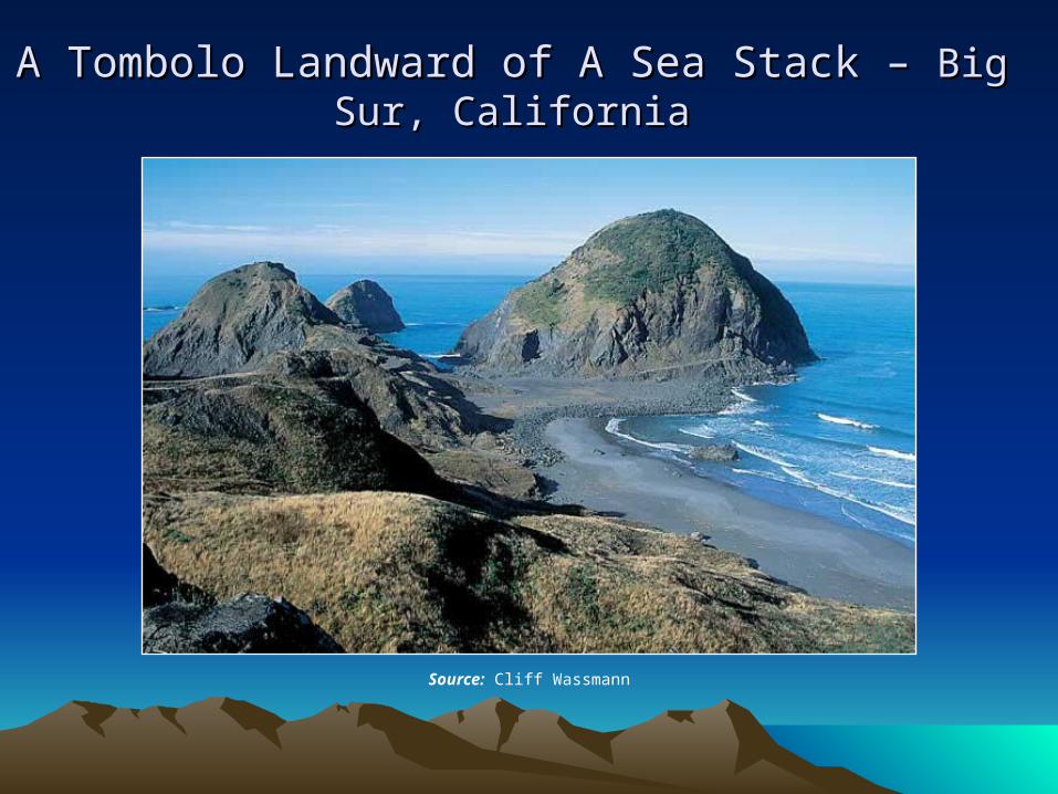
A Tombolo Landward of A Sea Stack A Tombolo Landward of A Sea Stack – – Big Sur, Big Sur, CaliforniaCalifornia
Source: Cliff Wassmann
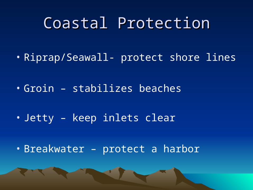
Coastal ProtectionCoastal Protection
• Riprap/Seawall- protect shore lines
• Groin – stabilizes beaches
• Jetty – keep inlets clear
• Breakwater – protect a harbor
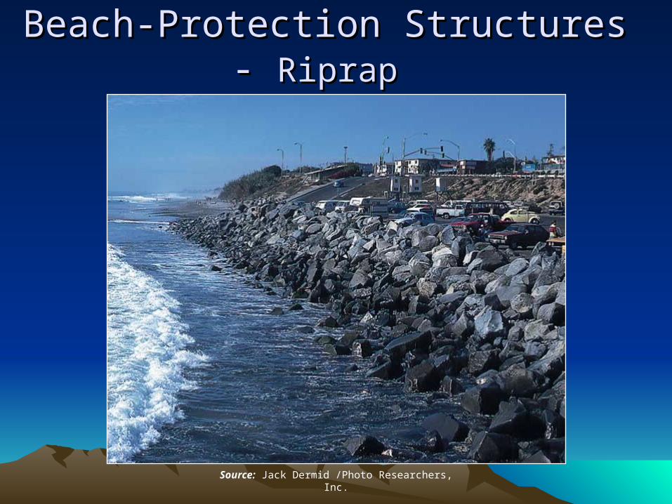
Beach-Protection Structures Beach-Protection Structures - - Riprap Riprap
Source: Jack Dermid /Photo Researchers, Inc.
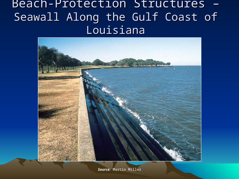
Beach-Protection Structures Beach-Protection Structures ––Seawall Along the Gulf Coast of LouisianaSeawall Along the Gulf Coast of Louisiana
Source: Martin Miller
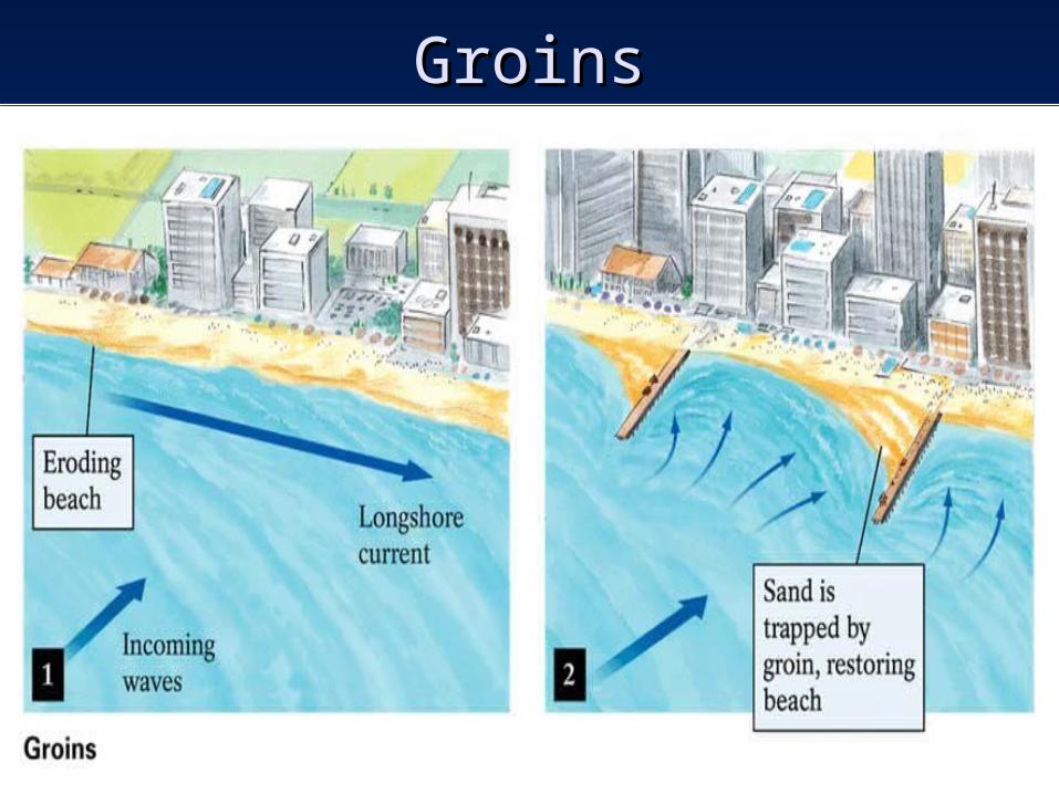
GroinsGroins
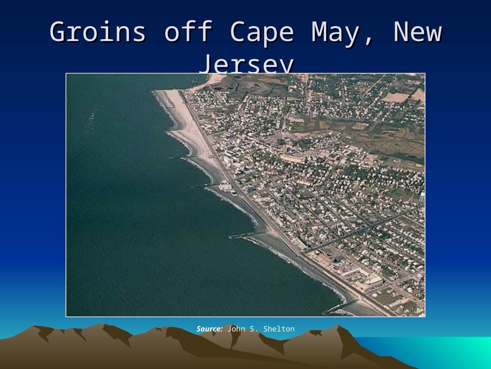
Groins off Cape May, New JerseyGroins off Cape May, New Jersey
Source: John S. Shelton
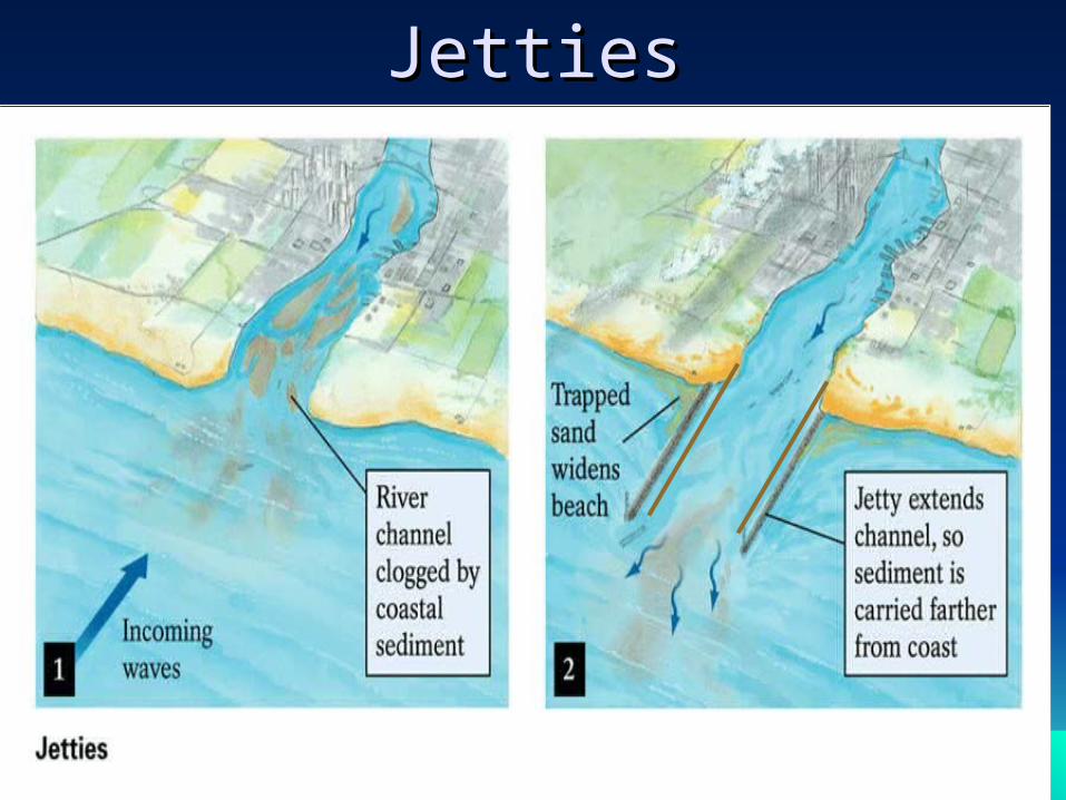
JettiesJetties
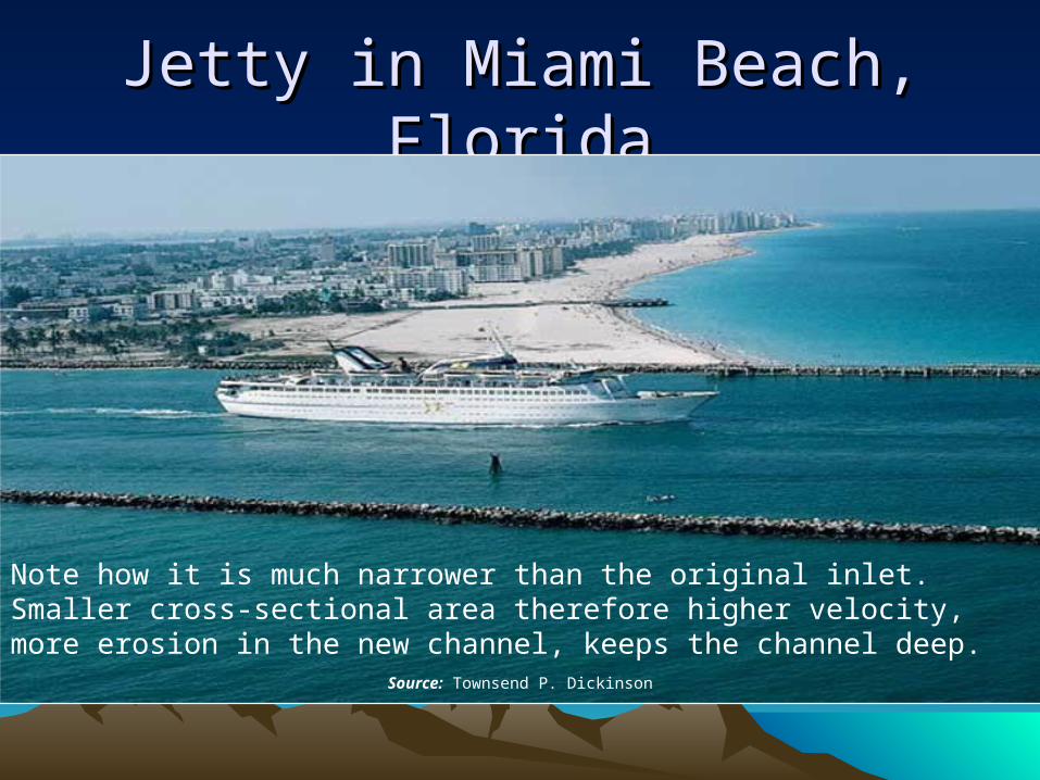
Jetty in Miami Beach, FloridaJetty in Miami Beach, Florida
Source: Townsend P. Dickinson
Note how it is much narrower than the original inlet. Smaller cross-sectional area therefore higher velocity, more erosion in the new channel, keeps the channel deep.
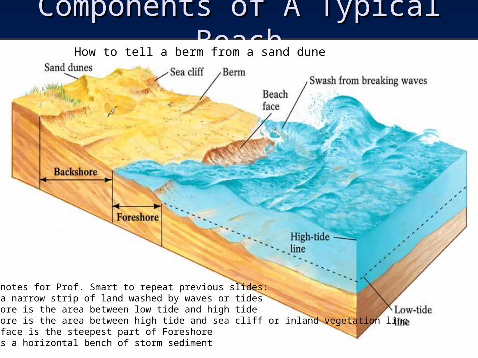
Components of A Typical BeachComponents of A Typical Beach
Small notes for Prof. Smart to repeat previous slides:Beach a narrow strip of land washed by waves or tidesForeshore is the area between low tide and high tideBackshore is the area between high tide and sea cliff or inland vegetation lineBeach face is the steepest part of ForeshoreBerm is a horizontal bench of storm sediment
How to tell a berm from a sand dune
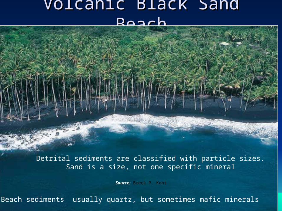
Volcanic Black Sand BeachVolcanic Black Sand Beach
Source: Breck P. Kent
Beach sediments usually quartz, but sometimes mafic minerals
Detrital sediments are classified with particle sizes. Sand is a size, not one specific mineral
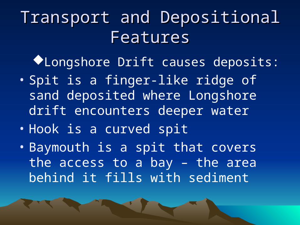
Transport and Depositional Transport and Depositional FeaturesFeatures
Longshore Drift causes deposits:
• Spit is a finger-like ridge of sand deposited where Longshore drift encounters deeper water
• Hook is a curved spit
• Baymouth is a spit that covers the access to a bay – the area behind it fills with sediment
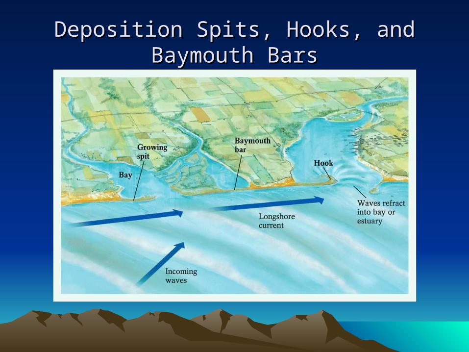
Deposition Spits, Hooks, and Baymouth Deposition Spits, Hooks, and Baymouth BarsBars
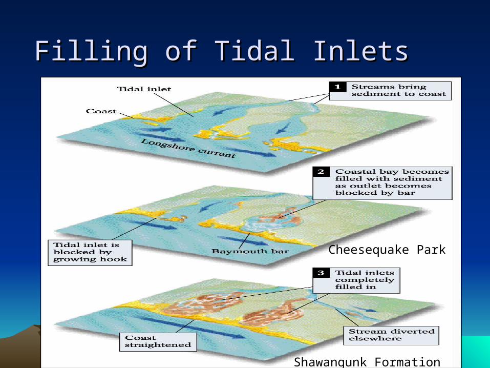
Filling of Tidal InletsFilling of Tidal Inlets
Cheesequake Park
Shawangunk Formation
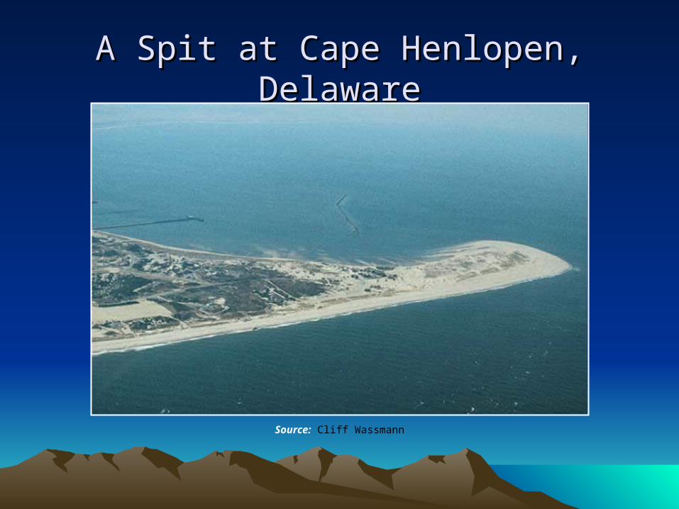
A Spit at Cape Henlopen, DelawareA Spit at Cape Henlopen, Delaware
Source: Cliff Wassmann
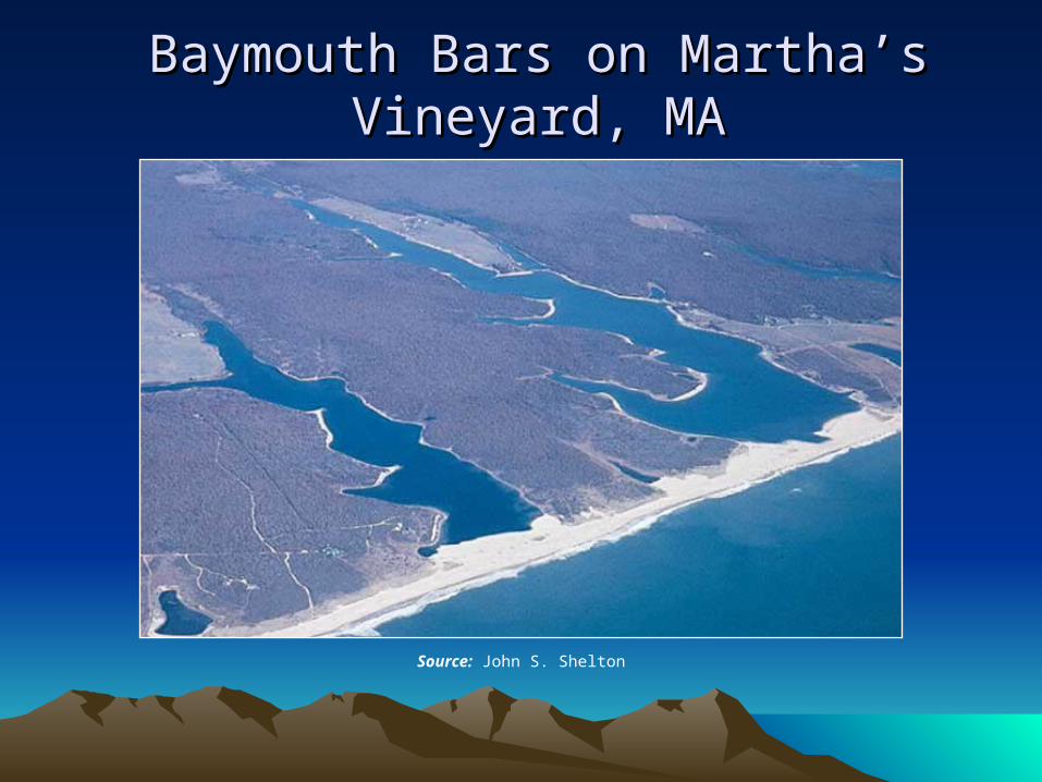
Baymouth Bars on Martha’s Vineyard, MABaymouth Bars on Martha’s Vineyard, MA
Source: John S. Shelton
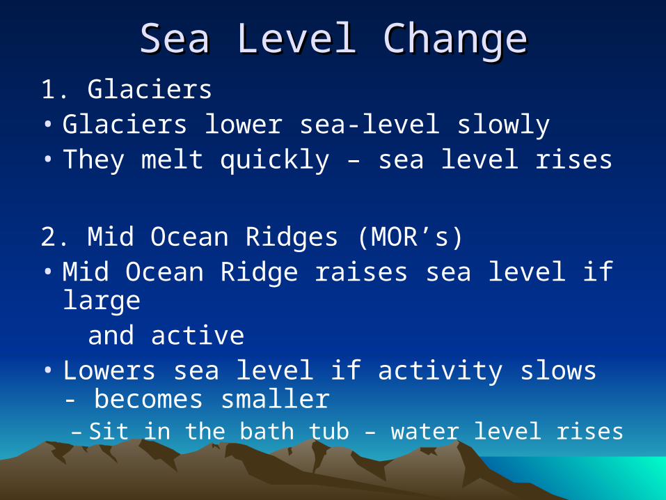
Sea Level ChangeSea Level Change1. Glaciers• Glaciers lower sea-level slowly• They melt quickly – sea level rises
2. Mid Ocean Ridges (MOR’s)• Mid Ocean Ridge raises sea level if large and active• Lowers sea level if activity slows -
becomes smaller– Sit in the bath tub – water level rises
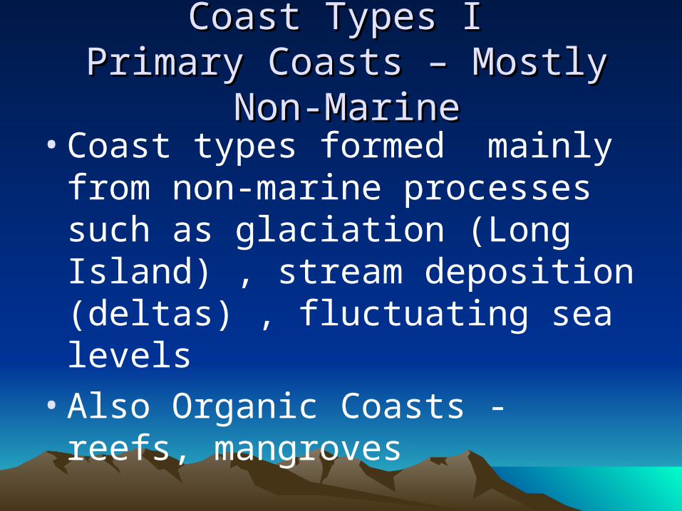
Coast Types I Coast Types I Primary Coasts – Mostly Non-MarinePrimary Coasts – Mostly Non-Marine
• Coast types formed mainly from non-marine processes such as glaciation (Long Island) , stream deposition (deltas) , fluctuating sea levels
• Also Organic Coasts - reefs, mangroves
Combined changes to coastlinesCombined changes to coastlines
• Tectonic uplift and sea-level changes
• Postglacial Isostatic rebound and sea-level changes
• Mid-ocean Ridge grows/wanes and sea-level changes
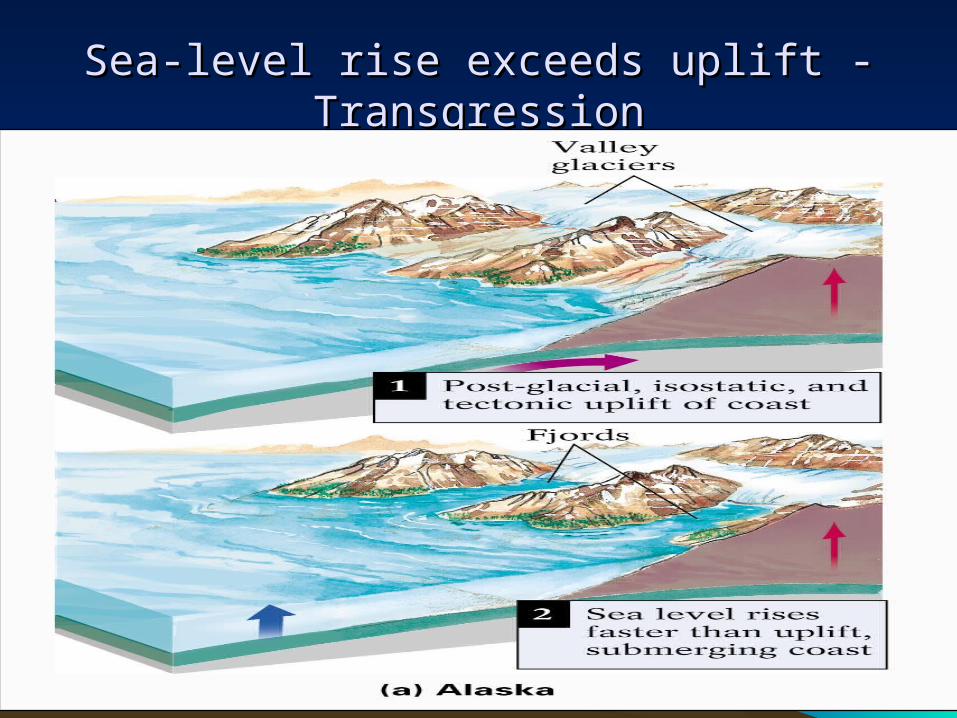
Sea-level rise exceeds uplift -TransgressionSea-level rise exceeds uplift -Transgression
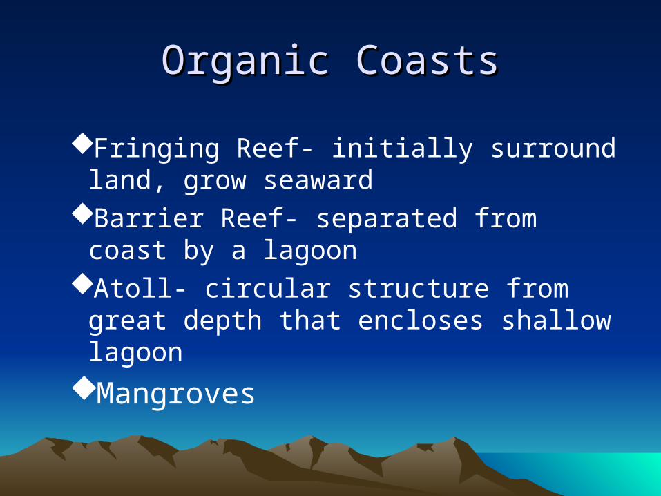
Organic CoastsOrganic Coasts
Fringing Reef- initially surround land, grow seaward
Barrier Reef- separated from coast by a lagoon
Atoll- circular structure from great depth that encloses shallow lagoon
Mangroves
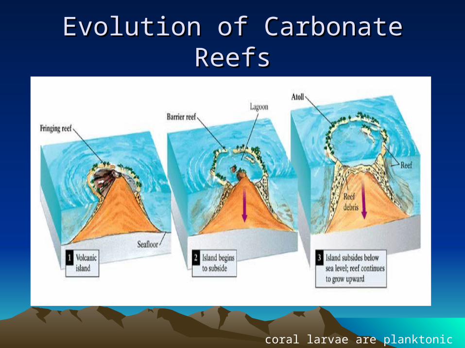
Evolution of Carbonate ReefsEvolution of Carbonate Reefs
Charles Darwin coral larvae are planktonic
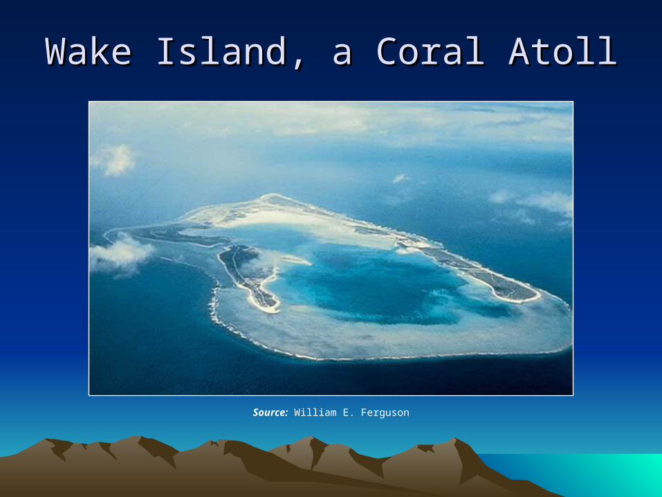
Wake Island, a Coral AtollWake Island, a Coral Atoll
Source: William E. Ferguson
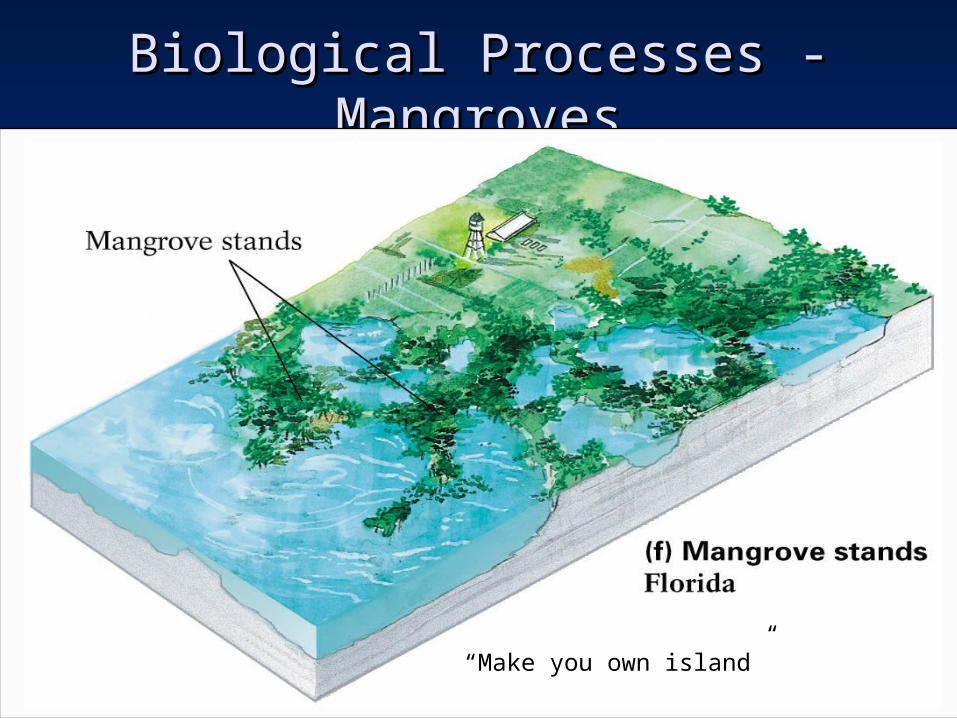
Biological Processes - MangrovesBiological Processes - Mangroves
“Make you own island”
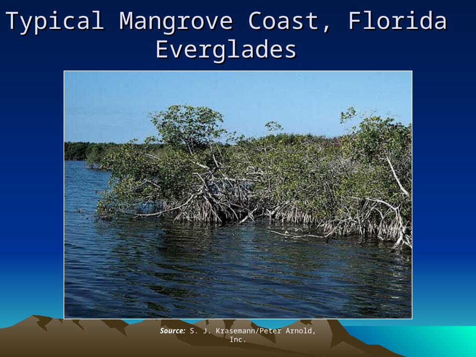
Typical Mangrove Coast, Florida Typical Mangrove Coast, Florida EvergladesEverglades
Source: S. J. Krasemann/Peter Arnold, Inc.
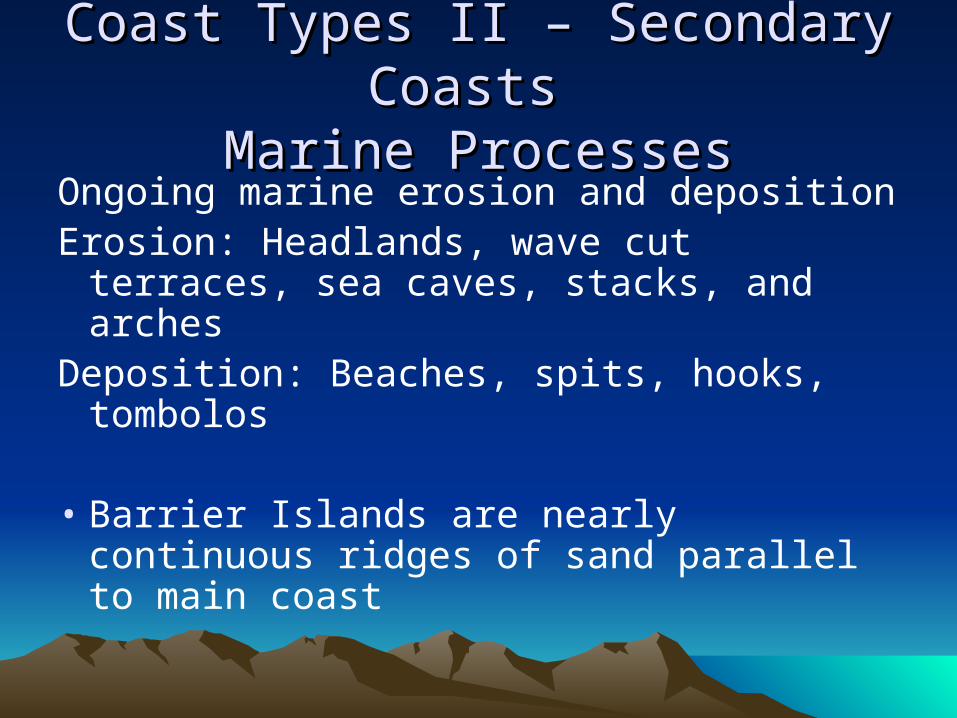
Coast Types II – Secondary Coasts Coast Types II – Secondary Coasts
Marine ProcessesMarine ProcessesOngoing marine erosion and depositionErosion: Headlands, wave cut terraces,
sea caves, stacks, and archesDeposition: Beaches, spits, hooks,
tombolos
• Barrier Islands are nearly continuous ridges of sand parallel to main coast
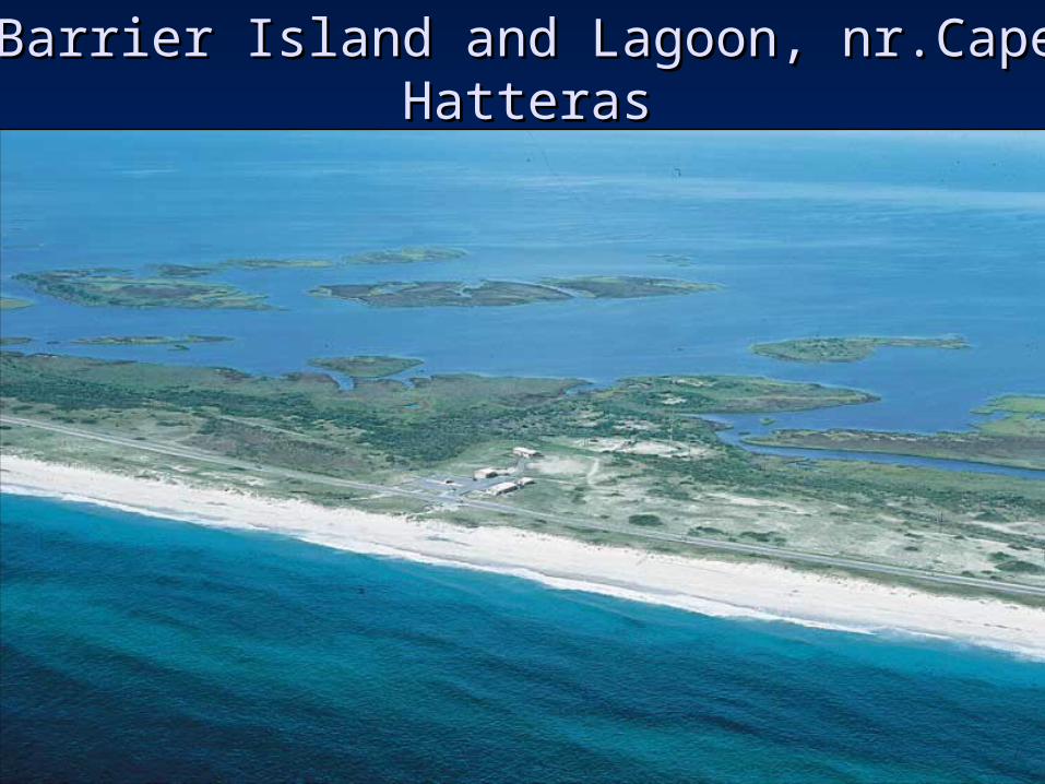
Barrier Island and Lagoon, nr.Cape HatterasBarrier Island and Lagoon, nr.Cape Hatteras
Source: Breck P. Kent
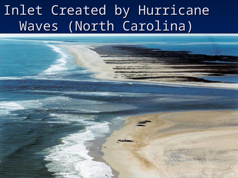
Inlet Created by Hurricane Waves Inlet Created by Hurricane Waves (North Carolina)(North Carolina)
Source: Associated Press/Raleigh News & Observer, Chris Seward
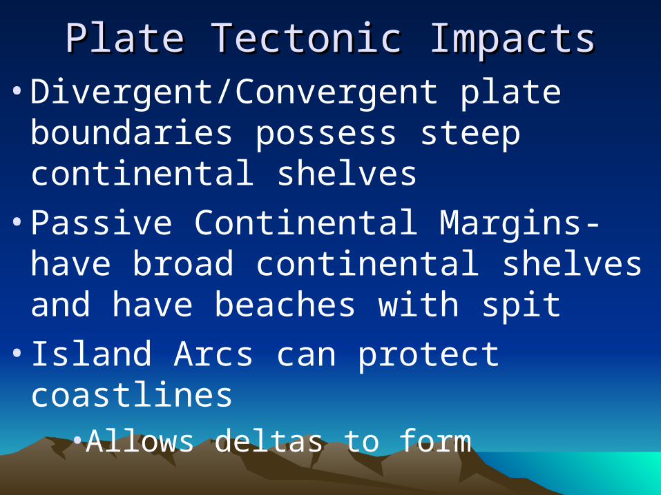
Plate Tectonic ImpactsPlate Tectonic Impacts• Divergent/Convergent plate
boundaries possess steep continental shelves
• Passive Continental Margins- have broad continental shelves and have beaches with spit
• Island Arcs can protect coastlines• Allows deltas to form
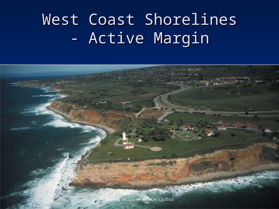
West Coast ShorelinesWest Coast Shorelines- Active Margin- Active Margin
Source: William Boyce/Corbis
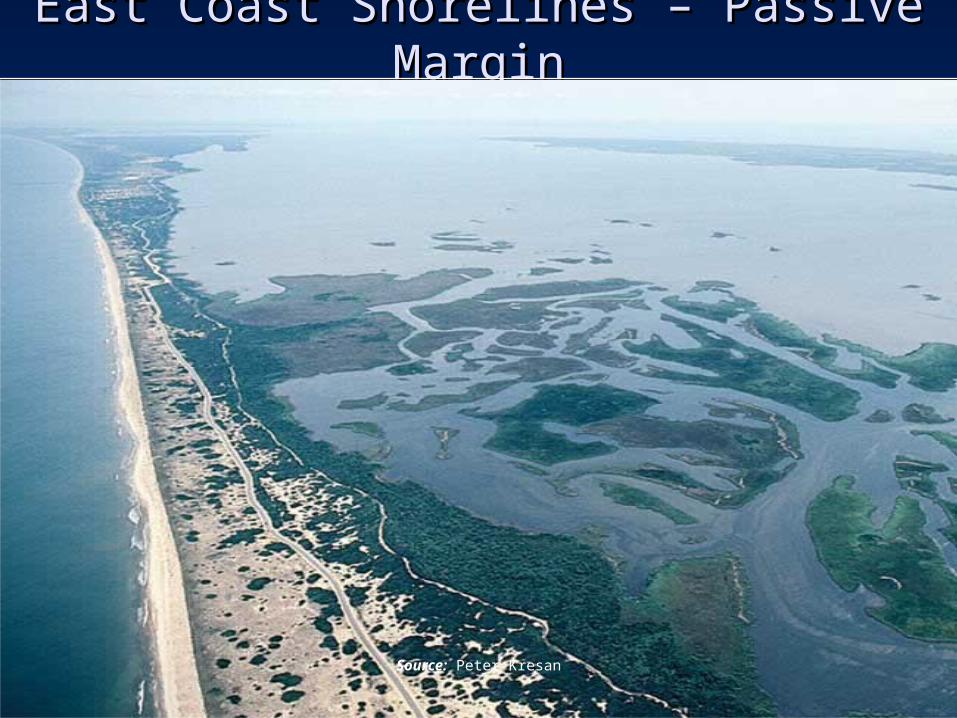
East Coast Shorelines – Passive MarginEast Coast Shorelines – Passive Margin
Source: Peter Kresan
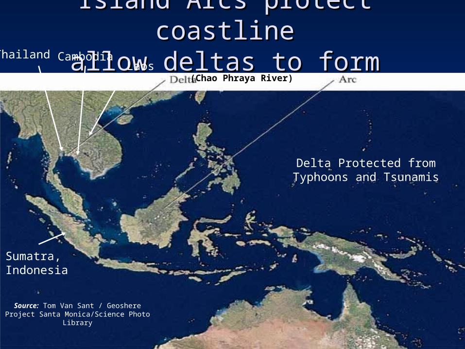
Island Arcs protect coastlineIsland Arcs protect coastlineallow deltas to formallow deltas to form
Source: Tom Van Sant / Geoshere Project Santa Monica/Science Photo Library
Thailand CambodiaLaos
(Chao Phraya River)
Sumatra, Indonesia
Delta Protected from Typhoons and Tsunamis
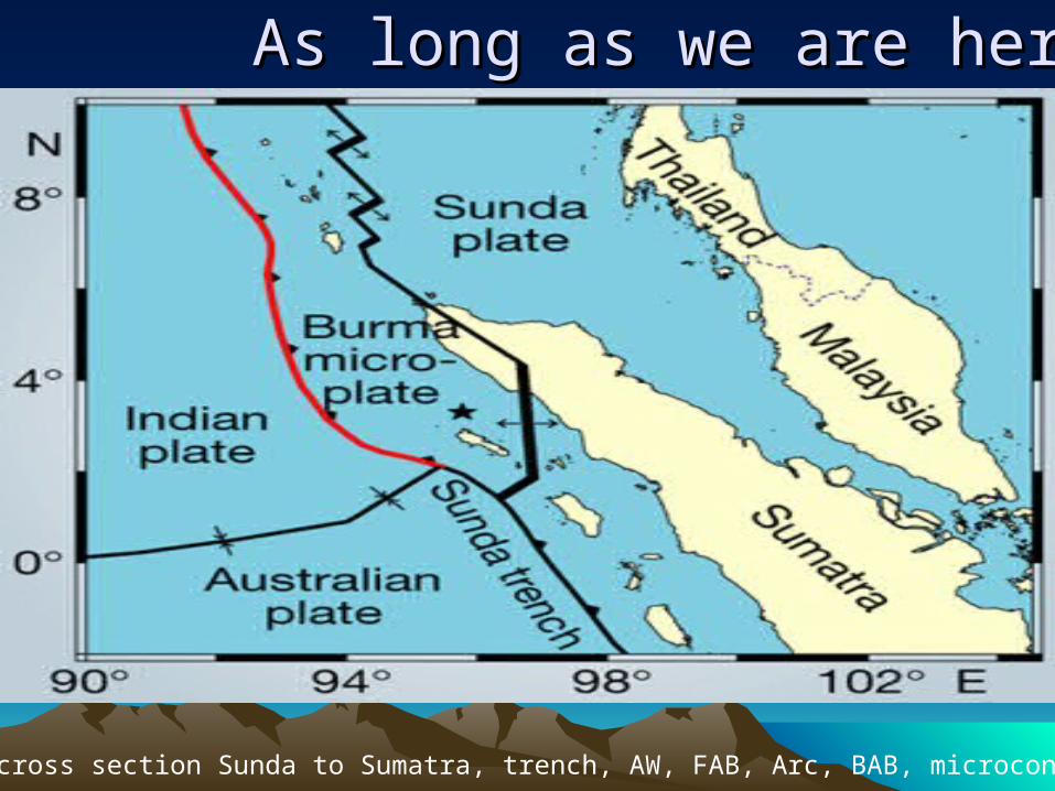
As long as we are hereAs long as we are here
Draw a cross section Sunda to Sumatra, trench, AW, FAB, Arc, BAB, microcontinent
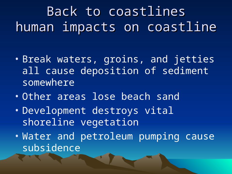
Back to coastlinesBack to coastlineshuman impacts on coastlinehuman impacts on coastline
• Break waters, groins, and jetties all cause deposition of sediment somewhere
• Other areas lose beach sand
• Development destroys vital shoreline vegetation
• Water and petroleum pumping cause subsidence
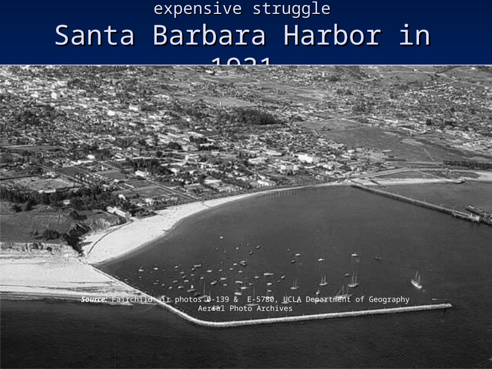
Our efforts to control nature can be a expensive struggleOur efforts to control nature can be a expensive struggle
Santa Barbara Harbor in 1931Santa Barbara Harbor in 1931
Source: Fairchild air photos 0-139 & E-5780, UCLA Department of Geography Aerial Photo Archives
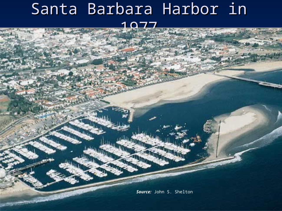
Santa Barbara Harbor in 1977Santa Barbara Harbor in 1977
Source: John S. Shelton
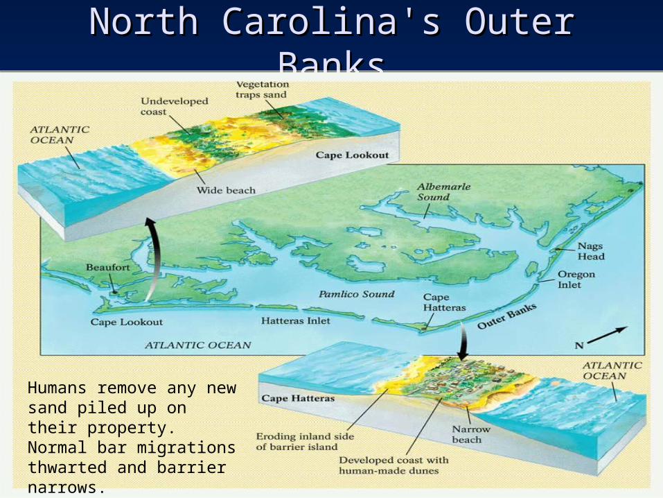
North Carolina's Outer BanksNorth Carolina's Outer Banks
Humans remove any new sand piled up on their property. Normal bar migrations thwarted and barrier narrows.
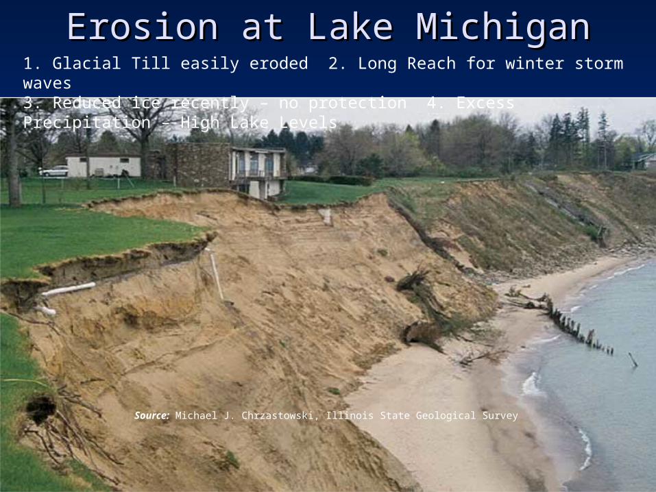
Erosion at Lake MichiganErosion at Lake Michigan
Source: Michael J. Chrzastowski, Illinois State Geological Survey
1. Glacial Till easily eroded 2. Long Reach for winter storm waves3. Reduced ice recently – no protection 4. Excess Precipitation – High Lake Levels
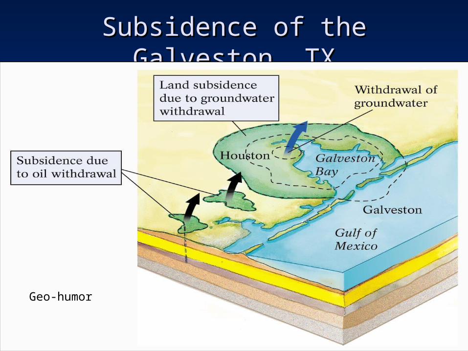
Subsidence of the Galveston, TXSubsidence of the Galveston, TX
Geo-humor
End of End of
Shores and Coastal ProcessesShores and Coastal Processes