Embed Size (px)
Citation preview
Signal Four Analytics
ILIR BEJLERI Geoplan Center - University of Florida
FDOT Transportation Data Symposium – October 2014
1
Overview
• Signal Four Analytics is a statewide interactive, web-based geospatial crash analytical tool
• Developed by and hosted at University of Florida, Geoplan Center
• Main site: http://s4.geoplan.ufl.edu/
2
Target Audience
• Developed for Florida government agencies in:– Law Enforcement,– Traffic Engineering, – Transportation Planning, – School Transportation, – Injury Prevention, – Universities– Any organization related to traffic safety
• And private Contractors/Consultants contractedby Florida public agencies
3
Support & Funding
• Funded by the State of Florida
• Through Florida Traffic Records Coordinating Committee (TRCC) (search for Florida TRCC)
• TRCC mission is to improve traffic information systems in the state
• TRCC manages federal funds available for this purpose
4
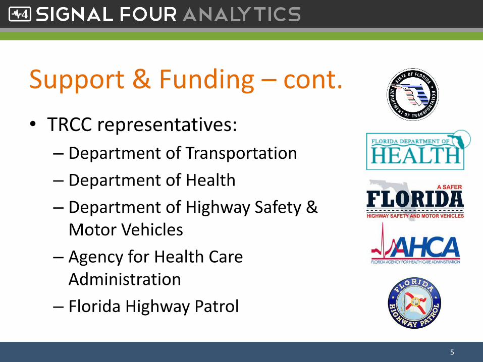
Support & Funding – cont.
• TRCC representatives:
– Department of Transportation
– Department of Health
– Department of Highway Safety & Motor Vehicles
– Agency for Health Care Administration
– Florida Highway Patrol
5
Support & Funding – cont.
• To learn more go to TRCC website:• http://www.dot.state.fl.us/safety/2A-Programs/Traffic-Crash-Data.shtm
• An easy way to get to it:
– Google search for “Florida TRCC”
6
S4 Analytics Focus• Accessibility
– Makes it easy to get to the data, no special software required
• Timeliness– Crash data is up to date as reported by law enforcement to
DHSMV
• Utilization– Web-based simple to use intuitive tools, minimal or no
training required
• Geospatial Analytics– Various functions to look at the data spatially
7
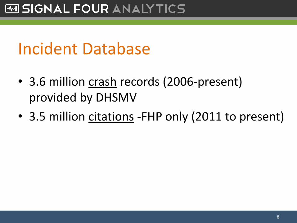
Incident Database
• 3.6 million crash records (2006-present) provided by DHSMV
• 3.5 million citations -FHP only (2011 to present)
8
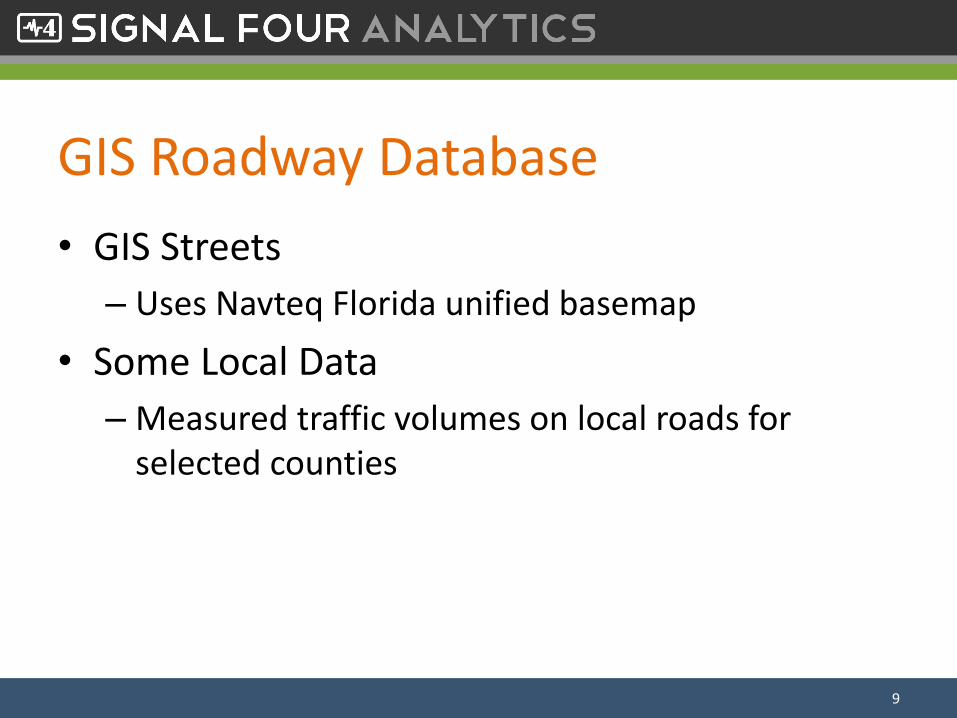
GIS Roadway Database
• GIS Streets
– Uses Navteq Florida unified basemap
• Some Local Data
– Measured traffic volumes on local roads for selected counties
9
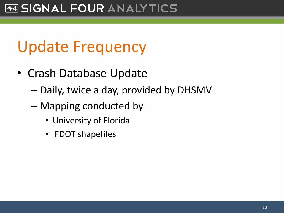
Update Frequency
• Crash Database Update
– Daily, twice a day, provided by DHSMV
– Mapping conducted by
• University of Florida
• FDOT shapefiles
10
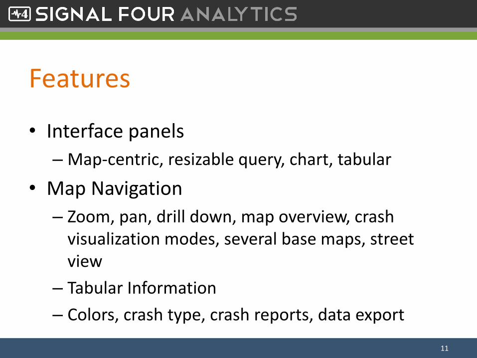
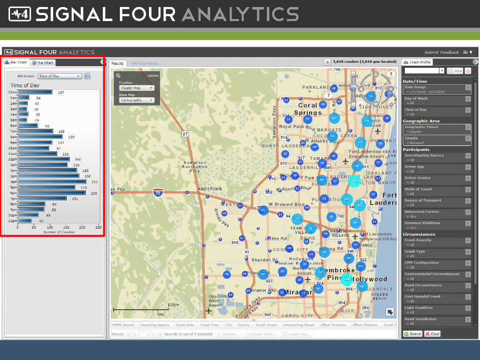
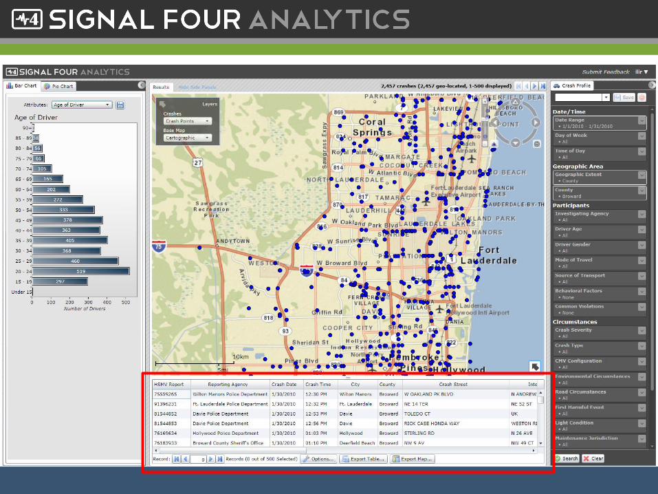
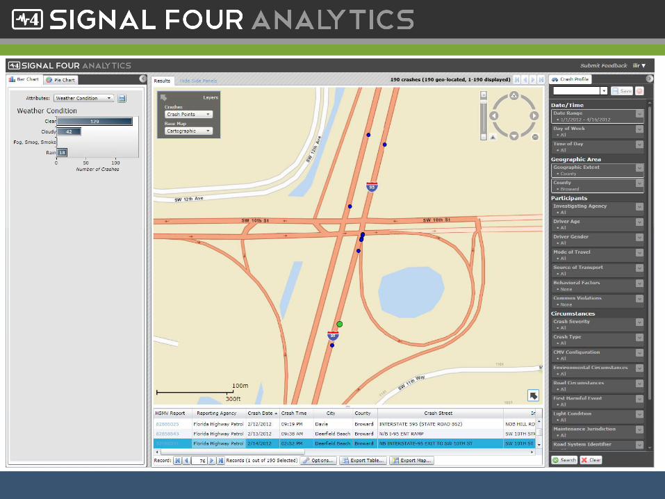
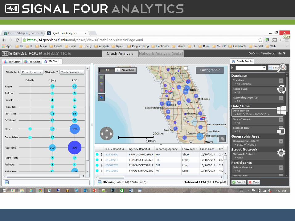
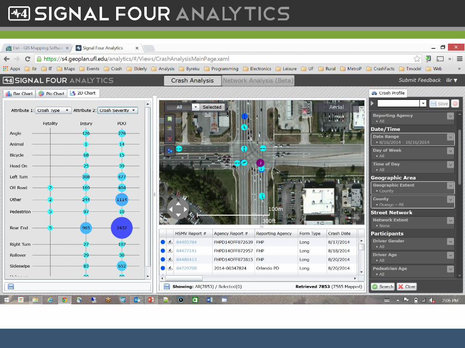
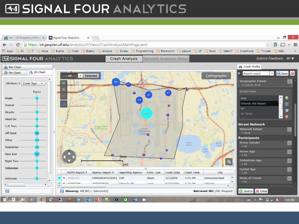
Features
• Interface panels
– Map-centric, resizable query, chart, tabular
• Map Navigation
– Zoom, pan, drill down, map overview, crash visualization modes, several base maps, street view
– Tabular Information
– Colors, crash type, crash reports, data export
11
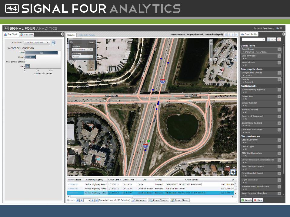
Features - cont
• Interface panels
– Map-centric, resizable query, chart, tabular
• Map Navigation
– Zoom, pan, drill down, map overview, crash visualization modes, several base maps, street view,
– Crash point symobology: color and symbol by crash type
• Data export
12
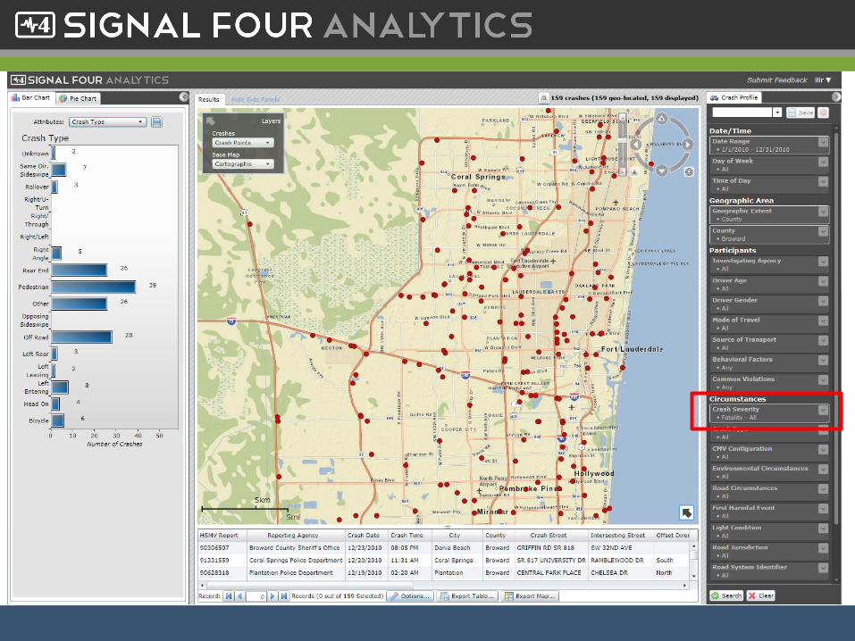
Features cont
• Bar charts
– Several attributes
• Query panel
– Geographic area
– Crash severity, bike/ped, etc
– Network (Intersection, Street, Custom, Route)
13
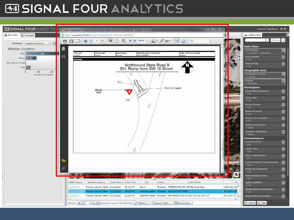
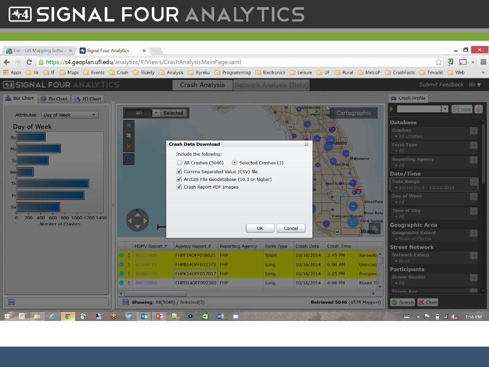
• Custom Geographic Area
• Export to GIS
• Network Extent
• 2D Charts & Collision Diagrams
• Selections
• Location and Attribute Editing
• Crash Types
14
Features cont
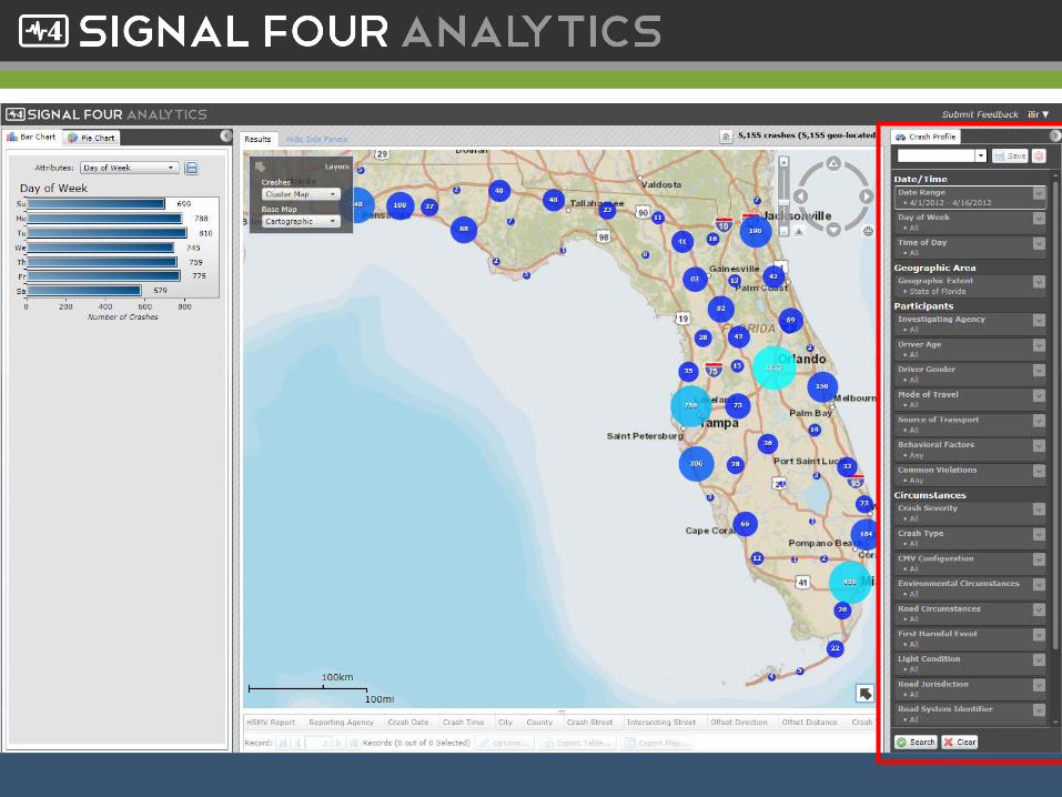
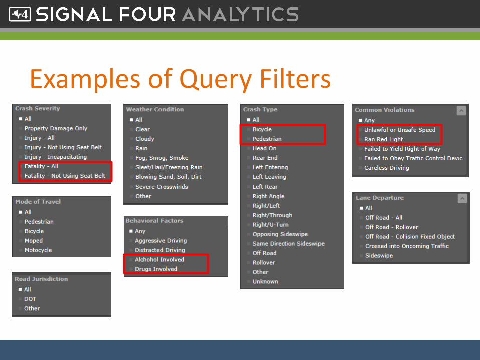
Examples of Query Filters
Users Summary
• Over 1500 users
• Over 230 agencies
27
Utilization: Quarterly Statistics
• 10,000 unique logins
• 25,000 queries issued
• 50,000 crash reports reviewed/downloaded
28
Road Ahead
• Update GIS database to 2014 unified basemap
• Complete citations query interface
• Finalize Network Analysis
• Enhanced analytics and usability
• Inclusion of location of traffic signals, red light running camera locations, schools etc.
29
Access
• Access is free – the state support it
• To get access: go to http://s4.geoplan.ufl.edu/and select Request Access link
• Access is typically provided within 24-48 hours
• Accept User Agreement regarding access to personal information
30


![12.3mm cv 8mm cv - c1p1 blog · 0mm cv cv Actual,microSIM3FF, resizable,to,nanoSIM, 15.0mm cv Actual,SIM2FF[non, micro],resizable,to, ... 2 Print the “Cutting Mask” page 3 Select](https://img.pdfslide.net/doc/110x75/5ac1b8c47f8b9a1c768d1c74/123mm-cv-8mm-cv-c1p1-blog-cv-cv-actualmicrosim3ff-resizabletonanosim-150mm.jpg)