Embed Size (px)
Citation preview
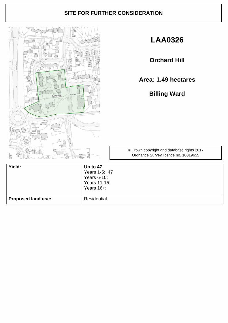
Yield: Up to 47 Years 1-5: 47 Years 6-10: Years 11-15: Years 16+:
Proposed land use: Residential
SITE FOR FURTHER CONSIDERATION
LAA0326
Orchard Hill
Area: 1.49 hectares
Billing Ward
© Crown copyright and database rights 2017 Ordnance Survey licence no. 10019655
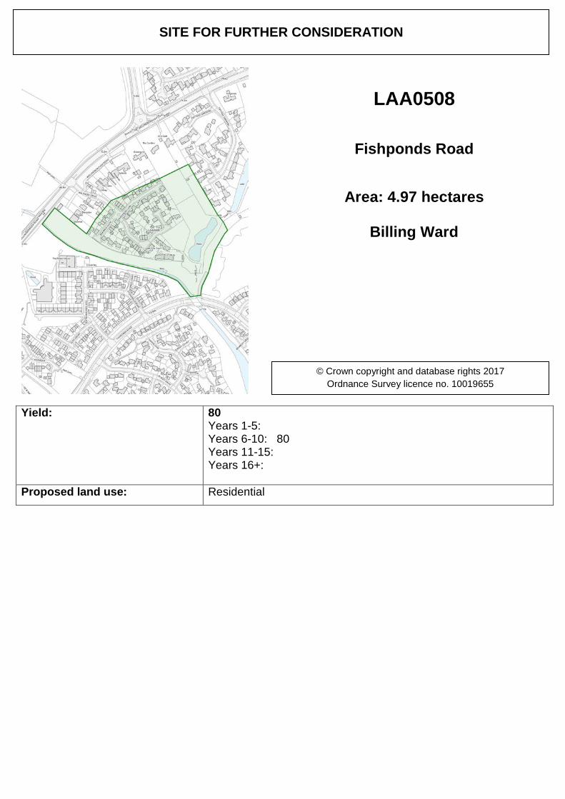
Yield: 80 Years 1-5: Years 6-10: 80 Years 11-15: Years 16+:
Proposed land use: Residential
SITE FOR FURTHER CONSIDERATION
LAA0508
Fishponds Road
Area: 4.97 hectares
Billing Ward
© Crown copyright and database rights 2017 Ordnance Survey licence no. 10019655
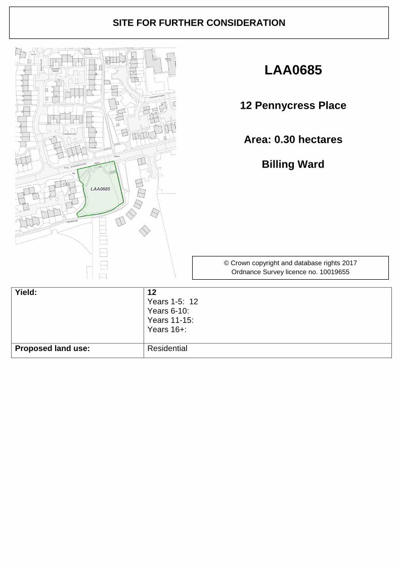
Yield: 12 Years 1-5: 12 Years 6-10: Years 11-15: Years 16+:
Proposed land use: Residential
SITE FOR FURTHER CONSIDERATION
LAA0685
12 Pennycress Place
Area: 0.30 hectares
Billing Ward
© Crown copyright and database rights 2017 Ordnance Survey licence no. 10019655
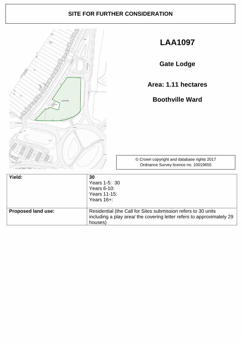
Yield: 30 Years 1-5: 30 Years 6-10: Years 11-15: Years 16+:
Proposed land use: Residential (the Call for Sites submission refers to 30 units including a play area/ the covering letter refers to approximately 29 houses)
SITE FOR FURTHER CONSIDERATION
LAA1097
Gate Lodge
Area: 1.11 hectares
Boothville Ward
© Crown copyright and database rights 2017 Ordnance Survey licence no. 10019655
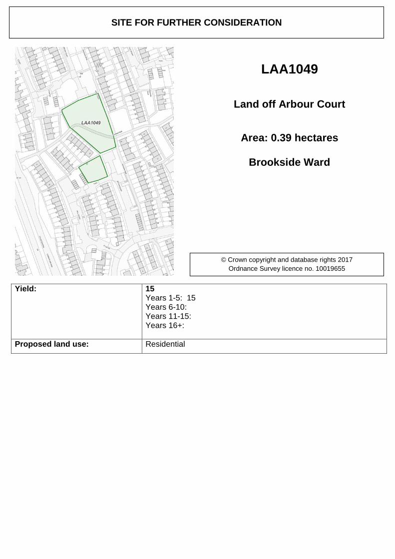
Yield: 15 Years 1-5: 15 Years 6-10: Years 11-15: Years 16+:
Proposed land use: Residential
SITE FOR FURTHER CONSIDERATION
LAA1049
Land off Arbour Court
Area: 0.39 hectares
Brookside Ward
© Crown copyright and database rights 2017 Ordnance Survey licence no. 10019655
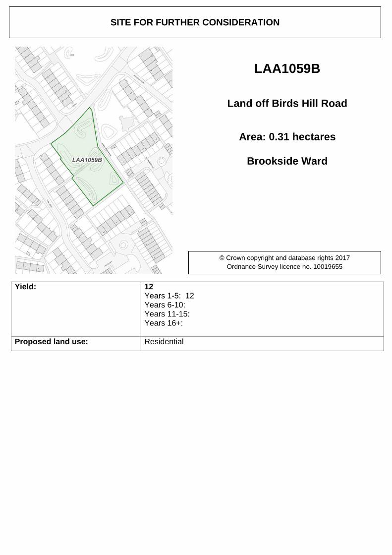
Yield: 12 Years 1-5: 12 Years 6-10: Years 11-15: Years 16+:
Proposed land use: Residential
SITE FOR FURTHER CONSIDERATION
LAA1059B
Land off Birds Hill Road
Area: 0.31 hectares
Brookside Ward
© Crown copyright and database rights 2017 Ordnance Survey licence no. 10019655
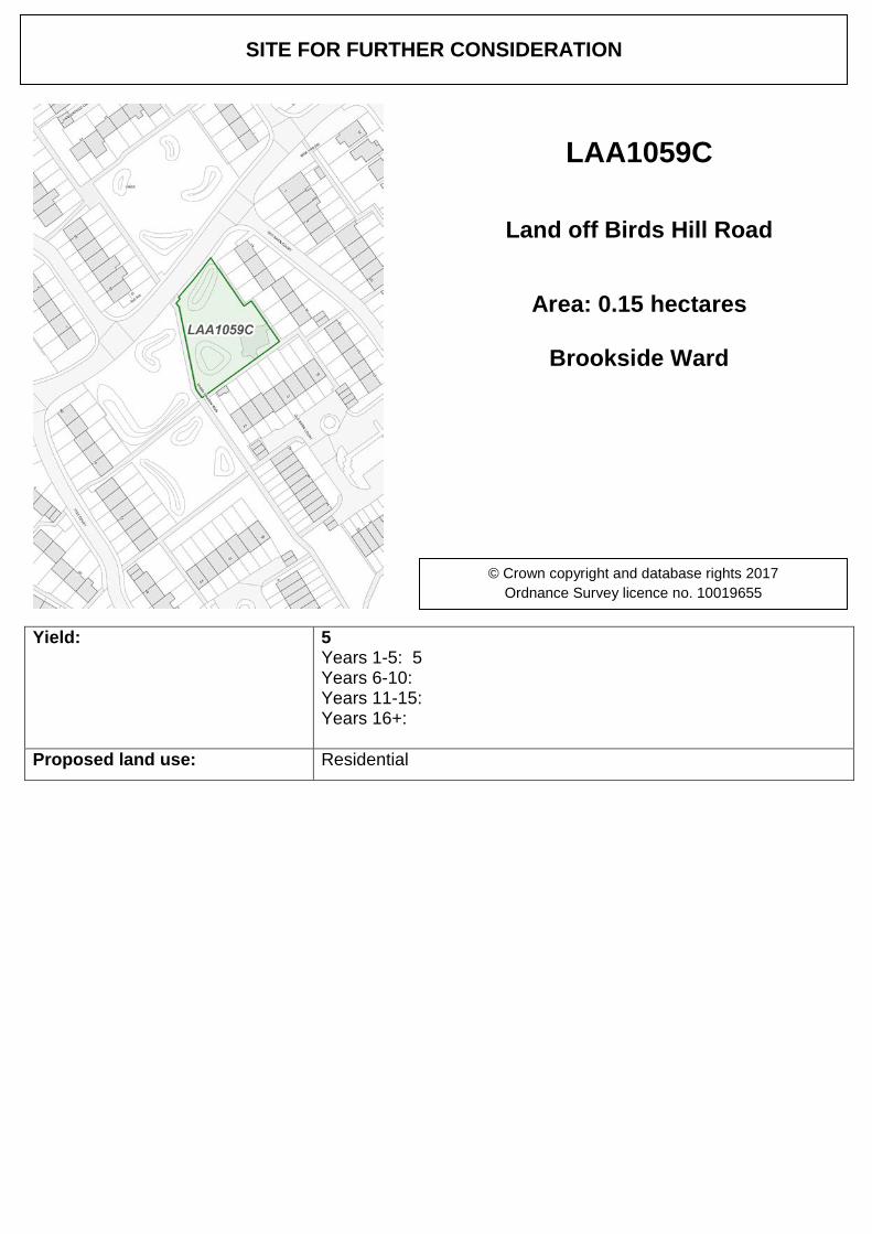
Yield: 5 Years 1-5: 5 Years 6-10: Years 11-15: Years 16+:
Proposed land use: Residential
SITE FOR FURTHER CONSIDERATION
LAA1059C
Land off Birds Hill Road
Area: 0.15 hectares
Brookside Ward
© Crown copyright and database rights 2017 Ordnance Survey licence no. 10019655
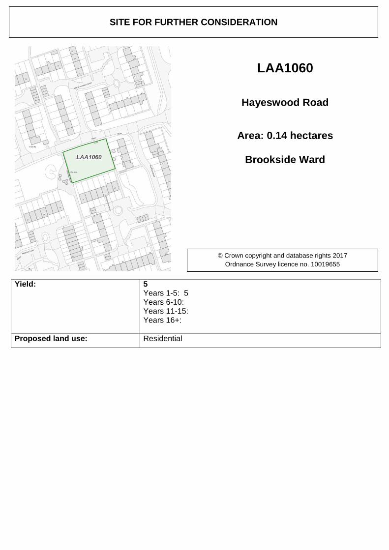
Yield: 5 Years 1-5: 5 Years 6-10: Years 11-15: Years 16+:
Proposed land use: Residential
SITE FOR FURTHER CONSIDERATION
LAA1060
Hayeswood Road
Area: 0.14 hectares
Brookside Ward
© Crown copyright and database rights 2017 Ordnance Survey licence no. 10019655
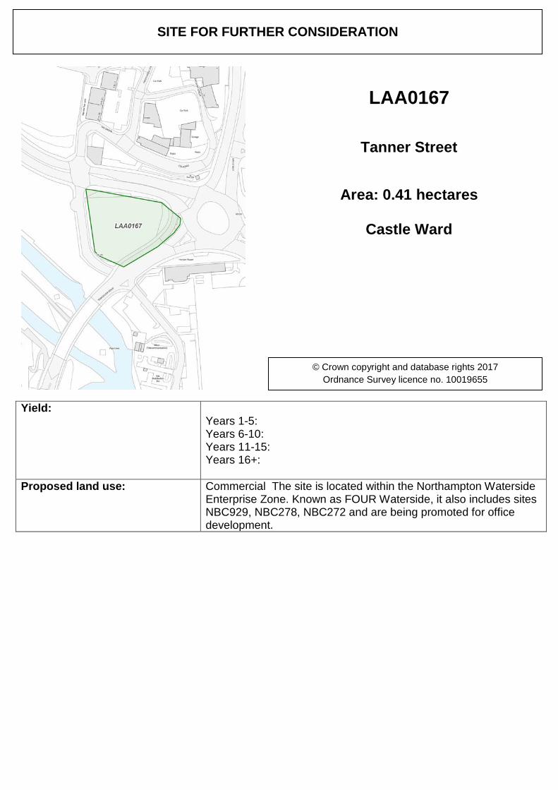
Yield: Years 1-5: Years 6-10: Years 11-15: Years 16+:
Proposed land use: Commercial The site is located within the Northampton Waterside Enterprise Zone. Known as FOUR Waterside, it also includes sites NBC929, NBC278, NBC272 and are being promoted for office development.
SITE FOR FURTHER CONSIDERATION
LAA0167
Tanner Street
Area: 0.41 hectares
Castle Ward
© Crown copyright and database rights 2017 Ordnance Survey licence no. 10019655
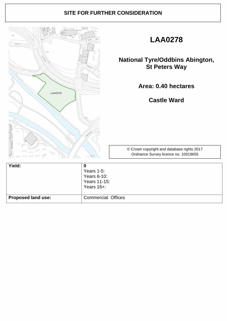
Yield: 0 Years 1-5: Years 6-10: Years 11-15: Years 16+:
Proposed land use: Commercial Offices
SITE FOR FURTHER CONSIDERATION
LAA0278
National Tyre/Oddbins Abington, St Peters Way
Area: 0.40 hectares
Castle Ward
© Crown copyright and database rights 2017 Ordnance Survey licence no. 10019655
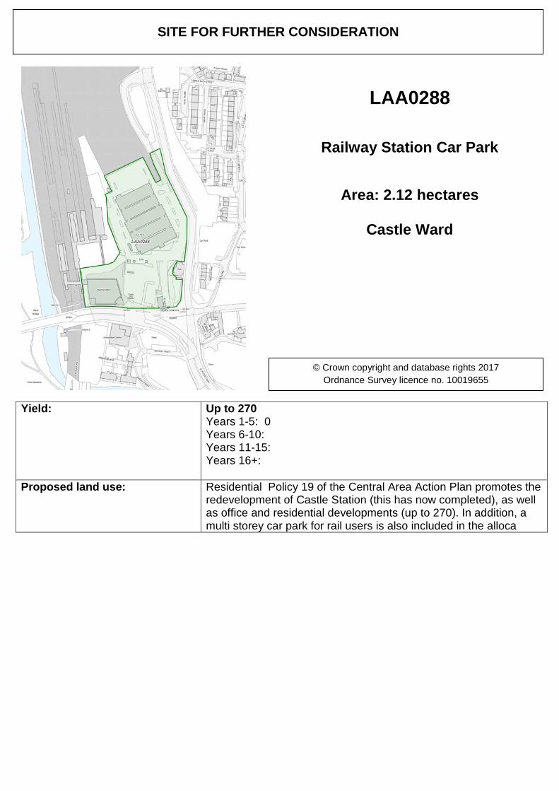
Yield: Up to 270 Years 1-5: 0 Years 6-10: Years 11-15: Years 16+:
Proposed land use: Residential Policy 19 of the Central Area Action Plan promotes the redevelopment of Castle Station (this has now completed), as well as office and residential developments (up to 270). In addition, a multi storey car park for rail users is also included in the alloca
SITE FOR FURTHER CONSIDERATION
LAA0288
Railway Station Car Park
Area: 2.12 hectares
Castle Ward
© Crown copyright and database rights 2017 Ordnance Survey licence no. 10019655
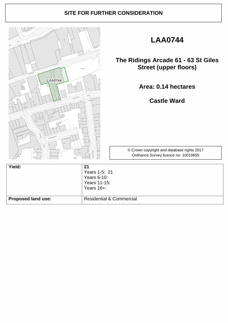
Yield: 21 Years 1-5: 21 Years 6-10: Years 11-15: Years 16+:
Proposed land use: Residential & Commercial
SITE FOR FURTHER CONSIDERATION
LAA0744
The Ridings Arcade 61 - 63 St Giles Street (upper floors)
Area: 0.14 hectares
Castle Ward
© Crown copyright and database rights 2017 Ordnance Survey licence no. 10019655
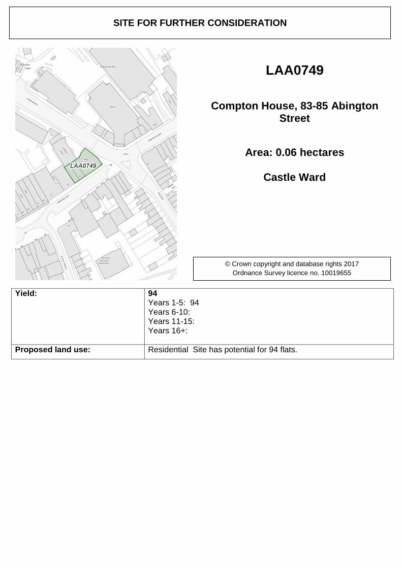
Yield: 94 Years 1-5: 94 Years 6-10: Years 11-15: Years 16+:
Proposed land use: Residential Site has potential for 94 flats.
SITE FOR FURTHER CONSIDERATION
LAA0749
Compton House, 83-85 Abington Street
Area: 0.06 hectares
Castle Ward
© Crown copyright and database rights 2017 Ordnance Survey licence no. 10019655
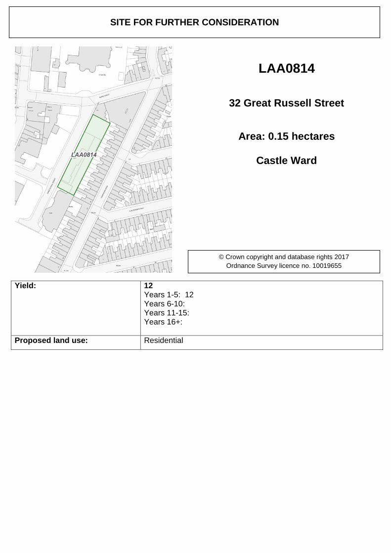
Yield: 12 Years 1-5: 12 Years 6-10: Years 11-15: Years 16+:
Proposed land use: Residential
SITE FOR FURTHER CONSIDERATION
LAA0814
32 Great Russell Street
Area: 0.15 hectares
Castle Ward
© Crown copyright and database rights 2017 Ordnance Survey licence no. 10019655
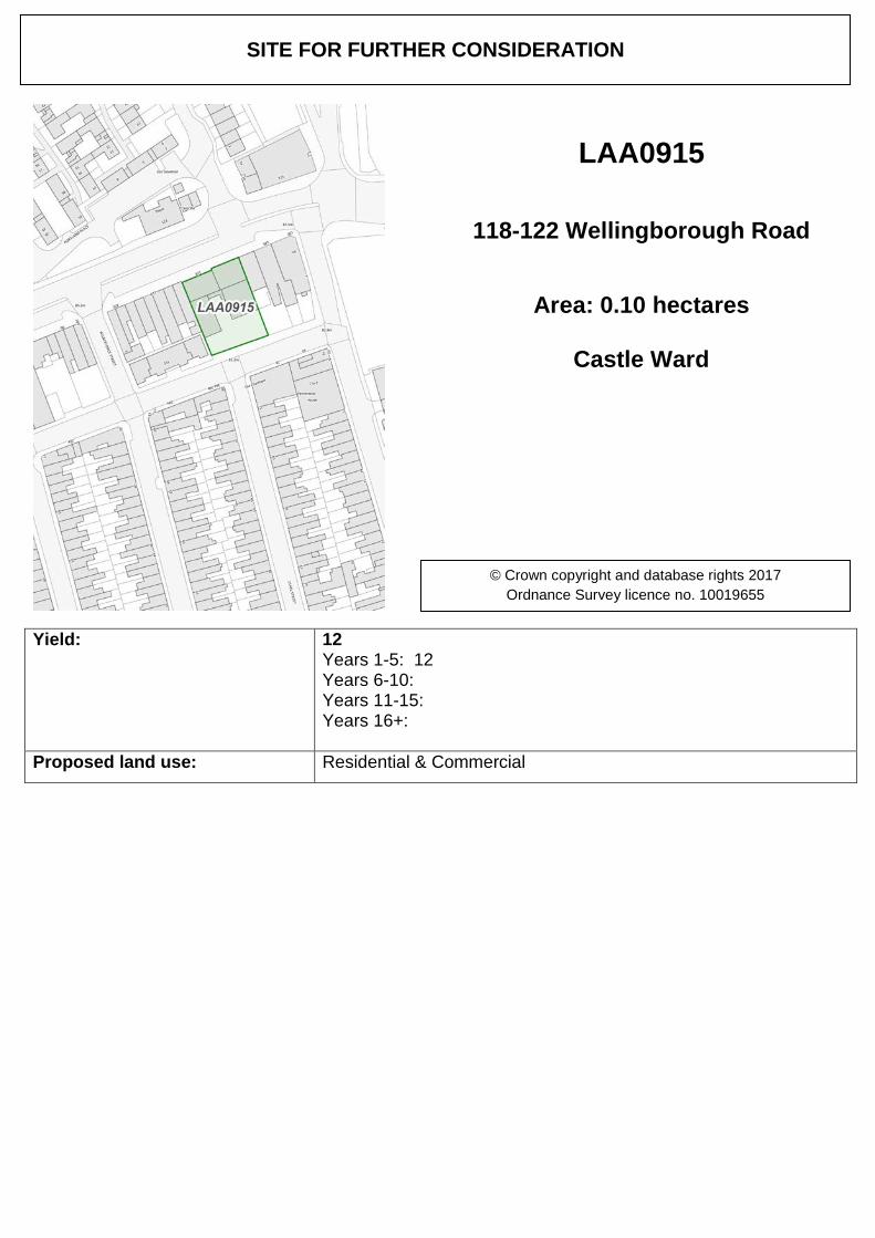
Yield: 12 Years 1-5: 12 Years 6-10: Years 11-15: Years 16+:
Proposed land use: Residential & Commercial
SITE FOR FURTHER CONSIDERATION
LAA0915
118-122 Wellingborough Road
Area: 0.10 hectares
Castle Ward
© Crown copyright and database rights 2017 Ordnance Survey licence no. 10019655
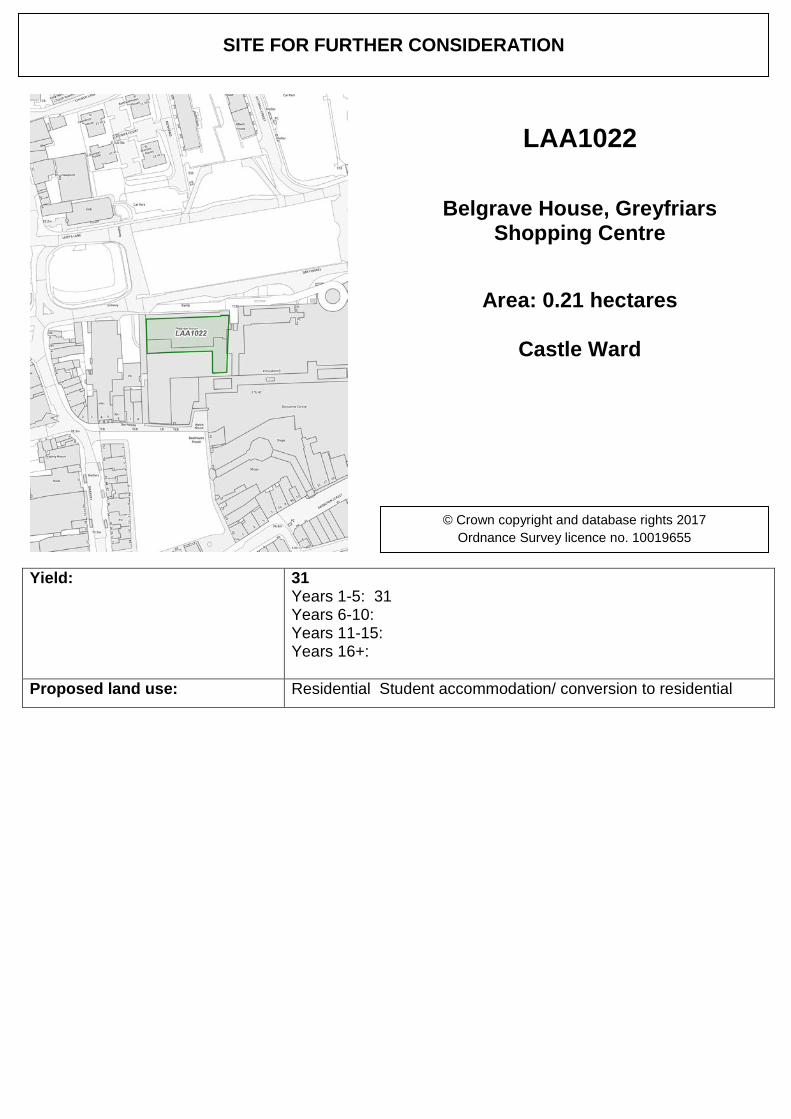
Yield: 31 Years 1-5: 31 Years 6-10: Years 11-15: Years 16+:
Proposed land use: Residential Student accommodation/ conversion to residential
SITE FOR FURTHER CONSIDERATION
LAA1022
Belgrave House, Greyfriars Shopping Centre
Area: 0.21 hectares
Castle Ward
© Crown copyright and database rights 2017 Ordnance Survey licence no. 10019655
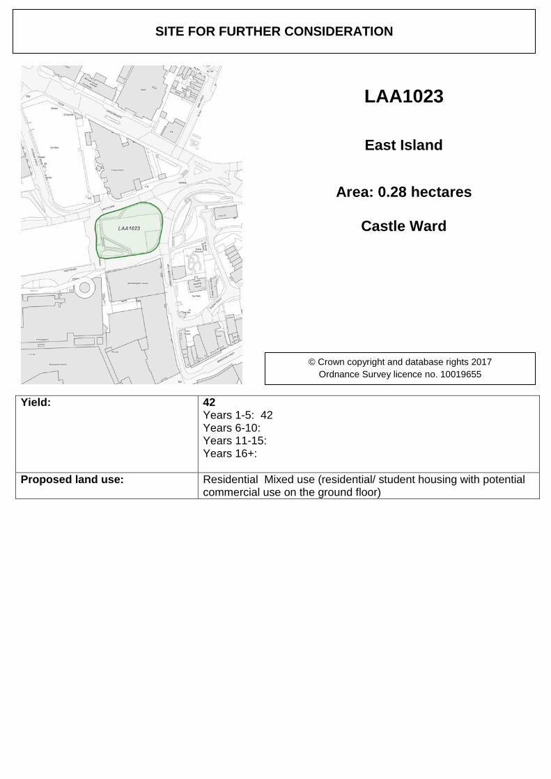
Yield: 42 Years 1-5: 42 Years 6-10: Years 11-15: Years 16+:
Proposed land use: Residential Mixed use (residential/ student housing with potential commercial use on the ground floor)
SITE FOR FURTHER CONSIDERATION
LAA1023
East Island
Area: 0.28 hectares
Castle Ward
© Crown copyright and database rights 2017 Ordnance Survey licence no. 10019655
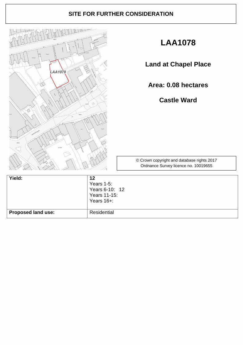
Yield: 12 Years 1-5: Years 6-10: 12 Years 11-15: Years 16+:
Proposed land use: Residential
SITE FOR FURTHER CONSIDERATION
LAA1078
Land at Chapel Place
Area: 0.08 hectares
Castle Ward
© Crown copyright and database rights 2017 Ordnance Survey licence no. 10019655
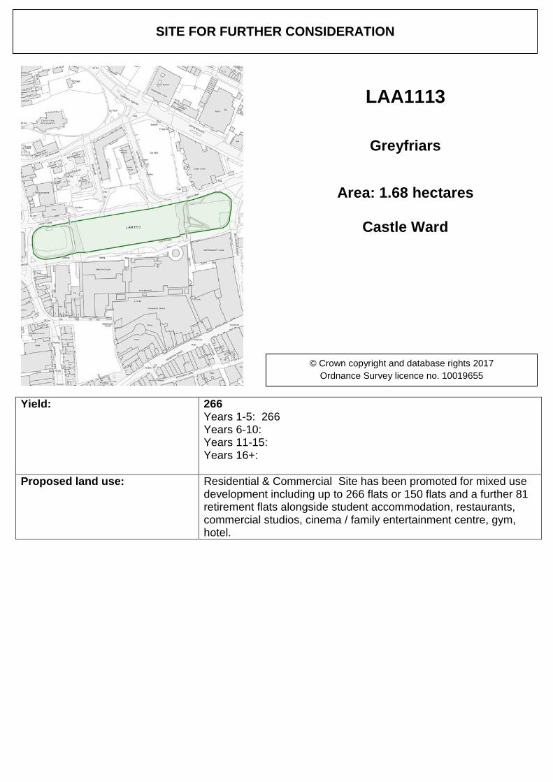
Yield: 266 Years 1-5: 266 Years 6-10: Years 11-15: Years 16+:
Proposed land use: Residential & Commercial Site has been promoted for mixed use development including up to 266 flats or 150 flats and a further 81 retirement flats alongside student accommodation, restaurants, commercial studios, cinema / family entertainment centre, gym, hotel.
SITE FOR FURTHER CONSIDERATION
LAA1113
Greyfriars
Area: 1.68 hectares
Castle Ward
© Crown copyright and database rights 2017 Ordnance Survey licence no. 10019655
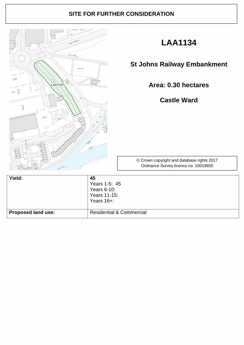
Yield: 45 Years 1-5: 45 Years 6-10: Years 11-15: Years 16+:
Proposed land use: Residential & Commercial
SITE FOR FURTHER CONSIDERATION
LAA1134
St Johns Railway Embankment
Area: 0.30 hectares
Castle Ward
© Crown copyright and database rights 2017 Ordnance Survey licence no. 10019655
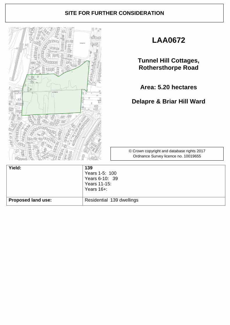
Yield: 139 Years 1-5: 100 Years 6-10: 39 Years 11-15: Years 16+:
Proposed land use: Residential 139 dwellings
SITE FOR FURTHER CONSIDERATION
LAA0672
Tunnel Hill Cottages, Rothersthorpe Road
Area: 5.20 hectares
Delapre & Briar Hill Ward
© Crown copyright and database rights 2017 Ordnance Survey licence no. 10019655
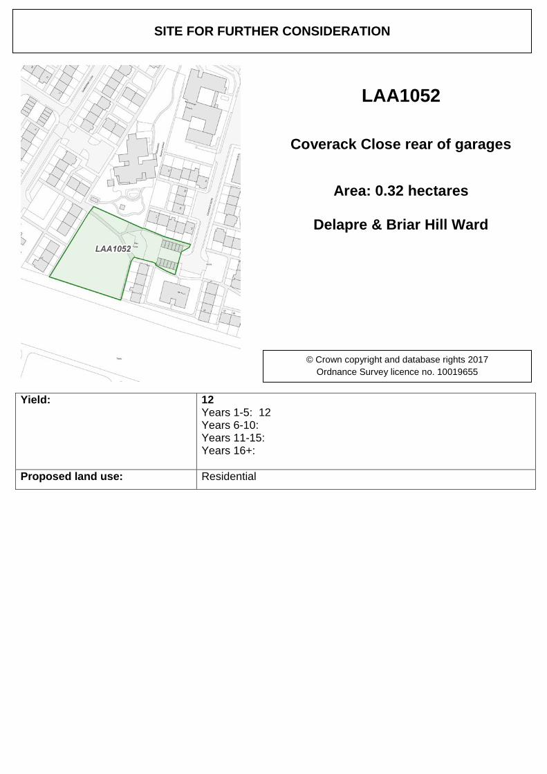
Yield: 12 Years 1-5: 12 Years 6-10: Years 11-15: Years 16+:
Proposed land use: Residential
SITE FOR FURTHER CONSIDERATION
LAA1052
Coverack Close rear of garages
Area: 0.32 hectares
Delapre & Briar Hill Ward
© Crown copyright and database rights 2017 Ordnance Survey licence no. 10019655
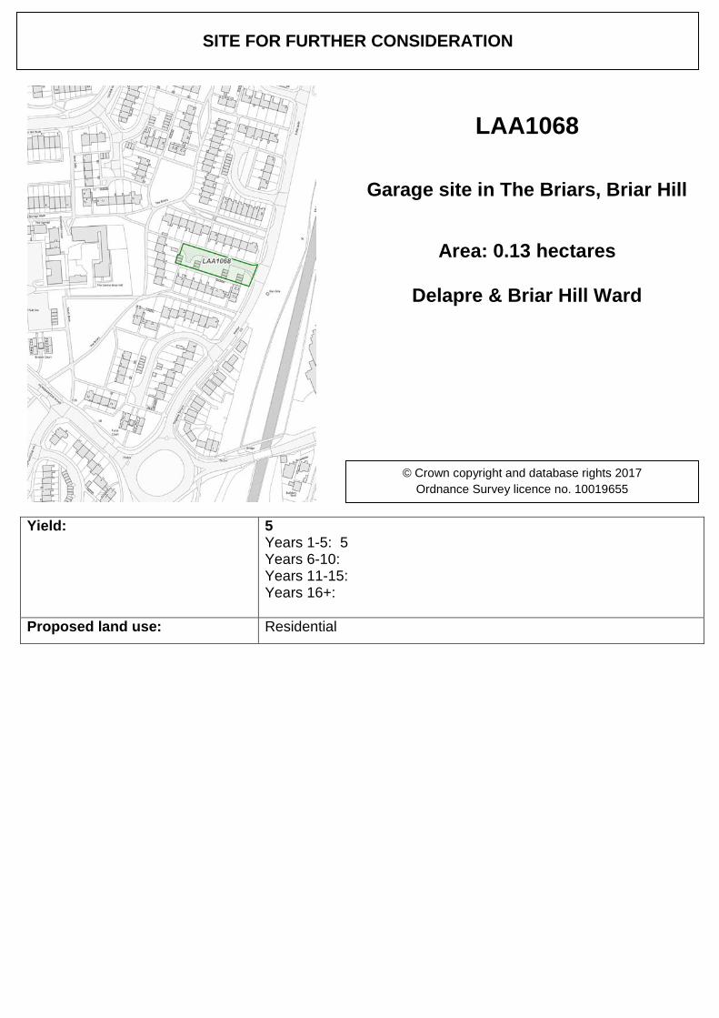
Yield: 5 Years 1-5: 5 Years 6-10: Years 11-15: Years 16+:
Proposed land use: Residential
SITE FOR FURTHER CONSIDERATION
LAA1068
Garage site in The Briars, Briar Hill
Area: 0.13 hectares
Delapre & Briar Hill Ward
© Crown copyright and database rights 2017 Ordnance Survey licence no. 10019655
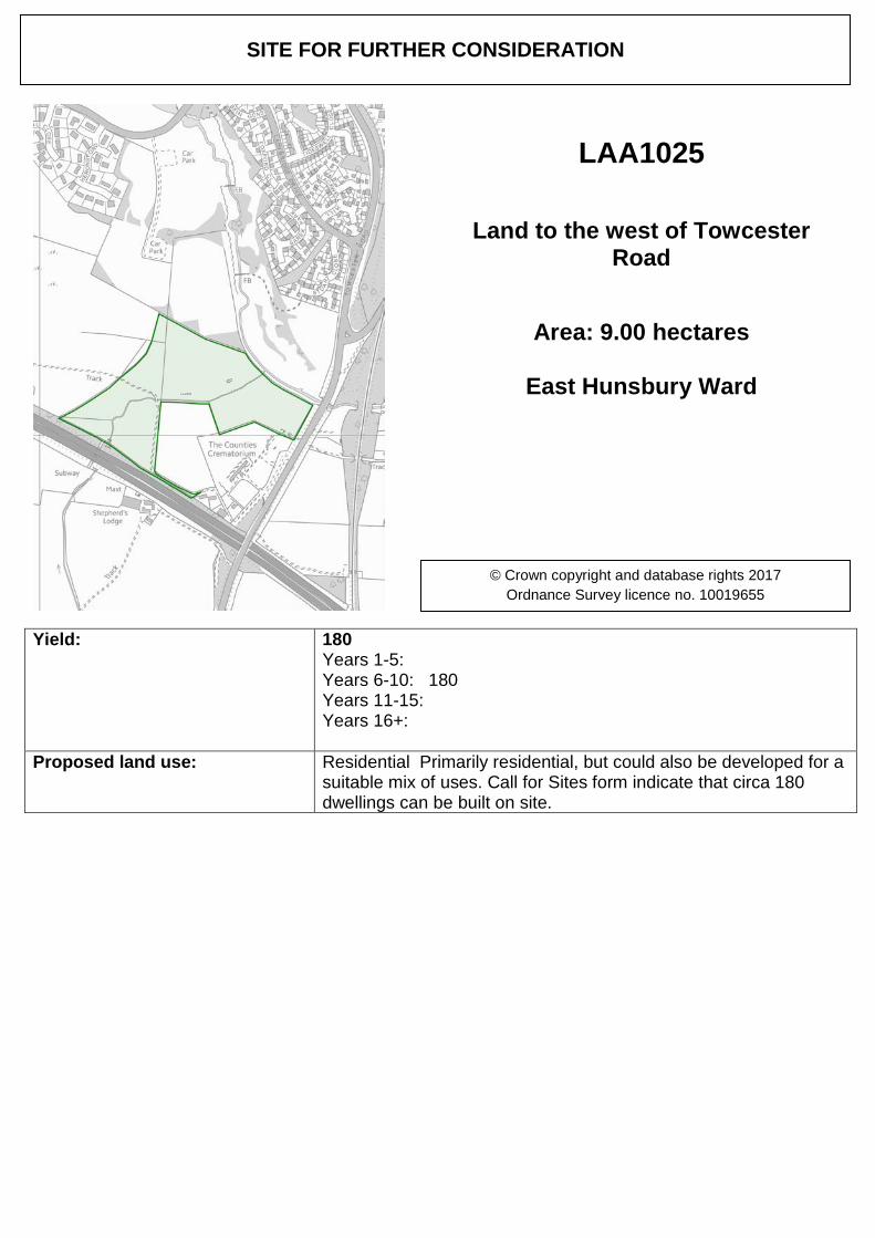
Yield: 180 Years 1-5: Years 6-10: 180 Years 11-15: Years 16+:
Proposed land use: Residential Primarily residential, but could also be developed for a suitable mix of uses. Call for Sites form indicate that circa 180 dwellings can be built on site.
SITE FOR FURTHER CONSIDERATION
LAA1025
Land to the west of Towcester Road
Area: 9.00 hectares
East Hunsbury Ward
© Crown copyright and database rights 2017 Ordnance Survey licence no. 10019655

Yield: 138 Years 1-5: 138 Years 6-10: Years 11-15: Years 16+:
Proposed land use: Residential
SITE FOR FURTHER CONSIDERATION
LAA1100
Hill Farm Rise
Area: 4.30 hectares
East Hunsbury Ward
© Crown copyright and database rights 2017 Ordnance Survey licence no. 10019655
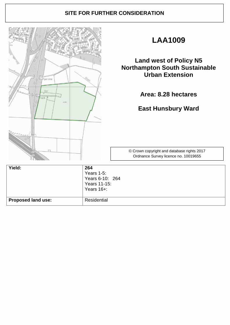
Yield: 264 Years 1-5: Years 6-10: 264 Years 11-15: Years 16+:
Proposed land use: Residential
SITE FOR FURTHER CONSIDERATION
LAA1009
Land west of Policy N5 Northampton South Sustainable
Urban Extension
Area: 8.28 hectares
East Hunsbury Ward
© Crown copyright and database rights 2017 Ordnance Survey licence no. 10019655
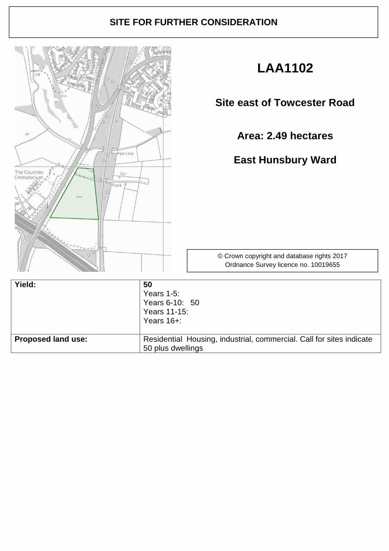
Yield: 50 Years 1-5: Years 6-10: 50 Years 11-15: Years 16+:
Proposed land use: Residential Housing, industrial, commercial. Call for sites indicate 50 plus dwellings
SITE FOR FURTHER CONSIDERATION
LAA1102
Site east of Towcester Road
Area: 2.49 hectares
East Hunsbury Ward
© Crown copyright and database rights 2017 Ordnance Survey licence no. 10019655
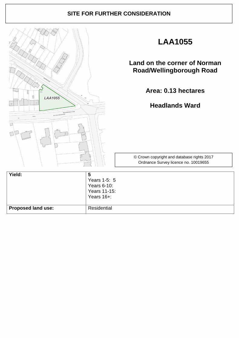
Yield: 5 Years 1-5: 5 Years 6-10: Years 11-15: Years 16+:
Proposed land use: Residential
SITE FOR FURTHER CONSIDERATION
LAA1055
Land on the corner of Norman Road/Wellingborough Road
Area: 0.13 hectares
Headlands Ward
© Crown copyright and database rights 2017 Ordnance Survey licence no. 10019655
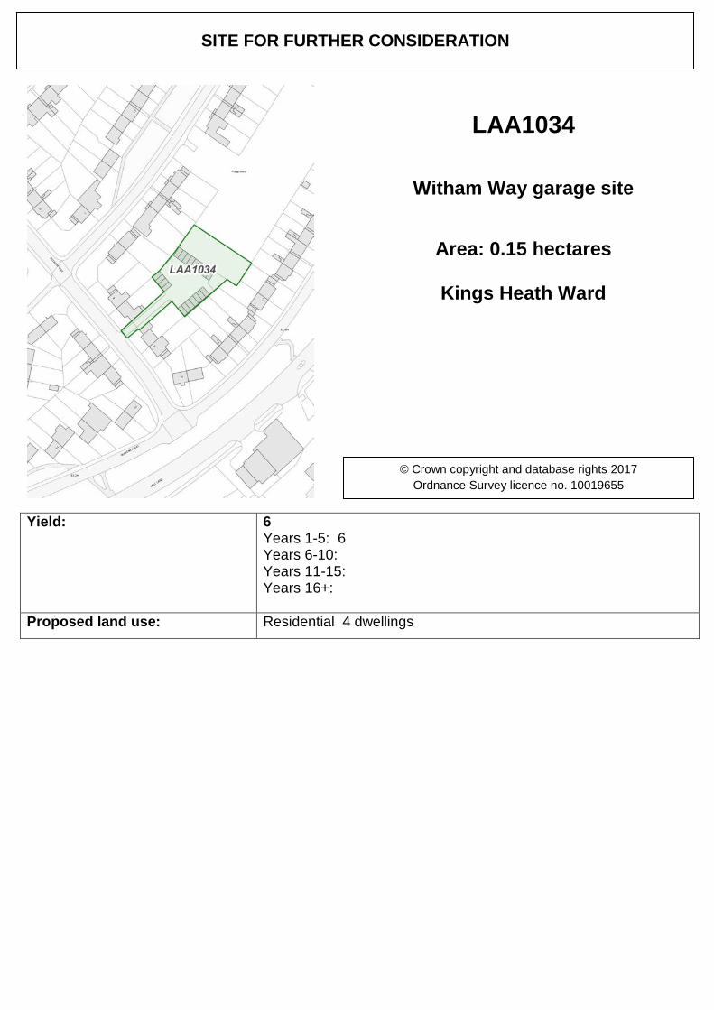
Yield: 6 Years 1-5: 6 Years 6-10: Years 11-15: Years 16+:
Proposed land use: Residential 4 dwellings
SITE FOR FURTHER CONSIDERATION
LAA1034
Witham Way garage site
Area: 0.15 hectares
Kings Heath Ward
© Crown copyright and database rights 2017 Ordnance Survey licence no. 10019655
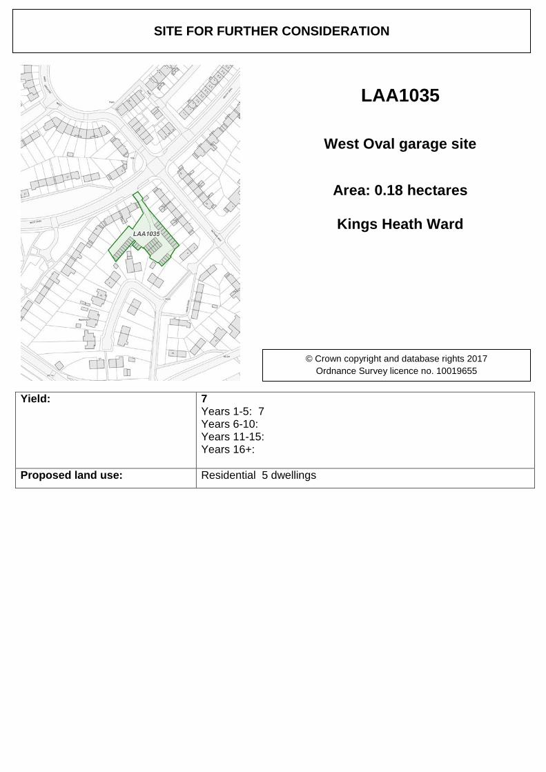
Yield: 7 Years 1-5: 7 Years 6-10: Years 11-15: Years 16+:
Proposed land use: Residential 5 dwellings
SITE FOR FURTHER CONSIDERATION
LAA1035
West Oval garage site
Area: 0.18 hectares
Kings Heath Ward
© Crown copyright and database rights 2017 Ordnance Survey licence no. 10019655

Yield: 7 Years 1-5: 7 Years 6-10: Years 11-15: Years 16+:
Proposed land use: Residential 5 units
SITE FOR FURTHER CONSIDERATION
LAA1036
Derwent Drive garage site
Area: 0.20 hectares
Kings Heath Ward
© Crown copyright and database rights 2017 Ordnance Survey licence no. 10019655
Yield: 6 Years 1-5: 6 Years 6-10: Years 11-15: Years 16+:
Proposed land use: Residential
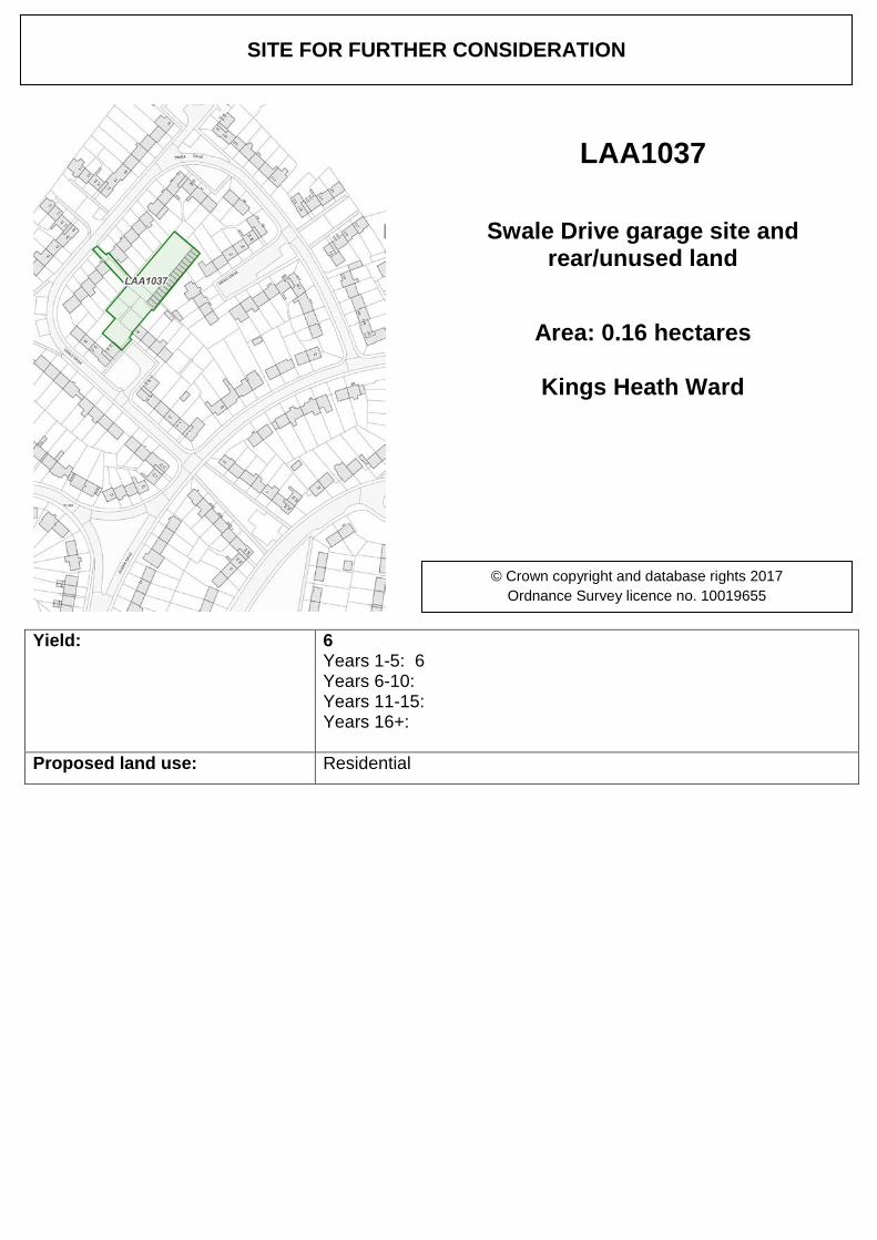
SITE FOR FURTHER CONSIDERATION
LAA1037
Swale Drive garage site and rear/unused land
Area: 0.16 hectares
Kings Heath Ward
© Crown copyright and database rights 2017 Ordnance Survey licence no. 10019655
Yield: 9 Years 1-5: 9 Years 6-10: Years 11-15: Years 16+:
Proposed land use: Residential It is proposed to sacrifice the end of terraced property which is still in Council ownership in order to gain an access to the site.
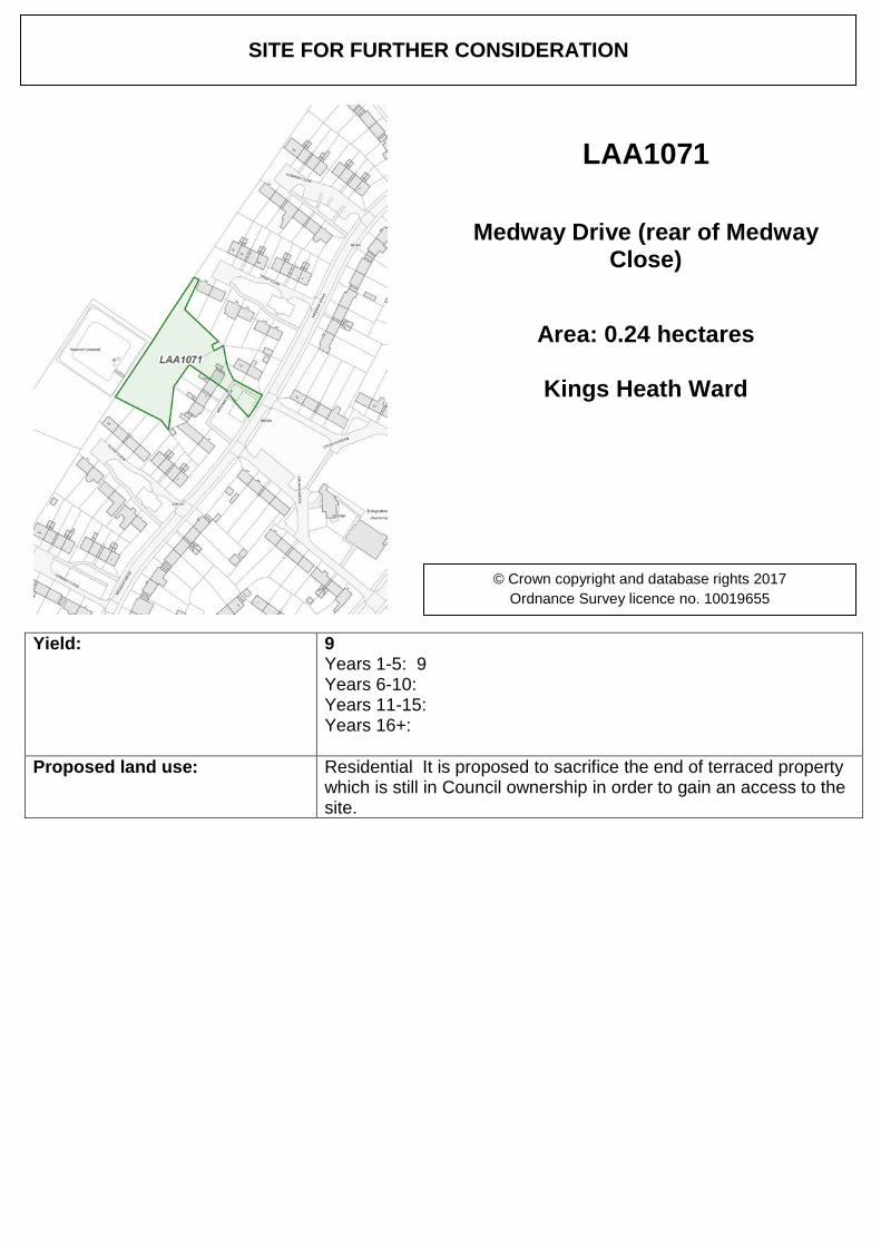
SITE FOR FURTHER CONSIDERATION
LAA1071
Medway Drive (rear of Medway Close)
Area: 0.24 hectares
Kings Heath Ward
© Crown copyright and database rights 2017 Ordnance Survey licence no. 10019655
Yield: 69 Years 1-5: Years 6-10: 69 Years 11-15: Years 16+:
Proposed land use: Residential
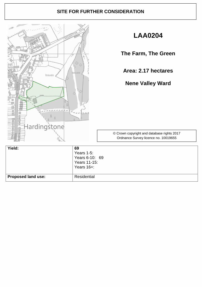
SITE FOR FURTHER CONSIDERATION
LAA0204
The Farm, The Green
Area: 2.17 hectares
Nene Valley Ward
© Crown copyright and database rights 2017 Ordnance Survey licence no. 10019655
Yield: 16 Years 1-5: 16 Years 6-10: Years 11-15: Years 16+:
Proposed land use: Residential 20 new dwellings.
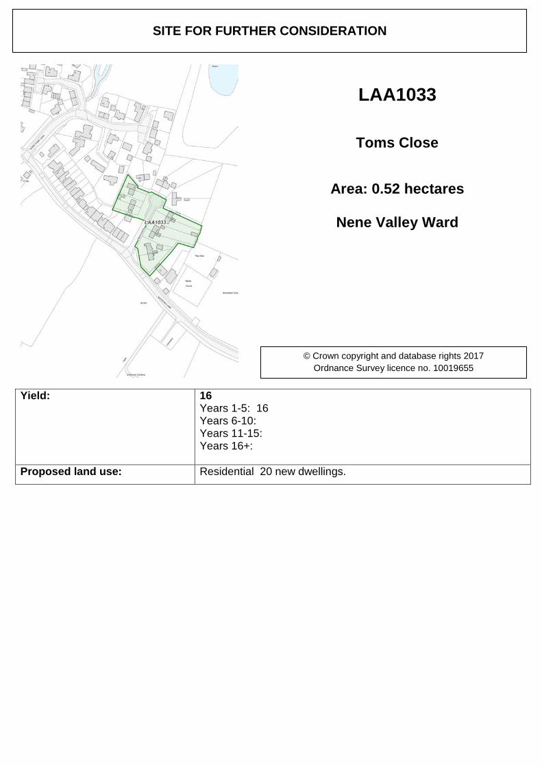
SITE FOR FURTHER CONSIDERATION
LAA1033
Toms Close
Area: 0.52 hectares
Nene Valley Ward
© Crown copyright and database rights 2017 Ordnance Survey licence no. 10019655
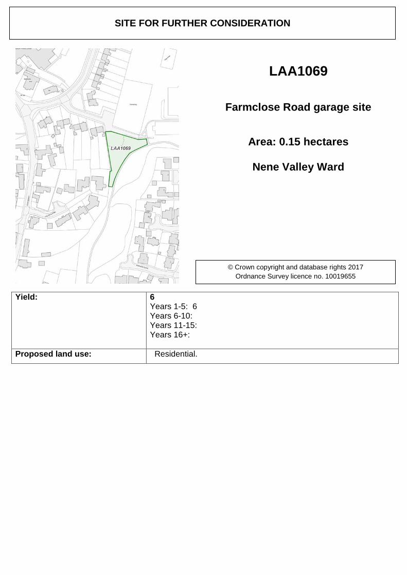
Yield: 6 Years 1-5: 6 Years 6-10: Years 11-15: Years 16+:
Proposed land use: Residential.
SITE FOR FURTHER CONSIDERATION
LAA1069
Farmclose Road garage site
Area: 0.15 hectares
Nene Valley Ward
© Crown copyright and database rights 2017 Ordnance Survey licence no. 10019655
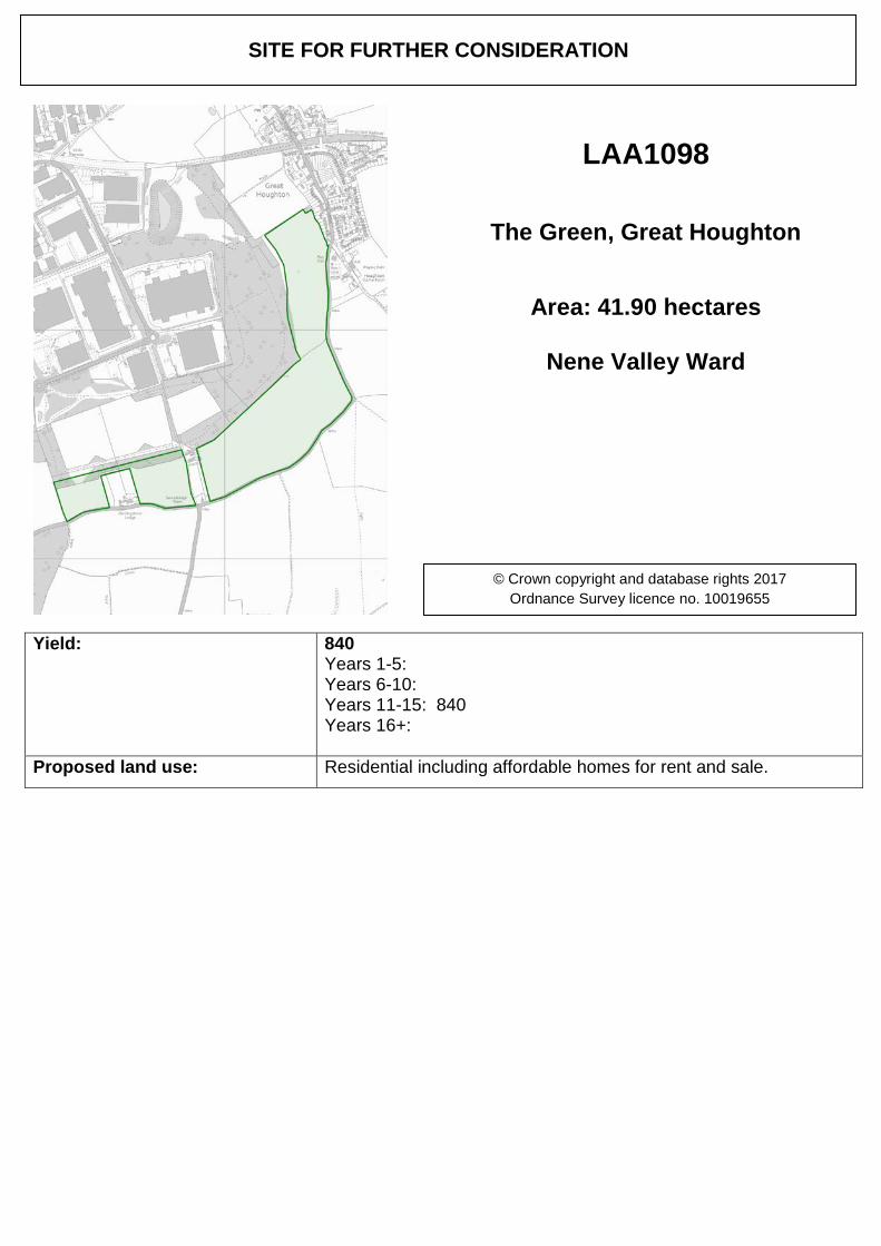
Yield: 840 Years 1-5: Years 6-10: Years 11-15: 840 Years 16+:
Proposed land use: Residential including affordable homes for rent and sale.
SITE FOR FURTHER CONSIDERATION
LAA1098
The Green, Great Houghton
Area: 41.90 hectares
Nene Valley Ward
© Crown copyright and database rights 2017 Ordnance Survey licence no. 10019655
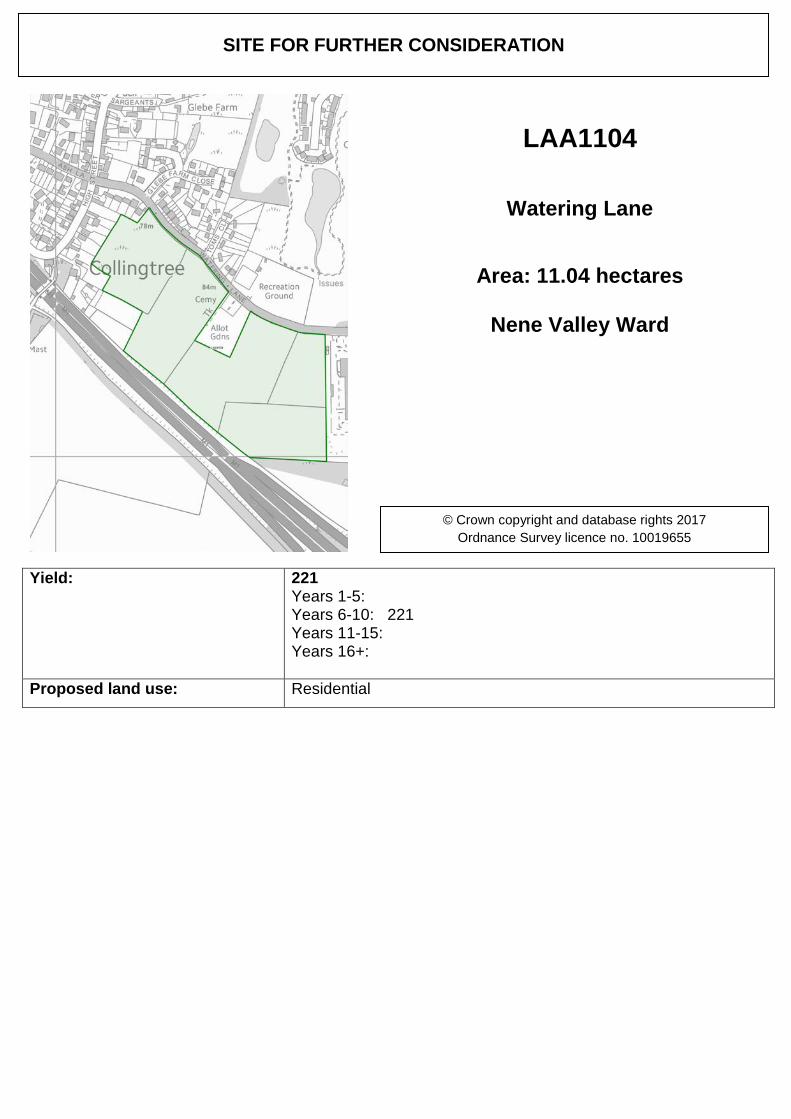
Yield: 221 Years 1-5: Years 6-10: 221 Years 11-15: Years 16+:
Proposed land use: Residential
SITE FOR FURTHER CONSIDERATION
LAA1104
Watering Lane
Area: 11.04 hectares
Nene Valley Ward
© Crown copyright and database rights 2017 Ordnance Survey licence no. 10019655
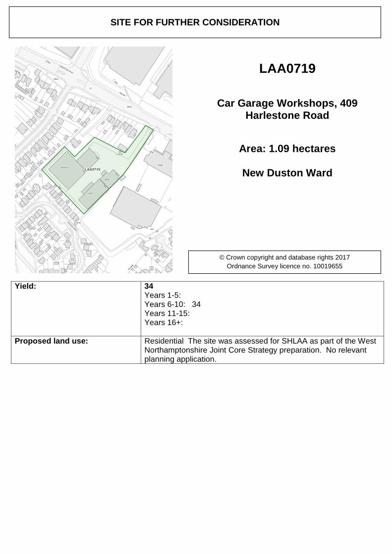
Yield: 34 Years 1-5: Years 6-10: 34 Years 11-15: Years 16+:
Proposed land use: Residential The site was assessed for SHLAA as part of the West Northamptonshire Joint Core Strategy preparation. No relevant planning application.
SITE FOR FURTHER CONSIDERATION
LAA0719
Car Garage Workshops, 409 Harlestone Road
Area: 1.09 hectares
New Duston Ward
© Crown copyright and database rights 2017 Ordnance Survey licence no. 10019655
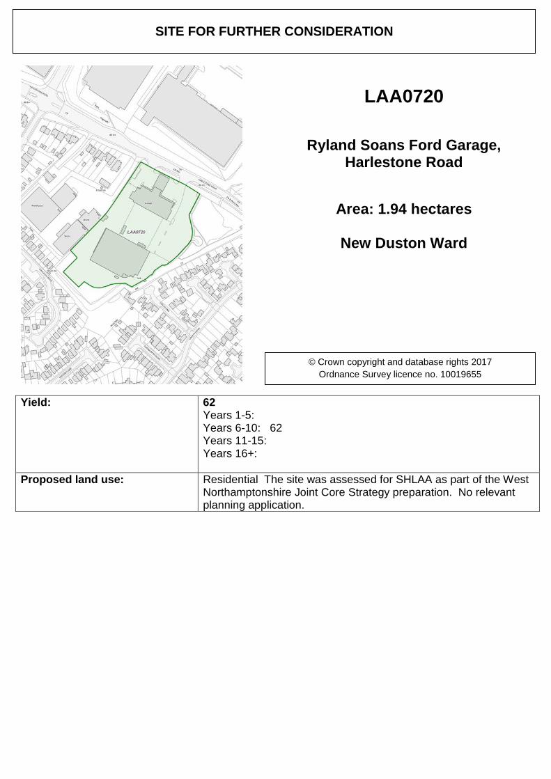
Yield: 62 Years 1-5: Years 6-10: 62 Years 11-15: Years 16+:
Proposed land use: Residential The site was assessed for SHLAA as part of the West Northamptonshire Joint Core Strategy preparation. No relevant planning application.
SITE FOR FURTHER CONSIDERATION
LAA0720
Ryland Soans Ford Garage, Harlestone Road
Area: 1.94 hectares
New Duston Ward
© Crown copyright and database rights 2017 Ordnance Survey licence no. 10019655
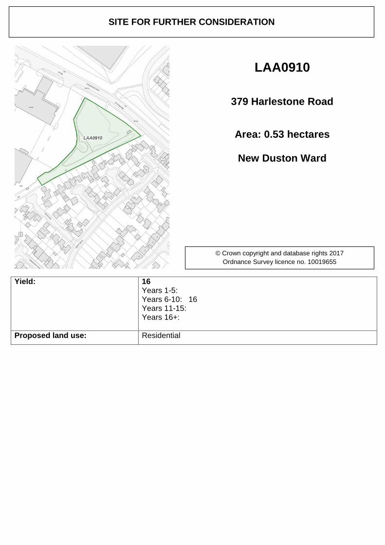
Yield: 16 Years 1-5: Years 6-10: 16 Years 11-15: Years 16+:
Proposed land use: Residential
SITE FOR FURTHER CONSIDERATION
LAA0910
379 Harlestone Road
Area: 0.53 hectares
New Duston Ward
© Crown copyright and database rights 2017 Ordnance Survey licence no. 10019655
Yield: Years 1-5: Years 6-10: Years 11-15: Years 16+:
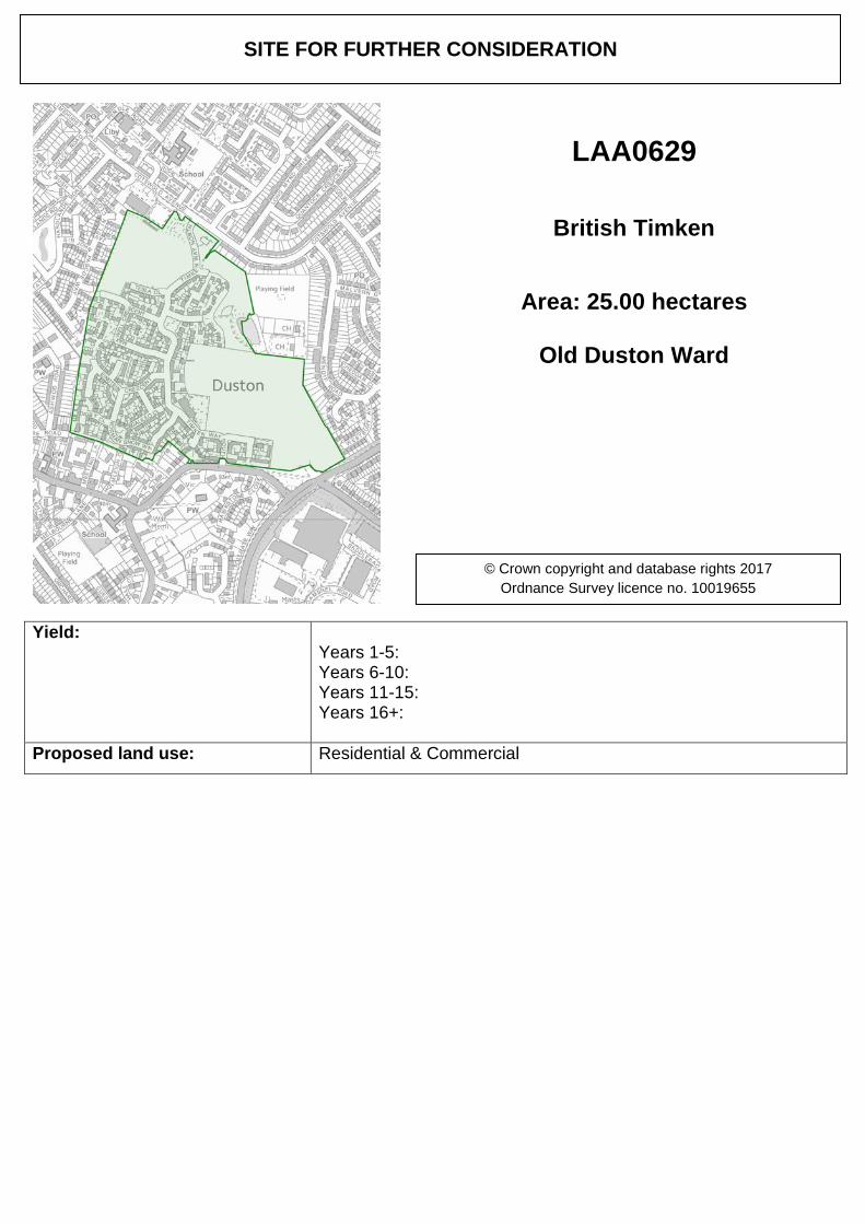
Proposed land use: Residential & Commercial
SITE FOR FURTHER CONSIDERATION
LAA0629
British Timken
Area: 25.00 hectares
Old Duston Ward
© Crown copyright and database rights 2017 Ordnance Survey licence no. 10019655
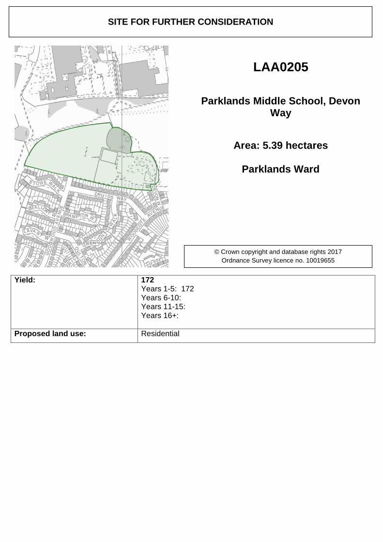
Yield: 172 Years 1-5: 172 Years 6-10: Years 11-15: Years 16+:
Proposed land use: Residential
SITE FOR FURTHER CONSIDERATION
LAA0205
Parklands Middle School, Devon Way
Area: 5.39 hectares
Parklands Ward
© Crown copyright and database rights 2017 Ordnance Survey licence no. 10019655
Yield: Years 1-5: Years 6-10: Years 11-15: Years 16+:
Proposed land use: Commercial
SITE FOR FURTHER CONSIDERATION
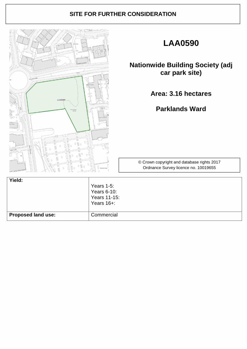
LAA0590
Nationwide Building Society (adj car park site)
Area: 3.16 hectares
Parklands Ward
© Crown copyright and database rights 2017 Ordnance Survey licence no. 10019655
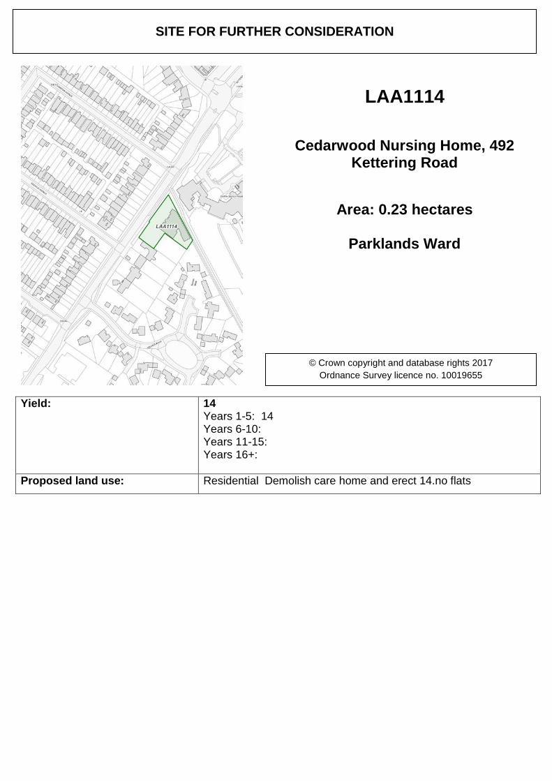
Yield: 14 Years 1-5: 14 Years 6-10: Years 11-15: Years 16+:
Proposed land use: Residential Demolish care home and erect 14.no flats
SITE FOR FURTHER CONSIDERATION
LAA1114
Cedarwood Nursing Home, 492 Kettering Road
Area: 0.23 hectares
Parklands Ward
© Crown copyright and database rights 2017 Ordnance Survey licence no. 10019655
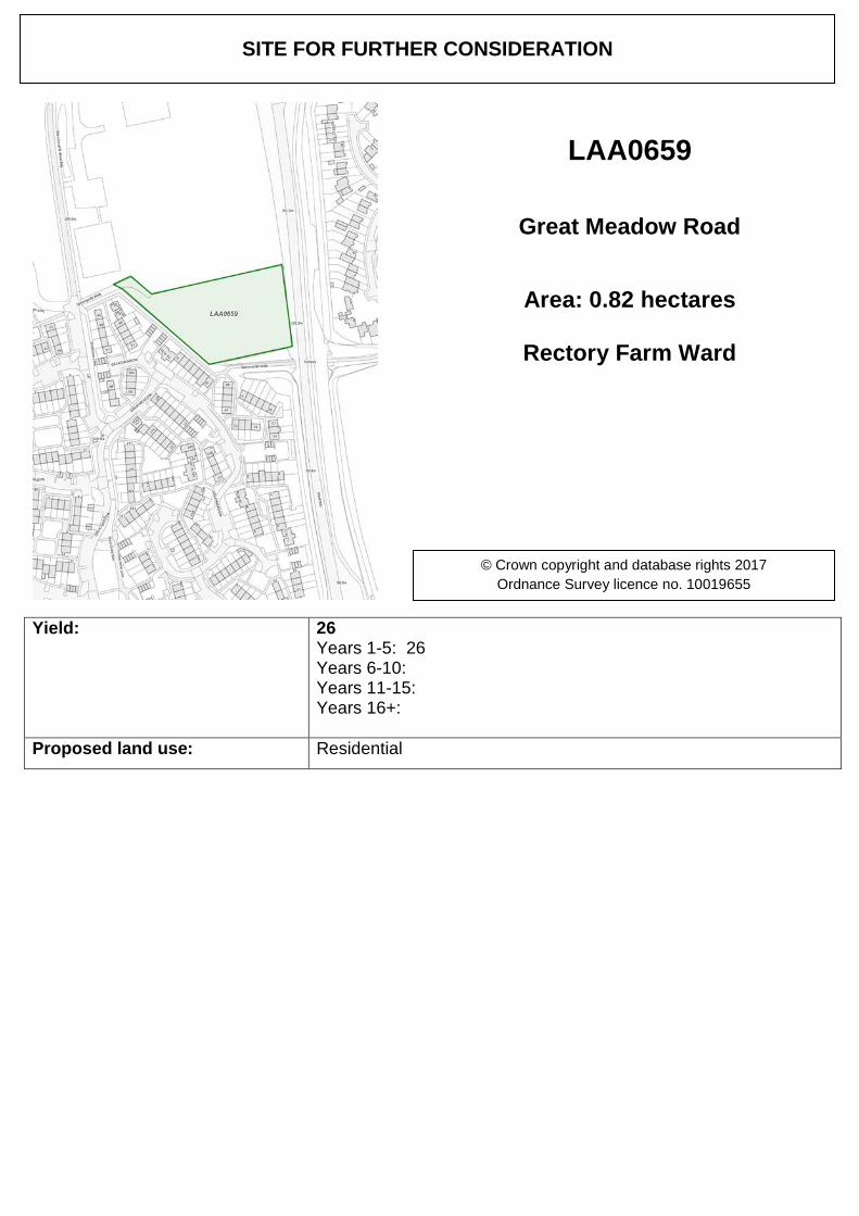
Yield: 26 Years 1-5: 26 Years 6-10: Years 11-15: Years 16+:
Proposed land use: Residential
SITE FOR FURTHER CONSIDERATION
LAA0659
Great Meadow Road
Area: 0.82 hectares
Rectory Farm Ward
© Crown copyright and database rights 2017 Ordnance Survey licence no. 10019655
Yield: Years 1-5: Years 6-10: Years 11-15: Years 16+:
Proposed land use: Commercial
SITE FOR FURTHER CONSIDERATION
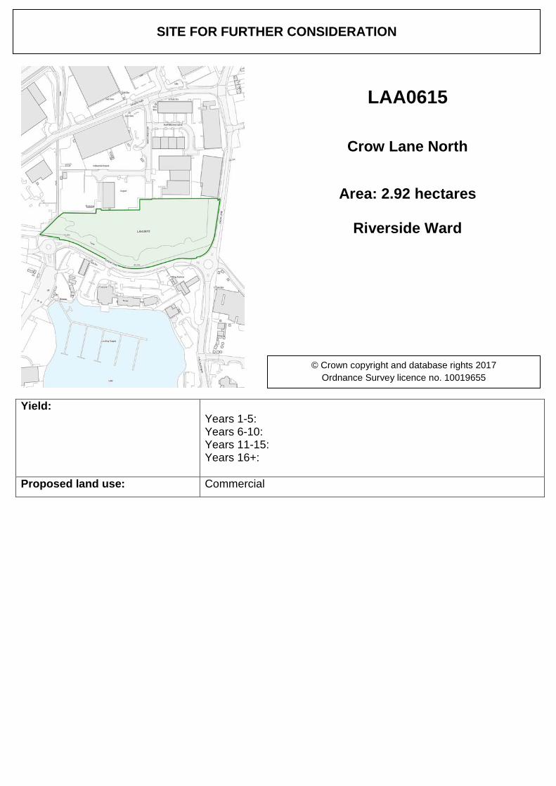
LAA0615
Crow Lane North
Area: 2.92 hectares
Riverside Ward
© Crown copyright and database rights 2017 Ordnance Survey licence no. 10019655
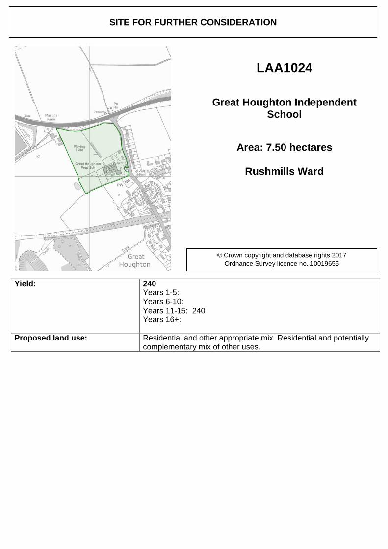
Yield: 240 Years 1-5: Years 6-10: Years 11-15: 240 Years 16+:
Proposed land use: Residential and other appropriate mix Residential and potentially complementary mix of other uses.
SITE FOR FURTHER CONSIDERATION
LAA1024
Great Houghton Independent School
Area: 7.50 hectares
Rushmills Ward
© Crown copyright and database rights 2017 Ordnance Survey licence no. 10019655
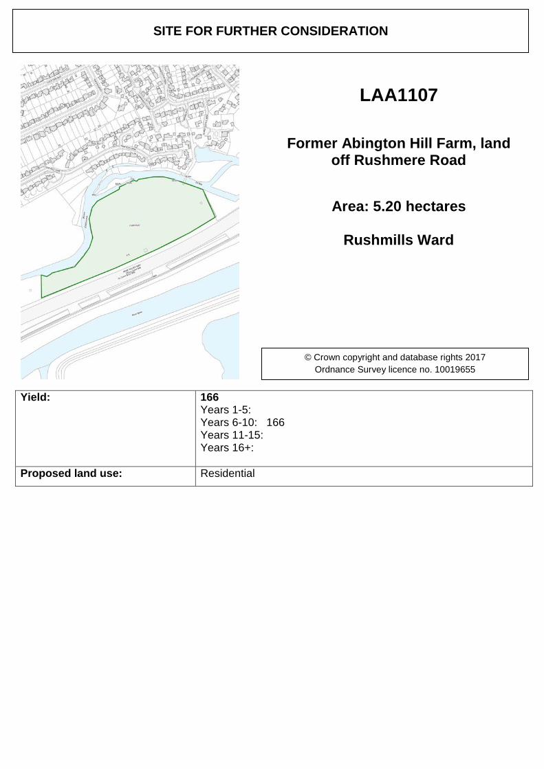
Yield: 166 Years 1-5: Years 6-10: 166 Years 11-15: Years 16+:
Proposed land use: Residential
SITE FOR FURTHER CONSIDERATION
LAA1107
Former Abington Hill Farm, land off Rushmere Road
Area: 5.20 hectares
Rushmills Ward
© Crown copyright and database rights 2017 Ordnance Survey licence no. 10019655
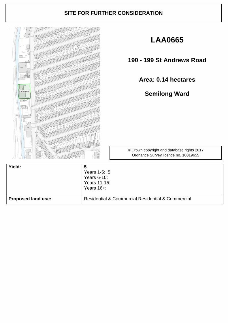
Yield: 5 Years 1-5: 5 Years 6-10: Years 11-15: Years 16+:
Proposed land use: Residential & Commercial Residential & Commercial
SITE FOR FURTHER CONSIDERATION
LAA0665
190 - 199 St Andrews Road
Area: 0.14 hectares
Semilong Ward
© Crown copyright and database rights 2017 Ordnance Survey licence no. 10019655
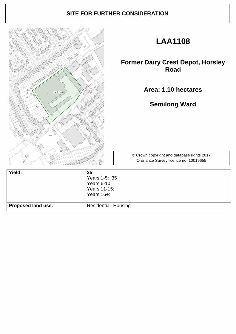
Yield: 35 Years 1-5: 35 Years 6-10: Years 11-15: Years 16+:
Proposed land use: Residential Housing
SITE FOR FURTHER CONSIDERATION
LAA1108
Former Dairy Crest Depot, Horsley Road
Area: 1.10 hectares
Semilong Ward
© Crown copyright and database rights 2017 Ordnance Survey licence no. 10019655
Yield: 31 Years 1-5: Years 6-10: 31 Years 11-15: Years 16+:
Proposed land use: Residential
SITE FOR FURTHER CONSIDERATION
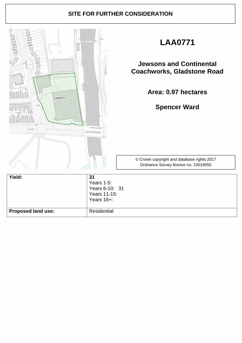
LAA0771
Jewsons and Continental Coachworks, Gladstone Road
Area: 0.97 hectares
Spencer Ward
© Crown copyright and database rights 2017 Ordnance Survey licence no. 10019655
Yield: 71 Years 1-5: 71 Years 6-10: Years 11-15: Years 16+:
Proposed land use: Residential
SITE FOR FURTHER CONSIDERATION
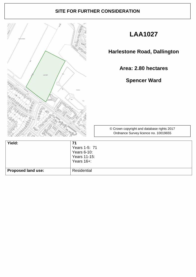
LAA1027
Harlestone Road, Dallington
Area: 2.80 hectares
Spencer Ward
© Crown copyright and database rights 2017 Ordnance Survey licence no. 10019655
Yield: 38 Years 1-5: 38 Years 6-10: Years 11-15: Years 16+:
Proposed land use: Residential
SITE FOR FURTHER CONSIDERATION
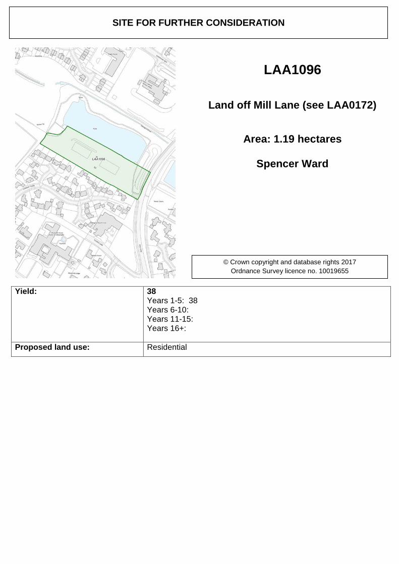
LAA1096
Land off Mill Lane (see LAA0172)
Area: 1.19 hectares
Spencer Ward
© Crown copyright and database rights 2017 Ordnance Survey licence no. 10019655
Yield: 24 Years 1-5: 24 Years 6-10: Years 11-15: Years 16+:
Proposed land use: Residential. Call for sites form indicate circa 24 dwellings.
SITE FOR FURTHER CONSIDERATION
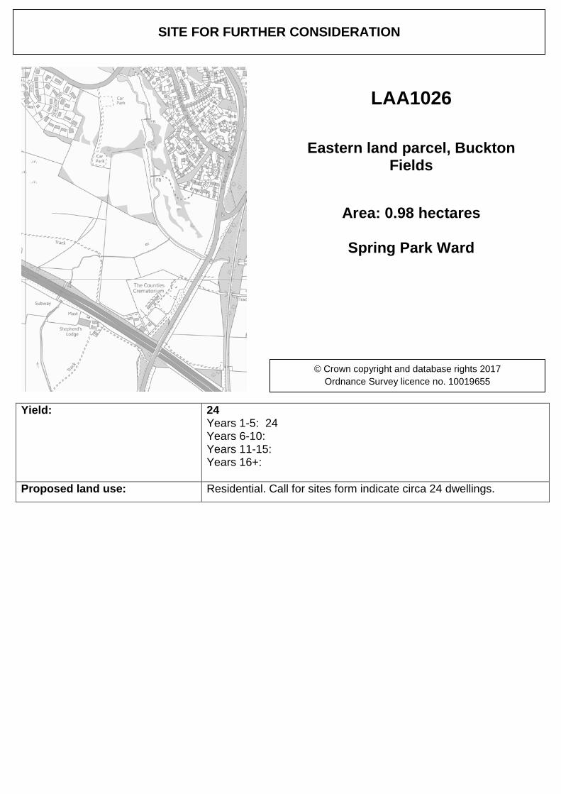
LAA1026
Eastern land parcel, Buckton Fields
Area: 0.98 hectares
Spring Park Ward
© Crown copyright and database rights 2017 Ordnance Survey licence no. 10019655
Yield: 14 Years 1-5: 14 Years 6-10: Years 11-15: Years 16+:
Proposed land use: Residential
SITE FOR FURTHER CONSIDERATION
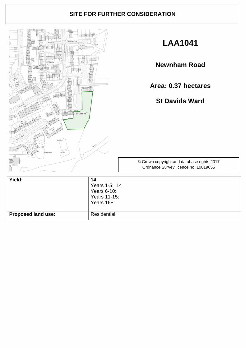
LAA1041
Newnham Road
Area: 0.37 hectares
St Davids Ward
© Crown copyright and database rights 2017 Ordnance Survey licence no. 10019655
Yield: Years 1-5: Years 6-10: Years 11-15: Years 16+:
Proposed land use: Commercial
SITE FOR FURTHER CONSIDERATION
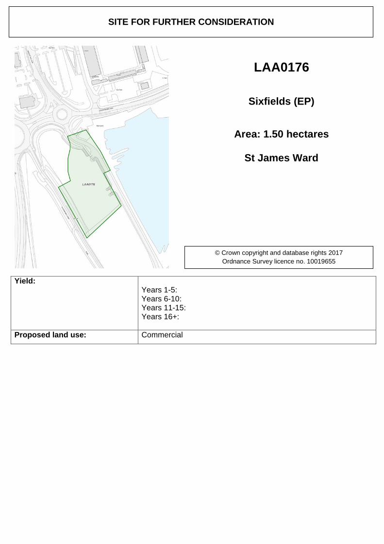
LAA0176
Sixfields (EP)
Area: 1.50 hectares
St James Ward
© Crown copyright and database rights 2017 Ordnance Survey licence no. 10019655
Yield: Years 1-5: 0 Years 6-10: Years 11-15: Years 16+:
Proposed land use: Commercial
SITE FOR FURTHER CONSIDERATION
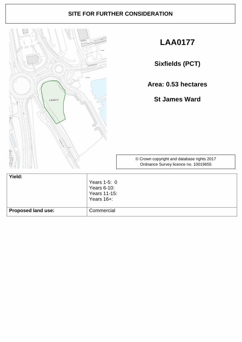
LAA0177
Sixfields (PCT)
Area: 0.53 hectares
St James Ward
© Crown copyright and database rights 2017 Ordnance Survey licence no. 10019655
Yield: Years 1-5: 0 Years 6-10: Years 11-15: Years 16+:
Proposed land use: Commercial
SITE FOR FURTHER CONSIDERATION
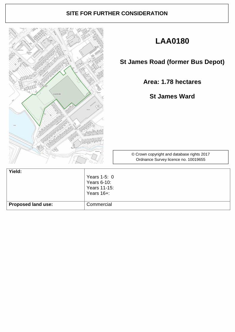
LAA0180
St James Road (former Bus Depot)
Area: 1.78 hectares
St James Ward
© Crown copyright and database rights 2017 Ordnance Survey licence no. 10019655
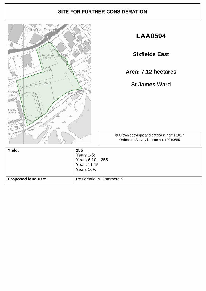
Yield: 255 Years 1-5: Years 6-10: 255 Years 11-15: Years 16+:
Proposed land use: Residential & Commercial
SITE FOR FURTHER CONSIDERATION
LAA0594
Sixfields East
Area: 7.12 hectares
St James Ward
© Crown copyright and database rights 2017 Ordnance Survey licence no. 10019655
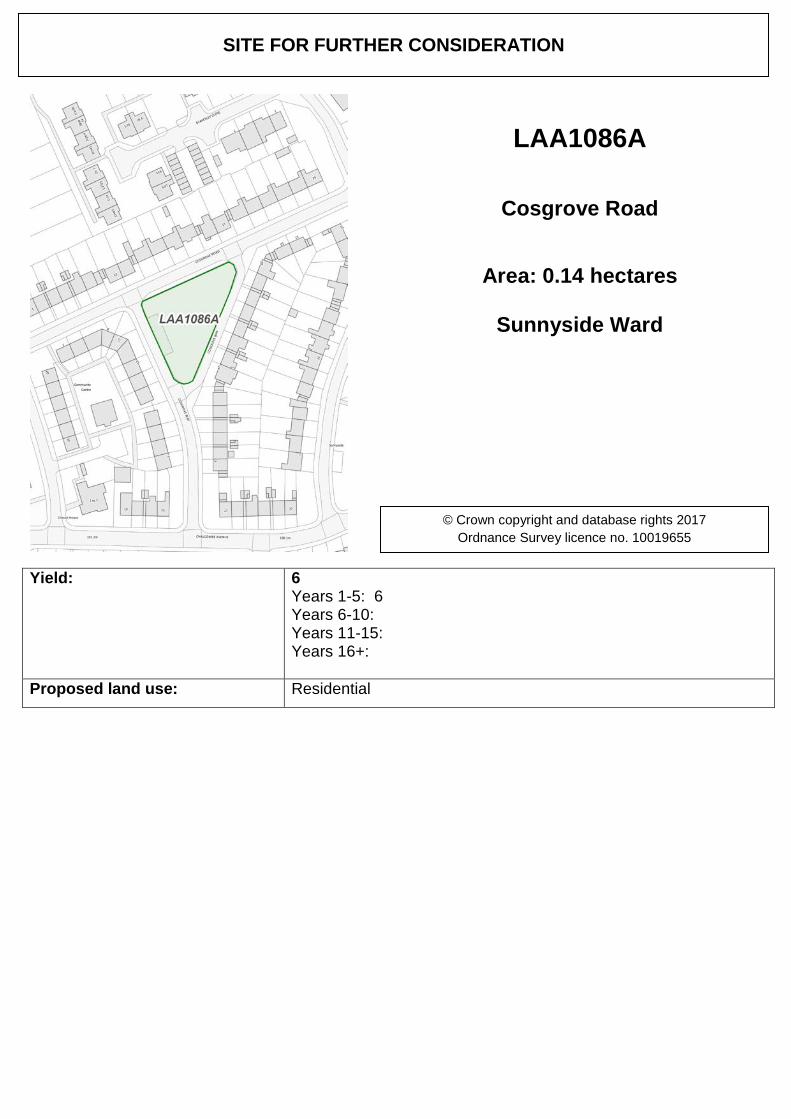
Yield: 6 Years 1-5: 6 Years 6-10: Years 11-15: Years 16+:
Proposed land use: Residential
SITE FOR FURTHER CONSIDERATION
LAA1086A
Cosgrove Road
Area: 0.14 hectares
Sunnyside Ward
© Crown copyright and database rights 2017 Ordnance Survey licence no. 10019655
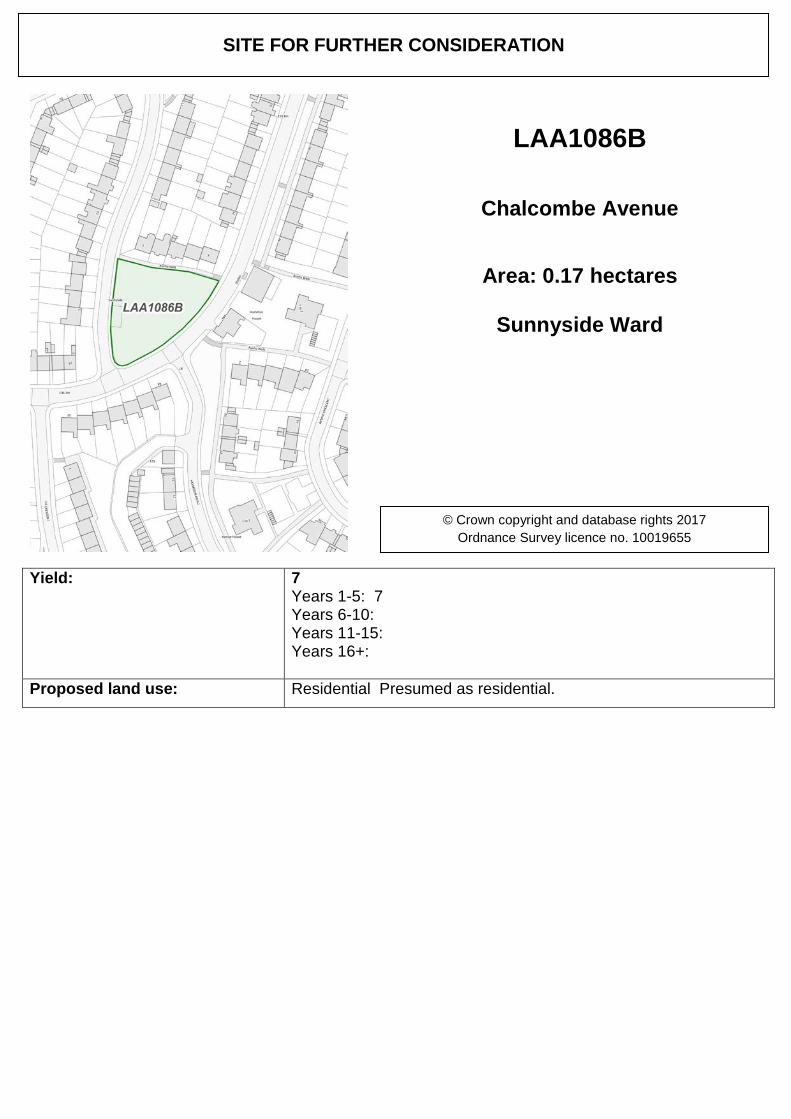
Yield: 7 Years 1-5: 7 Years 6-10: Years 11-15: Years 16+:
Proposed land use: Residential Presumed as residential.
SITE FOR FURTHER CONSIDERATION
LAA1086B
Chalcombe Avenue
Area: 0.17 hectares
Sunnyside Ward
© Crown copyright and database rights 2017 Ordnance Survey licence no. 10019655
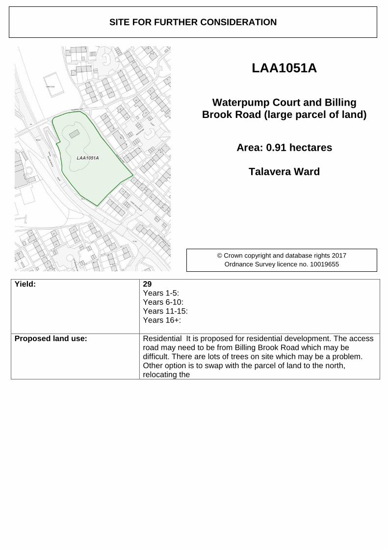
Yield: 29 Years 1-5: Years 6-10: Years 11-15: Years 16+:
Proposed land use: Residential It is proposed for residential development. The access road may need to be from Billing Brook Road which may be difficult. There are lots of trees on site which may be a problem. Other option is to swap with the parcel of land to the north, relocating the
SITE FOR FURTHER CONSIDERATION
LAA1051A
Waterpump Court and Billing Brook Road (large parcel of land)
Area: 0.91 hectares
Talavera Ward
© Crown copyright and database rights 2017 Ordnance Survey licence no. 10019655
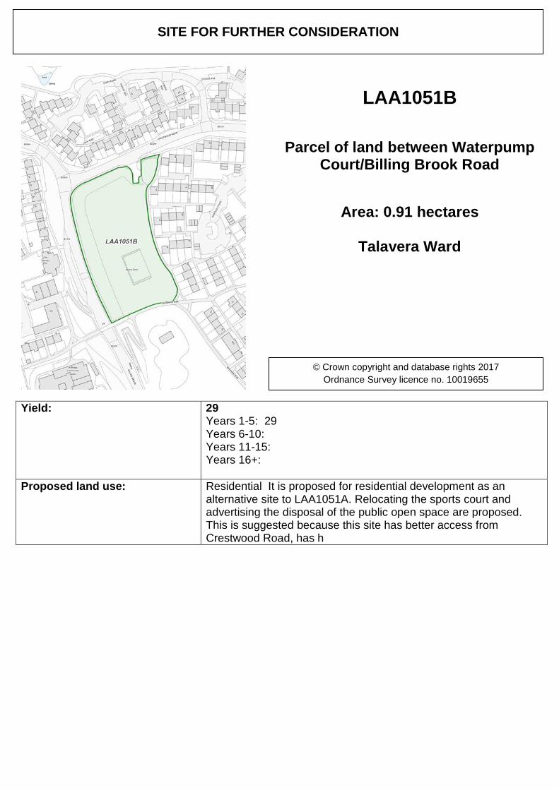
Yield: 29 Years 1-5: 29 Years 6-10: Years 11-15: Years 16+:
Proposed land use: Residential It is proposed for residential development as an alternative site to LAA1051A. Relocating the sports court and advertising the disposal of the public open space are proposed. This is suggested because this site has better access from Crestwood Road, has h
SITE FOR FURTHER CONSIDERATION
LAA1051B
Parcel of land between Waterpump Court/Billing Brook Road
Area: 0.91 hectares
Talavera Ward
© Crown copyright and database rights 2017 Ordnance Survey licence no. 10019655
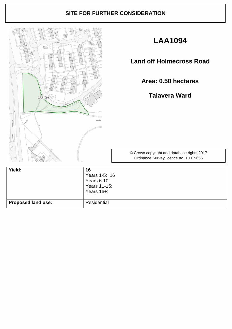
Yield: 16 Years 1-5: 16 Years 6-10: Years 11-15: Years 16+:
Proposed land use: Residential
SITE FOR FURTHER CONSIDERATION
LAA1094
Land off Holmecross Road
Area: 0.50 hectares
Talavera Ward
© Crown copyright and database rights 2017 Ordnance Survey licence no. 10019655
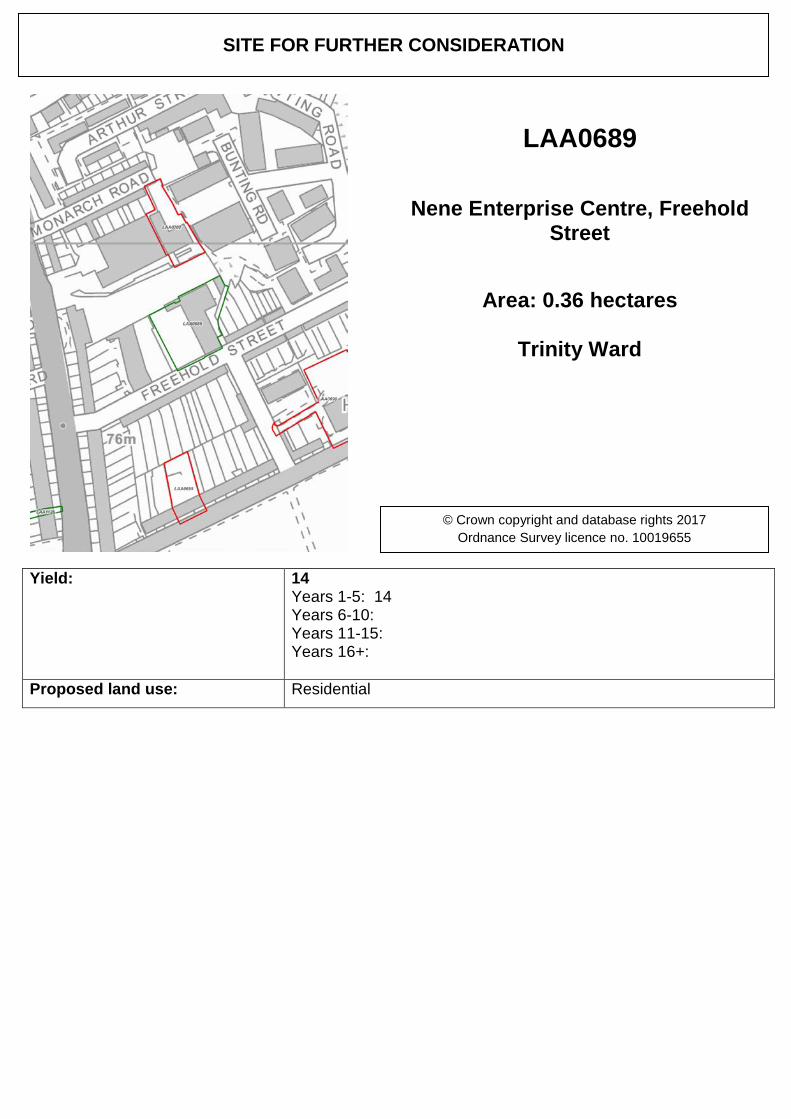
Yield: 14 Years 1-5: 14 Years 6-10: Years 11-15: Years 16+:
Proposed land use: Residential
SITE FOR FURTHER CONSIDERATION
LAA0689
Nene Enterprise Centre, Freehold Street
Area: 0.36 hectares
Trinity Ward
© Crown copyright and database rights 2017 Ordnance Survey licence no. 10019655
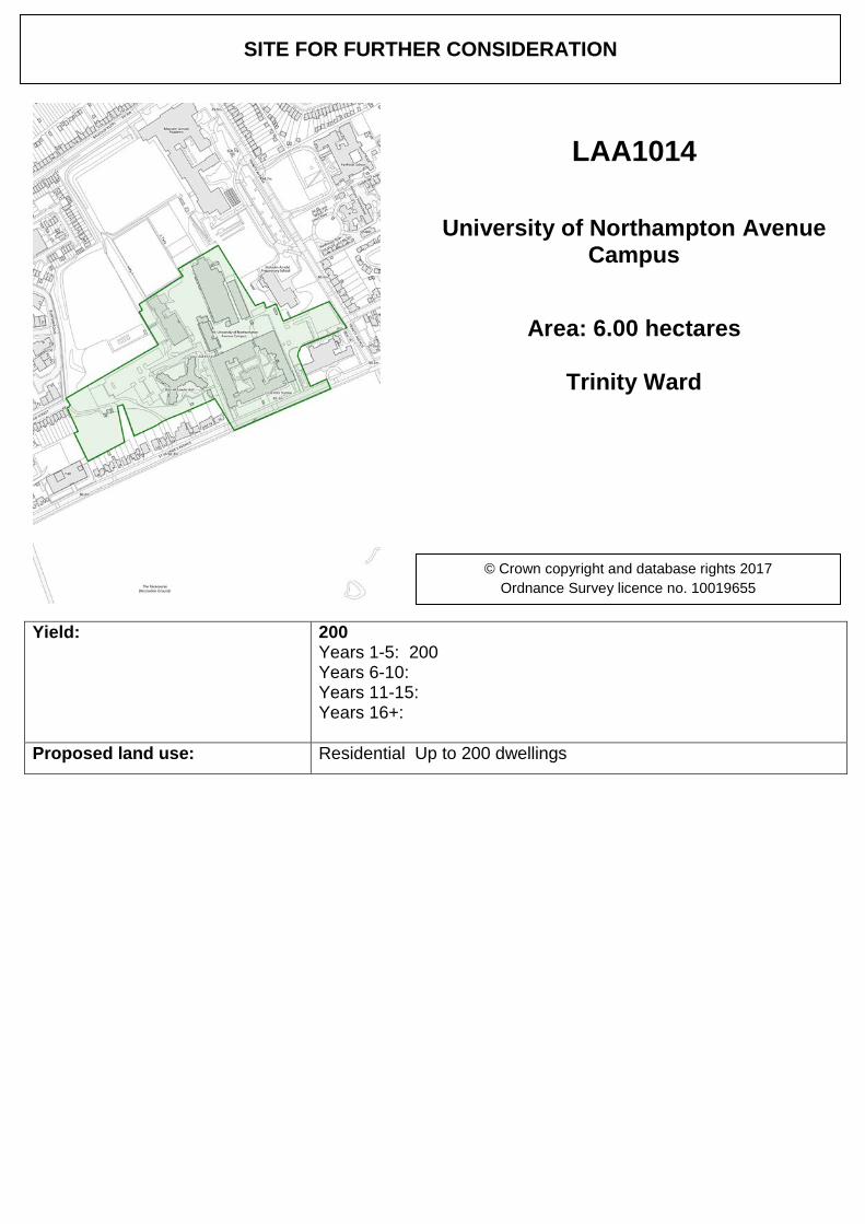
Yield: 200 Years 1-5: 200 Years 6-10: Years 11-15: Years 16+:
Proposed land use: Residential Up to 200 dwellings
SITE FOR FURTHER CONSIDERATION
LAA1014
University of Northampton Avenue Campus
Area: 6.00 hectares
Trinity Ward
© Crown copyright and database rights 2017 Ordnance Survey licence no. 10019655
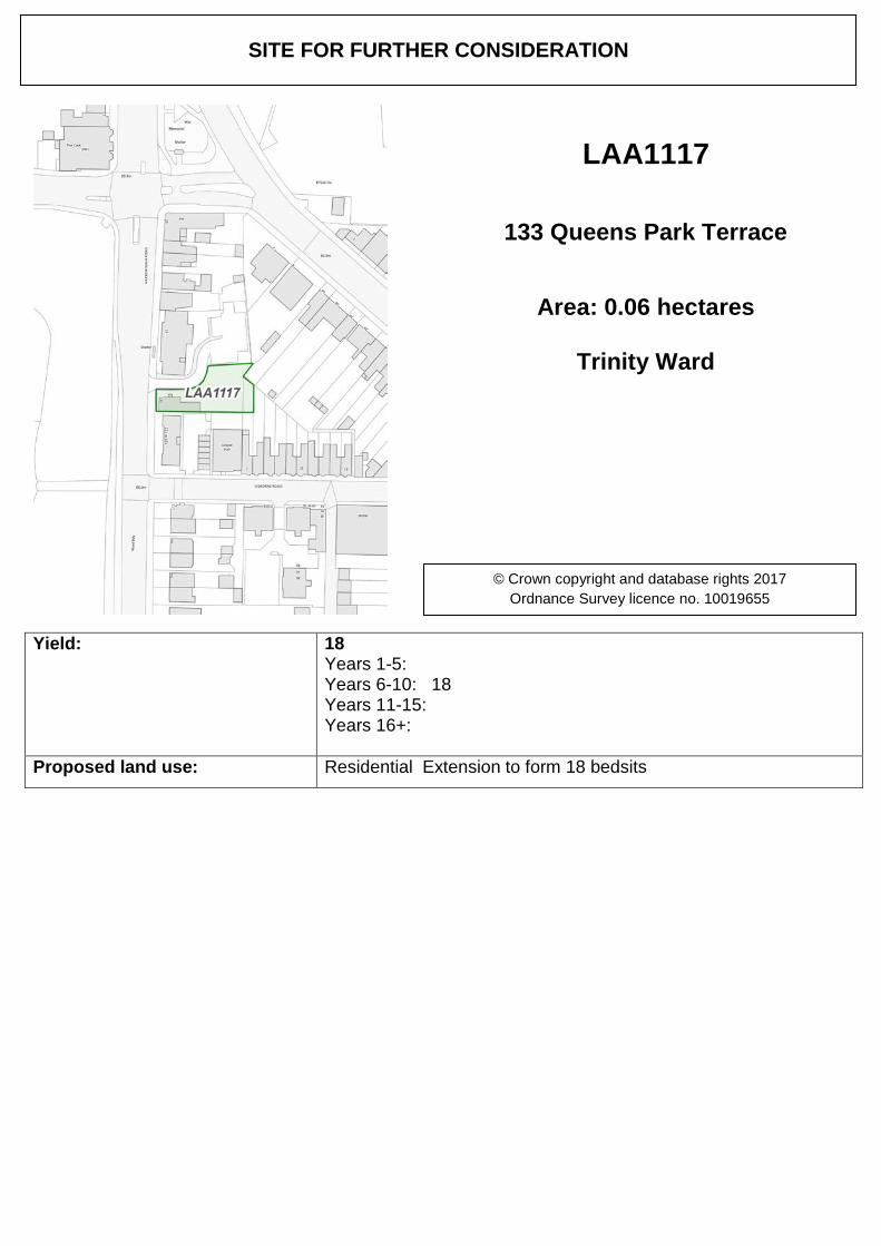
Yield: 18 Years 1-5: Years 6-10: 18 Years 11-15: Years 16+:
Proposed land use: Residential Extension to form 18 bedsits
SITE FOR FURTHER CONSIDERATION
LAA1117
133 Queens Park Terrace
Area: 0.06 hectares
Trinity Ward
© Crown copyright and database rights 2017 Ordnance Survey licence no. 10019655
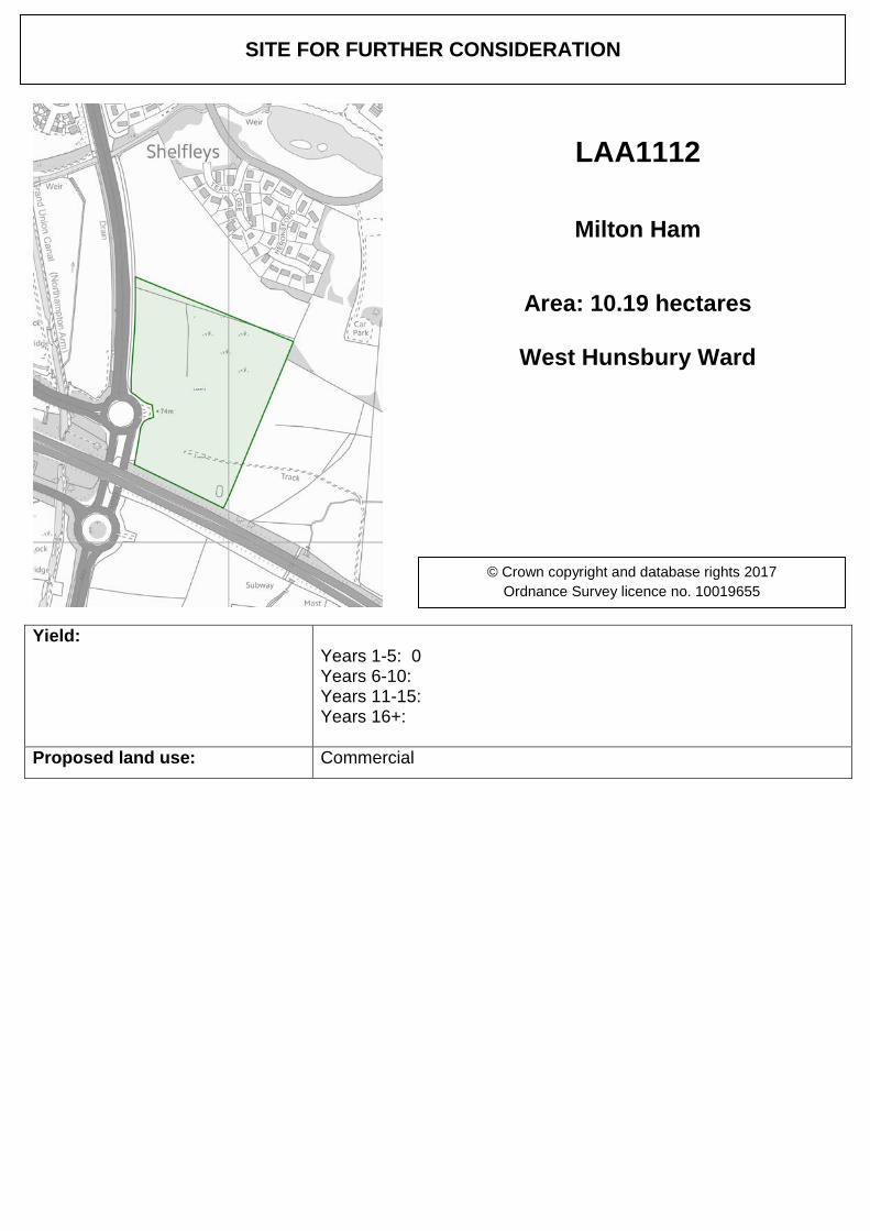
Yield: Years 1-5: 0 Years 6-10: Years 11-15: Years 16+:
Proposed land use: Commercial
SITE FOR FURTHER CONSIDERATION
LAA1112
Milton Ham
Area: 10.19 hectares
West Hunsbury Ward
© Crown copyright and database rights 2017 Ordnance Survey licence no. 10019655