Embed Size (px)
Citation preview
TAX MAPKEY/LOCATION MAP ZONING MAP
P.Q.
ZONING LEGEND
P.Q.
WAYNE TOWNSHIPPASSAIC COUNTY
SITE PLAN APPLICATION
BLOCK 3510, LOT 157TAX MAP SHEET 35.02
NEW JERSEY
PRELIMINARY & FINAL SITE PLAN
P.Q.
BLOCK LOT QUALIFIER OWNER NAME AND ADDRESS
GRAPHIC SCALE
UTILITIES / AUTHORITIES
GRAPHIC SCALE GRAPHIC SCALE
200' RADIUS NEIGHBORING PROPERTY DATA PER CERTIFIEDPROPERTY OWNERS LISTING DATED 05-05-2015
SHEET INDEX

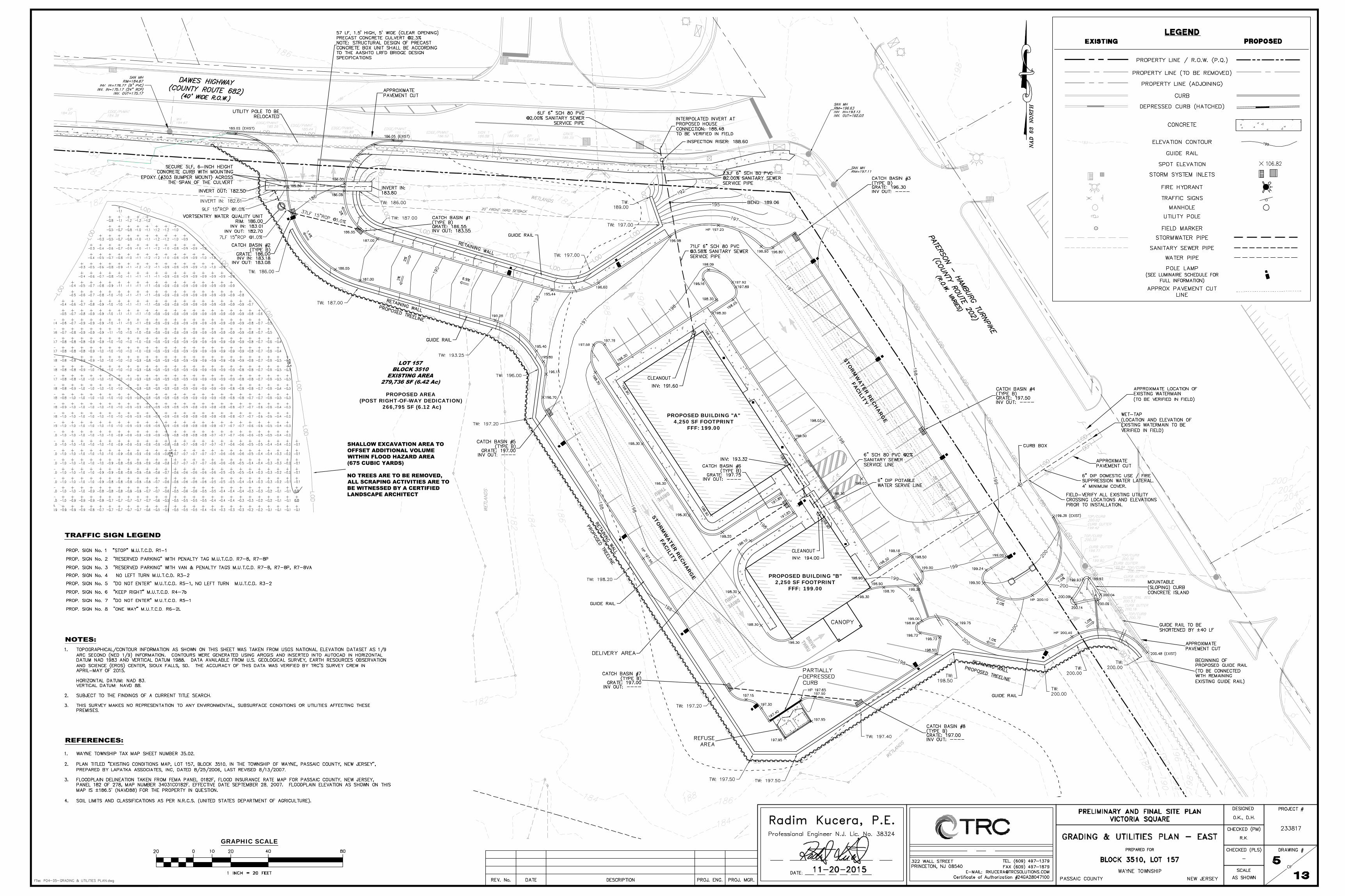
PROPOSED BUILDING "B"2,250 SF FOOTPRINT
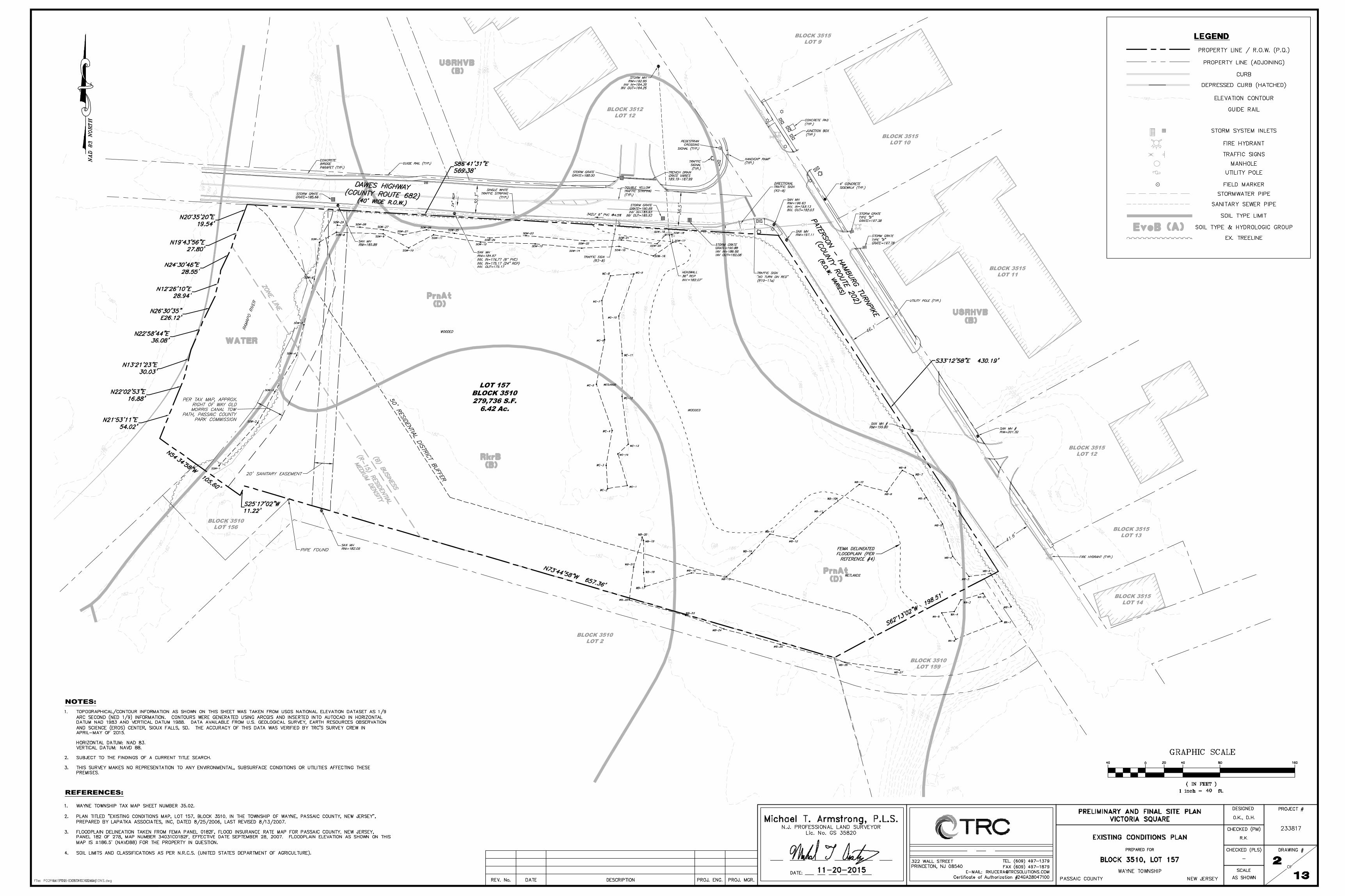
PROPOSED BUILDING "A"4,250 SF FOOTPRINT
17' WIDE PROPOSED ROADWIDENING AREA TO BEDEDICATED TO PASSAICCOUNTY (HATCHED)7,406 SF (0.17 Ac)
10' WIDE PROPOSED ROADWIDENING AREA TO BEDEDICATED TO PASSAICCOUNTY (HATCHED)5,535 SF (0.13 Ac)
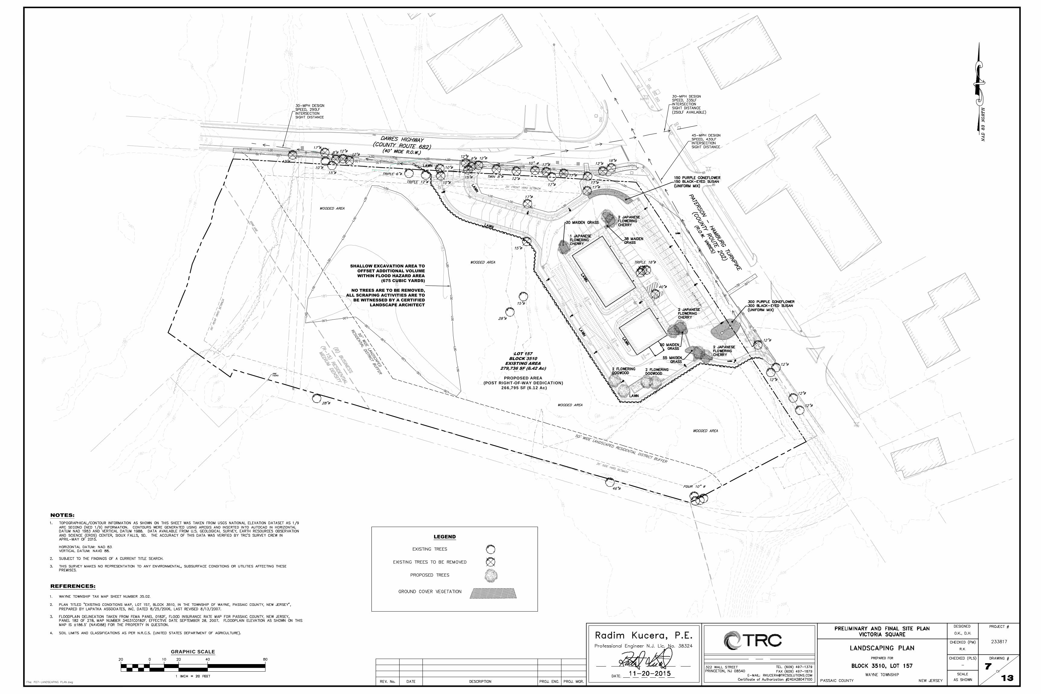
PROPOSED AREA(POST RIGHT-OF-WAY DEDICATION)
266,795 SF (6.12 Ac)
PROPOSED PARKING SPACE ANALYSIS
INSERT A
INSERT B
DESIGN VEHICLE
USES
≤2.5 STY/
6 FT
50 FT
4,250 SF
PROPOSED AREA(POST RIGHT-OF-WAY DEDICATION)
266,795 SF (6.12 Ac)PROPOSED BUILDING "A"
4,250 SF FOOTPRINTFFF: 199.00
STORM
WATER RECH
ARGE
FACILITY
GRAPHIC SCALE
PROPOSED AREA(POST RIGHT-OF-WAY DEDICATION)
266,795 SF (6.12 Ac)
PROPOSED BUILDING "B"2,250 SF FOOTPRINT
FFF: 199.00
PROPOSED BUILDING "A"4,250 SF FOOTPRINT
FFF: 199.00
STORM
WATER RECH
ARGE
FACILITY
STORM
WATER RECH
ARGE
FACILITY
GRAPHIC SCALE
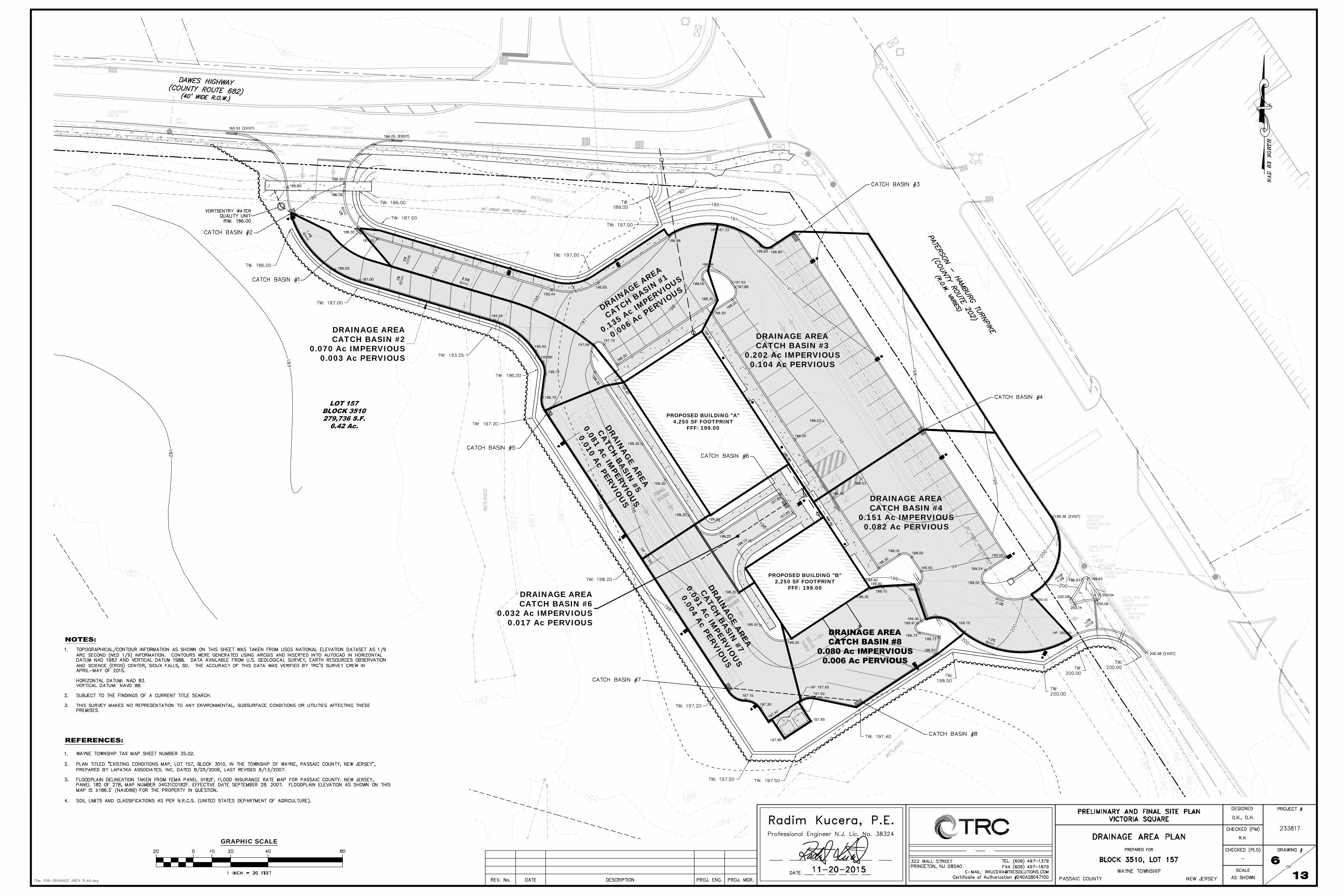
PROPOSED BUILDING "B"2,250 SF FOOTPRINT
FFF: 199.00
PROPOSED BUILDING "A"4,250 SF FOOTPRINT
FFF: 199.00
DRAINAGE AREA
CATCH BASIN #1
0.135 Ac IMPERVIOUS
0.006 Ac PERVIOUS
DRAINAGE AREACATCH BASIN #2
0.070 Ac IMPERVIOUS0.003 Ac PERVIOUS
DRAINAGE AREACATCH BASIN #4
0.151 Ac IMPERVIOUS0.082 Ac PERVIOUS
DRAINAG
E AREA
CATCH BASIN
#5
0.081 Ac IMPERVIO
US
0.010 Ac PERVIOU
S
DRAINAGE AREACATCH BASIN #3
0.202 Ac IMPERVIOUS0.104 Ac PERVIOUS
DRAINAG
E AREA
CATCH BASIN
#7
0.091 Ac IMPERVIO
US
0.004 Ac PERVIOU
S
DRAINAGE AREACATCH BASIN #6
0.032 Ac IMPERVIOUS0.017 Ac PERVIOUS
GRAPHIC SCALE
PROPOSED AREA(POST RIGHT-OF-WAY DEDICATION)
266,795 SF (6.12 Ac)
GRAPHIC SCALE
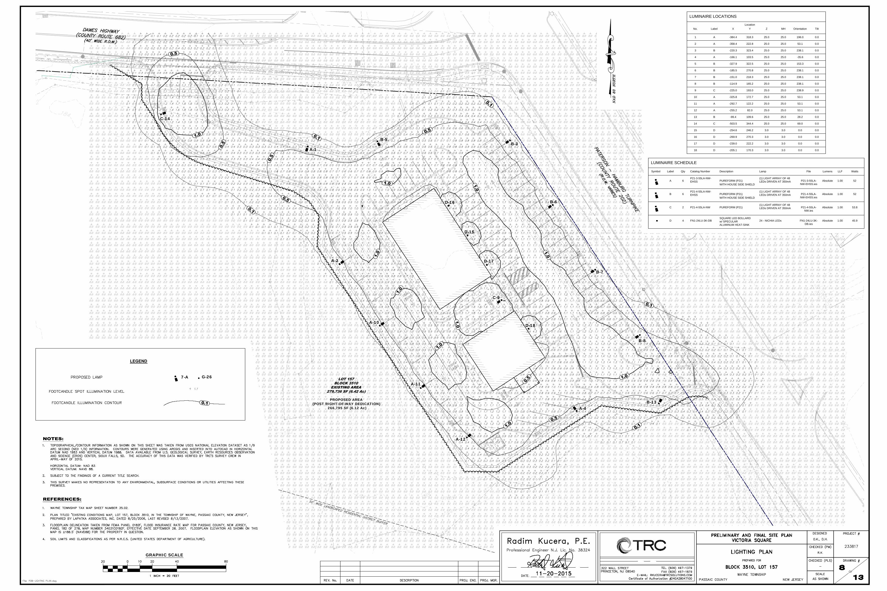
A-1
A-2
B-3
A-4
B-5
B-6
B-7
B-8
C-9
A-10
A-11
A-12
B-13
C-14
D-15
D-16
D-17
D-18
PROPOSED AREA(POST RIGHT-OF-WAY DEDICATION)
266,795 SF (6.12 Ac)
LEGEND
7-A G-26
GRAPHIC SCALE
LUMINAIRE LOCATIONS
No. Label X Y Z MH Orientation Tilt
Location
1 A -384.4 318.3 25.0 25.0 196.0 0.0
2 A -358.4 222.8 25.0 25.0 53.1 0.0
3 B -220.3 323.4 25.0 25.0 238.1 0.0
4 A -166.1 103.5 25.0 25.0 -35.6 0.0
5 B -327.9 322.5 25.0 25.0 153.3 0.0
6 B -185.5 270.8 25.0 25.0 238.1 0.0
7 B -151.0 218.3 25.0 25.0 238.1 0.0
8 B -114.9 165.2 25.0 25.0 238.1 0.0
9 C -225.0 193.0 25.0 25.0 238.9 0.0
10 A -325.8 172.7 25.0 25.0 53.1 0.0
11 A -292.7 122.2 25.0 25.0 53.1 0.0
12 A -255.2 82.0 25.0 25.0 53.1 0.0
13 B -99.4 109.6 25.0 25.0 28.2 0.0
14 C -503.5 344.4 25.0 25.0 69.0 0.0
15 D -254.6 246.2 3.0 3.0 0.0 0.0
16 D -269.9 270.3 3.0 3.0 0.0 0.0
17 D -239.0 222.2 3.0 3.0 0.0 0.0
18 D -205.1 170.3 3.0 3.0 0.0 0.0
LUMINAIRE SCHEDULE
Symbol Label Qty File Lumens LLF WattsCatalog Number Description Lamp
A 6 P21-3-55LA-
NW-EHSS.ies
Absolute 1.00 52
B 6 P21-4-55LA-
NW-EHSS.ies
Absolute 1.00 52
C 2 P21-4-55LA-
NW.ies
Absolute 1.00 53.8
D 4 FN1-24LU-3K-
DB.ies
Absolute 1.00 45.9
P21-3-55LA-NW-
EHSS
PUREFORM (P21)
(1) LIGHT ARRAY OF 48
LEDs DRIVEN AT 350mA
P21-4-55LA-NW-
EHSS
PUREFORM (P21)
(1) LIGHT ARRAY OF 48
LEDs DRIVEN AT 350mA
P21-4-55LA-NW PUREFORM (P21)
(1) LIGHT ARRAY OF 48
LEDs DRIVEN AT 350mA
FN1-24LU-3K-DB
SQUARE LED BOLLARD
w/ SPECULAR
ALUMINUM HEAT-SINK
24 - NICHIA LEDs
WITH HOUSE SIDE SHIELD
WITH HOUSE SIDE SHIELD
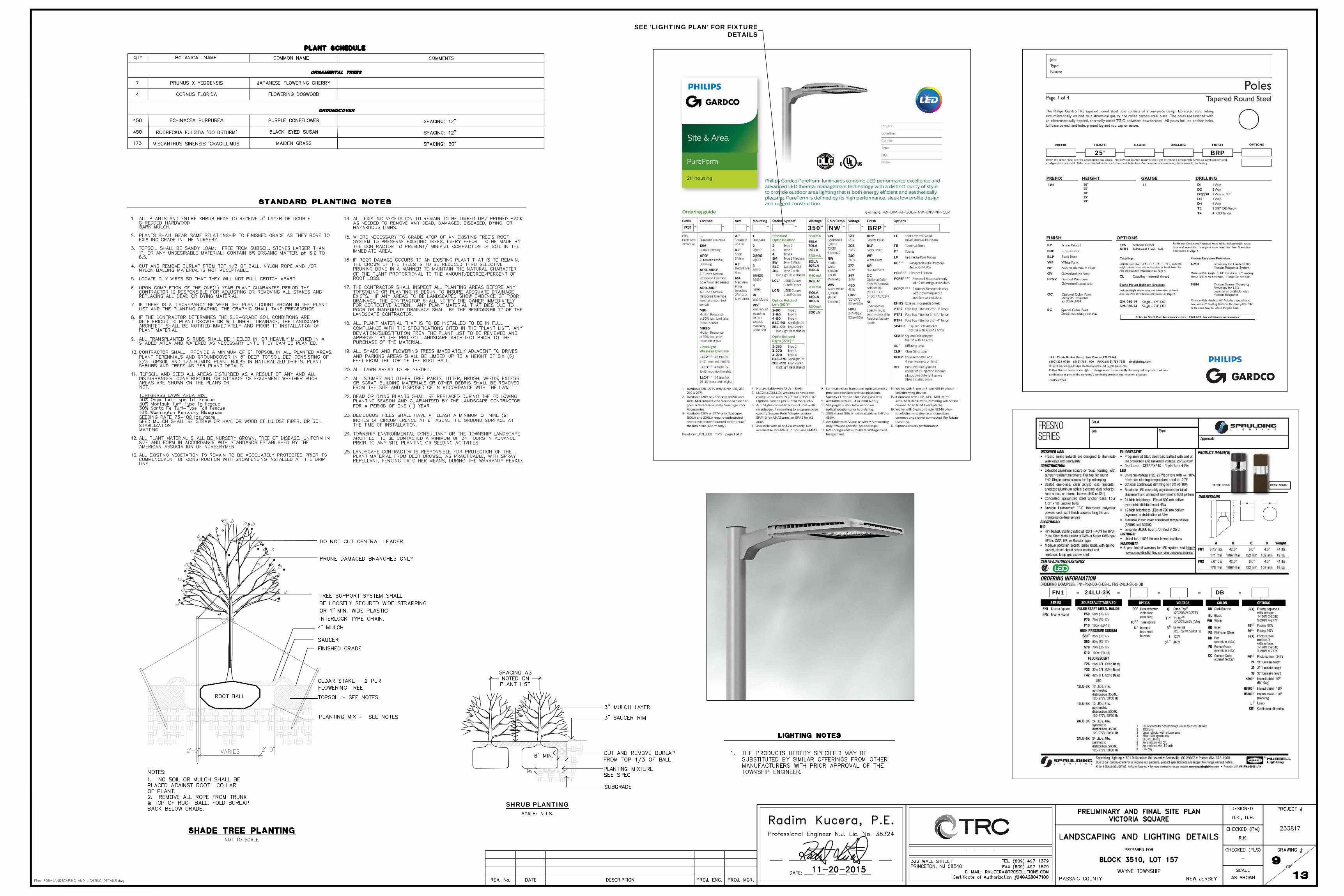
SEE 'LIGHTING PLAN' FOR FIXTUREDETAILS
SHRUB PLANTING
350 NW BRP
25' BRP
FN1 24LU-3K DB
PROPOSED AREA(POST RIGHT-OF-WAY DEDICATION)
266,795 SF (6.12 Ac)TEM
P. TOPSO
IL STOCK
PILE
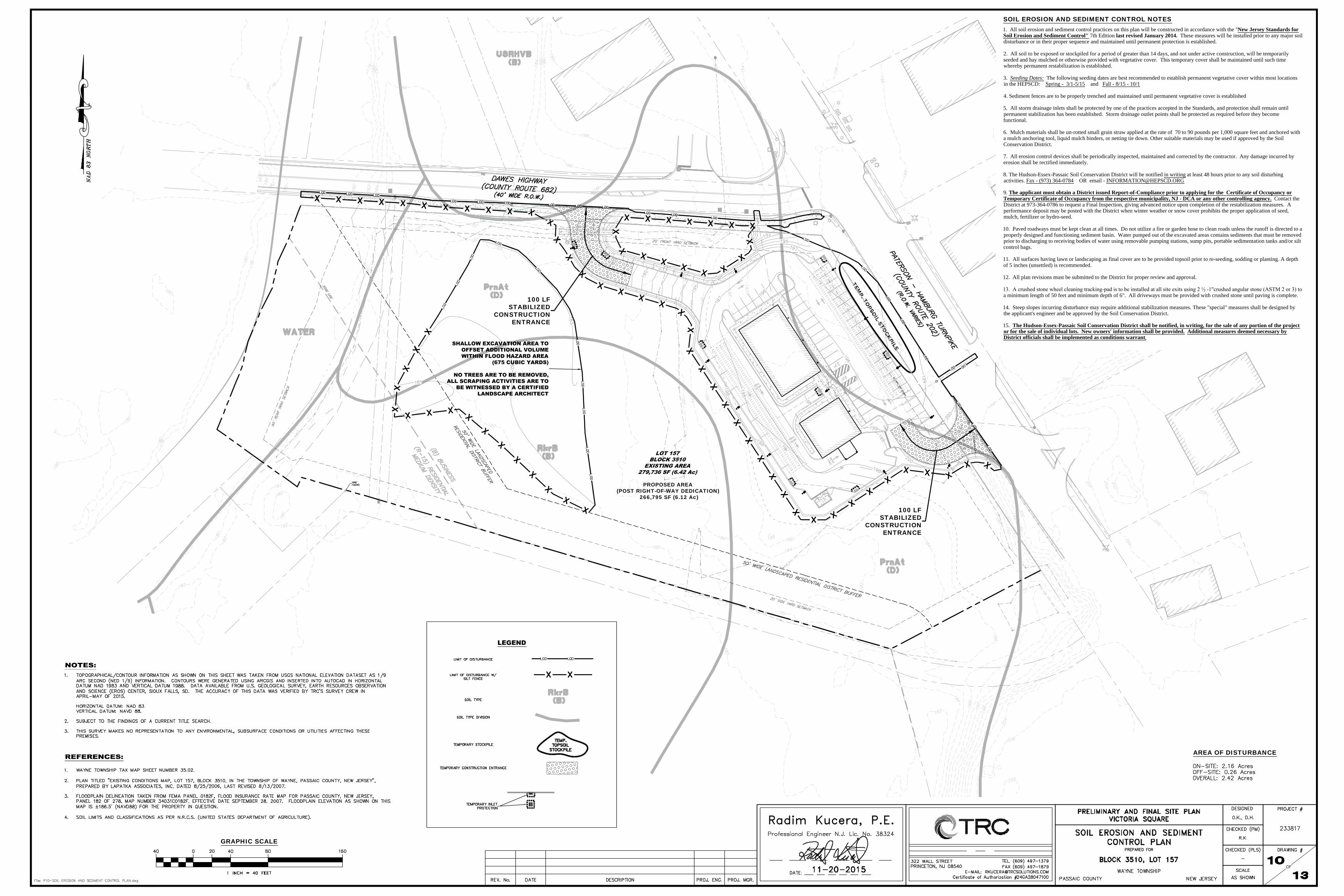
100 LFSTABILIZED
CONSTRUCTIONENTRANCE
100 LFSTABILIZED
CONSTRUCTIONENTRANCE
GRAPHIC SCALE
SOIL EROSION AND SEDIMENT CONTROL NOTES1. All soil erosion and sediment control practices on this plan will be constructed in accordance with the "New Jersey Standards forSoil Erosion and Sediment Control" 7th Edition last revised January 2014. These measures will be installed prior to any major soildisturbance or in their proper sequence and maintained until permanent protection is established.
2. All soil to be exposed or stockpiled for a period of greater than 14 days, and not under active construction, will be temporarilyseeded and hay mulched or otherwise provided with vegetative cover. This temporary cover shall be maintained until such timewhereby permanent restabilization is established.
3. Seeding Dates: The following seeding dates are best recommended to establish permanent vegetative cover within most locationsin the HEPSCD: Spring - 3/1-5/15 and Fall - 8/15 - 10/1
4. Sediment fences are to be properly trenched and maintained until permanent vegetative cover is established
5. All storm drainage inlets shall be protected by one of the practices accepted in the Standards, and protection shall remain untilpermanent stabilization has been established. Storm drainage outlet points shall be protected as required before they becomefunctional.
6. Mulch materials shall be un-rotted small grain straw applied at the rate of 70 to 90 pounds per 1,000 square feet and anchored witha mulch anchoring tool, liquid mulch binders, or netting tie down. Other suitable materials may be used if approved by the SoilConservation District.
7. All erosion control devices shall be periodically inspected, maintained and corrected by the contractor. Any damage incurred byerosion shall be rectified immediately.
8. The Hudson-Essex-Passaic Soil Conservation District will be notified in writing at least 48 hours prior to any soil disturbingactivities. Fax - (973) 364-0784 OR email - [email protected]
9. The applicant must obtain a District issued Report-of-Compliance prior to applying for the Certificate of Occupancy orTemporary Certificate of Occupancy from the respective municipality, NJ - DCA or any other controlling agency. Contact theDistrict at 973-364-0786 to request a Final Inspection, giving advanced notice upon completion of the restabilization measures. Aperformance deposit may be posted with the District when winter weather or snow cover prohibits the proper application of seed,mulch, fertilizer or hydro-seed.
10. Paved roadways must be kept clean at all times. Do not utilize a fire or garden hose to clean roads unless the runoff is directed to aproperly designed and functioning sediment basin. Water pumped out of the excavated areas contains sediments that must be removedprior to discharging to receiving bodies of water using removable pumping stations, sump pits, portable sedimentation tanks and/or siltcontrol bags.
11. All surfaces having lawn or landscaping as final cover are to be provided topsoil prior to re-seeding, sodding or planting. A depthof 5 inches (unsettled) is recommended.
12. All plan revisions must be submitted to the District for proper review and approval.
13. A crushed stone wheel cleaning tracking-pad is to be installed at all site exits using 2 ½ -1"crushed angular stone (ASTM 2 or 3) toa minimum length of 50 feet and minimum depth of 6". All driveways must be provided with crushed stone until paving is complete.
14. Steep slopes incurring disturbance may require additional stabilization measures. These "special" measures shall be designed bythe applicant's engineer and be approved by the Soil Conservation District.
15. The Hudson-Essex-Passaic Soil Conservation District shall be notified, in writing, for the sale of any portion of the projector for the sale of individual lots. New owners' information shall be provided. Additional measures deemed necessary byDistrict officials shall be implemented as conditions warrant.
AREA OF DISTURBANCE
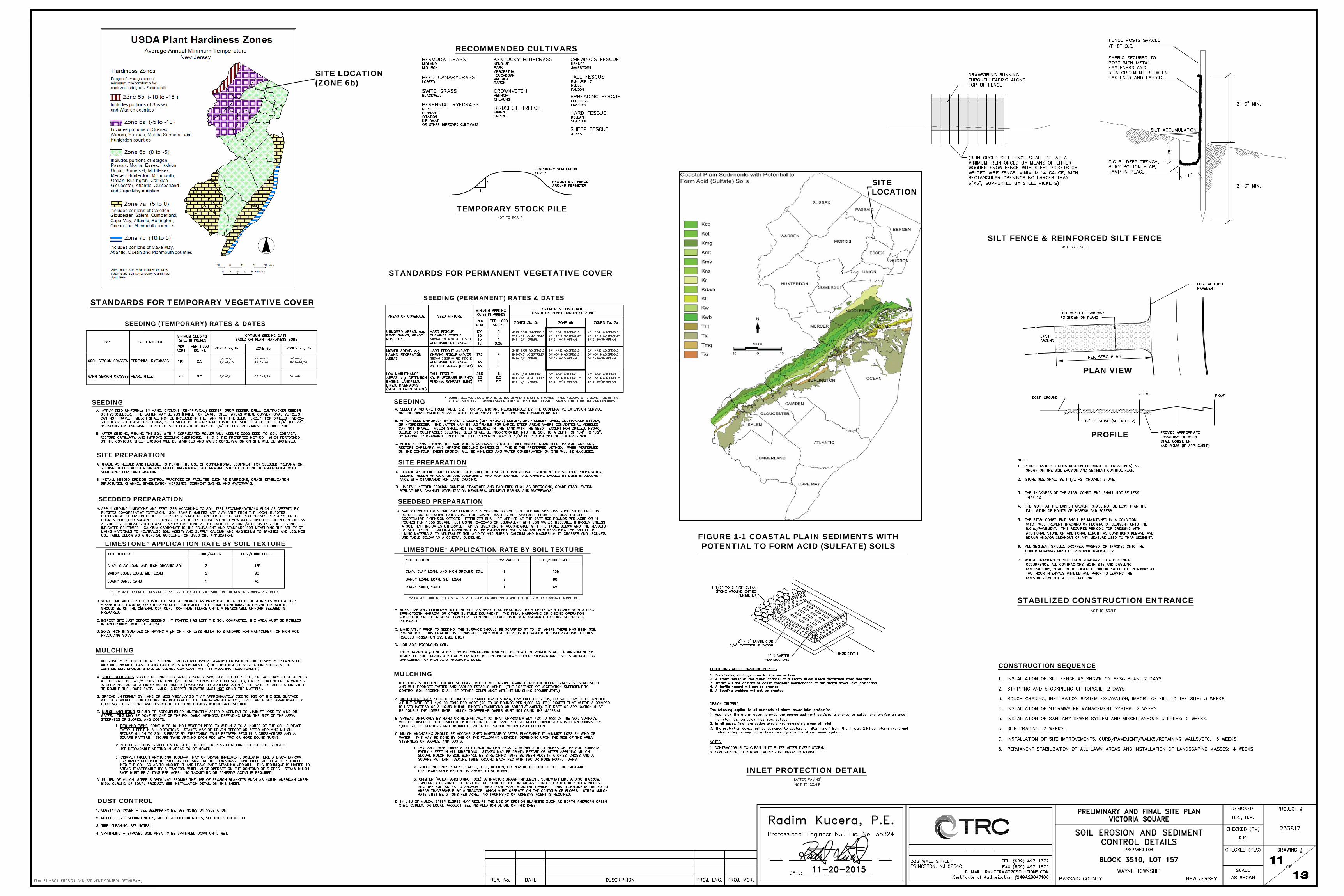
RECOMMENDED CULTIVARS
TEMPORARY STOCK PILE
PLAN VIEW
PROFILE
STABILIZED CONSTRUCTION ENTRANCE
SILT FENCE & REINFORCED SILT FENCE
SITE LOCATION(ZONE 6b)
MULCHING
MULCHING
DUST CONTROL
SEEDING
SEEDBED PREPARATION
SITE PREPARATION
SEEDBED PREPARATION
SITE PREPARATION
SEEDING
SEEDING (TEMPORARY) RATES & DATES
STANDARDS FOR TEMPORARY VEGETATIVE COVER SEEDING (PERMANENT) RATES & DATES
STANDARDS FOR PERMANENT VEGETATIVE COVER
LIMESTONE APPLICATION RATE BY SOIL TEXTURELIMESTONE APPLICATION RATE BY SOIL TEXTURE
CONSTRUCTION SEQUENCE
FIGURE 1-1 COASTAL PLAIN SEDIMENTS WITHPOTENTIAL TO FORM ACID (SULFATE) SOILS
SITELOCATION
INLET PROTECTION DETAIL
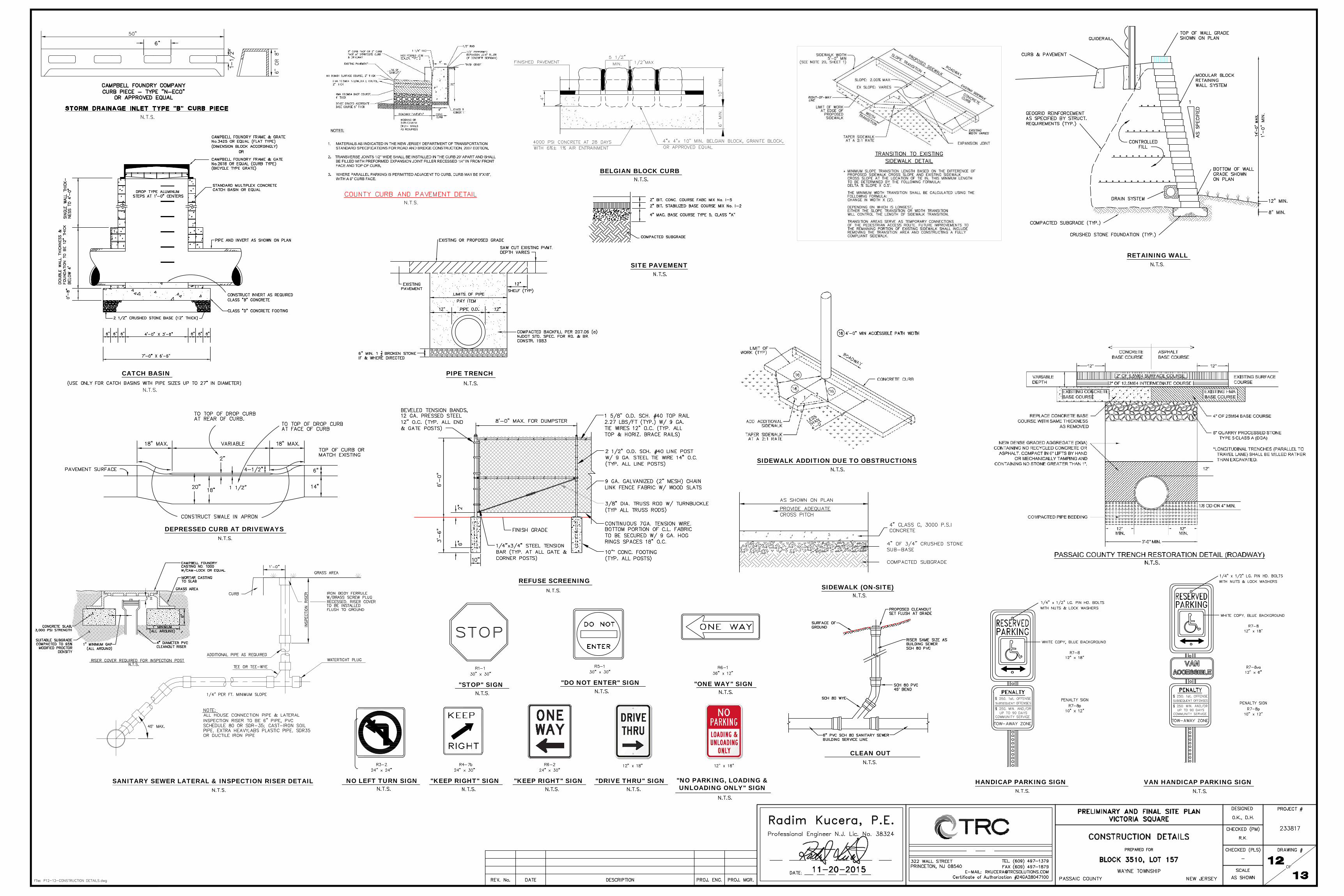
CATCH BASIN
HANDICAP PARKING SIGN VAN HANDICAP PARKING SIGN
"STOP" SIGN
NO LEFT TURN SIGN
"DO NOT ENTER" SIGN "ONE WAY" SIGN
"KEEP RIGHT" SIGN
CLEAN OUT
PIPE TRENCH
REFUSE SCREENING
RETAINING WALL
SIDEWALK (ON-SITE)
DEPRESSED CURB AT DRIVEWAYS
SITE PAVEMENT
SANITARY SEWER LATERAL & INSPECTION RISER DETAIL "KEEP RIGHT" SIGN "DRIVE THRU" SIGN "NO PARKING, LOADING &UNLOADING ONLY" SIGN
BELGIAN BLOCK CURB
SIDEWALK ADDITION DUE TO OBSTRUCTIONS
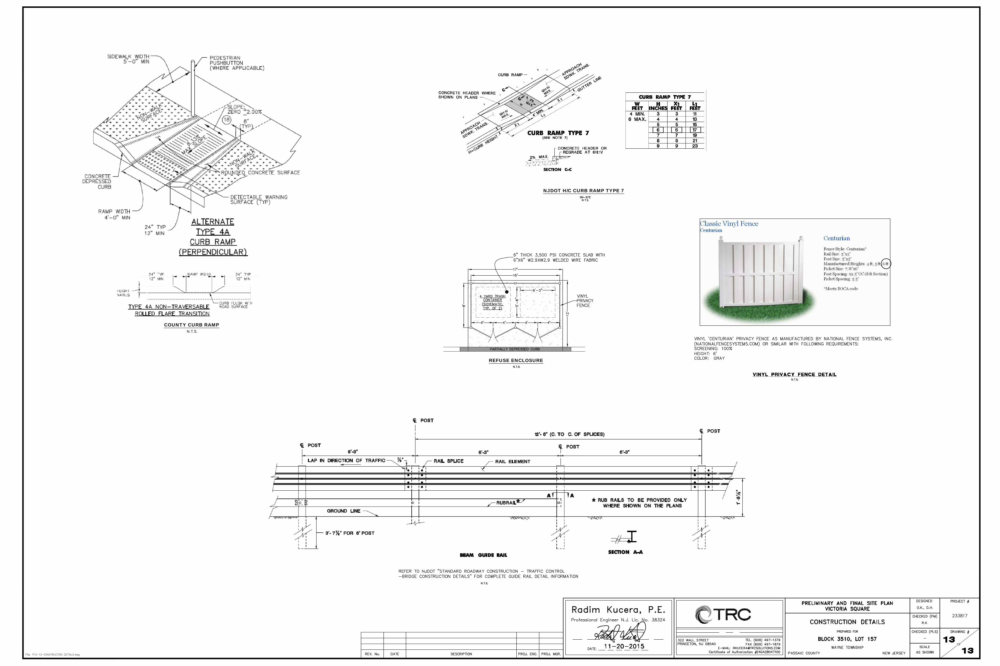
COUNTY CURB RAMP
NJDOT H/C CURB RAMP TYPE 7
REFUSE ENCLOSURE