Embed Size (px)
Citation preview

SM
Issues to Consider When Starting a GIS Project
Andy Schmidt
GIS Technician

SM
Issues To Consider Ina GIS Project
1. Identify Your Objectives2. Technical Considerations3. Who Will Create the GIS?4. Designing a GIS5 . Data Needs, Design and Capture6. Analyzing the Data and Presenting the Results7. Project Life Cycle

SM
Issue 1:Identify Your Objectives

SM
What Is the Problemto Solve With a GIS?
• How is it solved now?
• How would we like it solved?
• Are there alternate ways of solving by using a GIS?
Issue 1: Identify Your Objectives

SM
What Is the Needfor a GIS?
• How can GIS technology be implemented effectively to streamline existing functions?
• How can it change the way a particular goal is achieved?
Issue 1: Identify Your Objectives
SM
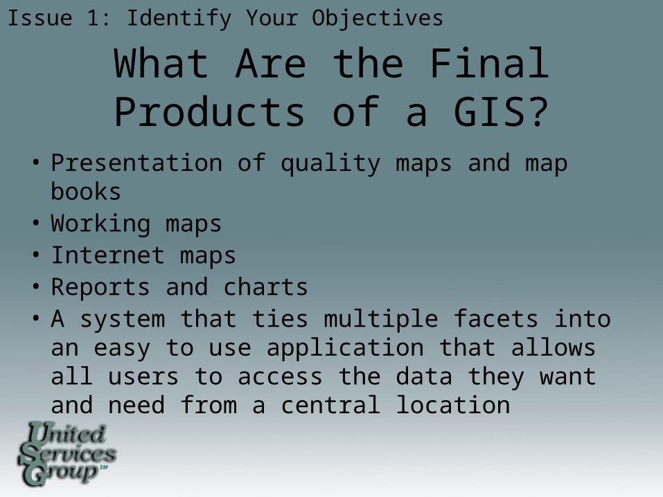
What Are the FinalProducts of a GIS?
• Presentation of quality maps and map books• Working maps• Internet maps• Reports and charts• A system that ties multiple facets into an easy to
use application that allows all users to access the data they want and need from a central location
Issue 1: Identify Your Objectives

SM
Who Is the Intended Audience?
• Decision Makers/Management• Technicians• Planners• Engineers• System Operators• Customers• Public
Issue 1: Identify Your Objectives
SM
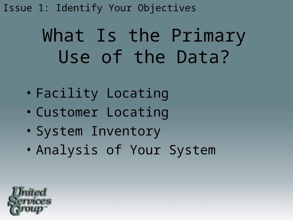
What Is the PrimaryUse of the Data?
• Facility Locating
• Customer Locating
• System Inventory
• Analysis of Your System
Issue 1: Identify Your Objectives
SM
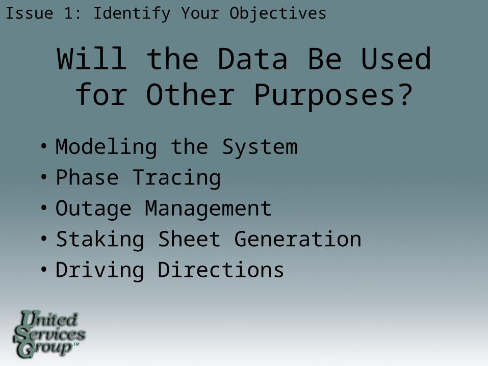
Will the Data Be Usedfor Other Purposes?
• Modeling the System
• Phase Tracing
• Outage Management
• Staking Sheet Generation
• Driving Directions
Issue 1: Identify Your Objectives

SM
What are the Requirements of These Other Purposes?
• Additional Software
• Quality Updated Data
• Good Data Management
• Customization
Issue 1: Identify Your Objectives

SM
What Are the Goalsof the Project?
• Short (0-2 years)
• Medium (1-5 years)
• Long (5+ years)
Issue 1: Identify Your Objectives
• Getting essential data into the GIS• Fix holes in data• Fix incorrect data
• Modeling• Adding additional data • Link to other software
• Advanced analysis of the system • Integration of GIS to many other systems

SM
Do You Plan to Start Small Then Expand?
• Start with a circuit, substation or predefined area then expand from it
• Convert whole systems starting with a specific device
• What is the expansion schedule or timeline?
• What are the most critical areas?
Issue 1: Identify your Objectives

SM
Issue 2: Technical Issues
SM
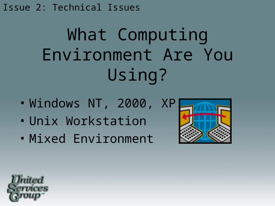
What Computing Environment Are You Using?
• Windows NT, 2000, XP
• Unix Workstation
• Mixed Environment
Issue 2: Technical Issues

SM
What GIS Software WillYou Be Using?
• May depend on your computing environment
• May depend on previous experience with a vendor
Issue 2: Technical Issues
SM
Key Factors in Choosinga Vendor
• Stability• Leadership in the Industry• Integration of Existing Legacy Systems• Partnerships or Long Term Alignments • Development • Flexibility • Open Architecture• Customizable
– Out of the box software should do 75% of what you want it to do
• Cost and Maintenance Agreements
Issue 2: Technical Issues

SM
Key Factors in Cost• Hardware• Software• Upgrades• Software Maintenance Agreements• Conversion • Development• Ability to Drive Technology Change• Organizational Size and Position of Resources• Scope Change• Revisions
Issue 2: Technical Issues
SM
Other Technical Issues
• How many people are responsible for making changes to the data?
• Single editor
• Multiple editors at one location
• Multiple editors accessing a server
• Who will be accessing the data?• Single user
• Multiple users at one location
• Several users at different locations using the internet
Issue 2: Technical Issues

SM
Issue 3: Who Will Create the GIS?

SM
• In-House
• Consultant
• Combination of In-House employees and Consultants
Issue 3: Who Will Create the GIS
Who Will Create the GIS?

SM
In-House• Set up a GIS Steering Team
• Leaders and managers.• Experts in the areas you want to incorporate.
• Dedicate the people to do the work• Implications
• Will the employees only be dedicated to the GIS?• Do you have to hire new people to replace those working on
the GIS?• Will dedicating the employees to GIS hinder the jobs of other
employees?• Do they really want to work on the GIS?• Are there people trained to do GIS work?
Issue 3: Who Will Create the GIS
SM
Consultant
• Set up a GIS Steering Team
• Dedicate a Contact Person
Issue 3: Who Will Create the GIS
• Key member of the GIS Team• Knowledge of all parts of the system• Available throughout the process• Passionate about the project

SM
Consultant
Issue 3: Who Will Create the GIS
• Choose the Consultant • Has extensive knowledge of GIS and the electric
utility
• Capable of doing what you want them to do
• Visit with them to see what they have done
• Ask others about the consultant - references
SM
Consultant
• Set up Timeline of Deliverables
Issue 3: Who Will Create the GIS
• Area check copies
• Initial conversion completion
• Updates
• System integration and takeover

SM
Combination of In-House Employees and Consultants
• Set up a GIS Steering Team• Determine Who Does What• Only Work on What Has Been Agreed Upon• Agree on Timelines and Deliverables and
Remember the Goals• Work Together Not Against Each Other• Correspond Frequently
Issue 3: Who Will Create the GIS

SM
Issue 4: Designing a GIS

SM
Plan, Plan and Plan!

SM
Objectives of Design
• Results in a Well-Constructed Operational Database That:
• Satisfies objectives and supports organizational requirements
• Contains all necessary data but no redundant data
• Organizes data so that different users can access the same data
• Accommodates different views of the data
• Distinguishes which applications maintain the data from which applications access the data
• Appropriately represents, codes and organizes graphical features
Issue 4: Designing a GIS

SM
Benefits From Good Design Although Time Consuming…
• Increased flexibility of data retrieval and analysis
• Increased likelihood of users developing applications
• Decrease time in attributing data
• Data that supports different users and uses
• A system that readily accommodates future functionality
• Minimized data redundancy
Issue 4: Designing a GIS

SM
Design Guidelines• Involve users• Educate users in what a GIS can do• Take it one step at a time• Build a team• Be creative• Create deliverables• Keep goals and objectives in focus• Do not add detail prematurely• Document carefully• Be flexible• Plan from your model
Issue 4: Designing a GIS
SM
Data Modeling
• Model the Users View of Data• Identify organizational functions
• Determine data needed to support functions
• Organize data into local groups
• Define Objects and Relationships• Identify and describe objects
• Specify relationships between objects
• Document model in diagram
Issue 4: Designing a GIS
SM
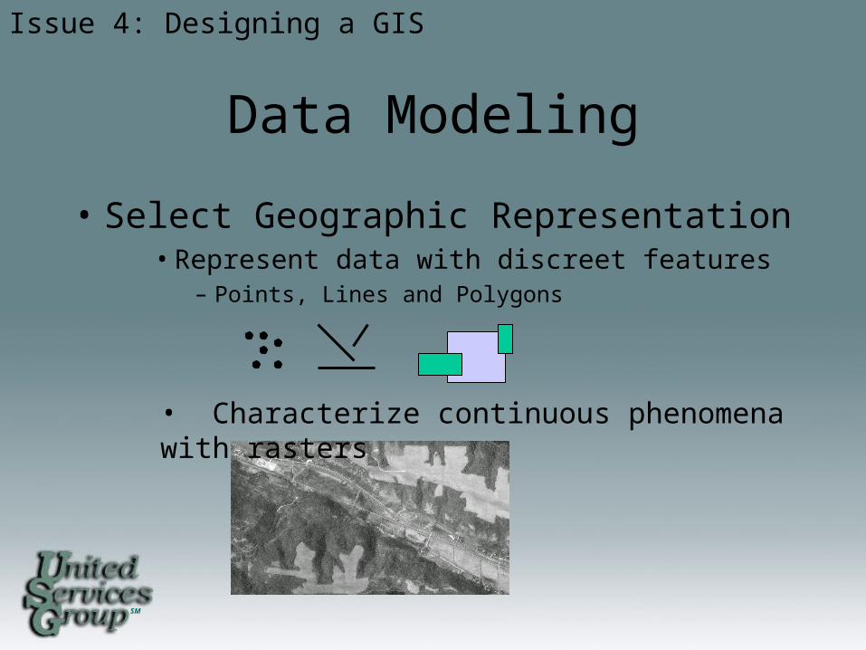
Data Modeling
• Select Geographic Representation• Represent data with discreet features
– Points, Lines and Polygons
Issue 4: Designing a GIS
• Characterize continuous phenomena with rasters

SM
Data Modeling
• Match Data to Spatial Elements• Determine geometry type of discrete features
• Specify relationships between features
• Implement attribute types for objects
Issue 4: Designing a GIS
SM
Data Modeling
• Organize Database Structure• Organize system of features
• Define topological associations
• Assign coordinate systems
• Define relationships, rules and domains
Issue 4: Designing a GIS

SM
Issue 5: Data Design, Needs and Capture
SM
Data Design
• Identify the Spatial Data Needed• Land-base
• Facility
• Determine the Required Feature Layers• Roads, Municipals, Water features, Parcels
• Conductor, Transformer, Consumer, Poles
Issue 5: Data Design Needs and Capture
SM
Data Design
• How Current Must the Data Be?• For planning, the most current data may be required
• For general mapping, data may be a few years old
• What Data Do I Have?• Digital
• Paper records
• Is it in a usable format?
• Can it be converted?
Issue 5: Data Design Needs and Capture
SM
Data Acquiring
• Where can I Get Missing Data From?• Government entities (DOT, DNR, LMIC, County,
and Municipal)• Other utilities• Other consultants• GPS• Aerial photos• DRG's (digital raster graphics)
Issue 5: Data Design Needs and Capture
SM
Data Acquiring
• How Much Are We Willing to Pay for Data?• Most entities charge for data
• Most entities request data sharing agreements
• When Do You Need the Data?• “Off-the-shelf" data sets can be acquired in one to two
business days
• Custom sets may take weeks to prepare
Issue 5: Data Design Needs and Capture

SM
Data Acquiring
• Will You Need Periodic Data Updates and How Frequently?
• Complete replacements
• Transactional updates (changes only)
• It is best to negotiate a maintenance schedule with the initial data license
Issue 5: Data Design Needs and Capture
SM
Data Specifics• Determine the Level of Detail Needed
• More detail or a large scale like 1:24,000• Less detail or small scale like 1:1,000,000
• Select the Map Area Boundary• Company service area• County/Township/Municipal region• Buffered region incase of expansion
• Determine The Level of Geography You WantTo Examine
• Service area• Township• Section• Quarter section• Miscellaneous detail areas
Issue 5: Data Design Needs and Capture
SM
Choose the CoordinateSystem and Units
• Coordinate Systems• UTM• State plain• County coordinates• Custom
• Units• Meters• Feet• Decimal degrees
Issue 5: Data Design Needs and Capture
SM
Choosing the Attributes
• Choose the Attributes Each Feature Needs.• Identifiers of Cooperative or Company
• Identifiers of substation
• Identifiers of circuit
• Identifiers of device (Must have a UNIQUE ID such as Device # or Account #)
• Very Important. Make sure there is a non-duplicate unique ID for every device in order to tie to other software or data
Issue 5: Data Design Needs and Capture Continued

SM
Data Representation
• Numbering System• Pole to Pole
Issue 5: Data Design Needs and Capture
SM
Data Representation
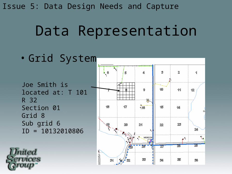
• Grid System
Issue 5: Data Design Needs and Capture
Joe Smith is located at: T 101 R 32 Section 01 Grid 8 Sub grid 6ID = 10132010806
SM
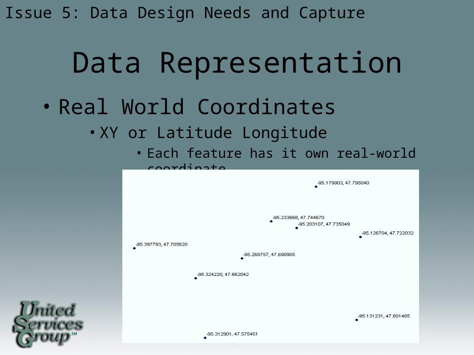
Data Representation
• Real World Coordinates• XY or Latitude Longitude
• Each feature has it own real-world coordinate
Issue 5: Data Design Needs and Capture
SM
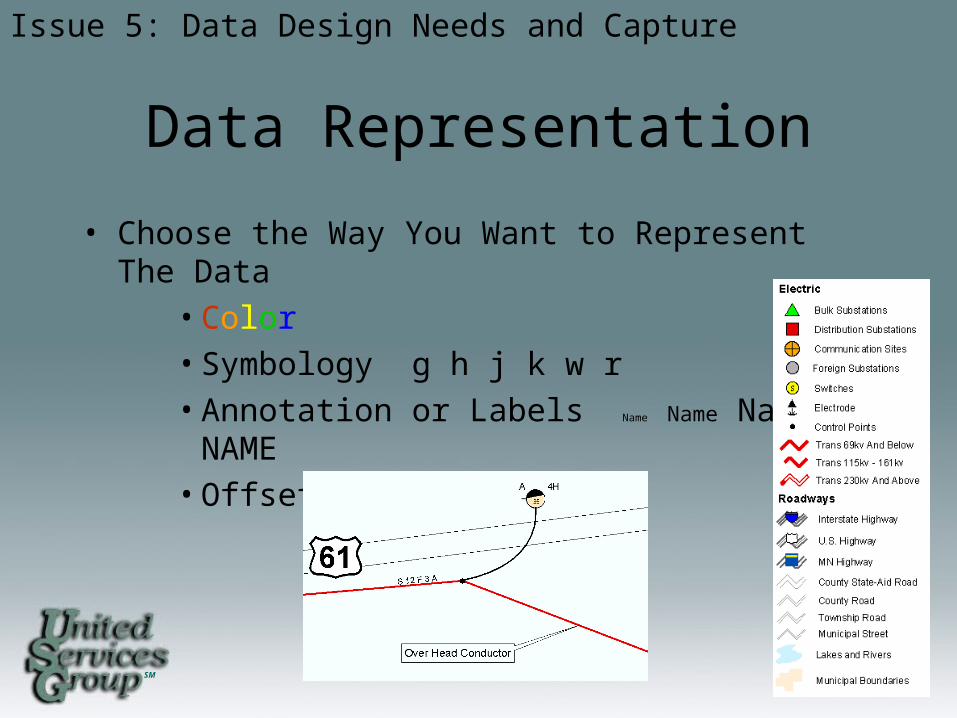
Data Representation
• Choose the Way You Want to Represent The Data
• Color
• Symbology g h j k w r
• Annotation or Labels Name Name Name NAME
• Offsets of Features
Issue 5: Data Design Needs and Capture
SM
Automation of Data
• Converting existing data from other systems and formats into the same format
• Digitizing data from paper• Adding GPS data• Data entry of attributes• Creating topology and connectivity
Issue 5: Data Design Needs and Capture
SM
Automation of Data
• Putting additional spatial data into real world coordinates
• Join adjacent data sets• Updating data sets• Verifying data with GPS• Perform QA/QC
• Correct locations
• Correct attributes
• Connectivity
Issue 5: Data Design Needs and Capture
SM
Conversion Issues
• Keep project goals in mind
• Do not add additional requirements until initial requirements are met
• What you put in is what you get out of a GIS
• Stick with one software or vendor until conversion is completed
Issue 5: Data Design Needs and Capture

SM
Issue 6: Analyzing the Data
and Presenting the Results
SM
Analyzing Data
• Referred to as Spatial Modeling• A Model is a Representation of Reality To:
• Simulate a process
• Predict an outcome
• Analyze a problem
• Models in a GIS• Connectivity
• Tracing up stream and down
• Proximity calculations
• Common ancestor finding
Issue 6: Analyzing the Data and Present the Results
SM
Presenting Results
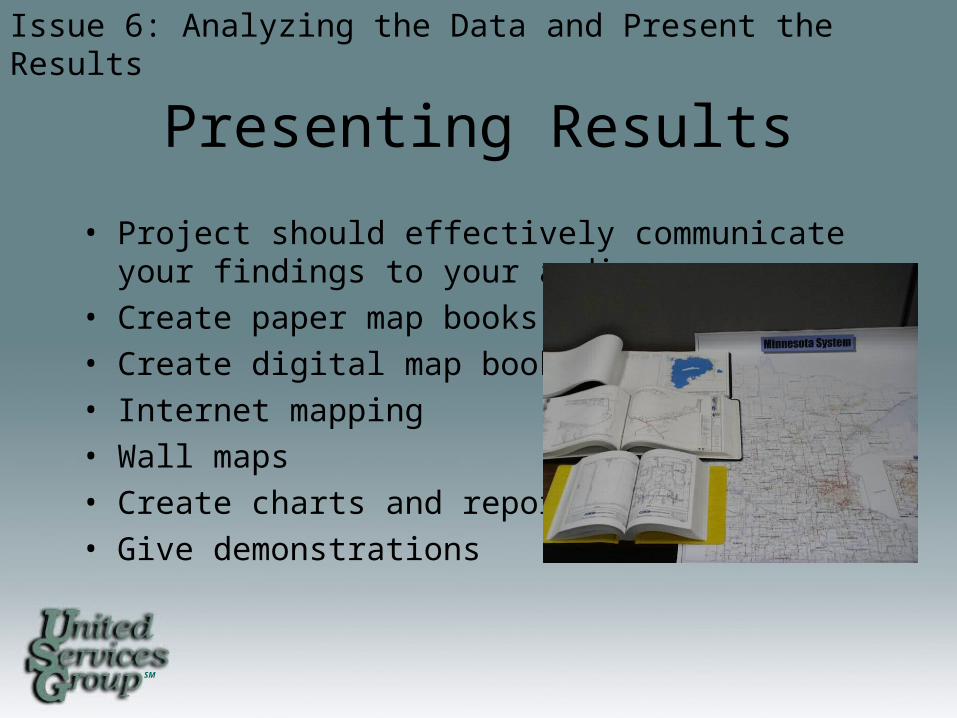
• Project should effectively communicate your findings to your audience
• Create paper map books
• Create digital map books
• Internet mapping
• Wall maps
• Create charts and reports
• Give demonstrations
Issue 6: Analyzing the Data and Present the Results

SM
Training Users
• In-House
• Software Vendors
• Consultants
• Conferences
• Internet Classes
• Local Colleges and Vocational Schools
Issue 6: Analyzing the Data and Present the Results

SM
Issue 7: Project Life Cycle Issues
SM
• GIS perceived as only a automated mapping tool to replace manual mapping
• People do not want to change• Inadequate quality control• Cannot access system or data• Poor project implementation• Unrealistic expectations• Poor training• Failure to plan on how to maintain the GIS data and
operations• Project cost overrun
• Scope change, adding premature detail
Problems That MightCause a GIS to Fail
Issue 7: Project Life Cycle Issues
SM
Conclusions
• When Starting a GIS• Identify your objectives for the project• Examine software, hardware and vendors• Determine who will create the GIS• Determine the design• Determine data needs & how to acquire• Train users• Stay focused on the goals

SM
These steps and Planning as a Team to meet the Goals will help insure a GIS
that will be Useful to all users as well as Cost Effective to the company.

SM
Questions?