Embed Size (px)
Citation preview
South Asia:And the study of its physical geography, climate, and vegetation.
Brain Breakfast: Excuse me, did someone order razor
soup?
Question 1: The worlds tallest mountain/peak is in the Himalaya Mountain Range, name this mountain/peak and how tall it might be. Answer 1:
Question 2: There are 2 island countries/nations and 5 continental countries/nations that make up South Asia, name them. Answer 2:
Question 3: South Asia is about ___ the size of the continental ______ ______ . Answer 3:
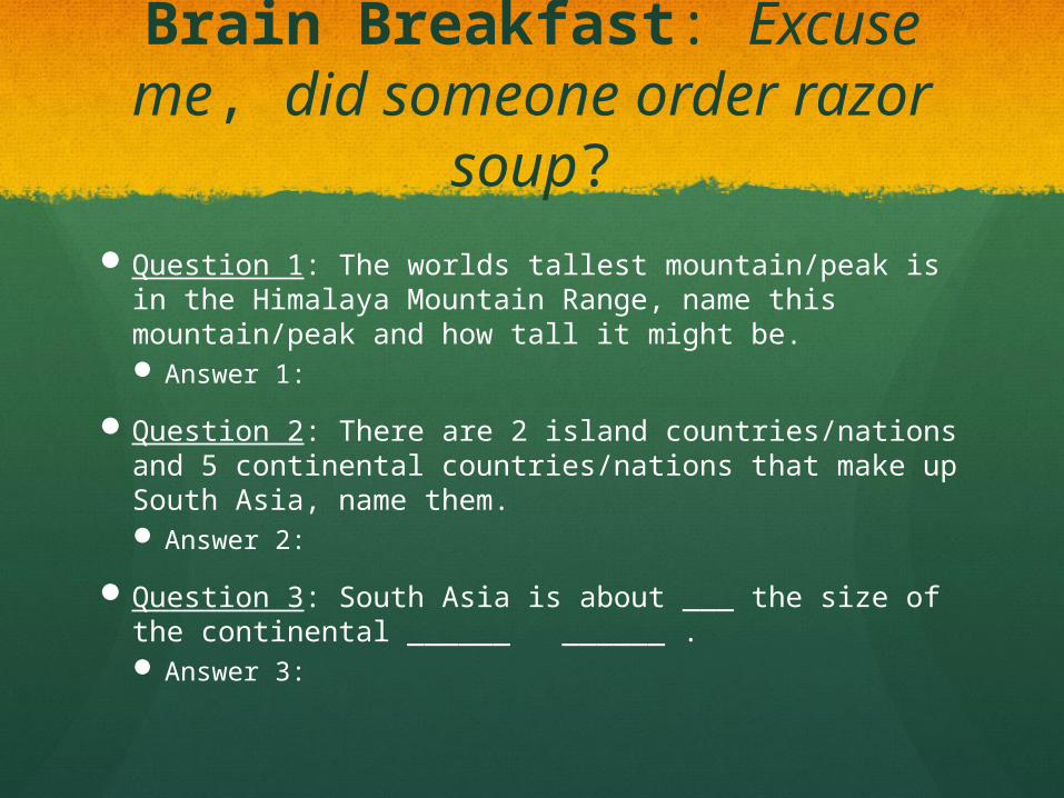
The Himalayan Mountain Range:
Including Mount EverestThe Himalayan Mountain Range
Mount Everest
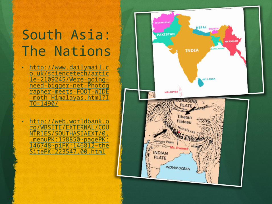
South Asia: The Nations • http://www.dailymail.co.uk/
sciencetech/article-2109245/Were-going-need-bigger-net-Photographer-meets-FOOT-WIDE-moth-Himalayas.html?ITO=1490/
• http://web.worldbank.org/WBSITE/EXTERNAL/COUNTRIES/SOUTHASIAEXT/0,,menuPK:158850~pagePK:146748~piPK:146812~theSitePK:223547,00.html
South Asia: A Land of Varied Landscapes
South Asia is a subcontinent, or a large, distinct landmass that is joined to a continent.
Forms a peninsula touched by three bodies of water: 1) the Arabian Sea to the west. 2) the Indian Ocean to the south. 3) the Bay of Bengal to the east.

The Himalaya: And other northern landforms
60 million years ago the Earth had one super landmass! South Asia was connected to Africa until it
began to break away. Indian subcontinent collided with South
Asia and the Himalayan Mountain Range was formed.
Himalaya: Spreads more than 1,000 miles across the Indian subcontinent.
The Himalaya: And other northern landforms cont’d. . .
To the north: The Himalaya meet the Karakoram
Mountains in the northernmost part of South Asia.
To the west: Hindu Kush mountains complete the range.
Khyber Pass: A narrow region between Afghanistan and Pakistan that allowed northern invaders to enter the Indian subcontinent.
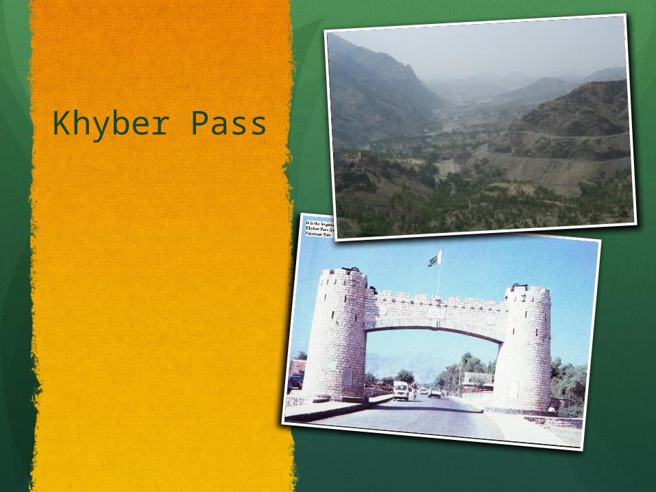
Khyber Pass
Central & Southern Landforms
Central Landforms: The Vindhya Range divides India into
northern and southern regions. The physical separation caused by mountains
influence distinct cultures developed in India.
Southern Landforms: Two chains of mountains located here. The Eastern Ghats and the Western Ghats. Together, a triangle of rugged mountains are
formed.

Southern Landforms: Cont’d. . . A Contrast with the
North
Eastern and Western Ghats continued… Between lies the Deccan Plateau: Once part of the
super continent that broke away and formed the Indian subcontinent.
Karnataka Plateau: South of the Deccan Plateau. Green hills, spices growing on plantations, wild
elephants in the rain forest.
Sri Lanka: Teardrop island located southeast of India.
Maldives: Southernmost country in South Asia. Tiny chain of coral islands.
Major River Systems:
There are three major river systems in South Asia: 1) The Indus River: “The Cradle of Ancient
India” Waters apple and peach orchards. Serves as an important transportation route.
2) The Brahmaputra River: Forms a delta at the Bay of Bengal. Serves as an important inland waterway for
ships. Provides 50% of Bangladesh’s power through
hydroelectricity.
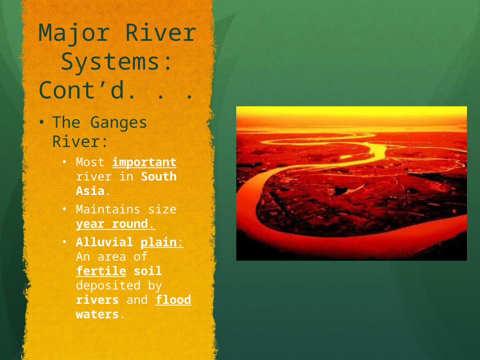
Major River Systems: Cont’d. . .
• The Ganges River:• Most important
river in South Asia.
• Maintains size year round.
• Alluvial plain: An area of fertile soil deposited by rivers and flood waters.
Natural Resources:
1) Water: Provides drinking water, fertile soil,
hydroelectricity, and transportation Chhukha Hydel hydroelectric project:
Bhutan.
2) Energy Resources: Petroleum reserves. Natural gas. Uranium deposits.

The Chhukha Hydroelectric Project
Began construction in the mid 1970’s and completed in 1986
Natural Resources: Cont’d. . .
3) Minerals: India:
The worlds leading producer of iron ore. 90% of the worlds mica: a layered rock used in making
electrical equipment. Sri Lanka:
One of the worlds largest producers of graphite: used for “lead” in pencils.
4) Timber: Important natural resource in South Asia. Overcutting leads to soil erosion. Many South Asian nations have banned timber exports.

South Asia: And its climates. . .
Tropical and Subtropical Climates: Tropical rain forest climates:
Western India and near the Ganges Delta. Ebony Trees, lush vines, and orchids. The Sundarbans: A swampy area in
Bangladesh with the worlds largest protected mangrove population.
Tropical savanna climates: Central India and eastern Sri Lanka. Grasslands that experience wet and dry
seasons.
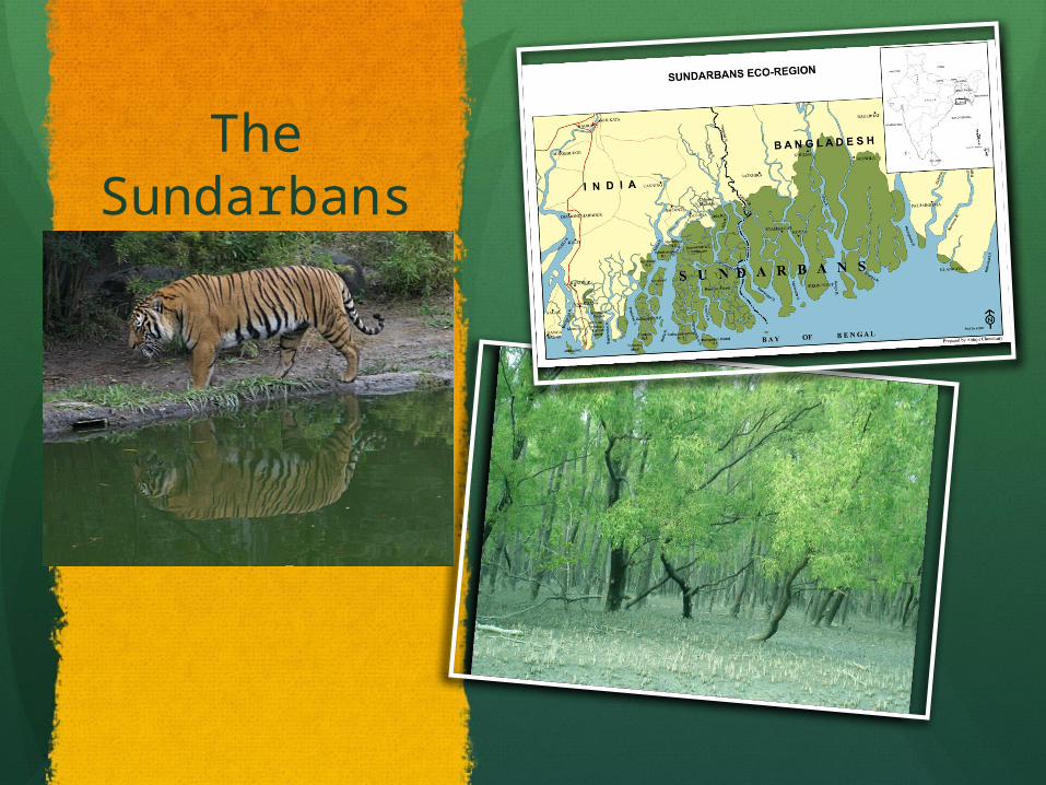
The Sundarbans
South Asia: Climates cont’d . . .
Humid subtropical climates: Temperate mixed forests. Located in Nepal, Bhutan, Bangladesh.
Highlands climates: Coldest climate region. Little vegetation at high elevation. Bamboo covers the Himalayan foothills.
Dry climates: Arid and windswept. Desert scrub, thorny trees, little grasses. Much remains a wasteland.
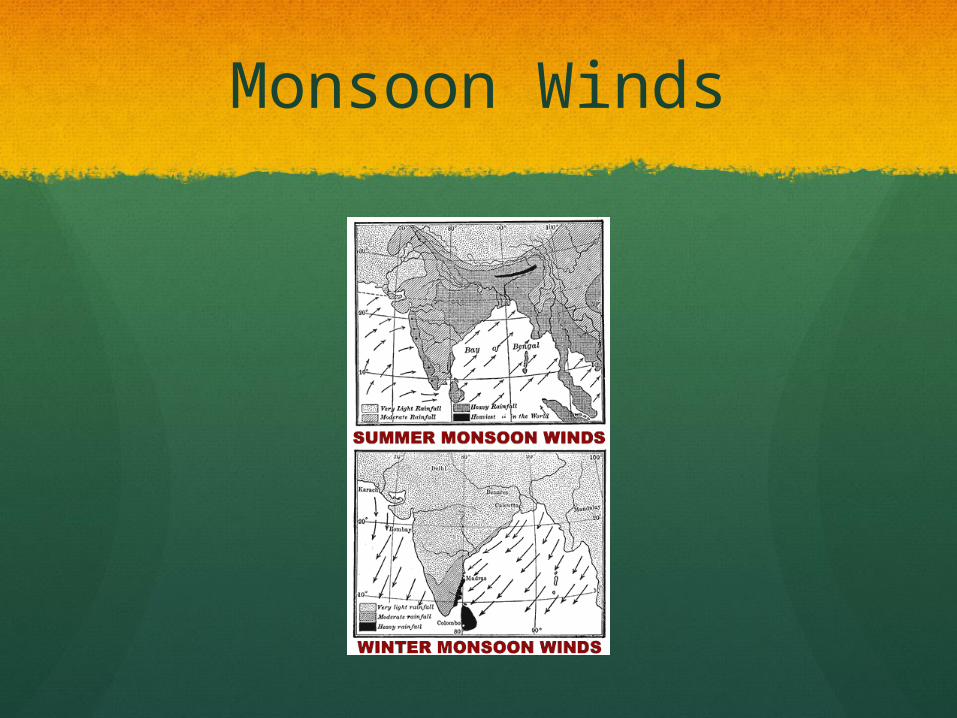
Monsoons
Three seasons: Hot: February – June. Wet: June/July – September. Cool: October – late February.
Seasons depend on monsoons: Cool season: Monsoon winds blow from the north. Hot season: Ocean air from the south brings
monsoon winds.
Cyclones: A storm with high winds and heavy rains.
Monsoon Winds
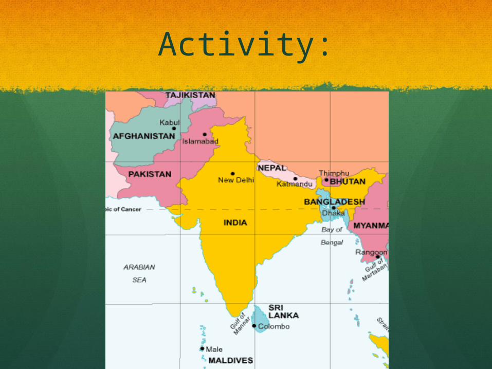
Activity:
Interesting Resources
http://www.stumbleupon.com/su/27Y6lk/www.lib.utexas.edu/maps/historical/india_1882.jpg/ (Ancient India)